i p - · pdf fileintegrated into the relevant post-graduate curriculum on disaster...
TRANSCRIPT

POLICY SEARCH FOR RESTORATION OF PADDY ECOSYSTEMS IN THE NILWALA
DOWNSTREAM AREA AFFECTED DUE TO NILWALA FLOOD PROTECTION SCHEME,
SOUTHERN SRI LANKA
K.D.N. Weerasinghe1, 2, Senaka Basnayake2, N.M.S.I. Arambepola2, Champa Navarathne1, Udaya Rathnayake1 and C.M.K.N.K.
Chandrasekara3
1Department of Agricultural Engineering, Faculty of Agriculture, University of Ruhuna, Mapalana, Kamburupitiya, Sri Lanka
2Asian Disaster Preparedness Center, 979/69, 24th Floor 979/69, Paholyothin Road, Samsen Nai Phayathai, Bangkok, Thailand 10400
3Department of Geography, University of Colombo, Colombo-03, Sri Lanka
Prepared for the Global Assessment Report on Disaster Risk Reduction 2015
Date: 31.01.2014
INPUT PAPER

2
Table of Contents Abstract ....................................................................................................................... 34
1. Introduction ............................................................................................................... 5
2. Background to the Project and Problems Associated with the Implementation of the
"Nilwala Ganga" Flood Protection Scheme (NGFPS) ........................................................... 6
3. Considerations in Designing the New Project ................................................................. 8
4. Project Methodology / Approach .................................................................................. 9
4.1 Identification of Most Vulnerable Ecosystems and Communities due to Multi- hazard
Impacts within the Nilwala Basin ................................................................................ 10
4.1.1 GIS and Remote Sensing Approach ................................................................. 10
4.1.2. Agro-Climatological and Hydrological Approach for Identifying Causes of
Vulnerability of Communities ............................................................................... 1312
4.1.3 Sociological Studies ................................................................................... 1413
4.2 Establishment of the Field Research Center and Piloting Innovative Technological
Solutions in Selected Vulnerable Communities ......................................................... 1413
4.3 Training and Capacity Building (Training of Farmer Community) .......................... 1514
4.4. Formation of the Monitoring and Management Committee ................................. 1514
4.5 Technology Intervention Program ..................................................................... 1817
4.6 Other Training/Capacity Building Initiatives Planned ........................................... 2019
5. Research Extension to Mekong Delta (Vietnam) ...................................................... 2120
6. Lessons Learned from the Implementation of the Project and Larger Contribution to HFA
through the Adapted Approach of the Project ............................................................. 2221
7. Conclusions .......................................................................................................... 2322
8. Acknowledgements ............................................................................................... 2423
References............................................................................................................... 2423
Chart 1: Major land use pattern changes in the Nilwala basin ....................................... 1211
Chart 2: Pproject execution plan ................................................................................ 1716
Image 2: (left) Brainstorming session with farmers in pilot project site, (right) Land use map
of the project area ........................................................................................................ 13
Image 3: Community and participants at the inauguration of the Field Research Extension
and Demonstration Center by the Executive Director of ADPC and Vice Chancellor of
University of Ruhuna .................................................................................................... 14
Image 4: Installation and testing of hand operated barrel (Archimedean) pump designed by
the University. Children enjoy the water pumping and learning about the technology ....... 16
Image 5: Water pumping to the drying fields by a pump coupled to a two wheel tractor (9
Jan. 2014) ................................................................................................................... 16

3
Image 6: Meeting of the Management and Monitoring Committee (MMC), chaired by the
District Secretary .......................................................................................................... 16
Image 7: Management committee along with farmers at the observatory hut in pilot site
(left), Media intervention (right) .................................................................................... 17
Image 8: Preparation of the field experiment plots and view of the experimental plots in
December 2013 ............................................................................................................ 18
Image 9: (left) Nursery preparation for parachute method of transplanting, (center) View of
paddy fields parachute method, (right) Broadcasting method ........................................... 19
Image 10: Appearance of the transplanted paddy fields (left) and broadcasted fields by the
farmers (during flowering and grain filling stage) ............................................................ 20
Image 11: Performance of different varieties at the end of flowering (24 Jan 2014) .......... 20
Image 12: Participants of the initial workshop and brainstorming session held in SIHYMET,
HoChi Minh city for project commencement in March 2013 (left), Third Meeting of the Local
Management Committee held in Tranoc provincial committee conference hall, Cantho ....... 21
Map 1: Nilwala River Basin ............................................................................................ 67
Map 2: Land use and land covers change, Nilwala basin .................................................. 11

4
Abstract Nilwala River is the major river in the Matara District of southern Sri Lanka, and is 72km in
length. Frequent floods and inundation of urban and peri-urban areas resulting in socio-
economic impacts are major problems that occur downstream of the basin. In order to
address these problems, the Nilwala Flood Protection Scheme was implemented in 1985, by
adding flood protection bunds and introducing deeper drainage networks to paddy
ecosystems, as well as pumping stations to evacuate the ten-year return floods. In spite of
this, the flood protection scheme created new problems for paddy ecosystems due to
development of acid sulphate conditions in drying paddy fields after rapid evacuation of flood
water from fields. At present, the Irrigation Department has to bear nearly 70 million rupees
on fuel alone for flood evacuation from rice fields, creating a conflict situation between the
authorities and farmer communities.
The pilot project initiated by ADPC, with financial support of AusAID, helped to study the
problems and address the policy issues while mainstreaming climate information applications
in order to reduce the vulnerabilities associated with paddy farming. Rallying academia,
government institutions, farmer organizations, and local governments under the leadership
of the District Secretary to form a management committee has helped in identifying the most
effective policy framework. It has also helped with addressing the main issues related to
acidity problems through technology interventions and adapting them for farming systems.
Agro ecological studies conducted in the basin by the University revealed that downstream of
the basin, ecosystems are often experiencing dry spells within the cropping season. The lack
of irrigation provisions to the drying fields results in crop failure due to dryness and
associated acidity development. The project established a field research unit for addressing
the farmer’s needs through participatory approaches, where academics, students and
farmers came together to undertake pilot demonstrations. The project findings will be
integrated into the relevant post-graduate curriculum on Disaster Management (DM).
5
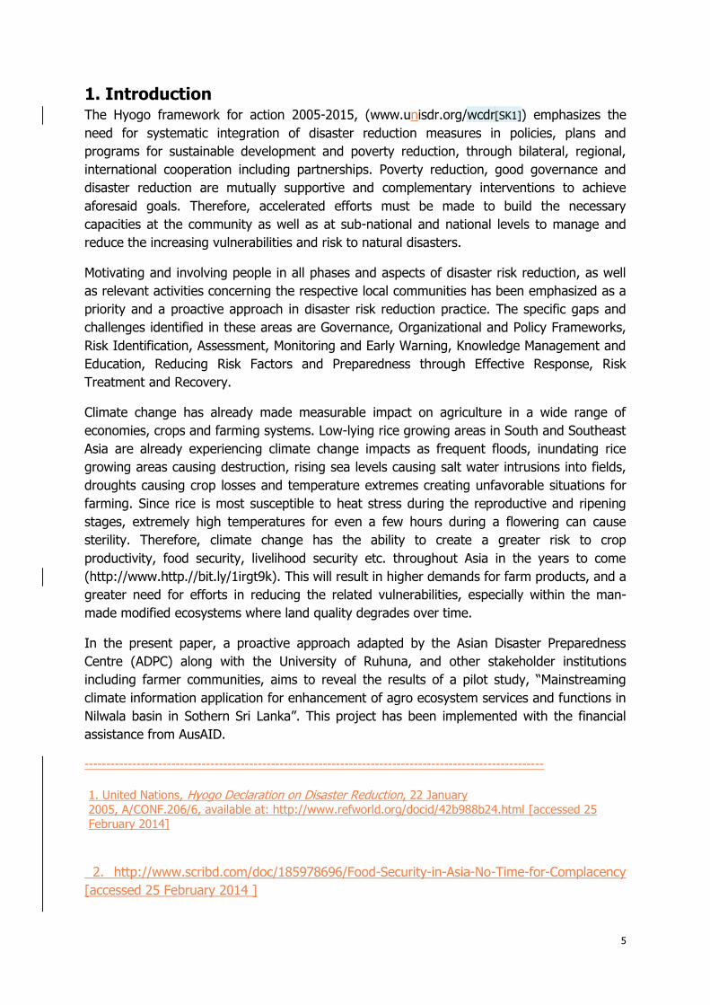
1. Introduction The Hyogo framework for action 2005-2015, (www.unisdr.org/wcdr[SK1]) emphasizes the
need for systematic integration of disaster reduction measures in policies, plans and
programs for sustainable development and poverty reduction, through bilateral, regional,
international cooperation including partnerships. Poverty reduction, good governance and
disaster reduction are mutually supportive and complementary interventions to achieve
aforesaid goals. Therefore, accelerated efforts must be made to build the necessary
capacities at the community as well as at sub-national and national levels to manage and
reduce the increasing vulnerabilities and risk to natural disasters.
Motivating and involving people in all phases and aspects of disaster risk reduction, as well
as relevant activities concerning the respective local communities has been emphasized as a
priority and a proactive approach in disaster risk reduction practice. The specific gaps and
challenges identified in these areas are Governance, Organizational and Policy Frameworks,
Risk Identification, Assessment, Monitoring and Early Warning, Knowledge Management and
Education, Reducing Risk Factors and Preparedness through Effective Response, Risk
Treatment and Recovery.
Climate change has already made measurable impact on agriculture in a wide range of
economies, crops and farming systems. Low-lying rice growing areas in South and Southeast
Asia are already experiencing climate change impacts as frequent floods, inundating rice
growing areas causing destruction, rising sea levels causing salt water intrusions into fields,
droughts causing crop losses and temperature extremes creating unfavorable situations for
farming. Since rice is most susceptible to heat stress during the reproductive and ripening
stages, extremely high temperatures for even a few hours during a flowering can cause
sterility. Therefore, climate change has the ability to create a greater risk to crop
productivity, food security, livelihood security etc. throughout Asia in the years to come
(http://www.http.//bit.ly/1irgt9k). This will result in higher demands for farm products, and a
greater need for efforts in reducing the related vulnerabilities, especially within the man-
made modified ecosystems where land quality degrades over time.
In the present paper, a proactive approach adapted by the Asian Disaster Preparedness
Centre (ADPC) along with the University of Ruhuna, and other stakeholder institutions
including farmer communities, aims to reveal the results of a pilot study, “Mainstreaming
climate information application for enhancement of agro ecosystem services and functions in
Nilwala basin in Sothern Sri Lanka”. This project has been implemented with the financial
assistance from AusAID.
----------------------------------------------------------------------------------------------------------
1. United Nations, Hyogo Declaration on Disaster Reduction, 22 January
2005, A/CONF.206/6, available at: http://www.refworld.org/docid/42b988b24.html [accessed 25
February 2014]
2. http://www.scribd.com/doc/185978696/Food-Security-in-Asia-No-Time-for-Complacency
[accessed 25 February 2014 ]

6
2. Background to the Project and Problems Associated with the
Implementation of the "Nilwala Ganga" Flood Protection
Scheme (NGFPS) Nilwala River is the major river in Matara District of southern Sri Lanka (Map 1). It originates
at Panilkanda, near Deniyaya, at an altitude of 1,050 m, and after traversing approximately
70 km it flows to the Indian Ocean at Matara. The area of the river basin is about 1,073
square km. Upstream Nilwala has a steep longitudinal slope, where the riverbed is rocky and
the longitudinal slope of the river gradually decreases from 0.4 m/km (GERSA, 1981 cited
from Delpachitra, 1996).
The average slope of the bottom of the riverbed approaches nearly zero at last 13 km of the
river, where Matara township and urban areas are concentrated. The major hazardous
events within the basin could be broadly described as flash floods, droughts, landslides and
severe erosion in the upstream side. Preliminary assessment of the sites susceptible to
landslides and severe erosions appear to be linked to scrub lands, which are mostly the
marginal and abounded tea lands, whereas floods often affect the lower basin area. Its flood
plain choked at its outlet to the sea restricts easy evacuation of floodwater to the sea, often
resulting in floods and inundation of roadways in Matara town (Panabokke, 1996). Since
both upper and lower basin areas are affected by hydro-metrological disaster events, and
invariably the events are influenced by global climate change, the events have become more
frequent and higher in magnitude. Therefore, it was essential that the government
undertake measures to mitigate the growing impacts of such events.
In 1968, The Engineering Consultants Incorporated (ECI) in Denver, USA, with the
assistance of the Irrigation Department of Sri Lanka, carried out a study that recommends an
option involved with construction of downstream flood control facilities. In 1979, as a result
the Government of Sri Lanka, 144 million Sri Lankan Rupess was received in financial
assistance from the French Government to implement the flood protection scheme to protect
Map 1: Nilwala River Basin

7
3960 ha of paddy fields in Kiralakele and Kadawedduwa sectors.
The Nilwala Ganga Flood Protection Scheme (NGFPS), which was implemented in 1985, has
created a deeper drainage network to paddy ecosystems, coupled with pumping stations to
evacuate the ten-year return floods. It involved the construction of new drainage canals,
bunds, control regulators and access roads, as well as the pump house to evacuate the ten-
year flood collected from 5000 ha basin within a period of 5.5 days. The NGFPS helped to
manage the urban floods, but it has resulted in a major disruption and alteration mentioned
above to the earlier hydrological equilibrium. The farmers had learned to live with these
disruptions that have caused several complicated situations. Even during the construction
phase, numbers of modifications were made to the original plans due to disputes and
conflicts occurred with the farmers.
Although the Nilwala project aimed to provide flood protection to paddy cultivation and
achieve a high target of paddy yields, it actually created new problems on paddy eco
systems. Among such new problems was the development of acid sulphate conditions in
drying paddy fields, which arose after changes in the hydrological regime of the locality from
rapid evacuation of floodwater and the intensive drainage. It is clear that NGFPS
underestimated this factor, and hence the paddy ecosystem is undergoing severe stress
(Weerasinghe et al., 1996, 2000). The major soil problems encountered in relation to this
have been identified as acidity, iron and Aluminium toxicity, phosphorous availability, low
base status and nutrient deficiencies and possible salinity, which are aggravated due to dry
spells. Improvement of water management is found to be the key factor in solving such
problems, which will help in rice intensification. Incorporation of Agro technology such as
transplanting, fertilizer application and adaption of more susceptible varieties is
recommended for safeguarding the paddy ecosystem degraded due to man-made structures
(Weerasinghe et al.1996, 2000, 2002). It has been recommended to maintain a submerged
and flowing water regime in the fields to prevent the periodical drying cycles, which are
elevated due to the climate change associated phenomena. Engineering measures such as
proper management of the gate opening in Nilwala river and lift water from drainage
channels for irrigation when electrical conductivity is as low as 2.6 mmhos/cm in order to
irrigate drying fields are recommended. The introduction of a polder system of irrigation was
also recommended (Weerasinghe et. al 1996).
The brackish water marsh of the mangrove swamps and mud flats are located at lower
elevations that are subject to inter-tidal intrusion of saline water. Around the period 4700-
3600 years BP, these valleys were submerged by the sea (Panabokke, 1996). The area is
subject to micro tidal range within 75-25 cm. During the high tides, fields located in the delta
region are subject to salinity intrusion and this situation has been aggravated by construction
of man-made structures that have prevented the natural system for flushing such salinity
intrusions by floodwater from time to time.
Since paddy fields are concentrated in the delta regions, which are located below 0.3 m
mean sea level, often floods, sea water intrusion and associated salinity and inhibited
drainage are the major threats incurred on rice based ecosystems of the area. Even though
academic research has demonstrated the way forward for the restoration process of the
ecosystem to protect it from the degradation due to man-made structures, which are

8
intensifying due problems associated with climate change, there is a gap between science
and practice. Farmers living in the basin are traditional farmers; the cultural and moral
bindings associated with paddy farming are very strongly linked to their life patterns. The
failure of the old system that was linked to farming practices aligned with periodical flooding
and washing regime of the paddy fields is looked at by them as a complete system failure.
Therefore, a systematic techno- sociological intervention to link communities with the
stakeholder institutions and agencies needs to be worked out.
There are other solutions proposed as alternatives to improve the livelihood of affected
farmers in the lower basin area such as animal husbandry, inland fishery so on. But such
practices have not been acceptable to traditional farmers due to religious and cultural
disagreements. On the other hand, loss of household income, productivity of traditional farm
land, difficulties in continuing livelihood practices etc. force the traditional farmers to migrate
to other areas looking for other types of employment. That has created new types of social
problems within such households and also had direct impact on land value of the farmland.
Continuation of such practices lead to other difficulties in motivating the new generation to
continue rice farming, and has led to the abandonment of very productive rice farming
areas.
3. Considerations in Designing the New Project After identifying various socio-economic and technical problems associated with the lower
Nilwala basin area, the project team felt that the new project should address the associated
gaps:
1. Identify a representative pilot project site within the Nilwala lower basin for a
technology intervention/demonstration program that can be implemented in
consultation with farmers and all other stakeholder institutions. The goal will be to
establish a model field research, extension and demonstration center by the
University to promote farmer interaction, conduct application research jointly with
farmers, knowledge transfer and wide dissemination of good practices.
2. Develop a system for constant on site monitoring by the farmer community for
following the different aspects of site condition changes due to variations in water
levels in the field that will have negative impacts, as well as to record infield
observations of climate variations that will have direct influence to such changes. In
the same way, the local office of the meteorological department has an opportunity
to interact with the farmer community by providing seasonal forecasts for cropping
seasons (at least for three months) so that farmers will be able to take major
decisions on crop selection, developing the farming system and taking associated
decisions.
3. Form a management and monitoring committee, rally all the stakeholder institutions
(Agriculture, Irrigation Department, Regional administration authorities, University,
etc.) under the chairmanship of the District Secretary for direct on-site interaction
between communities and other stakeholders to facilitate constructive dialogues for

9
decision making and policy interventions with the aim of mainstreaming the sound
farming practices within the lower basin area originating from the project.
The major goal of the pilot project is to build resilient farmer communities through
introduction of effective utilization of weather and climate information application and
appropriate agriculture and livelihood practices suitable to the paddy ecosystem, affected
under the “Nilwala” flood protection scheme and to empower them with necessary
knowledge on system changes to withstand weather/climate associated risks.
It will be achieved through:
• Capacity building of the farmer community to maximize the protective functions of
ecosystem through training demonstration and awareness building programs and
mainstreaming the climate information applications in agriculture and livelihood
sustainability;
• Creating a dialogue for onsite decision making by other stakeholders in consultation
with farmers; and
• Enhancement of the ecosystem capacities to withstand weather and climate
associated disaster risks based on the best practices by using an appropriate package
of technological solutions, which is the primary objective of piloting this project.
The integration of the ecosystem-based Disaster Risk Reduction (DRR) and Climate Change
Adaption (CCA) measures in the river basin development strategies, plans, regulations and
programs are also of vital importance. The project will strengthen the capacity of
professionals working in basin development for protecting and restoring the ecosystem to
maximize its protective function, through introduction of training and demonstrational
programs by the university, and by taking appropriate measures by the university to
integrate the good practices in the long and short term academic programs of the university.
4. Project Methodology / Approach The project activities commenced in December 2012 (Figure 2), by conducting a kick-off
workshop with the participation of all the stakeholders along with the Minister of Agriculture
at the University of Ruhuna.
The project activities and outcomes achieved are summarized below.

10
Image 1: Participants of the workshop with the Minister of Agriculture, Secretary Ministry of Agriculture, Vice Chancellor- University of Ruhuna, academics, farmer representatives and ADPC members etc. (left); banner of the first workshop (right)
4.1 Identification of Most Vulnerable Ecosystems and Communities due to
Multi- hazard Impacts within the Nilwala Basin
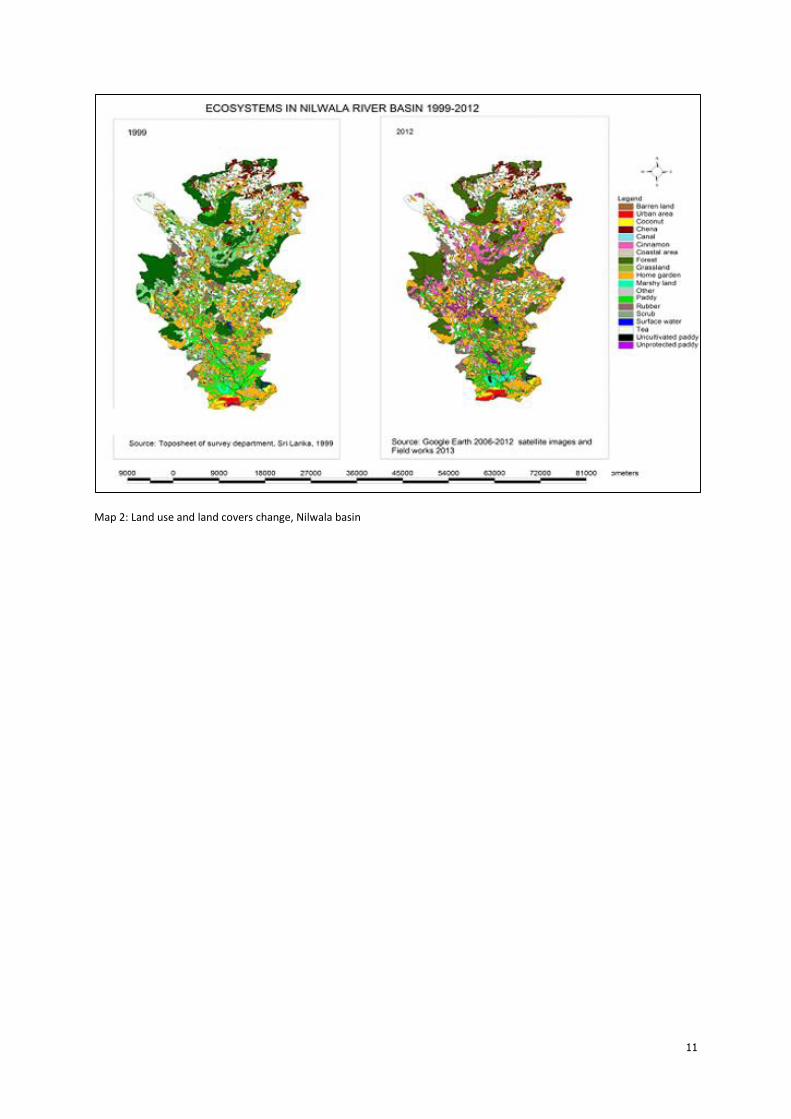
4.1.1 GIS and Remote Sensing Approach
The aerial photographs, available maps, etc. have been used to study the upper and lower
Nilwala basin area, identify the characteristics of different associated ecosystems and
demarcate them clearly in order to understand recent land use changes and impacts on the
different ecosystems due to natural and man-made changes within the basin. The vulnerable
ecosystems to landslides, floods, droughts, seawater intrusion, etc. in the upper and lower
reaches of the catchments have been identified and mapped. In particular, detailed studies
have been carried out in the lower basin area to identify the land use affected due to
creation of flood protection embankments under the Nilwala Ganga flood protection scheme
(NGFP) by the Government of Sri Lanka in 1985.
11
Map 2: Land use and land covers change, Nilwala basin

12
Chart 1: Major land use pattern changes in the Nilwala basin
Initially, the brainstorming session (Image 2A) and a field visit with the stakeholders were
conducted to identify and catalogue the different ecosystems and threats incurred on them.
Available literature was used to collect historical changes on ecosystems. Topographic sheets
published by the Survey Department, Sri Lanka were utilized to identify land use/cover
categories during the period 1999-2001. A field survey was conducted from January–March
2013 to demarcate the ecosystems in terms of land use/cover categories. The changes were
updated using GIS techniques to reflect the extent of different ecosystems. Field
observations were compared with Google Images available on Google Earth, 2012. The
images were geometrically corrected and projected to Geographical Information System
(GIS) layers. Land use/cover categories were identified through GIS analysis methods.
Based on the land use/types that were extracted from the topographic sheets of the Newalla
basin, a base map to identify the existing environmental condition was prepared.
After completing the initial ecosystems survey in the basin, the project selected a pilot site in
the "Kahaduwa paddy track" to conduct a technology intervention program for ecosystem
restoration and lively hood improvement of the farmer communities. A contour and the land
use map (Image 2B) of the pilot site was prepared.

13
Image 12: (left) Brainstorming session with farmers in pilot project site, (right) Land use map of the project area
Major problems associated with the farmers in the pilot site were identified through a survey
and brainstorming session conducted on 10 July 2013.
4.1.2. Agro-Climatological and Hydrological Approach for Identifying Causes of
Vulnerability of Communities
Detailed Climatological, hydrological and soil surveys were carried out in the identified highly
vulnerable agro-ecosystem areas in the lower Nilwala river basin to identify severity of the
problems. The farming systems, seasonality changes and traditional farming practices,
current obstacles in continuing the traditional farming practices etc. have been studied in
detail to understand the challenges faced by the farmers due to natural and man-made
changes observed in the recent past. A socio-economic and technological restoration plan for
the most vulnerable agro-ecosystem to cope with natural hazard scenarios associated with
climate variability such as floods, droughts, landslides, erosion, etc. as well as sea water
intrusion had been worked out. It was observed that innovative approaches are needed for
changing the farming practices, and participatory field research approaches will be necessary
to introduce such changes to create awareness of the farmers on the above aspects.
For climate information, application data from Mapalana faculty for the last 30 years (1950-
2012) was collected and analyzed with the program, "First (Weerasinghe, Sabatiere, Luc,
1998) to identify the onset of the season. Accumulation probability of 250 mm rains from 1
September at 80% probability was taken as the onset of the season based on the earlier
research conducted in Matara district (Weerasinghe et al 1998). Farmer experiences on
traditional wisdom associated with the Luna calendar and the forecast information provided
by the Meteorology Department was used for decision making for the following three months
in Maha season, commencing from September (SON).
For daily observation of the weather information, and to build community awareness on day-
to- day weather changes, an on-site rain gauge and Stevenson Screen with a Thermometer
and a dry and wet bulb psychrometer was installed at the field center. This helped farmers
to understand day-to-day weather events and check them with their traditional experiences.
14
Final decisions were made at a brainstorming session conducted with all the farmers along
with officials of the Irrigation Department, Field Officers of the Agrarian Services Department
and University academics, using the forecast information given by the Meteorological
department and the Disaster Management Centre. Accordingly, selected farmers of the pilot
study program agreed to commence their field activities on the given date (18th Oct. 2013 in
case of Maha).
This decision making process was accepted as the policy decision to be placed at the annual
"Kanna meeting" (official meeting for decision making on cropping dates, water allocation
etc. where all the decision making bodies and farmer organizations of the scheme decide on
the cropping calendar).
4.1.3 Sociological Studies
Sociological studies have been carried out for the most vulnerable communities to
understand the type of problems they face, traditional coping mechanisms and current
challenges faced due to changes in the pattern and magnitude of the multi hazards from a
social and cultural perspective. The sociological research also helped to identify the newly
created problems due to the implementation of the Nilwala Flood protection scheme by the
government.
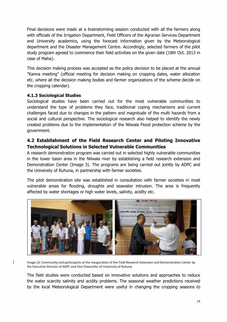
4.2 Establishment of the Field Research Center and Piloting Innovative
Technological Solutions in Selected Vulnerable Communities
A research demonstration program was carried out in selected highly vulnerable communities
in the lower basin area in the Nilwala river by establishing a field research extension and
Demonstration Center (Image 3). The programs are being carried out jointly by ADPC and
the University of Ruhuna, in partnership with farmer societies.
The pilot demonstration site was established in consultation with farmer societies in most
vulnerable areas for flooding, droughts and seawater intrusion. The area is frequently
affected by water shortages or high water levels, salinity, acidity etc.
Image 23: Community and participants at the inauguration of the Field Research Extension and Demonstration Center by the Executive Director of ADPC and Vice Chancellor of University of Ruhuna
The field studies were conducted based on innovative solutions and approaches to reduce
the water scarcity salinity and acidity problems. The seasonal weather predictions received
by the local Meteorological Department were useful in changing the cropping seasons to

15
avoid high floods. Certain local level measures were also taken to ensure water supply and
floodwater discharge through pumping by developing appropriate low cost pumps. In
addition to manual operations for discharging water using traditional ways, several wind and
solar powered water pumps will be installed.
4.3 Training and Capacity Building (Training of Farmer Community)
Training for the farmer community was provided by the Ruhuna University through the Pilot
Research Program. It was a more hands-on training through on-site activities. The farmers
were trained to use the seasonal forecasting information as a decision making tool as well to
observe weather parameters and water level fluctuations within the field. They were trained
in undertaking different farming practices, ways of coping with acidity, salinity, etc. to suit
the prevailing conditions in the field. They were also trained to interact with the Irrigation
Department and other government officials and obtained their support when and where
necessary. The farmers were happy to engage in innovative technological solutions as they
have witnessed the effectiveness of the pilot studies during the present season. Under the
next phase, the project plans to have more pilot sites and have more experience sharing
sessions between the new set of farmers and farmers already engaged in pilot sites.
4.4. Formation of the Monitoring and Management Committee
The Monitoring and Management Committee (MMC) was formed under the chairmanship of
District Secretary (Government Agent) of Matara District to provide strategic guidance for
smooth implementation of the project and to ensure long term sustainability beyond the
project period by creating ownership by all the project stakeholders (local governments,
Disaster Management Center, provincial and district officials from various departments such
as agriculture, irrigation, forestry, environment, academia, farming community etc. see Chart
2 Organizational Chart of the project).
The MMC has periodic meetings to convey the findings of the project and to discuss the
approach that should be taken to address different challenges. Often it is difficult for
academia to provide acceptable solutions to the farmer community, as certain practices are
different from the traditional practices and have been passed down through generations.
Furthermore, it is necessary to convince Government Officials to undertake certain measures
that are being implemented using additional resources. For example, the Irrigation
Department is responsible for pumping water using the canal network developed under the
Nilwala Flood protection scheme. The canal network has to be dredged time to time for
increasing the efficiency, but dredging will lower the water level in certain paddy fields,
which may create artificial droughts for the respective areas unless the Irrigation Department
is mindful of such facts. In such cases, extra pumping facilities need to be installed in
affected areas to ensure water supply. This aspect has been well looked after by the project
during the long dry spell during the first part of January, providing canal irrigation provision
by researching appropriate pumps for selected farmers (Image 4, Image 5).

16
Image 34: Installation and testing of hand operated barrel (Archimedean) pump designed by the University. Children enjoy the water pumping and learning about the technology
Image 45: Water pumping to the drying fields by a pump coupled to a two wheel tractor (9 Jan. 2014)
The MMC has created an enabling environment for farmers to discuss problems with
government officials and find solutions together. The academia has provided technical
inputs that are necessary for finding solutions, working closely with farmer community using
their fields as learning and teaching laboratories (Image 6 and 7).
Image 56: Meeting of the Management and Monitoring Committee (MMC), chaired by the District Secretary

17
Image 67: Management committee along with farmers at the observatory hut in pilot site (left), Media intervention (right)
The Organizational Structure of the Project
Chart 2: Pproject execution plan
Through a series of workshops and surveys, socio-economical and agronomical data was
gathered. More than 40 stakeholder participants from the University, Department of
Agriculture, Department of Agrarian Services, Department of Irrigation and Farmer
Federations participated in workshops and survey work. Based on the decisions made at the
workshops, and recommendations made by the management committee, the following
activities are being conducted since December 2012.
1. Building farmer’s awareness on the objectives, methodology and the expected
outcomes of the project through workshops and brainstorming sessions on
existing threats associated with climate change on paddy farmers located in

18
drying paddy fields, with water scarcity, in semi drying paddy fields, and in low
elevated paddy fields with excess water and submerged conditions in the pilot
site. The adaptation measures practiced by them are documented.
2. Field research and demonstration program in 'Maha " (major season) in Sep.
2013 in farmer fields along with the farmers to demonstrate technology
interventions as DRR measures to meet with climate change associated risks.
4.5 Technology Intervention Program
Based on past research evidences (Weerasinghe et al 1994; 1996,) and the information
gathered at brainstorming sessions with all the stake holders, an appropriate technology
intervention for the restoration of the ecosystem health, and to introduce livelihood options
are being tested as field trials commencing from Maha 2013 (Sep 2013-Feb 2014).
The objective of the field research program is to address the major problems associated with
soil acidity, water scarcity fertilizer practices, weeds, suitable crop varieties, and cropping
practices to meet with climate change associated changes in a participatory manner in
farmer’s fields, along with the undergraduate and the post graduate students.
One PhD program and a few M.Phil programs have been incorporated into the field research
program. The PhD program is supervised by a Senior Research Officer of the Department of
Agriculture. For student thesis work, the Senior Research Officer helps with knowledge
dissemination by sharing thesis work to upper levels of the Department of Agriculture
directly for policy adaptation and mainstreaming. [SK2]The following field experiments are
currently in progress:
Experiment 1: Impact of mulching, lime application and fertilizer materials on
growth, development and yield of rice plants in acidic soils of the Nilwala project
The design of the experiment is split plot design, with three replicates. There are 16
combinations in the trail with straw mulch and fertilizer combinations. Phenological
observations such as plant height, number of tillers per plant, weight and number of filled
and unfilled grains in plants, and average yield per square m are measured. Soil data at the
initial and end of the seasons such as pH, EC, total N and available phosphorus are also
measured. Based on the results of soil analysis and phenological observations, most
appropriate technologies will be recommended.
Image 78: Preparation of the field experiment plots and view of the experimental plots in December 2013

19
As per the results, greener color (leaf color chord LCC) in leaves at tilling could be observed
when rice was transplanted with straw mulch. This is an indication of high nitrogen use
efficiency when rice straw mulch is used along with other inputs; the weed population was
also well controlled with the mulch. Partially burnet rice husk, application of Eppawala rock
phosphate as phosphate fertilizer and lime application have also demonstrated promising
results.
Experiment 2: Impact of plant establishment methods on growth development
and yield of two rice varieties (traditional variety Kahata wee, new variety At
362)
The objective of the experiment is to identify a suitable establishment method of rice for
rain-fed farming under acidic conditions and to test the performance of the new variety
against the traditional varieties. The experiment has a split plot design. Plot size is three by
six m.
The parachute method of plant establishment also gave convincing results, especially for
boggy paddy fields with submerged water regime. In demonstrational plots, plant vigor was
much better and it was a very convenient method for the farmers to practice. After
observing the method, farmers have seen the advantage and many farmers are expecting to
practice the method in the next season.
Image 89: (left) Nursery preparation for parachute method of transplanting, (center) View of paddy fields parachute method, (right) Broadcasting method
In Image 10, appearance of the transplanted experimental plots that with broadcasted
adjacent farmer field during the intense flowering and panical formation stage (12 Jan) is
demonstrated. In transplanted fields, tilling was better and plant growth was much ahead
compared plant growth in the broadcasted fields. The usual practice adapted by the farmers
is to broadcast with very high seeds rate to control the weeds. However, weed population is
also high in the farmer fields, which inhibits plants growth and development, resulting poorly
developed panicles and low number of tillers.

20
Image 910: Appearance of the transplanted paddy fields (left) and broadcasted fields by the farmers (during flowering and grain filling stage)
Experiment 3: Performance evaluation of different rice varieties in Nilwala basin
(Observational trial in farmers’ fields)
The objective of the experiment was to identify the most suitable rice varieties for rain-fed
farming under acidic soil conditions. Widely used varieties were tested in the farmers’ fields.
Farmers were given the seed paddy and they established the new varieties in their fields by
themselves. Paddy varieties (1) At 362, (2) Ld 368, (3) Bg 369, and (4) Bg 357 are being
testing in the current season. Rice variety At 362 is performing well compared to other
varieties (Image 11).
Image 1011: Performance of different varieties at the end of flowering (24 Jan 2014)
The farmers were well convinced with these technologies and measures, and they will be
adapted to popularize these practices by farmer training and demonstration methods. The
experiments are continuing and final results will be submitted in a scientific conference to
take appropriate decisions for policy interventions by the management committee.
4.6 Other Training/Capacity Building Initiatives Planned
The following training packages are being planned under the next phase of the project:
21
1. A training course module on local level DRR and CCA measures to enhance
ecosystem services and functions for governmental officials attached to line
agencies/ministries
2. A training course module on Community-Based Disaster Risk Management
(CBDRM) methodology for improved agricultural practices to cope with climate
change and climate variations for local governmental officials
3. Strengthen the Field Research, Extension and Demonstration Center for
knowledge sharing and dissemination of experience, which was established in the
lower Nilwala basin under the AusAid funded project on, “Mainstreaming Climate
Information Application for Resilience Building of Vulnerable Communities in
Nilwala river basin of Sri Lanka”
4. Incorporate research findings into post- graduate courses undertaken by the
Agricultural Faculty of the Ruhuna University. Undergraduate students enrolled in
the Agriculture Engineering specialty, and postgraduate students in the Green
Technology M.Sc program are actively engaged with the field activity programs of
the project along with the farmers. The entire surveying and leveling work of the
project is given to the undergraduate students as an assignment.
5. ADPC plans to include project experience in Regional Training Courses conducted
by the Center annually.
5.
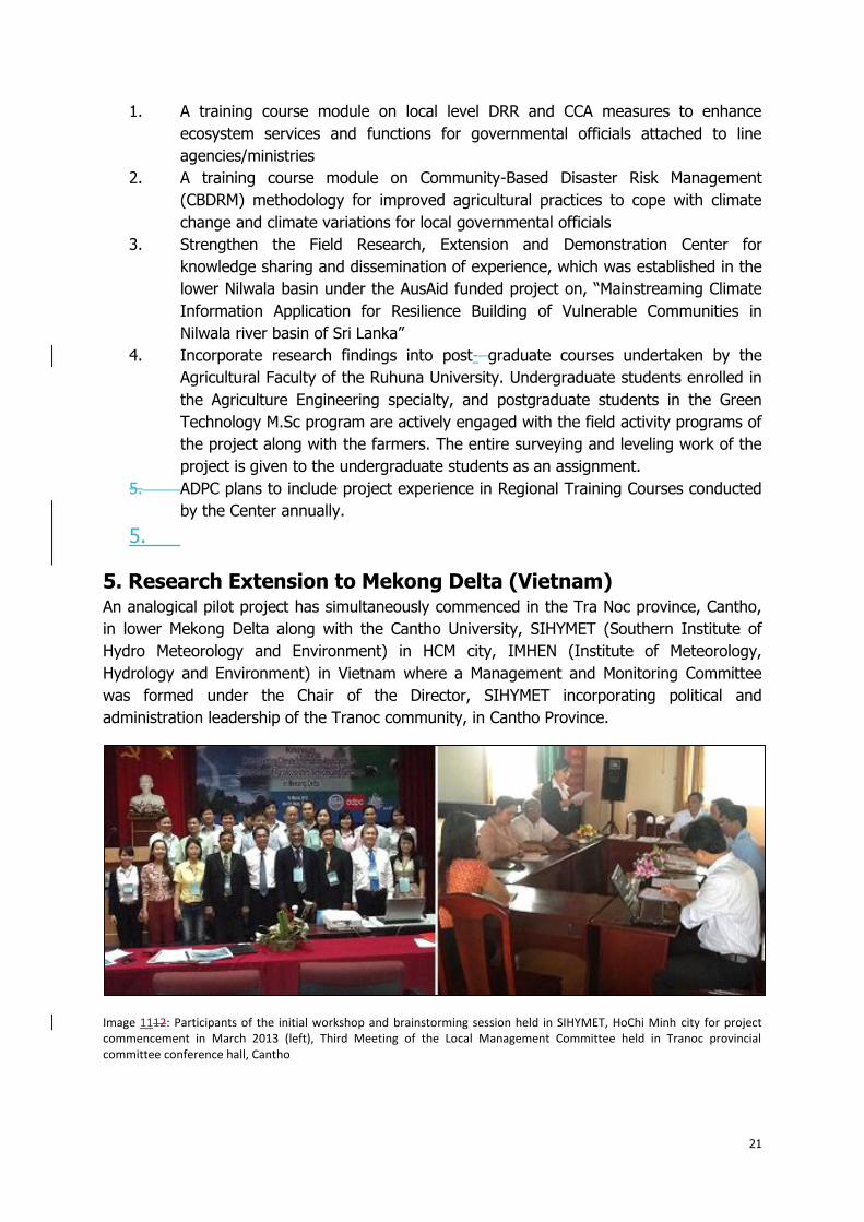
5. Research Extension to Mekong Delta (Vietnam) An analogical pilot project has simultaneously commenced in the Tra Noc province, Cantho,
in lower Mekong Delta along with the Cantho University, SIHYMET (Southern Institute of
Hydro Meteorology and Environment) in HCM city, IMHEN (Institute of Meteorology,
Hydrology and Environment) in Vietnam where a Management and Monitoring Committee
was formed under the Chair of the Director, SIHYMET incorporating political and
administration leadership of the Tranoc community, in Cantho Province.
Image 1112: Participants of the initial workshop and brainstorming session held in SIHYMET, HoChi Minh city for project commencement in March 2013 (left), Third Meeting of the Local Management Committee held in Tranoc provincial committee conference hall, Cantho

22
6. Lessons Learned from the Implementation of the Project and
Larger Contribution to HFA through the Adapted Approach of
and activities of the the Project[SK3] The main lesson learned from the project approach is that high effectiveness can be
generated through implementation of the project through a participatory approach. The
project team has assembled all the important stakeholders at the problem location and
through discussions in the field; everybody felt that win-win solutions could be found
through collaboration. Usually farmers demand for dewatering of the respective affected
area without understanding the effects on other farmland, which have led to certain conflicts
in the past. The Irrigation Department, which is the main authority responsible for
dewatering through pumping, faced problems of shortage of funds and other resources in
extending assistance to farmers year round. So now both have realized the limitations and
agreed to find manual solutions for dewatering during minor flooding situations. The
farmers discussed the problems among themselves with the participation of the officials from
the Irrigation Department, and helped each other come to the best solutions. The project
approach created decision-making and action through dialogue and it has proved to be very
effective.
Farmers have traditional farming practices, so new methodologies that are generated
through academic research often are not acceptable to farmers due to various social and
cultural reasons. Unless they see the effectiveness, which should translate to higher yields or
uninterrupted farming during the flood/drought-affected season, farmers are not willing to
adopt such practices. Therefore, it is important to have ownership-building for undertaking
appropriate solutions that will help in sustaining the practices in future beyond the project
period. The community-led farming practices carried out in the field through academic advice
was a good initiative that helped in build the confidence of the farmers, develop community
ownership and empower them with a new set of sound practices and technical solutions. The
new technology solution package proposed by the researchers came as a result of joint
collaborative work, as farmers worked hand-in-hand with academia. Traditional farmer
communities also gain the respect and rewards for contributions.
The management approach adapted by the project team for mainstreaming the new farming
practices directly influenced by the climate/weather predictions by the Meteorological agency
and field level observations of climate variations in the micro-catchment area, helped in
demonstrating the high effectiveness. The management committee set up the project with
government officials, academia and farmer communities, direct assistance to farmers by
academia and government officials was not possible in the past due to bureaucratic
procedural setbacks. Since this is an outcome of collaborative work, and the end product was
acceptable to farmers, they agreed to use seasonal forecasting products in important
decision-making practices in the future .The project team is confident that this approach and
technology applications can be easily replicated in areas within the lower catchment area
with similar problems. Even if similar approaches are adapted, the problems not seen in this
pilot study area also can also be resolved as the academia is willing to come up with
appropriate solutions. Since they now have direct access to farmer communities, they are
able to better understand the problems and provide assistance when and where needed.
23
Other farmer communities have seen these pilot demonstrations and the effectiveness and
there are more requests for assistance. The lesson that can be drawn, is when we do
something in the field that is very transparent, it can act as an advocacy method for further
replication.
The main contribution to HFA is the field demonstration of DRR applications and introduction
of sustainable, cost effective solutions to current problems with the possibility of replication.
The HFA has provided an opportunity for the academic and scientific community to think
about how scientific approaches can be presented to farmer societies in a simplified and
meaningful way. The effectiveness of collaborative work is evident and this can serve as a
good practice model for attending to problems in the agricultural sector that are affected due
to climate risk, and to come up with sustainable adaptation practices.
7. Conclusions Risk identification, assessment, monitoring and impacts on policy frame work through
knowledge management and education in a participatory manner with state agencies,
academia, communities, media, the private sector and policy makers is being piloted for DRR
adaptation by ADPC in the Nilwala river basin in southern Sri Lanka since December 2012,
with the support of AusAid funding. Th
e initial approach of the project was desk evaluation of the existing ecosystems, and
application of GIS and remote sensing technologies for further exploration of ecosystems for
DRR adaptation. That was followed by a farming systems approach for problem
identification, on farm research, research dissemination and policy interventions.
Ecosystems in the Nilwala basin are threatened due to climate change associated hazards
such as landslides, flash floods and earth slips upstream, as well as tsunamis, floods,
droughts sea water intrusion and salinity downstream. The major disasters occurred in the
basin in the recent past are floods and earth slips, which occurred in May 2003, and the
Asian tsunami in December 2004.
The total land extent of the basin is 1074 square km, where there are five major land
use/covers: Forests (17%), home gardens (27.70%), tea plantations (14.34%), rice fields
(13.07%) cinnamon (9.06%) and rubber (5.23%) plantations. Most of the paddy ecosystems
of the basin are concentrated in the delta region, which is a little above or below 0.3 m
mean sea level and is most vulnerable to climate change associated disasters. An additional
threat and conflict situation on paddy ecosystems of the delta region has been yield and land
losses after the implementation of the Nilwala Ganga Flood protection Scheme (NGFP) in
1985.
The innovative approach experimented by the ADPC included forming a management and
monitoring committee under the leadership of the District Secretary, along with the academic
leadership of the Ruhuna University, incorporating all relevant government and state

24
officials, community leaders farmer organizations and media for decision making
implementation and impact at the policy level. This approach appeared to be an efficient
mechanism for result orientation within the shortest possible time.
The establishment of the field center for community interactions at the problem sites with
academia and decision and policy makers for technology adaption, testing demonstration
and extension could be recommended as a good model for active community interaction and
to improve student-centered teaching and learning processes.
The experience gathered on the Sri Lankan situation is simultaneously being testeding in
tested in lower Mekong delta in a pilot site in Tranoc province along with Cantho University,
regional political and administrative leaders, SIHYMET, IMHEN and respective ministries.
Field-testing and adaptation is continuing in both Nilwala down stream and Tranoc Province
in Mekong Delta, Vietnam. .[SK4][SK5]
8. Acknowledgements The authors wish to acknowledge AusAID, for funding to carry out the present research and
development program. K.M.T.S.Bandara, Kapila Bandaranayake and Susantha Jayasinghe are
thanked for their technical assistance and manuscript preparation.
Honorable Minister of Agriculture Mr. Mahinda Yapa Abeywardena, and Secretary to the
ministry, Dr. D.B.T. Wijerathna, Southern Provincial secretary Ms. K.Athukorala, District
Secretary of Matara Ms.. E.A.C.Vidanagamachchi Asst District secretary Mr. Subash
Nanayakkara, Matara District Director of Agriculture, Dr. Ms. Sujatha Weerasinghe Southern
provincial Director of Irrigation Eng. Mrs. Deepika Thirimahavithana, Nilwala Engineer Mr. S.
Sooriyabandara, and his staff, Members of the management committee, farmers of the
Kahaduwa pilot project site, staff and the students of Ruhuna University are thanked for
their active involvement with the project activities.
References[SK6] Delpachitra U. (1996).. Nilwala Ganga Flood Protection Scheme; Proceedings of the
Symposium on Rehabilitation of the Nilwala Basin. The Open University Review of
Engineering Technology. Vol.2 No.1. pp 5-14.
Elkaduwa W.K.B, Sakthivadivel, R. (1998). Use of Historical Data as a Decision Support Tool
in Watershed Management: A Case Study of the Upper Nilwala Basin in Sri Lanka. Research
Report 26. International Water Management Institute, Colombo, Sri Lanka, pp 1-41.
Panabokke C.R. (1996). The Geomorphologic Setting and Salinity Intrusion in the Lower
Nilwala Basin; Proceedings of the Symposium on Rehabilitation of the Nilwala Basin.
The Open University Review of Engineering Technology. Vol.2 No.1. pp 17-21.

25
Weerasinghe K.D.N. (2009). Tank Base Irrigation and Paddy Ecosystems Development in Sri
Lanka, An Overview from Antiquity to the Present Proceedings of the Workshop.“ From
Environmental to Sustainable Science”. Thinking the Shift and the Role of Asian Agricultural
Science. Ibraki, Japan pp 152- 157.
C.M Navaratne C.M, K.D.N. Weerasinghe, N. Jayasuriya. (2004). Rainwater Harvesting and
Roof Runoff Coefficients. Proceedings of the International Conference on Sustainable Water
Resources Management in the Changing Environment of the Monsoon Region at Colombo,
Sri Lanka. Vol.II. pp 628-634.
Weerasinghe K.D.N., C.R. Panabokke, C.R. W.K.B Elkaduwa. W.K.B. (2000). Agro-climatic
Risk and Irrigation Need of the Nilwala Basin, Southern Sri Lanka, Proceedings of the
International Conference on Challenges Facing Irrigation and Drainage in the New
Millennium. Fort Collins, Colorado.
Weerasinghe K.D.N. (1996). Soil and Water Management for the Improved Rice Production
in the Acid Soils of the Nilwala Scheme, Southern Sri Lanka. Proceedings of the International
Symposium on Maximizing Sustainable Rice Yield through Improved Soil and Environmental
Management Vol. 1 113-121.
Weerasinghe K.D.N, J.L., Sabatier J.L., W.S Attanayake W.S. (2000). Water Balance and the
Irrigation Need of Rice in Different, Agro-ecological Regions of Sri Lanka, Proceedings of the
International Conference on Challenges Facing Irrigation and Drainage in the New
Millennium. Fort Collins, Colorado 2000.