http://. exeter 8/12/00
TRANSCRIPT

TOPS Top 10 Geography in conjunction with www.sln.org.uk/geography
http://www.sln.org.uk/geography/TOPS.htm

TOPS Top 10 Geography in conjunction with www.sln.org.uk/geography
Exeter 8/12/00

TOPS Top 10 Geography in conjunction with www.sln.org.uk/geography

TOPS Top 10 Geography in conjunction with www.sln.org.uk/geography
1. Flooding occurs when BANKFULL STAGE is exceeded
2. The Frequency of any particular flood is denoted by its recurrence interval
3. Most erosion and deposition takes place during flood periods
4. Frequently, human activity has accentuated the flood hazard
5. An understanding of the factors which control runoff enables steps to be taken within the catchment to reduce flood heights.
6. Knowledge of the way rivers erode enables the channel to be modified to reduce flood damage.
TOPS Top 10 Geography in conjunction with www.sln.org.uk/geography
An example of how a river is managed to
prevent flooding

TOPS Top 10 Geography in conjunction with www.sln.org.uk/geography

TOPS Top 10 Geography in conjunction with www.sln.org.uk/geography
The Mississippi river drainage basin is 3 million km2 in size
draining 41% of continental USA

TOPS Top 10 Geography in conjunction with www.sln.org.uk/geography
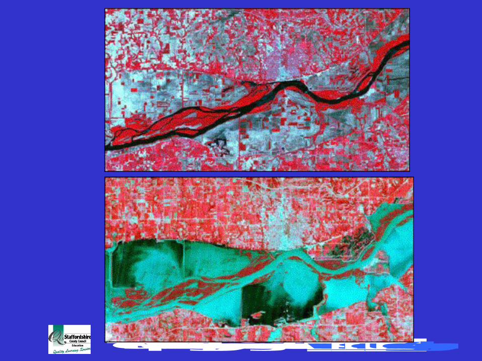
The Mississippi River at St. Louis, Missouri, was above flood
stage for 144 days between April 1 and September 30, 1993.
Seventeen thousand square miles of land were covered by floodwaters in a region covering all or parts of nine states (North Dakota, South Dakota, Nebraska, Kansas, Missouri,
Iowa, Wisconsin, Minnesota, Illinois).
TOPS Top 10 Geography in conjunction with www.sln.org.uk/geography
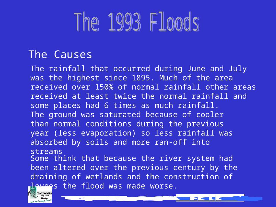
The CausesThe rainfall that occurred during June and July was the highest since 1895. Much of the area received over 150% of normal rainfall other areas received at least twice the normal rainfall and some places had 6 times as much rainfall.
The ground was saturated because of cooler than normal conditions during the previous year (less evaporation) so less rainfall was absorbed by soils and more ran-off into streams
Some think that because the river system had been altered over the previous century by the draining of wetlands and the construction of levees the flood was made worse.
TOPS Top 10 Geography in conjunction with www.sln.org.uk/geography

TOPS Top 10 Geography in conjunction with www.sln.org.uk/geography
The Mississippi River is one of the most heavily engineered natural features in the U.S. The character of the floodplain has changed to accommodate agriculture and urbanisation. Approximately 80% of the original wetlands along the river were drained since the 1940’s. Wetlands act as natural storage reservoirs for floodwaters.

TOPS Top 10 Geography in conjunction with www.sln.org.uk/geography
The river channel itself has been artificially constrained by levees and floodwalls. These structures serve to increase the volume of water that can be held in the channel and thus increase the size of the flooded area if the levee breaks.
TOPS Top 10 Geography in conjunction with www.sln.org.uk/geography
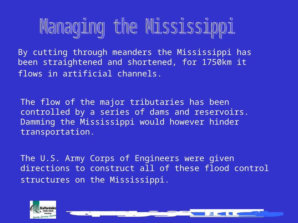
By cutting through meanders the Mississippi has been straightened
and shortened, for 1750km it flows in artificial channels.
The U.S. Army Corps of Engineers were given directions to construct
all of these flood control structures on the Mississippi.
The flow of the major tributaries has been controlled by a series of dams and reservoirs. Damming the Mississippi would however hinder transportation.

TOPS Top 10 Geography in conjunction with www.sln.org.uk/geography
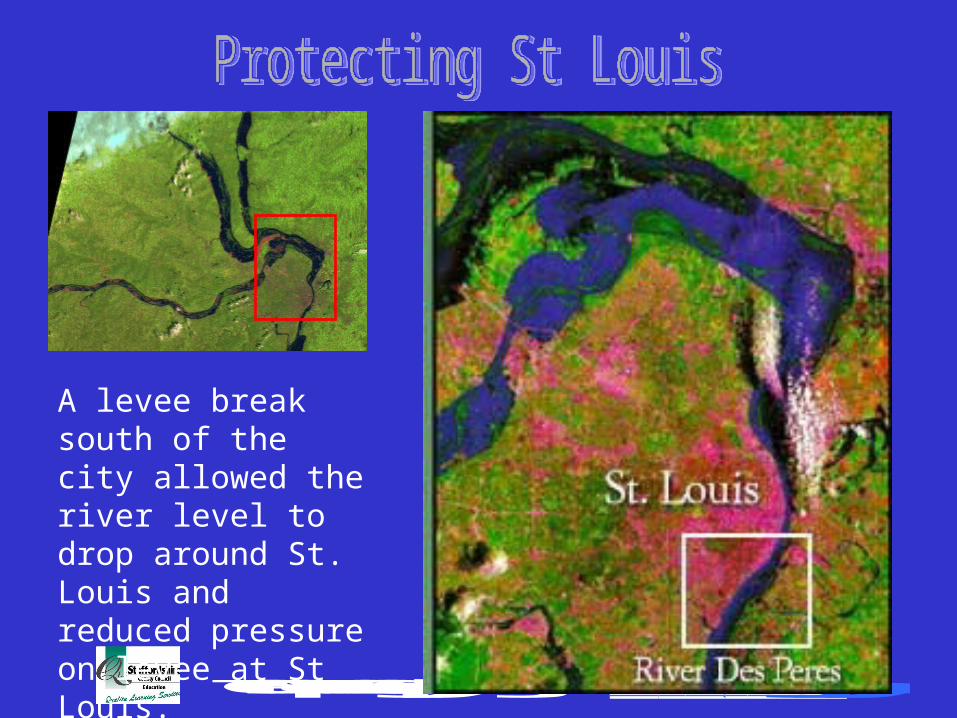
St. Louis was protected by a massive floodwall. The wall developed a leak but held up over the length of the flood.
TOPS Top 10 Geography in conjunction with www.sln.org.uk/geography
A levee break south of the city allowed the river level to drop around St. Louis and reduced pressure on levee at St Louis.
TOPS Top 10 Geography in conjunction with www.sln.org.uk/geography

TOPS Top 10 Geography in conjunction with www.sln.org.uk/geography

TOPS Top 10 Geography in conjunction with www.sln.org.uk/geography
As a result of the flooding 150 primary levees failed along the extent of the river, the river caused approximately $12 billion worth of damage, caused
50 deaths and broke communication lines.