http:
TRANSCRIPT

http://www.edwardmooney.com/history/qhhs-history-resources-maps.htm

www.world-maps.co.uk


Formed by glacial erosion.

http://www.canadianbiodiversity.mcgill.ca/english/species/plants/plantpages/pol_app.htm
Very old mountains formed by subduction and eroded over hundreds of thousands of years.
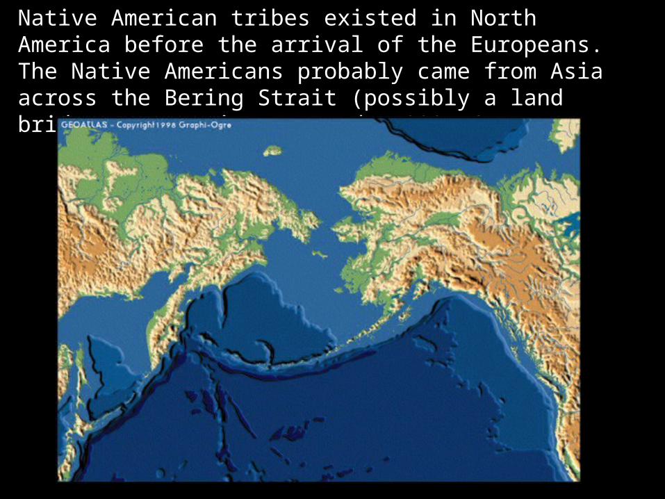
Native American tribes existed in North America before the arrival of the Europeans. The Native Americans probably came from Asia across the Bering Strait (possibly a land bridge at one time) around 15000 BC

http://www.saultmed.com/images/great_lakes_big.jpg
Formed by glacial erosion.
http://geology.utah.gov/surveynotes/gladasked/gladfoam.htm
http://www.geocities.com/SouthBeach/Shores/9144/Scrapbook/scrapbook.html
http://www.cnn.com/2001/US/01/15/utah.crash.01/
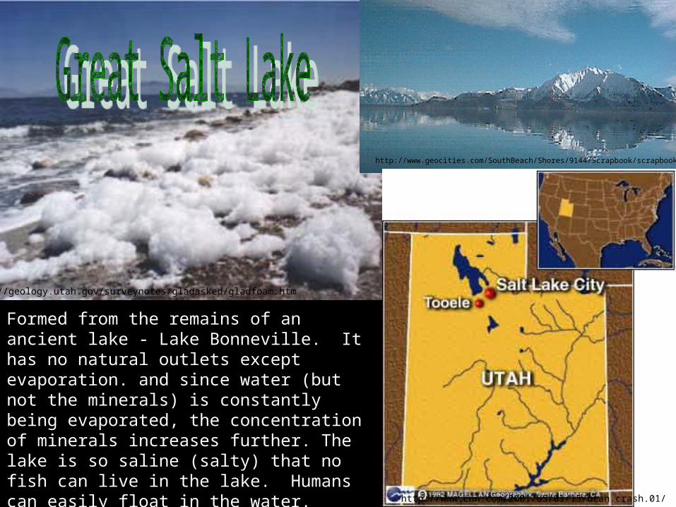
Formed from the remains of an ancient lake - Lake Bonneville. It has no natural outlets except evaporation. and since water (but not the minerals) is constantly being evaporated, the concentration of minerals increases further. The lake is so saline (salty) that no fish can live in the lake. Humans can easily float in the water.

http://www.crd.de/pics/themenreisen/kreuzfahrten/mississippi/Map.jpg
http://www.nasa.gov/images/content/126364main_pia04174-516.jpg
Major transportation route. Over half of the US is drained by the Mississippi River watershed.

http://www.nsc.org/graphics/basin.gif

Abundant fresh water has helped in agriculture, industry, and transportation (Water transportation is often the cheapest form of transport). Access to both the Atlantic and Pacific Oceans has helped in trade for both countries.
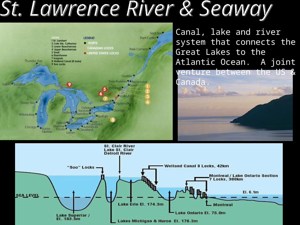
Canal, lake and river system that connects the Great Lakes to the Atlantic Ocean. A joint venture between the US & Canada.

http://www.accountingdirectory.us/12.jpg
Great Plains – formed by glacial erosion. Breadbasket of the world.

Vegetation

http://www.accountingdirectory.us/12.jpg

http://worldatlas.com/webimage/countrys/nalnd.htm
Formed by subduction of North American and Pacific plates. These mountains are geologically young (jagged peaks – not eroded)

http://www.canadianbiodiversity.mcgill.ca/english/species/plants/plantpages/pol_app.htm

The Canadian Shield is a large geographic area in eastern and central Canada composed of bare rock dating to the Precambrian Era (between 4.5 billion and 540 million years ago). It is also called the Laurentian Shield. The Canadian Shield is made up of some of the planet's oldest rock, largely granite and gneiss that was exposed from glacial erosion. Obviously growing large crops will be difficult in this area.

New York CityLos Angeles
Houston
PhiladelphiaPhoenix
San Antonio
San Diego
Dallas
Chicago
San JoseToronto
Montreal
VancouverCalgary
Ottowa