history and geography world deserts
TRANSCRIPT

History and GeoGrapHy
World DesertsReader
Frog in the Australian Outback
Joshua tree in the Mojave Desert
Camel train across the Sahara Desert
South American sheepherder
THIS BOOK IS THE PROPERTY OF:STATE
PROVINCE
COUNTY
PARISH
SCHOOL DISTRICT
OTHER
Book No.
Enter information in spaces to the left as instructed.
CONDITION
ISSUED RETURNEDISSUED TOYear Used
PUPILS to whom this textbook is issued must not write on any page or mark any part of it in any way, consumable textbooks excepted.
1. Teachers should see that the pupil’s name is clearly written in ink in the spaces above in every book issued.
2. The following terms should be used in recording the condition of the book: New; Good; Fair; Poor; Bad.
World DesertsReader

ISBN
: 978
-1-6
8380
-317
-1
Creative Commons LicensingThis work is licensed under a Creative Commons Attribution-NonCommercial-ShareAlike 4.0 International License.
You are free:to Share—to copy, distribute, and transmit the work to Remix—to adapt the work
Under the following conditions:Attribution—You must attribute the work in the following manner:
This work is based on an original work of the Core Knowledge® Foundation (www.coreknowledge.org) made available through licensing under a Creative Commons Attribution-NonCommercial-ShareAlike 4.0 International License. This does not in any way imply that the Core Knowledge Foundation endorses this work.
Noncommercial—You may not use this work for commercial purposes.
Share Alike—If you alter, transform, or build upon this work, you may distribute the resulting work only under the same or similar license to this one.
With the understanding that: For any reuse or distribution, you must make clear to others the license terms of this work. The best way to do this is with a link to this web page:
https://creativecommons.org/licenses/by-nc-sa/4.0/
Copyright © 2018 Core Knowledge Foundation www.coreknowledge.org
All Rights Reserved.
Core Knowledge®, Core Knowledge Curriculum Series™, Core Knowledge History and Geography™ and CKHG™ are trademarks of the Core Knowledge Foundation.
Trademarks and trade names are shown in this book strictly for illustrative and educational purposes and are the property of their respective owners. References herein should not be regarded as affecting the validity of said trademarks and trade names.

World DesertsTable of Contents
Chapter 1 What Is a Desert? . . . . . . . . . . . . . . . . . . . . . . . . . . . . . . . . 2
Chapter 2 Deserts of Africa . . . . . . . . . . . . . . . . . . . . . . . . . . . . . . . . 12
Chapter 3 Australia, a Dry Continent . . . . . . . . . . . . . . . . . . . . 18
Chapter 4 Deserts of Asia . . . . . . . . . . . . . . . . . . . . . . . . . . . . . . . . . . 24
Chapter 5 Deserts of North America . . . . . . . . . . . . . . . . . . . . . 30
Chapter 6 Deserts of South America . . . . . . . . . . . . . . . . . . . . . 36
Glossary . . . . . . . . . . . . . . . . . . . . . . . . . . . . . . . . . . . . . . . . . . . . . . . . . . . . . . 44

World DesertsReader
Core Knowledge History and Geography™
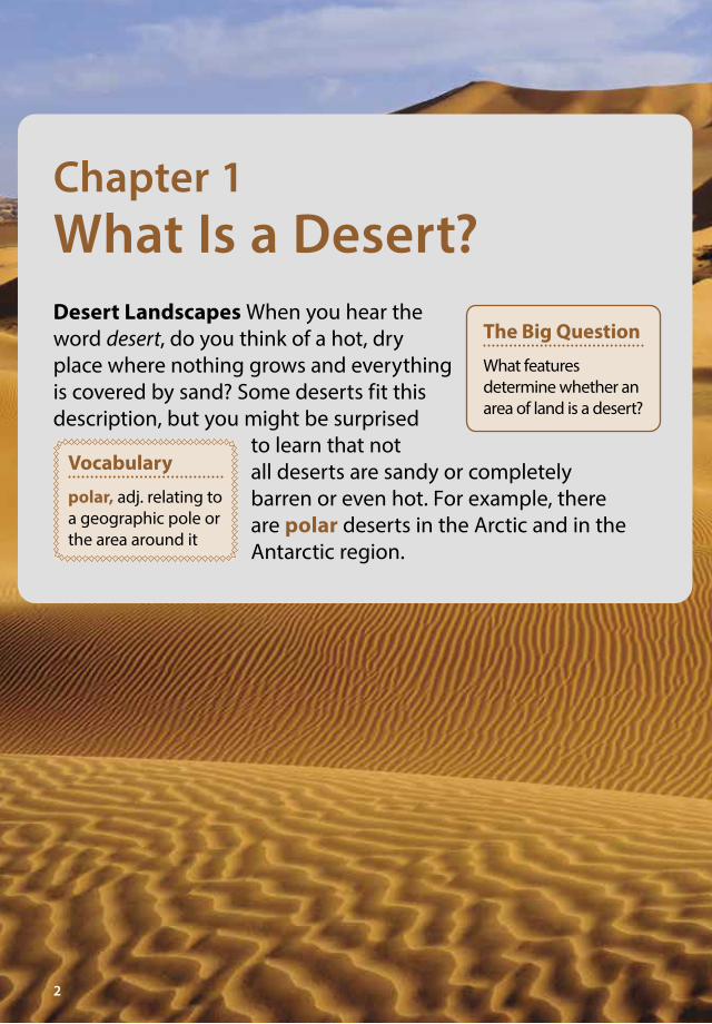
Chapter 1What Is a Desert?Desert Landscapes When you hear the word desert, do you think of a hot, dry place where nothing grows and everything is covered by sand? Some deserts fit this description, but you might be surprised
to learn that not all deserts are sandy or completely barren or even hot. For example, there are polar deserts in the Arctic and in the Antarctic region.
2
Vocabulary
polar, adj. relating to a geographic pole or the area around it
The Big Question
What features determine whether an area of land is a desert?
3
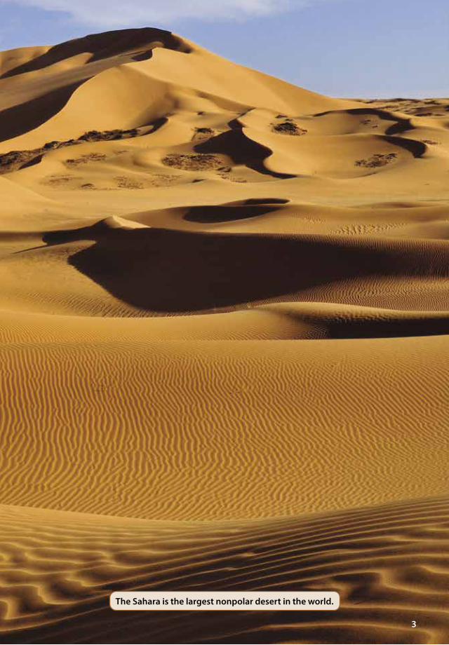
The Sahara is the largest nonpolar desert in the world.
4
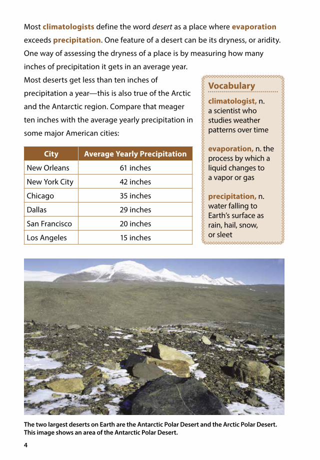
Most climatologists define the word desert as a place where evaporation
exceeds precipitation. One feature of a desert can be its dryness, or aridity.
One way of assessing the dryness of a place is by measuring how many
inches of precipitation it gets in an average year.
Most deserts get less than ten inches of
precipitation a year—this is also true of the Arctic
and the Antarctic region. Compare that meager
ten inches with the average yearly precipitation in
some major American cities:
City Average Yearly Precipitation
New Orleans 61 inches
New York City 42 inches
Chicago 35 inches
Dallas 29 inches
San Francisco 20 inches
Los Angeles 15 inches
The two largest deserts on Earth are the Antarctic Polar Desert and the Arctic Polar Desert. This image shows an area of the Antarctic Polar Desert.
Vocabulary
climatologist, n. a scientist who studies weather patterns over time
evaporation, n. the process by which a liquid changes to a vapor or gas
precipitation, n. water falling to Earth’s surface as rain, hail, snow, or sleet

5
Even when it does rain in a desert, plants and animals are often only able to
use a small amount of the rainwater. For example, sudden thunderstorms
can cause heavy rainfall, but the water quickly runs off in flash floods and
does not soak into the ground. When a light shower falls over a dry desert
area, most of the rain evaporates before it touches the ground because the
air is so dry.
The strength of the sun is also a factor. When temperatures are very high,
as they are in many deserts, evaporation speeds up. Because of this, the water
has less time to soak into the parched soil.
Desert Temperatures
Many deserts are hot as well as dry. Not surprisingly, deserts near the equator
are very hot. In the Sahara in Africa, daytime temperatures routinely soar
well above 100° Fahrenheit (F). However, the highest recognized recorded
temperature was measured on July 10, 1913, at Greenland Ranch in Death
Valley, California. On that day, the temperature reached 134°F.
Deserts far from the equator tend not to have the scorching hot temperatures
of the Sahara. In fact, during the winter, these deserts can be freezing cold.
The average winter temperature in the Gobi in northern China is 10° to l5°F.
And then there are the polar deserts. In the Arctic Polar Desert, the winter
temperature can drop below -60°F.
One feature that both “hot” and “cold” deserts share is a dramatic change
between daytime and nighttime temperatures. At night, the temperature in
a hot desert can drop anywhere from 30° to 70°F. Clouds keep warm air near
the ground. Desert skies, whether they are hot or dry, are often cloudless, so
at night much of the heat rises into the sky, leaving the desert much colder
than it is in the daytime.
6
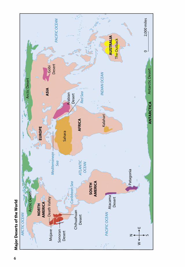
02,
000
mile
s
ATLA
NTI
C O
CEAN
PACI
FIC
OCE
AN
PACI
FIC
OCE
AN
IND
IAN
OCE
AN
ARCT
IC O
CEAN N
ORT
H
AM
ERIC
A
SOU
TH
AM
ERIC
A
ASI
A
Maj
or D
eser
ts o
f the
Wor
ld
Med
iterr
anea
nSe
a
Red
Sea
Carib
bean
Sea
Ata
cam
aD
eser
t
Pata
goni
aN S
EW
AFR
ICA
AN
TARC
TICA
Saha
ra
Gob
iD
eser
t
Ant
arct
ic D
eser
t
Kala
hari
Moj
ave
Dea
th V
alle
y
Sono
ran
Des
ert
Chih
uahu
anD
eser
t
Arc
tic D
eser
t
EURO
PE
Ara
bian
Des
ert
AU
STRA
LIA
The
Out
back
Arc
tic D
eser
t

7
Desert Landforms
Some deserts contain great seas of
sand, but other deserts have little
or no sand. Only about 2 percent of
North American deserts are covered
with sand. The Sahara, famous for its
sand dunes, is only about 10 percent
sand covered.
Just as deserts can exhibit a wide
range of temperatures, they can
also contain many different types
of landforms. Deserts can have
mountains, plateaus, or plains.
Some are covered with gravel, bare
bedrock, or sand.
Sometimes the desert landscape is
scarred and crisscrossed with ravines,
gullies, and canyons caused by rushing
water from flash floods. On those
rare occasions when rain does fall,
the water runs downhill, carving a path
through the thin soil. Eventually the
path turns into a ditch, the ditch into
a gully, the gully into a ravine, and the
ravine can even turn into a canyon.
Desert winds also shape the
landscape. The wind blows
away whatever thin topsoil there is,
leaving behind sand, rock, or gravel.
Great Sand Dunes National Park, in southern Colorado, is known for its spectacular dunes.
Here you can see how over many, many years, water has worn away the landscape to create a ravine.

8
Life in the Desert
Although some deserts of the world can be difficult places to live, over
thousands of years groups of people, as well as animals and plants, have found
ways to survive. The key to survival is the ability to adapt to the environment.
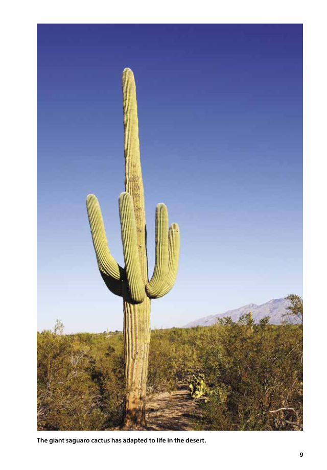
The giant saguaro (/suh*war*oh/) cactus grows in the deserts of southern
Arizona and northern Mexico. To survive in the desert, the cactus has
adapted to the environment in several ways. Its stem is fleshy and thick,
allowing it to store enormous amounts of water. It has no leaves that could
lose moisture. It also spreads its roots in a wide area near the surface of the
soil. This enables it to absorb, or take in, as much water as possible during
the infrequent rains.
Camels live in the Sahara and in other deserts. They can go for long periods of time
without drinking. The North American kangaroo rat is even more ideally adapted
to desert life. It can survive its entire lifetime without sipping a drop of water.
Kangaroo rats get the water they need to survive by eating plants, such as cacti.
9
The giant saguaro cactus has adapted to life in the desert.
10
It gets moisture from seeds and plant leaves, which contain small amounts of
water. However, its main adaptation is the special water recycling system in
its own body.
The kangaroo rat’s kidneys recycle water internally. The animal loses very
little water through natural processes. When a kangaroo rat has to relieve
itself, it leaves behind a patch of crystals instead of a stream of liquid urine.
Many desert animals, including rats, mice, squirrels, and lizards, are nocturnal.
They avoid the harsh heat of the daytime by burrowing deep into the ground
and coming out only at night.
People have also learned how to survive in desert areas. For example,
some native peoples of the American Southwest learned how to use irrigation
systems to water their crops. Entire Native American societies lived in
American desert lands. This is also true of the history of groups of people
who live, or once lived, in the great deserts of Africa and Asia.
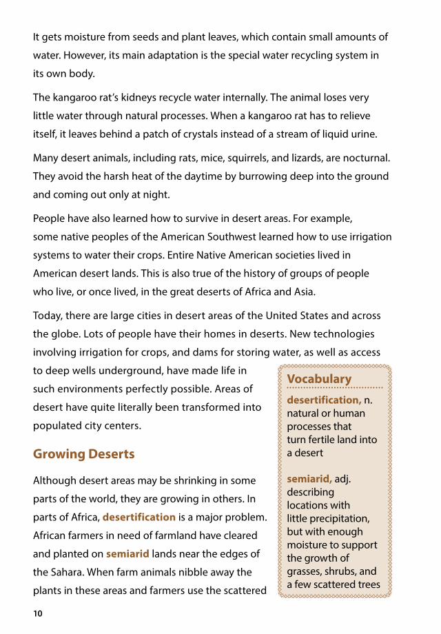
Today, there are large cities in desert areas of the United States and across
the globe. Lots of people have their homes in deserts. New technologies
involving irrigation for crops, and dams for storing water, as well as access
to deep wells underground, have made life in
such environments perfectly possible. Areas of
desert have quite literally been transformed into
populated city centers.
Growing Deserts
Although desert areas may be shrinking in some
parts of the world, they are growing in others. In
parts of Africa, desertification is a major problem.
African farmers in need of farmland have cleared
and planted on semiarid lands near the edges of
the Sahara. When farm animals nibble away the
plants in these areas and farmers use the scattered
Vocabulary
desertification, n. natural or human processes that turn fertile land into a desert
semiarid, adj. describing locations with little precipitation, but with enough moisture to support the growth of grasses, shrubs, and a few scattered trees
11
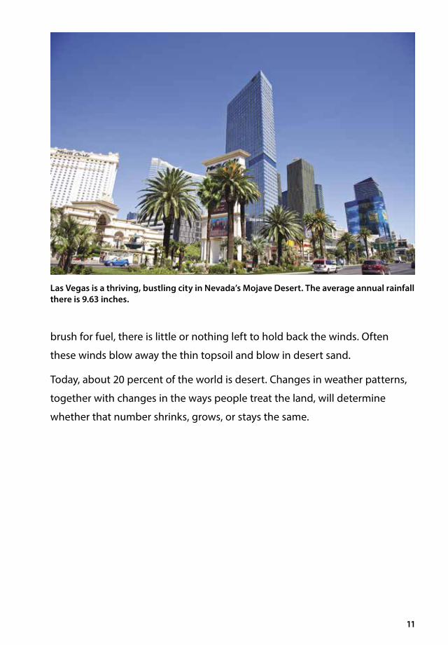
Las Vegas is a thriving, bustling city in Nevada’s Mojave Desert. The average annual rainfall there is 9.63 inches.
brush for fuel, there is little or nothing left to hold back the winds. Often
these winds blow away the thin topsoil and blow in desert sand.
Today, about 20 percent of the world is desert. Changes in weather patterns,
together with changes in the ways people treat the land, will determine
whether that number shrinks, grows, or stays the same.

Chapter 2Deserts of AfricaThe Sahara A caravan of camels makes its way across endless sand dunes. It follows a route between shifting dunes that sometimes rise several hundred feet high. The camels labor along at a steady two miles per hour. They each carry nearly four hundred pounds of salt from the salt mines in the desert.
12
The Big Question
What are the similarities and differences between the Sahara and Kalahari deserts?
13
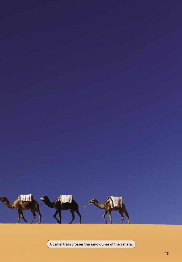
A camel train crosses the sand dunes of the Sahara.
14
The heat is brutal. The sun is high overhead, and the sand is reflecting its
heat. Fortunately, camels are designed for this kind of heat. Their long legs
keep their bodies well above the burning sand, their stomachs hold a lot of
water, and their humps contain fat that can be used for energy when food
supplies are short. But the humps have begun to sag, a sign the camels have
gone too long without food.
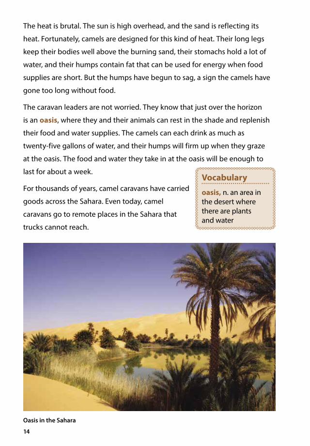
The caravan leaders are not worried. They know that just over the horizon
is an oasis, where they and their animals can rest in the shade and replenish
their food and water supplies. The camels can each drink as much as
twenty-five gallons of water, and their humps will firm up when they graze
at the oasis. The food and water they take in at the oasis will be enough to
last for about a week.
For thousands of years, camel caravans have carried
goods across the Sahara. Even today, camel
caravans go to remote places in the Sahara that
trucks cannot reach.
Oasis in the Sahara
Vocabulary
oasis, n. an area in the desert where there are plants and water

15
Vocabulary
salt flat, n. an area of land where evaporation has left a layer of salt
radiate, v. to send out
The Sahara is a patchwork desert of rocky
mountains, salt flats, gravel plains, and sand
seas. It stretches about three thousand miles
across Africa, from the Atlantic Ocean in the
west to the Red Sea in the east. It is 1,200 miles
from north to south and covers three and a half
million square miles. That’s almost the size of
the United States.
Daytime temperatures in the summer are
extremely hot. But like most deserts, the
Sahara does not hold the daytime heat.
Nighttime temperatures can sometimes drop
to freezing during the cooler months of the year.
The Sahara is drier than most deserts, with an average rainfall of less than
four inches per year. There are many years in which no rain falls in some
parts of the desert. Nevertheless, the Sahara does have widely scattered
permanent water sources, such as oases. And the world’s longest river, the
Nile, runs through the eastern part of this largest-of-all deserts.
Despite its barren features, much of the Sahara supports a variety of plant
and animal life. Many plants have special root systems that reach deep into
the earth to find water. Both large and small
animals live in the Sahara. There are antelopes that
rarely drink water but that get their moisture from
the shrubs they eat. Gazelles and wild mountain
sheep roam the dusty Sahara. The small fennec
fox, whose large ears radiate heat from its body to
help keep it cool, also calls the Sahara its home.
The Sahara supports human life too. Although fewer people live in the drier
areas of the Sahara, millions and millions of people live on the desert margins.
Fennec fox
16
A number of African countries have land that extends into this vast desert,
including Algeria, Chad, Egypt, Libya, Mali, Mauritania, Morocco, Niger,
Sudan, and Tunisia.
The Kalahari Desert
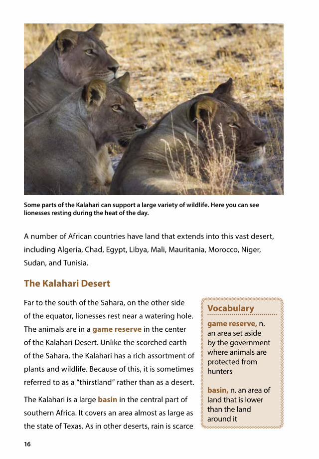
Far to the south of the Sahara, on the other side
of the equator, lionesses rest near a watering hole.
The animals are in a game reserve in the center
of the Kalahari Desert. Unlike the scorched earth
of the Sahara, the Kalahari has a rich assortment of
plants and wildlife. Because of this, it is sometimes
referred to as a “thirstland” rather than as a desert.
The Kalahari is a large basin in the central part of
southern Africa. It covers an area almost as large as
the state of Texas. As in other deserts, rain is scarce
Vocabulary
game reserve, n. an area set aside by the government where animals are protected from hunters
basin, n. an area of land that is lower than the land around it
Some parts of the Kalahari can support a large variety of wildlife. Here you can see lionesses resting during the heat of the day.

17
here and does not fall in predictable patterns. Most of the Kalahari averages
about five inches of rain per year. Yet some parts get more than fifteen
inches. This is usually enough moisture to support a variety of wildlife—large
animals such as wildebeests, lions, antelopes, jackals, elephants, giraffes, and
zebras, as well as many small animals, birds, and reptiles. Over thousands
of years, one group of people called the San (or Bushmen) learned to adapt
remarkably well to the dry conditions of the Kalahari.
The San People
The San learned how to find and save water. They use ostrich eggs as storage
containers. Ostrich eggs are the largest eggs laid by any bird. One ostrich egg
can hold as much liquid as two dozen chicken eggs. The San make a hole at
each end of an ostrich egg. Then they blow out the insides, which they use
for food. After a rain, they fill the hollow eggshells with water and tightly plug
the two ends. Then they bury the filled shells in the sand along their routes.
When the droughts come, as they always do, the San have a water supply.
The San, or Bushmen, are experts when it comes to living in the desert. Here you can see an ostrich egg being used to store water during a trek.

Chapter 3Australia, a Dry ContinentSurviving in the Desert In the heart of Australia, a man walks across the reddish-orange earth dotted with scrub brush. The man is an Aboriginal person. Aboriginal peoples have lived on the Australian continent for
at least forty thousand years. Thousands of years of close and careful observation of their environment have equipped Aboriginal peoples for survival on this mostly flat, mostly desert land.
The man stops to look at the earth. To the untrained eye, this spot is no different
from any other spot on the ground. He stomps with his bare foot, raising little
clouds of red dust. Lizards scurry into the scrub brush.
The man stops stomping and listens. He hears what he hoped to hear—the
croaking of frogs, muffled beneath the earth. The frogs have been tricked. From
their burrows under the surface, the desert frogs thought they were hearing the
sound of thunder, signaling that rain would soon fall.
18
The Big Question
What strategies have Aboriginal peoples adopted in order to survive the harsh conditions of desert life?
Vocabulary
scrub brush, n. small or short bushes and trees
19
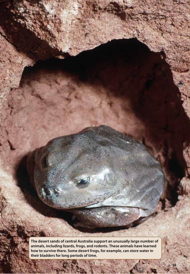
The desert sands of central Australia support an unusually large number of animals, including lizards, frogs, and rodents. These animals have learned how to survive there. Some desert frogs, for example, can store water in their bladders for long periods of time.
20
In a real rainstorm, the frogs emerge from their burrows and drink water from
rain pools. They fill their bodies almost to bursting. Then they retreat to their
burrows and use the water stored in their bodies until the next storm.
But the man has fooled the frogs. He uses sticks to dig in the earth. Finding a
burrow, he pulls out a frog, its body bloated with water. Tilting his head back,
he squeezes the frog until a stream of liquid squirts out, flowing down the
man’s parched throat.
The Outback
Two-thirds of Australia is arid or semiarid, with
few rivers and little rain. The interior of the
continent—called the Outback—is mostly desert.
The Outback is so dry in some regions that it seems
impossible that any creature could survive there.
Most of the desert land is covered with sand
hills and spotted with short grasses. Sands often
swirl into huge dunes. There is not much water
in the Outback, but after a rain, rocky pools
sometimes fill up. These pools are important
sources of water. Water also collects in pools in old
riverbeds, places the Australians call billabongs
(dry streambeds that fill with water only in the rainy season). Sudden, heavy
rains can briefly fill old riverbeds and lakes, but the water quickly washes
down the riverbed, and the lakes dry out, leaving salt flats.
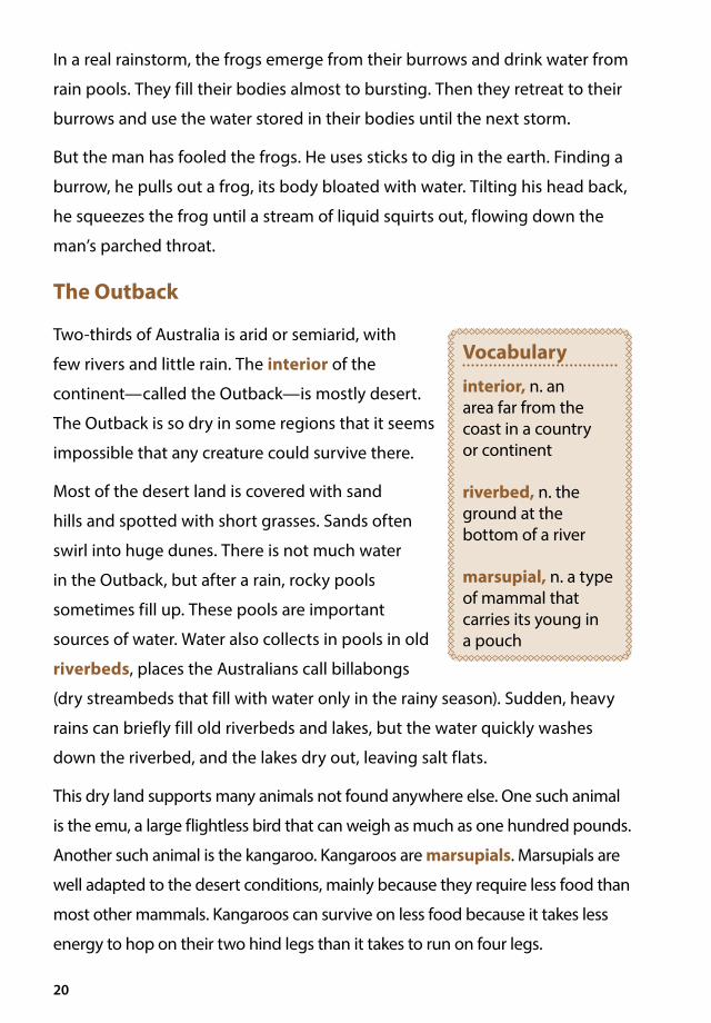
This dry land supports many animals not found anywhere else. One such animal
is the emu, a large flightless bird that can weigh as much as one hundred pounds.
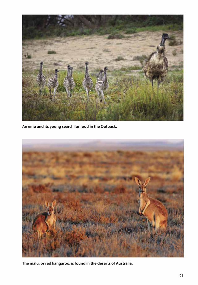
Another such animal is the kangaroo. Kangaroos are marsupials. Marsupials are
well adapted to the desert conditions, mainly because they require less food than
most other mammals. Kangaroos can survive on less food because it takes less
energy to hop on their two hind legs than it takes to run on four legs.
Vocabulary
interior, n. an area far from the coast in a country or continent
riverbed, n. the ground at the bottom of a river
marsupial, n. a type of mammal that carries its young in a pouch
21
An emu and its young search for food in the Outback.
The malu, or red kangaroo, is found in the deserts of Australia.

22
A Singing Map
Today, only a few
Aboriginal people who
live in the Australian
interior continue the
traditional way of life.
However, before the
Europeans came to
Australia and disrupted
their culture, the
Aboriginal people proved
that human beings can
survive in even the most
unforgiving climate.
According to the myths of
the Aboriginal people, the
world was created during
the “dreamtime,” a time
before time. The things
of Earth were created by ancestral beings. These beings walked Earth singing
out the name of each thing as they created it. They sang about the water
holes, the gum trees, the riverbeds, the sand dunes. Everywhere they walked,
they sang, leaving a trail of song behind them. Once the world was created
and named, the beings disappeared into nature. The beings themselves
disappeared, but their songs survived. This is the Aboriginal peoples’ myth of
how their “songlines” came into being.
These songlines, or songs, have been passed by word of mouth from
generation to generation for thousands of years. The songlines are literally
maps of the land.
This is an Australian gum, or eucalyptus, tree.
23
Australia’s Aboriginal people were originally
nomadic hunters and gatherers. These small
groups of people wandered a territory that could
be as large as a thousand square miles. By singing
the songs, they could find the food and water
necessary for survival. Their songlines led them
to rocky pools of water a hundred miles away, to
places where they could find wild
plant foods in season, or to rich
hunting grounds.
A single Aboriginal man on
a “walkabout,” or wandering
journey, might reach the edge
of the territory described in his
songlines. He would then ask the
group of Aboriginal people in the
next territory to teach him their
songlines. He could then safely
travel long distances in the harsh
desert, using the musical map of
the songlines to find his way.
The songlines continue to provide
Aboriginal people with the
knowledge they need to survive in
their desert lands.
Vocabulary
nomadic, adj. moving around often in search of food; not settled in one place
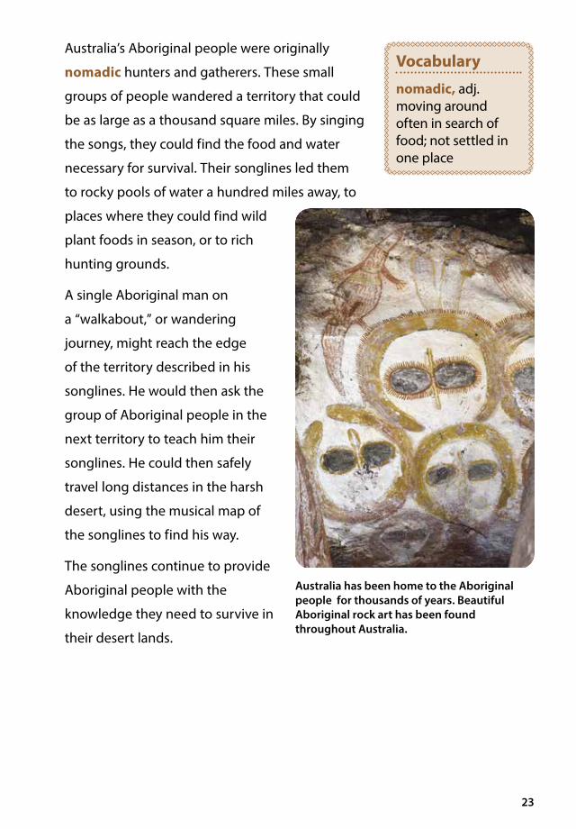
Australia has been home to the Aboriginal people for thousands of years. Beautiful Aboriginal rock art has been found throughout Australia.
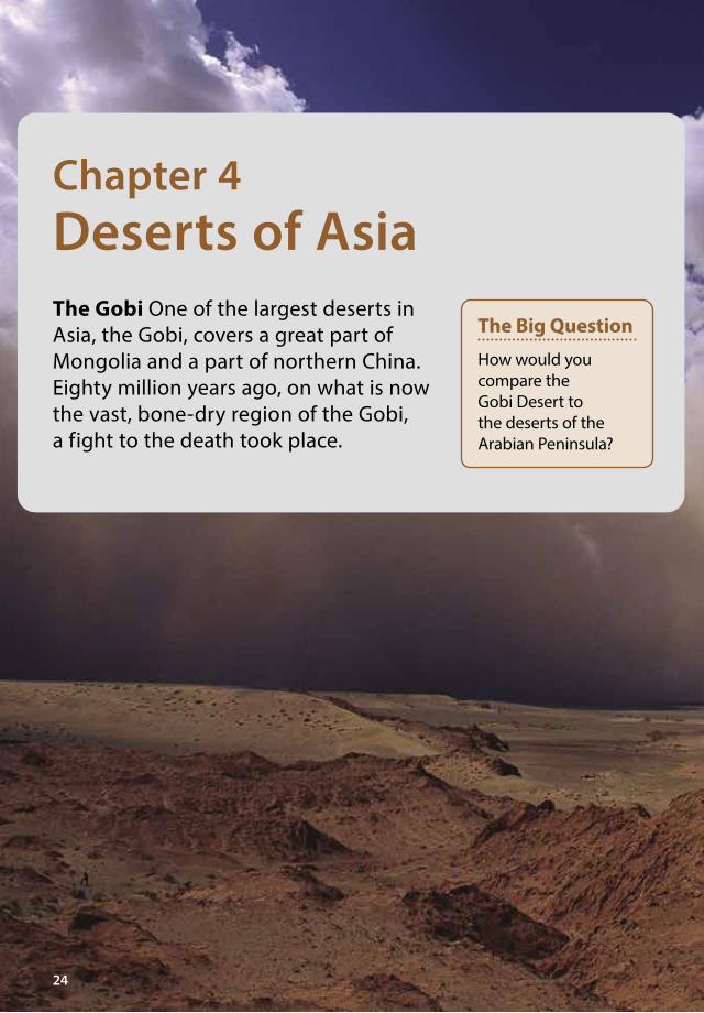
Chapter 4Deserts of Asia The Gobi One of the largest deserts in Asia, the Gobi, covers a great part of Mongolia and a part of northern China. Eighty million years ago, on what is now the vast, bone-dry region of the Gobi, a fight to the death took place.
24
The Big Question
How would you compare the Gobi Desert to the deserts of the Arabian Peninsula?
25
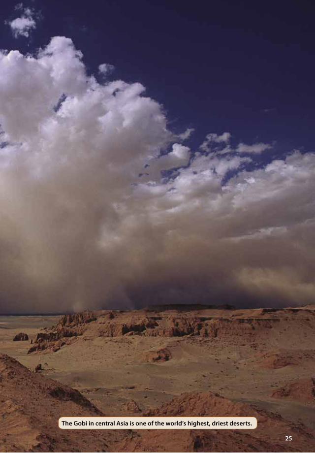
The Gobi in central Asia is one of the world’s highest, driest deserts.

26
When Dinosaurs Walked the Earth
A protoceratops, a plant-eating dinosaur,
peacefully grazed near the banks of a salt marsh.
In the grasses covering the area, a predator lurked.
It was a velociraptor, a small, but powerful, meat-
eating dinosaur. Sensing that the moment was
right, the velociraptor struck. Using its strong hind
legs, it jumped on the back of the protoceratops.
The plant-eating dinosaur fought back, using its hind legs, its long heavy tail,
and its beak-shaped jaws. But neither animal could overcome the other. Soon
both lay on the ground, gasping their last breaths. They died there together,
predator and prey. Nearly eighty million years later, scientists discovered their
bones in what had become the arid desert of the Gobi.
The Gobi Desert has been described as a treasure trove of dinosaur bones. Here you can see dinosaur bones found in the Gobi Desert.
Vocabulary
salt marsh, n. an area of coastal wetland, directly affected by the rise and fall of the tide
27
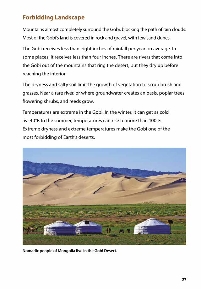
Forbidding Landscape
Mountains almost completely surround the Gobi, blocking the path of rain clouds.
Most of the Gobi’s land is covered in rock and gravel, with few sand dunes.
The Gobi receives less than eight inches of rainfall per year on average. In
some places, it receives less than four inches. There are rivers that come into
the Gobi out of the mountains that ring the desert, but they dry up before
reaching the interior.
The dryness and salty soil limit the growth of vegetation to scrub brush and
grasses. Near a rare river, or where groundwater creates an oasis, poplar trees,
flowering shrubs, and reeds grow.
Temperatures are extreme in the Gobi. In the winter, it can get as cold
as -40°F. In the summer, temperatures can rise to more than 100°F.
Extreme dryness and extreme temperatures make the Gobi one of the
most forbidding of Earth’s deserts.
Nomadic people of Mongolia live in the Gobi Desert.

28
The Arabian Peninsula
The Arabian Peninsula lies between the Red Sea and the Persian Gulf. Its
northernmost end connects the continents of Africa and Asia. The Arabian
Peninsula is made up of the countries of Yemen, Oman, Qatar, Bahrain,
Kuwait, Saudi Arabia, the United Arab Emirates, and parts of Jordan and Iraq.
Parts of the peninsula are covered with rock and
gravel, but most of it is a vast expanse of sand. It is
the largest sand desert in the world. Sand dunes can
reach as high as eight hundred feet and stretch for
thirty miles. The land is mostly empty. One large part
of the peninsula is called Rub’ al Khali, meaning Empty
Quarter in Arabic. The few camel-herding Bedouin
tribes that roam this land call the region ar-Ramlah,
or the Sand. In the summer, the average daytime
temperature in the sand deserts can reach 110°F.
Vocabulary
peninsula, n. a piece of land sticking out into a body of water, so that it is almost surrounded by water
Bedouin, adj. relating to nomadic Arab tribes of Arabia and North Africa
The sand dunes of the Arabian Peninsula can be hundreds of feet high and many miles long.

29
Not a single significant permanent river runs
through this peninsula. Most of the land is bone-
dry. Where there is enough moisture for people
to live, the most important plant is the date palm
tree. Dates are an important food for humans. In
addition, fiber from the trees is used for ropes and
mats, and the wood is used for building.
Most of the land on the peninsula belongs to Saudi Arabia. When the Saudi
Arabian king, Ibn Saud, inherited his kingdom in 1932, he did not know that
beneath the sand was enough oil to make him and his family very wealthy.
In 1933, officials from the American-owned Standard Oil Company offered
the king 35,000 gold coins, plus a percentage of profits from anything
found, for the right to drill for oil in his kingdom. After several years
of preparation and drilling, more oil was discovered than anyone had
imagined. Today, more than one-third of Earth’s known gas and oil lies
beneath the desert sands of the Arabian Peninsula. The discovery of oil in
the Arabian Peninsula has made some countries there very rich.
Vocabulary
fossil fuel, n. fuel, such as oil, natural gas, and coal formed in the earth from the remains of living things
Here you can see an oil refinery on the Arabian Peninsula. Most scientists believe that oil is formed from the remains of buried dead life forms—which is why it is called a fossil fuel.
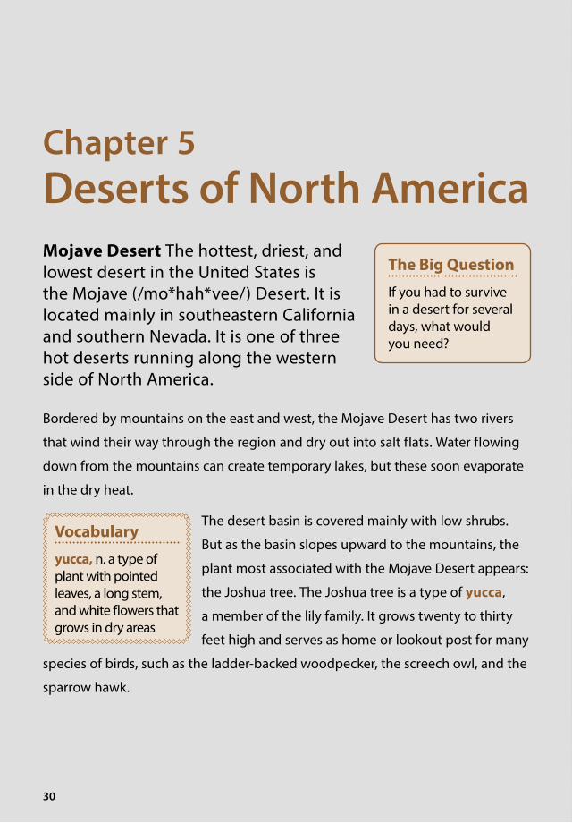
Chapter 5Deserts of North AmericaMojave Desert The hottest, driest, and lowest desert in the United States is the Mojave (/mo*hah*vee/) Desert. It is located mainly in southeastern California and southern Nevada. It is one of three hot deserts running along the western side of North America.
Bordered by mountains on the east and west, the Mojave Desert has two rivers
that wind their way through the region and dry out into salt flats. Water flowing
down from the mountains can create temporary lakes, but these soon evaporate
in the dry heat.
The desert basin is covered mainly with low shrubs.
But as the basin slopes upward to the mountains, the
plant most associated with the Mojave Desert appears:
the Joshua tree. The Joshua tree is a type of yucca,
a member of the lily family. It grows twenty to thirty
feet high and serves as home or lookout post for many
species of birds, such as the ladder-backed woodpecker, the screech owl, and the
sparrow hawk.
30
The Big Question
If you had to survive in a desert for several days, what would you need?
Vocabulary
yucca, n. a type of plant with pointed leaves, a long stem, and white flowers that grows in dry areas
31
The Joshua tree of the Mojave Desert is a spiked-leaf evergreen. It does not grow anywhere else in the world.
32
The most famous region of the Mojave Desert is Death Valley in California. It
is a low spot in the desert 130 miles long and ranging from 6 to 14 miles wide.
Death Valley is both the lowest and the hottest place in the United States.
It was formed when a block of earth dropped down between two fault lines.
At 282 feet below sea level, Death Valley has the lowest elevation in the
Western Hemisphere. It is also the driest place in the United States, receiving
less than two inches of rain per year. As you have discovered, Death Valley
boasts the all-time recognized record high temperature of 134°F.
Death Valley was once a busy area. In the 1800s,
workers mined borax there, a mineral salt with
many industrial uses. Covered wagons carried
workers and resources in and out of the desert.
Today, Death Valley is a national park.
The Sonoran Desert
In the 1800s, if you were a settler or a gold hunter
traveling the southern route to California, you
would have crossed the Sonoran Desert in Arizona.
The trail across the desert was a two-hundred-mile
stretch that earned the name Devil’s Highway.
Why such a grim name? This area of bleak desert
land through which the Devil’s Highway passed
has only one dependable water source. Coyotes,
wild burros, and Gila monsters roam this dusty
landscape. In some places, it is crusted with black
lava rock. Travelers in the 1800s could not avoid seeing makeshift crosses
dotting the trail, grave markers of the many travelers who died along the way.
In 1905, W. J. McGee, an editor for the National Geographic Society, set up a
research station to study the plants and animals of the region. His station was
located in one of the places in the desert that had water. He later wrote of his
Vocabulary
fault line, n. a crack or split in Earth’s crust along which movement takes place
sea level, n. land that is the same elevation as the surface of the sea or ocean
hemisphere, n. either of two halves of Earth
lava rock, n. rock formed by magma, or melted rock, that has reached Earth’s surface and cooled

33
encounter with two travelers who had miraculously survived this part of the
desert. McGee first met gold prospectors Pablo Valencia and his partner as they
passed along the trail. He invited them to spend the night at his camp. McGee
described Valencia as having a “remarkably fine and vigorous physique.”
Eight days later, McGee was awakened in the early morning by a piercing,
agonized scream. In a nearby canyon, McGee and his assistant discovered
Pablo Valencia. McGee was shocked. In just eight days, Valencia’s body
had shrunk until his “ribs ridged out like those of a starving horse. . . . His
joints and bones stood out and the skin clung to them in a way suggesting
shrunken rawhide.” They poured water over Valencia’s body and down his
throat, but Valencia could not talk or even swallow.
Valencia had been separated from his partner, who was with the horses and
supplies. He was left in the desert with only one canteen of water. He had
wandered in circles through the desert, lost and disoriented from thirst. By
the seventh day, he had lost forty pounds; he could not focus his eyes. He lay
down in a gully, convinced that he was going to die there. But he let out one
last howl, the cry that brought McGee to his rescue.
The Sonoran Desert stretches across Arizona and California, as well as northwestern Mexico.

34
Not all of the Sonoran Desert is as harsh as the area described in this tale.
In the eastern part of the desert, annual rainfall can certainly reach up to
ten inches. However, the western part of the desert might only receive
two inches of rain in an entire year.
The Sonoran Desert is also home to various plants, including the ocotillo
(/oh*kuh*tee*yo/), or candelabra, cactus and the prickly pear cactus, as well
as animals, such as the Mexican grey wolf, the mountain lion, and the great
horned owl.
From left to right above are the prickly pear cactus, the ocotillo cactus, and the saguaro cactus. The image below is of the great horned owl. All live in the Sonoran Desert.

35
The Chihuahuan Desert
To the south and east of the Sonoran Desert lies the Chihuahuan
(/chuh*wah*wahn/) Desert. Most of this desert sits on a plateau in Mexico,
between two mountain ranges. It also stretches into New Mexico and West
Texas. This desert has few sand dunes. The most notable are the white sand
dunes at White Sands National Monument in New Mexico. The area is so
isolated that the U.S. military uses part
of White Sands as a testing range for
bombs and missiles.
The desert plateau in Mexico
receives varying amounts of rainfall,
depending on elevation. Rain comes
mainly in the form of brief, violent
thunderstorms. Average rainfall is only
about eight inches a year, although
the higher elevations may receive
more. Temperatures vary according to
elevation, but most of the desert has
cool to cold winters and hot summers. White Sands National Park, New Mexico

Chapter 6Deserts of South AmericaA Place to Hide In the late 1800s, two American outlaws named Butch Cassidy and the Sundance Kid needed a place to hide. The two men hopped a boat to South America and found the perfect place to hide out: the vast plains and desert of southern Argentina called Patagonia.
36
The Big Question
What are the key features of the Patagonia Desert and the Atacama Desert?

37
A large part of Patagonia is semiarid and treeless.

38
They set up a cattle ranch for a few years on the plains of Patagonia, which
reminded them of the U.S. states of Wyoming and Montana. But the two
outlaws never could settle down. After a few years in Patagonia, they
wandered north and were killed in a shootout with soldiers in Bolivia.
Patagonia’s plains and desert are in the southern part of Argentina. This area
of land is bordered on the west by the soaring Andes Mountains and on the
east by the Atlantic Ocean. Cliffs line almost the entire length of its coast. In
the south, the cliffs can be as high as 150 feet.
Patagonia’s northern border is the Rio Colorado. From there, the region
stretches south 1,200 miles to the island of Tierra del Fuego (/tee*air*uh/del/
fway*goh/) at the tip of South America.
Patagonia
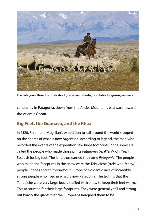
Much of Patagonia is a semiarid area of desert. Cattle and sheep graze on
short grasses and shrubs. Rainfall averages between four and eight inches
a year, but the dry winds evaporate most of the moisture, so that the entire
region is almost completely without trees. Rivers flow down from the Andes
toward the ocean, cutting deep canyons on the tableland. However, as these
rivers cross the dry region, they gradually become smaller and smaller. Only a
few of them make it all the way to the Atlantic.
The surface of the land is made up of gravel,
rock, and, in some places, basalt—a result of old
volcanoes in the region. The basalt flats often have
hollows that contain shallow lakes.
Patagonia is in the Southern Hemisphere, so the
winter months are June through September.
The coldest month is July, when temperatures can
drop well below freezing. Summer temperatures
can climb to 100°F or more. The wind blows
Vocabulary
tableland, n. a wide, flat area of land, often higher than surrounding land; a plateau
basalt, n. a dark gray or black volcanic rock that looks like glass
39
constantly in Patagonia, down from the Andes Mountains eastward toward
the Atlantic Ocean.
Big Feet, the Guanaco, and the Rhea
In 1520, Ferdinand Magellan’s expedition to sail around the world stopped
on the shores of what is now Argentina. According to legend, the man who
recorded the events of the expedition saw huge footprints in the snow. He
called the people who made those prints Patagones (/pat*ah*gohn*es/),
Spanish for big feet. The land thus earned the name Patagonia. The people
who made the footprints in the snow were the Tehuelche (/teh*whel*chay/)
people. Stories spread throughout Europe of a gigantic race of incredibly
strong people who lived in what is now Patagonia. The truth is that the
Tehuelche wore very large boots stuffed with straw to keep their feet warm.
This accounted for their large footprints. They were generally tall and strong
but hardly the giants that the Europeans imagined them to be.
The Patagonia Desert, with its short grasses and shrubs, is suitable for grazing animals.

40
When the Spanish came to Patagonia in the 1600s, they brought horses with
them. As happened in North America, horses escaped and were captured,
tamed, and bred by the indigenous people. Not much is known about the
Tehuelche before the horse was introduced. But with the horse, the Tehuelche
took to the flat, semiarid land of Patagonia, living much like Native Americans
of the Great Plains of North America. But the Tehuelche did not hunt buffalo.
They hunted guanaco and rhea.
The guanaco (gwah*nah*koh/), which is related to the camel, looks like
a small camel without a hump. It is about four feet tall at the shoulder,
with long legs and reddish brown hair. The Tehuelche hunted guanaco on
horseback, using bows and arrows and a weapon called a bola. A bola is
made from two or three strands of rope with a weight tied at each end.
The Tehuelche threw their bolas at the legs of animals, causing them to
fall when their legs became entangled. The Tehuelche also hunted rhea,
a flightless bird similar to the ostrich. The rhea is about five feet tall and
weighs about fifty pounds.
The guanaco, an animal related to the camel, is found in Patagonia.

41
An Argentinian cowboy demonstrates the use of bolas to capture animals.
The Atacama Desert
The Atacama Desert is located on the western coast of South America
between the Pacific Ocean and the Andes. It stretches six hundred miles from
southern Peru into northern Chile.
Climatologists consider parts of the Atacama Desert in Chile to be the
driest place on Earth. Years can pass there without a single drop of rain. The
Atacama Desert is also considered to be the oldest desert on Earth.
Other than some cacti and hardy grasses, little
grows in the Atacama Desert. It is a vast desert
of largely stony landscapes, salt lakes, canyons,
lava rock, and even dunes. Incredibly, because of
its unique terrain, NASA has used it to test fact-
finding equipment that could be sent to Mars. Scientists and photographers
frequent this almost alien landscape.
The Tehuelche hunted rhea on the plains of Patagonia.
Vocabulary
terrain, n. the landforms of a piece of land

42
Stargazers go there too. The Atacama Desert
has incredibly clear skies at night. As a result,
the Atacama Desert contains three international
observatories that have been set up to conduct
important work in the field of astronomy.
People do live on the edge of the Atacama Desert.
In fact, more than a million people live in its coastal cities and towns. Iquique,
Chile, is a large, thriving port city on the edge of this spectacular desert land.
This unique terrain draws scientists and photographers to the Atacama Desert.
Vocabulary
observatory, n. a building from which scientists watch and study the sky

43
The night sky is an extraordinary sight in the Atacama Desert.
Bbasalt, n. a dark gray or black volcanic rock
that looks like glass (38)
basin, n. an area of land that is lower than the land around it (16)
Bedouin, adj. relating to nomadic Arab tribes of Arabia and North Africa (28)
Cclimatologist, n. a scientist who studies
weather patterns over time (4)
Ddesertification, n. natural or human
processes that turn fertile land into a desert (10)
Eevaporation, n. the process by which a liquid
changes to a vapor or gas (4)
Ffault line, n. a crack or split in Earth’s crust
along which movement takes place (32)
fossil fuel, n. fuel, such as oil, natural gas, and coal formed in the earth from the remains of living things (29)
Ggame reserve, n. an area set aside by the
government where animals are protected from hunters (16)
Hhemisphere, n. either of two halves
of Earth (32)
Iinterior, n. an area far from the coast in a
country or continent (20)
Llava rock, n. rock formed by magma, or
melted rock, that has reached Earth’s surface and cooled (32)
Mmarsupial, n. a type of mammal that carries
its young in a pouch (20)
Nnomadic, adj. moving around often in search
of food; not settled in one place (23)
Ooasis, n. an area in the desert where there are
plants and water (14)
observatory, n. a building from which scientists watch and study the sky (42)
Ppeninsula, n. a piece of land sticking out
into a body of water, so that it is almost surrounded by water (28)
polar, adj. relating to a geographic pole or the area around it (2)
precipitation, n. water falling to Earth’s surface as rain, hail, snow, or sleet (4)
Rradiate, v. to send out (15)
riverbed, n. the ground at the bottom of a river (20)
Ssalt flat, n. an area of land where evaporation
has left a layer of salt (15)
salt marsh, n. an area of coastal wetland, directly affected by the rise and fall of the tide (26)
Glossary
44
scrub brush, n. small or short bushes and trees (18)
sea level, n. land that is the same elevation as the surface of the sea or ocean (32)
semiarid, adj. describing locations with little precipitation, but with enough moisture to support the growth of grasses, shrubs, and a few scattered trees (10)
Ttableland, n. a wide, flat area of land,
often higher than surrounding land; a plateau (38)
terrain, n. the landforms of a piece of land (41)
Yyucca, n. a type of plant with pointed leaves,
a long stem, and white flowers that grows in dry areas (30)
45


CKHG™
Core Knowledge History and GeoGrapHy™
Series Editor-In-ChiefE.D. Hirsch, Jr.
Editorial DirectorsLinda Bevilacqua and Rosie McCormick
Subject Matter ExpertCharles F. Gritzner, PhDDistinguished Professor Emeritus of Geography, South Dakota State University
Illustration and Photo Credits© NHPA/Photoshot/Photoshot/SuperStock: 21agf photo/SuperStock: 14Andy Selinger/age fotostock/SuperStock : 9Art Wolfe Stock/Cultura Limited/SuperStock: Cover C, 39Charles O. Cecil/age fotostock/SuperStock: 29CHARTON Franck/Hemis.fr/SuperStock: 16, 17D. Parer & E. Parer-Cook/Pantheon/SuperStock: Cover B, 19Dennis Mook/SuperStock: 34Edwin Remsberg/age fotostock/SuperStock: 28FLPA/SuperStock: 21Imagemore/SuperStock: 11Ingram Publishing/SuperStock: 7Juniors/SuperStock: 41K.D. McGraw/Rainbow/SuperStock: i, iii, 7LOOK-foto/SuperStock: 15M. Watson/ardea.com/Pantheo/Pantheon/SuperStock: 36–37Mark Newman/SuperStock: 34Mint Images/SuperStock: 40
Newman Mark/Prisma/SuperStock : 34Paul Mayall/imageBROKER/SuperStock : 22Pete Oxford/Minden Pictures/SuperStock : 24–25Philippe Michel/age fotostock/SuperStock : 1, 27Photononstop/SuperStock: 8PITAMITZ Sergio/Hemis.fr/SuperStock: 43Prisma/SuperStock: 4Radomir Hofman/age fotostock/SuperStock: 33RIEGER Bertrand/Hemis.fr/SuperStock: 41robertharding/SuperStock: Cover D, 12–13Seth Resnick/SuperStock: 42–43Stock Connection/SuperStock: 26Susan E. Degginger/age fotostock/SuperStock: 35Tom Vezo/Minden Pictures/SuperStock: 34Universal Images Group/SuperStock: 23Westend61/SuperStock: 2–3Yva Momatiuk & John Eastcott/Minden Pictures/SuperStock: Cover A, 30–31
ISBN: 978-1-68380-317-1 1000L
Core Knowledge History and GeoGrapHyunits at this level include:
World Deserts
Ancient Greece and Rome
The Enlightenment, The French Revolution, and Romanticism
The Industrial Revolution: Changes and Challenges
Independence for Latin America
The Making of America: Immigration, Industrialization, and Reform
www.coreknowledge.org
Core Knowledge Curriculum Series™Series Editor-in-Chief
E. D. Hirsch, Jr.
CKHG™
Core Knowledge History and GeoGrapHy™
A comprehensive program in world and American history and geography, integrating topics in civics and the arts,
exploring civilizations, cultures, and concepts specified in the Core Knowledge Sequence (content and skill guidelines for Grades K–8).