historical and architectural survey · about cross hill. mrs. sarah segars ... i. project summary...
TRANSCRIPT
Historical and Architectural Survey
Of Eastern Laurens County

HISTORICAL AND ARCHITECTURAL SURVEY OF
EASTERN LAURENS COUNTY, SOUTH CAROLINA
FINAL REPORT
APRIL 2, 2003
Submitted to:
Mr. Ernest Segars, County Administrator P.O. Box 445
3 Catherine Street Laurens, South Carolina 29360
Submitted by:
Jennifer Revels Palmetto Conservation Foundation
1314 Lincoln Street, Suite 213 Columbia, South Carolina 29201-3154
The activity that is the subject of this report has been financed, in part, with Federal funds from the National Park Services, U.S. Department of the Interior, and administered by the South Carolina Department of Archives and History. However, the contents and opinions do not necessarily reflect the views or policies of the Department of the Interior.
This program receives Federal financial assistance for identification and protection of historic properties. Under Title VI of the Civil Rights Act of 1964, Section 504 of the Rehabilitation Act of 1973, and the Age Discrimination Act of 1975, as amended, the U. S. Department of the Interior prohibits discrimination on the basis of race, color, national origin, disability or age in its federally assisted programs. If you believe you have been discriminated against in any program, activity, or facility as described above, or if you desire further information please write to: Office of Equal Opportunity, National Park Service, 1849 C Street, N.W., Washington DC 20240.
Eastern Laurens County Historical and Architectural Survey iii

ACKNOWLEDGEMENTS I would like to thank the following persons for their help and cooperation during the course of this survey: Mr. Sam Owens for providing historic photographs and information about the history of Clinton. Ms. Eileen Coleman for taking me on a tour of her town and providing historical information about Cross Hill. Mrs. Sarah Segars for providing information about the history of Cross Hill. Donny and Genie Wilder for their help and support.
Eastern Laurens County Historical and Architectural Survey

CONTENTS ACKNOWLEDGMENTS FIGURES I. PROJECT SUMMARY............................................................................................................................. 1 II. PROJECT OBJECTIVES ........................................................................................................................ 2 III. SURVEY METHODOLOGY................................................................................................................. 3 IV. HISTORICAL OVERVIEW .................................................................................................................. 5
Summary .............................................................................................................................................. 5 Cherokee Occupation ........................................................................................................................... 5 Settlement and the Revolutionary War (1740–1785)........................................................................... 5 County Establishment and Growth (1785–1865)................................................................................. 7 Community Growth and Industrial Expansion (1865–1930) ............................................................. 15 Post-World War II Development ....................................................................................................... 24 Rural Architecture in Laurens County ............................................................................................... 25
Dogtrots and Double Pen Houses .............................................................................................. 26 The I-House ............................................................................................................................... 29 Queen Anne ............................................................................................................................... 35
Urban Architecture in Laurens County .............................................................................................. 39 Mountville ................................................................................................................................. 40Renno......................................................................................................................................... 41 Cross Hill................................................................................................................................... 43 Clinton ....................................................................................................................................... 45Joanna Mill & Village ............................................................................................................... 50Clinton Mills.............................................................................................................................. 53Watts Mill .................................................................................................................................. 55
V. BIBLIOGRAPHY.................................................................................................................................. 57 VI. DATA GAPS........................................................................................................................................ 61 VII. RECOMMENDATIONS .................................................................................................................... 62
Rural Resources.................................................................................................................................. 62 Mountville .......................................................................................................................................... 62 Cross Hill ........................................................................................................................................... 63 Local Preservation Recommendations ............................................................................................... 63 Clinton................................................................................................................................................ 64 Local Preservation Recommendations ............................................................................................... 65
VIII. PROPERTIES DETERMINED ELIGIBLE FOR THE NATIONAL REGISTER
IX. COMPILED PROPERTY INVENTORY
Eastern Laurens County Historical and Architectural Survey iii

FIGURES
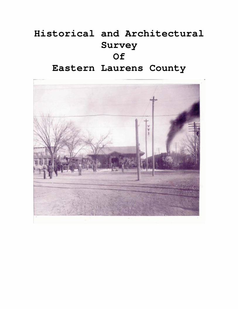
Clinton Depot with trains Cover 1. Riser Brickhouse………………………………………………………………...14 2. Belfast…………………………………………………………………………...15 3. Clinton ARP Church ……………………………………………………………16 4. Beaverdam Baptist Church……………………………………………………...17 5. J.S. Poole House………………………………………………………………...20 6. Lafayette Young House…………………………………………………………20 7. Site 2307………………………………………………………………………...23 8. O’Dell House …………………………………………………………………...24 9. Hinson House……………………………………………………………………24 10. D.E. Tribble House…………………………………………………………….25 11. W.C. Razor House ……………………………………………………………26 12. Renno School…………………………………………………………………..29 13. J.S. Poole House……………………………………………………………….33 14. Site 2063……………………………………………………………………….33 15. Site 2307……………………………………………………………………….34 16. Griffith House………………………………………………………………….36 17. Riser Brickhouse……………………………………………………………….37 18. Young.. House…………………………………………………………………38 19. Site 2239 & 2249………………………………………………………………39 20. J. O’Dell House………………………………………………………………..40 21. Site 2257……………………………………………………………………….41 22. Site 2099……………………………………………………………………….42 23. Site 2127……………………………………………………………………….42 24. R.S. Griffin House ……………………………………………………………43 25. Site 2218……………………………………………………………………….44 26. Site 2075……………………………………………………………………….46 27. Site 2083……………………………………………………………………….47 28. Site 2134……………………………………………………………………….47 29. Renno School……………………………………………………………….....48 30. Leaman Bros. Store…………………………………………………………....49 31. Razor House….………………………………………………………………..50 32. Hipp House…………………………………………………………………….50 33. Cross Hill High School………………………………………………………...51 34. William Bailey House…………………………………………………………52 35. J.W. Copeland House/Hays Infirmary………………………………………...53 36. Jacobs House…………………………………………………………………..53 37. Site 1746……………………………………………………………………….54 38. Henry Young House…………………………………………………………...54 39. Keller House…………………………………………………………………...55 40. Joanna Mills Housing Style 1 & 2……………………………………………..57 41. Joanna Mills Housing Style 3………………………………………………….57 42. Joanna Mills Housing Style 4………………………………………………….58 43. Joanna Mills Housing Style 5………………………………………………….58 44. Joanna Mills Housing Style 6………………………………………………….58 45. Clinton Mills Housing Style 1………..………………………………………..59
Eastern Laurens County Historical and Architectural Survey iv
46. Clinton Mills Housing Style 2………..………………………………………..59 47. Clinton Mills Housing Style 3………..………………………………………..59 48. Clinton Mills Housing Style 5………..………………………………………..59 49. Clinton Mills Housing Style 5 ………..……………………………………….60 50. Lydia Mills Housing Style 1………..………………………………………….60 51. Lydia Mills Housing Style 2………..………………………………………….60 52. Lydia Mills Housing Style 3………..………………………………………….60 53. Lydia Mills Housing Style 4………..………………………………………….60 54. Watts Mill Housing Style 1………..…………………………………………..61 55. Watts Mill Housing Style 2………..…………………………………………..61 56. Watts Mill Housing Style 3………..…………………………………………..62 57. Watts Mill Housing Style 4………..…………………………………………..62 58. Watts Mill Housing Style 5………..…………………………………………..62
Eastern Laurens County Historical and Architectural Survey v

I. PROJECT SUMMARY Palmetto Conservation Foundation conducted this historic resources survey of eastern Laurens County, South Carolina. The work was undertaken on behalf of Laurens County and was funded by a matching grant provided by the South Carolina Department of Archives and History. The survey was conducted for the purpose of identifying properties and districts that should be considered for possible local designation and/or NRHP designation within the county. The survey will be utilized for the creation and promotion of economic incentives for rehabilitation, education, and heritage tourism, and the information will aid local governments in future planning activities and cultural tourism development. This survey concludes a comprehensive survey for all of Laurens County. The western half of Laurens County was surveyed in 2002 by TRC, Inc. (Sherrer & Revels). The boundaries for the survey were the Laurens County line on the north, east, and south, and SC Highway 221 on the west. There were 763 properties surveyed within a total area of approximately 350-square miles. The results of the architectural survey indicate that there are potential historic districts within the towns of Cross Hill and Kinards (although the majority of Kinards is in Newberry County). In addition, there were 312 properties surveyed in the rural areas of the county. Of these identified properties, 7 are considered individually eligible for listing in the NRHP. There were 273 residential, 59 commercial, four religious, five educational and two industrial properties identified within the municipal limits of the city of Clinton. Of these identified properties, five are considered to be individually eligible for listing in the NRHP. One residential historic district within the Clinton city limits was identified as being eligible for listing in the NRHP. The Clinton Residential Historic District has two churches and 63 residential structures. There were 51 residential and 8 commercial properties identified within the municipal limits of the town of Cross Hill. Of these identified properties, one residential structure is considered to be individually eligible for listing in the NRHP. There were 13 residential structures, three commercial buildings, and two industrial buildings identified within the municipal limits of the town of Mountville. Of these identified properties, one residential structure is considered to be individually eligible for listing in the NRHP. There were two residential structures, 11 commercial buildings, and one church complex identified within the municipal limits of the town of Joanna. Of these identified properties, none are considered to be individually eligible for listing in the NRHP. Fieldwork for the project was conducted from September 2002 through March 2003. Ken Driggers, Director of Palmetto Conservation Foundation, supervised the survey, and Preservation Planner Jennifer Revels conducted the architectural survey and historical research and provided technical editing.
Eastern Laurens County Historical and Architectural Survey 1

II. PROJECT OBJECTIVES The historic resource survey of eastern Laurens County was undertaken in order to compile an up-to-date, accurate inventory of historic properties located within the eastern half of Laurens County. The information was compiled in order to identify properties and districts that should be considered for possible local designation and National Register designation, as well as to aid the local governments in preservation planning and cultural tourism development. Information gathered during the survey will be used to evaluate the loss of historic properties over time and the effects of new development on the historic fabric in the county’s incorporated municipalities. The survey will also aid in future preservation-planning efforts by identifying historic properties and districts. This information can then be used when creating future zoning ordinances and local preservation ordinances. By establishing a clear picture of the history of the county and how its architecture fits into that history, residents and local government officials will be able to make informed decisions regarding the adaptive reuse or demolition of historic properties. They will also be able to utilize the history in order to create an effective heritage tourism plan.
Eastern Laurens County Historical and Architectural Survey 2

III. SURVEY METHODOLOGY
Field survey of eastern Laurens County was undertaken in phases after an initial public meeting was held in the old Court House in the city of Laurens. There the survey was introduced and explained to the public. Questions were fielded at that time regarding any input or concerns that local citizens had regarding the survey and histories were gathered from owners of local historic properties. The city of Clinton was surveyed initially, followed by the rural areas including the towns of Cross Hill, Joanna, and Mountville. The intensive field survey began in October 2002 and was completed in March 2003. Before the survey began, the Survey Coordinator for the South Carolina Department of Archives and History assigned a block of survey numbers. Each surveyed property received a number that was noted in the top right hand corner of the final survey forms and alongside the property on the appropriate topographic maps. A surveyable property is defined as any property that is at least 50-years old and retains a good level of historical integrity. The National Register Criteria deals with “the quality of significance in American history, architecture, archaeology, engineering, and culture that is present in districts, sites, buildings, structures, and objects that possess integrity of location, design, setting, materials, workmanship, feeling, and association.” (National Register Bulletin 15, 1995:2). Any property eligible for listing in the NRHP must be significant under one or more of the following criteria:
Criterion A. Any property that is associated with events that have made a significant contribution to the broad patterns of our history. Criterion B. Any property that is associated with the lives of persons significant to our past. Criterion C. Any property that embodies the distinctive characteristics of a type, period, or method of construction, or that represents the work of a master, or that possesses high artistic value, or that represents a significant and distinguishable entity whose components may lack individual distinction. Criterion D. Any property that has yielded, or may be likely to yield, information important to our nation’s prehistory or history.
For a property to qualify for listing, it must meet at least one of the National Register Criteria listed above and retain historic integrity of those features necessary to convey its significance. During the course of the field survey, all roads within the proposed survey areas were walked or driven, and all existing, surveyable, aboveground structures were recorded in a Survey Database in Microsoft Access 97 format. In addition, black-and-white photographs were taken of every surveyed property and any related outbuildings. The film rolls and frames were logged, and the location of each property was noted on a
Eastern Laurens County Historical and Architectural Survey 3

USGS 7.5 Minute Quadrangle map. At the conclusion of the field survey, all properties were entered into a Geographic Information System (GIS) database to be added to the statewide information center located at the SCDAH. The GIS database includes the location of each recorded property as well as its historic name, historic use, and National Register eligibility. While the properties were being recorded, they were examined for National Register eligibility using the Criteria established by the U.S. Department of the Interior and the National Park Service as set forth in 36 CFR 60.4 (listed above). When possible, the owners of the house/business were consulted regarding any relevant history of the property in question, including old photographs and records pertaining to the structure. All information from these interviews, including photographs and documents, were recorded and included either on the final survey forms or in the final report. Once eligibility of individual properties had been determined, recommendations were made regarding possible designation of historic districts. According to the National Register Criteria, in order for a district to retain integrity as a whole, the majority of the components that make up the district’s historic character must possess integrity even if they are individually undistinguished. In addition, the relationships among the district’s components must be substantially unchanged since its period of significance. A component of a district is considered non-contributing if the structure has been significantly altered since the period of the district’s significance or the structure does not share the historic association of the district. All survey maps were clearly labeled with appropriate legends and depict the survey area boundaries, the locations of the surveyed historic properties (with survey numbers noted), and inaccessible areas. Boundaries for eligible districts are also noted and include the location of both contributing and non-contributing resources within each district. At the conclusion of the field survey, Jennifer Revels of the Palmetto Conservation Foundation accompanied Andrew Chandler and Brad Sauls from the South Carolina Department of Archives and History (SCDAH) on a field visit to the surveyed areas. At that time, all recommendations for National Register eligibility were examined and substantiated. All recommendations made by the SCDAH have been added into the final report. Potential threats to historic resources in the survey area were identified, and recommendations made for future preservation activities. These recommendations were developed in conjunction with the SCDAH.
Eastern Laurens County Historical and Architectural Survey 4

IV. HISTORICAL OVERVIEW
Summary Located in the middle of the South Carolina Piedmont, eastern Laurens County has a history of both agricultural and industrial revenue common among its neighboring counties. Its architectural history reflects a high level of prosperity from the mid- to late nineteenth century that coincided with peak cotton production, railroad expansion and the establishment of industries like the Joanna and Clinton Cotton Mills. In the late twentieth century, eastern Laurens County has remained largely rural with timber growth and processing becoming an important economic focal point. In addition, Presbyterian College and the Thornwell Home have kept the Clinton area alive with activity and Lake Greenwood continues to attract visitors and new residents to the county.
Cherokee Occupation The Cherokee are an Iroquoian-speaking group who migrated from Tennessee and North Carolina into the northwestern section of South Carolina in the sixteenth century. They occupied and hunted in lands that ranged from the Blue Ridge Mountains south to Abbeville County and southeast to the Broad River, where their territory abutted that of the Catawba. Their established towns remained in the more northern sections of their territory beyond the mountains, with only a few small towns in present-day Oconee County representing the most southern or lower part of their lands. Areas of Laurens County, similar to Abbeville County, were probably used as hunting grounds and for temporary encampments.
Settlement and the Revolutionary War (1740–1785) Beginning in the 1740s and 1750s, Europeans of Scottish, Irish, English, and German descent moved into the South Carolina Piedmont. They were drawn to the area by Governor Robert Johnson's township program, which set aside areas beyond the low country to encourage European-American settlement, granting participants tax credits and free land. Since the overthrow of the Lords Proprietors in 1719, governmental officials had looked for ways to use the colony’s frontier as a buffer from Indian and Spanish invasion. Officials also wanted to balance the increasing slave population with free settlers. Settlers of all nationalities began to take advantage of the Governor’s offer, however; present-day Laurens County area was not settled until the 1760s, after the Cherokee ceded their lower hunting grounds to the colony at the end of the Cherokee War. With the threat of Cherokee attacks lessened, settlers quickly migrated into these lands, many from Pennsylvania and Virginia where good land was becoming scarce.1
1 Walter Edgar, South Carolina: A History (Columbia: University of South Carolina Press, 1998), pp. 52-62; Weir, Colonial South Carolina, p. 275; Kovacik and Winberry, The Making of a Landscape, p. 80; William P. Jacobs, ed., The Scrapbook: A Compilation of Historical Facts about Places and Events of Laurens County, South Carolina (n.p.: Laurens County Historical Society and Laurens County Arts Council, 1982), p. 10.
Eastern Laurens County Historical and Architectural Survey 5

Settlers also moved west from the Newberry County area into Laurens following the retreat of the Cherokee. These groups were part of a large wave of immigration to the South Carolina backcountry following the Cherokee War, which resulted in a greater influx of white settlers as compared to the township program established forty years earlier. In the post-war years between 1760 and 1770, the percentage of the colony's white population living in the backcountry rose from about 50 percent to 75 percent.2 No structures in eastern Laurens County survive from this initial period of settlement. Until the 1760s, the Laurens County area was part of the parish system established by the colonial government that afforded little assistance to residents of the backcountry. Although an operating judicial system was not established in the backcountry until after the Revolutionary War, districts were organized in 1769. Laurens County was part of the Ninety Six District, which comprised a large area including present-day Abbeville, Greenwood, McCormick, and Edgefield Counties.3 Because of its proximity to Cherokee territory, Laurens County was drawn into the uncertain politics of the early Revolutionary War. Because of their distance from the heated politics of the coast, most back country residents were unaware of the grievances carried by their coastal neighbors against the mother country. Many back country residents remained loyal to England, particularly those who had received large grants of land from the King4. Rumors of the Cherokee planning to take advantage of the colony's political divisions, ally with local British sympathizers, and attack settlements in the backcountry were rampant. Others suggested that the Low Country government would incite the Cherokee to subdue the back settlements, which largely supported the British. Responding to the region's uncertainties, the Provincial Congress in Charleston sent a delegation to Ninety Six where William Henry Drayton secured a fragile agreement of non-commitment from backcountry Tory leaders. The agreement did not hold, however, and violence continued in the area as groups fought over militia supplies and worried about Cherokee allegiances. In July of 1776, just after the British made their first attempt to capture Charleston harbor, the Cherokee took advantage of the British presence and began an attack on the backcountry settlements. Over 250 battles were fought in South Carolina during the Revolutionary War, more than almost any other state. Eleven of those battles were fought in Laurens County. During the fighting, residents in the rural areas sought refuge at various forts such as Lindley’s Fort on Raeburn Creek. In the early morning of 15 July, Cherokees and local Tories dressed as Indians attacked the fort but were turned back by Jonathan Downs leading the local militia (the site of Lyndley's Fort is listed in the NRHP). In August 1780, the battle of Musgrove’s Mill was fought along the Enoree River, twelve miles north of the city of Laurens. It was near the mill that a small group of Patriots surprised and defeated a British garrison of more than 500 men. The victory marked one of the few
2 Weir, Colonial South Carolina, p. 209. 3 Edgar, South Carolina, pp. 212-221; Theresa M. Hicks, South Carolina: A Guide to County Records (Columbia: Peppercorn Publications, Inc., 1998), p. 168. 4 Jacobs, The Scrapbook, p. 8
Eastern Laurens County Historical and Architectural Survey 6

times that the patriot militia bested a larger force of provincial regulators and Tory militia5. Cherokee violence prompted the Provincial Congress to begin a campaign against the nation’s lower towns, during which they secured a further cession of most remaining Cherokee lands in South Carolina.6 In addition to the numerous battles that took place in the backcountry, residents were ever fearful of the horrible cruelty of the British forces. The Hayes Station massacre is one such example that took place in Laurens County, eight miles southwest of Clinton between the Belfast and Milton settlements. William “Bloody Bill” Cunningham was a resident of Laurens County and a member of one of Laurens County’s most influential families, the Cunningham’s of Rosemont Plantation. William Cunningham was an officer for the British armies and was notorious for his cruelty, earning him the nickname of Bloody Bill. Hayes Station, also known as Hayes Inn, was a stagecoach stop and gathering place for local the local Whig party. Owned by Colonel Joseph Hayes, the home also served as an inn for travelers. Cunningham led his men to the Station where he demanded that Hayes and about 25 persons staying there surrender to his forces. When they refused, the home was set on fire and the inhabitants forced to surrender. Upon exiting, Hayes and 18-year old Captain Daniel Williams were hanged. When the pole that they were strung on broke, Cunningham went on a rampage, cutting both men and 12 others to pieces with his sword7.
County establishment and growth (1785–1865) In the years following the Revolutionary War, South Carolina saw the ineffectiveness of the judicial district system and divided the larger districts into smaller, more manageable counties. Laurens County was created on 12 March 1785 from 780 square miles of the former Ninety Six District and a small portion of former Cherokee territory, including part of the upper reaches of the Reedy River that would be annexed into Greenville County a year later. In 1786, the boundaries of the county ran from the ferry at Island Ford on the Saluda River (now under Lake Greenwood) northwest along the Saluda to the Cherokee territory line of 1761, running northeast following that line from the Saluda River to the Enoree River, southeast along the Enoree River to O'Dell's Ford, and from O'Dell's Ford to Island Ford following the Old Ninety Six Road (which today follows portions of State Route 560). On 21 December 1792 Laurens lost another small section of territory along its western boundary to Greenville County, reducing the county's size to 730 square miles and creating the county boundaries that have remained until the present day. There were no further changes to the county other than its name change from Laurens County to Laurens District in 1800 and from Laurens District to Laurens County in 1868.8
5 Foy, Laurens County Sketchbook, pp. 9-10, 597-599; Jacobs, The Scrapbook, pp. 10-11. 6 Weir, Colonial South Carolina, pp. 322-325 and 330; Edgar, South Carolina, p. 229; Foy, Laurens County Sketchbook, pp. 9-10; Jacobs, The Scrapbook, p. 9; U. S. Department of the Interior, "Lindley's Fort," National Register of Historic Places Inventory -- Nomination Form, 7 November 1978, National Register Files, South Carolina Department of Archives and History, Section 8:1-2. 7 Foy, Laurens County Sketchbook, pp. 9-11; Jacobs, The Scrapbook, pp. 594-595; Edgar, South Carolina, pp. 212-221 8 John H. Long, ed., South Carolina: Atlas of Historical County Boundaries (New York: Charles Scribner's Sons, 1997), pp. 136-137; Jacobs, The Scrapbook, pp. 10.
Eastern Laurens County Historical and Architectural Survey 7

A delegation from the General Assembly chose to locate the Laurens County seat near the center of the county on high ground near Hudgen's Spring. A wooden building was later erected for use as a court, church, and school. The land containing the wooden courthouse building was sold to Samuel Saxon, who sold four acres to the county in 1792 for the purpose of creating a courthouse square. Saxon sold the parcels surrounding his property to Robert Goodloe Harper, who in turn sold the land within a mile radius of the square to the county for what would become the residential areas of the town of Laurens.9
Laurens, or Laurensville as it was referred to in the early nineteenth century, grew slowly after establishing its courthouse square in the 1810s and 1820s. The district replaced the wooden building where court was held in the late eighteenth century with a new courthouse in 1815, and in 1838 built the courthouse that remains in use today. Holland’s store, southeast of Laurensville, was the only merchandising place and post office located in the southern half of the county.10 The store was located approximately one mile west of the crossroads of the Greenville-Columbia and Spartanburg-Augusta highways. A local road coming in from the northwest also met at this junction creating an area known as the Five Points or Five Forks. The crossroads became a popular place for drinking, horseracing and cockfighting and as a result of such gained a notorious reputation that would continue well into the nineteenth century11. Laurensville lay between the two major routes from western North Carolina to the South Carolina markets at Augusta, Columbia and Charleston. Cattle and hog drivers as well as tourists in the antebellum period traveled from Asheville and the North Carolina interior on what was known as the Buncombe Turnpike, which connected to these trade roads in the South Carolina upstate. Farmers may have been able to sell their livestock or corn to the drovers, but the roads may have also increased social interaction with drovers and travelers, some who came from as far as Tennessee and Kentucky.12 While Laurens County farmers and merchants may have benefited from this relationship somewhat, their
distance from these major trade roads meant that the town of Laurensville and other crossroad towns grew more slowly than they might have if they connected directly to these routes.
Several communities in the late eighteenth and early nineteenth century did develop along these roads, often organizing around a stagecoach stop or tavern, post office, or church. These communities or crossroads offered places to gather for mustering, political rallies or worship, but had few stores and most did not survive into
Figure 1-Riser Brickhouse
9 Jacobs, The Scrapbook, pp. 10-11. 10 Jacobs, The Scrapbook, pp. 13. 11 Jacobs, The Scrapbook, pp. 36-38; Foy, Laurens County Sketchbook, pp. 22-23. 12 John C. Inscoe, Mountain Masters, Slavery, and the Sectional Crisis in Western North Carolina (Knoxville: University of Tennessee Press, 1989), pp. 42, 46-52 and 159.
Eastern Laurens County Historical and Architectural Survey 8

the late 1800s.13 Bond’s Crossroads was one such stop. Located along present-day Highway 66 on the Laurens and Newberry County line, the Riser Brickhouse (site 2167) was constructed ca. 1830 and served as a stagecoach stop on the road from Whitmire to Martin’s Depot (present day Joanna) (Figure 1). Dr. F.F. Calmes constructed the house in the early 1800s using brick made on the creek near Stomp Springs. Calmes sold the home to Major Samuel Young around 1850. Young turned the Brickhouse plantation into a profitable operation, with approximately 100 slaves living and working on the plantation at the time of the Civil War. A map of Laurens County done by the Kyzer Hellams Company in 1883 shows the “Brickhouse” across from Liberty Post Office14.
Other early communities include Martin’s Depot, Mountville, and Milton, all located south of the town of Clinton. Mountville appears on Mills' map in 1825 with the name "Richardson," the home of Dr. Dave Richardson, which served as the area’s first post office. A church and school were organized there in 1807—known as Beaverdam School on weekdays and Beaverdam Church on weekends15. Milton is located between present-day Joanna and Cross Hill along the Little River. The area is documented on Mills' map
with the name “Black.” John Black was one of the first and most influential settlers in the Milton area16. East of Milton John Simpson constructed Belfast (site 2058) in 1785, which later served as the area post office (Figure 2). Simpson constructed the home for his new bride and had the bricks for its construction shipped from his native Ireland. The home is named for Belfast, Ireland, where Simpson lived before moving to America17. The Milton area was also the scene of one of the bloodiest encounters
between the Whigs and Tories during the Revolutionary War. It was there that Colonel Joseph Hayes established his inn known as Hayes Station.
Figure 2-Belfast
The western portion of Laurens County has numerous rivers and streams that supported mills in the antebellum period. At least one antebellum industrial enterprise existed in eastern Laurens County where such rivers were not as prevalent. John Black modernized a flour and grist mill on Little River and constructed a stone dam, which powered the first saw mill in the area. As late as 1952, a small bridge over the Little River was rumored to have been built on the footings for Black’s Mill and the foundations of the mill house could be seen along the river at that time.18 Churches remained an important part of community development throughout the nineteenth century, and a religious revival movement in the early nineteenth century
13 Edgar, South Carolina, pp. 288-289. 14 Jacobs, The Scrapbook, pp. 575-576; Foy, Laurens County Sketchbook, pp. 87-88; Kyzer & Hellams, A Complete Map and Sketch of Laurens County, SC, 1883. 15 Jacobs, The Scrapbook, pp. 67-68; Foy, Laurens County Sketchbook, pp. 19-20 and 70; Robert Mills, "Laurens District, South Carolina," in Atlas of the State of South Carolina. 16 Foy, Laurens County Sketchbook, pp. 19-21; Robert Mills, "Laurens District, South Carolina," in Atlas of the State of South Carolina; 17 Jacobs, The Scrapbook, pp. 566-567; Foy, Laurens County Sketchbook, pp. 69-70. 18 Foy, Laurens County Sketchbook, pp. 18-20.
Eastern Laurens County Historical and Architectural Survey 9

encouraged the organization of several congregations. These religious communities offered a forum for social interaction among isolated farms and plantations. While some denominations initially opposed the growing practice of slavery, particularly the Methodist Church, church leaders and evangelicals resigned themselves to converting slaves and masters.19 Based on the majority Protestant Scots-Irish and English backgrounds of upcountry settlers, early churches in rural Laurens County were Presbyterian, Methodist, and Baptist. While most of these congregations are still active, none of their houses of worship retain architectural integrity from this period. Most congregations have built new structures as their original churches were destroyed or as the congregation outgrew their original building. One of the first congregations in the area was Duncan’s Creek Presbyterian Church (site 2171) organized by the family of John Duncan in 1753 is the oldest church organization in the upstate. The Duncan family settled around the junction of Duncan’s Creek and the Enoree River in the early 1700s. The first church building for the congregation was constructed of field stone in 1764, a date which is retained on the current stone building that was constructed in 1842. The congregation is often referred to as the mother of local Presbyterian Churches since both Lisbon and Clinton Presbyterian were begun as missions from Duncan’s Creek. Dr. William P. Jacobs, founder of Thornwell Orphanage and Presbyterian College was the minister at Duncan Creek before arriving in Clinton.20
Clinton First Presbyterian Church (site 1805), was organized by Reverend Zelotes Lee Holmes in 1843 (Figure 3). Reverend Holmes traveled to Laurens County from New York and served as pastor in both Rocky Springs Presbyterian and Duncan’s Creek Presbyterian before arriving in Clinton. The original church building was a frame structure that was replaced by a stone building in 1903 and destroyed by fire in 1929. The present sanctuary was constructed in 1931 following the fire. William Jacobs became pastor at First Presbyterian in 1864 and served until 1911. In its
history, the congregation has had only five ministers21.
Figure 3-Clinton First Presbyterian Church
Liberty Springs Presbyterian Church was organized in the town of Cross Hill in 1787. The church was organized by Reverend John McCosh of Scotland and takes its name from a nearby spring. The spring is also thought to be the location of an American encampment during the Revolutionary War where soldiers who had contracted smallpox were sent to recover. A large graveyard with depressions marked by fieldstones is located behind the church’s graveyard and is thought to be the resting place of the soldiers who 19 Lacy K. Ford, Jr., Origins of Southern Radicalism: The South Carolina Upcountry, 1800-1860 (New York: Oxford University Press, 1988), pp. 19-24. 20 Foy, Laurens County Sketchbook, pp. 42-43; Jacobs, The Scrapbook, pp. 46-47, 579; US. Department of the Interior, "Duncan’s Creek Presbyterian Church," National Register of Historic Places Inventory -- Nomination Form, 15 November 1973, National Register Files, South Carolina Department of Archives and History, Section 8; 21 Foy, Laurens County Sketchbook, pp. 42; Owens, Sam, Clinton (Charleston: Arcadia, 2000) pp. 99.
Eastern Laurens County Historical and Architectural Survey 10

succumbed to the smallpox epidemic. Liberty Springs Church is perhaps most well known as the meeting place for local activist Ann Pamela Cunningham and her supporters and is the starting point for her campaign to save and restore Mount Vernon.22 Rocky Springs Presbyterian Church’s (site 2259) congregation was organized in 1780 by Reverend McCombs in the woods near the “rocky spring” midway between Clinton and Ora. The original church building was of log construction and was succeeded four buildings, the fifth and current building constructed in 1920. Reverend Robert McClintock was the congregation’s first pastor and served from 1785 until his death in 1803. Following McClintock’s death, Reverend John B. Kennedy became the pastor and stirred up a great deal of controversy when he introduced the singing of hymns during the church service (only Psalms had been sung prior to that point)23. The Ora Associate Reformed Presbyterian Church (site 2263) was organized in 1790 on property belonging to a Mr. Madole. He later gave several acres of land to the congregation for use as a community cemetery, which is still in use today. Originally known as Madole’s Old Field Church, the congregation has gone by several names throughout its history including Warrior Creek Church (1809) and Bethel Church (1836). The present church building was constructed in 189624. The All Saints Episcopal Church (site 1873) in Clinton was organized as a mission church by Reverend W. E. Callender in 1908. A lot for the church building was donated that same year by Mr. George Ellis and $200 was raised for the construction of a building. Reverend Callender left Clinton in 1909, not having followed through with the construction of the church and congregants had to travel to Laurens for worship. It was not until 1915 when Reverend S.R. Guignard reinstated the mission. In 1952, the All Saint’s Mission purchased the old ARP Church from the Bank of Clinton and moved it from its location on North Broad Street to Calvert Avenue where it stands today25.
Beaverdam Baptist Church (site 2154) was organized 15 August 1807 with 59 members (Figure 4). Elder Joshua Palmer was the congregation’s first pastor. Three acres of land were given to the church in 1814 by Zachariah Bailey in order to construct a brick meeting house. The original plat shows the church building and cemetery as well as a path to a nearby spring where baptisms took place. Located approximately 2½ miles northwest of Mountville, the building is said to be the first brick church constructed within the county. A second brick
Figure 4- Beaverdam Church
22 Foy, Laurens County Sketchbook, pp. 44-45; Jacobs, The Scrapbook, pp. 45-46. 23 Foy, Laurens County Sketchbook, pp. 46-47; Jacobs, The Scrapbook, pp. 486-489; Rhodes, Libby Coats, Laurens County, South Carolina (Charleston: Arcadia, 2001) pp. 29. 24 Foy, Laurens County Sketchbook, pp. 48; Jacobs, The Scrapbook, pp. 476-477. 25 Jacobs, The Scrapbook, pp. 423-425; Owens, Sam, Clinton, pp. 36.
Eastern Laurens County Historical and Architectural Survey 11

church was constructed on this site in 1881and is the building that remains standing today. 26
Several congregations have retained and updated or expanded on an earlier structure, including Bethabara Baptist Church, which was organized in 1794 and is one of the oldest Baptist Churches in the state. The extant church was built in 1881, with changes including a rear addition and vinyl siding. Leesville Southern Methodist Church retains its ca. 1867 structure, with changes made in 1897, 1937, and 1956. Mt. Zion AME Church, organized ca. 1900 as a branch of the Mt. Zion Methodist Church, was remodeled in 1961, with additions to the building in the late twentieth century.27 Many of these congregations, despite changes to the church building, retain cemeteries that remain significant for their association with early settlers and community leaders.
The vast majority of persons who lived in Laurens County in the early to mid-nineteenth century lived on farms and plantations. Planters in the upstate of South Carolina had been growing short-staple cotton since the mid-eighteenth century, but the crop only became valuable after the invention of the cotton gin in 1793. Fed by the British textile market, Piedmont farmers purchased the greatest amount of land and slaves they could afford in order to grow cotton.28 The dominance of the crop spread so quickly, and to such a great extent, that as early as the 1820s, agricultural reformers began to suggest alternate crops and methods to curtail soil exhaustion. Robert Mills wrote of Laurens District in 1826, "The same erroneous system of cultivating our lands is pursued in this district as in others, so destructive to the soil and detrimental to the permanent advantage of the country…. We wish to see them giving back to the soil some portion of nourishment which they take from it."29 As early as 1830, Laurens was among the top cotton-producing districts in the state.30
Plantation agriculture altered Laurens County's society and landscape. Between 1820 and 1830 the district's slave population increased by 48 percent, while its free population grew by only 6 percent. After 1830, the free white population began to decrease as cotton lands became overworked and planters moved west and south to new territory in Mississippi, Alabama, and Texas. At the same time, the slave population continued to increase.31
Population of Laurens District (1790–1840) Year Free White
Population Other Free Persons Slave Population Total Population
1790 8,210 7
1,120 9,337
1810 11,645 29 3,308 14,982
26 Foy, Laurens County Sketchbook, pp. 50-51; Jacobs, The Scrapbook, pp. 426-427. 27 Jacobs, The Scrapbook, pp. 428, 460-461. 28 Kovacik and Winberry, The Making of a Landscape, pp. 88-90. 29 Mills, Statistics, p. 610. 30 Kovacik and Winberry, The Making of a Landscape, p. 89. 31 Inter-University Consortium for Political and Social Research (ICPSR), “United States Historical Census Data Browser," 1998 (http://fisher.lib.virginia.edu/census/), accessed 16-17 January 2002.
Eastern Laurens County Historical and Architectural Survey 12

1820 12,755 49 4,878 17,682
1830 13,564 56 7,243 20,863
1840 12,572 88 8,911 21,584
1850 11,370 84 11,953 23,407
1860 10,658 129 13,200 23,858
Source: ICPSR The change from small farms to larger plantations is further evidenced in the census records for Laurens District. In 1820, few persons owned more than 10 slaves. The largest slaveholder in the district may have been Robert Cunningham, who owned 67 slaves in 1820. Robert Cunningham built Rosemont Plantation on the Saluda River (no longer extant), later the home of Ann Pamela Cunningham who organized the Mount Vernon Ladies Association and was instrumental in creating the modern-day preservation movement. In 1830, Robert Cunningham owned at least 100 slaves, and in 1840, 143 persons. By 1830, although there were still non-slaveholders in the district, the average number of slaves owned increased to between 10 and 20, a trend that continued until the Civil War.32 Laurens is positioned geographically among the lower Piedmont counties, similar in climate to Edgefield and Fairfield. In the nineteenth century Laurens County had similar soil conditions but larger cotton-growing and slave-holding areas as compared to upper Piedmont counties like Anderson, Greenville and Spartanburg, where small- to medium-size farms and a white majority remained. Despite the overall statistics, the eastern portions of Laurens District may have more closely resembled Greenville than Newberry in their population and agricultural trends. Laurens County was the state's fourth largest producer of cotton in 1840, after Abbeville, Fairfield, and Edgefield. However, the county was the largest producer of wheat by a wide margin, and was also one of the largest producers of corn, oats, and dairy products. Ten years later in 1850, the county retained these trends, producing less cotton than Abbeville and Newberry Counties, but more wheat than Anderson County. Thus while slaves made Laurens a major cotton producer in the early and mid-nineteenth century, they did not gain a majority population until 1850, while Edgefield and Fairfield Districts had a majority black population as early as 1830.33 For those who were enslaved, life on upcountry cotton plantations differed greatly from that on lowcountry rice plantations. Slaves were usually forced to work in a gang system, in which they worked set hours each day, usually sunrise to sunset. These schedules differed from the task system, in which slaves were assigned a task to accomplish each 32 United States Bureau of the Census, Population Schedules, Laurens County, South Carolina: 1820-1840 (South Carolina Department of Archives and History, Columbia); Jacobs, The Scrapbook, pp. 146-147. 33 Ford, Origins of a Southern Radicalism, pp. 44-47; U. S. Department of State, Compendium of the Enumeration of the Inhabitants and Statistics of the United States (Washington: Thomas Allen, 1841), pp. 190-193; J. D. B. DeBow, Statistical View of the United States . . .Being a Compendium of the Seventh Census (Washington: Beverly Tucker, 1854), pp. 302-307.
Eastern Laurens County Historical and Architectural Survey 13

day, and were often able to use their free time if the task was accomplished early.34 Slave houses were two or three-room frame or log buildings with stone, brick, or stick chimneys, scattered around the plantation rather than on a street. Overseers lived with their families on the plantation in larger or more elaborate housing than that given to the slaves.35 Few examples of antebellum plantation buildings remain as many have been lost or modified at a later date to serve alternate purposes. There were no such structures identified within the eastern portion of the county.
The increasing practice of cotton monoculture and slavery acted to change the landscape of the Laurens District. As more farmers began to plant cotton, wooded areas were cleared to create fields and frame slave cabins and outbuildings such as barns and cotton presses were constructed to support production. As their finances increased, farmers began to replace their small log houses with larger, two-story frame houses, often in a form known as the Carolina I-house.36 Documented examples of this building type include the Young House near
Clinton, built ca. 1840 (Site 2116); the J.S. Poole House (Figure 5), built in 1818 (Site 2247); the Griffin House, built ca. 1845 (Site 2223); and Site 2156 which was built ca. 1850 near Beaverdam Church in the Hunter section. Many of these early houses have some outbuildings surviving, built in various years through the mid-twentieth century and used for differing purposes. These outbuildings include well houses, smokehouses, barns and tenant houses.
Figure 5- J.S. Poole House
Several local planters gained enough wealth to build more elaborate homes. These include the Lafayette Young House (Site 2064), a two-story frame building on the Old Milton Road, constructed in 1850 by John Young (Figure 6). Thomas A. Badgett built a Greek Revival cottage on Highway 49 on the north side of Laurens around 1860 (Site 2278). These two houses remain the only surviving examples of high-style architecture beyond the town of Clinton from the early to mid-nineteenth century.
Figure 6- Lafayette YoungHouse
The many large I-houses and several of the more elaborate homes reflect the prosperity of the 1850s cotton boom. Although Laurens did not keep pace with other lower Piedmont districts in cotton production in the first decades of the nineteenth century, Laurens District farmers increased their cotton production between 1850 and 1860, when other
34 Edgar, South Carolina, pp. 311-316. 35 George P. Rawick, ed., The American Slave: A Composite Autobiography (Westport, CT: The Greenwood Press, Inc., 1979), Supplement Series 1, Vol. 11, pp. 126-139, http://newdeal.feri.org/asn/asn09.htm. New Deal Network, http://newdeal.feri.org, accessed 6 February 2002. 36 Kovacik and Winberry, The Making of a Landscape, p. 89.
Eastern Laurens County Historical and Architectural Survey 14
districts were losing farmers to western states. The average number of improved acres per farm more than doubled in this decade, and cotton production increased while corn production and swine raising decreased as it did throughout the Piedmont. Historian Lacy K. Ford explains this trend by the increase in cotton prices and access to reasonably priced market goods via the railroad.37 The rumor of the arrival of the Laurens & Newberry Railroad through Five Points spurred growth in the area, leading residents to formally organize a town. In August 1852, 52 acres of land were parceled into 29 lots of varying size and dimension. In addition, five streets bounding the lots were laid out. It was decided that the new town would be named Clinton, in honor of Henry Clinton Young, a local attorney and representative in the South Carolina Legislature, who had helped to lay out the new town boundaries. On 8 September 1852, an auction was held in the small town of Clinton. Twenty-eight lots were sold; creating the core of what would become the second-largest community in the county38. In 1853, a railroad depot was constructed at the intersection of South Broad Street and West Carolina Avenue, at the center of the newly created community. The Laurens Railroad, which opened in 1854, connected to the Greenville and Columbia Railroad in Newberry and made self-sufficiency of farms no longer necessary. The railroad also brought building materials including bricks and planed boards that facilitated house construction and expansion. One Laurens District farmer wrote in 1852 that the railroad had increased land speculation, perhaps prompting farmers to move closer to the railroad or purchase additional lands. At the time, the Laurens Railroad traveled from Laurens, through Five Points, Martin’s Depot, Kinards and east to Newberry, so its conveniences benefited the eastern half of the county more than the western half. Farmers and plantation owners near Clinton and Martin’s Depot took advantage of the new market goods available on the new rail line.39
At the start of the Civil War, men in the eastern part of the county were mustered at Hamilton’s Old Field near Waterloo and at smaller community landmarks such as Hayes Station and the Brickhouse Plantation. At least 2,500 men from the county joined the Confederate Army. Although no battles were fought in Laurens County, residents suffered with other South Carolinians from the loss of family and friends, restricted access to food and supplies, and economic inflation.40 The war disrupted agricultural schedules and markets for years after as freedmen and women struggled to find their place in the new society, and former plantation owners resisted their loss of property.
37 Ford, Origins of a Southern Radicalism, pp. 219-222. 38 Jacobs, The Scrapbook, pp. 36-38; Foy, Laurens County Sketchbook, pp. 23; McKelvy, James and Mary, Bill for Partition and Role of Real Estate, August 1852, records on file at the Laurens County Courthouse. 39 Edgar, South Carolina, pp. 273-275; Ford, Origins of Southern Radicalism, pp. 244-259; Kovacik and Winberry, The Making of a Landscape, p. 96; Foy, Laurens County Sketchbook, p. 38; Virginia McAlester and Lee McAlester, A Field Guide to American Houses (New York: Alfred A. Knopf, 2000), p. 89. 40 Jacobs, The Scrapbook, pp. 14-15; Kovacik and Winberry, The Making of a Landscape, pp. 105-106.
Eastern Laurens County Historical and Architectural Survey 15

Community Growth, Industrial Expansion (1865–1930S) After the Civil War concluded in 1865, daily life in Laurens County changed for both the white and black populations. Former slaves left the farms and plantations where they had worked in search of family members who had been sold. Others left to find work in southern towns and cities while some stayed near their homes and negotiated contracts with their former owners for wages. Because a majority of former slaves had little education and most were illiterate, these contracts often took advantage of their situation, sometimes offering conditions that were equally restrictive as those under which they were enslaved. Farm owners divided their plantations into smaller tracts, which were then tended by tenants or sharecroppers. Cotton's post-war market price continued to fluctuate but remained low causing problems for farm owners, tenants, and sharecroppers. 41
Laurens County’s black residents responded to continued white political and social oppression by banding together to create their own communities. Churches were established to unite local citizens and provide religious and secular leadership. In these areas it was often the schools and churches that became the impetus for community development. Hebron Baptist Church, organized in 1883, was the first black Baptist church in the town of Clinton. The 14 original members of Hebron formed this congregation after receiving letters of dismission from New China Church located southeast of Clinton. They originally had no place to worship and borrowed space in the Presbyterian Church until a building could be constructed. Baptist Churches throughout the county were established in the 1860s and 1870s, including New China (site 2150) (organized in the late 1870s), Springfield (organized in 1888), Little River Zion (organized 1876), and White Plains (organized in 1872). These churches joined with several others in 1879 to form the Tumbling Shoals Baptist Association42. In 1915, the Association built Tumbling Shoals High School, the first high school for African American in Laurens County. The women’s auxiliary for the Baptist Association was formed at Hebron Church in October 1915. Their first meeting raised money to buy necessities for the Tumbling Shoals School. 43
African-American churches also began to establish schools. In 1926, the Bell Street School was constructed on Bell Street in Clinton. The 16-classroom brick school building serviced children through all 11 grades and educated children through 1949, when the building burned to the ground. While a second building was under construction, students attended nearby Bethel AME Church and in 1950, students returned to their new building—present-day Martha Dendy School. Rural schools were also constructed for African American students, although none could be identified during this survey. The town of Clinton grew slowly despite the fact that it was located on the only rail line from the Piedmont to Charleston. By 1864, there were only 150 residents living in town, a dozen “respectable” homes, 2-3 commercial buildings, a depot, and one brick building 41 Edgar, South Carolina, pp. 378-381 and 428-429; Kovacik and Winberry, The Making of a Landscape, pp. 105-108. 42 Jacobs, The Scrapbook, pp. 496-499. 43 Jacobs, The Scrapbook, pp. 498-499.
Eastern Laurens County Historical and Architectural Survey 16

that housed the local barroom and hotel on the corner of Musgrove Street and East Carolina Avenue. Robert Newton Spires Young was one of the first to construct his family home (site 1909) on South Broad Street in 1848, shortly before the railroad’s arrival. Young donated land from his estate for the location of the new college with the stipulation that the main building on the campus face the front door of his home. Also constructed early in the town’s history was the Davidson House (site 1721) on Musgrove Street. George Henry Davidson was the son of Captain John Davidson of Charleston and was a well know orchardist and gardener as well as a furniture designer. The two-story frame home had a one-story ell on its left side that is said to have been used as one of the town’s first school rooms. Clinton struggled through the Civil War, which had forced the closure of the railroad in 1864, leaving the streets and stores deserted. Few of the young men who fought for Clinton in the war returned home. The town’s post office was closed as were many of the stores. In 1866, Clinton’s original town charter expired, forcing the citizens to reorganize and reincorporate—including new elections for mayor and city council. At the time, the town’s population was 450.44
In the post-war years, the majority of Laurens County residents continued to farm, both as tenants and owners. Tenants, black and white, often moved from farm to farm in an attempt to secure the best arrangement and the best land. Some had their own tools and animals and only rented the land (cash renters); others borrowed everything from the landowner (sharecroppers).45 While few tenant houses remain extant, from the late nineteenth century to the mid-twentieth century they could have been found along nearly
every road. In the survey area, the majority of tenant houses were identified near larger farmhouses, preserved as outbuildings for storage or other uses. These include a tenant house associated with the Dr. L.F. Duckett House (Site 2176), homes associated with the Hinson House in Kinards (Sites 2306 & 2307) (Figure 7), Site 2153, Site 2128, Site 2137, Site 2063, and Site 2093. Occasionally these homes can be identified along the roadside, standing independent of other structures.
Figure 7-Site 2307
Like most Piedmont farmers in South Carolina, Laurens County farmers produced corn and wheat, but dedicated most of their acreage to upland or short staple cotton. Despite low prices, drought and insect infestations throughout the state in the late nineteenth century, Laurens County farmers experienced continued success through diversified agriculture. In 1870, Laurens County farmers produced over 50,000 bushels of spring wheat, making it the fourth largest producer after Anderson, Spartanburg, and Newberry Counties. Like its upcountry neighbors, Laurens also produced a large crop of winter wheat. By 1880, Laurens had increased its wheat production by almost 10,000 bushels, and its corn production from over 277,000 to more than 380,000 bushels. In the 1870s through the 1890s, Laurens County was also one of the top ten producers of cotton, 44 Jacobs, The Scrapbook, pp. 36-40. 45 Kovacik and Winberry, The Making of a Landscape, pp. 107-108.
Eastern Laurens County Historical and Architectural Survey 17

although never near the amounts produced by Barnwell, Abbeville, and Edgefield Counties.46 Many western Laurens County farmers succeeded in making enough money to build a new house or update an old one, and to add a cotton gin or new outbuildings to their farm. The Hinson House (Figure 9)(Site 2305), Site 2127, the Odell House (Figure 8)(Site 2165), and Site 2133 in Renno are just a few examples of many high-style farm residences built between 1870 and 1915.
Figure 9-Hinson House Figure 8- O'Dell House
While some other counties' agricultural production declined by 1900, Laurens increased its production. Laurens County was the fourth largest producer of cotton in the state that year while remaining a major producer of corn and wheat. Reba Ball remembers that her father, on his farm just outside of Gray Court, was careful to rotate his crops, including wheat, cotton, peas, and corn. He created terraces to prevent soil erosion, and aligned the terraces using surveying instruments. Such careful practices by some Laurens County farmers kept their yields high, but most farmers eventually exhausted their fields. By 1920, Laurens County's agricultural production more closely resembled that of its middle Piedmont neighbors. As soils became depleted from over-cultivation, agricultural production slowed in Laurens in the first decades of the twentieth century. By the 1920s and the 1930s, Laurens County was still among the top five producers of cotton, but at a loss to its other crops, reflecting the statewide patte
47rn of sacrificing food crops for
otton.
c
46 U. S. Department of the Interior, The Statistics of the Wealth and Industry of the United States . . .Compiled from the Original Returns of the Ninth Census, (June 1, 1870) (Washington: Government Printing Office, 1872), pp. 236-237; U. S. Department of the Interior, Report on the Productions of Agriculture, as Returned at the Tenth Census (June 1, 1880) (Washington: Government Printing Office, 1883), pp. 203-204, 240; U. S. Department of the Interior, Report on the Statistics of Agriculture in the United States at the Eleventh Census: 1890 (Washington: Government Printing Office, 1895), pp. 382-383, 396; Edgar, South Carolina, pp. 4427-431. 47 U. S. Department of the Interior, Twelfth Census of the United States, Taken in the Year 1900: Agriculture, Part II (Washington: United States Census Office, 1902), pp. 181-182, 433; U. S. Department of Commerce, Fourteenth Census of the United States Taken in the Year 1920, Volume VI, Part 2: Agriculture (Washington: Government Printing Office, 1922), pp. 286-290; U. S. Department of Commerce, Fifteenth Census of the United States: 1930, Agriculture, Volume II, Part 2 (Washington: US Government Printing Office, 1932), pp. 480-483; Interview with Reba Ball, 9 November 2001; Edgar, South Carolina, pp. 480-481.
Eastern Laurens County Historical and Architectural Survey 18

Cotton farmers were greatly helped by the construction of new railroad lines in eastern Laurens County. Between the 1870s and the 1890s, transportation averted its focus away from Charleston, and more railroads were constructed in the upstate to link cotton farms to mills and northern markets.48 The Laurens Railroad, destroyed during the Civil War, was rebuilt in 1876 as part of the Greenville and Columbia Railroad. In 1885, the Columbia, Newberry, and Laurens Railroad Company (CN&L) was organized and later took over the Laurens Railroad. In the same year Greenwood, Laurens and Spartanburg Railroad opened connecting those towns. In 1886, the Greenville and Laurens Railroad opened and was later owned by the Port Royal & Western Carolina (PR&WC) Railway, nd in 1896, the Charleston and Western Carolina railroad C&WC. In 1909, the CN&L
ser in the neighboring n
residences, a far cry from the gran
illiam Bailey (site 1886), M.S. Bailey’s third son and second
Railroad line was constructed in the 1890s. The center of business usually shifted to
aRailroad constructed a brick depot on Clinton’s Main Street.49 The new railroad connections began to change the towns of Clinton and Cross Hill from wayward frontier towns to commercial and social hubs within the county. In 1884, M.S. Bailey opened Clinton’s first Bank on West Pitts Street. Between 1884 and 1894, Clinton’s residents built a new hotel, two railroad passenger depots, a bank, several one-story brick commercial buildings that housed drug stores and several general merchandise stores, and offices. Despite this evident growth, the population only increased by 50 persons.50 The weekly Clinton Enterprise paper began operation in 1875, competing with the older Laurensville Herald and Laurens Adverti
g commercial district was ringed with small, one-story diose homes of the county seat.
In the late 1880s and 1890s, residential building remained scattered throughout town, with no clear establishment of neighborhoods. Successful businessmen and lawyers were building homes on and near Hampton, Woodrow, and Broad Streets, including J.W. Copeland (site 1796), owner of Copeland’s Store (Site 1634); D.E. Tribble (Figure 10)(site 1694), owner of D.E. Tribble Bldg. Supply and undertakers (site 1642); M.S. Bailey, owner of the local bank and president of Clinton Cotton Mills; and W
town of Laurens. The burgeoni
Figure 10- D.E. Tribble House
president of M.S. Bailey & Sons bank.51 Railroads also encouraged small town growth and created jobs for blacks and whites. Two older communities, Mountville, an early nineteenth-century community, and Cross Hill increased their population and businesses when the Georgia, Carolina & Northern
48 Kovacik and Winberry, The Making of a Landscape, 119-120. 49 “Clinton Historical Facts”, Clinton Chamber of Commerce, 1971, James D. Sheppard, "Chronology -- Railroads in General and those in Laurens County in Particular," typescript, 27 February 1997, “Railroads,” Laurens County history files, Laurens County Library. 50 Sanborn Map and Publishing Co. Limited, "Clinton, Laurens Co., S.C." (New York: Sanborn Map and Publishing Co., Limited, 1885 & 1894). 51 Owens, Sam, Clinton; Jacobs, The Scrapbook, p. 93-94.
Eastern Laurens County Historical and Architectural Survey 19

locate along the tracks. Small communities such as Milton and Scuffletown that were far from the rail lines began to die as farmers and business owners clamored to take
-chartered and corporated by D. H. Thompkins, South Carolina’s Secretary of State52.
on Saturday nights. In town, the day was lanned and run around the train schedule.
of the ntire section, including the original Beaverdam settlement nearly two miles away.
described by Dr. William Plumber Jacobs as a town of “gander pulling, gambling,
advantage of the railroad’s benefits. The town of Cross Hill is the site of one of the oldest settlements in Laurens County. It was occupied by settlers of Scotch-Irish descent, traveling into Laurens County from Pennsylvania, Ohio, and Virginia down the Great Wagon Road. John Carter constructed an Inn at the cross roads in 1795 and sporadic settlement began shortly thereafter although no written evidence can be obtained to substantiate the dates. Records have been located with the name “Cross Hill” as early as 1837 and the deed to Bathabara Church dated 1845 gives its location as “on the Ninety-Six trail near Cross Hill.” Officially, the town of Cross Hill was laid out in August 1890 in preparation for construction of the Georgia, Carolina, and Northern Railroad and was officially chartered on 24 December 1890. With the construction of the rail line through the area, the center of town shifted from the Carter’s Inn to the depot. On 1 March 1896, the town was rein
By the early twentieth century, the railroad had produced a flourishing town with 15 stores, five doctors, and nearly 1,200 residents. Soil surrounding the town was ideal for cotton production and area farmers began to construct grand homes along Cross Hill’s Main Street. Families of T.M Pinson (Site 2344), A.M. Hill (Site 2344), Conway Dial (Site 2337), W.C. Razor (Figure 11)(Site 2330) and J.H. Miller (Site 2358) each constructed homes along Main Street during this period. By the 1920s, the town had a brick yard, knitting mill, oil mill, flour
mill, and hosiery mill. There were, at the height of cotton production, three cotton gins in town that would stay open until midnight
Figure 11- W.C. Razor House
p Other new towns grew around railroad stops including Mountville (Sites 2069-2085), Martin’s Depot (Sites 2285-2297, 2300-2302) & Maddens (Site 2203), and Kinards (Sites 2304-2308); most remained small communities. Mountville, encompassing what was the Beaverdam settlement, was chartered on 30 August 1890. In 1892 the Seaboard Rail line was completed through the area and a small town emerged with new stores, churches and stately homes lining the streets. The new town was soon the focus e Clinton also continued to grow from its association with the railroad, becoming the second-largest town in the county behind the county seat. In its early years, Clinton was
52 Foy, The Scrapbook, pp. 45-50, Cornelison, Jimmy, “Tomorrow for Cross Hill” (Greenville News, Sunday, May 4, 1986, 1D); Austin, Lois & Sarah Segars, “From Here…To There… 1890-1990 Cross Hill” (local publication, 1990) pp. 11-23.
Eastern Laurens County Historical and Architectural Survey 20

drinking, rowdyism, brawling, and other little disorders”53 It has been said that ladies traveling to Laurensville from the southern portions of the county refused to travel through the town of Clinton. Jacobs had arrived in Clinton from the town of Yorkville in 1864—the year that Clinton was issued its charter from the state. The young Presbyterian minister saw the town as merely a “mud hole surrounded by barrooms”54 and immediately began his crusade to transform the unruly town into a respectable place to live and work. Despite Clinton’s reputation as a wayward hangout for drunks and gamblers, religion has played a major role in its development. The Broad Street Methodist Church was the first to locate in Clinton, having been constructed in 1854 at the corner of West Main Street and Laurens Street. In 1855 the First Presbyterian Church congregation constructed the first of three sanctuary buildings on West Carolina Avenue (site 1805). The current building was constructed in 1930 to replace a second building constructed in 1901. The Presbyterian Church would be the lifeblood of Clinton for years to come55. Dr. Jacobs, pastor of First Presbyterian Church, was dedicated to the welfare of the area’s orphaned children. Jacobs began purchasing land for his orphanage in 1873 and in 1875 Jacobs constructed the Home of Peace (Site 1915) that would become home to ten children orphaned during the Civil War and marked the beginning of Thornwell Orphanage. The Nellie Scott Library (Site 1914) was constructed in 1890, making it the second building on the campus. Thornwell was named for Dr. James Henley Thornwell, a professor at Columbia Theological Seminary and a mentor to Jacobs. What set this orphanage apart was Jacob’s unique approach to caring for the children, instead utilizing a cottage system whereby children lived in small homes in small groups with a matron. Jacobs also insisted the orphans busy themselves with tasks on the property rather than farming them out as a labor source56. Five years after the opening of Thornwell, Jacobs set about creating Clinton College. As mentioned earlier, Robert Newton Spires Young was one of the first to construct his family home (site 1909) which was located nearly adjacent to the Thornwell property. Young donated land from his estate for the location of the new college with the stipulation that the main building on the campus face the front door of his home. The college was started, primarily, to supplement the education for orphans at Thornwell. Jacobs vowed that the college would remain a Presbyterian institution of learning and would not be sectarian. The first building was constructed in 1886 and held both college preparatory classes as well as regular college classes. In 1890, a new charter for the school was issued and the name changed to Presbyterian College57.
53 Jacobs, William Plumer, Diary of William Plumber Jacobs (Oglethorpe Univ. Press; Georgia, 1937) as read in: Jacobs, The Scrapbook, pp. 36-38 54 Jacobs, Laurens County Sketchbook, pp. 23. 55Foy, The Scrapbook, pp. 432-434; Rhodes, Laurens County, pp. 96 56 Foy, The Scrapbook, 518-521; S. Department of the Interior, "Thornwell/Presbyterian College Historic District," National Register of Historic Places Inventory -- Nomination Form, 15 March 1982, National Register Files, South Carolina Department of Archives and History, Section 8:1 57 Jacobs, Laurens County Sketchbook, pp. 121, 124; Foy, The Scrapbook, 518-521; S. Department of the Interior, "Thornwell/Presbyterian College Historic District," National Register of Historic Places Inventory
Eastern Laurens County Historical and Architectural Survey 21

Since their inception, both Thornwell and Presbyterian College have flourished—the college now accommodating approximately 1,000 students and the orphanage housing over 350 children on 450 acres, which includes a large dairy farm. The campuses straddle Broad Street and make up the Thornwell/Presbyterian College National Register Historic District. Both have played a major role in keeping the town of Clinton alive when the loss of the railroad and the current loss of industry would have ensured its demise. Industry has had a large part Clinton’s history beginning with the opening of the Clinton Cotton Mill in 1896. M.S. Bailey, founder of the local bank, opened the mill as a business venture. At three-stories, the brick mill building was the largest structure around, containing 5,000 spindles and 150 looms. Always the savvy entrepreneur, Bailey recruited sharecroppers from the Piedmont and Appalachian regions to work in the mill for one-half of the wages earned in the New England mills. In 1902, Bailey and his sons opened Lydia Mill and Clinton II in 1903. The mills offered approximately 800 homes to employees who lived, worked and shopped in the mill village58. Industry in Clinton was not limited to the cotton mills. The Clinton Oil Mill was located on what is now a vacant field at the intersection of Main Street and North Adair Street. The mill was a branch of the American Agricultural Chemical Company that manufactured fertilizer and cotton seed oil. There was also a large lumber yard and lumber warehouse facility on Gary Street—where the Kentucky Fried Chicken parking lot is now located. Industrial growth in the county reflected not only the economic success and growth of the town of Clinton, but also the success of its farmers, gin and seed oil mill operators, and merchants in the rural areas. The textile mills and the demand for uniforms and fabric during World War I fueled the continuing dominance of cotton agriculture. The guano and cotton warehouses that lined the railroad tracks in Clinton reflected the precarious life cotton farmers led, growing and constantly fertilizing their soil, hoping to make enough to pay off debts and to secure seed and supplies for the next season.59 Many gins and cottonseed oil mills remain on the rural landscape. Gins at Cross Hill and Mountville (Site 2072) represent a once thriving industry that offered a necessary service to local cotton farmers. With the increased wealth, residents had money to spend on recreation. Movie houses such as the Casino Theater and the theater inside the Masonic Temple (Site 1645) entertained Clinton’s residents. People also liked to gather together for family events and dancing. Each weekend, Clinton residents would gather on the square for dancing and socializing. The Harris Spring Hotel was located on the road from Waterloo to Cross Hill and became a resort destination for the northern elite. The resort opened to the public in
-- Nomination Form, 15 March 1982, National Register Files, South Carolina Department of Archives and History, Section 8:1. 58 Foy, The Scrapbook, 655; Lunan, Charles, “Town’s Foundation Crumbling, Clinton, South Carolina Struggles to Survive Economically and Emotionally” (Charlotte Observer, March 24, 2002) 59 Edgar, South Carolina, pp. 480-481.
Eastern Laurens County Historical and Architectural Survey 22

June 1892, offering guests a pool, hot and cold baths, telephone and electrically lit porches. Harris Lithia Spring was said to produce water with the healing power of minerals and a bottling plant was constructed to bottle water, soda water, and ginger ale (Site 2211). Residents of Cross Hill would venture to the spring on weekends to drink the water and socialize with friends; however, no respectable resident would venture to the resort’s ballroom where there were reported “shady” undertakings!60
As Laurens County communities continued to grow and prosper, school districts in the county responded to a statewide effort to improve educational facilities, in most cases for white students only.61 Schools were added in rural areas, most being one- or two-room frame buildings, such as Site 2123 and Site 2262. Larger communities built two and three-story brick schools, like the Renno School (Figure 12) constructed in 1912 (Site 2130), Florida Street School constructed in Clinton in 1924 (Site 1666) and Cross Hill High
School (Site 2346).62
Figure 12- Renno School
As cotton prices continued to fall in the 1920s as a result of the boll weevil’s destruction, South Carolina experienced a severe economic depression long before the Great Depression of the 1930s. Rural residents began moving to cities and towns, while others, particularly African-Americans, moved north in search of work. While the white population in Laurens County continued to increase from 1900–1950, between 1920 and 1930 the black population declined by 20 percent.63 Like counties throughout the state, Laurens used New Deal-era projects to support its economy and residents, using the money for social programs that improved roads, parks, and educational facilities. In eastern Laurens County, the Works Progress Administration (WPA) funded the construction of the Presbyterian College and Public Library in Clinton.64 Road projects also had a significant impact in South Carolina. In 1928, Laurens County had over 162 miles of state highways, more than most counties in the state. However, over 135 miles of those highways were categorized as "top-soil, sand, clay, or gravel,"
60 “Harris Springs, The Opening Ball at that Health Giving Place” (Laurens Advertiser, June 28, 1895); Wooten, Becky, “Spring Helped Put Waterloo on Map” (Laurens Advertiser, Aug. 11, 1982); personal interview with Eileene Coleman and Sarah Segars, March 4, 2003; personal interview with Sam Owens, March 19, 2003. 61 Edgar, South Carolina, pp. 489-490. 62 Jacobs, The Scrapbook, pp. 503-505; Rhodes, Laurens County, pp. 120; Owens, Clinton, pp. 111. 63 U. S. Department of Commerce, Fourteenth Census of the United States, State Compendium, South Carolina (Washington: Government Printing Office, 1924)p. 14; U. S. Department of Commerce, Fifteenth Census of the United States: 1930, Population, Vol. III, Part 2 (Washington: United States Government Printing Office, 1932), p. 809. 64 Edgar, South Carolina, pp. 483-488, 502-503; Jacobs, The Scrapbook, pp. 523-525.
Eastern Laurens County Historical and Architectural Survey 23

not hard-surface roads.65 Clinton’s roads were repaired in the 1930s with the aid of $34,100 in revenue gained from a gas tax allocated to Laurens County66.
Post-World War II Development
During the late 1940s and 1950s, residents of Laurens County made housing, automobiles, education, and recreation their priorities. New housing was particularly needed. In 1940, over 50 percent of dwelling units had electricity in Laurens County, but over 70 percent had no running water and almost 75 percent had no bathtub or shower. Only 13 percent of the dwelling units were owner occupied.67 In Clinton, several new neighborhoods were developed in the post-war years along Shands and Caldwell Streets to the north of downtown, west of Clinton Mills, and south and east of town along Walnut Street and Elm Street.68 Often these new houses continued to segregate white and black residents of the town, and they varied widely in their size and amenities depending on the neighborhood. Although statewide many people have sought professional or industrial jobs in town or elsewhere, many people in Laurens County have continued to farm.69 Between 1940 and 1950, the number of farms decreased only slightly, while the average size of farms increased from 93 acres to 1,004 acres.70 Since the 1950s, the number of farms in Laurens County has steadily decreased. Nevertheless, eastern Laurens County continues to be a rural area with important agricultural resources. The eastern half of the county is largely rural with fewer roadways and towns than the county’s western half. In 2000, there were 686 farms in the county, placing Laurens among the top ten counties in the state. Cotton, hay, and oats, and livestock has become the county's primary product. In 1998 and 1999, farmers in Laurens County owned more cattle than in any other county in the state other than Anderson and Saluda.71 The Sumter National Forest covers a majority of the county lying east of Clinton and contains numerous timber stands for pulp production. Increased automobile ownership allowed residents to travel for vacations, but local spots also offered recreational opportunities. Lake Greenwood has become an increasingly popular location to have a second home. Cross Hill lies on one of the lake’s access roads and is experiencing an influx of businesses and traffic as a result. 65 John Hammond Moore, The South Carolina Highway Department, 1917-1987 (Columbia: University of South Carolina Press, 1987), p. 83. 66 Jacobs, The Scrapbook, pp. 39. 67 ICPSR, “Historical Census Data Browser," accessed 8 February 2002. 68 Sanborn Map Company, "Clinton, Laurens County, South Carolina, February 1930," (New York: Sanborn Map Company, 1930), p. 1; Sanborn Map Company, "Clinton, Laurens County, South Carolina, February 1930, Revised March 1955," (New York: Sanborn Map Company, 1958), p. 1. 69 Edgar, South Carolina, pp. 516-517. 70 ICPSR, “Historical Census Data Browser," accessed 7 February 2002; U.S. Department of Commerce, Census of Population: 1950 (Washington: U. S. Government Printing Office, 1952), p. 40-12. 71 South Carolina State Budget and Control Board, "South Carolina Statistical Abstract 1990," South Carolina Division of Research and Statistical Services, Columbia, p. 32; South Carolina State Budget and Control Board, "South Carolina Statistical Abstract 2000-2001," South Carolina State Budget and Control Board Office of Research and Statistics, Columbia, pp. 37-44.
Eastern Laurens County Historical and Architectural Survey 24

Although freight service continues on the railroads through the eastern part of the county, increased automobile ownership meant that fewer people used the railroads for travel. Passenger service generally ended in western Laurens County in the early 1970s. In Clinton, the brick depot constructed for the CN&L Railroad was demolished in 1963 and the town’s first depot (constructed in 1851) was demolished in 1968. By 1972, the CN&L tracks had been removed. Joanna, Cross Hill and Mountville have also demolished their passenger depots. Construction of Interstates 26 and 385 also changed where and how people lived, traveled, and did their business; helping some communities grow, while cutting others off from the new main mode of transportation. By 1961, Interstate 26 was completed through the upstate and Highway 276, the "Expressway" from Clinton to Greenville, was also opened (later Interstate 385). While Interstate 385 was beneficial to travelers looking for a short-cut from Greenville to Columbia, it was devastating early settlements such as Long Branch, which was divided by the highway resulting in the loss of homes and property. It also had a negative effect on Clinton which, until the interstate’s construction, was along the main north-south highway leading from Greenville to Columbia and the coast. Having been increasingly bypassed as a result of highway construction and the decline in rail service, populations in Clinton and Cross Hill decreased.72 Although the county population has steadily increased from 1960 to 2000, population in the town of Laurens declined between 1990 and 2000 when both Clinton Mills and Lydia Mill closed.73
Rural Architecture in Eastern Laurens County Architectural styles and trends in eastern Laurens County can be divided into two categories—rural and urban. The architecture in each area was developed and designed for different needs and lifestyles and represent different trends in design and construction. Michael Southern notes in his article on I-houses in the North Carolina Piedmont that there appears to be a delay in the transfer of popular styles from the urban to the rural areas and that by the time certain styles become widely popular and used in rural architecture, they are out of style in the urban centers. Because of this delay, rural styles tend to survive past traditional dates for architectural styles and trends. 74
72 Moore, South Carolina Highway Department, pp. 234-235; U. S. Department of Commerce, 1970 Census of Population, Vol. 1, Characteristics of the Population (Washington: U. S. Government Printing Office, 1972), pp. 42:18 and 42:19. 73 U.S. Department of Commerce, 1970 Census of Population, pp. 42:18-42:19; South Carolina Budget and Control Board, "South Carolina Statistical Abstract 1980," South Carolina Division of Research, Columbia, p. 36; U.S. Department of Commerce, 1990 Census of Population and Housing, Summary Population and Housing Statistics, South Carolina (Washington: U.S. Government Printing Office, 1991), p. 25; U.S. Department of Commerce, “Geographic Comparison Table, 2000 Census" (US Census Bureau, www.census.gov), accessed 8 February 2002. 74 Michael Southern, “The I-house as a Carrier of Style in Three Counties of the Northeastern Piedmont,” in Carolina Dwelling: Toward Preservation of Place in Celebration of North Carolina’s Vernacular Landscape (Raleigh: North Carolina State University Student Publication of the School of Design vol. 26, 1978), pp. 70-71.
Eastern Laurens County Historical and Architectural Survey 25

Early vernacular housing forms in rural Laurens County, as in most southeastern, inland regions during the eighteenth and early nineteenth centuries, were simple in design and construction. During this pre-railroad era, only those families living on or around navigable waterways had access to domestic and/or imported building supplies, limiting those living in rural areas to locally available building materials.75 These early one-story homes were linear in design consisting of one or two rooms. Large fieldstones were often used as foundation piers and the structure was constructed with frames of hand-hewn timber that were occasionally covered with thin strips of wood, or weatherboard, to create a weatherproof exterior.76 As the south began to experience renewed wealth through agricultural successes, larger scale homes began being built. Families that could afford to expand into a larger home did so in one of two ways: they added on to their current dwelling, eventually encasing the original home inside a much larger structure or they built a wholly separate house on their property. Fred Kniffen states that the “basal structure was often a simple, one-story dogtrot house; with economic affluence a second story was added and the whole structure weatherboarded.”77 Homes standing today that retain an earlier structure within their interior are rare and difficult to identify without close inspection. There are five basic housing forms found in the southeast prior to the widespread construction of the railroad in the mid-nineteenth century. First is the one-room, linear plan house. These homes had a laterally placed gable roof with one exterior end chimney and one entry door on the main facade. Second is the hall-and-parlor home. These one-and-one-half story residences were linear in plan consisting of two rooms divided by an entry hall and stair. Exterior end chimneys provided heat to each room. The third style is known as the extended hall-and-parlor home. These structures are an expanded version of the hall-and-parlor with rear shed rooms and a shed porch on the main façade. The fourth housing style of the pre-railroad era is the I-house. This housing form is simply a two-story version of the hall-and-parlor home and is the only style of the five housing forms that can be seen from the early eighteenth century, through the arrival of the railroad, and into the early twentieth century. The fifth and final pre-railroad housing form is a derivation of the I-house form known as the extended I-house. This two-story version of the extended hall-and-parlor home is often constructed with a rear ell and is the most common housing form found in the rural sections of western Laurens County.78
Dogtrots and Double Pen Houses Tenant housing and early worker housing is scarce in the rural areas of eastern Laurens County. These homes were constructed in single pen, double pen, or dogtrot forms and housed both transient farm hands and permanent workers on large farms. The dogtrot
75 McAlester and McAlester, A Field Guide, pp. 75-87. 76 McAlester and McAlester, A Field Guide, p. 75. 77 Fred Kniffen, “Folk Housing: Key to Diffusion,” Annals of the Association of American Geographers: December, 1965, p. 9. 78 McAlester and McAlester, A Field Guide, p. 80.
Eastern Laurens County Historical and Architectural Survey 26

form is rare in rural Laurens County, and no examples were identified during the course of fieldwork for this survey.
Extant homes of log construction, often referred to as “log cabins,” are rare in eastern Laurens County. This form of vernacular housing was popular in the eastern states because of the readily available source of lumber and was often constructed as temporary shelter later to be replaced with larger, frame houses once time and money became available.79 A majority of these homes have been lost either through neglect, or torn down by families for use as firewood or scrap wood once a more substantial home was completed. Site 2153 is an early double-
pen home of log construction located north of Cross Hill near Beaverdam Church. The home has a simple form with a lateral gable roof clad in raised seam metal, exterior end composite chimney, and weatherboard exterior with two entry doors on the main facade. The weatherboard has fallen off near the chimney, exposing the building’s log frame. A second example is the Poole House (Site 2247) located in the Scuffletown Township, approximately three miles north of Clinton in Long Branch (Figure 13). The home was constructed by Samuel A. Todd, an immigrant from Ireland, around 1818 (a date which is carved on the log framework of the front entry door). The entire home is said to be of log construction with a composite chimney on the north façade and a stone pier foundation. The kitchen was originally separate from the home but was attached at an unknown date.80
Figure 13- J.S. Poole House
Double pen, saddlebag, and multi-room dwellings were commonly used in the early twentieth century to house tenant farmers. Chimneys that once belonged to these homes can be seen dotting the landscape, standing alone and overgrown in many agricultural fields throughout the area. These modest dwellings can often be linked with larger farmhouses and many have associated outbuildings that were used by the tenants to store tools and crops. The most common form of tenant housing found in the eastern portion of the county is the saddlebag. Saddlebag homes
consist of two rooms with separate exterior access divided by a central chimney. The
Figure 14- Site 2063
79 McAlester and McAlester, A Field Guide, pp. 75-87. 80 Foy, Laurens County Sketchbook, pp. 142-143; Owens, Clinton, pp. 46.
Eastern Laurens County Historical and Architectural Survey 27

central placement of the chimney stack allows for the buildings to be used for multi-dwellings—giving the tenant in each portion of the home access to a heat source. Site 2063 (Figure 14) is a simple, one-story tenant house constructed in a U shape. The main façade is divided by a central chimney and contains two entry doors. Each half of the home also has a rear ell containing at least one additional room. The home is located on the road to Milton approximately ¼ mile north of a large farmhouse. The one-story frame tenant house has weatherboard siding, a lateral gable roof clad in composition shingles, central brick chimney, and six-over-six, double-hung sash windows. A second example of this type of housing can be seen in Site 2310 associated with the Hipp House in Cross Hill. The frame home has a lateral gable roof clad in raised seam metal, central chimney, two entry doors on the main façade, rear shed rooms, and a simple shed porch. A second form of tenant house identified during this survey was the double pen, linear plan house. A double pen structure is made up of two rooms that are accessed through doors on the exterior of the home and can vary depending on chimney placement. Unlike the saddlebag homes, ordinary double pen homes have either one or two exterior end chimneys. This form of home was rarely seen during the course of the survey although it is unknown whether these were not constructed or whether a majority of them have been lost over time. Site 2233 and Site 2122 retain the overall form of the double pen house, although they have only one entry door on their main facades. Both homes have lateral gable roofing clad in raised seam metal, exterior end brick chimneys, and six-over-six double-hung sash windows. Both homes sit in agricultural settings but have since been abandoned. Sites 2306 & 2307 are rare examples of single pen homes located near the Hinson home in Kinards (Figure 15). Unlike saddlebag and double-pen homes, the single pen homes have just one room, heated with an exterior end chimney. It was this type of construction that was commonly used for slave dwellings in the early 19th century. These homes were originally one-room homes with central entry doors and exterior end composite chimneys. Over the years, additions and alterations have been made to the homes, but originally they both had lateral gable roofs, weatherboard exteriors, stone pier foundations, and six-over-six windows.
Figure 15- Site 2307
The Silas Adams House (Site 2093) has a larger tenant house on its property that was likely used as a single family rather than multi-family dwelling. Located one-fourth of a mile east of the Adams home, the tenant house has one associated outbuilding. The linear plan frame structure has weatherboard siding, a lateral gable roof clad in raised seam metal, shed rooms along the rear façade, and two entry doors on the main façade. One exterior end chimney is located on the right façade and a one-room addition has been placed on the left.
Eastern Laurens County Historical and Architectural Survey 28

These small single-family and multi-family dwellings were constructed by farmers throughout the eastern half of Laurens County and were continually used until the mid-twentieth century. Census data from 1920 shows that Laurens County had 235,266 acres of land in tenant farms consisting of 4,747 tenant-operated farms. By 1940, the total number of tenant-operated farms had decreased to 2,080 with only 132,140 acres invested in the farms.81 As mentioned above, intact homes from the early periods of settlement are rare and most tenant homes from the early twentieth century often stand abandoned. The decrease in tenant farming toward the middle of the twentieth century accounts for the high number of homes that have been abandoned.
The I-House The I-house style, derived from British folk housing, is the predominant architectural form found in rural eastern Laurens County. While the overall form remains consistent throughout the survey area; the traditional I-house form differed depending on location, and varied in material, chimney placement, and floor plan. Front and rear additions such as porches, ells and shed rooms appeared in great variety, however, the lateral gable form that was two rooms wide, one room deep, and two stories in height remained consistent.82 The trend that saw many rural farming families moving from smaller, one-room homes to these much larger homes with four or more rooms and a formal central hallway can be attributed to the growing wealth of rural farmers in the mid-nineteenth century. Pioneers that were some of the first settlers in the backcountry regions of the state soon found themselves being joined by wealthy entrepreneurs who were eager to try their hand in cotton growth and production. These new inhabitants did not settle in simple one- or two-room linear homes, but according to Southern, constructed larger dwellings that “symbolized economic achievement and social respectability in the growing agrarian society.”83 The I-house form also began to grow in popularity with the already established rural farming families who began to benefit from the growth and sale of cotton. Both groups chose the I-house form because it allows for the largest, most impressive façade to be seen from the road—giving the illusion of a much larger structure than actually existed. With the new housing form came the creation of a formal hallway, which suggests a movement by the rural farming community toward the more formal culture of the coastal aristocracy. However, many scholars dismiss this idea, believing that the centrally placed hallway merely served as a cooling device during the hot summer months.84 Early I-house forms were simple extensions of the hall-and-parlor plan. This central hallway style existed as early as 1800, but did not become common until after 1820. By the middle of the nineteenth century, the central hallway arrangement became the preferred building method for both one and two story homes. The two-story home was
81 ICPSR, “Historical Census Data Browser," accessed 26 February 2002. 82 Kniffen, “Folk Housing,” p. 8. 83 Southern, “The I-house as a Carrier of Style,” p. 71. 84 Williams, Michael Ann, Homeplace: The Social Use and Meaning of the Folk Dwelling in Southwestern North Carolina (Athens: University of Georgia Press, 1991), pp. 93-114.
Eastern Laurens County Historical and Architectural Survey 29

popular among wealthy planters prior to the Civil War, although the one-story home was more common. In the post-war era, the two-story I-house form dominated the rural environment through the turn of the century.85 The added central hallway is the area of the house that was considered a symbol of progression from simple, laid back agrarian life to a more formalized social interaction. Early homes often had several entries on the main façade that allowed visitors immediate access to the family areas or formal parlors. The open plan of these early farmhouses was in stark contrast to the closed plan that accompanied the creation of central hallway homes. Williams terms this space “a ‘social lock’ that denied visitors immediate access to the hearth,” creating a very formal and socially ordered entry process.86 The hall, most often dominated by a staircase leading to the second floor bedrooms, had no heat source and was dependent on heat from the parlor and/or the family room fireplaces. Because of this, it was kept closed off from the remaining downstairs rooms during the winter months and left wide open during the summer months allowing the summer breeze to cool the home. Because the room served little other practical purpose it was considered by some to be “wasted space” and in many early homes it was simply removed, creating a hall-and-parlor style floor plan rather than a central hallway plan. The purpose of the change was to create more usable space within the home. Still others stretched the area creating an expanded central hall that could be put to use as a more informal parlor space.87 A majority of I-houses in eastern Laurens County were either constructed with or eventually added a one or two-story ell and/or shed rooms on the rear façade. These additions came as the need for more interior space arose or as luxuries such as indoor plumbing and electricity made bathrooms and modern kitchens possible. Many I-houses in the survey area appear to have originally been constructed with rear ells, creating an entirely unique subcategory of the more common form. Homes that were constructed with rear shed rooms are known as extended I-houses after the extended hall-and-parlor style from which it is adapted.
There are several antebellum examples of these homes remaining in rural Laurens County that reflect the pre-war wealth of many independent farmers in the area. The Griffith House (Site 2223), constructed in the early 1840s, is located three miles outside of Clinton on State Road 72 (Figure 16). The home was constructed by Major William Dunlap for his daughter Margaret who was married to Frank Griffith. The
Figure 16- Griffith House
85 Southern, “The I-house as a Carrier of Style,” p. 72. Southern gathered this statistical information regarding popular housing styles in rural North Carolina during the nineteenth century from files located at the North Carolina Division of Archives and History in Raleigh, NC. 86 Williams, Homeplace, pp. 93-94. 87 Williams, Homeplace, pp. 110-114.
Eastern Laurens County Historical and Architectural Survey 30

house was constructed on land given to Dunlap’s ancestor John Hunter.88 The two-story, frame, double-pile I-house has paired exterior end chimneys. A shed roof porch runs the length of the main façade and is supported by substantial square porch supports. The main entry to the home has double entry doors surrounded by a transom and sidelights. Transoms and sidelights can also be seen flanking each window on the main façade. The nine-over-six windows are separated from the sidelights by thin fluted pilasters and each window is encased in beaded molding with bulls eye corner detailing. The overall form of the Griffin House is unique when compared with other I-house examples throughout the county. The double-pile form is rare and was only found in three other instances during the survey. Because of the addition of synthetic siding to the home’s exterior, the home lacks overall historic integrity; therefore, the home is considered ineligible for listing in the NRHP. The Brickhouse (Site 2167) is a second example of the double-pile I-house (Figure 17). The land on which the home sits was on property that was part of an early grant to a man named Pennington. The two-and-one-half story home was constructed by Doctor F.F. Calmes in the early 1800s using brick made on the creek near Stomp Springs. Calmes moved to Newberry to practice medicine and sold the property to Major Samuel Young whose family had relocated to South Carolina from Pennsylvania. Young turned the once passive Brickhouse Plantation into a profitable operation, with approximately 100 slaves living and working on the plantation at the time of the Civil War. The property then passed from Major Young to his son Rev. William Young, a local Baptist minister who lived there until 1878. In 1903 the home was purchased by the Riser family and is still owned today by their descendants--the Shouses. Local legend says that the home was used as a stagecoach stop on the Whitmire-Joanna Road and gained prestige because Jefferson Davis stopped there briefly to water his horses on 30 April 1865.89 The Brickhouse was a local landmark. Located on the Laurens County/Newberry County border, the home sat at the intersection of Brick House Road and the Whitmire-Joanna Road. The rectilinear structure has a simple facade containing evenly spaced nine-over-nine, double hung sash windows with gauged arches and stone sills and a central entry door crowned with a fanlight and decorative arch. The home has paired exterior end chimneys and a stone foundation. We recommend the Brickhouse as eligible for listing in the National Register under Criterion C for its architecture.
Figure 17- Riser Brickhouse
Belfast (Site 2058) is located on Highway 56 near Milton, on the Laurens County/Newberry County line. The home was constructed ca. 1785 by Captain William 88 Owens, Clinton, pp. 44; Foy, Laurens County Sketchbook, pp. 127. 89 Foy, Laurens County Sketchbook, pp. 86; Jacobs, The Scrapbook, pp. 575-576
Eastern Laurens County Historical and Architectural Survey 31

Simpson, grandfather of South Carolina governor W.D. Simpson, who named the home after his native home of Belfast, Ireland. The brick used to construct the home was made in Ireland and shipped by boat and wagon to the building site. After its construction, Belfast housed the only post office between the towns of Laurens and Newberry.90 The overall form of the home remains in keeping with the I-house plan with a one-story, frame ell on the rear facade. The original nine-over-nine windows are evenly spaced across the main facade with simple sills and lintels. The double entry door is crowned with a fanlight and stone arch detail. A monumental gable portico has been added on the main façade, replacing what was likely a shed porch that stretched across the facade. Belfast was previously determined eligible for listing in the National Register in August 1999.
One final home that remains extant from the pre-Civil War period is located on the road from Clinton to Joanna. The Young House (Site 2116) was constructed before the Revolutionary War on land granted to Ainsworth Middleton in 1771. The two-story I-house was constructed in two phases—distinguished by the existence of a corner board separating the older portion (right) with the more recent section (left) (Figure 18). The house has a weatherboard exterior and lateral gable roof, two exterior-end chimneys (one stone
and one brick) and shed rooms along the rear façade. There are two entry doors on the main façade beneath a hip porch. At one time, the home had many outbuildings including servant’s quarters and a commissary.91 Today the home is abandoned and in poor condition. Because of the poor condition of the home, the overall historic integrity has been lost; therefore, the home is considered ineligible for listing in the NRHP.
Figure 18- Young House
As discussed earlier, the I-house form can vary with the placement of different key elements. The movement of the chimney location can bring about one such change. The majority of I-houses with centrally placed chimneys tend to differ slightly in size and shape from those with exterior end chimneys. The most obvious change made to these homes is window placement. Central chimney homes have only two windows on the second story of the main façade rather than three, and there are single windows on the gable ends rather than paired windows flanking the exterior chimney. The homes also tend to be narrower, consisting of three small bays as opposed to four or five bays in width. Overall, the homes are simpler in design and detailing than their double-chimney counterparts. Traditional exterior end chimney I-houses are most commonly found in rural eastern Laurens County; however, there are a few examples of the central chimney form.
90 Jacobs, The Scrapbook, pp. 566-567; 91 Foy, Laurens County Sketchbook, pp. 92; Owens, Clinton, pp. 54.
Eastern Laurens County Historical and Architectural Survey 32

Site 2173 is an example of a typical central chimney I-house. The home is a one-and-one-half-story home with central chimney; six-over-six, double hung sash windows; lateral gable roof clad in raised seam metal with rear shed rooms that create a saltbox appearance; and stone pier foundation. A second example of the central chimney I-house is Site 2249 (Figure 19). The home, located near Long Branch in the Scuffletown Township, resembles a saddlebag plan with two entry doors on the main facade, hip porch, and six-over-six, double-hung sash windows. The second story of the main facade has only two windows and a one-story ell projects from the rear façade. Sites 2239 (Figure 19) and 2241 are also examples of central chimney I-houses. Both located near Ora, the homes are simple in form and design with raised seam metal roofing, weatherboard exteriors, and simple shed porches. Both appear to have been small farmhouses but have greatly deteriorated
over the years. Site 2241 has a one-story rear ell but has lost its windows and is now surrounded by pine plantation. Site 2239 has rear shed rooms and has also lost its windows and its porch is collapsing. While each of these properties is an example of a unique architectural form within the survey area, they lack individual distinction. In addition, most have undergone various changes including the replacement of original windows, siding, and roofing material and as a result they are considered ineligible for listing in the NRHP.
Figure 19- Site 2239 (top) & Site 2249(bottom)
The central chimney plan is not common in the southeastern United States, having been preferred in the north and Midwest, the reason being that having a centrally located chimney would create heat that would in turn be trapped in the interior of the home. Families living in New England and the colder Midwestern states preferred to have the interior chimneys to create as much heat as possible during the cold winter months. Southerners, on the other hand, wanted the heat created by cooking to exit the home during the hot summer months and as a matter of function placed the chimneys on the exterior of the home. It is likely that families who migrated to the southern states from colder climates continued their building traditions less as a matter of function and more of a matter of tradition.92 The homes of rural western Laurens County reflect the era during which they were constructed. Before the advent of the railroad, structures built a great distance from water transport were limited to locally available building materials. Wood from the surrounding forests and local fieldstone were widely used as building materials. Development of the railroad industry made it possible to transport lumber and other materials necessary for 92 McAlester and McAlester , A Field Guide, pp. 75-86.
Eastern Laurens County Historical and Architectural Survey 33

construction. As a result, lumberyards were standard fixtures in towns all along the new rail lines and it became possible for rural homeowners to acquire brick, machine-sawn lumber, and fashionable wooden detailing for their homes at a reasonable cost. The railroad’s development, therefore, changed the traditional materials and style of folk dwellings across the country and many of the later I-houses, constructed in the late nineteenth and early twentieth century, are adorned with more decorative detailing than their earlier counterparts.93 As a result, I-houses made the transformation from simple, functional housing for rural farmers to the “pretentious houses of affluent local gentry.”94 In addition to the newer homes, many earlier I-houses got a new, up to date look with the application of wooden cutwork and restyled porches. The industrial revolution that accompanied the railroad was also reflected in the architecture of the time. The vernacular forms of the pre-railroad homes were not lost; they were merely altered when constructed with different techniques. For example, the use of lighter roof framing allowed for the construction of massed-plan houses with larger roof spans. Milled lumber made it possible to build homes with balloon and brace framing and two story homes became more commonplace in the post-railroad years.95
Rail transportation not only allowed the transport of building materials, but it also allowed for the transport of ideas. Passenger service on the train exposed travelers to building styles and techniques that they otherwise would not have been privy to and designs were subsequently distributed beyond their area of traditional dominance. Traveling craftsman also introduced new ideas and building techniques. Older house design, in conjunction with new forms and ideas, created a unique housing stock that can be connected to the prosperity and innovation of the railroad era.96
The J. O’Dell House (Site 2165) is an example of the post-railroad I-house (Figure 20).97 The ca. 1870 frame structure is constructed in the typical I-house plan with a rear ell. The façade is three bays in width with a central entry door surrounded by a transom and sidelights. The four-over-four, double-hung sash windows are paired and encased in simple wooden surrounds with decorative molding along the top. The bulk of the detailing on the home is located on the porch. The hip porch is supported with square posts that are topped with simple cutwork
brackets. Above each post are paired mullions that echo the mullions located along the facia board beneath the roofline. The porch balustrade also contains a highly decorative
Figure 20- J. O'Dell House
93 McAlester and McAlester, A Field Guide, pp. 75-87. 94 McAlester and McAlester , A Field Guide, p. 96. 95 McAlester and McAlester, A Field Guide, pp. 89-101. 96 McAlester and McAlester , A Field Guide, pp. 89-90. 97 Kyzer & Hellams, Map and Sketch of Laurens County, 1883.
Eastern Laurens County Historical and Architectural Survey 34

cutwork pattern. This elaborate wooden detailing is a hallmark of the Queen Anne style that became popular in the later part of the nineteenth century. The original weatherboard siding has been replaced with asbestos shingle siding and the foundation of both the home and porch has been replaced with concrete block.
A number of I-houses found in western Laurens County that were constructed in the post-railroad era have decorative, front facing gables in the center of the main façade. These gables often contained decorative wooden shingles and either shaped attic vents or stained glass windows. The overall forms of these structures is consistent with the I-house, however, the decorative gables give them a wholly unique look. Site 2257 is one such house. Constructed ca. 1910, the home is a two-story I-house with exterior chimneys on the
rear façade and one-story rear ell with shed porch (Figure 21). The gable in the center of the main façade is accented with a small, highly decorative cutwork attic vent. Each gable end contains elaborate cutwork bargeboard. The windows simple surrounds topped with dentals and decorative molding. The bulk of the home’s decoration, however, is its porches. The main façade is dominated by a hip porch supporting a second-story porch above the main entry. The porch on the first story is supported with turned posts and has an elaborate cutwork and spindle frieze, carved brackets, and scrollwork. The second-story porch has similar decoration with a turned balustrade (which has been removed on the first story). While each of these properties is an example of a noted architectural trend within the survey area, they lack individual distinction. In addition, most have undergone various changes including the replacement of original windows, siding, and porch detailing and as a result they are considered ineligible for listing in the NRHP.
Figure 21- Site 2257
A majority of the I-houses encountered throughout the rural portions of western Laurens County have been altered in some way from their original forms. The most common alteration made to these homes is that of the porch detailing. Judging from the style of porch alterations, a number of them were undertaken in the middle part of the twentieth century (1925–1945). Porches that reflect the Craftsman architectural styles are common and a majority of the porches have tapered wooden posts resting on brick piers.
Queen Anne The Queen Anne style gained popularity in the last decades of the nineteenth century. Steeply pitched roofs with irregular floor plans characterize the style as does a dominant front facing gable, decorative shingles, and decorative detailing along the porch. There are several distinct types of ornamentation that can be found on Queen Anne homes including spindlework detailing and turned columns along the porch (Spindlework), classical columns grouped together in twos or threes (Free Classic), and half timbering in
Eastern Laurens County Historical and Architectural Survey 35

the gables (Half-Timbered).98 This architectural style is very distinct and is usually found in urban areas where there was a concentration of wealth and high style homes. In rural areas one can occasionally find a classic example of the Queen Anne style; however, it is more common to find vernacular adaptations of the style.
Queen Anne and Vernacular Queen Anne were by far the most abundant styles found within the urban areas. The W. Bailey Home in Clinton (Site 1886) was the only high-style example recorded, however, there were numerous vernacular examples throughout the rural sections of the county. Site 2099 is located on Highway 39 near Lake Greenwood and is the most intact example of the Queen Anne style identified in the rural survey area (Figure 22). The two-story frame home has several characteristics that are distinctly Queen Anne,
but have been translated into a vernacular form. The roofline is a lateral gable but the main façade is made interesting by two front-facing, decorative gables on each end. The corners of the main façade have been canted and contain a window on the second story and a door on the main level. The hip porch wraps to both side facades and is supported with ionic columns, which is characteristic of the Free Classic subcategory. The home’s exterior is clad in weatherboard made interesting by the vertical placement of the siding beneath the porch on the first story. Unfortunately, vinyl exterior siding has been added to the home, taking away from its historic integrity. Therefore, this home is considered to be ineligible for listing in the National Register of Historic Places.
Figure 22- Site 2099
Site 2127 is located on Indian Creek Road, northeast of Joanna, and it typical of the vernacular Queen Anne homes encountered during the survey (Figure 23). The two-story frame home has a cross gable roof clad in composition shingles, two-over-two double-hung sash windows, hip roof porch that wraps to the left façade, and central entry accented with a transom and sidelights. There is a front-projecting gable wing on the left side of the main façade. This projecting gable wing is a hallmark of the vernacular Queen Anne style. At first glance, the home
appears very symmetrical like the I-houses of the late nineteenth century. Despite the projecting gable, windows located on the main façade remain evenly spaced. It is the decorative elements and the simple attempts at creating an irregular wall surface that draw these homes into the realm of the Queen Anne style. Site 2127 has a wrap porch that is supported with turned posts. The porch is accented by cutwork bracketing and a
Figure 23- Site 2127
98 McAlester and McAlester, A Field Guide, pp. 263-264.
Eastern Laurens County Historical and Architectural Survey 36

low, turned balustrade. Glancing around the property, there are several frame outbuildings associated with a farming operation including a large barn and a possible smokehouse. We recommend Site 2127 as eligible for listing in the National Register under Criterion C for its architecture. A third example of Queen Anne architecture is found just southwest of the town of Joanna, in eastern Laurens County. Site 2109 is a two-story structure with a hip roof containing a front projecting gable in the center of the main façade. This style of home, with a hip roof and two interior chimneys on the side roof slopes, is a second common form of the vernacular Queen Anne style. In this particular example, the attempt at irregularity is centered on the roofline rather than the exterior wall surface. The main body of the home has two-over-two double-hung sash windows, a hip porch that wraps to the right façade supported with thin columns, and a central entry door flanked by sidelights. The main slope of the roof is divided by a gable containing pedimented attic vent with roof returns. Homes with hipped roofs became more common in the post-railroad years because the availability of lighter, milled lumber, making larger roof spans possible. Each example of vernacular Queen Anne architecture in rural Laurens County displays different elements of style, however, these homes begin with the same basic core shape and differ only in the type and placement of stylistic elements. Vernacular Queen Anne homes, unlike their high-style counterparts, were constructed to serve practical functions. In the following examples, the Queen Anne style was adapted to one-story, central hallway homes. Each home of this type recorded during the survey had the same overall linear core shape with differing heights, chimney locations, porch shapes, and decorative detailing. Large, front gables that are accented with shingles, vents, and/or windows break the lateral gable roofline on these vernacular homes and are hallmarks of the style.
The Richard Simpson Griffin House (Site 2309) is located just outside of Cross Hill on Watts Bridge Road (Figure 24). The one-story frame structure has a lateral gable roof clad in composition shingles, vinyl exterior siding, two-over-two double-hung sash windows, brick pier and stone pier foundation and two exterior end chimneys. The hip porch supported with Doric columns wraps around both sides, stretching to the rear corners. A large, front facing gable is located in the center of the main façade roofline and
contains a decorative diamond-shaped attic vent. A similar vent was also located in the northern gable end. This particular home is a unique example although it lacks a high concentration of decorative detailing. The porch supports are typical of the Free Classic subtype, but it is the diamond-attic vent that remains the hallmark of these vernacular adaptations. The home, while an early example of this style of architecture, has a lack of overall historic integrity and is considered ineligible for listing in the NRHP.
Figure 24- R.S. Griffin House
Eastern Laurens County Historical and Architectural Survey 37

Site 2206 is located along Highway 72, southwest of Cross Hill. The one-and-one-half-story frame structure has weatherboard siding, six-over-six windows, two interior brick chimneys, central entry with sidelights, and two front facing gables on either end of the main façade containing small windows. The hip porch is supported with turned posts, but has lost its balustrade. In this example, it is the attempt at an irregular roofline by the addition of the two gables that makes this home Queen Anne. Due to a lack of overall historic integrity, this property is considered ineligible for listing in the NRHP. The Queen Anne style continued to be reflected in construction throughout the rural areas of the county until the 1920s when Craftsman style bungalows began to grow in popularity. The Craftsman style was considered to be the dominant style for smaller homes constructed in the early decades of the twentieth century. Originating in Southern California, the style spread in popularity through the publication of design books and magazines. Pattern books and mail-order homes also increased the popularity of the bungalow, which quickly became the most popular and fashionable small family home in the country until the mid-1930s.99
Homes constructed in the Craftsman style found in rural Laurens County are vernacular or bungalow adaptations that are represented in both one- and two-story buildings with weatherboard and brick exteriors. Roof shapes, chimney placement, and window treatments vary throughout the rural areas. As far as could be ascertained, these homes all belonged to small family farms and each had at least one associated outbuilding. Site 2182 is representative of the most simplistic of the bungalow homes surveyed with all decoration limited to the addition of triangular knee brackets and Craftsman style windows. The one-story, front-gable structure has weatherboard siding, a simple gable porch, and one interior brick chimney. The home has six-over-six, double-hung sash windows. Site 2193 was also constructed in the Craftsman style, but with a lateral gable roof rather than the typical front gable form. The home has a brick exterior (which is also unusual), engaged porch supported with square, brick posts; six-over-one windows, and a large shed dormer in the center of the main roofline.
Site 2218 is only slightly more stylized with an offset porch supported by tapered wooden posts atop brick piers (Figure 25). These porch supports are hallmarks of the Craftsman style and are the most common form of porch decoration found in the survey area. The home is a frame structure with vinyl siding, one interior chimney, and six-over-six, double-hung sash windows. While each of these homes are representative of the simple, bungalow style, they lack individual distinction and are considered ineligible for listing in the
Figure 25- Site 2218
99 McAlester and McAlester, A Field Guide, pp. 452-463.
Eastern Laurens County Historical and Architectural Survey 38

NRHP. Many early bungalow homes were constructed with lateral gable rooflines and central gables or dormers. These examples show a collision between the Queen Anne and Craftsman styles by borrowing elements from each. Site 2302 was constructed in this fashion with a simplified, one-story rectangular form, two interior chimneys placed symmetrically within the roofline, and a hip porch. There is a front facing gable in the center of the main façade with a diamond-shaped attic vent, however, the porch is supported with the characteristic tapered posts on brick piers and the windows on the main façade are paired—illustrating this mixing of styles. While each of these homes are good examples of the Craftsman bungalow, they lack individual distinction and are considered ineligible for listing in the NRHP. Throughout the rural areas of western Laurens County building continued at a steady pace from the 1940s to the present. Today the landscape of the rural areas is dominated by the presence of new construction and trailer parks. In many cases, older farmhouses have been demolished and the open lot occupied by a trailer home. In these locations, the outbuildings remain extant and it is obvious by the landscape and the location of older trees that perhaps an I-house or a Queen Anne farmhouse once occupied the land where the trailer now stands. The demolition or neglect of many older farmhouses in the area and the preference for newer, more temporary housing begs the question: Why do families abandon these homes in favor of something newer and smaller just yards away? To most preservationists, it is frustrating to drive through these areas and see homes in extreme states of disrepair or being used for the storage of farm equipment when the family lives in a newer home less than fifty yards away. During interviews with several homeowners throughout the course of the survey the reason became clearer. Most of these older farmhouses have been kept in the same family since their construction. Parents pass on the home to their children who live there and work the farm until they pass it along to their children. In many cases, the children who inherit the home have started lives elsewhere and do not wish to return to what becomes known as the “Homeplace.” In these instances, the homes stand abandoned and eventually deteriorate beyond repair. In other cases, the home simply becomes too large and to expensive to maintain. Many families who are unable to continue to live in the house for monetary reasons often do not sell the property because of strong emotional ties, leaving the structure to deteriorate. Michael Ann Williams discovered in her interviews with the aging rural population in northern North Carolina that a special association is given to these family homes that for most family members is unbreakable.100
Urban Architecture in Eastern Laurens County Eastern Laurens County has several communities that retain a high percentage of their historic fabric, including Cross Hill, Mountville and the city of Clinton. The town of
100 Williams, Homeplace, pp. 115-136.
Eastern Laurens County Historical and Architectural Survey 39

Joanna has retained little of its historic resources and today consists mainly of the Joanna Mills Village and a large 1970s neighborhood. The city of Clinton is the oldest of the three, beginning its organization in 1850 when the Greenville and Columbia Railroad constructed its line through the area. Cross Hill and Mountville have shorter histories, both becoming heavily settled after railroad expansion in the mid-nineteenth century, although the areas were settled long before then. Despite the difference of age in the three communities, the influence of railroad expansion and the wealth that accompanied the cotton boom is evident in the architecture of each. While the individual communities retain buildings from the pre-railroad era, the bulk of the housing dates from the mid-nineteenth to mid-twentieth centuries.
Mountville Mountville is the smallest of the three communities. The town of Mountville was chartered on August 30, 1890 shortly after the arrival of the Georgia, Carolina & Northern Rail line; however, the settlement around Mountville has been in existence since the early 1800s. The early community was located on Beaverdam Creek, first settled by Solomon Fuller and his family. In 1808, the Beaverdam Church and school was constructed near the creek. This church along with the Fuller, Hill, Dunlap, and Richardson families are noted on a map of Laurens County from 1883. Upon construction of the railroad, local residents migrated toward the depot and the new town soon became the social and economic center of the entire section. The GC&N Railroad Company laid out parcels around their depot and the town was born.101 The community enjoyed the successes of the cotton boom and the wealth that accompanied the expansion of the railroad and quickly grew into a thriving railroad town. New businesses and churches were established, a school was constructed, and a bank (Site 2069) was opened. New homes lined the streets, and a new post office (Site 2073) was established. Located just north of the commercial row is large industrial complex (Site 2072). The group consists of two large gin buildings with corrugated metal exteriors and several smaller frame structures including a store where feed and seed were sold. These gin buildings are representative of the local economy’s dependence on cotton and grain production.
Homes along Mountville’s streets were constructed largely in the Queen Anne style, popular during the town’s heaviest settlement period. By far the most imposing home that remains in Mountville is Site 2075, located at the intersection of Highway 72 and Grange Street (Figure 26). The two-story frame residence has a square core shape with a hip roof clad in pressed metal shingles, hip porch that wraps to both sides supported with ionic columns with a Figure 26- Site 2075
101 Jacobs, The Scrapbook, p. 67-68; G.C.&N.RY, Map of Mountville, Laurens County, SC (Laurens County Courthouse, Deed Book 4, pg. 135); Kyzer & Hellams, Map and Sketch of Laurens County, SC, 1883.
Eastern Laurens County Historical and Architectural Survey 40

pediment at the main entry, a second-story porch above the main entry with a turned balustrade, paired windows on the main façade, and two interior decorative chimneys. Surrounding the home are nine frame outbuildings. Also imposing but located slightly further from the town’s center is Site 2083 (Figure 27).The home is also square in massing with a hip roof and two interior brick chimneys accented with decorative bands. Each façade contains a projecting gable wing—each gable containing a small window and accented by a decorative cutwork finials. A two-story ell is located on the rear of the home. There is a one-story frame tenant house with central chimney and two entry doors on the main façade located northwest of the house. This home was likely the residence of a wealthy local farmer or businessman. Because of its high degree of historic integrity, we recommend Site 2083 as eligible for listing in the National Register of Historic Places under Criterion C for its architecture.
Figure 27- Site 2083
Just across the street sits a one-story Queen Anne residence. Site 2085 has an irregular shape with a front projecting gable on the right side of the main façade containing a bay window balanced by a front facing gable on left side of main façade. The hip porch wraps to the left façade and is accented by a cutwork frieze and balustrade. The elaborate detailing and large size of a majority of the early homes in Mountville is evidence of the prosperity that the town enjoyed during the railroad’s heyday. However, like so many before it, Mountville suffered a great loss with the cancellation of passenger service along the rail line. The depot has since been torn down, as have a majority of the stores built to service passengers and residents. The large ginning complex (Site 2072) and several stores (Sites 2070 & 2071) are all that remain of this once thriving town.
Renno
The town of Renno is also a late nineteenth century railroad community. Approximately seven miles north of Clinton, Renno was formed along the Seaboard rail line in the 1890s. At that time, the local post office was moved from the Weir home to the railroad and the name of the community changed to Renno. Life in this small town was formed entirely around the train. Willie Mae Copeland recalls that before the railroad, the area was a small farming community, but with the line’s arrival, construction began on three general stores (Site
2134) (Figure 28), a colored store, a blacksmith shop, a cotton gin, a telephone office (operated in a local residence), a movie theatre (short lived), and a passenger and freight
Figure 28- Site 2134
Eastern Laurens County Historical and Architectural Survey 41

depot. Each day, six passenger trains came through town: two passenger trains at night, two passenger trains at 2 and 2:30 in the afternoon, and two freight trains known as #5 and #6 that brought mail and other needs that were sold in the stores.102
In 1912, a brick school building was constructed on the north side of town. The Renno School (Site 2130) was two stories, containing classroom space on the bottom floor and a large auditorium on the upper floor (Figure 29). It was here that a number of community activities took place, including barbecues, oyster roasts, and small local plays.103 Homes in Renno reflected the period of growth experienced upon the railroad’s arrival. Site 2133 is located on Renno Road, north of the railroad tracks and
what used to be the commercial center of town. The two-story frame home is prominent not only in location but in design. It’s design is similar to the Weir House, an early home in the area and the town’s first post office. The pyramidal roof is topped with a decorative finial and the main façade is dominated by a front projecting gable wing. A large gable wing also projects on the eastern façade and each gable end contains a pedimented or diamond-shaped attic vent. Today, the home appears abandoned and it has undergone a number of changes including alterations to the porch and rear façade where the siding has been removed. Due to these changes, the home is considered ineligible for listing in the National Register of Historic Places.
Figure 29- Renno School
Site 2136 is another example of housing in the area. The one-story Queen Anne structure rests on a stone pier foundation and has a front projecting gable on the right side of the main façade balanced by a front facing gable on the left. Both contain a small, four-pane window. Each side façade contains a similar gable and the rear façade contains two ells. A hip roof porch wraps from the main façade to the right supported with turned posts and accented with cutwork brackets and a turned balustrade. The town of Renno today is almost non-existent. All but one brick commercial building have been lost and any traces that the train ever stopped there are gone. After the Great Depression, many of the local farmers lost their land and were forced to leave the area,
102 Jacobs, The Scrapbook, pp. 70-71. 103 Jacobs, The Scrapbook, pp. 67-68, 503-504.
Eastern Laurens County Historical and Architectural Survey 42

other families simply died off. It was during this time that a large percentage of the land was sold to the government and today the area is largely pine plantations.
Cross Hill The community of Cross Hill is located in southern Laurens County at the junction of Highways 39, 72 and 560. The name Cross Hill describes the topographic feature on which the town rests. There is a high ridge that runs from Chappells in Newberry County to Greenville that Indians used when they traveled from Charleston to the mountain villages. A second path runs from the Savannah River inland. The Carter Family constructed an Inn at the point where these paths intersected in 1795 and that is where the town began to form. Liberty Springs Presbyterian Church was constructed in the early 1800s, not long after settlement was established. A brick commercial building was constructed shortly after the Inn was opened and was used as a store until 1900 when the town center shifted toward the railroad depot.104 Like Mountville to the north, Cross Hill began to be heavily settled with the arrival of the GC&N Railroad in 1890. The land that the main section of town would be built on was donated by progressive resident Mary McGowan Miller in August of 1890 to induce the railroad company to come through the area. Mrs. Miller was right in her assumption, after the construction of the depot in the early 1890s, the town of Cross Hill quickly formed and would become a hub of activity. The town was officially incorporated in December 1890 and was prospering shortly thereafter. The Bank of Cross Hill was formed by several local businessmen and the town had two drug stores, a knitting mill, two gins, and two boarding houses. By the early twentieth century, the railroad had produced a flourishing town with 15 stores, five doctors, and nearly 1,200 residents. In the late 1910s, as many as 6,000 bales of cotton were produced in and around Cross Hill.105 A small downtown emerged with the depot acting as the main point of interest. Cross Hill was enjoying a period of great prosperity. J.E. Leaman opened his General Store on Main Street in 1912 (Site 2315) (Figure 30). Leaman operated as a time merchant—trading merchandise for property leins and future crops. The store stood next to the Cross Hill Hotel (Site 2316), run by the Wade Family106.
Figure 30- Leaman Brothers Store
104 Austin, Lois & Sarah Segars, From Here to There, Cross Hill 1890-1990, pp. 11-15. 105 Holder, Molly, “Leaman Brothers: ‘If we don’t have it, you don’t need it’” (Clinton Chronicle, Feb. 1, 1980) 106 Cornelison, Jimmy, “Tomorrow for Cross Hill” (Greenville News, Sunday, May 4, 1986, 1D), Holder, Molly, “Leaman Brothers: ‘If we don’t have it, you don’t need it’” (Clinton Chronicle, Feb. 1, 1980), Interview with Sarah Bozeman Segars, March 4, 2003.
Eastern Laurens County Historical and Architectural Survey 43

By the 1920s, the town had gained a brick yard, knitting mill, oil mill, flour mill, and hosiery mill. There were, at the height of cotton production, three cotton gins in town that would stay open until midnight on Saturday nights. In town, the day was planned and run around the train schedule. The “Ginky,” or passenger train, ran from Cross Hill to Greenwood allowing residents to make day trips for shopping and socializing. Each morning the mail arrived at 11:17 and a second train would come at 6:00 in the evening. Residents such as Mrs. Thompson and Mrs. Hipp would make small carry-on bags of food to sell to passengers when the train stopped.107
Architecture within the town, again, is greatly reflective of the town’s prosperity. The Queen Anne style dominates the landscape; however, a majority of the homes constructed during this era have undergone numerous changes including the alteration of their historic shape, the addition of synthetic siding, or demolition. The Razor House (Site 2330) is located on Cross Hill’s Main Street and remains a testament to the prosperity of the railroad era (Figure 31). The home was constructed by W.C. Razor who owned and ran
Razor’s Store, a general merchandise establishment that was later run by Fuller Motes.108 The two-story home has a gable-on-hip roof clad in raised seam metal. The main façade is dominated by a front projecting gable wing with canted corners and large, palladian-style window in the gable end. Each façade has a similar gable wing. The hip porch wraps to both facades and is supported with ionic columns and has a turned balustrade. Cutwork mullions are located beneath the eaves and two decorative chimneys are located within the roofline. Because of its high degree of historic integrity, we recommend Site 2330 as eligible for listing in the National Register of Historic Places under Criterion C for its architecture.
Figure 31- Razor House
The Hipp House (Site 2311) is located on the eastern edge of town and is also a good example of the Queen Anne style found in Cross Hill (Figure 32). The two-story home has a unique façade containing two projecting gable wings each with canted corners, the left projecting slightly further than the right. The entry is centered on the façade with a second story porch above, nestled between the projecting gables with a small turned balustrade. The hip porch wraps to the right with thin columns. A small tenant house is located approximately 100 yards
Figure 32- Hipp House
107 Cornelison, Jimmy, “Tomorrow for Cross Hill” (Greenville News, Sunday, May 4, 1986, 1D), Holder, Molly, “Leaman Brothers: ‘If we don’t have it, you don’t need it’” (Clinton Chronicle, Feb. 1, 1980), Interview with Sarah Bozeman Segars, March 4, 2003. 108 Austin, Lois & Sarah Segars, From Here to There, Cross Hill 1890-1990, pp. 42.
Eastern Laurens County Historical and Architectural Survey 44

east of the home. Asbestos shingle siding has been added to the home’s exterior and the porch has been altered. Because of these changes, the home lacks sufficient integrity and is therefore ineligible for listing in the National Register of Historic Places. On the north end of Main Street sits the J.H. Miller house (Site 2358). The home is one of the early structures in town. Constructed in 1890, the house was built in the I-house form with two exterior end chimneys, one-story rear ell, and symmetrical façade. The main façade is dominated by an ornate double porch. The wide main entry door has a transom and sidelights, which is identical in size and shape to the door on the second story leading to the porch. A shallow front facing gable is located in the center of the main façade containing a circular attic vent. The exterior siding has been replaced with asbestos shingle siding and a carport has been added to the south façade. Because of these changes, the home lacks sufficient integrity and is therefore ineligible for listing in the National Register of Historic Places.
Cross Hill contained a number of schools beginning with the early settlers and continuing into the mid-twentieth century. In the early days of settlement, the town had both a male and female academy in addition to the smaller frame schools throughout the section. In 1920, the Cross Hill High School (Site 2346) was constructed on Liberty Springs Road (Figure 33). The two-story brick building contained twelve classrooms and a large auditorium. The building was used for local white children until consolidation, now local children are transported to Clinton to attend
school. The High School building is now used as warehouse space for Byars Machinery.109
Figure 33- Cross Hill High School
Cross Hill’s demise began with the arrival of the boll weevil in 1921. Because cotton was the lifeblood of the town, once it was obliterated, there was no other reason for the town to exist. Throughout the 1930s, the town began a slow, evident decline. Most of the former cotton fields are now grown up with timber since the pulpwood manufacturers have moved into the area. Passenger service along the rail line ceased when Amtrak came through in the early 1970s.
Clinton Originally known as Five Points, the town of Clinton was first inhabited in the early 1800s. A small settlement grew up at the intersection of the Greenville-Columbia highway, the Spartanburg-Augusta highway, and a local road coming from the northwest. This busy intersection became a notorious place for drinking, horseracing, and gambling. The rumor of the arrival of the Laurens & Newberry Railroad through Five Points in
109 Austin, Lois & Sarah Segars, From Here to There, Cross Hill 1890-1990, pp. 42.
Eastern Laurens County Historical and Architectural Survey 45

spurred growth in the area, leading residents to formally organize a town. In August 1852, 52 acres of land were parceled into 29 lots of varying size and dimension. In addition, five streets bounding the lots were laid out. It was decided that the new town would be named Clinton, in honor of Henry Clinton Young, a local attorney and representative in the South Carolina Legislature, who had helped to lay out the new town boundaries. On 8 September 1852, an auction was held in the small town of Clinton. Twenty-eight lots were sold; creating the core of what would become the second-largest community in the county110. In 1853, a railroad depot was constructed at the intersection of South Broad Street and West Carolina Avenue, at the center of the newly created community. Like so many communities across the county, Clinton grew largely as a result of the railroad, becoming the hub for two separate lines by late 1800s. Both the Laurens & Newberry and the Greenville & Columbia Railroads stopped in Clinton and the town began to blossom. While several homes existed in the area prior to the railroad’s construction, a majority of homes in town today were built between 1890 and 1950.
Several local businessmen constructed homes in the vicinity of the commercial district. M.S. Bailey, a local banker and president of the Clinton Mills Company constructed a grand Queen Anne style home on North Broad Street. His son, William Bailey, constructed a home on South Broad. The W. Bailey Home (Site 1886) is located in the Thornwell/Presbyterian College Historic District, and is the only surviving example of high-style Queen Anne architecture within the survey area (Figure 34). Constructed ca. 1890, the two-story
home has an irregular shape, but the main façade is dominated by an octagonal tower with finial. The central gable end has a Palladian window and is accented with wooden shingles.
Figure 34- William Bailey House
D.E. Tribble constructed his home on Musgrove Street, just north of the commercial district. He constructed the home around 1905 next door to his original home which was constructed in 1894 (Site 1693). Tribble owned the local building supply store and also ran the only bi-racial undertakers in town. His store was located on Gary Street, currently located behind the Citgo Gas Station. Tribble’s home was a grand Queen Anne home with a projecting gable wing on the left side of the main façade balanced by a front facing gable to the right. Each gable end contains a small window and the home’s surface is made irregular by the addition of circular windows and smaller square windows throughout. The home has two interior chimneys with decorative tops and a one-story rear ell. D.E. Tribble’s store is no longer in business and the home has been divided into apartments. 110 Jacobs, The Scrapbook, pp. 36-38; Foy, Laurens County Sketchbook, pp. 23; McKelvy, James and Mary, Bill for Partition and Role of Real Estate, August 1852, records on file at the Laurens County Courthouse.
Eastern Laurens County Historical and Architectural Survey 46

Site 1796 is located on the northwest corner of South Woodrow Street and Hampton Avenue is another example of local Queen Anne style. The home was constructed ca. 1905 and contains elements of the Free Classic subtype. The lateral gable roof is clad in pressed metal shingles and the main façade roofline is dominated by two small gable dormers. The hip porch contains a pediment over the main entry door and wraps to the left façade where it contains a porte cochere. Mullions run beneath the eaves and each gable end contains wooden shingles and a small decorative window.
Located across Hampton Avenue from Site 1796 is the J.W. Copeland home (Site 1803) (Figure 35). Copeland was the owner of Copeland’s Store (Site 1634) located on the corner of West Main Street and North Broad Street. The home was constructed in the early 1900s and was home to the Copeland family until it was purchased by Dr. S.C. Hayes in the early 1930s. Dr. Hayes had been in charge of the Clinton Hospital, which had been located on the corner of East Main Street and Hays Street. In the late 1920s, the hospital burned and Dr. Hayes purchased the Copeland home in
order that the hospital be relocated there. Hayes left the home intact and constructed the needed rooms in a brick structure around the home including an operating room, eight private rooms, two wards and a lab.111
Figure 35- J.W. Copeland House/HaysInfirmary
The Lou Pitts Home (Site 1683), located on East Florida Street is a two-story Queen Anne home with a simple gable-front-and-wing design. A front projecting gable wing is located on the left side of the main façade and is balanced by a front facing gable on the right. Each gable end contains a unique cutwork attic vent. The home’s decoration is focused on the porch and the main entry door that is surrounded by a transom and sidelights. The hip porch wraps to the right façade and is supported with turned posts. Each porch support is flanked by cutwork brackets and a turned balustrade runs the length of the porch. By comparison, the James M. Pitts Home (Site 2000) is a two-story home similar to the vernacular Queen Anne homes located in the rural areas of the county. The main façade is dominated by a front projecting gable wing on the right side.
Each of the home’s gable ends contains a diamond-shaped attic vent. The main concentration of detailing on the home is located on the porch. The porch’s hip roof is supported by turned posts and a simple frieze runs beneath the facia board, which is decorated by a scallop design. In comparison to the Lou Pitts home, the James Pitts house has little decorative detailing.
Figure 36- Jacobs House The Jacobs House (Site 1948) on Walnut Street is a
111 Rhodes, Laurens County, pp.100; Owens, Clinton, pp. 62; Jacobs, The Scrapbook, pp. 531-532; “Dr. Hays’ Hospital” (Clinton Chronicle, Thursday May 7, 1936).
Eastern Laurens County Historical and Architectural Survey 47

unique example of the half-timbered Queen Anne style (Figure 36). Constructed in 1923, the home has a stone first floor and stuccoed second story with half-timbering. There is a front-projecting gable wing on the left side of the main façade balanced by a shallow projecting gable on the right side. A small gable dormer is located between the larger gables in the center of the façade. The central entry door is topped with steep gable porch supported by triangular knee brackets. Because of its high degree of historic integrity and its unique design, we recommend Site 1948 as eligible for listing in the National Register of Historic Places under Criterion C for its architecture.
Site 1746 takes a slightly different approach to the gable-front-and-wing design by placing the projecting gable wing in the center of the main façade (Figure 37). The home has several classic design elements of the Queen Anne style including ornately carved mullions, carved brackets at each corner beneath the roof eave and porch eave, carved brackets along the porch, and dramatic diamond-shaped attic vents in the gable ends. The two-story frame home has weatherboard exterior siding, thin four-over-four double-
hung sash windows that are paired on the main façade. The entry door contains a four-pane window and is surrounded by a transom and sidelights. A one-story ell is located on the rear of the home. Because of its high degree of historic integrity, we recommend Site 1746 as eligible for listing in the National Register of Historic Places under Criterion C for its architecture.
Figure 37- Site 1746
Queen Anne, while definitely the most widely identified building style in Clinton, was not the only style represented. There were a number of homes constructed in the Neoclassical style. Site 1724, located on Musgrove Street and the Henry Young house (Site 1825) (Figure 38)are both high style examples of the Neoclassical style. While it is unknown whether or not the same architect constructed both homes, they are strikingly similar in massing, design, and detailing. Both homes have an overall square form with a dominant Corinthian
portico extending over the one-story porch below. Both homes also have a one-story porch that wraps to both facades supported with simple Doric columns, dentils beneath the eaves of the porch and roof and within the portico’s gable end, and one-over-one double-hung sash windows. Each has a grand double entry door with sidelights and transom and a second grand entry leading to the balcony above the main entry. This second door is topped with a fanlight and is flanked by sidelights. The Young home is located within the Thornwell/Presbyterian College Historic District. Vinyl siding has
Figure 38-Henry Young House
Eastern Laurens County Historical and Architectural Survey 48

been added to the exterior of Site 1724, making it ineligible for listing in the National Register of Historic Places. The Clinton Museum (Site 1731) was constructed on North Broad Street and exhibits elements from both the Queen Anne and Neoclassical styles. The home has a square core shape with a hip roof having slightly flared eaves. There is a shallow hip wing projecting from the main façade and a hip dormer containing leaded windows. The porch is pedimented above the main entry and wraps to the right façade and is supported with ionic columns. A low matchstick balustrade runs the length of the porch. Dentil molding is evident beneath both the roof and porch eaves. The irregular massing of the home and the patterned windows is characteristic of the Queen Anne style, however, elements such as the classical columns and dentil molding are taken from the Neoclassical style. Because of its high degree of historic integrity and its unique design elements, we recommend Site 1731 as eligible for listing in the National Register of Historic Places under Criterion C for its architecture. As the town continued to grow and expand, different styles began to appear on the quiet neighborhood streets. The 1920s saw the introduction of Craftsman style bungalows into the area. The Craftsman style was considered to be the dominant style for smaller homes constructed in the early decades of the twentieth century. Originating in Southern California, the style spread in popularity through the publication of design books and magazines. Pattern books and mail-order homes also increased the popularity of the bungalow, which quickly became the most popular and fashionable small family home in the country until the mid-1930s.112
The Keller House (Site 1823) was constructed by one of Clinton’s pharmacists and is a classical example of the Craftsman Style (Figure 39). The two-story brick home has a lateral gable roof that is dominated on the main facade by a gable dormer. Prominent triangular knee brackets can be seen beneath the eaves of the roof. The porch contains the most stylized detailing with arched knee brackets supporting the porch roof resting on tall brick piers. Exposed roof beams and half timbering are seen
in the porch gable end. The entry door is offset to the left with a multi-pane transom and three-over-one window sidelights. Because of its high degree of historic integrity, we recommend Site 1823 as eligible for listing in the National Register of Historic Places under Criterion C for its architecture.
Figure 39- Keller House
Site 1875 is a one-story bungalow with similar decorative elements including a prominent gable dormer, exposed roof beams, four-over-one windows, and arched porch brackets resting on tall brick piers. Both Site 1875 and the Keller House are unique examples of the Craftsman style in Clinton. A majority of the homes are one-story, front 112 McAlester and McAlester, A Field Guide, pp. 452-463.
Eastern Laurens County Historical and Architectural Survey 49

gable homes with weatherboard exteriors, six-over-six double-hung sash windows, interior brick chimneys, and gable porches. Exposed rafter tails beneath the eaves is the only “decorative” detailing found to distinguish the homes as being of this style. There are also several examples of multi-unit housing within the city of Clinton. Sites 1802 and 1697 are both apartment complexes with distinctly different styles. Site 1802 is located on Woodrow Street. Constructed ca. 1920, the structure has elements of the Craftsman Style and resembles the additions made to create the Hays Hospital across the street. The building has three-over-one, double-hung sash windows as well as diamond-shaped windows accented by brick and stone surrounds; hip porches supported with simple, square brick posts; and interior brick chimneys. The overall shape and appearance of this building is linear and simple. In contrast, Site 1697 takes its design influences from the Minimal Traditional style, which became popular in the 1940s. The two-story brick building has six-over-six, double-hung sash windows; gable entry porches with arched brick entries; small, arched windows spaced evenly across the façade; and arched attic vents in the gable ends. Both of these apartment buildings indicate an influx in population during these periods that required affordable housing. Joanna Mill & Village In 1872, James S. Blalock relocated to Laurens County from Union, where he worked as a land overseer for a wealthy family. During his tenure as an overseer, he ran bales of cotton through the blockade during the Civil War, a job for which he was paid in gold. With this gold, Blalock purchased 7,000 acres of land in Martin’s Depot, south of Clinton. It was there that a new community began to form. A new post office was established and the town renamed Goldville in honor of Blalock’s large land purchase. The Blalock family farmed their land, producing a large amount of cotton each year. Blalock’s son L.W.C. Blalock urged his father to construct an oil mill, which became highly successful. The Blalock’s then built a small 5,000 spindle yarn mill and both were incorporated as Goldville Manufacturing.113
The yarn mill was named Banna Cotton Mill, named for L.W.C.’s wife. The mill operation was unsuccessful and after several years of stagnant profits, the corporation was taken over by Palmetto National Bank of Columbia and leased to prospectors from Greenville. In 1906, these men purchased Banna Cotton Mills and reorganized the structure under the name of Banna Manufacturing Company. At that time, the mill building was in such a poor condition, that it made operations nearly impossible. In addition, the mill village contained only 14 homes that were described by the new owners as tenements in need of serious repairs.114 In August 1909, the mill was enlarged, doubling its size to 10,000 spindles and 256 looms and by 1914, the mill had 15,000 spindles and 352 looms. In 1920, the president of 113 Jacobs, The Scrapbook, pp. 52-56. 114 Jacobs, The Scrapbook, pp. 52-53.
Eastern Laurens County Historical and Architectural Survey 50

the company, George Wright, left Banna and went to Watts Mill in Laurens. Upon his departure, William Moorhead became president and general manager.115 In May 1924, Banna Manufacturing was sold to the Hartshorn Interests in New York and the mill was renamed Joanna Manufacturing Company in honor of Mrs. Joanna Hartshorn Hack, the wife of one of the investors. It is at this point that the mill’s village became a major focus of both Henry Hack and Mr. Moorhead. Joanna Hack insisted that each mill home be equipped with indoor plumbing and that all homes be planted shrubbery and grass. Joanna also fostered the establishment of a community house, library, nursery and the employment of a registered nurse on the property.116
The Hacks turned a small, dingy, unattractive village into a model village renowned for its architecture and the comfort of its employees. The mill company was purchased again in 1937 by the Western Shade Cloth Company and expanded again, bringing the total mill works to 105,000 spindles and 2,600 looms by 1947. Joanna became the principal source of cloth used for manufacture of window shades, draperies, bookbinder cloth, and fabric for upholstery, luggage and walls.117 Throughout Joanna Manufacturing Company’s existence, importance was placed on employee health and well being. The model mill village grew to include 450 homes, many made of brick, and an 24-unit apartment building. The village, because of the many community services that it offered, always operated at a loss and in 1960, following a growing trend, Joanna Mills sold its homes to its employees to remain competitive in the marketplace. Today the Joanna Manufacturing Company is no longer in existence and it has become evident the large role that the mill had in the local community. A majority of the local stores have closed and the mill building is standing empty. The mill village comprises over half of the community with six identified housing styles.
Joanna Cotton Mills Employee Housing Style 1 (Figure 40) is a one-story frame home with front gable roof, offset engaged porch, triangular knee brackets beneath the eaves, six-over-six double-hung sash windows, brick foundation, and exposed rafter tails beneath the eaves. Joanna Cotton Mills Employee Housing Style 2 (Figure 40) is a one-story frame home with hip roof clad in pressed metal shingles, offset engaged porch, two interior brick chimneys, six-over-six double-hung sash
windows, brick foundation, and exposed rafter tails beneath the eaves.
Figure 40- Joanna Mill Housing Styles 1 & 2
115 Jacobs, The Scrapbook, pp. 53; Rhodes, Laurens County, pp. 106 116 Jacobs, The Scrapbook, pp. 53; Rhodes, Laurens County, pp. 106 117 Jacobs, The Scrapbook, pp. 53.
Eastern Laurens County Historical and Architectural Survey 51

Joanna Cotton Mills Employee Housing Style 3 (Figure 41) is a duplex dwelling with a lateral gable roof clad in metal shingles, two interior brick chimneys, six-over-six double-hung sash windows, entry doors on the corners with gable porches, and brick foundations.
Joanna Cotton Mills Employee Housing Style 4 (Figure 42) is a one-and-one-half story home with either two exterior end chimneys or two interior chimneys, two gable dormers on the main façade, brick foundation, six-over-six double-hung sash windows, and either brick or wood exterior siding.
Figure 41- Joanna Mill Housing Style 3
Joanna Cotton Mills Employee Housing Style 5
(Figure 43) is a rectilinear home with lateral gable roof clad in metal shingles, six-over-six double-hung sash, and brick foundation. There are two styles of this type: the first has two exterior end chimneys and a shed porch, the second has two interior chimneys with a gable porch.
Figure 42- Joanna Mill Housing Style 5
Joanna Cotton Mills Employee Housing Style 6 (Figure 44) was constructed in a T-shape with lateral gable roof clad in metal shingles and rear ell, six-over-six double-hung sash windows, three interior chimneys, gable porch, and brick foundation.
Figure 43- Joanna Mill Housing Style 5
Figure 44- Joanna Mill Housing Style 6
Today, the changes that the village has undergone over the years has become evident. The area is plagued with vacant lots, burned homes, and stylistic alterations. Many of the homes have altered their exterior siding, porches, windows, and historic core shapes as the owners have adapted the space. While the village itself may not be eligible for listing in the National Register of Historic Places, there are several support buildings that may meet the eligibility requirements. The village has a one-story brick school building with a hip roof, nine-over-nine double-hung sash windows, and cupola in center of roofline. The school was constructed in 1929 to replace classroom space in a smaller frame building. This first school building was constructed in 1919. The building housed classroom space downstairs and an auditorium upstairs, but eventually had to place movable partitions to allow for more space upstairs. This one-and-one-half story frame building has a gambrel roof, entry door with small gable porch, and paired windows on the main façade that are now boarded.118
118 Jacobs, The Scrapbook, pp. 512-513.
Eastern Laurens County Historical and Architectural Survey 52

Clinton Mills Clinton Mills, Inc. was founded in 1896 by Mercer Silas Bailey, a prominent Clinton businessman and founder of the town’s first banking institution. Bailey and his group of investors placed $50,000 into the mill company, which began with the Clinton Cotton Mill containing 5,000 spindles and 150 looms. At three stories, the mill was the largest structure in the area. Bailey recruited sharecroppers from the Piedmot and Appalacian areas who were willing to work for ½ of what workers in New England were paid. In 1902, Bailey and his sons opened the Lydia Cotton Mill and in 1903 opened Clinton II. In all, the mill company provided 800 homes for its workers and company stores which worked on credit. The Lydia and Clinton mills were merged into one company—Clinton Mills, Inc., in 1964.
Figure 45- Clinton Mills Housing Style 2
Figure 45- Clinton Mills Housing Style 3
Figure 47- Clinton Housing Style 1
The Clinton I & II Mill village is much larger than the Lydia village and has a larger diversity of housing stock. In all, the village has five distinct housing types. Clinton Mills Housing Style 1 (Figure 47) is a one-story frame structure with lateral gable roof clad in composition shingles, weatherboard exterior, one-over-one double-hung sash windows, two chimneys, decorative vents in the gable ends, and brick foundation. Clinton Mills Housing Style 2 (Figure 45) is a one-story frame structure with lateral gable roof clad in composition shingles, six-over-six double-hung sash windows, one central brick chimney, shed porch, and brick foundation. This particular style of housing has two entry doors on the main façade. Clinton Mills Housing Style 3 (Figure 46) is a one-and-one-half-story frame structure with front gable roof clad in composition shingles, aluminum siding, six-over-six double-hung sash windows, one central brick chimney, shed porch with wrought iron supports,
and brick foundation.
Figure 48- Clinton Mills Housing Style 5
Clinton Mills Housing Style 4 is a one-story frame structure with front gable roof clad in composition shingles, stucco exterior, six-over-six double-hung sash windows, brick chimney, gable porch with square wooden supports, exposed rafter tails beneath the eaves, and brick foundation.
Eastern Laurens County Historical and Architectural Survey 53

Clinton Mills Housing Style 5 (Figures 48 & 49) reflects
he Lydia Mill Village has only four housing types and is
ydia Mill Housing Style 2 (Figure 51) is a one-story
ydia Mill Housing Style 3 (Figure 52) is a one-story frame
ydia Mill Housing Style 4 (Figure 53) is a one-story frame
oth the Clinton and Lydia Mills and Villages have
development. In addition, a
Figure 46- Clinton Mills
the craftsman style with two distinct rooflines. One is a one-story frame structure with front gable and the second has a lateral gable roof. Both are clad in composition shingles, brick chimney, six-over-six double-hung sash windows, offset gable porch with square post supports resting on brick piers, and a brick foundation. The lateral gable homes have wood shingle exteriors and the front gable homes had weatherboard siding.
Housing Style 5
Tmuch smaller in size than the Clinton Village. Lydia Mill Housing Style 1 (Figure 50) is a one-story frame structure with front gable roof, six-over-six double-hung sash windows, offset gable porch and one interior brick chimney. Figure 50- Lydia Mill
Housing Style 1
Figure 51- Lydia Mill Housing
Lframe structure with front gable roof, six-over-six double-hung sash windows, shed porch, and one interior chimney on the roof ridge. Style 2
Figure 52- Lydia Mill Housing
Lstructure with lateral gable roof, six-over-six windows, shed porch, and two interior chimneys. Lstructure with front gable roof clad in composition shingles, offset engaged porch, six-over-six double-hung sash
windows, and one interior chimney.
Style 3
Bundergone a significant amount of changes over their history. The homes within the villages have had their porches enclosed or their porch decoration altered, windows have been changed, synthetic siding has been added to the exterior of the homes, and the flow of the streetscapes have been altered by the addition of trailer homes on vacant lots and the addition of inappropriate infill ll of the mill buildings have been altered over time to
accommodate growth and development. The original Clinton Mill building, constructed in 1896, is still evident; however, the windows have been enclosed with brick and several
Figure 53- Lydia Mill Housing Style 4
Eastern Laurens County Historical and Architectural Survey 54

additions have been added to the exterior. Similarly, the original three story Lydia Mill building is still evident beneath its layer of additions. Because the Clinton and Lydia mills and villages have undergone such drastic changes over the years and because the overall historical integrity has been lost, we recommend that the Clinton I & II Mill and Village and the Lydia Mill and Village are ineligible for listing in the National Register of Historic Places. Watts Mill Watts Mills was organized on October 21, 1902 and opened for business in 1904. The land for construction of the mill was purchased from William Dendy Watts and Sara Cannon Watts, for whom the plant was named. The two-story brick mill building housed machinery that wove strictly cotton cloth used for finery such as handkerchiefs. In 1920, 160,000 square feet of weaving room was added and the mill continued to produce cotton fabrics until the introduction of rayon in the 1930s. Members of the J.P. Stevens family have held stock in the Watts Mills Company since its inception in 1902 and in 1946 the Watts plant joined the J.P. Stevens & Co. Inc. In 1962, the plant underwent a major renovation adding 22,000 square feet of space, air conditioning, and modernized equipment. In the village’s original design, there were six sizes of homes for the workers to choose from ranging from three to eight rooms. A map issued to prospective boarders by the village also shows strategically placed cow sheds for use by residents, garages at each block, ball park, community house, drug store, and churches of the Methodist, Baptist and Presbyterian faiths (Figure).119
During the field survey, five identifiable housing forms were documented. Watts Mill Housing Style 1 (Figure 54) is a one-story frame structure with lateral gable roof, central brick chimney, rear ell, and brick pier with fill foundation. These were three room houses, which were one of the most common size homes in the village. Figure 54- Watts Mill Housing Style
1
Watts Mill Housing Style 2 (Figure 55) is a one-story frame structure with a hip roof, offset hip porch, and brick foundation. These homes were slightly larger with four rooms and were, next to the three room, the second most common size home but constructed in an unusual form. Figure 55- Watts Mill Housing
Style 2
119 “Instructions Governing Watts Mill Property”, document on file in the Laurens County Library vertical files, Wattville folder.
Eastern Laurens County Historical and Architectural Survey 55

Watts Mill Housing Style 3 (Figure 56) is a one-story rectilinear structure with lateral gable roof, central chimney, shed porch, six-over-six double-hung sash windows, and rear shed porch. These homes also contain four rooms. Figure 56- Watts Mill Housing
Style 3
Watts Mill Housing Style 4 (Figure 57) are one-story frame structures with hip roofs, shed porches, central chimneys and six-over-six double-hung sash windows. A hip roofed ell projects to the side giving the main façade the appearance of a much larger home. These structures had six interior rooms and
ere among the larger homes in the village. wFigure 57- Watts Mill Housing Style 4
Watts Mill Housing Style 5 (Figure 58) is a one-and-one-half story home with a gambrel roof, weatherboard exterior, hip porch with paired wooden post supports, hip dormer on the main façade, and two interior brick chimneys. According to the map of the village given to homebuyers, these homes contained seven ooms and only four were constructed. r
The Watts Mill and Village has undergone a significant amount of changes over its history. The homes within the villages have had their porches enclosed or their porch decoration altered,
windows have been changed, synthetic siding has been added to the exterior of the homes, and the flow of the streetscapes have been altered by the addition of trailer homes on vacant lots and the addition of inappropriate infill development. In addition, the mill building has been altered over time to accommodate growth and development. Because the Watts Mill and village has undergone such drastic changes over the years and because the overall historical integrity has been lost, we recommend that they are ineligible for isting in the National Register of Historic Places.
Figure 58- Watts Mill Housing Style 5
l
Eastern Laurens County Historical and Architectural Survey 56

V. BIBLIOGRAPHY
Primary Sources Austin, Lois & Sarah Segars, “From Here…To There… 1890-1990 Cross Hill” Cross
Hill, 1990. City Directory, Laurens and Clinton, South Carolina, 1917. Columbia: The Southern
Directory Agency, 1917. “Clinton Historical Facts”, Clinton Chamber of Commerce, 1971. DeBow, J. D. B. Statistical View of the United States . . .Being a Compendium of the
Seventh Census. Washington: Beverly Tucker, 1854. Holder, Molly. “Waterloo Has Napoleonic Pride.” Clinton Chronicle, 2 July 1981, 11-A. McKelvy, James & Mary. Bill for Partition and Role of Real Estate, August 1852,
records on file at the Laurens County Courthouse. Mills, Robert. Statistics of South Carolina, Including a View of Its Natural, Civil, and
Military History, General and Particular. Charleston, SC: Hurlbut and Lloyd, 1826.
“Railroads,” Laurens County history files, Laurens County Library. Rawick, George P., ed. The American Slave: A Composite Autobiography. Westport, CT:
The Greenwood Press, Inc., 1979. Supplement Series 1, Vol. 11. http://newdeal.feri.org/asn/asn09.htm. New Deal Network, http://newdeal.feri.org. Accessed 6 February 2002.
Sheppard, James D. “Chronology -- Railroads in General and those in Laurens County in Particular," typescript, 27 February 1997
South Carolina State Budget and Control Board. "South Carolina Statistical Abstract 1980." South Carolina Division of Research, Columbia.
_____. "South Carolina Statistical Abstract 1990." South Carolina Division of Research and Statistical Services, Columbia.
_____. "South Carolina Statistical Abstract 2000–2001." South Carolina State Budget and Control Board Office of Research and Statistics, Columbia.
The Laurens-Clinton City Directory, Vol. 1, 1912. Asheville, NC: Piedmont Directory Co., Inc. Publishers, 1912. United States Bureau of the Census. "Population Schedules, Laurens County, South
Carolina." 1820–1840. South Carolina Department of Archives and History, Columbia.
United States Department of Commerce, Bureau of the Census. 1970 Census of Population, Vol. 1, Characteristics of the Population. Washington: U. S. Government Printing Office, 1972.
_____. 1990 Census of Population and Housing, Summary Population and Housing Statistics, South Carolina. Washington: U. S. Government Printing Office, 1991.
_____. Census of Population: 1950. Washington: U. S. Government Printing Office, 1952.
_____. Fifteenth Census of the United States: 1930, Agriculture, Volume II, Part 2. Washington: US Government Printing Office, 1932.
_____. Fifteenth Census of the United States: 1930, Population, Vol. III, Part 2. Washington: Government Printing Office, 1932.
Eastern Laurens County Historical and Architectural Survey 57

_____. Fourteenth Census of the United States, State Compendium, South Carolina. Washington: Government Printing Office, 1924.
_____. Fourteenth Census of the United States Taken in the Year 1920, Volume VI, Part 2: Agriculture. Washington: Government Printing Office, 1922.
_____. "Geographic Comparison Table, 2000 Census." US Census Bureau, www.census.gov. Accessed 8 February 2002.
United States Department of the Interior, Bureau of the Census. Report of the Productions of Agriculture, as Returned at the Tenth Census (June 1, 1880) Washington: Government Printing Office, 1883.
_____. Report on the Population of the United States at the Eleventh Census: 1890. Washington: Government Printing Office, 1897.
_____. Report on the Statistics of Agriculture in the United States at the Eleventh Census: 1890. Washington: Government Printing Office, 1895.
_____. The Statistics of the Wealth and Industry of the United States . . .Compiled from the Original Returns of the Ninth Census (June 1, 1870). Washington: Government Printing Office, 1872.
_____. Twelfth Census of the Untied States, Taken in the Year 1900: Agriculture, Part II. Washington: United States Census Office, 1902.
United States Department of State. Compendium of the Enumeration of the Inhabitants and Statistics of the United States. Washington, Thomas Allen, 1841.
Maps "A New Map of South Carolina with Its Canals, Roads and Distances from Place to Place
along the Stage and Steamboat Routes." Philadelphia: Charles Desilver, 1856. Kyzer and Hellams. “A Complete Sketch of Laurens County, S.C.” N.p.: Kyzer and
Hellams, 1883. Mills, Robert. Atlas of the State of South Carolina. Baltimore: F. Lucas, Jr., 1825.
Reprint, Greenville, SC: Southern Historical Press, Inc., 1980. Sanborn Map Company. “Insurance Maps of Laurens, Laurens County, South Carolina.
June 1906.” New York: Sanborn Map Company, 1906. _____. “Clinton, Laurens County, South Carolina. September 1884.” New York: Sanborn
Map Company, 1884. _____. “Clinton, Laurens Co., South Carolina. April 1885.” New York: Sanborn Map
Company, 1885. _____. “Clinton, Laurens County, South Carolina. February 1894.” New York: Sanborn
Map Company, 1894. _____. "Clinton, Laurens County, South Carolina, February 1901. Revised March 1955."
New York: Sanborn Map Company, 1901. Interviews Sarah Segars March 4 2003 Eileene Coleman March 4, 2003 Sam Owens March 19, 2003 Secondary Sources Bowen, Ann Herd. Greenwood County: A History. Greenwood, SC: The Museum, 1992.
Eastern Laurens County Historical and Architectural Survey 58

Clinton Chronicle. “Dr. Hays’ Hospital” Thursday May 7, 1936. Clinton Chronicle. April 5, 1979 Cornelison, Jimmy. “Tomorrow for Cross Hill.” Greenville News, Sunday May 4, 1986.
1D. Edgar, Walter. South Carolina: A History. Columbia: University of South Carolina Press,
1998. Ford, Lacy K. Origins of Southern Radicalism: The South Carolina Upcountry, 1800–
1860. New York: Oxford University Press, 1988. Foy, Edna Riddle. "A Brief Sketch of the Development of Laurens County." In Julian
Stevenson Bolick, A Laurens County Sketchbook. N.p.: Mrs. Julian Bolick, 1973. Hicks, Theresa M. South Carolina: A Guide to County Records. Columbia: Peppercorn
Publications, Inc., 1998. Holder, Molly. “Leaman Brothers: ‘If we don’t have it, you don’t need it’.” Clinton
Chronicle, February 21, 1980. Inscoe, John C. Mountain Masters, Slavery, and the Sectional Crisis in Western North
Carolina. Knoxville: University of Tennessee Press, 1989. Inter-University Consortium for Political and Social Research (ICPSR). "United States
Historical Census Data Browser." http://fisher.lib.virginia.edu.census. accessed December 2002.
Jacobs, William P., ed. The Scrapbook: A Compilation of Historical Facts about Places and Events of Laurens County, South Carolina. N.p.: Laurens County Historical Society and Laurens County Arts Council, 1982.
Kniffen, Fred. "Folk Housing Key to Diffusion." In Annals of the Association of American Geographers, December 1965, pp. 3–26.
Kovacik, Charles F. and John J. Winberry. South Carolina: The Making of a Landscape. Columbia: University of South Carolina Press, 1987.
Laurens Commission of Public Works. "Laurens CPW Water Quality Report 2000." http://www.lcpw.com/water_quality_report.html. Laurens Commission of Public Works, http://www.lcpw.com. Accessed 7 February 2002.
Laurensville Herald. “Cross Hill Wants to be County Seat.” Wednesday January 19, 1910.
Laurensville Herald. “Bank of Ware Shoals Buys Harris Springs.” December 18, 1925. Laurens Advertiser. “Harris Springs the Opening Ball at that Health Giving Watering
Place” June 28, 1895. Laurens Advertiser. “Spring Helped Put Waterloo on the Map.” August 11, 1982. Laurens Advertiser. “Harris Springs Hotel Burned Friday Night” Thursday December 30,
1926. Laurens Advertiser. “J. Dunklin Watts Died Yesterday.” Thursday October 8, 1936. Lunan, Charles. “Town’s Foundation Crumbling: Clinton South Carolina Struggles to
Survive Economically and Emotionally.” Charlotte Observer, 24 March 2002. Laurens County Historical Commission. "Six Guide Yourself Tours." Laurens, SC:
Laurens County Historical Commission, 197? Long, John H., ed. South Carolina: Atlas of Historical County Boundaries. New York:
Charles Scribner's Sons, 1997. McAlester, Virginia and Lee McAlester. A Field Guide to American Houses. New York:
Alfred A. Knopf, 2000.
Eastern Laurens County Historical and Architectural Survey 59

McAllister, Jim. “He Likes Plenty of Buiscuts.” Greenville News, Monday June 18, 1973. McCarter, Chris. “JPS Files For Bankruptcy, Laurens Plant Will Be Closed.” Saturday
June 23, 2001. Moore, John Hammond. The South Carolina Highway Department, 1917–1987.
Columbia: University of South Carolina Press, 1987. Owens, Sam. Clinton. Charleston: Arcadia, 2000. Sheppard, James D. "Chronology -- Railroads in General and Those in Laurens County in
Particular." Typescript, 27 February 1997. Laurens County history files, Laurens County Library.
SC State Gazetteer & Business Directory. Charleston: Southern Directory & Publishing Co., 1883.
Southern, Michael. “The I-house as a Carrier of Style in Three Counties of the Northeast Piedmont” as read in Carolina Dwelling: Toward Preservation of Place in Celebration of North Carolina’s Vernacular Architecture vol. 26. Raleigh: North Carolina State University Student Publication of the School of Design, 1978.
Trinkley, Michael, Natalie Adams and Debi Hacker. "Plantation Life in the Piedmont: A Preliminary Examination of Rosemont Plantation, Laurens County, South Carolina. Chicora Research Foundation Series 29. Columbia: Chicora Foundation, Inc., March 1992.
United States Department of the Interior. "Duncan’s Creek Presbyterian Church." National Register of Historic Places Nomination, 15 November 1973. National Register Files, South Carolina Department of Archives and History, Columbia.
_____. "Clinton Commercial Historic District." National Register of Historic Places Nomination, 15 November 1984. National Register Files, South Carolina Department of Archives and History, Columbia.
_____. "Thornwell/Presbyterian College Historic District”. National Register of Historic Places Nomination, 15 March 1982. National Register Files, South Carolina Department of Archives and History, Columbia.
Weir, Robert M. Colonial South Carolina: A History. Columbia: University of South Carolina Press, 1997.
Williams, Michael Ann. Homeplace: The Social Use and Meaning of the Folk Dwelling in Southwestern North Carolina. Athens: University of Georgia Press, 1991.
Eastern Laurens County Historical and Architectural Survey 60

VI. DATA GAPS
During the course of the survey, there were several properties in the rural areas that were inaccessible and therefore were not surveyed. USGS topographic quadrangle maps indicated several areas where possible historic complexes were located; however, private property restrictions prevented access to these structures. Homes located on property that was inaccessible could not be evaluated for historic integrity and, therefore, were not recorded during the survey. When possible, any and all information that could be gathered from the public right of way was recorded and photographs taken. Only those properties that were not clearly visible from the public right of way were not recorded. If possible, permission to access and examine these properties should be gained in the near future and the homes evaluated at that time. The survey’s western boundary was established as Hwy 221. Only the properties located on the western side of the highway were evaluated and recorded during this survey with the exception of the city of Waterloo, which was surveyed in its entirety during the Western Laurens County Survey completed in 2002. There are several post-World War II housing developments located within the city of Clinton that warrant further investigation. It was evident from fieldwork that a great deal of construction was done in the post-War years. Because there is such a large concentration of these homes scattered throughout the Laurens city limits, and because their age falls on the cut-off line for survey eligibility, these neighborhoods were not recorded during the course of this survey. It is recommended that a follow-up survey of these areas be done in the year 2010 to evaluate the history and local significance of these developments. The town of Kinards straddles the Laurens/Newberry County line with the bulk of the town lying in Newberry County. We feel that there are sufficient resources within the town to create a historic district. The four properties lying within Laurens County were recorded for the purpose of this survey project with the understanding that the remainder of the town would be included when Newberry County was surveyed at a later date and evaluated for National Register eligibility at that time.
Eastern Laurens County Historical and Architectural Survey 61

VII. RECOMMENDATIONS
During fieldwork, 763 properties were identified within the survey boundaries. The majority of resources identified were residential and range in date of construction from 1840 to 1950. The towns of Mountville, Joanna, Cross Hill, and Clinton were surveyed in their entirety, and information was gathered to identify individual properties and districts for potential National Register designation. Information was also gathered to determine heritage tourism potential, the need for local preservation planning activities, and issues regarding threats to locally significant properties.
Rural Resources The survey identified 314 properties in the rural areas of eastern Laurens County. Properties within these areas range in date from 1840 to 1930 and were representative of many architectural styles. A majority of the homes in the rural areas that date before 1915 have either been abandoned and are in need of repair, or they have had inappropriate alterations making them ineligible for consideration for the NRHP. Several of these properties are eligible for their association with early Laurens County families despite their poor condition, and several others are eligible for their architecture. Within the rural areas, there are 6 properties that are individually eligible for listing in the NRHP.
Mountville The survey identified 18 properties within the municipal limits of the town of Mountville. A majority of the resources identified were residential and range in date of construction from 1890 to 1925. Residences and commercial structures identified within the survey area are irregularly spaced and would not form a cohesive district. Sites 2081 and 2083, located within the town limits, possess individual distinction and historic integrity, and are recommended eligible for listing in the NRHP.
Joanna The survey identified 14 properties within the municipal limits of the town of Joanna, including 11 commercial structures and 4 residential structures. The resources within the town limit range in date of construction from 1890 to 1930. Residences and commercial structures identified within the survey area are irregularly spaced, have lost their integrity and would not form a cohesive district. St. Boniface Catholic Church (Site 2285), located within the town limits, possesses individual distinction and historic integrity, and is recommended eligible for listing in the NRHP. The bulk of Joanna’s resources are related to the Joanna Mill and includes a large mill village. The village homes have undergone a significant number of alterations over the years and many home have been lost. Inappropriate infill development and alterations to the homes within the village have made it ineligible for listing in the National Register of Historic Places. There is a large neighborhood which consists of homes constructed in the 1970s and 1980s. These homes should be revisited in the year 2030 and evaluated then as a potential district.
Eastern Laurens County Historical and Architectural Survey 62

Cross Hill The survey identified 60 properties within the municipal limits of the town of Cross Hill. A majority of the resources identified were residential and range in date of construction from 1890 to 1950. Residences and commercial structures identified within the survey area are irregularly spaced, lack historic integrity and would not form a cohesive district. The Rasor House (Site 2330), located within the town limits, possesses individual distinction and historic integrity, and is recommended eligible for listing in the NRHP. Cross Hill High School (Site 2346), located within the town limits, also possesses individual distinction and is recommended eligible for listing in the NRHP.
Local Preservation Recommendations There are several developmental threats to historic properties within the municipal limits of Cross Hill. The town is quickly becoming a resort community for Lake Greenwood, and will soon begin to feel development pressures associated with development and road widening projects. The town has already been damaged by the loss of several key historic properties within the community including the Railroad Depot, the Cross Hill Inn, and several commercial buildings along Main Street. In addition, several key properties have been damaged by irresponsible additions, placement of inappropriate exterior siding, and the loss of historic detailing. The protection of the remaining historic fabric within the community should be a priority and can be accomplished by utilizing several tools including community involvement and the establishment of local preservation ordinances. Public awareness is the first step to successful local preservation programs. Steps should be taken to educate the public on proper preservation procedures for their homes using the Secretary of Interior’s Standards for the Treatment of Historic Properties as a guideline. These standards are not strict technical guidelines, but they promote sound preservation practices by considering four factors: the building’s importance to history, the physical condition of the building, the proposed use of the building, and the local code requirements. These standards can be used to create local preservation ordinances for individual homes or entire historic districts. A general understanding of these guidelines would aid the community and local planning officials when making decisions regarding design guidelines and approval of private rehabilitation projects. A workshop or pamphlet for residents living in historic homes or within historic districts would prove beneficial. Local preservation ordinances are needed to ensure the protection of the remaining historic structures within the community. Ordinances could establish set guidelines for the treatment of historic properties within the municipal limits by establishing criteria for their treatment. By creating these guidelines, the town can prevent the inappropriate treatment of properties as a result of new development. These ordinances could establish a Board of Architectural Review (BAR) that would help to ensure that the proper consideration is given to these properties that have been determined significant. The BAR would serve as a governing body and would review proposals to alter, relocate, or demolish any structure within the proposed National Register Historic District. Members
Eastern Laurens County Historical and Architectural Survey 63

of the committee should have a working knowledge of the town’s history, the role that key historic properties played in that history, and knowledge of the Secretary of Interior’s Standards for the Treatment of Historic Properties. Because a BAR plays such an important role in creating local preservation policy, it should remain in close contact with other state and federal preservation organizations including the South Carolina State Preservation Office and the National Park Service. Each of these organizations will provide technical support in the form of advice and/or written information that will guide the BAR when making decisions regarding the fate of local historic properties. There is a great deal of literature that can aid the review board in their policy and decision-making. Preservation Briefs and Preservation Tech Notes, both published by the National Park Service, offer advice and establish guidelines for the preservation of the built environment. Staff members from the State Historic Preservation Office are also available for consultation. The use of Federal and State funded tax incentives is another way to encourage local citizens and property owners that are interested in the preservation of local historic properties. Federal tax incentives can be used on income producing historic properties and are an excellent way to revitalize downtown commercial districts. A ten percent Federal tax credit can be taken on non-residential properties that were constructed before 1936. A 20 percent Federal tax credit can be taken on certified non-residential historic structures that are 50-years old. In addition, a State tax credit of 10 percent on income producing properties and 25 percent on historic residential properties took effect in January 2003. These state credits will be available on properties that meet the Preservation Office’s criteria and can be applied for in addition to the federal credits. Certification of these properties, based on the results of this survey, can be obtained from the State Historic Preservation Office. These incentives are an excellent resource when attempting to revitalize a commercial area.
Clinton The survey identified 344 properties within the municipal limits of the city of Clinton including 59 commercial structures and 273 residential structures. The resources within the town limits range in date of construction from 1830 to 1950. Within the town limits there are two historic districts, the Clinton Commercial Historic District and the Thornwell/Presbyterian College Historic District, that were listed in the NRHP in 1984 and 1982 respectively. During fieldwork, one new district was identified located east of the Clinton Commercial Historic District known as the Clinton Residential Historic District. Boundaries for the district is noted in the Appendix. The Clinton Residential Historic District would encompass 66 residential structures. The district includes homes constructed between 1880–1935 and also includes homes constructed in the 1930s and 1940s that may have previously been overlooked because of their age. This area is part of what appears to have been an upper- to middle-class neighborhood community that developed during the early years of the town’s growth and includes homes of some of the town’s first merchants. Located adjacent to the town’s commercial center, these properties also represent growth and development within the town experienced during the railroad’s heyday continuing into the early twentieth
Eastern Laurens County Historical and Architectural Survey 64

century. The district as a whole possesses a high level of integrity and we recommend the Clinton Residential Historic District as eligible for inclusion in the National Register under Criterion C for architecture. A second, potential district was documented southwest of the Presbyterian College campus. The Walnut Street Historic District would include properties on both sides of Walnut Street and on the south side of Maple Street west of its intersection with South Broad Street, and properties on both sides of Hickory, Chestnut and Cedar Streets between Maple and Walnut Streets. There are 44 residential structures within the district boundaries. The neighborhood was developed in the early to mid-twentieth century and the residential structures range in style from Tudor to Craftsman to Minimal Traditional. More information on the history of the development of the neighborhood and the construction of the homes is needed before a determination of eligibility can be made. It is recommended that more investigation be done on the area’s history and the eligibility be reevaluated.
Local Preservation Recommendations There are several developmental threats to historic properties within the municipal limits of Clinton. Clinton, after experiencing a period of economic setback due to the closing of its mills, is quickly becoming a bedroom community for Greenville and Newberry and is beginning to experience development pressures associated with urban sprawl. In addition, several key properties within the city have been lost as a result of demolition including the railroad depots, several commercial buildings on and around the public square, the Clinton Hotel and numerous homes and buildings throughout the city—several of which were demolished to make way for chain conglomerates such as McDonalds and Citgo. The protection of the remaining historic fabric of the city should be a priority and can be accomplished by utilizing several tools including community involvement, local government involvement, and the establishment of local preservation ordinances. Public awareness is the first step to successful local preservation programs. Steps should be taken to educate the public on proper preservation procedures for their homes using the Secretary of Interior’s Standards for the Treatment of Historic Properties as a guideline. These standards are not strict technical guidelines, but they promote responsible preservation practices by considering four factors: the building’s importance to history, the physical condition of the building, the proposed use of the building, and the local code requirements. These standards can be used to create local preservation ordinances for individual homes or entire historic districts. A general understanding of these guidelines would aid the community and local planning officials when making decisions regarding design guidelines and approval of private rehabilitation projects. By creating neighborhood associations within the city, a forum would be created where residents could voice concerns regarding the state of their neighborhood as well as share ideas and guidelines for the upkeep of the community. These association meetings could also be used as a forum for preservation related educational programs that demonstrate proper preservation procedures for the care of local historic homes and communities. In
Eastern Laurens County Historical and Architectural Survey 65

the end, the neighborhood associations would serve a dual purpose by creating a sense of pride in these areas and simultaneously educating the residents. Public activities and downtown festivals are another means of creating public awareness of preservation in the downtown area. By creating opportunities for residents and visitors to come into downtown, they are exposed to area restaurants and shops and are encouraged to return. Also important to the Clinton preservation movement is the documentation of local resources. This survey has documented historic properties within the city limits with photographs and survey forms; however, a deeper understanding of the community’s African-American history is needed. The survey identified several historically African-American neighborhoods where little if any information has been compiled. Funding and support should be given to aid in the documentation of these African American communities including the compilation of an oral history from the community’s older citizens and documentation of the role that African-American persons and businesses played in local history. Grants and local fundraising activities could aid in the cost of the undertaking. Local preservation ordinances are needed to ensure the protection of the remaining historic structures within the city limits. Ordinances would establish set guidelines for the treatment of historic properties within the municipal limits by setting forth criteria for their treatment. By establishing these guidelines, the town can prevent the inappropriate treatment of properties as a result of new development. These ordinances would establish a Board of Architectural Review (BAR) that would help to ensure that the proper consideration is given to properties that have been determined locally significant, individually eligible for listing in the NRHP or that are located within a documented historic district before their demolition or before adjacent properties are developed. The BAR would serve as a governing body and would review any and all proposals to alter, relocate, or demolish any structure within the proposed National Register Historic District. Members of the committee should have a working knowledge of the town’s history, the role that key historic properties played in that history, as well as knowledge of the Secretary of Interior’s Standards for the Treatment of Historic Properties. Because a BAR plays such an important role in mandating local preservation policy, it should remain in close contact with other state and federal preservation organizations including the State Preservation Office and the National Park Service. Each of these organizations will provide technical support in the form of advice and/or written information that will guide the BAR when making decisions regarding the fate of local historic properties. There is a great deal of literature that can aid the review board in their policy and decision making. Preservation Briefs and Preservation Tech Notes, both published by the National Park Service, offer advice and establish guidelines for the preservation of the built environment. Staff members from the State Historic Preservation Office are also available for consultation. The use of Federal and State funded tax incentives is another way to get local citizens and property owners interested in the preservation of local historic properties. Federal tax incentives can be used on income producing historic properties and are an excellent way to revitalize downtown commercial districts. A ten percent Federal tax credit can be taken
Eastern Laurens County Historical and Architectural Survey 66

on non-residential properties that were constructed in or before 1936. A twenty percent Federal tax credit can be taken on certified non-residential historic structures that are 50-years old. In addition, a State tax credit of 10 percent on income producing properties and 25 percent on historic residential properties will take effect in January 2003. Certification of these properties can be obtained from the State Historic Preservation Office.
Eastern Laurens County Historical and Architectural Survey 67

VIII. INDIVIDUAL PROPERTIES DETERMINED ELIGIBLE FOR LISTING IN THE NATIONAL REGISTER OF HISTORIC PLACES
Clinton Site No. Historic Name National Register Criteria 1683 Lou Pitts House Criterion C: Architecture 1731 Briggs-Coleman House Criterion C: Architecture 1926 Blalock, George House Criterion C: Architecture 1948 Jacobs House Criterion C: Architecture 2221 Boxwood Gardens Criterion C: Architecture Cross Hill Site No. Historic Name National Register Criteria 2075 unidentified house Criterion C: Architecture 2081 141 Mart Teague Rd. Criterion C: Architecture 2083 307 Mart Teague Rd. Criterion C: Architecture 2330 Razor House Criterion C: Architecture 2346 Cross Hill High School Criterion A: Education, Criterion C: Architecture Joanna Site No. Historic Name National Register Criteria 1666 Florida Street School Criterion A: Education Criterion C: Architecture 2285 St. Boniface Catholic Church Criterion C: Architecture/Criteria Consideration A 2305 Hinson House Criterion C: Architecture Newberry NW Site No. Historic Name National Register Criteria 2176 Calmes-Young-Riser House Criterion A: Agriculture Criterion C: Architecture Philson Crossroads Site No. Historic Name National Register Criteria 2176 Dr. L.F. Duckett House Criterion C: Architecture

HISTORIC DISTRICTS DETERMINED ELIGIBLE FOR LISTING IN THE NATIONAL REGISTER OF HISTORIC PLACES
Clinton Residential Historic District National Register Criterion C: Architecture Site No. Address 1796 NW corner of int. of S Woodrow St. & Hampton Ave. 1797 NE corner of int. of Woodrow St. & Hampton Ave. 1798 206 Hampton Ave. 1799 205 Hampton Ave. 1800 208 Hampton Ave. 1801 212 Hampton Ave. 1802 201-215 S Woodrow St. 1803 200 S Woodrow St. 1804 200 S Owens St. 1805 E Carolina Ave. 1817 200 S Adair St. 1818 301 S Owens St. 1819 300 S Owens St. 1820 302 S Owens St. 1821 304 S Owens St. 1822 305 S Owens St. 1823 306 S Owens St. 1824 205 Calvert Ave. 1825 NE corner of the int. of Cleveland St. & Calvert Ave. 1826 109 Cleveland St. 1827 110 Cleveland St. 1828 107 Cleveland St. 1829 108 Cleveland St. 1830 106 Cleveland St. 1831 105 Cleveland St. 1832 300 E Centennial Ave. 1833 302 Centennial St. 1834 203 Centennial St. 1835 201 Centennial St. 1836 200 Centennial St. 1837 221 S Woodrow St. 1838 217 S Woodrow St. 1839 204 S Woodrow St. 1840 109 E Centennial St. 1841 107 E Centennial St. 1842 101 E Centennial St. 1843 104 E Centennial St. 1844 106 E Centennial St.

Clinton Residential Historic District cont… National Register Criterion C: Architecture Site No. Address 1845 301 S Woodrow St. 1846 303 S Woodrow St. 1847 305 S Woodrow St. 1848 307 S Woodrow St. 1849 306 S Woodrow St. 1850 309 S Woodrow St. 1851 311 S Woodrow St. 1852 101 Calvert Ave. 1853 103 Calvert Ave. 1854 105 Calvert Ave. 1855 200 Calvert Ave. 1856 202 Calvert Ave. 1857 204 Calvert Ave. 1858 206 Calvert Ave. 1859 300 Calvert Ave. 1860 302 Calvert Ave. 1861 303 Calvert Ave. 1862 206 S Adair St. 1863 204 S Adair St. 1864 202 S Adair St. 1870 SE corner of int. of Woodrow St. & Carolina Ave. 1871 407 Calvert Ave. 1872 409 Calvert Ave. 1873 Calvert Ave, at int w/ S Holland St. 1874 500 Calvert Ave 1875 406 Calvert Ave. 1876 404 Calvert Ave. 1877 400 Calvert Ave.

S. C. Department of Archives & History υ 8301 Parklane Road υ Columbia υ South Carolina υ 29223-4905 υ (803) 896-6100 www.state.sc.us/scdah
HISTORICAL AND ARCHITECTURAL SURVEY OF EASTERN LAURENS COUNTY NATIONAL REGISTER EVALUATIONS The following determinations are based on evaluations of the Eastern Laurens County Survey by the State Historic Preservation Office (SHPO) of the S.C. Department of Archives and History. It is the opinion of the SHPO that the properties meet the eligibility criteria for inclusion in the National Register of Historic Places. These determinations are based on the present architectural integrity and available historical information for the properties included in the survey area. Properties may be removed from or added to this list if changes are made that affect a property's physical integrity. Historical information that is brought to the attention of the National Register Coordinator/Architectural Historian confirming or denying a property's historic significance may also affect a property's eligibility status. The process of identifying and evaluating historic properties is never complete; therefore, the SHPO encourages readers of this report to alert the National Register Coordinator to properties that may have been overlooked during this evaluation. National Register determinations of eligibility were made during and following a site visit to Eastern Laurens County on May 20, 2003, by SHPO staff Andrew W. Chandler and Bradley S. Sauls, and in consultation with Jennifer Revels of Palmetto Conservation Foundation. Site No. Property Name or Address National Register Criteria Clinton Quad 1683 Lou Pitts House C: Architecture 1731 Briggs-Coleman House C: Architecture 2221 Boxwood Gardens C: Architecture Cross Hill Quad 2075 unidentified house C: Architecture

2081 141 Mart Teague Road C: Architecture 2083 307 Mart Teague Road C: Architecture 2330 Razor House C: Architecture 2346 Cross Hill High School A: Education; C: Architecture Joanna Quad 1666 Florida Street School A: Education; C: Architecture 2285 St. Boniface Catholic Church C: Architecture 2305 Hinson House C: Architecture Newberry NW Quad 2167 Calmes-Young-Riser House C: Architecture Philson Crossroads Quad 2176 Dr. L. F. Duckett House C: Architecture

IX. Compiled Property Inventory
Site No Address/Location Historic Name Historic Use Date Eligibility
0000
Bush River Site No Address/Location Historic Name Historic Use Date Eligibility
2054 3903 Bush River Rd. Residential/Domestic ca. 1915 Not Eligible
2055 Bush River Rd, S side, approx. 1 Residential/Domestic ca. 1910 Not Eligible mi. W of int. w/ SC 560
2056 2689 Bush River Rd Residential/Domestic ca. 1915 Not Eligible
2057 4235 SC 560 Residential/Domestic ca. 1905 Not Eligible
2058 SC 56, W side, approx. 1/4 mi. S of Belfast Residential/Domestic ca. 1785 Eligible int. w/ SC 560
Clinton Site No Address/Location Historic Name Historic Use Date Eligibility
1607 210 North Broad Street J. Isaac Copeland & Bro. commercial ca. 1910 Contributes to Listed Store District
1608 208 N. Broad St. commercial ca. 1920 non-contributing in district
Inventory Page 1 of 65

1609 204 N. Broad St. commercial ca. 1937 non-contributing in district
1610 202 N. Broad St. The Commercial Bank commercial ca. 1910 Contributes to Listed District
1611 200 N. Broad St. The Commercial Bank commercial ca. 1910 Contributes to Listed District
1612 114 N. Broad St. commercial ca. 1938 non-contributing in district
1613 112 N. Broad St. commercial ca. non-contributing in 1940-50 district
1614 110 N. Broad St. commercial ca. 1912 Contributes to Listed District
1615 107 N Broad St. commercial ca. 1900 Contributes to Listed District
1616 109 N Broad Street Young's Pharmacy commercial ca. 1875 Contributes to Listed District
1617 111-113 N. Broad St. commercial ca. 1875 non-contributing in district
1618 101 E. Main St. First National Bank of commercial ca. 1910 Contributes to Listed Clinton District
1619 103-105 E. Main St. Copeland-Stone Company commercial ca. 1900 Contributes to Listed Building District
1620 107 E. Main St. commercial ca. 1920 non-contributing in district
Inventory Page 2 of 65

1621 100 Musgrove St. Briggs Block commercial ca. 1896 Contributes to Listed District
1622 102 Musgrove St. Briggs Block commercial ca. 1896 Contributes to Listed District
1623 104 Musgrove St. Briggs Block commercial ca. 1896 Contributes to Listed District
1624 106 Musgrove St. Sumeral Building commercial ca. 1894 Contributes to Listed District
1625 110 Musgrove St. City Station commercial ca. 1906 Contributes to Listed District
1626 112-114 Musgrove St. Belk's Department Store commercial ca. 1910 Contributes to Listed District
1627 116 Musgrove St. commercial ca. 1920 Contributes to Listed District
1628 118 Musgrove St. commercial ca. 1920 Contributes to Listed District
1629 120-122 Musgrove St. Rose's 5, 10, & 25 cent commercial ca. 1910 Contributes to Listed Stores District
1630 124 Musgrove St. commercial ca. 1910 non-contributing in district
1631 126-130 Musgrove St. commercial ca. 1906-8 Contributes to Listed District
1632 202 Musgrove St. commercial ca. 1911 Contributes to Listed District
Inventory Page 3 of 65

1633 103-107 E Pitts St. commercial ca. 1910 Contributes to Listed District
1634 100-102 W. Main St. J.W. Copeland Building commercial ca. Contributes to Listed 1894-1901 District
1635 104 W. Main St. commercial ca. 1890 Contributes to Listed District
1636 106 W. Main St. commercial ca. 1890 Contributes to Listed District
1637 200 W. Main St. Young Block commercial ca. 1878 non-contributing in district
1638 204 W. Main St. L.H. Davidson Store commercial ca. 1891 Contributes to Listed District
1639 123-127 E. Main St. Jacobs & Co. Building commercial ca. Contributes to Listed 1915-20 District
1640 129 E. Main St. commercial ca. 1910 Contributes to Listed District
1641 200 S. Broad St. The Telephone Exchange commercial ca. 1922-7 Contributes to Listed Building District
1642 107,109,115 Gary Street D.E. Tribble Co. Buildin commercial ca. 1890 Contributes to Listed g Supplies & Undertakers District
1643 113 S. Broad St. commercial ca. 1930 Contributes to Listed District
1644 115-117 S. Broad St. commercial ca. 1925 Contributes to Listed District
Inventory Page 4 of 65

1645 119-125 S. Broad St. Masonic Temple/Movie commercial ca. 1921 Contributes to Listed Theatre District
1646 127 S. Broad St. commercial ca. 1935 Contributes to Listed District
1647 NE corner of int. of S. Broad St. commercial ca. 1950 Not Eligible and Hampton Ave.
1682 209 N Owens St. Residential/Domestic ca. 1905 Not Eligible
1683 311 E Florida St. Pitts, Lou House Residential/Domestic ca. 1900 Eligible
1684 307 E Florida St. Residential/Domestic ca. 1920 Not Eligible
1685 306 E Florida St. Residential/Domestic ca. Not Eligible 1920-30
1686 E Florida St, S side, approx yds. Residential/Domestic ca. Not Eligible . 70 E of int. w/ N Woodrow St. 1930-40
1687 E Florida St, S side, approx. 40 yds Residential/Domestic ca. 1905 Not Eligible E of int. w/ N Woodrow St.
1688 303 E Florida St. Finney, Nannie House Residential/Domestic ca. 1905 Not Eligible
1689 504 N Broad St. Residential/Domestic ca. 1930 Not Eligible
1690 508 N Broad St. Residential/Domestic ca. 1910 Not Eligible
Inventory Page 5 of 65

1691 507 N Broad St. Residential/Domestic ca. 1905 Not Eligible
1692 304 Musgrove St. Residential/Domestic ca. Not Eligible 1925-30
1693 302 Musgrove St. Tribble, D.E. House Residential/Domestic ca. 1910 Not Eligible
1694 300 Musgrove St. Tribble, D.E. House Residential/Domestic ca. 1905 Not Eligible
1695 210 Musgrove St. Residential/Domestic ca. Not Eligible 1930-40
1696 300 E. Florida St. Residential/Domestic ca,. Not Eligible 1920-30
1697 205-209 Woodrow St. Holcombe Apartments Residential/Domestic ca. 1930 Not Eligible
1698 207 E. Ferguson St. Residential/Domestic ca. Not Eligible 1925-30
1699 209 E. Ferguson St. Residential/Domestic ca. Not Eligible 1925-30
1700 E Ferguson St., N side, approx. 60 Residential/Domestic ca. 1910 Not Eligible yds. E of int. w/ Red Line St.
1701 304 E. Ferguson St. Residential/Domestic ca. Not Eligible 1920-25
1702 306 E. Ferguson St. Residential/Domestic ca. Not Eligible 1920-25
Inventory Page 6 of 65

1703 316 E. Ferguson St. Residential/Domestic ca. Not Eligible 1920-25
1704 311 E. Ferguson St. Residential/Domestic ca. Not Eligible 1910-15
1705 318 E. Ferguson St. Residential/Domestic ca. Not Eligible 1910-15
1706 109 Horne St. Residential/Domestic ca. 1920 Not Eligible
1707 108 Horne St. Residential/Domestic ca. 1930 Not Eligible
1708 SW corner of Horne and N. Owens Residential/Domestic ca. 1930 Not Eligible Sts.
1709 310 N. Owens St. Residential/Domestic ca. 1930 Not Eligible
1710 308 N Owens St. Residential/Domestic ca. 1930 Not Eligible
1711 315 Davidson St. Residential/Domestic ca. Not Eligible 1940-50
1712 314 Davidson St. Residential/Domestic ca. 1930 Not Eligible
1713 306 Davidson St. Residential/Domestic ca. 1940 Not Eligible
1714 527 Musgrove St. Residential/Domestic ca. Not Eligible 1920-25
Inventory Page 7 of 65

1715 523 Musgrove St. Residential/Domestic ca. Not Eligible 1915-20
1716 522 Musgrove St. Residential/Domestic ca. Not Eligible 1940-50
1717 520 Musgrove St. Residential/Domestic ca. 1930 Not Eligible
1718 521 Musgrove St. Residential/Domestic ca. 1850 Not Eligible
1719 517 Musgrove St. Residential/Domestic ca. 1920 Not Eligible
1720 515 Musgrove St. Residential/Domestic ca. 1930 Not Eligible
1721 513 Musgrove St. Davidson, George Henry Residential/Domestic ca. 1830 Not Eligible House
1722 511 Musgrove St. Residential/Domestic ca. 1925 Not Eligible
1723 509 Musgrove St. Residential/Domestic ca. Not Eligible 1925-30
1724 415 Musgrove St. Residential/Domestic ca. 1890 Not Eligible
1725 418 Musgrove St. Lawrence Davidson House Residential/Domestic ca. 1890 Not Eligible
1726 New Grove St., W side, approx. 30 Residential/Domestic ca. 1905 Not Eligible yds. S of int. w/ Glendale Dr.
Inventory Page 8 of 65

1727 442 Musgrove St. Residential/Domestic ca. 1930 Not Eligible
1728 410 Musgrove St. Residential/Domestic ca. 1930 Not Eligible
1729 102 W. Florida St. Sunshine Cleaners commercial ca. 1940 Not Eligible
1730 N. Broad St, at int. w/ W. Florida St. U.S. Post Office commercial 1923 Not Eligible
1731 400 N. Broad St. Briggs-Coleman House Residential/Domestic ca. 1900 Eligible
1732 Elizabeth St., E side, just S of int. garage from Robert B. outbuilding ca. 1940 Not Eligible w/ W. Florida St. Vance Home
1733 W Pitts St., S side, approx. 20 yds. commercial ca. 1940 Not Eligible E of int. w/ Elizabeth St.
1734 W Pitts St., S side, approx. 40 yds commercial ca. 1920 Not Eligible W of int. w/ Wall St.
1735 SW corner of W Pitt & Wall Sts. commercial ca. 1912 Not Eligible
1736 W Main St commercial ca. 1900 Not Eligible
1737 W Main St. Cooper Motor Company commercial ca. 1915 Not Eligible
1738 W Main St. commercial ca. 1900 Not Eligible
Inventory Page 9 of 65

1739 219 W Main St. Industrial Supply Co., Inc. commercial ca. 1920 Not Eligible
1740 221 W Main St. commercial ca. 1900 Not Eligible
1741 223 W Main St. commercial ca. 1900 Not Eligible
1742 225 W Main St. commercial ca. 1920 Not Eligible
1743 NW corner of W Main & Elizabeth commercial ca. Not Eligible Sts. 1930-40
1744 227 W Main St. commercial ca. 1940 Not Eligible
1745 305-309 W. Main St. People's Bonded commercial ca. 1900 Not Eligible Warehouse
1746 W Main St., S side, approx. 75 yds. Residential/Domestic ca. 1880 Not Eligible E of int. w/ S. St.
1747 325 W. Main St. Shealy, Emma House Residential/Domestic ca. 1880 Not Eligible
1748 415 W. Main St. commercial ca. 1930 Not Eligible
1749 600 W. Main St. Residential/Domestic ca. 1940 Not Eligible
1750 736 W Main St. Residential/Domestic ca. 1920 Not Eligible
Inventory Page 10 of 65

1751 876 Airport Rd. commercial ca. 1920 Not Eligible
1752 804 Airport Rd. Residential/Domestic ca. 1930 Not Eligible
1753 107 Airport Rd. Residential/Domestic ca. 1940 Not Eligible
1754 114 Bond St. Residential/Domestic ca. 1920 Not Eligible
1755 SW corner of int. of N. Bell St. & commercial ca. 1940 Not Eligible Bond St.
1756 317 N Bell St. Residential/Domestic ca. Not Eligible 1910-15
1757 W. Pitts St., across from int. w/ Residential/Domestic ca. 1930 Not Eligible Laurens St.
1758 307 W Pitts St. Residential/Domestic ca. 1915 Not Eligible
1759 309 W. Pitts St. Residential/Domestic ca. Not Eligible 1910-15
1760 310 W Pitts St. Residential/Domestic ca. 1920 Not Eligible
1761 315 W Pitts St. Residential/Domestic ca. 1930 Not Eligible
1762 108 Salley St. Residential/Domestic ca. 1910 Not Eligible
Inventory Page 11 of 65

1763 1015 N Sloan St. Residential/Domestic ca. 1920 Not Eligible
1764 1020 N Sloan St. Residential/Domestic ca. 1920 Not Eligible
1765 105 Blueford St. Ext. Residential/Domestic ca. 1940 Not Eligible
1766 106 Blueford St. Ext. Residential/Domestic ca. 1940 Not Eligible
1767 106 E. Blueford St. Residential/Domestic ca. Not Eligible 1930-40
1768 108 E. Blueford St. Residential/Domestic ca. Not Eligible 1930-40
1769 6301 Elizabeth St. Residential/Domestic ca. 1930 Not Eligible
1770 634 Elizabeth St. Residential/Domestic ca. 1940 Not Eligible
1771 636 Elizabeth St. Residential/Domestic ca. 1940 Not Eligible
1772 108 Buice St. Residential/Domestic ca. 1940 Not Eligible
1773 710 Elizabeth St. Residential/Domestic ca. 1940 Not Eligible
1774 801 Elizabeth St. Residential/Domestic ca. 1930 Not Eligible
Inventory Page 12 of 65
1775 805 Elizabeth St. Residential/Domestic ca. 1940 Not Eligible
1776 901 Elizabeth St. Residential/Domestic ca. 1930 Not Eligible
1777 NW corner of int. of Elizabeth St. & Residential/Domestic ca. 1930 Not Eligible Summeral St.
1778 NE corner of int. of Summeral St. & Residential/Domestic ca. 1930 Not Eligible Neighborhood Dr.
1779 101 Neighborhood Dr. Residential/Domestic ca. 1930 Not Eligible
1780 303 Summeral St. Residential/Domestic ca. 1940 Not Eligible
1781 105 Neighborhood St. Residential/Domestic ca. 1940 Not Eligible
1782 808 N. Broad St. Residential/Domestic ca. 1920 Not Eligible
1783 N Broad St., W side, approx. 60 Residential/Domestic ca. 1920 Not Eligible yds. S of int. w/ Summeral St.
1784 705 N Broad St. Residential/Domestic ca. 1940 Not Eligible
1785 701 N Broad St. Residential/Domestic ca. 1920 Not Eligible
1786 607 N Broad St. Residential/Domestic ca. 1920 Not Eligible
Inventory Page 13 of 65

1787 605 N Broad St. Residential/Domestic ca. 1920 Not Eligible
1788 608 N Broad St. Residential/Domestic ca. 1920 Not Eligible
1789 601 N Broad St. Residential/Domestic ca. 1915 Not Eligible
1790 N Broad St., E side, approx. 100 Little, Randolph House Residential/Domestic ca. 1870 Not Eligible yds. N of int. w/
1791 520 N Broad St. Residential/Domestic ca. 1930 Not Eligible
1792 519 N Broad St. Residential/Domestic ca. 1915 Not Eligible
1793 N Broad St., across from int. w/ Residential/Domestic ca. 1925 Not Eligible
1794 511 N Broad St. Residential/Domestic ca. 1925 Not Eligible
1795 512 N Broad St. Residential/Domestic ca. 1890 Not Eligible
1796 NW corner of int. w St. Residential/Domestic ca. 1905 Contributes to of S Woodro & Hampton Ave. Eligible District
1797 NE corner of int. of Woodrow St. & Residential/Domestic ca. 1920 Contributes to Hampton Ave. Eligible District
1798 206 Hampton Ave. Residential/Domestic ca. 1925 Contributes to Eligible District
Inventory Page 14 of 65

1799 205 Hampton Ave. Religious ca. 1925 Contributes to Eligible District
1800 208 Hampton Ave. Residential/Domestic ca. Contributes to Eligible District
1801 212 Hampton Ave. Waters Ferguson House Residential/Domestic ca. 1900 Contributes to Eligible District
1802 201-215 S Woodrow St. Residential/Domestic ca. 1920 Contributes to Eligible District
1803 200 S Woodrow St. Hays Infirmary Health Care ca. 1920 Contributes to Eligible District
1804 200 S Owens St. Thackston House Residential/Domestic ca. 1900 Contributes to Eligible District
1805 E Carolina Ave. First Presbyterian Church Religious 1930 Contributes to Listed District
1817 200 S Adair St. Residential/Domestic ca. 1930 Contributes to Eligible District
1818 301 S Owens St. Residential/Domestic ca. 1925 Contributes to Eligible District
1819 300 S Owens St. Residential/Domestic ca. 1940 Contributes to Eligible District
1820 302 S Owens St. Residential/Domestic ca. 1930 Contributes to Eligible District
1821 304 S Owens St. Residential/Domestic ca. 1925 Contributes to Eligible District
Inventory Page 15 of 65

1822 305 S Owens St. Residential/Domestic ca. 1920 Contributes to Eligible District
1823 306 S Owens St. Keller House Residential/Domestic ca. 1920 Contributes to Eligible District
1824 205 Calvert Ave. Residential/Domestic ca. Contributes to 1930-40 Eligible District
1825 NE corner of the int. of Cleveland Residential/Domestic ca. Contributes to St. & Calvert Ave. 1930-40 Eligible District
1826 109 Cleveland St. Residential/Domestic ca. 1925 Contributes to Eligible District
1827 110 Cleveland St. Residential/Domestic ca. 1915 Contributes to Eligible District
1828 107 Cleveland St. Residential/Domestic ca. 1925 Contributes to Eligible District
1829 108 Cleveland St. Residential/Domestic ca. Contributes to 1920-25 Eligible District
1830 106 Cleveland St. Residential/Domestic ca. Contributes to 1925-30 Eligible District
1831 105 Cleveland St. Residential/Domestic ca. Contributes to 1940-50 Eligible District
1832 300 E Centennial Ave. Wright House Residential/Domestic ca. 1890 Contributes to Eligible District
1833 302 Centennial St. Philson-Kerns House Residential/Domestic ca. 1900 Contributes to Eligible District
Inventory Page 16 of 65

1834 203 Centennial St. Vance, Henry House Residential/Domestic ca. 1890 Contributes to Eligible District
1835 201 Centennial St. Residential/Domestic ca Contributes to 1940-50 Eligible District
1836 200 Centennial St. Kennedy House Residential/Domestic ca. 1900 Contributes to Eligible District
1837 221 S Woodrow St. Residential/Domestic ca. 1940 Contributes to Eligible District
1838 217 S Woodrow St. Residential/Domestic ca. 1925 Contributes to Eligible District
1839 204 S Woodrow St. Residential/Domestic ca. 1905 Contributes to Eligible District
1840 109 E Centennial St. Residential/Domestic ca. 1925 Contributes to Eligible District
1841 107 E Centennial St. Nash-Henry House Residential/Domestic ca. 1890 Contributes to Eligible District
1842 101 E Centennial St. Residential/Domestic ca. 1925 Contributes to Eligible District
1843 104 E Centennial St. Boyd, Butler House Residential/Domestic ca. 1915 Contributes to Eligible District
1844 106 E Centennial St. Griffin House Residential/Domestic ca. 1890 Contributes to Eligible District
1845 301 S Woodrow St. Residential/Domestic ca. Contributes to 1925-30 Eligible District
Inventory Page 17 of 65
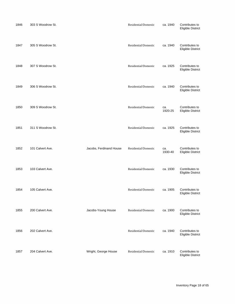
1846 303 S Woodrow St. Residential/Domestic ca. 1940 Contributes to Eligible District
1847 305 S Woodrow St. Residential/Domestic ca. 1940 Contributes to Eligible District
1848 307 S Woodrow St. Residential/Domestic ca. 1925 Contributes to Eligible District
1849 306 S Woodrow St. Residential/Domestic ca. 1940 Contributes to Eligible District
1850 309 S Woodrow St. Residential/Domestic ca. Contributes to 1920-25 Eligible District
1851 311 S Woodrow St. Residential/Domestic ca. 1925 Contributes to Eligible District
1852 101 Calvert Ave. Jacobs, Ferdinand House Residential/Domestic ca. Contributes to 1930-40 Eligible District
1853 103 Calvert Ave. Residential/Domestic ca. 1930 Contributes to Eligible District
1854 105 Calvert Ave. Residential/Domestic ca. 1905 Contributes to Eligible District
1855 200 Calvert Ave. Jacobs-Young House Residential/Domestic ca. 1900 Contributes to Eligible District
1856 202 Calvert Ave. Residential/Domestic ca. 1940 Contributes to Eligible District
1857 204 Calvert Ave. Wright, George House Residential/Domestic ca. 1910 Contributes to Eligible District
Inventory Page 18 of 65

1858 206 Calvert Ave. Residential/Domestic ca. Contributes to 1920-30 Eligible District
1859 300 Calvert Ave. Copeland-Milam House Residential/Domestic ca. 1905 Contributes to Eligible District
1860 302 Calvert Ave. Shands, William Hale Residential/Domestic ca. 1920 Contributes to House Eligible District
1861 303 Calvert Ave. Old Presbyterian Manse Residential/Domestic ca. 1900 Contributes to Eligible District
1862 206 S Adair St. Residential/Domestic ca. 1920 Contributes to Eligible District
1863 204 S Adair St. Residential/Domestic ca. Contributes to 1925-30 Eligible District
1864 202 S Adair St. Residential/Domestic ca. 1930 Contributes to Eligible District
1868 108 Adair St. Residential/Domestic ca. 1910 Not Eligible
1869 110 Adair St. Residential/Domestic ca. 1920 Not Eligible
1870 SE corner of int. of Woodrow St. & commercial ca. 1940 Contributes to Carolina Ave. Eligible District
1878 301 S Adair St. Residential/Domestic ca. 1940 Not Eligible
1879 205 Calhoun St. Residential/Domestic ca. 1940 Not Eligible
Inventory Page 19 of 65
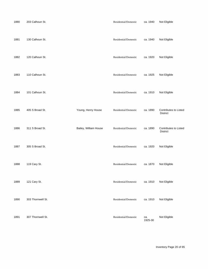
1880 203 Calhoun St. Residential/Domestic ca. 1940 Not Eligible
1881 130 Calhoun St. Residential/Domestic ca. 1940 Not Eligible
1882 120 Calhoun St. Residential/Domestic ca. 1920 Not Eligible
1883 110 Calhoun St. Residential/Domestic ca. 1925 Not Eligible
1884 101 Calhoun St. Residential/Domestic ca. 1910 Not Eligible
1885 405 S Broad St. Young, Henry House Residential/Domestic ca. 1890 Contributes to Listed District
1886 311 S Broad St. Bailey, William House Residential/Domestic ca. 1890 Contributes to Listed District
1887 305 S Broad St. Residential/Domestic ca. 1920 Not Eligible
1888 119 Cary St. Residential/Domestic ca. 1870 Not Eligible
1889 121 Cary St. Residential/Domestic ca. 1910 Not Eligible
1890 303 Thornwell St. Residential/Domestic ca. 1910 Not Eligible
1891 307 Thornwell St. Residential/Domestic ca. Not Eligible 1925-30
Inventory Page 20 of 65

1892 309 Thornwell St. Residential/Domestic ca. 1930 Not Eligible
1893 SE corner of int. of Centennial St. & Residential/Domestic ca. 1940 Not Eligible Thornwell St.
1894 114 Centennial St. Residential/Domestic ca. 1940 Not Eligible
1895 112 Centennial St. Residential/Domestic ca. 1940 Not Eligible
1896 110 Centennial St. Residential/Domestic ca. 1925 Not Eligible
1897 108 Centennial St. Bolick, Julian House Residential/Domestic ca. 1920 Not Eligible
1898 104 Centennial St. Residential/Domestic ca. 1925 Not Eligible
1899 106 Centennial Ln. Residential/Domestic ca. 1910 Not Eligible
1900 100 Centennial Ln. Residential/Domestic ca. 1910 Not Eligible
1901 SW corner of int. of Gary St. & Morehead, Bailey House Residential/Domestic ca. 1900 Not Eligible Centennial St.
1902 on the circle Jacobs Hall Educational 1915 Contributes to Listed District
1903 Presbyterian College Campus, S Industrial/Engineering ca. 1920 Contributes to Listed W corner of int. of Adair & Calhoun District Sts.
Inventory Page 21 of 65

1904 Adair St., E side, between Calhoun Neville Hall Educational ca. 1907 Contributes to Listed & Maple Sts. District
1905 NE corner of int. of Adair St. & Laurens Hall Educational ca. 1908 Contributes to Listed Maple St. District
1906 Calhoun St., S side, approx. 50 yds. Leroy Springs Gymnasium recreation ca. 1924 Contributes to Listed E of int w/ Adair St. District
1907 Presbyterian College Campus, just Doyle Infirmary Residential/Domestic ca. 1890 Contributes to Listed west of the gymnasium District
1908 512 Broad St. President's House Residential/Domestic ca. 1920 Contributes to Listed District
1909 510 South Broad St. Young, Rober Newton Residential/Domestic ca. 1850 Contributes to Listed t Spires House District
1910 508 S Broad St. Residential/Domestic ca. 1940 Contributes to Listed District
1911 NW corner of int. of S Broad St. & Mayes Baby Cottage Residential/Domestic ca. 1924 Contributes to Listed Calhoun St. District
1912 S Broad St., W side, approx 30 Stewart Cottage Residential/Domestic ca. 1950 Contributes to Listed . yds. N of int. w/ Calhoun St. District
1913 SW corner of in of S Broad & President's House Residential/Domestic ca. 1925 Contributes to Listed t Centennial Sts. District
1914 Thornwell Campus Nellie Scott Library Educational ca. 1890 Contributes to Listed District
1915 Thornwell Campus Home of Peace Residential/Domestic ca. 1875 Contributes to Listed District
Inventory Page 22 of 65

1916 Thornwell Campus Memorial Hall Other ca. 1940 Contributes to Listed District
1917 Thornwell Orphanage Technical School Educational ca. 1892 Contributes to Listed District
1918 Thornwell Campus Eldridge Fowler Cottage Residential/Domestic ca. 1905 Contributes to Listed District
1919 Thornwell Campus Children's Gift Academy Educational ca. 1895 Contributes to Listed District
1920 Thornwell Campus Silliman Cottage Residential/Domestic ca. 1907 Contributes to Listed District
1921 Thornwell Campus Anita Cottage Residential/Domestic ca. 1899 Contributes to Listed District
1922 Thornwell Campus Virginia Home Residential/Domestic ca. 1898 Contributes to Listed District
1923 Thornwell Campus Georgia Beatty Cottage Residential/Domestic ca. 1910 Contributes to Listed District
1924 102 Hwy 76 Dr. Spenser House Residential/Domestic ca. 1920 Not Eligible
1925 NW corner of S Broad & Elm Sts. Residential/Domestic ca. 1930 Not Eligible
1926 704 S Broad St. Oxley House Residential/Domestic ca. 1940 Not Eligible
1927 700 S Broad St. Residential/Domestic ca. Not Eligible 1930-40
Inventory Page 23 of 65

1928 SE corner of S Broad St. & E Religious 1951 Not Eligible Walnut St.
1929 Walnut St., S side, approx. 60 yds. Residential/Domestic ca. 1930 Not Eligible W of int. w/ S Broad St.
1930 107 W Walnut St. Residential/Domestic ca. Not Eligible 1920-25
1931 106 Walnut St. Residential/Domestic ca. 1925 Not Eligible
1932 200 Walnut St. Residential/Domestic ca. 1930 Not Eligible
1933 203 Walnut St. Residential/Domestic ca. 1940 Not Eligible
1934 205 Walnut St. Residential/Domestic ca. Not Eligible 1930-40
1935 204 Walnut St. Residential/Domestic ca. 1940 Not Eligible
1936 207 Walnut St. Residential/Domestic ca. 1940 Not Eligible
1937 206 Walnut St. Residential/Domestic ca. 1930 Not Eligible
1938 209 Walnut St. Residential/Domestic ca. 1930 Not Eligible
1939 208 Walnut St. Residential/Domestic ca. 1940 Not Eligible
Inventory Page 24 of 65

1940 301 W Walnut St. Residential/Domestic ca. 1950 Not Eligible
1941 303 W Walnut St Residential/Domestic ca. 1930 Not Eligible
1942 304 W Walnut St. Residential/Domestic ca. 1940 Not Eligible
1943 306 W Walnut St. Residential/Domestic ca. 1940 Not Eligible
1944 305 W Walnut St. Residential/Domestic ca. 1940 Not Eligible
1945 308 W Walnut St. Residential/Domestic ca Not Eligible 1930-40
1946 307 W Walnut St. Residential/Domestic ca. 1930 Not Eligible
1947 306 Chestnut St. Residential/Domestic ca. 1950 Not Eligible
1948 512 W Walnut St. Jacobs House Residential/Domestic 1923 Not Eligible
1949 201 Chestnut St. Residential/Domestic ca. 1940 Not Eligible
1950 402 Maple St. Residential/Domestic ca. 1920 Not Eligible
1951 400 Maple St. Residential/Domestic ca. 1930 Not Eligible
Inventory Page 25 of 65

1952 at the end of Young St. Residential/Domestic ca. 1940 Not Eligible
1953 205 Young St. Residential/Domestic ca. 1940 Not Eligible
1954 203 Young St. Residential/Domestic ca. 1930 Not Eligible
1955 200 Young St. Residential/Domestic ca. Not Eligible 1925-30
1956 108 Young Dr. Residential/Domestic ca. 1940 Not Eligible
1957 109 Young Dr. Residential/Domestic ca. 1945 Not Eligible
1958 106 Young Dr. Residential/Domestic ca. 1940 Not Eligible
1959 100 Young Dr. Residential/Domestic ca. 1925 Not Eligible
1960 105 Hickory St. Residential/Domestic ca. Not Eligible 1945-50
1961 202 Maple St. Residential/Domestic ca. Not Eligible 1930-40
1962 206 Maple St. Residential/Domestic ca. Not Eligible 1930-40
1963 210 Maple St. Residential/Domestic ca. 1925 Not Eligible
Inventory Page 26 of 65

1964 306 Maple St. Residential/Domestic ca. 1930 Not Eligible
1965 308 Maple St. Residential/Domestic ca. 1945 Not Eligible
1966 SW corner of int. of Maple St. & Residential/Domestic ca. Not Eligible Chestnut St. 1940-50
1967 301 W Maple St. Residential/Domestic ca. 1930 Not Eligible
1968 300 Chestnut St. Residential/Domestic ca. 1930 Not Eligible
1969 304 Chestnut St. Residential/Domestic ca. 1925 Not Eligible
1970 305 Chestnut St. Residential/Domestic ca. Not Eligible 1940-50
1971 303 Chestnut St. Residential/Domestic ca. 1940 Not Eligible
1972 203 W Maple St. Residential/Domestic ca. Not Eligible 1940-50
1973 201 W Maple St. Residential/Domestic ca. 1925 Not Eligible
1974 SW corner of int. of W Maple St. & Residential/Domestic ca. 1940 Not Eligible Hickory St.
1975 304 Hickory St. Residential/Domestic ca. 1925 Not Eligible
Inventory Page 27 of 65

1976 305 Hickory St. Residential/Domestic ca. 1950 Not Eligible
1977 303 Hickory St. Residential/Domestic ca. 1945 Not Eligible
1978 Maple St., S side, approx. 60 yds. Residential/Domestic ca. 1940 Not Eligible W of int. w/ S Broad St.
1979 600 S Broad St. Cooper, Lynn Home Residential/Domestic ca. 1920 Not Eligible
1980 602 S Broad St. Residential/Domestic ca. Not Eligible 1925-30
1981 604 S Broad St. Residential/Domestic ca. 1925 Not Eligible
1982 608 S Broad St. Residential/Domestic ca. 1925 Not Eligible
1983 610 S Broad St. Residential/Domestic ca. 1940 Not Eligible
1984 611 S Broad St. Residential/Domestic ca. 1920 Not Eligible
1985 605 S Broad St. Residential/Domestic ca. 1915 Not Eligible
1986 106 Maple St. Residential/Domestic ca. 1940 Not Eligible
1987 108 Maple St. Residential/Domestic ca. Not Eligible 1930-40
Inventory Page 28 of 65

1988 110 Maple St. Residential/Domestic ca. Not Eligible 1930-40
1989 112 Maple St. Residential/Domestic ca. Not Eligible 1930-40
1990 501 S Adair St. Residential/Domestic ca. 1890 Not Eligible
1991 S Adair St., W side, approx. 75 yds. Residential/Domestic ca. Not Eligible S of int. w/ Maple St. 1940-50
1992 114 Walnut St. Residential/Domestic ca. Not Eligible 1940-50
1993 112 Walnut St. Residential/Domestic ca. 1940 Not Eligible
1994 109 Walnut St. Residential/Domestic ca. 1945 Not Eligible
1995 106 Walnut St. Residential/Domestic ca. 1945 Not Eligible
1996 NE corner of Pine St. & Cedar St. Unknown ca. 1915 Not Eligible
1997 Jones St., W side, approx. 30 yds. Residential/Domestic ca. 1925 Not Eligible S of int w/ Florida St.
1998 506 E Florida St. Residential/Domestic ca. 1925 Not Eligible
2001 Hwy 72, N side, approx. 200 yds. E Residential/Domestic ca. 1940 Not Eligible of int. w/ N Broad St.
Inventory Page 29 of 65

2006 608 Musgrove St. Residential/Domestic ca. Not Eligible 1925-30
2007 607 Musgrove St. Residential/Domestic ca. 1920 Not Eligible
2008 606 Musgrove St. Residential/Domestic ca. 1925 Not Eligible
2009 602 Musgrove St. Residential/Domestic ca. 1925 Not Eligible
2010 Gary St, N side, approx. 1/2 mi. W Industrial/Engineering ca. 1910 Not Eligible of int. w/ Thornwell St.
2011 1335 Gary St. Residential/Domestic ca. 1910 Not Eligible
2012 415 Gary St. Residential/Domestic ca. 1915 Not Eligible
2013 1525 Gary St. Residential/Domestic ca. 1915 Not Eligible
2014 1529 Gary St. Residential/Domestic ca. 1915 Not Eligible
2015 1531 Gary St. Residential/Domestic ca. 1920 Not Eligible
2016 1601 Gary St. Residential/Domestic ca. Not Eligible 1915-20
2017 505 Gary St. Residential/Domestic ca. 1930 Not Eligible
Inventory Page 30 of 65

2018 511 Gary St. Residential/Domestic ca. 1940 Not Eligible
2019 1625 Gary St. Residential/Domestic ca. 1940 Not Eligible
2020 1617 Gary St. Residential/Domestic ca. 1925 Not Eligible
2021 1619 Gary St. Residential/Domestic ca. 1930 Not Eligible
2022 519 Gary St. Residential/Domestic ca. 1940 Not Eligible
2023 312 Livingstone St. Residential/Domestic ca. 1915 Not Eligible
2024 510 Livingstone St. Residential/Domestic ca. 1915 Not Eligible
2025 100 D St. Residential/Domestic ca. 1920 Not Eligible
2026 102 D St. Residential/Domestic ca. 1925 Not Eligible
2027 302 S Bell St. Residential/Domestic ca. 1915 Not Eligible
2028 1306 S Bell St. Residential/Domestic ca. 1920 Not Eligible
2029 1309 S Bell St. Residential/Domestic ca. 1925 Not Eligible
Inventory Page 31 of 65

2030 308 S Bell St. Residential/Domestic ca. 1925 Not Eligible
2031 312A S Bell St. Residential/Domestic ca. 1925 Not Eligible
2032 S Bell St., E side, approx. 150 yds. Residential/Domestic ca. 1910 Not Eligible S of int. w/ D St.
2033 S Bell St., W side, approx. 200 yds. Residential/Domestic ca. 1930 Not Eligible S of int. w/ D St.
2034 1251 S Bell St. Residential/Domestic ca Not Eligible 1910-15
2035 S Bell St., E side approx. 100 yds. Residential/Domestic ca. Not Eligible , N of int. w/ D St. 1910-15
2037 1234 S Bell St. Residential/Domestic ca. 1915 Not Eligible
2038 109 S Bell St. Residential/Domestic ca. 1915 Not Eligible
2039 107 S Bell St. Residential/Domestic ca. 1925 Not Eligible
2040 703 Tribble St. Residential/Domestic ca. 1915 Not Eligible
2041 511 W Carolina Ave. Residential/Domestic ca. 1925 Not Eligible
2042 507 W Carolina Ave. Residential/Domestic ca. 1930 Not Eligible
Inventory Page 32 of 65

2043 505 W Carolina Ave. Residential/Domestic ca. 1915 Not Eligible
2044 503 W Carolina Ave. Residential/Domestic ca. 1925 Not Eligible
2045 501 W Carolina Ave. Residential/Domestic ca. Not Eligible 1905-10
2046 110 Oak St. Residential/Domestic ca. 1930 Not Eligible
2047 108 Oak St. Residential/Domestic ca. 1930 Not Eligible
2048 401 Centennial Ave. Residential/Domestic ca. Not Eligible 1910-15
2049 521 W Centennial Ave. Residential/Domestic ca. Not Eligible 1940-50
2050 204 Kingstone St. Residential/Domestic ca. Not Eligible 1925-30
2051 315 Kingstone St. Residential/Domestic ca. 1930 Not Eligible
2052 422 Kingstone St. Residential/Domestic ca. Not Eligible 1925-30
2146 1346 Hwy 308 Residential/Domestic ca. 1920 Not Eligible
2147 1509 Hwy 308 Residential/Domestic ca. 1900 Not Eligible
Inventory Page 33 of 65

2148 Templeton Rd., E side, approx. 1/2 Residential/Domestic ca. 1915 Not Eligible mi. S of int. w/ Hwy 76
2149 Milam Rd., E side, approx. 1 mi. S Residential/Domestic ca. 1910 Not Eligible of int. w/
2150 Milam Rd., E side, approx. 1/2 mi. S New China Church Religious ca. 1920 Not Eligible of int. w/ Holmes Bridge Rd.
2151 Milam Rd., E side, approx. 1 mi. N Residential/Domestic ca. 1890 Not Eligible of int. w/ Hwy 72W
2152 Lisbon Rd., N side, approx. 1 1/4 Unknown ca. 1920 Not Eligible mi. N of int. w/ Hwy 72W
2153 Ginger Cr Rd., W side, approx. 1 Residential/Domestic ca. 1850 Not Eligible mi. S of int. w/ Beaverdam Church Rd.
2154 1555 Beaverdam Church Rd. Beaverdam Baptist Church Religious 1881 Not Eligible
2155 5295 Lisbon Rd. Residential/Domestic ca. 1880 Not Eligible
2156 5067 Lisbon Rd. Residential/Domestic ca. 1850 Not Eligible
2157 4647 Lisbon Rd. Residential/Domestic ca. 1930 Not Eligible
2158 4287 Lisbon Rd. Residential/Domestic ca. 1910 Not Eligible
2159 Brown Rd., S side, approx. 1/4 mi. E Residential/Domestic ca. 1910 Not Eligible of Harper St. Ext.
Inventory Page 34 of 65

2160 2635 E.B. Jacks Rd. Residential/Domestic ca. 1915 Not Eligible
2212 740 Charlotte's Rd. Residential/Domestic ca. 1920 Not Eligible
2213 Charlotte's Rd., W side, approx. 1/2 Residential/Domestic ca. 1920 Not Eligible mi. S of int w/ AB Jacks Rd.
2214 SE corner of int. of Hwy 76 E & Residential/Domestic ca. 1905 Not Eligible Torrington Rd.
2215 24580 Hwy 76 E Residential/Domestic ca. 1910 Not Eligible
2216 Torrington Rd., S side, approx. 1/4 Residential/Domestic ca. 1880 Not Eligible mi. W of int. w/ Hwy 76 E
2217 485 Torrington Rd. Residential/Domestic ca. 1940 Not Eligible
2218 1288 Torrington Rd. Residential/Domestic ca. 1920 Not Eligible
2219 114 Charlotte's Rd. Residential/Domestic ca. 1915 Not Eligible
2220 Charlotte's Rd., W side, across commercial ca. 1930 Not Eligible from int. w/ Poplar St.
2221 Poplar St., N side, approx. 1 mi. E Residential/Domestic ca. 1905 Eligible of int. w/ Charlotte's Rd.
2222 105 Mississippi Dr. Residential/Domestic ca. 1910 Not Eligible
Inventory Page 35 of 65

2223 2366 Charlotte's Rd. Griffin House Residential/Domestic ca. 1845 Not Eligible
2224 1427 Charlotte's Rd. Residential/Domestic ca. 1925 Not Eligible
2225 1075 Charlotte's Rd. Residential/Domestic ca. 1920 Not Eligible
2226 3541 SSR 103 Residential/Domestic ca. 1935 Not Eligible
2227 N side, approx. 1 mi., W of int. w/ Residential/Domestic ca. 1915 Not Eligible Hwy 72
2228 N side, approx. 1 mi. W of int. w/ Residential/Domestic ca. 1915 Not Eligible Hwy 72
2229 4497 Hwy 72 Residential/Domestic ca. 1940 Not Eligible
2230 62 Hwy 72 Residential/Domestic ca. 1925 Not Eligible
2231 4367 Hwy 72 Residential/Domestic ca. 1920 Not Eligible
2232 4424 Hwy 72 Residential/Domestic ca. 1920 Not Eligible
2233 Old Milton Rd., W side, approx. 1/2 Residential/Domestic ca.1900 Not Eligible mi. S of int. w/ Green Plain Rd.
2234 Old Milton Rd., E side, approx. 200 Residential/Domestic ca. 1890 Not Eligible yds. S of int. w/ Green Plain Rd.
Inventory Page 36 of 65

2235 Old Milton Rd., E side, approx. 150 Residential/Domestic ca. 1890 Not Eligible yds. S of int. w/ Green Plain Rd.
2236 209 Old Milton Rd. Residential/Domestic ca. 1910 Not Eligible
2237 Hwy 72, S side, approx. 100 yds. E Residential/Domestic ca. 1890 Not Eligible of int. w/ Keller Dr.
2238 Hwy 72, N side, approx. 1/2 mi. W Residential/Domestic ca. 1890 Not Eligible of int. w/ Green Plain Rd.
Cross Hill Site No Address/Location Historic Name Historic Use Date Eligibility
2059 6078 Mountville Rd. Antrim; Griffin-Williams Residential/Domestic ca. 1850 Not Eligible House
2060 5731 Mountville Rd. Residential/Domestic ca. 1850 Not Eligible
2061 5064 Mountville Rd. Residential/Domestic ca. Not Eligible 1905-10
2062 Jefferson Davis Rd., E side, Residential/Domestic ca. 1900 Not Eligible approx. 1/4 mi. N of int. w/ Mountville R
2063 Jefferson Davis Rd., E side, Residential/Domestic ca. 1900 Not Eligible approx. 1/2 mi. N of int. w/ Mountville R
2064 Jefferson Davis Rd., W side, Young, Lafayette House Residential/Domestic ca. 1850 Not Eligible approx. 11/2 mi. N of int. w/ Old Milton
2065 NW corner of int. of Mountville Rd. Residential/Domestic ca. 1910 Not Eligible and Blufford Rd.
Inventory Page 37 of 65

2066 3715 Mountville Rd. Residential/Domestic ca. 1850 Not Eligible
2067 2735 Mountville Rd. Residential/Domestic ca. Not Eligible 1910-15
2068 2417 Mountville Rd. Residential/Domestic ca. 1925 Not Eligible
2069 Mill St., W side, at int. w/ Grange St. commercial ca. 1900 Not Eligible
2070 Mill St., W side, approx. 30 yds N Industrial/Engineering ca. 1900 Not Eligible of int. w/ Grange St.
2071 Mill St., W side, approx. 50 yds. N commercial ca. 1920 Not Eligible of int. w/ Grange St.
2072 Mill St., N side, at int. w/ Hwy 72 Industrial/Engineering ca. Not Eligible 1900-20
2073 NW corner of int. of Hwy 72 & Mart commercial ca. 1930 Not Eligible Teague Rd.
2074 Hwy 72, w side, approx. 50 yds. S Residential/Domestic ca. 1890 Not Eligible of int. w/ Mart Teague Rd.
2075 Hwy 72, W side, on N corner of int. Residential/Domestic ca. 1880 Not Eligible w/ Grange St.
2076 9376 Hwy 72 Residential/Domestic ca. 1915 Not Eligible
2077 SE corner of int. of Hwy 72 and Residential/Domestic ca. 1900 Not Eligible Grange St.
Inventory Page 38 of 65

2078 Grange St., N side, approx. 50 yds. Residential/Domestic ca. 1925 Not Eligible E of int. w/ Mountville Rd.
2079 Mountville Rd., S side, approx. 10 Residential/Domestic ca. 1920 Not Eligible yds. E of int. w/ Grange St.
2080 1162 Mountville Rd. Residential/Domestic ca. 1880 Not Eligible
2081 141 Mart Teague Rd. Residential/Domestic ca. 1880 Eligible
2082 255 Mart Teague Rd. Residential/Domestic ca. 1890 Not Eligible
2083 307 Mart Teague Rd. Residential/Domestic ca. 1880 Eligible
2084 298 Mart Teague Rd. Residential/Domestic ca. Not Eligible 1910-15
2085 338 Mart Teague Rd. Residential/Domestic ca. 1910 Not Eligible
2086 3056 Puckett Ferry Rd. Residential/Domestic ca. 1910 Not Eligible
2087 Puckett Ferry Rd., N side, approx. Residential/Domestic ca. 1890 Not Eligible 1 mi. E of int. w/ Hwy 39
2088 9830 Hwy 72W Residential/Domestic ca. 1920 Not Eligible
2089 10039 Hwy 72 W Residential/Domestic ca. 1915 Not Eligible
Inventory Page 39 of 65

2090 Hwy 72, E side, approx. 100 yds. E Residential/Domestic ca. 1890 Not Eligible of road facing railroad tracks
2091 5602 Hwy 39 Koon-Dendy House Residential/Domestic ca. 1880 Not Eligible
2092 5818 Hwy 39 Residential/Domestic ca. 1925 Not Eligible
2093 6542 Hwy 39 Adams, Silas House Residential/Domestic ca. 1860 Not Eligible
2094 NW corner of int. of Watts Bridge Residential/Domestic ca. 1920 Not Eligible Rd. & Whiteford Rd.
2095 3519 Watts Bridge Rd. Residential/Domestic ca. 1890 Not Eligible
2096 Bethabara Church Rd, E side, Bethabara Church Religious ca. 1890 Not Eligible approx. 1/2 mi. S of int. w/ Hwy 39
2097 11885 Hwy 39 Residential/Domestic ca. 1915 Not Eligible
2098 432 Skipper's Lodge Rd. Residential/Domestic ca. 1890 Not Eligible
2099 SW corner of int. of Hwy 39 and Residential/Domestic ca. 1910 Not Eligible Skipper's Landing Rd.
2100 13997 Hwy 39 Residential/Domestic ca. 1900 Not Eligible
2309 Watts Bridge Rd., W side, approx. Griffin, Richard House Residential/Domestic ca. 1900 Not Eligible 1/2 mi. S of int. w/ Hwy 39
Inventory Page 40 of 65

2310 SC 560, N side, approx. 1/2 mi. E Residential/Domestic ca. 1900 Not Eligible of int. w/ Hwy 39.
2311 13691 SC 560 Hipp House Residential/Domestic ca. 1905 Not Eligible
2312 968 Main St. Government/Public ca. 1925 Not Eligible
2313 Main St., S side, in center of commercial ca. Not Eligible three-part commercial block. 1910-15
2314 958 Main St. commercial ca. 1910 Not Eligible
2315 SW corner of int. of Hwy 39 & Leaman Bros. Hardware, commercial ca. 1912 Not Eligible Church St. Dry Goods & Grocery
2316 Church St., W side, approx. 100 Cross Hill Hotel Residential/Domestic ca. 1890 Not Eligible yds. S of int. w/ Hwy 39
2317 37 Miller St. Hitt-Hill House Residential/Domestic ca. 1915 Not Eligible
2318 end of Miller St. Whiteford, Gregory House Residential/Domestic ca. 1905 Not Eligible
2319 Hwy 39, N side, across from int. w/ commercial ca. 1905 Not Eligible Church St.
2320 Mercantile Rd., S side, approx. 40 Griffin-Horne House Residential/Domestic ca. 1905 Not Eligible yds. W of int. w/ Hwy 39
2321 Mercantile Rd., S side, approx. 100 Turner-Boyde-Fagan House Residential/Domestic ca. 1905 Not Eligible yds. W of int. w/ Hwy 39
Inventory Page 41 of 65

2322 Trip St., E side, approx. 75 yds. N commercial ca. 1890 Not Eligible of int. w/ Hwy 39
2323 Trip St., E side, approx. 110 yds. N Residential/Domestic ca. 1880 Not Eligible of int. w/ Hwy 39
2324 Trip St., E side, approx. 125 yds. N Residential/Domestic ca. 1890 Not Eligible of int. w/ Hwy 39
2325 Hwy 39, E side, approx. 100 yds. S commercial ca. 1910 Not Eligible of int. w/ Leaman St.
2326 Hwy 39, E side, approx. 30 yds. S commercial ca. 1915 Not Eligible of int. w/ Leaman St.
2327 Hwy 39, E side, approx. 10 yds. S Residential/Domestic ca. 1905 Not Eligible of int. w/ Leaman St.
2328 689 Hwy 39 Residential/Domestic ca. 1905 Not Eligible
2329 659 Hwy 39 Residential/Domestic ca. 1880 Not Eligible
2330 629 Hwy 39 Rasor, W.C. House Residential/Domestic ca. 1880 Eligible
2331 585 Hwy 39 Residential/Domestic ca. 1915 Not Eligible
2332 503 Hwy 39 Residential/Domestic ca. Not Eligible 1920-25
2333 441 Hwy 39 Residential/Domestic ca. 1915 Not Eligible
Inventory Page 42 of 65

2334 Hwy 39, E side, approx. 1/4 mi. S Hill, A.M. House Residential/Domestic ca. 1880 Not Eligible of int. w/ Puckett's Ferry Rd.
2335 Hwy 39, E side, approx. 300 S Residential/Domestic ca. Not Eligible yds. of int. w/ Puckett's Ferry Rd. 1905-10
2336 257 Hwy 39 Simpson House Residential/Domestic ca. 1870 Not Eligible
2337 258 Hwy 39 Dial House Residential/Domestic ca. 1905 Not Eligible
2338 Hwy 39, W side, approx. 300 yds. S Residential/Domestic ca. 1890 Not Eligible of int. w/ Puckett's Ferry Rd.
2339 402 Hwy 39 Senn House Residential/Domestic ca. Not Eligible 1890-1900
2340 NW corner of int. of Hwy 39 & Residential/Domestic ca. 1870 Not Eligible Liberty Springs Rd.
2341 84 Liberty Springs Rd. Residential/Domestic ca. 1905 Not Eligible
2342 560 Hwy 39 Residential/Domestic ca. 1840 Not Eligible
2343 585 Hwy 39 Residential/Domestic ca. Not Eligible 1920-25
2344 644 Hwy 39 Pinson House Residential/Domestic ca. 1890 Not Eligible
2345 Hwy 39, W side, approx. 200 yds. Residential/Domestic ca. 1890 Not Eligible N of int. w/ Leaman St.
Inventory Page 43 of 65

2346 Liberty Springs Rd., S side, approx. Cross Hill High School Educational ca. 1925 Eligible 125 yds. E of int. w/ Hwy 39
2347 233 Liberty Springs Rd. Residential/Domestic ca. 1890 Not Eligible
2348 534 Leaman St. Hitt House Residential/Domestic ca. 1915 Not Eligible
2349 368 Leaman St. Residential/Domestic ca. 1870 Not Eligible
2350 SE corner of int. of Hwy 39 & SC Pet Miller, Undertaker commercial ca. 1930 Not Eligible 560
2351 1048 Hwy 39 Residential/Domestic ca. 1890 Not Eligible
2352 NW corner of int. of Hwy 39 & Cross Hill Methodist Religious ca. 1890 Not Eligible Church
2353 1131 Hwy 39 Residential/Domestic ca. 1920 Not Eligible
2354 1149 Hwy 39 Residential/Domestic ca. 1900 Not Eligible
2355 1183 Hwy 39 Residential/Domestic ca. 1890 Not Eligible
2356 1205 Hwy 39 Residential/Domestic ca. Not Eligible 1910-15
2357 1251 Hwy 39 Dr. Miller House Residential/Domestic 1939 Not Eligible
Inventory Page 44 of 65

2358 Hwy 39, E side, approx. 1/2 mi. S Miller, J.H. House Residential/Domestic ca. 1890 Not Eligible of int. w/ SC 560
2359 Hwy 39, E side, approx. 100 yds. S Residential/Domestic ca. 1890 Not Eligible of int. w/ Watts Bridge Rd.
2360 10404 Hwy 39 Hollingsworth, J.T. House Residential/Domestic ca. 1915 Not Eligible
2361 1446 Hwy 39 Wade, Robert House Residential/Domestic ca. 1910 Not Eligible
2362 Hwy 39, W side, approx. 1/2 mi. S Residential/Domestic ca. 1910 Not Eligible of int. w/ SC 560
2363 1234 Hwy 39 Griffin, R.W. House Residential/Domestic ca. 1890 Not Eligible
2364 1174 Hwy 39 Residential/Domestic ca. 1880 Not Eligible
2365 1150 Hwy 39 Residential/Domestic ca. 1930 Not Eligible
2366 749 Puckett's Ferry Rd. Pinson House Residential/Domestic ca. 1905 Not Eligible
2367 155 Puckett's Ferry Rd. Coleman-Turner House Residential/Domestic ca. 1890 Not Eligible
2368 114 Puckett's Ferry Rd. Proffit-Hill-Steadman Residential/Domestic ca. 1915 Not Eligible House
2369 13339 Hwy 72 McSwain-Coleman House Residential/Domestic ca. 1908 Not Eligible
Inventory Page 45 of 65

2370 13450 Hwy 72 McSwain House Residential/Domestic ca. 1890 Not Eligible
Enoree Site No Address/Location Historic Name Historic Use Date Eligibility
2181 1706 Patterson Plant Rd. Residential/Domestic ca. 1880 Not Eligible
2182 1717 Patterson Plant Rd. Residential/Domestic ca. 1920 Not Eligible
2183 1511 Patterson Plant Rd. Residential/Domestic ca. 1880 Not Eligible
2184 757 Cooper Rd. Residential/Domestic ca. 1880 Not Eligible
2185 Parsonage Rd. Residential/Domestic ca. Not Eligible 1915-20
2186 353 Parsonage Rd. Residential/Domestic ca. 1900 Not Eligible
2187 Parsonage Rd. Residential/Domestic ca. 1915 Not Eligible
2188 497 River Hill Rd. Residential/Domestic ca. 1890 Not Eligible
2189 Hwy 221, E side, approx. 30 yds. S commercial ca. Not Eligible of int. w/ Lanford Rd. 1925-30
2190 27228 Hwy 221 Residential/Domestic ca. 1910 Not Eligible
Inventory Page 46 of 65
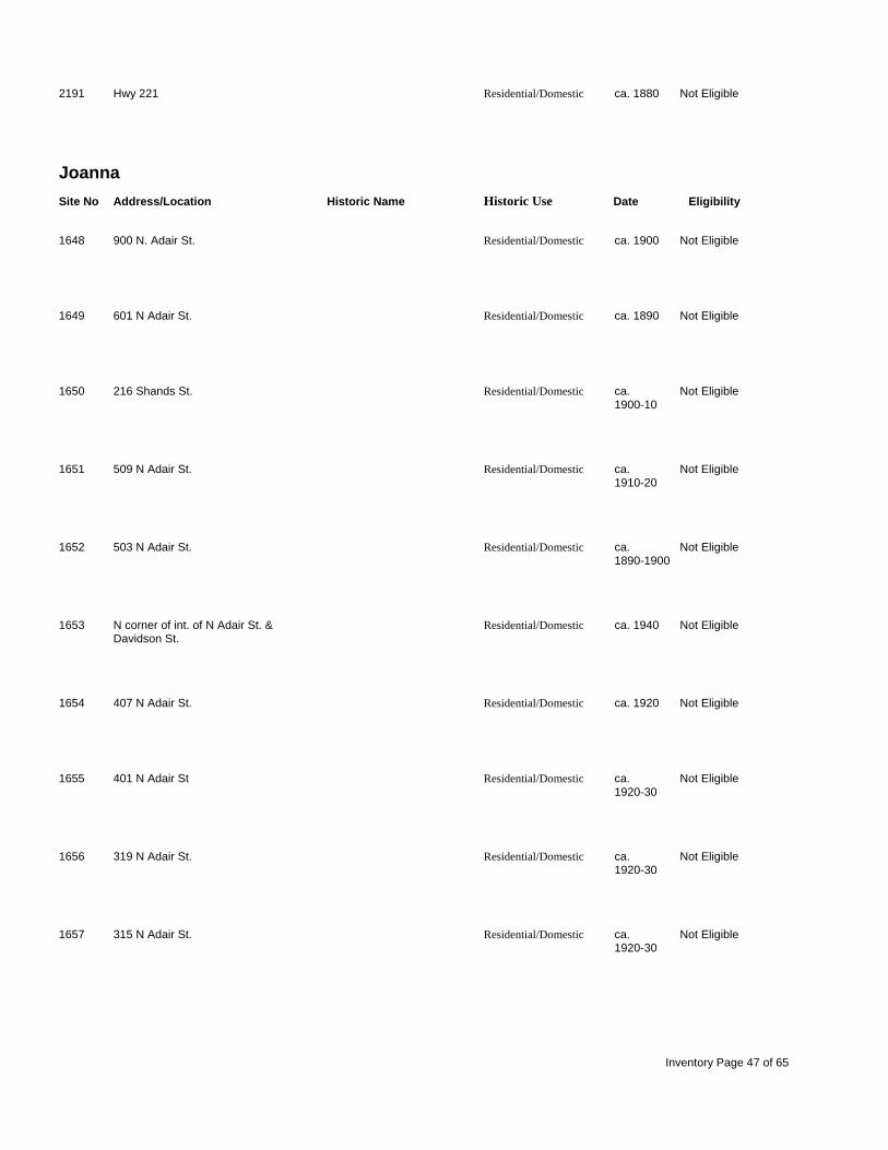
2191 Hwy 221 Residential/Domestic ca. 1880 Not Eligible
Joanna Site No Address/Location Historic Name Historic Use Date Eligibility
1648 900 N. Adair St. Residential/Domestic ca. 1900 Not Eligible
1649 601 N Adair St. Residential/Domestic ca. 1890 Not Eligible
1650 216 Shands St. Residential/Domestic ca. Not Eligible 1900-10
1651 509 N Adair St. Residential/Domestic ca. Not Eligible 1910-20
1652 503 N Adair St. Residential/Domestic ca. Not Eligible 1890-1900
1653 N corner of int. of N Adair St. & Residential/Domestic ca. 1940 Not Eligible Davidson St.
1654 407 N Adair St. Residential/Domestic ca. 1920 Not Eligible
1655 401 N Adair St Residential/Domestic ca. Not Eligible 1920-30
1656 319 N Adair St. Residential/Domestic ca. Not Eligible 1920-30
1657 315 N Adair St. Residential/Domestic ca. Not Eligible 1920-30
Inventory Page 47 of 65

1658 314 N Adair St. Residential/Domestic ca. Not Eligible 1920-30
1659 N Adair St, W side, approx. 100 Residential/Domestic ca Not Eligible yds. N of int. w/ Ferguson St. 1910-15
1660 301 N Adair St. Residential/Domestic ca. Not Eligible 1920-30
1661 201 N Adair St. Residential/Domestic ca. Not Eligible 1900-10
1662 204 N Adair St. Residential/Domestic ca. 1910 Not Eligible
1663 203 N Adair St. Residential/Domestic ca. Not Eligible 1890-1900
1664 200 N Adair St. Residential/Domestic ca. Not Eligible 1920-30
1665 411 E Florida St. Copeland, Dick House Residential/Domestic ca. 1900 Not Eligible
1666 600 E Florida St. Florida Street Elementary Educational 1924 Eligible School
1667 603 E Florida St. Residential/Domestic ca. Not Eligible 1900-10
1668 110 W Holland St. Residential/Domestic ca. Not Eligible 1945-50
1669 104 W Holland St. Residential/Domestic ca. 1940 Not Eligible
Inventory Page 48 of 65

1670 102 W Holland St. Residential/Domestic ca. 1940 Not Eligible
1671 112 W Holland St. Residential/Domestic ca. 1940 Not Eligible
1672 705 E Florida St. Residential/Domestic ca. 1930 Not Eligible
1673 707 E Florida St. Residential/Domestic ca. Not Eligible 1930-40
1674 709 E Florida St. Residential/Domestic ca. 1920 Not Eligible
1675 501 E Ferguson St. Residential/Domestic ca. 1910 Not Eligible
1676 500 E Ferguson St. Residential/Domestic ca. 1925 Not Eligible
1677 NW corner of int. of E Ferguson St. Residential/Domestic ca. Not Eligible & G St. 1905-10
1678 402 E Ferguson St. Residential/Domestic ca. 1905 Not Eligible
1679 403 E Ferguson St. Residential/Domestic ca. 1900 Not Eligible
1680 401 E Ferguson St. Dillard, Kit House Residential/Domestic ca. 1905 Not Eligible
1681 208 N Owens St. Residential/Domestic ca. 1905 Not Eligible
Inventory Page 49 of 65

1806 SE corner of int. of E Carolina Ave. Residential/Domestic ca. 1890 Not Eligible & S Adair St.
1807 602 E Carolina Ave. Residential/Domestic ca. 1925 Not Eligible
1808 604 E Carolina Ave. Pitts, Lewis C. House Residential/Domestic ca. 1915 Not Eligible
1809 606 E Carolina Ave. Neighbors, Edgar House Residential/Domestic ca. 1916 Not Eligible
1810 102 S Holland St. Residential/Domestic ca. 1910 Not Eligible
1811 104 S Holland St. Residential/Domestic ca. 1940 Not Eligible
1812 108 S Holland St. Residential/Domestic ca. Not Eligible 1940-50
1813 101 S Jones St. Residential/Domestic ca. 1945 Not Eligible
1814 204 Stonewall St. Residential/Domestic ca. Not Eligible 1930-40
1815 NE corner of Stonewall St. & S Adair Residential/Domestic ca. 1925 Not Eligible St.
1816 201 S Adair St. Residential/Domestic ca. Not Eligible 1940-50
1865 203 S Adair St. Residential/Domestic ca. 1930 Not Eligible
Inventory Page 50 of 65

1866 100 Adair St. Residential/Domestic ca. 1910 Not Eligible
1867 104 Adair St. Wallace's General Store Commerical ca. 1900 Not Eligible
1871 407 Calvert Ave. Residential/Domestic ca. 1925 Contributes to Eligible District
1872 409 Calvert Ave. Residential/Domestic ca. 1945 Contributes to Eligible District
1873 Calvert Ave, at int. w/ S Holland St. All Saints Episcopal Church Religious ca. 1900 Contributes to Eligible District
1874 500 Calvert Ave Residential/Domestic ca. 1940 Contributes to Eligible District
1875 406 Calvert Ave. Residential/Domestic ca. 1925 Contributes to Eligible District
1876 404 Calvert Ave. Residential/Domestic ca. 1940 Contributes to Eligible District
1877 400 Calvert Ave. Residential/Domestic ca. 1945 Contributes to Eligible District
1999 814 Carolina Ave. Residential/Domestic ca. 1925 Not Eligible
2000 Carolina Ave., S side, approx. 1/4 Pitts, James Milton Home Residential/Domestic ca. 1898 Not Eligible mi. E of int w. Liberty St.
2002 NE corner of int. of Musgrove St. & Residential/Domestic ca. 1890 Not Eligible Phillips St.
Inventory Page 51 of 65

2003 1000 Musgrove St. Residential/Domestic ca. 1925 Not Eligible
2004 NE corner of Hwy 72 & Henry St. Residential/Domestic ca. 1880 Not Eligible
2005 610 Musgrove St. Residential/Domestic ca. 1925 Not Eligible
2053 S corner of Hwy 72 & Campbell St. Residential/Domestic ca. 1900 Not Eligible
2101 Old Colony Rd., E side, approx. 1 Residential/Domestic ca. 1915 Not Eligible mi. N of Springdale Dr.
2102 28459 Hwy 76 Residential/Domestic ca. 1940 Not Eligible
2103 Hwy 76 Residential/Domestic ca. 1940 Not Eligible
2104 28557 Hwy 76 Residential/Domestic ca. 1940 Not Eligible
2105 28571 Hwy 76 Residential/Domestic ca. 1940 Not Eligible
2106 309 Hwy 56 Residential/Domestic ca. 1890 Not Eligible
2107 3812 Hwy 56 Residential/Domestic ca. 1910 Not Eligible
2108 5380 Hwy 56 Residential/Domestic ca. 1880 Not Eligible
Inventory Page 52 of 65

2109 Hopewell Church Rd., N side, Residential/Domestic ca. 1915 Not Eligible approx. 1/2 mi. N of Bush River Rd.
2110 Hopewell Church Rd., E side, Residential/Domestic ca. 1930 Not Eligible approx. 1/4 mi. S of Hwy 76
2111 2412 Hwy 66 Residential/Domestic ca. 1910 Not Eligible
2112 Hwy 66, S side, approx. 150 yds. W Residential/Domestic ca. 1910 Not Eligible of int. w/ Hopewell Ch. Rd.
2113 Hwy 66, S side, approx. 100 yds. W Residential/Domestic ca. 1920 Not Eligible of int w/ Hopewell Church Rd.
2114 Hwy 76, W side, approx. 1 1/2 mi. Residential/Domestic ca. 1920 Not Eligible N of int w. Hwy 66
2115 30404 Hwy 76 Residential/Domestic ca. 1925 Not Eligible
2116 Hwy 76, W side, approx. 1/2 mi. S Young House Residential/Domestic ca. 1840 Not Eligible of int. w/ Hurricane Church Rd.
2117 4054 Hurricane Church Rd. Residential/Domestic ca. 1915 Not Eligible
2118 3637 Hurricane Church Rd. Residential/Domestic ca. 1910 Not Eligible
2119 Hurricane Church Rd., N side, Industrial/Engineering ca. 1930 Not Eligible approx. 100 yds. N of int. w/
2120 213 Double A Trail Residential/Domestic ca. 1910 Not Eligible
Inventory Page 53 of 65

2121 165 Neighbors Ln. Residential/Domestic ca. 1915 Not Eligible
2122 164 Neighbors Ln. Residential/Domestic ca. 1900 Not Eligible
2123 SW corner of int. of Hwy 66 & Educational ca. 1920 Not Eligible Shady Grove Church Rd.
2124 3986 Shady Grove Church Rd. Residential/Domestic ca. 1900 Not Eligible
2125 3957 Shady Grove Church Rd. Residential/Domestic ca. 1930 Not Eligible
2126 272 Marshall Rd. Residential/Domestic ca. 1910 Not Eligible
2127 1689 Indian Creek Rd. Pitts House Residential/Domestic ca. 1900 Not Eligible
2128 Shady Grove Church Rd, S side, Residential/Domestic ca. 1910 Not Eligible approx. 1/4 mi. W of int. w/ Indian Ck
2129 2378 Shady Grove Church Rd. Residential/Domestic ca. 1930 Not Eligible
2130 Renno Rd., E side, approx. 1/2 mi. Old Renno School Educational ca. 1910 Not Eligible S of Fuller Rd.
2131 Renno Rd., E side, approx. 3/4 mi. Residential/Domestic ca. 1900 Not Eligible S of int. w/ Fuller Rd.
2132 1098 Renno Rd. Residential/Domestic ca. 1880 Not Eligible
Inventory Page 54 of 65
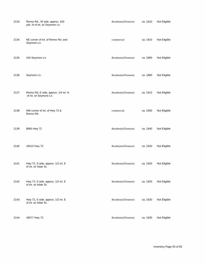
2133 Renno Rd., W side, approx. 100 Residential/Domestic ca. 1910 Not Eligible yds. N of int. w/ Seymore Ln.
2134 NE corner of int. of Renno Rd. and commercial ca. 1910 Not Eligible Seymore Ln.
2135 104 Seymore Ln. Residential/Domestic ca. 1880 Not Eligible
2136 Seymore Ln. Residential/Domestic ca. 1880 Not Eligible
2137 Renno Rd, E side, approx. 1/4 mi. N Residential/Domestic ca. 1910 Not Eligible of int. w/ Seymore Ln.
2138 NW corner of int. of Hwy 72 & commercial ca. 1900 Not Eligible Renno Rd.
2139 8865 Hwy 72 Residential/Domestic ca. 1940 Not Eligible
2140 18413 Hwy 72 Residential/Domestic ca. 1920 Not Eligible
2141 Hwy 72, S side, approx. 1/2 mi. E Residential/Domestic ca. 1920 Not Eligible of int. w/ Adair St.
2142 Hwy 72, S side, approx. 1/2 mi. E Residential/Domestic ca. 1920 Not Eligible of int. w/ Adair St.
2143 Hwy 72, S side, approx. 1/2 mi. E Residential/Domestic ca. 1920 Not Eligible of int. w/ Adair St.
2144 18077 Hwy 72 Residential/Domestic ca. 1930 Not Eligible
Inventory Page 55 of 65

2145 Hwy 56, W side, across from int. w/ Residential/Domestic ca. 1910 Not Eligible Burt Rd.
2161 Philson Rd., E side, approx. 1/4 mi. Residential/Domestic ca. 1910 Not Eligible N of int. w/ Hwy 72
2285 403 N Main Street St. Boniface Catholic Religious ca. 1949 Eligible Church
2286 Hwy 76 commercial ca. 1910 Not Eligible
2287 204 Hwy 76 commercial ca. 1950 Not Eligible
2288 NE corner of int. of Hwy 76 & commercial ca. 1940 Not Eligible
2289 Hwy 76, N side, approx. 10 yds. S commercial ca. 1910 Not Eligible of int w/
2290 Hwy 76 commercial ca. 1930 Not Eligible
2291 Hwy 76 commercial ca. 1940 Not Eligible
2292 Hwy 76, E side, approx. 15 yds. N commercial ca. 1910 Not Eligible of int. w/ Hwy 66
2293 SEC of int. of Hwy 76 & Hwy 66 commercial ca. 1930 Not Eligible
2294 121 Hwy 76 commercial ca. 1900 Not Eligible
Inventory Page 56 of 65

2295 Hwy 76, E side, approx. 1/4 mi. S commercial ca. 1900 Not Eligible of int w/ Hwy 66
2296 Hwy 76, E side, approx. 1/4 mi. S commercial ca. 1900 Not Eligible of int. w/ Hwy 66
2297 119 Hwy 66 Residential/Domestic ca. 1910 Not Eligible
2298 617 Fairview Church Rd. Residential/Domestic ca. 1920 Not Eligible
2299 3353 Hwy 66 Residential/Domestic ca. 1880 Not Eligible
2300 Hwy 76, E side, approx. 1/4 mi. S Residential/Domestic ca. 1910 Not Eligible of int w/ Hwy 66
2301 Hwy 76, E side, approx. 1/2 mi. S Residential/Domestic ca. 1920 Not Eligible of int. w/ Hwy 66
2302 32775 Hwy 76 Residential/Domestic ca. 1910 Not Eligible
2303 end of Montcrest Dr. Mt. Zion AME Church Religious ca. 1900 Not Eligible
2304 NW corner of int. of Hwy 76 & SC Oxner, Manuel House Residential/Domestic ca. 1900 Not Eligible 560
2305 SW corner of int. of SC 560 & Hinson, H. House Residential/Domestic ca. 1880 Eligible Woodyard Rd.
2306 Woodyard Rd., E side, approx. 1/4 Residential/Domestic ca. 1900 Not Eligible mi. N of int. w/ Hwy 560
Inventory Page 57 of 65

2307 Woodyard Rd., E side, approx. 1/4 Residential/Domestic ca. 1900 Not Eligible mi. N of int. w/ SC 560
2308 SC 560, W side, approx. 200 yds. S Residential/Domestic ca. 1905 Not Eligible of int. w/ Hwy 76
Laurens North Site No Address/Location Historic Name Historic Use Date Eligibility
2192 Hwy 221, E side, approx. 100 yds N Residential/Domestic ca. 1920 Not Eligible of int. w/ League Rd.
2193 Hwy 221, E side, approx. 1 mi. S of Residential/Domestic ca. 1920 Not Eligible int. w/ I-385
2194 69 Arvil Ln. Residential/Domestic ca. 1930 Not Eligible
Laurens South Site No Address/Location Historic Name Historic Use Date Eligibility
2195 Landfill Rd., E side, approx. 100 Residential/Domestic ca. Not Eligible yds. S of int. w/ Hwy 221 Bypass 1925-30
2196 Easy St., E side, approx. 1/4 mi. S Residential/Domestic ca. 1890 Not Eligible of int. w/ Hwy 221 Bypass
2197 1551 Easy St. Residential/Domestic ca. 1890 Not Eligible
2198 734 Lisbon Rd. Residential/Domestic ca. 1905 Not Eligible
2199 737 Burnt Mill Creek. Rd. Residential/Domestic ca. 1900 Not Eligible
Inventory Page 58 of 65

2200 Burnt Mill Creek. Rd., S side, Residential/Domestic ca. 1920 Not Eligible approx. 1/2 mi. E of int. w/ Lisbon Rd.
2201 NE corner of int. of Lisbon Rd. and Nickels-Milam House Residential/Domestic ca. 1828 Listed Roper Rd.
2202 behind 1348 Teague Rd. Residential/Domestic ca. 1880 Not Eligible
2203 Hwy 221, E side, approx. 1 1/4 mi. Residential/Domestic ca. 1890 Not Eligible S of int. w/ SC 127
2204 2829 Hwy 221 Residential/Domestic ca. 1940 Not Eligible
Newberry NW Site No Address/Location Historic Name Historic Use Date Eligibility
2166 Stomp Springs Cir. Residential/Domestic ca. 1920 Not Eligible
2167 NW corner of int. of SC66 & Stomp Calmes-Young-Riser Residential/Domestic ca. 1830 Eligible Springs Rd. House
2168 6119 Hwy 66 Residential/Domestic ca. 1905 Not Eligible
2169 Hwy 66, N side, approx. 1 mi. W of Residential/Domestic ca. 1910 Not Eligible int. w/ Stomp Springs Rd.
Ora Site No Address/Location Historic Name Historic Use Date Eligibility
2239 Rabbit Run Rd., S side, approx. 1/2 Residential/Domestic ca. 1890 Not Eligible mi. E of int. w/ Hwy 221
Inventory Page 59 of 65

2240 24124 Hwy 221 Residential/Domestic ca. 1890 Not Eligible
2241 Granny Apple Rd., S side, approx. 1 Residential/Domestic ca. 1890 Not Eligible mi. E of int. w/ Hwy 221
2242 Langston Rd., S side, approx. 1/4 Langston Baptist Church Religious ca. 1850 Not Eligible mi. W of int. w/ Duncan Creek Ch. Rd
2243 356 Long Branch Church Rd. Residential/Domestic ca. 1890 Not Eligible
2244 Long Branch Ch. Rd., W side, Residential/Domestic ca. 1920 Not Eligible approx. 100 yds. N of int. w/ SC 308
2245 SW corner of int. of SC 308 and Residential/Domestic ca. 1890 Not Eligible Long Branch Church Rd.
2246 4321 SC 308 Residential/Domestic ca. 1900 Not Eligible
2247 Poole Rd., W side, approx. 150 yds. Poole House Residential/Domestic ca. 1818 Not Eligible N of int. w/ Dogwood Ln.
2248 NE corner of int. of Poole Rd. & Residential/Domestic ca. 1900 Not Eligible Holder Rd.
2249 Poole Rd., W side, approx. 1 mi. N Residential/Domestic ca. 1880 Not Eligible of int. w/ Dogwood Ln.
2250 SC 308, E side, approx. 3/4 mi. S of Residential/Domestic ca. 1915 Not Eligible I-385
2251 Leesville Ch. Rd., N side, approx. Residential/Domestic ca. 1930 Not Eligible 100 yds. W of int. w/ SC 308
Inventory Page 60 of 65

2252 End of Fay Harris Rd. Residential/Domestic ca. 1880 Not Eligible
2253 958 Compton Rd. Residential/Domestic ca. 1890 Not Eligible
2254 Compton Rd., E side, approx. 3/4 Residential/Domestic ca. 1890 Not Eligible mi. N of int. w/ Leesville Ch. Rd.
2255 2252 Leesville Church Rd. Religious ca. 1880 Not Eligible
2256 3071 Torrington Rd. Residential/Domestic ca. 1905 Not Eligible
2257 813 Irwin Rd. Residential/Domestic ca. 1910 Not Eligible
2258 21 Irwin Rd. Residential/Domestic ca. 1925 Not Eligible
2259 Rocky Springs Ch. Rd., W side, Rocky Springs Church Religious 1920 Not Eligible approx. 1/4 mi. N of int w/ Irwin Rd.
2260 146 Curry Rd. Residential/Domestic ca. 1910 Not Eligible
2261 3588 Hwy 49 Residential/Domestic ca. 1850 Not Eligible
2262 Poole Town Rd, W side, approx. 1 Educational ca. 1920 Not Eligible mi. N of int w/ SC 308
2263 NE corner of int. of Hwy 221 & SC Ora ARP Church Religious ca. 1890 Not Eligible 308
Inventory Page 61 of 65

2264 Hwy 221, E side, approx. 1/4 mi. S Residential/Domestic ca. 1920 Not Eligible of int. w/ SC 308
2265 Penland Rd., N side, approx. 1 mi. Residential/Domestic ca. 1915 Not Eligible E of int. w/ SC 308
2266 2981 Bethany Church Rd. Residential/Domestic ca. 1880 Not Eligible
2267 Duncan Creek Church Rd., S side, Residential/Domestic ca. 1850 Not Eligible approx. 3/4 mi. E of int. w/ SC 308
2268 1396 Curry Rd. Residential/Domestic ca. 1920 Not Eligible
2269 Torrington Rd., N side, approx. 1/4 Residential/Domestic ca. 1880 Not Eligible mi. W of int w/ Penland Rd.
2270 Choctaw St., N side, across from Residential/Domestic ca. 1910 Not Eligible int. w/ Conway Ave.
2271 886 Lee Carey Rd. Residential/Domestic ca. 1910 Not Eligible
2272 354 Northside Church Rd. Residential/Domestic ca. 1920 Not Eligible
2273 SW corner of int. of Bobo Rd. & Residential/Domestic ca. 1910 Not Eligible
2274 90 Residential/Domestic ca. 1910 Not Eligible
2275 435 Hwy 49 Residential/Domestic ca. 1910 Not Eligible
Inventory Page 62 of 65

2276 SW corner of int. of Hwy 49 & Bobo Residential/Domestic ca. 1910 Not Eligible Rd.
2277 Hwy 49, N side, approx. 1/4 mi. E Residential/Domestic ca. 1910 Not Eligible of int. w/ Hwy 221
2278 203 Hwy 49 Badgett, Thomas A. House Residential/Domestic ca. 1860 Not Eligible
2279 145 Hwy 49 Residential/Domestic ca. 1890 Not Eligible
2280 110 Hwy 49 Residential/Domestic ca. 1910 Not Eligible
2281 NE corner of int. of Hwy 49 & Hwy commercial ca. 1920 Not Eligible 221
2282 3023 Fleming Mill Rd. Residential/Domestic ca. 1890 Not Eligible
2283 Hwy 49, N side, approx. 1/2 mi. W Residential/Domestic ca. 1880 Not Eligible of int. w/ Curry Rd.
2284 1634 Hwy 49 Residential/Domestic ca. 1920 Not Eligible
Philson Crossroads Site No Address/Location Historic Name Historic Use Date Eligibility
2170 end of Murphy St. Residential/Domestic ca. 1910 Not Eligible
2171 795 Golden Acres Rd. Duncan Creek Presbyterian Religious 1842 Listed Church
Inventory Page 63 of 65

2172 558 Philson Rd. Residential/Domestic ca. 1900 Not Eligible
2173 Philson Rd., N side, approx. 1/2 mi. Residential/Domestic ca. 1850 Not Eligible W of int. w/ Barrel Stave Rd.
2174 Philson Rd., N side, approx. 1/2 mi. Residential/Domestic ca. 1910 Not Eligible W of int. w/ Barrel Stave Rd.
2175 6871 Philson Rd. Residential/Domestic ca. 1870 Not Eligible
2176 4752 Bethany Church Rd. Duckett, Dr. L.F. House Residential/Domestic ca. 1890 Eligible
2177 15669 Hwy 56 Residential/Domestic ca. 1910 Not Eligible
2178 Little Acres Rd., S side, approx. 1/2 Residential/Domestic ca. 1910 Not Eligible mi. W of int. w/ Hwy 56
2179 end of Edmonds Rd. Residential/Domestic ca. 1890 Not Eligible
2180 Hwy 56, E side, approx. 1/4 mi. S Residential/Domestic ca. 1920 Not Eligible of int. w/ Philson Rd.
Sedalia Site No Address/Location Historic Name Historic Use Date Eligibility
2162 Hwy 72, N side, approx. 3 1/2 mi. Residential/Domestic ca. 1905 Not Eligible W of int. w/ Ridge Rd.
2163 26352 Hwy 72 Residential/Domestic ca. 1905 Not Eligible
Inventory Page 64 of 65

2164 890 Plum Rd. Residential/Domestic ca. 1880 Not Eligible
2165 30633 Hwy 72 O'Dell, J. House Residential/Domestic ca. 1870 Not Eligible
Waterloo Site No Address/Location Historic Name Historic Use Date Eligibility
2205 1785 Longview Rd. Residential/Domestic ca. 1900 Not Eligible
2206 NW corner of int. of Hwy 72 & Residential/Domestic ca. 1915 Not Eligible Longview Rd.
2207 SE corner of int. of Hwy 72 & Dove McGowan House Residential/Domestic ca. 1890 Not Eligible Field Rd.
2208 Hwy 72, N side, approx. 1/2 mi. E Residential/Domestic ca. 1920 Not Eligible of int. w/ Hwy 221
2209 16933 Hwy 221 Residential/Domestic ca. 1940 Not Eligible
2210 Harris Springs Rd., N side, approx. Residential/Domestic ca. 1890 Not Eligible 1/2 mi. E of int. w/ Hwy 221
2211 Harris Springs Rd., N side, approx. Harris Springs Bottling Co. Industrial/Engineering ca. 1900 Not Eligible 1/4 mi. W of int. w/ Blakely Rd.
Inventory Page 65 of 65