historical and archaeological resources of riverdale, a
TRANSCRIPT
Volume 1984 Article 16
1984
Historical and Archaeological Resources of Riverdale, A Company Historical and Archaeological Resources of Riverdale, A Company
Town in Goliad County, Texas Town in Goliad County, Texas
John W. Clark Jr.
Follow this and additional works at: https://scholarworks.sfasu.edu/ita
Part of the American Material Culture Commons, Archaeological Anthropology Commons,
Environmental Studies Commons, Other American Studies Commons, Other Arts and Humanities
Commons, Other History of Art, Architecture, and Archaeology Commons, and the United States History
Commons
Tell us how this article helped you.
This Article is brought to you for free and open access by the Center for Regional Heritage Research at SFA ScholarWorks. It has been accepted for inclusion in Index of Texas Archaeology: Open Access Gray Literature from the Lone Star State by an authorized editor of SFA ScholarWorks. For more information, please contact [email protected].
Historical and Archaeological Resources of Riverdale, A Company Town in Goliad Historical and Archaeological Resources of Riverdale, A Company Town in Goliad County, Texas County, Texas
Licensing Statement Licensing Statement This is a work for hire produced for the Texas Department of Transportation (TxDOT), which owns all rights, title, and interest in and to all data and other information developed for this project under its contract with the report producer. The report may be cited and brief passages from this publication may be reproduced without permission provided that credit is given to TxDOT and the firm that produced it. Permission to reprint an entire chapter, section, figures or tables must be obtained in advance from the Supervisor of the Archeological Studies Branch, Environmental Affairs Division, Texas Department of Transportation, 125 East 11th Street, Austin, Texas, 78701.
This article is available in Index of Texas Archaeology: Open Access Gray Literature from the Lone Star State: https://scholarworks.sfasu.edu/ita/vol1984/iss1/16

HISTORICAL AND ARCHAEOLOGICAL RESOURCES OF RIVERDALE,
A COMPANY TOWN IN GOLIAD COUNTY, TEXAS
BY
John W. Clark, Jr.
Texas State Department of Highways and Public Transportation
Highway Design Division July 1984

ABSTRACT
Proposed real ignment of a h i s t o r i c br idge a t Riverda le , Goliad County,
Texas, by t h e S t a t e Department of Highways and Pub l i c T ranspor t a t ion and
new approach right-of-way on County Road 134 w i l l a f f e c t po r t ions of t h e
community of Riverdale The community w a s founded by t h e R ive rda l e Gin
and Mi l l i ng Company and t h e Riverda le Mercant i le Company i n 1913, f o r
t h e s o l e purpose of processing co t ton . The community ceased t o e x i s t
over t h e period from 1946 through 1952.
iii

. . . . . . . . . . . . . . . . . . . . . . .
TABLE OF CONTENTS
ABSTRACT iii
TABLE OF CONTENTS v
L I S T O F F I G U R E S v i i
INTRODUCTION 1
GENERAL HISTORICAL BACKGROUND 3
HISTORICAL BACKGROUND OF RIVERDALE 13
ARCHAEOLOGICAL REMAINS 22
CONCLUSIONS 2 4
REFERENCES 26
APPENDIX I: INFORMANT INTERVIEWS 2 9
APPENDIX II: TRANSCRIBED DOCUMENTS 32
. . . . . . . . . . . . . . . . . . .. . . . . . . . . . . . . .
. . . . . . . . . . . . . . . . . . . .. . . . . . . . .
. . . . . . . . . . . . . . . . . . . . . . . . . . . . .
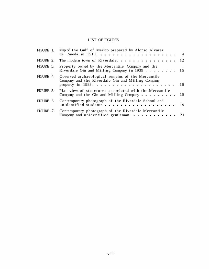
LIST OF FIGURES
FIGURE 1. Map of the Gulf of Mexico prepared by Alonso Alvarez de Pineda in 1519. 4
FIGURE 2. The modern town of Riverdale. 12
FIGURE 3. Property owned by the Mercantile Company and the Riverdale Gin and Mill ing Company i n 1939 15
FIGURE 4. Observed archaeological remains of the Mercantile Company and the Riverdale Gin and Mill ing Company property in 1983. 16
FIGURE 5. Plan view of s t ruc tu res associated with the Mercantile Company and the Gin and Mill ing Company 18
FIGURE 6. Contemporary photograph of the Riverdale School and unident i f ied s tudents 19
FIGURE 7. Contemporary photograph of the Riverdale Mercantile Company and unident i f ied gentleman. 21
v i i

INTRODUCTION
Interest in this site began with a proposal to replace the 100 ft.-long
Warren pony truss bridge, crossing the San Antonio River at the town of
Riverdale, as a segment of County Road 134. Since it is the policy of
the Archaeology Section of the Highway Design Division, State Department
of Highways and Public Transportation (SDHPT), to survey bridge
relocations where there may be a possibility of archaeological sites, a
survey was performed at the project location to locate any possible
prehistoric remains, and to examine the previously recorded historic
site of Riverdale (Site 41GD12) (Hester 1975:24).
The proposed project will involve the replacement of the bridge over the
San Antonio River at a new location and the realignment of County Road
134, both to match with the new bridge location and to eliminate a right
angle turn in the old road. The new right-of-way will be 100 ft. with
two 10 ft. lanes. The old Warren pony truss bridge will not be retained
due to objections of the landowner.
The survey and associated background research resulted in an assessment
of the structural remains, the location of an early aerial photograph
and contemporary maps of the property and structures, a small amount of
informant information, and a small amount of historical data. This
information was used to fill out a nomination form for the National
Register of Historic Places so that a determination of eligibility could
be made. In the opinions of archaeologists, from both the Archaeology
Section of the SDHPT and the State Historic Preservation Office (SHPO)
at the Texas Historical Commission (THC), the site meets the criteria
for nomination.
In concord with the office of the SHPO, it was agreed that mitigation of
the bridge replacement project would consist of the archaeological
survey already performed on the site and more extensive archival
research than had been done for the survey. Informant interviews
conducted during the study a r e presented i n Appendix I. Transcr ip ts of
deed records a r e presented i n Appendix II. The bridge i s t o be t r ea ted
separa te ly and w i l l be recorded through t echn ica l drawings and
photographs.
Severa l persons were responsib le f o r the c o l l e c t i o n of information here-
i n reported. D r . Clyde Bull ion, of the Environmental and Community
Factors Section of the Highway Design Division SDHPT, and Mr. Leo J.
Gle inser , Senior Resident Engineer of the SDHPT residency i n Goliad,
provided some of the information on the e a r l y community. More complete
a r c h i v a l research was performed by members of the Goliad County H i s-
t o r i c a l Commission a t the request of the SDHPT. The i n i t i a l survey and
a r c h i v a l search were performed by the author of t h i s repor t .

GENERAL HISTORICAL BACKGROUND
European occupation of the a rea now known a s Goliad County stemmed from
t h e explora t ions and mapping of the Gulf Coast by Alonso Alvarez de
Pineda i n 1519 (Fig. 1). The shipwrecked members of the Panf i lo de
Narvaez expedit ion t o Flor ida of 1527 landed, most likely, on the bar-
r i e r i s l and a t present Matagorda Bay. Four members of t h e expedit ion
survived t o t e l l t he t a l e (Nunez Cabeza de Vaca 1906: 35-131) and t o
provide information on the p r e h i s t o r i c occupants of the v i c i n i t y of
Goliad County. The f i r s t European se t t lement i n t h e a rea was on present
Garc i t a s Creek near i ts mouth a t Matagorda Bay, then thought t o be La
Bahia d e l E s p i r i t u Santo marked on the Pineda map.
There were rumors of a French colony es tab l i shed somewhere on the
Spanish Gulf Coast. An extensive hunt was taken up both on land and sea
by Spanish o f f i c i a l s (Weddle 1973), having l i t t l e e f f e c t u n t i l Alonso de
Leon, Governor of Coahuila, entered the a rea i n 1688 and captured the
French survivor Jean (Juan) Gery (de Leon 1688a and 1688b). Following
t h e .des t ruc t ion of La S a l l e s For t S t . Louis and t h e capture of t h e
remainder of the French survivors , another expedit ion l ed by Alonso de
Leon was sen t t o La Bahia d e l E s p i r i t u Santo t o e s t a b l i s h a p res id io and
t o e s t a b l i s h missions among the Tejas Indians (de Leon 1690). A
p r e s i d i o was f i r s t placed a t the s i t e of Fort S t . Louis i n Apr i l of 1722
by t h e Marquez de San Miguel de Aguayo on h i s colonizing expedit ion
(Santos 1981:78-79, 98-103). The pres id io was named Nuestra Senora de
Loreto. The Mission of E s p i r i t u Santo de Zuniga was a l s o founded.
The La Bahia d e l E s p i r i t u Santo establishments were moved t o Mission
Creek (now i n Vic to r i a County) and the Guadalupe River i n 1726 and
f i n a l l y t o the San Antonio River i n 1750 (O'Connor 1966:10-23). This
f i n a l loca t ion served a s the seed from which the present community and
county of Goliad grew. Along the San Antonio River, a l a r g e number of
missions and p r iva te ranches was es tabl i shed (Myres 1969, Weddle and

Thonhoff 1976). The community survived secularization attempts in the
early 1790s and the missions continued, albeit at a reduced level of
population and activity, until 1823.
With Napoleonic usurpation of the Bourbon monarchy in Spain, disaffected
criollos, Indians, and mestizos of New Spain (Mexico) revolted in 1810 under the leadership of Fr. Miguel Hidalgo Costilla. Much of the
revolution was crushed in 1811 with the capture and execution of
Hidalgo; but one of his followers, Bernardo Gutierrez, then in
Washington, allied himself with American Lieutenant Augustus W. Magee
and made plans to invade Texas and establish a republican state to be
annexed either to a republican Mexico or to the United States. Spanish
Governor Manuel Salcedo established himself at La Bahia (later Goliad).
Through a misestimation of the route of the army of Gutierrez-Magee and
good intelligence work by the Gutierrez-Magee party, the community was
virtually abandoned and was easily occupied. Salcedo made several
attacks on the site but failed to dislodge the Republicans. Eventually
he was forced to return to San Antonio where he was finally defeated and
murdered (Almaraz 1971).
Other filibusters including Perry and Long entered the community until
1821 when the Treaty of Cordoba was signed, creating the republic of
Mexico (Garrett 1969). In an attempt to populate the sparsely populated
province of Tejas, an empresario grant system was instituted with the
first colony established by Missourian, Stephen Fuller Austin. In the
Goliad area were the San Patricio colony of Irish settlers and the near-
by Powers colony. By 1829 a new settlement began two miles north of the
presidio and was given the name Goliad, an anagram of the last name of
Fr. Hidalgo.
In 1830, the Centralists overthrew the Federalist government and all
colonization efforts were halted. Final secularization of the Missions
Espiritu Santo de Zuniga and Nuestra Senora del Rosario took place at
t he same time. Farther e a s t i n the colonies of Austin and around
Nacogdoches, the new co lon i s t s grew r e s t i v e under the r e s t r i c t i v e Cen-
t r a l i s t government. I n 1832, the F e d e r a l i s t s pulled off t h e i r own coup
under the generalship of Antonio Lopez de Santa Anna. Texas declared i n
favor of the Federa l i s t c o n s i t i t u t i o n of 1824, r e s u l t i n g i n b r i e f
skirmishes a t Velasco and Nacogdoches.
The period between 1833 and 1835 was complex i n Mexican p o l i t i c s ,
f i n a l l y r e s u l t i n g with Lopez de Santa Anna i n power, t h i s time a s a Cen-
t r a l i s t . Meanwhile, Goliad suffered a se r ious cholera epidemic (Prue t t
and Cole 1983:8-10). As a r e s u l t of the C e n t r a l i s t government, the
t e r r i t o r y of Quintana Roo, the s t a t e of Yucatan, t h e s t a t e of Veracruz,
t h e s t a t e of Zacatecas, and the Texas port ion of t h e s t a t e of Coahuila y
Texas rebel led .
I n September of 1835, government forces attempted t o disarm c o l o n i s t s a t
Gonzales, r e s u l t i n g i n a small f racas . In October, a group led by
George Collingsworth and Ben Milam took the p res id io a t La Bahia with
few c a s u a l t i e s on e i t h e r s ide . By t h i s time the fever f o r a c t i o n was
high. Dr. James Grant of S a l t i l l o proposed an a t t a c k on Matamoros.
This a t t a c k was, however, preceded by a small b a t t l e a t Bejar. In order
t o proceed with the Matamoros venture, suppl ies were s t r ipped of the
Tejano ga r r i son a t Bejar. James Fannin was placed i n command of a
r e se rve o r second wave group. When he heard of the approach of the
Mexican army he attempted t o advise Grant t o withdraw but Grant would
not l i s t e n . Fannin concentrated a t Pres id io de La Bahia (Loreto) now
renamed For t Defiance. I n February of 1836 he received orders t o
r e i n f o r c e the ga r r i son a t Bejar and, a f t e r an aborted attempt, gave up.
I n March, the Mexican army sen t a small contingent t o San P a t r i c i o ,
captur ing the commands of Grant and Johnson (Prue t t and Cole 1983:12)
a f t e r the f a l l of the "Texian" ga r r i son a t the f o r t i f i e d mission of San
Antonio de Valero. Fannin was ordered t o withdraw from La Bahia

(Goliad) toward V i c t o r i a . A b a t t l e ensued wi th Mexican f o r c e s under
gene ra l J o s e Urrea a t t h e mission Nuestra Senora d e l Rosario (Castaneda
1971). Following t h i s b a t t l e , Fannin burned a l l s u p p l i e s t h a t cou ldn ' t
be c a r r i e d and s t a r t e d f o r V i c t o r i a i n t h e f a c e of Urrea's scou t s .
L a t e r i n t he day, Urrea's column confronted Fannin. Rather than with-
draw t o a defens ive pos i t i on , he formed a square i n an open f i e l d . The
p o s i t i o n was surrounded and f i g h t i n g continued u n t i l dark. The next
morning a r eques t f o r sur render was dispatched t o Fannin. The p r i s o n e r s
of w a r were r e tu rned t o La Bahia (Brown 1970:601-609; Castaneda
1971:221-230). On orde r s from Santa Anna t h e ma jo r i t y of t h e p r i s o n e r s
were executed.
The even t s a t Bejar and La Bahia p r e c i p i t a t e d a mass f l i g h t of Anglo
c o l o n i s t s , known a s " the runaway scrape." The war was p r e c i p i t a t e l y
ended i n a f i e l d a t t h e confluence of Buffalo Bayou and t h e San J a c i n t o
River w i th t h e cap tu re of t h e Mexican p re s iden t , General Antonio Lopez
d e Santa Anna. General V ic in t e F i l i s o l a , an I t a l i a n i n t h e s e r v i c e of
Mexico, was i n charge of t h e Mexican g a r r i s o n a t La Bahia fol lowing t h e
c a p t u r e of h i s commanding genera l . I n M a y of 1836 F i l i s o l a proceeded t o
remove t h e Mexican army south of t h e Rio Bravo (Rio Grande).
Following the removal of t h e Mexican army, Lipan and Comanche Ind ians
made r a i d s on t h e herds, and lagging Mexican s o l d i e r s a l s o h i t t h e
ranches. Land specu la t ion was rampant wi th many newcomers encroaching
on o ld e s t a b l i s h e d g ran t s . Meanwhile, General Urrea rep laced F i l i s o l a
and was ordered by t h e Mexican pres ident pro tempore t o proceed a g a i n s t
Texas from headquar te rs i n Matamoros, Tamaulipas. Three Mexican s h i p s
were captured i n Copano; wi th them information was gained t h a t Urrea
was planning a new ope ra t ion a g a i n s t Texas. Because of t h e d iscovery of
t h e ope ra t ion and r ecogn i t i on of independent Texas by England and
France, t h e invas ion was he ld o f f u n t i l March of 1842 ( P r u e t t and Cole
1983:16). On t h a t d a t e Goliad was ra ided by a f o r c e of 40 men; and
ano the r group l e d by General Vasquez appeared a t Bejar , occupied the

town f o r a couple of days, and returned t o Mexico wi th much of t h e
Hispanic populat ion.
A second Mexican invas ion of t h e Republic took p l ace i n September of
1842, and was l e d by General Adrien Woll. The B a t t l e of Salado Creek,
i n Bexar County, took p l ace a f t e r Woll occupied t h e town. Shor t ly
t h e r e a f t e r , Woll r e t r e a t e d t o Matamoros (Nance 1964:344-363). Following
t h i s r e t r e a t , t h e Texans planned the d i s a s t r o u s Mier exped i t i on of
December of 1842 (McCutchan 1978). Natura l ly , m i l i t a r y u n i t s were
f r e q u e n t l y passing through a wild and dangerous Goliad. I n December
1845, Texas was annexed t o t h e United S t a t e s and Anson Jones , p re s iden t
of t h e Republic of Texas, turned over t h e r e i n s of government t o
Governor J. Pinckney Henderson i n February of 1846.
United S t a t e s t roops were stationed i n t h e a r e a c a l l e d t h e Nueces S t r i p
which was claimed, w i th no h i s t o r i c a l foundat ion, by Texas. Thei r
presence soon r e s u l t e d i n t h e b a t t l e s of Pa lo Al to and Resaca de l a
Palma and was t h e beginning of t h e war wi th Mexico i n which Mexico l o s t
about ha l f i t s n a t i o n a l t e r r i t o r y t o t h e United S t a t e s . Texas Rangers
took p a r t i n e a r l y f i g h t i n g but were withdrawn, both because General
Zachary Taylor considered them too unruly and t o p r o t e c t t h e Texas
f r o n t i e r from Ind ian a t t a c k ( P r u e t t and Cole 1983:18-19). Severa l
Ranger companies continued wi th Taylor , however. Af te r t h e cap tu re of
Mexico C i ty , t h e T rea ty of Guadalupe Hidalgo was s igned, ceding a l l of
Texas, and t h e t e r r i t o r y of New Mexico, Arizona, Colorado, Nevada, Utah,
and C a l i f o r n i a t o t h e United S t a t e s (Meyer and Sherman 1979:346-353).
Following t h e war, w i th s e c u r i t y e s t a b l i s h e d , t r a d e boomed, w i th wagon
t r a i n s going from Ind iano la through Goliad t o San Antonio and New
Braunfels . European immigrants began t o e n t e r t h e a r e a from Germany,
Alsace, Bohemia, Poland, and o t h e r regions. As t r a d e and immigration
inc reased , t h e community prospered and developed. The economy was a l s o
a ided by immigrants going t o t h e C a l i f o r n i a gold f i e l d s who were passing

through and having wagons b u i l t i n Goliad. During t h i s per iod was an
a f f a i r c a l l e d t h e " c a r t war"--the r e s u l t of competi t ion between l o c a l
f r e i g h t e r s and carreteros h i r e d by merchants i n San Antonio. Ambushes,
sabotage of c a r t s , and v i g i l a n t e hangings cha rac t e r i zed t h e year 1851
( P r u e t t and Cole 1983:20).
During t h e period fol lowing t h e Mexican War and preceding t h e War
Between t h e S t a t e s , t h e H i l l y e r Female College, t h e Aranama College,
Goliad College, and Paine Female I n s t i t u t e were founded. The
development of t h e a r e a as an educ t iona l c e n t e r was suspended when t h e
C i v i l W a r began i n 1861. The e n t i r e s tudent body of Aranama c o l l e g e
e n l i s t e d f o r t h e s t a t e m i l i t i a and o t h e r men of t h e county e i t h e r
vo lunteered f o r va r ious u n i t e o r were conscr ip ted . The few s l a v e s i n
t h e county continued working throughout t h e war. Being on one of t h e
major c o t t o n r o u t e s , Goliad had much t r a f f i c pass through u n t i l t h e
c o a s t was blockaded. The l o c a l economy then became one of s u b s i s t e n c e
( P r u e t t and Cole 1983:22-23).
With t h e end of t he C i v i l W a r , and t h e a t t endan t l o s s of proper ty and
m i l i t a r y r u l e by t h e conquerors, many people were ruined economically.
Negro t roops were placed i n charge of t h e town and county of Goliad.
Imposed new laws caused cons iderable resentment on both s i d e s ; ex- slaves
r e fused t o work f o r wages. This s i t u a t i o n produced "Black Codes"
a t tempt ing t o r e q u i r e b lacks t o work f o r t h e i r sustenance. General
Char les G r i f f i n of t h e occupat ion army removed from o f f i c e t h e duly
e l e c t e d governor and e s t a b l i s h e d m i l i t a r y r u l e . He was succeeded by
General J . J . Reynolds, who forced t h e e l e c t i o n of E. J. Davis a s
governor i n a t r a v e s t y of an e l e c t i o n (Ramsdell 1970:108-114). Davis
c r e a t e d a s t a t e p o l i c e f o r c e d i r e c t l y under h i s o rde r s , which was
r e spons ib l e f o r s e r i o u s t r o u b l e and v i o l a t i o n s of t h e law ac ros s t h e
s t a t e ; and democratic p a r t y meetings were broken up. One group of
p o l i c e ope ra t ing i n t h e Goliad a r e a became known as t h e " regula tors ."

The e l e c t i o n of 1873 defea ted the carpetbag government. Davis a t tempted
t o have t h e United S t a t e s A r m y in te rvene but i t re fused t o do so and
s t a t e government was re turned t o t h e democratic process. With t h e
r e t u r n of more s e t t l e d cond i t i ons , t h e farmers and ranchers could con-
c e n t r a t e on t h e economic development of t h e county. The c a t t l e had
p r o l i f e r a t e d dur ing t h e war and proved t o be a major economic founda-
t i o n , a s they were during t h e Spanish Colonia l Period. Cotton r a i s i n g
was t h e second major economic p u r s u i t , with g i n s i n every town i n t h e
county. The 1870s and '80s were boom years i n c o t t o n c u l t u r e ; they were
a l s o t h e yea r s of t h e g r e a t c a t t l e d r ives . The Seda l i a , Chisholm, and
Western T r a i l s passed near Goliad. The Western T r a i l was much used by
Goliad ranchers ( s e e map i n Dary 1981:172). C a t t l e d r i v e s came t o an
end i n 1889 when t h e N e w York, Texas, and Mexican Rai lroad Div i s ion con-
s t r u c t e d a r a i l r o a d i n t h e county ( P r u e t t and Cole 1983:30).
I n August of 1889, a hu r r i cane destroyed Indianola , t h e p o r t f o r Goliad,
and caused damage i n Goliad i t s e l f . A tornado h i t t h e town i n 1902,
des t roy ing a p a r t of t h e town inc luding t h e San Antonio River Bridge and
Brooks College ( P r u e t t and Cole 1983:39-41). Some 114 people were
k i l l e d and 225 in ju red .
When World War I was underway t h e United S t a t e s s e n t a s a p a r t of i ts
c o n t r i b u t i o n t h e 36th I n f a n t r y Div is ion , inc luding a Goliad Company (K)
which saw a c t i o n i n France and Belgium. Following t h e war, a g r i c u l t u r e
cont inued t o develop. Archaeological i n v e s t i g a t i o n and r e s t o r a t i o n was
done by t h e Work P r o j e c t s Administrat ion and t h e C i v i l i a n Conservat ion
Corps i n t h e 1930s on E s p i r i t u Santo de Zuniga and P r e s i d i o Nuestra
Senor de Lore to de l a Bahia; and prel iminary excavat ion was done a t
Nuestra Senora d e l Rosar io , t h e Fannin b a t t l e f i e l d , and o t h e r publ ic
p r o p e r t i e s i n t h e county. Other even t s i n t h e years between t h e world
wars included a t i c k qua ran t ine i n 1921, t h e purchase of a water works
system i n 1926, inaugura t ion of t h e use of n a t u r a l gas i n 1928, f i r s t
paving of s t r e e t s i n 1930, purchase of land f o r a s t a t e park i n 1930,

const ruct ion of a sewer system i n 1930, and const ruct ion of sidewalks i n
1933 ( P r u e t t and Cole 1983:215-216).
Goliad men and women served i n World War II i n a v a r i e t y of geographic
a r e a s and i n many capac i t i e s . Following the war the ve terans returned
t o take up ranching, farming, and commerce. Restorat ion work on t h e
p res id io was completed i n 1967 and Texas Parks and Wildl i fe Department
s t a f f completed work on r e s t o r a t i o n a t E s p i r i t u Santo i n 1977. A county
h i s t o r i c a l commission was crea ted i n 1955. This organizat ion was
responsib le f o r placing h i s t o r i c a l markers on s i t e s i n t h e county, t h e
e r e c t i o n of a monument a t the b i r thp lace of General Ignacio Zaragosa,
t h e publ ica t ion of a county h i s t o r y (Prue t t and Cole 1983), and the
establishment and maintenance of a county museum. I n September of 1979
t h e l a s t t r a i n r an through Goliad. The t r acks were subsequently t o r n
up.
Throughout the period of h i s t o r i c occupation of t h e a r e a of Goliad
County, c a t t l e ranching and, l a t e r , farming have been t h e twin economic
bases of t h e county. C a t t l e ranching began i n t h e mid-eighteenth
century when E s p i r i t u Santo de Zuniga and Nuestra Senora d e l Rosario
were moved t o the San Antonio River, while the c u l t i v a t i o n of cot ton
began following the Texas Revolution. The c a t t l e indust ry saw two major
boom periods--the l a t e e ighteenth century and t h e l a t e n ineteenth
century. Cotton r a i s i n g a l s o saw two major periods of expansion-- late
n ineteenth century and t h e period following World War I. The second
boom period saw t h e founding and growth of a unique community wholly
or iented toward cot ton processing- Riverdale (Fig. 2).

This Page Redacted Per THC Policy

HISTORICALBACKGROUND OF RIVERDALE
Among t h e c o l o n i s t s i n Stephen F. Aus t in ' s colony was William Alber t
(Buck) P e t t u s , h i s wi fe E l i zabe th , and son John Freeman P e t t u s who, i n
1822, s e t t l e d on Palmetto Creek near San F e l i p e (Ray 1970:13) i n what
l a t e r became Aust in County. H i s b ro the r Freeman P e t t u s l oca t ed near
Columbus i n what was t o become Colorado County. They immigrated from
Alabama and were previous ly from V i r g i n i a (Ray 1970:182). John F.
P e t t u s served wi th Ben Milam a t t h e b a t t l e of Bexar, fought a t
Concepcion under Moseley Baker, and was a t t h e b a t t l e of San J a c i n t o .
He served i n a temporary Ranger company f o r 18 months ( P r u e t t and Cole
1983:308).
John F. P e t t u s was married t o Sarah York i n 1836. For h i s s e r v i c e t o
t h e r evo lu t ion he rece ived one bounty g ran t of land and one donat ion
g r a n t (320 and 640 a c r e s r e spec t ive ly ) i n 1838 (Mi l l e r 1967:526,828).
The bounty warrant was loca t ed i n Goliad County and was surveyed bu t no t
pa ten ted . The warrant was r e j e c t e d by t h e commissioner of t h e Court of
Claims i n 1857. The donat ion g ran t was pa ten ted t o him i n Llano County
i n 1846. He a t t h a t time a l s o received a bounty warrant f o r 640 a c r e s
i n Llano County patented a t t he same time as t h e donat ion g ran t . P e t t u s
appa ren t ly so ld o r t raded h i s Llano County land f o r land i n V i c t o r i a
County and i n 1859 purchased approximately 1000 a c r e s .
P e t t u s and h i s o l d e s t son served i n t h e Confederate Army, bu t n e i t h e r
app l i ed f o r pensions. Sarah York P e t t u s helped e s t a b l i s h t h e f i r s t
church i n Charco, and t h e community of Dry Medio was renamed P e t t u s
a f t e r John F. (P r u e t t and Cole 1983:308). The P e t t u s fami ly prospered
and t h e land was divided among t h e h e i r s who a t t a i n e d t h e i r own s t a t u s
i n t h e Goliad community.
I n 1913, a corpora t ion of i n v e s t o r s was formed, c a l l i n g i t s e l f t h e
Riverda le Gin and Mi l l i ng Company. Apparently, one of t h e i n v e s t o r s o r
a s s o c i a t e s was J. M. P e t t u s w h o so ld 3.5 a c r e s of land on t h e Berc l a i r -

Charco road, at a sharp bend in the San Antonio River, to the Gin and
Milling Company (Goliad County Deed Records, Vol. 38:509). There may
already have been an incipient settlement in the area at this time. In
any event, by 1915 there was also created the Riverdale Mercantile Corn-
pany. Pettus sold additional land to the combined companies. Over a
period of time, the Mercantile Company acquired 10.57 acres, while the
Riverdale Gin and Milling Company purchased 13.77 acres (Figs. 3 and 4).
One of the sales (J. M. Pettus and Sallie Pettus) to the Riverdale Mer-
cantile Company of five acres was made for $10, clearly indicating
personal interest in the enterprise (Goliad County Deed Records, Vol.
70:420-422).
James N. Lincoln was the only president of the company (in 1939) whose
name was found in courthouse records. W. L. Lutenbacher was the
secretary for the Gin and Milling Company, and V. W. Clarke (Doris
Bluntzer and Agnes Lutenbacher, personal communication) operated the gin
and later the Mercantile store.
By 1916, a school was started with Sophie Seidel Williams as the first
teacher (Sophie Seidel Williams, personal communication). The other
teachers were Mrs. Helen Lott in 1926 (Goliad County Public Bulletin
1925-1926) who continued until 1949, and Mrs. Gussie Pettus in 1916. A
Mr. Koenig ran a blacksmith shop at the site, aided by a Mr. Harding.
Mitchel Seeligson, was the first manager of the Mercantile Company (John
Freeman Lott, Sr., personal communication).
Over a period of time, several structures and businesses developed,
associated with both the Gin and Milling Company and the Mercantile
Company. Structures eventually associated with the Gin and Milling
Company were the gin, cotton derrick, seed house, cotton house, scale
house, engine room--including the light plant and grist mill, laborers'
quarters, gasoline storage shed, sleeping porch, hotel, lasarine house
or infirmary, the gin foreman's residence and outhouse, the bookkeeper's
FIGURE 3. Property owned by the Mercantile Company and the Riverdale Gin and Milling Company i n 1939.


house and outhouse, and a school. Buildings a s soc i a t ed wi th t h e Mercan-
t i l e Company were a barber shop, drayman's bu i ld ing , t h e Mercant i le
s t o r e and warehouse, s a l t warehouse, manager's house, s t a b l e , a second
schoo l local i ty- - perhaps t h e t eache r ' s house, market, and blacksmith 's
shop (F ig . 5 ) .
The Riverdale school was t o be cons t ruc ted on a l o t purchased from
J . M . P e t t u s i n 1923 (Goliad County Deed Records, Vol. 48:329). Through
a n e r r o r , t he school w a s b u i l t i n another , nearby, a r ea . This t r a c t w a s
purchased by t h e Riverda le Independent School D i s t r i c t , from t h e River-
d a l e Gin and Mi l l ing Company, i n 1939 (Goliad County Deed Records,
Vol. 90: 16) . By 1953, t he school (Fig. 6 ) was no longer being used by
t h e Goliad County Independent School D i s t r i c t ( successor t o Riverda le
Independent School D i s t r i c t ) and was r e l inqu i shed t o J. M. Pettus
(Goliad County Independent School D i s t r i c t Board of T rus t ees Records,
Vol. 156 :415).
Associated wi th t h e Riverda le Gin and Mi l l i ng Company and t h e Riverda le
Mercant i le Company was t h e Riverdale S t a t i o n on t h e Southern P a c i f i c
Rai l road near Be rc l a i r . This property was purchased from W. F. P e t t u s
i n 1915 (Goliad County Deed Records, Vol. 40:1) t o s e rve as t h e r a i l r o a d
terminus f o r t h e companies.
Associated wi th t h e community of Riverdale was County Road 134 and t h e
b r idge c ros s ing t h e San Antonio River a t t h i s po in t . Archiva l r e sea rch
has f a i l e d t o r e v e a l when t h e Warren pony t r u s s br idge was b u i l t .
Apparently i t was i n p l ace f a i r l y e a r l y i n t h e e x i s t e n c e of t h e commun-
i t y i f no t preda t ing i t . The deed f o r f i v e a c r e s of land so ld t o t h e
Riverda le Mercant i le Company by J. M. and S a l l i e P e t t u s (Goliad County
Deed
.Records, Vol. 70:420-422) descr ibed t h e proper ty thus ly :
". . .beginning a t t h e south o r southwestern p a r t of t h e p u b l i c br idge
a c r o s s t h e sa id San Antonio River , on t h e pub l i c road leading from
B e r c l a i r t o Charco..." . Although t h e deed i s dated 1933, it would

FUVERDALE PROPERTY
HOUSE AND LIGHT PLANT HAS DOUBLE WATER SUPPLY FROM STEAM HEAD AND FROM GASOLINE ENGINE
ALL PROPERTIES LIGHTED BY ELECTRICITY
"--
COTTON YARD
FIGURE 5. Plan view of structures associated with the Mercantile Company and the Gin and Milling Company.


suggest t h a t the bridge had been a p a r t of the meets and bounds
o r i g i n a l l y .
Although the bridge has never washed out i n a f lood, i t has undergone
r e p a i r s a t various times. The most notable case occurred i n t h e e a r l y
1930s (John Freeman L o t t , Sr . , personal communication) when a wagon
cross ing the bridge s t a r t e d the bridge swaying. The deck apparently
col lapsed behind the wagon. The wagon, team, and d r i v e r reached the
o t h e r s i d e and much of the bridge had t o be r e b u i l t .
Sometime between 1941 and 1953 most of Riverdale was abandoned and the
s t r u c t u r e s collapsed o r were t o r n down. The Mercantile Company s t o r e
(Fig. 7) and school were apparently the l a s t bui ld ings t o be removed.
The school was stil l i n opera t ion i n 1949 ( t h e c i t y d i rec to ry f o r
1948-1949 lists Mrs. Helen C. Lot t a s teacher and p r inc ipa l with 46
s tuden t s ) . Mr . John Freeman L o t t , Sr. , i nd ica tes t h a t the Mercantile
s t o r e was the l a s t s t r u c t u r e s tanding i n t h e community and was t o r n down
i n t h e e a r l y 1950s. The b r i cks were reused i n a nearby residence.

FIGURE 7. Contemporary photograph of the Riverdale Mercantile Company and unidentified gentleman.

ARCHAEOLOGICAL REMAINS
An archaeological reconnaissance of the proposed bridge replacement at
Riverdale was performed in October of 1983. At that time a number of
foundation remains including slabs in some areas, foundation walls, and
piers in other areas were recorded (Fig. 5). The observed remains can
easily be associated with known site structures as shown on a
contemporary map of the property. The most substantial foundation is a
combination concrete slab and brick pier complex associated with the
gin. The features of the foundation include a concrete-walled trough, a
line of brick piers, and circular structures.
The remains of the seed house consist of a flat slab with low raised
walls. Ramps are present on both ends of the foundation. The cotton
house foundation is a 36 ft. by 36 ft. octagonal slab. East of the
cotton house are the foundation remains of the scale house, consisting
of four heavy concrete piers and a circular slab on the north side.
West of the cotton house is the raised slab of the engine room with its
engine mounts and depressed areas. On one of the engine mounts is
inscribed "Erected March 13th 192_."
North of County Road 134 are the remains of buildings of the Riverdale
Mercantile Company. The most substantial of these remains is the raised
slab of the Mercantile store and warehouse. Associated with this
structure is a circular bed on the north end of the west wall and a
large, low-curbed circular slab. The presence of other structures
including the salt warehouse, manager's house, and school building is
indicated by shallow depressed areas with no undergrowth.
Three brick types were observed. The vast majority of bricks were
unmarked. One variety was stamped "D'Hanis" and was imported from
D'Hanis, Texas, southwest of San Antonio. Other bricks were stamped by
a St. Louis manufacturer. Other materials observed at the site include
fragments of window pane, glass electrical insulators, sheet iron, and

machine parts. An area south of the gin appears to have been a small
dump. Materials observed there include tin can fragments, fragments of
bottle glass, and sheet iron.

CONCLUSIONS
Clearly there are very substantial remains of the site readily visible.
Archival material and informant interviews add a great deal of knowledge
concerning the site. It is also clear that there are great gaps in the
archival record. It is certain that some of the gaps could be filled by
further research in county tax, deed, trust, and other records. It is
likely that some additional information could be gleaned from further
interviews conducted with specific goals in mind and recorded on tape.
The potential for further research is very great. This research would
have to include a great deal of archaeology in order to answer several
very important questions, among them questions regarding the magnitude
of business and types of goods available at the Mercantile store and
where they came from, the relationship between the various businesses,
residences, services, and industrial functions, artifactual
differentiation between industrial, service, and residential structures,
and other questions.
Because the proposed bridge relocation and approach will affect a small
portion of the site, impacting a portion of the laborers' quarters, the
outhouse of the bookkeeper, and a shallow dump area, it is believed that
further work in these areas would provide little additional information.
Since SDHPT work on the site would necessarily be limited to the new
right-of-way, the major structures of the site could not be investigated
by the SDHPT.
The town site of Riverdale is unique in the county; it is the only
company town. All other contemporary communities in the area were
essentially residence and commerical centers with relatively diversified
economic bases--cotton, cattle, and a variety of small businesses. The
existence of the community depended directly on the success of the
combined Gin and Milling Company and the Mercantile Company. The town
was established with a railhead purchased separately in 1913. It grew

and prospered for years and then rapidly declined in the years
immediately following World War II. The entire focus of the community
was oriented to the processing of cotton and those things needed to
support that industry.

REFERENCES
References Cited
Almaraz, F e l i x D. Jr., I 9 7 1 Tragic Caval ie r : Governor Manuel S a lc e d o of T e x a s ,
1808-1813. The Univers i ty of Texas P re s s . Austin.
Brown, John Henry 1970 H i s t o r y o f Texas from 1865 t o 1892. 2 vo l s . Facs imi le of
t h e 1892 e d i t i o n . Jenkins Publ i sh ing Company. Austin.
Castaneda, Carlos E. (T rans l a to r ) 1971 The Mexican S i d e o f the Texan R e v o l u t i o n (1836) b y the
C h i e f Mexican P a r t i c i p a n t s . Documentary Pub l i ca t ions . Washington, D.C.
Dary, David 1981 Cowboy C u l t u r e : A Saga o f F i v e C e n t u r i e s . Avon Books.
New York.
d e Leon, Alonso 1988a Car ta de Alonso de Leon a l Virrey (Monterrey, 2 1 de J u n i o
d e 1688). Reprinted i n Gomez Canedo, 1968, Primeras Expl o r a c i o n e s y Poblamiento d e Texas (1686-1694). Publ icac iones d e l I n s t i t u t o Tecnologico y de Es tudios Super iores de Monterrey, Se r i e : H i s t o r i a 6. Monterrey.
1988b Derro tero y demarcacion de l a t i e r r a de l a jornada que por orden d e l Excelentisimo Senor Conde de Monclova. Reprinted i n Gomez Canedo, 1968, Primeras E x p l o r a c i o n e s y Poblamiento d e Texas (1686-1694). Publ icac iones d e l I n s t i t u t o Tecnologico y de Es tudios Super iores de Monterrey, Se r i e : B i s t o r i a 6. Monterrey.
1690 Diario d e l genera l Alonso de Leon en s u en t r ada a Texas desde Coahuila. Reprinted i n Gomez Canedo, 1968, Primeras Exp lorac iones y Poblamiento d e T e x a s (1686-1694). Publ icac iones d e l I n s t i t u t o Tecnologico y de Es tudios Super iores de Monterrey, Se r i e : H i s t o r i a 6. Monterrey.
G a r r e t t , J u l i a Kathryn 1969 Green Flag over T e x a s : A S t o r y of the L a s t Y e a r s of S p a i n
i n Texas . Jenkins Publ i sh ing Company. Aust in.
Goliad County Independent School D i s t r i c t Board of T r u s t e e s Records.

G o li a d County Publ i c B u l l e t i n
Goliad County, Texas, County Courthouse, Goliad Deed Records . Vol. 38, Vol. 40, Vol. 48, Vol. 70, and Vol. 90.
Gomez Canedo, Lino 1968 Primeras Exp lorac iones y Poblamiento d e T e x a s (1686-1694).
Publicaciones del Instituto Tecnologico y de Estudios Superiores de Monterrey, Serie: Historia 6. Monterrey.
Hester, Thomas R. 1975 -Archaeological and Historical Resources in the San Antonio Guadalupe River Basins: A Preliminary Statement.
Regional S t u d i e s 1 . Center for Archaeological Research, The University of Texas at San Antonio.
McCutchan, Joseph D. 1978 M i e r E x p e d i t i o n Diary: A Texan P r i s o n e r ' s Account .
University of Texas Press. Austin.
Meyer, Michael C., and William L. Sherman 1979 The Course o f Mexican H i s t o r y . Oxford University Press.
New York.
Miller, Thomas Lloyd 1967 Bounty and Donat ion Land Gran t s o f Texas 1835-1888.
University of Texas Press. Austin.
Myres, Sandra L. 1969 The Ranch in Spanish Texas 1691-1800. S o c i a l S c i e n c e
S e r i e s 2 . Texas Western Press. El Paso.
Nance, Joseph Milton 1964 A t t a c k and C o u n t e r a t t a c k : The Texas-Mexican Frontier,
1842. University of Texas Press. Austin.
Nunez Cabeza de Vaca, Alvar 1906 Relacion de los Naufragios y Comentarios de Alvar Nunez
Cabeza de Vaca, Adelantado y Gobernador del Rio de la Plata. C o l e c c i o n d e L i b r o s y Documentos R e f e r e n t e s a l a H i s t o r i a d e America, T o m o v . 2 vols. Libreria General de Victoriano Suarez, Madrid.
O'Connor, Kathryn Stoner 1966 The P r e s i d i o La Bahia d e l E s p i r i t u S a n t o d e Zuniga 1721 t o
1846. Von Boeckmann-Jones Company. Austin.

Pruett, Jakie L., and Everett B. Cole 1983 The His tory and Heri tage of Goliad County. Eakin
Publications, Inc. Austin.
Ramsdell, Charles William 1970 Recons t ruc t ion i n Texas. Texas History Paperbacks,
University of Texas Press. Austin.
Ray, Worth S. 1970 Aus t in Colony Pioneers . Jenkins Publishing Company.
Austin.
Santos, Richard G. (Translator) 1981 Aguayo Expedi t ion i n t o Texas 1721: An Annotated
Trans la t i on o f t h e Diary Kept by B r . Juan Antonio de l a Pena. Jenkins Publishing Company. Austin.
Weddle, Robert S. 1973 Wilderness Manhunt: The Spanish Search f o r La S a l l e .
University of Texas Press. Austin.
Weddle, Robert S., and Robert H. Thonhoff 1976 Drama and C o n f l i c t : The Texas Saga of 1776. Madrona
Press. Austin.
Informants Cited
Bluntzer, Doris
Lott, John Freeman, Sr.
Lutenbacher, Agnes
Williams, Sophie Siedel
Additional information on the informant interviews is presented in
Appendix I. Interview records are on file in the SDHPT Archaeology Lab,
Austin, Texas.
APPENDIX I: INFORMANT INTERVIEWS
During t h e 1983 and 1984 i n v e s t i g a t i o n s f o r t h i s r e p o r t , a number of
former Riverda le r e s i d e n t s were interviewed by t h e Goliad County H i s-
t o r i c a l Commission. The i r summaries a r e h e r e i n provided.
Dor i s Bluntzer
D o r i s Bluntzer moved t o Riverda le about 1916. Her f a t h e r , V. W.
C la rke , r a n t h e g in . He a l s o had a m i l l where he ground corn meal f o r
r e s i d e n t s who came t o town on Saturdays. She s a i d h e r f a t h e r ginned day
and n igh t f o r s e v e r a l months of t h e year . There were f i v e o r s i x Anglo
f a m i l i e s l i v i n g i n town a t t h a t t i m e , p l u s s e v e r a l f a m i l i e s of Mexicans
and some Negroes who l i v e d i n l i t t l e houses furn ished by t h e company.
The town of Riverdale was b u i l t a long t h e i n s i d e curve of t h e r i v e r .
There was one l a r g e genera l s t o r e , t h e Riverdale Mercant i le . Mrs.
B lun tze r worked i n t h e dry goods department t h e r e a f t e r she graduated
from high school . The s t o r e had a soda foun ta in on one s ide . She says
t h a t t h e school on ly went t o t h e t e n t h grade, s o she had t o go i n t o
Goliad t o f i n i s h school . There is a s l a b e a s t of t h e b r idge where t h e
o l d s t o r e s tood. There was a l s o a blacksmith shop run by M r . Koenig,
t h e f a t h e r of Agnes Lutenbacher.
John Freeman L o t t , Sr.
A group of farmers and landowners i n t h e a r e a e s t a b l i s h e d t h e community
of Riverda le i n t h e e a r l y 1900s. There was a co t ton g i n , a blacksmith
shop, a h o t e l , a gene ra l s t o r e , a school , and s e v e r a l r e l a t e d bu i ld ings .
There were seven o r e i g h t houses b u i l t t h a t were homes f o r t h e people
who r a n t h e community businesses . Mi t che l l See l igson was t h e o r i g i n a l
manager of t h e Riverda le Mercant i le , and B i l l Lutenbacher succeeded him
and r a n i t u n t i l i t c losed i n t h e l a t e 1930s.

" Mr. P. N. Clarke ran t h e Riverda le c o t t o n g i n fo reve r ; and though I
c a n ' t r e c a l l t he name of t h e f i r s t blacksmith, one of t h e blacksmiths
was M r . Harding and another w a s a M r . Koenig. Mae Baker could t e l l
about t h a t 'cause Lar ry Baker worked t h e r e as a young man," r e l a t e s
M r . Lo t t .
I n t h e e a r l y '30s a man t h a t w a s working f o r Ramsey's crossed t h e
Riverda le Bridge wi th a wagon and team. The horses were t r o t t i n g and
t h e br idge got t o swaying and f e l l in--collapsed-- right behind t h e
wagon. The man, team, and wagon reached t h e o t h e r s i d e but t h e br idge
had t o be r e b u i l t .
The Riverda le Mercant i le was a b r i ck s t r u c t u r e t h a t was the l a s t remain-
i n g bui ld ing i n t h e community. I t w a s t o r n down i n t h e l a t e 1940s o r
e a r l y 1950s , and the b r i ck was purchased by t h e Alton G r i f f i n s t o bu i ld
a home a c r o s s t h e San Antonio River j u s t south of Goliad. The home i s
p r e s e n t l y owned by t h e Buddy Wheelises.
Agnes Lutenbacher
Agnes Lutenbacher r e l a t e s t h a t people brought work t o her f a t h e r ' s
blacksmith shop from many mi l e s around, and o f t e n t h e men's wives would
come a l s o and spend t h e day a t t h e Lutenbacher 's home while t h e men were
having t h e i r blacksmithing done. She says t h a t her bother and a f r i e n d
b u i l t a croquet ground next t o t h e Koenig home and even equipped i t wi th
e l e c t r i c l i g h t s . Groups came from as f a r away as B e r c l a i r t o play.
Riverda le a l s o had a very compet i t ive baseba l l team f o r many years . M s .
Lutenbacher t e l l s t h a t t h e r e was a l s o a meat market i n Riverda le , owned
and operated by J i m L o t t , J r . Be operated i t only on weekends, s i n c e
t h a t was when a l l t h e country people came t o town t o shop. During the
c o t t o n season, a h o t e l was i n opera t ion . A black man did t h e c leaning ,
and h i s young wife had a c a f e i n t h e h o t e l . M s . Lutenbacher says t h a t
sometimes they were "muddied in" during t h e win te r , and j u s t played
dominoes and popped corn. There was i c e d e l i v e r y t o Riverda le t h r e e
days a week. The produce man came on Thursdays, l eav ing summer sausage
a t t h e s t o r e which was a t r e a t . A t one time t h e r i v e r came up and
swallowed Agnes's b ro the r ' s boat. When t h e r i v e r subsided, he found h i s
boa t s t i l l t i e d , but overturned, wi th a 60 l b . c a t f i s h t rapped i n s i d e
t h e boat .
Sophie Se ide l Williams
Sophie S e i d e l Williams was the f i r s t school teacher a t Riverdale (1916).
The school was he ld i n a one-room schoolhouse. She was 16 y e a r s of age
when she went t h e r e t o teach. She boarded wi th t h e Ramsey family who
l i v e d about a mile from t h e school . She took a pony wi th her t o r i d e t o
school , bu t t h e pony got loose t h e f i r s t n igh t she was t h e r e and went
home t o Goliad. "Miss Sophie" had t o walk t o school , and she remembers
t h a t she got soaking wet t h e f i r s t day. Another i n c i d e n t she remembers
was t h a t she f a i n t e d one day i n t h e classroom and a l l he r pup i l s r an
outside--no one t r i e d t o he lp h e r o r r e p o r t h e r t r o u b l e t o anyone. Some
of t h e Mexican c h i l d r e n who ran away never came back. Doris Clarke
Bluntzer was one of "Miss Sophie's" s t u d e n t s a t t h a t t ime, and Mrs.
Bluntzer a l s o t o l d about t h e f a i n t i n g inc iden t . "Miss Sophie" taught
f o r two years , then she took a bus iness course and s t a r t e d working a t
t h e Goliad Bank.

APPENDIXII: TRANSCRIBED DOCUMENTS
Included he re a r e t r a n s c r i p t s of s e l e c t e d documents p e r t a i n i n g t o River-
d a l e and Riverda le S t a t ion . These documents a r e copies from Goliad
County Deed Records and from minutes of t h e Goliad County Independent
School D i s t r i c t meetings. I t i s bel ieved t h a t t h e s e documents provide
va luab le d a t a i n t he understanding of Riverdale .
S a l e by W. F. P e t t u s of Land f o r a Rai l road Terminal t o t he
Riverda le Gin and Mi l l i ng Company and t h e Riverda le Mercant i le Company
(Goliad County Deed Records, Vol. 40:1)
The S t a t e of Texas,
County of Goliad.
KNOW ALL MEN BY THESE PRESENTS: That I, W. F. Pettus, of s a i d county
and s t a t e , f o r and i n cons ide ra t ion of t he sum of Five Hundred ($500.00)
d o l l a r s , ca sh t o me i n hand paid by the Riverda le Mercant i le Company,
and t h e Riverda le Gin and Mi l l i ng Company, each p r i v a t e co rpo ra t ions ,
whose p r i n c i p a l p laces of bus iness a r e l oca t ed i n s a i d Goliad County,
Texas, t h e r e c e i p t of which i s hereby acknowledged, have granted , so ld
and conveyed, and by these p re sen t s do g r a n t , s e l l and convey unto t h e
s a i d Riverda le Mercant i le Company and s a i d Riverda le Gin and Mi l l i ng
Company, j o i n t l y , sha re and share a l i k e , a l l t h a t c e r t a i n t r a c t o r
p a r c e l of land , s i t u a t e d i n s a i d Goliad County, Texas, it being seven
and 51/100 a c r e s , and being a l l of a c e r t a i n t e n a c r e t r a c t , ou t of
o r i g i n a l g r a n t s i n t h e names of A. McKinney, E. Hay, ass ignee , and G.
C o r t i n a s , conveyed t o t he g r a n t e r he re in by T. F. P e t t u s , by deed dated
November 7 t h , 1914, and recorded i n Vol. 39, page 5621563, deed records
of s a i d Goliad County, Texas, which s a i d deed of conveyance and t h e
r eco rd thereof is made p a r t hereof f o r f u r t h e r d e s c r i p t i o n of s a i d t e n
a c r e s , l e s s , however but of s a i d t e n a c r e s , two and 40/100 a c r e s which
i s not conveyed hereby, s a i d two 2-49/100 a c r e s no t included i n t h i s
conveyance being descr ibed a s fol lows:

Beginning at a poin t 50 f e e t no r th of and a t r i g h t ang les from t h e
c e n t e r l i n e of t h e main t r ack of the G.H.&S.A. Railway oppos i t e Engi-
n e e r ' s s t a t i o n No. 6767+11. Thence northward a t r i g h t angles t o s a i d
main t r a c k 100 f e e t f o r corner . Thence westward p a r a l l e l e d wi th and 150
f e e t from t h e a fo resa id cen te r l i n e of sa id rai lway 1072.2 f e e t t o fence
f o r corner . Thence souther ly following sa id fence 102.1 f e e t t o a poin t
f o r corner on n o r t h property l i n e of s a i d rai lway. Thence eastward
a long the s a i d n o r t h property l i n e 50 f e e t from and p a r a l l e l e d wi th the
a f o r e s a i d c e n t e r l i n e of s a i d main t r ack 1092.8 f e e t t o t h e p lace of
beginning, conta in ing 2-40/100 a c r e s of land.
To have and t o hold t h e above described premises, t oge the r wi th a l l and
s i n g u l a r t h e r i g h t s and appurtenances t h e r e t o i n anywise belonging unto
t h e s a i d Riverda le Mercantile Company, and t h e s a i d Riverda le Gin and
Mi l l ing Company, t h e i r successors and a s s igns , r e s p e c t i v e l y , j o i n t l y ,
s h a r e and sha re a l i k e , fo reve r , and I do hereby bind myself, my h e i r s ,
executors and admin i s t r a to r s t o warrant and forever defend a l l and
s i n g u l a r t he s a i d premises, and improvements unto t h e s a i d Riverda le
Mercant i le Company and t h e sa id Riverdale Gin and Mil l ing Company,
r e s p e c t i v e l y , t h e i r successors and a s s igns , g a i n s t ( s i c ) eve r , person
whosoever claiming o r t o claim t h e same o r any pa r t thereof .
Witness my hand a t Goliad, Texas, t h i s February 21, 1915.
(I.R. 50 cent) T. F. P e t t u s
The S t a t e of Texas,
County of Goliad.
Before me, t he undersigned a u t h o r i t y , i n and f o r s a i d Goliad County,
Texas, on t h i s day personal ly appeared W. F. P e t t u s , known t o me t o be
t h e person whose name i s subscribed t o t h e foregoing instrument , and
acknowledged t o me t h a t he executed the same f o r t h e purposes and
considerat ion therein expressed.

Given under my hand and sea l of o f f i c e t h i s February 26 , 1915.
J. M. Pittman, Notary Public ,
i n and for Goliad County, Texas.
Fi led for record April 9 , 1915 a t 11 o'clock a.m.
And duly recorded April 10, 1915 a t 2 o'clock p.m.
(illegible) Clerk.

S a l e of a T rac t of Land by J. M. and S a l l i e P e t t u s t o t h e
R ive rda l e Mercant i le Company
(Goliad County Deed Records, Vol. 70:420-422)
J.M. PETTUS ET UX TO RIVERDALE MERCANTILE COMPANY
-QUITCLAIM DEED-
THE STATE OF TEXAS,
COUNTY OF GOLIAD.
KNOW ALL MEN BY THESE PRESENTS: That we , J . M . P e t t u s and wi fe , S a l l i e
P e t t u s , of Goliad County, Texas, f o r and i n cons ide ra t i on of t h e sum of
Ten (10.00) Do l l a r s t o u s i n hand paid by Riverda le Mercant i le Company,
a p r i v a t e co rpo ra t i on , of Goliad County, Texas, t h e r e c e i p t of which i s
hereby acknowledged, do by t h e s e p re sen t s barga in , se l l , r e l e a s e and
f o r e v e r qu i t c l a im unto t h e Riverda le Mercant i le Company, i t s succes so r s
and a s s i g n s , a l l our r i g h t , t i t l e and i n t e r e s t i n and t o a l l t h a t
c e r t a i n t r a c t o r p a r c e l of l and , s i t u a t e d i n s a i d Goliad County, Texas,
be ing p a r t of an o r i g i n a l g r a n t i n t h e name of Geo. Suther land , Abs t r ac t
No. 270, s i t u a t e d t h e South s i d e of t h e San Antonio r i v e r , about 12
m i l e s West of t h e town of Gol iad , con ta in ing F ive (5) a c r e s , more o r
less, having these metes and bounds:
BEGINNING a t t h e South o r Southwestern p i e r of t h e pub l i c b r idge a c r o s s
t h e s a i d San Antonio r i v e r , on t h e publ ic road l ead ing from B e r c l a i r t o
Charco;
THENCE i n a n o r t h e r l y , e a s t e r l y and sou the r ly d i r e c t i o n wi th t h e
meanders of s a i d San Antonio r i v e r , 690 ya rds , a l a r g e double tree,
marked I V X on t h e Western bank of s a i d r i v e r ;
THENCE i n a n o r t h e a s t e r l y d i r e c t i o n , with t h e e a s t e r n boundary of s a i d
road , 107 ya rds , a s t a k e , a bend i n s a i d road;
THENCE i n a wes t e r ly d i r e c t i o n 148 yards t h e no r th o r n o r t h e a s t e r n p i e r
of s a i d b r idge , d i r e c t l y oppos i t e t h e p lace of beginning.
This quitclaim deed is given for the reason that in the conveyance from
J. M. Pettus to the Riverdale Mercantile Company, dated April 16th,
1913, of record in Vol. 38, page 508 of the deed records of Goliad
County, Texas, the following provisions occurs, towit:
Provided, however, it is further understood by all parties hereto, that
this conveyance is made to the grantee herein for the sole purpose of
conducting a mercantile business thereon, and that in the event said
grantee or its successors or assigns, shall use the same for any other
purpose, or shall undertake to dispose of the same, or any part thereof,
and the same is used for any other purpose, then the title and posses-
sion of said property shall forth revert to the Grantor herein.
And the main purpose of this instrument is to, and we do hereby remove
said proviso, restriction or limitation contained in said conveyance,
and we do hereby change and convert said conveyance into a general
warranty deed without limitation or restriction of any kind or character
whatsoever.
To have and to hold the said premises, together with all and singular,
the rights, privileges and appurtenances thereto in any manner belonging
unto the said Riverdale Mercantile Company, its successors and assigns,
forever, so that neither we the said J. M. Pettus and wife, Sallie
Pettus, nor our heirs, nor any person or persons claiming under us,
shall, at any time hereafter, have, claim or demand any right or title
to the aforesaid premises or appurtenances or any part thereof.
Witness our hand this the 11th day of February, A.D. 1933.
J. M. Pettus
Sallie Pettus

THE STATE OF TEXAS,
COUNTY OF GOLIAD
Before me, the undersigned authority, in and for said State and County,
on this day personally appeared J. M. Pettus and wife, Sallie Pettus,
both known to me to be the persons whose names are subscribed to the
foregoing instrument, and each acknowledged to me that they each
executed the same for the purposes and considertation therein expressed,
and the said Sallie Pettus, wife of the said J. M. Pettus, having been
examined by -me privily and apart from her husband, and having the same
fully explained to her by me, she, the said Sallie Pettus acknowledged
such instrument to be her act and deed, and declared that she had will-
ingly signed the same for the purposes and consideration therein
expressed, and that she did not wish to retract it.
Given under my hand and seal of office this 11 day of February,
A.D. 1933.
W. E. Fouler, A Notary Public in and for
Goliad County, Texas.
Filed for record March 2, 1933, at 2 o'clock P.M.
And duly recorded March 2, 1933, at 4:20 o'clock P.M.
B. H. Bergmann Clerk,
County Court, Goliad County, Texas.

Resolu t ion of t h e Riverda le Gin and Mi l l i ng Company
Mortgaging Proper ty f o r a Loan
(Goliad County Deed of T r u s t Records, Vol. X:28-46)
THE RIVERDALE GIN AND MILLING COMPANY TO
R. L. PETTUS W. L. LUTENBACHER
CERTIFIED COPY OF RESOLUTION
A t a meeting of t h e Board of D i r e c t o r s of The R ive rda l e Gin and Mi l l i ng
Company, he ld a t t h e r e g u l a r meeting p l ace on t h e 3 rd day of J u l y , 1939,
a f u l l quorum being p re sen t and a l l p a r t i c i p a t i n g , i t was duly moved,
seconded and c a r r i e d t h a t James H. Lincoln, a s P re s iden t of and f o r and
inbeha l f of t h i s co rpo ra t i on s h a l l f o r t h w i t h make, execute and d e l i v e r a
c e r t a i n promissory no t e , s a i d n o t e t o be a l s o signed by c e r t a i n
sha reho lde r s of t h i s co rpo ra t i on , c a l l i n g f o r t h e sum of F i f t e e n
Thousand ($15,000.00) Do l l a r s , due on demand, payable t o t h e o rde r of
The Riverda le Gin and Mi l l ing Company, a t ' t h e o f f i c e of The F i r s t
Na t iona l Bank of Goliad, i n t h e C i t y of Goliad, i n Goliad County, Texas,
bea r ing i n t e r e s t from d a t e u n t i l paid a t t h e r a t e of e i g h t per c e n t per
annum, t h e i n t e r e s t due and payable annual ly and providing i f i n t e r e s t
i s n o t paid when due and t h e same s h a l l become a s t h e p r i n c i p a l and bear
i n t e r e s t a t t h e same r a t e , due, payable and compounded annual ly . Said
n o t e s h a l l a l s o con ta in t h e usua l t e n per c e n t a t t o r n e y s f e e c l a u s e and
payment thereof s h a l l be secured t o be paid by a deed of t r u s t on
c e r t a i n r e a l e s t a t e i n Goliad County, Texas, cons i s t i n g of t h e one-half
i n t e r e s t owned by t h i s co rpo ra t i on i n 7.765 a c r e s of l and , p a r t of
o r i g i n a l g r a n t s t o Ansel McKinney, Abst. No. 218, W. R. G r i f f i t h , Abst.
No. 135, and E. Ray, Assignee of C u a d r i l l a I r r i g a t i o n Co., Abst. No.
353, and 13.743 a c r e s of land ( i n t h r e e p a r c e l s ) , owned by t h i s
co rpo ra t i on , l oca t ed on t h e George Suther land , Abst. No. 270, o r i g i n a l
g r a n t . Said no t e s h a l l be a l s o secured t o be paid by a c h a t t e l mortgage
on a l l persona l p roper ty owned by t h i s co rpo ra t i on loca t ed on s a i d

p a r c e l s of land , exp res s ly inc luding a l l t o o l s , appara tus and machinery
used i n connection with t h e g i n p l an t l oca t ed thereon. No personal
p rope r ty t o be excepted o r reserved from s a i d c h a t t e l mortgage l i e n .
The s a i d James N. Lincoln, a s P re s iden t of and f o r and i n behalf of t h i s
co rpo ra t ion i s f u r t h e r hereby au thor ized and i n s t r u c t e d t o t r a n s f e r ,
s e l l and a s s i g n s a i d promissory no te t oge the r wi th s a i d deed of t r u s t
l i e n and c h a t t e l mortgage above mentioned t o The F i r s t Nat ional Bank of
Goliad, a s c o l l a t e r a l t o secure t h e payment of any and a l l o b l i g a t i o n s
now owing by t h i s corpora t ion t o s a i d Bank a s p r i n c i p a l , s u r e t y ,
endor se r , as w e l l as a l l o b l i g a t i o n s t h i s co rpo ra t ion may h e r e a f t e r own
such bank a s p r i n c i p a l , s u r e t y , endorser o r any otherwise.
The s a i d James N. Lincoln, a s P re s iden t of and f o r and i n behalf of t h i s
co rpo ra t ion , and W. L. Lutenbacher, a s Secre ta ry of t h i s Board of
D i r e c t o r s and General Manager of t h i s corpora t ion , a r e each hereby
au tho r i zed and empowered t o borrow money from s a i d The F i r s t Nat iona l
Bank of Goliad, f o r and i n behalf of t h i s co rpo ra t ion and t o s ign i t s
name t o any no te o r no te s o r o t h e r ins t ruments i n o rde r t o o b t a i n a loan
o r loans from such bank, and any and a l l such notes o r o t h e r ins t ruments
s h a l l be accepted a s t h e a c t s and deeds of t h i s co rpo ra t ion , and t h i s
co rpo ra t ion does hereby r a t i f y and agrees hereby t o r a t i f y and confirm
any and a l l such a c t s of s a i d James N. Lincoln, and/or s a i d W . L .
Lutenbacher, and a copy of t h i s r e s o l u t i o n s h a l l be de l ive red t o s a i d
bank f o r i t s information and guidance.
THE STATE OF TEXAS,
COUNTY OF GOLIAD.
We, James N. Lincoln, as P res iden t of The Riverda le Gin and Mi l l i ng Com
pany, and W. L. Lutenbacher, as Secre ta ry t h e r e o f , each hereby c e r t i f y
t h e above and foregoing i s a t r u e and c o r r e c t copy of a c e r t a i n
r e s o l u t i o n duly passed by t h e Board of D i r e c t o r s of s a i d co rpo ra t ion on
t h e day and d a t e s e t out t h e r e i n , a f u l l quorum being p re sen t and vot ing
i n favor t he reo f .

Witness our hands and t h e s e a l of s a i d corpora t ion , t h i s t h e 3rd day of
J u l y , A.D. 1939.
James N. Lincoln, P re s iden t of The Riverda le
Gin and Mi l l i ng Company
W. L. Lutenbacher, Sec re t a ry of The Riverda le
Gin and Mi l l ing Company.
THE STATE OF TEXAS,
COUNTY OF GOLIAD.
BEFORE ME, t h e undersigned a u t h o r i t y , on t h i s day pe r sona l ly appeared
James N. Lincoln, P re s iden t of The Riverdale Gin and Mi l l i ng Company,
and W. L. Lutenbacher, Secre ta ry of the Riverda le Gin and Mi l l i ng
Company, each known t o me t o be t h e person whose name i s subscr ibed t o
t h e foregoing ins t rument , and each acknowledged t o me t h a t he executed
t h e same f o r t h e purposes and cons ide ra t ion t h e r e i n expressed, i n t h e
c a p a c i t y t h e r e i n s t a t e d .
GIVEN UNDER MY HAND AND SEAL OF OFFICE, t h i s t h e 3rd day of J u l y ,
A.D. 1939.
Walter L. Bluntzer , A Notary Pub l i c
i n and f o r Goliad County, Texas.
F i l e d f o r record J u l y 7 t h , 1939 a t 3 o 'c lock P.M.
And duly recorded J u l y 8 t h , 1939 a t 3:35 o 'c lock P.M.
R. A. Burke Clerk,
County Court, Goliad County, Texas.
(CORP. SEAL)

Resolu t ion of t h e Goliad Independent School D i s t r i c t f o r
Reversion of t h e Riverda le School Property t o J . M . P e t t u s
(Goliad County Independent School D i s t r i c t , Vol. 156:415)
January 11, 1953
A t a meeting of t h e Board of Trus tees of Goliad Independent School
D i s t r i c t , of Goliad County, Texas, held on t h e 1 1 t h day of January ,
1954, a quorum were p re sen t , towi t :
Walter F r i e d r i c h s Dodge Barton
Herman S e i d e l
L. H. Von Dohlen
J. M. Hensley
Upon motion made by L. H. Von Dohlen and seconded by J. M. Hensley
t h e fol lowing r e s o l u t i o n was unanimously adopted, t owi t :
Whereas, by deed dated J u l y 6 , 1923, recorded i n Vol. 48, page 329, of
t h e Deed Records of Goliad County, Texas, J. M. P e t t u s conveyed t o t h e
Trus t ees of Riverda le Independent School D i s t r i c t , f o r school purposes,
a c e r t a i n t r a c t of one a c r e of land i n t h e George Sutherland Survey,
Abs t rac t No. 270, i n Goliad County, Texas, s a i d deed conta in ing a
r eve r s iona ry c l a u s e t o t h e e f f e c t t h a t should s a i d a c r e of land
t h e r e a f t e r cease t o be used f o r school purposes then t h e same would
r e v e r t t o t h e g ran to r i n s a id deed, h i s h e i r s o r a s s i g n s , r e f e rence
being hereby made t o s a i d deed and t h e record thereof f o r a l l p e r t i n e n t
purposes, and
Whereas, through mistake, no school was ever placed on t h e hereinabove
mentioned one a c r e t r a c t of land , bu t was placed on a c e r t a i n t r a c t of
one a c r e of land i n t h e George Sutherland Survey, Abs t rac t No. 270, i n
Goliad County, Texas, belonging t o Riverda le Gin and Mi l l i ng Company and
desc r ibed i n t h a t c e r t a i n deed from Riverda le Gin and Mi l l i ng Company t o

Riverda le Independent School D i s t r i c t , which deed i s da ted J u l y 3 , 1939,
and i s recorded i n Vol. 90, page 16, of t h e Deed Records of Goliad
County, Texas, r e f e rence t o which deed and t h e record thereof i s hereby
made f o r a l l p e r t i n e n t purposes, and
Whereas, a f t e r s a i d school was placed on t h e l a s t mentioned one a c r e
t r a c t , Riverdale Gin and Mi l l i ng Company conveyed s a i d one a c r e t r a c t t o
Riverda le Independent School D i s t r i c t by t h e a f o r e s a i d deed recorded i n
Vol. 90, page 16, t h e cons ide ra t ion f o r t h i s conveyance being t h e
conveyance by s a i d School D i s t r i c t t o Riverda le Gin and Mi l l i ng Company
of t h e one a c r e t r a c t descr ibed i n t h e a f o r e s a i d deed recorded i n
Vol. 48, page 329, of t h e Deed Records of Goliad County, Texas, and i n
o r d e r t o a i d i n and make poss ib l e t h e consumation of t h i s t r a n s a c t i o n
whereby s a i d School D i s t r i c t became t h e owner of t h e one a c r e t r a c t on
which i t had placed i t s bu i ld ing , t h e s a i d J . M . P e t t u s was r equ i r ed t o
r e l i n q u i s h h i s revers ionary i n t e r e s t i n s a i d one a c r e t r a c t descr ibed i n
s a i d deed so recorded i n Vol. 48, page 329, of t h e Deed Records of
Goliad County, Texas, such rel inquishment being by qu i t c l a im deed from
J . M . P e t t u s , e t ux, t h e Riverda le Gin and Mi l l i ng Company da ted June
29, 1939, recorded i n Vol. 90, page 19 , of t h e Deed Records of Goliad
County, Texas, and
Whereas, Goliad Independent School D i s t r i c t i s t h e successor t o River-
d a l e Independent School D i s t r i c t , and s a i d Goliad Independent School
D i s t r i c t no longer uses f o r school purposes t h e s a i d t r a c t of one a c r e
of land descr ibed i n t he a f o r e s a i d deed from Riverda le Gin and Mi l l i ng
Company t o Riverda le Independent School D i s t r i c t , recorded i n Vol. 90,
page 16, of t h e Deed Records of Goliad County, Texas, and i n view of t h e
above f a c t s s a i d J . M . P e t t u s is e n t i t l e d t o s a i d one a c r e of land;
Now, t h e r e f o r e , be it reso lved t h a t Goliad Independent School D i s t r i c t
i n cons ide ra t ion of t h e premises above s e t ou t and f o r t h e f u r t h e r con-
s i d e r a t i o n of t h e s u m o f One Do l l a r cash, qu i t c l a im t o s a i d J . M .

P e t t u s a l l r i g h t , t i t l e and i n t e r e s t of s a i d Goliad Independent School
D i s t r i c t i n and t o s a i d t r a c t of one a c r e of land descr ibed i n t h e
a f o r e s a i d deed from Riverda le Gin and Mi l l i ng Company t o Riverda le Inde-
pendent School D i s t r i c t , which deed is recorded i n Vol. 90, page 16, of
t h e Deed Records of Goliad County Texas, a s a f o r e s a i d ; and be i t f u r t h e r
reso lved t h a t Walter F r i e d r i c h s , P re s iden t of t h e Board of T rus t ees of
Goliad Independent School D i s t r i c t , and he is hereby au thor ized and
d i r e c t e d t o execute and d e l i v e r t o s a i d J . M . P e t t u s a qu i t c l a im deed
whereby Goliad Independent School D i s t r i c t qu i t c l a ims a l l i ts r i g h t ,
t i t l e and i n t e r e s t i n and t o t h i s one a c r e of land t o s a i d J . M .
P e t t u s .

REFERENCES CITED
Goliad County, Texas, County Courthouse, Goliad Deed Records
Vol. 40 Vol. 70
Deed of Trust Records Vol. X
Goliad County Independent School Dis t r i c t Board of Trustees Records