historic properties report: white sands missile range, new mexico
TRANSCRIPT
00
HISTORIC PROPERTIES REPORT
WHITE SANDS MISSILE RANGE, NEW MEXICO
"AND SUBINSTALLATION
UTAH LAUNCH COMPLEX, GRE2N RIVER, UTAH
FINAL REPORT
July 1984
"n :ýhý its-1nz : i6-J-
Thi's document was prepared under Contraet (CX-,--a
•..•..between Building Technology" Incorporated, Silver Spring, Maryland,:.:.•and the Historic Amer-ican B~uilding Survey/ltistoric American
,U ,.gineering Record, National Park Service.
U.S. Department of the Interior
;-:, ?• 87 1 8 0 0

hISTORIC PROPERTIES REPORT
WHiTE SANDS MISSILE RANGE, NEW MEXICO
AND SUBINSTALLATION
UTAH LAUNCH COMPLEX, GREEN RIVER, UTAH
FINAL REPORT
July 1984
This document was prepared under Contract CX-0001-2-0033between Building Technology Incorporated, Silver Spring, Marylamn
and the Historic American Building Survey/Historic AmericanEngineering Record, National Park Service,
U.S. Department of the Interior

EXECUTIVE SUMMARY
White Sands Missile Range, located in southern New Mexico, is the largest
and most highly instrumented range of its kind. It supports missile develop-
"ment and test programs for the Army, Navy, Air Force, the National Aeronautics
und Spf, .c Administration, and other organizations. Established in 1945, the
main rai.ge, excluding extension areas, covers nearly 4,000 square miles and
includs-, the 230 square mile White Sands National Monument. The Utah
Lpunch Complex in Green River, Utah, is a subitistallation to White Sands
that is now inactive. Both the missile range and the launch complex are
under the operational control of the U.S. Army Test and Evaluation Command.
The world's first atomic bomb was detonated on the northern part of the
range on July 16, 1945. The location of the blast, Trinity Site, is a National
Historic Landmark. The American V-2 rocket program began at White Sands
less than a year later, and a total of 67 V-2 rockets were tested between
1946 and 1951 at Launch Complex 33. thereby initiating America's space
program.
Category I historic properties at White Sands are Trinity Site (including
Ground Zero, Jumbo, six camera and instrumentation bunkers, the George
McDonald ranch house, and Base Camp) and Launch Complex 33 (the Army
blockhouse and V-2 gantry crane). Category 11 historic properties are the
"Holloman Test Track, located on the Holloman Air Force Base Supplemental
Area adjacent to White Sands, and the 100,000 and 500,000 pound Static Test
Stands. The Holloman track and the two static test stands are both closely

associated with early rocket and space-related research. Category HI historic
properties are the V-2 Assembly Building (Building 1538), Launch Complex 35
(the Navy blockhouse, launch towers, and U.S.S. Desert Ship), the Estey City
Mining Ruins, the Eugene Manlove Rhodes Grave Site, the Hardin Ranch, and
the Propulsion Unit Calibration Stand Blockhouse.
-I
4

CONTENTS
Executive Summary
PREFACE .... ..................... 1
1. INTRODUCTION ............................................................................ 3
Scope .................................................................................... 3
Methodology .......................................................................... 4
2. HISTORICAL OVERVIEW .............................................................. 14
Background ......................................................................... 14
Pre-Military Land Use .......................................................... 22
The Trinity Test ............................................................... . 45
Early Development at White Sands ..................................... 59
Holloman Air Force Base Supplemental Area ....................... 86
Utah Launch Complex .................................................. . 91
3. PRESERVATION RECOMMENDATIONS .......................................... 100
Background ............................................................................ 100
Category I Historic Properties ............................................. 105
Category II Historic Properties ............................................ 109
Category III Historic Properties .......................................... 113
BIBLIOGRAPHY .................................................................................. 122
Appendix A: McDonald Ranch Measured Drawings ............................ A-1
/
Sj!D*st
!til

PREFACE
This report presents the results of an historic properties survey of White
Sands Missile Range, New Mexico, and subinstallation Utah Launch Complex,
Green River, Utah. Prepared for the United States Army Materiel Development
and Readiness Command (DARCOM), the report is intended to assist the
Army in bringing these installations into compliance with the National Historic
Preservation Act of 1966 and its amendments, and related federal laws and
regulations. To this end, the report focuses on the identification, evaluation,
documentation, nomination, and preservation of historic properties at the two
installations. Chapter 1 sets forth the survey's scope and methodology;
Chapter 2 presents an architectural, historical, and technological overview of
the installations and their properties; and Chapter 3 identifies significant
properties by Army category and sets forth preservation recommendations.
Illustrations and an annotated bibliography supplement the text.
This re-port is part of a program initiated through a memorandum of agree-
ment between the National Park Service, Department of the Interior, and the
U.S. Department of the Army. The program covers 74 DARCOM installations
and has two components: 1) a survey of historic .- r .-- tUis (districts, buildings,
structures, and objects), amd 2) the development of archeological overviews.
Stanley H. Fried. Chief, Real Estate Brane.i of Headquarters DARCOM,
directed the program for the Army, and Dr. Robert J. iapsch, Chief of the
Historic American Buildings Survey/Historic American F.ngirv"-ing Record
(IIABS/IIAER) directed the program for the National Park Service. Sally
Kress Tompkins was program manager, and Robie S. Lange was project
manager for the historic properties survey. Technical assistance was pro-
vided by Donald C. Jackson.
Building Technology Incorporated acted as primary contractor to HABS/HAER
for the historic properties survey. William A. Brenner was BTI's principal-in-
charge and Dr. Larry D. Lankton was the chief technical consultant. Major
subcontractors were the MacDonald and Mack Partnership and Melvyn Green
and Associates. The authors of this report were David G. Buchanan, John P.
Johnson, and William A. Brenner. The authors gratefully acknowledge
Environmental Officer Albert Johnson and Range Inspector James T. Emanuel
of White Sands Missile Range for their invaluable help during the course of
the survey.
The complete HABS/HAER documentation for these installations will be
included in the HABS/HAER collections at the Library of Congress, Prints
and Photographs Division, under the designation HAER NO. NM-1.
2

Chapter 1
INTRODUCTION
SCOPE
This report is based on an historic properties survey conducted in 1983 of all
Army-owned properties located within the official boundaries of White Sands
Missile Range and the Utah Launch Complex. The survey included the following
tasks:
Completion of documentary research on the history of the installations
and their properties, and general research on the history of rocketry.
* Completion of a field inventory of properties at the installations.
S Preparation of an architectural, historical, and technological overview
for the installations.
Eahuation of historic properties and development of recommendations
for preservation of these properties.
Also completed as a part of the historic properties survey of the installations,
but not included in this report, are HAI3S/HAER Inventory cards for 102
individual properties. These cards, which constitute HABS/HAER Documentation
Level IV, will be provided to the Department of thlv Army. Archival copies
of the cards, with their accompanying phitographic negatives, will be transmitted
to the HABS/IHAER collections at the Library of Congress.
The methodology used to complete these tasks is described in the following
section of this report.
3

METHODOLOGY
1. Documentary Research
White Sands Missile Range, established in 1945 by the Ordnance Department
of the U.S. Army as a land range for testing rockets and missiles, is an
important site in the history of modern military technology. Documentary
research for this report focused on the rocketry programs associated
with White Sands and on the developmental history of the installation
itself. Published documentary sources were obtained at the Library of
Congress in Washington, D.C., the loc'al history archives of the New
Mexico State University at Las Cruces, and at White Sands Missile
Range. Unpublished sources were obtained from the historical files of
the Public Affairs Office of White Sands Missile Range. The Public
Affairs Officer, William Gross, provided complete access to the historic
photographic files, which yielded interesting and helpful material. White
Sands personnel also provided a variety of documents related to Trinity
Site, including the 1972 National Register of Historic Places nomination
for the site. The New Mexico State Historic Preservation Office in
"Santo Fe provided a copy of a state-wide engineering inventory conducted
in 197T by Texas Technological University at Lubbock, and a copy of
the state register form for Launch Complex 33 (New Mexico State
I4 Register of Cultural Properties, Property Number 580).
-4 Army records used for the field inventory included current Real Property
Irventory (RPI) printouts that listed all officially recorded buildings and
structures by facility classification and date of construction; the

installations' property record cards; base maps and photographs; and
installation master planning, archeological, and environmental assessment
and related reports and documents. Much of this information was
provided by Robert Mitchell and Jean Simpson of the Master Planning
Brqnch of the Facilities Engineer. A complete listing of documentary
material may be found in the bibliography.
Special research was conducted to determine the location and condition
of pre-military ranching and mining sites prior to actual field work.
Initial documentation was obtained from rati* maps arid existing real
estate records. Range Inspectors James T. Emanuel and Thomas Dayberry
supplemented this information with their extensive knowledge of the
range area. U.S.G.S. maps (15-minute series), Army Mapping Service
Quadrants (1:50,000), and a 1937 highway map of Soccorro County were
consulted and cross-referenced to provide the most accurate record
possible of ranch and mining sites within the boundaries of White Sands.
Research assistance and advice was also provided by Tom Merlan, New
Mexico State Historic Presevati )n Officer, Santa Fe; Patrick Beckett
of COAS Publishing and Research, Las Cruces; and Peter Eidenbach of
Human Systems Research, Inc., Tularosa. New Mexico.
2. Field Inventory
The field inventory of military properties at White Sands Missile Range
was conducted in February. 1983. by William A. Brenner. David G.
Buclanan, and John P. Johnson. The White Sands Environmental Officer,
Albert Johnson. coordinated the inventory proeess and provided assistance
with security procedures.

Field inventory procedures were based on the HABS/HAER Guidelines
for Inventories of Historic Buildings and Engineering and Industrial
Structures.1 HABS/HAER L, ventory cards were prepared for, and black
and white 35 mm photographs taken of, all buildings and structures
through 1945 and for representative post-1945 buildings and structures,2
as follows:
a) All buildings in the main post area were surveyed to confirm
existing real property records. The V-2 assembly building (1945)
and post-war representative building types were inventoried.
b) The South Range Launch Complex (Launch Complexes 32-38 and 50)
was surveyed and representative types of major launch facilities
were inventoried. A particular focus of this phase of the survey
was Launch Complex 33, including the Army blockhouse (1945) and
the Gantry Crane (1946). The blockhouse interior was examined to
learn more about its function, construction. and present condition
and use.
c) The static test sites were surveyed and the ttu-ce major test stands
were inventoried. An interior survey was made of the 500K Static
Tesqt Faeility. althou•h certain parts of the structure, including the
underground conturol room, were inaccessible.
d) All buildings in the main area of the Small Missile Range were
surveyed, and representative structures were inventoried.
6

e) A representative sample of the approximately 1,000 instrumentation
sites scattered throughout the 4,000 square mile area of White
Sands were inventoried.
0 r'he 2'tallion, Rhodes Canyon, Oseura, and North Oscura Range
Centers are located 60 to 100 miles up-range from the main post
area. Real property records for and detailed aerial photographs of
buildings in these areas were closely examined. Because the range
centers were constructed after 1945 and their buildings are all of
very simple wood and cinder block construction (and are similar to
many buildings on the main post area), only the Stallion, Rhodes
Canyon, and North Oscura Range Centers were visited, and no
buildings were inventoried at these sites.
Following the survey of military properties, Trinity Site and all known
pre-military ranching and mining properties on the missile range were
inventoried by William A. Brenner and David G. Buchanan. This inventory,
conducted by 4-wheel drive vehicle and helicopter, was led by Range
Insp1ctor James T. Emanuel. Approximately 60 ranch and mining sites
with extant structures were recorded and photographed during the
February. 1983 survey, and about 20 additional sites were photographed
by Range inspector Emnnuel in May, 1983.
The rocket te-t track at the Holloman Air Force Base Supplemertal
Area was inventoried by Willam A. Brenner anid David G. Buchwna.
Leon Washiewiez and Lt. Col. Charles Norwood provided a briefing and
tour of the test fatcilitv, which is operated by Ilolloman Air Force Base.
7

In March, 1983, a field inventory of the Utah Launch Complex at Green
River, Utah, was conducted by David G. Buchanan and John P. Johnson.
Sgt. Maj. L. Sexton assisted the survey team.
3. Historic Overview
A combined architectural, historical, and technological overview was
prepared from information developed from the documentary research
and the field inventory. It was written in two parts: 1) an introductory
description of the installation, and 2) a history of the installation by
periods of development, beginning with pre-military land uses. Maps
and photographs were selected to supplement the text as appropriate.
The objectives of the overview were to 1) establish the periods of
major construction at the installation, 2) identify important events and
individuals associated with specific historic properties, 3) describe pat-
terns and locations of historic property types, and 4) analyze specific
ouilding and industrial technologies employed at the installation.
4. Property Evaluation and Preservation Measures
Based on information developed in the historical overviews, properties
weru fir:At evaluated for historical significance in accordance with the
elegibility criteria for nomination to the National Register of Historic
Places These criteria require that eligible properties possess integrity
of location, dcsign, setting, materials, workmanship, feeling, and associa-
tion, and that they meet one or more of the following:3
S~8
•-: ! ,,• ' ,••,• ,•' '•,• '.'io••V,• ,' •,'• '•,• ,•.• ° - , , , .• -., . _ ,, • , , , • . 7.*•, o o' • -,

A. Are associated with events that have made a significant contribution
to the broad patterns of our history.
B. Are associated with the lives of persons significant in the nation's
past.
C. Embody the distinctive characteristics of a type, period, or method
of construction, represent the work of a master, possess high artistic
values, or represent a significant and distinguishable entity whose
components may lack individual distinction.
D. Have ;eided, or may be likely to yield, information imuportant in
pre-tbistory or history.
Properties thus evaluated were further assessed for placement in one of
five Army historic property categories as described in Army Regulation
Categc.y I Properties of major importance
Category IH Properties of importance
Category III Properties of minor importance
Category IV Properties of little or no importance
Category V Properties detrimental to the significance of
of adjacent historic properties
Based on an extensive review of the architectural. historical, and tech-
nological resources idcntified on DARCOM installations nationwide, four
criteria were developed to help determine the appropriate categorization
level for each Army property. These criteria were used to assess the
9

importance not only of properties of traditional historical interest, but
of the vast number of standardized or prototypical buildings, structures,
and production processes that were built and put into service during
World War II, as well as of properties assoeiated with many post-war
technological achievements. The four criteria were often used in com-
bination and are as follows:
1) Degree of importanwe as a work of architectural, engineering, or
industrial design. This criterion took into account the qualitative
factors by which design is normally judged: artistic merit, work-
manship, appropriate use of materials, and functionality.
2) Degree of rarity as a remaining example of a once widely used
architectural, engineering, or industrial design or process. This
criterion was applied primarily to the many standardized or proto-
typical DARCOM buildings, structures, or industrial processes. The
more widespread or influential the design or process, the greater
the importance of the remaining examples of the design or process
was considered to be. This !riterion was also used for non-military
structures such as farmhouses and other once prevalent building
types,
3) Degree of i!.tegrity or comrleteness. This criterion compared the
current condition, appearance, and function of a building, structure,
architectural assemblage, or industrial process to its original or
most historically iaipcctant condition, appearance, and function.
Those properties tha.t were highly intact were generally considered
of greater importance than those thot werc not.
10

4) Degree of association with an important person, program, or event.
This criterion was used to examine the relationship of a property to
a famous personage, wartime project, or similar factor that lent the
property special importance.
The majority of DARCOM properties were built just prior to or during
World War II, and special attention was given to their evaluation. Those
that still remain do not often possess individual importance, but collec-
tively they represer' the remnants of a vast construction undertaking
whose architectural, historical, and technological importance needed to
be assessed before cheir numbers diminished further. This assessment
zentered on an extensivw review of 'he military construction of the
1940-IJ45 period, and its contribution to the history of World War II
and the post-war Army landbcape.
Because technology has a'Iv•.nced so rapidly since the war, post-World
War II properties were also given attention. These properties were
avaiuated in terms of the nation's more recent accomplishments iu
weaponry, rocketry, electronics, and ,elated teciiiological a"d scientific
eadeavors. Thus the traditional definition of "historic" as a property 50
or more years old was not germane in the assessment of either World
War 11 or post-war DARCOM buildings and structur.es; rather, the his-
t-dric imporiance of all properties was evwiuated as completely a- pos-
sible regardless of age.
11

Property designations by category are expected to be useful for approxi-
mately ten years, after which al categorizations should be reviewed and
updated.
Following this categorization procedure, Category I, II, and III historic
properties were analyzed in terms of:
_ Current structural condition and state of repair. This information
was taken from the field inventory forms and photogaphs, and was
often supplemented by rechecking with facilities engineering
personnel.
* The nature of possible future adverse impacts to the property. This
information was gathered from the installation's master planning
documents and rechecked with facilities engineering personnel.
Based on the above considerations, the general preservation recommenda-
tions presented in Chapter 3 for Category I, U, and III historic properties
were developed. Special preservation recommendations were created for
individual properties as circumstances required.
5. Report Review
Prior to being completed in final form, this report was subjected to ant
9 in-house review by Building Technology Incorporated. It was then sent
in draft to the subjec' installation for comment and clearance and, witli
its associated historical materials, to HABS/HAER staff for technical
review. When the installation cleared the report, additional dr't cWpies
12
were sent to DARCOM, the appropriate State Historic Preservation
Officer, and, when requested, to the archeological contractor performing
parallel work at the installation. The report was revised based on all
comments collected, then published in final form.
NOTES
1. Historic American Buildings Survey/Historic American Engineering Record,National Park Service, Guidelines for Inventories of Historic Buildingsand Engineering and Industrial Structures (unpublished draft, 1982).
2. Representative post-World War II buildings and structures were definedas properties that were: (a) "representative" by virtue of constructiontype, architectural type, function, or a combination of these, (b) ofobvious Category I, II, or III historic importance, or (c) prominent onthe installation by virtue of size, location, or other distinctive feature.
3. National Park Service, How to Complete National Register Forms(Washington, D.C.: U.S. Government Printing Office, January 1977).
4. Army Regulation 420-40, Historic Preservation (Headquarters, U.S. Army:Washington, D.C., 15 April 1984).
'I1
2e13

Chapter 2
HISTORICAL OVERVIEW
BACKGROUND
White Sands Missile Range, located in southern New Mexico, is the largest
all-over-land military reservation in the United States. The main range,
excluding extension areas, covers nearly 4,000 square miles and includes the
230 square mile White Sands National Monument. Established February 20,
1945, and formally commissioned on July 13, 1945, as White Sands Proving
Ground, the name of the reservation was changed to White Sands Missile
Range in 1958. White Sands supports missile development and test programs
for the Army, Navy, and Air Force, the National Aeronautics and Space
Administration (NASA), and other government agencies. It is under the
operational control of the U.S. Army Test and Evaluation Command (TECOM),
a major subordinate command of DARCOM. The world's first atomic bomb
was detonated on the northern portion of the range on July 16, 1945. The
location of the blast, Trinity Site, is a National Historic Landmark.
(Illustrations 1 and 2)
The history of White Sands dates to World War II and the beginning of the
Army's rocket testing program. In June, 1944, the Army Ordnance Department
(ORD) awarded a contract for the research and development of long-range
surface-to-surface rockets to the California Institute of Technology (WIT).
The program, known as ORDCIT, conducted basic research applicable to
guided missiles. The first phase of the ORDCIT program developed the
14

4.411
VP,,
h)
W c
44 4

LEEND AE4"W"gM
10 S "" NOT &WA
AII-
06W N3"AMa
MWaw
I*J#J
16b
*avow imt &Va

Private-A and Private-F solid propellant rockets. These were tested at
Camp Irwin, California, and Fort Bliss, Texas, between December, .944, and
April, 1945.1 The second phase of the ORDCIT program was the design and
construction of the WAC Corporal, a 2,000 pound rocket powered by a liquid
propellant motor capable of carrying 25 pounds of meteorological instruments
to an altitude of 100,000 feet. 2
Anticipating a greatly expanded rocket program, the Army established a new
proving ground near White Sands, New Mexico, in early 1945 as a test firing
range for rockets and guided missiles. Concurrently preparations began in
the northern part of the range for the Trinity atomic bomb test, which took
place on July 16. In September, a modified Tiny Tim was the first rocket
tested at the new proving ground. Although originally designed as a naval
rocket to be used in forward firing from aircraft against ships, Tiny Tim was
tested as a jet-assisted take-off (JATO) or booster engine for the WAC
Corporal missile. 3
The third phase of the ORDCIT program was the Corporal-E missile, fired at
White Sands in May, 1947. This was the first ORDCIT test vehicle incor-
por.ating command guidance and the first completely American designed,
engineered, and fabricated surface-to-surface missile. Tests on the Corporal-E
were conducted between 1947 and 1951.4
Concurrent with the early ORDCIT testing, White Sands began its V-2 rocket
program. After the Allies captured German rocket bases, 300 boxcars of V-2
components were salvaged from factories. railyards, and airfields and shipped
to the United States. When German scientists of the famed A-4 Division of

the Peenemunde Rocket Base surrendered to the Allies in April, 1945, twenty
of the mo;t knowledgable, including Werner Von Braun, were assigned to
White Sands to aid in the development of an American rocket program bae.d
on the V-2. At White Sands, V-2 rockets were assemnbled from the salvaged
German parts, and a static test stand, designed in part by the German scientists,
was constructed to permit firing of the V-2 engine under full power conditions.
The successful firing made on this test stand in March, 1946, led to a flight
test in April of that year. Between 1946 and 1951, a total of 67 V-2 rockets
were assembled and tested at the proving ground. 5
Since that time, more than 30,000 rockets and missiles have been tested at
White Sands, including the Army's Aerobee, Honest John, Redstone, Nike
Ajax, Nike Hercules, Pershing, Patrioi, and Roland missiles, as well as
numerous Air Force and Navy missiles. 6
In 1 56, an off-range firing program was initiated with the launching of a
Rascal missile from near Orogrande, New Mexico. to an impact zone at
White Sands. Beginning in 1963, Air Force Athena missiles, and later Army
"Pershing mi•'iles, were launched from the Utah Launch Complex at Green
River, Utah, to impact on White Sands, about 450 miles away. 7
White Sands Missile Range currently -was the technical facilities for test
firing a great variety of long-range rockets and guided missiles. It is
equipped with numerous launch complexes and a network of optical and
electronic instrument buildings to collect a variety of test data. Computer
systems process and correlate test information to provide highly reliable
18

records of missile performance. Specil facilities, including nuel _-: environ-
ments, weapons systems simulation labs, and guidance and climate control
laboratories provide additional test capabilities.
White Sands is divided into various directorates and administrative support
offices. Among the major directorates are. the National Range Operations
(NRO), the Army Missile Test and Evaluation (ARMTE), and the Instrumentation
Directorate (ID). Several tenant organizations use the White Sands facilities,
including the Naval Ordnance Missile Test Facility (NOMTF), the Atmospheric
Sciences Laboratory (ASL), and the National Aeronauticei and Space Administra-
tor. C.".ASA).
The Naval Ord&,av'ce Missile Test Facility is the land-b.sed arm ef the Navy's
mLtsile program. The Navy was involved with the Army in the V-2 rocket
program, but since 1946 has ec-c~wntrated on its own missile programs. Among
the Navy missiles tested at White Sands are the Viking and Aurobee upper
atmospheric research rockets and a variety of surface-to-air missiles. 8
The Atmospheric Sciences Laboratory, now part of the Army Electronics
Research and Development Command (ERADCOM), was begun at White Sands
in 1946. Thqn a part of the Army Signal Corps, it provided radar apd
communications support for the early V-2 rocket program. Today, the
Atmospheric Sciences Laboratory conducts meteorological research, with
particular emphasis on atmospheric research and remote sensing techniques. 9
19
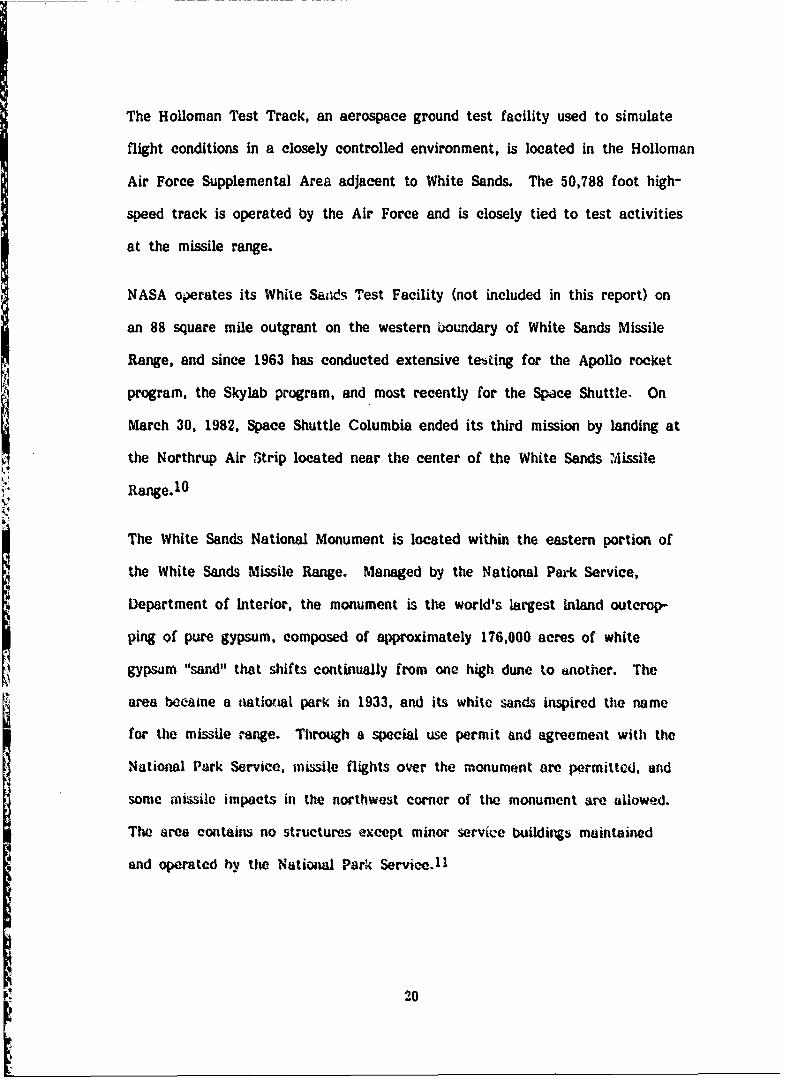
The Holloman Test Track, an aerospace ground test facility used to simulate
flight conditions in a closely controlled environment, is located in the Holloman
Air Force Supplemental Area adjacent to White Sands. The 50,788 foot high-
speed track is operated by the Air Force and is closely tied to test activities
at the missile range.
NASA operates its White S&e.s Test Facility (not included in this report) on
an 88 square mile outgrant on the western broundary of White Sands Missile
Range, and since 1963 has conducted extensive testing for the Apollo rocket
program, the Skylab program, and most recently for the Space Shuttle. On
March 30, 1982, Space Shuttle Columbia ended its third mission by landing at
the Northrup Air Strip located near the center of the White Sands M.3issile
Range. 1 0
The White Sands National Monument is located within the eastern portion of
the White Sands Missile Range. Managed by the National Park Service,
Department of Interior, the monument is the world's largest inland outcrop-
ping of pure gypsum. composed of approximately 176,000 acres of white
gypswm "sand" that shifts continually from one high dune to another. The
area became a national park in 1933, and its white sands inspired the name
for the missile range. Through a special use permit and agreemet with the
National Park Service. missile flights over the monument are permitted, and
some missile impacts in the northwest corner of the monument are allowed.
The area contains no structures except minor service buildings maintained
and operated hy the National Park Service. 1 1
20

PRE-MILITARY LAND USE
White Sands Missile Range covers a substantial part of the Tularosa Basin in
south-central New Mexico, where Indian cultures pre-dominated until the
arrival of Spanish soldiers, missionaries, and traders from Mexico in the late
16th century. Permanent white settlement began in the early 19th century
under land grants from the Mexican government. The Butterfield and Chisholm
Trails brought English-speaking settlers into the region prior to the Civil
War, but most permanent settlement took place after about 1880.
The land now within the missile range was used predominantly for ranching,
and to some extent mining, before its acquisition by the Army. Remnants of
both activities are scattered throughout much of the range, particularly in
the San Andres and Oscura Mountains, and the plains above Mockingbird Gap.
Signs of minhig activity are most prevalent on the eastern slope of San
Augustin Peak and around Mineral Hill, both situated in the southwest corner
of the range just above U.S. Route 70. There are many exposed mine openings
in the area, and remnants include a variety of small mining shacks and related
equipment, such as timbers, wire cables, piping, and the like. These mines
produced copper, lead. silver, some gold, and a small amount of zinc, but
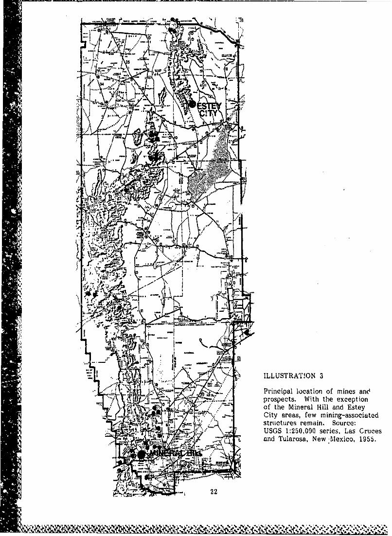
were largely abandoned by the late 1930s.12 (Illustrations 3. 4 and 5)
A smaller number of mines and prospectivg sites occur several miles northeast
of Mineral Hill on the eastern slopes of Black and Goat Mountains in the
Im lower San Andres. Few signs of mining activity exist in the middle of the
range, but a fairly large cluster of mines and prospecting sites are found at
the San Andres' northern tip near Capitol Peak and 'Mockingbird Gap.
I-
j4.*I~~Z&*'~ 4 'r'.w. . ~Si~J
-- 4k
.4 v rnia oaino ie n
.1 . prsecs With the. exeto
Cit aras few mining-asociate
;, an Tuaoa Ne -exco 155
A - ~ '* 422

A~
St e . lead,
p 18 .A
* 'l , °,1 3
ILLUSTRATION 4 Miner'al Hill mining ruins. The Miner'al Hill mnining district was heavily pros-pected and mined from about 1880 to the 19201s. although prospecting for goldc'~ntinu:,*d through the 19301s. The mines mainly produced copper. lead. and
*silver. s-'ome gold, arid a small amount of zinc. Source: Field inventor'y* photograph. 1983. W•illiam A. iSrenner, Buildin~g Technology, Inc.

ILLUSTRATION 5 Open vertical mine shaft, Mineral Hill mining di:;trict.source: Field inventory ph~otograph, 1983, William A.Brenner, Building Technology, Inc.
24
V Zz;ow e, .¶tt$..¶M.f(Ser * ~ ~ ... .V-. q 4 - '.

The most fully developed mining site at White Sands is at Estey City, a
cluster of stone ruins on the eastern slope of the lower Oscuras. Estey City
was a small copper mining boom town from 1901 to 1931 (according to postal
records) that was owned and operated by the Dividend Mining and Milling
Company. The only recognizable remains of Estey City are the stone rem-
nants of the company store and post office, and a depressed concrete
reservoir.13 (Illustration 6)
Several mining sites are clustered at the northern end of the Oscura Mountains
near the border of the missile range, and minor prospecting sites (often only
a hole in the ground adjacent to a small mound of dirt) can be found at
scattered sites throughout the range, on the plains as well as in the moun-
tains. Few contain associated structures or equipment.
Ranching activity concentrated primarily in the middle and upper San Andres
Mountains and on the eastern side of the Oscuras, with a moderate amount
of activity in the lower San Andres and on the plains, particularly above
Mockingbird Gap. The few ranches east of the San Andres were for the
most part located near the mountains' base. Ranching centered on sheep and
cattle raising, and the availability of potable water and suitable grazing land
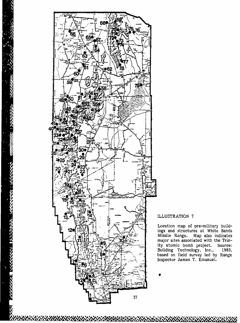
were primary locational determinants. 14 (Illustration 7)
"Buildings and structures associated with the ranches are mostly of simple
design and construction and have little stylistic ornamentation. Early houses
are made of adobe, logs, or stone, and later structures are more usually
constructed of board and batten or, occasionally, frame construction. Out-
buildings may be. made of all of these materials, but are often simple pole
'V

ILLUSTRATION 6 Zstey City ruins. Built by the Dividend Mining and MillingCompany, Estey City was an active copper mining complex forIthe first third of this century. Top view is of general storeremains from the northeast. Bottom view is of general storefrom southwest, with post office ruin in the distance. Source:Field inventory photograph, 1983, Williant A. Brenner, BuildingTechnology, Inc.
26
* 7v I
p~~2 65#..$i1tL
% L
34i. fW
~~~ V.. .5
- I7
61 "
591 ? -
.... S n
AA
l3/'~L '4~ ~ILLUSTRATION 7
.4 *.\. * ~Location map of pre-military build-126* \Y' ings and structures at White Sands
Missile Range. Map also indicatesmajor sites associated with the Trin-
ID* ~Building Technology, Inc., 1983,based on field survey led by RangeInspector James T. Emanuel.
s727

buildings covered with corrugated metal. The roofs of most 1ouses and
outbuildings are of corrugated metal over pole or frame joists; on adobe and
stone houses they sometimes cover earlier flat roofs made of dirt, sod, or
adobe laid over boards or timbers. Without exception, all ranch structures,
including houses, are one story in height. They rarely have basements or
cellars, and attics (when found) are low and unuseable. (Illustration 8)
Stone buildings at White Sands are mostly constructed of unfaced stone laid
up with either adobe or cement mortar. A few have faced stone, and some
are laid up without mortar. The stone structures are, as a group, the best
preserved on the range. (Illustration 9)
Board and batten buildings are more recent. They do not have interior wall
framing and are joined at the top with a small horizontal member that ties
the wall together and, on the bearing walls, supports the ceiling and roof
joists. Board and batten walls may have a double thickness of boards, but
often the vertical siding acts as both the interior and exterior wall. The
board and batten structures are the most common at White Sands and vary
from good to poor condition. (Illustration 10)
There are fewer log structures, but a surprising number for an area so lacking
in trees. Most appear quite old, and range from fair to poor condition. All
are of conventional log design. (Illustration 11)
Structures at White Sands built of adobe brick and mortar were usually (but
not always) covered with adobe stucco. Adobes vary in condition largely
according to the soundness of their roofs. Those that had uncovered sod,
28

'V6
44
tibes Let stn os tIo p ing has
II-I
2 LUTATO9

ofV Stoll lai ti ihu-otr h al os.w ihm yhv
bentehm4fPtGretsfmiv a ubero upre
byaruhtme tutr. Botmve so h eeWo
hos tnrhr n o erDnCno.I.i ae tutrthtue oceemra.Suce il netr htgah
193Sai .Bcaa.BuligTcnlg.Ic'30
m;Ze

I,,SU ' ' , ' -,.,. .4 1"
ILLUSTRATION 10 Board and batten house. This structure, the principal house at thePotter Ranch in Rhodes Canyon, is typical of the great number ofboard and batten houses at White Sands. Source: Field inventoryphotograph, 1983, David G. Buchanan, Building Technology Inc.
ILLUSTRATION 11 Log cabin. Trhe Les Greer house in lower Lee Canvonis one of the more fully developed logb structures on 'therange. The log houses at White Sands are generally"older and in poor(, condition than those of board andbatten. Source: Fie, ' inventory photogrph. 1983..illiam A. .renner B.uilding Technology, Inc.
31
:' "'

dirt, or adobe roofs are usually in complete ruin; those with intact corrugated
metal roofs (particularly those with ample roof overhangs) are often in sur-
prisingly good condition. (lllustra,ýions 12 and 13)
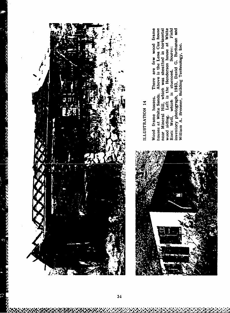
There are a few wood frame houses on the range. Of these, several are
stuccoed, and the remainder are covered with horizontal wood siding.
(Illustratioii 14)
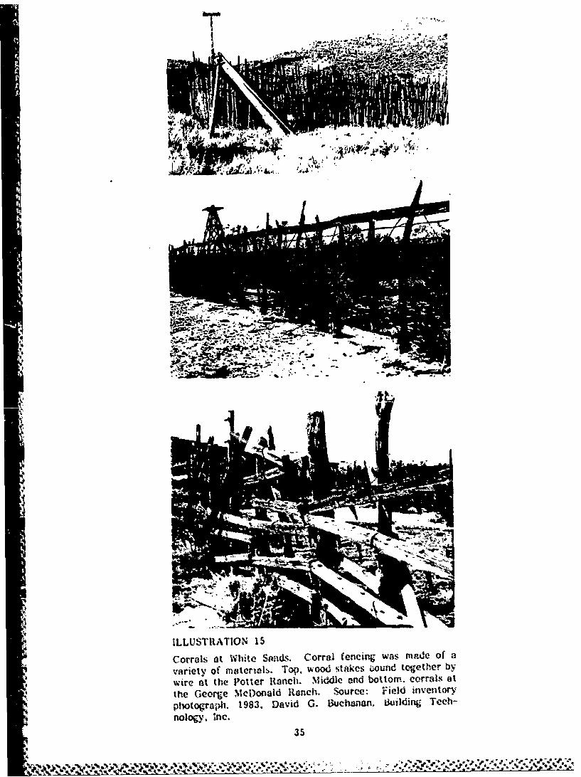
Other structures associated with pr.e-military ranching activities are corrals
and windmills. Corrals were often made of vertical stakes bound with wire,
although they could be made of virtually any material including simple barbed
wire strung on posts. Windmills are of the variety common throughout the
West, and mtnv still display the familiar Chicago Aeromotor logo on their
directional vanes. Older windmills have timber towers; later ones are often
supported by light guage steel structures. Occasionally a geared pumping
mechanism may be frund at the base of the windmill. This was linked by a
large belt to a gasoline ergine (or sometimes to the elevated drive wheel of
an automobile) to provide an optional means of pumping water. Holding
tanks or reservoirs located close v- the windmills were made of galvanized
steel, iron, concrete, stone, or, if they were large, simply of mounded earth.
The remains of earthen reservoirs are common on the range, as are those of
galvanized steel. Concrete and stone tanks are uaso plentiful, but only a few
iron tanks exist. (Illustrations 15 and 16)
An excellent example of a working ranch at White Sands, and the many
structures associated with it, is the George McDonald Ranch. Measured
drawings of the ranch, completed in early 1983, may be found in Appendix A.
(Also see Illustration 29.)
32
Iy, 4r

ILLUSTRATION 12 Adobe house. The Burris house near Capitol Peak is a relatively intactadobe structure, largely because of the sound condition of its roof.Obviously at one time a comfortable house, its layout and details
suggest that it was built in this century. Source: Field inventoryphctograph, 1983, David G. Buchanan, Building Technology, Inc.
V.,
ILLUSTRATION 13 Adobe house at the Ritch ranch. An older and highly deteriorated
structure once owned by W. G. Ritch. who was acting territorial
governor of New Mexico in 1865. Source: Field inventor. photograph.
1983, David G. Buchanan, Building Technology, Inc.
33
UPA O i4
Z3 0* '
'U -0.01cy
;;ot:;42 to.
00
.3 r
Wil
34
01,51N --.i;Q0 CUNN
I.7
ILLUSTRATION 15
Corrals, at White i~~ Corral (encing wais mAde Of 0variety of mstrirwk. Top, wood stAlkes 6ounid together bywire at the P'otter Ranch. Miiddle and bottom. corral.s' at
the George M1cDonald Ranch. 'Source: Field inventoryphotograoh. 1983. David G. 13uchana~n, Building, Tech-nology, Inc.
3
'w '41 %L3W
94
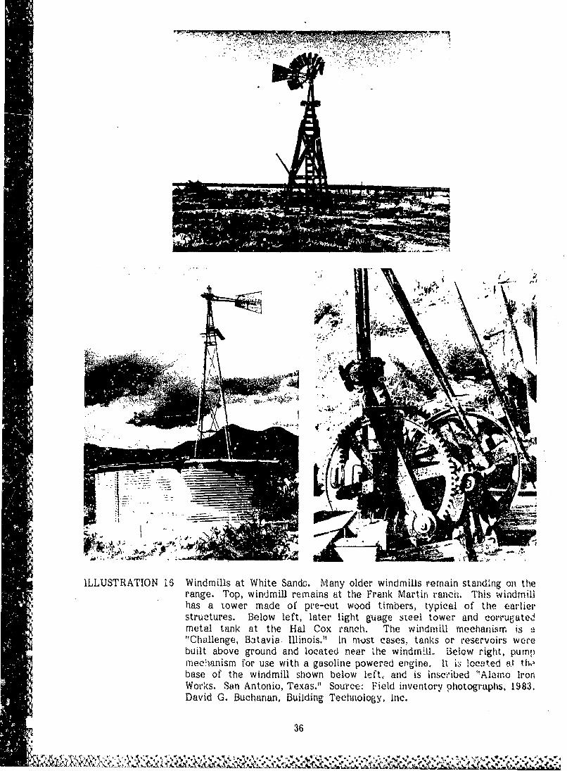
ILLUSTRATION 16 Windmills at White Sands. Many older windmills remain standing on therange. Top, windmill remains tit the Frank Martin raneiý. This winidmillhas a tower made of pre-cut wood timbers, typical of the earlierstruýtures. B~elow left, later light guage steel tower- and corr~ugatedmetal tank at the Hal Cox ranch. The windmill mechanisrmr is 9"Challenge, Batavia, Illinois." In most cases.` tanks or reservoirs werebuilt above ground and located near Lhe windm~ill, Below right, pumpmiec'hanism for use with a gasoline powered eilgine, It i3 104c-cted a t thwbase of the windmill shown below Icft, and is insce'ibed "Alamno Iron,Works. Son Antonio, Texas." Source: Field inventory photographis, 1983.David G. Buchanan, Building Technology, Inc.
36
* ~. .*~'~ ~X

x0
00
W) bi
0 0 E
to >1
I i) 0 >
4.
41
64
37
I2oN
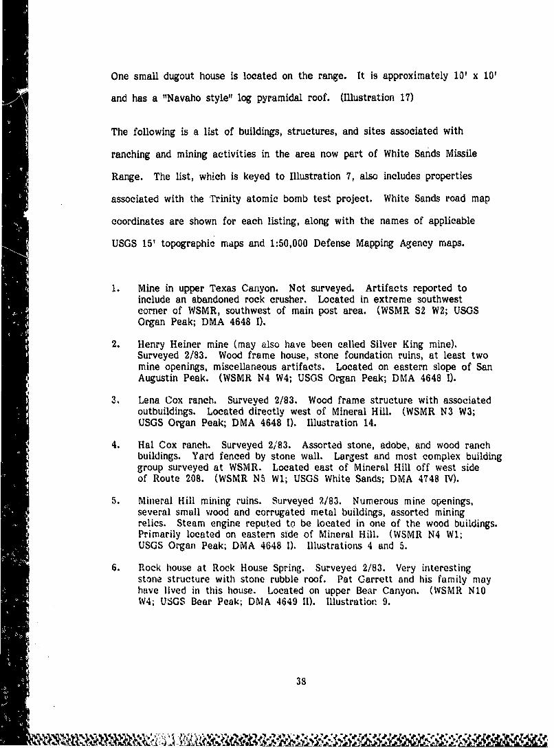
One small dugout house is located on the range. It is approximately 10' x 10'
and has a "Navaho style" log pyramidal roof. (Illustration 17)
The following is a list of buildings, structures, and sites associated with
ranching and mining activities in the area now part of White Sands Missile
Range. The list, which is keyed to Illustration 7, also includes properties
associated with the Trinity atomic bomb test project. White Sands road map
coordinates are shown for each listing, along with the names of applicable
USGS 15' topographic maps and 1:50,000 Defense Mapping Agency maps.
1. Mine in upper Texas Canyon. Not surveyed. Artifacts reported toinclude an abandoned rock crusher. Located in extreme southwestcorner of WSMR, southwest of main post area. (WSMR S2 W2; USGSOrgan Peak; DMA 4648 I).
2. Henry Heiner mine (may also have been called Silver King mine).Surveyed 2/83. Wood frame house, stone foundation ruins, at least twomine openings, miscellaneous artifacts. Located on eastern slope of SanAugustin Peak. (WSMR N4 W4; USGS Organ Peak; DMA 4648 I).
3. Lena Cox ranch. Surveyed 2/83. Wood frame structure with associatedoutbuildings. Located directly west of Mineral Hill. (WSMR N3 W3;USGS Organ Peak; DMA 4648 I). Illustration 14.
4. Hal Cox ranch. Surveyed 2/ 83. Assorted stone, adobe, and wood ranchbuildings. Yard fenced by stone wall. Largest and most complex buildinggroup surveyed at WSMR. Located east of Mineral Hill off west sideof Route 208. (WSMR N5 Wl; USGS White Sands; DMA 4748 IV).
5. Mineral Hill mining ruins. Surveyed 2/83. Numerous mine openings,several small wood and corrugated metal buildings, assorted miningrelics. Steam engine reputed to be located in one of the wood buildings.Primarily located on eastern side of Mineral Hill. (WSMR N4 Wl;USGS Organ Peak; DMA 4648 1). Illustrations 4 and 5.
6. Rock house at Rock House Spring. Surveyed 2/83. Very interestingsto-ne structure with stone rubble roof. Pat Garrett and his family mayhave lived in this house. Located on upper Bear Canyon. (WSMR Nl0W4; USGS Bear Peak; DMA 4649 I1). Illustration 9.
38
,.,.l

7. Love ranch headquarters. Surveyed 5/83. Stone house and large clusterof outbuildings. Located north of Bear Creek and Quartzite Mountain.(WSMR N11 W7; USGS Bear Peak; DMA 4649 II).
8. Fillepe Lucero ("lower Lucero") ranch. Surveyed 2/83. Very deterioratedadobe structure with several outbuildings. Located two miles directlyeast of St. Nicolas Spring, below Route 276. (WSMR N13 E4; USGSLake Lucero; DMA 4749 Ill).
9. Jose Lucero ("upper Lucero") ranch. Surveyed 2/83. Adobe structurewith roof partially attached. Outbuilding ruins. Located at well eastof Coker site on Route 7. (WSMR N18 E3; USGS Lake Lucero; DMA4749 I11).
10. Walter Baird ranch headquarters. Surveyed 2/83. Board and battenwood structure with intact roof. Several outbuildings, including adoberuin. Located near Baird Site, north of Route 70. (WSMR N20 E12;USGS Lake Lucero; DMA 4749 III).
11. Stone buildings at Ropes Spring. Surveyed 2/83. Three room stonehouse, with two small stone buildings, probably spring houses. Locatedon upper Ropes Draw. (WSMR N20 W5; USGS Bear Peak; DMA 4649 II).Illustration 8.
12. Stage station on upper Goldenburg Draw. Surveyed 5/83. Adobe ruins.Located one mile south of Cottonwood Spring. (WSMR N22 W7; USGSBear Peak; DMA 4649 IU).
13. Jack Bruton horse camp headquarters (a.k.a. Jackson horse camp).Surveyed 5/83. Stuccoed frame house and combination rock and adobehouse. Located on Horse Camp Draw. (WSMR N27 W9; USGS KaylorMountain; DMA 4649 1).
14. Baird horse camp. Surveyed 2/83. Adobe structure in partial ruin,with stone and wood outbuildings, Located about 1-1/2 miles northeastof RAD site, below Mayberry Canyon. (WSMR N28 Wi; USGS KaylorMountain; DMA 4649 I).
15. Fleck ranch. Surveyed 5/83. Adobe ruin with intact stone barn.Located on Fleck Draw. (WSMR N34 W10; USGS Kaylor Mountain;"DMA 4649 0).
16. Frank Anderegg ranch headquarters. Surveyed 2/83. Board and battenhouse with a relatively large barn, stable, other outbuildings, and ruins.Located between Fleck Draw and Dead Man Canyon in Dead Man watershed. (WSMR N33 W18; USGS Kaylor Mountain; DMA 4649 I).
39

17. Mrs. Anderegg house. Surveyed 5/83. Board and batten house. Locatedin middle portion of Dead Man Canyon. (WSMR N32 W4; USGS KaylorMountain; DMA 4649 I).
18. Frank Anderegg line camp. Surveyed 5/83. Board and batten house.Located at Doctor's Well in upper Lost Man Canyon. (WSMR N34 W6;USGS Kaylor Mountain; DMA 4649 I).
19. Henderson goat ranch. Not surveyed. Only burned ruins are reportedto remain. Located northeast of Hembrillo Pass. (WSMR N33 W9;USGS Kaylor Mountain; DMA 4649 I).
20. Floyd Crockett sheep ranch. Surveyed 5/83. Board and batten houseand outbuilding. Located about 2-1/2 miles west of Frank Crockettranch headquarters and 1/2 mile south of Ben Taylor Tank. (WSMRN44 W13; USGS Kaylor Mountain; DMA 4649 I).
21. Frank Crockett ranch headquarter3. Surveyed 2/83. Board and battenhouse, with several wood and metal covered outbuildings. Located inthe middle of Sulphur Canyon. (WSMR N42 W10; USGS Kaylor Moun-tain; DMA 4649 1).
22. W.G. Ritch ranch. Surveyed 2/83. Adobe structure in partial ruin.Board and batten garage. W.G. Ritch was acting territorial governor ofNew Mexico in 1865. Located at foot of Grandview Canyon. (WSMRN42 W4; USGS Kaylor Mountain; DMA 4649 1). Illustration 13.
23. Reported stone foundation ruins. Not surveyed. Located one mile eastof Bat Ranch Spring. (WSMR N45 W5; USGS Kaylor Mountain; DMA 4649 I).
24. L.H. Makinson house. Surveyed 5/83. Intact board and batten house.Located in lower Grapevine Canyon, one mile north-northwest of StrawberryPeak. (WSMR N46 W6; USGS Kaylor Mountain; DMA 4649 I).
25. Line camp at Walson Well. Surveyed 2/83. Small stone structure withno apparent outbuildings. Located one mile east of Walson Gap.(WSMR N46 W12; USGS Black Top Mountain; DMA 4650 11).
26. A.C. Woolf ranch headquarters. Surveyed 2/83. Large adobe housewith large porch, three stone fireplaces, French doors, and other archi-
4, tectural features. Few ancillary structures. Most architecturallydeveloped ranch house of those surveyed. Located in Hackberry Canyon.(WSMR NS0 W14; USGS Black Top Mountain; DMA 4650 II).
27. Wood ruins at Woolf Spring. Surveyed 2/83. Ruins of small log buildingand wood shack. Located in Cottonwood Canyon. (WSMR N50 Wl0;USGS Black Top Mountain; DMA 4650 II).
28. Rock house at Rock House Well. Surveyed 2/83. L-shaped stone buildingwith corral. Located in Cottonwood Canyon north of Black Top Mountain.(WSMR NS1 W1l; USGS Black Top Mountain; DMA 4650 II).
40

29. Oscar Nelson camp at Nelson Well. Surveyed 2/83. Small board andbatten house with wood corral. Located about 1/2 mile west of Route 7.(WSMR N50 W3; USGS Black Top Mountain; DMA 4650 II).
30. Henderson house at G. Henderson Well. Surveyed 5/83. Adobe ruin.Located about 1/2 mile west of Route 7 and directly east of GunsightPeak. (WSMR N52 W2; USGS Black Top Mountain; DMA 4650 If).
31. Reported sheep shed. Not surveyed. Located at windmill one milesouth-southwest of Red Hill Well, upper Cottonwood Canyon. (WSMRN52 W14; USGS Black Top Mountain; DMA 4650 I1).
32. Potter ranch headquarters. Surveyed 2/83. Building complex includesboard and batten house and barn, adobe house, log outbuilding, metalshed, and board and batten sheep shearing shed. Also several woodcorrals, a windmill, and related structures. Located at Towner Well,middle Rhodes Canyon on Route 6. (WSMR N55 W11; USGS Black TopMountain; DMA 4650 U). Illustration 10.
33. CCC camp site. Surveyed 2/83. Only two stone gate markers, severalconcrete slabs, and miscellaneous remnants remain. Located on thesouth side of Route 6, middle Rhodes Canyon, about 1/4 mile northwestof Rock House Spring. (WSMR N57 W13; USGS Black Top Mountain;DMA 4650 I1).
34. "Potsy" Potter sheep ranch. Surveyed 2/83. Board and batten house,garage, and two small outbuildings. Located near the middle of RhodesCanyon on Route 6. (WSMR N56 W1l; USGS Black Top Mountain; DMA4650 IU).
35. Remains of CCC road improvements. Surveyed 2/83. Stone walls,culverts, and related road improvements are visible along Route 6between Hardin Ranch and Rhodes Canyon Range Center. (WSMRN55-58 W5-15; USGS Black Top Mountain; DMA 4650 II).
36. Henderson house at Tip Top Ranch. Surveyed 2/83. Adobe house andwood frame house. Located off eastern end of Rhodes Canyon.(WSMR N55 W6; USGS Black Top Mountain; DMA 4650 II).
37. Henderson house at White Rock Well. Surveyed 2/83. Wood framehouse with adobe stucco. Located in Mackinson Canyon. (WSMR N58W6; USGS Black Top Mountain; DMA 4650 I1). Illustration 14.
38. F.E. Henderson house. Not surveyed. Only a shed is reported toremain. Located at Bear Den Tank in Bear Den Canyon. (WSMR N57W13; USGS Black Top Mountain; DMA 4650 II).
39. Miller ranch headquarters. Surveyed 2/83. Board and batten housewith several extensions. Located in western end of Rhodes Canyon onRoute 6. (WSMR N58 W14; USGS Black Top Mountain; DMA 4650 11).
41
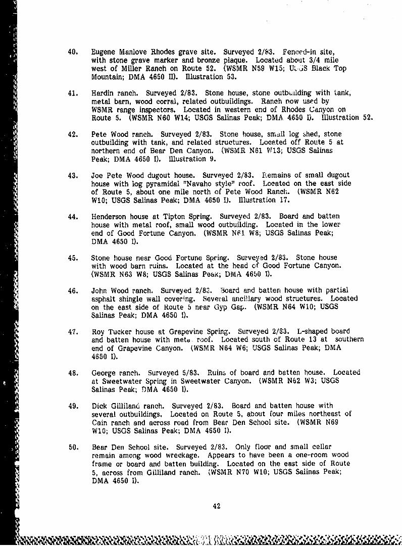
40. Eugene Manlove Rhodes grave site. Surveyed 2/83. Fenced-in site,with stone grave marker and bronze plaque. Located about 3/4 milewest of Miller Ranch on Route 52. (WSMR N59 W1S; U,'.iS Black TopMountain; DMA 4650 II). Illustration 53.
41. Hardin ranch. Surveyed 2/83. Stone house, stone outbuilding with "ank,metal barn, wood corral, related outbuildings. Ranch now used byWSMR range inspectors. Located in western end of Rhodes Canyon onRoute 5. (WSMR N60 W14; USGS Salinas Peak; DMA 4650 1). Illustration 52.
42. Pete Wood ranch. Surveyed 2/83. Stone house, small log shed, stoneoutbuilding with tank, and related structures. Located off Route 5 atnorthern end of Bear Den Canyon. (WSMR N61 W:13; USGS SalinasPeak; DMA 4650 1). Illustration 9.
43. Joe Pete Wood dugout house. Surveyed 2/83. FI.emains of small dugouthouse with log pyramidal "Navaho style" roof. Located on the east sideof Route 5, about one mile north of Pete Wood Ranch. (WSMR N62W10; USGS Salinas Peak; DMA 4650 I). Illus-tration 17.
44. Henderson house at Tipton Spring. Surveyed 2/83. Board and battenhouse with metal roof, small wood outbuilding. Located in the lowerend of Good Fortune Canyon. (WSMR NF1 W8; USGS Salinas Peak;DMA 4650 I).
45. Stone house near Good Fortune Spring. Surveyed 2/83. Stone housewith wood barn ruins. Located at the head of Good Fortune Canyon.(WSMR N63 W8; USGS Salinas Peai; DMA 4650 I).
46. John Wood ranch. Surveyed 2/82. 3oard and batten house with partialasphalt shingle wall covering. Several ancillary wood structures. Locatedon the east side of Route 5 near Gyp Gap. (WSMR N64 W10; USGSSalinas Peak; DMA 4650 1).
47. Roy Tucker house at Grapevine Spring. Surveyed 2/83. L-shaped boardand batten house with metu roof. Located south of Route 13 at southernend of Grapevine Canyon. (WSMR N64 W6; USGS Salinas Peak; DMA4650 1).
48. George ranch. Surveyed 5/83. Ruins of board and batten house. Locatedat Sweetwater Spring in Sweetwater Canyon. (WSMR N62 W3; USGSSalinas Peak; DMA 4650 1).
49. Dick Gillilanci ranch. Surveyed 2/83. Board and batten house withseveral outbuildings. Located on Route 5, about four miles northeast ofCain ranch and across road from Bear Den School site. (WSMR N69W10; USGS Salinas Peak; DMA 4650 I).
50. Bear Den School site. Surveyed 2/83. Only floor and small cellarremain among wood wreckage. Appears to have been a one-room woodframe or board and batten building. Located on the east side of Route5, across from Gilliland ranch. (WSMR N70 W10; USGS Salinas Peak;DMA 4650 1).
42

51. Martin line camp. Surveyed 5/83. Small board and batten house.Located at Martin Well off Route 13. (WSMR N71 W5; USGS SalinasPeak; DMA 4650 I).
52. L.W. Well log house. Surveyed 2/83. Log house with stone chimney.Windmill is only apparent associated structure. Located on Route 13 atnorthern end of Grapevine Canyon. (WSMR N66 W6; USGS SalinasPeak; DMA 4650 I).
53. Amlin Wood house. Surveyed 2/83. Stone house with two stoneoutbuildings. Associated structures include windmill, sheds, and corrals.Located at Thurgood Well, upper Thurgood Canyon. (WSMR N67 W3;USGS Salinas Peak; DMA 4650 I).
54. Les Greer ranch. Surveyed 2/83. Intact board and batten house withmetal roof. Nearby log cabin, also relatively intact. Located at JuniperWell in lower Lee Canyon. (WSMR N64 0; USGS Capitol Peak; DMA
A• 4750 IV). Illustration 11.
55. Greer line camp. Surveyed 2/83. Log cabin, appears to be built intwo sections. Located near Sheep Mountain Spring on the north slopeof Sheep Mountain. (WSMR N67 E2; USGS Capitol Peak; DMA 4750 IV).
56. Stone house. Surveyed 2/83. Small stone structure with highlydeteriorated roof. Located about 1/2 mile east of Brown Well. (WSMRN70 W2; USGS Salinas Peak; DMA 4653 I).
57. Thurgood ranch. Surveyed 2/83. Adobe house with adobe roof, ruins ofAa stone house, and related structures. Located in Thurgood Canyon,
about 1-1/2 miles west of Lava Gap. (WSMR N69 Ei" USGS CapitolPeak; DMA-4750 IV).
58. Burris ranch. Surveyed 2/83. Relatively large adobe structure withmostly intact metal roof. Associated outbuildings. Located at BurrisWell, two miles north-northwest of Capitol Peak. (WSMR N72 E2;USGS Capitol Peak; DMA 4750 IV). Illustration 12.
59. Frank Martin ranch headquarters. Surveyed 2/83. Wood frame housewith asphalt shingle siding. Board and batten storage shed, relatedstructures. Located near the Socorro/Sierra county line approximatelyequivalent between Routes 5 and 13. (WSMR N75 W8; USGS SalinasPeak DMA 4650 1).
60. Mike Arrieta Ranch (a.k.a. part of Harriet ranch). Surveyed 2/83.Only partially collapsed small wood structure remains. Located atLewis Well, one mile west of Route 13. (WSMR N78 W5; USGS GranjeanWell; DMA 4651 II).
61. McDonald brothers ranch (site of Trinity Base Camp). Surveyed 2/83.Complex adobe shed roof house, wood frame house, elevated watertank, wood shed, and concrete foundations of several base camp buildings.Located at bend in Route 13, 1/4 mile north of Pond Site. (W6MR N81W4; USGS Granjean Well; DMA 4651 U). Illustrations 26 and 27.
43
f*

62. Tom McDonald ranch at Mockingbird Gap Well. Surveyed 2/83. Boardand batten bunkhouse, stone and wood-fenced corrals. Ranch housepreviously demolished. Located near junction of Routes 7 and 12 atBen Site. (WSMR N79 E4; USGS Mockingbird Gap; DMA 4751 III).
63. George Foster ranch. Surveyed 2/83. Adobe house with adobe roof inpartial collapse. Collapsed adobe outbuilding. Grave of Mrs. Fosterlocated nearby. Located near Foster Well, about 3/4 mile off Route 7on access road to Stallion W.I.T. (WSMR N85 W3; USGS Granjean Well;DMA 4651 II).
64. George McDonald ranch (assembly site of the plutonium core for thefirst atomic bomb). Surveyed 2/83. Adobe house with stone outbuildings.Located two miles south-southeast of Trinity Site. (WSMR N88 El;USGS Mockingbird Gap; DMA 4751 III). Illustration 29 and Appendix A.
65. Charles Story ranch (a.k.a. Baber ranch). Surveyed 5/83. Ruins ofadobe structure and two stone outbuildings. Located approximately onemile northwest of Trinity Site. (WSMR N90 WI; USGS MockingbirdGap; DMA 4751 III).
66. Cicero Green ranch. Surveyed 5/83. Large adobe house in partial ruin.Located near Green Site on Route 349. (WSMR N92 W9; USGS GranjeanWell; DMA 4651 II).
67. Trinity Site. Surveyed 2/83. A national landmark. Fenced-in areawith lava stone marker and bronze plaques. Remains of "Jumbo," anunused steel containment vessel, and several reinforced concrete instrumentationbunkers are located nearby. (WSMR N38 0; USGS Mockingbird Gap;DMA 4951 Ill). Illustrations 18-22.
68. Houses at Smith Tank. Surveyed 5/83. Intact conrete house and adjacentruins of stone house. Located about two miles northwest of North
, Oscura Peak. (WSMR N96 E5; USGS Bingham; DMA 4751 IV).
69. Ozane stage station. Surveyed 5/83. Ruins of large stone building,-4 with ruins of smaller structure across road. Located approximately
4 three miles northwest of North Oscura Range Center. (WSMR N96 E9;USGS Bingham; DMA 4751 IV).
70. Manuel Moya house. Surveyed 2/b3. L-shaped stone structure withcollapsed sod roof. Located at Moya Tank on Route 9, one mile southof Routes 9 and 331 intersection. (WSMR N93 E9; USGS MockingbirdGap; DMA 4751 I11). Illustration 8.
71. Yates shack. Surveyed 2/83. Small shack with metal shed roof. Wallsare partially board and batten and partially corrugated metal. Locatedat Yates Tank, about one mile below Moya site. (WSMR N92 E9; USGSChihuahua ranch [a.k.a. Bull Gap]; DMA 4751 II).
444
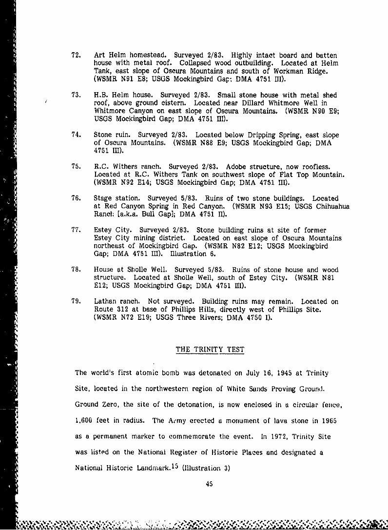
72. Art Helm homestead. Surveyed 2/83. Highly intact board and battenhouse with metal roof. Collapsed wood outbuilding. Located at HelmTank, east slope of Oscura Mountains and south of Workman Ridge.(WSMR N91 E8; USGS Mockingbird Gap; DMA 4751 III).
73. H.B. Helm house. Surveyed 2/83. Small stone house with metal shedroof, above ground cistern. Located near Dillard Whitmore Well inWhitmore Canyon on east slope of Oscura Mountains. (WSMR N90 E9;USGS Mockingbird Gap; DMA 4751 I1).
74. Stone ruin. Surveyed 2/83. Located below Dripping Spring, east slopeof Oscura Mountains. (WSMR N88 E9; USGS Mockingbird Gap; DMA4751 111).
75. R.C. Withers ranch. Surveyed 2/83. Adobe structure, now roofless.Located at R.C. Withers Tank on southwest slope of Flat Top Mountain.(WSMR N92 E14; USGS Mockingbird Gap; DMA 4751 Ill).
76. Stage station. Surveyed 5/83. Ruins of two stone buildings. Locatedat Red Canyon Spring in Red Canyon. (WSMR N93 E15; USGS ChihuahuaRanch (a.k.a. Bull Gap]; DMA 4751 11).
- 77. Estey City. Surveyed 2/83. Stone building ruins at site of formerEstey City mining district. Located on east slope of Oscura Mountainsnortheast of Mockingbird Gap. (WSMR N82 E12; USGS MockingbirdGap; DMA 4751 I11). Illustration 6.
78. House at Sholle Well. Surveyed 5/83. Ruins of stone house and woodstructure. Located at Sholle Well, south of Estey City. (WSMR N81E12; USGS Mockingbird Gap; DMA 4751 UII).
79. Lathan ranch. Not surveyed. Building ruins may remain. Located onRoute 312 at base of Phillips Hills, directly west of Phillips Site.(WSMR N72 E19; USGS Three Rivers; DMA 4750 I).
THE TRINITY TEST
The world's first atomic bomb was detonated on July 16, 1945 at Trinity
Site, located in the northwestern region of White Sands Proving Ground.
Ground Zero, the site of the detonation, is now enclosed in a circular fence,
1,600 feet in radius. The Aermy erected a monument of lava stone in 1965
as a permanent marker to commemorate the event. In 1972, Trinity Site
was listed on the National Register of Historic Places and designated a
National Historic Landmark. 15 (Illustration 3)
45
The site chosen for the test had been, until three days before the detonation,
a portion of the Alamagordo Bombing Range. It is called "Trinity" after the
code word for the highly secret project, the name selected by Dr. J. Robert
Oppenheimer, the project's scientific director. Work at the site began late
in 1944, and by May, 1945 preparations were completed for a test shot of
100 tons of high explosive laced with a small amount of fissionable material.
The test was to provide data for the calibration of test instruments and to
serve as a cress rehearsal for the functioning of the test organization. It
was successfully conducted on May 7 in a dramatic detonation that was
eclipsed only by the atomic explosion two months later. 16
The atomic test was set for 4 a.m. on Monday, July 16th. The. bomb had
been assembled on July 13th and placed atop a 100-foot steel tower on the
14th. Early in the morning of the 16th, scientists, technicians, and Army
personnel took their places in the old reservoir at Base Camp and in bunkers
10,000 yards to the south, west, and north of Ground Zero. Rain delayed
the detonation for one and one-half hours, but at 5:29:45 a.m. the bomb
exploded in a blast that exceeded all but the most optimistic scientific: • epectai~ns17
expectations. (Illustration 18)
Major sites associated with the Trinity test are: Ground Zero; Jumbo; camera,
instrumentation, and personnel bunkers to the north, west and south of Ground
Zero; the MacDonald Ranch, two miles to the southeast of Ground Zero; and
Base Camp, nine miles to the south of Ground Zero. (Illustration 19)
Ground Zero is marked by a stone obelisk bearing the national historic land-
mark plaque near tie remains of the four concrete piers that supported the
_* bomb tower. The barely noticeable depression caused by the blast is 800
46
4,.•

-4U
*4
LL
474

:S OS______*MM ISION (VACUAý11ONAftAý[
RANGE)U AN JAIWASY SLMtVAIIO~4IS5*LI IAi0 (M. - -. -. -
51§' AT.WG CENTER 1. -
>-. *AR$4O
1,.4 2400442ftut sat". 11-4"s4
J$4iZUV 611000
otUY 2 M10R
z1, 1 , 1 4
'193 2*M V J26
I to),i 7ON NORT 05 'R
444,
NLW HID 'J 'AOYASt.4)
00ALLIGOS
ONJEAN N OO
APSWC TAOT~ .j9.~
IWtA# I9 3W.
10,00 ITMCW1AIDRANCH''
*02SOMA I
101000S
00
122 1 912 I~ L4)¶ tU~A~9 1QI~r9j
031. BAS CAMP
-'tsit of. tthet
100 tons (1001) TNT test explosion: t6e McDonald Ranch, where4 the Active nucleei- core materials 'or the bomb were assembled.
the ,personnel and camer;n bunkers At 10,000 yards north ann 10.000yardis west; twe site of the control bunker at 10.000 yaxrds south
.4 (now demolished); and the site of Base- Camp. where 200 -personnelwere stationed during the test preparations. Source: BuildingTechnology, Inc. and WSMR Master Plan Basic Information Maps.October. 1970.
48
W -k

feet in radius and several feet deep at the point of explosion. It is littered
with particles of "trinitite" (sand and dirt fused into a glass-like substance by
the blast). Shortly after the explosion, a wooden shelter was erected several
hundred feet from Ground Zero to preserve intact a section of trinitite.
Currently, two laxi;r concentric circles of cyclone fencing protect Ground
Zero. (Illustrations 20 and 21)
Jumbo is located near the entrance to Ground Zero. This massive iron
cylinder was designed for a contained test of the bomb. The test was can-
celled in favor of the uncontained test that actually took place, and Jumbo
was never used. The atomic explosion destroyed the 60-foot high structure
located northwest of Ground Zero that supported Jumbo, but Jumbo itself
was not damaged. Its hemispherical ends were removed in a later salvage
attempt, but complete demolition was unsuccessful, and it was eventually
moved to its present location at the entrance to Ground Zero. (Illustration 22)
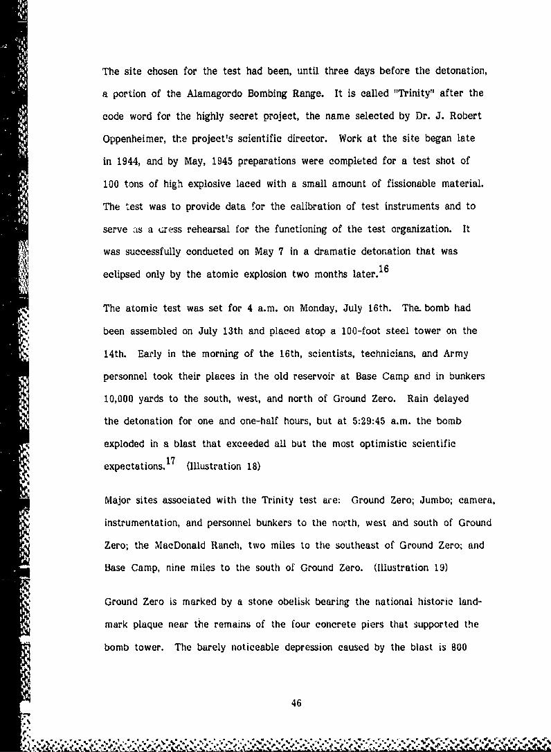
Eight hundred yards west of Ground Zero stands a small concrete instrumen-
tation bunker built on an earthen mound. This unmanned bunker housed
instruments to provide data on the test. There are three other instrumenta-
tion bunkers at North 800 yards and North 1000 yards and at Northwest 600
yards. All four bunkers are largely intact, but are gradually deteriorating.
(Illustrations 23 and 24)
At the time of the test, a personnel bunker and command center under the
direction of Dr. Rooert Oppenheimer stood at South 10.000 yards, and personnel
and camera bunkers were located at North 10.000 and West 10.000 yards.
49
±~W ¶ 4 % % ~ %~

4AA
M ~lo U W lent e re c tý e d a t frin lity s it !, iu c e a b o n-,to
,LLUSTrRATION 0 rtet detoflatIdO oftewrd Irs ncea b
crn t jul 1% t 4 o r e: ~j.S. Ar-mY
onli ) ffair 16,ce White Sax~ds 'Missile Range
pu li &s q'
-~ '
n -

4
w it
C.A.
CIL
Q) 8p'1
o a)C
92
orp
0 0.m~-
INA
C, ~ -P ~C )iP ~ f

0 ca
-El
o .E
4 ~ - 4 .. L: n
V~,O>~~ L
- J< ys4ý.
41-
4F- 1
~ .-..
. .

-- ----------
A-w
ILLUSTRATVI-N 24 Camera bunkers at Trinity Site. Top, bunker10,000 yards west of Ground Zero. Bottom,bunker at 10,000 yards north. Bunkers wereadjacent to earth-covtered personnel bunkers tha t
have since been demolished. Source: WSM RPhotographic Laboratory, 1983.
54
Today only the camera bunkers at North 10,000 and West 10,000 remain.
They are square concrete structures, approximately nine by nine by nine,
with no rear walls and with several observation apertures on the sides facing
Ground Zero. The three personnel bunkers at North, West, and South 10,000,
which were made of timber with earth-covered concrete roofs, have since
been demolished. (Illustration 25)
Base Camp was located at the former McDonald brothers ranch approximately
nine miles south-southwest of Ground Zero. Of the facilities that housed the
200 men working on the Trinity test, only a wood frame house, an adobe
house, and a small wood shed still stand, all in poor condition. The concrete
floor of the generator house is located between the two houses, and behind
them are the concrete floors of a latrine and garage. An earthen reservoir,
two wooden water tank platforms (one still holding a wood tank), and the
remains of a windmill are sited north of the houses. The many temporary
wood frame hutments used by the Army were removed after the test.
(Illustrations 26 and 27)
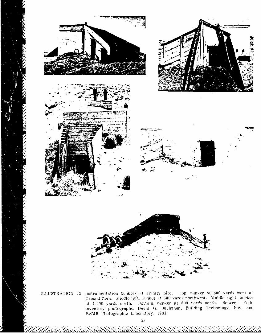
On July 13, 1945, scientists at the George McDonald ranch house, two miles
southeast of Ground Zero, assembled the bomb's active nuclear materials
(which had been delivered the previous day from the Los Alamos Scientific
Laboratory). Prior to the war, the McDonwdd ranch house was the center of
an active and highly developed ranching complex that included, besides the
main house, two cisterns, a bunkhouse, a sizl ble garage/barn, a large, two-
part concrete water tank fed by a well with a Chicago Aeromotor windmill,
a root cellar, several sheds, and a number of corrals and associated feeding
55
7ýýN Z 7

X44
ý j 4 ) -- --'0 56
cn~*~ %-

EU
.0-
WI 0
E 3:
,z 'r - -\
o-40c:4
z
0\\
4~lUC2 ~57

V0 co 0VV
- 0
(A 4 00
E ') 0 Qa: o I4. u O'D
4) = =~ C ..
BE. o o .0 -
4-#
bD 0
*.a 0
-Y. 'a)4ii
> Q
~ a31 ___
0 ~ b Aj__

and watering devices. The ranch structures were not seriously affected by
the detonation, but are now in disrepair, The Army is currently stabilizing
the ranch house. (Illustrations 28 and 29)
Myriad communication and power lines, strung between poles or over scrub
"growth, ran from Ground Zero to the various bunkers and Base Camp. Several
lines and poles still exist; some are erect, but most have fallen to the ground.18
EARLY DEVELOPMENT AT WHITE SANDS
Early in 1945, the Army Ordnance Department selected the Tularosa Basin in
southern New Mexico as the site of a permanent land range for the test
firing and recovery of guided missiles and rockets. The 100 mile by 40 mile
site was adjacent to both Fort Bliss, a permanent Army post at El Paso,
Texas, and the Alamogordo Army Air Base (now Holloman Air Force Base) at
Alamogordo, New Mexico. The local climate and geography of the region
were conducive to rocket testing - the arid land was almost void of vegeta-
tion, the sky was cloudless most of the year, and the San Andres and
Sacramento Mountains bordering the area afforded natural locations for
observing and tracking flights. The entire region was only sparsely populated -
no major towns or industries were located on the proposed range -- and only
a few small mines and a number of widely separated ranch houses were
situated in the region. No railroad or air lines traversed the site, and only
one major road, U.S. Route 70, crossed the Tularosa Basin. 19
In February, 1945, the Army declared the use of the area a militqry necessity.
Portions of the site were acquired from the Fort Bliss Antiaircraft Range,
25
" ~59
*' 3

ItD
'4 o
c1
f. V
6 0
'II
1E 41c
='j
ILLUSTRATION 29The George McDonald Ranch as it exlists todav. 1,11Army is now in the process of stabilizing the ranch house.Source. White Sands Photographic Lulhoratory. 1983.
i 61

the Dona Ana Target Range, the Castner Target Range, and the Alamogordo
Bombing Range. White Sands National Monument and the Jornado Experimental
Range also lay within the confines of the area. Additional land was acquired
or leased from private owners or state and local governments. 20
Co-use agreements were made with a number of ranchers that required them
to vacate their properties for limited periods during test firings. These
proved unworkable, however, and in March, 1949, the Army acquired the
ranches on an exclusive use basis. Meanwhile, the New Mexico State High-
way Department had declared the previous November that U.S. Route 70 was
a military highway subject to periodic closings. 2 1
Following the establishment of White Sands in early 1945, the Corps of
Engineers began construction of the main post area in the southwest corner
of the base. The main post was planned in four quadrants: the administra-
tion and troop area, the technical area, the industrial and warehouse area,
and the quarters and parade ground area. Temporary CCC buildings and a
hangar were moved to the site from Sandia Air Base near Albuquerque. and
Dallas type hutments, 16 x 16 feet, were constructed of plywood to provide
accommodations for military troops. A huge metal quonset hut (Building
1538) was constructed as the missile assembly facility for the V-2 rocket
program. This building, and a small blockhouse (Building 1592) west of it.
are the oniy World War II era structures remaining in the main post area.22
(Illustrations 30. 52, and 55) The blockhouse, was associated with an early
"Propulsion Unit Calibration Stand, built under the direction of Werner Von
Braun in July 1946. that has been since dismantled.
'S 62
S,

•', " " ' I' .
* ' • 'o. 1
r"
j, j .
" ' ","g -, : , *," ', i 4l :
' . .;%;t, , ,,, ,, . 4.,. d¶.4 .'.-,. •, ,6 . ,,,,,/i
... p. • c• • .~
r,,),••": A., .. 4 j5iT,"
,..,. ,4,4 , J,., , *,. ' ' ' , 1'ii %4" J4.• ., 1 • g "/
'-"-" . ., .. ., • . A.,
"94 -4 4 ''VI' -. "1 91 " "
4-I I * ' gb I \' ,°
*
., , . . -,..
* .., .'.., , U ,t- 4
*, .
- ' i4
--..U ,, . ' ' | ,
".9• .4 '1 ',,
A -- -5 4• [ k
-94- .. . .. .,
, ,'" 4445. -' . 4.4I,
"-4 .4
%r. & .,.,,.;,.
>5 " . . , ""q,." ., .' ''...-- '':... "". . "3 " . """"" -""" -"-'',"""-. , -" , -".'." - -" - - ,"" ",9-.

Missile firing facilities were located approximately 6-1/2 miles east of the
main post. Construct ion of the first launch area, now Launch Complex 33,
began in July, 1945 with erection of the Army blockhouse (Building 20814).
It housed firing controls, communication equij.ment, and instruments for
recording rocket test flights. The 60' by 40' reinforced concrete building has
heavy walls and a thick pyramidal roof designed to withstand the impact of
a rocket falling freely from an altitude of 100 miles. 2 3
The first permanent launch site, merely a concrete pad, was completed in
May, 1946, but was superseded in November by a new launch facility with a
gantry crane (Building 20820) and a specially designed launch pad with a
blast deflector and water spillway. The gantry crane, a 75 foot steel tower
with four work piatforms, was built on tracks so that it could roll forward
to service and prepare V-2 rockets for flight tests, then roll away from the
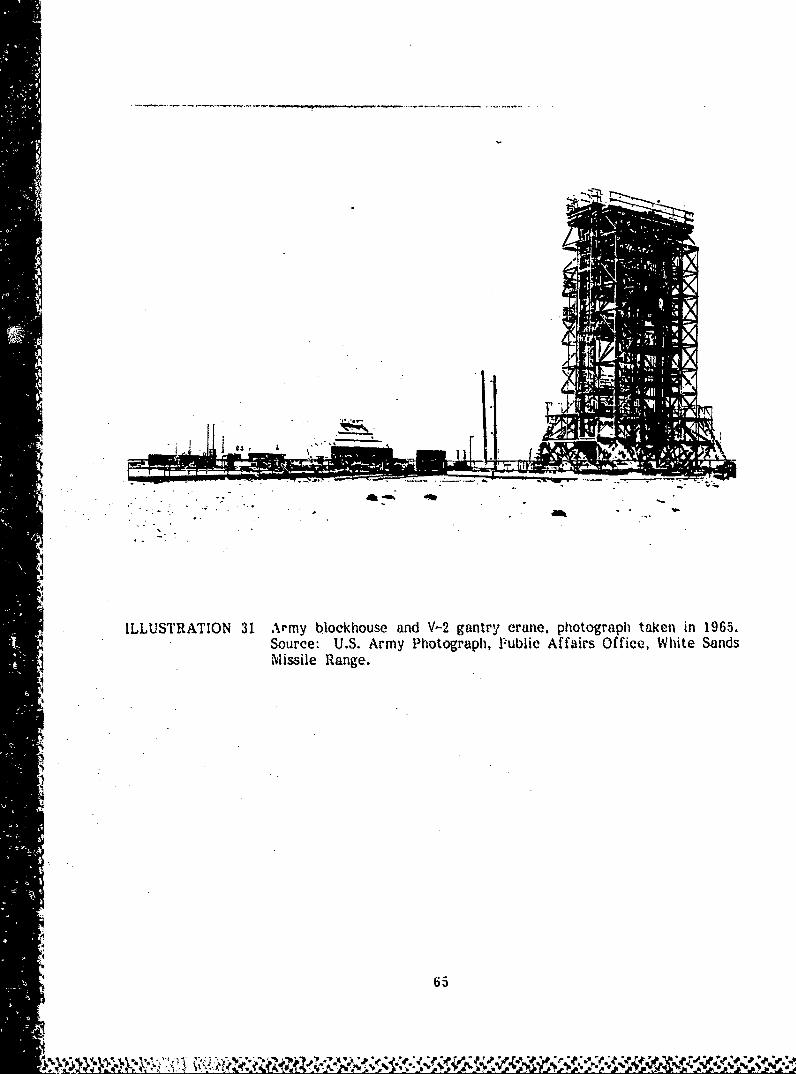
launch site during actual rocket firings.24 (Illustrations 31-34)
From 1946 through 1951, a total of 67 V-2 rockets were launched and tested
at this site. LJaunch Complex 33 remains virtually intact; both the V-2 gantry
crane and the Army blockhouse are in good condition. The blockhouse is
still in use and the gantry crane has recently been cleaned and painted. The
complex was listed on the New Mexico Register of Cultural Properties in
1977 (Property No. 0580). 25 (Illustration 35)
In 1946, the Naval Ordnance Missile Test Facility at White Sands constructed
its own rccket firing facilities two miles east of the Army blockhouse at
what is now Launch Complex 35. A launch pad anId two steel launcii towers
(Buildings 23230 and 23231) were completed in 1946 to facilitate testing of
the Aerobee and other early Navy missiles. The Navy's reivforced conc,*ete
"- 4' 64
AA
.4
ILLUSTRATION 31 Army blockhouse and V-2 gantry crane, photograph taken in 1965.Source: U.S. Army Photograph, lPublic Affairs Office, White SandsMissile Range.
a 65

'AA
*~~~ '~~uILUSTRATION 32 V-2 rocket test firing c. 1946. Source: U.S. ArmyPhotograph, Public Affairs Office, White Sands N-issideRange.
66

"I -SR TO 3 -
-. 194 .. Suc- US iyPoogah lb far
Ofie 'it ad isieRne
.67

hoj
*1 ~4.J 1
0 0~
68:
'IU6. r CC

ILLUSTRATION 35Army blockhouse and V-'2 gantry erawlo today. Source:Field inventory photographs. 1983. David G. Buchanan.
Building Technology. Inc.
i69
blockhouse (Building 23240), finished in 1947, is similar to the Army's, but
slightly smaller. The Navy's U.S.S. Desert Ship facility (Building 23270) was
constructed in 1953 as a control center and radar building with instrumentation
capable of simulating sea-like conditions for various missile tests. The Navy
blockhouse and the Desert Ship are still in active use by the Navy. 2 6
(Illustration 36)
Other early launch facilities in the South Launch Area include Launch
Complex 32, containing the Sergeant Missile (1958) and Hawk Missile (1959)
facilities; Launch Complex 36, including the Little Joe II complex (1958 - 1968);
and Launch Complex 38, originally constructed in 1959 as the assembly and
launch area for the Nike-Zeus missile. 27
In addition to the early launch facilities, several stands were built to static
test rocket motors. The first was constructed early in 1946 for testing a
V-2 rocket motor. The initial test took place on March 15, when a V-2
motor was fired continuously for 57 seconds. The successful test led to
later aerial firings of the V-2 rocket. 28
This early static test stand, known as the 100,000 Pound (100K) Rocket
1Static Test Facility (Building 19300), was designed for te-sting liquid propel-
lant propulsion units with a capacity of 100,000 pounds thrust. Located in
A the southwest corner of the installation, it consisted of a reinforced concrete
flame pit and a 50 foot steel tower. During tests, a rocket engine was
vertically mounted on the tower and fired: flames from the rocket engine
were quenched by 900 gallons of water per minute supplied from a storage
"tank above tbe site. A blockhouwe with -b•nc corwrete wal6. contained the
70

~1 ,
4444
ILLUSTRATION 36 Navy blockhouse and launeh towers.and U.S.S. Desert Ship. The lWunchtowers date from 1946 and the bloek-house from 1947. The Desert Shipfacility was built in 1953 and earsimulate sea-like conditions for var-ious missile tests. Source: 'ieldinventory photographs, 1983. David G.Buchanan. Building Technology, Inc.
,4
,4

.4
Z-I 4T
401~
- ~.* .- 4 .,
21,
tILLUSTRATION 37, 100,000 Pound Static T est St mc in oper!It on, nodaite was gilen for the photogratph. Source: U .S.Army Phot ogrnph. Public Affairs Office. Whiute
"A ~Sands Missile Range.
III- - -
observation and instrumentation space. Instrumentation on 86 channels provided
data on such parameters as temperature, pressure, vibration, and acceleration. 2 9
(Illustration 37)
The 100K facility served the V-2 rocket program from 1946 to 1949. In
1951, it was modified for firing the CORPORAL missile, and in 1956 an
outrigger engine mount was added as part of the CORPORAL tests. The
facility is now abandoned. Its blockhouse and the concrete flame pit remain,
but the steel tower has been dismantled and all instruments removed. 3 0
(Illustration 38)
In 1947, the planning and design of a larger static test stand was begun for
firing liquid propellant rocket motors for extended durations with up to 500,000
•4 pounds of thrust. Construction of the 500,000 Pound (500K) Rocket Static
Test Facility (Building 19241) was begun in 1948 and completed in 1950.
This test stand included two liquid fuel tanks (each with a concrete barrier),
two pump houses, an underground control room, a steel frame engine mount,
and a concrete flame pit lined with steel plates. During tests, the flames
from a rocket engine were diverted into this pit and quenched by 3000 gallons
of water per minute supplied from a nearby storage tank.31 (Illustration 39)
In 1951, the test stand was altered and the engine mounting, originally a 60
* degree mount, was replaced by a steel frame tower 60 feet high that held
She test engine in a vertical position. The maximum thrust capacity of the
* facility was reduced from 500.000 to 125.000 pounds.4
The 500K facility was tile largest test stand constructed at White Sands. In
-150 nd 0951 it was used in a series of long duration tests with V-2 rockets.
After a modification in 1951. the test stand was used for acceptance firings
73
XW.* . . - V% !u ~~,...

4A
Id
ILLUSTRATIION 38 1OO,000 Pound Static Test Standtoday. Source: Field inventoryphotographs, 1983. David G. BuIch-anan. Building Technolog.* Inc.
• 74
I,• •, '• ,;,.;..,'•',,, ,•,'. .,,,.;.. ... , ,•...,• . -. . . . .• . . ,,.... ,, ..... . .,
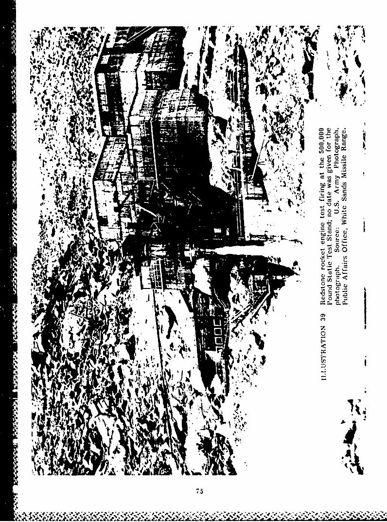
W, 4
A'A
*0 -
0oi2
VUuOttL
cc E-
bCD
100,
41
It5
qi4

of the Redstone missile power plant, and after 1956, for test firings of the
Nike Ajax and Nike Hercules missile systems. It is presently abandoned and
stands in a deteriorated state. Although the basic structure is intact, its
instrumentation and fuel storage tanks have been removed. A concrete
observation bunker, located just west of the test stand, still remains in good
condition. 3 3 (Illustration 40)
A third major static test stand was completed in early 1954: the 300,000
Pound (300K) Solid Propellant Test Facility (Building 19468). It consisted of
four concrete test bays, an open test pad, and an observation bunker. Two
test bays accommodated a thrust of 300,000 pounds, and two were rated for
1 5,000 pounds thrust. This facility has since been modified to conduct motor
vibration and other tests, and no longer reflects its original use.3 4
An important component of even Wie earliest tests at White Sands was the
collection of data on the flight performance and characteristics of rockets
and missiles, In 1946, the first instrumentation site, "A" Station, was
established one mile south of the Army blockhouse. Two instrument trucks
and ten men from the Signal Corps Engineering Laboratories at Fort Monmouth.
New Jersey. were stationed at White Sands to provide communications equip-
ment for the range. The first missile they suecessfully tracked was a V-2
rocket fired on April 16. 1946-35
lBecaus, of its proximity to the launch site, tracking from "A" Station proved
difficult, and its etquipnment was moved to a new site, "C'" Station. about 3Ot
miles south of the Army blockhouse. "C" Sta.ion served as the first permanent
76
-- 9
N ~ ~ 9~i~J,

-�
A
� '
-� -
2�')'
I
A
N -� ;j**. -
-w
'1�. -i..1 '.'* II'UE�!
�JII,I *IW�j .� L. �
- �J 0---*
- VN _
J�v
4..
) -
p
4.
�
S
I.S � uI.I.�i*
'4.

control center, combining all missile control and tracking facilities in one
area. The site still serves as a control center. The present two story con-
crete block structure (Building 21925) dates from 1959. Three FPS-16 Radar
sets, also dating from 1959, provided ifiormation about range safety control
and aided in-flight tests.3G
The missile range now has more than 1,000 precisely surveyed instrumenta-
tion sites and over 700 optical and electronic instrument buildings. 37 Optical
measuring systems include tracking telescopes and terminal telescopes, non-
tracking fixed camera-. an irtetheodolites. Cinetheodolites produce filmed
records of missile tests that provide information about location, acceleration,
and missile flight performance. iTelemetty ,%_ý other electror,'c measuring
systems, including fixed and mobile radar units, provide data on internal
conditions and performance of the rocket's engine during testing. 3 8
(Illustration 41)
In 1951, the Small Missile Range was established just north of U.S. Highway 70.
This one by ten mile test range has launch facilities and fixed camera instrument
buildings. Launch facilities, missile assembly warehouses, and storage buildings
are located in the southern end of the site. A flight control building
(Building 27170), constructed in 1953, houses an observation tower and instru-
ment rooms. Bowen-Knapp Camera Stations are evenly sgced in parallel
-- I rows on both sides of the range to record flight performance. The Small
Missile Range was first used to test the LOKI missile, test-fired at White
Sands from l1ýl to 1955. The site still tests hand-held and mobile launch
missiles.3 9
78

". ... I!10 I,`
,••.,
ILLUSTRATION 41 Instrumentation sites at White Sands. There are over1,C(J0 precisely surveyed instrumentation sites and morethan 700 optical and electronic instrument buildings onthe range, of which these are examples. Above left,radome (1954) on elevated platform. Above right,Bowen-Knapp camera station (1952). Below, cinetheo-dolite (1961) on elevated platform. Source: Fieldinventory photographs, 1983, David G. Buchanan, Build-ing Technology, Inc.
79
.ýN j'Ne*-- ¾- -z

After completion of the first permanent launch and test facilities in 1945
and 1946, contracts were let for larger, semi-permanent buildings in the main
post area. One- and two-story 800 series wood buildings were constructed to
serve as administrative buildings, barracks, mess halls, recreational facilities, and
laboratories. Some still remain; Buildings 108, 109, 118, and 119, for example,
were constructed in 1947 as barracks and are now used as administrative
buildings. 4 0 (Illustration 42)
In the spring of 1946, construction began on a Naval cantonment adjacent to
the Army cantonment area. Several structures remain, including six quonset
huts (Buildings 418-421, 442, and 446) originally built to provide additional
housing for Navy enlisted personnel. Three quonset huts built in 1947 as
41shop buildings (Buildings 1472, 1473, and 1475) also remain.
Betwe.-a 1•6 rid 1956, the main post area assumed the general appearance
it has today. Major permanent construction included a headquarters building
(Building 100), completed in 1951; a major administration building (Building 1530)
also completed in 1951 and used today as the National Range Headquarters;
a laboratory (Building 1512), completed in 1954; and a fire station (Building 155),
completed in 1950. These masonry st-Puctures are located in the administration
and troop area and the technical area of the main post. Five major missile
assembly buildings (Buildings 1540, 1544, 1550, 1554 and 1558) were also built
in the technical area between 1946 and 1955. These large steel warehouse
structures accommodated the expanded number of missile tests conducted
during this period. Various small warehouses and shops and a maintenance
facility (Building 1790) were built in 1948.
80
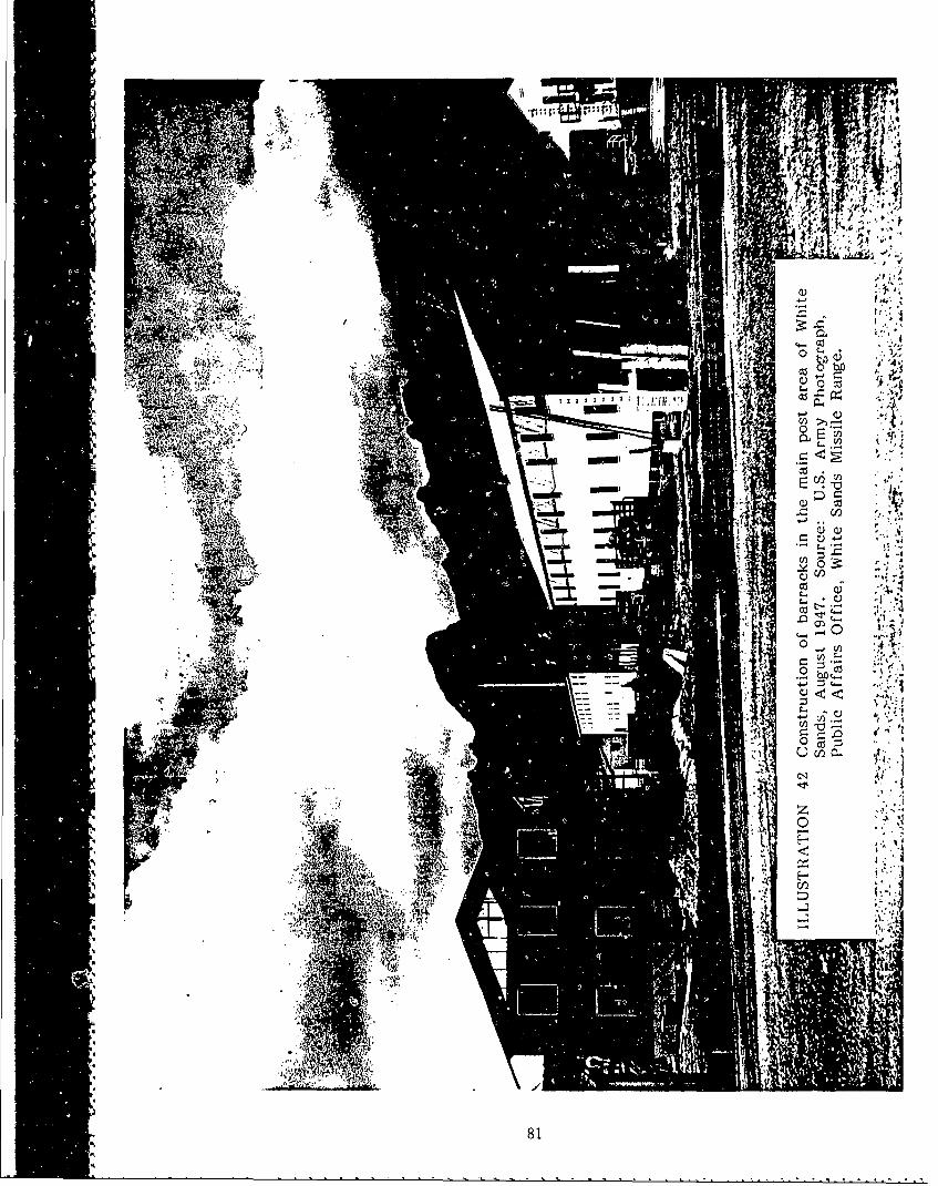
*E 14
i '. I
+jV
.11k 'I; '
cq, ~
Al*~ ..
. . .. . . . ....
81

Construction focussed on housing and community facilities between 1946 and
1956. The Army and the Navy housing areas went up on the western edge
of the main post, separated from the administration and technical areas.
One- and two-family houses were planned on an irregular street grid. These
dwellings, built of concrete block with a stucco finish, provided permanent
housing for 430 families. Between 1953 and 1956, three permanent barracks
(Buildings 128, 129 and 143), an elementary school, a commissary, and a
cafeteria were also built, as well as a branch U.S. Post Office, a bank, and
a post exchange. (Illustration 43)
Since 1956, many of the wood cantonment buildings in the main post area
have been demolished. New construction has included two permanent barracks
and a mess hall (Buildings 124, 126 and 160), built in 1959; a number of
warehouses and fabrication shops; additional housing units erected between
1958 and 1961; and additional community facilities, including a chapel
(Building 265), completed in 1961, a new post exchange (Buildiig 260), a
health clinic (Building 530), and a number of recreational facilities.
Missile Park, a triangular shaped site at the intersection of Headquarters and
Nike Avenues in the main post area, has served as an outdoor missile museum
since 1955. The park features examples or models cf the many Army, Navy,
and Air Force missiles and rockets tested at the range. The missiles are
displayed in typical firing attitude.
The first three missiles installed at Missile Park were the German V-2, the
American version of the German V-i (known as the Loon), and the U.S.
82
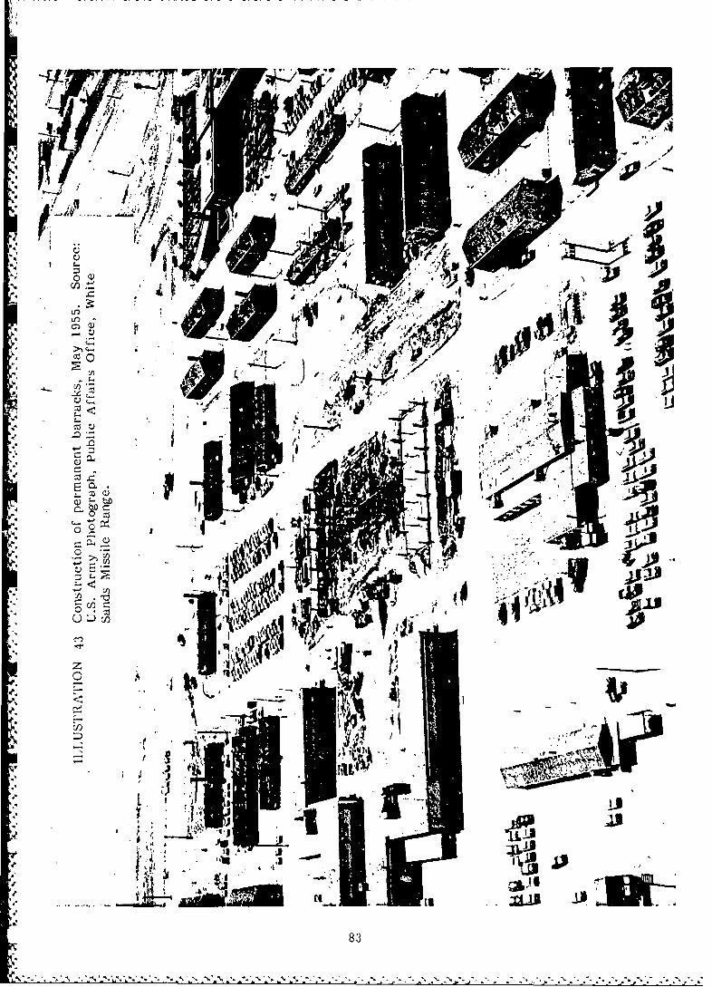
*O
LL
t -j
-'I 74FA,.
83L
• -.• I - j, -
o - S ' pil I
L L3• ~ - --
83
Army's Nike I, later known as the Nike-Ajax. The remaining missiles have
been donated by the private contractors that developed and built them. 4 3
(Illustration 44)
Four major up-range communication and instrumentation centers were estab-
lished beginning in the early 1950's. These areas provide technical and
support facilities for the range. Virtually all the range center buildings are
simple wood or cinderblock buildings. 4 2
Rhodes Canyon Range Center, lvcated mid-range, is a permanent operational
area that provides communications and maintenance support. A communiea-
tions repeater building (Building 30724) was built here in 1952. Other major
facilities include a carpenter shop (Building 30780), built in 1953; an instru-
mentation building (Building 30728), built in 1955; a telephone exchange
building (Building 30726), built in 1957; several maintenance and storage
facilities; and a 20-man crew shelter with mess (Building 30740), built in
1960.
Stallion Range Center, headquarters for north range operations, is located
near the northwest corner of White Sands, 104 miles north of the main post
area. The Army built a generator building (Building 34182), an instrumentation
building (Building 34181), and a cinetheodolite building (Building 34183) in
1953. The center also includes a 40-man barracks (Building 34215), built in
1955, and four 40-man crew shelters (Buildings 34213, 34224, 34226, and 34228),
built in 1960.
84

* .1
- .0'
.14
II
q4
Oscura Range Center, located in the northeast corner of the mid-range area,
provides technical support and serves as a temporary base for missiles fired
downrange. The center includes an instrument building (Building 31766), built
in 1953, and a 40-man barracks (Building 31725), built in 1956.
North Oscura Range Center consists of four separate areas, located 4 miles
apart, atop the Oscura Mountains in the northeast corner of the Range. No
longer functioning as a support area, it is used today mainly for missile
tracking instrumentation and communications for north range tests. There
are several instrumentation buildings: Building 33200, built in 1952;
Building 33152, built in 1953; Building 33153, built in 1954; and a com-
munications building (Building 33170), built in 1955. A 40-man crew shelter
(Building 33130) was built in 1953.
HOLLOMAN AIR FORCE BASE SUPPLEMENTAL AREA
The Holloman Air Force Base Supplemental Area contains the Holloman Test
Track, an aerospace ground test facility used to simulate flight conditions
under a closely controlled environment. The track provides a link between
laboratory investigations and full-scale flight tests. Specially designed test
vehicles, powered by either liquid or solid propellant rocket engines, are
accelerated along the test track at speeds of up to 7,000 feet per second
(Mach 6) to measure the performance of a wide variety of items at high
speeds or under great acceleration or deceleration stresses. 44
(Illustrations 45 and 46)
86

I -. - -.
-A.* * A-
ILLUSTRATION 45 An aerial view of the Holloman Test Track, looking north;no date given for the photograph. Source: Tile HollomanTrack, Armament Division, Holloman Air Force -Iase, NewM-exico, 1974.
87

IL::.,.JfTRA , ION 46
Typical example of a test sled.
A monorail sled durin~g a high speed erosion test.4"•
A typical monorail sled at high speed.
Source: The Holleman Track, Armament Division, Holloman Air Force Base,New Meico, 1-974.
38

The track was designed in 1950 as a test facility for the Snark missile.
Originally 3,500 feet long, it was extended in 1956-57 to 35,000 feet to
accommodate a greater range of missile tests. An additional 5,588 feet of
track was laid in 1966, and the last addition in 1972 expanded the track to
50,788 linear feet, just under 10 miles.4 5
The track is constructed of heavy duty crane rails supported on a continuous
reinforced concrete girder. Most of the track is a two-rail design, although
the final 15,200 foot extension incorporates a third rail for special three-
track test sleds. The tracks are precisely aligned to assure a high degree of
straightness and surface smoothness. 4 6
The test facility also includes four blockhouses, a centrally located telemetry
station, a multiplicity of instrumentation sites, and shop buildings for rocket
sled fabrication and preparation. The blockhouses are used as control buildings
to launch sleds from different positions along the track, and the telemetry
station (known as the Midway Building) serves as the central facility for
telemetry and data recording. 4 7 (Illustration 47)
Major electronic data systems at the test track record information about sled
position, velocity, and acceleration. Optical instrumentation is also widely
used. Special cameras having two major optical systems are employed for
recording high speed tests. The first is a metric optical instrument that
photographs the test sled in relation to precisely surveyed sites. The accel-
eration and velocity of a sled can be computed from tiis photographic data.
The second system is Image Motion Compensation (IMC) photography, which
provides a detailed view of a test object as it passes a given point on the
89
... ....

0 E
h at
t) t
-at10 Ii
4 I
900

track. Traditional motion picture coverage is also provided during rocket
tests.4 8 (illustration 48)
The Hoiloman Test Track performs a wide variety of tests. It frequently
tests aircraft ejection seats at operational speeds that closely simulate flight
conditions. Environmental tests are also frequently performed at the Holloman
track: rain, hail, and dust are ingeniously simulated by special machines to
test a mis�nIe oi warhead's ability to withstand various 'iimatic or atmo-
spheric conditions. The Hoiloman Test Track also does aerodynamic, re-
entry, and impact testing for both military and civilian users.4 9
(illustration 49)
I'
UTAH LAUNCH COMPLEX
The Utah Launch Cample,� is a subinstailation of White Sands Missile Range
located in eastern Utah approximately two miles east of the town of Green
River. It is sited on mostly barren land and consists of 6.309 cres of exclu-
save use and 11,872 acres of co-use property. There are no pre-military
structures on the site. Prior to becoming inactive in 1979. it functioned as
an off-iang� missii� test facility for Air Force and Army missile programs.
The Air Foree established Green River in 1962 as a remote :nissile launch
site for �he ABRES (Advanced Ballistic Re-entry System) program, and from
Fcbru�ry. 1964, to August. 1973. Athena rockets were launched from Green
River to targets 4S0 miles away at White Sands.20 In 1971. the Army
relocated its Pershing missile launch site to Green River from Gilson Butte �1
91
* Vj�,'

II
ILLUSTRATION 48 An example o&" a shadowgraph of a test sled taken at
high1 specci by image motion com~pensation (1MC) photo-graphic technique. Source: The liolloman Track,
Mexico. 1974.
92

jt''
Ala
ILLUSTRATION' 49 A eteecints cnutd tteHlmnTs
Trck Sore ie5-lmnTvk rnmn
Diiin Hoa'-.--r---6 c 8.--'t-ewMexco½174
93 ~ '1

The Utah Launch Complex consists of a headquarters area, the Athena Launch
Complex, and the Pershing Launch Complex. The headquarters area, established
in 1962, was originally composed of trailers and prefabricated steel buildings
that housed officer, maintenance and technical facilities, a telephone exchange,
a .inirg hall, a fire station, and housing for military and civilian workers.
Th' Olsin Construction Company of Salt Lake City was the prime contractor.
Mont of the steel buildings remain, but many of the trailers have been removed. 5 2
The Athena Launch Complex, built in 1963, includes a blockhouse and three
launch pads. Launch Pad 1 (Building 50253) and Launch Pad 2 (Building 50291)
are covered by a Temperature Controlled Environmental Enclosure (TCEE), a
steel building that provides a controlled environment for assembling and
preparing missiles for launch. Sited on rails, it can be rolled away from the
launcher prior to firing. The TCEE has been removed from Launch Pad 3.
Nearby a reinforced concrete blockhouse (Building 50207) houses instruments
and launch control equipment. A separate instrumentation site on a mountain
ridge near the northern border of the facility tracks missiles after launch.
This site includes radar and telemetry systems, optical and frequency moni-
toring systems, and a meteorological station. The Pershing Launch Complex
was established in 1971, but all that remains of this site is an earth, wood,
and concrete protective bunker and a concrete launch pad.5 3 (i;ustrations 50
and 5 1)
94
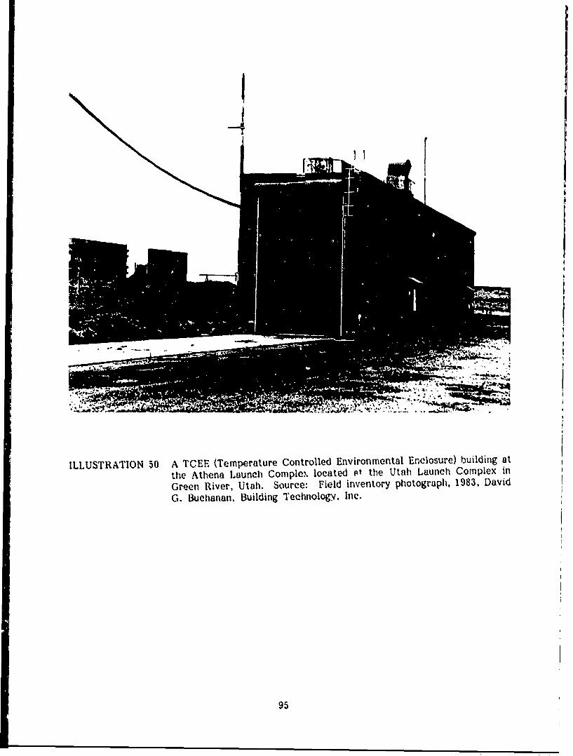
ILLUSTRATION 50 A TCEE (Temperature Controlled Environmental Enclosure) building atthe Athena Launch Complex, located st the Utahl Launch Complex in
Green River, Utah. Source: Field inventory photograph, 1983, DavidG. B~uchanan, Building Technology. Inic.
95

4T
4
ILLUSTRATION 51 Concrete blockhouse at the Athena Launch Complexlocated in the Utah Launch Complex at Green River,Utah. Source: Field Inventory Photograph, 1983.
96

NOTES
1. Public Affairs Office. White Sands History, pp. 47-48; see also Frank J.Malina, "Origins and First Decade of the Jet Propulsion Laboratory," TheHistory of Rocket Technology, pp. 46-66.
2. White Sands History, pp. 49-55.
3. Ibid.
4. Ibid pp. 55-62.
5. Ibid, pp. 62-96; see also Frederick I. Ordway and Mitchell R. Sharpe, TheRocket Team, pp. 344-362; and E. J. Tangerman, "Nazi Vengeance: TheGerman V-2 Rocket Flies Again at White Sands Proving Ground," ArmyOrdnance, pp. 153-155; Harvey Riukins, "A Report on the OrdnanceFirings at White Sands," Army Ordnance, pp. 429-431; White Sands MissileRange, Fact Sheet, "V-2 Story."
6. White Sands Missile Range, Fact Sheet, "White Sands Missile Range at aGlance;" see also Ernst Stuhlinger, "Army Activities in Space - A History,"IRE Transactions on Military Electronics, pp. 64-69.
7. White Sands Missile Range, Fact Sheet, "Extended Range Sites, Utah andIdaho."
8. White Sands History, pp. 28-30; White Sands Missile Range, Fact Sheet,"White Sands Missile Range at a Glance," p. 5.
9. White Sands Missile Range, Fact Sheet, "White Sands Missile Range at aGlance," pp. 5-6.
10. Ibid, pp. 6-7; see also White Sands Missile Range. Fact Sheet, "SpaceSFhtle at White Sands Missile Range."
11. White Sands Missile Range. Fact Sheet, "Hi! ,a 3 Background of WhiteSands Missile Range," pp. 2-3; Whit.e Sands ,*,e -winge, Installati,',nEnvironmental Impact Assessment, p. 31.
12. Paige W. Christiansen, "Dona Ana County, Newv Mexico: Historic Themes,"Guidebook to the Las Cruces Country, pp. 71-73; White Sands Missile(VngeW Fact Sher, "Historical Background of Wh:.te Sands Missile Range,"pp. 3-11, 16-21; T. E. Kelly, "The Lost Padre Mine and the Organ MiningDistrict," Guidebook to the Las Cruces Country, pp. 163-165; WhiteSands Missile Range. Fact Sheet. "Historical Background of White SandsMissile Range," p. 19.
13. Personal interview with Peter Eidenbach. Human Systems Research. Inc..Tularosa. New *Mexico, February. 1983; and brochure entitled. "DividendMining and Milling Company at Estcy City, New Mexico," c. 1905.
97

14. Peter L. Eidenbach and Mark Whimberly, Archaeological Reconnaissancein White Sands National Monument, see "The Lucero Ranch - Lawman'sRetreat," pp. 17-18; see also Janet A. Stewart, Arizona Ranch H-rouses:Southern Territorial Styles, 1867-1900; and 0. E. Meinzer and R. F. Hare,Geology and Water Resources of Tularosa Basin, New Mexico, pp. 118-119.
15. National Register of Historic Places, Trinity Site, Nomination, 1972.
16. Lansing Lamont, Day of Trinity, pp. 235-256; Los Alamos ScientificLaboratory, Los Alamos 1943-1945, The Beginning of an Era, pp. 29-57.
17. ibid.
18. Ibid.
19. White Sands History, pp. 14-15.
20. Ibid, pp. 16-17.
21. Ibid.
22. Ibid, pp. 20-21.
23. New Mexico State Register of Cultural Properties; White Sands History,p. 22.
24. Ibid.
25. Ibid.
26. Field inventory and White Sands Real Property Inventory.
27. Ibid.
28. Special Report, "100,000 Pound Rocket Static Test Stand," pp. 1-7.
29. Ibid.
30. Installation Environmental Impact Assessment, p. 15; field inventory.
31. Special Report, "500.000 Pound Rocket Static Test Stand," pp. 1-2. E-l1;see also John W. Herrick, Rocket Encyclopedia, pp. 502-507.
32. Ibi__.
33. Installation Environmental Impact Assessment. p. 15; field inventory.
34. Special Report, "300,000 Pound Rocket Static Test Stand," p. 1.
35. White Sands hlistory• pp. 25-26.
98

36. Ibid.
37. White Sands Missile Range, Fact Sheet, "White Sands Missile Range at aGlance."
38. Ibid.
39. White Sands History, pp. 120-124; field inventory.
40. bi pp. 22-24.
41. bI.
42. Installation Environmental Impact Assessment, pp. 16-25 and Real PropertyInventory.
43. White Sands Missile Range, Fact Sheet, "Missile Park."
44. Armament Division 6585th Test Group Test Track Division, The HollomanTrack, pp. 1-2; see also Herrick, pp. 419-420.
45. Ibid, p. 5.
46. Ibid, pp. 5-6.
47. Field inventory.
48. Holloman Track, pp. 35-44.
49. jp. 3 13,
pp. 19_s t
5ý0. Ti omas G. Alexander, "Brief Histories of Three Federal Military Installationsin Utah," Utah Historical Quarterly. pp. 132-137.
51, White Sands Missile Range, Fact Sheet, "Extended Range Sites in Utahand WdoIo," pp. 1-2.
52 White Sands Missile Range, Installation Environmental Impact Assessment,p. 30.
53. Ibid.
9
99

Chapter 3
PRESERVATION RECOMMENDATIONS
BACKGROUND
Army Regulation 420-40 requires that an historic preservation plan be developed
as an integral part of each installation's planning and long range maintenance
and development scheduling.1 The purpose of such a program is to:
. Preserve historic properties to reflect the Army's role in historyand its continuing concern for the protection of the nation's heritage.
0 Implement historic preservation projects as an integral part of theinstallation's maintenance and construction programs.
Find adaptive uses for historic properties in order to maintain themas actively used facilities on the installation.
Eitninate damage or destruction due to improper maintenance,repair, or use that may alter or destroy the significant elements ofany property.
Enhance the most historically significant areas of the installationthrough appropriate landscaping and conservation.
To meet these overall preservation objectives, the general preservation recom-
mendations set forth below hrave been developed:
Category I Historic Properties
All Category I historic properties not currently listed on or nominated to the
National Register of Historic Places are assumed to be eligible for nomination
regardless of age. The following general preservation recommendations apply
to these properties:
1O00
a) Each Category I historic property should be treated as if it were
on the National Register, whether listed or not. Properties not
currently listed should be nominated. Category I historic properties
should not be altered or demolished. All work on such properties
shall be performed in accordance with Sections 106 and 110(f) of
the National Historic Preservation Act as amended in 1980, and the
regulations of the Advisory Council for Historic Preservation (ACHP)
as outlined in the "Protection of Historic and Cultural Properties"
(36 CFR 800).
b) An individual preservation plan should be developed and put into
effect for each Category I historic property. This pian should
delineate the appropriate restoration or preservation program to be
carried out for the property. It should include a maintenance and
repair schedule and estimated initial and annual costs. The preser-
vation plan should be approved by the State Historic Preservation
Officer and the Advisory Council in accordance with the above
referenced ACHP regulatiun. Until the historic preservation plan is
put into effect. Category I historic properties should tv maintained
in accordance with the recommended approaches of the Secretary
of the Interior's Standard. for Reliabilitation and Revised Guidelines
for Rehabilitating Historic D!uildirsq and in consultation with the
State Historic Preservation Officer.
101

c) Each Category I historic property should be documented in accor-
dance with Historic American Buildings Survey/Historic American
Engineering Record (HABS/HAER) Documentation Level II, and the
documentation submitted for inclusion in the HABS/HAER collections
in the Library of Congress. When no adequate architectural drawings
exist for a Category I historic property, it should be documented in
accordance with Documentation Level I of these standards. In
cases where standard measured drawings are unable to record sig-
nificant features of a property or technological process, interpretive
drawings also should be prepared.
Category II Historic Properties
All Category U historic properties not currently listed on or nominated to
the National Register of Historic Places are assumed to be eligible for nomi-
nation regardless of age. The following general preservation recommendations
aply to these properties:
a) Each Category 11 historic property should be treated as if it were
on the National Register. whether listed or not. Properties not
currently listed should be nominated. Category 11 historic prop-
erties should not be altered or demolished. All work on such prop-
erties shall be performed in accordance with Sections If and
110(f) of the National Historic Preservaeion Act as amended in
1980, and the regulations of the Advisory Council for Historic
Preservation (ACHP) as outlined in the "Protection of Historic ,nd
C,iltural Propertie'" (3C CFR 800).
102

b) An individual preservation plan should be developed and put into
effect for each Category IR historic property. This plan should
deiineat- the appropriate preservation cr rehabilitation program to
be carried out for the property or for those parts of the property
which contribute to its historical, architectural, or technological
importance. It should include a maintenance and repair schedule
and estimated initial and annual costs. The preservation plan should
be approved by the State Historic Preservation Officer and the
Advisory Council in accordance with the above referenced ACHP
regulations. Until the historic preservation plan is put into effect,
Category II historic properties should be maintained in accordance
with the recommended approaches in the Secretary of the Interior's
Standards for Rehabilitation and Revised Guidelines for Rehabilitating
Historic Buildings4 and in consultation with the State Historic
Preservation Officer.
c) Each Catego.*y 11 historic prope.rty should be documented in aecor-
dance with Historic American Buildings Survey/Historic Amnerican
Eigineering Record (IJABS/IAER) Documentation Level II, and tWe
documentation submitted for inclusion in the HArSiMAER colkie-
tions in the Library of Congrest.
Category I[_ Histeric Properties
The following preservation re-omnmendaticns apply to, Category III historic
properties:
103
a) Category III historic properties listed on or eligible for nomination
to the National Register as part of a district or thematic group
should be treated in accordance with Sections 106 and 110(f) of the
National Historic Preservation Act as amended in 1980, and the
regulations of the Advisory Council for Historic Preservation as
outlined in the "Protection of Historic and Cultural Properties"
(36 CFR 800). Such properties should not be demolished and their
facades, or those parts of the property that contribute to the
historical landscape, should be protected from major modifications.
Preservation plans should be developed for groupings of Category III
historic properties within a district or thematic group. The scope
of these plans should be limited to those parts of each property
that contribute to the district or group's importance. Until such
plans ae'e put into effect, these properties should be maintained in
accordance with the recommended approaches in the Secretary of
the Interior's Standards for Rehabilitation and Revised Guidelines
for Rehabilitating Historic Buildings 6 and in consultation with the
State Historic Preservation Officer.
b) Category III histori,.' properties not listed on or eligible for nomina-
tion to the National Register as part of a district or thematic
group should receive routine maintenance. Such properties should
not be demolished, and their facades, or those parts of the property
that contribute to the historical landscape, should be protected
from modification. If the properties are unoccupied, they should,
as i minimum, be maintained in stable condition and prevented
from deteriorating.
104
r.% ..A -,-- -.A.P , % .+s :,4 ,- *.- '--.*',, r , -"*0'-"'. . ..' . .'.t . ''."% ' ."" k*-'. .. .

HABS/HAER Documentation Level IV has been completed for all Category Ill
historic properties, and no additional documentation is required as long as
they are not endangered. Category III historic properties that are endangered
for operational or other reasons should be documented in accordance with
HABS/HAER Documentation Level III, and submitted for inclusion in the
HABS/HAER collections in the Library of Congress.' Similar structures need
only be documented once.
CATEGORY I HISTORIC PROPERTIES
Trinity Sit',
SPackground and significance. Trinity Site, the location of the test
explosion of the world's first atomic bomb, is a National Historic Land-
mark and is listed on the National Register of Historic Places. Existing
properties at Trinity Site include: Ground Zero, the site of the detona-
"tion; Jumbo, the specially designed, but never used, giant plutonium
containment vessel; the camera and instrumentation bunkers to the
"north, northwest, and west of Ground Zero used to record the test; the
McDonald ranch house, where the active nuclear core components oi
the bomb were assembled; and the remains : Base Camp, the on-site
test headquarters.
These properties are all closely associated with the Trinity test, an
event of major importance to the 20tn century and perhaps to the
history of mankind. Because of this association. Ground Zero, Jumbo.
105
•'•.:,•~~~4 -f?,",• • ,+ .,,,,.,.,• .,,,, .' +.,.•,.,' J+ P ' Ca 4',V,' •, I,% +e ',% •,¢ ,', ,+, ,€, %.'+ ' .,€,€ +, ..--0% , ..- ••,•.-., / .-

the camera and instrumentation bunkers, the McDonald ranch house, and
the remaining structures at Base Camp are Category I historic properties.
. Condition and potential adverse impacts.
1) Ground Zero. The area around Ground Zero was covered with a
greenish glaze of fused sand and dirt particles when scientists first
visited the detonation site after the blast. A low wooden shelter
was erected over a portion of the material, named "trinitite" by
Al the project scientists, to perserve it intact. The remainder of the
trinitite has been scattered, but the site is otherwise unaltered and
is protected by two large concentric circles of cyclone fencing.
The wooden shelter that covers the trinitite is in fair condition.
There are no plans to further disturb or otherwise modify the site.
2) Jumbo. Jumbo was unaffected by the explosion, and attempts were
later made to destroy the huge vessel. Its hemispherical ends were
removed by explosives, but further attempts to demolish Jumbo
failed, and it was later moved to its present location at the entrance
to Ground Zero. There are no plans to alter or move this property.
3) Camera and instrumentation bunkers. The remaining bunkers at 600
yards northwest, 800 and 10,000 yards west, and 800, 1,000, and
_'4' 10,000 yards north are intact, although several have suffered minor
d damage in the past, perhaps partially from the test itself. There
are no plans to alter or otherwise disturb these properties.
106
4) George McDonald ranch house. The ranch house has deteriorated
significantly since the Trinity test, although no serious structural
damage was caused by the shock wave from the blast (some of the
existing window, roof, and chimney damage, however, occurred at
that time). Stabilization of the structure began in 1982 and a
definitive plan to determine the level of preservation appropriate
for the structure has been prepared.
5) Base Camp. All of the temporary buildings erected by the Army
at Ldse Camp were dismantled after the test. The wood frame
and adobe ranch houses and the wood shed that remain are in poor
condition. The wooden water tanK and two adjacent tank and
w',idmill structures are highly deteriorated. Several concrete foun-
daticns ;rom Tr~nity Cump (the floors of a generator shed, latrine,
and garage) are intact. At present, there are no plans to disturb
these properties.
Preservation option.
1) The McDonald ranen house nas been documenteri tv HABS/HAER
Docum'intation Level I. The following properties will be recorded
to HABS/HAER Documentation Level II: Jumbo and the towi.-r base
at Ground Zero; the instrumentation bunkers at West 800, North-
west 600, and North 800 and '060; the camera bunkers tt North
and West 10,000; and the ren'aning properties at the site of Base
Camp. Interpretive drawings will ie prepared showing the relation-
ships of these oropee'ties and their function in the Trinity test.
107
PfAI 4.1,4 At *N VA X,',--IAA%

2) An historic preservation plan should be developed and put into
effect for each of the above properties. The plan should focus on
the degree to which each property should be protected, stabilized,
or otherwise preserved. The buildings at Base Camp should be
excluded from the plan until current litigation over these properties
is resolved.
Launch Complex 33 (Army Blockhouse and V-2 Gantry Crane)
A Background and significance. Launch Complex 33 is of exceptional
* •historical significance because of its close association with the origins
of the American rocket program. It test fired 67 V-2 rockets between
1946 and 1951, the first major rocket firings conducted in the United
States. The V-2 was the first vehicle to carry scientific instruments
into the upper atmosphere, thereby greatly expanding atmospheric
research. As the first large rocket with a liquid propellant motor, the
V-2 provided the technological base for the Saturn 5, the rocket that
first launched American astronauts to the moon. The intercontinental
ballistic missile systems that have revolutionized strategic warfare are4
also technologically based on the V-2.
Major structures at Launch Complex 33 are the Army blockhouse
(Building 20814), built in 1945 as the first permanent structure at White
Sands; a 365' x 372' concrete launch pad with water spillway and blast
deflector; and ti.e V-2 gantry crane (Building 20820), a 75' moveable
steel tower with t'our work platforms for servicing the rocket in-place.
(See Chapter 2, Early Development of White Sands, and Illustrations 30-34).
"._'• 108
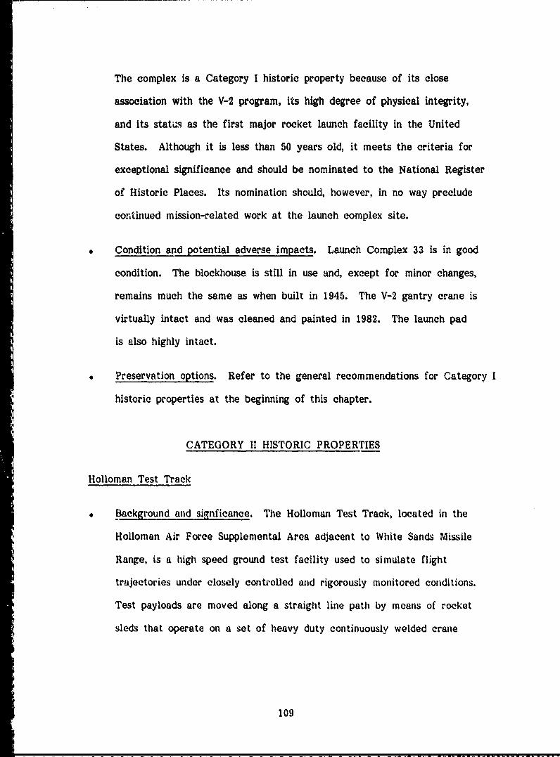
The complex is a Category I historic property because of its close
association with the V-2 program, its high degree of physical integrity,
and Its statas as the first major rocket launch facility in the United
States. Although it is less than 50 years old, it meets the criteria for
exceptional significance and should be nominated to the National Register
of Historic Places. Its nomination should, however, in no way preclude
continued mission-related work at the launch complex site.
"" Condition and potential adverse impacts. Launch Complex 33 is in good
condition. The blockhouse is still in use and, except for minor changes,
remains much the same as when built in 1945. The V-2 gantry crane is
virtually intact and was cleaned and painted in 1982. The launch pad
is also highly intact.
"* Preservation options. Refer to the general recommendations for Category I
historic properties at the beginning of this chapter.
CATEGORY II HISTORIC PROPERTIES
"Holloman Test Track
Background and signficance. The Holloman Test Track, located in the
Holloman Air Force Supplemental Area adjacent to White Sands Missile
Range, is a high speed ground test facility used to simulate flight
trajectories under closely controUed and rigorously monitored conditions.
Test payloads are moved along a straight line path by means of rocket
sleds that operate on a set of heavy duty continuously welded crane
109

rails 50,788 feet in length. Routinely capable of handling rocket sleds
at velocities of 7,000 feet per second (Mach 6), it is the longest, most
precisely aligned, and most completely instrumented facility of its kind.
The original track was built in 1950 and was expanded to its present
length in 1972. Support facilities include two rain simulation facilities,
an ejection test site, a blast test site, an impact test site, four block-
houses, a telemetry ground station (the Midway building) and amplifier
building, a track control facility, and storage, maintenance, and shop
facilities. The track remains fully operational today, and there are no
plans to discontinue its active use. (See Chapter 2, Holloman Air
Force Base Supplemental Area, and Illustrations 45-49.)
The test track is a Category 1H historic property because it is an impor-tant and highly unique work of engineering design. The property does
not meet the exceptional significance criteria of the National Register
for properties less than 50 years old because it is not yet truly historic
nor can it be termed exceptionally important to any major aviation or
space program.
* Condition and potential adverse impacts. The Holloman Test Track is
an actively used facility and is maintained as such. Changes are made
to the track and its supporting facilities as operational needs require.
There are no plans to discontinue its use.
Preservation options. Because the test track is an active facility and
must respond to changing operational needs, the general preservation
recommendations for Category 11 historic properties should not apply at
110

this time. The oldest part of the track will be 50 years old in the
year 2000. Its historical significance should be reevaluated at this
time, or earlier if the facility is to be altered significantly or
deactivated.
100,000 Pound Static Test Stand
-Background and significance. The 100,000 (100K) Pound Static Test
Stand, constructed early in 1946, was used until 1949 for testing V-2
rocket motors. An initial test took place in March, 1946, and subse-
quent tests led to later aerial firings of the V-2. The 100K facility
could test liquid propellant propulsion units with a maximum capacity of
100,000 pounds of thrust. It was later modified for testing the Corporal
missile, but has since been partially dismantled. (See Chapter 2, Early
Development at White Sands, and Illustrations 37 and 38.)
The 100K Static Test Stand is a Category II historic property because
of its association with the American V-2 rocket program. The facility
does not meet the exceptional significance criteria of the National
Register for properties less than 50 years old.
Condition and potential adverse impacts. The 100K Static Test Stand is
now abandoned. its blockhouse and concrete flame pit are still intact,
but its steel tower has been dismantled and its instruments removed.
The facility is deteriorating slowly with age. There are no current
plans to alter or demolish this property.
Preservation options. Refer to the general preservation recommenda-
tions for Category II historic properties at the beginning of this chapter.
Ill

500,000 Pound Static Test Stand
Background and significance. The 500,000 (500K) Pound Static Test
Stand was constructed between 1948 and 1950 for testing liquid propel-
lant rocket motors for extended firings with up to 500,000 pounds of
thrust. In 1950 and 1951 it was used for a series of long duration
tests of V-2 rocket motors. It was modified in 1951 for testing Redstone
power plants, and later Nike-Ajax and Nike-Hercules rocket motors.
The facility is no longer used. (See Chapter 2, Early Development at
White Sands, and Illustrations 39 and 40.)
The 500K Static Test Stand is a Category U historic property because
of its direct assocation with the American V-2 and other early rocket
programs at White Sands. It does not meet the exceptional signficance
criteria of the National Register for properties under 50 years old.
Condition and potential adverse impacts. The 500K facility has been
abandoned for some time and is deteriorating slowly with age. Although
the basic structure is intact, all instrumentation and the fuel storage
tanks have been removed. Its concrete observation bunker, located just
west of the test stand, remains in good condition.
Preservation options. Refer to the general preservation recommenda-
tions for Category II historic properties at the beginning of this chapter.
112

CATEGORY III HISTORIC PROPERTIES
V-2 Assembly Building (Building 1538)
Background and significance. Building 1538, a huge metal quonset hut
located in the middle of the main post area, was erected in 1945 to
repair and reconstruct captured V-2 rockets. All 67 V-2 rockets test
fired at White Sands between 1946 and 1951 were assembled in this
facility. It is the earliest existing building on the main post and is one
of the two remaining World War II era buildings at the installation (the
other is the Army blockhouse). The facility is no longer used for rocket
assembly, but its exterior appearance has changed little since 1945.
(See Chapter 2, Background and Early Development at White Sands, and
Illustrations 30 and 52.) The V-2 assembly building, although simply a
standard metal quonset hut, is a Category Ill historic property because
of its historical association with the V-2 rocket program.
" * Condition and potential adverse impacts. The facility is maintained in
good condition and is virtually intact. There are no current plans to
alter or demolish this property.
Preservation options. Refer to the general preservation recommenda-
R tions for Category III historic properties at the beginning of this chapter.
Launch Complex 35 (Navy Blockhouse, Launch Towers, and U.S.S. Desert Ship)
Background and signficance. The Naval Ordnance Missile Test Facility
at White Sands began the development of rocket firing facilities at
113

ILLUSTRATION 52 V-2 assembly building. Building 1531 wasbuilt in 1945 to assemble V-2 rocket partscaptured in Germany for test firing at WhiteSands. It remains intact today in the centerof the main post area (see also Illustratior.29). Source: Field inventory photograph,1983, David G. Buchanan, Building Tech-nolo~gy, Inc.
4!
ILLUSTRATION 53 Grtfe of Eugene Manlove Rhodes. Rhodes(1869-1934) was a prominent writer of west-ern novwls in the early part of this century.He is buried near his childhood home at thewestern end of Rhodes Canyon. Source:Field inventory photograph. 1983. David G.Buchanan. Building Technology. Inc.
114
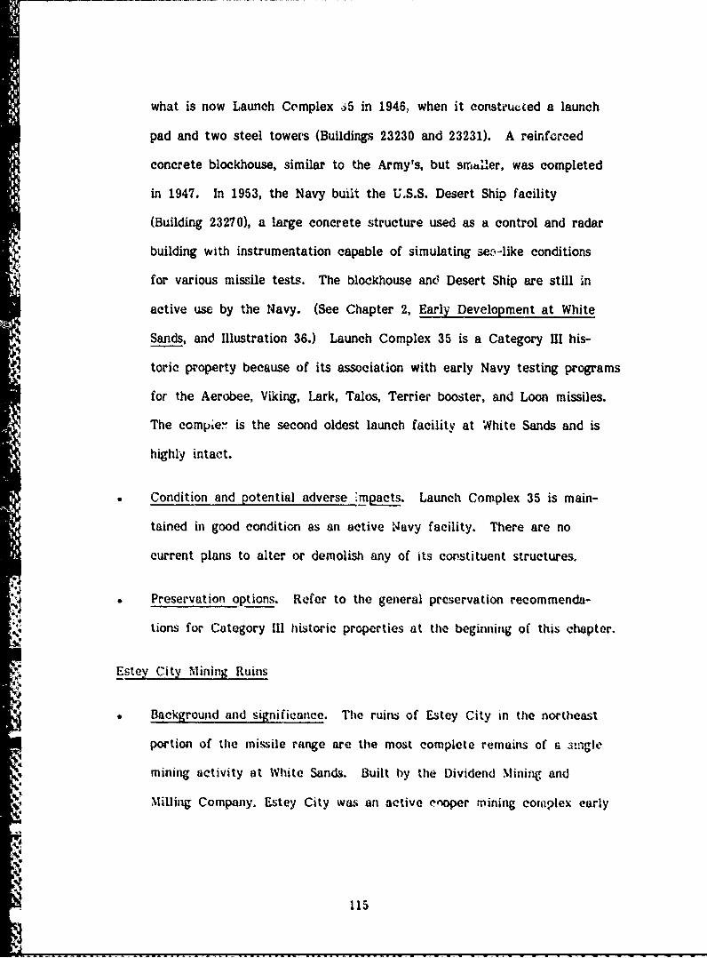
what is now Launch Complex 65 in 1946, when it constructed a launch
pad and two steel towers (Buildings 23230 and 23231). A reinforced
concrete blockhouse, similar to the Army's, but smud'er, was completed
in 1947. In 1953, the Navy built the U.S.S. Desert Ship facility
(Building 23270), a large concrete structure used as a control and radar
building with instrumentation capable of simulating sec-like conditions
for various missile tests. The blockhouse anex Desert Ship are still in
active use by the Navy. (See Chapter 2, Early Development at White
Sands, and Illustration 36.) Launch Complex 35 is a Category III his-
toric property because of its association with early Navy testing programs
for the Aerobee, Viking, Lark, Tales, Terrier booster, and Loon missiles.
The compae.' is the second oldest launch facility at White Sands and is
highly intact.
Condition and potential adverse m mpacts. Launch Complex 35 is main-
tained in good condition as an active 'Navy facility. There are no
current plans to alter or demolish any of its constituent structures.
Preservation options. Refer to the general preservation recommenda-
lions for Category III historic properties at the beginning of this chapter.
Estey City Mining Ruins
Background and significance. The ruins of Estey City in the northeast
portion of the missile range are the most complete remains of a sni'igle
mining activity at White Sands. Built by the Dividend Mining and
Milling Company. Estey City was an active cooper mining complex early
115

in this century. The stone walls of the general store and post office
are still identifiable, but little else remains. (See Chapter 2, Pre-
Military Land Use, and Illustration 6.) The Estey City mining ruins are
a Category III historic property because they are a good example of an
important pre-military land use at White Sands.
Condition and potential ad'terse impacts. ThE site is in a state of ruin,
and will continue to slowly deteriorate with time. There are no current
plans to disturb the site.
Preservation options. The site should be left intact and undisturbed.
Should further historic or archeological investigation prove the signif-
icance of the site, consideration should be given to stabilizing the ruins
to prevent or retard further decay.
Eugene Manlove Rhodes Grave Site
Background and significance. Eugene Manlove Rhodes, a nationally-
known writer of western novels, poems, and short stories, was born in
the Tularosa Basin in 1869, During his lifetime he published over 100
stories and fourteen novels, including Paso Por Aqui, which was later
made into the motion picture "Four Faces West." Rhodes died in 1934
and his body was returned to Rhodes Canyon in the west central part
of the missile range for burial. Under a 1951 New Mexico statute.
New Mexico State University was named the custodian of the grave, a
small fenced-in area with a simple stone grave marker and p'aque.
116
r *•' * . ~ ~ - ' ,*,,,, * *~ ~' ~ ~ *

(See Chapter 2, Pre-Military Land Use, and Illustration 53.) The grave
site is a Category M historic property because of its historical associa-
tion with this well-known writer.
Condition and potential adverse impacts. The grave marker and plaque
are intact, although the fence surrounding the site may need minor
repair. There are no current plans to disturb this site.
Preservation options. Refer to the general preservation recommendations
for Category III historic properties at the beginning of this chapter.
Hardin Ranch
Background and significance. The Hardin Ranch, located at the western
end of Rhodes Canyon, is the only former ranch on the missile range
that has not been abandoned. White Sands range inspectors maintain
the ranch house, outbuildings, and corral as an up-range headquarters.
The ranch house itself is a plain stone structure, less architecturally
interesting than many on the range, but taken as a whole the ranch
complex is representative of the many ranches once active at White
Sands. (See Chapter 2, Pre-Military Land Use, and illustration 54.)
The Hardin Ranch is a Category Ill historic property because it is a
good example of a highly intact ranch complex from an important
historic era.
Condition and otential adverse impacts. Hardin Ranch is maintained in
good condition. There arc no current plans to alter or demolish any of
the properties at the ranch.
114

Z .-a
c- :3 a
V) e)j
0
C -
* a))
0 :t
11ia

Preservation options. Refer to the general preservation recommenda-
tions for Category III historic properties at the beginning of this chapter.
Propulsion Unit Calibration Stand Blockhouse
Background and significance. The Propulsion Unit Calibration Stand
blockhouse (Building 1592) was constructed in July 1946, apparently
under the direction of Werner Von Braun. It was used as a protective
control house for testing V-2 propulsion units on a nearby calibration
stand. No controls or instrumentation remain in the blockhouse, and
the calibration stand has since been dismantled. The blockhouse is a
Category III historic property because of its close association with early
V-2 rocket testing at White Sands (see Chapter 2, Early Development at
White Sands, and Illustration 55).
V Condition and potential adverse impacts. The blockhouse is maintained
in adeauate condition as a storage building and there are no current
plans to alter or demolish this property.
* Preservation options. Refer to the general preservation recommenda-
tions for Category III historic properties a the beginning of this chapter.
NOT ES
1. Army Regulation 420-40, Historic Preservation (Headquarters, U.S. Army:Washington, D.C., 15 April 1984).
2. National Park Service, Secretary of the Interior's Standards for Rehabilitationand Revised Guidelines for Rehabilitating Historic Buildings, 1983 (Washington,D.C.: Preservation Assistance Division. National Park Service, 1983).
119
t:d4%k:- AZ %I

" - •1o. *, 1 *
- 0
Ic
V-o
Ii
0 0)* .. o . -•
tt IV
S&I* 120
I, -
3. National Park Service, "Archeology and Historic Preservation; Secretaryof the Interior's Standards and Guidelines," Federal Register, Part IV,28 September 1983, pp. 44730-44734.
4. National Park Service, Secretary of the Interior's Standards.
5. National Park Service, "Archeology and Historic Preservation."
6. National Park Service, Secretary of the Interior's Standards.
7. National Park Service, "Archeology and Historic Preservation."
1 21

BIBLIOGRAPHY
Pre-Military Land Use
Christiansen, Paige W. "Dona Ana County, New Mexico: Historic Themes,"Guidebook of the Las Cruces Country. Socorro, N.M.: New MexicoGeological Society. 1975. Article discusses Spanish and American settle-ment, including livestock and mining industries.
"Dividend Mining and Milling Company at Estey City, New Mexico," brochure c. 1905.
Eidenbach, Peter L. and Mark Whimberly. Archaeological Reconnaissancein White Sands National Monument. Tularosa, New Mexico: Human
-Systems Research, Inc., 1980. An archaeological field report for theNational Park Service containing references to pre-military land use inthe range, including an investigation of the Lucerno Ranch.
Kelly, T. E. "The Lost Padre Mine and the Organ Mining District," Guide-book of the Las Cruces Country. Socorro, N.M.: New Mexico GeologicalSociety, 1975. Map of gold mine sites and historic overview of industryin Organ and San Andres Mountains.
Meinzer, 0. E. and R. F. Hare. Geology and Water Resources of TularosaBasin, New Mexico: U.S. Geological Society Water Supply Paper 343.Washington, D.C.: GPO, 1915. Remarkable field survey and map (1914)of ranches, railroads, mineral and water resources in this area.
Stewart, Janet A. Arizona Ranch Houses: Southern Territorial Styles,1867-1900. Tucson: Arizona Historical Society, 1974. Historical andarchitectural study of house styles similar to those found in southernNew Mexico.
U.S. Department of Agriculture. Range and Livestock Production Practicesin the Southwest. Washington, D.C.: GPO, 1943. Discussion oF recommendedrange management techniques in southern New Mexico.
White Sands Missile Range
Armament u~ivision 6585th Test Group Test Track Division. The HollomanTrack, Holloman Air Force Base, N.M., 1974.
Bell, Wendell and William L. Curniford. Historic Engineering Site Inventory,tFhw Mexico, Lubbock, TX: History of Engineering Program, TexasTech University, 1977. Engineering inventory by county, including "WhiteSands V-2 Launching Site" registration form for New Mexico Register ofCultural Properties.
122
4. • i "I•%f . r . ? .~* . .z •, ,.

Emme, Eugene M. The History of Rocket Technology. Detroit: WayneState, 1964. Articles discussing major U.S. rocket programs, including"The Redstone, Jupiter and Juno" by Dr. Wernher Von Braun, (1912-1977).
Greenwood, Richard. "Trinity Site" National Register of Historic PlacesInventory Form, National Park Service, Department of the Interior,January, 1975. Nomination form for blast area and surrounding facilitiesbuilt in 1945.
Haley, Andrew G. Rocketry and Space Exploration. New York: Van Nostrand,1958. Discussion on post-war rocketry and industrial cooperation.
Herrick, John W., ed. Rocket Encyclopedia. Los Angeles: Aero, 1959.Discussion and illustrations of rocket technology including "test stand"and "rocket track."
Lamont, Lansing. Day of Trinity. New York: Atheneum, 1965. Summaryand map of facilities in area of Trinity Site.
Ley, Willy. Rockets, Missiles and Space Travel. New York: Viking, 1958.Chapter on early White Sands Proving Ground.
"Los Alamos Scientific Laboratory. Los Alamos: Beginning of an Era, 1943-1945.Los Alamos, N.M.: LASL, nd. Accounts of activities at Trinity Site,McDonald Ranch and Base Camp.
Ordway, Frederick I. and Mitchell R. Sharpe. The Rocket Team. New York:Crowell, 1979. Discussion of 'V-2s in the Desert".
Riukins, Harvey. "A Report on the Ordnance Firings at White Sands," ArmyOrdnance. v. 31, no. 161, March-April, 1947. Candid discussion ofresults of first 17 V-2 test firings.
Stuhlinger, Ernst. "Army Activities in Space - A History," IRE Transactionson Military Electronics. v. 49-4, no. 2-3, April-July, 1960. Account ofArmy's role in missile development until 1960, including Corporal, Nike-Ajax, and Jupiter programs.
Tangerman, E. J. "Nazi Vengeance: The German V-. Rocket Flies Again at"he White Sands Proving Ground" Army Ordnance, v. 31, no. 158,September-October, 1946. First illustrated and technical account of V-2launches.
White Sands History. White Sands, N.M., Public Affairs Office, 1959. Anaccount of the early history of White Sands, with extensive referenceto primary sources.
White Sands Missile Range. Basic Information Maps (46 plates). Office ofFacilities Engineer, January, 1980.
123

White Sands Missile Range. DARCOM Installation and AcLivity Brochure.U.S. Army Test and Evaluation Commanu, 1981.
White Sands Missile Range. Facilities Utilization. Office of FacilitiesEngineer, August, 1981. List of building dates, functions, and categorycode.
White Sands Missile Range. Fact Sheets, "Missile Park," "V-2 Story," "TheFirst Atomic Bomb," "Missile Fact Sheets," "White Sands Missile Rangeat a Glance," "Historical Background of White Sands Missile RangeArea," and "Space Shuttle at White Sands Missile Range." Office ofPublic Affairs, n.d.
White Sands Missile Range. Installation Environmental Impact Assessment.Office of Environmental Engineering, March, 1976.
White Sands Missile Range. Real Property Inventory. Office of FacilitiesEngineer, 1982.
White Sands Proving Ground. "The 300,000 Pound Solid Propellant Test Facilities"(1957), "500,000 Pound Rocket Static Test Facility" (1957), "100,000Pound Rocket Static Test Facility" (1958). Propulsion Branch of Electro-Mechanical Laboratories, Engineering Reports on Test Facilities.
Utah Launch Complex
Alexander, Thomas G. "Brief Histories of Three Federal Military Installationsin Utah" Utah Historical Quarterly, v. 34, no. 2, spring 1966.
White Sands Missile Range. Extended Range Sites in Utah and Idaho. WSMR,N.M.: Public Affairs Office, Fact Sheet, n.d.
Utah Launch Complex. Real Property Inventory. White Sands, N.M.: OfficeA of Facilities Engineer, 1982.
-10
124
Appendix A
McDONALD RANCH HOUSE AT TRINITY SITE
Historic American Buildings Survey
Measured Drawings
1983
I
A-

-IAIMiW "NOOOS )N#f VIM Wfl JAW311S A.LINIW. IV HONVU CIVNOGOW¶I~n wooi
I ~ ~ hifli JiE':
0 L
H 'EN
wj -
IM, 11I~C
~"1i~eý
I J
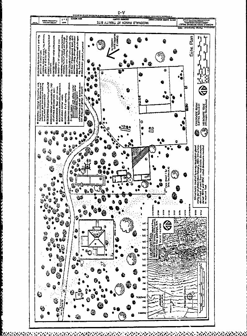
OWNALXMji .~l .IN J ......O~NO~I1SYNYd e R2MKltNIVfO
"04 -0 -~OWO )Jew ~
* a
$A a
U lBHIM i la*1
sat
JigI4,1
~ 'IDtie
lo

311S AIININW.I lv H CnV~ NOMO ;i
-II'
I-o
'1 1 1 ''..........Iall
EECi
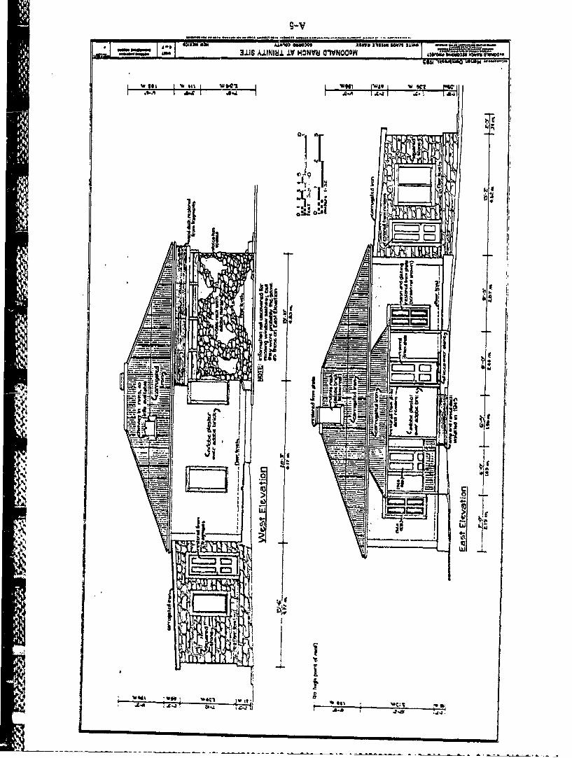
~~ - LLI~~S A41NNIW. IT HONVU CVNOOOW ~ ~ o.~,ws@~O
-e-

9-VAll MM3 AAIWflO 01a0201 ""Ym INmsi Nls SAW*ape3lS AININIW ILV HONVU GIVNOO'.N JA@ l .NO1 M6Y3@y" ~
I~e -~ 1.441o ~w*
baEl r
k ~~

L-V
-. ~3±11 A.LINIU± IV HOWNV Ol~'NOO2W
LU 1 ;11WW
.. ® -I
5'.'
IMI
tzliI
-' I H

9-V.ee .. ........... .
.ir r
Vic
ID
vo Cz M
wc~I 'wzl i
..........