historic photographs and supplemental images
TRANSCRIPT
Andrews-Bartlett Homestead—Supplemental Images 1
Andrews-Bartlett Homestead Proposed Historic District
Supplemental Images
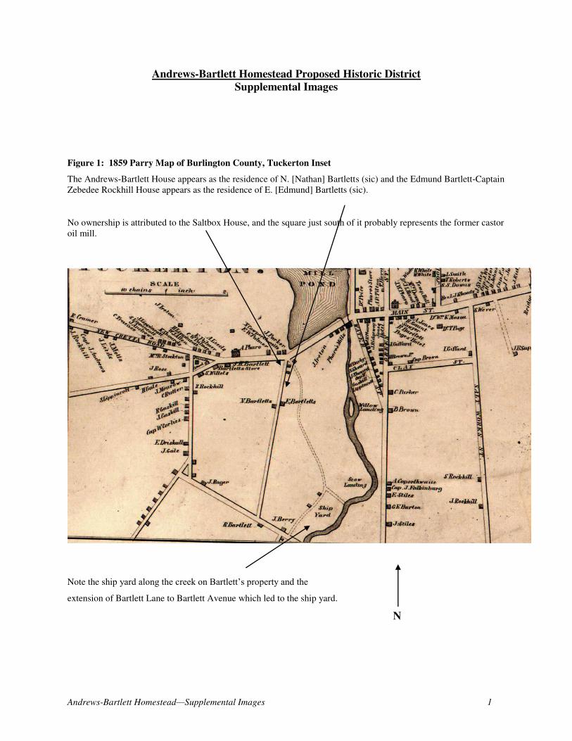
Figure 1: 1859 Parry Map of Burlington County, Tuckerton Inset
The Andrews-Bartlett House appears as the residence of N. [Nathan] Bartletts (sic) and the Edmund Bartlett-Captain
Zebedee Rockhill House appears as the residence of E. [Edmund] Bartletts (sic).
No ownership is attributed to the Saltbox House, and the square just south of it probably represents the former castor
oil mill.
Note the ship yard along the creek on Bartlett’s property and the
extension of Bartlett Lane to Bartlett Avenue which led to the ship yard.
N

Andrews-Bartlett Homestead—Supplemental Images 2
Figure 2: 1876 Scott Map of Burlington County, Tuckerton Inset
On this map, the Andrews-Bartlett House shows as the residence of Miss Bartlett, even though it was occupied by
the three unmarried Bartlett sisters; the Bartlett-Rockhill House is shown as the residence of A. [sic] Rockhill, and
the Saltbox House is shown as the residence of B. [Benjamin] Jones, a sailor who was renting the property at the
time from Oliver Shinn, its owner. Neither the castor oil mill building nor the ship yard is shown.

Andrews-Bartlett Homestead—Supplemental Images 3
Figure 3: 1878 Woolman & Rose Atlas of the Jersey Coast, Tuckerton
The Andrews-Bartlett House still shows as “Miss Bartlett” while the Bartlett-Rockhill House is shown as the
residence of “A. Gaskill;” this may be a mistake on the cartographer’s part since Zebedee Rockhill still owned the property and appears as living there in every census taken during his ownership. There is no name attached to the
Saltbox House, and Bartlett Lane no longer extends to Bartlett Avenue.

Andrews-Bartlett Homestead—Supplemental Images 4
Figure 4: ca. 1940
photograph of the
Andrews-Bartlett
House
View almost south. Note
the large boxwood in
front of the front door.
[Atlantic County
Historical Society]
Figure 5: ca. 1930 photograph of the Andrews-Bartlett
House
Note the lack of trees behind the house. View southeast.
[Atlantic County Historical Society]
Andrews-Bartlett Homestead—Supplemental Images 5
Figure 6: ca.
1979 photo of the
Andrews Bartlett
House
Taken shortly
after the house
was donated to
the Tuckerton
Historical
Society. View
almost south.
[Tuckerton
Historical
Society]
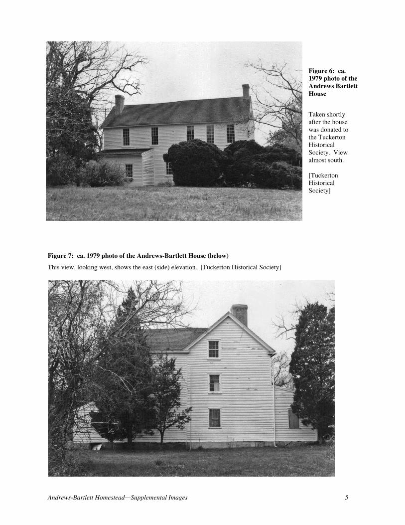
Figure 7: ca. 1979 photo of the Andrews-Bartlett House (below)
This view, looking west, shows the east (side) elevation. [Tuckerton Historical Society]

Andrews-Bartlett Homestead—Supplemental Images 6
Figure 8: Castor Oil Mill
This historic photo,
undated, reportedly shows
the castor oil mill to the left.
[Tuckerton Historical
Society]
Figure 9: ca. 1910 photograph of the Edmund Bartlett-Captain Zebedee Rockhill House (above)
This view shows the addition to the southwest corner of the main block as an open air screened porch. View
northeast. [Tuckerton Historical Society]

Andrews-Bartlett Homestead—Supplemental Images 7
Figure 10: ca. 1930 view of the Bartlett-Rockhill House
In this view, the open air porch has been enclosed to create additional
living space. View almost north. [Atlantic County Historical Society]
Figure 11: (below) first floor plan of the ca. 1711 John Welling House, Pennington, Mercer County
This floor plan shows how one chimney was used to serve a cooking fireplace in the parlor and a corner fireplace in
a smaller room adjacent to the parlor. This building is only 1’ deeper than the Andrews-Bartlett House with lean-to.
[Historic American Buildings Survey]

Andrews-Bartlett Homestead—Supplemental Images 8
Figure 12: Dutch timber frame diagram for a
typical 1½ story house
This illustration shows the widely-spaced bents
comprised of anchor beams that are tied into 1½
story posts.
[Gabrielle Lanier and Bernard Herman, Everyday
Architecture of the Mid-Atlantic, p. 91]
Figure 13: Diagram of an English-derived
Heavy Timber Frame Building (below)

Andrews-Bartlett Homestead—Supplemental Images 9
Figure 14: Dutch American Anchor-Bent Framing Types
The Bartlett-Andrews House is framing type #2 on the above diagram.
[Clifford Zink, “Dutch Framed Houses in New York and New Jersey,” Winterthur Portfolio, Vol. 22, No. 4, Winter,
1987, p. 285]