high conservation value interpretation in cameroon · high conservation value interpretation in...
TRANSCRIPT

High Conservation Value interpretation in Cameroon
Setting identification criteria and indicators in Cameroon – Version for public consultation
January 2016
With the support from TEREA

Setting identification criteria and indicators in Cameroon – Version for public consultation 2 / 20
CONTENTS
1. INTRODUCTION ................................................................................................................... 5
1.1 Context and Objective .............................................................................................................. 5
1.2 Methodology .............................................................................................................................. 5
2. APPLICATION OF HCV INTERNATIONAL DEFINITIONS IN CAMEROON ..................... 6
2.1 HVC 1: Biodiversity concentrations .......................................................................................... 6
2.1.1 Interpretation of HCV 1 at the national scale .................................................................................... 6 2.1.1.1 Criterion 1.a: Areas with high level of biodiversity with international or national status .............................. 6 2.1.1.2 Criterion 1.b: concentrations of Rare Threatened and Endangered, endemic, restricted range or protected species 7 2.1.1.3 Criterion 1.c: Internationally or nationally recognised sites/habitats with high level of endemism ............. 8 2.1.1.4 Criterion 1.d: Internationally or nationally recognised sites used temporarily by CR, EN, VU, endemic, protected or restricted range species ..................................................................................................................................... 8
2.1.2 Interpretation of HCV 1 at the project area scale ............................................................................ 9 2.1.2.1 Criterion 1.e: Areas within the project area which directly supports the biodiversity of an HCV 1 defined at the national scale ....................................................................................................................................................................... 9 2.1.2.2 Concentrations of CR, EN, VU, endemic, restricted range or protected species ............................................. 9 2.1.2.3 Sites used temporarily by CR, EN, VU, endemic, protected or restricted range species ............................ 11 2.1.2.4 Ecosystems/habitats with high level of endemism ............................................................................................. 11
2.2 HVC 2: Landscapes ................................................................................................................. 12
2.3 HVC 3: Ecosystems and habitats ........................................................................................... 12
2.3.1 Interpretation of HCV 3 at the national scale .................................................................................. 12 2.3.1.1 Criterion 3.a: Protected ecosystem by the law .................................................................................................. 13 2.3.1.2 Criterion 3.b: Threatened ecosystems ................................................................................................................. 13 2.3.1.3 Criterion 3.c: Rare ecosystems.............................................................................................................................. 14
2.3.2 Interpretation of HCV 3 at the project area scale .......................................................................... 14 2.3.2.1 Criterion 3.d: Fragile or sensitive ecosystems .................................................................................................... 14
2.4 HVC 4: Ecosystem services ..................................................................................................... 14
2.4.1 Interpretation of HCV 4 at the national scale .................................................................................. 14 2.4.1.1 Criterion 4.a: Protected watershed by the law ................................................................................................. 15 2.4.1.2 Criterion 4.b: core of aquifers of interest (water quality and quantity) ........................................................ 15
2.4.2 Interpretation of HCV 4 at the project area scale .......................................................................... 15 2.4.2.1 Criterion 4.c: Areas where surface erosion risk of the project upstream of important national infrastructure and of local population drinking water catchments is considered unacceptably high ................................................... 15 2.4.2.2 Criterion 4.d: Areas within the concession found to play a role in the production of drinking water for downstream populations (including urban population if relevant) .................................................................................... 16 2.4.2.3 Criterion 4.e: Ecosystems recognized to play a role in the water cycle ........................................................ 16 2.4.2.4 Criterion 4.f: Areas in a savannah-forest transition landscape which could be useful to prevent the spread of fires 16 2.4.2.5 Criterion 4.g: Existing vegetation barriers against wind erosion and extreme events ................................ 17
2.5 HVC 5: Basic needs of local populations ............................................................................. 17
2.5.1 Interpretation of HCV 5 at the project area scale .......................................................................... 17 2.5.1.1 Criterion 5.a: Sites and resources within the concession satisfying basic needs ............................................ 18
2.6 HCV 6: Cultural values ........................................................................................................... 19
2.6.1 Interpretation of HCV 6 at the national scale .................................................................................. 19 2.6.1.1 Criterion 6.a: Sites with an internationally or nationally historical or archaeological status ...................... 19
2.6.2 Interpretation of HCV 6 at the project area scale .......................................................................... 19 2.6.2.1 Areas important for maintaining the cultural identity or unique characteristics of a local community and indigenous peoples .................................................................................................................................................................. 19
3. REFERENCES ....................................................................................................................... 20
4. ANNEXES............................................................................................................................ 21

Setting identification criteria and indicators in Cameroon – Version for public consultation 3 / 20
ACRONYMS
C&I Criteria and Indicators
CITES Convention on International Trade in Endangered Species of Wild Fauna and
Flora
CR, EN,VU Critically, Endangered, Vulnerable (IUCN status of species)
FSC Forest Stewardship Council
FPIC Free Prior and Informed Consent
IFL Intact Forest Landscapes
IUCN International Union for the Conservation of Nature
HCV High Conservation Value
NBSAP National Biodiversity Strategy Action Plan
RTE Rare, Threatened and Endangered (species)
UNESCO United Nations’ Educational Scientific and Cultural Organization

Setting identification criteria and indicators in Cameroon – Version for public consultation 4 / 20
DEFINITIONS
Intact Forest Landscape (IFL) is an unbroken expanse of natural ecosystems within the zone of
current forest extent, showing no signs of significant human activity and large enough that all
native biodiversity, including viable populations of wide-ranging species, could be maintained.
Although all IFL are within the forest zone, some may contain extensive naturally tree-less areas,
including grasslands, wetlands, lakes, alpine areas, and ice. (Official definition:
http://www.intactforests.org/concept.html)
Threatened and Endangered species:
In this document threatened and endangered species include:
Species with an international or national IUCN status which is CR or EN or VU
Species under the Appendix I and II of the CITES
Protected species
“Protected species” are understood as the species fully protected by Cameroonian legal texts,
they fall under the legal category A.
Setting identification criteria and indicators in Cameroon – Version for public consultation 5 / 20
1. INTRODUCTION
1.1 Context and Objective
“A High Conservation Value (HCV) is a biological, ecological, social or cultural value of
outstanding significance or critical importance” (HCV RN, 2013).
High Conservation Values have been a tool used in many different contexts to manage
appropriately resource use and conservation planning most of the time through certification
schemes.
To engage in a national interpretation of the six HCVs is an effective way to ensure some
consistency in HCV assessments in Cameroon and furthermore to frame the development of
industrial activities in the country.
Cameroon has decided to engage in this process and the first step of this process consisted in
setting criteria and indicators (C&I) for the identification of HCV at the national level. A draft
document with these C&I was submitted to the validation of the NBSAP national group in charge
of the strategic goal B, objective 6 during a validation workshop held in Kribi in November
2015.
The current report presents the results of this workshop which last three days and gathered over
thirty people. The objective of the workshop was to validate the criteria and indicators proposed
to identify HCVs in Cameroon as well as the suggested identification methodologies.
It was recognised that some further work is needed to use the criteria and indicators for direct
identification such as:
collecting relevant information or testing different hypothesis/thresholds to be able to
use the indicators in the process of HCV identification;
identifying relevant sources of information to use the indicators or test the
hypothesis/thresholds.
1.2 Methodology
Setting criteria and indicators for the identification of High Conservation Values in Cameroon
followed the following process:
Criteria were set to define the aspects the International/generic definition covered in
Cameroon;
Indicators were defined to be as precise as possible.
HCV identification criteria and indicators were defined at the national level. Therefore they aim
at being valid for the territory. Two scales were considered: the project area (forest concession,
palm oil permit, etc.) and the national scale.
For each indicator an identification methodology has been suggested.

Setting identification criteria and indicators in Cameroon – Version for public consultation 6 / 20
2. APPLICATION OF HCV INTERNATIONAL DEFINITIONS IN
CAMEROON
2.1 HVC 1: Biodiversity concentrations
The common guidance (2013, HCV RN) gives the following generic definition of the first High
Conservation Value:
2.1.1 Interpretation of HCV 1 at the national scale
Four criteria have been set at the national scale:
1.a: Areas with high level of biodiversity with international or national status;
1.b: Concentrations of Rare Threatened and Endangered, endemic, restricted range or
protected species;
1.c: Internationally or nationally recognised sites/habitats with high level of endemism;
1.d Internationally or nationally recognised sites used temporarily by CR, EN, VU, endemic,
protected or restricted range species.
2.1.1.1 Criterion 1.a: Areas with high level of biodiversity with international or national
status
Indicators Suggested methodology
- Classified areas for strict protection by forest
and environment legal texts in force.
- Classified areas for strict protection by
International Conventions ratified by The
Republic of Cameroon (UNESCO, Ramsar, etc.)
List and map (with a detailed legend) all the
concerned areas. It would be useful to define for
each area the characteristics for which they have
been classified.
Indicators Suggested methodology
- Recognized areas with high biodiversity by
other institutions: Important Bird Areas (IBA), Key
Biodiversity Areas, Alliance for Zero Extinction
sites, Centres of Plant Diversity, Core areas of
Reserves of Biosphere, etc.
List and map (with a detailed legend) all the
concerned areas. It would be useful to define for
each area the characteristics for which they have
been recognized.
Concentrations of biological diversity including endemic species and Rare,
Threatened or Endangered (RTE) species that are significant at global,
regional or national levels.

Setting identification criteria and indicators in Cameroon – Version for public consultation 7 / 20
Recommendations:
For this indicator, it has been recommended to assess:
the consequences in terms of surface covered at the national scale ;
the relevance of identifying the whole surface of each component as some of them might be
already quite degraded and because some of the concerned areas might already bear some
agro-industries.
2.1.1.2 Criterion 1.b: concentrations of Rare Threatened and Endangered, endemic,
restricted range or protected species
Indicators Methodology : recommendations
- Concentration of Rare Threatened and
Endangered, endemic, restricted range or
protected species of large animal species of
international and national importance or a
combination of the above species
The recommended methodology to identify the
extent of this criterion is the one used by the
Gabon HCV project presented in Annexe 1.
In order to test the applicability of this
methodology, it is needed in the first place to
identify the species or the combination of species
on which this methodology could be used
(enough data, relevant to criteria and indicator,
etc.).
Examples given: elephants, great apes, large
carnivores, etc.
The species or the combination of species for
which the methodology will be applied must
either be Rare Threatened and Endangered,
endemic, restricted range or protected species
Once this pre-requisite is set, it is important to
assess the consequences in terms of surface
covered by testing different “concentration
thresholds” (see Annexe 1 for more details).
- Concentration of restricted range species For this indicator it is recommended to consult
specialists/experts of mammals, birds,
amphibians, reptiles, fish, plants etc. to assess
which species and sites would be concerned by
this indicator at the national scale.
The lack of available data for this indicator
might not allow to determinate exhaustively the
sites with concentration of restricted range
species. This indicator should therefore be
defined at the national scale on current
knowledge and updated regularaly.
(example Cross river Gorilla, Ebo gorilla,
manatee, etc.)

Setting identification criteria and indicators in Cameroon – Version for public consultation 8 / 20
2.1.1.3 Criterion 1.c: Internationally or nationally recognised sites/habitats with high
level of endemism
Indicators Suggested methodology
- recognized areas with high level of plant
endemism
Some research/expertise is on-going in
Cameroon (especially on the Atlantic area of
Cameroon) to identify areas with a high level of
endemism of some families of plants (see
Professeur Sonké and Docteur Droissart on-going
research).
It is recommended to assess with the concerned
specialists/experts the consequences in terms of
surface covered by setting different thresholds
of endemism.
- recognized areas with high level of fish
endemism
It is recommended to consult specialists/experts
in ichthyology to determine which site(s) would fit
the definition of the criteria.
For example crater lakes
- recognized areas with high level of endemism
for other taxa: birds, small mammals, reptiles
and amphibians
It is recommended to consult specialists/experts
for each taxon to determine which site(s) would
fit the definition of the criteria.
2.1.1.4 Criterion 1.d: Internationally or nationally recognised sites used temporarily by
CR, EN, VU, endemic, protected or restricted range species
Indicators Suggested methodology
- Internationally or nationally recognised sites
used temporarily by migratory species (birds,
sea turtles, etc.)
It is recommended to consult specialists/experts
to determine which site(s) would fit the definition
of the criteria.
- Nationally recognised fauna or flora corridors It is recommended to consult specialists/experts
to determine which site(s)/area(s) would fit the
definition of the criteria.
- Internationally or nationally recognized refugia
for fauna and flora.
It is recommended to consult specialists/experts
to determine which site(s)/area(s) would fit the
definition of the criteria.
Setting identification criteria and indicators in Cameroon – Version for public consultation 9 / 20
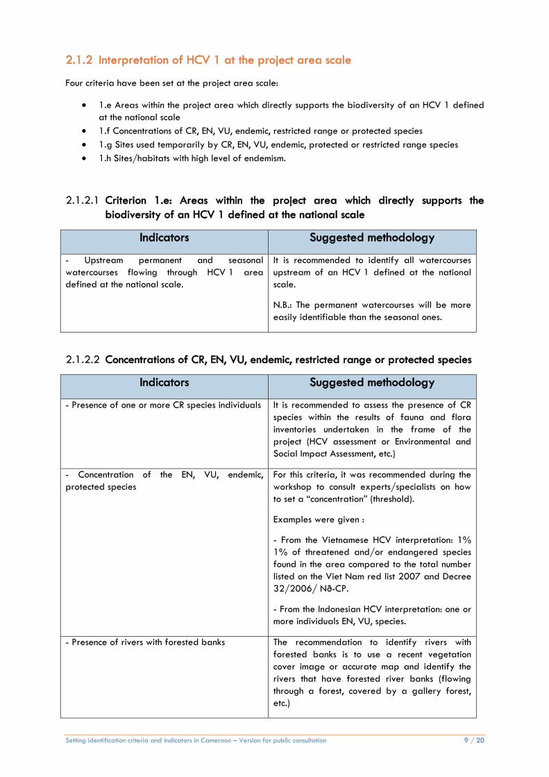
2.1.2 Interpretation of HCV 1 at the project area scale
Four criteria have been set at the project area scale:
1.e Areas within the project area which directly supports the biodiversity of an HCV 1 defined
at the national scale
1.f Concentrations of CR, EN, VU, endemic, restricted range or protected species
1.g Sites used temporarily by CR, EN, VU, endemic, protected or restricted range species
1.h Sites/habitats with high level of endemism.
2.1.2.1 Criterion 1.e: Areas within the project area which directly supports the
biodiversity of an HCV 1 defined at the national scale
Indicators Suggested methodology
- Upstream permanent and seasonal
watercourses flowing through HCV 1 area
defined at the national scale.
It is recommended to identify all watercourses
upstream of an HCV 1 defined at the national
scale.
N.B.: The permanent watercourses will be more
easily identifiable than the seasonal ones.
2.1.2.2 Concentrations of CR, EN, VU, endemic, restricted range or protected species
Indicators Suggested methodology
- Presence of one or more CR species individuals It is recommended to assess the presence of CR
species within the results of fauna and flora
inventories undertaken in the frame of the
project (HCV assessment or Environmental and
Social Impact Assessment, etc.)
- Concentration of the EN, VU, endemic,
protected species
For this criteria, it was recommended during the
workshop to consult experts/specialists on how
to set a “concentration” (threshold).
Examples were given :
- From the Vietnamese HCV interpretation: 1%
1% of threatened and/or endangered species
found in the area compared to the total number
listed on the Viet Nam red list 2007 and Decree
32/2006/ Nð-CP.
- From the Indonesian HCV interpretation: one or
more individuals EN, VU, species.
- Presence of rivers with forested banks The recommendation to identify rivers with
forested banks is to use a recent vegetation
cover image or accurate map and identify the
rivers that have forested river banks (flowing
through a forest, covered by a gallery forest,
etc.)
Setting identification criteria and indicators in Cameroon – Version for public consultation 10 / 20
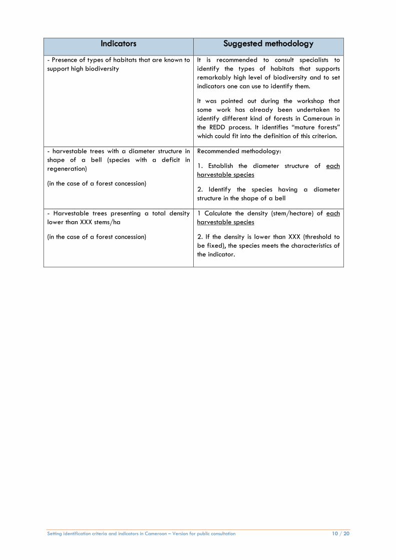
Indicators Suggested methodology
- Presence of types of habitats that are known to
support high biodiversity
It is recommended to consult specialists to
identify the types of habitats that supports
remarkably high level of biodiversity and to set
indicators one can use to identify them.
It was pointed out during the workshop that
some work has already been undertaken to
identify different kind of forests in Cameroun in
the REDD process. It identifies “mature forests”
which could fit into the definition of this criterion.
- harvestable trees with a diameter structure in
shape of a bell (species with a deficit in
regeneration)
(in the case of a forest concession)
Recommended methodology:
1. Establish the diameter structure of each
harvestable species
2. Identify the species having a diameter
structure in the shape of a bell
- Harvestable trees presenting a total density
lower than XXX stems/ha
(in the case of a forest concession)
1 Calculate the density (stem/hectare) of each
harvestable species
2. If the density is lower than XXX (threshold to
be fixed), the species meets the characteristics of
the indicator.
Setting identification criteria and indicators in Cameroon – Version for public consultation 11 / 20
2.1.2.3 Sites used temporarily by CR, EN, VU, endemic, protected or restricted range
species
Indicators Suggested methodology
- Presence of natural wetlands : riparian forests,
floodable and flooded forests, marshes, (for
birds, fish, reptiles, amphibians)
1. At the project area scale, from the forest
stratification and flora inventory, estimate the
spread of wetlands
2. This estimation can be refined with the
analysis of a Digital Elevation Model and
detailed inventories (e.g. harvesting inventories)
- concentration of trees that bear fruits eaten by
medium and large mammals
Applicable in the case of :
a permanent forest concession,
If the area to conserve the concentration of
trees is adjacent or can directly be
connected to an area not to be converted.
N.B.: Identification feasible mostly from precise
inventories, e.g. harvesting inventories that cover
100% of an area
Suggested methodology:
1. Identify the location or distribution of trees
that bear fruits eaten by large mammals
It was recommended to set indicators to interpret
the “concentration of trees”.
- presence of a baï / natural forest clearings
(clairières naturelles)/ “saline”/ « saline
wetlands »
N.B.: Identification feasible mostly from precise
inventories, e.g. harvesting inventories that cover
100% of an area
2.1.2.4 Ecosystems/habitats with high level of endemism
Indicators Suggested methodology
- Presence of ecosystems with signs of high level
of endemism
Recommended methodology
1. Establish a forest stratification map
2. Analyse the presence of indicators of high
level of endemism and the extent of the
ecosystem/habitat via a stratification.
It was recommended to consult experts/
specialists to establish a list of indicators of high
endemism.
Setting identification criteria and indicators in Cameroon – Version for public consultation 12 / 20
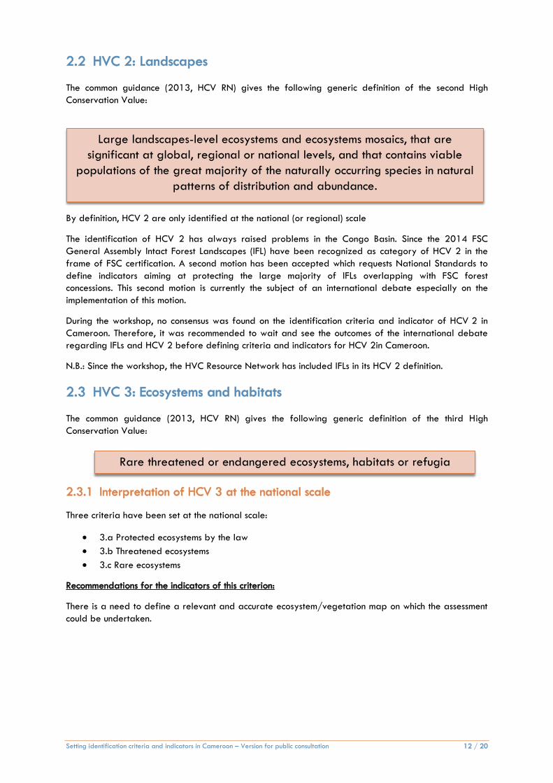
2.2 HVC 2: Landscapes
The common guidance (2013, HCV RN) gives the following generic definition of the second High
Conservation Value:
By definition, HCV 2 are only identified at the national (or regional) scale
The identification of HCV 2 has always raised problems in the Congo Basin. Since the 2014 FSC
General Assembly Intact Forest Landscapes (IFL) have been recognized as category of HCV 2 in the
frame of FSC certification. A second motion has been accepted which requests National Standards to
define indicators aiming at protecting the large majority of IFLs overlapping with FSC forest
concessions. This second motion is currently the subject of an international debate especially on the
implementation of this motion.
During the workshop, no consensus was found on the identification criteria and indicator of HCV 2 in
Cameroon. Therefore, it was recommended to wait and see the outcomes of the international debate
regarding IFLs and HCV 2 before defining criteria and indicators for HCV 2in Cameroon.
N.B.: Since the workshop, the HVC Resource Network has included IFLs in its HCV 2 definition.
2.3 HVC 3: Ecosystems and habitats
The common guidance (2013, HCV RN) gives the following generic definition of the third High
Conservation Value:
2.3.1 Interpretation of HCV 3 at the national scale
Three criteria have been set at the national scale:
3.a Protected ecosystems by the law
3.b Threatened ecosystems
3.c Rare ecosystems
Recommendations for the indicators of this criterion:
There is a need to define a relevant and accurate ecosystem/vegetation map on which the assessment
could be undertaken.
Rare threatened or endangered ecosystems, habitats or refugia
Large landscapes-level ecosystems and ecosystems mosaics, that are
significant at global, regional or national levels, and that contains viable
populations of the great majority of the naturally occurring species in natural
patterns of distribution and abundance.
Setting identification criteria and indicators in Cameroon – Version for public consultation 13 / 20
2.3.1.1 Criterion 3.a: Protected ecosystem by the law
Indicators Suggested methodology
-Protected ecosystems by forest and environment
legal texts in force
It was recommended to analyse the protected
ecosystems by the different relevant legal texts.
2.3.1.2 Criterion 3.b: Threatened ecosystems
Indicators Suggested methodology
Ecosystem extent that has decreased of XX% or
more from date/period (?) in the agro-ecological
zones/ bio-geographical regions/ centres of
endemism where it occurs
The methodology suggested for this indicator is the
one used in the Indonesian Interpretation (Annex 4
of the 2010 version).
N.B.: The presentation of this methodology could
not be found.
It was recommended during the workshop to:
- validate the approach by specialists/experts;
- determine on which “entity” it is more relevant to
undertake the approach (agro-ecological zones,
bio-geographical regions, centres of endemism,
etc.)
- set the percentage of decrease (for example in
Indonesia it was set at 50%);
- define the period on which to do the analysis;
Ecosystem which extent is expected to decline by
more than XX% in the future (period?) in the agro-
ecological zones/bio-geographical regions/
centres of endemism where it occurs
Same recommendations as above.
The methodology proposed for this indicator is the
one used in the Indonesian Interpretation (Annex 4
of the 2010 version) but it could not be found.
It was recommended during the workshop to:
- validate the approach by specialists/experts;
- determine on which “entity” it is more relevant to
undertake the approach (agro-ecological zones,
bio-geographical regions, centres of endemism,
etc.)
- set the percentage of decrease (for example in
Indonesia it was set at 75%);
- define the period on which the methodology
should be tested.

Setting identification criteria and indicators in Cameroon – Version for public consultation 14 / 20
2.3.1.3 Criterion 3.c: Rare ecosystems
Indicators Suggested methodology
Ecosystem that covers less than XX% of the agro-
ecological zones/bio-geographical regions/centres
of endemism where it occurs
After having set the threshold, all the ecosystem
presenting an extent under the established
threshold are considered rare.
2.3.2 Interpretation of HCV 3 at the project area scale
One criterion has been set at the project area scale:
2.d Fragile or sensitive ecosystems
2.3.2.1 Criterion 3.d: Fragile or sensitive ecosystems
Indicators Suggested methodology
- Presence of fragile or sensitive ecosystems:
mangroves, cloud forests, marshes, rocky forests,
inselbergs, baïs, lakes, savannah (maximal size?)
included into a dense forested area, forest areas
(maximal size) included into a savannah area,
afro-mountainous/sub-mountainous/mountainous,
caves, cliffs, etc.
It is recommended to have experts/specialists
identify as exhaustively as possible the
fragile/sensitive ecosystems potentially present in
Cameroon and their means/indicators of
identification.
The methodologies to identify fragile and sensitive
ecosystems will be determined when the
means/indicator of identification will be known.
2.4 HVC 4: Ecosystem services
The common guidance (2013, HCV RN) gives the following generic definition of the fourth High
Conservation Value:
Basic ecosystem services in critical situations including protection of water
catchments and control of erosion of vulnerable soils and slopes.
2.4.1 Interpretation of HCV 4 at the national scale
Two criteria have been set at the national scale:
4.a Protected watershed by the law
4.b Core of aquifers of interest

Setting identification criteria and indicators in Cameroon – Version for public consultation 15 / 20
2.4.1.1 Criterion 4.a: Protected watershed by the law
Indicators Suggested methodology
- areas protected by law for water quality or
quantity reasons
It was recommended to analyse the relevant legal
texts to highlight what areas or types of areas
are protected in the frame of watershed
protection in Cameroon as well as the level of
protection associated to each type of area.
2.4.1.2 Criterion 4.b: core of aquifers of interest (water quality and quantity)
Indicators Suggested methodology
Presence of a core of an aquifer of interest
Will be identified as aquifer of interest, if one of
the indicator below is met:
Of interest for human activities (drinking
water, irrigation, etc.)
Large hydrogeological potentiality
Vulnerable aquifers
It was recommended to consult experts/specialists
on the methodology to be used to identify and
delineate aquifers of interest and their cores.
2.4.2 Interpretation of HCV 4 at the project area scale
Five criteria have been set at the project area scale:
4.c Areas where surface erosion risk of the project upstream of important national
infrastructure and of local population drinking water catchments is considered unacceptably
high
4.d Areas within the project area found to play a role in the production of drinking water for
downstream populations (including urban population if relevant))
4.e Ecosystems playing an important role in the water cycle
4.f Areas in a savannah-forest transition landscape preventing the spread of fires
4.g Existing vegetation barriers against wind erosion and extreme events
2.4.2.1 Criterion 4.c: Areas where surface erosion risk of the project upstream of
important national infrastructure and of local population drinking water
catchments is considered unacceptably high
For this criteria, a methodology was proposed but the participants of the validation workshop did not
feel they were knowledgeable enough to analyse the relevance of the proposed indicators.
Therefore indicators for this criteria still need to be further developed. The participants of the workshop
recommended that relevant experts are consulted on the proposed indicators or propose other
indicators.

Setting identification criteria and indicators in Cameroon – Version for public consultation 16 / 20
2.4.2.2 Criterion 4.d: Areas within the concession found to play a role in the production
of drinking water for downstream populations (including urban population if
relevant)
Indicators Suggested methodology
- Rivers and springs present within the project
area found to play a role in the production of
drinking water for downstream population
(including urban population if relevant))
It is recommended to Identify through local
consultation which rivers and/or springs are used
for drinking water.
2.4.2.3 Criterion 4.e: Ecosystems recognized to play a role in the water cycle
Indicators Suggested methodology
- Presence of ecosystems recognized to play a
role in the water cycle: cloud forest, marshes,
forest on soils sensitive to salt, forest on steep
slopes, riparian forest, floodable/flooded forests,
forests ponds (FAO, 2009)
It is recommended to have experts/specialists
identify as exhaustively as possible the ecosystems
recognized to play a role in the water cycle
potentially present in Cameroon and their means
of identification.
The methodologies to identify fragile and sensitive
ecosystems will be determined when the means of
identification will be known.
For forest on steep slopes: a threshold will have to
be defined according to thresholds present in the
legal texts of Cameroon.
2.4.2.4 Criterion 4.f: Areas in a savannah-forest transition landscape which could be
useful to prevent the spread of fires
Indicators Suggested methodology
- In a savannah-forest transition landscape,
presence of natural fire breaks : wetlands, river
banks, lakes, etc.
It is recommended to have experts/specialists
identify as exhaustively as possible what kind of
pattern/ecosystem/sites could be identified as
natural fire breaks potentially present in
Cameroon and their means of identification.
The methodologies to identify natural fire breaks
will be determined when the means of
identification will be known.

Setting identification criteria and indicators in Cameroon – Version for public consultation 17 / 20
2.4.2.5 Criterion 4.g: Existing vegetation barriers against wind erosion and extreme
events
Indicators Suggested methodology
Presence of existing vegetation barriers against
extreme events : storms, tsunamis, etc.
It is recommended to have experts/specialists
identify as exhaustively as possible what kind of
pattern/ecosystem/sites could be identified as
existing vegetation barriers against extreme
events potentially present in Cameroon and their
means of identification.
The methodologies to identify existing vegetation
barriers against extreme events will be
determined when the means of identification will
be known.
2.5 HVC 5: Basic needs of local populations
The common guidance (2013, HCV RN) gives the following generic definition of the fifth High
Conservation Value:
N.B.: Identifying HCV 5 can only be done at the project area scale as it requires engagement with
these local communities or indigenous peoples.
One criterion has been identified at the project area scale: Sites and resources within the concession
satisfying basic needs (criterion 5.a).
2.5.1 Interpretation of HCV 5 at the project area scale
The common guidance (2013) gives the following basic needs to be determined with the local
communities:
a. Food
b. Water
c. Clothing
d. Materials for building and tools
e. Firewood
f. Medicines
g. Fodder for livestock.
Sites and resources fundamental for satisfying the basic necessities of local
communities or indigenous peoples (for example for livelihoods, health, nutrition,
water) identified through engagement with these local communities or
indigenous peoples

Setting identification criteria and indicators in Cameroon – Version for public consultation 18 / 20
A previous work has been undertaken for HCV identification in Community forests in Cameroon (Mbolo,
2008). This section resumes the findings of this publication attributes related to HCV 5 in Cameroon:
Non Timber Forest Products
Bushmeat
Fish
Medicinal products
Fuelwood or wood for charcoal
Timber
Watershed
Land
Ecotourism.
It is important to recognize that a lot of local households depend on the sale of agricultural products
and NTFPs for their “basic needs”. Therefore the “commercial scale” needed to be carefully and
pragmatically estimated by HCV assessors.
The inclusion of “land” and in particular “agricultural land” as in the interpretation for Community
Forests in Cameroon was thoroughly discussed during the validation workshop
The common guidance (2013) states that : “Until this question is resolved through further work, it is
recommended that in every HCV assessment, specific attention should be given to the question of
subsistence farming and how this impacts food security. Traditional agricultural systems that maintain
associated biodiversity may qualify as HCV, but this should be determined on a case by case basis.” It
was decided to be on the same page in Cameroon.
It was asked that the recommended methodology for HCV 5 and HCV 6 carefully takes into account
gender issues.
2.5.1.1 Criterion 5.a: Sites and resources within the concession satisfying basic needs
Indicators Suggested methodology
- Sites (restricted range)
- Resources (diffuse/spread not limited to a site)
The recommended methodology to identify HCV 5
was through a socio-economic study along with a
participatory mapping exercise which could
include a GPS location of the different elements
of HCV 5.
Some aspects are of importance when identifying
HCV 5: irreplaceability of the resources/sites, the
“sustainability” of the management of HCV 5 and
gender issues, etc.

Setting identification criteria and indicators in Cameroon – Version for public consultation 19 / 20
2.6 HCV 6: Cultural values
The common guidance (2013, HCV RN) gives the following generic definition of the sixth High
Conservation Value:
N.B.: Identifying HCV 6 can only be done at the project area scale as it requires engagement with
these local communities or indigenous peoples.
2.6.1 Interpretation of HCV 6 at the national scale
One criterion has been identified at the project area scale: Sites with an internationally or nationally
historical or archaeological status
2.6.1.1 Criterion 6.a: Sites with an internationally or nationally historical or
archaeological status
Indicators Suggested methodology
UNESCO cultural heritage sites
Sites with a national status
Identify and locate the relevant sites in the legal
texts and recognise by international conventions
2.6.2 Interpretation of HCV 6 at the project area scale
One criterion has been identified at the project area scale: areas important for maintaining the cultural
identity or unique characteristics of a local community and indigenous peoples
2.6.2.1 Areas important for maintaining the cultural identity or unique characteristics of
a local community and indigenous peoples
Indicators Suggested methodology
Sites with religious/sacred/traditional/
cultural/historical significance: for rituals, collection
of ingredients necessary for rituals and festivals,
important for traditional identity, etc.
Identification of relevant areas within the
concession through engagement with local
communities and a participatory mapping
exercise (first on paper or on the ground then with
a GPS location if possible) Ecosystems with religious-sacred-traditional-
cultural significance
Sites, resource, habitats and landscapes of global or national cultural
archaeological or historical significance and/or critical, ecological economic or
religious/sacred importance for the traditional cultures of local communities or
local peoples identified through engagement with these local communities or
indigenous peoples
Setting identification criteria and indicators in Cameroon – Version for public consultation 20 / 20
3. REFERENCES ON HCVS
About High Conservation Values
HCV RN, 2013. Common Guidance for the identification of High Conservation Values. A good
practice guide for identifying HCVs across different ecosystems and production systems.
Mbolo, 2008. Toolkit of HCV process for small and low intensity managed forest in Cameroon.
Visit the HCV resource Network documentation: https://www.hcvnetwork.org/resources
Setting identification criteria and indicators in Cameroon – Version for public consultation 21 / 20
4. ANNEXES
Annexe 1 : Methodology used concentration of elephants and great apes in the Gabon HCV
Project


Annexe 1 : Methodology used
concentration of elephants and great
apes in the Gabon HCV Project
Methodology of identification of the HCV 1 criteria: Concentration of CR, EN, VU, protected endemic and restricted range large animal species of international and
national importance (elephants, great apes, large carnivores, etc.) or a combination of the above species
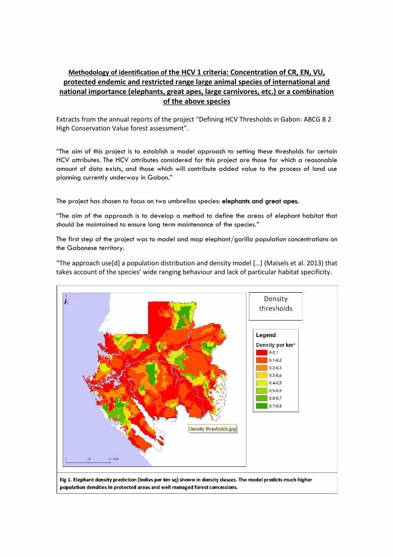
Extracts from the annual reports of the project “Defining HCV Thresholds in Gabon: ABCG B 2 High Conservation Value forest assessment”.
“The aim of this project is to establish a model approach to setting these thresholds for certain
HCV attributes. The HCV attributes considered for this project are those for which a reasonable
amount of data exists, and those which will contribute added value to the process of land use
planning currently underway in Gabon.”
The project has chosen to focus on two umbrellas species: elephants and great apes.
“The aim of the approach is to develop a method to define the areas of elephant habitat that
should be maintained to ensure long term maintenance of the species.”
The first step of the project was to model and map elephant/gorilla population concentrations on
the Gabonese territory.
“The approach use[d] a population distribution and density model […] (Maisels et al. 2013) that takes account of the species’ wide ranging behaviour and lack of particular habitat specificity.

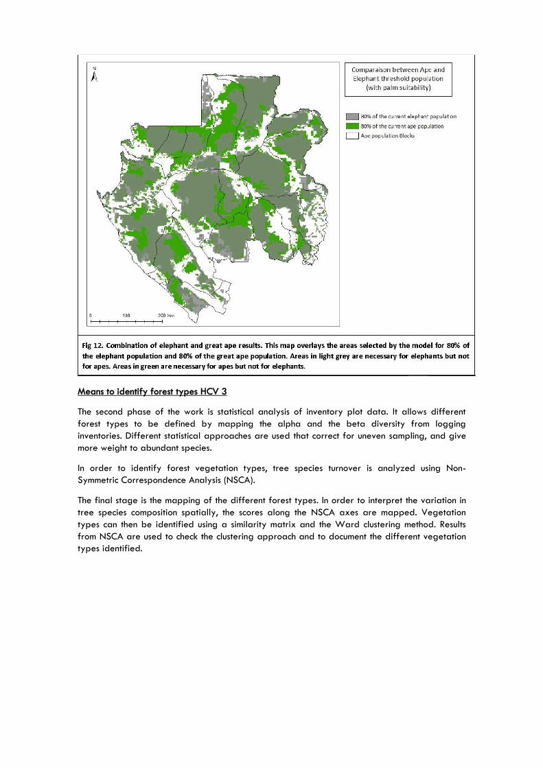
The second step was to delineate contiguous blocks of habitat for viable elephant population
based on certain assumptions. In each block the objective was to model the “optimal area of
land required to conserve” a certain percentage of the elephant population.
“Repeating this analysis at different percentage target thresholds is informative, as it shows how much more land would be required under forest if the target percentage is increased.”
“A similar approach to the modelling of elephant populations has been undertaken for great
apes by Fiona Maisels and Samantha Strindberg of WCS.”
Here are the results they obtained.

And then they tried to combine both 80% population target area for elephants and great apes.
Means to identify forest types HCV 3
The second phase of the work is statistical analysis of inventory plot data. It allows different
forest types to be defined by mapping the alpha and the beta diversity from logging
inventories. Different statistical approaches are used that correct for uneven sampling, and give
more weight to abundant species.
In order to identify forest vegetation types, tree species turnover is analyzed using Non-
Symmetric Correspondence Analysis (NSCA).
The final stage is the mapping of the different forest types. In order to interpret the variation in
tree species composition spatially, the scores along the NSCA axes are mapped. Vegetation
types can then be identified using a similarity matrix and the Ward clustering method. Results
from NSCA are used to check the clustering approach and to document the different vegetation
types identified.