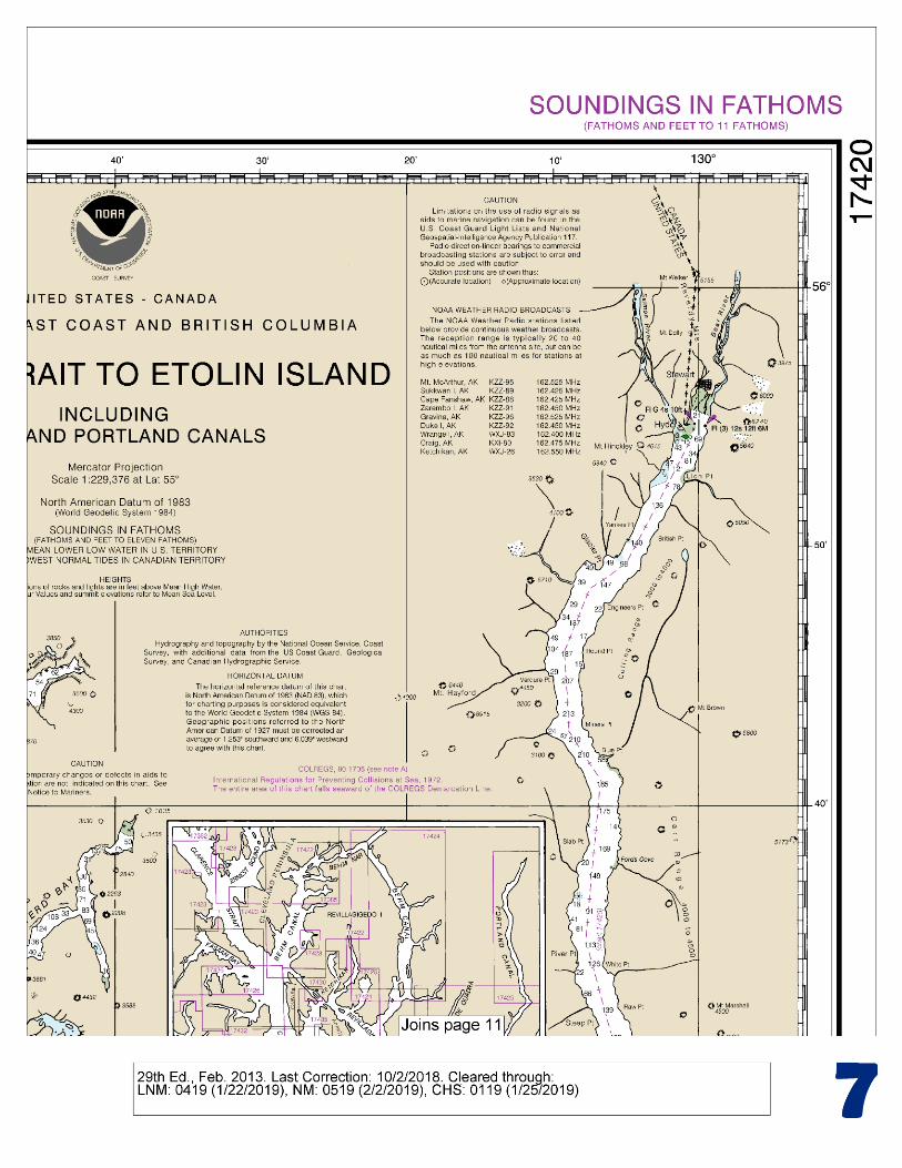
hecate strait to etolin island - quick links · hecate strait to etolin island . noaa chart 17420 ....
TRANSCRIPT

BookletChart™ Hecate Strait to Etolin Island NOAA Chart 17420
A reduced-scale NOAA nautical chart for small boaters When possible, use the full-size NOAA chart for navigation.
Included Area

2
Published by the National Oceanic and Atmospheric Administration
National Ocean Service Office of Coast Survey
www.NauticalCharts.NOAA.gov 888-990-NOAA
What are Nautical Charts?
Nautical charts are a fundamental tool of marine navigation. They show water depths, obstructions, buoys, other aids to navigation, and much more. The information is shown in a way that promotes safe and efficient navigation. Chart carriage is mandatory on the commercial ships that carry America’s commerce. They are also used on every Navy and Coast Guard ship, fishing and passenger vessels, and are widely carried by recreational boaters.
What is a BookletChart?
This BookletChart is made to help recreational boaters locate themselves on the water. It has been reduced in scale for convenience, but otherwise contains all the information of the full-scale nautical chart. The bar scales have also been reduced, and are accurate when used to measure distances in this BookletChart. See the Note at the bottom of page 5 for the reduction in scale applied to this chart.
Whenever possible, use the official, full scale NOAA nautical chart for navigation. Nautical chart sales agents are listed on the Internet at http://www.NauticalCharts.NOAA.gov.
This BookletChart does NOT fulfill chart carriage requirements for regulated commercial vessels under Titles 33 and 44 of the Code of Federal Regulations.
Notice to Mariners Correction Status
This BookletChart has been updated for chart corrections published in the U.S. Coast Guard Local Notice to Mariners, the National Geospatial Intelligence Agency Weekly Notice to Mariners, and, where applicable, the Canadian Coast Guard Notice to Mariners. Additional chart corrections have been made by NOAA in advance of their publication in a Notice to Mariners. The last Notices to Mariners applied to this chart are listed in the Note at the bottom of page 7. Coast Pilot excerpts are not being corrected.
For latest Coast Pilot excerpt visit the Office of Coast Survey website at http://www.nauticalcharts.noaa.gov/nsd/searchbychart.php?chart=17420.
(Selected Excerpts from Coast Pilot) Graham Island forms the S side of Dixon Entrance for 50 miles from Langara Island to Hecate Strait. Langara Island, on the S side of the W end of Dixon Entrance, is a small irregularly shaped, densely wooded island, close off Cape Knox, the northwesternmost point of Graham Island. Langara Point Light (54°15'24"N., 133°03'30"W.) is shown from an octagonal tower on the NW end of Langara Island. A
white dwelling is about 135 yards E of the light. Forrester Island, about 14.5 miles off the Dall Island shore, is a prominent landmark for the approach to Dixon Entrance from NW. The
island is wooded and mountainous. Cape Muzon, the S extremity of Dall Island, forms the NW headland of Dixon Entrance. It is heavily wooded and rises to a rounded peak 2 miles NW of the extremity of the cape. Off the E end of the cape is a group of small islands and rocks. A breaker is 0.3 mile off the S shore of the cape. Vessels should give the cape a berth of at least 1 mile. A bank with a reported least depth of 14 fathoms is 2 miles SW of Cape Muzon Light. Cape Muzon Light (54°39'54"N., 132°41'34"W.), 80 feet above the water, is shown from a spindle with a red and white diamond-shaped daymark on the S extremity of the cape. Celestial Reef (54°31'N., 131°28'W.), about 10 miles SSE of West Devil Rock, is about 1 mile long and has three heads with less than 1 fathom over them near the S end. The depth over the remainder of the shoal is about 10 fathoms. A rock, covered 1½ fathoms, is 0.7 mile NE of the reef. Two 10-fathom shoals are about 0.5 mile N and 3 miles NNW of the reef, respectively. An 8-fathom shoal is about 2 miles S of the center of the reef. Zayas Island, in the NE part of Dixon Entrance and about 11.5 miles SE of Barren Island, is wooded, flat-topped, and high near the S end. A rock, with 4 feet over it, is about 0.7 mile N of Aranzazu Point, the NW extremity of Zayas Island. Foul ground marked by kelp extends along the N shore of the island with several 5-fathom spots about 1 mile N of the island. A light marks the southernmost point of the island. McCullock Rock, a pinnacle rock with 9 feet over it, is about 4 miles W of Jacinto Point, the SW extremity of Zayas Island. A 3-fathom shoal and a 5-fathom shoal are about 0.4 mile ESE and about 1.3 miles NNE of the rock, respectively. Dundas Islands, in the E part of Dixon Entrance, consist of Dundas Island, Baron Island, Dunira Island, Melville Island, and numerous small islets and rocks. Dundas, the northwesternmost and largest island, has a number of conspicuous mountains, of which Mount Henry, towards the S end of the island, is the highest. Two conspicuous hills are in the NW part of the island. Slab Hill, flat-topped with a knob, is conspicuous near the NE end of the island. The coasts of the four large islands of the group are much indented by small creeks and bays. Caution.–Recent surveys indicate less water than charted in the vicinity of Dundas Islands. Mariners are advised to navigate with caution in the vicinity of these islands as many rocks awash and submerged, and some marked by kelp, have been reported in this area. Holliday Island Light (54°37'24"N., 130°45'30"W.) is shown from a white slatted daymark on a concrete base on the N end of Holliday Island, which is 0.3 mile off the NE end of Dundas Island. Revillagigedo Channel and Tongass Narrows (chart 17428) are connecting bodies of water that have a combined length of about 53 miles from their junction with Dixon Entrance at Tree Point Light to their junction with Clarence Strait at Guard Islands Light. On their S side they connect with Clarence Strait through Felice Strait and Nichols Passage. Revillagigedo Island, separated from the mainland by Behm Canal, forms the greater part of the N shore of the passages. Behm Canal borders the E, N, and W sides of Revillagigedo Island; its E entrance, between Point Sykes and Point Alava, is about 5.7 miles NNE of Mary Island Light.
U.S. Coast Guard Rescue Coordination Center 24 hour Regional Contact for Emergencies
RCC Juneau Commander
17th CG District (907) 463-2000 Juneau, Alaska
G
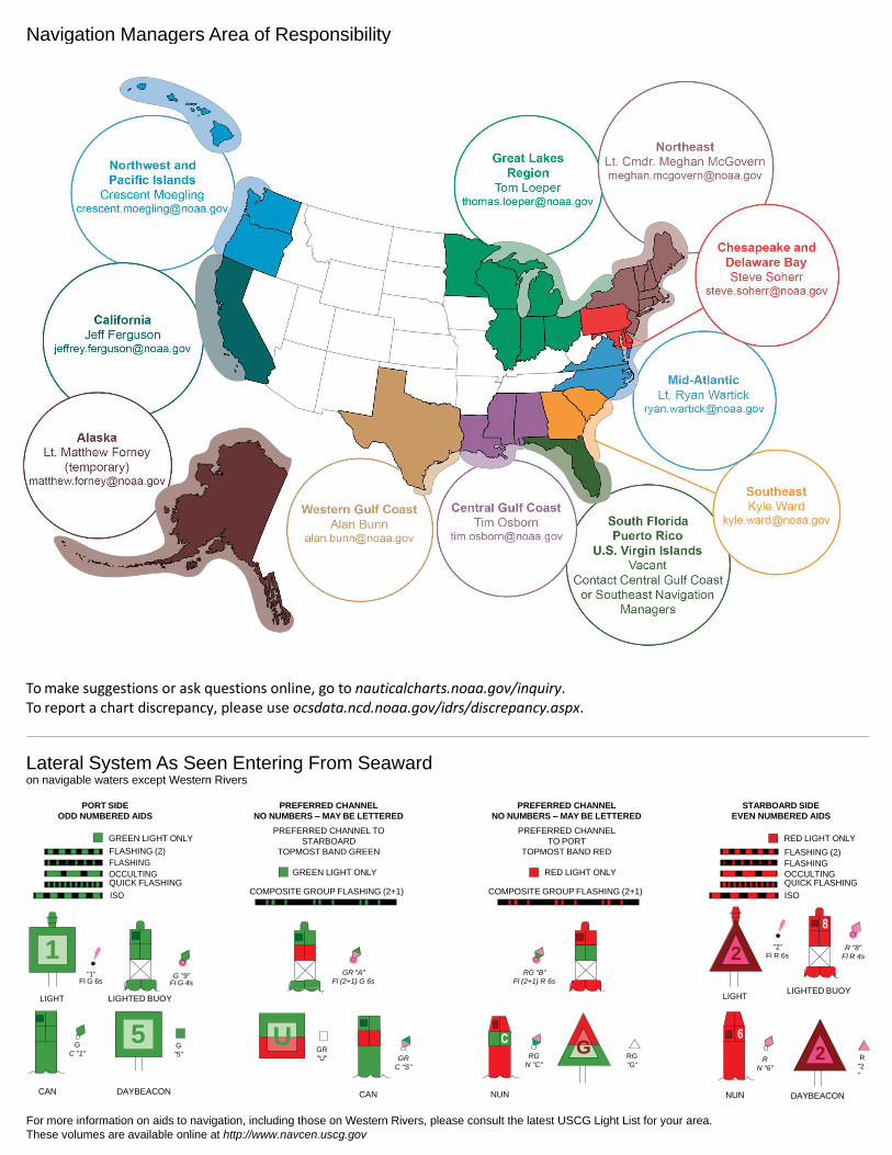
NOAA’s navigation managers serve as ambassadors to the maritime community. They help identify navigational challenges facing professional and recreational mariners, and provide NOAA resources and information for safe navigation. For additional information, please visit nauticalcharts.noaa.gov/service/navmanagers
To make suggestions or ask questions online, go to nauticalcharts.noaa.gov/inquiry. To report a chart discrepancy, please use ocsdata.ncd.noaa.gov/idrs/discrepancy.aspx.
Lateral System As Seen Entering From Seaward on navigable waters except Western Rivers
PORT SIDE
ODD NUMBERED AIDS
GREEN LIGHT ONLY
FLASHING (2)
PREFERRED CHANNEL
NO NUMBERS – MAY BE LETTERED
PREFERRED CHANNEL TO
STARBOARD
TOPMOST BAND GREEN
PREFERRED CHANNEL
NO NUMBERS – MAY BE LETTERED
PREFERRED CHANNEL
TO PORT
TOPMOST BAND RED
STARBOARD SIDE
EVEN NUMBERED AIDS
RED LIGHT ONLY
FLASHING (2)
FLASHING FLASHING
OCCULTING GREEN LIGHT ONLY RED LIGHT ONLY OCCULTING QUICK FLASHING QUICK FLASHING
ISO COMPOSITE GROUP FLASHING (2+1) COMPOSITE GROUP FLASHING (2+1) ISO
"1"
Fl G 6s
G "9"
Fl G 4s
GR "A"
Fl (2+1) G 6s
RG "B"
Fl (2+1) R 6s
"2"
Fl R 6s
8
R "8"
Fl R 4s
LIGHT
G
C "1"
LIGHTED BUOY
G
"5"
GR
"U"
GR
C "S"
RG
N "C"
RG
"G"
LIGHT
6
R
N "6"
LIGHTED BUOY
R
"2
"
CAN DAYBEACON
CAN NUN NUN
DAYBEACON
For more information on aids to navigation, including those on Western Rivers, please consult the latest USCG Light List for your area.
These volumes are available online at http://www.navcen.uscg.gov
Navigation Managers Area of Responsibility
Northeast
Lt. Meghan McGovern
Northwest and
Pacific Islands
Crescent Moegling
Great Lakes Region
Tom Loeper
Chesapeake and
Delaware Bay
Steve Soherr
California
Jeff Ferguson
[email protected] Mid-Atlantic
Lt. Ryan Wartick
Alaska
Lt. Timothy M. Smith
Western Gulf Coast
Alan Bunn
Central Gulf Coast
Tim Osborn
[email protected] South Florida
Puerto Rico
U.S. Virgin Islands
Michael Henderson
Southeast
Kyle Ward
2
2 C U 5
1


VHF Marine Radio channels for use on the waterways:Channel 6 – Inter-ship safety communications.Channel 9 – Communications between boats and ship-to-coast.Channel 13 – Navigation purposes at bridges, locks, and harbors.Channel 16 – Emergency, distress and safety calls to Coast Guard and others, and to initiate calls to other
vessels. Contact the other vessel, agree to another channel, and then switch.Channel 22A – Calls between the Coast Guard and the public. Severe weather warnings, hazards to navigation and safety warnings are broadcast here.Channels 68, 69, 71, 72 and 78A – Recreational boat channels.
Getting and Giving Help — Signal other boaters using visual distress signals (flares, orange flag, lights, arm signals); whistles; horns; and on your VHF radio. You are required by law to help boaters in trouble. Respond to distress signals, but do not endanger yourself.
EMERGENCY INFORMATION
Distress Call Procedures
• Make sure radio is on.• Select Channel 16.• Press/Hold the transmit button.• Clearly say: “MAYDAY, MAYDAY, MAYDAY.”• Also give: Vessel Name and/or Description;Position and/or Location; Nature of Emergency; Number of People on Board.• Release transmit button.• Wait for 10 seconds — If no responseRepeat MAYDAY call.
HAVE ALL PERSONS PUT ON LIFE JACKETS!
This Booklet chart has been designed for duplex printing (printed on front and back of one sheet). If a duplex option is not available on your printer, you may print each sheet and arrange them back-to-back to allow for the proper layout when viewing.
QR
Quick ReferencesNautical chart related products and information - http://www.nauticalcharts.noaa.gov
Interactive chart catalog - http://www.charts.noaa.gov/InteractiveCatalog/nrnc.shtmlReport a chart discrepancy - http://ocsdata.ncd.noaa.gov/idrs/discrepancy.aspx
Chart and chart related inquiries and comments - http://ocsdata.ncd.noaa.gov/idrs/inquiry.aspx?frompage=ContactUs
Chart updates (LNM and NM corrections) - http://www.nauticalcharts.noaa.gov/mcd/updates/LNM_NM.html
Coast Pilot online - http://www.nauticalcharts.noaa.gov/nsd/cpdownload.htm
Tides and Currents - http://tidesandcurrents.noaa.gov
Marine Forecasts - http://www.nws.noaa.gov/om/marine/home.htm
National Data Buoy Center - http://www.ndbc.noaa.gov/
NowCoast web portal for coastal conditions - http://www.nowcoast.noaa.gov/
National Weather Service - http://www.weather.gov/
National Hurrican Center - http://www.nhc.noaa.gov/
Pacific Tsunami Warning Center - http://ptwc.weather.gov/
Contact Us - http://www.nauticalcharts.noaa.gov/staff/contact.htm
NOAA’s Office of Coast Survey The Nation’s Chartmaker
For the latest news from Coast Survey, follow @NOAAcharts
NOAA Weather Radio All Hazards (NWR) is a nationwide network of radio stations broadcasting continuous weather information directly from the nearest National Weather Service office. NWR broadcasts official Weather Service warnings, watches, forecasts and other hazard information 24 hours a day, 7 days a week. http://www.nws.noaa.gov/nwr/