ha and hma index map - bureau of land … · no warranty is made by the bureau of land management...
TRANSCRIPT

Idaho
Arizona
Colorado
Nevada
NewMexico
Utah
Wyoming
CO 1, UT 1
UT 2
UT 3
UT 4
UT 5
UT 6,NV 2
UT 7
HMA BoundariesHA BoundariesMap Index AreasState Boundaries
20 0 2010
MilesApril 3, 2011
No warranty is made by the Bureau of Land Management as to the accuracy, reliability or completeness of these data for individual use or aggregate use with other data.
UtahHA and HMA Index Map


6
40
191
80
70
BattlementMesa
De Beque
CarbondaleEl Jebel
Loma
Collbran
FruitaMolina
Westwater
MesaPalisade
Redlands
Redstone
FruitvaleCliftonMarble
Lapoint
Bryan Rock SpringsPeru
GreenRiver
Quealy
MonellBitterCreek
ManilaHiawatha
Baggs DixonSavery
PowderWash
Greystone
MaeserVernal
Naples
Maybell Lay Craig
JensenFortDuchesne
HaydenMilner
ElkSprings
Randlett
Hamilton
Mack
Dinosaur BlueMountain
Moffat
MassadonaAxial
Ouray Rangely
BonanzaMeeker
RioBlanco
NewCastleSiltRifle
GlenwoodSprings
CardiffParachute
Rock Springs
Salt Wells Creek
Salt WellsCreek
Bonanza
HillCreek
HillCreek
WinterRidge
WestDouglas
Creek
Piceance-EastDouglas Creek
Sand Creek East
DotyMountain/Cherokee
SouthGranger
CheckerboardSouth
Sand Creek West
SandWashBasin
NorthPiceance
LittleBookCliffs
Douglas Mountain
Rock Springs
HA BoundariesCity
RoadInterstate HighwayUS HighwayState HighwayState Boundaries
Land OwnershipBureau of Indian AffairsBureau of Land ManagementBureau of ReclaimationDepartment of DefenseDepartment of EnergyFish and Wildlife ServiceNational Park ServiceOther Federal AgenciesPrivate LandState LandForest ServiceWater
10 0 105
Miles
May 18, 2011
No warranty is made by the Bureau of Land Management as to the accuracy, reliability or completeness of these data for individual use or aggregate use with other data.
Colorado, Utah CO Index Map 1, UT Index Map 1
Herd Areas
HA and HMA Overview Map

6
40
191
70
DinosaurBlueMountain
MoffatMassadonaAxialOuray
RangelyBonanza
Meeker
RioBlanco
NewCastle
Maeser
Rifle GlenwoodSpringsCardiffParachute
BattlementMesa
De Beque
Manila
Hiawatha BaggsDixon
SaveryPowderWash
Greystone
VernalNaples
Silt
Maybell LayCraigJensen
HaydenElkSprings
Hamilton
Salt Wells CreekAdobe Town
Piceance-East Douglas Creek
Sand Wash Basin
HMA BoundariesCity
RoadInterstate HighwayUS HighwayState HighwayState Boundaries
Land OwnershipBureau of Indian AffairsBureau of Land ManagementBureau of ReclaimationDepartment of DefenseDepartment of EnergyFish and Wildlife ServiceNational Park ServiceOther Federal AgenciesPrivate LandState LandForest ServiceWater
9 0 94.5
MilesApril 3, 2011
No warranty is made by the Bureau of Land Management as to the accuracy, reliability or completeness of these data for individual use or aggregate use with other data.
Colorado, Utah CO Index Map 1, UT Index Map 1
Herd Management Areas

160
163
89
TorreyTeasdale CainevilleFruitaGrover
Antimony
BoulderTown
Escalante
Tropic
WhiteCanyon
CannonvilleHenrieville
BigWater
Page
Kayenta
Angle CanyonLands
Moody-WagonBox Mesa
HarveysFear
HA BoundariesCity
RoadInterstate HighwayUS HighwayState HighwayState Boundaries
Land OwnershipBureau of Indian AffairsBureau of Land ManagementBureau of ReclaimationDepartment of DefenseDepartment of EnergyFish and Wildlife ServiceNational Park ServiceOther Federal AgenciesPrivate LandState LandForest ServiceWater
7 0 73.5
Miles
May 18, 2011
No warranty is made by the Bureau of Land Management as to the accuracy, reliability or completeness of these data for individual use or aggregate use with other data.
UT Index Map 2UtahHerd Areas
HA and HMA Overview Map
191
6
89
70
FayetteSterling
Gunnison
OrangevilleCastleDaleCenterfield
Woodside
MayfieldAxtell
ClawsonFerron
RedmondSalina Moore
Emery
GreenRiver Thompson
Springs
Burrville
FremontLoa
Wattis
BicknellHanksville
TorreyTeasdaleCaineville
FruitaGrover
BoulderTown
EscalanteWhiteCanyon
FountainGreen
Fairview ClearCreek
Levan
SpringGlenMount
PleasantMoroniPrice
Wales SpringCity
Wellington Sunnyside
Lyman
EastCarbon
HiawathaColumbia
Ephraim
Mounds
Elmo Cedar
Manti
ClevelandHuntington
WinterRidge
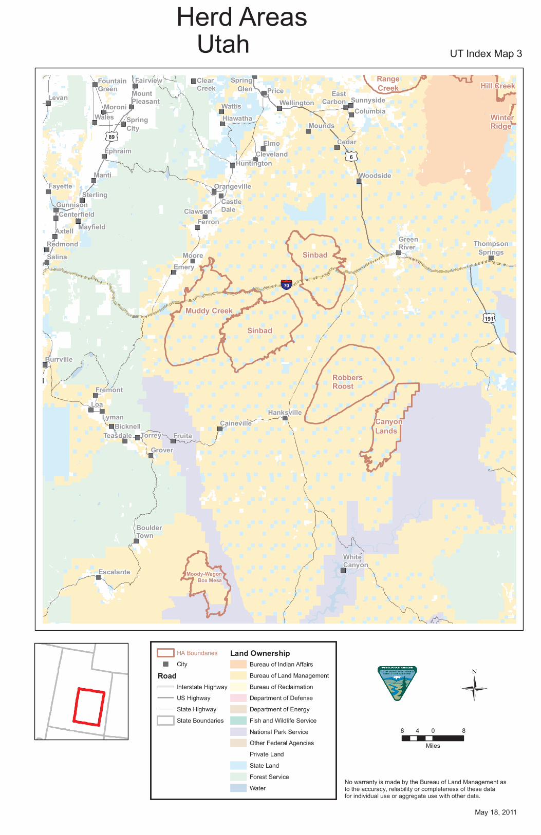
Sinbad
Muddy Creek
Sinbad
RobbersRoost
CanyonLands
Moody-WagonBox Mesa
Hill CreekRangeCreek
HA BoundariesCity
RoadInterstate HighwayUS HighwayState HighwayState Boundaries
Land OwnershipBureau of Indian AffairsBureau of Land ManagementBureau of ReclaimationDepartment of DefenseDepartment of EnergyFish and Wildlife ServiceNational Park ServiceOther Federal AgenciesPrivate LandState LandForest ServiceWater
8 0 84
Miles
May 18, 2011
No warranty is made by the Bureau of Land Management as to the accuracy, reliability or completeness of these data for individual use or aggregate use with other data.
UT Index Map 3UtahHerd Areas
HA and HMA Overview Map

191
89
6
70
Fayette
SterlingGunnison Orangeville
CastleDale
CenterfieldWoodsideMayfield
Axtell ClawsonFerronRedmond
MooreEmery
Cleveland
Fremont
LoaLyman
Bicknell
HanksvilleTorreyTeasdale CainevilleFruita
Grover
Ephraim Mounds
GreenRiver
ElmoCedarManti Huntington
BoulderTown
Muddy Creek
Canyon Lands
Sinbad
HMA BoundariesCity
RoadInterstate HighwayUS HighwayState HighwayState Boundaries
Land OwnershipBureau of Indian AffairsBureau of Land ManagementBureau of ReclaimationDepartment of DefenseDepartment of EnergyFish and Wildlife ServiceNational Park ServiceOther Federal AgenciesPrivate LandState LandForest ServiceWater
9 0 94.5
MilesApril 3, 2011
No warranty is made by the Bureau of Land Management as to the accuracy, reliability or completeness of these data for individual use or aggregate use with other data.
UT Index Map 3UtahHerd Management Areas

191
40
6
Upalco Roosevelt Ballard FortDuchesne
Randlett
DuchesneMyton
Bridgeland
Ouray
SunnysideEastCarbon
Columbia
Mounds
Cedar
Woodside
Bonanza
HillCreek
HillCreekRange Creek
WinterRidge
Sinbad
HA BoundariesCity
RoadInterstate HighwayUS HighwayState HighwayState Boundaries
Land OwnershipBureau of Indian AffairsBureau of Land ManagementBureau of ReclaimationDepartment of DefenseDepartment of EnergyFish and Wildlife ServiceNational Park ServiceOther Federal AgenciesPrivate LandState LandForest ServiceWater
5 0 52.5
Miles
May 18, 2011
No warranty is made by the Bureau of Land Management as to the accuracy, reliability or completeness of these data for individual use or aggregate use with other data.
UT Index Map 4UtahHerd Areas
HA and HMA Overview Map

191
6
Ouray
SunnysideEastCarbon
Columbia
Cedar
Woodside
Range Creek
HMA BoundariesCity
RoadInterstate HighwayUS HighwayState HighwayState Boundaries
Land OwnershipBureau of Indian AffairsBureau of Land ManagementBureau of ReclaimationDepartment of DefenseDepartment of EnergyFish and Wildlife ServiceNational Park ServiceOther Federal AgenciesPrivate LandState LandForest ServiceWater
5 0 52.5
MilesApril 3, 2011
No warranty is made by the Bureau of Land Management as to the accuracy, reliability or completeness of these data for individual use or aggregate use with other data.
UT Index Map 4UtahHerd Management Areas

89
6
189
50
215
84
15
80
BennionErda WestJordan
Midvale
ParkCity
SandyTooele WhiteCity
AltaGraniteHerriman
RivertonDraper
Stockton Bluffdale AlpineHighlandRush
ValleySaintJohn
OphirCedar
Hills
GoldHill
Lehi American ForkCedarFort Saratoga
Springs
PleasantGrove
EagleMountain
Lindon
FairfieldVineyard
Orem
Faust
Provo
Vernon
Springville
Callao
MapletonSpanish
ForkLofgreen SalemPayson
Kaysville
WoodlandHillsElk
RidgeEureka SantaquinElberta
Goshen ThistleSilverCity
TroutCreek
Birdseye
MonaJericho
Indianola
NephiFountainGreen
LeamingtonLynndylLevan
Sugarville Mills
Abraham
MoroniWales
SpringCity
Delta Oak CityHinckley
Oasis Deseret
Ephraim
Salduro Arinosa Knolls TimpieBurmester
Lucin Willard
Lakeside
PleasantViewPlain
City NorthOgden
FarrWest
HarrisvillePromontoryPoint
HuntsvilleOgdenWest
Haven SouthOgdenHooperRiverdale
Washington TerraceRoySunset UintahWest Point ClearfieldSyracuse Layton
FruitHeights
DevilsSlide
MorganFarmington
Henefer
Genola
Porterville
Low
CentervilleWestBountiful Bountiful
WoodsCrossVal
Verda
Clive
North Salt Lake
Saltair Salt LakeCity
MagnaWest Valley
CityCanyon RimEastMillcreek
MillcreekStansbury
Park TaylorsvilleMurrayKearnsGrantsville
HolladayCottonwoodOquirrh
Big Creek
OquirrhMountain
Onaqui Mountain
Confusion
Swasey
Conger
CedarMountain
Big Creek
HA BoundariesCity
RoadInterstate HighwayUS HighwayState HighwayState Boundaries
Land OwnershipBureau of Indian AffairsBureau of Land ManagementBureau of ReclaimationDepartment of DefenseDepartment of EnergyFish and Wildlife ServiceNational Park ServiceOther Federal AgenciesPrivate LandState LandForest ServiceWater
8 0 84
Miles
May 18, 2011
No warranty is made by the Bureau of Land Management as to the accuracy, reliability or completeness of these data for individual use or aggregate use with other data.
UT Index Map 5UtahHerd Areas
HA and HMA Overview Map

89
6
189
15
215
84
80
Erda UnionWest JordanMidvale
SandyTooele South JordanWhite
City GraniteHerrimanRiverton DraperStockton
Bluffdale AlpineHighland
RushValleySaint
John OphirCedarHills
LehiAmerican
ForkCedarFort
SaratogaSprings
PleasantGroveEagle
MountainLindon
Fairfield VineyardOrem
Kaysville
ProvoVernon
SpringvilleMapleton
SpanishFork
Lofgreen
SalemPayson
GenolaWoodlandHills
ElkRidge
EurekaSantaquinElberta
GoshenSilverCity Birdseye
MonaJericho
Indianola
Nephi
FountainGreen
SalduroArinosa
Knolls
Timpie
Burmester
North OgdenHarrisville
PromontoryPoint Marriott-Slaterville
OgdenWestHaven
SouthOgdenHooper
WashingtonTerrace
RoyClinton
Sunset UintahWestPoint South
WeberClearfieldSyracuseLayton
FruitHeights
FarmingtonLowCentervilleWestBountifulBountifulWoods
CrossVal
Verda
Faust
CliveNorthSalt LakeSaltairSalt LakeCityMagna South Salt Lake
West Valley CityEastMillcreekMillcreek
StansburyPark
Taylorsville MurrayGrantsville HolladayCottonwoodOquirrh
Onaqui Mountain
Confusion
Swasey
Cedar Mountain
HMA BoundariesCity
RoadInterstate HighwayUS HighwayState HighwayState Boundaries
Land OwnershipBureau of Indian AffairsBureau of Land ManagementBureau of ReclaimationDepartment of DefenseDepartment of EnergyFish and Wildlife ServiceNational Park ServiceOther Federal AgenciesPrivate LandState LandForest ServiceWater
9 0 94.5
MilesApril 3, 2011
No warranty is made by the Bureau of Land Management as to the accuracy, reliability or completeness of these data for individual use or aggregate use with other data.
UT Index Map 5UtahHerd Management Areas

6
93
50
89
15
70
SilverCity
TroutCreek
Jericho
Gandy
LeamingtonLynndylSugarville
AbrahamDelta Oak City
HinckleyOasisDeseret
Scipio
ClearLake
Garrison
Holden
FlowellFillmore
MeadowHatton
KanoshBlackRock
Richfield
AnnabellaElsinoreCove
Fort
Goshute
MonroeSulphurdale Sevier
MilfordMarysvale
Manderfield
RushValley
SaintJohn
Ophir
GoldHill
Joseph
CedarFort
Ibapah
Fairfield
Faust
Tippett
Vernon
Callao
Lofgreen
Eureka
Kingtop
Burbank
SulphurFrisco
BlawnWash
Choke Cherry
AntelopeValley
Goshute
Moriah
FortificationPatterson-Eagle
SchellCreek
MurphyWash
CedarMountain
OquirrhMountain
Onaqui Mountain
Confusion
Swasey
Goshute
Conger
HA BoundariesCity
RoadInterstate HighwayUS HighwayState HighwayState Boundaries
Land OwnershipBureau of Indian AffairsBureau of Land ManagementBureau of ReclaimationDepartment of DefenseDepartment of EnergyFish and Wildlife ServiceNational Park ServiceOther Federal AgenciesPrivate LandState LandForest ServiceWater
7.5 0 7.53.75
Miles
May 18, 2011
No warranty is made by the Bureau of Land Management as to the accuracy, reliability or completeness of these data for individual use or aggregate use with other data.
UT Index Map 6, NV Index Map 2Utah, NevadaHerd Areas
HA and HMA Overview Map

89
50
6
15
70
Oak CityHinckleyOasisDeseret
ClearLake
Garrison
Holden
FlowellFillmore
MeadowHattonKanoshBlack
Rock
Richfield
TroutCreek
ElsinoreCoveFort Joseph Monroe
Ibapah
FaustTippett VernonGoshute Callao
Annabella
Gandy
LeamingtonLynndylSugarville
Abraham
DeltaConger
Kingtop
SulphurFrisco
AntelopeCedar Mountain
Onaqui Mountain
Confusion
Swasey
HMA BoundariesCity
RoadInterstate HighwayUS HighwayState HighwayState Boundaries
Land OwnershipBureau of Indian AffairsBureau of Land ManagementBureau of ReclaimationDepartment of DefenseDepartment of EnergyFish and Wildlife ServiceNational Park ServiceOther Federal AgenciesPrivate LandState LandForest ServiceWater
6 0 63
MilesApril 3, 2011
No warranty is made by the Bureau of Land Management as to the accuracy, reliability or completeness of these data for individual use or aggregate use with other data.
UT Index Map 6, NV Index Map 2Utah, NevadaHerd Management Areas

93
50
89
6
15
70
JosephMonroeSulphurdale Sevier
MilfordMarysvale
Manderfield
AdamsvilleBeaverGreenvilleMinersville Junction
Ursine
Latimer
Pioche
KingstonCircleville
Lund
ZaneBeryl
Panaca
Spry
Modena
Paragonah
Uvada
Parowan
Crestline
SummitEnochIron
SpringsPanguitch
Newcastle
Islen Acoma
CedarCity
BrianHead
EnterpriseHamiltonsFort
HatchRubys
Inn
KanarravilleBryce
CanyonNewHarmony
Tropic
CentralPineValley
CoveFort
VeyoGunlock
Pintura
Alton
ToquervilleLeedsShivwits
Glendale
Ivins La VerkinVirgin
Orderville
SantaClara
HurricaneMountCarmel
WashingtonSpringdale
SaintGeorge Rockville
Hinckley
Cannonville
OasisDeseret Scipio
ClearLake
Garrison
Holden
FlowellFillmore
MeadowHatton
KanoshBlackRock
Richfield
Elsinore
Sulphur
Frisco
Blawn Wash
Choke Cherry FourMileBible
Spring
TillyCreek
Mt Elinor
ChlorideCanyon
North Hills
Dry Lake
Patterson-Eagle
DeerLodge
CanyonHighland Peak
MillerFlat
LittleMountain
CloverCreek
CloverMountains
BlueNosePeak
MormonMountains
MurphyWash
Fortification
Conger
Kingtop
Burbank
Swasey
HA BoundariesCity
RoadInterstate HighwayUS HighwayState HighwayState Boundaries
Land OwnershipBureau of Indian AffairsBureau of Land ManagementBureau of ReclaimationDepartment of DefenseDepartment of EnergyFish and Wildlife ServiceNational Park ServiceOther Federal AgenciesPrivate LandState LandForest ServiceWater
8 0 84
Miles
May 18, 2011
No warranty is made by the Bureau of Land Management as to the accuracy, reliability or completeness of these data for individual use or aggregate use with other data.
UT Index Map 7UtahHerd Areas
HA and HMA Overview Map

936
8915
70
Manderfield
AdamsvilleBeaverGreenvilleMinersville
JunctionUrsine LatimerKingston
CirclevilleLund
ZaneBerylSpryModena
ParagonahUvada Parowan
Crestline SummitEnochIronSprings
PanguitchNewcastleAcoma Cedar
City BrianHead
Milford
HamiltonsFort
Hatch RubysInnKanarraville Bryce
CanyonNewHarmony TropicCentral
PineValley CannonvilleVeyo
Gunlock Pintura Alton
ClearLake
Enterprise
Garrison
Flowell
MeadowHatton
KanoshBlackRock
CoveFort
Sulphurdale
Eagle
North Hills
Sulphur Frisco
Kingtop
Four Mile
Bible SpringTilly Creek
Mt Elinor
Cholride Canyon
Choke Cherry
HMA BoundariesCity
RoadInterstate HighwayUS HighwayState HighwayState Boundaries
Land OwnershipBureau of Indian AffairsBureau of Land ManagementBureau of ReclaimationDepartment of DefenseDepartment of EnergyFish and Wildlife ServiceNational Park ServiceOther Federal AgenciesPrivate LandState LandForest ServiceWater6 0 63
MilesApril 3, 2011
No warranty is made by the Bureau of Land Management as to the accuracy, reliability or completeness of these data for individual use or aggregate use with other data.
UT Index Map 7UtahHerd Management Areas