gvsu sustainable storm water initiative - mi-wea.org gvsu.pdf · gvsu sustainable storm water...
TRANSCRIPT

GVSU Sustainable Storm Water Initiative
MWEA Watershed Seminar
Bath, MI
December 5, 2013
Dr. Peter J. Wampler
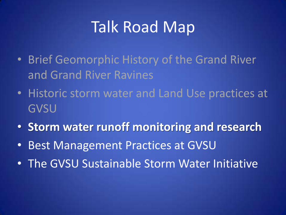
Talk Road Map
• Brief Geomorphic History of the Grand River and Grand River Ravines
• Historic storm water and Land Use practices at GVSU
• Storm water runoff monitoring and research
• Best Management Practices at GVSU
• The GVSU Sustainable Storm Water Initiative

The Grand River and Grand River Valley
Churches and Wampler (2013)
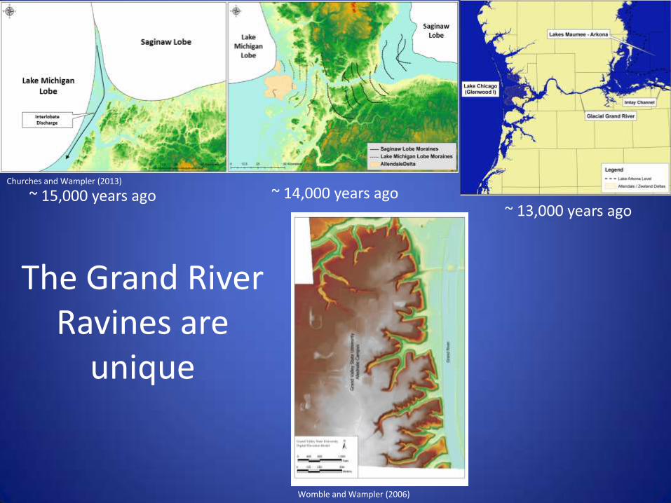
The Grand River Ravines are
unique
~ 15,000 years ago ~ 14,000 years ago ~ 13,000 years ago
Churches and Wampler (2013)
Womble and Wampler (2006)

Runoff direction toward ravines
• Drainage divide bisects campus.
• Historically water was directed east into the ravines from parking lots and buildings Drainage Divide
Talk Road Map
• Brief Geomorphic History of the Grand River and Grand River Ravines
• Historic storm water and Land Use practices at GVSU
• Storm water runoff monitoring and research
• Best Management Practices at GVSU
• The GVSU Sustainable Storm Water Initiative
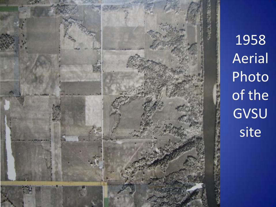
1958 Aerial Photo of the GVSU site

2004 Aerial Photo of the GVSU site

2011 Aerial Photo of the GVSU site
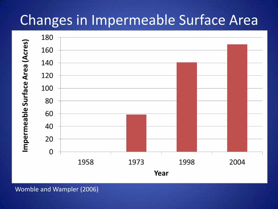
Changes in Impermeable Surface Area
Womble and Wampler (2006)
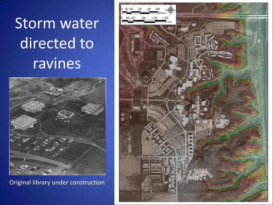
Storm water directed to
ravines
Original library under construction
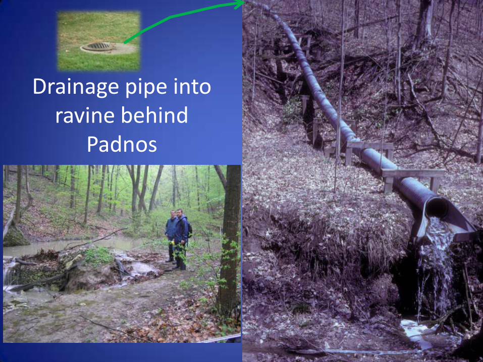
Drainage pipe into ravine behind
Padnos
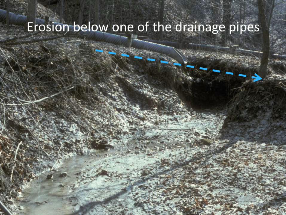
Erosion below one of the drainage pipes

Runoff and Erosion Control
Video courtesy of Steve Snell, facilities planning
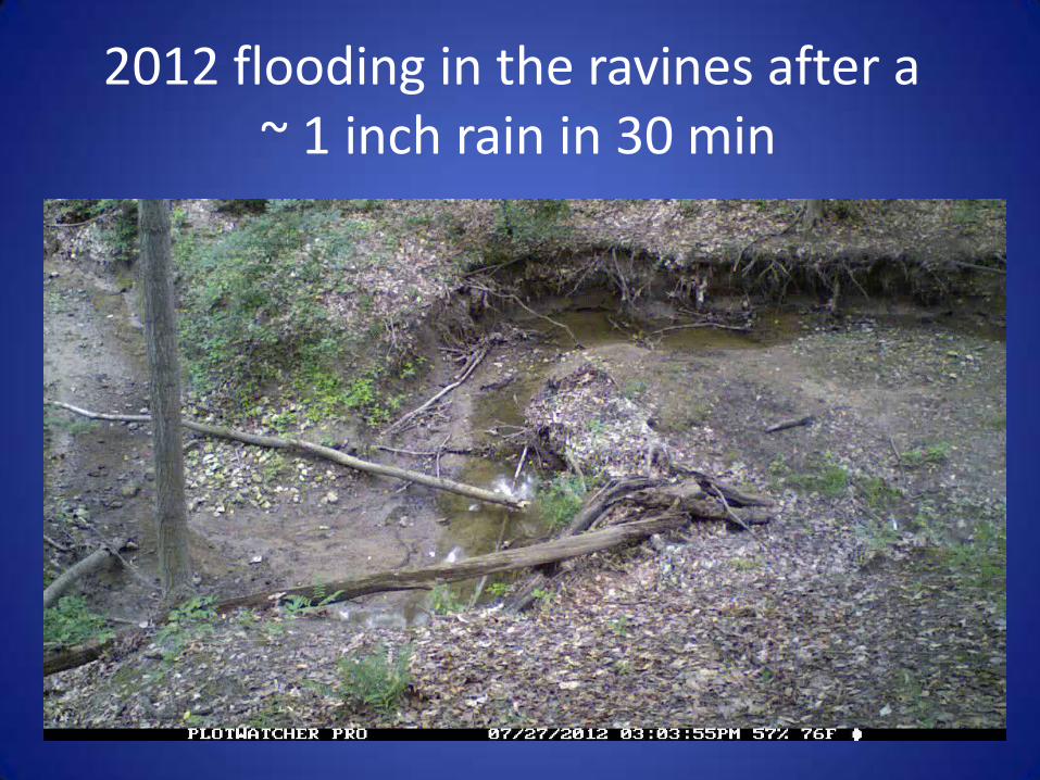
2012 flooding in the ravines after a ~ 1 inch rain in 30 min
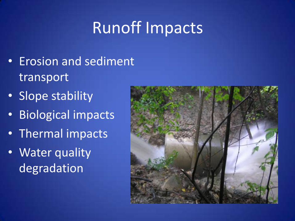
Runoff Impacts
• Erosion and sediment transport
• Slope stability
• Biological impacts
• Thermal impacts
• Water quality degradation
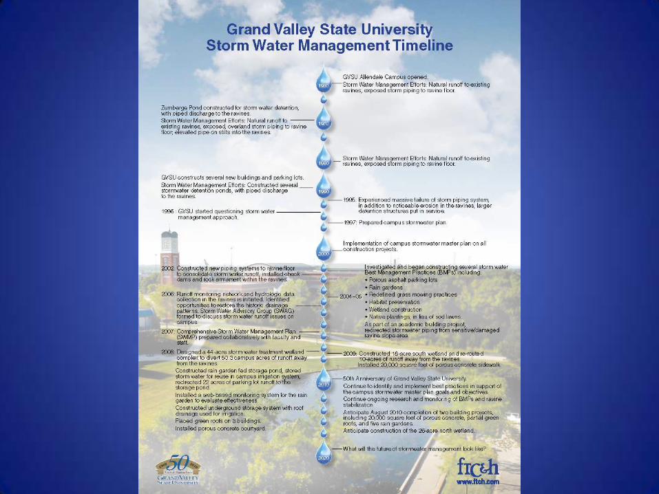
GVSU Stormwater Timeline
Talk Road Map
• Brief Geomorphic History of the Grand River and Grand River Ravines
• Historic storm water and Land Use practices at GVSU
• Storm water runoff monitoring and research
• Best Management Practices at GVSU
• The GVSU Sustainable Storm Water Initiative
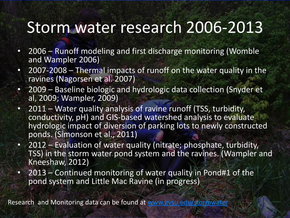
Storm water research 2006-2013 • 2006 – Runoff modeling and first discharge monitoring (Womble
and Wampler 2006) • 2007-2008 – Thermal impacts of runoff on the water quality in the
ravines (Nagorsen et al. 2007) • 2009 – Baseline biologic and hydrologic data collection (Snyder et
al, 2009; Wampler, 2009) • 2011 – Water quality analysis of ravine runoff (TSS, turbidity,
conductivity, pH) and GIS-based watershed analysis to evaluate hydrologic impact of diversion of parking lots to newly constructed ponds. (Simonson et al., 2011)
• 2012 – Evaluation of water quality (nitrate; phosphate, turbidity, TSS) in the storm water pond system and the ravines. (Wampler and Kneeshaw, 2012)
• 2013 – Continued monitoring of water quality in Pond#1 of the pond system and Little Mac Ravine (in progress)
Research and Monitoring data can be found at www.gvsu.edu/stormwater
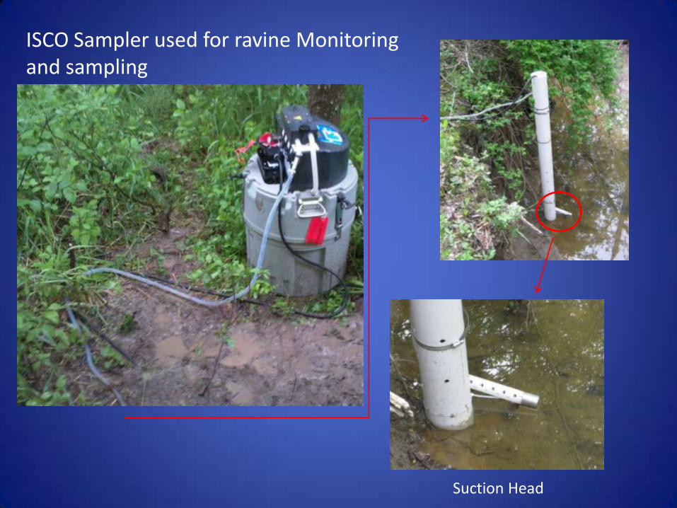
ISCO Sampler used for ravine Monitoring and sampling
Suction Head

Sediment samples from 5/23/11
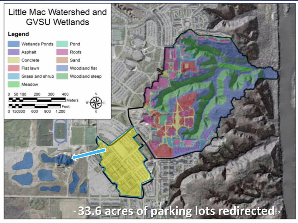
Watershed and Wetland Location Post-Diversion
22 ~ 33.6 acres of parking lots redirected
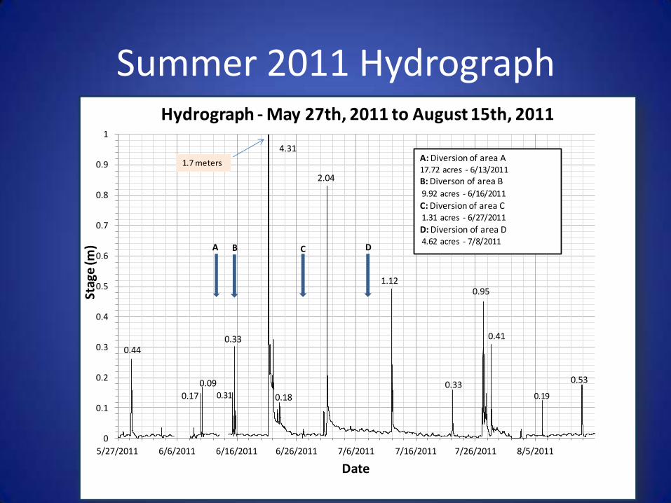
Summer 2011 Hydrograph
0.00
0.50
1.00
1.50
2.00
2.50
3.00
3.50
4.00
4.50
5.00
He
igh
t (i
n)
Date
Total Rainfall per Event (in)
0
0.1
0.2
0.3
0.4
0.5
0.6
0.7
0.8
0.9
1
5/27/2011 6/6/2011 6/16/2011 6/26/2011 7/6/2011 7/16/2011 7/26/2011 8/5/2011
Stag
e (m
)
Date
Hydrograph - May 27th, 2011 to August 15th, 2011
0.44
0.17
0.33
4.31
0.18
2.04
1.12
0.33
0.95
0.41
A B C D
A: Diversion of area A17.72 acres - 6/13/2011
B: Diverson of area B 9.92 acres - 6/16/2011
C: Diversion of area C1.31 acres - 6/27/2011
D: Diversion of area D4.62 acres - 7/8/2011
0.53
0.31 0.19
0.09
1.7 meters
0
1000
2000
3000
4000
5000
6000
7000
8000
TSS
Co
nce
ntr
atio
n (
mg
/l)
Date
TSS Concentration per Event
TSS Mean
TSS Max
A B C D
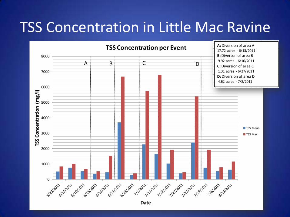
TSS Concentration in Little Mac Ravine
0
1000
2000
3000
4000
5000
6000
7000
8000
TSS
Co
nce
ntr
atio
n (
mg
/l)
Date
TSS Concentration per Event
TSS Mean
TSS Max
A B C D
0
0.1
0.2
0.3
0.4
0.5
0.6
0.7
0.8
0.9
1
5/27/2011 6/6/2011 6/16/2011 6/26/2011 7/6/2011 7/16/2011 7/26/2011 8/5/2011
Stag
e (m
)
Date
Hydrograph - May 27th, 2011 to August 15th, 2011
0.44
0.17
0.33
4.31
0.18
2.04
1.12
0.33
0.95
0.41
A B C D
A: Diversion of area A17.72 acres - 6/13/2011
B: Diverson of area B 9.92 acres - 6/16/2011
C: Diversion of area C1.31 acres - 6/27/2011
D: Diversion of area D4.62 acres - 7/8/2011
0.53
0.31 0.19
0.09
1.7 meters

GVSU Storm Water Management Complex

GVSU Storm water Management Complex
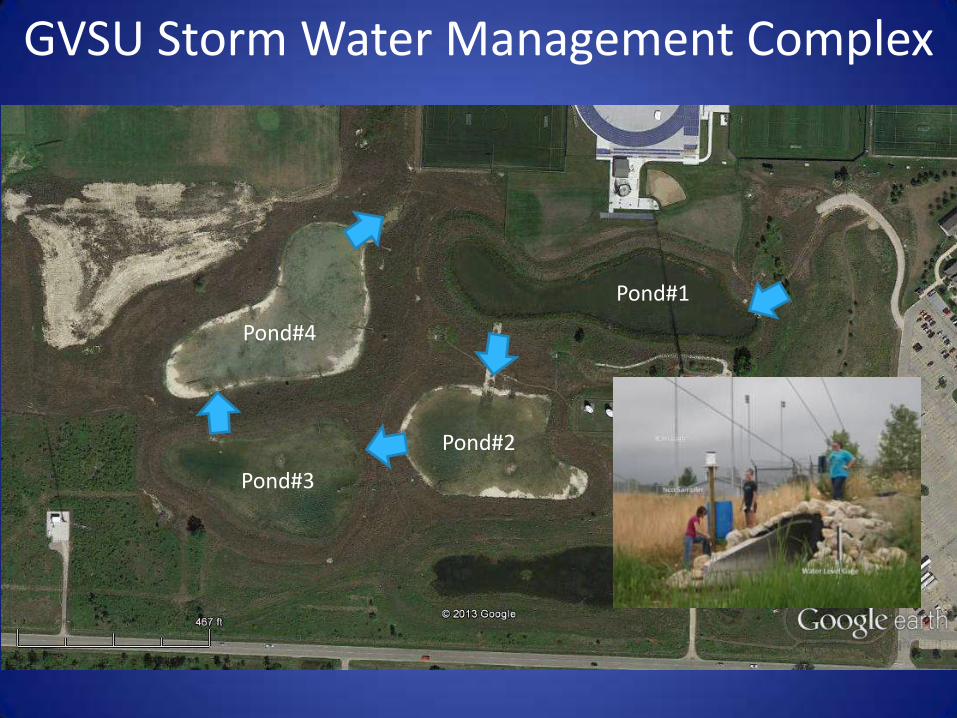
GVSU Storm Water Management Complex
Pond#1
Pond#2
Pond#3
Pond#4
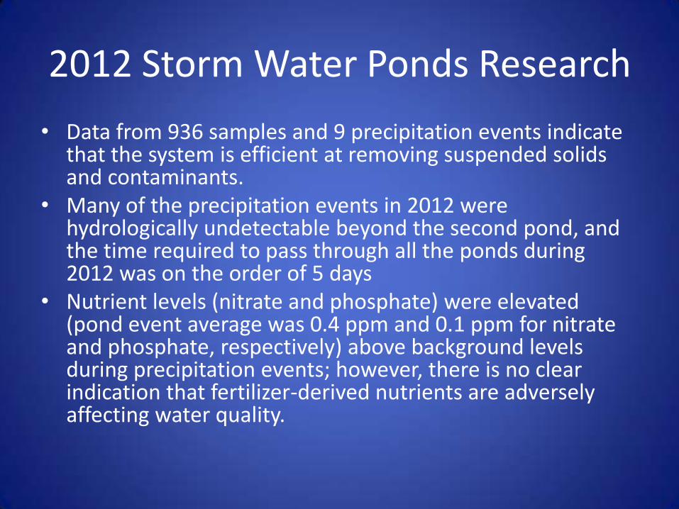
2012 Storm Water Ponds Research
• Data from 936 samples and 9 precipitation events indicate that the system is efficient at removing suspended solids and contaminants.
• Many of the precipitation events in 2012 were hydrologically undetectable beyond the second pond, and the time required to pass through all the ponds during 2012 was on the order of 5 days
• Nutrient levels (nitrate and phosphate) were elevated (pond event average was 0.4 ppm and 0.1 ppm for nitrate and phosphate, respectively) above background levels during precipitation events; however, there is no clear indication that fertilizer-derived nutrients are adversely affecting water quality.
Talk Road Map
• Brief Geomorphic History of the Grand River and Grand River Ravines
• Historic storm water and Land Use practices at GVSU
• Storm water runoff monitoring and research
• Best Management Practices at GVSU
• The GVSU Sustainable Storm Water Initiative

Storm Water BMPS at GVSU
• Bio swales
• Permeable Concrete and Asphalt
• Rain Gardens (Large and Small)
• Detention Ponds
• Green roofs
• Vegetated buffers (no mow zones)
Mackinac Bio Swale after light rain
Mackinac Bio Swale after heavy rain
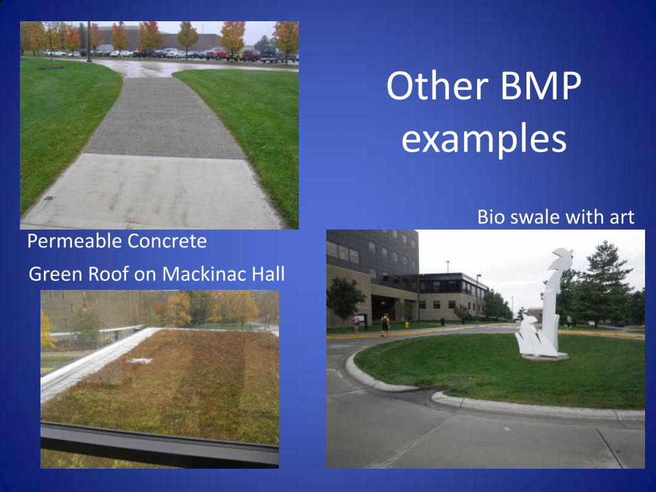
Other BMP examples
Bio swale with art Permeable Concrete
Green Roof on Mackinac Hall
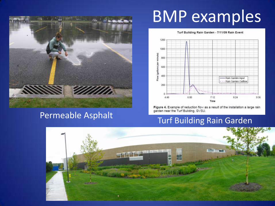
Permeable Asphalt
BMP examples
Turf Building Rain Garden
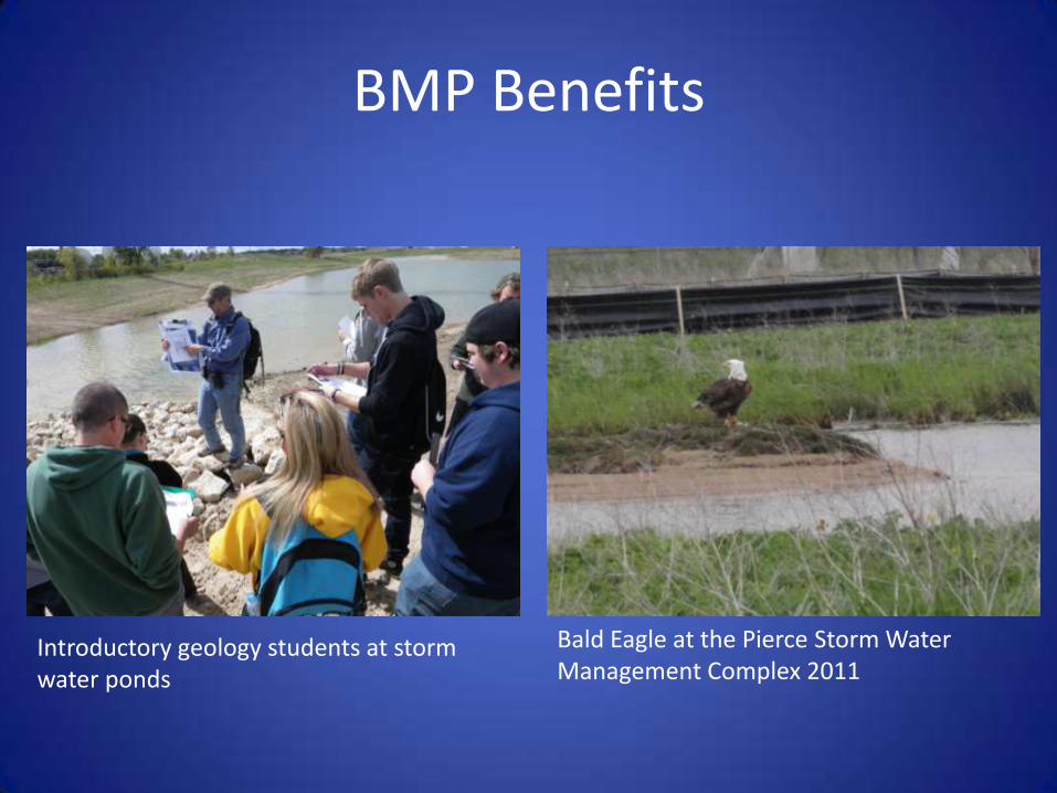
BMP Benefits
Introductory geology students at storm water ponds
Bald Eagle at the Pierce Storm Water Management Complex 2011

Talk Road Map
• Brief Geomorphic History of the Grand River and Grand River Ravines
• Historic storm water and Land Use practices at GVSU
• Storm water runoff monitoring and research
• Best Management Practices at GVSU
• The GVSU Sustainable Storm Water Initiative

Key goals of the GVSU Sustainable Storm Water Initiative
• Return campus to pre-campus (pre-1960’s) runoff levels
• Design all new buildings and grounds with no net runoff increase
• Implement BMP pilot projects to test BMP’s
• Support continued monitoring and data collection
• Foster collaboration between facilities and GVSU faculty and students

The GVSU Sustainable Storm Water Initiative Web Site
www.gvsu.edu/stormwater
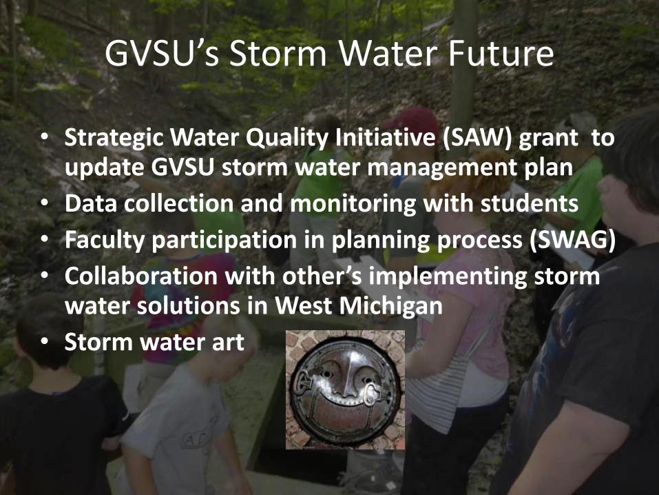
GVSU’s Storm Water Future
• Strategic Water Quality Initiative (SAW) grant to update GVSU storm water management plan
• Data collection and monitoring with students
• Faculty participation in planning process (SWAG)
• Collaboration with other’s implementing storm water solutions in West Michigan
• Storm water art
Acknowledgements
• Dr. Eric Snyder, GVSU
• Dr. Tara Kneeshaw, GVSU
• Kerri Miller, FTCH
• James Moyer, GVSU facilities
38
Questions ?