guide to the geology of the apple - university of...
TRANSCRIPT

Guide to the Geology of the AppleRiver Canyon State Park andSurrounding Area of NortheasternJo Daviess County, IllinoisWayne T. FrankieIllinois State Geological Survey
Robert S. NelsonIllinois State University
Field Trip Guidebook 2002B October 19, 2002November 2, 2002
George H. Ryan, Governor
Department of Natural ResourcesBrent Manning, Director
ILLINOIS STATE GEOLOGICAL SURVEYWilliam W. Shilts, Chief

Geological Science Field Trips The Illinois State Geological Survey (ISGS) conducts four free tours each year to acquaint the public with the rocks, mineral resources, and landscapes of various regions of the state and the geological processes that have led to their origin. Each trip is an all-day excursion through one or more Illinois counties. Frequent stops are made to explore interest-ing phenomena, explain the processes that shape our environment, discuss principles of earth science, and collect rocks and fossils. People of all ages and interests are welcome. The trips are especially helpful to teachers who prepare earth science units. We ask, however, that grade school students be accompanied by at least one parent or guardian for each five students. High school science classes should be supervised by at least one adult for each ten students.
A list of guidebooks of earlier field trips for planning class tours and private outings may be obtained by contacting the Geoscience Outreach Coordinator, Illinois State Geological Survey, Natural Resources Building, 615 East Peabody Drive, Champaign, IL 61820-6964. Telephone: 217- 244-2427 or 217-333-4747. This information is on the ISGS home page:
http://www.isgs.uiuc.edu.
Six USGS 7.5-Minute Quadrangle maps (Apple River, Elizabeth Northeast, Scales Mound East, Scales Mound West, Shullsburg, and Warren) provide coverage for this field trip area.
v Printed with soybean ink on recycled paper
Printed by authority of the State of Illinois 3/02 - 1M
Cover photo: Apple River Canyon State Park (photo by W. T. Frankie).
ILLINOIS
NATURALRESOURCES
DEPARTMENT OF
Jonathan H. Goodwin, Chair Michael L. Barnhardt David R. Larson B. Brandon Curry John H. McBride Anne L. Erdmann Donald G. Mikulic
William R. Roy
Editorial Board

Guide to the Geology of the AppleRiver Canyon State Park andSurrounding Area of NortheasternJo Daviess County, IllinoisWayne T. Frankie,Illinois State Geological Survey
Robert S. NelsonIllinois State University
Field Trip Guidebook 2002B October 19, 2002November 2, 2002
George H. Ryan, Governor
Department of Natural ResourcesBrent Manning, Director
ILLINOIS STATE GEOLOGICAL SURVEYWilliam W. Shilts, ChiefNatural Resources Building615 E. Peabody DriveChampaign, IL 61820-6964Home page: http://www.isgs.uiuc.edu/


CONTENTSIntroduction 1Geologic Framework 1 Precambrian Era 1 Paleozoic Era 2Depositional History 3 Paleozoic Era 3 Stratigraphic Units and Contacts 3 Mesozoic Era 7Ancient Environmental History 7Stratigraphy 12 Bedrock Names 12 Ordovician Period 12 Silurian Period 12Structural Setting 14 Wisconsin Arch 14Preglacial History of Northwestern Illinois 14 Erosion Surfaces 15Glacial History of Illinois 16 Pleistocene Epoch 16Geomorphology 21 Wisconsin Driftless Section 21 Rock River Hill Country 23Natural Divisions and Geology 23 Natural Divisions 23 Wisconsin Driftless Division 24 Drainage 24 Relief 24Natural Resources 24 Mineral Production 24 Groundwater 25 Future of Mineral Industries in Illinois 25
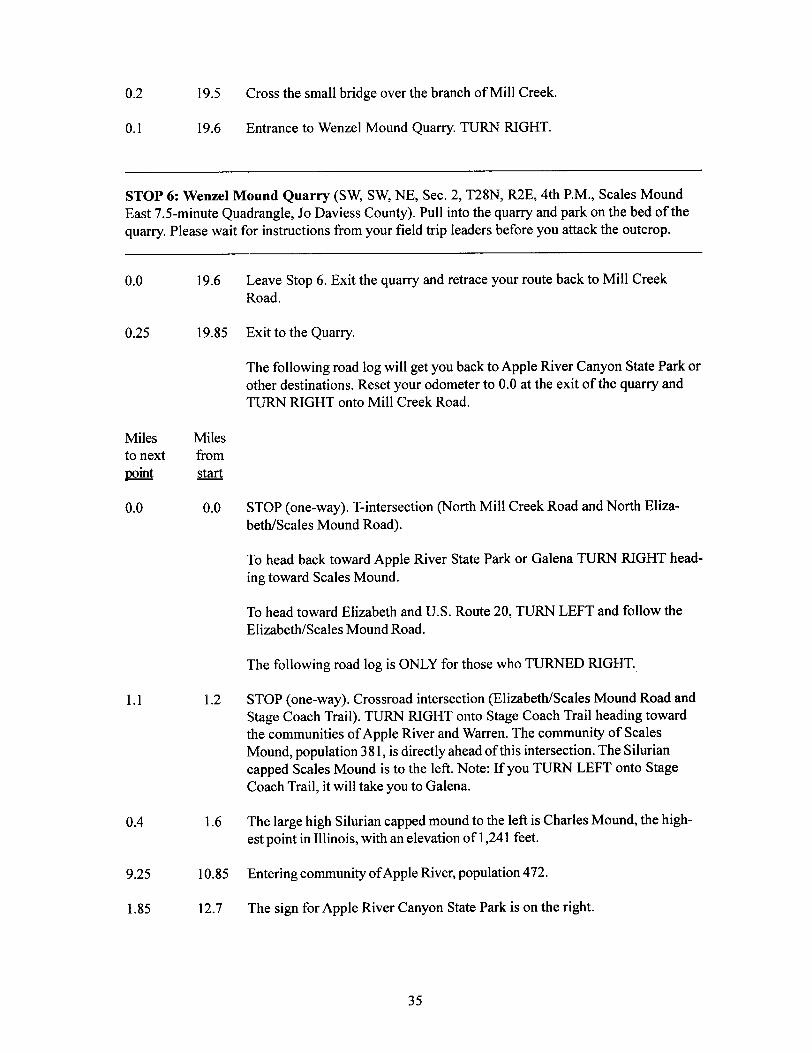
GUIDE TO THE ROUTE 27STOP DESCRIPTIONS 47 1 Rutherford’s Quarry and Dolomite Prairie 54 2 Youngbluth Quarry 56 3 Benton Mound 59 4 Lunch 60 5 Cox Quarry 62 6 Wenzel Mound Quarry 65
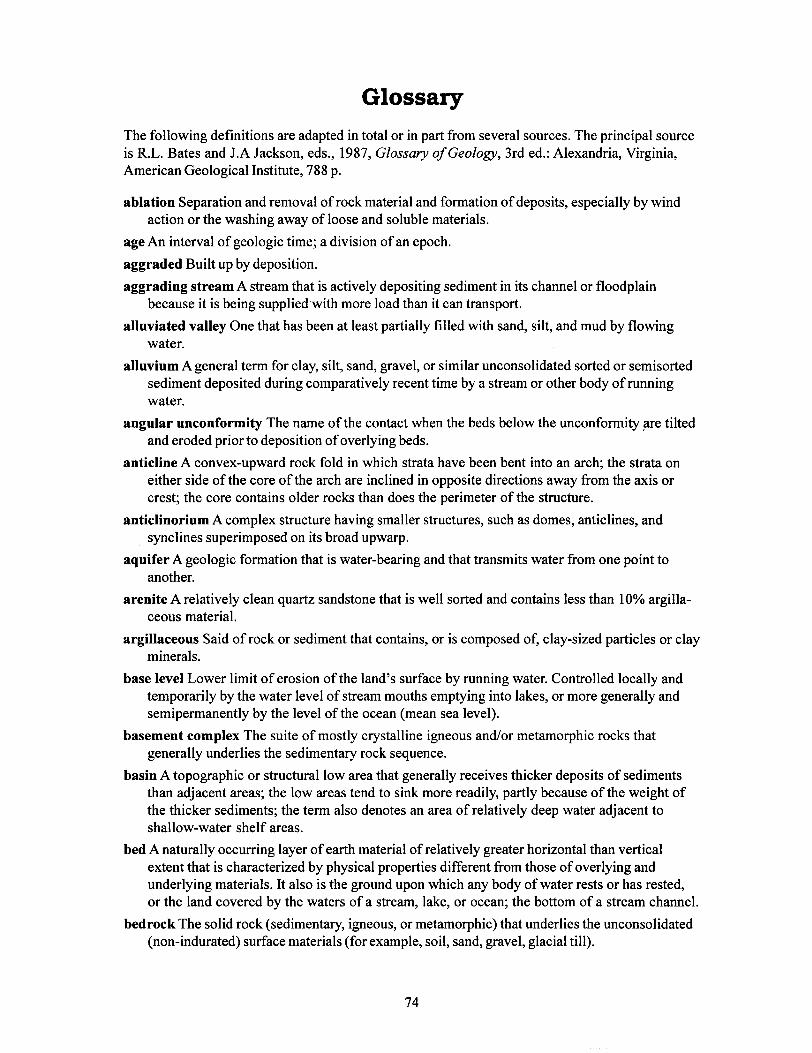
REFERENCES 70RELATED READINGS 71GLOSSARY 74SUPPLEMENTARY READING 82

Generalized geologic column showing succession of rocks in Illinois.
10,000
Period or Systemand Thickness
Age(years ago)E
po
ch
Holocene
General Types of Rocks
Pliocene
Paleocene
Quaternary0-500'
Tertiary0-500'
Cretaceous0-300'
Pennsylvanian0-3,000'
("Coal Measures")
Mississippian0-3,500'
Devonian0-1,500'
Silurian0-1,000'
Ordovician500-2,000'
Cambrian1,500-3,000'
Precambrian
1.8 m5.3 m
33.7 m
54.8 m
65.0 m
144 m
290 m
323 m
354 m
417 m
443 m
490 m
543 m
Era
Ag
eo
fM
am
ma
lsA
ge
of
Re
ptile
sA
ge
ofA
mp
hib
ian
sa
nd
Ea
rly
Pla
nts
Ag
eo
fIn
ve
rte
bra
tes
CE
NO
ZO
IC"R
ece
nt
Life
"M
ES
OZ
OIC
"Mid
dle
Life
"P
AL
EO
ZO
IC"A
ncie
nt
Life
"
Recent alluvium in river valleys
Glacial till, glacial outwash, gravel, sand, silt,lake deposits of clay and silt, loess and sand
dunes; covers nearly all of state except north-west corner and southern tip
Chert gravel, present in northern, southern andwestern Illinois
Mostly micaceous sand with some silt and clay;presently only in southern Illinois
Mostly clay, little sand; present only in southernIllinois
Mostly sand, some thin beds of clay, and, locally,gravel, present only in southern Illinois
Largely shale and sandstone with beds of coal,limestone, and clay
Black and gray shale at base, middle zone ofthick limestone that grades to siltstonechert, and shale; upper zone of interbeddedsandstone, shale, and limestone
Thick limestone, minor sandstones and shales;largely chert and cherty limestone in southernIllinois; black shale at top
Principally dolomite and limestone
Largely dolomite and limestone but containssandstone, shale, and siltstone formations
Chiefly sandstones with some dolomite and shale;exposed only in small areas in north-centralIllinois
Igneous and metamorphic rocks; known inIllinois only from deep wells
Ple
isto
ce
ne
Gla
cia
l Ag
eE
oce
ne
Ag
eo
fF
ish
es


4
0-100Mosalem
Tete des Morts15-20
Dolomite, light gray, slightly cherty, thick-bedded
medium to fine-grained, relatively pure.
Dolomite, gray, cherty; medium-bedded; lower part
is very argillaceous dolomite grading to dolomitic
shale at base.;
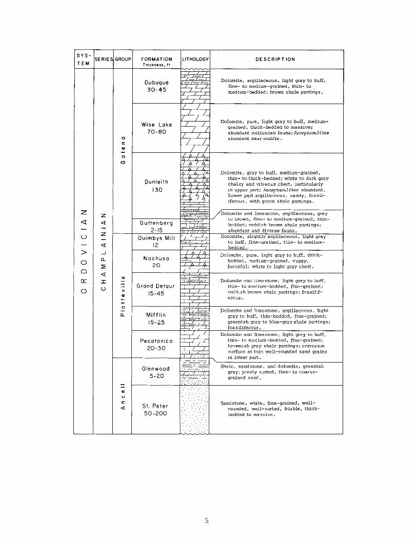
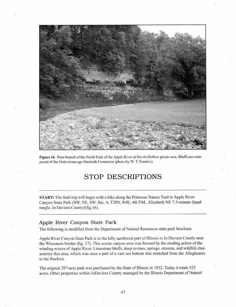
Figure 2 Generalized stratigraphic column from the top of the Niagaran (middle Silurian) to the base of the Champlainian (middle Ordovician) in the field trip area (modified from Kolata and Buschbach 1976). Figure continues on the next page.
5

6
normal fault reverse fault
fault plane
fault line
footwall
hanging wall
normal fault after erosion and burial
horst
graben
Figure 3 Diagrammatic illustrations of fault types that may be present in the field trip area. A fault is a fracture in the Earth’s crust along which there has been relative movement of the opposing blocks. A fault is usually an inclined plane, and when the hanging wall (the block above the plane) has moved up relative to the footwall (the block below the fracture), the fault is a reverse fault. When the hanging wall has moved down relative to the footwall, the fault is a normal fault.
x
xx
zx
A B
Figure 4 Schematic drawings of (A) a disconformity and (B) an angular unconformity (x represents the conformable rock sequence, and z is the plane of unconformity).


8
Plum ZoRiver Faul nt e
MIS
SIS
SIP
PI R
IVE
RA
RC
H
Glasford
WISCO
NSIN
ARCH Des Plaines
Sandwich Fault Zone
KANKAKEEARCH
Kentland
La Salle
Royal
Cente
rFo
rtvill
e
Mt. C
armel
CIN
CIN
NAT
IA
RC
H
Pennyrile F.S.
Moorman
Central F.S.
Fluo
rspa
rAr
ea F
.C.
Roe
ugh Crw
eek-Shawn eto n SF. .
Wab
ash
Valle
yCla
yC
ity
SANGAMON
ARCH
WE
ST
ER
N
SH
ELF
Anticlinorium
FAIRFIELD
BASIN
Sal
em
Fishhook
Pittsfield
Du
Quo
in
Loud
en
SPARTA
SHELF
Waterloo-D
upoValmeyer
Linc
Foln
old
Cap au Gr�s F.F .
Marshall-S
idell
OZARK
DOME
OmahaDomeCottage Grove
HicksDome
F.S. Faul
t
Sys
tem
Lusk
Creek
F.Z.
Ste. G
.
enevieev F .Z
PASCOLA
ARCH
Reelfo
ot R
ift
OmahaDome
MISSISSIPPI EMBAYMENT
0
0
20 40 60 mi
40 80 km
AnticlineSynclineMonoclineFault, ticks on
downthrown sideCrypto-explosive or
impact structure
F.C.F.F.F.S. Fault System
Faulted Flexure
F.Z.
Fault Complex
Fault Zone
Apple River Canyon State Park
Figure 5 Structural features of Illinois (modified from Buschbach and Kolata 1991).
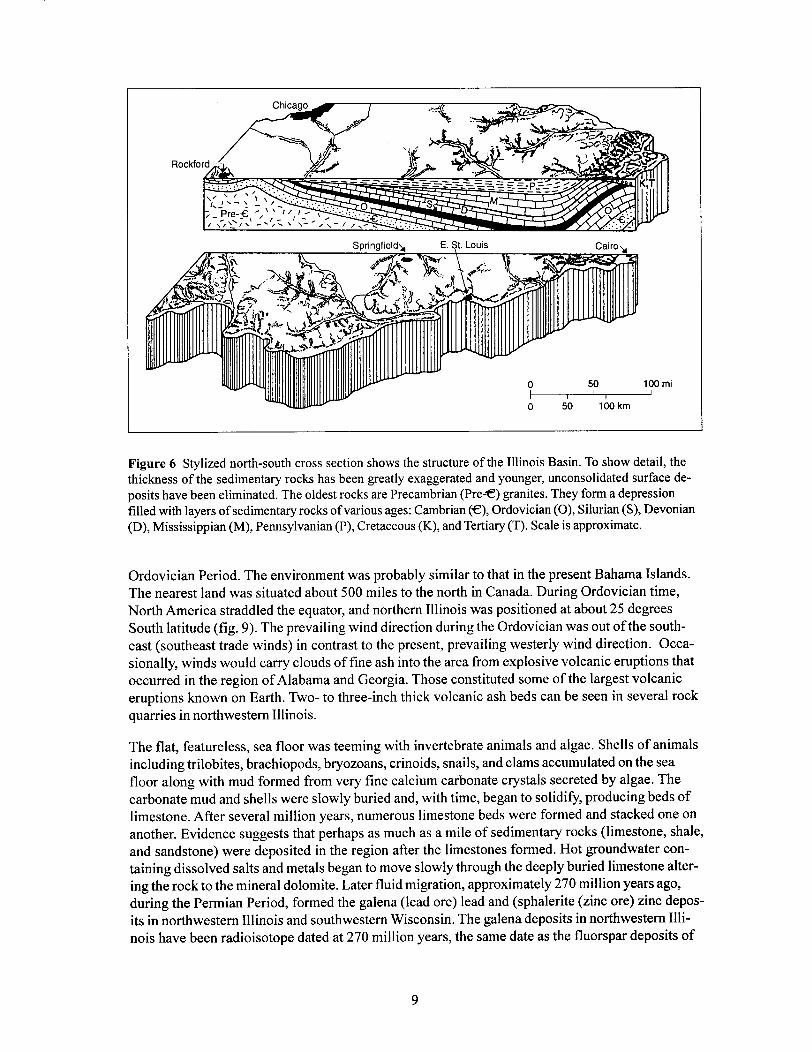

10
Figure 7 Bedrock geology beneath the surficial deposits in Illinois.

11
Figure 8 Bedrock valleys of Illinois (modified from Piskin and Bergstrom 1975).


18
Figure 12 Generalized map of the glacial deposits in Illinois (modified from Willman and Frye 1970).
19
“Woodfordian”
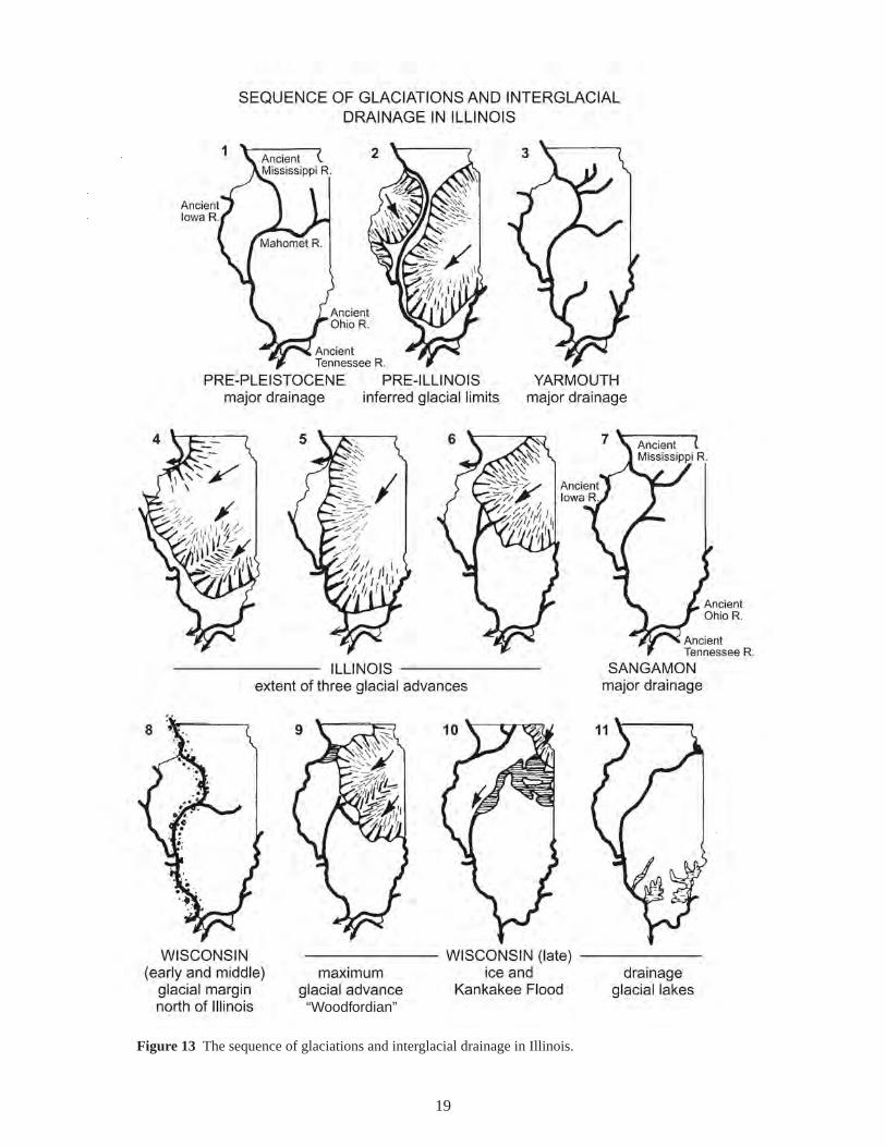
Figure 13 The sequence of glaciations and interglacial drainage in Illinois.

20
Yearsbeforepresent Sediment record
Dominant climate conditionsDominant land forming and soil
forming events
Time-distance diagramInterglacial andglacial episodes
HO
LO-
CE
NE
(not
to s
cale
)P
LEIS
TOC
EN
E E
PO
CH
10,000
interglacialepisode
25,000
75,000
125,000
300,000
425,000
1,600,000and older
WISCONSIN(late)glacialepisode
WISCONSIN(early and middle)
glacial marginnorth of Illinois
SANGAMONinterglacial
episode
ILLINOISglacialepisode
YARMOUTHinterglacial
episode
?
PRE-ILLINOISglacial
and
interglacialepisodes
River, lake, wind, andslope deposits.
Till and ice-marginaldeposits; outwash andglacial lake deposits;loess.
Loess; river, lake, andslope deposits.
River, lake, wind, andslope deposits.
Till and ice-marginaldeposits; outwash andglacial lake deposits;loess.
River, lake, wind, andslope deposits.
Till and ice-marginaldeposits; outwash andglacial lake deposits;loess plus nonglacialriver, lake, wind, andslope deposits.
Warm; stable landscape conditions.Formation of modern soil; running wa-ter, lake, wind, and slope processes.
Cold; unstable landscape conditions.Glacial deposition, erosion, andlandforming processes (e.g., formationof end moraines, outwash plains, valleytrains, proglacial lakes, kettles), plusrunning water, lake, wind, and slopeprocesses.
Cool; stable.Weathering, soil formation (FarmdaleSoil and minor soils); wind and runningwater processes.
Warm; stable.Weathering, soil formation (SangamonGeosol); running water, lake, wind, andslope processes.
Cold; unstable.Glacial deposition, erosion, and land-forming processes, plus proglacialrunning water, lake, wind, and slopeprocesses; possible minor soilformation.
Warm; stable.Long weathering interval with deep soilformation (Yarmouth Geosol); runningwater, lake, wind, and slope processes.
Alternating stable and unstable inter-vals of uncertain duration.Glacial deposition, erosion, andforming processes, plus proglacialand interglacial running water, lake,wind, and slope processes; interglacialweathering and soil formation.
land-
?
glacialice
1
2
3
4
5
6
Figure 14 Timetable illustrating the glacial and interglacial events sediment record, and dominant climate conditions of the Ice Age in Illinois (modified from Killey 1998).

22
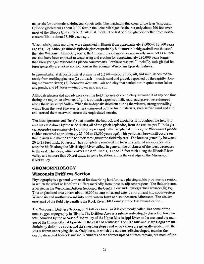
Figure 15 Physiographic divisions of Illinois (modified from Leighton et al. 1948).


37
0 .5 1 mi
0 .5 1 kmN
START
1

38
0 .5 1 mi
0 .5 1 kmN
1

39
0 .5 1 mi
0 .5 1 kmN
2

40
0 .5 1 mi
0 .5 1 kmN
3

41
0 .5 1 mi
0 .5 1 kmN
4
LUNCH

42
0 .5 1 mi
0 .5 1 kmN
5
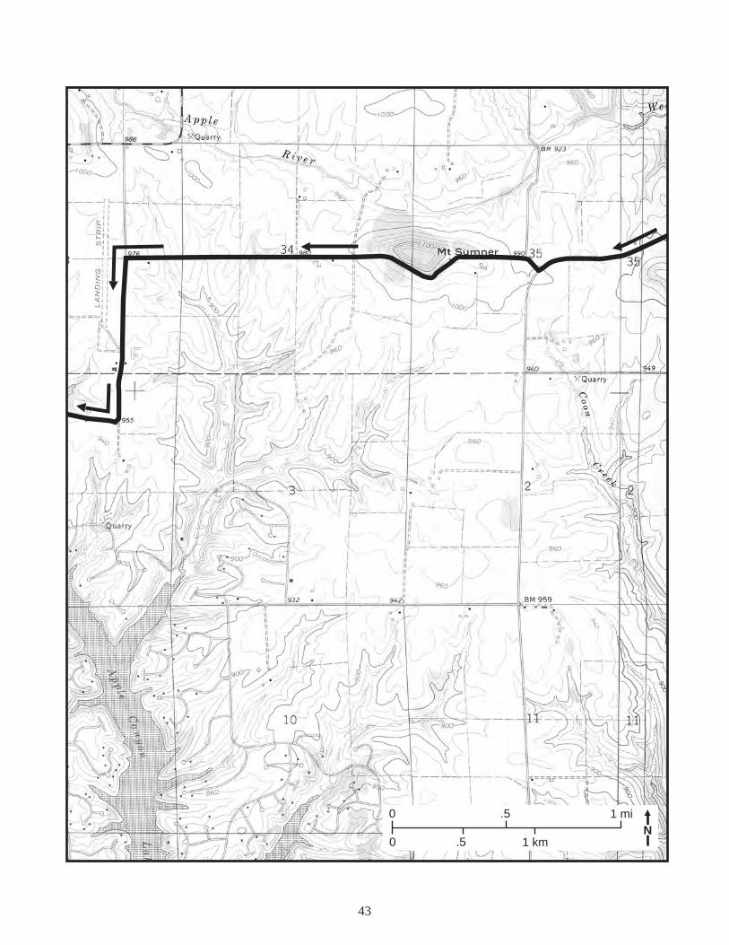
43
0 .5 1 mi
0 .5 1 kmN

44
0 .5 1 mi
0 .5 1 kmN

45
0 .5 1 mi
0 .5 1 kmN
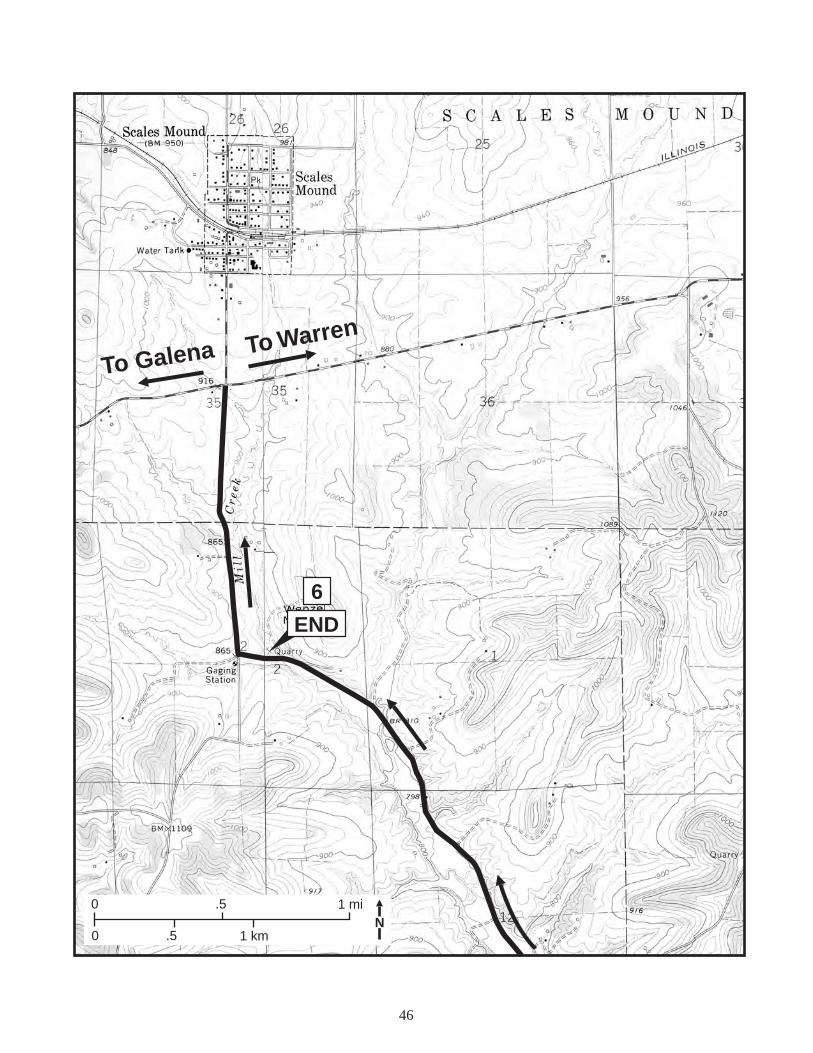
46
6
END
To Galena To Warren
0 .5 1 mi
0 .5 1 kmN


51
N
Stockton
City of Apple River
DRAINAGE
DIVIDE
E
W
City of Apple River
Stockton
N
OutletGlacier
Blockedvalley
Lake
City of Apple River
Stockton
West ForkApple River
Mill Creek
Hell’sBranch Coon
Creek
APPLE RIVER
GLA
CIE
RB
OU
ND
AR
Y
South Fork
Buriedvalley
MudRunCreek
North
Fork
ClearC
reek
Yellow
Creek
A
B
C
Figure 18. (A) Pre-Illinois glacial episode drainage (modi-fied from Reinertsen et al.1972). (B) Illinois glacial epi-sode drainage (modified from Reinertsen et al.1972). (C) Post-Illinois glacial episode drainage (modified from Rein-ertsen, Berggren, and Killey 1972).


83
Figure A2 Generalized sequence of strata in the Galena area.


87

88

90
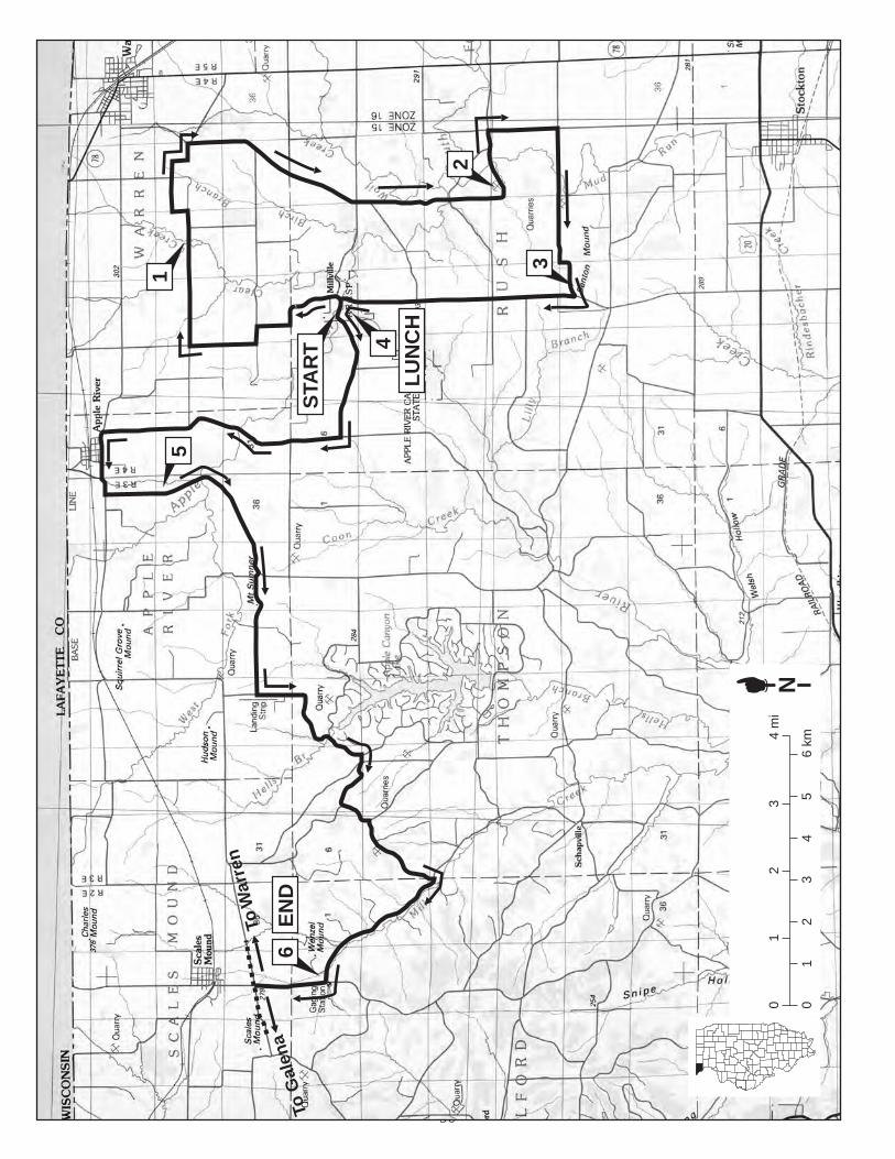
STA
RT
1
4
2
3
5
LU
NC
H
EN
D6
ToW
arre
n
To G
alen
a
01
23
45
6 km
01
23
4 m
iN