guidance for illinois food security act (fsa) … · ... (fsa) wetland determinations . including...
TRANSCRIPT

July 2016
GUIDANCE FOR ILLINOIS FOOD SECURITY ACT (FSA) WETLAND DETERMINATIONS INCLUDING STATE OFFSITE METHODS (SOSM)
TABLE OF CONTENTS INTRODUCTION ..........................................................................................................................................................2 FSA WETLAND DETERMINATIONS PROCESS...............................................................................................................4 STEP 1: WETLAND IDENTIFICATION ............................................................................................................................5
1.1 DEVELOP A BASE MAP ...............................................................................................................................5 1.1.1 Information supplementing the Corps Manual and FSA variances: .....................................................5 1.1.2 Information supplementing All Sections in the Corps Manual .............................................................6 1.2 STATE OFFSITE METHOD (SOSM) SUPPLEMENTING SECTION D, ..............................................................7 1.2.1 Hydrophytic Vegetation (no pre-1985 drainage), ................................................................................7 1.2.2 Hydric soils ............................................................................................................................................8 1.2.3 Wetland Hydrology ...............................................................................................................................8 1.3 INFORMATION SUPPLEMENTING SECTION F: ATYPICAL SITUATIONS ......................................................9 1.3.1 Hydrophytic Vegetation (no pre-1985 drainage): ................................................................................9 1.3.2 Hydrophytic Vegetation (with pre-1985 drainage): .......................................................................... 10 1.3.3 Wetland Hydrology (post 1985 drainage with no pre-1985 drainage): ............................................ 11 1.3.4 Wetland Hydrology (post 1985 drainage with pre-1985 drainage):.................................................. 12 1.4 INFORMATION SUPPLEMENTING SECTION G: PROBLEM AREAS ........................................................... 12 1.4.1 Hydrophytic Vegetation (no pre-1985 drainage): ............................................................................. 12 1.4.2 Wetland Hydrology: ........................................................................................................................... 13 1.5 FINALIZATION OF BASE MAP .................................................................................................................. 14
STEP 2: ASSIGNMENT OF WC LABELS ...................................................................................................................... 14 2.1 VERIFICATION OF PRESENCE OF WOODY VEGETATION AS OF DECEMBER 23, 1985. .......................... 14 2.2 VERIFICATION OF PRE- 1985 CROPPING HISTORY ................................................................................. 14 2.3 VERIFICATION OF PRE-DECEMBER 23, 1985 MANIPULATION(S) ........................................................... 15 2.4 VERIFICATION OF POST 1985 POTENTIAL CONVERSION ....................................................................... 15 2.5 VERIFICATION OF POTHOLE LANDFORM ............................................................................................. 15 2.6 VERIFICATION OF CONSECUTIVE LENGTH OF DURATION & PONDING AND/OR SATURATION ............ 16 2.7 DETERMINATION OF THE REQUIRED CONDITIONS FOR THE FOLLOWING WC LABELS ........................ 16
STEP 3: DETERMINATION OF SIZE AND DEVELOPMENT OF CERTIFIED WETLAND DETERMINATION MAP ............ 19 3.1 SUBDIVIDING AND COMBINING SAMPLING UNITS INTO WC LABELED POLYGONS ............................. 19 3.2 TRANSFERRING BASE MAP SAMPLING UNITS TO CWD MAP ................................................................ 19 3.3 CWD MAP labels and legend .................................................................................................................. 19
APPENDIX A – ILLINOIS POTHOLE REGION .............................................................................................................. 21 APPENDIX B – HYDROLOGY METHODS .................................................................................................................... 22
Part 1 – Numerical Analysis Methods ............................................................................................................... 22 Part 2 – Determination of Imagery Reflecting Normal Circumstances ............................................................. 28

2 GUIDANCE FOR ILLINOIS FSA WETLAND DETERMINATIONS
July 2016
INTRODUCTION The National Food Security Act Manual (NFSAM) provides internal agency policy related to the Highly Erodible Land Conservation and Wetland Conservation provisions of the 1985 Food Security Act (FSA). Part 514.7 of the NFSAM explains that the FSA wetland determination process requires a technical determination of whether or not the site (sampling unit(s)) is a wetland, then a separate independent determination of whether or not any exemptions to the provisions apply. Based on these two decisions, a certified wetland determination map is prepared with an appropriate Wetland Conservation (WC) label assigned to each sampling unit (sampling units may be combined). The size of each area with a WC label is provided. Thus, the FSA wetland determination decision includes three independent steps: Step 1: Wetland Identification, Step 2: Assignment of WC Labels and Step 3: Sizing. To accomplish the first step (wetland identification), the Secretary of Agriculture directed the Natural Resources Conservation Service (NRCS) to develop and utilize offsite and onsite wetland identification procedures (7 CFR 12.30(a)(4)). The NRCS responded by providing such procedures in the NFSAM. The NFSAM Part 527 FSA Wetland Identification Procedures directs that NRCS will utilize Part IV: Methods contained in the Corps of Engineers Wetland Delineation Manual (Corps Manual) for onsite and offsite determinations. The NFSAM explains that the on-site procedures contained in the Corps Manual are supplemented by the Corps Regional Supplements and the FSA variances to the Corps Methods, as provided in Part 527 FSA Wetland Identification Procedures. The FSA Wetland Identification Procedures provide that the Corps offsite procedures found in Part IV, Section D, Subsection 1 – Onsite Inspection Unnecessary can be augmented with the development of State Offsite Methods (SOSM). Paragraph (2-14) of the FSA Wetland Identification Procedures defines SOSM as “Methods developed by the NRCS for the sole purpose of supplementing the offsite methodology in the Corp Manual for use in identifying wetlands for FSA purposes. The adoption process for State Offsite Methods will include solicitation of State Committee recommendations. These methods may replace or supplement methods provided for in State Mapping Conventions.” Section F (Atypical Situations) and Section G (Problem Areas) of the Corps Manual includes options for the utilization of offsite resources (and Chapter 5 of the Regional Supplements) for decision-making when faced with difficult situations (non-routine). Therefore, the definition of SOSM is interpreted to include utilization of SOSM’s to supplement the offsite options provided in Sections F and G of the Corps Manual (and Chapter 5 of the Regional Supplements). The purpose of this document is to provide guidance to agency experts to maximize consistency and accuracy of wetland determinations. Included in this document are supplemental information concerning SOSMs and offsite resources, within the context of the Corps Methods, for rendering decisions under either: 1) Routine - onsite inspection is unnecessary, 2) Section F situations, and/or 3) Section G situations, including Chapter 5 of the Regional Supplements. Additionally, this document provides guidance related to the assignment of WC labels and sizing. This document incorporates by reference the current versions and pertinent sections of the following documents:
• National Food Security Act Manual (NFSAM) • Food Security Act (FSA) Wetland Identification Procedures (NFSAM Part 527 Appendix)(FSA Procedures)

3 GUIDANCE FOR ILLINOIS FSA WETLAND DETERMINATIONS
July 2016
• 1987 United States Army Corps of Engineers (USACE) Wetland Delineation Manual, Technical Report Y-87-1 (‘87 Manual)
• USACE Regional Supplements (Midwest; North Central and Northeast; Atlantic and Gulf Coastal Plain) to the ’87 Manual (Regional Supplements)
• Title 210 Engineering, National Engineering Handbook (NEH), Part 650, Engineering Field Handbook (EFH), Chapter 19 - Hydrology Tools for Wetland Determination
The NRCS presented this document to the State Technical Committee to solicit feedback and recommendations as required in paragraph (2-14) of the FSA Wetland Identification Procedures. This document takes into account unique regional, state, and local wetland characteristics. As directed by the Secretary of Agriculture, this document was developed consistently with surrounding states. This document adheres to regulations and policies in effect as of the date of this document but may be subject to change. For FSA purposes, the term “wetland” is defined in 16 U.S.C. section 3801(a)(18) as land that—
• Has a predominance of hydric soils. • Is inundated or saturated by surface or groundwater at a frequency and duration sufficient to support a
prevalence of hydrophytic vegetation typically adapted for life in saturated soil conditions. • Under normal circumstances supports a prevalence of such vegetation.
For the purposes of FSA and any other act, this term does not include lands in Alaska identified as having high potential for agricultural development that have a predominance of permafrost soils.
According to paragraph (3-2) of the FSA Wetland Identification Procedures, “This definition is unique to the statute, and all decisions regarding the identification of FSA wetlands must be based on this definition. The statute adds further clarity to the concept of an FSA wetland by defining “hydric soil” and “hydrophytic vegetation” (as those concepts will be applied to the WC provisions) and by the specific direction given to the Secretary as to the hydric soils and hydrophytic vegetation criteria that must be developed by USDA (16 U.S.C. Section 3801(b)(1)).” Wetland identification decisions are based on conditions that are expected to occur under Normal Circumstances. The FSA Wetland Identification Procedures paragraph (2-10) defines Normal Circumstances (NC) as, “The soil and hydrologic conditions that are normally present, without regard to whether the vegetation has been removed (7 CFR section 12.31(b)(2)(i)). For FSA wetland identification purposes, this concept is the consideration of normal and abnormal climate-based site changes and natural and artificial disturbance-based site changes that can create wetland identification challenges. “Normally present” is further explained as the vegetative, soil, and hydrologic conditions that occur under both of these conditions:
a. Without regard to whether the site has been subject to drainage actions (see drainage definition) after December 23, 1985, and without regard to whether the vegetation has been removed or significantly altered.
b. During the wet portion of the growing season under normal climatic conditions (normal environmental conditions).”
The FSA Wetland Identification Procedures paragraph (2-11) defines Normal Environmental Conditions (NEC) as. “The climate-based concept of NC, defined as the physical conditions, characteristics (hydrology, soil, and

4 GUIDANCE FOR ILLINOIS FSA WETLAND DETERMINATIONS
July 2016
vegetation), or both that would exist in a typical situation (2-12) on a site during the wet portion of the growing season in a normal climatic year.” Normal Circumstances as used in the FSA wetland definition requires that decisions be based not on anomalies, but rather what would normally occur on the sampling unit during NEC (FSA Procedures paragraph (3-3)). In the Corps methods, the concept of “normal” is separated into the disturbance-based concept of normal circumstances (typical/atypical situations) and the climate-based concept of normal circumstances called “normal environmental conditions” (NEC). The NRCS adopts this concept that a determination of “normal” is a two-pronged consideration (FSA Procedures paragraph (3-4)). For FSA purposes the agency expert will determine the normal circumstances (NC) of the sampling unit as those that would be expected to occur,
• In the absence of post-12/23/1985 drainage actions that alter the normal soil or hydrologic conditions. • In the absence of an alteration (removal or change) in the plant community such that a decision cannot
be made if the site would support a prevalence of hydrophytic vegetation if undisturbed. • During the wet portion of the growing season during a year experiencing normal weather patterns.
In the absence of direct evidence, the decision if a sampling unit meets a particular diagnostic factor (wetland hydrology, prevalence of hydrophytic vegetation, and a predominance of hydric soils) is assisted by confirmation of the presence of indicators. The use of indicators to predict the conditions that would occur under NC is referred to as the “indicator-based approach to wetland identification.” Indicators can be obtained from remote sensed data sources or onsite visits. The Corps, EPA, and NRCS utilize the indicator-based approach to assist in decision-making. The ultimate decision if a site meets the FSA criteria for any of the three diagnostic factors is made from a preponderance of evidence, best professional judgment, and the FSA definitions, criteria, or both, of hydrophytic vegetation, hydric soils, and wetland hydrology (FSA Wetland Identification Procedures paragraph (4-3)). According to Paragraph (4-4) of the FSA Wetland Identification Procedures, “The decision if the site is an FSA wetland is ultimately rendered based on the determination of a presence or absence of each of the three factors under NC. Areas determined to support wetland hydrology, a prevalence of hydrophytic vegetation, and a predominance of hydric soils (all under NC), as each factor is defined by the FSA, are wetlands subject to the WC provisions of the act.”
FSA WETLAND DETERMINATIONS PROCESS Wetland determinations are technical decisions resulting from the determination of whether or not an area is a wetland (wetland ID), including a determination of the appropriate wetland type (WC compliance label) and size (FSA Wetland Identification Procedures paragraph (2-18)). Therefore, the NRCS identifies three unique and separate steps to the wetland determination process. Within the first two steps each of the three wetland diagnostic factors must be assessed independently to determine if a decision can be rendered at the diagnostic factor level using offsite data sources. Agency experts making wetland determinations must have the appropriate “Wetland Determination Approval Authority” delegated and documented in accordance with current NRCS policy. The first step in the wetland identification process is to subdivide the project into different areas called sampling units (FSA Procedures (2-12)) and identify each sampling unit on a base map. Then for each sampling unit, an

5 GUIDANCE FOR ILLINOIS FSA WETLAND DETERMINATIONS
July 2016
independent consideration of each of the three wetland diagnostic factors is made. For each sampling unit the agency expert must decide when applying Section C: Selection of Method of the ’Corps Manual which level is most appropriate. Selection of Section D – Routine Determinations, Subsection 1 – Onsite Inspection Unnecessary, procedures is not likely to occur in active cropland. Within the agriculture landscape, most often decisions are rendered when one or more factor is either atypical (Section F) or climatically challenged (Section G). Therefore, agency experts will most often utilize Section D – Routine Determinations, Subsection 2 – Onsite Inspection Necessary, procedures supplemented with the methods provided in Section F, G, and/or Chapter 5 of the Regional Supplements. The agency expert selects the most appropriate method(s) to identify wetlands. This decision is not made at the project (USDA tract/field) scale; rather for each sampling unit identified and delineated on the wetland identification base map. The agency expert retains the sole responsibility to determine the level of routine determination (Section D, Subsection 1, Subsection 2, or Subsection 3), and if Sections F or G will be utilized. NOTES:
• All agency decisions during Step 1 are made at the sampling unit level. • The term “imagery” refers to all forms of remotely captured imagery or photography, digital or analog,
at all resolutions. • Unless otherwise stated, the use of “1985” in this document refers to December 23, 1985. • A single resource document (tool) can contain multiple data sources. Each resource document can be
used to support the decision for one or more wetland diagnostic factor. A soil survey contains multiple data sources (soils map, hydrology data, vegetative data, and use limitation data). The soil survey can be used to assist in a decision for one or more diagnostic factor. However, a single remote data source contained within the published county soil survey manuscript (i.e. hydric soils list, vegetative data table) can only be applied to a single factor.
STEP 1: WETLAND IDENTIFICATION 1.1 DEVELOP A BASE MAP
The agency expert must utilize preliminary data gathering and synthesis in determining whether a typical or atypical situation exists (FSA Variance 5-9). The Corps Manual, Section B (Preliminary Data Gathering and Synthesis), Step 2; and Section D, Routine Determination, Subsection 2 – Onsite Inspection Necessary, Step 1 and Step 4, require the agency expert to identify the project area, make a base map, and identify sampling units.
1.1.1 INFORMATION SUPPLEMENTING THE CORPS MANUAL AND FSA VARIANCES:
• Users will graphically subdivide the project into sampling units on a base map image using resources A through F (as available) as indicated below.
• The base map needs to be large enough to read and record multiple sampling units in one location (e.g. concentric circles).
• A sampling unit will only be recorded once. Sampling unit boundaries do not need to match exactly between resources.
• The agency expert determines sampling unit validity. • Sampling units will be located using the following remote resources:
6 GUIDANCE FOR ILLINOIS FSA WETLAND DETERMINATIONS
July 2016
A. Review the NRCS wetland inventory maps OR previous non-certified determinations, if available. Each previously identified polygon may be a sampling unit.
B. Review appropriate imagery. Each signature listed is a sampling unit: • Surface water • Areas of a cropfield with areas of bare, dark saturated soil tones, with crop growing around the area,
as the result of drowned-out crops or crop damage due to wetness. • Areas of cropfield with stunted crop as seen by severely reduced crop canopy cover, and of yellow
color or brighter on black and white photography, compared to the surrounding crop. • Hydrophytic vegetation (observed as vegetation of different color, usually lighter green or brighter
on black and white photography, than crop or forage). • Isolated areas that are not farmed with rest of the field (includes areas not planted due to wetness
at time of planting). • Differences in vegetation (within a field) due to different planting dates (e.g. patches of beans
planted in a cornfield or the same crop at different growth stages). • Inclusion of wet areas in “set-aside” if other indicators of saturation are evident (dark saturated soil
tones or light reflecting off of standing water).
Note: The term “appropriate” means that the agency expert will select the imagery year or years that best represents Normal Circumstances, including “Normal Environmental Conditions”, to identify and size sampling units. Section I of the NRCS Field Office Technical Guide includes the image years determined to reflect Normal Environmental Conditions for specific geographic locations. For sampling units with pre-1985 manipulations utilize imagery immediately following the drainage manipulation year (or as close as possible) to determine the best drained condition, and/or use other resources such as producer submitted documentation of installed drainage, drainage equations, or other resources to determine the presence or absence of sampling units and their size.
C. Review the National Wetland Inventory (NWI) maps. Each NWI polygon not matching resources in A or
B above is also a sampling unit. D. Review the soil survey and the county hydric soils list. Identify listed hydric soil map units, map units
with hydric soils as part of their name, or soils with hydric inclusions, and map units with conventional wetland symbols. Each soil survey feature not matching resources A, B or C above will be a sampling unit.
E. Review other inventory tools, if available. Note sampling units as applicable. F. Identify a single representative non-wetland (upland) sampling unit for each project area (tract or field)
using the soil survey resource. The agency expert will use best professional judgment to select a single representative observation point with this sampling unit.
1.1.2 INFORMATION SUPPLEMENTING ALL SECTIONS IN THE CORPS MANUAL • Representative Observation Points (ROP) will be utilized each time a sampling unit is identified. • Typically, the Representative Observation Points (ROP) will be annotated approximately halfway
between the edge of the sampling unit and the center of the sampling unit and will not be located within a surface ditch, if present. However, unique site characteristics or remote data set quality (e.g. cloud cover) may require flexibility in the location of any ROP.
• Factor indicators (remote or field) must be identified in the approximate ROP location.

7 GUIDANCE FOR ILLINOIS FSA WETLAND DETERMINATIONS
July 2016
Illinois Variance (IL1-0): When determining the number and locations of sampling units (defined in FSA Procedures paragraph (2-12)) the agency expert may utilize in the office methods to meet the intent of “traversing the area” and will not be required to identify sampling units in the field.
1.2 STATE OFFSITE METHOD (SOSM) SUPPLEMENTING ’87 MANUAL SECTION D, ROUTINE DETERMINATIONS, SUBSECTION 1: ONSITE INSPECTION UNNECESSARY; and SUBSECTION 3 (FOR PORTIONS OF THE PROJECT AREA THAT ARE ADEQUATELY CHARACTERIZED)
Section B, Preliminary Data Gathering and Synthesis, directs the user to (among other things) determine whether the factor(s) are adequately characterized for the project area. The agency expert is to use the remote data to determine the characteristics that currently exists on the sampling unit, not what factor would exist at the sampling unit in the absence of disturbance. If the user is attempting to predict the conditions that would have occurred prior to disturbance (e.g. cropping), then Subsection 1 is not appropriate. The use of Section F: Atypical Situations (disturbance-based challenges) and Section G: Problem Areas (climate-based challenges) are not designed to be applied when the user selects Subsection 1, but rather when the user selects Subsection 2.
1.2.1 HYDROPHYTIC VEGETATION (NO PRE-1985 DRAINAGE),
Where the vegetation is not significantly disturbed or problematic due to climate. For each sampling unit, the dominant species in each vegetation layer must be known. Dominant species are those listed in any of the resources. Resources meeting one or more indicator test (from the Regional Supplements) demonstrates that the hydrophytic vegetation factor is met. Illinois Variance (IL1-1) to Subsection 1, Step 2: When determining “whether hydrophytic vegetation is present” from the summarized information in Section B, Step 4d, “Federal, State, or local government documents that contain information about the area vegetation,” the agency expert will utilize the federal documents in the manner indicated below.
• ESD – the Historic Plant Climax Community (or Reference Community) plant composition table indicates
the sampling unit is composed of plants that meet the definition (meets any vegetation indicator from the appropriate Regional Supplement).
• Approved IL NRCS wetland reference sites that are within the same soil map unit (or inclusion), in the
same Major Land Resource Area, and have similar precipitation zones. The selected reference site case file documentation indicates the sampling unit is composed of plants that meet the definition (meets any vegetation indicator from the appropriate Regional Supplement).
• OSD – Use this only if ESD information is not available. Use and Vegetation indicates the site has plants
that meet the hydrophytic vegetation definition (lists hydrophytic vegetation as native vegetation for the soil series). All species listed or vegetative zones of a Class are considered dominant for purposes of the vegetation indicator(s) from the appropriate Regional Supplement. Illinois Variance (IL1-2) to Subsection 1, Step 2: When determining “whether hydrophytic vegetation is present” from the summarized information in Section B, Step 4b, “NWI overlays or maps,” the agency expert will utilize the NWI mapping in the following manner:
NWI Mapping – If any portion of the sampling unit (or the ROP) is mapped as emergent, shrub vegetation, forested, or aquatic bed on an NWI map (e.g. PEM, PSS, PFO, PAB or

8 GUIDANCE FOR ILLINOIS FSA WETLAND DETERMINATIONS
July 2016
wetter) then all listed species are considered in any vegetation indicator test from the Corps Regional Supplement. If individual species are not listed under the NWI class (e.g. “emergent”) then the sampling unit is considered to be dominated by hydrophytic vegetation and meets the definition.
1.2.2 HYDRIC SOILS
For each sampling unit the soil series must be known. The current national policy will be followed:
"NRCS shall identify hydric soils through the use of published soil maps which reflect soil surveys completed by or through the use of onsite reviews.” Title 7 CFR § 12.31(a)(1) “NRCS shall determine whether an area of a field or other parcel of land has a predominance of hydric soils that are inundated or saturated as follows:” • “If a soil map unit has hydric soil as all or part of its name, that soil map unit or portion of the map
unit related to the hydric soil will be determined to have a predominance of hydric soils.” • “If a soil map unit is named for a miscellaneous area that meets the criteria for hydric soils (i.e.,
riverwash, playas, beaches, or water) the soil map unit will be determined to have a predominance of hydric soils.”
• “If a soil map unit contains inclusions of hydric soils, that portion of the soil map unit identified as hydric soil will be determined to have a predominance of hydric soils.” Title 7 CFR § 12.31(a)(2)
The remote indicator that the hydric soils definition is met is if the sample unit contains a soil map unit that has a hydric soil as all or part of its name or contains a hydric inclusion.
IL Variance (IL1-3) to Subsection 1, Step 5: When determining “whether hydric soils are present,” the agency expert will utilize Title 7 CFR § 12.31(a)(2) in the manner indicated below:
If a soil map unit has a hydric soil as all or part of its name or contains a hydric inclusion, that portion of the hydric component (major or minor) in the soil survey can be verified by either:
• Identifying that the landform of the sampling unit is consistent with the landform (such as depression, closed depression, flats or swale) of the hydric component or inclusion; or,
• Using the Official Soil Series Description: Taxonomic Class, Geographic Setting, Geographically Associated Soils, and Use and Vegetation.
If a field visit based on offsite evidence is required for a map unit that is non-hydric, including minor components, then hydric soil indicator documentation is required.
1.2.3 WETLAND HYDROLOGY
For each sampling unit, there must be documented evidence of frequent inundation or soil saturation during the growing season. The NRCS defines wetland hydrology (FSA Wetland ID Procedures 2-19) as inundation or saturation of the site by surface or groundwater during a growing season at a frequency and duration sufficient to support a prevalence of hydrophytic vegetation. Sampling units and wetness signatures in field(s)/tract(s) with perennial vegetative cover (such as pasture, grassland, non-cropped riparian areas and woodland) may not be readily visible. In such cases an onsite field investigation is necessary.

9 GUIDANCE FOR ILLINOIS FSA WETLAND DETERMINATIONS
July 2016
IL Variance (IL1-4) to Subsection 1, Step 3: When determining “whether wetland hydrology is present” the agency expert will independently assess the hydrology factor by utilizing the NRCS imagery review methodology to determine if wetness signatures are found on more than 50 percent of imagery reviewed reflecting NC (Appendix B Part 2). The imagery review will consist of at least 5 years of imagery. For counties that have less than five years of imagery available with normal precipitation, use the normal years that are available and verify potential wetlands in the field. Wetness signature abbreviations include INU (Inundation) and CT (Color Tone difference).
The following are remote indicators that the wetland hydrology definition is met: 1. Imagery showing surface water inundation (INU) by ponding or flooding under NC. 2. Imagery showing a Color Tone difference (CT) due to wetness that is reflective of NC (Appendix B
Part 2) that: a) was occurring on the date of the imagery, or b) that occurred previous to the imagery but the evidence of this wetting event remains evident. Color tones provide clear distinctions in the condition of the sampling unit compared to the condition in the surrounding field including, but not limited to, size and color. Color tone differences accepted as remote indicators of wetland hydrology include:
• Areas of a cropfield with areas of bare, dark saturated soil tones, with crop growing around the area, as the result of drowned-out crops or crop damage due to wetness.
• Areas of cropfield with stunted crop as seen by severely reduced crop canopy cover, and of yellow color or brighter on black and white photography, compared to the surrounding crop.
• Hydrophytic vegetation (observed as vegetation of different color, usually lighter green or brighter on black and white photography, than crop or forage).
• Isolated areas that are not farmed with rest of the field (includes areas not planted due to wetness at time of planting).
• Differences in vegetation (within a field) due to different planting dates (e.g. patches of beans planted in a cornfield or the same crop at different growth stages).
• Inclusion of wet areas in “set-aside” if other indicators of saturation are evident (dark saturated soil tones or light reflecting off of standing water).
1.3 INFORMATION SUPPLEMENTING SECTION F: ATYPICAL SITUATIONS Section B, Preliminary Data Gathering and Synthesis, and Section D, Routine Determinations, Subsection 1 and Subsection 2, directs the user to (among other things) determine whether there is evidence of recent significant alteration due to human activity or natural events. And, if so then to proceed to Section F for one or more factors, as applicable.
1.3.1 HYDROPHYTIC VEGETATION (NO PRE-1985 DRAINAGE):
For each sampling unit, the dominant species (or community) in each vegetation layer may not be known. Positive indicators of this factor could not be found (or would be misleading) due to effects of recent human activities or natural events. When determining “the type of vegetation that previously occurred” (Section F, Subsection 1, Step 3), “e. SCS records” are potential sources of such evidence. FSA Variance 5-31 states the agency expert will consider NRCS records, such as ecological site descriptions and data from NRCS reference sites, as potential data sources in addition to soil survey data.

10 GUIDANCE FOR ILLINOIS FSA WETLAND DETERMINATIONS
July 2016
Illinois Variance (IL1-5) to Section F, Subsection 1, Step 3. “e. SCS/NRCS records” will be used as follows:
• ESD – the Historic Plant Climax Community (or Reference Community) plant composition table indicates
the sampling unit is composed of plants that meet the definition (meets any vegetation indicator from the appropriate Corps Regional Supplement).
• Approved IL NRCS wetland reference sites that are within the same soil map unit (or inclusion), in the
same Major Land Resource Area, and have similar precipitation zones. The selected reference site case file documentation indicates the sampling unit is composed of plants that meet the definition (meets any vegetation indicator from the appropriate Corps Regional Supplement).
• OSD – Use this only if ESD information is not available. Use and Vegetation indicates the site has plants
that meet the hydrophytic vegetation definition (lists hydrophytic vegetation as native vegetation for the soil series). All species listed or vegetative zones of a Class are considered dominant for purposes of the vegetation indicator(s) from the appropriate Corps Regional Supplement.
Illinois Variance (IL1-6): to Section F, Subsection 1, Step 3. “h. NWI” will be used as follows: If any portion of the sampling unit (or the ROP) is mapped as emergent, shrub vegetation, forested, or aquatic bed on an NWI map (e.g. PEM, PSS, PFO, PAB, or wetter) then all listed species are considered dominant in any vegetation indicator test from the Corps Regional Supplement. If individual species are not listed under the NWI class (e.g. “emergent”) then the sampling unit is considered to be dominated by hydrophytic vegetation and meets the definition.
1.3.2 HYDROPHYTIC VEGETATION (WITH PRE-1985 DRAINAGE):
Because of past drainage (and often current disturbance of vegetation), for each sampling unit, the dominant species will not typically be known, but rather must be inferred. Positive or negative indicators of this factor could not be found (or would be misleading) due to effects of recent human activities or natural events or the pre-1985 drainage actions. Illinois Variance (IL1-7): Section F, Subsection 1, Step 3 When determining “the type of vegetation that previously occurred”, the agency expert may utilize the Regional Supplement Chapter 5 – Problematic Vegetation Procedures. When verifying that the sampling unit is in a landscape position that is likely to collect or concentrate water, the landscape position does not include the ditch itself, if applicable. If the drain no longer allows the sampling unit to “collect or concentrate water” (Normal Circumstances/best drained conditions) then the hydrology factor cannot be met and therefore the hydrophytic vegetation definition cannot be met. Acceptable tools to confirm landscape position that is likely to collect or concentrate water are:
• LiDAR and GIS Basin Fill, concentrated flow analysis model • Digital Elevation Model (DEM) • Topography map • Evidence of ponded water observed in imagery
1. Use the Corps Methods, Regional Supplement Chapter 5 – Problematic Vegetation Procedure “[(d)
Midwest and North Central and Northeast; (c) Atlantic and Gulf Coastal Plain] Managed plant communities”, approach [(4) Midwest, North Central and Northeast; (5) Atlantic and Gulf Coastal Plain].

11 GUIDANCE FOR ILLINOIS FSA WETLAND DETERMINATIONS
July 2016
The approach states, “If an appropriate ungrazed area cannot be located or if the ungrazed vegetation condition cannot be determined, make the wetland determination (Step 1) based on indicators of hydric soils and wetland hydrology.”
2. Use the Corps Methods, Regional Supplement Chapter 5 – Problematic Vegetation Procedure “[(d) Midwest and North Central and Northeast; (c) Atlantic and Gulf Coastal Plain] Managed plant communities”, approach [(4) Midwest, North Central and Northeast; (5) Atlantic and Gulf Coastal Plain] is used. The approach states, “If the unmanaged vegetation condition cannot be determined, make the wetland determination (Step 1) based on indicators of hydric soils and wetland hydrology.”
For drained non-wetland sampling units, the ESD or OSD resources from Section 2.3 may still be used as these sampling units would not have had predominance of hydrophytic vegetation in their undrained condition.
1.3.3 WETLAND HYDROLOGY (POST 1985 DRAINAGE WITH NO PRE-1985 DRAINAGE):
For each sampling unit, the hydrology may not be known. Positive indicators of this factor may not be present (or would be misleading) due to effects of recent human activities or natural events. Illinois Variance (IL1-8): Section F, Subsection 3, Step 3 When characterizing “the hydrology that previously existed in the area,” step 3 does not include all “potential sources of information.” Therefore, the agency expert may utilize the supplemental information below. Additionally, Regional Supplements Chapter 5 – Agriculture Lands (or Agriculture Lands and Silviculture) for (3) Hydrology is used then this information supplements tool 3.b. (aerial photography review) and tool 3.e. (hydrologic models), respectively. • When determining “whether wetland hydrology is present” the agency expert will independently
assess the hydrology factor by utilizing the NRCS imagery review methodology to determine if wetness signatures are found on more than 50 percent of imagery reviewed reflecting NC (Appendix B Part 2).
• The wetness signature review period will start from the year of drainage manipulation (e.g. potential conversion) and consist of at least 5 previous years of imagery reflecting NC. For counties that have less than five years of imagery available with normal precipitation, use the normal years that are available and verify potential wetlands in the field. (Appendix B Part 2).
• Wetness signature abbreviations include INU (Inundation) and CT (Color Tone difference). The following are remote indicators that the wetland hydrology definition is met:
1. Imagery showing surface water inundation (INU) by ponding or flooding under NC. 2. Imagery showing a Color Tone difference (CT) due to wetness that is reflective of NC (Appendix B Part 2)
that: a) was occurring on the date of the imagery, or b) that occurred previous to the imagery but the evidence of this wetting event remains evident. Color tones provide clear distinctions in the condition of the sampling unit compared to the condition in the surrounding field including, but not limited to, size and color. Color tone differences accepted as remote indicators of wetland hydrology include: • Areas of a cropfield with areas of bare, dark saturated soil tones, with crop growing around the area,
as the result of drowned-out crops or crop damage due to wetness. • Areas of cropfield with stunted crop as seen by severely reduced crop canopy cover, and of yellow
color or brighter on black and white photography, compared to the surrounding crop.

12 GUIDANCE FOR ILLINOIS FSA WETLAND DETERMINATIONS
July 2016
• Hydrophytic vegetation (observed as vegetation of different color, usually lighter green or brighter on black and white photography, than crop or forage).
• Isolated areas that are not farmed with rest of the field (includes areas not planted due to wetness at time of planting).
• Differences in vegetation (within a field) due to different planting dates (e.g. patches of beans planted in a cornfield or the same crop at different growth stages).
• Inclusion of wet areas in “set-aside” if other indicators of saturation are evident (dark saturated soil tones or light reflecting off of standing water).
IL Variance (IL1-9): Section F, Subsection 3, Step 3 Hydrologic modeling supplemental information may be used according to Appendix B Part 1. The Objective Criteria for wetland hydrology modeling is: 7 or more consecutive days of inundation (flooding or ponding) or 14 or more consecutive days of saturation (a water table within 12” of the soil surface) during the growing season with a 50% chance annual probability of occurrence. Users are advised that sampling units and wetness signatures in field(s)/tract(s) with perennial vegetative cover (such as pasture, rangeland, CRP, and woodland) may not be readily visible. In such cases, field verification may be required.
1.3.4 WETLAND HYDROLOGY (PRE-1985 DRAINAGE WITH OR WITHOUT POST 1985 DRAINAGE):
The agency expert will utilize the information from Section 1.3.3 within the context of FSA Variance (5-28). The supplemental information provided below explains how the agency expert utilizes FSA Variance (5-28). • The agency expert must determine Normal Circumstances in consideration of when the
manipulation was installed and the best drained conditions of the sampling unit. • To determine the best drained conditions, the agency expert must review imagery years
immediately following the approximate pre-1985 drainage manipulation year through 1985 or further, if necessary.
• The agency expert must consider lack of maintenance (e.g., tile blowout) and recent maintenance when reviewing imagery.
1.4 INFORMATION SUPPLEMENTING SECTION G: PROBLEM AREAS
Section D, Routine Determinations, Subsection 2, directs the user to (among other things) determine whether normal environmental conditions are present (Step 5). And, if the area presently lacks hydrophytic vegetation or hydrologic indicators due to annual or seasonal fluctuations in precipitation or ground-water levels, or hydrophytic vegetation indicators lacking due to seasonal fluctuations in temperature then to proceed to Section G for one or more factors, as applicable. Section D, Routine Determinations, Subsection 2, first asks the user if the sampling unit is an atypical situation before asking the user about normal environmental conditions (climate challenges). Therefore, when the agency expert identifies an Atypical Situation (Section F) and the sampling unit is “climatically challenged” (Section G), then the agency expert will utilize Section F procedures
1.4.1 HYDROPHYTIC VEGETATION (NO PRE-1985 DRAINAGE):
Refer to Section 1.3.1 for supplemental information and state variances.

13 GUIDANCE FOR ILLINOIS FSA WETLAND DETERMINATIONS
July 2016
1.4.2 WETLAND HYDROLOGY: The procedures in Section G are supplemented by Chapter 5 of the Regional Supplements, Wetlands that Periodically Lack Indicators of Wetland Hydrology, Procedure 3.e. and 3.f.
Illinois Variance (IL1-10): Chapter 5, Wetlands that Periodically Lack Indicators of Wetland Hydrology, Procedure 3.f. Evaluating multiple years of aerial photography. When determining “whether wetland hydrology is present” the agency expert will independently assess the hydrology factor by utilizing the NRCS imagery review methodology to determine if wetness signatures are found on more than 50 percent of imagery reviewed reflecting NC (Appendix B Part 2). The imagery review will consist of at least 5 years of imagery. For counties that have less than five years of imagery available with normal precipitation, use the normal years that are available and verify potential wetlands in the field. Wetness signature abbreviations include INU (Inundation) and CT (Color Tone difference). The following are remote indicators that the wetland hydrology definition is met:
1. Imagery showing surface water inundation (INU) by ponding or flooding under NC. 2. Imagery showing a Color Tone difference (CT) due to wetness that is reflective of NC (Appendix B Part 2)
that: a) was occurring on the date of the imagery, or b) that occurred previous to the imagery but the evidence of this wetting event remains evident. Color tones provide clear distinctions in the condition of the sampling unit compared to the condition in the surrounding field including, but not limited to, size and color. Color tone differences accepted as remote indicators of wetland hydrology include: • Areas of a cropfield with areas of bare, dark saturated soil tones, with crop growing around the area,
as the result of drowned-out crops or crop damage due to wetness. • Areas of cropfield with stunted crop as seen by severely reduced crop canopy cover, and of yellow
color or brighter on black and white photography, compared to the surrounding crop. • Hydrophytic vegetation (observed as vegetation of different color, usually lighter green or brighter
on black and white photography, than crop or forage). • Isolated areas that are not farmed with rest of the field (includes areas not planted due to wetness
at time of planting). • Differences in vegetation (within a field) due to different planting dates (e.g. patches of beans
planted in a cornfield or the same crop at different growth stages). • Inclusion of wet areas in “set-aside” if other indicators of saturation are evident (dark saturated soil
tones or light reflecting off of standing water).
Illinois Variance (IL1-11): Chapter 5, Wetlands that Periodically Lack Indicators of Wetland Hydrology Procedure 3.e. Hydrology Tools For use of Hydrology Tools see Appendix B Part 1. • Numerical hydrologic analysis methods which calculate that the frequency and duration of
saturation and/or inundation meet the Objective Criteria. • The Objective Criteria for wetland hydrology modeling is: 7 or more consecutive days of inundation
(flooding or ponding) or 14 or more consecutive days of saturation (a water table within 12” of the soil surface) during the growing season with a 50% chance annual probability of occurrence.
Users are advised that sampling units and wetness signatures in field(s)/tract(s) with perennial vegetative cover (such as pasture, rangeland, CRP, and woodland) may not be readily visible. In such cases, field verification may be required.

14 GUIDANCE FOR ILLINOIS FSA WETLAND DETERMINATIONS
July 2016
1.5 FINALIZATION OF BASE MAP
The agency expert will analyze each sampling unit answer to the three wetland diagnostic factors: • If all three factor answers are yes (the factors are met) for a sampling unit then record a “Y” (yes) on the
base map for the sampling unit. • If any factor answer is no (a factor is not met) for a sampling unit then record an “N” (no) on the base
map for the sampling unit. • Include the final base map in the case file.
STEP 2: ASSIGNMENT OF WC LABELS Sampling units identified as a “Y” (wetland) or “N” (non-wetland) in Section 2 will be assigned the appropriate WC compliance label as determined by any applicable exemptions found in the current version of the NFSAM. Note: Unless otherwise stated, the use of “1985” in this document refers to December 23, 1985.
2.1 VERIFICATION OF PRESENCE OF WOODY VEGETATION AS OF DECEMBER 23, 1985. The following are indicators that the sample unit supported, or did not support, woody vegetation on December 23, 1985 (7 CRF 12.2). Woody vegetation is defined as perennial plants with woody stems large enough that normal agricultural cultivation cannot remove.
• Imagery from 1985 that shows the absence of woody vegetation. • Imagery from 1986 that shows the presences of woody vegetation. • Farm Service Agency records indicate 1985 cropping history (crop must have been planted)(Indicates an
absence of woody vegetation December 23, 1985). Woody vegetation presence, as of December 23, 1985, decision threshold is met if imagery from 1986 shows the presences of woody vegetation. Woody vegetation presence, as of December 23, 1985, decision threshold is NOT met if imagery from 1985 shows the absence of woody vegetation, OR Farm Service Agency records indicate 1985 cropping history.
Document decision on the worksheet and proceed to Step 2.2.
2.2 VERIFICATION OF PRE- 1985 CROPPING HISTORY The following are indicators that pre-1985 cropping history (“agricultural commodity produced at least once before 1985” (7 CFR 12.2)) is met.
• Imagery (pre-1985) shows cropping and/or attempted cropping. • Farm Service Agency records indicate pre-1985 cropping history (crop must have been planted –
does not include other records such as prevented planting) and imagery concurs. Cropping history decision threshold is met if pre-1985 cropping history appears on at least one remote indicator.
Document decision on the worksheet and proceed to Step 2.3.

15 GUIDANCE FOR ILLINOIS FSA WETLAND DETERMINATIONS
July 2016
2.3 VERIFICATION OF PRE-DECEMBER 23, 1985 MANIPULATION(S) Manipulations are defined by regulation as an activity that drains, dredges, fills, levels, or otherwise manipulates (including the removal of woody vegetation or any activity that results in impairing or reducing the flow and circulation of water) for the purpose of or to have the effect of making possible the production of an agricultural commodity. In Illinois, it is accepted that all hydric soils which are cropped in most years and have been cropped before 1985, have had manipulation by drainage or clearing woody vegetation. In prairie soils extensive tiling was done as wet areas were brought into crop production between 1850 and 1900. By 1950 even isolated wet areas in cropland had had some drainage but may not have been completely drained. Therefore, unless there is evidence to the contrary, hydric prairie soils regularly cropped before 1985 are considered to have had some drainage manipulation before 1985. Forested soils (per ESD/OSD) of the state were obviously cleared of woody vegetation at some time before 1985 if they were cropland in 1985. The following are remote indicators that pre-1985 manipulation(s) could be confirmed.
• 1985 or earlier imagery showing hydric prairie soils that were cropped in most years. • 1985 or earlier imagery showing forested soils (per ESD/OSD) that were cropped • 1985 or earlier imagery showing manipulation(s) (NFSAM Part 514). • Pre-1985 NRCS records showing verified manipulation(s). • Pre-1985 land-based photographs showing a manipulation (e.g. tile inlet/outlet)
Pre-1985 manipulation decision threshold is met if at least one indicator above is met.
Document decision on the worksheet and proceed to Step 2.4.
2.4 VERIFICATION OF POST 1985 POTENTIAL CONVERSION The following are remote indicators that post-1985 a potential conversion occurred.
• Post-1985 imagery showing manipulation(s) (NFSAM Part 514). • Post-1985 NRCS or Farm Service Agency records showing manipulation(s). • Post-1985 producer provided records showing manipulation(s). • Post-1985 land-based photographs showing a manipulation (e.g. tile inlet/outlet)
Post-1985 potential conversion decision threshold is met if the manipulation appears on at least one indicator listed above.
For sample units that meet all three factor sand are labeled “Y”, this is a potential CW+yr and requires an onsite wetland investigation.
For sample units marked with an “N” document decision on the worksheet and proceed to Step 2.5.
2.5 VERIFICATION OF POTHOLE LANDFORM Before the project area can be considered for pothole criteria, it must first be located within the Illinois Pothole Region (Appendix A). The following are remote indicators that the site is a pothole.

16 GUIDANCE FOR ILLINOIS FSA WETLAND DETERMINATIONS
July 2016
• Imagery and/or land-based photography shows ponding of water or evidence that ponding occurs in a closed topographic depression in a glaciated upland (non-floodplain, non-riparian) landscape. The term upland follows the concept from the national Soil Survey Handbook (NSSH).
• LiDAR shows a closed topographic depression in a glaciated upland landscape position. • USGS Topographic map, Digital Elevation Model (DEM) or other land survey shows a closed topographic
depression in a glaciated upland landscape position. • Soil Survey data shows a depression, pothole, or closed topographic depression in a glaciated upland
landscape position. Pothole decision threshold is met if the project area is within the Illinois Pothole Region and the landform appears on at least one remote indicator.
Document decision on the worksheet and proceed to Step 2.6.
2.6 VERIFICATION OF CONSECUTIVE LENGTH (DURATION) OF PONDING AND/OR SATURATION DURING THE GROWING SEASON ON DECEMBER 23, 1985 IN MOST YEARS (50% CHANCE OR MORE) - COMPLETE THIS STEP (2.6) ONLY IF A MANIPULATION WAS DOCUMENTED IN STEP 2.3. Ponding and/or saturation duration decision threshold is met if at least one of following indicators are met. Producer provided records indicate the authorized drainage has been maintained and wetness signatures are not the result of lack of maintenance. If there are no producer provided records then the agency expert is to presume maintenance has been conducted and wetness signatures are valid For potholes: 1. If an area is a pre-1985 drainage manipulated pothole and if the area is determined to be wetland in
Step 1 (a “Y” on the base map) then the area meets length (duration) of ponding and/or saturation criteria.
2. Otherwise, length (duration) of ponding and/or saturation criteria is not met for pre-1985 drainage manipulated potholes.
For all other geomorphic settings (landscape positions): 3. At least 50 percent of all years reviewed with wetness signatures indicating inundation. Wetness
signature abbreviations include INU (Inundation); OR 4. At least 20 percent of all years reviewed with wetness signatures indicating inundation and LiDAR
analysis, or other data, indicating the sampling unit ponds water at least 2 feet deep; OR 5. Results of analytical techniques (such as drainage equation(s) and flooding duration evaluation(s))
show that ponding would not be removed from the sampling unit within 15 days. (Appendix B Part 1)
Document decision on the worksheet and proceed to Step 2.7.
2.7 DETERMINATION OF THE REQUIRED CONDITIONS FOR THE FOLLOWING WC LABELS Refer to Part 514 of the NFSAM, 7 CFR 12.2 and 7 CFR 12.5 for a full discussion of the requirements for various exemptions. This SOSM specifically will address NW, W, PC, FW, FWP, AW, *CW, and *CW plus year. All other WC compliance label assignments require the use of the NFSAM and

17 GUIDANCE FOR ILLINOIS FSA WETLAND DETERMINATIONS
July 2016
possible onsite investigations. Use the WC Conservation Compliance Label Matrix Table (Table 1.0) to determine if the required conditions for the above WC labels are met.
Document WC Type decisions on the worksheet and proceed to Step 3.

18 GUIDANCE FOR ILLINOIS FSA WETLAND DETERMINATIONS
July 2016
Table 1.0 Wetland Conservation Compliance Label Matrix. Step 1 Step 2
Hydro-phytic Veg.
Hydric Soils
Wetland Hydrology
Woody Veg. as of 12/23/85
Pre-1985 Cropping History
Pre 12/23/85 Manipulation
Post 12/23/85 Manipulation
Landform Ponding Duration
Saturation Duration
WC Label
N for any factor Y or N Y or N N N Any n/a n/a NW Y Y or N Y N Any n/a n/a NW
Y for ALL factors
Y or N Y or N N N Any n/a n/a W Y Y or N Y N Any n/a n/a W N Y Y N Pothole Y or N Y FW1 N Y Y N Non-pothole Y n/a FW1 P N Y N Any Y or N Y FWP1
Y Y Y or N N Y Y N Pothole N N PC
Y Y Y or N N Y Y N Non- Pothole N n/a PC
Y for all factors WITH non-hydric surrounding soils. Was a
non-hydric soil before manipulation.
Y or N Y or N Y or N Y or N Man made n/a n/a AW
Y for all factors Y or N Y Y Y or N Man made N2 N2 AW
Y for ALL factors before conversion manipulation
Y or N Y or N Y or N Y only if
12/23/1985 to 11/28/90
Pothole Y or N Y *CW
Y or N Y or N Y or N Y only if
12/23/1985 to 11/28/90
Non- Pothole Y n/a *CW
Y or N Y or N Y or N Y (any year) Pothole Y or N Y *CW3 Y or N Y or N Y or N Y (any year) Non-pothole Y n/a *CW3
Y or N Y or N Y or N Y If after 11/28/90 Pothole Y or N Y *CW +
yr
Y or N Y or N Y or N Y If after
11/28/90 Non-
Pothole Y n/a *CW + yr
1 If abandoned for five continuous years between 1985 and present the WC Label is W. 2 Did not meet ponding or saturation criteria before manipulation to make it AW.
3 If the post-1985 drainage manipulation is completed by an organized Drainage District. Y = Yes N = No P = Manipulated and used for pasture or hayland before 1985 and on 12/23/1985 met hydrology criterion (7 day ponding or 14 day saturation). *For converted wetlands, an onsite investigation must be conducted. Minimum Effect Exemption (MW) may apply to a CW when an action has a minimal effect on the functions and values of the wetland. A USDA participant may requests a MW for a proposed conversion of a wetland. In both cases conduct a minimal effect evaluation using the Illinois Wetland Minimal Effect Evaluation October 1997 located on the NRCS Share Point site under Ecological Sciences/Compliance/Wetland.

19 GUIDANCE FOR ILLINOIS FSA WETLAND DETERMINATIONS
July 2016
STEP 3: DETERMINATION OF SIZE AND DEVELOPMENT OF CERTIFIED WETLAND DETERMINATION MAP 3.1 SUBDIVIDING AND COMBINING SAMPLING UNITS INTO WC LABELED POLYGONS
The agency expert will, as appropriate, further divide or combine the sampling units identified in Step 1.0 into labeled polygons for the certified wetland determination map. This decision is based on the answers determined in Step 2 (e.g. pothole/non-pothole, cropping history, manipulation, hydrology duration).
For example, a sampling unit has the following characteristics: • Step 1 - Meets all 3 factors (e.g., base map = “Y”) • Step 2 - Has pre-1985 cropping history on the west half and no pre-1985 cropping history on the east
half (in grass); has a pre-1985 manipulation in it; is a pothole; meets saturation duration. The sampling unit has different pre-1985 cropping history on the east and west halves, yet all other characteristics (Step 1 and 2 answers) apply to the entire sampling unit. Therefore, the sampling unit should be divided into two labeled polygons for the certified wetland determination map. The non-wetland polygon will represent the remainder of the project area acres.
Proceed to Step 3.2
3.2 TRANSFERRING BASE MAP SAMPLING UNITS TO CWD MAP
The agency expert is reminded that size of an area is not part of the wetland criteria; there is no minimum size threshold. The NRCS has determined that the labeled polygons on the CWD map are to be delineated using desktop digitizing methods.
To the extent that the polygon can be digitized on the CWD map place the WC polygon with label on the CWD map to represent the size, shape and location of the sample unit(s), or part of the sample unit.
To the extent possible and practical, utilize the Common Land Unit (CLU) field boundaries and field numbers when making the CWD map.
Proceed to Step 3.3
3.3 CWD MAP LABELS AND LEGEND
Each wetland/non-wetland polygon on the CWD map will be labeled with: • Site number or field number identifying the polygon. • FSA wetland label • Acres
In addition the CWD map will contain:
• Title: Certified Wetland Determination • Date • Agency: Natural Resources Conservation Service
20 GUIDANCE FOR ILLINOIS FSA WETLAND DETERMINATIONS
July 2016
• State • County
• Field Office • Tract Number • Information needed to locate the tract, such as the Township, Range, and Section • North arrow • Scale
THE CWD MAP CAN NOW BE USED TO COMPLETE THE NRCS CPA-026E HIGHLY ERODIBLE LAND AND WETLAND CONSERVATION DETERMINATION FORM, ISSUE THE CWD AND DOCUMENT THE CWD ACCORDING TO NRCS POLICY AND PROCEDURES.

21 GUIDANCE FOR ILLINOIS FSA WETLAND DETERMINATIONS
July 2016
APPENDIX A – ILLINOIS POTHOLE REGION The NRCS in Illinois will use the definition of pothole as noted below. Pothole – [glacial geology] A type of small pit or closed depression, generally circular or elliptical, occurring in an outwash plain, a recessional moraine, or a till plain; including lake plains. Note: A closed depression is one that, prior to any anthropogenic drainage, ponded water. Also, generally circular or elliptical does not preclude irregular shapes. Drainage is defined in the FSA Wetland ID procedures. In Illinois, potholes for Food Security Act purposes, are found within the extent of Wisconsin Glaciation and its outwash areas as depicted on the following map.

22 GUIDANCE FOR ILLINOIS FSA WETLAND DETERMINATIONS
July 2016
APPENDIX B – HYDROLOGY METHODS
PART 1 – NUMERICAL ANALYSIS METHODS Numerical analysis methods are described and procedures given for their use in Chapter 19 of the Engineering Field Handbook (EFH) “Hydrology Tools for Wetland Determinations”. The predominant reference for the equations, figures and table in this Appendix is the Wisconsin NRCS “Scope and Effect” document. The References section of Appendix B contains a complete listing of the sources consulted. When using numerical analysis methods to determine wetland hydrologic conditions, analyze two scenarios: Normal Conditions and Converted Conditions. Converted Conditions are sites that have had hydrologic manipulation after December 23, 1985. The period of record for the Normal Conditions climate factors will be the longest available continuous record set within the period 1970-2000. The period of record for the Converted Conditions scenario will be longest available continuous record set ending with the water year closest to the conversion date. Use the following criteria in addition to the requirements in EFH Chapter 19, as applicable to the method being used.
I. Scope and Effect Equations
Scope and effect equations can be used to determine whether existing or proposed drainage systems are sufficient to remove wetland hydrology from a site. They differ in their applicability to the various situations that may be encountered in wetland compliance. Some conditions will require the application of more than one equation, if the durations of both saturation and ponding are to be determined (reference Table 1.0 in Section 2.6.) In general, use the van Schilfgaarde Equation to determine whether the objective criteria for duration of saturation are met. Use Kirkham’s Equation for determining the time needed for removal of surface ponding by a subsurface tile drain that is directly below the area of interest. For convenience, these processes are presented below. However, if the site does not fit the scope of the van Schilfgaarde or Kirkham method, use an appropriate method from the literature. Basic Data Effective radius “re” is a parameter in several drainage scope and effect equations. The effective radius accounts for the resistance to inflow in the perforated drainage tubing or clay tile. Table B1 may be used to determine effective radius.

23 GUIDANCE FOR ILLINOIS FSA WETLAND DETERMINATIONS
July 2016
Drain Type and Size Effective Radius, re (feet)
Corrugated Drainage Tubing Diameter:
3”
4”
5”
6” 8”
10”
12” or larger
0.0115
0.0167
0.034
0.048
0.080
0.111
0.142
Clay Tile 4” Diameter, space between tiles:
1/16”
1/8”
0.0098
0.0157
Ditch (any size) 1.00
Table B1. Effective Radius for Scope and Effect Equations Drainable Porosity “f” is another parameter relevant to scope and effect equations. Drainable porosity is the percentage of air-filled pores present when the soil has drained to field capacity, and is typically expressed as a fraction or decimal percent (inches per inch, or centimeters per centimeter). Obtain the data for the soil from the NRCS Web Soil Survey. “Water content, 1/3 bar” represents the soil moisture content at field capacity: convert the percentage to a fraction. Estimate soil porosity at field capacity (in decimal percent) by dividing the soil’s “bulk density, 1/3 bar” by the bulk density of solid rock (typically 2.65 grams per cubic centimeter) and subtracting that fraction from 1 to obtain a fraction representing the void space in the soil. Calculate the drainable porosity by subtracting the two fractions: soil porosity minus soil moisture content (at field capacity). Equivalent Hydraulic Conductivity “K” may also be found using data from the NRCS Web Soil Survey. For soils with distinct strata of differing textures and structures, it is necessary to compute an equivalent hydraulic conductivity by essentially performing a weighted average. Details on this method are outlined in EFH Chapter 19 (650.1909c(2)). In general for Illinois soils likely to need a scope and effect analysis, the “Saturated Hydraulic Conductivity (Ksat)” from the Web Soil Survey will suffice. Use the “All Layers (Weighted Average)” option to summarize the Ksat rating by soil map unit. The results will be presented in micrometers per second. Multiply the published rating for the soil with the lowest Ksat in the area of interest by 0.28 to convert µm per second to feet per day. Van Schilfgaarde Equation Use this method to determine whether the objective criteria for duration of saturation are met. It is valid where the soil saturation is the result of a high water table and the hydrology has been altered

24 GUIDANCE FOR ILLINOIS FSA WETLAND DETERMINATIONS
July 2016
with ditch or tile drainage, which represents much of the landscape in the Pothole region of Illinois. The van Schilfgaarde Equation is not valid when the drain rests on an impermeable layer. If the bottom of the drain is within one foot of an impermeable layer, use the Ellipse Equation, the Hooghoudt Equation, or other methods. To determine if saturation indicating FSA wetland hydrology exists, analyze whether a water table can be maintained within 12” of the soil surface for 14 days during the wettest part of the growing season with a 50% chance annual probability of occurrence. For the humid climate in Illinois, we set the initial water table at the soil surface, and determine the lateral effect distance from which the drain can draw the water table down 1.0 foot in a 14 day period. Note that if ponding exists as a result of the 50% chance annual probability of occurrence, it will be necessary to first determine the amount of time required to draw the water level down to the soil surface, using a method such as the Kirkham equation, and reducing the 14 day period accordingly. If the ponding exists for 7 days or more, there will be no need to proceed with the van Schilfgaarde analysis.
• If the drain is located a distance greater than or equal to the lateral effect distance from the site, wetland hydrology is confirmed for the site.
• If the drain is closer than the lateral effect distance, the wetland hydrology has been removed from the portion of the site within the computed lateral effect distance of the drain.
Figure B1. Van Schilfgaarde variables
𝐿𝐿𝑒𝑒 = 12
�9 𝐾𝐾 𝑡𝑡 𝑑𝑑𝑒𝑒
𝑓𝑓′�ln�𝑚𝑚0(2 𝑑𝑑𝑒𝑒 + 𝑚𝑚)� − ln�𝑚𝑚 (2 𝑑𝑑𝑒𝑒 + 𝑚𝑚0)���0.5
Where: Le = Lateral effect distance, ft. K = equivalent hydraulic conductivity, ft./day t = time for water table to drop from m0 to m, days (use 14 days) de = equivalent depth from the drain to the impermeable layer, ft. f = drainable porosity of the water-conducting soil, in/in or cm/cm f’ = drainable porosity adjusted for surface roughness (f’ = f + s/12)
Center of tile or baseflow elevation in ditch
25 GUIDANCE FOR ILLINOIS FSA WETLAND DETERMINATIONS
July 2016
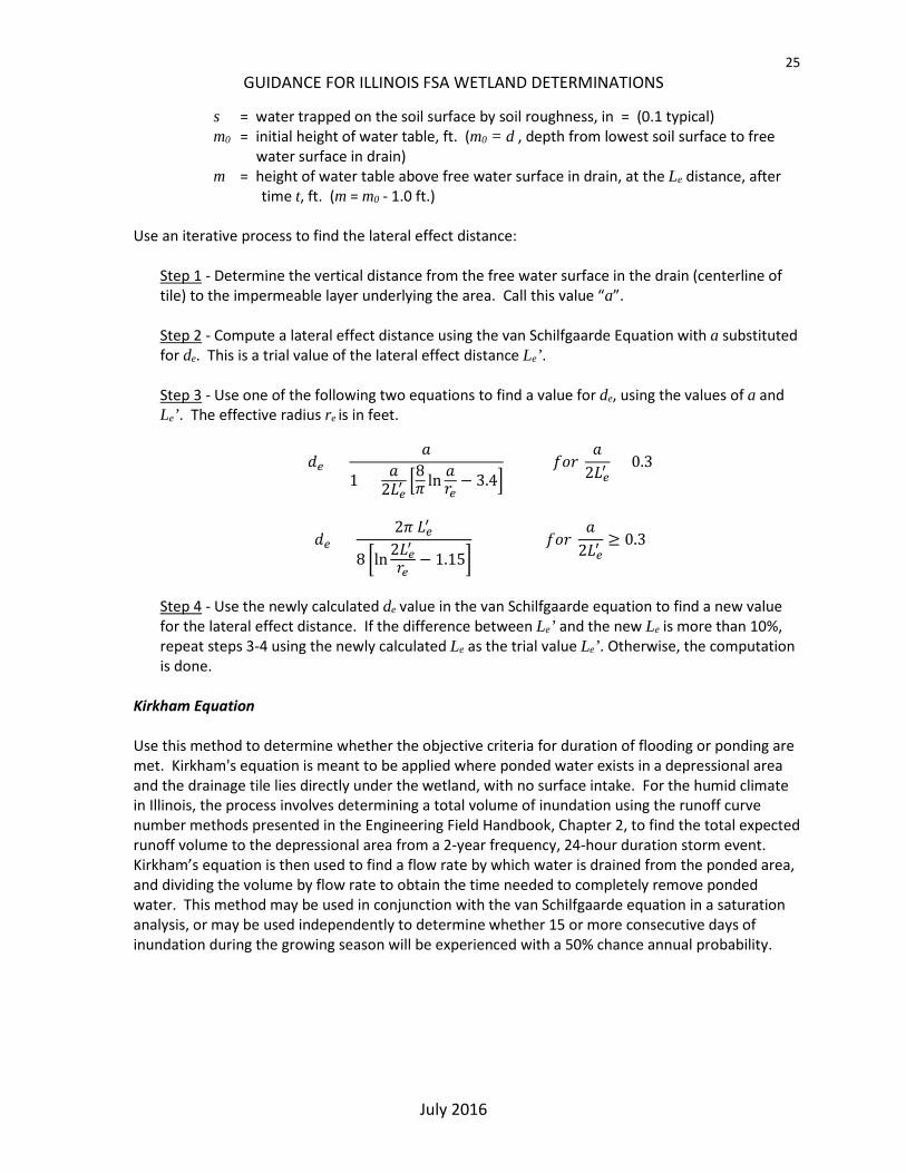
s = water trapped on the soil surface by soil roughness, in = (0.1 typical) m0 = initial height of water table, ft. (m0 = d , depth from lowest soil surface to free
water surface in drain) m = height of water table above free water surface in drain, at the Le distance, after
time t, ft. (m = m0 - 1.0 ft.) Use an iterative process to find the lateral effect distance:
Step 1 - Determine the vertical distance from the free water surface in the drain (centerline of tile) to the impermeable layer underlying the area. Call this value “a”. Step 2 - Compute a lateral effect distance using the van Schilfgaarde Equation with a substituted for de. This is a trial value of the lateral effect distance Le’. Step 3 - Use one of the following two equations to find a value for de, using the values of a and Le’. The effective radius re is in feet.
𝑑𝑑𝑒𝑒 = 𝑎𝑎
1 + 𝑎𝑎2𝐿𝐿𝑒𝑒′�8𝜋𝜋 ln 𝑎𝑎𝑟𝑟𝑒𝑒
− 3.4� 𝑓𝑓𝑓𝑓𝑟𝑟
𝑎𝑎2𝐿𝐿𝑒𝑒′
< 0.3
𝑑𝑑𝑒𝑒 = 2𝜋𝜋 𝐿𝐿𝑒𝑒′
8 �ln 2𝐿𝐿𝑒𝑒′𝑟𝑟𝑒𝑒
− 1.15� 𝑓𝑓𝑓𝑓𝑟𝑟
𝑎𝑎2𝐿𝐿𝑒𝑒′
≥ 0.3
Step 4 - Use the newly calculated de value in the van Schilfgaarde equation to find a new value for the lateral effect distance. If the difference between Le’ and the new Le is more than 10%, repeat steps 3-4 using the newly calculated Le as the trial value Le’. Otherwise, the computation is done.
Kirkham Equation Use this method to determine whether the objective criteria for duration of flooding or ponding are met. Kirkham's equation is meant to be applied where ponded water exists in a depressional area and the drainage tile lies directly under the wetland, with no surface intake. For the humid climate in Illinois, the process involves determining a total volume of inundation using the runoff curve number methods presented in the Engineering Field Handbook, Chapter 2, to find the total expected runoff volume to the depressional area from a 2-year frequency, 24-hour duration storm event. Kirkham’s equation is then used to find a flow rate by which water is drained from the ponded area, and dividing the volume by flow rate to obtain the time needed to completely remove ponded water. This method may be used in conjunction with the van Schilfgaarde equation in a saturation analysis, or may be used independently to determine whether 15 or more consecutive days of inundation during the growing season will be experienced with a 50% chance annual probability.

26 GUIDANCE FOR ILLINOIS FSA WETLAND DETERMINATIONS
July 2016
Figure B2. Kirkham variables There are two versions of the Kirkham equation: one for a single drain and the other for parallel, evenly spaced drains positioned beneath the ponded area.
𝑄𝑄 = 2𝜋𝜋 𝑘𝑘 (𝑡𝑡+𝑑𝑑−𝑟𝑟𝑒𝑒)
ln�2𝑑𝑑𝑟𝑟𝑒𝑒� for single drain; 𝑄𝑄 = 4𝜋𝜋 𝑘𝑘 (𝑡𝑡+𝑑𝑑− 𝑟𝑟𝑒𝑒)
𝑔𝑔 for parallel drains
Where: Q = Drain flow rate per unit length of drain, ft3/hr per foot k = hydraulic conductivity, ft./hr. (k = K / 24) t = average depth of ponded water, ft. (Compute runoff volume from the 2-year, 24-
hour storm event for the site, and use the topographic site information to determine an average depth to hold the volume. Set t equal to this depth or the total depth of the low spot, whichever is less.)
d = depth from lowest soil surface to tile center line, ft. re = effective radius of tile, ft. g = intermediate value for parallel drain calculation; see below S = spacing between tile lines (parallel drains only; see below), ft. h = depth from lowest soil surface to impermeable layer, ft.
𝑔𝑔 = 2 ln�sinh �𝜋𝜋(2𝑑𝑑 − 𝑟𝑟𝑒𝑒)
𝑆𝑆 �
sinh(𝜋𝜋 𝑟𝑟𝑒𝑒 /𝑆𝑆) � − 2 �(−1)𝑛𝑛∞
𝑛𝑛=1
ln�sinh2 �2𝜋𝜋𝜋𝜋ℎ
𝑆𝑆 � − sinh2 �𝜋𝜋𝑟𝑟𝑒𝑒𝑆𝑆 �
sinh2 �2𝜋𝜋𝜋𝜋ℎ𝑆𝑆 � − sinh2 �𝜋𝜋(2𝑑𝑑 − 𝑟𝑟𝑒𝑒)
𝑆𝑆 ��
The computation for the intermediate value, g, is best done using computer-aided methods. The infinite series terms will generally become negligible after the first 5-10 in the series. Use the relevant equation to determine the drain flow rate per unit length of drain. Multiply this value by the total length of drain underlying the site to obtain a flow rate. Compare the computed flow rate to the flow capacity of the tile drain(s). Use the lesser of the two flow rates to determine the time needed to completely drain the ponded surface water.

27 GUIDANCE FOR ILLINOIS FSA WETLAND DETERMINATIONS
July 2016
II. Runoff Volumes
The weather data used in whichever runoff volume method is selected from the options presented in EFH Chapter 19 must consist of at least 20 years of continuous daily rainfall and temperature records from the Primary Climate Station representing the Climate Station Zone containing the site. The map ILLINOIS CLIMATE STATION ZONES FOR WETLAND DETERMINATIONS showing the Climate Zones, and climate stations is located in the NRCS Field Office Technical Guide (eFOTG), Section I, Climate Data. Use stream gage records if available and applicable to the area being analyzed. The manual runoff computation method may also be used.
III. Flood Inundation Modelling (Stream and Lake Gage)
For landscapes subject to stream flooding, such as riverine landscapes, wetland hydrology can be analyzed based on flooding inundation. Inundation can be analyzed either by hand computations, or by use of a water surface profile software such as HEC-RAS. Data must contain at least 20 years of continuous daily mean flow data, but no more than 30 years.
IV. Observation Wells
For groundwater monitoring, use a minimum of 10 years of continuously collected records. The records must cover the dates within the wetland growing season for each year. For records collected on a time step larger than daily, convert to daily records by straight line interpolation.
V. Other
Other numerical analysis methods are appropriate if the method results in computation of numbers that can be compared to the Objective Criteria. These methods can include monthly time-step water budgeting, combinations of methods to cover combinations of dynamic flooding, static ponding, and soil saturation, and others.
The State Conservation Engineer may approve analysis methods not specifically detailed in this document.
VI. Appendix B.1 References
USDA-NRCS. January 2011. WI 650.1905 Scope and Effect Equations. EFH Notice210-WI-121. USDA-NRCS. September 2015. Hydrology Tools for Wetland Determination. Part 650, Title 210 –
National Engineering Handbook, Chapter 19. USDA-NRCS. August 1989. Estimating Runoff. Part 650, Title 210 – National Engineering Handbook,
Chapter 2. USDA-NRCS. Web Soil Survey. http://websoilsurvey.nrcs.usda.gov/app/

28 GUIDANCE FOR ILLINOIS FSA WETLAND DETERMINATIONS
July 2016
PART 2 – DETERMINATION OF IMAGERY REFLECTING NORMAL CIRCUMSTANCES The imagery used by NRCS to observe the presence or absence of wetness signatures is usually aerial photography taken by the USDA Farm Service Agency National Agriculture Imagery Program. Imagery since 2004 is available through the NRCS Geo Spatial Data Gateway. Before 2004 the imagery is physical color slides, some dating back to 1978, and is usually located in the USDA Service Center. In Illinois, the imagery used for wetland determinations is taken each year during the growing season, usually in the month of July although it can be from June through August.
Agency experts will use imagery representing Normal Circumstances as identified by the “Illinois Climate Zones for Wetland Determinations” map and the “Summary of Normal Precipitation Years for Climate Station Zones” which is a summary of normal precipitation years from the “IL Climate Evaluation of Precipitation” spreadsheet and list the best years of imagery to use when making wetland determinations in the climate station zone. All three documents are maintained on the NRCS Field Office Technical Guide (eFOTG) web site. Use the climate station zone that contains the majority of the area where the wetland determination will be made. For each climate zone, the years of imagery that best represents Normal Circumstances are identified by the “Summary of Normal Precipitation Years for Climate Station Zones”. Use the oldest years of imagery listed for the climate zone until at least 5 years of usable imagery for the determination site are obtained. More than five years of imagery may be used if the evaluation of only five years is inconclusive. All years with normal precipitation can be identified from the “IL Climate Evaluation of Precipitation” spreadsheet for the climate station. For counties that have less than five years of imagery available with normal precipitation, use the normal years that are available and verify potential wetlands in the field. The data for each climate station zone can be accessed through eFOTG in Section II, Climate Data, AgACIS. The “Illinois Climate Evaluation of Precipitation” spreadsheet evaluates the long term precipitation averages for the climate zone and the actual monthly precipitation for each year, for the 3 month period before the time the imagery is usually taken (April, May and June). Each year is then determined by the evaluation to have wet, normal, or dry conditions for that year.
The monthly total and daily precipitation for July in each of the normal years will be reviewed if the photography has an unusually high number of surface water signatures over the entire photograph (appears to be a wet year) when compared to other normal years. In this case, if July has a monthly total precipitation above the normal range in the WETS table, or an unusually high daily amount within the month (>2 inches), then that year should not be used as a year with normal precipitation because it could represent a photograph taken soon after a major precipitation event or wet period not considered normal circumstances. If a high number of surface water signatures are not present over the entire photograph, then the evaluation of July precipitation is not necessary.