guadalupe mountains wilderness core elements · guadalupe mountains national park is a haven of...
TRANSCRIPT

2010
Christina Mills
Guadalupe Mountains Wilderness Core Elements
Wilderness Fellow Guadalupe Mountains National Park [email protected] 915-828-3251 x 2430

Guadalupe Mountains Wilderness Core Elements 2010
2 | P a g e
Executive Summary
Guadalupe Mountains National Park is a haven of diversity, an interface of Chihuahuan Desert, Rocky Mountain, and Great Plains flora and fauna. Montane, canyon, and aquatic species coexist in a remarkable balance among globally unique geological features. Currently, the park protects 46,850 acres of designated wilderness, with 35,484 acres eligible for further wilderness study. In order to preserve these lands to the degree expected by the Wilderness Act, an evaluation of the current condition of the wilderness and a plan for monitoring long-term trends is critical.
The purpose of this document is to provide a foundation for a Wilderness Stewardship Strategy by presenting a current baseline assessment of the character of the Guadalupe Mountains Wilderness. A qualitative narrative describes the wilderness resource in terms of four qualities of wilderness character. In order to translate a conceptual narrative into concrete measures that can be monitored over time, a more quantitative suite of indicators and measures was developed. Baseline data has been collected, primarily from existing resources, and is followed by an assessment of the significance of the data and a description of how data was obtained. Also contained within this document are guidance and tools for protecting wilderness character in all management decisions, as well as recommended future planning considerations.
The intent behind this wilderness framework is for these measures of wilderness character to continue to be monitored annually or every five years to assess whether the trend in each measure is improving, stable, or degrading. An additional objective of this document is to generate discussion among park staff about future wilderness planning needs in order to initiate the alternative development process for a Wilderness Stewardship Plan.

Guadalupe Mountains Wilderness Core Elements 2010
3 | P a g e
Table of Contents General Wilderness Information .................................................................................................................................................... ..4 History of Land Status and Legislation..……………………………………………………………………………………….....4
Current Land Status………………………………………………………………………………………………………………………5
Map of the Guadalupe Mountains Wilderness…..………………………………………………………………………….…6
Relationship to other Plans and Programs………………….………………………………………………………………….7
Park Purpose, Significance, and Fundamental Resources and Values…………………………….………………...7
Wilderness Character Narrative ............................................................................................................................................ …....15
Untrammeled Quality……………………………………………………………………………………………………….….……....15 Natural Quality…………………………………………………………………………………………………………….………..……..16
Undeveloped Quality…………………………………………………………………………………………………….…..………….17
Opportunity for Solitude or Primitive Recreation Quality……………………………………………..….…...…….....18
Wilderness Character Baseline Assessment…………………………………………………………………………………..…….20
Untrammeled Quality………………………………………………………………………………………………………….……….20
Natural Quality……………………………………………………………………………………………....……………….…….…….21
Undeveloped Quality……………………………………………………………………………………………...…..…….….………27
Opportunity for Solitude or Primitive Recreation Quality………………………………………………….….….……28
Administrative Guidance………………………………………………………………………………..………………...….……………..32 Minimum Requirements Analysis: Introduction……………………………………………………………….....…………32
Minimum Requirements Analysis: Standard Operating Procedure Process Outline………………..….…….32
Future Wilderness Stewardship Planning Needs…………………..……………………………………….….……..…………..35
Appendix……………………………………………………………………………………………………………………….…………..………38
Appendix A: Applicable Laws and Policy………………………………………………………………….……………….………38
Appendix B: Public Law 95-625…………………………………………………………………………………………….….…..….41
Appendix C: Legal Description of the Wilderness Area………………………………..……………..………….….…….…50
Appendix D: The Wilderness Act……………………………………………………………………………..…..……...……………53
Appendix E: Narrative Development Process………………………………………………………………..….….…..………..60
Appendix F: Threatened, Endangered, and Sensitive Species……………………………………………………….........61
Appendix G: Map of Air and Water Quality Monitoring Sites………………………………………………………………63
Appendix H: Dropped Measures Table…………………………………………………………………………..…..…………..…64
Appendix I: Minimum Requirements Analysis Superintendent’s Order………………………………………..…….65
Appendix J: Minimum Requirements Decision Guide Worksheets…………………………..………..………...……..67

Guadalupe Mountains Wilderness Core Elements 2010
4 | P a g e
GENERAL WILDERNESS INFORMATION
History of Land Status and Legislation
Guadalupe Mountains National park was established by Public Law 89-667, passed on October 15, 1966, “to preserve in public ownership an area in the State of Texas possessing outstanding geological values together with scenic and other natural values of great significance.” Formal establishment of the park, with a size of 76,293 acres, occurred on September 30, 1972.
The Wilderness Act of 1964 mandated that the Secretary of the Interior examine roadless areas larger than 5,000 acres within national parks and suggest those that should be included in the National Wilderness Preservation System. As planning for the establishment of Guadalupe Mountains National Park got underway in 1970, the topic of wilderness designation became a controversial issue. On March 17, 1970, many people gathered to express their opinions concerning the park’s proposed master plan and wilderness proposal. Those in favor of wilderness designation, led by Sierra Club regional chairman Joseph Leach, advocated for no development. Leach, however, did not oppose the tramway that the Park Service suggested building through Pine Springs Canyon. Several others, such as Clare Cranston of the U.S.G.S., pushed for a more developed park, implying that restricting access to the Guadalupe Mountains would be “discrimination of the worst kind…against the bulk of our population.”1The majority of those present, however, did not want the park to be “developed to such a point that preservation of its wilderness state, which they all seemed to value, would become impossible.”2
In May, the Carlsbad Chamber of Commerce mailed a letter to the Guadalupe Mountains planning team, articulating the view that most tourists would be excluded from the park if it became designated wilderness and recommending development to the extent of that at Carlsbad Caverns. The Carlsbad newspaper, the Current-Argus, became a forum for public opinions. Eventually, the Carlsbad Chamber of Commerce repealed its original position and declared its support for the Master Plan and Wilderness Proposal in October of 1971. As a result, the public hearings held in November of 1971 were not as contentious as they might have been otherwise. In October 1972, President Richard M. Nixon submitted to Congress the Wilderness Proposal for Guadalupe Mountains National Park
3
1 Fabry, Judith K. 1988. Guadalupe Mountains National Park: An Administrative History. Southwest Cultural Resources Center. pp 58.
.
2 El Paso Herald Post, March 18, 1970 3 Fabry, Judith K. 1988. Guadalupe Mountains National Park: An Administrative History. Southwest Cultural Resources Center. pp 58-59.

Guadalupe Mountains Wilderness Core Elements 2010
5 | P a g e
Congress formally designated 46,850 acres of Guadalupe Mountains National Park as wilderness in 1978, six years later, under The National Parks and Recreation Act - Public Law 95-625. Based on the Wilderness Act of 1964, the intent of this action was to create within the park “an area where the earth and its community of life are untrammeled by man, where man himself is a visitor who does not remain.” This designation is one of the highest levels of protection allocated to federal lands, striving to preserve the ecological and primitive integrity of this area.
A wilderness eligibility assessment has determined that 35,484 acres comprised of six units throughout the park are now eligible for further wilderness study. This area can only be designated as wilderness following the completion of a formal Wilderness study and a recommendation by Congress. Until then, it must be managed as wilderness.
For the Public Law 95-625, see Appendix A. For the Legal Description of the Wilderness Area, see Appendix B.
Current Land Status
As mandated by the National Parks and Recreation Act of 1978, 46,850 acres of Guadalupe Mountains National Park is designated as wilderness. Wilderness areas are to possess the following characteristics (as identified in the Wilderness Act, See Appendix C):
• The earth and its community of life are untrammeled by humans, where humans are visitors and do not remain;
• The area is undeveloped and retains its primeval character and influence, without permanent improvements or human habitation;
• The area generally appears to have been affected primarily by the forces of nature, with the imprint of humans’ work substantially unnoticeable;
• The area is protected and managed so as to preserve its natural conditions; and
• The area offers outstanding opportunities for solitude or a primitive and unconfined type of recreation.
A wilderness eligibility assessment has determined that 6 units totaling 35,484 acres are eligible for further wilderness study. These units are (1) the newly acquired Salt Basin Dunes on the park’s west side of approximately 9,126 acres, (2) The Patterson Hills and Bajadas of
Photo: Buehler

Guadalupe Mountains Wilderness Core Elements 2010
6 | P a g e
approximately 22,776, (3) Guadalupe Peak and Pine Springs Canyon of approximately 960 acres, (4) Bear Canyon of approximately 83 acres (5) Eastern Escarpment of approximately 1,550 acres and (6) Basin and Range of approximately 989 acres. Unit 1 represents land added to the park in 1997 and has never been studied for its wilderness eligibility. The other five units are areas contiguous to the present designated wilderness and were left out of the original Wilderness Study for reasons that no longer affect their eligibility (GMP).
Map of the Guadalupe Mountains Wilderness

Guadalupe Mountains Wilderness Core Elements 2010
7 | P a g e
Relationship to Other Plans and Programs:
Several plans and/or management actions could affect or would be influenced by an approved Wilderness Stewardship Plan for Guadalupe Mountains National Park. Existing plans and programs and their relationship to the wilderness planning effort are described briefly here: Examples of other program plans at Guadalupe Mountains include the General Management Plan (GMP), Backcountry/ Wilderness Management Plan, Resource Stewardship Strategy (RSS), Land Protection Plan, Wildland Fire Management Plan, and Comprehensive Interpretive Plan. The 1995 Backcountry/Wilderness Management Plan is both outdated and recreation-focused. This Wilderness Stewardship Plan integrates portions of the existing GMP, RSS, and Backcountry/Wilderness plan where appropriate, and incorporates wilderness character to strengthen stewardship and the decision making process within the park. Wilderness stewardship planning is meant to complement and operate in conjunction with other park planning efforts. It also values the wilderness resource in a more holistic way, including recreational, scenic, natural, wild, and other less tangible qualities. Programs, such as the NPS Inventory and Monitoring Program (I&M Program) initiated through the Natural Resource Challenge, also play an important role and connection to wilderness character assessment, monitoring, and planning. Guadalupe Mountains National Park is part of the Chihuahuan Desert Network (CHDN). The CDN has identified 23 vital signs to be monitored within network parks. Four vital signs refer to air quality, two refer to climate, two to focal species, one to invasive plants, four to landscape condition and dynamics, five to soils and vegetation, and five to water quality and quantity. Eighteen vital signs will be monitored with CHDN funds.
Park Purpose, Significance, and Fundamental Resources and Values
National park purpose statements reaffirm the reasons for which the national park was set aside as a unit of the national park system and provide the foundation for national park management and use. The purposes of Guadalupe Mountains National Park are as follows:
1. To preserve an area possessing outstanding, globally unique geological features together with scenic, natural, and cultural values of great significance.
2. To manage a designated wilderness area where the earth and its community of life are untrammeled, and where humans are visitors who do not remain.
3. To provide opportunities for visitors to understand, enjoy, appreciate, and experience the unique nature of the park.

Guadalupe Mountains Wilderness Core Elements 2010
8 | P a g e
4. To provide educational and research opportunities that enhance stewardship and wider understanding of resources.
National park significance statements capture the essence of the national park’s importance to our country’s natural and cultural heritage. Significance statements do not inventory national park resources, but instead answer questions such as
• Why are Guadalupe Mountains National Park’s resources distinctive? • What do they contribute to our natural or cultural heritage? Defining a national park’s significance helps managers make decisions that preserve the resources and values necessary to accomplish that park’s purpose. The significance of Guadalupe Mountains National Park is as follows.
1. Guadalupe Mountains National Park is situated at the western terminus of the world’s most extensive and well-exposed fossil reef, including related shelf and basinal rocks, which have achieved international designation as the world’s best example of Middle Permian geology.
a) A tremendous earth fault on the west side of the park attracts major geological interest because it exposes numerous classical depositional settings superimposed over a long interval of geologic time.
b) The western area of the park contains excellent examples of playa depositional systems, including evaporite minerals, salt lake shorelines, and areas of aeolian dunes.
2. Stark contrasts between mountains and desert, overwhelming vistas stretching as far as the eye can see, brilliant fall colors created by the unusually plentiful vegetation, deep rock-ribbed canyons and sparkling white dunes contribute to the extraordinary scenic beauty of the Guadalupes.
3. Rugged and windswept, the Guadalupe Mountains’ wilderness provides opportunities to experience the unaltered dynamic of life in a remote landscape resplendent in its isolated beauty and inspirational solitude.
4. Guadalupe Mountains National Park is an island within an arid sea where an interface of Chihuahuan Desert, Rocky Mountain, and Great Plains flora and fauna was isolated by environmental changes. It contains relict and endemic montane, canyon, and aquatic species in a delicate balance created by elements of physical geography, latitude, climate, and hydrology.
Photo: Buehler

Guadalupe Mountains Wilderness Core Elements 2010
9 | P a g e
5. The cultural resources of the Guadalupes reflect the continuous association of peoples characterized by spiritual connections and adaptations to a dynamic environment.
Fundamental Resources and Values (from 2009 RSS) Fundamental resources and values are those resources that are critical to achieving a park’s purpose and maintaining its significance. If the fundamental resources and values are degraded, the park significance could be jeopardized. Fundamental resources and values are derived primarily from analyzing the park significance statements and determining the critical attributes that make up each significance statement. They elaborate on what is most important about the park and may include systems, processes, features, visitor experiences, stories, scenes, sounds, smells or other resources and values. They are part of the foundation for all planning and management at the park while providing a basis for the management of resources and actions. The following come from the RSS with additions to demonstrate their relevance to wilderness character. Fundamental Resources and Values listed in the RSS that do not pertain to wilderness have been omitted. Geologic Resources: Capitan Reef and Related Deposits
• Type Localities- numerous locations within the park from which fossil species
- The Middle Permian Capitan Reef system is one of the world’s largest and best preserved fossil reefs. Between 260 and 270 million years ago this reef lined approximately 400 linear miles of the margin of an ancient inland sea known as the Delaware Basin. It is also one of the world’s best exposed fossil reefs, complete with rocks representing the entire associated depositional environments from lagoon, outer shelf, back reef, reef, forereef slope, and deep basin. The entire three-dimensional character of these deposits and the sequence of transition from one to the other are readily observable at many places along the 11 miles of the reef exposed within the park. These rocks preserve an astounding diversity of fossil organisms that inhabited those ancient environments. These fossils illustrate the abundance, diversity, and complex interactions characteristic of organisms inhabiting reef systems throughout geologic time.
were first reported in scientific literature • Type Sections- several locations within the park where geological formations and Capitan Reef and members were first described in scientific literature Western Escarpment Geological Section- This faulted exposure of a one mile-thick and 10 mile long slice of Middle Permian marine rocks were deposited during 15 million years of geologic time. This continuous vertical accumulation clearly demonstrates the depositional sequence that lead to the formation of the Capitan Reef system. Guadalupian Stratotype- The park contains the world’s only reference standard for the Middle Permian portion of the geologic

Guadalupe Mountains Wilderness Core Elements 2010
10 | P a g e
time scale, an interval of time now known as the Guadalupian Epoch. The three component subdivisions of this time interval, the Roadian, Wordian, and Capitanian Ages, are also designated within the park. These designations as Global Stratotype Section and Points (GSSP) are conferred only after exhaustive study by a committee of the International Union of Geological Sciences determines that the geology of one area is the world’s best representative for that time interval. These unique resources were previously, and will continue to be, focal points of geological research. Salt Basin
- Landforms here record the existence of a large isolated lake that gradually dried and became a playa lake basin during the last 10,000 years of the Quaternary Epoch. Progressive shrinking of the lake left behind classic geomorphic features such as coppice dunes, salt lake deposits, shoreline terraces, shoreline dune ridges, and the second largest gypsum sand dune field in North America.
Other Important Resources/Values: Caves and Karstleast 30 documented caves. Many contain beautiful travertine cave formations, as well as
– The limestones of the Capitan Reef system within the park contain at
providing roosting areas for bats. A number of these caves contain deposits of Pleistocene Age animals and plants that attest to the diversity of life in the Guadalupe Mountains long ago when the area was much wetter than now. Among the extinct animals whose bones are found in these caves are giant ground sloths, horses, tiny pronghorn antelope, and a species of large vulture. Some caves preserve evidence of early human inhabitants. The paleontologic record of some caves has been partially studied but little is known of currently active cave biota. Eons of rain and running water have sculpted the limestones of the high mountain ridges into classic karst landscapes with steep canyons, towering rock spires, sinkholes, and springs. Fractures in the limestone capture rainfall and channel it downward to feed numerous springs and recharge aquifers. The Guadalupe Mountains create their own rainfall and capture it, thereby becoming an important recharge area for fresh drinking water. Museum Collectionsoutcrops are the original reference items for named species and are crucial voucher specimens that help to document the great diversity of organisms that lived just before and during the accumulation of the Capitan Reef. In addition, field notes provide basic data necessary for documenting the geological context of collected specimens. Research documents identify the scientific significance of geological resources.
- Type specimens of fossils from the park’s classical Permian geological
Scenic Resources:
Guadalupe Mountains Wilderness Core Elements 2010
11 | P a g e
Stark contrasts between mountains and desert, overwhelming vistas stretching as far as the eye can see, brilliant fall colors created by the unusually plentiful vegetation, deep rock-ribbed canyons and sparkling white dunes contribute to the extraordinary scenic beauty of the Guadalupe Mountains. Unobstructed Views
– These views are an important reason that visitors are allured and drawn to the Guadalupe Mountains Wilderness. Unobstructed views into the park from the surrounding Chihuahuan Desert, as well as views from the park back out to that same desert and beyond are an important part of the park experience, enhancing the visitor’s sense of solitude.
El Capitan—Historically, as an important landmark, El Capitan was an icon on the western horizon to travelers as they journeyed from the east to the frontier town of El Paso and beyond. Its iconic status continues today both with travelers traveling along US Highway 62/180 to the modern city of El Paso and as an icon for the state of Texas. Guadalupe Peak—At 8,752 feet, Guadalupe Peak is the highest point in Texas. Silhouetted against the setting sun, together with El Capitan, it remains a significant landmark for the surrounding region. As the highest vantage point in the region as well as the state it provides spectacular views of the surrounding desert, and distant mountain ranges continually lure visitors to its summit. Night Skies - Because of its remoteness, Guadalupe Mountains National Park provides an excellent vantage point to view from one of the southernmost locations in the United States an unobscured night sky, where a myriad of stars, galaxies, planets and other celestial bodies are revealed. McKittrick Canyon—In the fall of every year McKittrick Canyon puts on a display of vibrant colors of yellow, red, and gold as many of the deciduous trees and shrubs prepare for winter. This display is unique in the region with many visitors traveling hundreds of miles to spend hours in the canyon viewing the beautiful scenery. Gypsum Dunes - Stretching for miles, the shimmering expanse of undulating eolian dunes are comprised almost entirely of white gypsum sand. This expanse of white is second only in the United States to those of Whites Sands National Monument, the world’s largest gypsum dune field in south central New Mexico. Views of the Western Escarpment - Dramatically and majestically ascending over 5,000 feet skyward, the Western Escarpment forms an apparently impenetrable wall that towers above the desert floor. With El Capitan and Guadalupe Peak on its southern terminus, the escarpment presents a signature view of the park to visitors approaching from the west.
Guadalupe Mountains Wilderness Core Elements 2010
12 | P a g e
Views of canyons throughout the park -Dramatic views of the deep canyons incising the Guadalupe Mountains Wilderness contribute significantly to the visitor experience of the park’s backcountry and wilderness users. Natural Resources: Guadalupe Mountains National Park is an island within an arid sea where an interface of Chihuahuan Desert, Rocky Mountain, and Great Plains flora and fauna was isolated by environmental changes. It contains relict and endemic montane, canyon, and aquatic species in a delicate balance created by elements of physical geography, latitude, climate, and hydrology. Protection of the integrity of these resources is essential for the preservation of the natural quality of wilderness character. Natural Hydrologic Processes
– Water resources in the park occur naturally and are uninterrupted, providing unique habitat for aquatic species within the Guadalupe Mountains.
Aquatic species
• Water resources, including groundwater, perennial streams, springs, seeps, and
- McKittrick Creek, a perennial stream, creates an interior riparian deciduous forest community that provides rare habitat for aquatic species in a desert environment.
the travertine that allows them to appear, occur in various areas of the park, sustaining and enhancing vegetation and lifeforms.
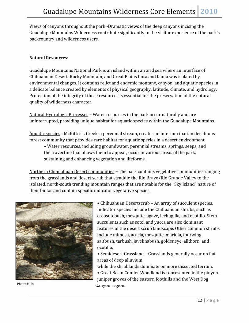
Northern Chihuahuan Desert communities
– The park contains vegetative communities ranging from the grasslands and desert scrub that straddle the Rio Bravo/Rio Grande Valley to the isolated, north-south trending mountain ranges that are notable for the “Sky Island” nature of their biotas and contain specific indicator vegetative species.
• Chihuahuan Desertscrub – An array of succulent species. Indicator species include the Chihuahuan shrubs, such as creosotebush, mesquite, agave, lechugilla, and ocotillo. Stem succulents such as sotol and yucca are also dominant features of the desert scrub landscape. Other common shrubs include mimosa, acacia, mesquite, mariola, fourwing saltbush, tarbush, javelinabush, goldeneye, allthorn, and ocotillo. • Semidesert Grassland – Grasslands generally occur on flat areas of deep alluvium while the shrublands dominate on more dissected terrain. • Great Basin Conifer Woodland is represented in the pinyon-juniper groves of the eastern foothills and the West Dog
Canyon region. Photo: Mills

Guadalupe Mountains Wilderness Core Elements 2010
13 | P a g e
• The gypsum dunes area supports an assemblage of gypsum-dependent plants and animals.
Riparian/Canyonstreams and includes the most diverse assemblage of riparian vegetation. Canyons
– McKittrick Canyon contains the largest of the park’s two perennial
contain Interior Riparian Deciduous Woodland in the bottoms and Madrean Evergreen Woodland on mesic slopes. The Interior Chaparral community is prevalent on southfacing canyon walls and mountain slopes. Montane/Sky Islandoccurrence of a montane forest that is known as a “Sky Island” within the desert.
– The park’s high elevation and natural setting allow for the rare
• The higher elevations of the park allow for the growth of a sustainable suite of Rocky Mountain Conifer Forest, including ponderosa pine, douglas fir, Southwestern white pine, and aspen. • The “Sky Island” contains a relict forest species, douglas fir, that is a holdover from previous ages.
Other Important Resources/Values: Rare and endangered species
– Due to the park’s varied landscapes and natural setting, a variety of rare and endangered species occur within park boundaries, including endemic species, federal- and state-listed species, and species of management concern. The Chihuahuan Desert has been identified as the third most biologically diverse desert ecoregion of the world, rivaled only by the Great Sandy-Tanami Desert of Australia and the Namib-Karoo of southern Africa (World Wildlife Fund 2000). Localized endemism occurs in several taxa where the basin and range physiography promotes isolation.
Natural diversity
– The park provides a protected environment that allows natural diversity to be maintained and promoted.
Cultural Resources: The cultural resources of the Guadalupes reflect the continuous association of peoples characterized by spiritual connections and adaptations to a dynamic environment. Along with evidence of seasonal habitation dating to 12,000 years ago, the park contains archeological remnants of prehistoric occupation dating to the Spanish exploration period. Historic remains of more permanent settlement occur as early as the 1850s and continue through the early years of the park’s establishment.
• Prehistoric lithic scatters, hearths Archeological Resources
Guadalupe Mountains Wilderness Core Elements 2010
14 | P a g e
• Proto-historic ceramics, pot shards, roasting pits • Historic Native American midden rings, rock art • Emigrant Trail to California and Butterfield Stage Route segments – Determined eligible for inclusion in the National Register in 1978. • Historic military encampments
• Williams Ranch – The only ranching operation on the west side of the park. Period of significance is 1906-1915. Determined eligible for inclusion in the National Register in 2006.
Ranching Landscape
Grisham-Hunter Line Cabin – Associated with the consolidation of small scale operations into a successful corporate ranching entity. Period of significance is 1928-1940. Determined eligible for inclusion in the National Register in 2006.
Other Important Resources/Values:
• Spanish Exploration – The de Vargas expedition commissioned by the Governor of Mexico first documented resources of Guadalupe Canyon and the Salt Flats in 1692. Apparently during the period of Spanish exploration, a Spanish soldier observed an image of the Lady of Guadalupe on the face of El Capitan, thereby providing the modern geographical name for the Guadalupe Mountains. • Present-Day Religious Practices – Sites throughout the park hold sacred significance to American Indians and Hispanic Catholics. Pilgrimages, offerings and other religious practices continue at certain locations today. • Archives and Museum Collections – The park collections contain a substantial number of prehistoric and historic artifacts. Among these are various flaked stone tools, grinding stones, and ceramics from the park’s prehistoric archeological sites. Historic artifacts include excavated materials from Buffalo Soldier encampments and battle sites, Mescalero Apache encampments, and numerous objects associated with local ranch homes and the ranching industry.
Wilderness: Although the resources and values above are important components of the Wilderness, wilderness itself is also a resource. It is a sanctuary for its inhabitants and visitors alike, and its cumulative value far exceeds the value of each of its individual qualities.

Guadalupe Mountains Wilderness Core Elements 2010
15 | P a g e
WILDERNESS CHARACTER NARRATIVE
Overview of Wilderness Character
The Guadalupe Mountains Wilderness hosts a unique variety of landscapes, from the blunt ruggedness of El Capitan to the gentle ripples of the sand dunes. Smooth rust-colored Texas Madrones twist up the mountainside as the Wilderness area seamlessly blends arid desert and lush mountain springs. The creosote bush lends visitors the unmistakable scent of the desert after a rain, and the warm smell of vanilla welcomes those who closely examine a Ponderosa Pine. Here, one can scale scenic peaks, discover expertly adapted wildlife, inspect ancient fossils, and enjoy the serenade of the Canyon Wren’s cascading whistles. This fragile mosaic of ecosystems remains both a precious resource and haven for visitors and inhabitants alike.
An interagency team4 has developed a national framework to monitor wilderness character, using four main qualities of wilderness:
Untrammeled: Wilderness is essentially unhindered and free from modern human control or manipulation
Natural: Wilderness maintains ecological systems that are substantially free from the effects of modern civilization
Undeveloped: Wilderness retains its primeval character and influence, and is essentially without permanent improvements or modern human occupation
Solitude or Unconfined Recreation
: Wilderness provides outstanding opportunities for a primitive and unconfined type of recreation
Untrammeled Quality:
The untrammeled quality of the Guadalupe Mountains Wilderness can be seen in the water-carved canyons, the track of a mountain lion, or in the delicate shoots of new grass emerging from a lightning charred landscape. This Wilderness seems to have a life of its own, in which one can witness the final flowering of an agave or listen to the wind rise and fall through the canyons. Here, the park thoroughly “appears to have been affected primarily by the forces of nature,” and the “earth and its community of life are untrammeled by man.” As a “trammel” traditionally refers to a restraint for a horse, “untrammeled” in the wilderness sense connotes an area that is unhindered by modern people. This quality represents the “wild,” in
4 Landres, P et al. (2008) Keeping It Wild: An Interagency Strategy to Monitor Trends in Wilderness Character Across the National Wilderness Preservation System

Guadalupe Mountains Wilderness Core Elements 2010
16 | P a g e
“wilderness.” Any intentional or unintentional, authorized or unauthorized treatment or action that manipulates the Wilderness degrades this quality.
Perpetuating the untrammeled quality requires managers to restrain themselves, rather than restraining the Wilderness. Often, upholding the untrammeled quality can detract from another Wilderness quality, such as “naturalness,” or vice-versa. For example, exotic species may be removed in order to attain natural species composition, which would in turn be a manipulation of the current Wilderness.
The primary actions that degrade the untrammeled quality in the Guadalupe Mountains Wilderness include removal of exotic species, native plant revegetation, and the prescription and suppression of fire. Although no species are being reintroduced at present, the reintroduction of big horned sheep remains a possibility. Efforts to eradicate barbary sheep, feral hogs, mullein, Russian thistle, and horehound, among other non-native species, are ongoing in the Wilderness. Visitor ignited fires significantly alter the landscape and are considered trammeling, as are the subsequent efforts to suppress them. Active fuel reduction strategies are also implemented. Research that involves the removal of plants or geologic resources also degrades the untrammeled quality. On the other hand, this research and the above management actions enhance the natural quality wilderness.
Natural Quality:
The community of life within the Guadalupe Mountains Wilderness is part of an extensive and complex desert, riparian and montane system. This tableau of habitats supports a unique level of diversity, from the salinity adapted scrubs of the gypsum dunes to the lofty pines of the coniferous forests. In fact, the Chihuahuan Desert has been identified as the third most biologically diverse desert ecoregion of the world (World Wildlife Fund 2000). In addition, the Guadalupe Mountains Wilderness is located at the western terminus of the world’s most extensive and well-exposed fossil reef, including related shelf and basinal rocks, which have achieved international designation as the world’s best example of Middle Permian geology. The natural quality, however, has been degraded by internal and external forces that threaten the flora and fauna, the atmospheric and hydrologic conditions, the fire regime, nutrient cycling, and geologic resources of the Guadalupe Mountains. Cumulatively, such influences compromise the natural integrity of the Wilderness as a whole.
A variety of species within the park are listed as rare or endangered, such as the Mexican spotted owl and peregrine falcon, and many grasses are still recovering from the past effects of livestock grazing. Some animals that once were present in the park have been extirpated, such as the bighorn sheep and Mexican gray wolf. Several invasive species have been introduced, modifying natural species composition. Although air quality within the park is relatively good, vehicles and surrounding agricultural and industrial activity can cause pollutants including fine particulates, ozone, and sulfur and nitrogen compounds to be transported into the park. These

Guadalupe Mountains Wilderness Core Elements 2010
17 | P a g e
activities can result in haze or deposition to soils, vegetation, and waters, which can alter soil nutrient cycling or cause eutrophication of waters. Other external disturbances include light and noise, primarily from surrounding urban areas, the highway, petroleum exploration
operations, or commercial air traffic. Past suppression of fires has led to the accumulation of fuel, and prohibited visitor activities can lead to human-ignited fires within the Wilderness. The Guadalupe Mountains Wilderness provides a unique opportunity to explore and study a one of a kind geologic resource, and actions that damage the resource demean this wilderness quality. The resource has suffered some, although limited, degradation by geologic tools such as rock hammers, and samples are periodically removed from the Wilderness by both scientists and visitors. However, researchers are required to go through a stringent process in order to obtain a permit and must follow specific guidelines mandated by park managers.
Although the biophysical environment and overall integrity of the Guadalupe Mountains Wilderness have suffered from some external and internal degradation, the system remains a rare haven of diversity and complexity. Reintroduction of extirpated species, removal of exotic species, and the positive effects of visitor education are reinstating natural conditions, while ongoing research is increasing understanding of overall ecologic and geologic processes. Due to conscientious permitting allocation and ranger vigilance, the overall condition of the geology remains very much intact. The extraordinary landscape and variety of ecological systems creates a unique natural character in the Guadalupe Mountains Wilderness.
Undeveloped Quality:
The remoteness of the Guadalupe Mountains Wilderness exemplifies the undeveloped quality. Visitors are allured by the relatively unobstructed views, both into the park from the surrounding Chihuahuan Desert, as well as from the mountain peaks outward. Distance from neighboring towns provides an excellent vantage point from which to view impressive night skies, and vast canyons harbor little evidence of human presence.
Several areas within the Wilderness do, however, contain modern developments. The patrol cabin at Pine Top has been constructed for patrol use and visitor safety. Radio repeaters exist within the Wilderness, although they are critical for ensuring safety. Signage can be found
Phot
o: M
ills

Guadalupe Mountains Wilderness Core Elements 2010
18 | P a g e
along the Permian Reef trail, as 28 numbered signs mark locations of geologic interest. Several large water tanks and piping constructed by settlers can be found within the Bowl. Hunter Line Shack, while clearly a development, is remnant of ranching history and is eligible for listing in the National Register, rendering it appropriate within wilderness. Other historical developments include remnants of a ranching camp in South McKittrick, several mine adits and prospects off of the Tejas trail near Dog Canyon, remains of small stone dams in Pine Springs and McKittrick canyons, and a cabin in the Bowl, a vestige of ranching in the Guadalupes. On the west side of the wilderness area, equipment remains from unsuccessful oil exploration and operations in the 1940’s. More recent developments exist around Smith Springs including flagstones, a bench, and handrails. Upon construction, these developments were installed to protect the spring from disturbance, which does enhance its natural quality. Scientific equipment, such as Remote Automated Weather Stations, can also be found. In the case of fire, helicopter flights add to the impact of existing commercial flights, further degrading this quality.
Overall, the majority of the 46,850 acres remain primarily free from permanent improvements or human habitation. This unspoiled condition must be preserved in order to render the Guadalupe Wilderness truly wild.
Solitude or Primitive and Unconfined Recreation Quality:
Perhaps one of the least tangible qualities, the outstanding opportunity for solitude and recreation remains a fundamental characteristic of the Guadalupe Mountains Wilderness. The vast views of endless sky and impossibly distant horizons, secluded canyons, and secret springs elicit a liberating isolation from the urban world. Extensive trails and sites for hiking, backpacking, camping, horseback riding, sightseeing, nature study, and bird watching provide visitors with outstanding options for recreation.
As surrounding areas develop, structures and anthropogenic actions that occur outside of the wilderness boundary have increasingly begun to hamper these opportunities. From many wilderness vistas, Highway 62/180 is a prominent feature, as are the Visitor Center, McKittrick Canyon Contact Station, Frijole Ranch, parking lots, and buildings within Pine Springs. Other developments not affiliated with the park also detract from one’s sense of remoteness, ranging from urban centers and their lights to fences and wind turbines. Noise from commercial aircraft further serves as an intermittent reminder of happenings outside of wilderness.
Developments associated with recreational activities are considered an impediment to solitude because they signify human presence. Visitor constructed wind shelters, fire rings, social trails and trash can all be found within wilderness campsites, although primarily at those that receive heavier use, such as Pine Top, Tejas, and Guadalupe Peak. At all campsites, treated wooden poles delineate designated tent pads. The existence of these pads, while detracting from one’s sense of solitude, also protect surrounding vegetation and provide some of the only

Guadalupe Mountains Wilderness Core Elements 2010
19 | P a g e
clear, flat places to pitch a tent within the park. Throughout the trail system, signs distinguish campsites and provide direction at trailheads, as well as warning visitors of sensitive environments. Perhaps the most apparent detriment to solitude is contact with visitors themselves. Although this is rare in much of the Wilderness, contact with other visitors is almost guaranteed when hiking Guadalupe Peak.
Outstanding recreational opportunities exist within the Guadalupe Mountains Wilderness. Visitors can hike an extensive trail system and in most places explore what lies beyond them. Several user restrictions, however, can confine visitor opportunities for recreation. Limiting some trails to hikers only, designating campsites, and allowing only day use of McKittrick Canyon, along with prohibitions of visitor actions such as lighting a campfire, diminish this unconfined quality of wilderness. Paradoxically, the relative remoteness of the Wilderness itself and visitor use restrictions both detract and enhance this quality by constraining recreation but enhancing the opportunity for solitude.
The Guadalupe Mountains Wilderness, however, seeks to strike a balance between maintaining solitude and providing recreational opportunities, allowing the user liberty to explore a striking and unique wilderness free from the encumbrance of modern society.
For the Wilderness Character Narrative development process, see Appendix E.

Guadalupe Mountains Wilderness Core Elements 2010
20 | P a g e
WILDERNESS CHARACTER BASELINE ASSESSMENT
Introduction:
In the interest of translating the concept of wilderness character into something tangible and assessable, a monitoring suite of measures and indicators was developed. These indicators and measures were derived from Keeping it Wild, although some measures have been added, omitted, or altered for applicability, feasibility, and relevance to the Guadalupe Mountains Wilderness. The table below is the proposed monitoring suite with data sources and baseline conditions. Each quality is followed by an assessment of the results and the process or protocol by which the baseline condition was obtained. Measures that were considered and dropped are listed in Appendix H, along with the reason each measure was dismissed.
QUALITY: UNTRAMMELED
Monitoring Question: What are the trends in actions that control or manipulate the earth and its community of life inside wilderness?
Indicator Measure Data Source(s) Baseline Condition & Year
Notes
Actions authorized by the federal land manager that manipulate the biophysical environment
Number of plant removal projects
Resource Management (RM)
3 (2009)
Number of Feral Hog and Barbary Sheep taken
RM/ P:Drive 12 (2009) 7 Barbary Sheep 5 Feral Hogs
Number of prescribed burns
Fire Program Clerk 0 (2009)
Percent of natural fires suppressed
FMO 33% (2009) 2 of 3 fires extinguished by rain
Actions not authorized by the Federal land manager that manipulate the biophysical environment
Number of human ignited fires
Fire Program Clerk 1 (2009)

Guadalupe Mountains Wilderness Core Elements 2010
21 | P a g e
• Number of plant removal projects: The number of exotic plant removal projects (3) in 2009 was determined from a dbf spreadsheet compiled by park biologist Jeremy Markuson. Projects are listed by year, location, and date. Entries were counted as one project if they occurred within the same few days (i.e verbascum thapsus was removed from the Bowl on 08/03/2009 and 08/06/2009. This was counted as one project). Although more than 3 exotic plant removal projects were executed in 2009, only those with locations listed within wilderness were counted.
• Number of feral hog and Barbary sheep eradications: The number of exotic animals killed (12) was obtained from an excel spreadsheet available from Resource Management.
• Number of prescribed burns: The number of prescribed burns within wilderness in 2009 (0) was obtained by verbal confirmation from Fire Management Officer John Montoya.
• Percent of natural fire starts that received a suppression response: This was obtained using an excel spreadsheet of all fires within the park from Fire Program Clerk Kendra Mayes. UTM coordinates and acreage are included within the spreadsheet. Using this information and a map of the wilderness boundary, fires that occurred outside of wilderness were eliminated. Three fires remained for 2009. An email correspondence with FMO John Montoya confirmed that 2 fires were extinguished by rain, when asked how many of these received a suppression response. Therefore, 1 of 3 fires, or 33% of fires within wilderness received a suppression response in 2009.
• Visitor ignited fires: Using the spreadsheet described above from the Fire Program Clerk, 1 of the 3 fires in 2009 were human caused, while the other two were “natural.”
QUALITY: NATURAL
Monitoring Question: What are the trends in terrestrial, aquatic, and atmospheric natural resources inside wilderness?
Indicator Measure Data Source(s) Baseline Condition & Year
Notes
Plant and animal species and communities
Number of indigenous species that are listed as threatened, endangered, or sensitive
RM 68 T,E, and sensitive species (2009)
See Appendix F
Number of extirpated indigenous species
RM 7 (2009) (bighorn sheep, gray wolf, grizzly bear, American bison, black-tailed prairie dog, Rio Grande cutthroat trout, Guadalupe fescue)

Guadalupe Mountains Wilderness Core Elements 2010
22 | P a g e
Number of reintroduced, previously extirpated species
RM project reports 0 (2009)
Area treated for invasive species
RM 26.69 acres
Number of invasive plant removal projects
RM 3 (2009)
Mexican Spotted Owls
Park biologist 9-10, stable See process
Status of search for Guadalupe fescue, a historically present native grass
Park biologist Search so far unsuccessful, perceived extirpated
Average area of vegetation loss around tent pads (m2)
Grund, Carolin PT:26.43 BM: 1.14 BR: 1.88 MA: 12.45 MR: 5.69 WR: 7.96 (1999)
Physical Resources Deciview National IMPROVE data
10.48 (2008)
Sum of anthropogenic fine nitrate and sulfate
National IMPROVE data
NO3f (0.1746) + SO4f (1.0121) = 1.1867
Highest 8 hour average ozone concentration (ppb)
NPS Air Resources Division (John D. Ray)
68 (2009)
W126 NPS Air Resources Division (John D. Ray)
7 (2009)
# Days > 76 ppb (NAAQ standard)
NPS Air Resources Division (John D. Ray)
0 (2009)
Acid deposition based on concentration of sulfur and nitrogen in wet deposition
National NADP/NTN data
SO4 mg/L = 0.946 NO3 mg/L = 0.847 (2009)

Guadalupe Mountains Wilderness Core Elements 2010
23 | P a g e
Water Quality RM DO: 6.39 mg/L pH: 8.22 Hardness (CA): 137.48 mg/L SO4: 11.38 mg/L NO3: 1.1 mg/L P: 0.23 Temp: 14.94
Monitoring Site GPS Coordinates: (1) 520172 E; 3536668 N (2) 520048 E; 3537171 N (3) 520528 E; 3538331 N (4) 521831 E; 3538848 N (5) 520469 E; 3530085 N
Change in Geologic Specimen Abundance
NPS Reports 20 63 of 65 localities actual loss score = 20
Geologic Research Impacts
RM See below for status report
Caves and Karst Condition
RM See below for status report
Biophysical Processes
Extent and magnitude of global climate change –average yearly temperature
National RAWS data stations
51.47 degrees Fahrenheit
Monthly averages available
• Number of indigenous species that are listed as threatened, endangered, or sensitive: In the Guadalupe Mountains, 68 species are listed threatened, endangered, or sensitive. This number was taken from a spreadsheet from biologist Jeremy Markuson, although species of concern have been eliminated (See Appendix F). Species of concern were not counted because although these species may need to be watched elsewhere, the population in this park be may perfectly healthy and stable. In other words, a higher number of species of concern does not reflect a loss of the natural quality of wilderness character.
• Number of extirpated species: The number of extirpated species (7) was also obtained from resource management.
• Number of reintroduced, previously extirpated species: (0), as verbally confirmed by the park biologist
• Area treated for invasive species: Obtained from a GIS layer compiled by the park biologist
• Number of invasive plant removal projects: See method above, under the Untrammeled quality
• Status of Mexican Spotted Owls: the population of Mexican Spotted Owls is stable, according to biologist Jeremy Markuson. He provided survey data in the form of an Excel spreadsheet. It is assumed that 9-10 owls inhabit the park. Surveys began in 1999 by surveying 11 locations within the park that the owls are known to inhabit. If a

Guadalupe Mountains Wilderness Core Elements 2010
24 | P a g e
single owl or a pair is found in that location, the result is noted (i.e male, female, adult, juvenile, pair, no survey, or no response).
o To obtain the upper estimation of 10: In some cases an owl may not be found during the survey, although it may be thought that the owl still resides in that location. This would lead to a ‘no response’ entry, although there is no indication that the population is declining. Because of this under-reporting of the number of owls that reside within the park, and estimation using solely 2009 data would result in falsely low data. To solve this problem, I looked at 3 years of surveys (2008, 2009, and 2010). For each location, I took the highest number of owls recorded in each of the three years. For example, in Lower Devil’s Den, no survey was conducted in 2008 or 2009, but a pair was found in 2010. I counted this as two owls. In Lower Pine Springs, 1 female was found in 2008, a pair in 2009, and 1 male in 2010. I counted this as two owls, under the assumption that although only 1 was found in the most recent survey, it’s very likely that the pair still resides.
o To obtain the lower estimation of 9: I used the results of the most recent survey, conducted in 2010.
• Status of the search for Guadalupe fescue: The search for Guadalupe fescue, a historically present native grass, has been so far unsuccessful, despite several attempts to locate it. However, because the wilderness area is large and the grass is difficult to distinguish from other grasses, the Guadalupe fescue may not necessarily be absent. Therefore, its existence within the park is perceived to be extirpated.
• Average area of vegetation loss around tent pads: In 1999, Carolin Grund conducted an extensive study entitled: Tourism and Resource Impacts in Wilderness Areas: Travel Analysis and Backcountry Campsite Monitoring at Guadalupe Mountains National Park, Texas/USA. Area of vegetation loss at the campsites in m2 was used (Table4, page116). Those campsites not within wilderness were not included.
• Deciview: The most recent available complete data for Deciview was from 2008. All the readings taken in 2008 were averaged to get a yearly average of 10.48. This was taken from the National IMPROVE database. The Deciview is measured adjacent to the wilderness, not within it, although the reading would likely be very similar. See Appendix G for a map of monitoring sites. The deciview scale is linear to humanly-perceived changes in visual air quality. A one dv change is approximately a 10% change in the extinction coefficient, which is a small, but usually perceptible scenic change. The dv scale is near zero for a pristine atmosphere (dv = 0 for Rayleigh conditions at approximately 1.8km elevation) and increases as visibility degrades. Because the index increases as haze increases, it is characterized as a haziness index. Haziness is caused by particulates in the air from surrounding urban areas, but most often dust and soil stirred up by wind or nearby agricultural activities. A value of 10.48 is quite good, as the median summer visibility in the relatively clean Colorado Plateau has a dv value of

Guadalupe Mountains Wilderness Core Elements 2010
25 | P a g e
approximately 12, and median summer visibility in the Eastern U.S. has a dv value of approximately 325
• Sum of Anthropogenic fine nitrate and sulfate: This value was also taken from the IMPROVE database. By summing the yearly averages from 2009 [NO3f (0.1746) + SO4f (1.0121)] we get a value of 1.1867. This is quite a low value, indicating excellent air quality
.
6
• Highest 8 hour average ozone concentration: GUMO does not monitor ozone. However, John D. Ray of the NPS Air Resources Division recommended using this measure from Carlsbad Caverns National Park. This can be found in the latest “
.
Air Quality in the National Parks Report.” Our highest average ozone concentration in ppb = 68, well below the National Ambient Air Quality Standard of 75 ppb.
• W-126: the W-126 reading, obtained from the same source as above, is 7. The EPA proposes a standard range of 7-15 ppm-hours.7
• Number of Days > 76 ppb – 76
ppb is the ozone concentration standard of the NAAQ. The number of days above that standard would be the number of days in violation of that standard. At GUMO, 0 days violated this standard.
• Acid deposition based on
concentration of sulfur and nitrogen in wet deposition: The wet deposition sulfur and nitrogen readings were 0.946 mg/L and 0.847 mg/L respectively. They are also measured adjacent to the wilderness. See Appendix G for a map of monitoring sites. These are extremely good results, as they represent some of the lowest concentrations in the country (See NPS Air Resources Division Wet Deposition Monitoring Protocol).
• Water Quality: Several water quality indicators are measured at GUMO. They are recorded in an Excel spreadsheet, obtained from GIS Specialist/Data Manager Jonena Hearst. See Appendix G for a map of water sampling sites. See ‘Notes’ in the table above for GPS coordinates of the 5 monitoring sites.
o Average DO for 2009 was 6.39 mg/L, which is a healthy level. DO fluctuates throughout the year with water temperature. Oxygen is essential for both plants and animals, but high levels in water can be harmful to fish and other aquatic
5 Interagency Monitoring of Protected Visual Environments Newsletter, April 1993. http://vista.cira.colostate.edu/improve/publications/NewsLetters/apr_93.pdf 6 Understanding Particle Pollution, EPA. http://www.epa.gov/airtrends/aqtrnd04/pmreport03/pmunderstand_2405.pdf 7 http://www.epa.gov/ttn/analysis/w126.htm
Phot
o: B
ieri

Guadalupe Mountains Wilderness Core Elements 2010
26 | P a g e
organisms. Decreased DO can be harmful to fish and other aquatic organisms. Expected levels: 4.0 to 12.0 mg/L.8
o A pH test measures the alkalinity or acidity concentration in water. A pH of 7 is neutral, below 7 is acidic, and above 7 is basic or alkaline. Levels from 6.5-9.0 are to be expected, so average GUMO 2009 reading of 8.22 is quite healthy.
9
o Hardness is caused by compounds of calcium and magnesium, and by a variety of other metals. General guidelines for classification of waters are: 0 to 60 mg/L (milligrams per liter) as calcium carbonate is classified as soft; 61 to 120 mg/L as moderately hard; 121 to 180 mg/L as hard; and more than 180 mg/L as very hard. Guadalupe Mountains water has an average hardness of 137.48 mg/L.
10
o SO4 - Dissolved sulphates, also measured in mg/L, are non-metallic compounds that occur naturally in several minerals. Concentrations typically range from 2-30 mg/L in lakes and rivers. Ambient Water Quality Guidelines put forth by the Environmental Protection Division of British Columbia mandate that the maximum concentration for SO4 is 100 mg/L, not to be exceeded at any time for freshwater aquatic life. A level of 50 mg/L is an alert level. Average sulphate levels for GUMO in 2009 were healthy, at 11.38 mg/L.
11
o NO3 - Nitrogen is a nutrient necessary for growth of all living organisms. In excess amounts, nitrates in water cause an increase in algae growth. Algae can rob the water of dissolved oxygen and eventually can kill fish and other aquatic life. Under certain conditions high levels of nitrates (10 mg/L or more) in drinking water can be toxic to humans. Nitrates are measured in milligrams per liter (mg/L). Expected levels are less than 1.0mg/L. Guadalupe Mountains National Park had an average reading of 1.1 mg/L in 2009.
12
o Phosphorous: Current average phosphorous levels in the park are 0.23. (Need more info on Phosphorous Standards)
o Temperature: Water temperature fluctuates greatly throughout the year. Average monthly temperatures have also been calculated to show seasonal fluctuation. The yearly average for 2009 is 14.94 degrees C.
• Change in Geologic Specimen Abundance: At 63 of 65 localities, the actual loss score is 20, which means the change in geologic specimen abundance as measured by the Paleontological Locality Condition Assessment Form criteria. An actual loss score of 20 is the target value or desired condition, and was obtained from the Resource Stewardship Strategy (pg 63).
8 http://www.lcra.org/water/quality/crwn/indicators.html 9 http://www.lcra.org/water/quality/crwn/indicators.html 10 http://water.usgs.gov/owq/hardness-alkalinity.html 11 http://www.env.gov.bc.ca/wat/wq/BCguidelines/sulphate/sulphate.html 12 http://www.lcra.org/water/quality/crwn/indicators.html

Guadalupe Mountains Wilderness Core Elements 2010
27 | P a g e
• Geologic Research Impacts: This measure was obtained in the form of a “professional judgment” status report from GIS specialist/Data Manager Jonena Hearst with approval from Resource Management Specialist Fred Armstrong: “Very little damage has been done to geologic resources due to collection. Requests for sample collection within Wilderness are subject to scrutiny by program managers. Researchers must adhere to strict collecting guidelines which are outlined in the research permit. The park instituted these procedures and guidelines following an early incident which resulted in limited impairment to geologic outcrops in a canyon. The canyon in question is seldom visited by recreational visitors, however, a number of geological researchers visit the canyon annually. Since the implementation of collecting guidelines, there has been no degradation of geological resources due to collection. A significant risk to geologic resources stems from the formation of social trails leading to sites of geologic interest. The park plans to address these issues in the Geological Resources Management Plan which should be completed within the next three years.”
• Condition of Caves and Karst: This measure was obtained in the form of a “professional judgment” status report from GIS specialist/Data Manager Jonena Hearst with approval from Resource Management Specialist Fred Armstrong: “The caves and karst features are in good condition, and have changed very little since Wilderness designation. Most caves are relatively inaccessible. Cave inventories and photo-documentation of conditions were not conducted prior to park acquisition. Official inventories have begun. Two caves have completed inventories and a complete inventory of all caves is a park long-term goal due to the inaccessibility of most caves and the difficulty of finding personnel with the appropriate skills in spelunking and inventory. The photographs and inventory data that currently exist are available internally within Guadalupe Mountains National Park.”
• Extent and Magnitude of Global Climate Change: The average temperature was 51.47 degrees Fahrenheit in 2009 and was obtained from the Guadalupe Peak RAWS station. Historical data is available from MesoWest.
QUALITY: UNDEVELOPED
Monitoring Question: What are the trends in non-recreational development, mechanization, and cultural resources inside wilderness?
Indicator Measure Data Source(s) Baseline Condition & Year
Notes
Non-recreational structures, installations, and developments
Number of non recreational structures
RM/Staff 13 (2009) 1 RAWS, 2 repeaters, 9 non recreational signs, and Pine Top cabin
Use of motor vehicles, motorized equipment, or
Number of Minimum Requirements documents
P:Drive 0 (2009)

Guadalupe Mountains Wilderness Core Elements 2010
28 | P a g e
mechanical transport
Number of emergency uses of helicopters and motorized equipment
FMO and Chief Ranger
0 (2009)
Loss of statutorily protected cultural resources
Severity of disturbances to cultural resources
Photos/Status reports (RM)
• Number of non-recreational research structures: Currently, 13 non recreational research structures are within wilderness, including 1 RAWS station, 2 radio repeaters, and 9 non-recreational signs. These signs are the geologic markers along the Permian Reef trail, and were determined to be within wilderness by the method listed above (see Recreational Signage). While the RAWS station provides valuable weather data and the radio repeaters are essential for visitor and staff safety. Geologic markers are important for both geologists who contribute valuable information to the park and for educating visitors. However, the geologic markers do detract from the undeveloped quality of the wilderness. Pine Top cabin contains warming equipment, extra water and MREs, and is used to station rangers in the backcountry overnight and to aid in visitor emergencies. It was originally considered administratively necessary, but current management will not restore it in the case of fire or deterioration.
• Number of Minimum Requirements Documents: These worksheets are posted to the P:drive, and would be a measure of the non-emergency use of motor vehicles, motorized equipment, or mechanical transport within wilderness. None were posted to the P:drive in 2009.
• Number of emergency uses of helicopters and motorized equipment: According to Fire Management Officer John Montoya, 0 helicopters or motorized equipment were used for in emergencies in 2009.
• Severity of disturbances to cultural resources:
QUALITY: SOLITUDE OR PRIMITIVE AND UNCONFINED RECREATION
Monitoring Question: What are the trends in outstanding opportunities for solitude and opportunities for primitive and unconfined recreation within wilderness?
Indicator Measure Data Source(s) Baseline Condition & Year
Notes
Remoteness from sights and sounds of people inside wilderness
Annual number of visitors
NPS Reports 198,882 (2009)
Number of backcountry nights
NPS Reports 2,405 (2009)

Guadalupe Mountains Wilderness Core Elements 2010
29 | P a g e
Number of trail contacts (visitors/hour)
Staff (Patrol Log) 1.48 during regular season 7.66 during Fall Colors (2010)
Amount of unauthorized recreational development
Average number of items of trash
Staff record 3.9 (2010)
Number of fire rings
P:Drive and staff record
5 (2010)
Number of wind shelters
Staff record, campsite photos
9 (2010)
Number of social trails
Grund research PT: 38 MR: 26 BM: 7 BR: 5 MA: 18 WR: 18 (1999)
Type and amount of agency provided recreation
Number of tent pads
Staff record 60 (2010)
Number of recreational signs
RM 62 (2010)
Remoteness from occupied and modified areas outside the wilderness
Night sky visibility averaged over the wilderness
Staff data collection
21.70 mag/arcsec2 (2010)
Average number of overflights heard per hour
Staff record 6.08
• Annual number of visitors: This was obtained from NPS reports under the NPS Stats page. Guadalupe Mountains National Park was selected, followed by “Annual Park Visitation.” In 2009, 198,882 people visited the park. This is lower than most other parks in the NPS. This number does not, however, indicate how many visitors entered the wilderness. A low number of visitors may be good in the interest of resource protection, but also could be considered bad, as one of the goals of wilderness is to provide the opportunity for recreation.
• Number of backcountry nights: This figure, 2405 backcountry user nights, was also obtained from the NPS Stats page. Guadalupe Mountains National Park was first selected, followed by “GUMO Overnight Stays Report.” To obtain data for 2009, The report for December 2009 was chosen. There is column that lists backcountry overnight stays, “This YTD.” This number is also not wholly indicative of wilderness use, as all wilderness users may not spend nights in the backcountry. Both this measure, and the measure listed above, in combination, may give a general indication of solitude within the Wilderness. Currently, the opportunity for solitude is excellent, but if these numbers

Guadalupe Mountains Wilderness Core Elements 2010
30 | P a g e
increase, solitude may decrease either on trails in general, or within backcountry campsites.
• Number of trail contacts (Visitors/hour): this metric was calculated using the patrol log located on the P: drive as well as my personal notes. If both number of visitors encountered and number of hours were recorded, then the number of visitors was divided by the number of hours. If the backcountry patrol was an overnight lasting two days, 8 hours a day were assumed, for a total of 16 hours. Because visitation is so much higher during fall colors, all of the reports that fell into this time period were averaged to get a total number of 7.66 visitors/hour during Fall Colors. This number would be higher or lower, depending on where in the park one chose to hike. For example, if one were to hike McKittrick during Fall Colors, the rate would be higher. All of the reports that did not occur during Fall Colors were averaged for a rate of 1.48 visitors/hour. Again, this number may be higher or lower depending on where one chose to hike. These rates may be skewed, as often rangers are asked to patrol in areas where they expect to encounter more visitors.
• Average items of trash: The average items of trash (3.9) comes from the patrol log where rangers have indicated an approximate number of items of trash found and my personal notes. Often, this is not recorded in the backcountry patrol log, so more entries would improve the accuracy of this measure. This number may also be an under representation of the items of trash within wilderness, because smaller items may or may not be counted. Overall, the Guadalupe Mountains wilderness has very little trash. The vast majority of litter is found on the Guadalupe Peak trail (most of which is not within wilderness) or in McKittrick Canyon during Fall Colors. Park staff do a good job removing trash when found.
• Number of fire rings: This figure (5) comes from fire rings recorded by staff in the back country patrol log and my personal notes. As many of the fire rings found are not recorded on the patrol log, this is an underrepresentation. However, most visitors comply with the ‘No Fires’ rule, so it is not common for fire rings to detract from one’s sense of solitude.
• Number of wind shelters: 9 wind shelters have been recorded at sites throughout the wilderness. These visitor constructed developments detract from the quality of solitude by reminding campers of other human presence.
• Number of social trails: In all, 112 social trails around campsites within wilderness were recorded by Carolin Grund in her 1999 report entitled: Tourism and Resource Impacts in Wilderness Areas: Travel, Analysis and Backcountry Campsite Monitoring At Guadalupe Mountains National Park, Texas/USA. Her drawings are located in Appendix J of the report.
Photo: Bieri

Guadalupe Mountains Wilderness Core Elements 2010
31 | P a g e
• Number of tent pads: There are currently 60 tent pads within wilderness. The front desk of the Visitor’s Center keeps a list of these sites. While tent pads do detract from one’s sense of solitude by representing human presence, and from one’s opportunity for primitive recreation, they also protect vegetation and other resources and provide some of the few flat places to pitch a tent within the wilderness.
• Recreational signage: Throughout the wilderness, there are 62 recreational signs. A spreadsheet of all signs within the park is available from Resource Management. In order to determine which signs are within wilderness, the UTM coordinates associated with each sign were compared with a map of the wilderness boundary. Those that fell outside of the wilderness boundary were eliminated. Tejas signs were considered inside the wilderness boundary if the UTM easting coordinate was less than 514600 and the northing was less than 3538200 for those signs near Dog Canyon. Tejas signs were considered inside the wilderness boundary if the easting was less than 515600 and the northing was greater than 3529400 near Pine Springs. McKittrick signs were considered inside the wilderness boundary if the easting was less than 520700 and the northing was less than 3538400. All signs were considered recreational except for the numbered geologic markers located along the Permian Reef trail.
• Night sky visibility: Night sky visibility was 21.70 mag/arcsec2 and was recorded with a Unihedron Sky Quality Meter by taking manual readings on nights with a new moon. The first reading was taken from Wilderness Ridge, a remote location on the eastern side of the park, and the second was taken from a Bush Mountain, a remote location on the west side of the park. Guadalupe Mountains National Park has very dark night skies, as the darkest sky reading would be approximately 23 mag/arcsec2. If one were to take a reading within an urban area, the meter might read around 17 mag/arcsec2. Photo mosaics are available on the P:drive >Resource Management>Night Sky.
• Average number of overflights heard per hour: The average number of overflights heard per hour is 6.08. This was determined by recording each aircraft heard each time I was hiking, and dividing by the number of hours spent hiking in the wilderness that day. All of the rates were then averaged. In a 1995 executive summary report to congress entitled: Report on the Effects of Aircraft Overflights on the National Park System, Appendix B lists parks identified as potentially having overflight problems. Parks are listed with the management rank of 1, 2, or 3 (1 being assigned to parks in each region with the highest severity of aircraft overflight problems). Guadalupe Mountains National Park was assigned a 1. It is unlikely that overflights have decreased since 1995, so this remains a detriment to solitude.
• Number of area closures: Currently, 3 area closures are in place. McKittrick Canyon is closed to visitors after 4:30pm or 6:00 pm, depending on the time of year, and two Research Natural Areas (South McKittrick and Devil’s Den Canyon) are closed at all times. While this does restrict the opportunity for unconfined recreation, these closures are essential to protecting valuable resources at this time.

Guadalupe Mountains Wilderness Core Elements 2010
32 | P a g e
ADMINISTRATIVE GUIDANCE
Minimum Requirements Analysis Introduction:
The concept of “minimum requirements” stems from section 4(c) of the Wilderness Act of 1964, which lists several prohibited uses including: temporary roads, use of motor vehicles, landing of aircraft, mechanical transport, and structures or installations, followed by the phrase, “…except as necessary to meet minimum requirements for the administration of the area for the purpose of this Act.” National Park Service Management policies (Sections 6.3.1 and 6.3.5) require the application of the concept of “minimum requirement” for the administration of the wilderness area regardless of wilderness category (designated, recommended, proposed, eligible for study, and potential). Guadalupe Mountains National Park has 46,850 acres of designated wilderness and an additional 35,484 acres are eligible for study. These two areas comprise 95% of the park. The Minimum Requirements Decision Guide will help wilderness stewards determine whether any administrative action is truly necessary, and if so, what is the activity with the least impact to wilderness character. In the past, this was referred to as the “minimum tool”, but is now generally referred to as the “minimum activity”, because factors other than what type of tools are used are also considered important when deciding on how best to preserve wilderness character (e.g. mode of transport). It is important to remember a few things when making decisions on complying with the letter and the spirit of the Wilderness Act. The Minimum Requirements Analysis should not be done by one person, but should be a thoughtful process implemented by an interdisciplinary team. It should be performed before the administrative action in question takes place, and not afterward as a justification. A range of “feasible” alternatives should be considered including the possibility that the most appropriate administrative response is no action at all. When determining minimum requirements, the potential disruption of wilderness character and resources will be considered before, and given more significance, than economic efficiency and convenience. If a compromise of wilderness resources or character is unavoidable, only those actions that preserve wilderness character and/or have localized, short-term adverse impacts will be acceptable (2006 NPS Management Policies 6.3.5). The Minimum Requirements Decision Guide can be a useful tool to help facilitate constructive discussions and keep our Wilderness wild. Minimum Requirements Analysis Standard Operating Procedure Process Outline:
1. Form interdisciplinary team consisting of the Wilderness Coordinator, Park Superintendent, and a representative from each of the following divisions: Resource Management, Maintenance, Fire Management, Interpretation, and Visitor Protection. Each team member should be familiar with the Wilderness Act and the Minimum Requirements Decision Guide (MRDG). This team will use the latest version of the MRDG form (Form 2009b) that is available at www.wilderness.net/MRDG/ and on the park’s P: drive in the MRDG folder.

Guadalupe Mountains Wilderness Core Elements 2010
33 | P a g e
The MRDG is a two-step process. In Step 1, the team must determine if administrative action is necessary. If action is necessary, then in Step 2, the team will determine the minimum activity. The MRDG process outline below will serve as the remainder of this SOP.
2. Describe the situation that may prompt action and describe why it is a problem or issue.
This should not be a description of a possible method or tool, but rather of the situation that prompts the possible need for action. It is incorrect to say “We need to use chainsaws to clear blown down trees.” Instead, say, “Blown down trees are blocking trails.” You will then determine if action is necessary, and if so, what minimum activity will be.
3. Determine whether administrative action is necessary by answering the following questions:
A. Is action necessary within wilderness?
B. Is action necessary to satisfy valid existing rights or a special provision in wilderness legislation (Wilderness Act of 1964 or subsequent wilderness laws) that allows consideration of the Section 4(c) prohibited uses? Cite law and section. Example: use of aircraft in the control of fire, insects, and disease [Section 4. (d)(1), Wilderness Act of 1964, P.L. 88-577] C. Is action necessary to meet the requirements of other laws (ESA, ARPA, NHPA, Clean Air Act, etc.)? D. Is action necessary to conform to direction contained in agency policy, unit and wilderness management plans, species recovery plans, or agreements with tribal, state and local governments or federal agencies? Example: A programmatic decision to treat invasive weeds has already been addressed in a unit level plan that included wilderness. Note that even if relevant programmatic decisions have already been made that satisfy Step 1of the MRDG, both Step 1 and Step 2 should be completed to determine the minimum administrative activity. E. Is action necessary to preserve one or more of the qualities of wilderness character? There are four qualities of wilderness which should be addressed. The four qualities of wilderness character are: 1) untrammeled—Wilderness is ideally unhindered and free from modern human control or manipulation. 2) undeveloped—Wilderness retains its primeval character and influence, and is essentially without permanent improvement or modern human occupation. 3) natural—Wilderness ecological systems are substantially free from the effects of modern civilization. 4) outstanding opportunities for solitude or a primitive and unconfined type of recreation— Wilderness provides outstanding opportunities for solitude or primitive and unconfined recreation.

Guadalupe Mountains Wilderness Core Elements 2010
34 | P a g e
F. Is action necessary to support one or more of the public purposes for wilderness of recreation, scenic, scientific, education, conservation, and historical use?
4. If answering “Yes” to any of the above questions, determine the minimum activity which least impacts the wilderness resource and character. 5. Create a range of alternatives to consider. Alternatives considered should include one with the use of the prohibited equipment or facilities, one with none of the Section 4(c) prohibitions, and if possible, one with a mix of prohibited and non-prohibited uses. Alternatives should be “feasible” and creative. Be sure to describe how impacts will be mitigated by: employee training, location of work areas, campsites, and travel routes; project timing; temporary closures; or other actions. Include a “No Action” alternative to allow for a comprehensive comparison of effects. 6. For each alternative, describe effects based on the following:
—Qualities of wilderness character (untrammeled, undeveloped, natural, and outstanding opportunities for solitude or a primitive and unconfined type of recreation) —Heritage and cultural resources —Maintaining traditional skills —Special Provisions —Economics and time constraints —Safety of personnel, visitors, and contractors
When considering the effects of the various alternatives it is helpful to create a chart for ease of comparison. Use a ranking and symbol system consisting of 1-3 pluses for beneficial effects and 1-3 minus signs for detrimental effects. Example: + = minor and/or short-term (less than 1 year) benefit, ++ = moderate and/or intermediate duration (1-2 years) benefit, +++ = major and/or long-term to permanent benefit. 7. Identify the selected alternative. 8. Describe the rationale for selecting this alternative, based on law and policy criteria. Include documentation of safety criterion, if appropriate. 9. Describe any monitoring and reporting requirements. 10. After the MRDG form has been completed and signed, scan and save to the compliance folder for the project in question and to the MRDG folder found on the P: drive. For the Minimum Requirements Superintendent’s Order, see Appendix I, and for Minimum Requirements Decision Guide Worksheets, see Appendix J.
Lessons learned and case studies from previous MRDG efforts are located on the P drive (P:\Minimum Tool\Minimum Requirements Analysis\1_MRA.Intro.Instructions.Worksheets.Examples).

Guadalupe Mountains Wilderness Core Elements 2010
35 | P a g e
FUTURE WILDERNESS STEWARDSHIP PLANNING NEEDS
Open Camping:
Two areas within Guadalupe Mountains National Park are designated as open camping zones. Currently, there seems to be an unwritten ‘if the visitors don’t ask, don’t tell’ policy towards these zones. While resource protection and visitor safety are two primary concerns of the park, the current practice is restricting visitor’s opportunity to experience a more unconfined type of wilderness recreation.
Wind Shelters: Wind shelters have been constructed and maintained by backcountry campers and are not park endorsed. However, they detract from the opportunity for solitude, as they are a reminder of other human presence. Park staff actively disperse fire rings, another sign of human presence, but currently leave wind shelters in place. Park management should consider the impact of these wind shelters and consider the possibility of removing them.
Tent Pads: Tent pads at backcountry campsites provide critical resource protection and are necessary due to the rocky terrain in the Guadalupe Mountains. In some sites, however, tent pads can be placed quite close together, and visitors have complained of the impact on their opportunity for solitude. Placing tent pads farther apart in the future should be considered.
Geologic Markers: While the numbered geologic markers along the Permian Reef trail aid geologists and those visitors interested in studying the unique geology within the park, they are large, prominent and metal, and do detract from the undeveloped quality of the wilderness. Smaller, less visually intrusive signs, perhaps constructed using natural materials would improve the undeveloped quality of the wilderness.
Phot
o: B
ieri

Guadalupe Mountains Wilderness Core Elements 2010
36 | P a g e
Pine Top Cabin: While Pine Top Cabin was originally considered administratively necessary for visitor protection, it remains a development within wilderness. Visitors knowingly assume a heightened level of risk when they enter wilderness, which often adds to the quality of their wilderness experience. The cabin is no longer considered administratively necessary, so its fate should be considered in the forthcoming Wilderness Stewardship Plan.
Flights: Overflights are currently a major disturbance to one’s sense of solitude within the Guadalupe Mountains Wilderness. On one day, 16 aircraft were heard within a span of 1 hr and 45 minutes. Although the National Park Service and managers may have very little influence on the FAA, attempts should be made if possible to mitigate the problem.
Light: Currently, Guadalupe Mountains National Park has excellent dark night skies. When camping on the west side of the park, however, a large light dome from El Paso, as well as lights from Dell City and other sources, are scattered across the desert resulting in a large visual impact at night. Similarly, lights from Whites City, oil wells, and other sources have a visual impact on for those camping on the northeast side of the park. While managers have no influence over these developments, efforts should be made to educate developers and those in urban centers about the effects of lights on solitude within wilderness and about proper shielding of their lights.
Tanks and Piping: Several tanks and much piping remain throughout the wilderness from ranching practices in the 1930’s. Although these developments are historical, visitors often encounter these developments with little or no historical context, the result being a degradation of the undeveloped quality in the mind of the visitor. The historical value of these developments should be further examined, or efforts to educate visitors on their historical significance should be made.
Staff Monitoring: Currently, Guadalupe Mountains park staff do an excellent job of collecting air and water data, and many do a thorough job of recording visitor contacts and violations on the backcountry patrol log. To avoid flawed data and ensure that data collection in the future is consistent and repeatable, designated “Wilderness Monitoring” days and locations will be chosen for monitoring visitor contacts, violations, and overflights.
Education: Park staff do an excellent job of educating visitors on park history, geology, and safe hiking and camping practices. In the future, wilderness character and further Leave No Trace education would be beneficial to both visitors and the resource. Resource Management should continue to do an excellent job informing researchers on prohibited uses and special considerations within wilderness.

Guadalupe Mountains Wilderness Core Elements 2010
37 | P a g e
Minimum Requirements: While the Minimum Requirements process is improving, it is especially important that forms are filled out by an interdisciplinary team, that they are done thoroughly and correctly, and that the process is an honest consideration of the necessity of any action, not simply a justification for a planned violation of the Wilderness Act.

Guadalupe Mountains Wilderness Core Elements 2010
38 | P a g e
APPENDIX
Appendix A: Applicable Law and Policy
A Wilderness Stewardship Strategy is essential to preserving wilderness character as mandated by the law and agency policy. Section 2(a) of the 1964 Wilderness Act states that wilderness areas “shall be administered for the use and enjoyment of the American people in such a manner as will leave them unimpaired for future use and enjoyment as wilderness, and so as to provide for the protection of these areas, the preservation of their wilderness character…” The Wilderness Act further expresses agency responsibility to preserve wilderness character in section 4(b), Use of Wilderness Areas. National Park Service Policy contributes to the need for this plan by mandating that “In addition to managing these areas for the preservation of the physical wilderness resources, planning for these areas must ensure that the wilderness character is likewise preserved” (2006 Management Policies, 6.3).
Federal:
• Enabling Legislation: o Public Law 89-667, passed on October 15, 1966, authorized the establishment of
Guadalupe Mountains National Park “to preserve in public ownership an area in the State of Texas possessing outstanding geological values together with scenic and other natural values of great significance.”
o Congress formally designated 46,850 acres of Guadalupe Mountains National Park as wilderness in 1978 under The National Parks and Recreation Act - Public Law 95-625
• The Organic Act: o “The service thus established shall promote and regulate the use of the Federal
areas known as national parks, monuments, and reservations hereinafter specified by such means and measures as conform to the fundamental purpose of the said parks, monuments, and reservations which purpose is to conserve the scenery and the natural and historic objects and the wild life therein and to provide for the enjoyment of the same in such manner and by such means as will leave them unimpaired for the enjoyment of future generations.”
• The Wilderness Act o See Appendix D
• NEPA
o “The National Environmental Policy Act (NEPA) requires federal agencies to integrate environmental values into their decision making processes by considering the environmental impacts of their proposed actions and reasonable alternatives to those actions. To meet NEPA requirements federal agencies prepare a detailed statement known as an Environmental Impact Statement (EIS). EPA reviews and comments on EISs prepared by other federal agencies, maintains a national filing

Guadalupe Mountains Wilderness Core Elements 2010
39 | P a g e
system for all EISs, and assures that its own actions comply with NEPA.” (EPA http://www.epa.gov/compliance/nepa/)
o The National Environmental Policy Act mandates that it is the responsibility of the federal government to:
1. fulfill the responsibilities of each generation as trustee of the environment for succeeding generations;
2. assure for all Americans safe, healthful, productive, and aesthetically and culturally pleasing surroundings;
3. attain the widest range of beneficial uses of the environment without degradation, risk to health or safety, or other undesirable and unintended consequences;
4. preserve important historic, cultural, and natural aspects of our national heritage, and maintain, wherever possible, an environment which supports diversity, and variety of individual choice;
5. achieve a balance between population and resource use which will permit high standards of living and a wide sharing of life's amenities; and
6. enhance the quality of renewable resources and approach the maximum attainable recycling of depletable resources.
• ESA
o “…All Federal departments and agencies shall seek to conserve endangered species and threatened species and shall utilize their authorities in furtherance of the purposes of this Act.” (sec. 2 (c))
• National Historic Preservation Act o “It shall be the policy of the Federal Government to administer federally owned,
administered, or controlled prehistoric and historic resources in a spirit of stewardship for the inspiration and benefit of present and future generations.” (sec. 2 (3))
National Park Service:
• The policies of the National Park Service that are presented in director’s orders and related documents are available on the Internet at <http://home.nps.gov/applications/npspolicy/DOrders.fm>
• Management Policies o “In addition to managing these areas for the preservation of the physical
wilderness resources, planning for these areas must ensure that the wilderness character is likewise preserved” (2006 Management Policies, 6.3).
• Reference Manual 41 o “The purpose of this guidance paper is to compare distinctions in law and policy
that guide similar actions on lands protected as wilderness and those generically protected as backcountry within the National Park System.”
• Director’s Order #41

Guadalupe Mountains Wilderness Core Elements 2010
40 | P a g e
o “The purpose of Director’s Order #41 is to provide accountability, consistency, and continuity to the National Park Service’s wilderness management program, and to otherwise guide Service wide efforts in meeting the letter and spirit of the 1964 Wilderness Act.” (A)
o “Park superintendents with wilderness resources will prepare and implement a wilderness management plan or equivalent integrated into an appropriate planning document.” (B.3.b.i)

Guadalupe Mountains Wilderness Core Elements 2010
41 | P a g e
Appendix B: Public Law 95-625
PUBLIC LAW 95—625—NOV. 10, 1978 92 STAT. 3467
Public Law 95—625 95th Congress
An Act
To authorize additional appropriations for the acquisition of lands and interests in lands within the Sawtooth National Recreation Area in Idaho.
No. 10, 1978
[S. 791]
Be it enacted by the Senate and House of Representatives of the United States of America in Congress assembled,
National Parks and Recreation Act of 1978.
SHORT TITLE AND TABLE OF CONTENTS
SECTION 1. This Act may be cited as the "National Parks and Recreation Act of 1978".
16 USC 1 note.
TABLE OF CONTENTS
Sec. 1. Short title and title of contents. Sec. 2. Definition. Sec. 3. Authorization of appropriations.
TITLE I—DEVELOPMENT CEILING INCREASES
Sec. 101. Specific increases.
Agate Fossil Beds National Monument. Andersonville National Historic Site. Andrew Johnson National Historic Site. Biscayne National Monument. Capitol Reef National Park. Carl Sandburg Home National Historic Site. Cowpens National Battlefield Site. De Soto National Memorial. Fort Bowie National Historic Site, Frederick Douglass Home, District of Columbia. Grant Kohrs Ranch National Historic Site. Guadalupe Mountains National Park. Gulf Islands National Seashore. Harper's Ferry National Historical Park. Hubbell Trading Post National Historic Site. Indiana Dunes National Lakeshore. John Muir National Historic Site, Lands in Prince Georges and Charles Counties, Maryland. Longfellow National Historic Site. Pecos National Monument. Perry's Victory and International Peace Memorial.

Guadalupe Mountains Wilderness Core Elements 2010
42 | P a g e
San Juan Island National Historical Park. Sitka National Historical Parke Statue of Liberty National Monument. Thaddeus Kosciuszko Home National Historic Site. Tuskegee Institute National Historic Site. Whiskeytown-Shasta-Trinity National Recreation Area. William Howard Taft National Historic Site, Wilson's Creek National Battlefield.
TITLE II—ACQUISITION CEILING INCREASES
Sec. 201. Acquisition ceilings.
Big Cypress National Preserve. Buffalo National River. Cumberland Island National Seashore.
Sec. 202. Sawtooth National Recreation Area.
PUBLIC LAW 95—625—NOV. 10, 1978 92 STAT. 3470
TABLE OF CONTENTS—Continued
TITLE VII—WILD AND SCENIC RIVERS ACT AMENDMENTS—Continued
Subtitle D—Amendments to Public Law 90-542
Sec. 761. Technical amendments. Sec. 762. Federal lands; cooperative agreements. Sec. 763. Miscellaneous technical amendments. Sec. 764. Lease of Federal lands.
TITLE VIII—RECOGNITION OF THE HONORABLE WILLIAM M. KETCHUM
Sec. 801. Recognition of the Honorable William M. Ketchum.
TITLE IX—JEAN LAFITTE NATIONAL HISTORICAL PARK
TITLE X—URBAN PARK AND RECREATION RECOVERY PROGRAM
TITLE XI—NEW RIVER GORGE NATIONAL RIVER
TITLE XII—FORT SCOTT NATIONAL HISTORIC SITE

Guadalupe Mountains Wilderness Core Elements 2010
43 | P a g e
TITLE XIII—REPORT AND BOUNDARY REVISION
Sec. 1301. Beaverhead or Gallatin National Forests. Sec. 1302. Hampton National Historic Site.
DEFINITION
Sec. 2. As used in this Act, except as otherwise specifically provided, the term "Secretary" means the Secretary of the Interior.
AUTHORIZATION OF APPROPRIATIONS
Sec. 3. Authorizations of moneys to be appropriated under this Act shall be effective on October 1, 1978. Not withstanding any other provision of this Act, authority to enter into contracts, to incur obligations, or to make payments under this Act shall be effective only to the extent, and in such amounts, as are provided in advance in appropriation Acts.
TITLE I—DEVELOPMENT CEILING INCREASES
Effective date.
SPECIFIC INCREASES
Sec. 101. The limitations on funds for development within certain units of the National Park System and affiliated areas are amended as follows:
Appropriation authorization.
(1) Agate Fossil Beds National Monument, Nebraska: Section 4 of the Act of June 5, 1965 (79 Stat. 123), is amended by changing "$1,842,000" to "$2,012,000".
(2) Andersonville National Historic Site, Georgia: Section 4 of the Act of October 10, 1970 (84 Stat. 989), is amended by changing "$1,605,000" to "$2,205,000 for development.", and by deleting "(March 1969 prices), for development plus or minus such amounts, if any, as may be justified by reason of ordinary fluctuation in construction costs as indicated by engineering cost indices applicable to the types of construction involved herein.".
(3) Andrew Johnson National Historic Site, Tennessee: Section 3 of the Act of December 11, 1963 (77 Stat. 350) is amended by changing "$266,000" to "$286,000".
16 USC 431 note.
(4) Biscayne National Monument, Florida: Section 5 of the Act of October 18, 1968 (82 Stat. 1188), is amended by changing "$2,900,000" to "$6,565,000".
16 USC 450qq-4
PUBLIC LAW 95—625—NOV. 10, 1978 92 STAT.

Guadalupe Mountains Wilderness Core Elements 2010
44 | P a g e
3471
(5) Capitol Reef National Park, Utah: Section 7 of the Act of December 18, 1971 (85 Stat. 739), is amended by changing "$1,052,700 (April 1970 prices)" to "$1,373,000 for development.", and by deleting "for development, plus or minus such amounts, if any, as may be justified by reason of ordinary fluctuations in construction costs as indicated by engineering cost indexes applicable to the types of construction involved herein."
(6) Carl Sandburg Home National Historic Site, North Carolina: Section 3 of the Act of October 17, 1968 (82 Stat. 1154), is amended by changing "$952,000" to "$1,662,000".
(7) Cowpens National Battlefield Site, South Carolina: Section 402 of the Act of April 11, 1972 (86 Stat. 120), is amended by changing "$3,108,000" to "$5,108,000".
16 USC 273f.
(8) De Soto National Memorial, Florida: Section 3 of the Act of March 11, 1948 (62 Stat. 78), as amended, is further amended changing "$3,108,000" to "$5,108,000".
(9) Fort Bowie National Historic Site, Arizona: Section 4 of the Act of August 30, 1964 (78 Stat. 681), is amended by deleting "$550,000 to carry out the purposes of this Act,", and inserting in lieu thereof: "$85,000 for land acquisition and $1,043,000 for development".
(10) Frederick Douglass Home, District of Columbia: Section 4 of the Act of September 5, 1962 (76 Stat. 435), is amended by changing "$413,000" to "$1,350,000".
(11)Grant Kohrs Ranch National Historic Site, Montana: Section 4 of the Act of August 25, 1972 (86 Stat. 632), is amended to read as follows: "SEC. 4 There are authorized to be appropriated such sums as may be necessary to carry out the provision of this Act, but not to exceed $752,000 for land acquisition and not to exceed $2,075,000 for development."; the additional sums herein authorized for land acquisition may be used to acquire the fee simple title to lands over which the United States has acquired easements or other less than fee interests.
16 USC 450dd note.
(12) Guadalupe Mountains National Park, Texas: Section 6 of the Act of October 15, 1966 (80 Stat. 920), is amended by changing "$10,362,000" to "$24,715,000", and by adding the following new sentence at the end of the section: "No funds appropriated for development purposes pursuant to this Act may be expended for
16 USC 283e.

Guadalupe Mountains Wilderness Core Elements 2010
45 | P a g e
improvements incompatible with wilderness management within the corridor of the park leading to the summit of Guadalupe Peak".
(13) Gulf Islands National Seashore, Florida-Mississippi: Section 11 of the Act of January 8, 1971 (84 Stat. 1967), is amended by changing "$17,774,000" to "$14,224,000", and by deleting the phrase, "(June 1970 prices) for development, plus such amounts, if any, as may be justified by reason of ordinary fluctuations in construction costs as indicated by engineering costs indices applicable to the types of construction involved herein.", and inserting lieu thereof "for development.".
16 USC 4592h—10.
(14) Harper's Ferry National Historical Park, Maryland-West Virginia: Section 4 of the Act of June 30, 1944 (58 Stat. 645), is amended further by changing "$8,690,000" to "$12,385,000".
16 USC 450bb note.
(15) Hubbell Trading Post National Historic Site, Arizona: Section 3 of the Act of August 28, 1965 (79 Stat. 584), is amended by changing "$952,000" to "$977,000".
16 USC 461 note.
PUBLIC LAW 95—625—NOV. 10, 1978 92 STAT. 3489
shore and, in addition, the waters surrounding said area to distances of some thousand feet in the Atlantic Ocean and up to four thousand feet in Great South Bay and Moriches Bay and, in addition, mainland terminal and headquarters sites, not to exceed a total of twelve acres, on the Patchogue River within Suffolk County, New York, all as deliniated on the map identified as "Fire Island National Seashore", numbered OGP-0004, dated May 1978. The Secretary shall publish in the offices of the Department of the Interior."
Map, publication in Federal Register.
(b) Section 2 of such Act is amended by adding the following new subsection at the end thereof:
"(g) The authority of the Secretary to condemn undeveloped tracts within the Dune District as depicted on map entitled "Fire Island National Seashore" numbered OGP-00004 dated May 1978, is suspended so long as the owner or owners of the undeveloped property maintain the property in its natural state. Undeveloped property within the Dune District that is acquired by the Secretary shall remain in its natural state.".
Undeveloped tracts and property 16 USC 459e&3151;1.
(c) Section 7(b) of such Act is amended by striking the phrase "Brookhaven town park at", and inserting in lieu thereof: "Ocean Ridge portion of".
16 USC 459e—6.
(d) Section 10 of such Act is amended by striking "$18,000,000", 16 USC 4593—

Guadalupe Mountains Wilderness Core Elements 2010
46 | P a g e
and inserting in lieu thereof "$23,000,000". 9.
CUMBERLAND ISLAND NATIONAL SEASHORE
Sec. 323. Section 1 of the Act of October 23, 1972 (86 Stat. 1066), is amended by changing the phrase "numbered CUIS 40,000B, and dated June 1971,", to read "numbered CUIS 4,000D, and dated January 1978,".
16 USC 459i.
TITLE IV—WILDERNESS
DESIGNATION OF AREAS
Sec. 401. The following lands are hereby designated as wilderness in accordance with section 3(c) of the Wilderness Act (78 Stat. 890; 16 U.S.C. 1132(c)), and shall be administered by the Secretary in accordance with the applicable provisions of the Wilderness Act:
Administration 16 USC 1132 note. 16 USC 1131 note.
(1) Buffalo National River, Arkansas, wilderness comprising approximately ten thousand five hundred and twenty-nine acres and potential wilderness additions comprising approximately twenty-five thousand four hundred and seventy-one acres depicted on a map entitled "Wilderness Plan, Buffalo National River, Arkansas", numbered 173 20,036 B and dated March 1975, to be known as the Buffalo National River Wilderness.
(2) Carlsbad Caverns National Park, New Mexico, wilderness comprising approximately thirty-three thousand one hundred and twenty-five acres and potential wilderness additions comprising approximately three hundred and twenty acres, depicted on a map entitled "Wilderness Plan, Carlsbad Caverns National Park, New Mexico," numbered 130-20,003-B and dated January 1978, to be known as the Carlsbad Caverns Wilderness. By January 1, 1980, the Secretary shall review the remainder of the park and shall report to the President, in accordance with section 3 (c) and (d) of the Wilderness Act (78 Stat. 891; 16 U.S.C. 1132 (c) and (d)), his recommendations as to the suitability or nonsuitability of any additional areas within the park for preservation as wilderness and any designation of such areas as wilderness shall be accomplished in accordance with said subsections of the Wilderness Act.
Report to President.
PUBLIC LAW 95—625—NOV. 10, 1978 92 STAT. 3490
(3) Everglades National Park, Florida, wilderness comprising approximately one million two hundred and ninety-six thousand five hundred acres and potential wilderness additions comprising approximately eighty-one thousand nine hundred acres, depicted
16 USC 1131 note.
Guadalupe Mountains Wilderness Core Elements 2010
47 | P a g e
on a map entitled "Wilderness Plan, Everglades National Park, Florida", numbered 160-20,011 and dated June 1971, to be known as the Everglades Wilderness.
(4) Guadalupe Mountains National Park, Texas, wilderness comprising approximately forty-six thousand eight hundred and fifty acres, depicted on the map entitled "Wilderness Plan, Guadalupe Mountains National Park, Texas," numbered 166-20,006-B and dated July 1972, to be known as the Guadalupe Mountains Wilderness.
(5) Gulf Islands National Seashore, Florida, and Mississippi, wilderness comprising approximately one thousand eight hundred acres and potential wilderness additions comprising approximately two thousand eight hundred acres, depicted on a map entitled "Wilderness Plan, Gulf Islands National Seashore, Mississippi, Florida", numbered 635-20,018-A and dated March 1977, to be known as the Gulf Islands Wilderness.
(6) Hawaii Volcanoes National Park, Hawaii, wilderness comprising approximately one hundred and twenty-three thousand one hundred acres and potential wilderness additions comprising approximately seven thousand eight hundred and fifty acres, depicted on a map entitled "Wilderness Plan, Hawaii Volcanoes National park, Hawaii", numbered 124-20,020 and dated April 1974, to be known as the Hawaii Volcanoes Wilderness.
(7) Organ Pipe Cactus National Monument, Arizona, wilderness comprising approximately three hundred and twelve thousand six hundred acres and potential wilderness additions comprising approximately one thousand two hundred and forty acres, depicted on the map entitled "Wilderness Plan, Organ Pipe Cactus National Monument, Arizona", numbered 157-20,001-B and dated October 1978, to be known as the Organ Pipe Cactus Wilderness.
(8) Theodore Roosevelt National Memorial Park, North Dakota, wilderness comprising approximately twenty-nine thousand nine hundred and twenty acres, depicted on maps entitled "Theodore Roosevelt National Memorial Park, North Dakota" (North Unit and South Unit) numbered 387-20,007-E and dated January 1978, to be known as the Theodore Roosevelt Wilderness.
MAP AND DESCRIPTION
Sec. 402. A map and description of the boundaries of the areas designated in this title shall be on file and available for public
Public availability.
Guadalupe Mountains Wilderness Core Elements 2010
48 | P a g e
inspection in of office of the Director of the National Park Service, Department of the Interior, and in the Office of the Superintendent of each area designated in this title. As soon as practicable after this Act takes effect, maps of the wilderness areas and descriptions of their boundaries shall be filed with the Committee on Interior and Insular Affairs of the House of Representatives and the Committee on Energy and Natural Resources of the United States Senate, and such maps and descriptions shall have the same force and effect as if included in this Act: Provided, That correction of clerical and typographical errors in such maps and descriptions may be made.
Filing with congressional committees.
PUBLIC LAW 95—625—NOV. 10, 1978 92 STAT. 3491
CESSATION OF CERTAIN USES
Sec. 403. Any lands which represent potential wilderness additions in this title, upon publication inn the Federal Register of a notice by the Secretary that at all uses thereon prohibited by the Wilderness Act have ceased, shall thereby be designated wilderness Lands designated as potential wilderness additions shall be managed by the Secretary insofar as practicable as wilderness until such time as said lands are designated as wilderness.
ADMINISTRATION
SEC. 404. The areas designated by this Act as wilderness shall be administered by the Secretary of the Interior in accordance with the applicable provisions of the Wilderness Act governing areas designated by that Act as wilderness, except that any reference in such provisions to the effective date of the Wilderness Act shall be deemed to be a reference to the effective date of this Act, and, where appropriate, any reference to the Secretary of Agriculture shall be deemed to be a reference to the Secretary of the Interior.
SAVINGS PROVISIONS
Sec. 405. Nothing in this tithe shall be construed to diminish the authority of the Coast Guard, pursuant to sections 2 and 81 of title 14, United States Code, and title 1 of the Ports and Waterways Safety Act of 1972 (33 U.S.C. 1221), or the Federal Aviation Administration to use the areas designated wilderness by this Act within the Everglades National Park, Florida ; and the Gulf Islands National Seashore, Florida and Mississippi, for navigational and maritime safety purposes.
Designation notice. publication in Federal Register. 16 USC 1131B note. Management.

Guadalupe Mountains Wilderness Core Elements 2010
49 | P a g e
TITLE V—ESTABLISHMENT OF NEW AREAS AND ADDITIONS TO NATIONAL TRAILS SYSTEM
Subtitle A—Parks, Seashores, Etc.
GUAM NATIONAL SEASHORE
Sec. 501. (a) The Secretary through the Director of the National Park Service, shall revise and update the National Park Service study of the Guam National Seashore and, after consultation with the Secretary of the Department of Defense and the Governor of Guam, shall transmit tine revised study within two years to the Committee on Energy and Natural Resources of the Senate and the Committee on Interior and Insular Affairs of the House of Representatives including his recommendations and a series of options for congressional consideration each of which—
(1) will encompass the area from Ajayen Bay to Nimitz Beach including Cocos and Anac Islands and extending inland as far as the Fena Valley Reservoir and Mount Sasalaguan, and
(2) if implemented, will afford protection to the natural and historic resources of the area as well as providing visitor access and interpretive services.
Study revision, transmittal to congressional committees.
(b) The Secretary, and the Secretary of tine Department of Defense, shall take such actions as they may deem appropriate within their existing authorities to protect the resource values of the submerged lands within the area of the study referred to in subsection (a) of this section.
Submerged lands resource values, protection

Guadalupe Mountains Wilderness Core Elements 2010
50 | P a g e
Appendix C: Legal Description of the Wilderness Area
Guadalupe Mountains Wilderness as designated by Public Law 95-625: The Wilderness area is depicted on the map titled “Guadalupe Mountains Wilderness, Guadalupe Mountains National Park, Texas,” No. 166-20,006-B, sheet 2 of 2, January 1980 and is described as follows: Beginning at the northeast corner of Guadalupe Mountains national Park being the northwest corner of Section 1 of Texas and Pacific Railroad Block 65, Township 1 on the state line of Eddy County, New Mexico and Culberson County, Texas; thence, south on the park boundary line to the hydrographic divide at about 5,130 feet elevation lying southerly and adjacent to the intermittent stream near the southeast corner of said Section 1; leaving the park boundary, westerly on the hydrographic divide to the 5,300 foot contour line; westerly on the 5,300 foot contour to a point 400 feet easterly of McKittrick Canyon road at the mouth of McKittrick Canyon; northwesterly into McKittrick Canyon on a parallel line 400 feet from the road to a point 400 feet distant from Pratt Lodge development area near the confluence of North and South McKittrick Canyons; counterclockwise maintaining a distance of 400 feet from the Pratt Lodge development area perimeter to a point 200 feet southerly from the McKittrick Canyon road; easterly on a parallel line 200 feet from McKittrick Canyon road to the northerly-southerly hydrographic divide at about 5,150 feet elevation lying westerly and near the east line of Section 2 of Texas and Pacific Railroad Block 65, Township 1; southerly uphill on the hydrographic divide to the 5,750 foot contour line; southerly on the 5,750 foot contour to the east-west centerline of Section 33 of Texas and Pacific Railroad Block 65, Township 1; west on section centerline to the 6,250 foot contour line; southwesterly on the 6,250 foot contour to a point 200 feet northeasterly of the high-standard trail leading from the vicinity of Pine Spring to the escarpment rim; northwesterly uphill on a parallel line 200 feet from the high-standard trail to the top of the escarpment; southwesterly on the escarpment rim about 400 feet to a point; southeasterly downhill on a parallel line 200 feet from the high-standard trail to the 6,250 foot contour line; southerly on the 6,250 foot contour to the east-west centerline of Section 41 of Texas and Pacific Railroad Block 65, Township 1; west on section centerlines to the drainage centerline of Pine Spring Canyon at about 6,300 feet elevation; northerly upstream on the drainage centerline of Pine Spring Canyon passing Devils Hall to the confluence with the drainage centerline of an unnamed canyon at about 6,570 feet elevation;

Guadalupe Mountains Wilderness Core Elements 2010
51 | P a g e
westerly upstream on the drainage centerline of the unnamed canyon to the confluence of the drainage centerlines of the two major unnamed canyons on the north face of Guadalupe Peak at about 7,290 feet elevation; southerly to the left upstream in the major drainage centerline of the unnamed canyon to its point of origin atop Guadalupe Peak, excluding that portion of Guadalupe Peak above 8,650 feet for the pylon commemoration airmail service; easterly downward along the main eastern hydrographic divide leading from Guadalupe Peak to the point of origin of the drainage centerline on the south escarpment at about 7,600 feet elevation near the west edge of the terrace; southeasterly downhill on the drainage centerline to the east line of Section 43 of Texas and Pacific Railroad Block 65, Township 1; south on section line to the corner of Guadalupe Mountains National Park on the southeast corner of said Section 43; south, west and south on the park boundary line to the east ¼ corner of Section 24 of Public School Land Block 121; leaving the park boundary, west on section centerline to the west ¼ corner or said Section 24; north on section lines to the east ¼ corner of Section 14 of Public School land Block 121; west on section centerline to the center of said Section 14; north on section centerline to the north ¼ corner of said Section 14; west on section line to the northwest corner of said Section 14; north on section lines to the west ¼ corner of section 2 of Public School Land Block 121; east on section centerline to the prolongation of the common section line of Sections 46 and 47 of Texas and Pacific Railroad Block 66, Township 1; north in a straight line to the common south corner of said Sections 46 and 47 and the general base of the western escarpment at about 5,000 feet elevation; northwesterly following the toe of the slope of the prominent escarpment, passing Shumard Canyon, Shirttail Canyon and the mile wide unnamed open canyon, to the drainage centerline of the intermittent stream supplied by Bush Mountain and Bartlett Peak at about 4,500 feet elevation near the east-west centerline of Section 33 of Texas and Pacific Railroad Block 66, Township 1; westerly downstream on the drainage centerline to the north-south centerline of Section 32 of Texas and Pacific Railroad Block 66, Township 1; north on section centerlines to the center of Section 29 of Texas and Pacific Railroad Block 66, Township 1; west on section centerline to the west ¼ corner of said Section 29; north on section lines to the east ¼ corner of Section 19 of Texas and Pacific Railroad Block 66, Township 1; west on section centerline to the center of said Section 19; north on section centerlines to the center of Section 7 of Texas and Pacific Railroad Block 66, Township 1; west on section centerline to the boundary line of Guadalupe Mountains National Park on the west ¼ corner of said Section 7;
Guadalupe Mountains Wilderness Core Elements 2010
52 | P a g e
north on the park boundary line to the northwest corner of Guadalupe Mountains National Park on the state line of New Mexico and Texas; east on the park boundary line to the drainage centerline in Cork Canyon; southeasterly upstream on the drainage centerline in Cork Canyon to the source of the nearest hydrographic divide at about 6,170 feet elevation lying southerly of the road adjacent to Coyote Peak; easterly on the northeast major hydrographic divide lying southerly of the road to its terminus in the drainage centerline at about 6,190 feet elevation; northeasterly downstream on the drainage centerline to Humphrey Canyon and to the north boundary line of Guadalupe Mountains National Park on the state line of New Mexico and Texas; east on the park boundary line to a point 300 feet westerly of Upper Dog Canyon road; southerly into Uppper Dog Canyon on a parallel line 300 feet from the road to the drainage centerline that meets Upper Dog Canyon at about 6,600 feet elevation; easterly crossing Upper Dog Canyon about 600 feet to a point; northerly on a parallel line 300 feet from Upper Dog Canyon road to the boundary line of Guadalupe Mountains National Park on the state line of New Mexico and Texas, and east on the park boundary line to the beginning corner. The wilderness area described herein contains 46,850 acres, more or less.

Guadalupe Mountains Wilderness Core Elements 2010
53 | P a g e
Appendix D: The Wilderness Act
WILDERNESS ACT Public Law 88-577 (16 U.S. C. 1131-1136)
88th Congress, Second Session September 3, 1964
AN ACT To establish a National Wilderness Preservation System for the permanent good of the
whole people, and for other purposes. Be it enacted by the Senate and House of Representatives of the United States of America in
Congress assembled. Short Title
Section 1. This Act may be cited as the "Wilderness Act."
WILDERNESS SYSTEM ESTABLISHED STATEMENT OF POLICY Section 2.(a) In order to assure that an increasing population, accompanied by expanding settlement and growing mechanization, does not occupy and modify all areas within the United States and its possessions, leaving no lands designated for preservation and protection in their natural condition, it is hereby declared to be the policy of the Congress to secure for the American people of present and future generations the benefits of an enduring resource of wilderness. For this purpose there is hereby established a National Wilderness Preservation System to be composed of federally owned areas designated by Congress as ''wilderness areas'', and these shall be administered for the use and enjoyment of the American people in such manner as will leave them unimpaired for future use and enjoyment as wilderness, and so as to provide for the protection of these areas, the preservation of their wilderness character, and for the gathering and dissemination of information regarding their use and enjoyment as wilderness; and no Federal lands shall be designated as ''wilderness areas'' except as provided for in this Act or by a subsequent Act. (b) The inclusion of an area in the National Wilderness Preservation System notwithstanding, the area shall continue to be managed by the Department and agency having jurisdiction thereover immediately before its inclusion in the National Wilderness Preservation System unless otherwise provided by Act of Congress. No appropriation shall be available for the payment of expenses or salaries for the administration of the National Wilderness Preservation System as a separate unit nor shall any appropriations be available for additional personnel stated as being required solely for the purpose of managing or administering areas solely because they are included within the National Wilderness Preservation System.
DEFINITION OF WILDERNESS (c) A wilderness, in contrast with those areas where man and his own works dominate the landscape, is hereby recognized as an area where the earth and its community of life are untrammeled by man, where man himself is a visitor who does not remain. An area of wilderness is further defined to mean in this Act an area of undeveloped Federal land retaining its primeval character and influence, without permanent improvements or human habitation, which is protected and managed so as to preserve its natural conditions and which (1) generally appears to have been affected primarily by the forces of nature, with the imprint of man's work substantially unnoticeable; (2) has outstanding opportunities for solitude or a primitive and unconfined type of recreation; (3) has at least five thousand acres of land or is of sufficient size as to make practicable its preservation and use in an unimpaired condition;

Guadalupe Mountains Wilderness Core Elements 2010
54 | P a g e
and (4) may also contain ecological, geological, or other features of scientific, educational, scenic, or historical value.
NATIONAL WILDERNESS PRESERVATION SYSTEM - EXTENT OF SYSTEM Section 3.(a) All areas within the national forests classified at least 30 days before September 3, 1964 by the Secretary of Agriculture or the Chief of the Forest Service as ''wilderness'', ''wild'', or ''canoe'' are hereby designated as wilderness areas. The Secretary of Agriculture shall –
(1) Within one year after September 3, 1964, file a map and legal description of each wilderness area with the Interior and Insular Affairs Committees of the United States Senate and the House of Representatives, and such descriptions shall have the same force and effect as if included in this Act: Provided, however, That correction of clerical and typographical errors in such legal descriptions and maps may be made. (2) Maintain, available to the public, records pertaining to said wilderness areas, including maps and legal descriptions, copies of regulations governing them, copies of public notices of, and reports submitted to Congress regarding pending additions, eliminations, or modifications. Maps, legal descriptions, and regulations pertaining to wilderness areas within their respective jurisdictions also shall be available to the public in the offices of regional foresters, national forest supervisors, and forest rangers. Classification. (b) The Secretary of Agriculture shall, within ten years after September 3, 1964, review, as to its suitability or nonsuitability for preservation as wilderness, each area in the national forests classified on September 3, 1964 by the Secretary of Agriculture or the Chief of the Forest Service as ''primitive'' and report his findings to the President. Presidential recommendation to Congress. The President shall advise the United States Senate and House of Representatives of his recommendations with respect to the designation as ''wilderness'' or other reclassification of each area on which review has been completed, together with maps and a definition of boundaries. Such advice shall be given with respect to not less than one-third of all the areas now classified as ''primitive'' within three years after September 3, 1964, not less than two-thirds within seven years after September 3, 1964, and the remaining areas within ten years after September 3, 1964. Congressional approval. Each recommendation of the President for designation as ''wilderness'' shall become effective only if so provided by an Act of Congress. Areas classified as ''primitive'' on September 3, 1964 shall continue to be administered under the rules and regulations affecting such areas on September 3, 1964 until Congress has determined otherwise. Any such area may be increased in size by the President at the time he submits his recommendations to the Congress by not more than five thousand acres with no more than one thousand two hundred and eighty acres of such increase in any one compact unit; if it is proposed to increase the size of any such area by more than five thousand acres or by more than one thousand two hundred and eighty acres in any one compact unit the increase in size shall not become effective until acted upon by Congress. Nothing herein contained shall limit the President in proposing, as part of his recommendations to Congress, the alteration of existing boundaries of primitive areas or recommending the addition of any contiguous area of national forest lands predominantly of wilderness value. Notwithstanding any other provisions of this Act, the Secretary of Agriculture may complete his review and delete such area as may be necessary, but not to exceed seven thousand acres, from the southern tip of the Gore Range-Eagles Nest Primitive Area, Colorado, if the Secretary determines that such action is in the public interest.

Guadalupe Mountains Wilderness Core Elements 2010
55 | P a g e
Report to President. (c) Within ten years after September 3, 1964 the Secretary of the Interior shall review every roadless area of five thousand contiguous acres or more in the national parks, monuments and other units of the national park system and every such area of, and every roadless island within the national wildlife refuges and game ranges, under his jurisdiction on September 3, 1964 and shall report to the President his recommendation as to the suitability or nonsuitability of each such area or island for preservation as wilderness. Presidential recommendation to Congress. The President shall advise the President of the Senate and the Speaker of the House of Representatives of his recommendation with respect to the designation as wilderness of each such area or island on which review has been completed, together with a map thereof and a definition of its boundaries. Such advice shall be given with respect to not less than one-third of the areas and islands to be reviewed under this subsection within three years after September 3, 1964, not less than two-thirds within seven years of September 3, 1964 and the remainder within ten years of September 3, 1964. Congressional approval. A recommendation of the President for designation as wilderness shall become effective only if so provided by an Act of Congress. Nothing contained herein shall, by implication or otherwise, be construed to lessen the present statutory authority of the Secretary of the Interior with respect to the maintenance of roadless areas within units of the national park system. Suitability. (d)(1) The Secretary of Agriculture and the Secretary of the Interior shall, prior to submitting any recommendations to the President with respect to the suitability of any area for preservation as wilderness – Publication in Federal Register. (A) give such public notice of the proposed action as they deem appropriate, including publication in the Federal Register and in a newspaper having general circulation in the area or areas in the vicinity of the affected land; Hearings. (B) hold a public hearing or hearings at a location or locations convenient to the area affected. The hearings shall be announced through such means as the respective Secretaries involved deem appropriate, including notices in the Federal Register and in newspapers of general circulation in the area: Provided, That if the lands involved are located in more than one State, at least one hearing shall be held in each State in which a portion of the land lies; (C) at least thirty days before the date of a hearing advise the Governor of each State and the governing board of each county, or in Alaska the borough, in which the lands are located, and Federal departments and agencies concerned, and invite such officials and Federal agencies to submit their views on the proposed action at the hearing or by no later than thirty days following the date of the hearing. Any views submitted to the appropriate Secretary under the provisions of (1) of this subsection with respect to any area shall be included with any recommendations to the President and to Congress with respect to such area. Proposed modification. (e) Any modification or adjustment of boundaries of any wilderness area shall be recommended by the appropriate Secretary after public notice of such proposal and public hearing or hearings as provided in subsection (d) of this section. The proposed modification or adjustment shall then be recommended with map and description thereof to the President. The President shall advise the United States Senate and the House of Representatives of his recommendations with respect to such modification or adjustment and such recommendations shall become effective only in the same manner as provided for in subsections (b) and (c) of this section.
USE OF WILDERNESS AREAS

Guadalupe Mountains Wilderness Core Elements 2010
56 | P a g e
Section 4.(a) The purposes of this Act are hereby declared to be within and supplemental to the purposes for which national forests and units of the national park and national wildlife refuge systems are established and administered and - (1) Nothing in this Act shall be deemed to be in interference with the purpose for which national forests are established as set forth in the Act of June 4, 1897 (30 Stat. 11), and the Multiple-Use Sustained-Yield Act of June 12, 1960 (74 Stat. 215) (16 U.S.C. 528-531). (2) Nothing in this Act shall modify the restrictions and provisions of the Shipstead-Nolan Act (Public Law 539, Seventy-first Congress, July 10, 1930; 46 Stat. 1020), the Thye–Blatnik Act (Public Law 733, Eightieth Congress, June 22, 1948; 62 Stat. 568), and the Humphrey-Thye-Blatnik-Andresen Act (Public Law 607, Eighty-Fourth Congress, June 22, 1956; 70 Stat. 326), as applying to the Superior National Forest or the regulations of the Secretary of Agriculture. (3) Nothing in this Act shall modify the statutory authority under which units of the national park system are created. Further, the designation of any area of any park, monument, or other unit of the national park system as a wilderness area pursuant to this Actshall in no manner lower the standards evolved for the use and preservation of such park, monument, or other unit of the national park system in accordance with sections 1, 2, 3, and 4 of this title, the statutory authority under which the area was created, or any other Act of Congress which might pertain to or affect such area, including, but not limited to, the Act of June 8, 1906 (34 Stat. 225; 16 U.S.C. 432 et seq.); section 3(2) of the Federal Power Act (16 U.S.C. 796(2)); and the Act of August 21, 1935 (49 Stat. 666; 16 U.S.C. 461 et seq.). (b) Except as otherwise provided in this Act, each agency administering any area designated as wilderness shall be responsible for preserving the wilderness character of the area and shall so administer such area for such other purposes for which it may have been established as also to preserve its wilderness character. Except as otherwise provided in this Act, wilderness areas shall be devoted to the public purposes of recreational, scenic, scientific, educational, conservation, and historical use.
PROHIBITION OF CERTAIN USES (c) Except as specifically provided for in this Act, and subject to existing private rights, there shall be no commercial enterprise and no permanent road within any wilderness area designated by this Act and, except as necessary to meet minimum requirements for the administration of the area for the purpose of this Act (including measures required in emergencies involving the health and safety of persons within the area), there shall be no temporary road, no use of motor vehicles, motorized equipment or motorboats, no landing of aircraft, no other form of mechanical transport, and no structure or installation within any such area.
SPECIAL PROVISIONS (d) The following special provisions are hereby made: (1) Within wilderness areas designated by this Act the use of aircraft or motorboats, where these uses have already become established, may be permitted to continue subject to such restrictions as the Secretary of Agriculture deems desirable. In addition, such measures may be taken as may be necessary in the control of fire, insects, and diseases, subject to such conditions as the Secretary deems desirable. (2) Nothing in this Act shall prevent within national forest wilderness areas any activity, including prospecting, for the purpose of gathering information about mineral or other resources, if such activity is carried on in a manner compatible with the preservation of the wilderness environment. Furthermore, in accordance with such program as the Secretary of the Interior shall develop and conduct in consultation with the Secretary of Agriculture, such areas shall be surveyed on a planned, recurring basis consistent with the concept of wilderness

Guadalupe Mountains Wilderness Core Elements 2010
57 | P a g e
preservation by the United States Geological Survey and the United States Bureau of Mines to determine the mineral values, if any, that may be present; and the results of such surveys shall be made available to the public and submitted to the President and Congress. Mineral leases, claims, etc. (3) Not withstanding any other provisions of this Act, until midnight December 31, 1983, the United States mining laws and all laws pertaining to mineral leasing shall, to the extent as applicable prior to September 3, 1964, extend to those national forest lands designated by this Act as "wilderness areas"; subject, however, to such reasonable regulations governing ingress and egress as may be prescribed by the Secretary of Agriculture consistent with the use of the land for mineral location and development and exploration, drilling, and production, and use of land for transmission lines, waterlines, telephone lines, or facilities necessary in exploring, drilling, producing, mining, and processing operations, including where essential the use of mechanized ground or air equipment and restoration as near as practicable of the surface of the land disturbed in performing prospecting, location, and , in oil and gas leasing, discovery work, exploration, drilling, and production, as soon as they have served their purpose. Mining locations lying within the boundaries of said wilderness areas shall be held and used solely for mining or processing operations and uses reasonably incident thereto; and hereafter, subject to valid existing rights, all patents issued under the mining laws of the United States affecting national forest lands designated by this Act as wilderness areas shall convey title to the mineral deposits within the claim, together with the right to cut and use so much of the mature timber therefrom as may be needed in the extraction, removal, and beneficiation of the mineral deposits, if needed timber is not otherwise reasonably available, and if the timber is cut under sound principles of forest management as defined by the national forest rules and regulations, but each such patent shall reserve to the United States all title in or to the surface of the lands and products thereof, and no use of the surface of the claim or the resources therefrom not reasonably required for carrying on mining or prospecting shall be allowed except as otherwise expressly provided in this Act: Provided, That, unless hereafter specifically authorized, no patent within wilderness areas designated by this Act shall issue after December 31, 1983, except for the valid claims existing on or before December 31, 1983. Mining claims located after September 3, 1964, within the boundaries of wilderness areas designated by this Actshall create no rights in excess of those rights which may be patented under the provisions of this subsection. Mineral leases, permits, and licenses covering lands within national forest wilderness areas designated by this Act shall contain such reasonable stipulations as may be prescribed by the Secretary of Agriculture for the protection of the wilderness character of the land consistent with the use of the land for the purposes for which they are leased, permitted, or licensed. Subject to valid rights then existing, effective January 1, 1984, the minerals in lands designated by this Act as wilderness areas are withdrawn from all forms of appropriation under the mining laws and from disposition under all laws pertaining to mineral leasing and all amendments thereto. Water resources and grazing. (4) Within wilderness areas in the national forests designated by this Act, (1) the President may, within a specific area and in accordance with such regulations as he may deem desirable, authorize prospecting for water resources, the establishment and maintenance of reservoirs, water-conservation works, power projects, transmission lines, and other facilities needed in the public interest, including the road construction and maintenance essential to development and use thereof, upon his determination that such use or uses in the specific area will better serve the interests of the United States and the people thereof than will its denial; and (2) the grazing of livestock, where established prior to September 3, 1964, shall be permitted to continue subject to such reasonable regulations as are deemed necessary by the Secretary of Agriculture.

Guadalupe Mountains Wilderness Core Elements 2010
58 | P a g e
(5) Other provisions of this Act to the contrary notwithstanding, the management of the Boundary Waters Canoe Area, formerly designated as the Superior, Little Indian Sioux, and Caribou Roadless Areas, in the Superior National Forest, Minnesota, shall be in accordance with regulations established by the Secretary of Agriculture in accordance with the general purpose of maintaining, without unnecessary restrictions on other uses, including that of timber, the primitive character of the area, particularly in the vicinity of lakes, streams, and portages: Provided, That nothing in this Act shall preclude the continuance within the area of any already established use of motorboats. (6) Commercial services may be performed within the wilderness areas designated by this Actto the extent necessary for activities which are proper for realizing the recreational or other wilderness purposes of the areas. (7) Nothing in this Act shall constitute an express or implied claim or denial on the part of the Federal Government as to exemption from State water laws. (8) Nothing in this Act shall be construed as affecting the jurisdiction or responsibilities of the several States with respect to wildlife and fish in the national forests.
STATE AND PRIVATE LANDS WITHIN WILDERNESS AREAS Section 5.(a) In any case where State -owned or privately owned land is completely surrounded by national forest lands within areas designated by this Act as wilderness, such State or private owner shall be given such rights as may be necessary to assure adequate access to such State -owned or privately owned land by such State or private owner and their successors in interest, or the State -owned land or privately owned land shall be exchanged for federally owned land in the same State of approximately equal value under authorities available to the Secretary of Agriculture: Transfers, restriction. Provided, however, That the United States shall not transfer to a State or private owner any mineral interests unless the State or private owner relinquishes or causes to be relinquished to the United States the mineral interest in the surrounded land. (b) In any case where valid mining claims or other valid occupancies are wholly within a designated national forest wilderness area, the Secretary of Agriculture shall, by reasonable regulations consistent with the preservation of the area as wilderness, permit ingress and egress to such surrounded areas by means which have been or are being customarily enjoyed with respect to other such areas similarly situated. Acquisition. (c) Subject to the appropriation of funds by Congress, the Secretary of Agriculture is authorized to acquire privately owned land within the perimeter of any area designated by this Act as wilderness if (1) the owner concurs in such acquisition or (2) the acquisition is specifically authorized by Congress.
GIFTS, BEQUESTS, AND CONTRIBUTIONS Section 6.(a) The Secretary of Agriculture may accept gifts or bequests of land within wilderness areas designated by this Act for preservation as wilderness. The Secretary of Agriculture may also accept gifts or bequests of land adjacent to wilderness areas designated by this Act for preservation as wilderness if he has given sixty days advance notice thereof to the President of the Senate and the Speaker of the House of Representatives. Land accepted by the Secretary of Agriculture under this section shall become part of the wilderness area involved. Regulations with regard to any such land may be in accordance with such agreements, consistent with the policy of this Act, as are made at the time of such gift, or such conditions, consistent with such policy, as may be included in, and accepted with, such bequest. (b) Authorization to accept private contributions and gifts The Secretary of Agriculture or the Secretary of the Interior is authorized to accept private contributions and gifts to be used to further the purposes of this Act.

Guadalupe Mountains Wilderness Core Elements 2010
59 | P a g e
ANNUAL REPORTS Section 7. At the opening of each session of Congress, the Secretaries of Agriculture and Interior shall jointly report to the President for transmission to Congress on the status of the wilderness system, including a list and descriptions of the areas in the system, regulations in effect, and other pertinent information, together with any recommendations they may care to make.
APPROVED SEPTEMBER 3, 1964. Legislative History:
House Reports: No 1538 accompanying H.R. 9070 (Committee on Interior & Insular Affairs) and No. 1829 (Committee of Conference).
Senate report: No. 109 (Committee on Interior & Insular Affairs). Congressional Record: Vol. 109 (1963):
• April 4, 8, considered in Senate. • April 9, considered and passed Senate.
• Vol. 110 (1964): July 28, considered in House. • July 30, considered and passed House, amended, in lieu of H.R. 9070
• August 20, House and Senate agreed to conference report.

Guadalupe Mountains Wilderness Core Elements 2010
60 | P a g e
Appendix E: Wilderness Character Narrative Development Process
The following are the steps undertaken to develop a Wilderness Character Narrative.
The first few weeks involved hiking extensively throughout the wilderness, reading relevant literature (existing park plans, administrative history, The Wilderness Act, etc), taking Wilderness related Eppley courses online, and conversing with park staff in order to understand both the tangible and intangible values of the wilderness.
In July 2010, the Wilderness Fellows convened in Everglades National Park for a wilderness workshop with Peter Landres, Suzy Stuzman, WASO and EVER staff, and others. After receiving further guidance on Wilderness Character and the concept of a narrative, the Wilderness Fellows drafted a narrative for the Marjory Stoneman Douglass Wilderness. The narrative for the Guadalupe Mountains Wilderness was primarily modeled after the EVER narrative, as well as an example from DEVA. In addition, a significant amount of time was spent researching Guadalupe Mountains National Park and its resources, as well as consulting with park staff. After receiving edits from other Wilderness Fellows, Peter Landres, and internal GUMO staff, the final narrative was produced.
Park staff were consulted throughout the process, including wilderness coordinator and interpretive ranger Michael Haynie, other law enforcement and interpretive rangers, park geologists, fire program clerk, fire management officer, park biologist, GIS specialist/data manager, resource management specialist, and the superintendent.

Guadalupe Mountains Wilderness Core Elements 2010
61 | P a g e
Appendix F: Threatened, Endangered, and Sensitive Species
Taxa Category Scientific Name Common Name(s) Mammal Cynomys ludovicianus Black-tailed prairie dog Mammal Ovis canadensis nelsoni Desert bighorn sheep Bird Meleagris gallopavo Wild Turkey Mammal Ursus americanus American black bear Mammal Antilocapra americana American pronghorn Mammal Taxidea taxus Badger Vascular Plant Hymenopappus biennis biennial woolywhite
Vascular Plant Escobaria dasyacantha var.dasyacantha Big Bend foxtail cactus Bird Athene cunicularia Burrowing owl
Vascular Plant Penstemon cardinalis regalis Cardinal beardtongue penstemon
Vascular Plant Aquilegia chrysantha chaplinei Chapline's Columbine Vascular Plant Hexalectris revoluta Chisos coral-root Vascular Plant Agave glomeruliflora Chisos Mountains agave Vascular Plant Pinaropappus parvus Dwarf Rock Lettuce Mammal Cervus elaphus elk, wapiti Bird Buteo regalis Ferruginous hawk
Vascular Plant Streptanthus sparsiflorus Few-flowered jewelflower Vascular Plant Perityle quinqueflora Five-flowered Rock Daisy Vascular Plant Perityle fosteri Foster's rockdaisy
Vascular Plant Hexalectris nitida Glass Mountains crested coralroot
Reptile Lamporpelta alterna Gray-banded kingsnake Mammal Eutamias canipes Gray-footed chipmunk Vascular Plant Festuca ligulata Guadalupe fescue
Vascular Plant Sophora gypsophila guadalupensis Guadalupe Mountain Laurel
Mammal Sylvilagus floridanus Guadalupe Mountains cottontail Invertebrate Animal Cincindela politula petrophila
Guadalupe Mountains Tiger Beetle
Vascular Plant Viola guadalupensis Guadalupe Mountains Violet
Vascular Plant Escobaria guadalupensis Guadalupe pincushion cactus
Vascular Plant Ericameria nauseosa ssp. nauseosa var.texensis Guadalupe Rabbitbrush
Mammal Thomomys bottae guadalupensis Guadalupe Southern Pocket Gopher
Vascular Plant Astragalus gypsodes Gypsum milkvetch Vascular Plant Lepidospartum burgessii Gypsum Scalebroom

Guadalupe Mountains Wilderness Core Elements 2010
62 | P a g e
Mammal Pecari tajacu Javelina, collared peccary Reptile Holbrookia maculata Lesser earless lizard Bird Lanius ludovicianus Loggerhead shrike Vascular Plant Chaetopappa hersheyi Mat Leastdaisy Vascular Plant Hedeoma apiculata McKittrick pennyroyal Mammal Microtus mogollonensis Mogollon vole Bird Cyrtonyx montezumae Montezuma quail Mammal Felis concolor Mountain lion Vascular Plant Salvia summa Mountain Sage
Reptile Phrynosoma douglasi hernandesi Mountain Short-horned Lizard Mammal Odocoileus hemionus Mule deer Vascular Plant Prunus murrayana Murray's plum
Vascular Plant Peniocereus greggii var. greggii Night-blooming cereus
Vascular Plant Sclerocactus papyracanthus Paper-spine cactus Vascular Plant Cryptantha paysonii Payson's cryptantha Vascular Plant Populus tremuloides Quaking aspen Fish Oncorhynchus mykiss Rainbow trout Mammal Bassariscus astutus ringtail Vascular Plant Polygala rimulicola Rock crevice milkwort Vascular Plant Lesquerella valida Scaly Bladderpod Vascular Plant Scutellaria laevis Smooth-stem skullcap Mammal Euderma maculatum Spotted bat Vascular Plant Hexalectris warnockii Texas crested coralroot Reptile Phrynosoma cornutum Texas horned lizard Vascular Plant Arbutus xalapensis Texas madrone Vascular Plant Valeriana texana Texas Valerian Vascular Plant Lycium texanum Texas wolf-berry Mammal Corynorhinus townsendii Townsend's big-eared bat Vascular Plant Nolina arenicola Trans-Pecos beargrass Vascular Plant Pseudoclappia watsonii Watson's false clapdaisy Bird Coccyzus americanus Yellow-billed cuckoo Vascular Plant Nama xylopodum Yellowseed fiddleleaf
Bird Falco peregrinus anatum American peregrine falcon Amphibian Ambystoma tigrinum Tiger Salamander Vascular Plant Microthelys rubrocallosa Green Medusa Orchid Bird Buteogallus anthracinus Common Black-Hawk

Guadalupe Mountains Wilderness Core Elements 2010
63 | P a g e
Appendix G: Map of Air and Water Quality Monitoring Sites
Water Quality Monitoring Sites
Wet Deposition Monitoring Site
IMPROVE (Deciview) Monitoring Site

Guadalupe Mountains Wilderness Core Elements 2010
64 | P a g e
Appendix H: Dropped Measures
Dropped Measure Reason why measure was dropped
Data not available / quality of available
data poor
Low relevance to assessing wilderness character
Insufficient conceptual
development of measure
Low relevance to
this wilderness
Other
Untrammeled Quality
Tree Carvings and Vandalism
x
Number of water bodies stocked with fish
x
Natural Quality Acres of authorized grazing allotments and AUMs
x
Extent and magnitude of stream bank erosion
x x
Extent and magnitude of soil disturbance and loss
x x x
Departure from natural fire regimes
x x
Pathways for movement of non-indigenous species into the wilderness
x x x
Loss of connectivity with surrounding landscape
x x x
Undeveloped Quality Unauthorized physical development
x
Area or potential impact of inholdings
x
Solitude or Primitive and Unconfined Recreation Quality Area of wilderness affected by travel routes inside the wilderness
x
Area of wilderness affected by travel routes adjacent to the wilderness
x x

Guadalupe Mountains Wilderness Core Elements 2010
65 | P a g e
Appendix I: Minimum Requirements Analysis Superintendent’s Orders:
INTRODUCTION: As a wilderness park, we are required by policy to engage in a process that facilitates the minimum impacts of our operation on wilderness. The concept of “minimum requirements” stems from section 4(c) of the Wilderness Act of 1964, which lists several prohibited uses including: temporary roads, use of motor vehicles, landing of aircraft, mechanical transport, and structures or installations, followed by the phrase, “…except as necessary to meet minimum requirements for the administration of the area for the purpose of this Act.” National Park Service Management policies (Sections 6.3.1 and 6.3.5) require the application of the concept of “minimum requirement” for the administration of the wilderness area regardless of wilderness category (designated, recommended, proposed, eligible for study, and potential). Guadalupe Mountains National Park has 46,850 acres of designated wilderness and an additional 35,484 acres are eligible for study. These two areas comprise 95% of the park. The Minimum Requirements Decision Guide will help wilderness stewards determine whether any administrative action is truly necessary, and if so, what is the activity with the least impact to wilderness character. In the past, this was referred to as the “minimum tool”, but is now generally referred to as the “minimum activity”, because factors other than what type of tools are used are also considered important when deciding on how best to preserve wilderness character (e.g. mode of transport). It is important to remember a few things when making decisions on complying with the letter and the spirit of the Wilderness Act. The Minimum Requirements Analysis should not be done by one person, but should be a thoughtful process implemented by an interdisciplinary team. It should be performed before the administrative action in question takes place, and not afterward as a justification. A range of “feasible” alternatives should be considered including the possibility that the most appropriate administrative response is no action at all. When determining minimum requirements, the potential disruption of wilderness character and resources will be considered before, and given more significance, than economic efficiency and

Guadalupe Mountains Wilderness Core Elements 2010
66 | P a g e
convenience. If a compromise of wilderness resources or character is unavoidable, only those actions that preserve wilderness character and/or have localized, short-term adverse impacts will be acceptable (2006 NPS Management Policies 6.3.5). The following Minimum Requirements Analysis will be used as the primary took to help us facilitate constructive discussions and keep our Wilderness wild. However, do not let this be your only tool for having valid discussions about the intangibles of wilderness. Anyone considering impacts to wilderness should also make themselves knowledgeable of Chapter 6, Wilderness Preservation and Management, NPS Management Policies, 2006. Effectively immediately, the following Superintendent’s Order will be applied to all actions which may have impacts on wilderness values. This order is in effect until superseded. Additionally, I have provided a copy of the Carhart Minimum Requirements Decision Guide Worksheet to aid you in assessing potential impacts to our wilderness. Should you have any questions and/or need clarification, please contact our wilderness program coordinator, Michael Haynie, John V. Lujan, Superintendent

Guadalupe Mountains Wilderness Core Elements 2010
67 | P a g e
Appendix J: Minimum Requirements Decision Guide Worksheet
ARTHUR CARHART NATIONAL WILDERNESS TRAINING CENTER
MINIMUM REQUIREMENTS DECISION GUIDE
WORKSHEETS “. . . except as necessary to meet minimum requirements for the administration of the area for the purpose of this Act...” – the Wilderness Act, 1964
Please refer to the accompanying MRDG Instructions for filling out this guide. The spaces in the worksheets will expand as necessary as you enter your response.
Step 1: Determine if any administrative action is necessary
.
To determine if administrative action is necessary
, answer the questions listed in A - F on the following pages.
Description: Briefly describe the situation that may prompt action.

Guadalupe Mountains Wilderness Core Elements 2010
68 | P a g e
Yes: No:
Explain:
Yes: No: Not Applicable:
Explain:
Yes: No: Not Applicable:
Explain:
B. Describe Valid Existing Rights or Special Provisions of Wilderness Legislation
Is action necessary to satisfy valid existing rights or a special provision in wilderness legislation (the Wilderness Act of 1964 or subsequent wilderness laws) that allows consideration of the Section 4(c) prohibited uses? Cite law and section.
C. Describe Requirements of Other Legislation
Is action necessary to meet the requirements of other laws?
A. Describe Options Outside of Wilderness
Is action necessary within wilderness?

Guadalupe Mountains Wilderness Core Elements 2010
69 | P a g e
Yes: No: Not Applicable:
Explain:
Untrammeled: Yes: No: Not Applicable:
Explain:
Undeveloped: Yes: No: Not Applicable:
Explain:
D. Describe Other Guidance
Is action necessary to conform to direction contained in agency policy, unit and wilderness management plans, species recovery plans, or agreements with tribal, state and local governments or other federal agencies?
E. Wilderness Character
Is action necessary to preserve one or more of the qualities of wilderness character including: untrammeled, undeveloped, natural, outstanding opportunities for solitude or a primitive and unconfined type of recreation, or unique components that reflect the character of this wilderness area?

Guadalupe Mountains Wilderness Core Elements 2010
70 | P a g e
Natural: Yes: No: Not Applicable:
Explain:
Outstanding opportunities for solitude or a primitive and unconfined type of recreation:
Yes: No: Not Applicable:
Explain:
Other unique components that reflect the character of this wilderness:
Yes: No: Not Applicable:
Explain:
Recreation: Yes: No: Not Applicable:
Explain:
F. Describe Effects to the Public Purposes of Wilderness
Is action necessary to support one or more of the public purposes for wilderness (as stated in Section 4(b) of the Wilderness Act) of recreation, scenic, scientific, education, conservation, and historical use?

Guadalupe Mountains Wilderness Core Elements 2010
71 | P a g e
Scenic: Yes: No: Not Applicable:
Explain:
Scientific: Yes: No: Not Applicable:
Explain:
Education: Yes: No: Not Applicable:
Explain:
Conservation: Yes: No: Not Applicable:
Explain:
Historical use: Yes: No: Not Applicable:
Explain:
Step 1 Decision: Is any administrative action necessary in wilderness?

Guadalupe Mountains Wilderness Core Elements 2010
72 | P a g e
Yes: No: More information needed:
Explain:
If action is necessary, proceed to Step 2 to determine the minimum
activity.
Step 2: Determine the minimum
activity.
Please refer to the accompanying MRDG Instructions for an explanation of the effects criteria displayed below.
Description of Alternatives For each alternative, describe what methods and techniques will be used, when the activity will take place, where the activity will take place, what mitigation measures are necessary, and the general effects to the wilderness resource and character.
Description:
Effects:
Wilderness Character
“Untrammeled”
“Undeveloped”
“Natural”
“Outstanding opportunities for solitude or a primitive and unconfined type of recreation”
Alternative # _____

Guadalupe Mountains Wilderness Core Elements 2010
73 | P a g e
Other unique components that reflect the character of this wilderness
Heritage and Cultural Resources
Maintaining Traditional Skills Special Provisions Economic and Time Constraints
Additional Wilderness-specific Comparison Criteria
Safety of Visitors, Personnel, and Contractors
Comparison of Alternatives It may be useful to compare each alternative’s positive and negative effects to each of the criteria in tabular form, keeping in mind the law’s mandate to “preserve wilderness character.”
Alternative A Alternative B Alternative C No Action
Untrammeled
Undeveloped
Natural
Solitude or Primitive Recreation
Unique components
WILDERNESS CHARACTER

Guadalupe Mountains Wilderness Core Elements 2010
74 | P a g e
Alternative A Alternative B Alternative C No Action
Heritage & Cultural Resources
Maintaining Traditional Skills
Special Provisions
Economics & Time
Additional Wilderness Criteria
OTHER CRITERIA SUMMARY
Alternative A Alternative B Alternative C No Action
SAFETY
Safety Criterion If safety issues override impacts to wilderness character or other criteria, provide documentation that the use of motorized equipment or other prohibited uses is necessary because to do otherwise would cause increased risks to workers or visitors that cannot be satisfactorily mitigated through training, use of personal protective equipment (PPE), or other requirements to alleviate the safety risk. (This documentation can take the form of agency accident-rate data tracking occurrences and severity; a project-specific job hazard analysis; research literature; or other specific agency guidelines.)
Documentation:

Guadalupe Mountains Wilderness Core Elements 2010
75 | P a g e
Please refer to the accompanying MRDG Instructions before describing the selected alternative and describing the rationale for selection.
Selected alternative:
Rationale
for selecting this alternative (including documentation of safety criterion, if appropriate):
Monitoring and reporting requirements:
Check any Wilderness Act Section 4(c) uses approved in this alternative:
mechanical transport landing of aircraft
motorized equipment temporary road
motor vehicles structure or installation
motorboats
Record and report any authorizations of Wilderness Act Section 4(c) uses according to agency procedures.
Step 2 Decision: What is the Minimum Activity?

Guadalupe Mountains Wilderness Core Elements 2010
76 | P a g e
Approvals Signature Name Position Date
Prepared by:
Recommended:
Recommended:
Approved: