gtech 361 lecture 02 introduction to arcgis. today’s objectives explore a map and get information...
Post on 21-Dec-2015
219 views
TRANSCRIPT

GTECH 361
Lecture 02
Introduction to ArcGIS

Today’s Objectives
explore a map and get information about map features
preview geographic data and metadata add data to a map describe the structure of a map explain how a GIS represents real-world objects change the way features are drawn on a map access feature information in different ways describe spatial relationships of map features describe how GIS can be used to solve problems

GIS Map Organization
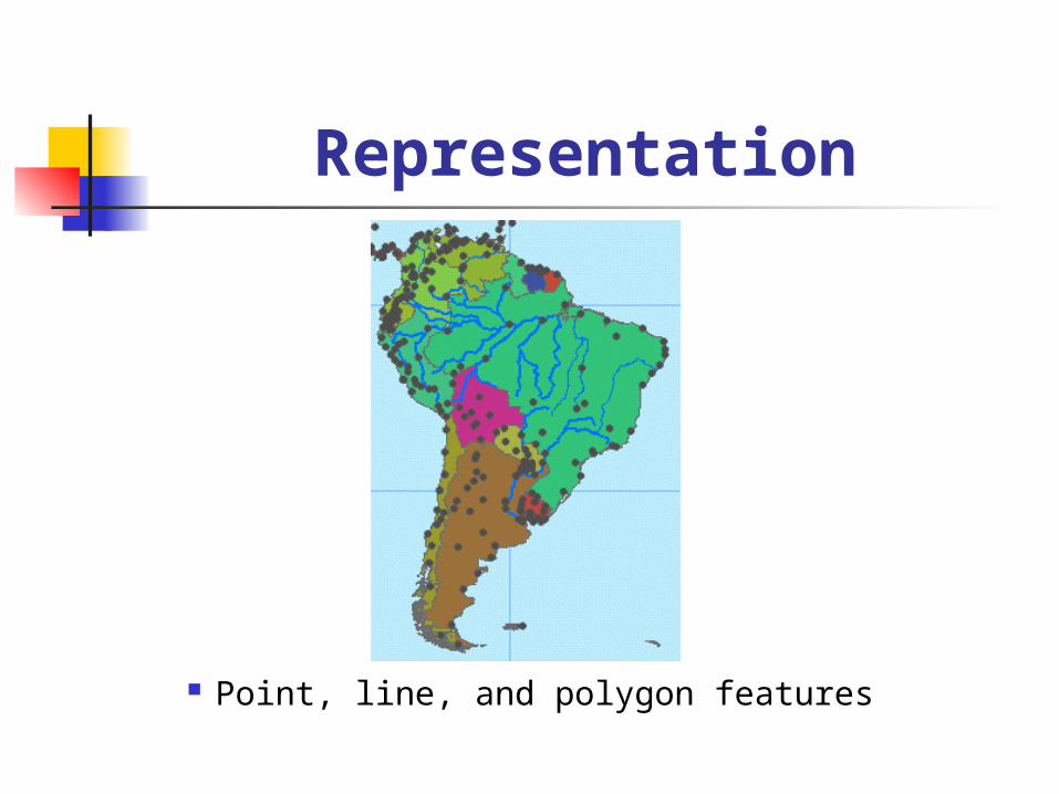
Representation
Point, line, and polygon features
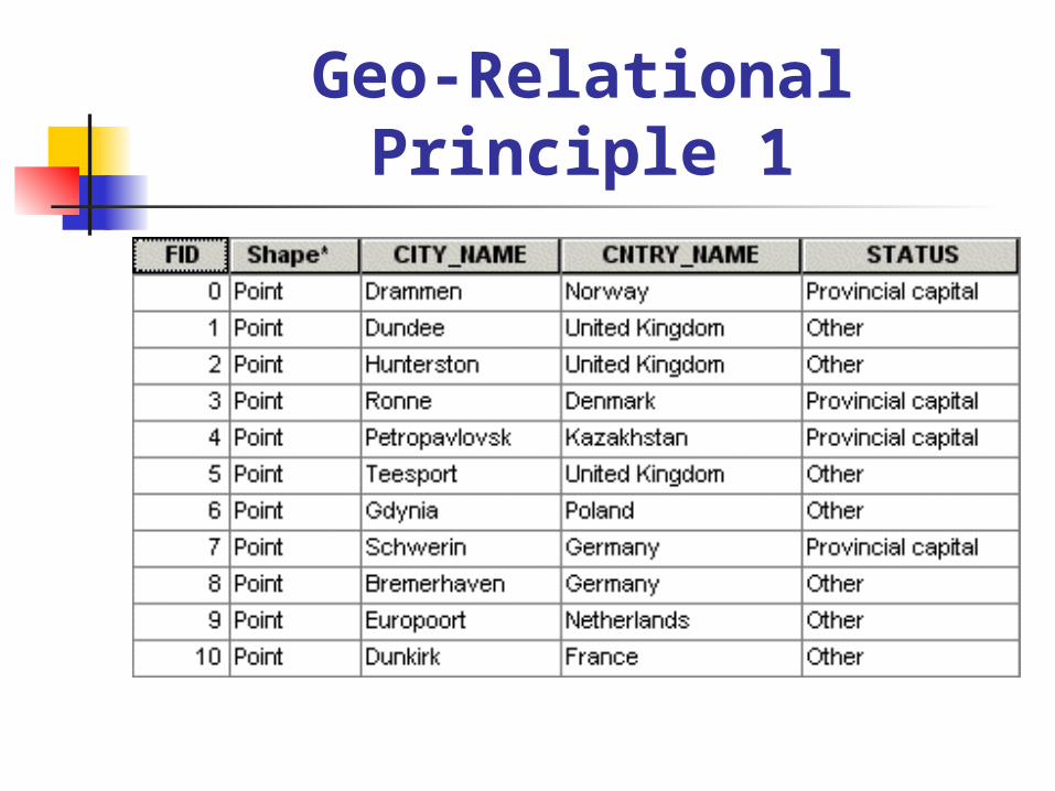
Geo-Relational Principle 1

Geo-Relational Principle 2
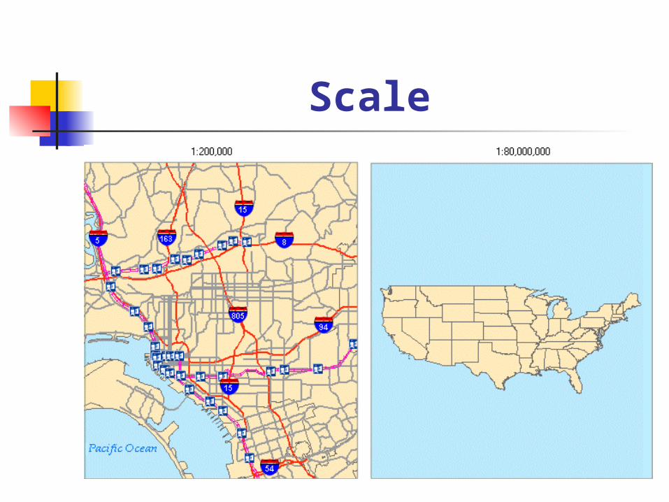
Scale

The ArcGIS Suite

System Architecture
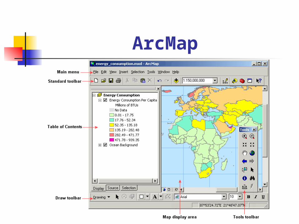
ArcMap

Map Production

ArcCatalog

ArcCatalog Views

ArcToolbox
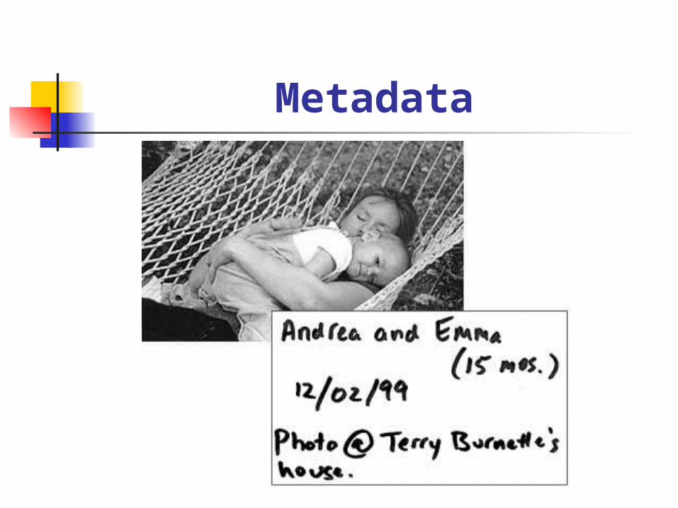
Metadata

Metadata in ArcGIS
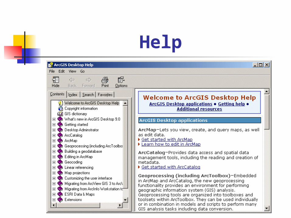
Help

GIS DataFormats

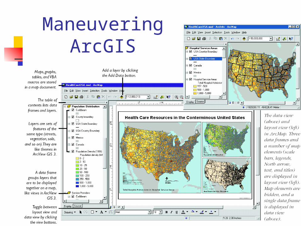
Maneuvering ArcGIS

Connecting to Folders

Table of Contents
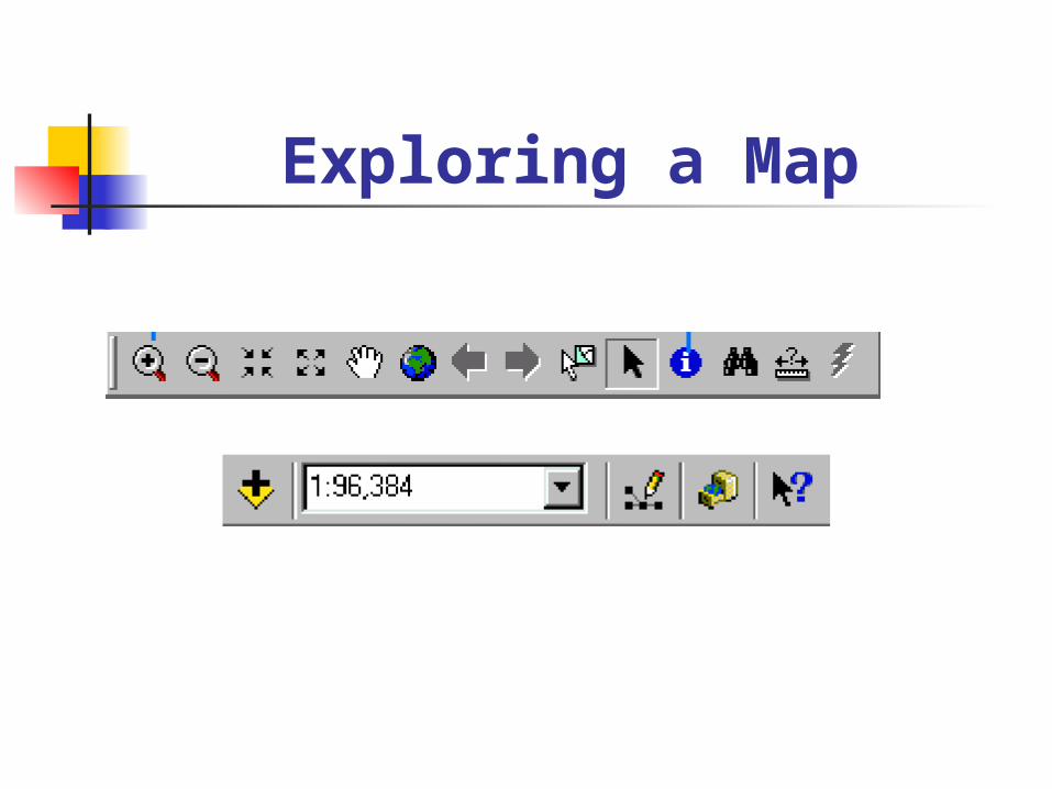
Exploring a Map

MakingAppearances

MakingAppearanc
es
part 2
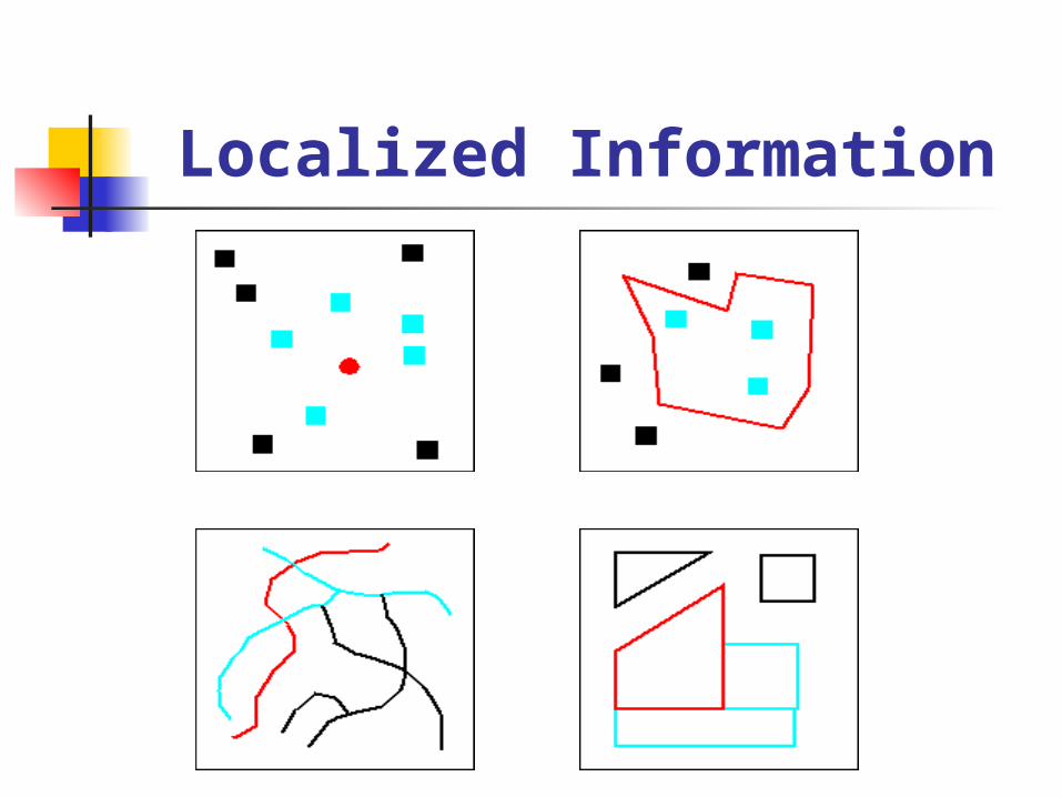
Localized Information
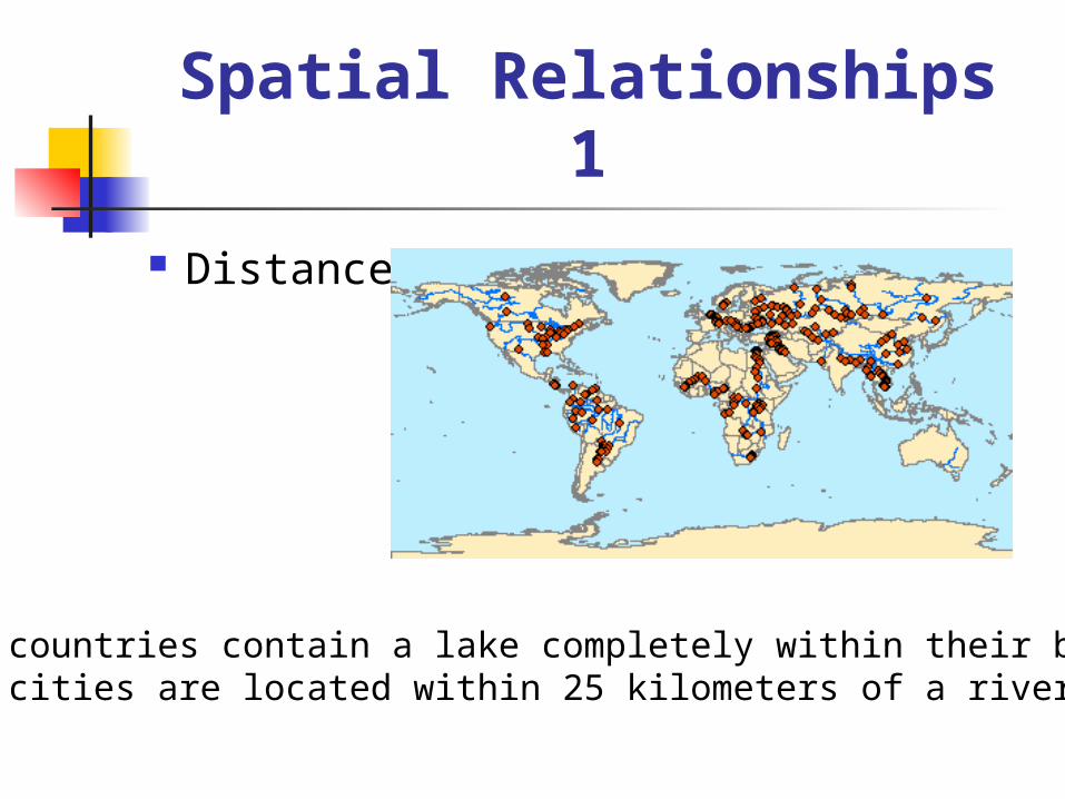
Spatial Relationships 1
Distance
Which countries contain a lake completely within their borders?Which cities are located within 25 kilometers of a river?

Spatial Relationships 2
Intersection
Which countries have a river that intersects their border?

Spatial Relationships 3 Adjacency
Which countries share a border with Russia?

Spatial Relationships 4
Containment
Which countries contain a lake completely within their borders?
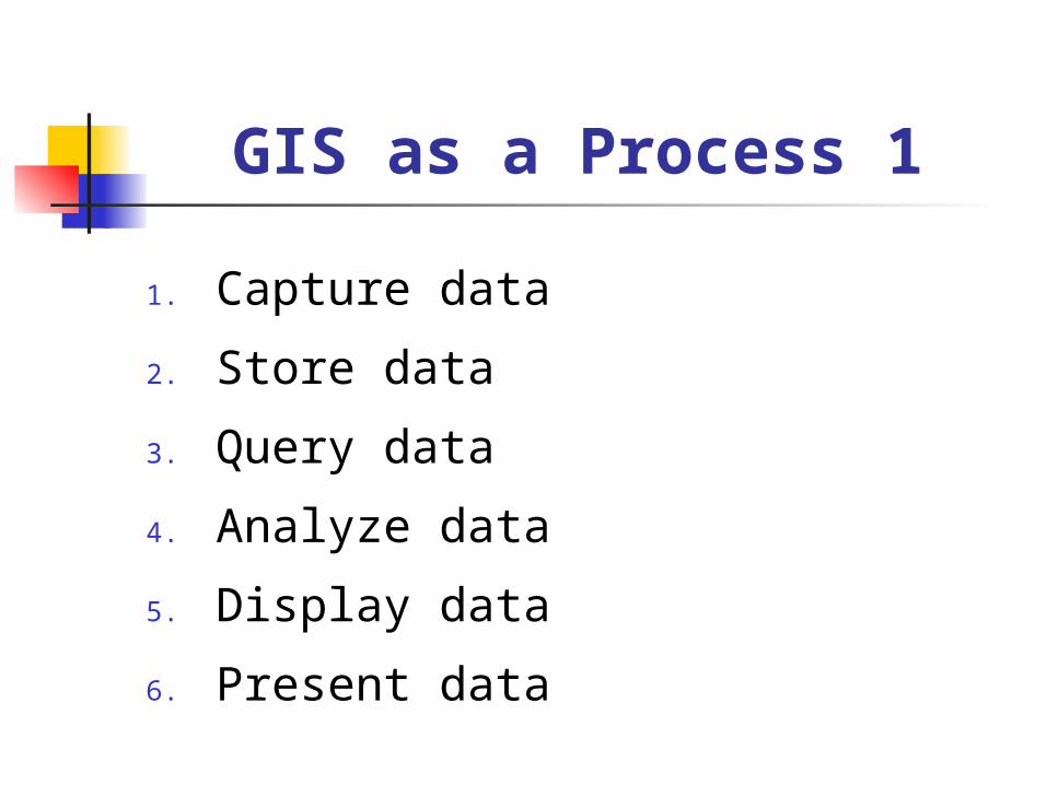
GIS as a Process 1
1. Capture data
2. Store data
3. Query data
4. Analyze data
5. Display data
6. Present data

1. Ask a geographic question2. Acquire geographic data3. Explore geographic data4. Analyze geographic information5. Act on geographic knowledge
GIS as a Process 2
Summary A GIS organizes and stores information about the
world as a collection of thematic layers. Each layer contains features with the same shape and attributes, all located within a common geographic area.
Each feature is assigned a unique numerical identifier and is characterized by a unique location in space and a corresponding record in a table.
Features can be stored in a GIS as three primary shapes: points, lines, or polygons.
Features have spatial relationships with other features, and with a GIS you can find features based on their spatial relationships.
The geographic inquiry process provides a framework for solving problems with GIS.