great smoky mountains - quiet light publishing
TRANSCRIPT
Richard MackF o r e w o r d b y S t e v e K e m p
THIRTY YEARS OF AMERICAN LANDSCAPES
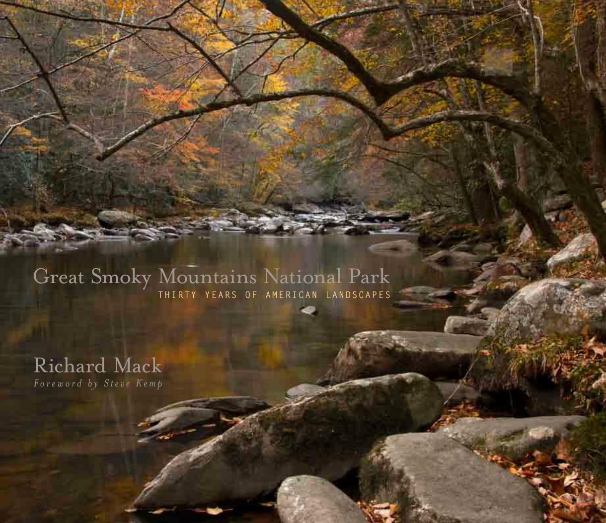
Great Smoky Mountains National Park

Richard MackF o r e w o r d b y S t e v e K e m p
THIRTY YEARS OF AMERICAN LANDSCAPES
Great Smoky Mountains National Park

© 2009 Quiet Light PublishingEvanston, Illinois 60201
Tel: 847-864-4911Web: www.quietlightpublishing.comEmail: [email protected]
Photographs © 2009 by Richard MackForeword © 2009 Steve KempMap Courtesy of the National Park Service, Harpers FerryHarvey Broome quote from "Out Under the Sky of the Great Smokies" © 2001 courtesy The Wilderness Society.
Design: Richard Mack & Rich Nickel
Printed by CS Graphics PTE Ltd, Singapore
All rights reserved. No part of this work covered by the copyright herein may be reproduced or used in any form or by any means - graphic, electronic or mechanical including photocopying, recording, taping of information on storage and retrieval systems - without the prior written permission from the publisher.
The copyright on each photograph in this book belongs to the photographer, and no reproductions of the photographic images contained herein may be made without the express permission of the photographer. For information on fine art prints contact the photographer at www.mackphoto.com.
First Edition
10 Digit ISBN: 0-9753954-2-4 13 Digit ISBN: 978-0-9753954-2-4 Library of Congress Control Number: 2009921091
Distributed by Quiet Light Publishing, Evanston, Illinois
The paper used in this publication meets the minimum standardsof the American National Standard for Permanence of Paperfor Printed Library Materials
PUBLISHED BY
QUIET LIGHT PUBLISHING
EVANSTON, ILLINOIS
Richard MackF o r e w o r d b y S t e v e K e m p
THIRTY YEARS OF AMERICAN LANDSCAPES
Great Smoky Mountains National Park

THIS BOOK IS DEDICATED WITH LOVE TO KATHY, MY WIFE AND FRIEND,
WHO HAS TRAVELED MANY TRAILS WITH ME,
INCLUDING THE ONES IN THE SMOKIES.
CONTENTS
12 CADES COVE C A D E S C O V E
A B R A M S F A L L S
F O O T H I L L S P A R K W A Y
58 LITTLE RIVER ROAD L A U R E L F A L L S
Q U I E T W A L K W A Y S
L I T T L E R I V E R
M I D D L E P R O N G L I T T L E R I V E R
100 NEWFOUND GAP ROAD Q U I E T W A L K W A Y S
W E S T P R O N G L I T T L E P I G E O N R I V E R
M O R T O N O V E R L O O K
C L I N G M A N S D O M E
N E W F O U N D G A P
GREAT SMOKY MOUNTAINS NATIONAL PARK
6 FOREWORD
B Y S T E V E K E M P , G R E A T S M O K Y M O U N T A I N S A S S O C I A T I O N
8 THIRTY YEARS OF MAKING IMAGES
B Y R I C H A R D M A C K
218 PARK MAP & PHOTO NOTES
219 ACKNOWLEDGMENTS
140 OCONALUFTEE D E E P C R E E K O V E R L O O K
O C O N A L U F T E E R I V E R
B A L S A M M O U N T A I N R O A D
D E E P C R E E K
I N D I A N C R E E K F A L L S
174 COSBY &
CATALOOCHEE C O S B Y
H E N W A L L O W F A L L S
B I G C R E E K
M O U S E F A L L S
C A T A L O O C H E E
196 ROARING FORK R O A R I N G F O R K R I V E R
T H E P L A C E O F A T H O U S A N D D R I P S F A L L S
G R E E N B R I E R
F E R N F A L L S
P H O T O G R A P H Y B Y R I C H A R D M A C K
T E X T B Y S T E V E K E M P

FOREWORDby Steve Kemp
7
The very first black bear I ever saw in Great Smoky Mountains National Park was carrying a fully loaded aluminum frame backpack in its mouth and galloping directly toward me at an impressive clip. Behind the racing bruin, five frantically screaming humans were in hot pursuit. I jumped behind a large spruce tree just in time to avoid being bowled over by the big omnivore, who continued to lug the heavy pack in an ungraceful manner.
It’s not every day you see people running after a bear in the Great Smoky Mountains, or a bear so well equipped for backcountry travel, for that matter, so I fell in behind the agitated mob to see what was up. I didn’t have to wonder for long. Ursus Americanus immediately veered from the trail, leapt over a fallen log, and barreled into an impenetrable tangle of blackberry, witch hobble, and other shrubs. The bear halted, as did the pursuing rabble. A nearly breathless man in his early 40s shared with me, “My car keys and sleeping bag are in that pack.”
Now that explained a lot. We were, by the way, atop Mount Le Conte in late November, five to seven hard miles from the nearest road, and it was already past noon. The party’s cookstove, breakfast, and a three-pound Virginia ham were also in jeopardy.
In hindsight, it was pure and simple negligence on the part of the backpackers that led to the bear’s acquisition of the loot. An hour or so earlier, after struggling up the flanks of the 6,593-foot mountain, the hikers had unburdened themselves of their heavy loads on the porch of the famous wilderness lodge that was now closed for the season. Then, relatively unfettered, they were free to see the sights: Clifftops, Myrtle Point, perhaps even High Top.
As you’ve probably heard, bears are the very definition of opportunistic. If a bunch of hikers from Knoxville, Tennessee abandons a nylon bag containing a three-pound sugar cured ham, instant grits, dehydrated scrambled eggs, and a plastic tube of chunky peanut butter on your mountain, it’s the human equivalent of a Brinks truck accidentally dumping a bag of $50s on your front lawn.
Upon their return from the sights, the backpackers discovered the sizable bruin sorting through the contents of their five packs. When the obviously ill-mannered bipeds began shouting and hurling stones, the bear grabbed the most valuable pack and vamoosed.
Meanwhile, back in the bramble, the man with the securely locked car at the remote trailhead was growing increasingly listless. From the general vicinity of the bear, sounds of tearing nylon filled the chilly alpine air. In a foolhardy and desperate gesture, the Knoxvillian picked up the lance-like trunk of a fallen fir tree and charged the thicket with a decidedly anxious “rebel yell.”
Now, for a 195-pound suburban human to intimidate an adult Eastern black bear with a large stick and falsetto rebel yell is, amazingly, not outside the realm of possibilities. For the most part, bears don’t look for trouble. They are 95 percent conflict avoidance. There are no doctors or emergency rooms in bear-dom, so even a minor injury can spoil their plan for a long and fruitful existence.
That said, a wild mountain bear in late autumn in possession of a three-pound ham and side dishes is a completely different story. As the foolhardy man reached the approximate midpoint of his charge, there arose from the dense vegetation ahead a low and highly assertive growl that halted the infantry in his tracks. A dozen Dobermans growling in unison could not have been any clearer in message or intent. The rest of the party began backing away in an orderly manner as well. So impressed were we by the bruin’s prowess, the decision not to share the mountain with him that night was both quick and unanimous. In fact, not a one of us felt extremely optimistic about our likelihood of surviving that day until we had covered the many stony miles back to the trailhead and started down the road toward Gatlinburg in my little pickup. Even those in the back bed with teeth-a-chattering seemed to have a renewed appreciation for their intact flesh and the ephemeral gift called life.
That is why the Great Smoky Mountains are among my favorite places on Earth. When the wise ones in 1934 established this national park to “conserve the scenery and the natural and historic objects and the wildlife therein…for the enjoyment of future generations,” it’s impossible that even they could imagine just how much enjoyment the park would provide. It is one of the too few places in our beloved East where coddled urbanites with uncallused hands and double mocha-lattes coursing through our veins can experience, in a stunningly un-virtual way, an environment that for 99.8 percent of human existence was the world.
Some nine million people visit Great Smoky Mountains National Park every year. More than a million traipse the trails, risking blisters, stinging nettle, and encounters with oversized omnivores for a glimpse of the elusive wild. Yet, despite the easy access and ensuing masses, there is nothing watered down about the Smoky Mountain wilderness.
For me, the landscape of the Great Smoky Mountains is the perfect blend of hospitable and inhospitable. Unfold your camping chair on the banks of the Little Pigeon River at Greenbrier. Place it on the cobbles in the shade, close enough to feel the breeze off the water and see the kingfishers flap by. Take some sparkling water, crackers, biscotti, a book, a friend. Voila, no one in a royal family has it over you in quality of life.
Or, if you are more in the mood for character-building adventure, embark on an eight-mile jaunt to the top of Thunderhead. Make sure you run out of water before you reach the summit. You will clearly recall leaving your rain gear in the back seat just as the sleet begins. You hear the crack of thunder at the same instant lightning flashes. In the clouds and driving rain it’s easy to lose the trail…
Water is also responsible for the range’s signature beauty. The Cherokee name for the Smokies is Shaconage (sha-con-a-gay), which has been translated to “blue, like smoke.” This moniker describes the sublime bluish haze that softens our views of the rounded peaks and which the very best photographers wait patiently to capture. This ethereal blue smoke is formed when water vapor combines with a variety of substances exhaled by the green forests that so thoroughly cloak the mountains. The Blue Ridge Mountains, one of the Appalachian ranges north of the Smokies, is also named for this phenomenon.
But there is another variety of water-vapor based “smoke” which I contend the Great Smokies flaunt better than any other mountains on our planet. That is the rising tendrils of cloud, the spiraling streamers born after a rain, just as the higher clouds lift. Sometimes these watery phantoms resemble a serpent raising its head to strike, the sail of a ship, a curtain dragged by the sky. They float from the rain-gorged creeks, from the damp hollows, lingering in their freshened Valhalla.
You can never tire of watching the Smokies after a rain, from the porch, from the camp chair, or from a boulder. It’s a pleasant reminder for urbanites and suburbanites alike of what isn’t laid out in spreadsheets and 10-digit codes. That out there in the verdant, mist-shrouded mountains is a lifetime’s worth of mysteries and adventures still recognizable as the world.
Thankfully, when we can’t be in the park, we have the artistry of Richard Mack’s magnificent images to remind us of these moments in this timeless place.
The exquisite sublimity of the Smoky Mountain landscape comes from the fact that it’s alive. While classic western landscapes bear testament to time’s stoic march, the Smokies are a riot of impatience. Every hour is different than the one before. A morning of steady rain coaxes the first pink-striped mountain laurels into bloom. Overnight, 10,000 brightly colored warblers arrive from the south. A half million emerald green mayflies hatch on Little River. Blossoms as big as birds’ nests open on the magnolia trees. Lightning starts a smoky forest fire. Hawks kettle. Tree frogs “erp.” River otter pups are born. Hoarfrost coats the evergreens.
If a team of landscape architects were to design an 800-square-mile landform for maximum abundance and diversity of life (without delving into tropical environments and related pestilence), their result would look a lot like the Great Smoky Mountains. Proudly standing over their 3-D scale model, the spokesperson for the team would use her laser pointer to indicate a lower elevation river valley and explain, “This will be a perfect place for species of trees associated with the South. Your sweet gum, black gum, silver bell, American holly, etc. On the west side of the range, on dry sunny ridges like these, you’ll see mountain laurel, Virginia pine, scarlet oak, southern red oak, chestnut oak, and pitch pines. Higher up, in the cool damp heart of the range, you’ll find the primo hardwoods—yellow buckeyes, sugar maple, basswood, northern red oak, tulip trees, and black cherry. Above them, where it’s cooler and wetter still, it’s going to look like New England. Open forests with yellow birch, American beech, pin cherry, mountain maple. Then, for the icing on the cake, above 5,000 feet, it will be mostly evergreen—red spruce and Fraser fir—with some American mountain ash and Catawba rhododendron for good measure. A bit of eastern Canada, if you will.
“All this variety in vegetation and micro-climate will be a bonanza for wildlife, too. Southern species like mocking birds and skinks will love the lowlands. Northerners like Canada warblers and bog lemmings will be on terra cognito up top. And as the seasons shift, as spring climbs the ridges or autumn descends, lots of animals, from bears to juncos, can take advantage of the available food supplies just by roaming upslope or down.”
The foundation for this bio-cornucopia is the mountains themselves. They are ancient and worn, comfortably rounded, creviced, and mossy-backed, like an old stone cottage in the woods. In profile, at sunrise, their curves are pleasingly organic, like shoulders, like hips, like the back of a mink. Some of the rock is more than a billion years old, last uplifted about 200 million years ago. Most is sandstone, siltstone, or shale. For millions of years it has been allowed to gracefully crumble, spared inundation by salty seas and scouring by mile-thick glaciers.
By comparison, the Rockies and Sierras are young and raw, jagged and capped by ice. They are like the house still under construction in the newest subdivision, soil dredged to bedrock and fresh materials sparkling in the sun. During North America’s many ice ages and intervening warm-ups, the Smokies have been an ark, offering their protected habitats to species displaced by changes in climate. When the disruptions passed, life dispersed from the range to repopulate the ravaged landscapes, like seeds from a dandelion. Water is the other big charm on the Smokies’ bracelet. All life needs it, and in the Smokies most flora and fauna consistently get their fill.It can really pour here. Summer cloudbursts unleash landslides on steep slopes in the highlands every few years. If you stand on the banks of a flooding river you can hear rocks roll like bowling balls along the stream bottom. On the highest peaks, the average annual precipitation is about 84 inches. Even the lowlands receive something like double the precipitation of the Midwest’s “breadbasket.” Rain, dispersed relatively evenly throughout the year, plus a fairly long growing season, allows a genuine flourishing of life.
It was a typical day in the Smokies, foggy, misty, some rain. I spent it along the Middle Fork of the Little Pigeon River and on the Oconaluftee River, working out detail images of the rocks and streams in the soft light. Photographs of rivers in this quiet light appeal to me. The light leads your eyes up the river, revealing more the longer you look. Petals on the flowers come into sharp focus in the softer light. The woods open themselves up in ways they do not in the harshness of direct sunlight. It was a fine day to be a photographer in Great Smoky Mountains National Park.
As I headed back to camp over Newfound Gap and down toward Elkmont, I watched the sky. Even though it had been cloudy and overcast all day long, you never know what can happen right at sunset. For this reason I stopped at Morton Overlook on the way down the mountainside. The overlook is one of the most photographed locations in the park, but this evening it was deserted. The gray skies held little promise for most people. Yet as I stood there with my brother-in-law Bill, looking out over the valley to the horizon, I saw just a bit of lightness in the clouds near the edge of the earth. Enough to make me comment that it wouldn’t take much for the sun to peak through for just a moment and perhaps be spectacular. We still had about a half hour before sunset. Enough time to set up the tripod, and then become bored. A few cars came and went, stopping only long enough for the occupants to look out the window and decide there wasn’t anything worth seeing. And then the sky started to transform before our eyes. I quickly put the camera back onto the tripod, watching the light as it brightened just that little band of clouds. Then, without warning, the sun popped out from between the clouds in a spectacular burst of bright red sunlight, illuminating the bottoms of the clouds. I began to click off shots as fast as I could. Bill stood next to me, almost as excited as I was. Now cars began to screech to a halt as people jumped out, snapped a quick picture, and drove off. And then it was over. It lasted maybe 120 seconds, evolving the entire time from very sharp hard light on the underneath of the clouds to a softer look as the sun became filtered once again. The overcast returned, and just as quickly we began to think about dinner. A fine day of photography in the park.
In the Smokies there is a feeling of timelessness, where nature takes over, a feeling of stability and maturity. It can be seen in the fallen logs lying on the forest floor, covered with layers of thick moss and new plant growth. It can be seen in the lichen- covered rocks along the streams; in the cliffs that form the faces of places like Charlies Bunion, Alum Cave, and Chimney Tops; and even in the parking lot at Clingmans Dome, where firs and rhododendron grow out of the cracks in the rock wall and reach toward the sky. This timelessness can be experienced under a night sky filled with millions of stars, or in the forest during a full moon, when each tree and branch seems to be illuminated as if it were daytime. This maturity seeps into the valleys, especially on those mornings when clouds fill them full of moisture and give rise to the name “the great Smokies.”
Fortunately, the sheer roughness of the Great Smoky Mountains, as well as the efforts of folks working for wilderness protection, have kept roads from being constructed through a majority of the land area, creating one of the largest parkland areas in the eastern United States. To be sure, the park can be seen very nicely by motoring along the roads – but it is best explored on foot, along the streams, Quiet Walkways, and the hundreds of miles of trails. You need to get out into the park to fully experience the park. To hear the melody of the water rushing over the rocks and the chorus of the winds movements through the trees above. It is then the senses begin to absorb the beauty of the Great Smokies. It’s then its undisturbed, breathtaking, magnificence wraps around you.
I began my quest to become a landscape photographer while on my first trip to Great Smoky Mountains National Park back in 1974 with my future wife, Kathy. I was not then as intense about photography as I am now. I was just beginning my journey and in all honesty wanted to find the closest national park to my home in Illinois. I chose the Smokies and the love affair began – between me and the park and between my wife and I. Since then I have visited many of our national parks, but I continue to be drawn back to the beauty, diversity, and complexity of the Smokies. It is, after all, a park that offers everything: historic buildings and living history, magnificent streams and waterfalls, a variety of old-growth and new-growth forests, large fields and coves with abundant wildlife, and of course, those stunning vistas into “smoke” filled valleys.
I took the plunge into the depths of the Great Smokies when Kathy and I headed out on our first backpacking trip, from the top of Clingmans Dome down into Deep Creek Valley. We descended from the hot June air at the parking lot down into cool stands of Fraser firs. I remember the crisp smell of those old pines as we descended. Cool air swirled up the side of the mountain in gentle breezes, giving us respite from the heat. The sound of the wind in the pines played out above us as we hiked. We camped along the stream in the valley below and spent a few days walking the trails. In that relatively short amount of time we became enthralled with the beauty which is Great Smoky Mountains National Park.
On subsequent trips we, like many, have spent most of our time at sites along the main roads of the park. Wandering along the many Quiet Walkways, hiking the popular trails at Alum Cave Bluffs, Laurel Falls and Abrams Falls or one of the many nature trails. We have made time to backpack to places like Gregory Bald, and discovered another route down to Deep Creek. We’ve spent evenings in Cades Cove watching the deer and looking for black bear. I’ve been fortunate to see many species while exploring the park over the years -- bear, coyotes, squirrels, skunk, wild hogs, wild turkey, a plethora of birds, and hundreds of deer and elk. On one special night a great horned owl swept down silently in front of us and perched on a tree limb about eight feet away. We stared at each other for a few minutes until it silently lifted off and flew back into the woods.
I’ve seen the changes that occur over time to a park like Great Smoky Mountains. The rock slide at Alum Cave, the Fraser firs on Clingmans Dome eaten away by the Balsam Wooly Adelgid. The farms in Cades Cove, where a few descendents of the original farm families still worked the land in the 1970s and 80s. Some of their barns and sheds have rotted away and fallen down, eventually removed for safety reasons.
THIRTY YEARS OF MAKING IMAGESby Richard Mack
9
Over thirty years, many things have changed, and many others have stayed the same. The Fraser firs on Clingmans Dome have almost been destroyed by the Balsam Wooly Adelgid, yet younger trees now crowd the understory. Portions of the Alum Cave trail were inundated by a landslide during a thunderstorm. Cades Cove is no longer farmed. Logging operations cleared much of what is today parkland. Yet to the inexperienced eye, the places where lumber companies clear-cut mountainsides in the late 1800s and early 1900s are barely perceptible, a testament to both Mother Nature’s ability to regenerate and remove the scars of mankind, and to mankind itself for having the foresight to preserve this remarkable landscape. In some cases, entire species have disappeared from the area, like the buffalo and wolves, or even from the earth entirely as is the case with the passenger pigeon. But other species have been reintroduced. Elk have been returned to Cataloochee and have migrated into other areas of the park. The synchronized fireflies have been around forever, but only in the last 15 years have they become a popular treat if you are lucky enough to catch their 10-day show in early summer.
Some of these changes are reflected in this book, whether a black and white image of an old barn taken in 1976, or one of my last shots of a sunrise as seen from Newfound Gap in November 2008. I hope you will enjoy my vision of Great Smoky Mountains National Park. It is a jewel in our national park system. My wish is that you will come to love, as I do, the details of the leaves, the rush of water in the streams, the colors of the landscape as it changes from season to season.
Each day I’ve spent in the park – either alone or with family or friends -- has been with camera equipment in hand. At first my goal was to photograph the park in black and white, capturing the landscape in the same manner other photographers had featured the mountains of the western states in stunning black & white imagery, but I soon took up shooting in color as well. How else to record the subtle hues of the sunset over the mountains, the bright colors of wildflowers in the spring.
There have been only a few times when the alarm clock went off before sunrise that I can actually say I was happy to get up and get moving. Yet, when I would arrive at the location for a morning photo shoot, the longing for my warm bed was completely gone. Many times I have arisen early to get into Cades Cove before dawn. I love walking along Sparks and Hyatt Lanes in the early morning mist, aiming my lens at the old road lined with trees or across the prairie grasses to the forests and mountainsides. There are not many folks out at that time and we all seem engrossed in our own little worlds in the soft morning light. The wildlife is still out at this time of the morning, quietly wandering the fields and lazily eating their morning meals. And it is quiet. No loud traffic going around the cove edges. No one shouting across the fields. Just me, my camera, and the natural world. I work almost without thinking about it. Seeing the shape of the trees amidst the morning fog, or quickly capturing the deer as they wander by. I tend to see in photographs, so framing each scene is second nature to me. There are times and images that take more work, where I need to walk around and view things from various angles and in different light before making a final decision on how to capture the essence of the scene. As the sunlight begins to radiate out over the horizon, I know where I want to be and what I am looking to capture in my lens. But the sun never rises the same way twice. There might be clouds, fog, or mist, which can change how each morning looks. And as the sun comes up you had better be ready to change your thought process in order to capture what actually appears before you and not what you wanted to appear. Change is inevitable in nature, no matter how much preparation and planning has gone into a shot. If I am lucky the light will be as dramatic as I had hoped. It will wrap around the trees in just the right way, nicely illuminating the eastern edges of the tree trunks with the soft light of dawn. Or, if I am looking down into the valleys from some distant vista and the morning temperature is right, there will be clouds in the valleys, waiting to grab hold of the sun’s first yellow rays. An hour after sunrise, the glory of the first light is gone, and it is time to return from whence I came for some breakfast.
Though sunrises and sunsets are spectacular, almost anytime is a great time to photograph somewhere in the park. During mid-day you can find a ridgeline where the sun etches graphic shapes, you can explore a stream shaded by the hillsides, or you can photograph wildflowers in the forests. The possibilities are endless. One afternoon I was shooting along Straight Fork Creek when it began to rain. Nothing unusual about that, so I kept working after putting rain gear on myself and the camera equipment. As I concentrated on the river I heard a crashing sound in the woods. Was it a falling tree? A bear? Then I heard it again, only closer. Whatever it was, it now had my full attention. And then out of the trees ran a wild hog. Luckily, it was fairly small and clearly as startled by me as I was by it. I quickly turned my camera around on its tripod and made a few exposures – but I was still set for a slow shutter speed and this new little friend had neither the time nor the inclination to help me out. He trotted away through the woods as fast as he had arrived. My attempt to photograph my first and only sighting of a wild hog ended up as merely a memory.
Sometimes, however, the timing is perfect. One evening in the spring of 1976, Kathy and I were out in Cades Cove near the Abrams Falls trailhead. As we came out of the woods, fog shrouded the entire little valley in that area. It was a very thick fog – allowing only a few yards of visibility. We could hear deer all around us as we walked up the side of a small hill. Then the fog lifted ever so slightly, unveiling the deer foraging on the hillside near us while still obscuring the ground below us. I lifted the camera, steadied by one of the fence posts, and began to shoot away. Each click of the shutter prompted a quizzical look from the deer, as if to say, “what are you doing?” As the fog rolled back in we waited, once again hearing but not seeing the deer. Soon it was too dark to shoot anymore. These photos are among my all-time favorites from our time in the park.

“ M a n h a s c r e a t e d s o m e l o v e l y d w e l l i n g s – s o m e s o u l s t i r r i n g l i t e r a t u r e . H e h a s d o n e m u c h t o a l l e v i a t e p h y s i c a l p a i n . B u t h e h a s n o t , i n h i s c i t i e s , c r e a t e d a s u b s t i t u t e f o r a s u n s e t , a g r o v e o f p i n e s , t h e m u s i c o f t h e w i n d s , t h e d a n k s m e l l o f t h e d e e p f o r e s t , o r t h e s h y b e a u t y o f t h e w i l d f l o w e r . ”
HARVEY BROOME, AUTHOR OF O U T U N D E R T H E S K Y O F T H E G R E A T S M O K I E S
Great Smoky mountainS national Park
SUNRISE, FOOTHILLS PARKWAY O C T O B E R 2 0 0 8

CADES COVE
Because of its abundance of wildlife, Cades Cove is nicknamed “the
Serengeti of the South.” All day, every day, cars and pickup trucks loaded
with wildlife watchers troll the 11-mile loop, all eyes pealed for white-
tailed deer, wild turkey, bear, beaver, otter, and coyote. More often than
not, especially mornings and evenings, their efforts are rewarded.
The place name begs explaining. A "cove" in the southern Appalachian
vernacular is a valley surrounded by mountains. “Cades” can likely be
traced to “Kate,” the daughter of Cherokee Chief Abram, who lived in
a village downstream from the cove beside his namesake stream. The
Cherokee visited Cades Cove frequently because of the rich variety of
wildlife and edible and medicinal plants.
The cove owes much of its richness to its geology. Whereas most of the
Smokies bedrock is sandstone or siltstone, Cades Cove has a less acidic
limestone floor. This “sweeter” soil supports a plethora of flora which
is responsible for attracting wildlife, and, during the early 19th century,
attracted the attention of white settlers.
The latter stole into the Cherokee-owned valley around 1820 and very
soon flourished. By 1850, 685 people lived there. Their farms produced corn, wheat, barley, cotton, and vegetables.
Soon there were white-steepled churches, country stores, water-powered grist mills, an industrial iron forge, and herds of
livestock that could be summered on mile-high meadows above the cove.
All of this gradually came to a close when the land was purchased for the national park, officially established in 1934.
However, a variety of historic buildings have been faithfully preserved, from the John Oliver cabin (home of the first family
of white settlers) to the Cable grist mill.
As a fortuitous result, visitors to Cades Cove today are treated to a rare blend of human history, wildlife viewing
opportunities, and scenic splendor.
1 3SUNRISE ON SPARKS LANE A P R I L 2 0 0 8

1 4 THREE TREES J U N E 1 9 9 5 1 5EVENING ALONG SPARKS LANE O C T O B E R 2 0 0 6

1 6 AFTERNOON, HENRY WHITEHEAD PLACE O C T O B E R 2 0 0 6 1 7AFTERNOON, HENRY WHITEHEAD PLACE O C T O B E R 2 0 0 6

1 8ABRAMS FALLS A P R I L 2 0 0 8 1 9ABRAMS FALLS A P R I L 2 0 0 8

OAK TREE IN FIELD M A Y 1 9 8 62 0 2 1DEER, EARLY MORNING J U N E 2 0 0 8

TREES & LICHEN N O V E M B E R 1 9 8 4 2 3CABLE MILL HISTORIC AREA N O V E M B E R 1 9 8 4WILD TURKEY J U N E 2 0 0 8COYOTE N O V E M B E R 2 0 0 6

2 4 DEER, EARLY MORNING J U N E 2 0 0 8 2 5EVENING ALONG SPARKS LANE J U N E 2 0 0 8

2 6 BARN A P R I L 1 9 7 6 2 7DEER IN MIST A P R I L 1 9 7 6

2 8 EVENING WHERE THE BARN ONCE STOOD J U N E 2 0 0 8 BLACK BEARS IN OAKS O C T O B E R 2 0 0 8
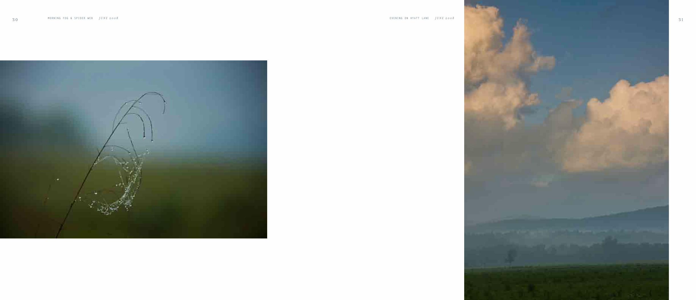
3 0 MORNING FOG & SPIDER WEB J U N E 2 0 0 8 EVENING ON HYATT LANE J U N E 2 0 0 8 3 1

FLOWERING DOGWOOD AT CARTER SHIELD'S CABIN A P R I L 1 9 8 63 2 3 3EVENING, METHODIST CHURCH J U N E 2 0 0 8

3 4 DOGWOOD ON SPARKS LANE A P R I L 1 9 8 6 3 5METHODIST CHURCH FROM RICH MOUNTAIN O C T O B E R 1 9 7 8TIPTON PLACE A P R I L 1 9 8 6

3 6 BLACK BEAR O C T O B E R 1 9 8 4 EVENING ON HYATT LANE J U N E 2 0 0 8 3 7
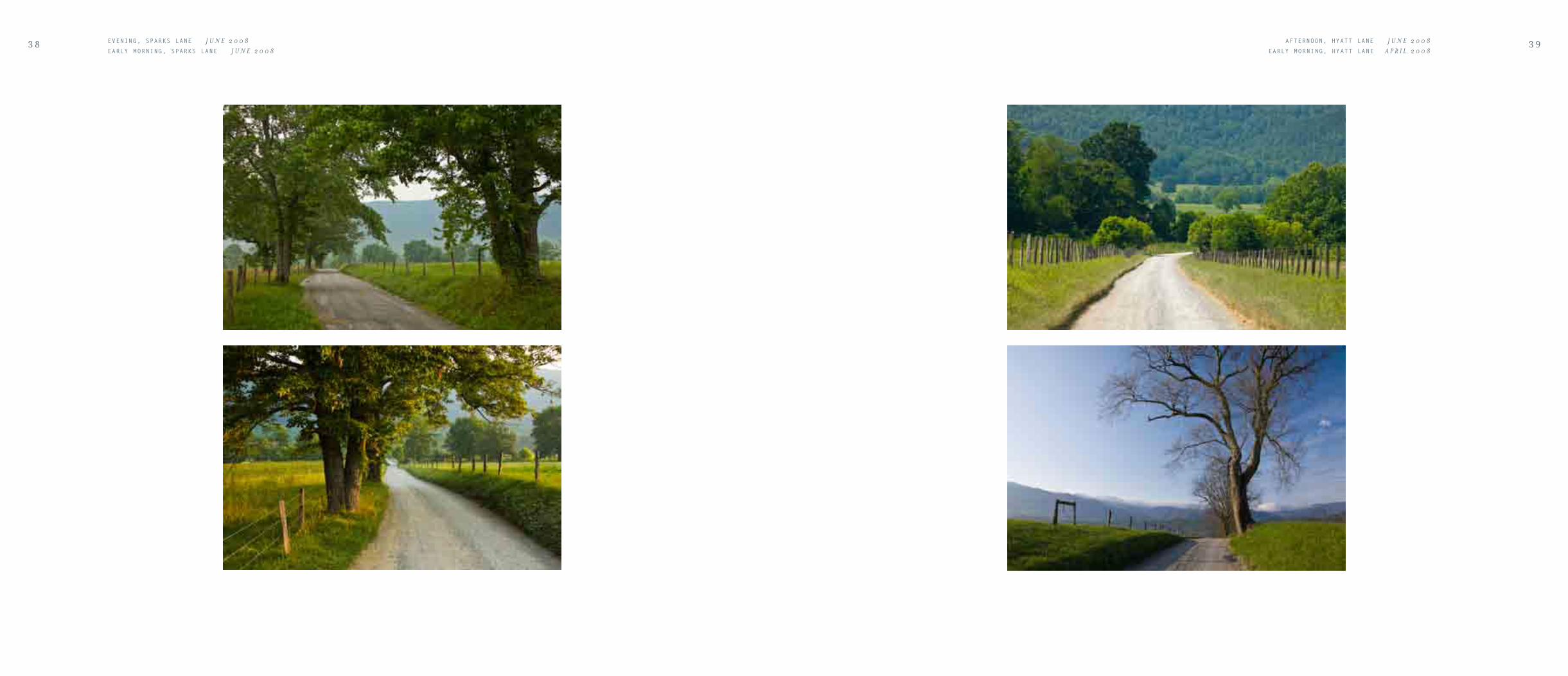
3 8 EVENING, SPARKS LANE J U N E 2 0 0 8EARLY MORNING, SPARKS LANE J U N E 2 0 0 8
3 9 AFTERNOON, HYATT LANE J U N E 2 0 0 8 EARLY MORNING, HYATT LANE A P R I L 2 0 0 8
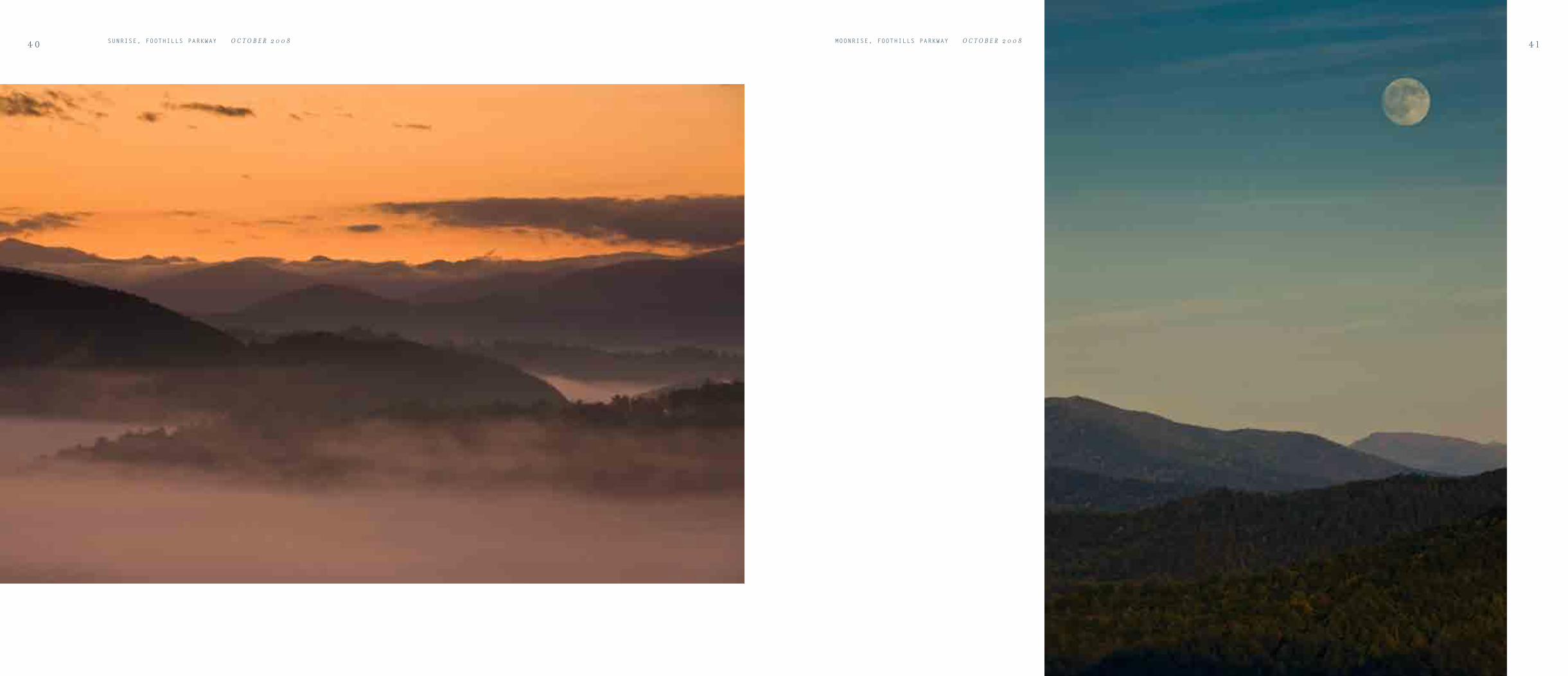
4 0 SUNRISE, FOOTHILLS PARKWAY O C T O B E R 2 0 0 8 4 1MOONRISE, FOOTHILLS PARKWAY O C T O B E R 2 0 0 8

4 2 HALBRED-LEAF VIOLET A P R I L 2 0 0 8TRAILING ARBUTUS, ABRAMS FALLS TRAIL A P R I L 2 0 0 8
4 3RED OAK LEAF O C T O B E R 2 0 0 6FERN FIDDLEHEADS A P R I L 2 0 0 8

4 4 MORNING FOG, FOOTHILLS PARKWAY O C T O B E R 2 0 0 8 4 5MORNING, FOOTHILLS PARKWAY O C T O B E R 2 0 0 8

4 6 SUNRISE, FOOTHILLS PARKWAY A P R I L 2 0 0 8 4 7DOGWOODS BLOOMING M A Y 1 9 8 6

4 8 FOREST & NEW YORK FERNS J U N E 2 0 0 8MEADOW FIELD ALONG SPARKS LANE J U N E 2 0 0 8
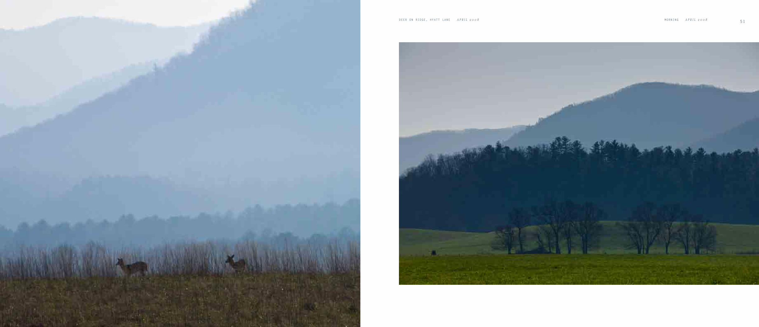
5 1MORNING A P R I L 2 0 0 8DEER ON RIDGE, HYATT LANE A P R I L 2 0 0 8

5 2 MORNING ALONG THE FOOTHILLS PARKWAY A P R I L 2 0 0 8 5 3MORNING ALONG THE FOOTHILLS PARKWAY N O V E M B E R 2 0 0 6

5 4
2 1 t O c t .
C o u r s e D i s t a n c e & r e f f u s .
S . 8 0 º E 2 m i l e s t o t h e p l a c e t h e M a n d a n h a d a v i l l a g e
f o r m e r l y a t t h e f o o t o f a … . o n t h e S . S . p a s s e d
a r i v e r
N . 1 6 º W . 1 1 / 2 m i l e s t o a g r o v e o n t h e S . S .
N . 4 0 º W . 3 1 / 2 m i l e s t o a p t . o n t h e S . S . r i v e r w i d e a n d
S a n d b a r s , a l a r g e w i l l o w I s l a n d
7
WILLIAM CLARK, 2 1 s t O c t O b e r s u n d a y 1 8 0 4
RIDGELINE, FOOTHILLS PARKWAY N O V E M B E R 2 0 0 6 5 5EVENING ALONG SPARKS LANE N O V E M B E R 2 0 0 6O v e r l e a f EVENING BARN AND FIELDS J U N E 1 9 9 1


LITTLE RIVER ROAD
Around 1900, something like a gold rush started along Little River.
Until that time it was rural and rustic with a capital “R.” Families eked
out a living on tiny, rocky farms, doing much of their trade on the
barter system and growing or fabricating most of what they needed, be
it cabbage, a barn, or whiskey.
The gold in these old hills was hardwood trees. When the big lumber
companies had finished denuding the Northeast and upper Midwest,
they pointed their steely teeth toward the Smokies.
The Little River watershed was “Ground Zero” for the timber boom
in the Smokies. The hamlet of Townsend, where Little River exits the
national park, was named for Col. Townsend, the head of Little River
Lumber Company. It grew up around a sprawling sawmill operation.
Upstream, logging railroads, splash dams, and skid roads snaked up
nearly every tributary. Boomtowns, complete with company scrip
(coins) and company stores, sprang from the ground at Elkmont
and Tremont. Farmers traded hoes for cross-cut saws and their old
economy for a new.
The national park came together about the time the timber boom played out. The land healed. Today there is nowhere
lovelier than Little River Road in April or October. In spring, the magenta flowers of redbud delight the traveler at
almost every curve. Dogwoods blossom too, along with lady slipper orchids, phlox, and trilliums.
In fall, the reds are furnished by dogwood and maple leaves; the golds by birches, hickories, and beech.
The waters of Little River run clear and cold from rapid to pool, over and over. Tributaries join the main stream
in surprise waterfalls. Follow a branch up and you’ll find where Little River begins, at the mile-high springs where
Appalachian Trail backpackers pause to draw their water.
5 9CONFLUENCE, LAUREL CREEK & SPENCE BRANCH M A Y 2 0 0 6

6 0 FALL FOREST N O V E M B E R 2 0 0 6 6 1 LAUREL CREEK CASCADES N O V E M B E R 2 0 0 6

FLOWERING DOGWOOD A P R I L 2 0 0 8 6 3 YELLOW TRILLIUM PAINT THE FOREST FLOOR A P R I L 2 0 0 8

6 4 STREAM, QUIET WALKWAY J U N E 1 9 9 1 6 5FLOWER & ROCK, STREAM ON QUIET WALKWAY J U N E 2 0 0 8

6 6 ROCKS DETAIL, LITTLE RIVER J U N E 2 0 0 8 6 7OVER HANGING TREE, LITTLE RIVER J U N E 2 0 0 8

6 8 AFTERNOON, MIDDLE PRONG LITTLE RIVER M A Y 2 0 0 6 6 9AFTERNOON, MIDDLE PRONG LITTLE RIVER M A Y 2 0 0 6

7 0 FALL LEAF, MIDDLE PRONG LITTLE RIVER N O V E M E B R 2 0 0 6
FALL REFLECTIONS, MIDDLE PRONG LITTLE RIVER N O V E M E B R 2 0 0 6

7 2 REFLECTIONS, METCALF BOTTOMS N O V E M B E R 2 0 0 8 7 3LITTLE RIVER N O V E M B E R 2 0 0 8

74 SEASONAL FALLS FLOWING INTO MIDDLE PRONG OF THE LITTLE RIVER A P R I L 2 0 0 8 7 5SOLOMAN'S SEAL, MIDDLE PRONG LITTLE RIVER A P R I L 2 0 0 8

7 6 MOSS AT RIVER'S EDGE, MIDDLE PRONG LITTLE RIVER A P R I L 2 0 0 8FLOWERING DOGWOOD, MIDDLE PRONG LITTLE RIVER A P R I L 2 0 0 8
7 7THYME LEAF BLUETS, MIDDLE PRONG LITTLE RIVER A P R I L 2 0 0 8BLUETS AND PURPLE VIOLET, MIDDLE PRONG LITTLE RIVER A P R I L 2 0 0 8

7 8 DOGWOOD BLOOMS, MIDDLE PRONG LITTLE RIVER J U N E 2 0 0 8 7 9ROCK DETAILS, MIDDLE PRONG LITTLE RIVER J U N E 2 0 0 8

8 0 AFTERNOON, MIDDLE PRONG LITTLE RIVER J U N E 2 0 0 8 8 1FALL REFLECTIONS, MIDDLE PRONG LITTLE RIVER N O V E M B E R 2 0 0 6

8 2 ROCK & WATER, THE SINKS O C T O B E R 2 0 0 8 8 3TREE ROOTS, ROCKS & RIVER, LITTLE RIVER O C T O B E R 2 0 0 8

8 4 STREAM DETAIL, MIDDLE PRONG LITTLE RIVER M A Y 2 0 0 6 8 5LAUREL FALLS O C T O B E R 2 0 0 8

8 6 FOREST, LYNN CAMP PRONG TRAIL O C T O B E R 2 0 0 8 8 7LYNN CAMP PRONG O C T O B E R 2 0 0 8

MIDDLE PRONG LITTLE RIVER O C T O B E R 2 0 0 88 8

9 0 ROCK & LEAF, MIDDLE PRONG LITTLE RIVER J U N E 2 0 0 8 9 1MIDDLE PRONG LITTLE RIVER M A Y 2 0 0 6

9 2 REFLECTIONS, LITTLE RIVER N O V E M B E R 2 0 0 8 9 3FALL COLORS ALONG LITTLE RIVER ROAD N O V E M B E R 2 0 0 8

9 4 FALL COLORS, LITTLE RIVER ROAD N O V E M B E R 2 0 0 8 9 5LITTLE RIVER N O V E M B E R 2 0 0 8

9 6 FOREST, LYNN CAMP PRONG TRAIL N O V E M B E R 2 0 0 8MIDDLE PRONG LITTLE RIVER N O V E M B E R 2 0 0 8
9 7MIDDLE PRONG LITTLE RIVER N O V E M B E R 2 0 0 8 O v e r l e a f MIDDLE PRONG LITTLE RIVER N O V E M B E R 2 0 0 8


NEWFOUND GAP ROADEVENING, CLINMANS DOME J U N E 2 0 0 8
During the 19th century, the “road” across the Great Smoky Mountains
was so arduous that some found it easier to remove the wheels from their
wagons and simply drag the beds.
Travelers today, especially those from more horizontal landscapes,
continue to find the pilgrimage from Gatlinburg, Tennessee to Newfound
Gap somewhat daunting. Especially at those places where the narrow road
is barely notched from the side of a Smoky Mountain, and only a low
stone wall separates travelers from the abyss.
Yet therein lies the beauty. Rising from the valley of the West Prong of
the Little Pigeon River, the “road over the mountain” offers view after
stunning view. One of the first to be encountered is Carlos Campbell
Overlook. From here, one has a grandstand view of Mt. Le Conte, rising
from the verdant cove hardwood forest at its base to the Canadian Zone
spruce-fir along its summit.
Farther along, travelers are treated to a view of the Chimney Tops, a
favorite destination of hearty day hikers. In fact, if you study the summit
closely, you’ll probably notice the tiny shapes of tired trampers scrambling
up the spire.
Higher still, Morton Overlook offers one of the most famous views in the Smokies. Sunset can be especially memorable from
this spot, and photographers crowd the parking area whenever one seems promising. The scene is framed by red spruce trees
and looks down on the Chimney Tops, Newfound Gap Road, and more peaks and gorges on the Tennessee side. Many are
the images on book covers and calendar pages that were captured from this perch.
At 5,046 feet, Newfound Gap itself sits squarely on the border of Tennessee and North Carolina. In the West, such a
mountain crossing would be called a pass, in the Northeast, a notch. It was named “new-found” because the old, wheel-
busting route crossed the mountains two miles to the west. The old route was a bit higher and rougher, so the park road was
engineered to cross at the “new” gap.
From the gap, you have long views into both states. You also stand at an interesting crossroads. The 2,100-mile Appalachian
Trail crosses U.S. 441 exactly at Newfound Gap. For thru-hikers starting in Georgia and bound for Maine, the gap marks
the completion of the first eight percent of their trip.
1 0 1

1 0 2 SUGARLANDS VALLEY & MOUNT LE CONTE N O V E M B E R 1 9 8 4 , A P R I L 2 0 0 2SUGARLANDS VALLEY & MOUNT LE CONTE N O V E M B E R 2 0 0 6 , J A N U A R Y 2 0 0 6
1 0 3SUGARLANDS VALLEY LEADING UP THE BASE OF MOUNT LE CONTE N O V E M B E R 2 0 0 8

1 0 4 MOUNTAIN LAUREL J U N E 1 9 8 1 1 0 5SUNSET, MORTON OVERLOOK J U N E 1 9 8 1
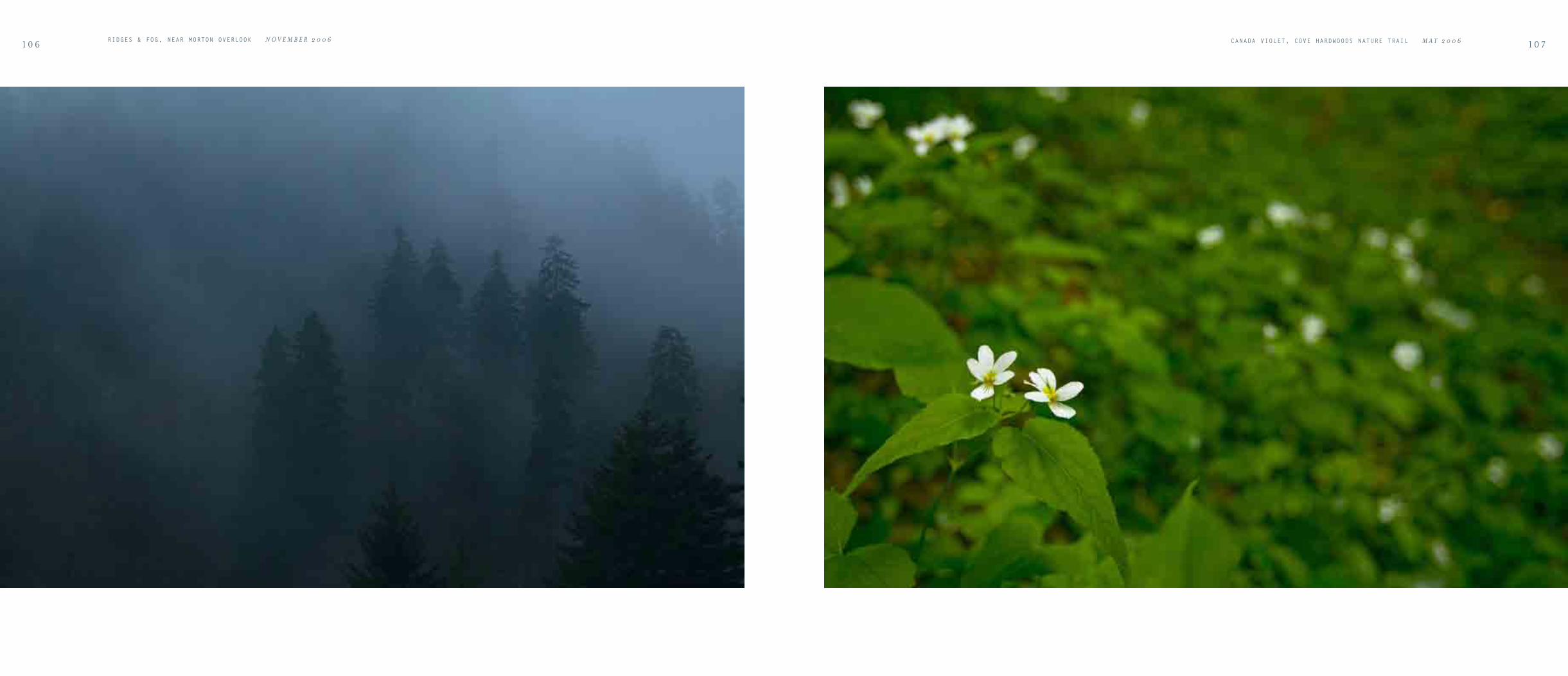
1 0 6RIDGES & FOG, NEAR MORTON OVERLOOK N O V E M B E R 2 0 0 6
1 0 7CANADA VIOLET, COVE HARDWOODS NATURE TRAIL M A Y 2 0 0 6

1 0 8 SUNRISE, NEWFOUND GAP N O V E M B E R 2 0 0 8 1 0 9SUNRISE, NEWFOUND GAP N O V E M B E R 2 0 0 8

1 1 0 HEATH BALD, CHIMNEY TOPS J U N E 2 0 0 8 1 1 1WEST PRONG LITTLE PIGEON RIVER J U N E 2 0 0 8

1 1 2 WINTER, CLINGMANS DOME RIDGES M A R C H 2 0 0 8 1 1 3WINTER SUNSET, MORTON OVERLOOK M A R C H 2 0 0 8

1 1 4 WINTER, WEST PRONG LITTLE PIGEON RIVER M A R C H 2 0 0 8 1 1 5ROCK WALL AND SMALL PINE M A R C H 2 0 0 8

CREEK, COVE HARDWOODS NATURE TRAIL M A Y 2 0 0 6 1 1 7WEST PRONG LITTLE PIGEON RIVER M A Y 2 0 0 6

1 1 8 ROCKS, WEST PRONG LITTLE PIGEON RIVER M A Y 2 0 0 6 WEST PRONG LITTLE PIGEON RIVER M A Y 2 0 0 6

SUNSET, MORTON OVERLOOK M A Y 2 0 0 6 1 2 1
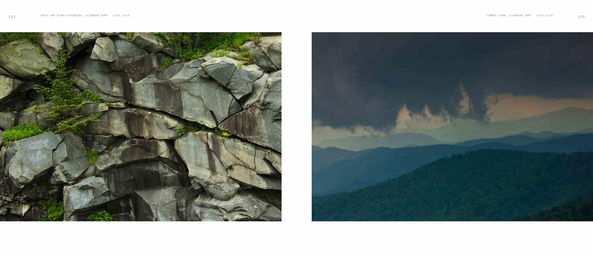
1 2 2 ROCKS AND YOUNG EVERGREENS, CLINGMANS DOME J U N E 2 0 0 8 1 2 3SUMMER STORM, CLINGMANS DOME J U N E 2 0 0 8

1 2 4 MOONRISE, CLINGMANS DOME O C T O B E R 2 0 0 8 MOONRISE, CLINGMANS DOME O C T O B E R 2 0 0 8

1 2 6 1 2 7FRASER FIR FOREST, CLINGMANS DOME J U N E 2 0 0 8SUNSET, CLINGMANS DOME J U N E 2 0 0 8
FRASER FIR TREE, CLINGMANS DOME J U N E 2 0 0 8CATAWBA RHODODENDRON, CLINGMANS DOME J U N E 2 0 0 8

1 2 8 FRASER FIR, CLINGMANS DOME JUNE 2008
EVENING & GRASSES, CLINGMANS DOME JUNE 20081 2 9SUNSET, CLINGMANS DOME J U N E 2 0 0 8

1 3 0 FOREST, FORNEY RIDGE J U N E 1 9 9 1FOREST ALONG DEEP CREEK TRAIL, CLINGMANS DOME O C T O B E R 1 9 8 4
1 3 1FOREST, NEWFOUND GAP ROAD O C T O B E R 1 9 8 4FRASER FIR, CLINGMANS DOME J U N E 1 9 9 1

1 3 2 SUNSET, NEWFOUND GAP ROAD J U N E 2 0 0 8 1 3 3SUNSET, WEST PRONG LITTLE PIGEON RIVER VALLEY J U N E 2 0 0 8

1 3 4 MORNING, NEWFOUND GAP O C T O B E R 2 0 0 8 1 3 5FOREST DETAILS NEWFOUND GAP ROAD N O V E M B E R 2 0 0 6 & O C T O B E R 2 0 0 8

1 3 6 ROCKS & LEAVES, WEST PRONG LITTLE PIGEON RIVER O C T O B E R 2 0 0 8
FOG & FOREST, NEWFOUND GAP O C T O B E R 2 0 0 8
O v e r l e a f SUNSET, CLINGMANS DOME O C T O B E R 2 0 0 8


OCONALUFTEESUNRISE, DEEP CREEK OVERLOOK J U N E 2 0 0 8
Although more of Great Smoky Mountains National Park lies in the state of
North Carolina than Tennessee, the southern, or Carolina side of the range
is often neglected by visitors. Much of the reason for the imbalance is simple
geography. Traveling from the immediate north or west, the Tennessee side
of the Great Smokies is the first major outcrop of the Appalachians that one
encounters. Coming from the south or east, travelers first meet the Blue
Ridge Mountains, which are a major destination unto themselves and a
substantial barrier to reaching the south side of the Smokies.
In other words, the Carolina Smokies are mountains surrounded by
mountains. Even in the heavily populated East, even in the transportation
crazy 21st century, they are a long day’s journey from just about everywhere.
Yet the journey is supremely worth the effort. Just by turning off the
popular Blue Ridge Parkway you can have Balsam Mountain and Heintooga
Ridge almost to yourself any summer or autumn day. This mile-high
area offers some of the best panoramic views and cool July breezes in the
southern mountains.
Even more remote is the Fontana Lake region. The very large, clear lake at
the center of this area serves as the park boundary. A short boat ride takes
you far off the beaten path to places like Hazel Creek and Eagle Creek,
revered by anglers and rich in 19th century mountain history.
The Deep Creek area is just outside the pleasantly Mayberry-esque town
of Bryson City. Deep Creek is one of the loveliest of many lovely Smoky
Mountain streams. Its tributaries offer hikers a variety of glittering
waterfalls to enjoy.
The storied Oconaluftee River runs swift and wide through the Carolina
Smokies, providing haven for rainbow and brown trout. As it prepares
to exit the Smoky Mountains, it wends near two sites of special historic
interest. First, the Mountain Farm Museum with its precious collection of
log buildings and occasional historic demonstrations, then the Cherokee
Indian Reservation with its impressive American Indian museum and
quality arts and crafts galleries. Together the sites relate a tantalizing story of
life in mountains surrounded by mountains lived by people tenacious and
ingenious enough to thrive.

1 4 2 ELK, OCONALUFTEE VISITOR'S CENTER FIELD J U N E 2 0 0 8 1 4 3RAIN & FOG, OCONALUFTEE RIVER J U N E 2 0 0 8

1 4 4 BOULDERS ON THE OCONALUFTEE RIVER J U N E 2 0 0 8 1 4 5MORNING, BENT TREE & THE OCONALUFTEE RIVER J U N E 2 0 0 8

FLAME AZALEA & MOUNTAINS, BALSAM MOUNTAIN ROAD J U N E 2 0 0 81 4 6 1 4 7FLAME AZALEA, BALSAM MOUNTAIN ROAD J U N E 2 0 0 8

1 4 8 AFTERNOON, OCONALUFTEE RIVER J U N E 2 0 0 8 1 4 9ELK CALF, OCONALUFTEE VISITOR'S CENTER J U N E 2 0 0 8

1 5 0SUGAR MAPLES, BALSAM MOUNTAIN J U N E 2 0 0 8
1 5 1SUNRISE, DEEP CREEK VALLEY J U N E 2 0 0 8

1 5 2 STRAIGHT FORK CREEK, BALSAM MOUNTAIN J U N E 2 0 0 8 1 5 3STRAIGHT FORK CREEK, BALSAM MOUNTAIN J U N E 2 0 0 8

1 5 4 STRAIGHT FORK CREEK, BALSAM MOUNTAIN J U N E 2 0 0 8 1 5 5THREE VIEWS, JUNEY WHANK FALLS O C T O B E R 2 0 0 8

1 5 7SUNSET, BLUE RIDGE PARKWAY JUNE 2008

1 5 8 MINGUS MILL J U N E 2 0 0 8DETAIL, MINGUS MILL O C T O B E R 1 9 8 1
1 5 9MOUNTAIN LAUREL, BLUE RIDGE PARKWAY J U N E 2 0 0 8

1 6 0 WOOD FERNS & FOREST, INDIAN CREEK TRAIL J U N E 2 0 0 8 1 6 1OCONALUFTEE RIVER N O V E M B E R 2 0 0 6

1 6 2 SUNRISE, DEEP CREEK OVERLOOK O C T O B E R 2 0 0 8 1 6 3MOONSET, DEEP CREEK OVERLOOK O C T O B E R 2 0 0 8

1 6 4 SUNRISE, DEEP CREEK OVERLOOK N O V E M B E R 2 0 0 8 1 6 5SUNRISE, DEEP CREEK OVERLOOK N O V E M B E R 2 0 0 8

1 6 6 FALL FOREST, DEEP CREEK O C T O B E R 2 0 0 8 1 6 7DEEP CREEK O C T O B E R 2 0 0 8

1 6 8 NOLAND CREEK O C T O B E R 2 0 0 8 1 6 9INDIAN CREEK FALLS O C T O B E R 2 0 0 8

1 7 0 FALL FOREST, LAKESHORE TRAIL O C T O B E R 2 0 0 8 1 7 1TUNNEL ON THE LAKESHORE TRAIL O C T O B E R 2 0 0 8O v e r l e a f DEEP CREEK OVERLOOK J U N E 2 0 0 8


COSBY & CATALOOCHEE
For the most part, you don’t just happen upon the Cosby or Cataloochee
areas of Great Smoky Mountains National Park. Getting there is almost
always intentional and usually requires a certain tolerance for winding
mountain roads.
Despite its reputation for an outlaw past, the Cosby area is one of the
friendliest and most peaceful valleys in a part of the country that prides
itself on friendly and peaceful. To be sure, a lot of liquor, both legal and
illegal, was distilled in this neck of the woods at one time. But according
to historians, converting bulky food crops, like corn, into concentrated
form, like whiskey, was a perfectly logical economic choice for farmers
living in a remote area with poor roads for transporting agricultural
commodities.
Being remote also helped preserve the beauty of the east side of the
Smokies. Much of the park’s best old-growth forest persists in this
place, so far from the centers of commerce that few of the big lumber
companies ever got around to setting up shop. And even by Smoky
Mountain standards, the mountains here are exceptionally steep. From
Cosby Campground, the ridge-running Appalachian Trail is only a mile
and a half, as the crow flies. But for wingless humans, shouldering a pack,
the two-and-a-half mile ascent by trail is the very definition of grueling.
Nearby Cataloochee Valley shares remoteness with Cosby, but otherwise it is quite a different place. Whereas farmers in
the Cosby vicinity were constantly challenged by rocky soils and the long shadows cast by towering ridges, Cataloochee
was relatively broad and fertile. Several of Cataloochee’s larger land owners became rather prosperous by growing grains
and apples and raising livestock. The tourism industry was already blossoming in Cataloochee even before the park was
established.
Recently, the peaceful Cataloochee Valley showed its precociousness in an entirely new way. Cataloochee was chosen as the
best place to start the reintroduction of elk to the Great Smoky Mountains. Today, though they must go out of their way to
do so, visitors to Cataloochee can see wild elk in the Great Smokies for the first time in more than a century.
1 7 5BIG CREEK M A Y 2 0 0 6

1 7 6 STAR CHICKWEED, COSBY M A Y 2 0 0 6 COSBY CREEK M A Y 2 0 0 6

VASEY'S TRILLIUM, COSBY M A Y 2 0 0 6YELLOW TRILLIUM, COSBY M A Y 2 0 0 6
1 7 8 1 7 9MUSHROOM, COSBY M A Y 2 0 0 6PAINTED TRILIUM, HEN WALLOW FALLS M A Y 2 0 0 6

HEN WALLOW FALLS M A Y 2 0 0 61 8 0 1 8 1 DETAIL HEN WALLOW FALLS M A Y 2 0 0 6

1 8 2 W I L D G E R A N I U M , B I G C R E E K M A Y 2 0 0 6 1 8 3MIDNIGHT HOLE, BIG CREEK M A Y 2 0 0 6

1 8 4 ROCK DETAIL, BIG CREEK M A Y 2 0 0 6 1 8 5BIG CREEK M A Y 2 0 0 6

1 8 6 CATALOOCHEE CREEK O C T O B E R 2 0 0 8 1 8 7MOUSE CREEK FALLS POURING INTO BIG CREEK M A Y 2 0 0 6

1 8 8 PALMER CHAPEL, CATALOOCHEE J U N E 2 0 0 8 1 8 9WEST SIDE, PALMER CHAPEL METHODIST CHURCH, CATALOOCHEE J U N E 2 0 0 8INTERIOR, PALMER CHAPEL METHODIST CHURCH, CATALOOCHEE J U N E 2 0 0 8

1 9 01 9 0 CATALOOCHEE VALLEY J U N E 2 0 0 8 1 9 1ELK, CATALOOCHEE O C T O B E R 2 0 0 8 1 9 1

ELK HERD, CATALOOCHEE O C T O B E R 2 0 0 81 9 2 ELK RUT, CATALOOCHEE O C T O B E R 2 0 0 8O v e r l e a f MEADOW, CATALOOCHEE O C T O B E R 2 0 0 8
1 9 3


ROARING FORK
The Great Smoky Mountains near Gatlinburg, including the Roaring
Fork, Cherokee Orchard, and Greenbrier areas, are world-renowned for
the exquisite beauty of their rivers, forests, and wildflowers. No more
than two or three miles from the hubbub of downtown Gatlinburg there
stand groves of 400-year-old woods and individual trees that grow larger
than any others of their kind.
The forests of this area of the Great Smokies eluded the loggers’ saw more
successfully than elsewhere because of the rugged terrain. Gatlinburg’s
elevation is approximately 1,500 feet, but just four miles south loom the
summits of peaks 5,000 feet higher. As seasoned hikers will tell you, this
topography is as demanding at any mountains in the contiguous U.S.
The tempestuous rivers that plunge through this locale also define it.
Roaring Fork literally roars when a thunderstorm on the flanks of Mount
Le Conte raises its waters four feet in a few minutes. The Little Pigeon
River through Greenbrier is just as likely to jump its banks and engulf
low-lying forest.
When tenacious and clannish mountain farmers lived up in these hollows, such floods often swept away grist mills, crops,
and even livestock. Out-of-control forest fires were fairly common, too. Yet families with the surnames Ogle, Whaley,
Huskey, Cardwell, Reagan, and Clabo endured. They were, after all, mostly of Scotch-Irish descent, and the rocky, steep-
sloped farms were places that no one else wanted very badly. They were places where people went who wanted to be left alone.
Yet even their mountain refuge was not exempt from change. When the national park was being formed in the 1920s and
‘30s, many had to sell their farms and leave. Old roads became hiking trails and pastures filled with wildflowers. Still, if you
thumb through a local phone directory, you’ll notice that many families didn’t stray far. The hardscrabble heritage of Roaring
Fork and Greenbrier is something they’ve chosen to hold onto.
1 9 7NOAH "BUD" OGLE PLACE O C T O B E R 2 0 0 8

1 9 8 THE PLACE OF A THOUSAND DRIPS WATERFALL, ROARING FORK M A Y 2 0 0 6 1 9 9ROARING FORK STREAM M A Y 2 0 0 6

2 0 0 EPHRAIM BALES PLACE N O V E M B E R 2 0 0 8 2 0 1EPHRAIM BALES PLACE O C T O B E R 2 0 0 8

2 0 2 BARN DETAIL & ROCK WALL, EPHRAIM BALES PLACE N O V E M B E R 2 0 0 8 2 0 3ROARING FORK STREAM N O V E M B E R 2 0 0 8

2 0 4 WHITE & YELLOW TRILLIUM A P R I L 2 0 0 4 2 0 5FOAM FLOWER, PORTERS CREEK TRAIL M A Y 2 0 0 6

2 0 6 FRINGED PHACELIA, PORTERS CREEK TRAIL M A Y 2 0 0 8 2 0 7ROARING FORK CREEK M A Y 2 0 0 6

2 0 8 WHITE VIOLET, WAKE ROBBIN TRILLIUM, PORTERS CREEK M A Y 2 0 0 8SQUIRREL CORN, STAR CHICKWEED, PORTERS CREEK M A Y 2 0 0 8
2 0 9WILD GERANIUM, BROOK LETTUCE, PORTERS CREEK M A Y 2 0 0 8PURPLE VIOLET, BLUE PHLOX, PORTERS CREEK M A Y 2 0 0 8

FERN BRANCH FALLS M A Y 2 0 0 6 2 1 1LARGE WHITE TRILLIUM, PORTERS CREEK TRAIL M A Y 2 0 0 8

2 1 2 WHITE WAKE ROBIN TRILLIUM, PORTERS CREEK TRAIL A P R I L 2 0 0 8MUSHROOM, PORTERS CREEK TRAIL A P R I L 2 0 0 8
2 1 3BISHOP'S CAP, PORTERS CREEK TRAIL A P R I L 2 0 0 8YELLOW TRILLIUM, PORTERS CREEK TRAIL A P R I L 2 0 0 8

2 1 4 ROARING FORK CREEK N O V E M B E R 2 0 0 8 REAGAN MILL, ROARING FORK CREEK N O V E M B E R 2 0 0 8O v e r l e a f ROARING FORK CREEK N O V E M B E R 2 0 0 8


2 1 8 PARK MAP
When I started in earnest to create this book in 2005, I quickly realized
how little I really knew about the park. I had few images from winter,
had never visited some parts of the park, and when I considered the
“story” of the park, I realized that several “chapters” were missing from
my imagery. I began to plan more in-depth trips for specific reasons,
whether to explore a remote area like Cataloochee and Balsam Mountain
or to capture the spring flowers or fall colors better than I had before.
Between 2005 and the end of 2008 I ventured into the park at least four
to six times a year. Of course, I have included some of the imagery from
my earliest trips into the park, partly because they are images that can no
longer be seen and are therefore part of the park’s history, and partly just
because I like the images. But I confess that many of the shots which made
the final edit are recent images. This is due in part to my development
as a photographer; and certainly, advanced camera equipment and digital
imaging have made for better quality images.
As for the technical issues about which I am always asked, I have shot with
many types of cameras over the years. My earliest work was done in 35mm
film with an old Minolta SRT101, a camera given to me when I graduated high school. I have also used a Canon V 35mm camera,
a Hasselblad, and a Fuji 617 Panoramic camera. As for film, I predominately used Fujichrome Velvia for color work. For black and
white images I used Ilford’s Pan F or Delta to get finer grain and resolution. More recently I’ve shot digital with a
Canon 1Ds, which produces 12.6MB files, and the Canon 1Ds Mark III, which gives you 21.6MB files to start with. When these are
processed in Photoshop they can quickly become huge files at 400MB or more. In Photoshop I have done some digital work with
the images in order to get them to the point at which I saw the image in the field. This can entail a variety of processes to bring out
the best in a digital image, much like you would work with a black and white or color image in the darkroom to make it the image
you envisioned when you snapped the shutter.
You can plan your photographs with minute detail, factor in where the sun will come up and at what time, figure out the phases
of the moon, the season for wildflowers or wildlife, but in the end, there is a certain amount of luck involved. Maybe part of the
difference between images that are sublime and those that are simply satisfactory is how often you put yourself in the right place
at the right time to take advantage of not only your preparation and expectations, but what is presented by nature. Either way, it
requires great effort to compile a body of images that work well together.
I had more than 6,000 images spanning thirty years of work from which to choose. A daunting task, to say the least. I believe those
that were ultimately selected tell the story of the park as it has evolved during this time frame. And, of course, my hope is that I
have presented an inspirational tribute to one of our greatest national treasures.
2 1 9ACKNOWLEDGMENTS
Every book is the culmination of intense work by many people.
I would first like to thank my production team, which included
my favorite designers--Rich Nickel and Rudi Backart. Rich
and Rudi steered me down the right path on design and image
selections. Rich also endured many emails, phone calls, and
other communications in my search for the perfect placement
of images and text, selection of images, and pre-production
questions. His tireless efforts have paid off, and the visual style
of this book is a tribute to his insights. Laurie Prossnitz did an
excellent job of editing the text and cleaning up my grammar.
Her editorial suggestions were always taken with gratitude.
Also, I’d like to thank Karen Powelson and all the folks at CS
Graphics, which printed this book. Their professionalism
made it an almost effortless process from start to finish.
During the course of a 30-year project, you meet lots of
exceptional people who are willing to give you a hand. None
more so than Steve Kemp, Interpretive Products & Services
Director for the Great Smoky Mountains Association. His
beautifully written foreword and text fit perfectly with my
idea of how this book should feel and read. He also provided
encouragement and advice along the way. My only regret
is that we didn’t meet sooner in the course of this project!
I also want to thank Janet Rock, Botanist for Great Smoky
Mountains National Park, who made sure I correctly identified
the wildflowers. Janet saved me lots of time with my head in a
plant- identification book! I look forward to hiking with them
both on future trips to the park.
During the last three decades I have traveled to the park both
by myself and with friends or relatives. Many trips since 2000
have been with my brother-in-law, Bill Gunther. Bill waits
patiently as I work, reads a lot of books, and takes long walks
in the area. Our conversations over meals kept me sane and
grounded. His friendship is invaluable. His wife Sandy joined
us on one trip, and held down the fort at home on others.
Thank you.
I also called on my friend and favorite pilot Philip Prossnitz to
fly me down to the Smokies as fast as possible on winter trips.
Sometimes we had only a day’s notice of snow arriving in the
park, and Phil was always willing to clear his schedule and gas
up the plane.
Over the years, Kathy and I have hiked through the Smokies
with many friends and family members. These trips were all
memorable and I thank you for joining us on each and every
one of them. Thanks also for being patient as I stopped to
photograph along the trails.
To my daughter Sara and son Sam, we have dragged you to the
park on many a vacation since you were quite young. Thanks
for being such good company and for giving us the opportunity
to appreciate the park’s beauty through your eyes. I remember
the many times you waited while I worked, but one evening
stands out, when you were about five and seven years old. I was
shooting a sunset at Morton Overlook. The sun and clouds
proved muted but interesting. After returning to the car,
where Kathy had kept you entertained, I was told it had been an
hour since I started. I couldn’t believe it had been that long but
you all assured me it had been. You wondered out loud what
takes so long. A few months later the photograph sold for a
book cover and you were both thrilled to have been there when
it was taken. You said you finally understood what it takes and
why. Now you are visiting the park by yourselves and making
your own memories, which gives me great pleasure. Thanks for
the memories, may we make many more.
Finally, to my wife Kathy, to whom this book is dedicated.
We can’t count the number of times we have been to the
park together, yet every trip brings us new adventures. You
have always kept me on track personally and professionally,
encouraging me when I think things are not going well. Your
support and levelheadedness during this process have been
priceless. I have enjoyed traveling with you down the paths in
the Smokies, and in life, and look forward to many more years
blazing trails together.
Thank you and peace to you all,
Richard Mack
PHOTO NOTES

Quiet Light Publishing specializes in the publication of fine art and photographic works, archival quality prints and coffee table books of
extraordinary quality. Any of the photographs in this book are available individually as an archival print, with a selection available as fine
art Great Smoky Mountains National Park posters and note cards. Please visit our website for more information.
Q U I E T L I G H T P U B L I S H I N G , E V A N S T O N , I L L I N O I S
W W W . Q U I E T L I G H T P U B L I S H I N G . C O M
Also available from Quiet Light Publishing:
The Lewis & Clark Trail American Landscapes, Photographs by Richard Mack. In this multiple award winning book, Richard has captured the spirit
of the American West, its history and vastness in an extraordinary set of images depicting the Lewis & Clark Trail as most likely seen by the
Lewis & Clark Expedition. Richard retraced the steps of the Corps of Discovery at the same time of year as they travelled in 1804-1806,
giving the reader the feeling of being on the expedition. To date this book has won over a dozen awards for the photography, design and
printing including two Silver Medals in the Benjamin Franklin Book Awards for Best Nature Book and Best Coffee Table Book.
Please see our website or your local bookstore. www.quietlightpublishing.com