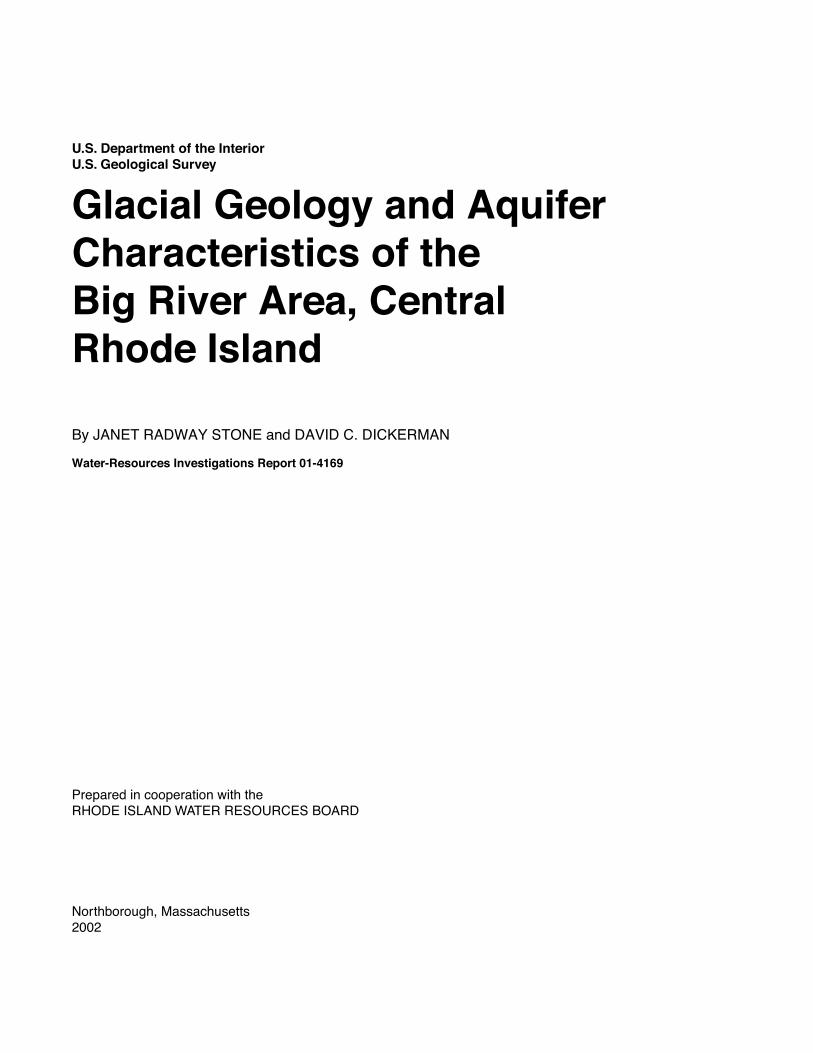
glacial geology and aquifer characteristics of the big ... · u.s. department of the interior u.s....
TRANSCRIPT

U.S. Department of the InteriorU.S. Geological Survey
Glacial Geology and Aquifer Characteristics of theBig River Area, Central Rhode Island
Water-Resources Investigations Report 01-4169
By JANET RADWAY STONE and DAVID C. DICKERMAN
Prepared in cooperation with theRHODE ISLAND WATER RESOURCES BOARD
Stone and Dickerm
an — G
LACIAL G
EOLO
GY AN
D AQ
UIFER
CH
ARAC
TERISTIC
S OF TH
E BIG R
IVER AR
EA, CEN
TRAL R
HO
DE ISLAN
D —
WR
IR 01-4169
MASSACHUSETTS
CO
NN
ECTI
CU
T
Big River Study Area
RHODE ISLAND
U.S. Department of the InteriorU.S. Geological Survey
Glacial Geology and Aquifer Characteristics of theBig River Area, Central Rhode Island
By JANET RADWAY STONE and DAVID C. DICKERMAN
Water-Resources Investigations Report 01-4169
Prepared in cooperation with theRHODE ISLAND WATER RESOURCES BOARD
Northborough, Massachusetts2002
U.S. DEPARTMENT OF THE INTERIORGALE A. NORTON, Secretary
U.S. GEOLOGICAL SURVEYCharles G. Groat, Director
For additional information write to: Copies of this report can be purchased from:
Subdistrict Chief U.S. Geological SurveyMassachusetts-Rhode Island District Branch of Information ServicesU.S. Geological Survey Box 25286Water Resources Division Denver, CO 80225-028610 Bearfoot RoadNorthborough, MA 01532
or visit our Web site at
http://ma.water.usgs.gov

CONTENTS
Introduction ........................................................................................................................................................................... 1Acknowledgments ....................................................................................................................................................... 3Previous Studies .......................................................................................................................................................... 3Topography and Drainage ........................................................................................................................................... 3Bedrock ....................................................................................................................................................................... 3
Glacial Geology..................................................................................................................................................................... 4Distribution of Surficial Materials............................................................................................................................... 4Till ............................................................................................................................................................................... 5Meltwater Deposits...................................................................................................................................................... 5Glacial Lakes and Ice-Margin Positions during Deglaciation..................................................................................... 6Postglacial Deposits .................................................................................................................................................... 8
Aquifer Characteristics.......................................................................................................................................................... 8Till ............................................................................................................................................................................... 8Stratified Deposits ....................................................................................................................................................... 9
Hydraulic Properties of the Sand and Gravel Aquifer....................................................................................... 9Aquifer Tests ..................................................................................................................................................... 10
References ............................................................................................................................................................................. 11
FIGURES
1, 2. Maps showing:1. Location of study area and major drainages in the Big River area, Rhode Island ........................................ 22. Glacial lakes and ice-margin positions during deglaciation, Big River area................................................. 7
TABLES
1. Surficial materials, well-construction characteristics, and hydraulic properties determined from aquifer tests in the Big River area, Rhode Island ................................................................................................................ 10
CONVERSION FACTORS AND VERTICAL DATUM
CONVERSION FACTORS
VERTICAL DATUM
Sea Level: In this report “sea level” refers to the National Geodetic Vertical Datum of 1929 (NGVDof 1929)—a geodetic datum derived from a general adjustment of the first-order level nets of theUnited States and Canada, formerly called Sea Level Datum of 1929.
Multiply By To obtain
foot (ft) 0.3048 meterfoot per day (ft/d) 0.3048 meter per day
gallon per minute (gal/min) 0.06309 liter per secondinch (in.) 25.4 millimetermile (mi) 1.609 kilometer
square foot per day (ft2/d) 0.09290 square meter per day square mile (mi2) 2.590 square kilometer
Contents III

Glacial Geology and Aquifer Characteristics of theBig River Area, Central Rhode Island
By Janet Radway Stone and David C. Dickerman
INTRODUCTION
The Rhode Island Water Resources Board (RIWRB), which is responsible for developing the State’s major water resources, is concerned that contin-ued growth in demand for water in Rhode Island will severely stress water supplies. In the early 1960s, the State proposed construction of a surface-water reser-voir in the Big River Basin in central Rhode Island to meet the growing water demands, but, to date (2001) the U.S. Environmental Protection Agency has not given approval for construction of this reservoir. As an alternative, the RIWRB would like to identify sites in the Big River area stream-aquifer system where high-yield supply wells can be constructed to meet future water demands. A cooperative study was initiated during the summer of 1995 by the U.S. Geological Survey (USGS) and the RIWRB to evaluate ground water as a source of water supply in the Big River area.
This report presents the initial results of a multi-year investigation of the three-dimensional characteris-tics of the surficial aquifer system based on geologic and geophysical field studies, and provides information needed to protect, develop, and manage the Big River area stream-aquifer system. The Big River area includes the entire Big River drainage basin and part of the Mishnock River drainage basin (fig. 1) and covers approximately 35 mi2, including parts of the towns of Coventry, Exeter, and West Greenwich. Most of the Big River area is in Kent County, with a small
part in Washington County; it encompasses parts of the Coventry Center, Hope Valley, Crompton, and Slocum 7.5-minute quadrangles.
This investigation includes a characterization of the geologic framework and an evaluation of the hydraulic properties of the stream-aquifer system. The Big River area stream-aquifer system is the surficial aquifer and the network of rivers, brooks, lakes, and ponds that overlie and are in hydraulic connection with the aquifer. The surficial materials units of the Big River area and the accompanying bedrock-surface contours (pl. 1) were delineated on the basis of data collected during field mapping, seismic-refraction surveys, ground-penetrating radar surveys, logs from all available wells and test holes, and results of previous investigations.
Some streams in the study area lose surface water naturally to the underlying sand and gravel aqui-fer, whereas others lose water to the aquifer by induced infiltration of streamflow caused by ground-water withdrawals. Most large ground-water withdrawals are from public-supply wells in the sand and gravel aquifer in the Mishnock River Basin. Minimal ground-water withdrawals take place in the Big River Basin, because most of the land is designated as open space and pro-tected from development by State law. The primary use of surface water in the study area is for recreation. Water from the Flat River Reservoir, the largest surface-water body in the study area, is used only for recreational purposes.
Introduction 1

2 Glacial Geology and Aquifer Characteristics of the Big River Area, Central Rhode Island
MA
SS
AC
HU
SE
TT
S
CO
NN
EC
TIC
UT
Big River Study Area
RHODE ISLAND
5
5
IslandBlock
10 MILES0
10 KILOMETERS0
NewShoreham
41o15'
71o07'30"
71o15'
71o22'30"71o30'71o37'30"71o45'
42o00'
41o52'30"
41o45'
41o30'
41o37'30"
41o22'30"
BLOCK ISLAND SOUND
RHODE ISLAND SOUND
ATLANTIC OCEAN
Burrillville
Smithfield
NorthCumberland
Lincoln
Johnston
Providence
ProvidenceNorth
Smithfield
Cranston
WarwickWest
Woonsocket
Coventry
West Greenwich
Exeter
Richmond
Hopkinton
Bristol
Warren
Barrington
Warwick
Providence
SouthKingstown
GreenwichEast
NorthKingstown
Nar
raga
nset
t
Pawtucket
East
Newport
Middletown
Portsmouth
Tiverton
ComptonJa
mes
tow
n
Little
Charlestown
Westerly
Glocester
ScituateFoster
FallsCentral
Figure 1.
Location of study area and major streams in the Big River area, Rhode Island.

Acknowledgments
The authors express appreciation to Timothy Brown, General Manager, Kent County Water Authority for providing well logs, aquifer-test data, and pumpage records for water-supply wells in the Mishnock River Basin. Special acknowledgment is made to Patrick Craft, formerly with the USGS, who analyzed aquifer-test data and calculated hydraulic properties at six test sites. The authors also wish to thank Lance Ostiguy, USGS, who provided map digiti-zation and GIS (geographic information systems) support, and Mark Bonito, USGS, for digital drafting.
Previous Studies
Surficial geologic maps have been published for the Hope Valley quadrangle (Feininger, 1962), Crompton quadrangle (Smith, 1956), and Slocum quadrangle (Power, 1957). These maps are based on a morphogenic classification of deposits, and generally show an accurate distribution of glacial till, glacial meltwater deposits, and postglacial deposits, but do not describe the thickness and textural distribution of the surficial materials. The surficial geology of the Coventry Center quadrangle was not previously mapped. The bedrock geology was mapped for the Coventry Center quadrangle (Moore, 1963), Hope Valley quadrangle (Moore, 1958), Crompton quadran-gle (Quinn, 1963), and Slocum quadrangle (Power, 1959). Many surficial geologic contacts and locations of nearly all bedrock outcrops shown on the surficial materials map (pl. 1) were taken from these earlier quadrangle studies. The bedrock geology of the area has been updated on the new Bedrock Geologic Map of Rhode Island by Hermes and others (1994). Ground-water maps have been published for the Crompton quadrangle (Allen and others, 1959), Hope Valley quadrangle (Bierschenk and Hahn, 1959), Slocum quadrangle (Hahn, 1959), and Coventry Center quad-rangle (Mason and Hahn, 1960). Also, Gonthier (1966)
conducted a water-resources investigation for the South Branch Pawtuxet River Basin, which includes the Big River Basin.
Topography and Drainage
Landforms in the Big River study area consist of a series of north- to northwest-trending hills and valleys. Most hills that form the drainage basin divide are higher than 400 ft in altitude; the highest point is at 600 ft on the top of Raccoon Hill. Valley bottoms generally are below 300 ft, and contain a variety of glacial landforms such as flat-topped ice-contact (kame) deltas, sinuous esker ridges, glacial lake-bottom plains, and postglacial wetlands and flood-plains. The lowest altitude in the area is 240 ft along the Mishnock River where the river exits the drainage basin in the northeastern part of the area. The Big River Basin drains to the north and includes seven streams ultimately tributary to the east-flowing Flat River and South Branch Pawtuxet River: Raccoon Brook is a north-flowing tributary to the south- and southeast-flowing Nooseneck River; Congdon River is a north-flowing stream that joins the Nooseneck River to form the north-flowing Big River; Carr River and other north- and northwest-flowing tributaries join the Big River in the central part of the study area. Bear Brook flows north and east to join the Big River, and the Mishnock River originates in a large wetland area, and flows northerly to the South Branch Pawtuxet River. The northern end of the Big River Valley now is flooded by the Flat River Reservoir.
Bedrock
Bedrock controls the large-scale aspect of the landscape in the study area. The basin is underlain by granitic rocks of the Scituate Igneous Suite (Hermes and others, 1994), formerly called Scituate granite
Introduction 3

gneiss (Quinn, 1971). The granite has undergone Paleozoic metamorphism and has a gneissic structure and texture. Although locally massive, in most places the rock is moderately foliated and compositionally layered. In the western part of the study area, the strike of foliation and layering generally is north-northeast with low (25–35˚) northwest dips; in the central part, the strike of foliation is north to north-northwest with steep (greater than 70˚) to vertical dip. In the eastern-most part of the area, foliation trends are northeast to east-northeast with moderate (less than 40˚) northwest to north-northwest dips. Locally, Mesozoic-aged diabase dikes intrude the granitic rock. Ubiquitous fractures and joints cut the bedrock; cross-cutting fractures include near-horizontal unroofing joints and high-angle to vertical fractures generated by tectonic stresses. The orientation of dominant sets of high-angle fractures coupled with the orientation of foliation and layering in the bedrock control the erosional resistance of the rock, hence the trend and shape of bedrock hills and valleys. The bedrock valleys, which today are par-tially filled with glacial meltwater sediments, were developed from deeply weathered zones in the bed-rock, modified by multiple episodes of continental glaciation as glacial ice preferentially plucked the fractured bedrock along zones of structural weakness.
Granitic bedrock in New England has extremely low primary porosity, and ground water is present only in fractures that cut the rock mass. Such bedrock is capable of providing enough water for domestic-well use and is, therefore, an important aquifer. The yield of water from bedrock wells is related to the number and connectivity of fractures that the well intersects. Reported yields of wells tapping bedrock in the study area range from less than 1 to 50 gal/min, with a median yield of 5 gal/min. Bedrock wells range from 25 to 500 ft in depth, with a median well depth of 200 ft (Gonthier, 1966).
The configuration of the bedrock surface in the valleys beneath surficial materials is shown on the plate (red contour lines) where it lies at or below 300 ft in altitude. Bedrock-surface contours were delineated on the basis of reported depths to bedrock or refusal at all available wells and test holes, as well as geologic infer-ence based on a regional understanding of the thickness and distribution of surficial deposits. Depth to bedrock ranges from 0 to as much as 250 ft in the study area. The deepest bedrock valley lies below 100 ft in altitude in the Mishnock River Valley.
GLACIAL GEOLOGY
Glacial deposits overlie bedrock in the Big River area (plate) and range from a few feet to more than 200 ft in thickness. Most of these materials are deposits of the last two continental ice sheets that covered New England during the middle and late Pleistocene. Most deposits were laid down during the advance and retreat of the last (late Wisconsinan) ice sheet, which reached its terminus on Long Island, N.Y., about 21,000 years ago, and was retreating northward through the Big River area by about 17,000 years ago (Stone and Borns, 1986; Boothroyd and others, 1998). The glacial depos-its are divided into two broad categories—glacial till and glacial meltwater deposits. Till was deposited directly by glacier ice and is characterized as a non-sorted matrix of sand, silt, and clay with variable amounts of pebbles, cobbles, and large boulders. Gla-cial meltwater deposits were laid down by meltwater in lakes and streams in front of the retreating ice margin during deglaciation. These materials, also referred to as glacial stratified deposits, consist of well-sorted to poorly sorted layers of gravel, sand, silt, and clay. Post-glacial sediments, primarily floodplain alluvium and swamp deposits, are thin surface units and make up a lesser proportion of the surficial materials in the study area.
Distribution of Surficial Materials
The distribution of surficial materials that lie between the land surface (below the pedogenic soil horizon) and the bedrock surface is shown on the map (plate). Cross-sections A-A′, B-B′, C-C′, D-D′, and E-E′ (plate) illustrate the characteristic vertical succession of glacial till, glacial meltwater deposits, and postgla-cial deposits. In upland areas, till is the major surficial material: it is present as a discontinuous blanket deposit of variable thickness over the bedrock surface. In most places, till is less than 10 to15 ft thick; areas where till is thicker than 10 to15 ft are shown on the map by the dark gray color. Till is thickest in drumlins, such as Nooseneck Hill and Weaver Hill, and on the northwestern sides of bedrock hills, such as Hungry Hill. In the valleys, glacial meltwater deposits are the predominant surficial materials. These deposits gener-ally overlie till; however, well logs indicate that in some places till is not present in the subsurface and the
4 Glacial Geology and Aquifer Characteristics of the Big River Area, Central Rhode Island
meltwater deposits lie directly on bedrock. In the smaller valleys, like Raccoon Brook and Nooseneck River Valleys, meltwater deposits generally are 10 to 40 ft thick. In the Big River, Carr River, and Mishnock River Valleys, meltwater deposits generally are 50 to 100 ft thick and completely mask the till-draped bedrock surface. Postglacial materials locally overlie the glacial deposits in the study area. Alluvium under-lies the floodplains of most rivers and brooks. Swamp deposits cover many floodplain surfaces and fill other poorly drained areas like kettle holes, where blocks of glacial ice, that were buried by meltwater sediments, subsequently melted.
Till
Glacial till generally is a compact, nonsorted mixture of sand, silt, clay and stones, laid down directly by glacial ice. Tills laid down during two sepa-rate episodes of continental glaciation are present throughout southern New England (Stone and Borns, 1986; Melvin and others, 1992; Stone and others, 1998), and both types are present in the study area. The lower (Illinoian-age) till is discontinuous and is present only in areas of thick till, such as drumlins and north-western sides of bedrock hills. Although no exposures were observed in the Big River area during recent field mapping, lower till observed elsewhere in Rhode Island and Connecticut typically is gray to olive-gray, very compact mixture of pebbles, cobbles, and few boulders in a sandy matrix that contains up to 30–40 percent silt and clay; it commonly is stained with iron oxide. The upper parts of lower till sections contain distinct subhorizontal fissility; this fissility and a less well-developed, subvertical, iron- and manganese-stained joint system give the lower till an angular blocky structure.
The upper (late Wisconsinan age) till was depos-ited by the last ice sheet. Upper till exposures generally reveal compact, gray to gray-brown, non-oxidized, stony till with a sand/silt matrix. This till is interpreted to be a lodgment facies, which exhibits a weakly devel-oped subhorizontal fissility. Where the upper till over-lies the lower till, discrete pieces of the oxidized lower till occur as blocks within the matrix of the non-oxidized upper till. Locally, upper till is present as morainal deposits of ablation till. This material accu-mulated as a nonsorted mixture of sand, gravel, and silt with numerous large boulders directly at the ice front at sequential terminal positions during deglaciation.
Ablation till typically is much less compact than lodgement till because the material was melted out of glacial ice at the margin during deglaciation rather than smeared beneath the great weight of the ice sheet as lodgment till.
Meltwater Deposits
Glacial meltwater deposits were laid down during retreat of the last ice sheet through the Big River area about 17,000 years ago. These sediments (also called glacial stratified deposits) consist of gravel, sand, silt, and clay carried away from the ice front by meltwater streams, which commonly flowed directly or indirectly into glacial lakes. The meltwater deposits consist of mappable bodies of coarse-grained sediment (gravel, sand and gravel, and sand) and fine-grained sediment (very fine sand, silt, and clay). Coarse-grained, poorly sorted, and relatively angular gravel and sand were deposited at, and proximal to, the ice front. This material commonly was laid down on top of ice at the glacier margin. Subsequent melting of the ice produced “collapsed” ice-contact scarps and kettle holes in these proximal deposits. Finer-grained and better-sorted gravel and sand was deposited farther away from the ice margin, commonly in deltas that pro-graded into glacial lakes. Well-sorted, very fine sand, silt, and clay settled out as bottom sediments in these lakes. These bodies of contemporaneously deposited sediments, which grade from coarse grained near the ice margin to fine grained in areas distal from the ice, are called morphosequences (Koteff and Pessl, 1981; Stone and others, 1992). Morphosequences in the Big River area commonly are 0.25 to 1 mi long and are present in the valleys in shingled form; that is—the coarse-grained, collapsed, ice-contact northern part of one sequence is overlain by the fine-grained distal end of the next sequence to the north (see plate, sec-tions A-A′, B-B′, C-C′). This shingled relation between morphosequences is the result of sequential deposition related to systematic northward retreat of the margin of the ice sheet during deglaciation. Seven different types of morphosequences are common in southern New England and these have been defined in Stone and others (1998) and Koteff and Pessl (1981).
The coarse-grained meltwater deposits in the Big River area consist predominantly of a series of ice-marginal deltaic and lacustrine-fan morphosequences laid down sequentially in a series of glacial lakes (see plate, sections A-A′, and B-B′). Fine-grained meltwater
Glacial Geology 5

deposits consist of lake-bottom sediments laid down in deeper parts of the lake in front of the deltas and fans. In some places along the valley, successive deltas were built up against earlier ones, so that the surface gradient of the meltwater deposit is continuous from one deltaic morphosequence to the next. In other places, low areas underlain by lake-bottom sediments separate the del-taic sequences. Interfingering sand and gravel deposits and sand deposits are typical in the proximal areas of morphosequences, and interfingering sand deposits and fine deposits are common in distal parts.
Glacial Lakes and Ice-Margin Positions during Deglaciation
In order to map the distribution of coarse-grained and fine-grained meltwater deposits in an area and to predict textural variations in the subsurface, it is neces-sary to first understand ice-margin configurations and the associated depositional environments during retreat of the glacier. The highest level (altitude) at which gla-cial sands and gravels were deposited in particular val-leys was controlled by the base level of the meltwater streams during the time of northward ice retreat through the area. In the north-draining Big River area, a series of glacial lakes controlled the levels of meltwater deposition as the ice margin retreated from south to north. Successive ice-margin positions, recorded by the proximal slopes of ice-marginal deltas and lacustrine fans, dammed these lakes. Lake levels were at succes-sively lower altitudes as the wasting ice uncovered lower lake spillways. Ice-margin positions and the extent of individual glacial lake deposits are shown in figure 2.
When the ice margin retreated northward across the southern part of the Big River drainage divide, small glacial lakes formed in the north-sloping Raccoon Brook and Congdon River Valleys, followed by a larger glacial lake in the Big River Valley. Melt-water was impounded in these valleys by the northerly retreating ice margin, and the earliest spillway for each lake was through bedrock-floored saddles on the drainage divide to the south.
In the Raccoon Brook Valley, a small lake (rb, fig. 2) controlled by a spillway at an altitude of 415 ft across the drainage divide was a basin for deltaic sediments. Deltaic sands and gravels reach 430 ft in altitude in the upper (southern) part of the valley. Two successively lower deposits at the northern end of the valley at 410 ft and 390 ft in altitude, were graded to lower levels of ponding controlled by spillways at 405 ft and 385 ft cut into thick till on the north side of Nooseneck Hill.
In the upper Nooseneck River Valley, a small lake (nr, fig. 2) was impounded while ice remained in the lower Nooseneck Valley; because of the northeast-ward lobation of the ice front, the upper valley became ice free. Fluviodeltaic sands and gravels at 415–425 ft in altitude were graded to a pond controlled by a 405-ft spillway along the southern valley side.
West of Fish Hill, a small lake (fh, fig. 2) first spilled across the lowest point (425 ft in altitude) on a local drainage divide between Nooseneck River and Bear Brook. Ice-marginal delta deposits controlled by this level of ponding are at 435 ft. Meltwater carved a series of deep channels in the thick till across the top of Fish Hill as it escaped from the valley along the edge of the ice margin at successively lower altitudes. The two southernmost channels head at 435 ft, higher than the 425-ft spillway that controlled the ponding in the val-ley. The next two channels to the north head at 405 ft, and these served as lower spillways for the small lake; the level of deltaic sand at the north end of the valley is at 405 ft. The northernmost meltwater channel across Fish Hill is at 385-ft altitude; when water could escape at this level, ponded conditions no longer were present in the valley.
In the Congdon River Valley, a small glacial lake (cr, fig. 2) formed as soon as the ice margin retreated across the drainage divide; early ponding was con-trolled by a spillway across the divide in the Money Swamp Pond Valley at an altitude of 385 ft, while ice persisted in the Millbrook Pond Valley to the west; a lower spillway at 365 ft across the divide in the latter valley controlled the lake level as successive ice-marginal deltas were built northward in the Congdon River Valley. Non-collapsed delta surfaces are at 395 ft in the central part of the valley and 385 ft in the northern part.
6 Glacial Geology and Aquifer Characteristics of the Big River Area, Central Rhode Island

Glacial Geology 7
3 5 0
3 0 0
3 5 0
3 0 0
40
0
40
0
3 0 0
35
0
25
0
25
0
30
0
30
0
25
0
3 0 0
3 0 0
35
0
4 0 0
30
0
3 0 0
3 5 04 0 0
4 5 0
3 5 0
3 0 0
50
0
35
0
45
0
4 0 0
4 5 0
5 0 0
40
0
3 0 0
35
0
35
0
40
0
50
0
45
0
30
0
3 5 0
45
0
4 0 0
35
0
40
0
5 0 0
5 5 0
5 0 0 45
0
55
0
55
05
50
50
0
45
0
3 0 0 2 5 0
2 5 0 25
025
0
2 5 0
3 0 0
25
0
2 5 0
2 5 0
25
0
2 5 0
25
0
2 5 0
2 5 0
3 0 0
3 5 02
50
30
0
25
0
2 5 0
3 5 0
25
0
35
0
2 5 0
25
0
3 5 0
30
0
25
0
0 10,000 FEET
0 2 MILES
5,000
0 3 KILOMETERS1 2
CONTOUR INTERVAL 50 FEETNATIONAL GEODETIC VERTICAL DATUM OF 1929
1
450,000 460,000 470,000 480,000 490,000490,000
180,000
190,000
200,000
210,000
220,000
EXPLANATION
GLACIAL LAKE DEPOSITS
POSTGLACIAL DEPOSITS
Glacial Lake Mishnock deposits, Stage 2Glacial Lake Mishnock deposits, Stage 1Fish Hill ice-dammed pond depositsNooseneck River ice-dammed pond depositsRaccoon Brook ice-dammed pond depositsCongdon River ice-dammed pond deposits
AlluviumSwamp
Ice-margin position, ticks point up ice
Glacial lake spillway (number is approximatealtitude in feet)
ICE MARGINS AND SPILLWAYS
GLACIAL TILL
Till, less than 15 feet thickTill, greater than 15 feet thick
lm2lm1
fhnr
rbcr
cr
lm1
lm1
lm2
fh
rb
nr
lm2
lm2
lm1
lm2
lm1
405
425
365 385
325
245295405
385
405
405
415
385
W e a v e r H i l l
N o o s e n e c kH i l l
R a c c o o nH i l l
H u n g r yH i l lF i s h
H i l l
H o p k i n sH i l l
Crompton QuadrangleSlocum Quadrangle
41o37’30" Coventry Center QuadrangleHope Valley Quadrangle
41o40’
41o35’
71o40’ 71o37’30" 71o35’
Flat River
Reservoi r
Cap
wellMill Pond
CarrPondTarbox
Pond
Lake Mishnock
MapleRootPond
ReynoldsPond
MillbrookPond
No
os e
nec
k
R i v e rC
on
gd
on
R iv
e r
R i v
er C
ar r
Ri v e r
M i s h n o c kS w a m p
O
l dH
ick o
r y
Br ook
Mi s
h
no c k
Riv
er
C e d a r
S w a m p
Ra
cc
oo
n
Br o
ok
Be a
rB
roo
k
TiogueLake
S o u t h Bran
ch Pa w t u xe t
Riv
e r
Money SwampPond
Dam
Big
Rhode Island coordinate system,10,000 foot coordinate system used in digitization of map units and digital compositing of this map. 1927 North American datum. Base topographic information derived from U.S. Geological Survey topographic quadrangle sheets:Coventry Center, R.I., Photorevisions as of 1970,Crompton, R.I., Photorevisions as of 1970,Hope Valley, R.I., Photorevisions as of 1970, andSlocum, R.I., Photorevisions as of 1970.Source topographic sheets were Polyconic projection
Geologic interpretation by J.R. Stone
Big River Study Area
42ß00’
41ß30’
71ß15’
71ß45’
B L O C K I S L A N D S O U N D
MA
SS
AC
HU
SE
TTSCO
NN
EC
TIC
UT
41ß45’
71ß30’
30 KILOMETERS
0
0
20 MILES
RHODE ISLAND
Figure 2.
Glacial lakes and ice-margin positions during deglaciation, Big River area, Rhode Island.
In the Big River Valley, the first stage of glacial Lake Mishnock (lm1, fig. 2) developed as the ice margin retreated into the broader valley now occupied by the Big River and its eastern tributaries. Northerly retreat of the ice margin uncovered a 325-ft spillway across the drainage divide west of Hopkins Hill, and water levels fell about 40 ft from the level of ponding in the Congdon River Valley. The thickest and most extensive meltwater deposits in the study area are ice-marginal deltas, lacustrine fans, and lake-bottom sediments of glacial Lake Mishnock. These deposits were laid down in association with at least six succes-sive ice-margin positions (fig. 2). Delta-surface altitudes in this stage of Lake Mishnock are at 345 ft, and their topset-foreset contacts record a lake level of about 335 ft. Ice-marginal lacustrine fans deposited at the mouths of ice tunnels on the floor of the lake are present in several places within this stage of the lake. The top of these landforms did not build up to the lake surface, and therefore, lie below 345 ft. The southern half of section B-B′ (plate) crosses a well-developed series of four lacustrine fans and illustrates the “shin-gled” nature of coarser and finer sediments typical of successive ice-marginal morphosequences.
As the ice retreated into the Mishnock River Valley, a lower spillway for stage 2 of glacial Lake Mishnock (lm2, fig. 2) was opened to the east, and the spillway across the drainage divide to the south was abandoned. Meltwater escaped briefly through a spill-way at 295 ft across a till hill on the east side of the val-ley, and a few small deltas (included with stage 1 deposits) at 305 ft were graded to this level in the lower Bear Brook Valley and on the east side of Hungry Hill. With further retreat, lower spillways to the east were uncovered at altitudes of 265 ft (east of map area) and 245 ft; a few deltas associated with stage 2 are present in the map area and are at 275-ft altitude, but thick lake-bottom deposits predominate in the Mishnock Swamp area.
At the end of glacial retreat and meltwater depo-sition, all the glacial lakes were largely filled by the deltas and lake-bottom sediments that presently under-lie the Big River study area. The altitude of the paleo-water level in each lake is recorded by the unconform-able contact between flat-lying, gravelly, fluvial topset beds and dipping, sandy, subaqueous foreset beds in the deltas. The topset-foreset contact beneath the flat, non-collapsed parts of delta surfaces commonly marks
the boundary between gravel or sand and gravel beds and lower sand and silty sand beds (see plate, sections A-A′ through E-E′).
Postglacial Deposits
Postglacial deposits that consist of floodplain alluvium and swamp deposits accumulated after degla-ciation of the valley was complete and glacial lakes drained. Large blocks of detached glacial ice melted, forming kettle-hole depressions, such as Mishnock Lake. At the same time, postglacial streams incised the glacial sediments, and an integrated drainage system developed. Rivers and streams incised rapidly, and modern floodplain surfaces developed early after lake drainage. Alluvium underlying the floodplain surfaces consists of relatively thin sand, gravel, and silt (reworked glacial deposits) with minor amounts of organic matter; thicker glacial deposits generally underlie the alluvium. As postglacial vegetation moved into the region, organic debris accumulated as peat and gyttja (freshwater organic-rich mud) in low-lying, poorly drained areas and closed basins created by the melting of ice blocks. This peat and gyttja may be as much as 10 ft thick in the larger wetland areas.
AQUIFER CHARACTERISTICS
Glacial stratified (meltwater) deposits and the overlying, hydraulically connected network of rivers, brooks, lakes, ponds, and wetlands constitute the major stream-aquifer system in the Big River study area. Hydraulic conductivity and transmissivity vary widely in the glacial stratified deposits and depend on the grain-size distribution (texture) and stratification characteristics (facies) in the stratified deposits.
Till
Till underlies most uplands in the Big River area and in many places extends beneath stratified deposits in the valleys. The distribution of till is important because it affects the circulation of ground water, par-ticularly rates of recharge to and discharge from the underlying bedrock aquifer. Till generally is not
8 Glacial Geology and Aquifer Characteristics of the Big River Area, Central Rhode Island

considered a reliable water-bearing unit because of small saturated thickness and low hydraulic conductiv-ity; however, it does constitute an aquifer capable of yielding small amounts of water for domestic and agri-cultural use. Generally, till yields no more than 2 to 3 gal/min to large-diameter wells (Hahn, 1959). Wells completed in till typically go dry during drought peri-ods and may go dry annually during late summer or early fall.
Stratified Deposits
Stratified deposits underlie about 50 percent of the study area and reach a maximum known thickness of about 250 ft. Most stratified deposits occupy the two major north-south trending preglacial bedrock valleys, the preglacial Big River Valley to the west of Hungry Hill, and the preglacial Mishnock River Valley just east of Hungry Hill. Fine-grained stratified sediments (very fine sand, silts, and clay) have the lowest trans-missivity, low water-bearing capacity, and may produce local semiconfining conditions in the aquifer. Thick, saturated coarse-grained stratified sediments (coarse gravel to fine sand) have the highest transmissivity and the capacity to yield large quantities of water to wells. These coarse-grained sediments form the sand and gravel aquifer, which is the only aquifer in the study area capable of producing yields of more than 300 gal/min from individual wells. The aquifer is unconfined and is in hydraulic connection with rivers, brooks, lakes, ponds, and wetlands. Well yields depend on natural recharge to the sand and gravel aquifer, the hydraulic properties of the aquifer, and the degree of connection between the aquifer and overlying streams.
Hydraulic Properties of the Sand and Gravel Aquifer
The Big River area surficial materials map (plate) is a geohydrologic tool that can be used to iden-tify sites in the stratified deposits that have the best potential to yield more than 300 gal/min to individual supply wells. Information shown on the map about the distribution and thickness of fine-grained and coarse-grained sediments in the stratified deposits was used to locate exploratory well sites. Six sites with the greatest potential for high yields were chosen, and aquifer tests were done to characterize hydraulic properties of the
sand and gravel aquifer. Test wells were screened from a minimum depth of 55 to 75 ft to a maximum depth of 163 to 183 ft below the land surface. Test wells were pumped for 2 days at rates of 325 to 920 gal/min, and water level responses were monitored in the pumped and surrounding observation wells. These hydraulic responses were analyzed using the methods of Moench (Barlow and Moench, 1999), and indicate that the transmissivity (T) of the sand and gravel aquifer ranges from 6,400 to 22,300 ft2/d (foot squared per day). Results of the analyses also show that the horizontal hydraulic conductivity (Kh) of the aquifer ranges from 94 to 281 ft/d, and the vertical hydraulic conductivity (Kv) ranges from 0.9 to 39.4 ft/d. All aquifer-test data are available in the Rhode Island Subdistrict Office of the USGS. The T, Kh, and Kv values summarized in table 1 are average values based on the total saturated thickness of the stratified deposits at each pumping well.
The sand and gravel aquifer hydraulically is anisotropic and heterogeneous. The anisotropy is due chiefly to the small-scale interbedding of coarser and finer layers that is typical of glacial meltwater deposits. This interbedding causes ground water to flow easily in the horizontal direction along coarser layers. The pres-ence of finer beds above and below the coarser beds impedes flow in the vertical direction. Anisotropy also may be due to the horizontal orientation of elongated, plate-shaped grains, which causes the hydraulic con-ductivity of individual beds in the aquifer to be lower in the vertical direction. Estimated ratios of horizontal to vertical hydraulic conductivity for the aquifer ranged from 5:1 to 125:1 (table 1), with higher ratios in the preglacial Mishnock River Valley than in the Big River Valley.
The heterogeneity of the aquifer is due to spatial variation and geologic complexity of the glacial melt-water deposits. This heterogeneity must be considered when using the surficial materials map and bedrock surface contours (plate) to locate potentially favorable sites for new water-supply wells. Although wells at all six aquifer-test sites tap thick sand and gravel deposits, differences in the three-dimensional distribution of tex-tural units in the aquifer near the sites are important. The approximate area of pumping influence at each pumped well is shown on the plate. The circular areas of pumping influence were drawn using the distance from the pumped well to the farthest observation well
Glacial Geology 9

Table 1.
Surficial materials, well-construction characteristics, and hydraulic properties determined from aquifer tests in the Big River area, Rhode Island
[
Surficial materials map unit:
Map units are shown on the plate. b, saturated thickness at the pumping well; f, fine deposits; Kh, horizontal hydraulic conductivity; Kv, vertical hydraulic conductivity; s, sand deposits, sg, sand and gravel; T, transmissivity; USGS, U.S. Geological Survey; WGW 354, West Greenwich Well 354; in., inch; ft, foot; ft/d, foot per day; gal/min, gallons per minute; ft
2
/d, square foot per day]
USGSwell No. and
diameter
Surficialmaterialsmap unit
Depth of screenedinterval
(ft)
Screenslotsize(in.)
Altitudeof
screenedinterval
(ft)
Pumpingrate
(gal/min)
b(ft)
T(ft
2
/d) Kh
(ft/d) Kv
(ft/d)Ratio
Kh:Kv
WGW 354 (8-in.) f / sg 120–125125–135135–140
0.100.140.150
143–123 350 137 22,300 163 3.3 50:1
WGW 355 (8-in.) sg 113–115115–123123–133
.080
.100
.200
156–136 400 124 14,600 117 2.4 50:1
WGW 374 (8-in.) sg / s / f / sg 163–183 .100 121–101 743 159 18,400 116 .9 125:1
WGW 410 (10-in.) sg 60–80 .100 219–199 920 63 17,700 281 39.4 7:1WGW 356 (10-in.) s / f / sg 90–100
100–110.020.030
171–151 550 104 11,600 112 22.5 5:1
WGW 411 (10-in.) sg 55–75 .050 203–183 325 67 6,400 94 9.4 10:1
monitored during the aquifer test. The area of pumping influence for all aquifer-test sites extends into map units other than the one in which the pumped well is located.
Aquifer Tests
At three of the six aquifer-test sites, WGW 355, 410, and 411, wells penetrate proximal parts of mor-phosequences, and the entire thickness of the aquifer is sand and gravel (table 1). At two of the other three sites (WGW 354 and 356), the lower sections of sand and gravel, which are proximal parts of ice-marginal morphosequences, are overlain by fine-grained materials that are distal facies of later morphose-quences. At these sites, much of the saturated thickness of the aquifer is fine-grained, poorly permeable mate-rial, and it is likely that most of the water pumped comes from the lesser thickness of the buried sand and gravel unit. The pumped well at site WGW 374 pene-trates the core of an ice-marginal lacustrine fan deposit, which has a complex stratigraphy of coarser and finer units. The lower section of coarse-grained sand and gravel, in which the well is screened, is overlain by a 50-ft section of fine-grained, poorly permeable mate-rial; however, the upper 100 ft of the section also is
coarse-grained material consisting of interbedded sand and gravel; this material may contribute to the relatively high T calculated for this site. The Kh value of 116 ft/d is a conservative estimate based on the total saturated thickness of 159 ft; it is likely that most of the water pumped comes from the lower 30-ft sand-and-gravel unit, and the Kh of this unit may be as high as 600 ft/d.
Sites WGW 355, 374, and 354 are within 1,300 ft of each other in the preglacial Mishnock River Valley where bedrock is deepest and the satu-rated thickness of the aquifer is greatest (generally 140 to 160 ft). Transmissivity values calculated from aquifer tests in this area are 14,600 ft2/d at WGW 355, 18,400 ft2/d at WGW 374, and 22,300 ft2/d at WGW 354. Sites WGW 354 and 374 have the high-est estimated T values despite the fact that a large per-centage of the total saturated thickness at these sites is composed of fine-grained materials, indicating that the Kh of the lower sand and gravel likely is much higher than those values for the entire saturated thickness at these sites. A low T value was calculated for site WGW 355 even though the saturated thickness at this well is entirely in sand and gravel. During the installa-tion of WGW 355, coarse gravel was encountered at 133 ft below land surface, and the well casing could not
10 Glacial Geology and Aquifer Characteristics of the Big River Area, Central Rhode Island
be advanced any deeper. It is likely that this site pro-duced a lower T value than sites WGW 354 and 374 because the base of the primary water-bearing unit at WGW 355 is about 30 ft below the bottom of the well screen, and that unit, composed mostly of gravel, was not fully tested.
Distances between sites WGW 410, 356, and 411 in the Big River Valley are greater (3,000 to 6,800 ft) than between sites in the Mishnock River Valley. In general, the saturated thickness of the aquifer is less than in the Big River Valley (generally 60 to 100 ft). The southernmost aquifer-test site in the Big River Valley (WGW 410) is composed entirely of sand and gravel with a high calculated Kh of 281 ft/d. Because of the high Kh, this well could be pumped at a rate of 920 gal/min during a 2-day aquifer test; this rate was the highest tested. The T calculated for WGW 410 is 17,700 ft2/d. Only the relatively small saturated thickness of the aquifer (63 ft) prevents this site from having the largest transmissivity of the six sites tested.
At site WGW 356, the lower section of sand and gravel in which the well is screened is the proximal facies of an ice-marginal morphosequence. This mate-rial is overlain by 55 ft of fine-grained distal facies of a later deposit. The Kh of 112 ft/d calculated for the entire saturated thickness of the aquifer at WGW 356 probably is too low. It is likely that most of the water pumped from WGW 356 comes from the lower sand-and-gravel unit which would have a higher Kh. The T calculated for the entire saturated thickness of the aquifer at WGW 356 is 11,600 ft2/d.
The stratified deposits at the northernmost aqui-fer-test site in the Big River Valley (WGW 411) are all sand and gravel (table 1). The hydraulic properties at this site are the lowest calculated for stratified deposits; this result is most likely because of the smaller satu-rated thickness and the presence of extensive fine-grained deposits in the eastern part of the test site. Also, the coarse-grained deposits in the western part of the aquifer-test site are likely to have lower Kh than those at the other sites, because they are in a more ice-distal position within the morphosequence. The T calculated for the aquifer at site WGW 411 was 6,400 ft2/d and the Kh was 94 ft/d.
New exploratory well sites in coarse-grained stratified deposits in the Big River area with the poten-tial to yield 300 gal/min or more to individual supply wells can be identified with greater precision by using
the detailed textural delineation and information on the depth to bedrock shown on the plate. This map pro-vides water-resource planners and water-supply managers with a unique geohydrologic tool that can be used to help identify new sites for ground-water development in the stratified deposits of the Big River area stream-aquifer system.
REFERENCES
Allen, W.B., Johnson, K.E., and Mason, R.A., 1959, Ground-water map of Crompton quadrangle, Rhode Island: Rhode Island Water Resources Coordinating Board GWM-3, scale 1:24,000.
Barlow, P.M., and Moench, A.F., 1999, WTAQ—A computer program for estimating hydraulic properties for confined and water-table aquifers: U.S. Geological Survey Water-Resources Investigations Report 99-4225, 74 p.
Bierschenk, W.H., and Hahn, G.W., 1959, Ground-water map of Hope Valley quadrangle, Rhode Island: Rhode Island Water Resources Coordinating Board GWM-6, scale 1:24,000.
Boothroyd, J.C., Freedman, J.H., Brenner, H.B., and Stone, J.R., 1998, The glacial geology of southern Rhode Island; in Murray, D.P., ed., Guidebook to field trips in Rhode Island and adjacent regions of Connecticut and Massachusetts: Kingston, R.I., New England Intercollegiate Geological Conference, 90th Annual Meeting, October 9–11, 1998, University of Rhode Island, Department of Geology, p. C5-1–C5-25.
Feininger, T.G., 1962, Surficial geology of the Hope Valley quadrangle, Rhode Island: U.S. Geological Survey Geologic Quadrangle GQ-166, scale 1:24,000.
Hahn, G.W., 1959, Ground-water map of Slocum quadrangle, Rhode Island: Rhode Island Water Resources Coordinating Board GWM-2, scale 1:24,000.
Hermes, O.D., Gromet, L.P., and Murray, D.P., 1994, Bedrock geologic map of Rhode Island: Office of the Rhode Island State Geologist, Rhode Island Map Series No. 1, scale 1:100,000.
Gonthier, J.B., 1966, Hydrologic data for the South Branch Pawtuxet River Basin, Rhode Island: Rhode Island Water Resources Coordinating Board, Hydrologic Bulletin 6, 35 p., 2 pls.
Koteff, Carl, and Pessl, Fred, Jr., 1981, Systematic ice retreat in New England: U.S. Geological Survey Professional Paper 1179, 20 p.
Glacial Geology 11

Mason, R.A., and Hahn, G.W., 1960, Ground-water map of Coventry Center quadrangle, Rhode Island: Rhode Island Water Resources Coordinating Board GWM-8, scale 1:24,000.
Melvin, R.L., deLima, V.A., and Stone, B.D., 1992, The stratigraphy and hydraulic properties of tills in southern New England: U.S. Geological Survey Open-File Report 91-481, 53 p.
Moore, G.E., 1958, Bedrock geology of the Hope Valley quadrangle, Rhode Island: U.S. Geological Survey Geologic Quadrangle GQ-105, scale 1:31,680.
_____1963, Bedrock geology of the Coventry Center quadrangle, Rhode Island: U.S. Geological Survey Bulletin 1158-A, 24 p., scale 1:24,000.
Power, W.R., Jr., 1957, Surficial geology of the Slocum quadrangle, Rhode Island: U.S. Geological Survey Geologic Quadrangle GQ-106, scale 1:31,680.
_____1959, Bedrock geology of the Slocum quadrangle, Rhode Island: U.S. Geological Survey Geologic Quadrangle GQ-114, scale 1:31,680.
Quinn, A.W., 1963, Bedrock geology of the Crompton quadrangle, Rhode Island: U.S. Geological Survey Bulletin 1158-B, 17 p., scale 1:24,000.
_____1971, Bedrock geology of Rhode Island: U.S. Geological Survey Bulletin 1295, 68 p.
Smith, J.H., 1956, Surficial geology of the Crompton quadrangle, Rhode Island: U.S. Geological Survey Geologic Quadrangle GQ-94, scale 1:31,680.
Stone, B.D., and Borns, H.W., Jr., 1986, Pleistocene glacial and interglacial stratigraphy of New England, Long Island, and adjacent George’s Bank and Gulf of Maine, in Sibrava, V., Bowen, D.Q., and Richmond, G.M., eds., Quaternary glaciations in the northern hemisphere: Oxford, Pergamon Press, p. 39–52.
Stone, J.R., Schafer, J.P., London, E.H., and Thompson, W.B., 1992, Surficial materials map of Connecticut: U.S. Geological Survey Special Map, scale 1:125,000, 2 sheets.
Stone, J.R., Schafer, London, E.H., DiGiacomo-Cohen, M.L., Lewis, R.S., and Thompson, W.B., 1998, Quaternary geologic map of Connecticut and Long Island Sound Basin: U.S. Geological Survey Open-File Report 98-371, 69 p., scale 1:175,000.
Wentworth, C.K., 1922, A scale of grade and class terms for clastic sediments: Journal of Geology, v. 30, p. 377–392.
12 Glacial Geology and Aquifer Characteristics of the Big River Area, Central Rhode Island