gis & data visualization jan2013 from mina and pong
TRANSCRIPT
IMU
Mina LEE 24 Jan 2013 , Update by Pongswai TERAPONG 31
Jan 2014
GIS & Data Visualization
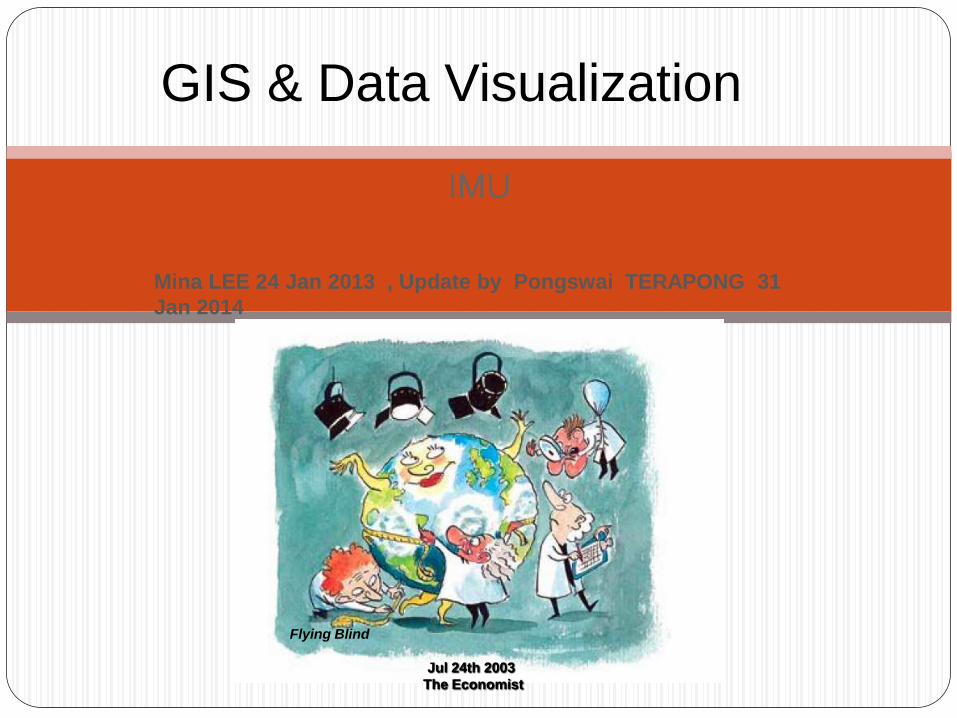
Flying Blind
Jul 24th 2003
The Economist

GIS
Geographic Information System
A geographic information system (GIS) integrates
hardware, software, and data for capturing, managing,
analyzing, and displaying all forms of geographically
referenced information
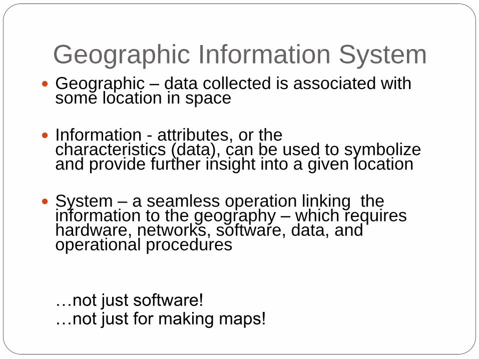
Geographic Information System Geographic – data collected is associated with
some location in space
Information - attributes, or thecharacteristics (data), can be used to symbolize and provide further insight into a given location
System – a seamless operation linking the information to the geography – which requires hardware, networks, software, data, and operational procedures
…not just software! …not just for making maps!

Geography and Databases
A GIS stores information about the world as a
collection of thematic layers that can be linked
together by geography
Polygon 3 Scrub 17 Very high Clay

GIS provides Data Integration
• Roads
• Land Parcels
• Population
• Utilities
• Land Mines
• Hospitals
• Refugee Camps
• Wells
• Sanitation
Vectors
Topology
Networks
Terrain
Surveys
Images
CADDrawings
Annotation
Addresses
27 Main St.
Attributes
ABC
107’
3D Objects
Dimensions
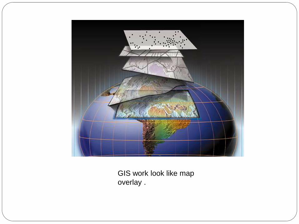
GIS work look like map
overlay .
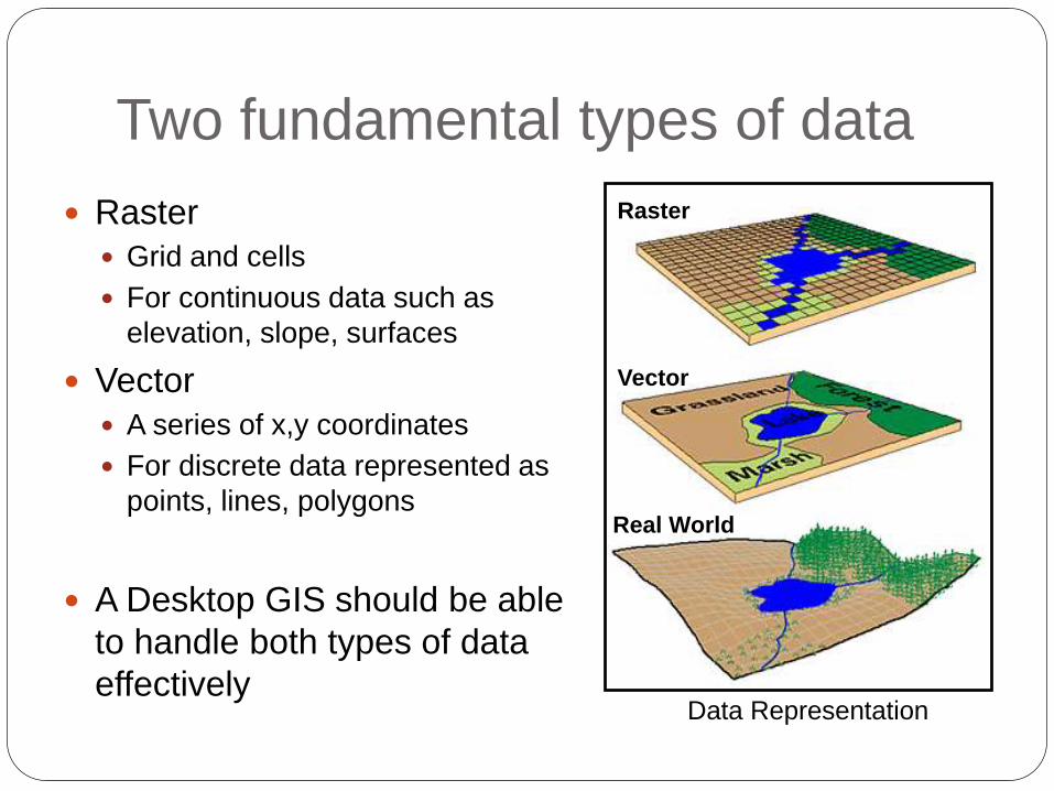
Two fundamental types of data
Raster
Grid and cells
For continuous data such as
elevation, slope, surfaces
Vector
A series of x,y coordinates
For discrete data represented as
points, lines, polygons
A Desktop GIS should be able
to handle both types of data
effectivelyData Representation
Raster
Vector
Real World
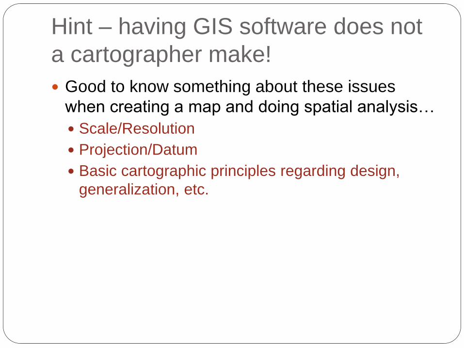
Hint – having GIS software does not
a cartographer make!
Good to know something about these issues
when creating a map and doing spatial analysis…
Scale/Resolution
Projection/Datum
Basic cartographic principles regarding design,
generalization, etc.
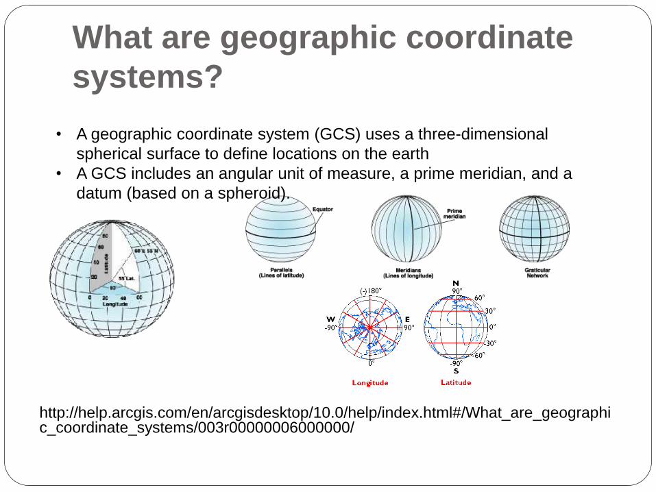
What are geographic coordinate
systems?
http://help.arcgis.com/en/arcgisdesktop/10.0/help/index.html#/What_are_geographic_coordinate_systems/003r00000006000000/
• A geographic coordinate system (GCS) uses a three-dimensional
spherical surface to define locations on the earth
• A GCS includes an angular unit of measure, a prime meridian, and a
datum (based on a spheroid).
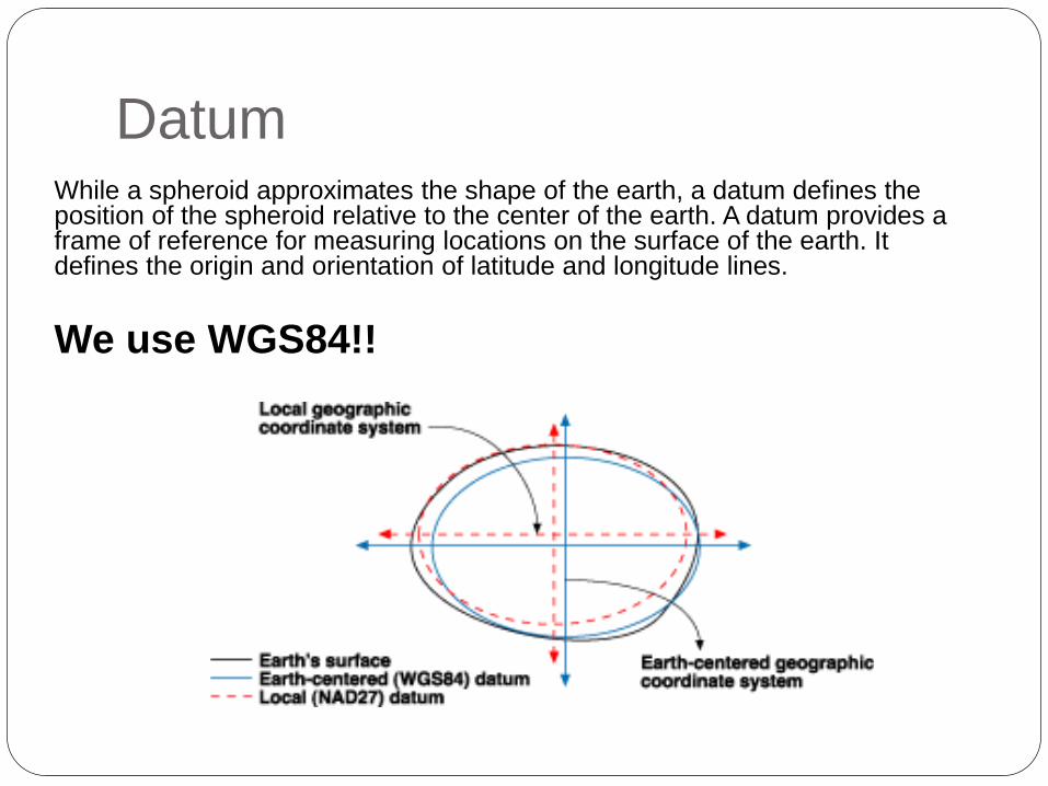
DatumWhile a spheroid approximates the shape of the earth, a datum defines the position of the spheroid relative to the center of the earth. A datum provides a frame of reference for measuring locations on the surface of the earth. It defines the origin and orientation of latitude and longitude lines.
We use WGS84!!
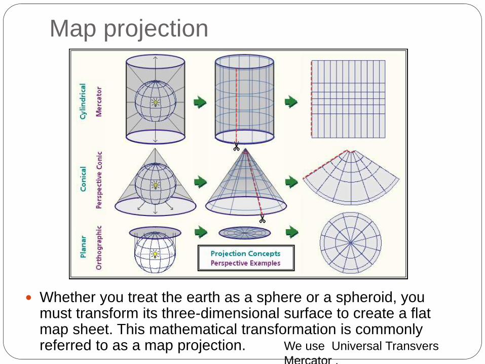
Map projection
We use Universal Transvers
Mercator .
Whether you treat the earth as a sphere or a spheroid, you must transform its three-dimensional surface to create a flat map sheet. This mathematical transformation is commonly referred to as a map projection.

Universal Transvers Mercator.
The following diagram shows how three-
dimensional features are compressed to
fit onto a flat surface.
The Universal Transverse Mercator coordinate system was developed by the United States
Army Corps of Engineers in the 1940s. The transverse Mercator map projection is an
adaptation of the standard Mercator projection. The transverse version is widely used in
national and international mapping systems around the world, including the UTM. When
paired with a suitable geodetic datum, the transverse Mercator delivers high accuracy in
zones less than a few Latitude degrees in east-west extent.
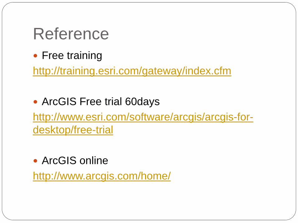
Reference
Free training
http://training.esri.com/gateway/index.cfm
ArcGIS Free trial 60days
http://www.esri.com/software/arcgis/arcgis-for-
desktop/free-trial
ArcGIS online
http://www.arcgis.com/home/

ArcGIS
ArcGIS is a comprehensive system that allows
people to collect, organize, manage, analyze,
communicate, and distribute geographic information.

ArcGIS – ArcMap

ArcGIS - ArcCatalog
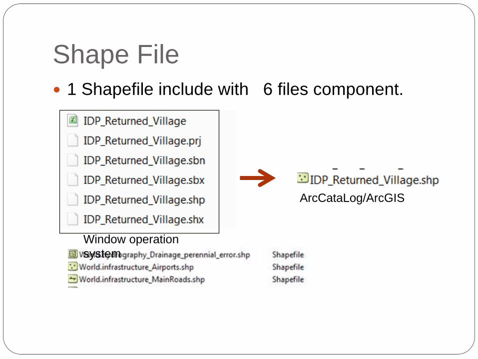
Shape File
1 Shapefile include with 6 files component.
Window operation
system
ArcCataLog/ArcGIS
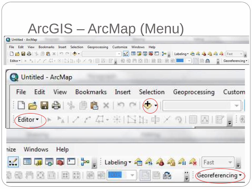
ArcGIS – ArcMap (Menu)

Use of IMU shared drive (M)
Maplibrary(?) to under products
All document products under completed?

Use of IMU shared drive (M)
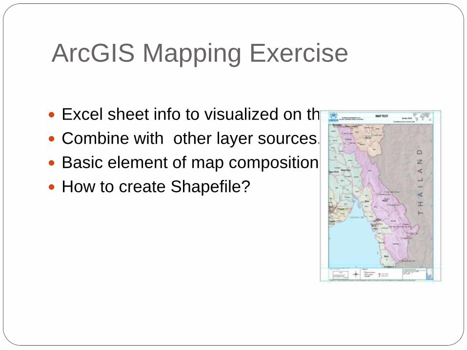
ArcGIS Mapping Exercise
Excel sheet info to visualized on the map.
Combine with other layer sources.
Basic element of map composition.
How to create Shapefile?
What are an important things to put
on the Map?
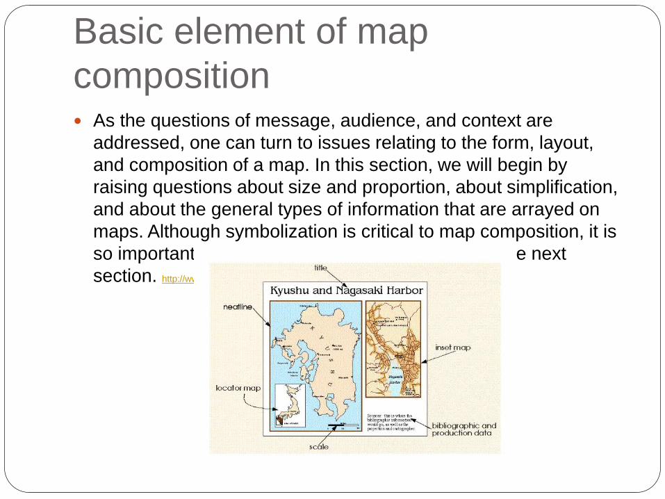
Basic element of map
composition As the questions of message, audience, and context are
addressed, one can turn to issues relating to the form, layout,
and composition of a map. In this section, we will begin by
raising questions about size and proportion, about simplification,
and about the general types of information that are arrayed on
maps. Although symbolization is critical to map composition, it is
so important a subject that it will be considered in the next
section. http://www.colorado.edu/geography

The format of the final
production?
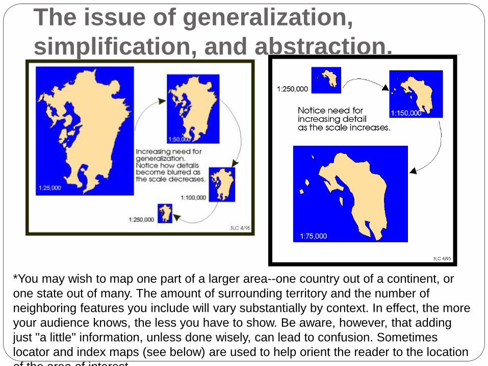
The issue of generalization,
simplification, and abstraction.
*You may wish to map one part of a larger area--one country out of a continent, or
one state out of many. The amount of surrounding territory and the number of
neighboring features you include will vary substantially by context. In effect, the more
your audience knows, the less you have to show. Be aware, however, that adding
just "a little" information, unless done wisely, can lead to confusion. Sometimes
locator and index maps (see below) are used to help orient the reader to the location
of the area of interest.

Basic map elements: Information
commonly needed by the map
reader
Map Scale
Direction
Legend
Basic map elements: Information
commonly needed by the map
reader
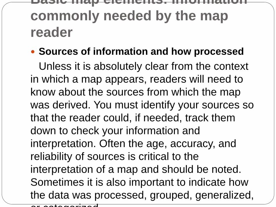
Sources of information and how processed
Unless it is absolutely clear from the context
in which a map appears, readers will need to
know about the sources from which the map
was derived. You must identify your sources so
that the reader could, if needed, track them
down to check your information and
interpretation. Often the age, accuracy, and
reliability of sources is critical to the
interpretation of a map and should be noted.
Sometimes it is also important to indicate how
the data was processed, grouped, generalized,
or categorized.

ESSENTIAL ELEMENTS THAT ARE
SENSITIVE TO CONTEXT: Title
The title of a map is usually one of it's most essential features. As such, it should receive very careful attention so as to match the needs of the theme and audience. A short title might suffice if readers can be assumed to be familiar with the theme being presented, more information is needed for less experienced readers. The content of the title should also be measured against other lettering applied to the map, for example in the legend or annotations. Sometimes, legends and annotations supplant much of the content of a title. Also, be aware that captions usually take the place of titles for maps appearing in publications such as books and journals.
Projection
The projection used to create a map influences the representation of area, distance, direction, and shape. It should be noted when these characteristics are of prime importance to the interpretation of the map. Some widely used locational reference systems such as the U.S. State Plane Coordinate system and Universal Transverse Mercator system are based on predefined projective geometries that are implicit in the use of the coordinate systems themselves.
Cartographer
The authority lying behind the composition of a map can be of prime importance in some situations. Most maps note the name, initials, or corporate identity of the cartographer(s).
Date of production
The meaning and value of some maps--such as those relating to current affairs or weather--are time sensitive. The reader must know when they were produced to gauge whether to trust them. An out-of- date road atlas or city map can cause tremendous frustration. Other maps are less sensitive to the passage of time, but the date of production can still be important if, for example, better information becomes available in the period after publication. Be sure to indicate the date of production for your map, or make sure that it can be inferred from the context in which it is to appear (maps that appear in newspapers, magazines, and journals can be dated in this way). The detail with which you specify the date of production will depend again on the nature of your theme and audience.

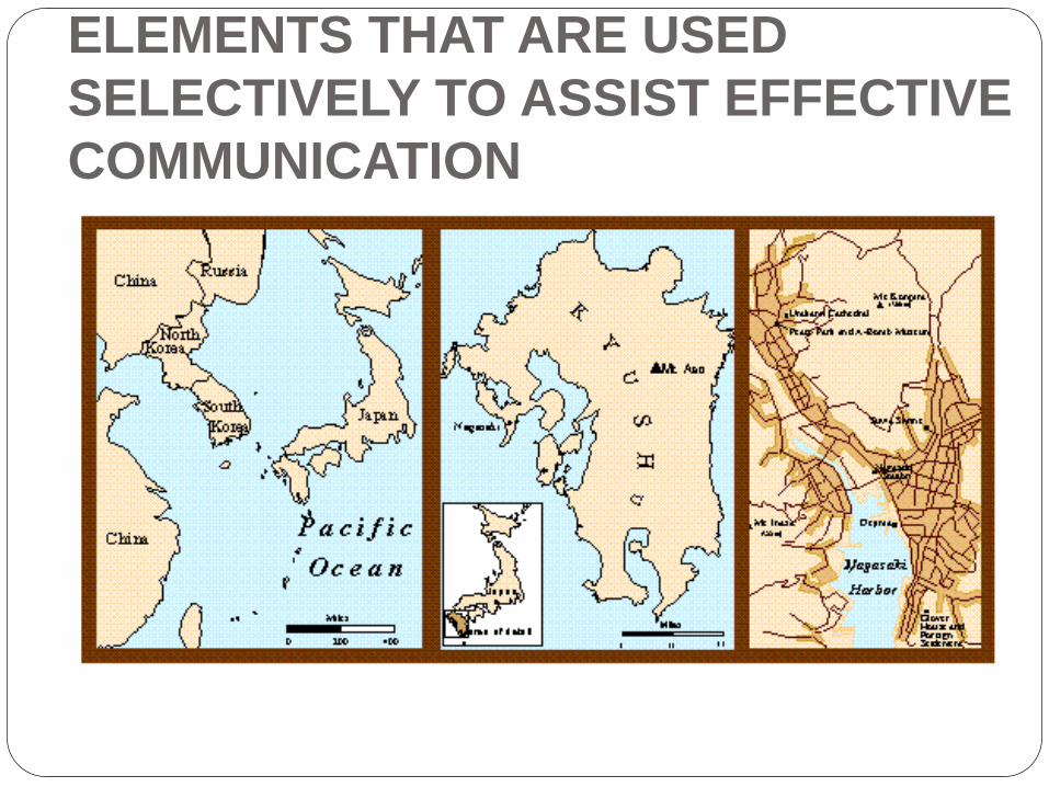
ELEMENTS THAT ARE USED
SELECTIVELY TO ASSIST
EFFECTIVE COMMUNICATION Neatlines
Neatlines or clipping lines are used to frame a map and to indicate exactly where the area of a map begins and ends. The outer neatline of a map--its border--helps to frame the entire map composition to draw the reader's attention to the various elements of information. Neatlines are also used to "clip" the area of the body of the map and of locator, inset, and index maps. Neatlines are not always needed to trim the body of the map. Examples. Some geographic areas can, so to speak, be suspended in space without a neatline. In other cases, the areal extent of a map can be made apparent in other ways.
Locator maps
Some maps portray areas whose locations may be unfamiliar to readers. In such cases, the cartographer adds a "helper" or locator map that places the body of the map within a larger geographical context with which the reader can be expected to be familiar. A detailed map of troop movements on the first day of the Battle of Gettysburg may require, for example, a locator map indicating Gettysburg's position within the road network of south central Pennsylvania and northern Maryland in 1863.
Inset maps
Sometimes observations and data are so densely clustered in small sections of a larger map that the cartographer must provide the reader with additional close-up, "zoomed-in" maps of these smaller areas. Otherwise the data will obscure itself. These close-up detailed maps are called insets.
Index maps
There are limits to the amount of information that can be placed effectively in the body of a map, even though this information is useful to readers. Sometimes labels and other information have to be moved to an index map.

ELEMENTS THAT ARE USED
SELECTIVELY TO ASSIST EFFECTIVE
COMMUNICATION
ELEMENTS THAT ARE USED
SELECTIVELY TO ASSIST EFFECTIVE
COMMUNICATION