ghana national drought plan - knowledge hub final... · 5 background 1.1 country profile ghana...
TRANSCRIPT

1
GHANA NATIONAL DROUGHT PLAN

2
Table of Contents Background ................................................................................................................................................... 5
1.1 Country Profile .................................................................................................................................... 5
1.1.1 Size and Location ............................................................................................................................. 5
1.1.2 Climate ............................................................................................................................................. 6
1.1.3 Agro-ecological Zones ...................................................................................................................... 6
1.1.4 Soils .................................................................................................................................................. 7
1.1.4 Relief, Topography and Drainage ..................................................................................................... 8
1.1.5 Socio-Economic Situation ................................................................................................................ 9
1.1.6 Land Use ......................................................................................................................................... 11
1.1.7 Irrigation......................................................................................................................................... 16
1.1.8 Water Resources ............................................................................................................................ 17
1.1.9 Energy ............................................................................................................................................ 20
1.1.10 Biodiversity .................................................................................................................................. 21
1.1.11 Tourism ........................................................................................................................................ 21
1.2 Purpose, Scope, Goals and Objectives .............................................................................................. 22
1.3 Plan Development: Introduction to the Ten Step Process ................................................................ 22
Relationship to other Plans and Policies ..................................................................................................... 23
2.1 International Drought Related Initiatives ......................................................................................... 23
2.1.1 Sustainable Development Goals .................................................................................................... 23
2.1.2 Land Degradation Neutrality Initiative (LDN) ................................................................................ 24
2.1.3 Agenda 2063 .................................................................................................................................. 25
2.1.4 Great Green Wall for the Sahara and Sahel Initiative (GGWSSI) ................................................... 26
2.1.5 Africa Forest Landscape Restoration Initiative (AFR100) .............................................................. 26
2.1.5 Climate Change Related Initiatives ................................................................................................ 27
2.1.5.1 Paris Agreement on Climate Change 2015 ................................................................................. 27
2.1.5.2 National Determined Contributions ........................................................................................... 27
2.1.5.3 Bonn Challenge ........................................................................................................................... 28
2.2 National Drought Related Policies .................................................................................................... 28

3
2.2.1 National Water laws existing Drought Mitigation Strategies and Planning Issues ........................ 28
2.2.1.10 Draft Medium-Long term Development plan (twenty-year development Plan 2010 – 2030 -
Volume 1. ................................................................................................................................................ 34
2.2.1.13 Savannah Accelerated Development Authority........................................................................ 34
2.3 Importance of National Drought Plan ............................................................................................... 44
Overview of Drought in Ghana ................................................................................................................... 45
3.1 Historical Occurrences ...................................................................................................................... 45
3.2 Understanding Drought: Meteorological, Agricultural, Hydrological and Socioeconomic Drought 47
3.2.1 Definition of Drought ..................................................................................................................... 47
3.2.2 Types of Drought ..................................................................................................................... 48
3.3 Drought Impacts ............................................................................................................................... 51
Organization and Assignment of Responsibilities ....................................................................................... 56
4.1 Organizational Overview ................................................................................................................... 56
Stakeholder Involvement ........................................................................................................................ 60
4.2 Assignment of Responsibilities ......................................................................................................... 61
Drought Monitoring, Forecasting and Impact Assessment ........................................................................ 63
5.1 Drought Indices ................................................................................................................................. 63
5.2 Current Monitoring, Forecasting and Data Collection ...................................................................... 64
5.3 Drought Severity in all Relevant Sectors ........................................................................................... 65
5.4 A Drought Impact Assessment Methodology ................................................................................... 66
Drought Risk and Vulnerability ................................................................................................................... 66
6.1 The Drought Risk and Vulnerability Assessment and GIS Mapping .................................................. 66
Drought Communication and Response Actions ........................................................................................ 70
7.1 Drought Communication Protocol .................................................................................................... 70
7.1.1 Communication Objectives ............................................................................................................ 71
7.1.2 Target Audiences ........................................................................................................................... 71
Change Required ......................................................................................................................................... 72
7.1.3 Key Concepts and Messages .......................................................................................................... 72
Communication Programme ....................................................................................................................... 74
TV broadcasts .......................................................................................................................................... 75
Drought News (Radio, Print) ................................................................................................................... 75
Journalist Training ................................................................................................................................... 76

4
Regular Program Updates to Partners (E-newsletter) ............................................................................ 76
Standard Drought Collateral ................................................................................................................... 77
The Drought website ............................................................................................................................... 77
Joint Publications with MDAs and CSOs ................................................................................................. 78
Dialogues and Round-tables ................................................................................................................... 78
Event Planning ............................................................................................................................................ 79
Human resources ........................................................................................................................................ 80
Delivery Mechanisms .................................................................................................................................. 80
7.2 Declaration of Drought Conditions ................................................................................................... 80
7.4 Drought Response Actions ................................................................................................................ 80
Drought Mitigation and Preparedness ....................................................................................................... 81
8.1 National Water Resource Monitoring and Impact Assessment........................................................ 82
8.2 Development of Alternative Water Sources ..................................................................................... 82
8.4 Legislation and Land Use Policy ........................................................................................................ 82
Recommendations and Implementation Actions ....................................................................................... 85
9.1 Priority Implementation Actions Recommendations ....................................................................... 85

5
Background
1.1 Country Profile
Ghana initiated steps in combating the effects of drought and desertification since
1985 after suffering the devastating effects of a national drought in 1982/1983.
For a good appreciation of the impact of drought a country profile provides the
context in which drought occurs in Ghana is presented.
1.1.1 Size and Location
The Republic of Ghana lies along the Gulf of Guinea in West Africa and covers a
land area of 238,539 km2 and a 550km long coastline. It lies between latitudes 4º
44' and 11º 15' N and longitude 3º 15' W and 1º 12' E. The Exclusive Economic Zone
Figure 1: Location Map of Ghana
(EEZ) adds an extra 110,000km2 of the sea to the territorial area of Ghana. The
country is bordered on the east by Togo, on the west by Cote d’Ivoire and on the
north by Burkina Faso. The country is divided into ten administrative regions and
two hundred and sixteen (216) districts.
Of the total geographical area of 238,539 km2 in Ghana, about 82,258 km2 is
covered as forest, and 155, 614 km2 as savanna land. The total inland water area,
which includes the Volta Lake, Lake Bosomtwi, etc., is about 11,800km2. It is
estimated that in 2013 (MOFA) approximately 7,834 km2 of land was utilised for
cultivation. This figure does not include areas planted with cocoa. It is estimated
that arable land takes 56% of this total land area. About 44% of the arable land is
under cultivation. Compared to 1994, this represents an increase of 700,000 ha

6
or 5%. Agricultural land availability per capita has varied from 1.56 ha in 1970 to
1.11 in 1984 and 0.74ha in 2000. The implication of these figures is that pressure
on the natural resources base, particularly the soil, will increase with increasing
population. The area under cultivation has decreased to 73115 km2 (30.7%) in
2009 (MOFA, 2010).
1.1.2 Climate
The country has a warm equatorial climate. Mean annual temperatures range
between 24C and 36C, with a mean relative humidity of 81%. Relative humidity
is high at the coastal areas decreasing inland. The dry harmattan conditions occur
from November to January throughout the country, but severer in the north.
Rainfall decreases from south to north and eastwards, reaching an average 800
mm in the extreme northeast and in the southeastern coastal areas. Rainfall in
the wettest areas of the forest zone reaches an average of 2,000 mm. The rainfall
pattern in the northern savanna area is uni-modal whilst in the forest and forest-
savanna transitional zones have a bi-modal pattern.
Climate variability and change is evident in Ghana and pose a major threat to
national development which manifests itself in increasing levels of desertification
in the northern savannah, undermines agricultural potential and economic
viability of the northern ecological zone.
1.1.3 Agro-ecological Zones
The country is divided into six agro-ecological zones (AEZs) defined on the basis of climate, reflected by the natural vegetation and influenced by the soils. These zones are namely, Sudan, Guinea and Coastal Savannas, the Forest-Savanna Transitional, the Semi-deciduous Forest and the High Forest zones. The Ecological Zones Map of Ghana (figures 1 below) shows the distribution of the AEZs across the country. In all these zones the natural vegetation has undergone a considerable change through human activities.

7
Figure 2: Ecological Zones Map of Ghana
1.1.4 Soils
The characteristics of the soils of Ghana are influenced by local climate and vegetation, including other organisms, which act on the various geological materials as modified by local relief or topography over periods of time. According to FAO/UNESCO classification (1990), the major soil groups occurring in

8
the various agro-ecological zones are: a. High Rainforest – Acrisols, Nitisols, Gleysols b. Semi-deciduous Forest – Acrisols, Nitisols and Gleysols c. Forest Savanna Transition – Lixisols, Nitisols, Plinthosols and Cambisols d. Guinea Savanna – Lixisols, Acrisols, Luvisols and Gleysols e. Sudan Savanna – Lixisols, Acrisols, Luvisols and Lithosols f. Coastal Savanna – Acrisols, Luvisols, Cambisols, Gleysols, Solonetz and
integrades g. Alluvial soils (Fluvisols) and eroded and shallow soils (Leptosols) are found
in all the agro-ecological zones.
1.1.4 Relief, Topography and Drainage
Ghana is characterised generally by low relief, with very few places attaining elevations of 1,000 metres. Flanked on the north, west and south by a series of highly eroded plateau formed mostly from crystalline intrusive rocks of volcanic origin. The elevation of the plateau generally ranges from 100 – 300 metres but are surmounted in many parts by residual highlands of higher elevation and often capped with bauxite. Along the southern and northern margins of the Voltaian Basin are two prominent areas of highland, the Kwahu Plateau and the Gambaga, both of which are bordered by steep, picturesque scarps. The topography is predominantly undulating with slopes less than 5% and many less than 1%. More steeply sloping and rolling terrain occurs in parts of the south-west of the country along the Voltaian escarpment. The Kwahu plateau extends for 260 km northwest-southeast from Wenchi to Koforidua with an average elevation of 1500 feet whilst the Gambaga scarp has an elevation of 300-450 metres (Gambaga Scarp, 2011; Kwahu Plateau, 2011). About 67 percent of Ghana, comprising the Northern, Upper and Volta Regions, is drained by the Volta River and its tributaries which flow directly into the sea. The area outside the Volta drainage basin in the southwestern and southern third of the country drains into the sea through such rivers as Tano, Ankobra, Ofin, Birim, Ayensu and Bia. In the Volta basin only the main stream, the Black and White Volta, the Oti and major tributaries in the south are perennial. The others dry out completely or break into disconnected pools in the dry season.

9
1.1.5 Socio-Economic Situation
The population of Ghana according to the 2010 census is 24, 233,431 a 28.1% increase from 2000. The population has grown at an annual rate of 2.4% since 2000 (Ghana Statistical Service, 2011). The population of Ghana as at March 2000 was 18.4 million which is about triple the 1960 population of 6.7 million (Ghana Statistical Service, 2000). Based on the growth rate of 2.7 per cent, the World Bank estimated a population of 20.3 million in 2003 and 25.8 million in 2015 (World Bank, 2006). About 63 per cent of the total population lives in rural areas. The population distribution varies across the ecological zones of the country with the Savanna zones (Guinea, Sudan and Coastal Savanna), which are the most vulnerable to land degradation, carrying 51.4 per cent of the total population compared with 50 per cent in 1984 (EPA, 2002). Population density of Ghana was 36 persons/km2 in 1970 and increased to 77 persons/km2 in 2000 and 102 persons/km2 in 2010 (Ghana Statistical Service, 2011). When physiographic and agricultural land availability is taken into consideration the density is higher as shown in the table below. In the Upper East, Upper West and Northern Regions, the regions more vulnerable to degradation, population density has increased between 1984 and 2000 from 87, 24 and 17 to 104, 31 and 21 persons/km2, respectively, representing a corresponding increase of 20, 29 and 24 percent (Ghana Statistical Service, 2000) and has again increased to 116, 36 and 35 persons/km2 in 2010 (Ghana Statistical Service, 2011). The urban settlement hierarchy developed under the National Spatial Development Framework (NSDF) has 70 urban settlements in four grades (Figure 9), whose combined area-of-influence account for 90% of the national population, 95% of the urban population and 80% of the rural population (Government of Ghana, 2015a). Indeed, the satellite towns of the major cities are growing very fast as there has been progressive dispersion of economic activities from the metropolitan core to the peri-urban fringe (Government of Ghana, 2015a). The peri-urban zones/areas constitute integral elements of the cities and their functioning, operation and development present a host of socio-economic and environmental challenges. Ghana’s economic growth record has been one of unevenness, particularly in the

10
1970s. With a reasonably high GDP growth in the 1950s and early 1960s, the Ghanaian economy began to experience a slowdown in GDP growth in the 1964. In the 1980s, the liberal reform programme or Economic Recovery Programme (ERP), with major support from the International Monetary Fund (IMF) and the World Bank, was introduced to halt the downward economic spiral. The economy responded positively to ERP/SAP soon after its inception. It recovered from its negative growth rate from about -5% in 1983 to a significant rate of 8% in 1984. The positive growth rate has continued since that time, picking up considerable steam after 2001. Real Gross Domestic Product (GDP) growth was 4.5 percent in 2002, 5.2 percent in 2003 and 5.8 percent (est.) in 2004, which was higher than the Ghana Poverty Reduction Strategy (GPRS) targets. Moreover, since the dominant economic activity in Ghana is agriculture, sustaining the positive growth rate, a programme of accelerated development must also transform agriculture through greater investment in land resource management. From 2005-2009, the GDP growth has been 5.8, 6.2, 7.2 and 4.1 respectively (ISSER, 2010). There is a significantly positive correlation between poverty and environmental degradation. Many poor people in an attempt to improve their economic position degrade the environment either knowingly or unknowingly. It is common to find people practicing shifting cultivation, unsustainable hunting practices and bush burning as well as cutting down tree species for fuelwood which results in continuous depletion of natural resources and pollution of the natural environment. One of the multiple objectives in the prioritization of investments under GSIF is the reduction of poverty and societal vulnerability to land degradation. Knowledge about the magnitude and the geographic distribution of poverty in the country is therefore relevant to investment targeting. Data from the Ghana Living Standard Surveys indicate that about 36.9% of the country’s population was poor in 1987-1988. This level, however, dropped to 31.5% between1991-1992. In 1992, over 30% of Ghanaians were classified as poor and out of which, almost 75% lived in rural areas where agricultural production is the major economic activity. In 1998/99, 42.2% of all households in Ghana in the lowest income quintile were located in the rural savanna zone.

11
In terms of economic activity, poverty is by far highest among food crop subsistence farmers. The poverty-land degradation nexus is well evidenced in Ghana where communities worst affected by land degradation are among the poorest. The consequences of land degradation in rural communities are poor growth, reduced crop yields and very low rural incomes. This situation imposes further pressure on land and this increases the poverty level in the rural areas. Poverty is a constraint that limits the ability of most rural population to adopt sustainable measures although they may be aware of the need to do so. Ghana has, however, made considerable progress in terms of poverty reduction. This occurred largely through economic growth. Data from GLSS show a reduction in Poverty Headcount from 39.5 in 1998/1999 to 28.6 percent in 2005/2006. At the same period, extreme poverty fell from 27 percent to about 18 percent. Although the benefits are not equally spread geographically, Ghana was able to achieve the Millennium development goals (MDG) objective of halving poverty before 2015. In 2014 the Ghana Living Standard Survey indicated that a quarter of Ghanaians are poor while under a tenth of the population is extremely poor. Extreme poverty is concentrated mainly in rural savannah with more than a quarter in this category. Poverty is mainly a rural phenomenon and five out of the ten regions had poverty incidence ratios lower than the national average of 24.2% while the remaining half had rates higher than the national average. Greater Accra Region is the least poor and Upper West Region the poorest overall. In 2012/2013 6.4 million (24.2%) were poor. Poverty incidence during period for Ghana as a whole was 8.4%, rural Ghana15.0% and rural savannah was 27.3%. However the incidence in the three northern regions: Upper East Region, Upper West Region and Northern Region were 44.4%, 70.7% and 50.4% respectively. The total contribution of the three savannah regions to national poverty was 61.0%. The Northern Region’s contribution was 30.6%, Upper East Region- 11.9% and Upper West Region 18.5%.
1.1.6 Land Use
Available land use/land cover information of the country has been obtained using LANDSAT Thematic Mapper ™ satellite data covering the period January 2000 and January 2008.

12
Table 1: Land Cover Categories 2000
LAND COVER CLASS (2000) AREA (km2))
Closed Forest 12,607
Open Forest / Secondary Regrowth 47,695 Mixture of Closed Forest/Woodland Patches with Grass Cover
20,684 Mixture of Widely Open Forest/Woodland with Grass Cover
33,080
Grassland with Scattered Trees 69,964 Grassland / Bare Surface / Settlement
53,718
Table 2: Land Cover Categories 2008
LAND COVER CLASS (2008) AREA (km2))
Closed Forest 11,748 Open Forest / Secondary Regrowth 37,624
Mixture of Closed Forest/Woodland Patches with Grass Cover
35,183 Mixture of Widely Open Forest/Woodland with Grass Cover
22,145
Grassland with Scattered Trees 51,164 Grassland / Bare Surface / Settlement
79,884

13
Figure 3a: Land Cover Map 2000

14
Figure 3b: Land Cover Map 2008
Agricultural lands are probably the most important natural asset in Ghana since majority of the population depend on agriculture for their livelihood. This sector is the largest in the economy in terms of its contribution to Gross Domestic Product

15
(GDP) and employment, among others. Agriculture accounted for 34.5% of GDP in 2009 (ISSER, 2010) but fell to 20.2% in 2015 (MOF/GSS 2015). The agricultural sector is made up of five sub-sectors namely; crops other than cocoa (64% of agricultural GDP) cocoa (13%), forestry (11%), livestock (including poultry) (7%) and fisheries (5%). It contributes to insuring food security, provides raw materials for local industries, generates foreign exchange, and provides employment and incomes for most of the population (especially those living in the rural areas), thereby contributing to poverty reduction. It is also an important source of raw materials for the manufacturing industry. The agriculture sector is the main backbone of the Ghanaian economy. It contributes about 21% of the country’s gross domestic product (GDP) and employs more than half of the labour force 41.3% of the active population which is dominated by women (MOF/GSS 2015) as well as providing raw materials for industrial growth and development (GOG, 2010, IFPRI/MOFA, 2015). The agricultural sector in Ghana is probably the most reliant on soil conditions in respect to crop production. Soil is the main medium on which crops thrive, which means the condition of the soil is an important determinant for crops growth and productivity. Healthy soils are important for Ghana has a total arable land of about 13,628,179 ha. However, most of the soils of these arable lands are less fertile and coarse textured. The coarse nature of these soils results in poor soil structure, reducing their ability to hold water for a long period. As a result, dry conditions easily occur within the growing season. Ghana’s agriculture is predominantly rain-fed, and therefore the fortunes of the agriculture sector have generally followed the rainfall patterns from year to year. Irrigation agriculture is at best rudimentary in Ghana. In 2002, the total area under irrigation was about 11,000 hectares and increased to 30,269 hectares in 2010. Fertilizer usage in Ghana averaged about 34,000mt per annum for the last ten years, and this is one of the lowest in Africa. Ghana therefore ranks amongst countries where fertilizers usage is lowest. In 2009, out of a total 12, 038 Mt of agrochemical imports, insecticides accounted for 42.1%, fungicides 10.4%, herbicides 37.6% and rodenticides 9.9%. Fertilizer imports also increased from 43,498 Mt in 2000 to 335,186Mt in 2009 (MOFA, 2010). The use of fertilizer in crop production in Ghana remains at about 8 Kg /ha

16
(Fuentes et al., 2012), despite the fact that nutrient depletion is among the highest in Africa (Henao & Baanante, 2006). Although considerable research and policy analysis on fertilizer use in Ghana has been done, there are still knowledge gaps, on the state of condition of Ghanaian soils. The types of technologies applied in all sub-sectors of agricultural production in the country are basically traditional and rudimentary, except in the case of commercial farms (including non-traditional export crops). The adoption of improved technologies among farmers is still low in Ghana and at different levels across the different sub-sectors. Ghana’s agriculture is largely based on smallholder farms characterized by low input and output technologies. About 90% of farm holdings are less than 2 hectares in size.
1.1.7 Irrigation
An irrigation potential of over one million hectares has been identified in the country. The potential is mainly in the desertification-prone zones, namely, Coastal, Sudan and Guinea savanna ecological zones. Water for irrigated agriculture is supplied mostly from small and medium scale reservoirs. There is also the potential for using groundwater for irrigation. Groundwater used in farming and particularly for irrigation depends on its quality and quantity, soil type, proposed crops and irrigation methods envisaged. The natural quality of water in the ecological zones seems to be quite suitable for irrigation. A survey revealed that there are 755 dams and 2,633 dugouts in the informal irrigation sub-sector. Volta Region recorded the highest number of dams (164), while Ashanti region recorded the least (19). In the case of dugouts, the highest number of 838 was recorded by Western Region with the Upper West Region recording the least (54). Out of a total area under irrigation covering 10,262.34 ha for all ten regions, Brong Ahafo had the largest area with 2,816.60 ha (IDA, 2008). This was a little over a quarter of the total area under informal irrigation representing 27.45%. Central Region with 324.60 ha, recorded the least area under irrigation representing 3.16% of the total area under informal irrigation. In all, there are 22 formal irrigation schemes in Ghana covering a total of 8,778 ha. The formal irrigation schemes are managed by the Ghana Irrigation Development Authority.

17
1.1.8 Water Resources
Ghana has significant stock of water resources which serve a variety of important national needs. Water is a basic necessity for various forms of human activities including provision for human consumption, agriculture (crop production, livestock, fisheries), industrial applications (power generation, processing) and transportation. Generally, water supply development in Ghana is influenced by an abundance of surface water while the potential of groundwater resources remain relatively underdeveloped. Surface water is used to supply potable water to population centres, provide hydropower and for irrigation among others. Ghana is drained by the Volta, South-Western and Coastal Rivers Systems covering 70%, 22% and 8% respectively of the total area of the country. The Volta River system has a catchment area within Ghana of 165,700km2 and is the largest of all the river basins. The entire Volta River Basin occupies nearly two-thirds of Ghana’s land area, stretching from the south-east to the northern and eastern boundaries of the country.
There are two major lakes in the country, the Volta and Bosomtwi. The Volta Lake covers about 8,482.3 km2 surface area. It was created during the construction of Akosombo Dam to generate hydro-electricity in 1964. It is fed by a number of important tributaries, which include mainly the Oti, White Volta, and the Black Volta rivers. The mean annual flow rate downstream of the dam is of the order 34,200 million cubic metres per annum.
Bosomtwi is the only largest natural lake in Ghana located about 32 km south-east of Kumasi in the Ashanti region. It has an approximate area of 48km2 and is 78 meters deep at the deepest section and it is about 19km in diameter. Only small streams discharge into the lake with a direct annual mean rainfall input of about 1520mm. The level of the lake fluctuates in recent times and the villages around it like Obonu has been re-sited at least three times due to rise in level of the lake. The Volta River and the Volta Lake provide water for industrial and domestic use and also for irrigation. They provide the livelihoods for a number of people who are engaged in fishing along its banks, as well as remain an important transportation link between the south and the north for the country. The country is underlain by sedimentary and non-sedimentary formation. Groundwater therefore, occurs in both the sedimentary and non-sedimentary formations which are usually overlain by a weathered layer (or regolith) that varies in thickness and lithology. The resource is particularly of profound

18
importance in many rural and some urban communities in Ghana although the real potential of groundwater resources is yet to be harnessed. This is made up of wells and boreholes and in some communities serve as the only source of water supply for domestic consumption. Groundwater occurrence is usually controlled by secondary porosity developed mainly as result of chemical weathering, faulting and fracturing. Aquifer characteristics are therefore highly variable notably because of the anisotropic nature of fracture networks and the complexity and variable intensity of weathering processes involved in the regolith development. The most productive groundwater zones are therefore, the lower part of the regolith and the upper part of the fractured bedrock although groundwater also occurs in fault zones and along lithologic contacts. Depths of aquifers are usually between 10m and 60m with yields rarely exceeding 6m3/h. It is estimated that the changing rain patterns will lead to a general reduction in annual river flow in Ghana by 15-20% for the year 2020 and 30-40% for the year 2050 CSIR-WRI 2000). The impacts of the rising temperature and intensive rainfall cause floods that result in water pollution which invariably affect freshwater quality, increase cost of water production, decreases accessibility and availability (Asumadu-Sarkodie, Owusu and Rufangura, 2015). Ghana is predicted to become a water stress country by 2025 (CSIR-WRI 2000) and water scarcity will be experienced in many places in the country (Kankam Yeboah et al., 2011; Asumadu-Sarkodie, Owusu and Rufangura, 2015). All of impact dilution of waste water discharges into surface waters and the self-purification capacity of rivers. The distribution of water within the country is not uniform, the south-western part (rain forest ecological zone) are better watered than the coastal and northern regions (savannah ecological zones). Seasonal variability is also observed for raw water availability. Surface water coverage is 5% of total land area of the country Fresh water from both surface and ground is used mainly for irrigation, industrial and domestic purposes. About 37,843 km³ is used for hydroelectricity generation at the Akosombo Dam each year (MOF, 2015)

19
Figure 4

20
1.1.9 Energy
Ghana has diverse renewable energy resources. Ghana’s known renewable energy resources are solar, biomass, wind and hydro. The bulk of Ghana’s energy consumption is from biomass in the form of fuelwood and charcoal, which account for about 60% of total energy consumption. In 2008, Ghana’s biomass energy consumption was 11.7 million tonnes and estimated that 14 million m3 of wood are consumed annually and was expected to rise to 20 million m3 in 2010. Projections by the Energy Commission suggest Ghana is likely to consume 25 million tonnes of fuelwood by 2020. Most of the supply will come from standing stock; that is, 15 million tonnes and 10 million tonnes from regeneration or yield. This will increase the rate of deforestation especially in the northern part of the country which vulnerable to drought. Ghana rate of deforestation is one of the highest in Africa (1.37% based on recent value) (UNEP, 2015) due to increased use of wood fuel. Share of wood fuel in total energy consumption is 55% (2012 value). This presents a major threat to the country's environmental stability. The demand for wood for charcoal has increased at an average rate of 1.2% annually since 2008, whilst firewood demand has fallen at an average of 7% per annum since 2008 (Energy Commission 2014). Biomass resources cover about 20.8 million hectares of the 23.8 million ha land mass of Ghana, and is the source of supply of about 60% of the total energy used in the country (Ghana Energy Commission, 2004). Charcoal derived from wood carbonization is the most common cleaner cooking fuel in urban Ghana and produces less indoor pollution than fuelwood, however the current inefficient production method, where low yield kilns are used for charcoal production leading to significant transformation losses is one of the cause of forest destruction in the transition zone and mainly in the northern savanna regions of Ghana. In 2009 2.6 kilotonnes of charcoal was exported. Since 2003, exporters of charcoal are required to obtain a permit or license from the Energy Commission. 20 million tonnes of fuelwood is consumed annually in the form of fuelwood and charcoal. Fuelwood and charcoal meet approximately 75% of Ghana’s fuel requirements. Annual per capita consumption is approximately 180kg and total

21
consumption of about 700,000 tonnes. Information provided recently by the Energy Commission of Ghana indicates that the rate of wood fuel supply has exceeded the rate of replenishment by natural regeneration and unless steps are taken to cultivate biomass, continuous extraction would lead to massive deforestation and environmental damage.
1.1.10 Biodiversity
Land is the key environmental asset of the country and includes forests, soils, wildlife, wetlands, and water resources. In addition, land provides habitats for biodiverse species; supports nutrient cycling; contributes to the provision of food, fresh water, and wood; and helps regulate the climate and floods. For instance, the forest, savanna, wetland, and coastal ecosystems provide habitats for at least 2,975 plant species, 728 birds, 225 mammals, and 221 reptiles. Ghana’s biological resources are under severe threat from unsustainable land-use practices which has the potential to further limit livelihood options and economic opportunities especially for rural populations in the drought-prone northern part of Ghana, who rely heavily on these resources.
1.1.11 Tourism
Tourism, a growing sector currently generating ca. US1.6 billion and which is slated to become the number one future foreign exchange earner for Ghana (World Travel & Tourism Council, 2015) relies heavily on wildlife and other natural habitats, aside from cultural attractions. Bush meat contributes significantly to the national and local economies (Ntiamoa-Baidu, 1998; Kamins et al., 2011; McNamara et al., 2015), and together with other non-timber forest products such as charcoal, honey and medicinal plants, constitute a major source of livelihood, especially in the rural areas. It is estimated that services and products derived from biodiversity provide income sources for about a quarter of the Ghanaian population (GSS, 2014). Ecotourism, sustainable non-timber forest products (NTFP) utilization and management, ecosystem productivity maintenance should be given significant attention in any future efforts towards sustainable land management. Possibilities of domestication of high-value biological resources such as medicinal plants and wild food resources should be thoroughly explored, documented and shared with the relevant institutions and individuals. This will help reduce the impact of

22
drought in vulnerable parts of the country.
1.2 Purpose, Scope, Goals and Objectives
The National Drought Plan for Ghana is prepared in response to the decision
29/COP.13 of the Conference of Parties of the United Nations Convention to
Combat Desertification (UNCCD). The decision requested the institutions and
bodies of the Convention to implement a drought initiative in the biennium 2018-
2019. Ghana expressed interest to join the initiative and was accordingly selected
to participate. Ghana prepared a plan the National Plan of Action to Drought and
Desertification (NPACD) to deal with the effects of drought and desertification in
1987. Since then a number of other plans, strategies and frameworks have been
prepared to deal with the issue of drought. The plan has not been reviewed since
so this initiative affords the opportunity for an update and result in the
development of national drought plan which specifies the process and steps
needed to address drought and related activities, such as early warning and
forecasting, alert declaration levels and triggers, developing impact assessments,
response recommendations and mitigation actions.
The ultimate goal is prepare a comprehensive national drought plan for Ghana.
The objectives of the plan are to help Ghana build her capacity in drought
resilience through concrete actions for drought preparedness. It will help boost
the resilience of people, communities and ecosystems against drought.
1.3 Plan Development: Introduction to the Ten Step Process
The UNCCD Secretariat overseeing the drought plan initiative has developed a
model national drought plan outline for the guidance of countries. Each country is
expected to adapt the outline to the country’s institutional set up. In the case of
Ghana since 1985 a number of activities have been implemented to address
drought related problems, so there is a wealth information and knowledge
available for the preparation of the drought plan. In view of this and in
consultation with the UNCCD Ghana National Focal Point it was agreed that the
draft plan prepared will be submitted to the existing national body which hosted
by the Environmental Protection Agency with representatives of all the relevant

23
agencies for discussion and comments. The Ghana National Drought Plan
preparation did not strictly follow steps in the drought and preparedness process.
The current institutional framework will be reviewed and adjusted if need be.
Relationship to other Plans and Policies
2.1 International Drought Related Initiatives
2.1.1 Sustainable Development Goals
The Sustainable Development Goals (SDGs) are successors to the Millenium Development Goals (MDGs) and serving as reference goals for the international development community for the period 2015-2030. They are seen as more integrated than the MDGs and likely to facilitate policy integration across sectors (Le Blanc, 2015). The SDGs serve as guideposts for the difficult transition to sustainable development. The SDGs are an ambitious agenda with 17 goals and 169 targets which are seen as a network to spur action in areas of critical importance to humanity- people, planet, prosperity, peace and partnership. The core principle of the 2030 Agenda for Sustainable Development is ‘leave no one behind’. The SDGs reflects Africa’s context and priorities and have the potential to serve as a foundation for long term sustainable solutions of the continent, especially if coherence and alignment is maintained with the vision in Agenda 2063, the Africa Union’s 50 year vision and action plan. (Nicolai et al 2016). The SDGs stretch across the sustainable development spectrum- poverty, growth, biodiversity, health, education, peace, partnership, hunger, water and sanitation, energy, gender, industrialization, inequality, cities, waste, climate change and oceans. Majority of the goals are related to sustainable land management; 15 of the goals have targets related to sustainable management of land resources. To be able to implement the Agenda, countries need mechanisms to ensure effective management of natural capital and reverse environmental degradation to achieve economic growth, environmental sustainability and social inclusion. The SDGs build upon data gathering under the Millennium Development Goals, and require annual reporting of high quality data from all countries. The environment is central to each of the SDGs and need sound environmental management by individual countries if they are to be delivered by the 2030 target. Ghana has

24
rooted its economic policies and developmental agenda towards achieving the SDGs. The SDGs form an integral part of the Medium-Term National Development Policy Framework (2018-2021).
2.1.2 Land Degradation Neutrality Initiative (LDN)
The concept of land degradation neutrality is related to the SDG 15 but specifically target 15.3 which seek by 2020 to combat desertification and restore degraded land and soil, including land affected by desertification, drought and floods, and strive to achieve a land degradation neutral world. It is a state whereby the amount of healthy and productive land resources necessary to support ecosystem services, remains stable or increase within specific temporal and spatial scales. The Initiative is an attempt to halt land degradation. The goal will be achieved by:
a. Managing land more sustainably, to reduce the rate of degradation. b. Increasing the rate of restoration of degraded land
There four components of the LDN framework:
• Establishing a structured dialogue between government, science, business and civil society communities on land degradation challenges, priorities and opportunities for immediate action;
• Identifying the gaps and synergies with the National Action Programme while considering land degradation neutrality as a key strategic goal;
• Formulating special scale and set indicators that reflect each participating country’s circumstances and capacities, and setting targets, on a voluntary basis, for achieving land degradation neutrality;
• Implementing strategies at the community/landscape level on a pilot basis in order to evaluate policies and practices that are to be achieved land degradation neutrality by 2030.
The requirements for these are baseline information on land use and land use changes, reporting, monitoring and verification systems. Ghana has gone through all the LDN processes and integrated LDN into national policy processes. Under the LDN initiative Ghana intends to achieve the following targets by 2030:
• reforest 882.86 km²
• improve productivity and soil organic carbon stocks in18475.96km² of

25
cropland
• rehabilitate/restore 5107.70 km² of degraded forest
• rehabilitate/restore and sustainably manage 4593.39km² of degraded shrubs and sparsely vegetated areas for improved productivity and reduction in bush/wild fires
• reduce conversion of 4507.72 km² of remaining forest to other types of vegetation and halt all illegal mining activities, and
• increase the soil organic carbon of degraded croplands and rangelands by 66% (ie 1.20% to 2.0%)
There are a number of initiatives focused on Africa. These include the Africa
Union Agenda 2013-2063, the Great Green Wall for the Sahara and Sahel Initiative (GGWSSI), Africa Landscape Action Plan (ALAP), Africa Forest Landscape Restoration Initiative (AFR100) and Africa Resilient Landscape Initiative (ARLI). Details are given on a few of these initiatives below:
2.1.3 Agenda 2063
The Agenda 2063 is a 50 year agenda launched in anticipation of the Africa Union reaching its golden jubilee. It has the motto “the African We Want Agenda 2063 Framework” with the Pan-African Vision of an integrated prosperous and peaceful Africa, driven by its own citizens representing a dynamic force in the international arena. The Agenda covers eight areas of focus- social and economic development, integration, democratic governance and security.
It is phased in 10 year periods. The first 10 year covers 2013-2023. Aspiration 1 is a prosperous Africa based on inclusive growth and sustainable development. Priority areas cover sustainable and inclusive economic growth; agricultural value addition and agro-business development; biodiversity, conservation and sustainable natural resource and management; water security; climate resilience and natural disasters preparedness and prevention. Under Aspiration 1, Goal 5 is modern agriculture for increased productivity and production and Goal 7 is about environmentally sustainable climate resilient economies and communities. Some targets include a national target of at least 30% of agricultural land placed under sustainable land management practice; all national parks and protected areas are well managed on the basis of master and
26
national plans; water security- increase 2013 levels of water productivity from rain-fed agriculture and irrigation by 60%; and climate resilience and natural disaster and preparedness- at least 30% of farmers, pastoralists and fisher folks practice climate resilient production systems and reduce to 2013 levels emissions arising from agriculture biodiversity loss, land use, and deforestation.
2.1.4 Great Green Wall for the Sahara and Sahel Initiative (GGWSSI)
The Great Green Wall for the Sahara and Sahel Initiative (GGWSSI) involves 21 countries including Ghana to address desertification and climate. It is an African Partnership to halt and reverse land degradation in Africa’s arid lands. The concept for the Initiative was developed in 2005 with the aim to erect 15 kilometer wide tree-barrier linking Dakar to Djibouti to stop “desert encroachment”, protect ecosystems and human communities in the south and north of the Sahara from harmful effects of desertification and drought on their economic and social development. The Initiative started in 2007 as a pan-African sustainable landscape programme to address land degradation and desertification, boost food, environmental and economic security, and support communities to adapt to climate change.
2.1.5 Africa Forest Landscape Restoration Initiative (AFR100)
This is an Africa Union endorsed initiative but country led effort with the goal of restoring 100 million hectares of deforested and degraded landscape across Sub-Sahara Africa (SSA) by 2030. It will help the acceleration, restoration to enhance food security, increase climate resilience and mitigation and combat rural poverty. The initiative was launched by the NEPAD Agency, World Resources Institute (WRI) and Germany’s Federal Ministry of Economic Cooperation and Development (BMZ) provide technical support and facilitate financing for partner countries. AFR100 will halt the 3 million hectares of forest lost annually and 65% of land in Africa affected by degradation and 3% of gross domestic product (GDP) lost annually from soil and nutrient depletion on cropland. The Initiative used the landscape approach which entails managing multiple land uses in an integrated manner, taking into account both environmental conditions and the human needs that depend on healthy ecosystems. AFR100 recognizes the benefits that forest and trees can provide in African landscapes: improved soil fertility, enhanced agricultural productivity and food security, greater availability and improved quality of water resources, reduced desertification, increased biodiversity, green
27
jobs, economic growth and increased climate change mitigation and resilience. Ghana has committed herself to restore 2 million hectares of degraded land in northern Ghana, which is an LDN hotspot rich in biodiversity under threat. The AFR100 partners have earmarked 1 billion United States dollars development finance and 540 million United States dollars from the private sector.
2.1.5 Climate Change Related Initiatives
2.1.5.1 Paris Agreement on Climate Change 2015
The Agreement was adopted by 195 countries on December 2015. The Agreement has 29 articles and countries are expected to make national contributions to global goals. It has a mitigation framework with special focus on REDD Plus and countries are expected make 5 yearly submissions on their nationally determined contributions (NDCs). There also sections on adaptation and loss and damage, implementation mechanism, technology development and transfer, capacity building, transparency for action and support and global stocktaking.
2.1.5.2 National Determined Contributions
Ghana’s NDCs build on proposals in other national documents submitted to the United Nations Framework Convention on Climate Change (UNFCCC) such as national communications, biennial update reports, national appropriate mitigation actions (NAMAs) and technology needs assessment (TNAs). Ghana’s NDCs has 20 mitigation and 11 adaptation programme of actions in seven priority economic sectors to be implemented over a 10 year period (2020-2030). The priority sectors are sustainable land use and food security, climate-proof infrastructure, equitable social development, sustainable mass transportation, sustainable energy security, sustainable forest management and alternative urban waste management. Some of the actions which is SLM related are planting of 10,000 hectares annual reforestation/ afforestation of degraded lands, and promoting climate smart agriculture in the savannah landscape. The benefits will support the attainment of SDGs (1, 2, 7, 9, 12, 13, 15 and 17), boost local economic investments, enhance energy security through the development of local energy resources, enhance food

28
security and improve ecosystem service and contribute to NDC targets by19.6 % of total emissions. Ghana intends to source 5 billion United States dollars from the Green Climate Fund.
2.1.5.3 Bonn Challenge
A global effort to restore 150 million hectares of world’s deforested and degraded land by 2020 and 350 million hectares by 2030. These new global initiatives shows the change of mindset in acknowledging the importance SLM in the lives of majority of people in developing countries and the contribution SLM can make in addressing the threat of climate change for that matter the impact of drought. Most of the initiatives contain aspects of sustainable land management which if put together in coherent programme will change the lives of people affected by drought related land degradation and help in the transition of Ghana’s economy from vulnerability to climate change to protect the weakest and the poorest citizens.
2.2 National Drought Related Policies
2.2.1 National Water laws existing Drought Mitigation Strategies and Planning Issues
There has been considerable upsurge in the development of policy and implementation actions during the last five decades, which may have considerable sustainability implications for land resource management in Ghana. Some of the institutions that have spearheaded policy and action are: National Development Planning Commission; the Ministry of Food and Agriculture; Environmental Protection Agency; the Ministry of Local Government and Rural Development; Ministry of Works, Housing and Water Resources and the Ministry of Lands and Natural Resources. Some of the major policies, strategies, programmes and plans are briefly outlined below. 2.2.1.1 In Ghana, land degradation as a major threat to soil resources and livelihood of the population was recognized in the early 1950s in the northern savanna areas where droughts are a frequent occurrence. The land planning activities during the 1950s, led to the enactment of the Land Planning and Soil Conservation Ordinance of 1953 (amended 1957), which sought to declare certain areas as planning areas where it was considered that measures were required to maintain

29
the productive potential of the land. It adopted measures that involved movement and resettlement of communities from degraded areas to planned and less degraded ones. The planned programmes involved watershed protection, forest reservation, fuel wood plantations, fencing and reseeding of grazing areas among others that ensured sustained use of the land. The ordinance established planning committees for the designated areas. However, the land-planning programme collapsed abruptly with the gaining of political independence in 1957. The ordinance remains on the statute books but land use planning activities practically ceased around 1960. 2.2.1.2 Forest land reservation is one of the earliest measures taken to control the land degradation in Ghana since the early years of the present century. Reservation involved the protection of designated areas of forest and other cover for forestry land uses or for the protection of the environment generally. The Forestry Ordinance of 1927 empowered government to constitute reserves in designated areas. Reserves were distributed to protect high grounds and watersheds, or to serve as shelter belts or barriers reserves to protect agricultural crops from drying wind conditions from the north. Productive reserves ensured sustained production of timber. Initially, restricted to the high forest zone, reservation was extended to the savanna areas in 1937.
A national forestry policy was adopted in 1948 emphasising the role of the reserved forests and the need to ensure adequate supply of forest produce for the people. Forestry policy had no direct implications for soil fertility on farms except through the maintenance of humid conditions and the protection of catchment area soils. A new forestry policy was adopted in 1994 to include important provision for social forestry and agroforestry-forestry. This policy has been revised in 2012 to include issues of climate change other global concerns.
2.2.1.3 The Control and Prevention of Bushfires Law, 1983 (PNDCL 46) sought to control the setting up of bushfires which is rampant during dry seasons and periods of drought. This policy was improved in 1990 as the PNDC L 229, the improved policy emphasized preventive measures through establishment of Bushfire control Sub-Committees, education, monitoring and establishment and training of Fire Volunteers Squads. 2.2.1.4 In 1988, the Government of Ghana initiated a major effort to put the
30
essence of the intricate relationship between the environment and development on the priority agenda through the adoption of the Ghana Environmental Policy. The aim of the National Environmental Policy is to improve the surroundings, living conditions and the quality of life of the entire citizenry, both present and future generations. This culminated into the development of the National Environmental Action Plan (NEAP) in 1990 to tackle broader environmental issues including land degradation. The NEAP provided a framework for interventions deemed necessary to safeguard the environment. The NEAP indicated Government commitment to policy, planning, legislative and institutional actions related to land resource management, forestry and wildlife, water management, marine and coastal ecosystems, human settlements, and pollution control. Among others, the policy is developed within the principles of optimum yield in the use of environmental resources and ecosystems as well as the use of incentives and regulatory measures to achieve specific objectives which includes the assurance of sound management of natural resources and environment and the integration of environmental considerations in sectoral, structural and socio-economic planning at the national, regional, district and grass root levels. 2.2.1.5 As a signatory to the United Nations Convention to Combat Desertification, Ghana was obliged to prepare a National Action Programme (NAP) to Combat Desertification and mitigate the effects of drought. In order to grasp the current circumstances, it became necessary for Ghana to revise and update the 1987 NPACD in order to capture the current situation on the ground. This obligation was duly fulfilled in April 2002 and approved by the Government of Ghana in 2003. The overall objective of the National Action Programme (NAP) to combat drought and desertification is to emphasise environmentally sound and sustainable integrated local development programmes for drought prone semi-arid and arid areas, based on participatory mechanisms, and on integration of strategies for poverty alleviation and other sector programmes including forestry, agriculture, health, industry and water supply into efforts to combat the effects of drought. The NAP recognises the cross-sectoral nature of land degradation. It focuses on integrated watershed management and targets seven action programmes to be priority areas. These include land use and soil management, management of vegetative cover, wildlife and biodiversity management, water resources management, rural infrastructure development, energy resources management, and improvement of socio-economic environment for poverty

31
reduction. The restoration of the vegetal cover has been identified as a key management objective. In the past although many efforts had been made in the agricultural sector particularly since the 1990s, including a Medium Term Agricultural Development Project (MTADP), an Accelerated Agricultural Growth and Development Strategy (AAGDS), and an Agricultural Services Sub-sector Investment Project (AgSSIP), the structure of agriculture in Ghana has remained virtually the same over the years. 2.2.1.6 The Medium-Team Agricultural Development Programme (MTADP), was designed and adopted in 1990 by the Government. The MTADP provided the framework for an efficient allocation of public and private sector resources with a focus for policy and institutional reforms (Dapaah, 1990). The programme identified the need for promoting improved land management (soil fertility improvement and soil and water conservation) as one of its priorities for achieving its goals. The implementation of the MTADP provided the opportunity for the formulation of a community based land and water management project that was implemented as a component of the Ghana Environmental Resources Management Project. The project focused on building the capability (development of systems and staff training) of the Ministry of Food and Agriculture (MoFA) to be able to promote improved land management techniques as part of its extension service delivery. The MTADP also provided the environment for the formulation and preparation of the National Soil Fertility Action Plan. The Plan aimed at achieving improved nutrient availability for crop production through an integrated approach. The implementation of the MTADP was followed by the formulation of Accelerated Agricultural Growth and Development Strategy (AAGDS) that led to the development of an Agricultural Services Sub-sector Investment Project (AgSSIP). The project aimed at investments in to improve the agriculture services delivery to farmers and other stakeholders. Although sustainable land management (SLM) was not identified as one of the priority areas, it received due attention through extension service delivery at the farmer level. 2.2.1.7 The Accelerated Agriculture Growth and Development Strategy (AAGDS)
32
also provided the framework for the formulation of a Food and Agriculture Sector Development Policy (FASDEP I) in 2002. This was the first attempt by government to provide a comprehensive framework for agricultural development, with the intention to adopt a sector-wide approach to managing agricultural development in contrast to the discrete project approaches pursued in the past. The FASDEP I was a strategic framework for modernizing the agricultural sector with a focus on the private sector. FASDEP I sought to achieve the following: a) enhanced human resource development and institutional capacity building; b) improved financial services delivery; c) development, dissemination and adoption of appropriate technology; d) infrastructure development; e) promotion of selected commodities and improved access to markets. FASDEP I was revised after 5 years of implementation in 2007 to include lessons learnt during the period of its implementation. The revised FASDEP II (adopted in 2008) sought to enhance the environment for all categories of farmers, with emphasis on poor, risk prone and risk-averse producers. FASDEP II has the following as it main pillars; a) food security and emergency preparedness; b) improved growth in incomes; c) increased competitiveness and enhanced integration into domestic and international markets; d) sustainable management of land and environment e) science and technology applied in food and agriculture development; and f) improved institutional coordination. 2.2.1.8 The Agricultural Sustainable Land Management Strategy and Action Plan was developed to operationalize portions of the National Land Policy that deals with agriculture land use and the fourth objective of FASDEP II (sustainable management of land and environment). The Strategy and Action Plan aims at addressing the root causes of land degradation and removal of barriers to up-scaling land management activities to provide good opportunity for enhancing the rate of development of severely affected areas within Ghana. The broad objectives of the strategy and action plan is to contribute to the achievement of improved agricultural productivity, food security, enhanced livelihoods, ecosystem integrity, growth and development in an environmentally sustainable manner. 2.2.1.9 Ghana opted for debt relief under the Heavily Indebted Poor Country (HIPC) Programme in 2001 and therefore, agreed to prepare a Poverty Reduction Strategy (PRS). This strategy showed how the country’s’ economy would be managed to achieve sustainable economic growth and deliver pro-poor goals and

33
objectives. Ghana’s Poverty Reduction Strategy (GPRS) was implemented over a period of 2003 – 2006, reflected a policy framework that was directed primarily towards achieving macroeconomic stability and the attainment of the anti-poverty objectives of the UN’s Millennium Development Goals (MDGs). The revised Growth and Poverty Reduction Strategy (GPRS II) was designed to introduce a shift of strategic focus towards the central goal of accelerated growth of the national economy and society to propel Ghana towards middle-income status within a measureable planning period. It acknowledges land degradation as key challenge to the economic growth potential of the agricultural sector, and consequently, to the growth potential of the country. The strategy also gives more emphasis to natural resource management, and identifies a number of interventions that could directly or indirectly favour the wider adoption of sustainable land management practices. Intervention areas for modernising agriculture as specified in the GPRS II are:
▪ Reform of land acquisition and property rights ▪ Accelerating provision of irrigation infrastructure ▪ Enhancing access to credit and inputs for agriculture ▪ Promoting selective crop development ▪ Improving access to mechanised agriculture ▪ Increasing access to extension services ▪ Provision of infrastructure for aquaculture ▪ Restoration of degraded environment; and ▪ Increasing access to markets through improvements in farm roads, among
others.
The GPRS attributes rural poverty largely to poorly-functioning markets for agricultural outputs and to low productivity because of the reliance on rudimentary technology, farming practices and low-yielding inputs. The intention of Government is to put in place measures to encourage farmers to shift from subsistence agriculture to market-oriented production using simple but relatively more advanced technologies and get involved in non-farm activities such as processing. Modernization of agriculture is the king-pin for Ghana’s export-led growth as contained in the Growth and Poverty Reduction Strategy (GPRS II). Modernizing agriculture in Ghana to promote growth and development as well as ensure poverty reduction/eradication has been the focus of Ghana Government’s

34
last two economic development strategies, Ghana Poverty Reduction Strategy I – 2003 to 2005 (GPRS I), and its sequel the Growth and Poverty Reduction Strategy II – 2006 to 2009 (GPRS II). This is also emphasized in the Millennium Challenge Compact (MCC) whose implementation commenced in mid-2006 to promote economic growth in Ghana through agricultural modernization.
2.2.1.10 Draft Medium-Long term Development plan (twenty-year development Plan
2010 – 2030 - Volume 1.
The plan seeks agricultural development-led industrialization, with a focus on enhancing the productivity of human capital as the means to generating higher incomes and reducing significantly the incidence of poverty. The new medium to long-term plan anchors Ghana’s industrialisation on modernisation of agriculture. The purpose of agricultural modernisation in the plan ‘is to make agriculture more competitive both on the domestic and global markets through the use of innovative and appropriate modern technologies (NDPC, 2008). The Northern Development Initiative adds two significant dimensions by introducing a market-induced system of incentives for the innovations required to make producers competitive in order to acquire sustained incomes; and operating within a long-term vision of a ‘forested north’, which infuses environmental sustainability into a market-driven productivity enhancement. 2.2.1.11 A Water Use Regulations and procedures for the issuance of rights to water users by means of permits were passed by Parliament at the end of 2001 (LI 1692). Implementation of LI 1692 is well advanced by way of education of key stakeholders i.e. the District Assemblies. 2.2.1.12 The National Land Policy is the key national policy that addresses land sector issues and is cross-sectoral in nature. The policy provides a number of guidelines for land use and management and set the framework for the development of subsequent instruments (e.g. strategies and action plans) by land dependent sector agencies for ensuring sustainable land management within each sector.
2.2.1.13 Savannah Accelerated Development Authority
In the immediate aftermath of the floods in 2007, GoG developed a

35
comprehensive development strategy and action plan titled “Sustainable Development initiative for Northern Ghana” for investment by Government, the private sector and development partners.. The vision of this strategy and action plan is to develop a healthy and diversified economy based on the concept of a “Forested North”, where food crops and vegetables are inter-cropped with economic trees that are resilient to weather changes, sustain a stable environment, and creating a permanent stake in land for poor people. A number of policies and strategies that relate to SLM exist within the country including National Soil Fertility Action Plan (1998) which focused on sustainable land improvements for food security, the National Environment Policy (1991), the National Biodiversity Strategy and Action Plan (2004), the National Land Policy (1999), the National Wetlands Conservation Strategy (1999) and the National Forest and Wildlife Policy (1994). Since 2010 a number of initiatives, policies and strategies at global and national level have been pursued which acknowledge the need for implementing SLM practices giving impetus to the importance to SLM practices. Some national level policies and strategies include the following:
a) An Agenda for Transformation: The Coordinated Programme of Economic
and Social Development Policies (2014-2020).
The Agenda outlines medium-term policy interventions for effective natural
resource management covering:
i) biodiversity and protected areas management;
ii) land management and restoration of degraded forests;
iii) wetlands and water resources management;
iv) community participation in natural resource management; and
v) climate variability and change.
b) Ghana Shared Growth and Development Agenda (GSGDA) II (2014-2017).
The Agenda serve as a guide to the formulation of medium-term and annual plans
and budgets at sector and district levels. The focus area and policy objectives

36
include: promotion of sustainable environment and water management; reverse
forest and land degradation; enhance capacity to adapt to climate change; and
mitigate the impacts of climate variability and change.
c) Medium-Term National Development Policy Framework (2018-2021) under
the Long Term National Development Policy Framework (in preparation).
The policy objectives and strategies encompass several aspects of SLM. The SDG
15 is captured in Section 3A under sub-goal: “protect, restore and promote
sustainable use of terrestrial ecosystems, sustainably manage forests, combat
desertification and halt and reverse land degradation and halt biodiversity loss”
The focus area is “Natural Resource Management and Environmental
Governance” with the following policy objectives:
i) strengthen environmental governance;
ii) promote sustainable use of forest and wildlife resources;
iii) promote sustainable water resource management;
iv) promote sustainable land management;
v) prevent environmental pollution;
vi) promote efficient management of mineral resources.
The focus area on Adaptation to the current and projected impacts of climate
change fall under sub-goal: “Take urgent Action to Combat Climate Change and its
Impacts” with the following objectives:
i) develop climate resilience agriculture and food security systems;
ii) improve capacity to adapt to climate change impacts;
iii) manage climate-induced health risks; and

37
iv) mitigate the impacts of climate variability and change.
d) Ghana National Climate Change Policy (NCCP), 2012.
The vision is to ensure a climate-resilient and climate-compatible economy whilst
achieving sustainable development through equitable low-carbon economic
growth for Ghana. The three objectives of the policy are:
i) effective adaptation;
ii) social development; and
iii) mitigation.
The four thematic areas identified to address the adaptation issues are:
i) Energy and Infrastructure;
ii) Natural resources management;
iii) Agriculture and food security; and
iv) Disaster preparedness and response.
e) National Climate Change Policy Action Programme for implementation
(2015-2020).
The purpose is to put in place robust measures needed to address the challenges
posed by climate change and climate vulnerability. The policy theme 4.3 on
Natural Resource Management comprises: increase carbon sinks, and improve
management and resilience of terrestrial and aquatic ecosystems. The
programme elaborates the interventions to achieve these focus areas.
f) Draft Ghana Forest Plantation Strategy (2015-2040).
The goal is to achieve sustainable supply of planted forest goods and services to
deliver a range of economic social and environmental benefits.

38
Strategic objective 1 aims to:
i) establish and manage 500,000 ha of forest plantations and
undertake enrichment planting of 100,000 ha through the
application of best practice principles by 2040; and
ii) undertake maintenance and rehabilitation of an estimated
235,000 ha of existing forest plantations using best practices.
g) The National Wildfire Policy.
Wildfire is a major driver of deforestation and forest degradation. The policy
outlines strategic actions to manage wildfires in forest areas; and seeks to
promote effective and efficient management of wildfires for the sustainable
management of natural resources and maintenance of environmental quality
to improve on the socio-economic well-being of the citizenry.
The objectives include:
i) Ensure effective and efficient prevention and control of wildfires;
ii) Adoption of alternative resource management systems that will minimize
the occurrence of wildfires;
iii) Develop the necessary structures and systems management; and
iv) Promote user-focused research in wildfire management.
h) National Riparian Buffer Zone Policy (2011).
The policy aims at ensuring that all designated buffer zones along rivers, streams,
lakes, reservoirs and other water bodies are sustainably managed for all. The
overall objectives include:

39
i) Protect, restore and maintain ecological and livelihood support functions of the
buffer zone; and ii) Coordinate and harmonize policies and laws in the area of
buffer zones amongst various governmental agencies with the view to achieving
maximum synergy.
i) The Food and Agriculture Development Policy (FASDEP II) and its Medium-
Term Agricultural Sector Investment Plan (METASIP II), 2014-2017.
The FASDEP and METASIP are the main drivers for achieving the accelerated
modernization of agriculture envisaged within the GSGDA. They encompass six
policy/programme areas including: food security and emergency preparedness;
and sustainable management of land and environment. The key strategies for
achieving the latter policy objective include: resolving land acquisition and
security of title problems through the establishment of a system of land banks;
promotion of the development of community land use plans and enforcing their
use particularly in urban and peri-urban agriculture; mainstream sustainable land
and environmental management in agriculture sector planning and
implementation; intensify integration/mainstreaming of climate change into
sectoral and district plans; and provide alternative livelihood schemes for local
communities to reduce pressure on land adjacent to protected areas and water
bodies.
j) National Climate Smart Agriculture and Food Security Action Plan (2016-
2020).
The plan specifically aims to: i) develop climate-resilient agriculture and food
systems for all agro-ecological zones; ii) develop human resource capacity for
climate-resilient agriculture; iii) elaborate on the implementation framework

40
and specific climate-smart agriculture activities to be carried out at the
respective levels of governance. Specific actions include: i) development and
promotion of climate-resilient cropping systems; ii) Risk transfer and
alternative livelihood systems; and iii) Improved marketing systems.
k) National Integrated Water Resources Plan (2012).
The Plan recognizes that Ghana’s water resources are at risk of depletion and
degradation due to uncontrolled catchment degradation, pressure due to climate
change and climate variability. The action programme has six overarching policy
objectives, including: strengthen the regulating and institutional framework for
managing and protecting water resources for water security and enhancing
resilience to climate change; enhance public awareness and education on water
resources management issues and ensure gender equity in water resources
management and planning.
l) Ghana National Bioenergy Policy 2010-Draft.
Biomass is the dominant source of the energy supply of the country. Ghana’s
overreliance on wood fuels is accelerating deforestation and forest degradation
through firewood and charcoal which contribute about 60 % of the total energy
consumption. The policy objective for sustainable supply and production of wood
fuels is to promote and ensure land management and expansion of the country’s
natural forest. Strategies include supporting the Forest Service Division (FSD) and
Agricultural Extension Units of MoFA to create awareness on the need for
sustainable supply, production and utilization of wood fuels; and identifying and
providing incentives for the development of woodlots in the savanna and
transitional zones.
41
m) National Water Policy (2007).
The policy aims at ensuring effective development and management of the
country’s water resources.
Based on the principle of Integrated Water Resources Management (IWRM), it
encourages the sustainable exploitation, utilization and management of water
resources to ensure full socio-economic benefits to present and future
generation, while maintaining biodiversity and the quality of the environment.
Among other measures, it ensures the availability of water in sufficient quantity
and quality for different purposes including agricultural use to sustain food
production and security
It provides the development and use of appropriate technologies for sustainable
resource management. The National Water Policy was approved in June 2007
with one of its focal area is Climate Variability and Change.
The main challenge the Water Policy tried to address include:
- Ensuring adequate response strategies are in place
- Ensuring adequate support to vulnerable people for implementing their
own coping strategies.
Policy objectives include:
- Minimisation of the effects of climate variability and change
- Institution of measures to mitigate the effects of and prevent damage
caused by extreme hydrological occurrences (floods and droughts)
Policy Measures and/ or Actions include the:
- Application of appropriate technologies to provide the necessary
information for detection and early warning systems for floods and drought
-
n) The Medium Term National Development Policy Framework: An Agenda for

42
Jobs: Creativity, Prosperity and Equal Opportunity for All (2018- 2021)
under the Long- Term National Development Policy Framework.
The Policy Framework prepared by the National Development Planning
Commission (NDPC) drives the country’s development Agenda which guides
the formulation of medium- term and annual plans and budgets at the sector
and district levels. The advantage is that, the NDPC, which coordinates the
formulation of national development policies and their implementation at all
levels, is mandated to assume the leading role in the implementation of the
Sustainable Development Goals (SDGs) in Ghana. It coordinates and reports on
SDG- related activities in the country and provides technical support to
implementing agencies where required. Among its key functions are; i)
dissemination/public engagement; ii) incorporating the SDGs into national
plans and their subsequent incorporation in District Development Plans; and
iii) monitoring and evaluation.
The Agenda acknowledges the challenges of climate change that affect the
livelihoods of about 60% of the population who depend directly or indirectly on
natural resources.
The goals and objectives of the Agenda are:
• Create opportunities for all Ghanaians;
• Safeguard the natural environment, ensure a resilient built environment;
• Maintain a stable, united and safe society; and
• Build a prosperous society.
One of the main focus of the Agenda in the medium term is to expand forest
conservation areas, promote sustainable water resources development and

43
management, combat deforestation, desertification and soil erosion and enhance
climate change resilience.
Under the Agenda there are a number of initiatives which has relevance and will
promote the scaling up of SLM. These are “Planting for Food and Jobs”, “One
Village, One Dam” and “One District, One Factory”. The initiatives intend using
agriculture to serve as the main driver of transformation.
The first year of the Agenda as indicated in budget for 2018, under agriculture aim
to improve food security and promote sustainable agriculture as in SDG2.
Under the Planting for Food and Jobs, 201,000 farmers have been registered, 220
tractors and accessories distributed and 192 small dams and dugouts in 64
districts identified for development under the One Village One Dam initiative
especially in northern Ghana.
In 2018 some of the activities are:
• 500,000 farmers will be registered and recruit 2,700 extension agents to
support the Planting for Food and Jobs Programme
• Construct 50 small dams, dugouts and complete phase 1 of the Tamne,
Kamarkie and Uasi Irrigation schemes
• Develop 30 pumping schemes and 100,000 boreholes and conduct
feasibility studies for water transmission lines in Northern Ghana.
The Agenda and 2018 budget is a reflection of how Ghana is implementing the
SDGs.

44
2.3 Importance of National Drought Plan
A national drought plan is important to the social and economic well-being of Ghanaians as some of the critical sectors of Ghana’s economy such as water, agriculture, health and energy are drought sensitive so livelihoods in general are affected. The 1982/83 drought resulted in reduced export earnings through crop losses, large-scale human suffering, hydro-electric power generation was reduced by 30 percent thus affecting energy security (World Bank, 2010). The impact of the 1975-1977 was high as it covered an area of 159,640 km² and affected 500,000 people. The cost of famine relief was $1.7 million.
Droughts affect the physical, biological and chemical properties of soil which undergo changes resulting in the lowering of their supporting powers to land use.
The effect of drought can be noticed very clearly on crop performance when the lack of water availability is severe. This water stress can affect soil chemical, physical, and biological activities that are essential for plant and soil health.
One of the obvious effects of drought on soil health is the lack of nutrient uptake
by crops, as water is the major medium for moving nutrients into plants as a
result of water uptake. The increase in soil temperature associated with lack of
soil moisture has an impact on microbial activities and nutrient processing, both
of which are important for plant use for biomass and grain production.
Drought has the effect of reducing vegetation and exposing the soils. Droughts of
varying duration have affected Ghana in the past. Most recent occurrence is those
of 1970, 1975, 1977 and 1983/84. Frequent and extensive drought lead to
reduction of vegetation cover and when the rains begin, depending on their
nature, erosion occurs.
Drought puts stress on limited water supplies while overharvesting especially
forests and forest and fisheries is causing degradation and loss productive
ecosystem. It also results in low availability of water for all uses
Drought-prone areas experience migration of the population to more favourable
areas.

45
In the northern part of Ghana the effects of drought is compounded by:
• Population and livestock pressure on the land beyond the carrying capacity
• A harsh climate that concentrates rainfall in about 4-6 months of the year
• Inappropriate farming practices that encourage soil erosion and its
impoverishment
• Removal of vegetation for fuelwood, medicine, building
• Burning of vegetation for land clearing and hunting.
Drought alone does not, in the short run, produce resource degradation. Other
factors include population growth, the spread of extensive agriculture,
deforestation and rapid urbanization which contributes to demand for fuelwood.
Drought increases vulnerability to degradation and acerbates over-grazing,
diminishing soil-fertility deforestation. The consequences of drought include crop
failures, livestock mortality, migration and desertion of localities.
Overview of Drought in Ghana
3.1 Historical Occurrences
Ghana has experienced periodic droughts in the past evidenced by some of the
‘Ananse’ (folk) stories and festivals to commemorate such occasions. Droughts
should therefore not come as a shock but instead be anticipated and steps taken
to minimize their effects (Benneh 1985). In general Ghana is vulnerable to
drought but the phenomenon is a recurring hazard in the northern part of the
country. In Ghana generally droughts seem to have parallels in the past within a
sequence of about 30 years or so. However recently they are more frequent as a
World Bank study (2010) on precipitation forecast reveals a cyclical pattern over
the period 2010-50 for all regions of the country with high rainfall levels followed
by drought every decade or so.
Tandoh (1985) noted that three distinct droughts (1910-1920, 1939-1949, and
1968-83) of varying intensities and duration affected West Africa. The first two
droughts lasted for about 10 years in each case and followed by a wet period. The
third drought period 1968-1983 was the most severe and caused much alarm,

46
panic and havoc to the economies of most countries in West Africa. It started
imperceptibly in 1960 in the Sahel-Sahara-Sudano-Guinea region as a dry year and
spread gradually from north to south. In the four ecological zones of West Africa
there is a persistence of drought years. One year drought tends to follow another
year and succeeding years. Studies (Nicholson, 1979) found several runs of 8
years, 9 years, and 10 years of drought in the rainfall series in all zones of West
Africa.
There were parallels of the West African drought periods in Ghana. For Ghana,
the drought of 1918-1920 affected the Gold Coast colony, Ashanti and the
Northern Territories were affected. The drought period of 1939-1949, droughts
occurred in Navrongo 1940-1949 and in Kumasi 1939-1950. In Kete Krachi there
was an abnormally long period of drought which started gradually in 1950 and
increased in intensity until 1983. During this long period of 34 years of dryness,
Kete Krachi experienced as many as 24 years of below average rainfall and only 10
years of above average rainfall. In Wa, the drought set in much later in 1946 and
ended well beyond 1949 into 1961 whilst in Accra it started much early in 1935
and went beyond 1949 to 1959.
The drought of 1968-1983 in West Africa affected all stations in Ghana except
Accra which had an unusually long period of wet years punctuated by a few dry
years. In Navrongo and Kete Krachi the drought years were particularly long and
pronounced. The 1982/83 drought was seen as unprecedented in the history of
the country and was felt across the whole country, resulting in destruction of
farms, livestock and other forms of life and property by bush fires.
Another study of drought data for five stations over a period of 45-60 years
(Ampadu-Agyei et al 1994), indicate a general increase in drought frequency
especially in the high rainfall zones of southern Ghana (Axim and Kumasi) and in
the north (Bawku). Axim had eleven droughts in 46 years (1945-1989). Only three
occurred in the first 20 years, while five occurred in the last decade. Droughts
were frequent in the last 20 years of the period. Drought frequencies have been
on the increase from the 1970s.

47
Since the 1982/83 drought, other droughts have occurred in 1990-1992 and
2004/2005.
It has been noted (NDPC 2015) that incidence of disasters (fires, lightings,
droughts, diseases and epidemics) across the country increased significantly from
300 in 2014 to 962 in 2015.
The severe drought in 1981-83 acted as a catalyst for actions to address the
problem of drought in the country. Ghana applied to the UN general Assembly in
December 1983 to be included in the list of countries which benefit from the UN
Sudano-Sahelien Office (UNSO) assistance following decisions adopted by the
Governing Council of the United Nations Environment Programme (UNEP) and
UNDP, duly noted the General Assembly in its resolution 39/688 of 17 December
1984.
In July 1984, the Environmental Protection Council (EPC) set up a committee to
plan a National Workshop on Drought and Desertification in Ghana. The
workshop was held in 24-25 January 1985 to review actions taken in Ghana to
combat the effects of drought and desertification and to develop plans and
strategies for positive actions to combat these effects. The committee was
reconstituted into a National Planning Committee to prepare a National Plan of
Action to combat the Effects of Drought and Desertification. A desertification
control planning and programming mission of UNSO visited the Ghana to develop
actions to address the issue. A contract was signed between UNSO and
Government of Ghana (GOG) with the Environmental Protection Council (EPC)
and the United Nations Development Programme (UNDP) acting as executing and
funding agencies respectively.
3.2 Understanding Drought: Meteorological, Agricultural, Hydrological and
Socioeconomic Drought
3.2.1 Definition of Drought
Drought can be classified in a number of ways in terms of the spatial extent
(Wisner et al 1974): national, regional or local and the nature of the drought.

48
A drought is said to be national if its effect on production is more than 10% of the
population or last two or more growing seasons. It is national if production loss is
serious in most ecological zones and occurs once in a decade. A regional drought
affects the production of less than 10% of the population and last one or two
seasons confined to medium and low potential areas. The occurrence of regional
varies according to the kinds of crops grown and the densities of livestock and
grazing patterns. Local drought occurs every year in marginal agricultural zones.
Most the droughts experienced in northern Ghana can be classified as local and
regional as the area is affected by drought stress during the growing season.
Drought and dry spells occur frequently in northern Ghana every year within the
rainy season. The droughts of 1975-77 and 1982-83 were national in nature.
3.2.2 Types of Drought
Ofori-Sarpong (1980) cites Palmer (1965) as providing three categories of
drought: meteorological, hydrological and agricultural.
Meteorological drought occurs when the amount of rainfall is less than the long
term average. Meteorological drought occurred country-wide in the 1983, 1992
and 2001 when mean monthly precipitation generally fell below 900mm.
It is hydrological when rainfall is sufficiently below average making surface water
and ground water reserves are inadequate for all requirements.
Agricultural drought occurs when there is loss of evapotranspiration is greater
than the total rainfall in the growing season.
Ofori-Sarpong (1980) provides some hydro-meteorological aspects of the 1975-
1977 drought: in 1975 about 90% of the country received annual rainfall below
normal. In 1976 the drought was nationwide as almost every part of the country
recoded annual rainfall below normal and with the 1977 drought, the southern
had rainfall 30-50% below normal and the northern half received rainfall more or
equal to 80% of the normal.
All stations in the northern part of Ghana experienced decrease in the length of
the growing season during the drought of 1975-1977 (Ofori-Sarpong 1985). The
49
mean growing period begins from mid-June to mid-September. In 1975 the period
reduced from 3 months to 2 ½ months and further reduced to two months.
There was no variation with regard to dry years from north to south compared to
wet years. The maximum length of run of dry years or drought was years in the
northern half of the country and 4 years in the southern half of the country.
There is a fourth category of drought, socio-economic drought as hazard is a
function of the agricultural and social system as of nature. Socio-economic
drought occurs when water demand exceeds supply causing socio-economic
impact. Man is a creative actor, who attempts to cope with an environment which
is both physical and sociological.
Results of a study on mapping the vulnerability of crop production to drought in
Ghana using rainfall, yield and socio-economic data (Antwi-Agyei et al 2012)
showed that crop production to drought in Ghana has discernible geographic and
socio-economic patterns, with the Northern, Upper West and Upper East regions
being most vulnerable. They have the lowest adaptive capacity (carrying capacity)
due to low socio=economic development and have economies based on rain-fed
agriculture. They indicate that there are considerable differences between
districts that can be explained only partly by socio-economic variables with
further community and household-scale research required to explain the causes
of differences in vulnerability status.
The authors indicate the results highlight that national and regional scale multi-
indicator vulnerability assessments are a vital first step in assessing vulnerability
across a large area. They think the inputs can guide both local-level research and
also demonstrate the need for region-specific policies to reduce vulnerability and
to enhance drought preparedness within dryland farming communities.
A recent analysis of the 20 years rainfall records from the 22 synoptic weather stations for the six agro-ecological zones (MESTI/EPA 2015) showed variable rate of change in observed rainfall. The rate of change ranges from 333% for the southern (rainforest and coastal agro-ecological zones), 112% for middle (deciduous and transition zone) to 431% for northern parts (Guinea and Sudan savannah zones) of Ghana. Decadal rainfall change was negative for the middle

50
part at -2.8%, but positive for southern (13%) and northern (3.3%). The changes are more intense towards the north than the south for both temperature and rainfall. Based on the historical rainfall patterns (1980-2010), rainfall across the country has been projected to decrease by 2.9% in the near future (2040). This will be followed by a slight increase in the mid future (2060) by 1.1% and later decrease in the far future (2080) by 1.7%. This observation is a reflection of the uncertainty associated with rainfall (see figure 4a and 4b). Figure 5a: Observed and Projected Average Rainfall 1981-2010 (left) and 2011-2040 (right)

51
Figure 5b: Observed and Projected Average Rainfall 2041 (left) and 2061-2080 (right)
3.3 Drought Impacts
In Ghana the effects of drought follow a general known pattern. This involves
importation of food supplied to supplement crop failures. Most rivers reach low
levels or dry up. Water reservoirs levels reduce or dry up. Bushfires are also
rampant.

52
Figure 6: Climate Change Impacts
The impact of drought can be classified by the famine potential as high, medium
or low. Pattern of population is important in assessing impact of drought. The
impact of drought can be determined. Drought imposes cost on the nation
through direct monetary costs such as famine relief, production losses, social
costs through poor school performance, increase in nutritional problems and
nutritional related disease and impact on technological change and rural
development.
As result of droughts, inflows into the Volta in Ghana in 2001, 2007 and 2013-
2014 reduced significantly resulting in low level of water in the Akosombo and
Kpong reservoirs, and recently the Bui dam. This led to reduction in power
generating capacity by close to 1000 megawatts of power. The low power

53
generation affected literally every sector of the economy with grave
consequences for industry, health and tourism sectors.
In addressing the degradation problems in the country, the Environmental
Protection Agency (EPA) since the 1980s recognized the link of drought
occurrence to sustainable land management as central to the country’s efforts to
address environmental problems and achieve sustainable economic development
in the face of increasing population.
However, there is a recognized lack of long range forward planning by the Ministries, Departments and Agencies (MDAs) responsible for managing the land resources of Ghana. The result is a prevalence of several ad-hoc measures, including investments, promoted to deal with land degradation issues thus drought is not addressed in a holistic manner. In order to reverse this situation to provide long-term solutions to land degradation problems in Ghana, the Government of Ghana has undertaken several initiatives. These include the adoption of a National Action Programme (NAP) to Combat Drought and Desertification, Agricultural Sustainable Land Management Strategy and Action Plan, as well as collaborating with the international community. These initiatives are important for enhancing policy and programme responses to land degradation issues. In particular, sustainable land management (SLM) has emerged as a key cross-sectoral response domain, which links natural resources, agriculture and related sectors. These initiatives do not provide elaborate drought risk reduction strategies. In spite of this, there is no “blue-print” for a systematic and effective approach for managing drought. Therefore, drought is dealt within programmes and projects developed to promote SLM development without any reference to a coordinated and clearly established milestone for drought management. Besides, several barriers including institutional, knowledge management, financial and management beset current approaches and strategies to management drought in Ghana. Climate change is globally currently recognized as the greatest challenge humankind affecting all sectors of economic development in all countries of the world. There has been an astronomical increase in the awareness of climate change. Climate change describes the persistent change in climate variables over
54
time. Some of the main variables of concern include temperature, wind and ocean currents and rainfall. It is common in Ghana to interpret climate change in terms of rainfall, especially in terms of drought and floods. Some studies by Adiku and Stone (1995) have shown that the number of drought events in Accra increased from 1 every 10 years in the 1930s to 1 every 3 years by the 1980s. In Bawku, the frequency of drought rose from 1 in 10 years to 1 in 2 years for the same time periods. Undoubtedly, drought frequencies have increased. It has been observed in recent times that the frequency of floods has also increased. In effect, the evidence suggests that the Ghanaian climate may also be affected by the global climate change phenomenon. Climate change and for that matter can impact negatively on livelihoods of Ghanaians in several ways. First, as an agricultural country that largely depends on rainfall, swings in rainfall patterns affect production levels of crops and forage availability for livestock production. In the wake of the rapidly changing rainfall amounts, farmers can no longer depend on their age-long experience and indigenous knowledge alone to plan their practices. Some fore-knowledge of the nature of the coming season would help a great deal. The impact of climate change on livelihoods must also be assessed within the context of the severity, duration and spatial extent of droughts and floods and they should be seen beyond the immediate effects alone. A sensational view of climate change impact would result only in short term solutions (such as emergency relief) and ignore the long term solutions, which must include changes in land use, and policy formulation for sustainable use of resources, among others. Indeed, some studies carried out in Ghana, through a collaboration between the Department of Soil Science, Legon, and the University of Florida, USA, showed that agricultural practices that improve fallow periods, and retained plant residues on the soil surface could maintain the soil organic matter, minimize CO2 emission, and mitigate the effect of severe droughts over a series of years, compared with the usual farmer practice of residue burning or ploughing (Adiku et al., 2009). Further research is required to investigate the potential of other land management practices that would minimize the adverse effects of climate change on crop production.

55
Drought (climate change) impact on livelihoods must also consider the socio-economic and livelihood parameters of the community. In the social sciences, four main capitals are considered in livelihood studies. These include (i) the physical capital (infrastructure), (ii) financial capital, (iii) human capital, i.e. education and (iv) social network. The level of endowment of individuals with these capitals determines the extent to which they are affected by climate change. For example, a farmer who has a water dam infrastructure can irrigate his/her field and offset climate change (drought) impact. A farmer or nation with sufficient financial resources can import food during times of crop failure. Those with good social network can depend on remittances or support from their organizations to offset stressors. Finally, educated farmers can seek information on the types of varieties to grow depending on the potential of the coming season. In effect, the design of the approaches to minimize the impact of climate change on the livelihoods of persons must first assess their levels of endowment of the capitals. Invariably, an increase in all capitals, will help in coping with drought. Recent studies have also shown that climate change (drought) impact has gender dimensions (Sagoe, 2010). Undoubtedly, rural women are less endowed with the livelihood capitals and hence are more vulnerable than their male counterparts. Rural women must walk long distances to collect fuelwood and haul/fetch water in times of drought. Their crops fail often and due to lower education than men, they often do not benefit from extension advice. Moreover, they have less financial resources. Thus, efforts at minimizing climate change impact must consider gender differences too. Adequate research support is required to help determine the existing levels of the social capitals of farmers. One approach to the minimization of drought impact is to adapt to it. One innovation is to introduce a weather-index based agricultural insurance to farmers. This will provide a cushion for the farmer, in the event that crop failure results from extreme events such as droughts or floods. An insurance scheme will also provide education to farmers on crop choice and land management. Insurance will increase farmers’ resilience to climate change impact and will minimize farmer indebtedness and bankruptcy when crops fail. Currently, the German Technical Cooperation (GTZ) is supporting the National Insurance Commission to introduce a weather-based agricultural insurance into Ghana, with the involvement of the Department of Soil Science of the University of Ghana.

56
Organization and Assignment of Responsibilities
4.1 Organizational Overview
Drought matters are covered by a multiplicity of agencies. The relevant sectors
are agriculture, food security, environment, meteorology, energy and tourism.
Despite this over the years the same organizational structure as in Figure 6 has
been used to handle interventions matters related to drought and desertification,
sustainable land management and also serve as the national steering committee
for the United Nations Convention to Combat Desertification (UNCCD). This
avoids the situation of having a multiplicity of structures dealing with individual
issues which may be related. The structure conforms to the national governance
structure.
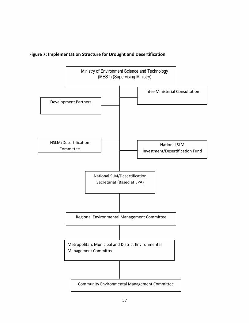
57
Figure 7: Implementation Structure for Drought and Desertification
Ministry of Environment Science and Technology (MEST) (Supervising Ministry)
National SLM/Desertification
Secretariat (Based at EPA)
Regional Environmental Management Committee
Metropolitan, Municipal and District Environmental
Management Committee
Development Partners
NSLM/Desertification
Committee
Inter-Ministerial Consultation
National SLM
Investment/Desertification Fund
Community Environmental Management Committee
58
The EPA is the lead institution responsible for the coordination and
implementation of the drought and desertification matters. There are four levels
of control which involve committees at the national, regional, district and
community levels.
The national committee is technical in composition and has sub-committees. The
national committee has the following responsibilities:
▪ Decision making and co-ordination of activities at national level; ▪ Assessment and assigning responsibilities to various stakeholders; ▪ Approval of policies, budgets and other measures to create an enabling
environment; ▪ Provision of technical support, monitoring and evaluation of activities.
The committee is co-chaired by the Ministries of Finance and Economic Planning ( MoFEP) and Ministry of Environment, Science, Technology and Innovation (MESTI). The EPA serves as Secretary. The regional committee is an inter-disciplinary committee consisting of regional heads of departments and organizations such as the EPA, Forestry Services Division, MOFA, Ghana National Fire Service, NGOs, private sector women organizations, the Regional Planning and Coordinating Unit, the District Assemblies and Traditional Authorities. The regional committee provides guidance and support to programmes developed at the district and community levels. The regional committee is responsible for developing and sourcing funds for regional programmes. The main functions of the regional committees are mainly for advising, coordinating and providing technical backstopping to efforts in the respective regions. Some of the areas to be addressed include annual bush burning, land degradation, wildlife conservation, biodiversity, soil conservation, afforestation and woodlot establishment for household energy. At the district level the authorities offer the best channel for involving the people at the grassroots level. They form the level of government closest to people and

59
best placed to reflect local concerns and priorities and to develop and implement practical action programmes. At the district level, the committee is made up of Assembly members; representatives of decentralised departments, representative of relevant of NGOs/CBOs, representative of the Traditional Chiefs and representative of women organisations. The main function is to assist to formulate local policies, programmes or enact local byelaws to protect the environment. These organizations are mandated to coordinate, plan and implement activities to combat desertification and drought at the district level. It is proposed that the Assembly representative serves as Chairman of the Committee and the District Agricultural Officer as Secretary to the Committee. In the event that the district has no Agricultural Officer at post, the Secretary should be elected from the membership. The district committee is responsible for issues concerned with natural resource management in relation to sustainable land management The community level committee is responsible for the identification of priority concerns that will help in the formulation of viable programmes on natural resource management and the environment. Activities include:
▪ Awareness campaigns on the environment, ▪ Afforestation ▪ Fuelwood plantations for household energy ▪ Assessing micro-credits for small-scale farmers and petty traders
The national secretariat is based at EPA is responsible the day-to-day management and administration. The secretariat serves as the executive committee. Its main tasks include:
▪ Provision of full secretarial support. ▪ Co-ordination and managing the financial resources and keeping records of
financial flows, donor support etc. ▪ Collate and review programmes and project proposals developed at
community, district and regional levels. ▪ Prepare progress and annual reports on implementation and disseminate
to all stakeholders. ▪ Co-ordinate and participate in the elaboration and implementation. ▪ Co-ordinate legal issues and link up with other conventions, policies and
development programmes.

60
▪ Carryout duties that may be assigned to it and its sub-committees.
Stakeholder Involvement
Stakeholder involvement is an important pre-requisite for the success of programmes on the ground – the land users (farmers) – in the formulation, decision processes and implementation of all activities that are planned to solve their problems. Their economic well-being, social and health status will improve as the programmes enter various successful phases. The key stakeholders and their roles are outlined in Table .
Table 3: Stakeholders and their Possible Participation
Major Stakeholders
Description Role
Farmers
Small scale Farmers Pastoralists Medium-Large Scale Farmers who reside and depend on affected lands
▪ Very instrumental in problem identification and provision of solution to some problems
▪ Have a wealth of experience in local conditions and customs
▪ Have invaluable indigenous knowledge.
▪ Owners of the process
Government
Represented in by selected Sector Ministries/Departments
▪ Coordinator of all activities through Local Ministries/Departments
▪ Assigns responsibilities to stakeholders.
▪ Ensures obligations under the convention are met.
▪ Mobilization of masses.
NGOs, CBOs Locally or Internationally based NGOs involved in
▪ Promote popular participation.
▪ Complement government’s

61
environmental, development and other activities in different parts of the country
effort ▪ Could provide funding for
GSIF activities.
Local Authorities/District Assemblies
District Chief Executive, District Planner etc.
▪ Promote development of district and communities
Academia Include Research Institutions, Universities etc.
▪ Assist in carrying out research in various areas including technology development
▪ Training
Business/Private Sector
Business and Industrial Community
Funding of some activities
Chiefs/Traditional Rulers
Paramount chiefs, sub-chiefs, Tindanas etc.
Mobilize and sensitise local communities
4.2 Assignment of Responsibilities
The Ghana Meteorological Authority has over 30 major weather monitoring
stations spread across the country. It issues daily weather information regularly
on regional scale. 95 percent of Ghana’s territory is covered by synoptic
automatic weather stations and 5 percent covered by meteorological radar.
However the institution would need to have the infrastructure at many of the
locations upgraded to enhance service delivery. It faces a number of challenges
which include inadequate professional staff, inadequate funding, poor
infrastructure for gathering information and forecasting, lack of efficient
telecommunication system, lack of high computational capacity and automatic
weather equipment.
A number of bodies are responsible for monitoring stream flow of major river
bodies. These include the Hydrological Services Department and the Water
Research Institute of the CSIR which also monitor ground water.

62
The Water Resources Commission (WRC) is responsible coordinating water
resources agencies, regulating water resources use and management of the
country’s water resources.
The Volta River Authority (VRA) is responsible for the development and
generation of hydro-electric power of Ghana’s rivers. It has a continuous
monitoring programme for all the reservoirs housing their power generation
installations. However, there is little integration of the various monitoring
systems.
The Ghana Irrigation Development Authority (GIDA) under the Ministry of Food
and Agriculture is responsible for irrigation matters.it formulates and executes
plans to promote the development of land and water resources for crop
production, livestock watering, aquaculture, agricultural related industries and
institutions. It also implements irrigation and drainage plans for all year round
agriculture production in Ghana.
The National Disaster Management Organization (NADMO) is the line institution
for disaster response in Ghana. NADMO developed a national contingency plan in
2008 for floods and identified gaps for updating every six months. The plan has
identified early warning methods. NADMO has a Hydro-meteorological Technical
Advisory Committee.
The Environmental Protection Agency coordinates all matters on the environment
and responsible for desertification and climate changes programmes while the
Ministry of Environment, Science, Technology and Innovation deals with policy
matters.
The Ministry of Local Government and Rural Development is responsible policy
and supervision of local government structures.
The Ministry of Interior handles all internal security mateers.
The Ministry of Food and Agriculture is responsible for policy and implementation
of programmes on food, crops, livestock development and extension services to
farmers.

63
The Ministry of Finance and Economic Planning is responsible for allocation of
funds for government programmes.
Drought Monitoring, Forecasting and Impact Assessment
There is no planned and coordinated monitoring and management of drought in
Ghana. Available information is isolated and do not provide a broad overview of
the nature, extent and cost to the economy and how it affects the livelihoods of
the population. Even if information exists, it has not been assembled in an
integrated information management system. Available data on inflows into the
Volta River in Ghana in 2001, 2007 and 2013-2014 reduced significantly resulting
in low level of water in the Akosombo and Kpong reservoirs, and recently the Bui
dam. This led to reduction in power generating capacity by close to 1000
megawatts of power. The low power generation affected literally every sector of
the economy with grave consequences for industry, health and tourism sectors.
Response to drought is mainly reactive. For example there was a delay in
response to the drought of 1974 and 1977. The severity of this particular drought
was due to the government’s denial of their existence.
The National Disaster Management Organization (NADMO) is the line institution
for disaster response in Ghana. Since its formation, in all the occasions that
drought conditions had affected the northern sector, NADMO supplied food relief
to individuals within affected communities. The World Food Programme also
participates in providing food relief. Emergency funding is costly and less
effective.
5.1 Drought Indices
In Ghana, currently the Ghana Meteorological Agency does not use drought
indices for drought forecasting but forecasting is based on rainfall forecast. Ghana
should consider adopting any of the following drought indices in existence:
o The Palmer Drought Severity Index (PDSI) is based on a soil water balance
equation. The PDSI is based on the supply and demand concept of the
water balance equation and therefore incorporates prior precipitation,

64
moisture supply, runoff and evaporation demand at the surface level. Its
main shortcoming is that it has a fixed temporal scale.
o Standardized Precipitation Index (SPI) is based on the precipitation
frequency approach. SPI widely accepted and calculated at different time
scales. The main criticism of SPI is the sole use of precipitation data.
o The Standard Precipitation Evaporation Index (SPEI) has been developed
recently and combines the sensitivity of PDSI to changes in evaporation
demand caused by temperature within the multi-temporal nature of the
SPI.
5.2 Current Monitoring, Forecasting and Data Collection
A functional drought early warning system in Ghana has been developed recently
through an initiative on Improving Resiliency of Crops to Drought through
Strengthened Early Warning within Ghana. This initiative is being implemented by
the Climate Technology Centre and Network (CTCN) with support from the Green
Climate Fund (GCF). It will result in the development of an early warning system
facilitating the provision of timely and information related to the water and
agriculture sectors which allow these sectors to mitigate impacts of incidence of
drought. It also involves early warning communication by developing tools for
dissemination of drought related information to national and regional
organisations.
The initial phase of the project involved the following activities:
• Identification of gaps to drought forecasting and dissemination and
associated need for including climate variability and climate change in
drying season management.
• Updating inventory of past, existing and planning activities.
The tool used for the drought early warning system and risk management was at
the organisational level and not at the farmer level. The north of Ghana was used
as the pilot area due to data availability. The drought forecasting system will
assist in determining insurance to be paid to affected persons.

65
Green Climate Fund (GCF) Readiness funds was allocated to develop a concept
note towards the potential up-scaling of this project to a large scale GCF project
to be implemented at the national level.
The Concept Note has been completed for the application of a full size GCF
funded project with the title “Improving resilience of food security and water
management to climate variability and change”
The Concept Note was submitted using the Simplified Approval Process through
UNEP (an Accredited Entity) to GCF with a budget of US$10 million.
The Drought Early Warning System is a web-based portal based on the well-proven web platform technology tested in numerous projects worldwide. Key national stakeholders have been trained in using the system, which allows them to:
* Access near real-time data related to drought (climate, vegetation, water availability)
* Identify and locate drought based on a wide range of drought indices
* Forecast the development and onset of drought through drought indices linked to climate forecast
* Establish user-defined thresholds for drought warning based on national selected drought indices
* Disseminate information through automated reporting facilities
The final handover of the Drought Early Warning System was done at a final workshop in Accra with the attendance of the key national organisations from Ghana.
5.3 Drought Severity in all Relevant Sectors
In Ghana drought severity is experienced in the main sectors of the country’s
economy which are climate sensitive. The main sectors are agriculture, energy
and water. This is because there is limited use of irrigation making agricultural
areas vulnerable to climate change. In severe drought year food and water
shortages do occur and production of energy which affects productivity in
general.

66
5.4 A Drought Impact Assessment Methodology
Drought affects several sectors with agriculture the most affected by low rainfall
as food production systems are generally rain-fed. Food production systems in the
northern parts of Ghana tend to be most affected by drought. The south-eastern
coastal areas depend heavily on ground water which tend to be affected sea
water intrusion during periods of low rainfall and affects both agriculture and
drinking water supplies.
There is no evidence of drought impact assessment methodology in existence.
This may be the result of the complexity of the nature of drought. However due to
the importance of drought to the socio-economic development of Ghana, there is
the urgent need to put in place a comprehensive institutional systems and
framework for the study of drought.
Drought Risk and Vulnerability
6.1 The Drought Risk and Vulnerability Assessment and GIS Mapping
Drought situations in the country have always affected several sectors.
Agricultural activities have been usually most affected by low precipitation as
most food production systems are generally rain fed. The food production
systems in northern parts of the country tend to be most vulnerable to
occurrence of meteorological drought. The south eastern coastal areas which
depend heavily on ground water resources tend to be seriously affected by sea
water intrusion into ground, during the periods of low precipitation, and this
affects both agriculture and drinking water supplies. Recent low level of water
inflows into the Volta River System and the impact on Hydro-power generation
has affected all sectors of the economy, particularly manufacturing, mining and
health sectors.
Results of a study on mapping the vulnerability of crop production to drought in
Ghana using rainfall, yield and socio-economic data (Antwi-Agyei et al 2012)
showed that crop production to drought in Ghana has discernible geographic and
socio-economic patterns, with the Northern, Upper West and Upper East regions
being most vulnerable. They have the lowest adaptive capacity (carrying capacity)

67
due to low socio-economic development and have economies based on rain-fed
agriculture. They indicate that there are considerable differences between
districts that can be explained only partly by socio-economic variables with
further community and household-scale research required to explain the causes
of differences in vulnerability status.
The authors indicate the results highlight that national and regional scale multi-
indicator vulnerability assessments are a vital first step in assessing vulnerability
across a large area. They think the inputs can guide both local-level research and
also demonstrate the need for region-specific policies to reduce vulnerability and
to enhance drought preparedness within dryland farming communities.
Towards efforts to make the Ghanaian economy resilient by preventing or
reducing water and food insecurities due to climate change and variability,
communities must know the areas, extent and magnitude of flood and drought
risks in their communities and the capacities they have to enable them prepare
and manage these disasters. A risk mapping project seeks to equip every district
in Ghana was carried out starting with the five pilot districts under the African
Adaptation Project (AAP), with easy access to flood and drought risk maps
showing areas at risk, safe havens and evacuation plans as a planning tool for
effective community flood and drought Disaster Risk Reduction.
Even though long-term climate projections and ensuring that surveillance systems
are able to detect changing patterns of these phenomena will be increasingly
important to ensure that communities are prepared for risks changing over time
yet Disaster Risk Reduction which ensures reducing vulnerabilities and increasing
capacities in general will help populations cope with the effects of Climate Change
and variability.
The project used GIS software to map the spatial distribution of flood and drought
risk and overlay climatic and environmental factors such as the proximity to water
bodies, precipitation, elevation, or land use to identify possible environmental risk
factors associated with the specific phenomena.

68
The Flood and Drought Risk maps were the end product of lengthy and complex
analytical processes by the team members expressing a model of risk reality. The
beneficiary communities and stakeholders indicated that the map(s) expressed
well the reality at validation workshops held in each of the Districts mapped.
Spatial flood and drought risk maps were developed for five selected districts.
Each selected district represented a distinct ecological precinct of the country and
was characterized by unique climate and vegetation features except the transition
zone. The districts belonged to unique ecological zones and the selection was also
made based on the common climate risks and impacts confronting the districts.
The main objective of the flood and drought risk mapping was to contribute to
the vulnerability assessment by identifying flood and drought high-risk areas and
use the information to support effective community-based flood and drought risk
reduction planning. By reducing flood and drought risk, the communities in the
districts will build greater resilience to the negative impacts of climate change.
Methodology and approach
The flood and drought risk mapping covers five districts spread across five ecological zones in the country. The districts are (a) West Mamprusi in the Northern Region, (b) Sissala East District in the Upper West Region, (c) Alwen Suaman District in the Western Region, (d) Fanteakwa in the Eastern Region and (e) Keta in the Volta Region (Figure ).

69
Figure 8: Geographic spread of districts for flood and drought risk mapping
The methodology adopted for the spatial vulnerability assessment included a
desktop analysis of the five study areas, GIS-based preliminary flood and drought
risk mapping, field verification of the developed preliminary flood and drought
maps, vulnerability assessment and stakeholders’ validation workshop. GIS layers
on climate, land use, vegetation, soil and topography were combined in a multi-
criteria analysis to produce the specific flood and drought risk maps. The risk
maps were colour coded green-yellow-red indicating low-moderate-high risk
areas respectively. The GIS analysis involved the application of geo-statistical
techniques in the development and modeling of flood and drought risk maps
through the combination of climatic, environmental and other ancillary data
layers in multi- criteria evaluation. Ratings and classification for each factor/layer
were ranked from low to very high based on degree of vulnerability.
Subsequently, every layer was re-classified based on these ranks, multiplied by
70
their standard weight, and then added to other layers to obtain the output risk
maps. The output risk maps for flood and drought for the respective districts are
symbolized with a green-yellow- orange-red colour scheme indicating no-risk,
low-risk, medium-risk, and high-risk areas. The selection and weighting of
different factors for hazard and risk maps were informed by literature and expert
input from the National Disaster Management Organization (NADMO) research
team. The accuracy of hotspots in the risk maps were validated by stakeholder’s
workshop undertaken in the 5 districts.
Geographic spread of drought risk The factors that influence drought are largely related to length of dry spell,
vegetation cover and soil moisture. In general, drought risks are spread widely
across the ecological zones, the high forest has the minimum risk to drought
whereas areas in the deciduous ecological zone tend to have high risk to drought.
Drought Communication and Response Actions
7.1 Drought Communication Protocol
A major setback for communicating information on drought is that there is no
integrated early warning system that serves the needs of all sectors. There are
also no reports of systematic soil moisture and carbon monitoring programs.
A mechanism for disseminating drought information through radio, TV, cell
phones and other forms of communication should be established to ensure
communities take precautionary measures to avoid the impact of drought.
Communications is a conduit for changing the way people behave. Behavioural change involves the complex interaction of rational (decisions possibly affecting risk and vulnerability), emotional (comfort of the known versus fear of the unknown), physical (enabled vs. disabled) and political (empowerment versus helplessness) factors.
Awareness does not bring about change without the enabling legal and financial systems, nor without empowerment.
Addressing a very complex phenomenon such as drought, requires an integrated approach to communications management vis-à-vis overall program
71
implementation. The overall objective of, and hence message with regard to management and coping with drought should be centred on improving and protecting livelihoods and alleviating poverty in Ghana.
7.1.1 Communication Objectives
The key communications objectives are as follows:
• To promote drought awareness on the livelihoods of affected people;
• To motivate key partners from MDAs, CSOs and Regional and District Governments, educational institutions (secondary schools, universities), the private sector to collaborate as a coalition for mainstreaming drought issues;
• To provide the mechanism through which key stakeholders collect and exchange drought data and evaluate them against established norms and standards;
• To mainstream drought control in sectoral policies to ensure that institutions, legislation, budgets and strategic plans; and
• To identify and mobilize stable financial resources required to manage the drought problem.
7.1.2 Target Audiences
The Communications Plan should target the following groups:
• MDAs, CSOs and Regional and District Governments through their focal points;
• Educational institutions (primary, secondary schools, universities);
• The private sector;
• Field officers of line ministries involved in drought related issues (e.g. agricultural extension services);
• Journalists of national and regional newspapers, magazines;
• The public at large.
Each of these target groups will receive the appropriate messages according to
their level and area of involvement. Key messages (e.g. impact of drought on land
degradation, climate change) will be reflected in major communications.
Specific events, such as the annual World Environment Day, World Water Day,
World Day to Combat Desertification etc. are considered excellent opportunities

72
of communication to a public of development partners and MDAs and relevant
stakeholders need to be supported actively.
Change Required
From To
Overlapping initiatives with too narrow approach to development
Collective action: a comprehensive approach to drought management
Isolated Pooling resources & networking knowledge on drought& its effects
Barriers Enabling sectoral policy development; Empowerment of stakeholders
Neutral or indifferent attitude Advocating drought awareness
7.1.3 Key Concepts and Messages
AII core messages, written and visual, will be directly or indirectly communicated using the concept of "Preparedness for Living with Drought". This concept encapsulates the acknowledging drought as an integral part of daily life in Ghana: improving and protecting rural livelihoods and promoting food security will not deliver long term benefits if these efforts are not embedded in the sound and sustainable management of the drought. Conversely, drought and its associated ecological, economic and social consequences impede on the welfare of individual rural households, rural economies and the social stability of the country.
Key messages associated with each of the communication objectives include:
WHAT SUSTAINABLE DROUGHT MANAGEMENT OFFERS
Functioning ecosystems:
• Sustain life on earth;
• Benefit people by maintaining climate and hydrological cycles, controlling erosion and preventing natural disasters;
• Provide products - such as food, water, timber, fuel, fibre and medicines - for human consumption and trade; and
• Create aesthetic, social and spiritual havens.
ABOUT COLLABORATION AND COALITIONS
Collaboration and coalitions:

73
• Bring together MDAs, private, local governments, education and civil society stakeholders;
• Transcend sectoral interests and support the multiple dimensions of livelihoods;
• Pool resources, increase scale and reduce transaction costs;
• Avoid overlap/duplication and waste of resources, and
• Have greater impact.
ABOUT COLLECTING AND EXCHANGING KNOWLEDGE
Sharing knowledge:
• Promote replication and benchmarking;
• Provides more options for achieving economic and social benefit;
• Save time and money;
• Build the capacity of governments and organizations; and
• Empower people.
ABOUT REMOVING BARRIERS TO DROUGHT MANAGEMENT
Without barriers:
• Drought Management can be mainstreamed in sectoral policies;
• MDAs can develop their own drought control policies with support from and in line with national drought strategies, standards and norms;
• Regional offices can develop their own action plans in consultation with the main drought coordinating body;
• The press can report in an informed way on drought matters, on drought policies activities;
• The regulatory bodies can enforce drought control laws and regulations in an informed way;
• Regional and District governments can set their priorities for action with support from and in consultation with drought coordinating body;
• Communities can learn (Learning by doing) how to create long-term financial and economic benefits from sustainable drought management for themselves;
• Communities can participate in drought management in ways that respect local customs and traditions, but reduces their risk and vulnerability;
• Integrated drought management will yield long-term economic benefits for Ghana; and

74
• Enabling laws, active community organizations and long-term technical support produce lasting solutions.
ABOUT MONEY AND INVESTMENT
Strategic investments in and financing of drought management and mainstreaming:
• Can improve natural resource-based livelihoods;
• Can align and harmonize policies across institutions;
• Allow for scaling up environmental programmes for greater impact;
• Boost investment in the land's long-term productive potential; and
• Support and add value to existing mechanisms (national and regional donor initiatives).
Communication Programme
The communication program supports the 5 communication objectives as illustrated in the table below. Some of the media channels and/or communication tools may support several of the communication objectives, or may be used simultaneously for greater impact at, for example, major events. A short description of each of the outputs follows:
Table 4: Communication Programme
Objective/Output
Promote Environmental Governance
Create Coalitions
Knowledge Sharing
Remove Barriers
Money and Investment
Audience Internal & External
External Internal & External
External External
TV programme • • • • •
(indirect)
(indirect)
Radio and Print News
• • • • •
(indirect)
(indirect)
Journalist Training
• • • •
(indirect (indirect)

75
)
Police Force Training
• • •
Judiciary •
Active Drought Website Management
• • • • •
(indirect)
Joint Publications with MDAs and CSOs
• • •
Round Tables and Dialogues
• • • •
Donor coordination
• • •
TV broadcasts
A monthly or bi-monthly educational TV program (with 2 to 5 repeat screenings per month) broadcasted on national channels. The program will aim to promote the concept of multi-sectoral drought management and inform the broader public of methods and technologies to address the consequences of drought on poverty and livelihoods.
Such a series of programmes will be expensive. It will be essential to implement in phases:
• Re-organise the internal structure, relationships, delegation of responsibilities between drought related departments;
• To programme a call for tenders for the production of the series;
• Seek co-funding;
• Design the program content in such a way that 3 - 5 minute segments could also be used on the drought website, and/or for training purposes; and
• Use the archived and specially-filmed footage as the basis of videos for drought control promotion.
Drought News (Radio, Print)
This activity will contribute to an independent communication voice on drought control to an existing multi-stakeholder platform. The approach is multi-media
76
and multi-lingual, taking account of the Ghanaian context and drawing on and strengthening local capacities. It draws on the experience and capacities of MDAs, CSOs, SMEs and private organisations, and other relevant media and communication partners in Ghana.
Independent news reporting for print media and radio will be distributed through the mass media, a dedicated "news" web-site and targeted newsletters for decision makers, with linkages to the drought coordinating body website and knowledge management system. All the outputs will be available in English, with a selection made available in main local languages. Journalists training workshops will strengthen the capacity of local journalists to contribute to drought control and through their own media outlets. This activity will also support the TV program, the dialogues/round-tables and other major events by issuing announcements, invitations, coverage and report backs.
Journalist Training
Drought management institution will conduct training sessions for journalists at major events related to drought management, laws, procedures, regulations, norms and standards. The training and practical advice aims to increase reporting on drought issues and the quality of reporting. In addition to the formal training sessions, the journalists will receive hands-on guidance, and enjoy the opportunity to meet policy-makers and heads of MDAs/donor and other delegations present at these events.
Regular Program Updates to Partners (E-newsletter)
It will be essential to keep the partners updated on new developments and changes to the program through regular electronic newsletters. These quarterly newsletters will have a more "internal" orientation to ensure that all partner organizations are kept abreast of programmatic developments, policy processes, upcoming meetings and required inputs. Quarterly newsletters should:
• Respond to the information needs of partner organizations - i.e. program-specific updates, not general promotional material;
• Provide succinct information with more details available than on the drought website;
• Provide opportunities for input by partner organizations; and
• Be produced regularly (i.e. a timely and reliable source of information).

77
Standard Drought Collateral
It will be useful to provide all the partners with the necessary drought collateral to use for their own promotional and/or advocacy purposes. Such collateral could include project brochures & contact information, annual reports, posters, fact sheets and policy briefs. The products could be produced on a routine basis, for example annual reports, or specifically for major events, in the case of policy briefs.
The Drought website
An important means available at present is the drought organisations website,
which will be further developed to serve this communication strategy (announce
and promote particular events, policy or political initiatives, etc.).
The Drought website should become the main source for information to the larger public in Ghana and abroad.
The website will be updated at least monthly and at the occasion of any major event concerning drought activities, initiatives, press communications, newsletters, etc.
This will require the recruitment of a professional permanent staff responsible for the management and maintenance of the website and for general internal ICT management.
As such the following considerations should be given to the website:
• Designing a new at-a-glance home page that gives an overview of drought, its occurrence, frequency and impacts, information options - thus less wordy and more entry points to the different sections, which could include geographic entry points;
• Profiling the partners in drought management, and indicate their interests/roles;
• Providing a limited space for administration or process-related information and clearly define these sections;
• Providing ample space and content for technical know-how, solutions and success stories (or have a link to very practical sections of the drought knowledge management system);
• Providing dedicated space for policy work and advocacy;

78
• Enabling (password-protected) networking, discussion and interaction through the website; and
• Providing a (password-protected) contact management service, where individuals could register interest, obtain details of relevant focal points, etc.
The drought website should be linked to (or have as a sub-site) the connection to (inter)national agencies, (inter)national events related to drought management and control, news-sites, which will provide more general updates, trends and reporting on approaches on drought across the continent and the world.
Joint Publications with MDAs and CSOs
The purpose of joint technical publications is threefold:
• To disseminate technical knowledge about implementing drought control approaches, using the publication production process to synthesize knowledge collated through the initiative;
• To foster inter-MDA and multi-partner collaboration through joint publishing; and,
• To produce collateral for dissemination.
It will be essential that the content of technical publications responds to the needs of stakeholders (the intermediary and final beneficiaries), and probably be more practical or field oriented, than an exhaustive or academic analysis of the issue. In addition, preference should be given to produce these technical publications in flexible digital publishing formats, while summaries could be produced in hardcopy.
Dialogues and Round-tables
High-level dialogues and round-tables are political and advocacy events used to obtain buy-in, commitment and leadership from organizations and the Government. By nature of the logistics involved in organizing these events, they are best implemented during the high-level segments of major (inter)national or multi-lateral events.
The content design of the dialogues and roundtables should support key policy objectives of drought management at the particular event, or to have a frank problem-solving type of debate, which could also include discussing funding
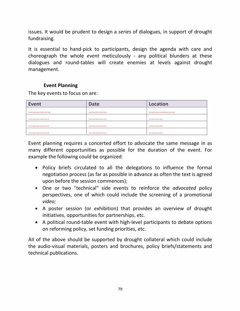
79
issues. It would be prudent to design a series of dialogues, in support of drought fundraising.
It is essential to hand-pick to participants, design the agenda with care and choreograph the whole event meticulously - any political blunders at these dialogues and round-tables will create enemies at levels against drought management.
Event Planning
The key events to focus on are:
Event Date Location ................ ............. ...................
............... ............. ..........
............... ............. ..........
............... ............. ..........
Event planning requires a concerted effort to advocate the same message in as many different opportunities as possible for the duration of the event. For example the following could be organized:
• Policy briefs circulated to all the delegations to influence the formal negotiation process (as far as possible in advance as often the text is agreed upon before the session commences);
• One or two "technical" side events to reinforce the advocated policy perspectives, one of which could include the screening of a promotional video;
• A poster session (or exhibition) that provides an overview of drought initiatives, opportunities for partnerships, etc.
• A political round-table event with high-level participants to debate options on reforming policy, set funding priorities, etc.
AII of the above should be supported by drought collateral which could include the audio-visual materials, posters and brochures, policy briefs/statements and technical publications.

80
Human resources
Human resources on drought management and control should be trained in
communication on drought matters. Financial resources and time of drought staff
for communication should be provided for in the programmes.
Delivery Mechanisms
The purpose of a Drought Communication Strategy is to provide a context within
which a structured communication policy on drought can be developed. In ideal
circumstances this will guide the development of cost-efficient and effective
communications for on drought at the national and the international levels.
7.2 Declaration of Drought Conditions
A drought preparedness committee should be established to declare the
incidence of drought based scientific evidence.
7.3 Communication and Coordination Guidelines
Communication and coordination guidelines should be developed to ensure the
effective handling of drought management matters.
7.4 Drought Response Actions
Response to drought is mainly reactive. For example there was a delay in
response to the drought of 1974 and 1977. The severity of this particular drought
was due to the government’s denial of their existence.
The National Disaster Management Organization (NADMO) is the line institution
for disaster response in Ghana. In all the occasions that drought conditions had
affected the northern sector, NADMO supplied food relief to individuals within
affected communities. The World Food Programme also participates in providing
food relief. Emergency funding is costly and less effective.
The National Drought Management Team/Committee should communicate the
incidence of drought to the National Disaster Management Organization
(NADMO) is the line institution for disaster response in Ghana.
81
Drought alleviation measures have focused overwhelmingly on mitigation. It is
only in recent times that the EPA collaborating with the Ministry of Food and
Agriculture to build resilience in food production systems through enhancing the
capacity of rural farmers to improve soil fertility and moisture. The government
has established a food buffer stock company to support measures towards food
security in the event of crop failure.
A riparian buffer zone policy was also formulated to protect watersheds in 2013.
Additionally, the capacity of vulnerable communities to prepare micro watershed
plans was being undertaken under a World Bank funded initiative through a
Sustainable Land and Water Management Project for the Northern Guinea and
Sudan Savanna areas.
The need for Knowledge and Skills for drought Management
Lessons learned in the implementation of sustainable land and water
management initiative have demonstrated that community members require
drought risk reduction knowledge and skills in order to proactively address the
risk of drought. The National Action Plan to combat drought and desertification
and Preparedness does not provide for elaborate drought risk reduction
strategies
Drought Mitigation and Preparedness
The main objective of this plan is to move Ghana away from the past reactive
approach to drought management to a proactive one. This means Ghana should
take deliberate efforts to prepare for droughts, to minimize the their impact
through improved coordination, enhanced procedures for monitoring drought
conditions and early warning capability, improved assessment of drought impacts
and effective response to drought emergencies. This also requires implementing
drought mitigation strategies to minimize the potential effects of drought.
There are a number of initiatives being undertaking in this wise on a number of
fronts. However, there is an absence of an overarching framework within which
the initiatives are implemented.

82
8.1 National Water Resource Monitoring and Impact Assessment
The Water Resources Commission (WRC) in 2009 (Dovie, 2009) commissioned a
study to catalogue disasters, preparedness and measures already implemented by
a diversity of stakeholders in Ghana’s three northern regions. The report apart
from examining the effects of flood and drought disasters on the biophysical
environment, and implications for the local population, also assessed and
evaluated the efficiency, sustainability and patronage of available early systems
and information, with emphasis on local indicators within external context.
The study found coping strategies for drought to include self-help, solidarity of
households and informal social networks based on neighbourhood, kinship, clans
men, friends and relatives and religious ties. It recommended the mapping of
drought hotspots to serve as baseline for contingency planning and setting of
priorities for drought risk reduction.
The Water Resources Commission is implementing a number of activities in terms
of monitoring water quality, ground water resources and using the integrated
water resource management approaches through a river basin approach instead
of using political entities.
8.2 Development of Alternative Water Sources
Over the years there have been efforts to provide alternative sources of water for
the population. This involves the development of surface and ground water
resources to meet the socio-economic needs the population. There is also the
promotion water harvesting systems and land and water conservation measures
and technologies in drought prone areas.
8.3 Water Conservation Practices/ Public Education Awareness and Outreach
Ghana is currently implementing a strategic investment framework for
sustainable land management under the National Action Programme to combat
drought and desertification covering the drought prone northern part of the
country.
8.4 Legislation and Land Use Policy
The importance of the soil and soil conditions in successful agricultural land use in

83
Ghana was acknowledged in 1927 when a committee on agricultural policy and organization in that year emphasized specialized investigational work into soil and rainfall. A countrywide survey of soil erosion was conducted in 1937. It was recognized at that early date that the solution to the problems of soils and agricultural production generally lay in the change from the existing land rotation to permanent agriculture (Department of Agriculture, 1937). These efforts resulted in the passage of the Land Planning and Soil Conservation Act, 1953 which was amended in 1957 as the Land Planning and Soil Conservation (Amendment) Act, 1957.
A review of the Land Planning and Soil Conservation (Amendment) Act 1957 should be carried out with the view to updating it to encompass current realities and to serve as a basis for establishing guidelines for land use planning in Ghana.
Drought conditions in affected regions are affected by the use of fire for land clearing in all the ecological zones is a major contributory factor to deforestation and natural resource degradation. Indiscriminate bush burning is still pervasive and is one of the major environmental problems militating against natural resource conservation and management. Biodiversity (both fauna and flora) and habitat, which supports wildlife, is destroyed. The problem of bushfires has become chronic and contributed immensely to rural poverty. The anti-bushfire law (PNDC Law 229) has not been effective in arresting the problem of bushfires. The Fire Service has not had adequate legal support in dealing with offenders and the role of traditional rulers and Tindanas in the enforcement of the law is not recognised. It is in the light of these constraints that the PNDC Law 229 would be reviewed to accommodate the deficiencies in the law The Buffer Zone Policy for Managing River Basins initiated by the Water Resources Commission should be incorporated in any land use planning regulations to ensure that that streams, lakes or other surface water bodies shall be adequately vegetated, sustainably managed to restore, conserve and maintain ecological integrity of river ecosystems and to provide optimal socio-economic benefits of such designated areas”. The policy indicates that as much as possible a 3-tier buffer zone should be the norm for effective erosion control and halting of water quality degradation caused by nutrients, animal/human wastes, sediments and

84
run-off. The Sustainable Land and Water Project (SLWP) will adopt the recommended buffer zone widths indicated below;
▪ Municipal reservoir shoreline protective buffer: 60 to 90 meters (e.g. Weija Dam, Lake Bosomtwe);
▪ Major perennial rivers/streams: 15 to 60 metres; (e.g. Volta, Tano, Offin); ▪ Minor perennial streams: 5 to 15 metres; ▪ Important intermittent Streams: 5 to 20 metres; and ▪ Streams within forest reserves: 25 to 50 metres
Furthermore, in the 3-tier zoning concept, the forested buffer widths shall be modified if there are steep slopes within close proximity to the river system, and in those cases, the buffer may be adjusted as follows:
Slope Width of buffer 15-20 % add 3 metres 20-25 % add 10 metres 25-30 % add 20 metres
Legislation should be enacted to provide incentives for sustainable land management adoption. In addition there should be the development of modalities for the comprehensive payment scheme for environmental services provided through SLM adoption (including water regulation and quality central, biodiversity conservation, carbon sequestration etc.). The SLWP will embark on the following;
▪ Review the existing agricultural credit scheme to support SLM programme ▪ Develop modalities of the comprehensive payment scheme for
environmental services provided through SLM adoption (including water regulation and quality central, biodiversity conservation, carbon sequestration etc.).
▪ Engage a consultant to design appropriate framework for selecting FBOs and farmers eligible for matching grants.

85
Recommendations and Implementation Actions
The high profile given to drought activities in 1985 has slowed down though the
frequency of drought has increased. Despite this, Ghana is implementing a
number of strategies and actions to minimize the impact of drought especially in
the northern half of the country where the incidence of high though drought is
nationwide phenomenon. Drought should be given priority due to the number of
people affected and as the root causes of the problems of hunger, famine,
poverty and child mortality. Despite these efforts there is no defined drought
management infrastructure in existence.
9.1 Priority Implementation Actions Recommendations
To ensure that these strategies and actions achieve the desired impact, a number
of actions are required in preparing for, responding to and recovering from
drought. Actions are required in the following areas:
• Institutional framework
Coordination structures should be set up at national, regional, district and
community levels. The national coordination committee on drought should set
sub-committees to handle specific aspects of drought. Mitigation and information
centres on drought should be set up. The national coordination committee should
lead in the institutionalization of effective drought preparedness and response
strategies. It should evaluate performance in drought preparedness, response and
recovery after each drought. The national drought plan should be revised every
five years which should include the extent the plan is being followed and
suitability of drought indicators. Drought prone districts should be assisted to
develop drought management plans.
• Legal framework
The Land Planning and Soil Conservation Ordinance of 1953 should be reviewed
and serve as the framework legislation on land use planning for drought
management.
• Land use planning framework

86
Clear cut policies and regulations on land use planning should be put in place.
There should be a scale up in the coverage of coordinated land use planning as
being implemented under the sustainable land and water project within the
framework of the Ghana Strategic Investment Framework (GSIF) on sustainable
land management. The land use plans should include watershed management
and stream buffers.
• Monitoring and assessment mechanism
Climatic changes and other natural hazards expose Ghana to various types of
natural and manmade hazards, which have occurred with increasing frequency in
the last twenty years. Natural phenomena, especially floods and drought,
regularly result in disasters that cause severe food insecurity, and disruption of
livelihoods. These disasters negatively impact on enterprises of poor smallholders
and increase their vulnerability to food insecurity.
A drought early warning system should a drought watch, drought triggers and
alert system with response levels for effective drought management.
There need to strengthen existing networks and establish new networks of hydro-
meteorological and hydrological stations. Data on surface water resources should
be updated.
A comprehensive study covering the critical areas of drought management should
be conducted to develop an effective system for drought management in Ghana.
This is necessary as there are a number of gaps in preparing the national drought
plan. The study should cover historical droughts to serve as a basis for monitoring
current droughts.
Drought hazard and vulnerability maps should be prepared for drought prone
areas of the country.
• Information management and communication system
Develop drought information tools which are critical for implementing drought
management plans as part of a drought information system. This should include

87
guidance to districts, communities and water dependent industries. A
clearinghouse should be set to disseminate drought information. An annual
drought status should be prepared to inform policy makers on drought situation.
• Education and training on drought management
The technical capacity, knowledge and skills of all the relevant agencies should be
built in drought management. In addition community resilience and response
capacities to drought should be built through the promotion of enhanced
livelihood adaptation mechanisms.
• Science and technology
There is need for improvement in knowledge on climate and water resources,
soil; bushfire control; knowledge on rangelands and improvement of farming
systems
• Financial mechanism for drought management activities
Establish contingency funding mechanism, a drought fund as stated in the
National Action Programme on Desertification to fund drought management
activities. There is no need for duplication of structures.
The summary of the priority actions are presented in Table 5 below.

88
Table 5 Priority Actions
Actions Activities Lead Responsible Agencies
1. Institutional Framework
- Coordination structures:
- national
- regional
- district
- community
- mitigation centre
EPA , MOFA, WRC, FC, MESTI, MOFEP, NDPC, Regional bodies
2. Legislation Review Land Planning & Soil Conservation Ordinance
EPA, MOFA, FC, WRC, Districts
3. Land Use Planning
Land use plans MOFA, WRC, FC Districts, communities
4. Monitoring Early Warning Drought Watch
GMA,WRC, HSD,VRA, EPA, NADMO
5. Information Management
Hazard maps Clearinghouse
EPA
6. Education and Training
Knowledge & skills Universities, Ministries, Departments & Agencies, CSOs
7. Science and Technology
Knowledge improvement on drought
Universities and research institutions
8. Financial Mechanism
Establishment of drought fund
MOFEP
9.2 Future Updates and Revisions
The drought plan should be revised and updated every five years based on
empirical information gathered and analysed by the national drought committee.
89
REFERENCES
Antwi-Agyei, et al 2012. Mapping the Vulnerability of Crop Production to Drought in Ghana Using Rainfall, Yield and Socio-economic Data. Applied Geography 32 (2012) 324-334. Ayibotele,N.B 1979. Water Resources Development and the Environment in Ghana. 1970-1979. International Training Centre for Water Resources Management (ITCWRM) December 1979 Ampadu-Agyei, O et al 1994. Climate and Africa Country Report, Ghana. Africa Conference on Policy Options and Response to Climate Change. UNEP Nairobi, Kenya December 5-8 1994.
Benneh, G 1985 Socio-economic Responses to Climatic Changes in Report of Workshop on Combating the Effects of Drought and Desertification. 24-25 January, 1985. Accra, Ghana.
CTTN.2014 Response Plan- Improving Resilience of Crops to Drought through Strengthening Early Warning within Ghana. Climate Technology Centre and Network.
DGRD (1992). A Socio-Economic Survey In The Upper East Region With Reference To Drought and Desertification Control In Ghana. A Report By The Department Of Geography And Resources Development, University Of Ghana, Legon. E.P.C., Accra, Ghana.
Dovie, D.B 2010 Climate Change, Water and Disasters. Water Resources Commission WRC) WRC-CCA Reort Series No. 1 2010. Climate Change Adaptation Integrated Water Resources Management Project
EPA (2002) National Action Plan to Combat Drought and Desertification, Ghana
EPA (2015)Third National Communication Ghana 2015.Climate Change Report to UNFCCC.
EPC 1985 Report of Workshop on Combating the Effects of Drought and Desertification. 24-25 January, 1985. Accra Ghana.
EPC 1987 National Plan of Action to Combat Desertification. Prepared for Government of Ghana (GOG) with support of the United Nations Sudano-Sahelian Office (UNSO. March 1987.
Ghana Statistical Service (2011). Ghana Living Standards Survey (GLSS) 6.
Government of Ghana (GOG) 2010. METSIP 2011-2015 Government of Ghana

90
MOFA
Government of Ghana (GOG) 2015. Land Administration Project II National Spatial Development Framework 2015-2035. Space, Efficiency and Growth. Ministry of lands and Natural Resources, Ministry of Environment, Science, Technology and Innovation. Town and Country Planning Department, Natioanal Development Planning Commission.
Government of Ghana, National Climate Policy, Part II Sectoral Strategies
Henao, J. and Baanante, C. (2006). Agricultural Production and Soil Nutrient Mining in Africa: Implications for Resource Conservation and Policy Development. IFDC. An International Development Center Technical Bulletin. Muscle Shoals.AL USA.
IFPRI/MOFA (2015) Towards a Sustainable Soil Fertility Strategy in Ghana. Report submitted to MOFA GOG
ISSER (2010) The State of the Ghanaian Economy in 2009. ISSER, Accra, 218 pp
Jarawura, F.X 2013 Drought and Migration in Northern Ghana. Unpublished PHD Thesis University of Ghana, Centre for Migration Studies.
MESTI 2013 Ghana National Climate Change Policy
MOF (2015) Public Expenditure Review of the Forestry Sector, MOF, Accra October 2015.
MOFA (2010). Agriculture in Ghana Facts and Figures. 55 pp.
National Development Planning Commission (2008). Draft Medium-Long term Development plan (seven-Year development Plan 2008 – 2015. Volume 1. Towards a Development Policy Framework, 88 pp.
Ofori-Sarpong, E. 1980 The 1975-1977 Drought –Hydro-meteorological Aspects. Bulletin de I’IFAN T. 42, Ser’ A No 4 1980 pp 649-661
Ofori-Sarpong, E. 1985 The Nature of Rainfall and Soil Moisture in the Northern Part of Ghana During the 1975-1977 Drought. Geografiska 67 A ( 1985) 3-4 pp 177-186.
Tandoh, S E 1985 Climate Patterns and Changes of the West African Climate in Report of Workshop on Combating the Effects of Drought and Desertification. 24-25 January, 1985. Accra, Ghana.

91
UNCCD,2017. Drought Adaptation and Resilience in Developing Countries Briefing Paper 23/2017 UNCCD.
Vicente-Servao, Sergio M. et al 2012. Challenges for Drought Mitigation in Africa: The Potential Use of Geographic Data and Drought Information Systems. Applied Geography 34 (2012) 471-486 Elsevier.
White, G.F Ed. 1974 Natural Hazards, Local, National, Global. 1974 Oxford University.
World Bank, 2010 Economics of Adaptation to Climate Change Ghana
WRC (2014). Water Resources Commission Annual Report. Accra.