gfbiofield: a brief history of problems and solutions a brief history of problems and solutions (now...
TRANSCRIPT

GFBioField: A Brief History of Problems and Solutions
(now with extra problems!)

Some background … Sensors Data Capture and Processing. Marine Scales and Sablefish Surveys. Survey Block Management. Hardware Issues. Quality Assurance.
Topics
Oracle relational database to store biological data collected on Groundfish surveys and from commercial sampling.
Developed in the 1990s by Stanley, Rutherford, Coulson, and Lee.
Effectively models the entire process of collecting Groundfish biological data all the way from leaving the dock to returning again.
In The Beginning: GFBio

“GFBioField”
SQL Server Server
Clients
Data Processingand Storage User Interface:
Data-entry forms,reports, and tools

Semi-ruggedized server laptops Ruggedized laptops and tablets Marel marine scales Fish measuring boards Wi-Fi router RAID storage Webcams Bluetooth headphones Barcode scanners
Hardware

Typical Configuration
Dry L
ab o
r Brid
ge
Wet
Lab
or O
n-Dec
k
Server
CS Laptop
RAID
Router
Biosample Station (x3)
Haul Card Station

Sensor Data Capture and Processing

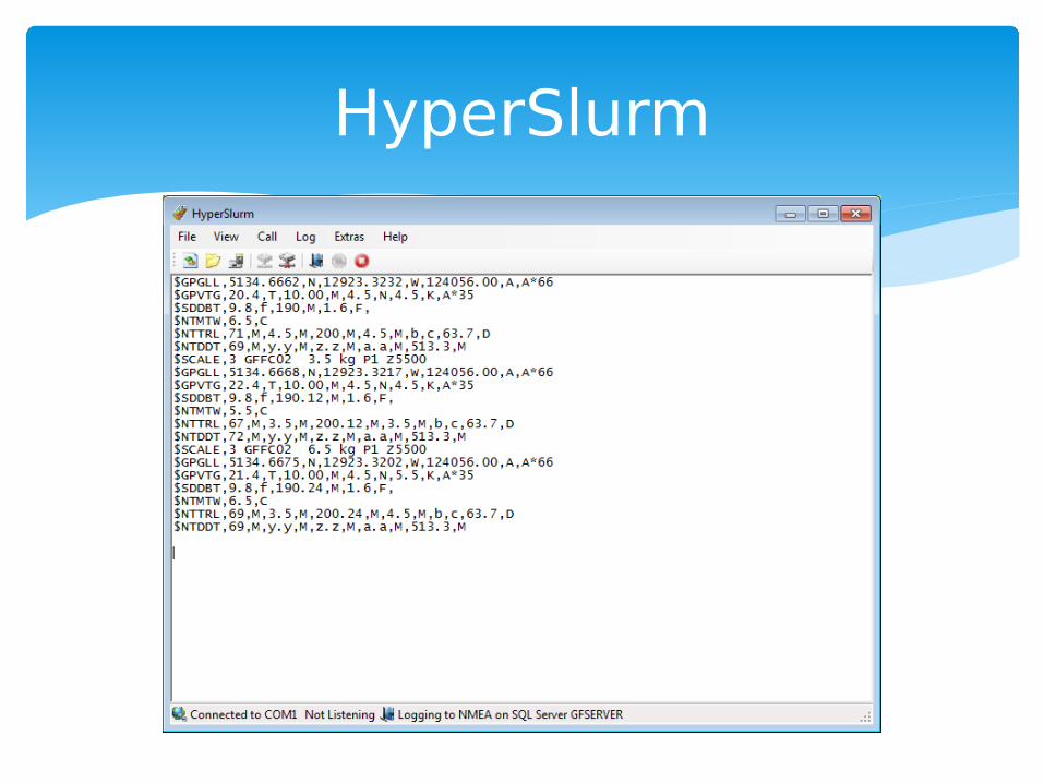
Broadcast live (not logged) at regular intervals over serial (RS-232) or network (TCP/IP) interfaces.
Usually use NMEA standard for transmission.
Sensor Data
$GPGLL,4916.45,N,12311.12,W,225444,A

HyperTerm
07:11:40
HyperSlurm

HyperSlurm
01/13/2016 08:02:05|$GPGLL,5134.6662,N,12923.3232,W,124056.00,A,A*6601/13/2016 08:02:05|$GPVTG,22.4,T,10.00,M,4.5,N,4.5,K,A*3501/13/2016 08:02:06|$SDDBT,9.8,f,190,M,1.6,F,01/13/2016 08:02:06|$NTMTW,5.5,C01/13/2016 08:02:06|$NTTRL,71,M,3.5,M,200,M,3.5,M,b,c,63.7,D01/13/2016 08:02:07|$NTDDT,72,M,y.y,M,z.z,M,a.a,M,513.3,M01/13/2016 08:02:07|$SCALE,3 GFFC02 4.5 kg P1 Z550001/13/2016 08:02:09|$GPGLL,5134.6668,N,12923.3217,W,124056.00,A,A*6601/13/2016 08:02:10|$GPVTG,23.4,T,10.00,M,4.5,N,4.5,K,A*3501/13/2016 08:02:10|$SDDBT,9.8,f,190.12,M,1.6,F,01/13/2016 08:02:10|$NTMTW,6.5,C
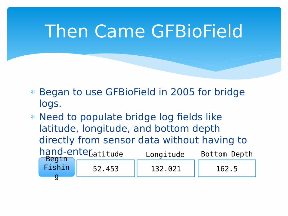
Began to use GFBioField in 2005 for bridge logs.
Need to populate bridge log fields like latitude, longitude, and bottom depth directly from sensor data without having to hand-enter.
Then Came GFBioField
Begin Fishin
g
Latitude Longitude
52.453 132.021
Bottom Depth
162.5

Modified HyperSlurm so that it could broadcast data over a network.
HyperSlurm (again)
GPS
Sounder
Network
342 m
342 m

Room for Improvement
Now we can populate data-entry fields like latitude and longitude without entering by hand.
BUT: Timing is an issue – what if e.g. latitude and longitude aren’t available exactly when I need them?
And what if I need to retrieve values from the past?
How to make all logged data available online at any time.
Begin Fishin
g
Latitude Longitude
52.453 132.021
Bottom Depth
162.5

Modified HyperSlurm so that it logs all NMEA records to a database.
HyperSlurm (again) + SQL Server
GPS
Sounder
342 m
342 mSQL
Server

NMEA Database
NMEA_LOG
$ABCD,nn,yy,zz*E
NMEA_VESSEL_POSITION
NMEA_BOTTOM_DEPTH
NMEA_HEADROPE_HEIGHT
52.345 N / 132.34 W
453.23 m
4.3 m

NMEA_VESSEL_POSITION
Column Name Example Value
RECORD_ID 1876
TIME_STAMP 06/15/2015 5:34:23.412
LATITUDE 52.5243
LONGITUDE 130.8376

Sablefish Trap Survey
Takes place in October and November.
Big seas, but the bigger problem is WIND!
Marine scales are motion-compensated but can’t cope with wind.
Difficult to press the “print” button when the green “steady” light flashes.

Discovered that you could configure a Marel scale to continually output data, instead of just when you press the print button.
Why not use our existing NMEA solution to capture scale weights?
We can query the database for our weight, instead of using the scale print button.
E.g. Give me the most recent steady weight from the last two seconds.
Remote Scale

Remote Scale
2231 g
On-Deck Sheltered
2231 g 2231 g
2231 g

Survey Block Management

All of our trawl surveys employ a random stratified design.
Fishing locations for each survey year are randomly selected from a grid of 2x2 km blocks prior to the survey.
Survey Blocks

WCVI Survey Blocks
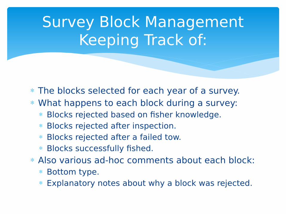
The blocks selected for each year of a survey. What happens to each block during a survey:
Blocks rejected based on fisher knowledge. Blocks rejected after inspection. Blocks rejected after a failed tow. Blocks successfully fished.
Also various ad-hoc comments about each block: Bottom type. Explanatory notes about why a block was rejected.
Survey Block ManagementKeeping Track of:

ArcMap GIS project with custom forms and VBA code.
Track block status. Add/remove blocks. Attach comments to blocks. Export blocks to Nobeltec. Worked well, but … Totally separate from
GFBioField so fishing activity not linked to block management.
ArcMap GIS
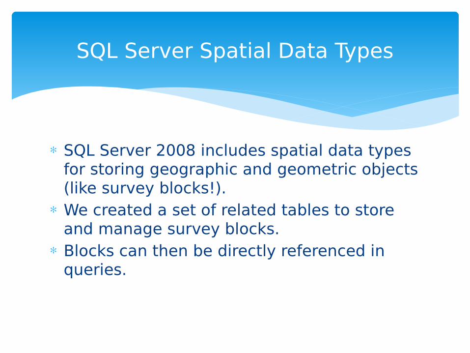
SQL Server 2008 includes spatial data types for storing geographic and geometric objects (like survey blocks!).
We created a set of related tables to store and manage survey blocks.
Blocks can then be directly referenced in queries.
SQL Server Spatial Data Types

So now we have our survey blocks integrated into the same database that holds the rest of our survey data.
We still need a GIS tool to view and edit our survey blocks and other spatial data.
SQL Server Spatial Data Types

Free, Open Source GIS component that can be embedded into MS Access forms (and other Windows applications).
Fully programmable via Visual Basic for Applications. Now we can create a GIS form in our GFBioField
application to view and manage our survey blocks. Except … MapWindow doesn’t know about SQL Server
spatial data types.
MapWindow ActiveX Control

MapWindow can read specially formatted strings as spatial data.
For example, the following string represents one of our survey blocks:
5;0;-129.2702|50.8694|-129.2418|50.8694|-129.2419|50.8874|-129.2703|50.8874|-129.2702|50.8694|
So we wrote some SQL code to convert SQL Server spatial data to MapWindow Serialized Strings.
MapWindow Serialized String

Other Stuff
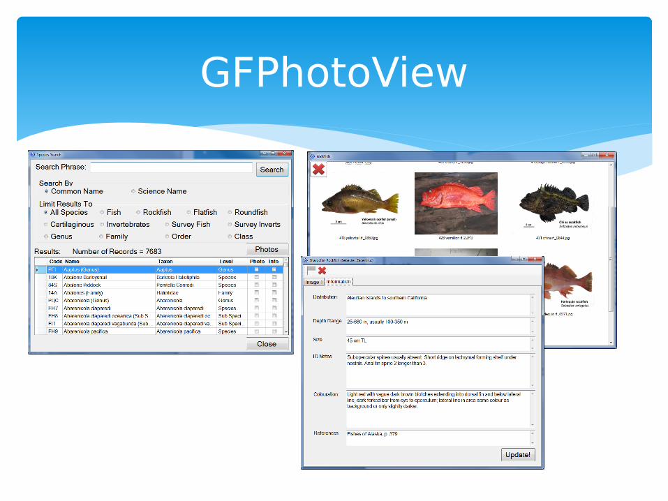
GFPhotoView

Open Source instant message/chat server and client
Openfire server software runs on our database server
Spark chat clients on all GFBioField client computers
Convenient communications between bridge and deck/sampling areas
Openfire and Spark