getting the most what you need to know: from your visit
TRANSCRIPT
Getting the Most From Your Visit
What You Need to Know: • There are five areas which serve as bases for
If you're like most people, you will probably be eager to get out of the car and start exploring the park by the time you drive in the entrance gates. To make the most of your visit, read the "What You Need to Know" box at right and then match the following suggestions with your time and interests.
FROM THE SOUTHWEST, you'll entervia the Nisqually gate. The arch of giant cedar logs, first erected in 1911, and the 1908 Oscar Brown cabin, south of the road, are examples of the rustic style of park architecture that became popular at Mount Rainier and other national parks.
The Longmire Historic District, 7 miles from the park entrance, was the site of James Longmire's homestead, lodging, and mineral springs .resort. The first park headquarters was established here in 1916. Services at Longmire include: •Longmire Museum-open daily.
• Narada Falls, 8 miles from Longmire. Walk the steep but short trail for the best view. Parking is limited.
Parad ise, 12 miles from Longmire, is the most popular destination in the park and is famous for its wildflower meadows.
A hike here is rewarding, but can be crowded. Services at Paradise include: • The Jackson Memorial Visitor
Center- open daily, exhibits, films, guided interpretive programs, book store, food service, gift shop, and restrooms.
exploration: Longmire (southwest corner) Paradise (south side) Ohanapecosh (southeast corner) Sunrise/White River (northeast corner) Carbon River/Mowich Lake (northwest corner).
• Parking can be difficult or impossible to find on sunny summer weekends at Paradise, Sunrise, Grove of the Patriarchs, and at trailheads between Longmire and Paradise. Try to visit these areas on weekdays, arrive early in the day, and carpool to the park.
• Park roads are winding, road shoulders are narrow, and the maximum speed limitis 35 m.p.h. in most areas. Watch for pedestrians, sightseers, and wildlife. Use pull-outs to allow faster drivers to pass you safely.
• Keep wildlife wild. Feeding park animals and birds is unhealthy for them and dangerous to you.
• The Paradise Inn-lodging, dining room, gift shop, restrooms.
damage to the vegetation and soils. Please stay on the trail and leave the flowers for others to enjoy.
•The Guide House-information about summit climbs with Rainier Mountaineering, Inc.
• The Paradise Ranger Station- open daily, climbing and wilderness permits and hiking information.
The section of road between Chinook Pass and the north park boundary is part of the Mather Memorial Parkway, named for Stephen Mather, the first director of the National Park Service.
•Wilderness Information Center-open daily, wilderness permits and hiking information.
• National Park Inn-food, lodging, gift shop.
The p lon-t5 o~ -the 51/ba I pine meotlow5 ore m05-t
~rogi re and v11 lnerob le o5 -the 5now me l-t5 and -the 50i I i5 we-t . Pleo5e 5-toy on c.on5-trvc.-ted
The White River/Sunrise area is easy to visit if you enter from the east side, but requires quite a bit of driving from the southwest entrance. If you are camping, consider eastside campgrounds at Ohanapecosh or White River.
The road between Longmire and Paradise is winding and steep, and was designed for scenery rather than speed. En route, consider stopping at:
,.. ,.. J __ -trai 15 or on 5now l o-t leo5-t w -~ ~F> ! ) on ly. Po no-t -taKe 5hortc.11-t5 ac.r055 -the meotlow5!
• Cougar Rock Picnic Area, 2 miles from Longmire.
• Christine Falls, 3.5 miles from Longmire. A short walk from the pullout provides a spectacular view of the falls through the bridge opening. Parking is limited.
• Glacier Bridge, 5 miles from Longmire, is worth a stop for the view, but do not stop your car on the bridge! Park in a paved pullout and use the
If you plan to hike, remember that Paradise is located at 5,400' elevation and most trails are hilly. Please stay on the trails: the meadows are very fragile and heavily visited.
A number of additional hikes are located on the road between Paradise and Ohanapecosh. See page 6 for details.
FROM THE SOUTHEAST, your first stop will be Ohanapecosh. The east side of the park is somewhat drier and sunnier than the west side,
The road to Sunrise passes the White River Entrance Station about 1 mile from the junction with Highway 410. The White River Wilderness Information Center here is open daily for climbing and wilderness permits and hiking information.
Five miles from the junction with Highway 410, you'll pass the one-mile spur which leads to the White River campground and trailhead. Services at White River include a ranger station, campground, and picnic area.
Eleven miles from White River, the road reaches Sunrise, also called Yakima Park. At an
elevation of 6,400', this is the walkway. The lower end of the Nisqually Glacier is just above the
rocky cliff on the left side as you look up the valley.
making it a good destination when Paradise and Longmire are wet and foggy. Services include:
Pe-t-5 are on 1 errrr 1 highest point to . . YI!I¥ F> •ffea 0!1 road5 and which you can ft! parKrng area5 an 1 m p a 115-t be lea5hed. drive in the park.
• Ricksecker Point, 6 miles from Longmire, offers excellent views of the Mountain and the Nisqually Valley.
Ohanapecosh Visitor Center-open daily, exhibits,
og5 are no-ta llowed on parK -tra;r5 . Summer is short
Longmire to Paradise Paradise to Ohanapecosh Ohanapecoshtothe
SunriseNv'hite River turnoff The SunriseNv'hite River turnoff
to Sunrise Seattle to Paradise via Highway 706 Seattle to Paradise via
Highway 410 and Enumclaw Yakima to Paradise
guided interpretive programs, restrooms. • Ohanapecosh Campground and picnic area.
Between Ohanapecosh and White River, a short detour from
17 miles
14 miles 99 miles
109 miles 99 miles
30 minutes
45 minutes 2 1 /2 hours
3 hours 2 hours
Cayuse Pass east on Highway 410 will take you to Tipsoo Lake, which is surrounded by subalpine wildflower meadows. A short and pleasant trail circles the lake. This area is heavily visited and you'll see signs of
here, but the views and excellent trail system make this the second most visited location in the park. Parking can be a problem on sunny weekends; try to arrive early or visit on weekdays. Services include: • Sunrise Visitor Center-open daily, exhibits,
guided interpretive programs, picnic area. • Sunrise Day Lodge-food service, gifts (no
overnight lodging). • Public restrooms and telephones.
FROM THE NORTHWEST, you can visit the Carbon River area. A short trail near the Carbon River entrance station takes you into a fine example of a temperate rain forest. The gravelled Carbon River road ends approximately
Continued on pg 2... \r)
Welcome For Your Information ...
WeictJm,e; ... ... to Mount Rainier
National Park, a crown jewel of the northwest and of the National Park System. Behind the beautiful scenes of this great park are an exceptional group of women and men who Superintendent ]on]arv~ are at work around the clock to preserve and protect park resources and provide for a quality experience for you.
Road crews are up early to clear rock fall or to patch holes in our mountain highways, trail crews are out for days repairing bridges for safe stream crossings, climbing rangers patrol the high mountain to educate and assist climbers, and protection rangers work the front country and wilderness to ensure your visit is a safe one. Biologists sample the air, water and wildlife to keep a pulse of the sensitive environment of the park, and interpreters work the information desks and lead walks that inform us all about the wonders of Mount Rainier. Electricians, plumbers, carpenters, water treatment operators keep the infrastructure operational and restore the great historic structures of the park, and administrators keep the supplies in stock, the computers running, and the budgets accountable.
These are employees of the U.S. Government and they take a great deal of pride in the service they provide to you and the park every day. National Parks have consistently been one of the most popular destinations in America not only because they are beautiful places, but also because they are maintained with a deep devotion from a small dedicated staff along with an energetic group of volunteers. So when you are out there in the parks this summer and see one of the "behind the scenes" workers, say "Thanks." I do.
-~\~\~~~ ........___;
Jon Jarvis, Superintendent Mount Rainier National Park
Entrance Fees The entrance fee for Mount Rainier National
Park is $10 per single, private, non-commercial vehicle. It covers everyone in the vehicle and is valid for seven consecutive days. The entrance fee for a single motorcyclist or bicyclist, pedestrian, charter bus passenger, or passenger in a non-privately owned vehicle is $5 per person. There is no charge for Golden Age, Golden Access, Golden Eagle, or National Park Pass holders. For fee information on tour buses, annual passes, and Golden Passports, call (360) 569-2211, ext. 6003.
Editor/Designer: Alisa Lynch Chief of Interpretation: Maria Gillett Superintendent: Jon Jarvis Contributors: Rick Kirschner, Jim Petterson,
Carol Sperling, and Ted Stout. Publisher: Northwest Interpretive Association
909 1st Ave., Ste. 630, Seattle, WA 98104 Tel. (206) 220-4140
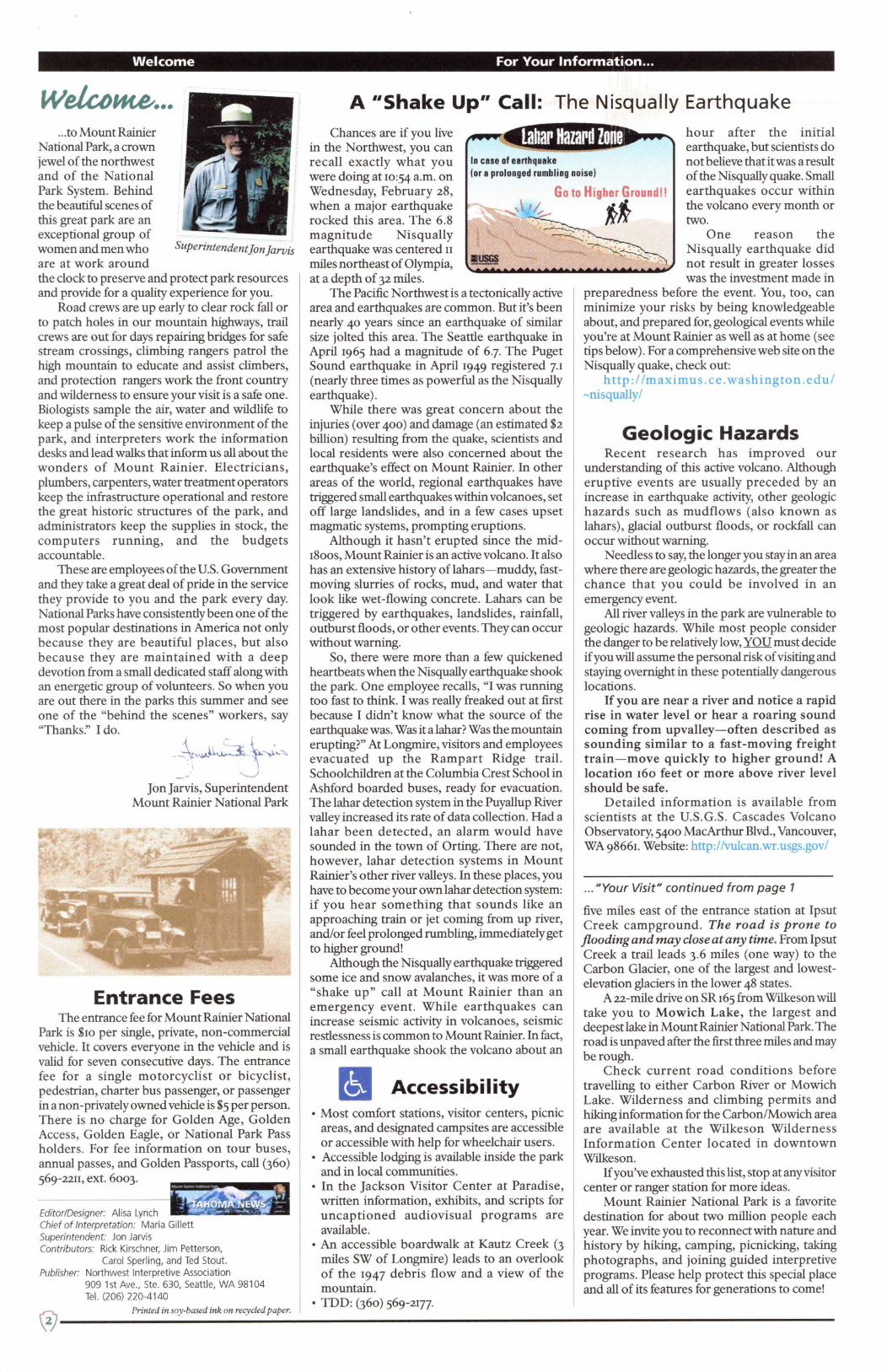
A ••shake Up" Call: The Nisqually Earthquake
Chances are if you live in the Northwest, you can recall exactly what you In case of earthquake were doing at 10:54 a.m. on (or a prolonged rumbling noise I
hour after the initial earthquake, but scientists do not believe that it was a result of the Nisqually quake. Small earthquakes occur within the volcano every month or two.
Wednesday, February 28, when a major earthquake rocked this area. The 6.8 magnitude Nisqually earthquake was centered 11
One reason the
miles northeast of Olympia, !!!!! ,,.. ............................. _. ............... .... at a depth of 32 miles.
Nisqually earthquake did not result in greater losses was the investment made in
The Pacific Northwest is a tectonically active area and earthquakes are common. But it's been nearly 40 years since an earthquake of similar size jolted this area. The Seattle earthquake in April 1965 had a magnitude of 6.7. The Puget Sound earthquake in April 1949 registered 7.1 (nearly three times as powerful as the Nisqually earthquake) .
While there was great concern about the injuries (over 400) and damage (an estimated $2 billion) resulting from the quake, scientists and local residents were also concerned about the earthquake's effect on Mount Rainier. In other areas of the world, regional earthquakes have triggered small earthquakes within volcanoes, set off large landslides, and in a few cases upset magmatic systems, prompting eruptions.
Although it hasn't erupted since the mid-18oos, Mount Rainier is an active volcano. It also has an extensive history of lahars-muddy, fastmoving slurries of rocks, mud, and water that look like wet-flowing concrete. Lahars can be triggered by earthquakes, landslides, rainfall, outburst floods, or other events. They can occur without warning.
So, there were more than a few quickened heartbeats when the Nisqually earthquake shook the park. One employee recalls, "I was running too fast to think. I was really freaked out at first because I didn't know what the source of the earthquake was. Was it a lahar? Was the mountain erupting?" At Longmire, visitors and employees evacuated up the Rampart Ridge trail. Schoolchildren at the Columbia Crest School in Ashford boarded buses, ready for evacuation. The lahar detection system in the Puyallup River valley increased its rate of data collection. Had a lahar been detected, an alarm would have sounded in the town of Orting. There are not, however, lahar detection systems in Mount Rainier's other river valleys. In these places, you have to become your own lahar detection system: if you hear something that sounds like an approaching train or jet coming from up river, and/or feel prolonged rumbling, immediately get to higher ground!
Although the Nisqually earthquake triggered some ice and snow avalanches, it was more of a "shake up" call at Mount Rainier than an emergency event. While earthquakes can increase seismic activity in volcanoes, seismic restlessness is common to Mount Rainier. In fact, a small earthquake shook the volcano about an
Accessibility • Most comfort stations, visitor centers, picnic
areas, and designated campsites are accessible or accessible with help for wheelchair users.
• Accessible lodging is available inside the park and in local communities.
• In the Jackson Visitor Center at Paradise, written information, exhibits, and scripts for uncaptioned audiovisual programs are available.
• An accessible boardwalk at Kautz Creek (3 miles SW of Longmire) leads to an overlook of the 1947 debris flow and a view of the mountain.
• TDD: (360) 569-2177.
preparedness before the event. You, too, can minimize your risks by being knowledgeable about, and prepared for, geological events while you're at Mount Rainier as well as at home (see tips below). For a comprehensive web site on the Nisqually quake, check out:
http://maximus.ce.washington.edu/ -nisqually/
Geologic Hazards Recent research has improved our
understanding of this active volcano. Although eruptive events are usually preceded by an increase in earthquake activity, other geologic hazards such as mudflows (also known as lahars), glacial outburst floods, or rockfall can occur without warning.
Needless to say, the longer you stay in an area where there are geologic hazards, the greater the chance that you could be involved in an emergency event.
All river valleys in the park are vulnerable to geologic hazards. While most people consider the danger to be relatively low, YOU must decide if you will assume the personal risk of visiting and staying overnight in these potentially dangerous locations.
If you are near a river and notice a rapid rise in water level or hear a roaring sound coming from upvalley-often described as sounding similar to a fast-moving freight train-move quickly to higher ground! A location 160 feet or more above river level should be safe.
Detailed information is available from scientists at the U.S.G.S. Cascades Volcano Observatory, 5400 MacArthur Blvd., Vancouver, WA 98661. Website: http://vulcan.wr.usgs.gov/
... "Your Visit" continued from page 1
five miles east of the entrance station at Ipsut Creek campground. The road is prone to flooding and may close at any time. From Ipsut Creek a trail leads 3.6 miles (one way) to the Carbon Glacier, one of the largest and lowestelevation glaciers in the lower 48 states.
A 22-mile drive on SR 165 from Wilkeson will take you to Mowich Lake, the largest and deepest lake in Mount Rainier National Park. The road is unpaved after the first three miles and may be rough.
Check current road conditions before travelling to either Carbon River or Mowich Lake. Wilderness and climbing permits and hiking information for the Carbon/Mowich area are available at the Wilkeson Wilderness Information Center located in downtown Wilkeson.
If you've exhausted this list, stop at any visitor center or ranger station for more ideas.
Mount Rainier National Park is a favorite destination for about two million people each year. We invite you to reconnect with nature and history by hiking, camping, picnicking, taking photographs, and joining guided interpretive programs. Please help protect this special place and all of its features for generations to come!
(:;i Printed in soy-based ink on recycled paper.
\~ -----------------------------------------------------------------

Safety is the Starting Point for a Great Visit!
''Leave No Trace" of your Wilderness trip
• plan ahead & prepare • travel & camp on durable surf aces
• dispose of waste properly • leave what you find
• minimize campfire impacts* • respect wildlife
• be considerate of other visitors
* for emergency use only; fires are not allowed in Mount Rainier's Wilderness.
Carry the 11 10 Essentials"
and know how to use them! • map of the area
•compass • extra food and water
• first aid kit • flashlight, extra batteries & bulb
• sunglasses & sunscreen • pocketknife
• extra clothing & rain gear • emergency shelter
• matches in a waterproof container*
Wilderness camping permits are required for all overnight stays in the park's backcountry. Climbing permits are required for travel above 10,000' and/or on glaciers.
Safety First! Mount Rainier National Park offers excellent
opportunities for exploration and adventure, but it also offers opportunities to get lost or injured. Reduce your risk by following these simple guidelines:
Planning to Hike the Muir Snowfield? The Muir Snow.field, a permanent field of
snow, ice, and rock outcrops, is located north of Paradise, between 7000' - w,ooo' in elevation.
Beware It's very easy to get
lost or injured when the weather deteriorates, the trail is covered with
If yov t.1re no-t -trv ly l<now 1et.1~t.1b le ~ prept.1red, or if -the wet.1-ther i5 q,ve5-tiOMb le, don' -t pr15h yo11r Ive.I<!
Thousands of people hike on the Muir Snowfield each year en route to Camp Muir. On a clear day,
snow, you don't know where you are, and/or you don't know how to assess avalanche hazard and avoid the danger.
Even though trail crews are at work throughout the park this summer, you may encounter downed trees and missing footlogs at river crossings. Be especially careful at river crossings. Many people underestimate the power of the water and are unaware of large rolling boulders that are being carried along by it. If you must cross, do it in the morning when rivers are generally lower.
While we had less than average snowfall last winter, some trails may remain snow-covered into summer. Beware of snow-covered trails and steep, icy slopes; thin snowbridges over streams and crevasses; snow moats; wet, slippery rocks, especially near rivers and waterfalls; and snow cornices. Prepare
When hiking, climbing, skiing, or snowboarding, bring the "IO Essentials" and know how to use them. Obtain compass bearings for treks to Camp Muir or other off-trail destinations; carry a map, compass, and an altimeter; wear rain- and wind-resistant clothing and proper footwear; and take a whistle, a" space blanket," and a snow shovel. Wear sunscreen and sunglasses when travelling on snow to avoid snowblindness and extreme sunburn. Prepare for the weather. Even in summer, you may encounter "winter" storms. Have enough gear so that you don't have to face a winter storm while dressed for summer. We anticipate a "dry" summer: don't rely solely on backcountry water sources and exercise extreme caution with stoves and campfires. Stop by a visitor center or Wilderness Information Center to inquire about burning restrictions that may be in effect. Take Care
Tell someone your travel plans so they can notify the park if you fail to return. Do not travel alone. If visibility is poor, do not travel at all. Taking these few precautions could save your day ... and your life!
If you see a bear ... • Never feed a bear. • Never run from a bear.
the hike is spectacular. But, when the weather deteriorates, as it often and unpredictably does, crossing the Muir Snowfield can be disastrous. More hikers, skiers, climbers, and snowboarders get lost on the Muir Snowfield each year than in the rest of the park combined. While many find their way out, searches must be initiated for others, and some are never found.
What makes the Muir Snowfield such a dangerous place? The snowfield is made up of snow and rocks. In whiteout conditions, snow, rocks, and sky look the same, making it extremely difficult to stay oriented. Even those who have hiked the snowfield dozens of times (including park rangers) find it easy to get off course. Travel too far west and you'll encounter cliffs, avalanche chutes, and the huge crevasses of the Nisqually Glacier. Veer too far east and you'll end up on the Paradise Glacier, with its many crevasses and steep cliffs. In 1999, four people were lost on the Muir Snowfield- three have never been found. Two had ascended the snowfield dozens of times and were very experienced hikers.
Do not become a Muir Snowfield statistic! • Avoid the snowfield in questionable
weather, especially if you are alone or unprepared. Weather conditions can change suddenly and drastically, even on a "sunny" day.
• If you're ascending and clouds or fog start rolling in, turn around and head back to Paradise. If that's not possible, stop moving, dig in, and wait for better weather. Without a compass, map, and altimeter, and expertise in their use, it is extremely difficult to find your way back to the trailhead in a whiteout.
• Do not attempt to descend from Camp Muir in poor weather. Do not descend on skis or a snowboard in limited visibility-you could become lost faster!
• When hiking to Camp Muir, be sure to carry emergency bivouac gear so that you can spend the night out if you have to.
While it may be disappointing to abandon your hike to Camp Muir, remember that the snowfield will be there for you next time, in
better weather. Ask a ranger for tips on other areas to explore during this visit.
Mountain Lions Mountain lions, also called
cougars or pumas, are common but rarely observed in Mount Rainier National Park. Consummate hunters, they prey primarily on blacktailed mule deer and elk calves in the western Cascades. Lions are quite large and distinctly catlike in appearance, with a very long tail. From nose to base of tail an adult male may measure 50", and its tail may be 36" long. Mountain lions generally have gray to reddish-tan fur.
No lion-caused human injuries have occurred at Mount Rainier, although sightings and encounters have increased in recent years. Powerful hunters, lions can pose a threat to people, especially when just learning to hunt or when protecting their young. As humans have moved into relatively undeveloped rural areas in the past few decades, lion attacks have become more frequent. However, attacks on humans by mountain lions are still rare. It's very unlikely you'll see a mountain lion while you're here. If you do, remember:
Children & lone adults are most at risk: • Don't hike alone. • Keep children close to you. • Running or jogging puts you at higher risk.
If YOU meet a mountain lion: • DON'T RUN! Stand still and stand together
with your companions. Face the lion.
• Pick up and hold small children immediately. • Stand upright and try to make yourself appear
larger. •Shout! • If attacked, fight back aggressively.
Please report all sightings of mountain lions as soon as possible to the nearest ranger station, visitor center, or park headquarters at (360) 569-2211, extension 3373 or extension 2334.
N£:Ver<. ~eed parl< wiltfo~e . ?et-s are only perm;t-t-ed on roads and in parl<it1q areas and mvst- be letJ5hed . They are NOT perm;t-t-ed on t-ra; Is/
Wilderness Permits An optional reservation
system for Wilderness campers and climbers is in effect May through September. Reservations may be made two months in
advance of your trip. Backcountry reservations are $20 per party (1-12 people) for one to 14 consecutive nights.
Sixty percent of all backcountry Wilderness sites and zones are available for reservation. The remaining 40% are issued on a first-come, firstserved basis on the day the trip begins.
While advance reservations are optional, permits are required anytime you spend a night in the backcountry. Permits can be obtained in person at a Wilderness Information Center or Visitor Center. Climbers pay a Cost Recovery Fee of $15 per person, per climb; or $25 for an annual pass, which is good for one year from date of purchase.
A Reservation Request Form is available at visitor centers and on the internet at www.nps.gov/mora/recreation/rsvpform.htm. Completed forms should be faxed or mailed to: Wilderness Reservations Office, Mount Rainier
National Park, Tahoma Woods Star
• Do not approach or follow a bear or come between it and its cubs.
• If a bear approaches, try to scare it away
Permit-5 ore reqpired ~or a 11 O\lem;qhtst-ays it1 t-he Wilderness ant.A ~or t-ro"e I
obove ro,ooo' ant.ii or on q lac.iers.
Route, Ashford, WA 98304-9751. Tel. (360) 569-HIKE. Fax (360) 569-3131.
See page 6 for climbing information.
• Report all bear sightings to a ranger. L...-~~~~~~~~~~~~_._------------------------~~--~®

Interpretive Activities & Visitor Services -- July 1 to September 3, 2001
You're Invited! join a park ranger or volunteer for an evening program, guided nature walk, or talk and explore the natural resources and cultural history of Mount Rainier National Park. A variety of programs are offered throughout the park each day. Distances are roundtrip.
Longmire/Cougar Rock Area A Look at Longmire 2 p.m. & 3:30 p.m. An introduction to the cultural history of the Longmire Area. Meet in front of the Longmire Museum (30 minutes).
Naturalist's Choice 10 a.m. Topics and activities vary from week to week. Inquire at the Longmire Museum. Meet in front of the historic Longmire gas station (time varies).
Junior Ranger Program 8 p.m. thru July 31. 7:30 p.m. beginning August 1. Meet a ranger for fun and educational activities for kids ages 6-11. Meet at the Cougar Rock Campground Amphitheater. Additional parking is available at the picnic area across from the campground (45 minutes).
Evening Program 9 p.m. thru July 31. 8:30 p.m. beginning August 1. Explore a variety of topics on Mount Rainier's natural and cultural history. Program topics/titles are listed on area bulletin boards. Meet at the Cougar Rock Campground Amphitheater. Additional parking is available at the picnic area across from the campground (45 minutes).
Paradise Area Sub-alpine Stroll 10:30 a.m. Explore the wildflower meadows around Paradise and learn how life adapts to mountain conditions. This walk may be wheelchair accessible; check with the rangers at the front desk. Meet at the flagpole outside the Jackson Visitor Center (1.5 hours, 1 mile).
Oh, What a Paradise! 11 :30 a.m. & 6:15 p.m. Our efforts to protect and revegetate the Paradise Meadows continue every summer. Watch this slide program to learn more about the ongoing program and what you can do to participate. Jackson Visitor Center auditorium (20 minutes).
Junior Ranger Program 12:45 p.m. Hey kids: cool stuff happens at Paradise! Meet a ranger for fun and educational activities for kids ages 6-11. Programs may be indoors or outdoors, weather and activity dependent. Meet at the Jackson Visitor Center lobby, near the relief map. Parents are welcome (1 hour).
100 Years in Paradise 1 p.m. The park was established in 1899 and like today, Paradise was a prime destination! Join this easy walk through part of the historic area to gain a perspective on visiting the park in the early years. This walk may be wheelchair accessible; check with the rangers at the front desk. Meet at the Paradise Ranger Station flag pole, in the upper parking lot. (1 hour, 1 mile).
Perilous Beauty 3:15 p.m. Did you know that Mount Rainier is an active volcano? Learn more in this video. Jackson Visitor Center auditorium (30 minutes).
Nisqually Vista Walk 3:30 p.m. Is Mount Rainier an active volcano? What's the difference between glacial ice and regular ice? Learn about our active, icy volcano on this leisurely walk. Meet at the flagpole outside the Jackson Visitor Center (1.5 hours, 1.25 miles).
Evening Program 9 p.m. Explore a variety of topics about Mount Rainier National Park. Topics are posted in the Jackson Visitor Center and the Paradise Inn. Meet in the Paradise Inn lobby (45 minutes).
•
•
•
•
•
•
•
•
•
•
•
• • • •
• • • •
• • • •
• • • •
• • • •
• • • •
• • • •
• • • •
• • • •
• •
• •
• •
• •
• •
• •
• •
• •
• •
SJ) The Longmire Museum (information, exhibits, and book sales) is open daily from 9 a.m. to 6 p.m. Tel. 360-569-22n x. 3314
The Longmire Wilderness Information Center is open daily for wilderness permits and reservations. Sun. - Thurs. 7:30 a.m. - 6:30 p.m . Fri. - Sat. 7 a.m. - 6:30 p.m. Tel. 360-569-HIKE
The National Park Inn and the General Store are located nearby. See page 6 for hours and services.
The Cougar Rock Campground is located nearby. See page 7 for details.
FACILITIES &SERVICES s
The Jackson Visitor Center (information, exhibits, films, book sales, food service, gifts, and showers) is open daily from 9 a.m. to 7 p.m. Tel. 360-569-22n x. 6036
The Paradise Ranger Station (climbing and wilderness information and permits) is open daily. Sun. - Thurs. 7 a.m. - 1 p.m. Fri. - Sat. 6 a.m. - I p.m. (may close during rescues or medical emergencies). Tel. 360-569-22n x. 6009
The historic Paradise Inn is located nearby. See page 6 for hours and services.
Rainier Mountaineering, Inc. (RMI) offers guided climbs of Mount Rainier and related seminars. Their operation is based out of the historic guidehouse. Tel. 360-569-2227
©------------------------------------------------_.;..------~
r
Interpretive Activities & Visitor Services -- July 1 to September 3, 2001
Sunrise/White River Area
Emmons Glacier Walk 9 a.m. Walk to a close-up view of the largest glacier in the contiguous United States. Meet at the White River Patrol Cabin in the White River campground (2 hours. 3.5 miles).
Sunrise Stroll 11 a.m. & 3 p.m. Explore the natural and cultural history of Sunrise on this short walk. Meet at the Sunrise Visitor Center (30 minutes. 0.5 mile).
Mount Fremont Lookout 1 p.m. to 5 p.m. A park naturalist will be available to answer your questions as you enjoy the view. Meet at the Mount Fremont Fire Lookout. 6 miles (roundtrip) hike from Sunrise.
Junior Ranger Program 10 a.m. Meet a ranger for fun and educational activities for kids ages 6-11 and parents too! Meet at the White River Campground amphitheater. (45 minutes).
Evening Program at White River Campground 7 p.m. Explore a variety of Mount Rainier natural and cultural history topics. Program topics/titles are listed on area bulletin boards. Meet at the White River Campground Campfire Circle (45 minutes).
Ohanapecosh Area
Grove of the Patriarchs Walk 10 a.m. Walk along the Ohanapecosh River to a magnificent grove of ancient trees. Meet at the Grove of the Patriarchs parking area (limited parking), near the Stevens Canyon Entrance Station (1.5 hours. 2 miles).
Silver Falls Walk 10 a.m. Explore the forest on the way to a breathtaking waterfall. Meet at the bulletin board by the bridge in Loop B of the Ohanapecosh Campground. (2 hours. 3 miles) .
Junior Ranger Program 2 p.m. Fun in the forest for kids ages 6-11 and parents too! Space is limited. Register at the Ohanapecosh Visitor Center. Meet at the Ohanapecosh Campground Amphitheater (1 hour).
Evening Program 9 p.m. thru July 31. 8:30 p.m. beginning August 1. Explore a variety Mount Rainier natural and cultural history topics. Program topics/titles are listed on area bulletin boards. Meet at the Ohanapecosh Campground Amphitheater. Additional parking is available at the picnic area. (1 hour).
Carbon River Area
Junior Ranger Program 10 a.m. If you're 6-11 years old, don't miss this fun-filled program! Topics and hands-on activities vary. Parents are welcome to attend. See a ranger or check Carbon River/lpsut Creek bulletin boards for location (1 hour).
Campfire Program 7:30 p.m. Explore a variety of topics on Mount Rainier National Park. Programs are posted on Carbon River/lpsut Creek bulletin boards. 45 minutes. Meet at the lpsut Creek Campground amphitheater (45 minutes).
• • • • •
•
•
•
• •
• •
• • • • •
•
• •
•
• •
•
•
•
• •
FACILITIES &SERVICES
~E
The Sunrise Visitor Center (information, exhibits, and book sales) is open daily from 9 a.m. to 6 p.m. Tel. 360-663-2425
The White River Ranger Station is open daily for climbing and wilderness information and permits. Sun. - Wed. 8 a.m. - 5 p.m. Thurs. - Sat. 7 a.m. - 7 p.m. Tel. (360) 663-2273
The Sunrise Day Lodge offers food service and a gift shop (no overnight lodging) . See page 6 for hours and services.
The White River Campground is located nearby. See page 7 for details.
FACILITIES &SERVICES
The Ohanapecosh Visitor Center (information, exhibits, and book sales) is open daily from 9 a.m. to 6 p.m. Tel. 360-569-22n x. 6046
The Ohanapecosh Campground is located nearby. See page 7 for details.
CARBON RIVER ROAD IS SUBJECT TO FLOODING AND
~ MAY CLOSE AT ANY TIME. ~ 7>~ 7>~ e"'07>.<:l>~ 07>~ Check current status at an
~07> 0~'S e"''S eo<::' .§". 07>~ ~..§ entrance station or visitor center.
o/~~~~~~ ~~
•
•
FACILITIES &SERVICES
Obtain wilderness permits at the Wilkeson Wilderness Information Center in downtown Wilkeson. Sun. - Thurs. 7:30 a.m. - 6:30 p.m. Fri. - Sat. T30 a.m. - 8 p.m. Tel. (360) 829-5127.
The Ipsut Creek and Mowich Lake Campgrounds are located nearby. See page 7 for details.
~----------------------------------------------------~®

Fee Demo Program/Facilities Long-Range Planning Hiking and Climbing
Your Fees at Work Mount Rainier National
Park is part of the improves this park Congressionally-authorized
User Fee
Recreation Fee Demonstration Program. The program allows federal land management agencies to increase and retain entrance and user fees. Eighty percent of the fees at Mount Rainier are kept in the park, while twenty percent are made available to other parks in need.
Current "Fee Demo" projects include: completion of the last mile of the Wonderland Trail, upgrading sewage treatment facilities, rehabilitating trails at the Grove of the Patriarchs and Reflection Lakes, upgrading interpretive exhibits and media, and rehabilitating campgrounds.
Your fees are playing a vital role in fulfilling Mount Rainier National Park's mission to protect park resources and to provide for visitor enjoyment. As you explore the park, look for signs of your fees at work!
Food& Lodging
For lodging reservations in the park call Mt. Rainier Guest Services at 360-569-2275
www.guestservices.com/rainier
Nat1~nal Park Inn (Longmire) Lodging and dining. Open year-round. Front desk: 7 a.m. -IO p.m. daily Restaurant: 7 a.m. - 8 p.m. daily
-~t1_opal_Park Inn Post Qftlce (Longmire) Open year-round. Closed Sundays and Holidays. Monday - Friday: 8:30 a.m. - 5 p.m. Saturday: 8:30 a.m. - 12 p.m.
General Store (Longmire) Open year-round. Groceries, gifts,firewood.
8 a.m. - 8 p.m. daily Firewood is also available in Loop A of Cougar Rock campground: Friday - Sunday 4 p.m. - 9 p.m.
Jc ckso_n VisitQr Center (Paradise) Grill & Gift Shop:
IO a.m. - 7 p.m. daily Showers (located in the basement):
Available 9 a.m. - 6:30 p.m. ???
P_arad1s_e_ Inn (Paradise) Front Desk: Open 24 hours daily Dining Room
Breakfast 7 a.m. - 9:30 a.m. Lunch 12 p.m. - 2 p.m. Dinner 5:30 p.m. - 8:30 p.m. Sunday Brunch II a.m. - 2:30 p.m.
Glacier Lounge 12 p.m. - II p.m. Gift Shop 8 a.m. - 9 p.m. Snack Bar 9 a.m. - 8 p.m.
Parad1sj? Im1Post Office Closed Sundays and Holidays. Monday - Friday: 8:30 a.m. - 5 p.m. Saturday: 8:30 a.m. - 12 p.m.
Sundse L.Qdge Day use only/no overnight lodging. Snack Bar/Gift Shop 10 a.m. - 7 p.m.
Gasoline, lodging, dining, and other services are available in local communities. A list of these services is available at park visitor centers and on the park's web site: www.nps.gov/mora. Religious services are available in the park and in local communities.
GAS IS NOT AVAILABLE IN THE PARK.
@-------
Plea5e CONSeRve WA..,-~=/ .,.., . d '1.-,...... _ vllrinq rovqh+- c..ond;t-;on5 and a lway5, make
every drop c..ovnt-. U5e wat-er Wi5ely.
Park Planning Planning for the future of Mount Rainier
National Park is a monumental task and responsibility that is shared by park managers and the public alike. You may have already attended public meetings or seen newsletters about the planning process in which Mount Rainier is currently engaged. When completed, the product of this process, a General Management Plan and Environmental Impact Statement (GMP/EIS) for Mount Rainier National Park, will outline a broad philosophical approach to managing the park and specific actions that are needed to reach identified goals as we move into the 21st century.
Later this fall, watch for notices regarding the release of the Final GMP/EIS and Record of Decision (ROD) approval document for the beginning of implementation.
To be placed on the mailing list for future newsletter(s), please contact Superintendent, Mount Rainier National Park, Tahoma Woods Star Route, Ashford, WA. 98304-9751. Tel. (360) 569-22II ext. 2301. E-mail: [email protected]
Pon'+- let- a 51ip, -trip, or ~al I rllin yo/Ir Vi5i-tWear proper ~oot-wear I Com~or-t, $/lppor-t, IJl1d -trac,-tiOl1 are 'l/i-tal. eac.h yet>r, ;nakqµa-te ~oot-wear ;5 -to blame ~or do7-en5 o~ if!illrie5.
Easy & Moderate Hikes
Mount Rainier guides, r9r2
Climbing Mount Rainier Over IO,ooo people attempt to climb Mount
Rainier each year. About half actually make it to the 14,410' summit.
Climbing information is available at ranger stations and on the park's web site at www.nps.gov/mora/home .htm. For prerecorded route conditions, call (360) 569-2211 ext. 6009.
Rainier Mountaineering, Inc. (RMI) conducts guided climbs and related seminars. Call (360) 569-2227 or visit RMI's website at www.rmiguides.com for more information.
Guide services on the Emmons Glacier Route are offered by:
•Alpine Ascents International (206) 378-1927 ·American Alpine Institute (360) 671-1505 •Cascade Alpine Guides (425) 602-0656 •Mount Rainier Alpine Guides (360) 825-3773
Area Trail Name Trailhead Location Roundtrip
Comments Distance
Twin Firs 3 miles west of 0.4-mile loop Short hike in old growth Longmire trail forest. Limited parking.
Trail of the Across road from the 0.7-mile loop Good for children &
Longmire evening strolls. Shadows National Park Inn. trail Meadow/Mtn. views.
Carter Falls 2 miles east of Longmire 2 miles Easy hike, climbs 500' at end.
Nisqually Vista Just west of the Jackson 1.25-mile paved Meadow & glacier Visitor Center loop views, strollers OK.
Paradise 1 mile via the Leads through
Myrtle Falls Upper parking lot, near east side of the wildflower meadows to the restrooms Skyline a waterfall. Great views
Trail/paved of the Mountain.
Bench & Snow 1 mile east of Louise 2.5 miles
Watch for bears in late
Stevens Lakes Lake, south of road summer.
Canyon Road Box Canyon n miles east of Paradise 0.5-mile loop View a deep, narrow
canyon.
Grove of the Near Stevens Canyon 1.2-mile loop Old growth forest, Patriarchs entrance ancient trees.
Ohanapecosh Old growth forest,
Silver Falls Ohanapecosh Visitor 2.4-mile loop Center waterfall.
Mather Tipsoo Lake Off SR 410, east of 0.5-mile loop Short trail around the
Parkway Cayuse Pass lake. Mountain views.
White River Emmons Upper end of White 3 miles
Mountain and glacier Moraine Trail River Campground views.
Emmons Vista South side of parking lot 1 mile Suitable for strollers.
Wildflower meadows Nature Trail North side of parking lot 1.5 miles and great Mountain
Sunrise views.
Mount Obtain map at visitor Fremont North side of parking lot 6 miles center. Take water and Lookout snacks.
Check trail conditions before hiking. Trails and roads may be snow-covered. Please stay on trails. Do not pick wildflowers or feed wildlife. Pets are not allowed on trails.

Special Programs • Drive-in Campgrounds
Thursday, July 5 - 7 p.m., WR Living With A Volcano in Your Backyard Carolyn Driedger, Hydrologist U.S. Geological Survey
Wednesday, July n - 9 p.m., CR 8500 Years of Human History: the Archeology of Mount Rainier Greg Burtchard, Archeologist National Park Service
Thursday, July 12 - 9 p.m., OH Exploring the Buried Forests around Mount Rainier Pat Pringle, Geologist
join a subject matter expert on Wednesday and Thursday evenings for an in-depth look at some aspect of the park's history and resources. All talks are free and open to all. Times and locations vary.
Locations: CR OH WR PA
Cougar Rock Campground Amphitheater Ohanapecosh Campground Amphitheater White River Campground Campfire Circle Paradise Inn Lobby
Thursday, August 9 - 8:30 p.m., OH Early Visitors: the Archeological Record of Mount Rainier Pat McCutcheon, Archeologist Central Washington University
Wednesday, August 15 - 9 p.m., PA The May 18, 1980 Eruption of Mt. St. Helens Robert Yates, Geologist Oregon State University
Thursday, August 16 - 7 p.m., WR Fire Chasers and Adventure Seekers:
Washington Department of Natural Resources
The Historic Trails of Mount Rainier Paul Sadin, Park Ranger-Historian National Park Service
Wednesday, July 18 - 9 p.m., PA Mean and Green: Lifestyles of High Altitude Plants Laurie Kurth, Botanist, National Park Service
Wednesday, July 19 - 7 p.m., WR Mountain Fever Jim Ross, Park Ranger, National Park Service
Wednesday, July 25 - 9 p.m., CR Wild about Rainier: Wildlife Research at Mount Rainier Cori Conner, Biological Technician National Park Service
Wednesday, July 26 - 9 p.m., OH What's Cooking at Cascade Volcanoes? Willie Scott, Geologist, U.S. Geological Survey
Wednesday, August 1 - 9:00 p.m., PA Bringing History to Life: Discovering the Treasures of the Mount Rainier Archives Deborah Osterberg, Museum Curator National Park Service
Wednesday, August 22 - 8:30 p.m., CR Mountain Medley: Songs, Stories & More ... Patricia Heusner, Park Ranger-Educator, National Park Service
Thursday, August 23 - 8:30 p.m., OH Updating Mount Rainier's Geologic Story: Results of Recent Geologic Research Tom Sisson, Geologist, U.S. Geological Survey
Wednesday, August 29 - 8:30 p.m., CR?? Nisqually Culture The McCloud Family Nisqually Tribal Members
60-therinq .Qirewood in -the porl<. i5 prohibi-ted.
Firewood i5 °" oi lob le .Qor 5o le o-t -the L-onqmire 5-tore ona -the Co11qor !<oc-1<. !t. Ohonopec-o5h Compqr011na5. BvnMq re5-tric--tiort5 may be in e.Q.Qec..-t ave -to drOflqh-t wndi-ti0fl$.
Drive-in Campgrounds Thursday, August 2 - 7 p.m., WR The Call of the Backcountry Name Elev. Fee
#of Flush
Jack Morrison, Park Ranger National Park Service
Wednesday, August 8 - 8:30 p.m., CR Earthquakes and Volcanoes: Predicting Mount Rainier's Next Eruption Steve Malone, Seismologist University of Washington
A Blast From the Past A new feature
recently premiered on the park's website: Nature Notes.
Hundreds of issues of the notes were published by park naturalists from 1923 through 1939· They featured articles on plants, wildlife, road and trail conditions, park regulations, safety cautions, and history, along with poems, illustrations and anecdotes.
Sunshine Point Open all year
2000 1
Cougar Rock* OpenMay25 3180 1
to Oct. 9, 2001
Ohanapecosh* OpenMay25 1914'
to Oct. 9, 2001
White River Open]une 22 4400' to Oct. 1, 2001
lpsut Creek Open all year,
depending on snow 2300'
& road status
Mowich Lake Open May25 4950'
to Oct. 8, 2001
sites Toilets
$10 18
$12 173 +
$15* 5 group x sites
$12 188 +
$15* 1 group x
site
$10 112 x
31 + $9 2 group
sites
30 None walk-in
sites
Ask for a Junior Ranger Activity Book. It's FREE and available at visitor centers. Complete it and you'll earn a badge and certificate. You'll also learn lots of cool stuff about your park!
MOUNT ST. HELENS INSTITUTE Events at Mount Rainier
Registration and fees required. Contact the Mount St. Helens Institute at (360) 891-5095for information.
Saturday, July 14 Ancient Forest Ecology Robert Van Pelt, Forester University of Washington
Saturday, September 8 Emmons Glacier Geologic Odyssey Carolyn Driedger, Hydrologist U.S. United States Geological Survey
OLYMPIC PARK INSTITUTE (OPI) Events at Mount Rainier
Registration and fees required. Contact OPI at (360) 928-3720 for information.
Saturday, August 4 Wildflowers of Mount Rainier Jack Morrison, Park Ranger-Naturalist, National Park Service
Tuesday - Friday, August 7 - 10
What's Cooking At Mount Rainier: A Volcanic Study for Educators Carolyn Driedger, Geologist U.S. Geological Survey
Pit Dump Location/Notes
Toilets Station
SW corner of park, x 0.25 miles E of the
Nisqually Entrance.
SW corner of park, x 2.3 miles NE of
Longmire.
SE corner of park, x 11 miles NE of
Packwood on SRI23.
E side of park, 5 miles W of
White River Entrance.
NW corner of park, 5 miles E of Carbon
River Entrance. x ROAD SUBJECT TO WASHOUT -- may close at any time.
x NW corner of park, at NO the end of SR165.
Potable Unpaved Road. WATER NO FIRES.
The internet and the special efforts of two park volunteers have made it possible to experience yesterday today. Over 150 issues are currently on the web. We hope to continue adding issues until the collection is complete. Check it out at:
www.nps.gov/mora/notes/nn-intro.htm
* Advance reservations are required for Cougar Rock and Ohanapecosh Campgrounds from the last Monday in June through Labor Day. Call 1-800-365-CAMP up to 5 months in advance or reserve your site online at http:l/reservations.op~.9ov The nightly fee during the reservation period is $15 per site. All other campgrounds are operated on a first-come, first-served basis.

Park Partners
Thank You Volunteers! Each year more than
85,000 volunteers donate over 3,000,000 hours of service in the national parks. They come from every state and nearly every country in the world to help preserve and protect America's natural and cultural heritage for the enjoyment of this and
future generations. At Mount Rainier National Park, 786 volunteers contributed a total of 42,406 hours in 2000. We express our deep appreciation to them and to all who are volunteering in 2001! For more information, contact Volunteer Coordinator, Tahoma Woods Star Route, Ashford, WA 98304-9751. Tel. (360) 569-2211ext.3414.
E-mail: mora_ [email protected]
Northwest Interpretive Association
Northwest Interpretive Association operates bookstores in the park's visitor centers and information centers. As a non-profit organization benefitting educational programs in the national parks and forests of the Pacific Northwest, NWIA plays an important role in making interpretive and educational publications available to travelers. It also funds special interpretive projects in the areas it serves.
For more information or membership, call (360) 569-2211, ext. 3320, or visit NWIA on the web at www.nwpubliclands.com
Washington's Washington's National Park Fund National was created to restore, enhance, and Park Fund preserve Washington's national parks. The
Fund is a private, independent, not-forprofit organization that works with individuals, businesses, foundations, and others to secure financial and volunteer support for projects to improve the parks. The Fund supports education and interpretation, trail and access improvement, natural resource research and protection, cultural resource research and protection, and visitor services.
Last year at Mount Rainier, the Fund supported natural and cultural resource surveys and special outreach programs for students, organizations, and communities.
If you'd like to help, look for donation boxes at park visitor centers, or contact Jen Benn, Executive Director, Washington's National Park Fund, 2112 Third Avenue, Suite 501, Seattle, WA 98121. Tel. (206) 770-0627. www.wnpf.org
Deep green forests and natural wonders. Civil War
battlefields and presidential homes. In grand cities and
grand canyons •..
Experience Your America with a
National Parks Pass
AS A VISITOR Maui to Maine, Alaska to the Everglades, use your Pass for admission to National Parks requiring entrance fees. It's good for one full year.
AS A PARTNER More than 80% of proceeds from your purchase of a National Parks Pass supports projects that make the National Parks experience possible.
Plus, your Pass includes a PopOut Map™ listing all national parks, a Proud Partner vehicle decal, and entitles you to a FREE subscription to GoParks Newsletter that puts you at the forefront of park activities and events.
Purchase your National Parks Pass at any Mount Rainier Entrance Station, online at www.nationalparks.org, or by calling 1-888-GO-PARKS.
Just $50 (plus shipping and handling if you buy online or by phone).
If you only plan to visit Mount Rainier National Park, consider the Mount Rainier Annual Pass . It costs $20 and, like the National Parks Pass, is good for one full year. It does llQ1 include the GoParks Newsletter, decal, or PopOut Map™
365 DAYS • 384 WAYS TO EXPERIENCE YOUR AMERICA
The National Park Service cares for special places saved by the American people so that all may experience our heritage. Mount Rainier National Park is a source of insp~ration,
providing boundless opportunities for exploration, solitude, and contemplation.
Welcome to Your National Park! Whether you are looking for wilderness solitude or
historical architecture, spectacular drives or challenging hikes, Mount Rainier National Park has something for you. This issue includes information that will help you plan your activities and have a safe and enjoyable visit.
Plan for Traffic Delays Long snowy winters mean that most of Mount
Rainier's road maintenance must be done in summer. Please budget extra time into your schedule to accommodate construction delays. Use the time to enjoy the view ... or to read your Tahoma News!
Rehabilitation efforts on the Mather Memorial Parkway (SR 410) continue this summer. Expect up to 30 minute delays from east of Cayuse Pass (intersection of SR 123 and SR 410) to Chinook Pass. Additional construction delays may be encountered outside the park. We appreciate your patience!
Remember also, to not let your need for speed get the best of you. Park roads and narrow and turny and you'll be sharing them with many other drivers, bicyclists, and even pedestrians. Buckle up and obey speed limits. Have a great visit!
IN THIS ISSUE: Getting the Most from Your Visit.. .... .. 1-2 Welcome/Geology/FYI. ... .. .... .............. 2 SafetyNVilderness Permits .. ................ 3 Interpretive Activities .. .. ...................... 4-5 Facilities & Services ....... .... ..... .. .. ..... ... . 4-5 Food & Lodging .. ...... .. .. ... .... ... ..... .... .. . 6 Hiking/Climbing .. ..... .... ....... ... .. .. ..... ... 6 Mount Rainier Institute Programs ... .... 7 Drive-in Campgrounds ........ .... .... ...... . 7 Park Partners .. .. ....... .. .... .. .... .... ........... 8
IN CASE OF EMERGENCY
DIAL 9-1-1
Mor111t 8t.!i11ier Te 1epho11e Nvmbers c.4ret.! Code: ~(oO)
T'Pt>: 5(o,-2.l 77 6e11ert.! I: 5(o,-2.2.ll
longmire MV5evm ext. 7714 f't.!rt.!di5e Vi5itor Center ext . w07(o Ohtlnt.!pec.o5h Vi5itor Center ext. (o04-w Svnri5e Vi5itor Center roro7-2425 Wi 1derne55 tn~o Center 5w<J-Ht!<e www.11ps.gov lmort.!
Mt. Rt.!inier 6vest Servic.es 5(o,-2.2. 75' www .gvestservic.es . c.om/r~ i n ier
Northwest Interpretive .4ssoc.it.!tiOt1 5(o,-2.2.l l e.xt. ~~2.o www .nps.qo-vlmort.!I NW IA/nwi~ .htm