getting the boundaries right: the dod real property...
TRANSCRIPT
Getting The Boundaries Right: The DoD Real Property Inventory Mapping Pilot Project
David LaBranche, P.E.DISDI Mission Assurance Officer
ODUSD(I&E), Business Enterprise Integration
24 May, 2007
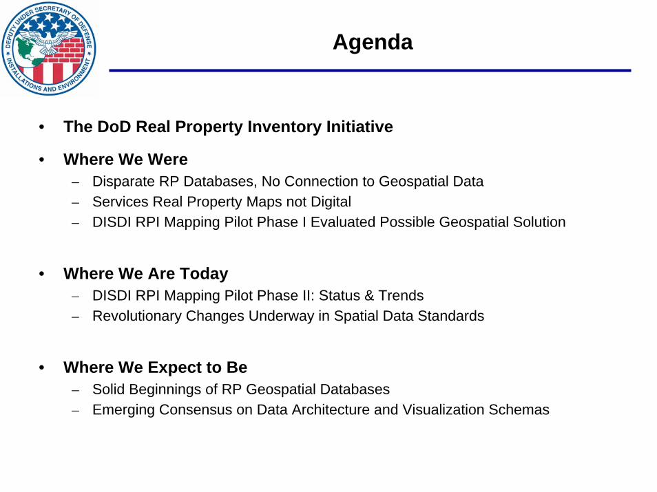
Agenda
• The DoD Real Property Inventory Initiative
• Where We Were– Disparate RP Databases, No Connection to Geospatial Data– Services Real Property Maps not Digital– DISDI RPI Mapping Pilot Phase I Evaluated Possible Geospatial Solution
• Where We Are Today– DISDI RPI Mapping Pilot Phase II: Status & Trends– Revolutionary Changes Underway in Spatial Data Standards
• Where We Expect to Be– Solid Beginnings of RP Geospatial Databases– Emerging Consensus on Data Architecture and Visualization Schemas

The DoD Business Domain –Supporting Net-Centric Warfare
The RP&ILM CBM will provide the Warfighter and other Core Business Missions with continuous access to I&E information.
“ Data is an essential enabler of network-centric warfare and shall be made visible, accessible, and understandable to any potential user in DoD as early as possible in the life cycle to support mission objectives.” DOD Directive 8320.2 December 2, 2004.
The DoD Business Domain has 5 Core Business Mission Areas:
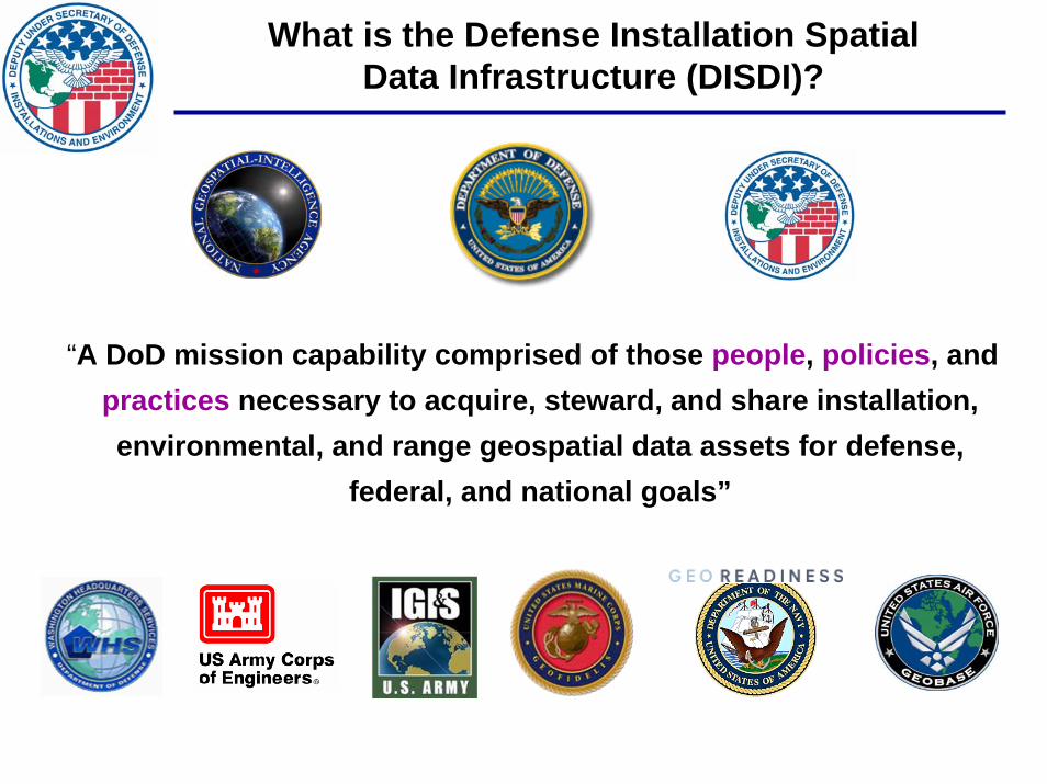
What is the Defense Installation SpatialData Infrastructure (DISDI)?
“A DoD mission capability comprised of those people, policies, and practices necessary to acquire, steward, and share installation, environmental, and range geospatial data assets for defense,
federal, and national goals”
IMAGERY
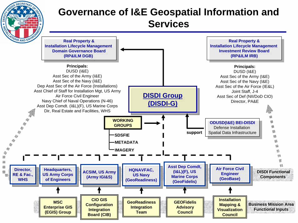
Governance of I&E Geospatial Information and Services
Real Property &Installation Lifecycle Management
Domain Governance Board(RP&ILM DGB)
Real Property &Installation Lifecycle Management
Domain Governance Board(RP&ILM DGB)
Real Property &Installation Lifecycle Management
Investment Review Board(RP&ILM IRB)
Real Property &Installation Lifecycle Management
Investment Review Board(RP&ILM IRB)
ODUSD(I&E) BEI-DISDIDefense Installation
Spatial Data Infrastructure
ODUSD(I&E) BEI-DISDIDefense Installation
Spatial Data Infrastructure
Principals:DUSD (I&E)
Asst Sec of the Army (I&E)Asst Sec of the Navy (I&E)
Asst Sec of the Air Force (IE&L)Joint Staff, J-4
Asst Sec of Def (NII/DoD CIO)Director, PA&E
Principals:DUSD (I&E)
Asst Sec of the Army (I&E)Asst Sec of the Navy (I&E)
Dep Asst Sec of the Air Force (Installations)Asst Chief of Staff for Installation Mgt, US Army
Air Force Civil EngineerNavy Chief of Naval Operations (N-46)
Asst Dep Comdt. (I&L)(F), US Marine CorpsDir, Real Estate and Facilities, WHS
DISDI Group (DISDI-G)
DISDI Group (DISDI-G)
ACSIM, US Army(Army IGI&S)
ACSIM, US Army(Army IGI&S)
HQNAVFAC, US Navy
(GeoReadiness)
HQNAVFAC, US Navy
(GeoReadiness)
Asst Dep Comdt, (I&L)(F), US
Marine Corps(GeoFidelis)
Asst Dep Comdt, (I&L)(F), US
Marine Corps(GeoFidelis)
Air Force Civil Engineer
(GeoBase)
Air Force Civil Engineer
(GeoBase)Headquarters,
US Army Corps of Engineers
Headquarters, US Army Corps
of Engineers
GeoReadinessIntegration
Team
Installation Mapping &
Visualization Council
MSC Enterprise GIS (EGIS) Group
CIO GIS Configuration
Integration Board (CIB)
GEOFidelisAdvisoryCouncil
Business Mission AreaFunctional Inputs
Business Mission AreaBusiness Mission AreaFunctional InputsFunctional Inputs
support support support
WORKING GROUPS
DISDI FunctionalComponents
DISDI FunctionalDISDI FunctionalComponents Components
SDSFIEMETADATA
Director,RE & Fac.,
WHS
Director,RE & Fac.,
WHS
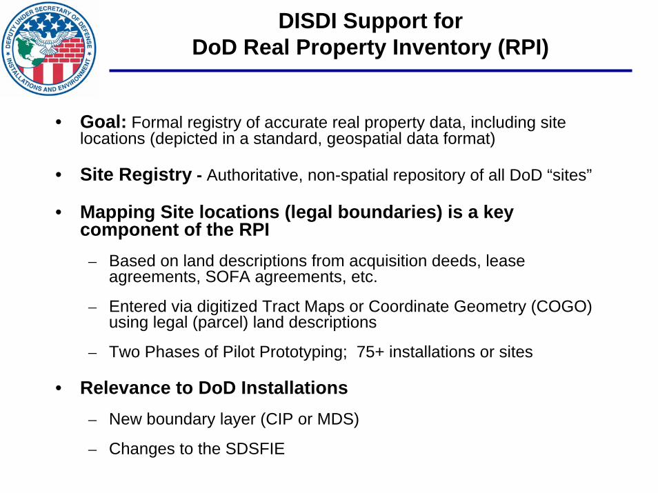
DISDI Support for DoD Real Property Inventory (RPI)
• Goal: Formal registry of accurate real property data, including site locations (depicted in a standard, geospatial data format)
• Site Registry - Authoritative, non-spatial repository of all DoD “sites”
• Mapping Site locations (legal boundaries) is a key component of the RPI– Based on land descriptions from acquisition deeds, lease
agreements, SOFA agreements, etc.
– Entered via digitized Tract Maps or Coordinate Geometry (COGO) using legal (parcel) land descriptions
– Two Phases of Pilot Prototyping; 75+ installations or sites
• Relevance to DoD Installations– New boundary layer (CIP or MDS)
– Changes to the SDSFIE
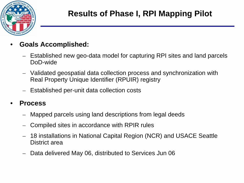
Results of Phase I, RPI Mapping Pilot
• Goals Accomplished:– Established new geo-data model for capturing RPI sites and land parcels
DoD-wide
– Validated geospatial data collection process and synchronization with Real Property Unique Identifier (RPUIR) registry
– Established per-unit data collection costs
• Process– Mapped parcels using land descriptions from legal deeds
– Compiled sites in accordance with RPIR rules
– 18 installations in National Capital Region (NCR) and USACE Seattle District area
– Data delivered May 06, distributed to Services Jun 06
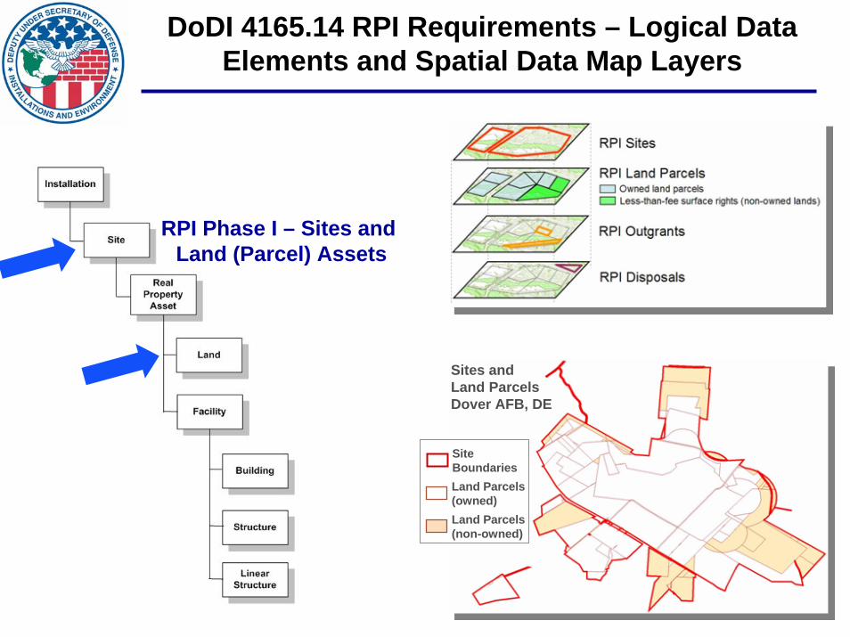
DoDI 4165.14 RPI Requirements – Logical Data Elements and Spatial Data Map Layers
RPI Phase I – Sites and Land (Parcel) Assets
Sites and Land ParcelsDover AFB, DE
SiteBoundariesLand Parcels (owned)Land Parcels (non-owned)
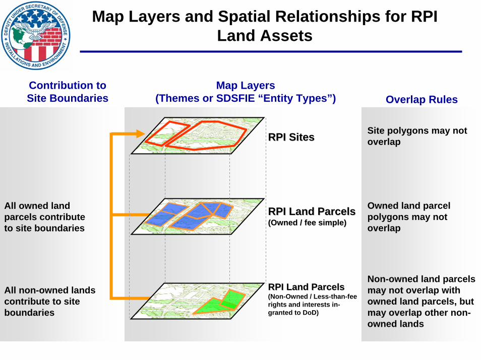
Map Layers and Spatial Relationships for RPI Land Assets
Map Layers(Themes or SDSFIE “Entity Types”)
Contribution to Site Boundaries Overlap Rules
Site polygons may not overlap
RPI Land ParcelsRPI Land Parcels(Owned / fee simple)(Owned / fee simple)
Owned land parcel polygons may not overlap
All owned land parcels contribute to site boundaries
RPI Land ParcelsRPI Land Parcels(Non-Owned / Less-than-fee rights and interests in-granted to DoD)
Non-owned land parcels may not overlap with owned land parcels, but may overlap other non-owned lands
All non-owned lands contribute to site boundaries
RPI SitesRPI Sites
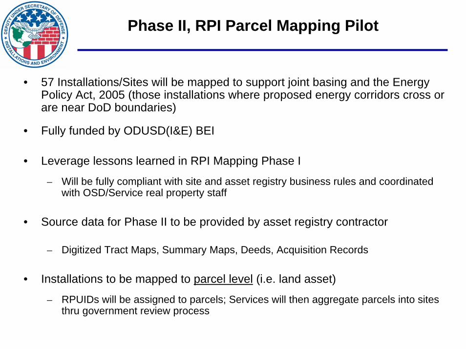
Phase II, RPI Parcel Mapping Pilot
• 57 Installations/Sites will be mapped to support joint basing and the Energy Policy Act, 2005 (those installations where proposed energy corridors cross or are near DoD boundaries)
• Fully funded by ODUSD(I&E) BEI
• Leverage lessons learned in RPI Mapping Phase I
– Will be fully compliant with site and asset registry business rules and coordinated with OSD/Service real property staff
• Source data for Phase II to be provided by asset registry contractor
– Digitized Tract Maps, Summary Maps, Deeds, Acquisition Records
• Installations to be mapped to parcel level (i.e. land asset)
– RPUIDs will be assigned to parcels; Services will then aggregate parcels into sites thru government review process

Progress and Initial ResultsPhase II, RPI Parcel Mapping Pilot
• Imagery Acquired for all 57 Installations/Sites
• Asset Registry Contractor (Bearing Point) has delivered source documents for all Installations/Sites
– Contractors evaluating completeness of source document records, alignment with official site names, etc.
– Contractor discovering differences between paper records and automated real property records
• Contractors and Component RPO/GIO teams are working closely to clarify apparent record discrepancies, data gaps, etc.
• 11 Installations/sites have been delivered in draft form for Component RPO/GIO review
• OSD considering adding additional Installations/Sites based on available funding
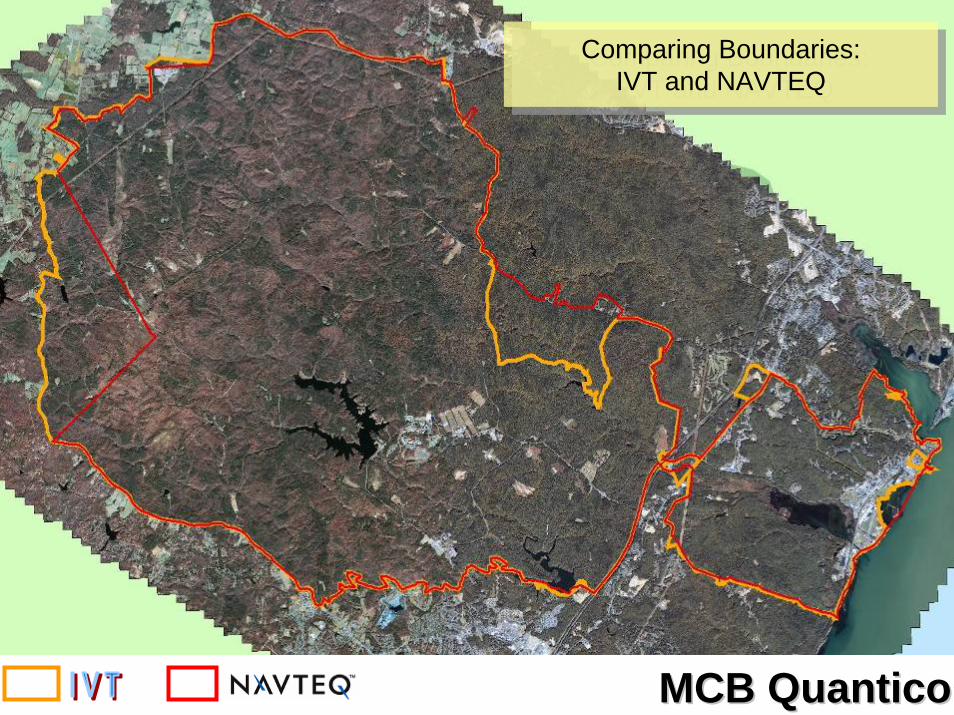
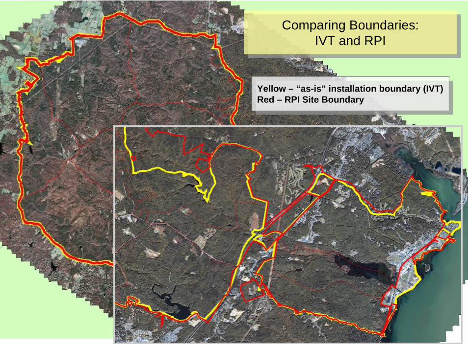
MCB QuanticoMCB Quantico
Comparing Boundaries: IVT and NAVTEQ
Comparing Boundaries: IVT and NAVTEQ
Yellow – “as-is” installation boundary (IVT)Red – RPI Site Boundary
Yellow – “as-is” installation boundary (IVT)Red – RPI Site Boundary
Comparing Boundaries: IVT and RPI
Comparing Boundaries: IVT and RPI
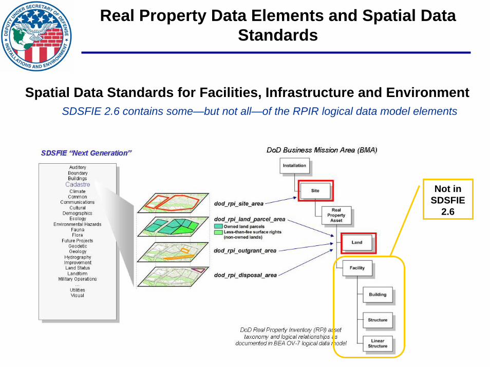
Real Property Data Elements and Spatial Data Standards
Spatial Data Standards for Facilities, Infrastructure and EnvironmentSDSFIE 2.6 contains some—but not all—of the RPIR logical data model elements
Not in SDSFIE
2.6
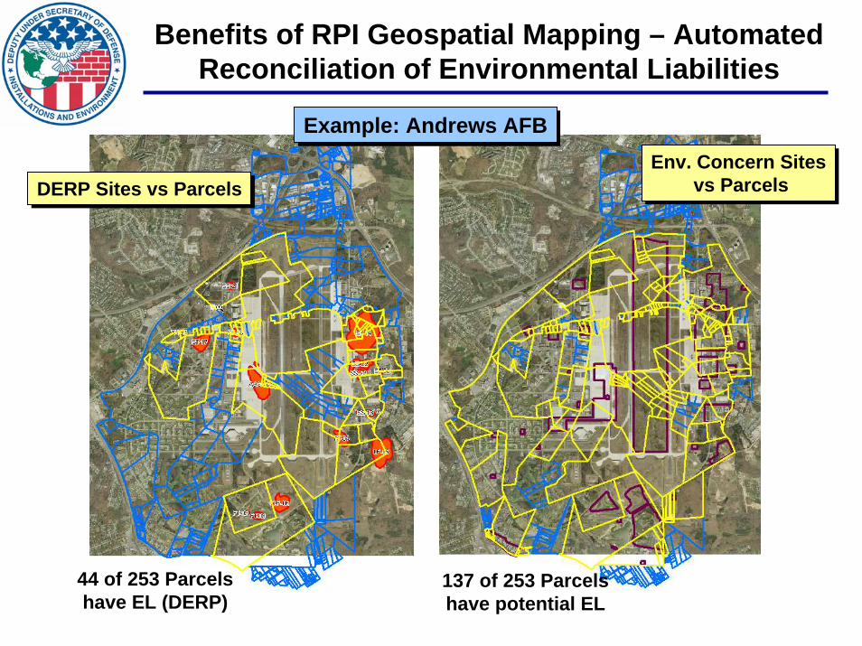
Benefits of RPI Geospatial Mapping – Automated Reconciliation of Environmental Liabilities
137 of 253 Parcels have potential EL
44 of 253 Parcels have EL (DERP)
Example: Andrews AFBExample: Andrews AFB
DERP Sites vs ParcelsDERP Sites vs ParcelsEnv. Concern Sites
vs ParcelsEnv. Concern Sites
vs Parcels

Military Installation & Range Boundaries:The Way Forward
SHORTSHORT--TERMTERM
• “Official Site Name Lists” still lack consistency with legacy site names, reference documents
• Reported Parcel Acreage Values– Currently based on Deeds– GIS-derived values typically have greater
accuracy– Business Rules may be needed
• Boundary Accuracy Issues– Not all survey reference data is created
equal– RPOs gathering knowledge from pilot
project use cases– Business Rules may be needed
LONGLONG--TERMTERM
• Component Level Follow-up Activities– Recompiling Site Boundaries for higher
fidelity– Real Property guidance to capture parcel
level boundary rules– Designate or Develop RPI spatial
databases, linked to RPI business databases
• Multi-year effort; spiral development
• RPUID will allow linkage to many other mission databases
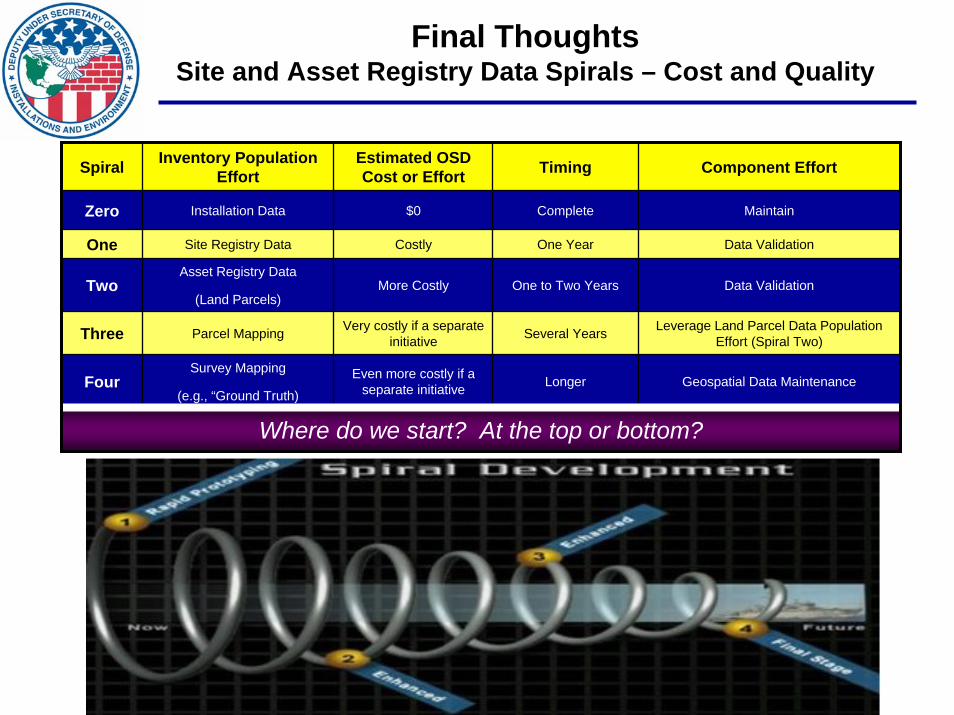
Final ThoughtsSite and Asset Registry Data Spirals – Cost and Quality
Spiral Inventory Population Effort
Estimated OSD Cost or Effort Timing Component Effort
Zero Installation Data $0 Complete
One Year
One to Two Years
Several Years
FourSurvey Mapping
(e.g., “Ground Truth)Even more costly if a
separate initiative Longer Geospatial Data Maintenance
Maintain
One Site Registry Data Costly Data Validation
TwoAsset Registry Data
(Land Parcels)More Costly Data Validation
Three Parcel Mapping Very costly if a separate initiative
Leverage Land Parcel Data Population Effort (Spiral Two)
Where do we start? At the top or bottom?

Questions?
Mr. David LaBranche, P.E.Mr. David LaBranche, P.E.Defense Installation Spatial Data Infrastructure (DISDI)Defense Installation Spatial Data Infrastructure (DISDI)
Office of the Deputy Undersecretary of Defense for InstallationsOffice of the Deputy Undersecretary of Defense for Installations & Environment, & Environment, Business Enterprise Integration DirectorateBusiness Enterprise Integration Directorate
ODUSD(I&E) BEIODUSD(I&E) BEI
EE--mail: mail: [email protected]@osd.mil
Web site and DISDI Portal: Web site and DISDI Portal: www.acq.osd.mil/ie/bei/disdi.htmwww.acq.osd.mil/ie/bei/disdi.htm