geotechnical effects of the 2015 magnitude 7.8 gorkha ... due to bans on flying ... wedge underlain...
TRANSCRIPT

Geotechnical Effects of the 2015 Magnitude 7.8Gorkha, Nepal, Earthquake and Aftershocksby Robb E. S. Moss, Eric M. Thompson, D. Scott Kieffer, Binod Tiwari,Youssef M. A. Hashash, Indra Acharya, Basanta Raj Adhikari, DomnikiAsimaki, Kevin B. Clahan, Brian D. Collins, Sachindra Dahal, Randall W.Jibson, Diwakar Khadka, Amy Macdonald, Chris L. M. Madugo,H. Benjamin Mason, Menzer Pehlivan, Deepak Rayamajhi, andSital UpretyABSTRACTThis article summarizes the geotechnical effects of the25 April 2015 M 7.8 Gorkha, Nepal, earthquake and after-shocks, as documented by a reconnaissance team that under-took a broad engineering and scientific assessment of thedamage and collected perishable data for future analysis. Briefdescriptions are provided of ground shaking, surface fault rup-ture, landsliding, soil failure, and infrastructure performance.The goal of this reconnaissance effort, led by Geotechnical Ex-treme Events Reconnaissance, is to learn from earthquakes andmitigate hazards in future earthquakes.
INTRODUCTION
Geotechnical Extreme Event Reconnaissance (GEER) is anorganization with the goal of documenting geotechnical effectsfrom extreme events, including earthquakes and other naturaldisasters. Following the M 7.8 event, GEER mobilized two re-connaissance teams to collect perishable data on the geotech-nical effects of the 25 April 2015 Gorkha, Nepal, earthquake.The following observations and data were collected:• the absence or presence of surface fault ruptures,• triggered landslides,• liquefaction and other soil-failure mechanisms, and• geotechnical-related damage to infrastructure.
The initial GEER team surveyed the large affected area bycar due to bans on flying (following an in-country U.S. heli-copter crash) and on unmanned aerial vehicles (UAVs; due tounauthorized use by others immediately following the earth-quake). The initial GEER team covered a broad region rangingfrom Pokhara in the west to Charikot in the east and from theTibet border in the north to the India border in the south(Fig. 1). By the time the follow-up team arrived, the flying banhad been lifted and team members were able to use helicoptersand UAVs (after receiving permission) to observe regions thatcould not be reached by car.
This article presents a summary of the full GEER reporton the 2015 Gorkha earthquake sequence that can be found
at www.geerassociation.org/GEER_Post%20EQ%20Reports/Nepal_2015 (last accessed September 2015). Because in-depth seismol-ogy, tectonics, rupture mechanics, and other source detailsare contained in separate articles in this special issue, this sum-mary focuses solely on the geotechnical aspects of the postearth-quake investigations and includes only essential backgroundinformation.
GEOLOGIC AND GEOMORPHIC SETTING
The Himalaya region consists of a 100-km-wide accretionarywedge underlain by a north-dipping plate boundary décolle-ment that slips in major earthquakes. Three major thrust faults(from north to south: the inactive Main Central thrust [MCT]fault, the most likely inactive Main Boundary thrust [MBT]fault, and the active Main Frontal thrust [MFT] fault) convergeat depth into a single major shear zone, the Main Himalayanthrust (MHT), along which the Indian crust is thrust beneathEurasia (Bollinger et al., 2006). The MCTmarks the southernboundary of the High Himalaya, composed of highly meta-morphosed, amphibolite-grade schist with intrusive graniticplutons attributed to an accreted terrane (Robinson et al.,2001). The MBT bounds the Lesser Himalaya, which arecomposed primarily of folded, medium-to-low-grade metase-diments (DeCelles et al., 2001). The MFTmarks the southernboundary of the sub-Himalaya, which is generally composed ofseveral kilometers of Tertiary siltstones, sandstones, and con-glomerates that have been scraped off the Precambrian Indianbasement. Great earthquakes in the Himalaya rupture to thesurface along the MFT, whereas large earthquakes, such asthe 2015 Gorkha earthquake, are blind ruptures limited to theMHT. The Kathmandu Valley (Fig. 1b) is unique within theLesser Himalaya because it is a deep sedimentary basin, struc-turally defined by thrust faulting on the north and the south.Neogene to Quaternary sediments as thick as 500 m predomi-nantly formed in lacustrine and fluvial depositional environ-ments within the basin. The stratigraphy consists mainlyof interbedded clays and silts with some sands and gravels(Piya, 2004).
1514 Seismological Research Letters Volume 86, Number 6 November/December 2015 doi: 10.1785/0220150158

▴ Figure 1. (a) The epicenters and extent of the surface projection of the fault planes for the M 7.8 mainshock and M 7.3 aftershock,selected cities and villages referenced in this article, the Global Positioning System (GPS) tracks of the Geotechnical Extreme EventReconnaissance (GEER) teams, and a simplified representation of the observed damage to hydropower projects. There are more hydro-power symbols than there are hydropower projects visited by GEER, because we visited multiple sites (e.g., headworks, penstocks, dams,and powerhouses) associated with each hydropower project. (b) Enlarged view of the Kathmandu Valley shows the locations of soilfailure investigated by GEER and the location of U.S. Geological Survey (USGS) station KATNP in Kathmandu. The basemap relief is fromJarvis et al. (2008).
Seismological Research Letters Volume 86, Number 6 November/December 2015 1515

GROUND MOTIONS AND SITE RESPONSE
The 2015 earthquake sequence was poorly recorded; and, as ofthe date of this publication, only one strong-motion recordinghas been made available to the greater scientific community(station KATNP, administered by the U.S. Geological Survey[USGS]; location given in Fig. 1b). (Other strong-motion in-struments apparently recorded the earthquakes, but an em-bargo of the data has precluded access). The lack of near-source instrumental records highlights the importance of mac-roseimicity as the only means for quantifying the shakingintensity; this is discussed in detail by Martin et al. (2015).Despite the large magnitude of the 25 April 2015 mainshock(M 7.8) and the short distance from Kathmandu to the rup-ture plane (∼10 km), station KATNP exhibited anomalouslylow energy at short periods (<1 s). This is consistent withthe findings of Martin et al. (2015), which show that, relativeto the Szeliga et al. (2010) empirical equations, the shakingintensity was lower than expected at short distances (<100 km)but consistent with expectations at larger distances (>100 km).Figure 2 shows the rotation-independent response spectral ac-celeration RotD50 (Boore, 2010) against the Boore et al.(2014) ground-motion prediction equations (GMPEs) forboth the M 7.8 mainshock and M 7.3 aftershock. Althoughthe Boore et al. (2014) equations were developed primarilywith ground motions from the western United States (WUS),they provide an approximate analog to Nepal because bothare active crustal regions. Similarly, the GMPE selectionscheme employed by ShakeMap (Garcia et al., 2012) uses aWUS GMPE for this region. The Boore et al. (2014) equa-tions predict a peak ground acceleration (PGA) of 0:49g forthe M 7.8 earthquake, which is much higher than the re-corded PGA of 0:16g . Because of the data paucity, however,the factors that shaped the amplitude and frequency contentof the mainshock are still poorly understood.
The low amplitude of short-period shaking in the main-shock is a peculiar characteristic of this event. The observationthat the short-period energy of the M 7.3 aftershock is wellmodeled by Boore et al. (2014) is evidence that the lack ofshort-period energy is related to the specific source processof theM 7.8 mainshock rather than the properties of the crustor basin. Although the response spectrum of the mainshockappears to be rich in energy at long periods, the comparisonto Boore et al. (2014) shows that it is not especially large foran earthquake of this size recorded at a soft soil site. For thecomparisons in Figure 2, we assume the time-averaged shear-wave velocity in the upper 30 m (V S30) is 200 m=s, based onhorizontal-to-vertical ratios at station KATNP by Paudyalet al. (2012).
FAULT RUPTURE
Extensive ground-based field investigations of the MFT andMBT were conducted by members of the GEER team, as wellas by other researchers (Angster et al., 2015). The groundtracks in Figure 1 indicate where we looked for surface rupture
during our investigation. The MBT was observed along theNarayanghat–Mugling Highway north of Bharatpur and nearthe village of Shaktikhor, along the Tribhuvan Rajpath High-way north of the town of Hetauda, and along the B.P. Highwaynorth of Bardibas (Fig. 1). No evidence of surface rupture orassociated ground deformation, such as ground warping or tilt-ing, was identified by the GEER team or reported by residents.Other effects of the earthquake, such as elevated groundwaterlevels and substantially increased spring and streamflow vol-umes, were reported in the watersheds all along the MBT formore than several weeks following the 25 April 2015 Gorkhaearthquake.
The MFT is well expressed south of the MBT along theeast–west-trending Siwalik Hills of the sub-Himalaya. TheTertiary sedimentary material is easily erodible but forms steeprelief, demonstrating the active deformation associated withthe MFT. Field reconnaissance along the MFT from ChitwanNational Park (west of Hetauda) to Bardibas (Fig. 1) did notreveal any evidence for surface-fault rupture or associatedground deformation. Several large drainages exposing the MFTscarp were explored, including drainages near the towns ofAmlekhganj, Paurai, and Khayarmara. Thrust faulting withintheTertiary materials was observed in many of these exposures,but no surface deformation related to the Gorkha earthquakewas distinguished.
Paleoseismic data suggest that earthquakes in 1255 and1934 ruptured to the surface along the MFT, south of Kath-mandu (Bollinger et al., 2014). Field observations after the2015 rupture, which nucleated on MHT (Avouac et al., 2015),suggest the rupture only extended to the base of the MFT.These findings are consistent with the magnitude dependenceof surface rupture for events in this region, where surface rup-ture has resulted from the M >8 events (e.g., 1255 and 1934)but not the M <8 events (e.g., 1803, 1833, 1905, and 2015).
LANDSLIDES
Landslides triggered by strong shaking were the dominant geo-technical effect of the recent earthquakes in Nepal. Steep slopesproduced by rapid tectonic uplift create high landslide hazardin Nepal even in the absence of ground shaking. Landslidestriggered during the mainshock and aftershocks blocked roads,dammed rivers, and damaged villages, causing hundreds offatalities. In some cases, rivers with landslide dams pose an on-going hazard for downstream villages.
GEER team members investigated most major drainages inthe broad epicentral region of the Gorkha earthquake sequence(specific tracks are given in Fig. 1). We observed thousands oflandslides and estimate that the total number of landslides trig-gered is in the few tens of thousands, which includes landslidesin China that were not directly investigated in the field (Col-lins and Jibson, 2015). This estimate is consistent with previ-ously developed relationships between earthquake magnitudeand number of landslides: the Malamud et al. (2004) relationshippredicts about 25,000 landslides, and the Keefer (2002) relation-ship predicts about 60,000 landslides for an M 7.8 earthquake.
1516 Seismological Research Letters Volume 86, Number 6 November/December 2015

Our estimate of the number of landslides is near the lower boun-dary of what would be expected from these relationships; giventhe steep terrain of Nepal, many more landslides may have beenexpected. Virtually all of the landslides were falls and slides ofrock and soil, which is consistent with observations from otherworldwide earthquakes (Keefer, 1984, 2002). Although a fewlarge debris avalanches occurred, the predominant mode oflandsliding was by shallow, translational failure (Collins andJibson, 2015).
The largest and most destructive landslide resulting fromthe earthquakes was the Langtang debris avalanche (see map inFig. 1; photo in Fig. 3), which began as a snow and ice ava-lanche and entrained debris before becoming airborne off a500-m-tall cliff. Estimates of the velocity of the airborne land-slide debris approach 100 m=s (Collins and Jibson, 2015). Afew outlying structures on the east end of the village were notburied but were flattened by an accompanying air blast gener-ated by the speed and volume of the debris avalanche. In
0.001
0.01
0.1
1
Rot
D50
(g)
KATNP M 7.8 MainshockBSSA14 median, VS30 = 200 m/s
BSSA14 +/−1σ
−0.2
−0.1
0.0
0.1
0.2
Acc
eler
atio
n (g
)
M 7.8 Mainshock East−West
−0.2
−0.1
0.0
0.1
0.2
Acc
eler
atio
n (g
)
M 7.8 Mainshock North−South
0.01 0.1 1 100.001
0.01
0.1
1
Period (s)
Rot
D50
(g)
KATNP M 7.3 AftershockBSSA14 median, VS30 = 200 m/s
BSSA14 +/−1σ
−0.2
−0.1
0.0
0.1
0.2
Acc
eler
atio
n (g
)
M 7.3 Aftershock East−West
0 20 40 60 80 100 120 140−0.2
−0.1
0.0
0.1
0.2
Time (s)
Acc
eler
atio
n (g
)
M 7.3 Aftershock North−South
▴ Figure 2. Ground shaking from the (top row) M 7.8 Gorkha earthquake and the (bottom row) M 7.3 aftershock recorded at stationKATNP. (Left) Orientation-independent response spectral acceleration (RodD50) compared with the Boore et al. (2014, labeled BSSA14)ground-motion prediction equation (GMPE). (Right) Horizontal-component time histories. V S30 is the time-averaged shear-wave velocity to30 m depth.
Seismological Research Letters Volume 86, Number 6 November/December 2015 1517

addition to destroying many structures, the air blast completelyflattened the forest for about 1 km in each direction up anddown the valley, as well as all the way up to the tree line on thesouth (opposing) valley slope. Trees were stripped of branchesand bark and were laid down in a radial pattern outward fromthe deposit. The estimated volume of the Langtang landslide is2; 000; 000 m3, and the estimated number of fatalities is approx-imately 200 (Collins and Jibson, 2015).
Several important valley-blocking landslides also occurred,the most notable of which buried the village of Baisari on theKali Gandaki River (Fig. 4; 28.4026° N, 83.6017° E) severalweeks after the mainshock. The rockslide at Baisari, with anestimated volume of 300; 000 m3, failed progressively. Accord-ing to interviews with members of the Nepal Army, cracks wereobserved in the cliff following the April 2015 M 7.8 earth-quake, and these cracks widened during the M 7.3 earthquakeon 12 May 2015. Ten days later, rocks began falling from the
cliff, prompting evacuation of Baisari. Two days after that, atabout 1:00 a.m. local time on 24 May, the slope above the riverfailed; the resulting landslide dammed the river and buried theentire village, including 27 homes, under about 30 m of land-slide debris. The lake overtopped the dam 16 hours later.Authorities were able to evacuate the downstream villages justprior to its failure.
In most cases, valley-blocking landslides that impoundedlakes breached without incident. For example, the Goganelandslide (28.0857° N, 85.2274° E) with an estimated volumeof 150; 000 m3, partially breached but impounds a small lake;landslide dams that temporarily blocked the flow of the Mar-syangdi River between the villages of Pisang and Humdebreached naturally and did not impound lakes as of a few weeksafter the earthquake. In some cases, valley-blocking landslidesconsisted primarily of coarse rock fragments and were per-meable enough that little or no water was impounded; an ex-ample is the Shyamran rock slide (28.1387° N, 84.8507° E),with an estimated volume of 30; 000 m3. As of the beginningof the 2015 monsoon season, some valley-blocking landslideswere still in place and posed ongoing hazard during the ap-proaching periods of high river flow. Further details are avail-able in the full GEER report and in Collins and Jibson (2015).
SOIL FAILURE
Seismic soil-failure modes, such as liquefaction and cyclic fail-ure, require strong shaking of weak soils. Because of the moun-tainous and steep terrain throughout most of Nepal, weak soilsare located primarily in sedimentary basins (e.g., Kathmanduand Pokhara) and the Indo-Gangetic plain.
The GEER team observed soil failure around the Kath-manduValley in many locations (Fig. 1b). Most of the soil fail-ures are classified as “incipient,” indicating evidence of soilfailure that did not result in appreciable deformations. For ex-ample, sand boils, ground cracks, and minor building tilt (<2°)were observed in Manamaiju, but the buildings were not seri-ously damaged. Forecasts (e.g., Piya, 2004) of the amount andscale of liquefaction in the KathmanduValley were not realizedfor many possible reasons:• the aforementioned low amplitude of high-frequency
shaking from the mainshock;• the water table potentially being deeper (due to ground-
water withdrawal) than at the time of prior earthquakesand liquefaction;
• seasonal variations in the water table (the earthquake oc-curred near the end of the dry season when water levelswere likely at their lowest levels); and
• the lacustrine sediment being insusceptible to liquefactionbecause of the fine grain-size distribution.
Typical soil-failure observations included sand boils, groundfissures, tilted buildings, and, in one case, root vegetables ejectedout of the ground. Soil types ranged from fine sand and silty sandto low-plasticity silty clay that is locally termed “black cotton.”
The depth of the water table in the KathmanduValley typ-ically ranges between 1 and 9 m. The lacustrine environment of
▴ Figure 3. The Langtang debris avalanche (28.2121° N,85.4991° E), which destroyed the entire village of Langtang eitherthrough direct impact or by consequent air blast. An estimated200 people were killed in this single event. (a) Oblique northwestview of deposit with cliff from which the debris became airborne.Buildings in foreground were pushed over by the ensuing airblast.(b) Aerial view of deposit showing location of the Langtang Rivertunnel through ice and debris (blue arrows). Reproduced fromCollins and Jibson (2015).
1518 Seismological Research Letters Volume 86, Number 6 November/December 2015

the Kathmandu Valley transitioned to a fluvial environmentaround the end of the last ice age (∼11 ky). Surficial depositsare primarily soft, interbedded lacustrine and fluvial sediments(Piya, 2004).
Many of the soil-failure sites liquefied, as indicated bythe presence of sand boils (e.g., Manamaiju, Bungamati, Chan-gunarayan, and Mulpani). However, an interesting groundfailure occurred along the Arniko Highway in Lokanthali(27.67439° N, 85.36267° E), where lateral cracks having 2-m-deep fissures and as much as 1.5 m of nearly vertical offset oc-curred over a large area on or near ground sloping toward ariver channel (see the photo in Fig. 5 and a map of the fissuresin Fig. 6). The lack of evidence for liquefaction, reports that thefailure progressed slowly, and the observation that the slip sur-face extended into the weak black cotton clay led to an initialassessment that these failures resulted from cyclic failure (i.e.,structural breakdown of clay particles) in the black cotton clay,for which lab tests indicated moderate sensitivity and a liquid-ity index greater than one. Subsequent trenching and hand-
▴ Figure 4. Rock slide (28.4026° N, 83.6017° E) along the Kali Gandaki River on 24 May 2015 that buried the village of Baisari and blocked theflow of the river for 16 hours nearly one month following the main earthquake shock (a,b). Progressive failure of the nearly 350-m-tall rockmass through the weathered bedrock profile is thought to have led to its eventual collapse. Reproduced from Collins and Jibson (2015).
▴ Figure 5. Measurement of one of the locations having the larg-est offsets that was observed in the Lokanthali area along theArniko Highway (27.67439° N and 85.36267° E).
Seismological Research Letters Volume 86, Number 6 November/December 2015 1519

▴ Figure 6. Mapped ground cracks or fissures in the Lokanthali area along the Arniko Highway. Extensive cracking had lateral defor-mations as great as 2 m and vertical deformations as great as 1.5 m.
1520 Seismological Research Letters Volume 86, Number 6 November/December 2015
augering revealed more complex failure planes that were notevident on the surface. A 2.5-m-deep trench revealed buriedliquefaction escape structures capped by fine-grained fluvialoverbank deposits and fill layers. The 2015 slip surface ap-pears to have offset a sand layer that had been injected froma previous event and extended down into a massive sand layer>1 m thick, suggesting that these failures are lateral spreads.It is also possible that both cyclic failure and liquefactioncontributed to the soil failure in and around Lokanthali.We saw similar ground fissures in Syuchatar (27.69723° N,85.27408° E); however, that site did not experience the largedisplacements observed in Lokanthali.
PERFORMANCE OF INFRASTRUCTURE
Damage to infrastructure (e.g., roads, bridges, pipelines, anddams) after earthquakes can hinder rescue, recovery, and rebuild-ing. Nepal’s civil infrastructure is mainly composed of roadsthroughout the mountainous terrain, bridges crossing the numer-ous rivers, and hydropower facilities. In general, the infrastructureperformed well in the earthquakes with some exceptions.
Few bridges were damaged. One is the Singa Durbar Bridgein downtown Kathmandu (location given in Fig. 1). It wasundamaged after the mainshock, but the M 7.3 aftershockcaused a soft-soil failure, resulting in cracks perpendicular tothe right of way and parallel to the creek under the bridge. Lat-eral cracks in the raised concrete sidewalk sections extend onboth sides of the bridge parallel to the creek and are separatedby roughly 100 m along the length of the bridge.
Twenty major hydropower plants and a number of microhydropower plants were generating 800 MW of hydropowerfor Nepal before the April 2015 earthquake and its aftershocks.The earthquakes damaged 16 projects totaling ∼270 MW ofgenerating capacity. The GEER team visited seven hydropowerprojects (Fig. 1). In the steep, narrow, upper reaches of thedrainages, projects were impacted primarily by rock falls.Roads, penstocks, and secondary structures received the bruntof damage from these slope failures. In the lower reaches of thedrainages, where river valleys open up and water is typicallytransmitted via open canals, shaking-related impacts such assettlement and structural damage was more common. The sig-nificant amount of rock-fall debris still mantling the steepupper reaches of the rivers near the epicentral areas poses acontinued rock-fall hazard that will impact roads and hydro-power infrastructure far into the future.
The loss of life from these earthquakes was mainly due topoor construction, generally consisting of unreinforced orpoorly reinforced homes constructed of rock, brick, or con-crete (BuildChange, 2015). The building codes in Nepaladequately detail how shear resistance should be incorporatedinto a structural design and how to avoid weak foundationsoils, but enforcement of codes is poor (http://www.usaid.gov/nepal/fact‑sheets/building‑code‑implementation‑program‑municipalities‑nepal, last accessed September 2015). There-fore, more strictly enforced building codes could reduce lossof life in future earthquakes.
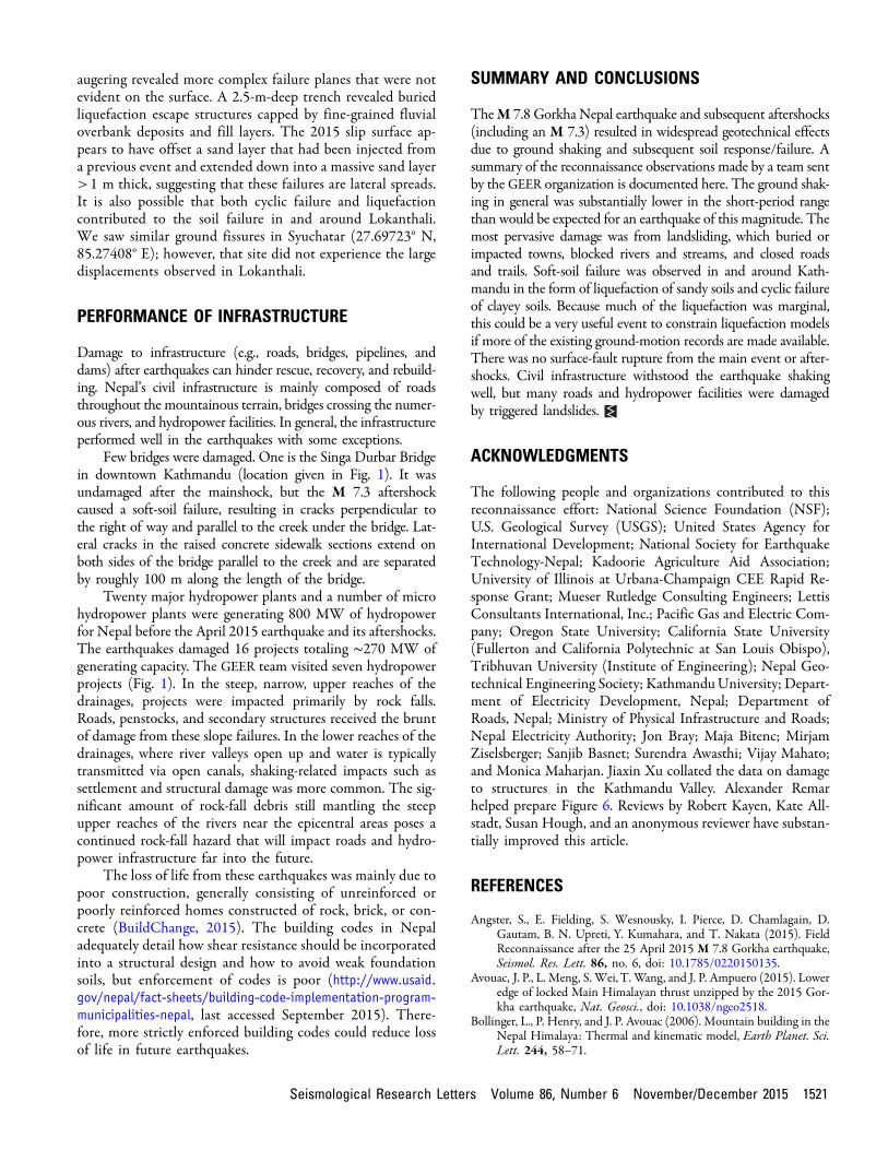
SUMMARY AND CONCLUSIONS
TheM 7.8 Gorkha Nepal earthquake and subsequent aftershocks(including an M 7.3) resulted in widespread geotechnical effectsdue to ground shaking and subsequent soil response/failure. Asummary of the reconnaissance observations made by a team sentby the GEER organization is documented here. The ground shak-ing in general was substantially lower in the short-period rangethan would be expected for an earthquake of this magnitude. Themost pervasive damage was from landsliding, which buried orimpacted towns, blocked rivers and streams, and closed roadsand trails. Soft-soil failure was observed in and around Kath-mandu in the form of liquefaction of sandy soils and cyclic failureof clayey soils. Because much of the liquefaction was marginal,this could be a very useful event to constrain liquefaction modelsif more of the existing ground-motion records are made available.There was no surface-fault rupture from the main event or after-shocks. Civil infrastructure withstood the earthquake shakingwell, but many roads and hydropower facilities were damagedby triggered landslides.
ACKNOWLEDGMENTS
The following people and organizations contributed to thisreconnaissance effort: National Science Foundation (NSF);U.S. Geological Survey (USGS); United States Agency forInternational Development; National Society for EarthquakeTechnology-Nepal; Kadoorie Agriculture Aid Association;University of Illinois at Urbana-Champaign CEE Rapid Re-sponse Grant; Mueser Rutledge Consulting Engineers; LettisConsultants International, Inc.; Pacific Gas and Electric Com-pany; Oregon State University; California State University(Fullerton and California Polytechnic at San Louis Obispo),Tribhuvan University (Institute of Engineering); Nepal Geo-technical Engineering Society; KathmanduUniversity; Depart-ment of Electricity Development, Nepal; Department ofRoads, Nepal; Ministry of Physical Infrastructure and Roads;Nepal Electricity Authority; Jon Bray; Maja Bitenc; MirjamZiselsberger; Sanjib Basnet; Surendra Awasthi; Vijay Mahato;and Monica Maharjan. Jiaxin Xu collated the data on damageto structures in the Kathmandu Valley. Alexander Remarhelped prepare Figure 6. Reviews by Robert Kayen, Kate All-stadt, Susan Hough, and an anonymous reviewer have substan-tially improved this article.
REFERENCES
Angster, S., E. Fielding, S. Wesnousky, I. Pierce, D. Chamlagain, D.Gautam, B. N. Upreti, Y. Kumahara, and T. Nakata (2015). FieldReconnaissance after the 25 April 2015 M 7.8 Gorkha earthquake,Seismol. Res. Lett. 86, no. 6, doi: 10.1785/0220150135.
Avouac, J. P., L. Meng, S. Wei,T. Wang, and J. P. Ampuero (2015). Loweredge of locked Main Himalayan thrust unzipped by the 2015 Gor-kha earthquake, Nat. Geosci., doi: 10.1038/ngeo2518.
Bollinger, L., P. Henry, and J. P. Avouac (2006). Mountain building in theNepal Himalaya: Thermal and kinematic model, Earth Planet. Sci.Lett. 244, 58–71.
Seismological Research Letters Volume 86, Number 6 November/December 2015 1521

Bollinger, L., S. N. Sapkota, P. Tapponnier, Y. Klinger, M. Rizza, J. Vander Woerd, J. R. Tiwari, R. Pandey, A. Bitri, and S. Bes de Berc(2014). Estimating the return times of great Himalayan earth-quakes in eastern Nepal: Evidence from the Patu and Bardibasstrands of the Main Frontal thrust, J. Geophys. Res. 119, 7123–7163, doi: 10.1002/2014JB010970.
Boore, D. M. (2010). Orientation-independent, nongeometric-meanmeasures of seismic intensity from two horizontal componentsof motion, Bull. Seismol. Soc. Am. 100, 1830–1835.
Boore, D. M., J. P. Stewart, E. Seyhan, and G. M. Atkinson (2014). NGA-West 2 equations for predicting PGA, PGV, and 5%-damped PSAfor shallow crustal earthquakes, Earthq. Spectra 30, 1057–1085.
BuildChange (2015). Post Disaster Report—Nepal, http://www.buildchange.org/wp‑content/uploads/2015/06/2015‑Nepal‑EQ‑Reconnaissance‑Report_Build‑Change.pdf (last accessed September 2015).
Collins, B. D., and R. W. Jibson (2015). Assessment of existing and po-tential landslide hazards resulting from the April 25, 2015 Gorkha,Nepal earthquake sequence, U.S. Geol. Surv. Open-File Rept. 2015–1142, 50 pp., doi: 10.3133/ofr20151142.
DeCelles, P. G., D. M. Robinson, J. Quade, T. P. Ojha, C. N. Garzione,P. Copeland, and B. N. Upreti (2001). Stratigraphy, structure, andtectonic evolution of the Himalayan fold-thrust belt in westernNepal, Tectonics 20, 487–509.
Garcia, D., D. J. Wald, and M. G. Hearne (2012). A global earthquakediscrimination scheme to optimize ground motion prediction equa-tion selection, Bull. Seismol. Soc. Am. 102, 185–203.
Jarvis, A., H. I. Reuter, A. Nelson, and E. Guevara (2008). Hole-filledSRTM for the Globe Version 4, available from the CGIAR-CSISRTM 90m Database, http://srtm.csi.cgiar.org (last accessed Sep-tember 2015).
Keefer, D. K. (1984). Landslides caused by earthquakes, Geol. Soc. Am.Bull. 95, 406–421.
Keefer, D. K. (2002). Investigating landslides caused by earthquakes—Ahistorical review, Surv. Geophys. 23, 473–510.
Malamud, B. D., D. L. Turcotte, F. Guzzetti, and P. Reichenbach (2004).Landslide inventories and their statistical properties, Earth Surf.Process. Landf. 29, 687–711.
Martin, S. S., S. E. Hough, and C. Hung (2015). Ground motions fromthe 2015 M 7.8 Gorkha, Nepal, earthquake constrained by a de-tailed assessment of macroseismic data, Seismol. Res. Lett. 86,no. 6, doi: 10.1785/0220150138.
Paudyal, Y. R., R. Yatabe, N. P. Bhandary, and R. K. Dahal (2012). Astudy of local amplification effect of soil layers on ground motionin the Kathmandu Valley using microtremor analysis, Earthq. Eng.Eng. Vib. 11, 257–268.
Piya, B. K. (2004). Generation of a geological database for the liquefac-tion hazard assessment in Kathmandu valley, Thesis in partial fulfill-ment of MS, International Institute for Geo-Information Scienceand Earth Observation, Enschede, The Netherlands.
Robinson, D. M., P. G. DeCelles, P. J. Patchett, and C. N. Garzione (2001).The kinematic evolution of the Nepalese Himalaya interpreted fromNd isotope, Earth Planet. Sci. Lett. 192, 507–521.
Szeliga, W., S. E. Hough, S. Martin, and R. Bilham (2010). Intensity,magnitude, location, and attenuation in India for felt earthquakessince 1762, Bull. Seismol. Soc. Am. 100, 570–584.
Robb E. S. MossCalifornia Polytechnic State University
Department of Civil and Environmental Engineering 13-217San Luis Obispo, California 93407-0353 U.S.A.
Eric M. ThompsonRandall W. Jibson
U.S. Geological Survey1711 Illinois Street
Golden, Colorado 80401 [email protected]
D. Scott KiefferGraz University of TechnologyInstitute of Applied Geosciences
Rechbauerstrasse 128010 Graz, Austria
Binod TiwariCalifornia State University, Fullerton
College of Engineering and Computer Science800 N State College Boulevard, E-419
Fullerton, California 92834 U.S.A.
Youssef M. A. HashashUniversity of Illinois at Urbana-Champaign
2230c Newmark Civil Engineering Laboratory205 N. Mathews Avenue
Urbana, Illinois 61801 U.S.A.
Indra AcharyaBasanta Raj AdhikariTribhuvan University
Department of Civil EngineeringInstitute of Engineering
Pulchowk CampusPulchowk, Lalitpur
P.O. Box 1175, Nepal
Domniki AsimakiCalifornia Institute of Technology
1200 E. California BoulevardMC 104-44
Pasadena, California 91125 U.S.A.
Kevin B. ClahanLettis Consultants International, Inc.
1981 N. Broadway, Suite 330Walnut Creek, California 94596 U.S.A.
Brian D. CollinsU.S. Geological Survey
345 Middlefield Road, MS973Menlo Park, California 94025 U.S.A.
Sachindra DahalUniversity of Illinois at Urbana-Champaign
B235 Newmark Civil Engineering LaboratoryUrbana, Illinois 61801 U.S.A.
Diwakar KhadkaMaterial Test Pvt. Ltd.
Mid-BaneshworG.P.O. Box 1274
Kathmandu, Nepal
1522 Seismological Research Letters Volume 86, Number 6 November/December 2015

Amy MacdonaldThornton Tomasetti51 Madison Avenue
New York, New York 10010 U.S.A.
Chris L. M. MadugoPacific Gas and Electric Company
Mail Code N4C, Room 422AP.O. Box 770000
San Francisco, California 94177 U.S.A.
H. Benjamin MasonDeepak Rayamajhi
Oregon State UniversitySchool of Civil and Construction Engineering
1491 SW Campus WayCorvallis, Oregon 97331 U.S.A.
Menzer PehlivanMueser Rutledge Consulting Engineers
225 West 34th StreetNew York, New York 10122 U.S.A.
Sital UpretyUniversity of Illinois at Urbana-Champaign
205 N. Mathews Avenue4158 Newmark Lab, MC 250Urbana, Illinois 61801 U.S.A.
Seismological Research Letters Volume 86, Number 6 November/December 2015 1523