geospatial image-mapping & terrestrial intelligence on command an airborne high resolution...
TRANSCRIPT

Geospatial Image-Mapping & Geospatial Image-Mapping & Terrestrial Intelligence Terrestrial Intelligence
on Commandon Command
AN AIRBORNE HIGH RESOLUTION
Thermal-Infrared and Multi-Spectral MAPPING SYSTEM
...Trials in the Suwannee River Basin, FL (November 2002)

Turtle Bay FL - November 2002Turtle Bay FL - November 2002Fresh Water Spring Seep MappingFresh Water Spring Seep Mapping

Possiblefresh waterspring

200 image Three band CIRgeoTIFmosaic
G 550nmR 650nmIR 805nm

Thermal Imagery is used on aircraft flying at 3000 ft AGLto locate natural springs and warm water seeps duringwinter months.
Temperature scale is approx.. 15 C degrees between intensity of black (cooler) and white (warmer)
Thermal imagery spatial resolution 60cm

Detail of Detail of Sub-Surface Sub-Surface StructureStructure

Image re-sampleImage re-sample
Contrast Contrast Compression is Compression is used to enable used to enable detailed detailed analysis of analysis of sub-surface sub-surface Structure more Structure more clearly.clearly.

300 image mosaic
Spring Creek FL30cm CIR

250 image250 imagemosaicmosaicSpring Creek Spring Creek FLFL
30cm CIR30cm CIR
Spring Source

Spring SourceSpring Source
note the difference in temperature note the difference in temperature of warmer stream than one to westof warmer stream than one to west

Elbow RiverElbow RiverWeaslehead Weaslehead Glenmore Glenmore Reservoir, Reservoir, Calgary ABCalgary ABAug 22, 2002Aug 22, 2002
Hidden Hidden Channel Channel mappingmapping
30cm CIR30cm CIR150 image 150 image mosaicmosaic

USGS 1m DEMUSGS 1m DEMWeeks BayWeeks BayMagnolia RiverMagnolia RiverFish RiverFish River
Gulf ShoresGulf ShoresAlabamaAlabamaAug 04, 2004Aug 04, 2004

USGS 1m DEM USGS 1m DEM &&ThermalThermal
Weeks BayWeeks BayMagnolia RiverMagnolia RiverFish RiverFish River
Gulf ShoresGulf ShoresAlabamaAlabamaAug 04, 2004Aug 04, 2004

Thermal Profile of Magnolia RiverThermal Profile of Magnolia River
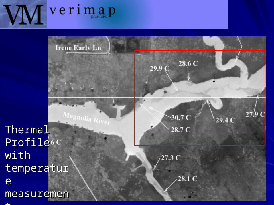
Thermal Thermal Profile with Profile with temperature temperature measurementmeasurement

Thermal re-sampleto look at
the thermaldifferential
in more detail
Scale 250 ft

28.6 C
29.1
Source ofMagnolia
River
Scale 2500 ft
Scale 2500 ft

Scale 1000ft

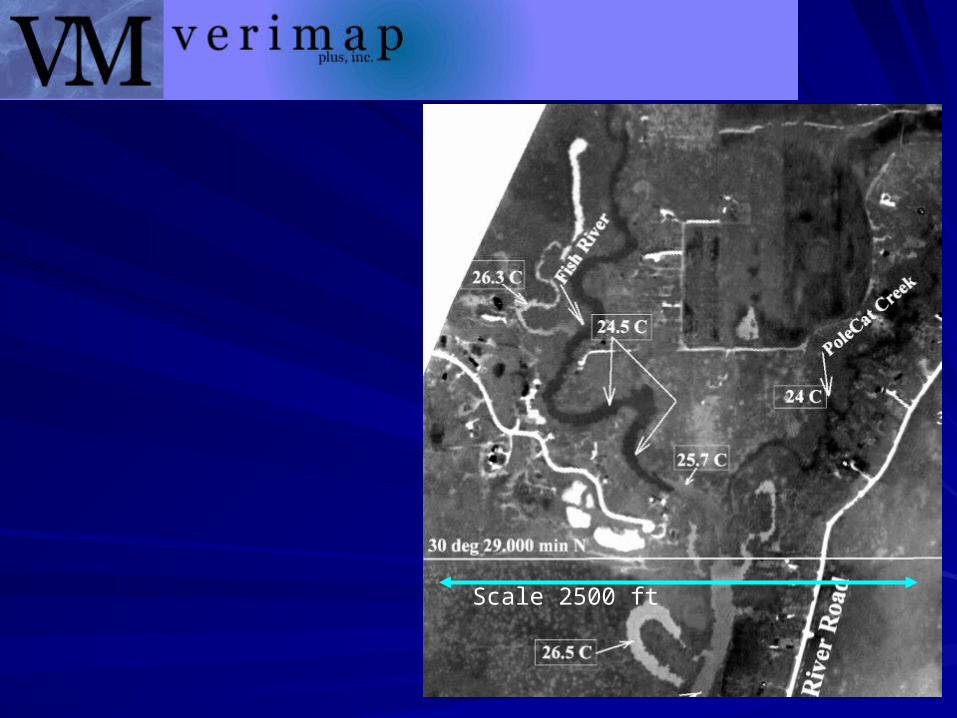
Fish RiverFish River

Scale 1000 ft

Tributary course mapping - Thermal InfraredTributary course mapping - Thermal Infrared

Moisture and Stream mapping - 150 image mosaicMoisture and Stream mapping - 150 image mosaic

Thermal Map - 900 image mosaicThermal Map - 900 image mosaic
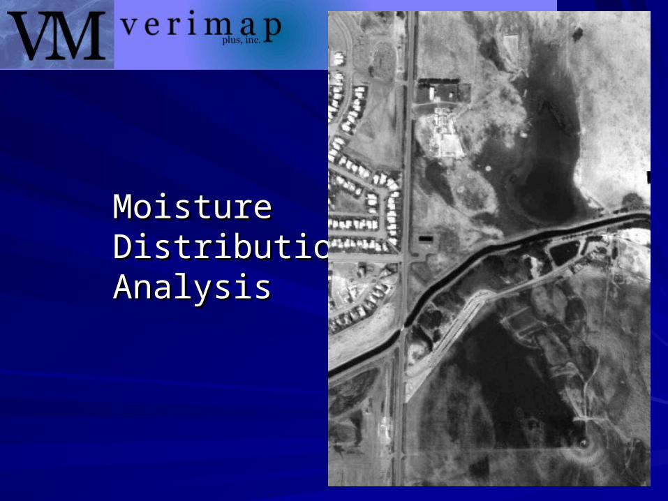
Moisture Moisture Distribution Distribution AnalysisAnalysis

Industrial Intelligence – An Airborne ViewIndustrial Intelligence – An Airborne View
Industries everywhere, require intelligent information to manage assets and conduct efficient mission operations.
“Smart-Data” requires “Smart-Systems” that “combine” a number of technologies that are operated from a unique vantage-point (airborne).
We use Fully digital configurations, with fast & sophisticated processing that provide rapid response and wireless delivery of imagery where and when it is needed.

Image Mapping Intelligence – Target MarketsImage Mapping Intelligence – Target Markets
Our Airborne Image-Mapping Services was designed for...– Fire-Mapping & Fire-Suppression Mission-Critical Initiatives
The system was seen as a natural fit for...– Agriculture & Environmental Management
Crop Control (Maximizing/Minimizing/Eradication)
Water, Fertilizer & Augment Programs
– EnvironmentalHerd, Livestock & Wildlife Migration & Management
Vegetation
Waterways
Terrain, Space & Territory Planning
Emergency Response & Logistics (Earthquake, Flooding, etc.)

Start of Lost Start of Lost Creek Fire,Creek Fire,
Alberta CanadaAlberta Canada
Our system was Our system was designed for designed for rapid delivery of rapid delivery of mapping mapping imageryimagery

Fire Mapping & Fire SuppressionFire Mapping & Fire Suppression
Hundreds of millions of dollars are spent fighting fires in North America every year. Intelligent-Mapping realizes huge savings of valuable resources, by deploying them most-
accurately where the action is needed most.

Mission Critical Operations – Fire Suppression
Accurate, and to the “minute” intelligent mapping and pinpoint 3D visual information provides 100%
effectiveness applied to fire-fighting operations.

Aerial attack plans, 3D visualization assists Aerial attack plans, 3D visualization assists
Mop-Up Fire SuppressionMop-Up Fire Suppression
Fire Mapping
We have designed a 3D system.
That is, produce an ortho-rectified thermal mosaic and place it onto the
3D Terrain Model or DEM.

Aerial Infrared-Imaging Today, Aerial Infrared-Imaging Today,
Mop-Up Fire Detection 2004Mop-Up Fire Detection 2004
What you What you Can’t Can’t see,see,
Can Hurt Can Hurt you!!you!!

FireMap FireMap 24hrs 24hrs laterlater

Fire Mapping
Navigate to the spot with simple hand held devices.
The 3D maps are putback in the field with
ruggedized pen tablet or hand-held with
GPS to navigate to the area
of interest in real-time

…for that matter, to go one step further, technology is available today
in broadband wireless systems
to email the image mosaics
back to the field or suppression aircraft.
Ground personnel willhave the very accurate
thermal hot spot map withGPS to virtually stand
on the hot spot if it’s hard to
find...

Image-MapsImage-Mapsare geoTIF are geoTIF files and are files and are used on used on Laptops and Laptops and PDA devices PDA devices with GPS with GPS immediately, immediately, as moving as moving map displays map displays to navigate. to navigate.

The Technology - GPS Track Over Image (2m accuracy)The Technology - GPS Track Over Image (2m accuracy)

Raymond Raymond MS MS AirportAirport60 image 60 image thermal thermal mosaicmosaic

The The TechnologyTechnology
Sub-pixel Sub-pixel Fire Fire DetectionDetection

Image Mapping Intelligence – Target MarketsImage Mapping Intelligence – Target Markets
As well as...– Terrestrial Based Assets (Energy & Utilities)
Oil & Gas, Pipeline Transport
Electrical & Powerline
Roads, and Surface Transport Facilities
Dams & Holding Structures
Commercial/Industrial Buildings and Structures

Pipeline Location Mapping Pipeline Location Mapping

Asset Management
Pipeline MappingPipeline Mapping
Electrical Grid Electrical Grid MappingMapping
Railway, Road, Railway, Road, TransportTransport
Bridges, Terrestrial Bridges, Terrestrial AssetsAssets
Buildings, Commercial Buildings, Commercial PropertyProperty


Thermal plume discharge...

How to read a How to read a ThermogramThermogram
White is warmerWhite is warmerBlack is coolerBlack is cooler

VeriMap PLUSVeriMap PLUS
Note the warm dischargethermal pattern in area...

The TechnologyThe Technology
A quick tour …A quick tour …

Airborne Airborne
MK IVMK IV
installed installed Jan 2000Jan 2000
Pilot digital Pilot digital navigationnavigation
electronicelectronic
flight display flight display keeps driver on-keeps driver on-
lineline
Laser
Camera
Twin Engine Cessna 337E Twin Engine Cessna 337E SkyMasterSkyMaster

...corridors or ...corridors or many strips many strips
together,together,to mosaic to mosaic the the
big image-mapbig image-map
Moving Map Display for pilot Navigation

The Principle of Scanning LiDAR
Laser
5000 to 75,000 pulses per second
15 - 20 cm
Direction of
Flight
GPS ReferenceBase Station
Laser PulseLaser
Spot Size
Scan Line

Ft McMurray, AB
…approximately700
50 cm imagestotal

VeriMapVeriMap Ft McMurray, AB

State of the Art ProcessingState of the Art Processing
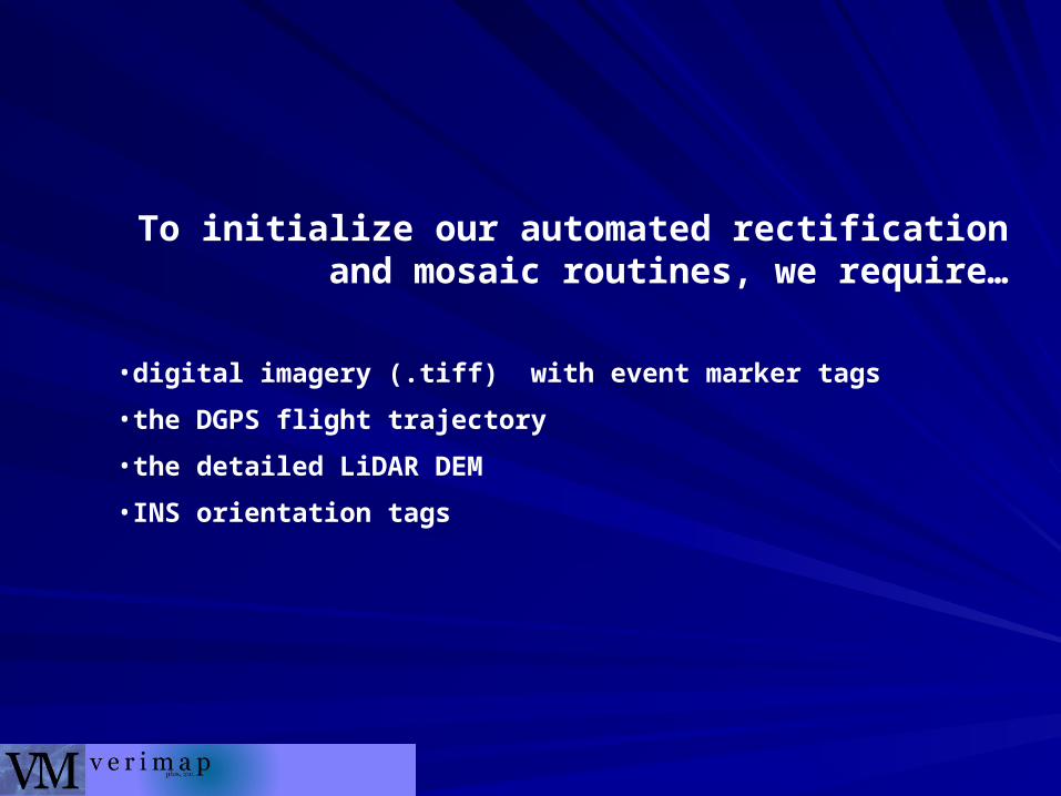
To initialize our automated rectification and mosaic routines, we require…
•digital imagery (.tiff) with event marker tags
•the DGPS flight trajectory
•the detailed LiDAR DEM
•INS orientation tags

Quality Control verifies we have complete coverage over the area of interest (no imagery gaps allowed).
We then create intermediate file sets of
• imagery orientation from the INS/trajectory
• a DEM.geotif at the final image resolution
Rectification of each image is completed.
Then a mosaic is run to create
the tiles of desired size and datum

Conclusion …Conclusion …
……over the past 7 years we have over the past 7 years we have developed the Rapid Mapping developed the Rapid Mapping System.System.
Prices have dropped from $3.00 Prices have dropped from $3.00 per acre to $0.50 per acre in some per acre to $0.50 per acre in some applicationsapplications
3m Imagery can be available for 3m Imagery can be available for $0.10 per acre in some Agriculture $0.10 per acre in some Agriculture applicationsapplications
Our latest advancement is to move Our latest advancement is to move the mapping system into a high the mapping system into a high altitude aircraft to achieve mapping altitude aircraft to achieve mapping production rates of 1,000,000 to production rates of 1,000,000 to 3,000,000 acres per session…3,000,000 acres per session…
……and deliver that and deliver that
imagery in 24hrsimagery in 24hrs