geomorphology, river hydrology and natural processes€¦ · geomorphology, river hydrology and...
TRANSCRIPT

Geomorphology, river hydrology and natural processes
Steve Addy
SNH Sharing Good Practice Event: Identifying and planning river restoration projects
Strathpeffer, 24th September 2013
Outline
Controls on channel morphology
Fluvial processes
Channel morphology variability
River types
Links to river ecology
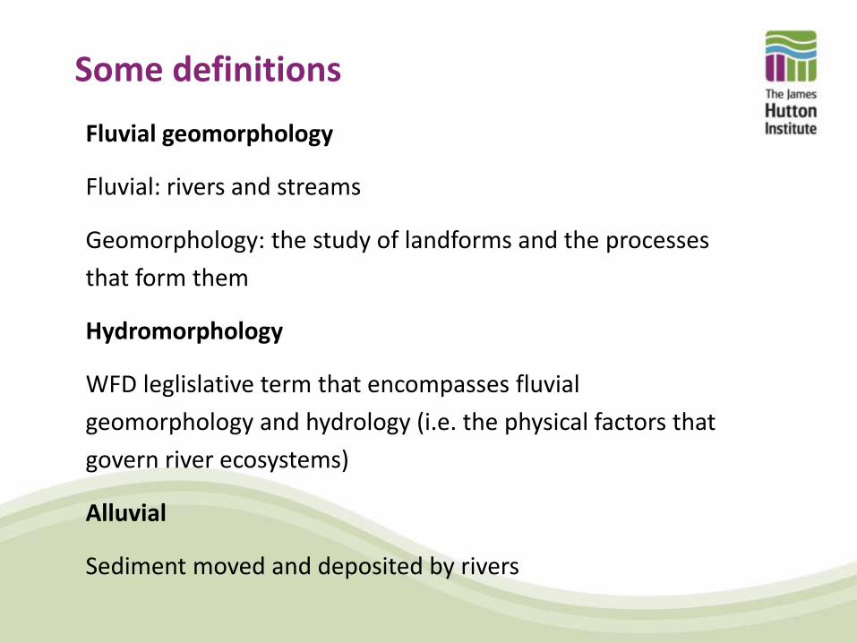
Some definitions
Fluvial geomorphology
Fluvial: rivers and streams
Geomorphology: the study of landforms and the processes
that form them
Hydromorphology
WFD leglislative term that encompasses fluvial
geomorphology and hydrology (i.e. the physical factors that
govern river ecosystems)
Alluvial
Sediment moved and deposited by rivers

Why is fluvial geomorphology important?
• Fluvial forms and processes are recognised as a key
component of river systems in EU WFD and national
legislation
• River landforms and flows constitute the basic ‘physical
template’ that influences riverine biota
• Fluvial geomorphology input is needed for sustainable river
management and restoration
• For mitigating flood risk and geomorphic hazards
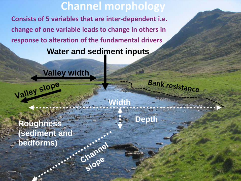
Channel morphology Consists of 5 variables that are inter-dependent i.e.
change of one variable leads to change in others in
response to alteration of the fundamental drivers
Width
Depth Roughness
(sediment and
bedforms)
Water and sediment inputs
Valley width

Channel pattern
(Church, 2006)
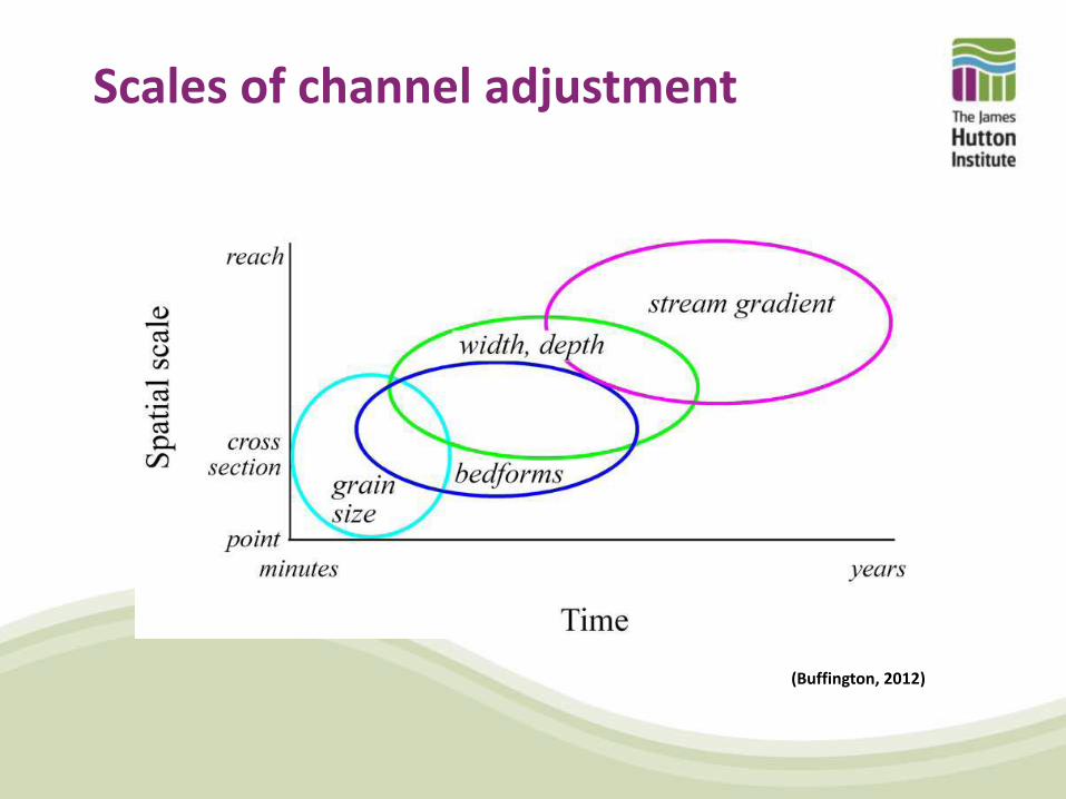
Scales of channel adjustment
(Buffington, 2012)
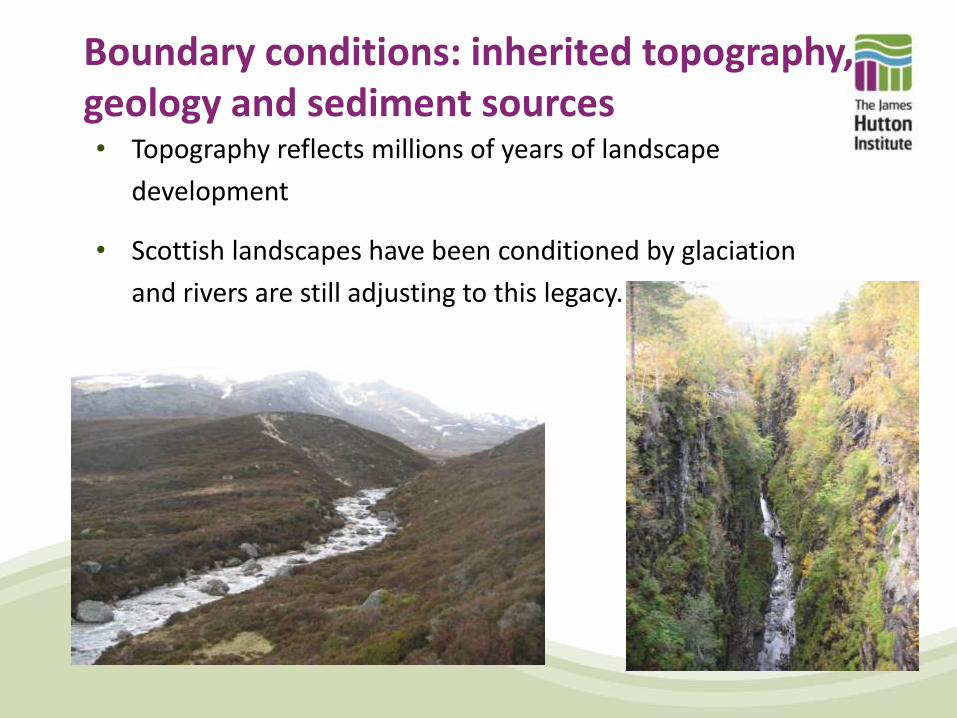
Boundary conditions: inherited topography, geology and sediment sources • Topography reflects millions of years of landscape
development
• Scottish landscapes have been conditioned by glaciation
and rivers are still adjusting to this legacy.
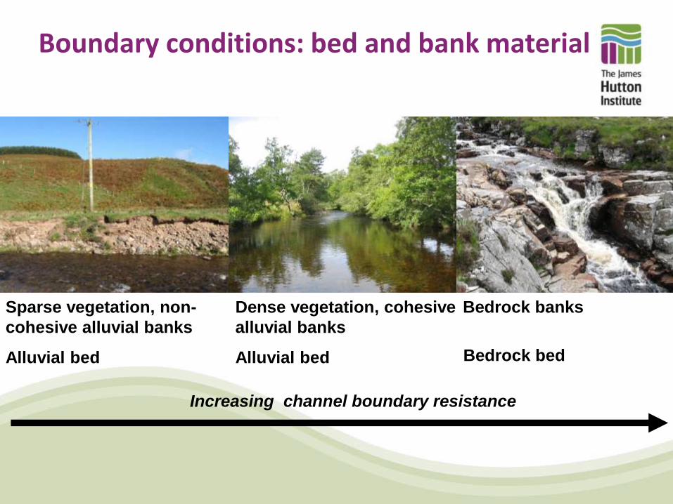
Boundary conditions: bed and bank material
Sparse vegetation, non-
cohesive alluvial banks
Alluvial bed
Dense vegetation, cohesive
alluvial banks
Alluvial bed
Bedrock banks
Bedrock bed
Increasing channel boundary resistance
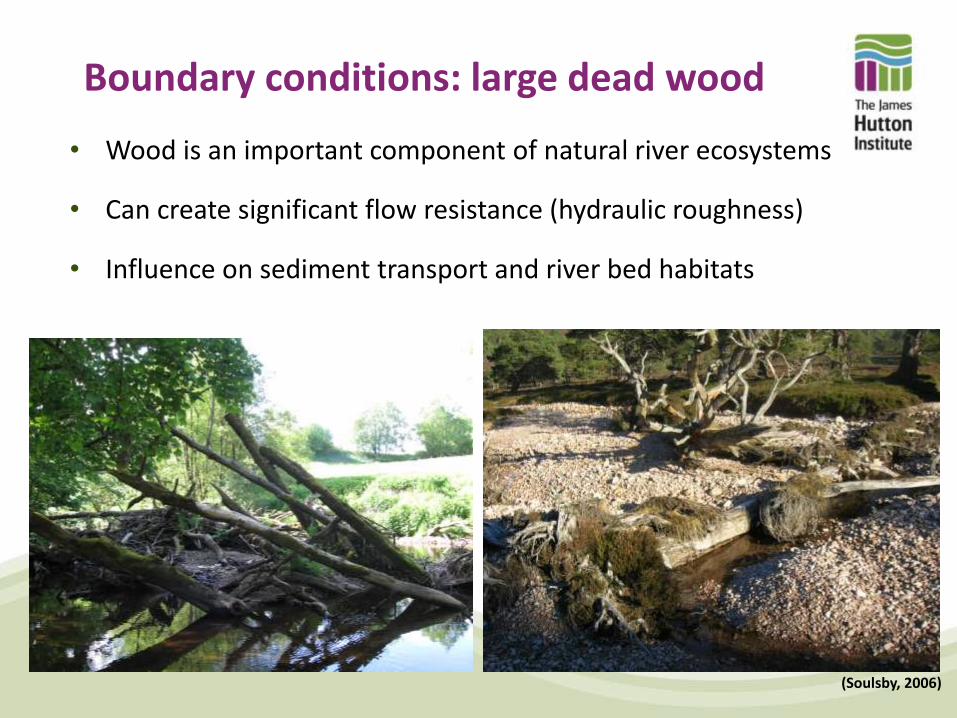
Boundary conditions: large dead wood
• Wood is an important component of natural river ecosystems
• Can create significant flow resistance (hydraulic roughness)
• Influence on sediment transport and river bed habitats
(Soulsby, 2006)
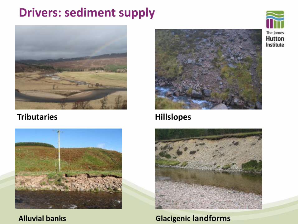
Drivers: sediment supply
Alluvial banks Glacigenic landforms
Tributaries Hillslopes
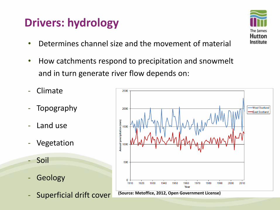
Drivers: hydrology
• Determines channel size and the movement of material
• How catchments respond to precipitation and snowmelt
and in turn generate river flow depends on:
- Climate
- Topography
- Land use
- Vegetation
- Soil
- Geology
- Superficial drift cover (Source: Metoffice, 2012, Open Government License)

River flows over time
Understanding how flows change (magnitude and frequency) over time is important for understanding channel changes, predicting and managing flood risk
Sources of information:
Flow gauging network (~100 years)
Historical record (centuries)
Geomorphic record (1000s of years)
Source: http://www.environment-agency.gov.uk/cy/hiflows/
Old Bridge, Perth
River Dee at Woodend

River flow in open channels
Area (A)
Bankfull
Wetted perimeter
(WP) R = A/WP
Q = A x V
V = (1/n) x R0.66 x S0.5
Where S slope (m/m) and ‘n’ Manning’s roughness
Discharge (Q, m/s3) or flow, is defined as the rate at which a volume of water travels through a cross-section per unit of time. Given by the formula:
Depth
(stage)
Velocity (V, m/s) is given by the Manning equation:
Hydraulic radius (R) a measure of channel shape is given by the formula:
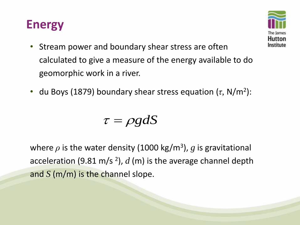
Energy
• Stream power and boundary shear stress are often
calculated to give a measure of the energy available to do
geomorphic work in a river.
• du Boys (1879) boundary shear stress equation (τ, N/m2):
where ρ is the water density (1000 kg/m3), g is gravitational
acceleration (9.81 m/s 2), d (m) is the average channel depth
and S (m/m) is the channel slope.
gdS
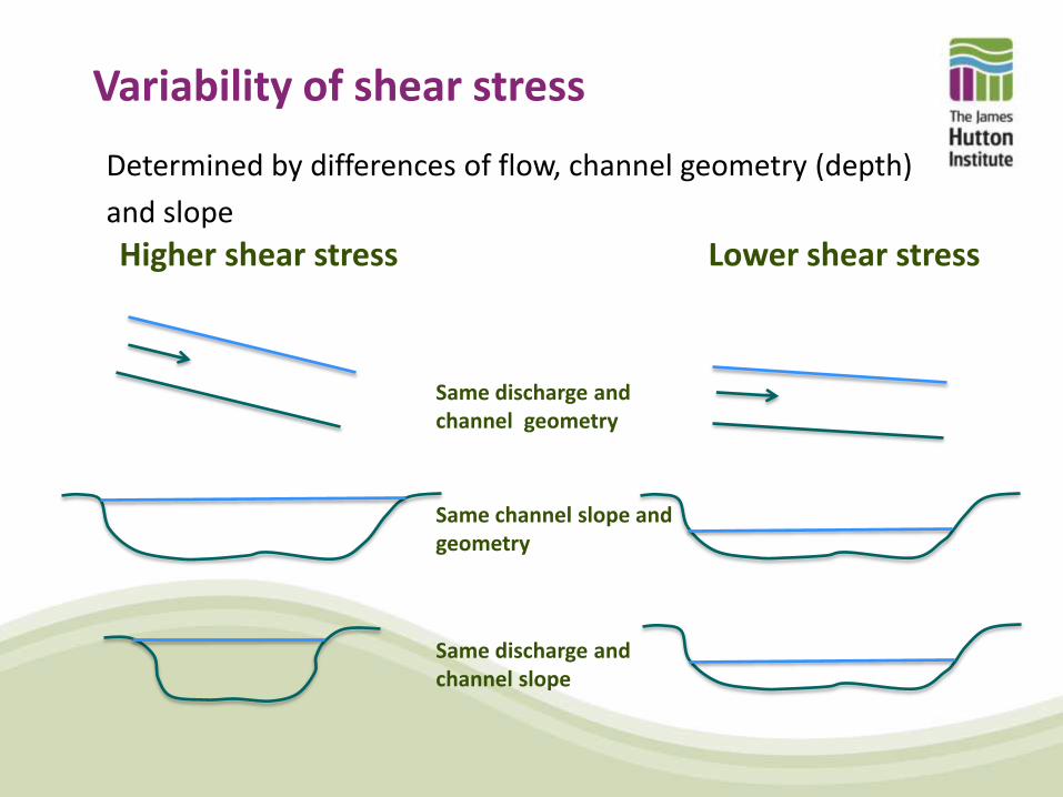
Variability of shear stress
Determined by differences of flow, channel geometry (depth)
and slope
Higher shear stress Lower shear stress
Same discharge and channel geometry
Same channel slope and geometry
Same discharge and channel slope
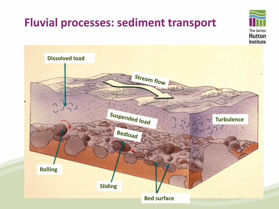
Fluvial processes: sediment transport
Bed surface
Turbulence
Dissolved load
Rolling
Sliding
Fluvial processes: sediment transport
• Washload or suspended load is the movement of fine
(generally < 2 mm) material in suspension
• Bedload movement is the movement of coarse sediment
along the bed; most important in terms of shaping
channel morphology
• Transport capacity – the volume of sediment that can be
transported
• Competence – the maximum size of sediment that can
be transported
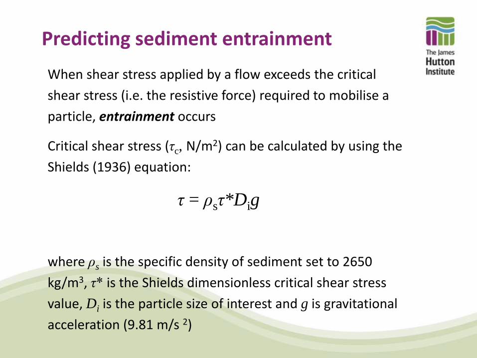
Predicting sediment entrainment
When shear stress applied by a flow exceeds the critical
shear stress (i.e. the resistive force) required to mobilise a
particle, entrainment occurs
Critical shear stress (τc, N/m2) can be calculated by using the
Shields (1936) equation:
τ = ρsτ*Dig
where ρs is the specific density of sediment set to 2650
kg/m3, τ* is the Shields dimensionless critical shear stress
value, Di is the particle size of interest and g is gravitational
acceleration (9.81 m/s 2)

Further controls on sediment entrainment
Imbrication
Bedform and grain roughness
Packing, protrusion and hiding effects
Armouring
Sub-surface layer
Armour layer Flow direction
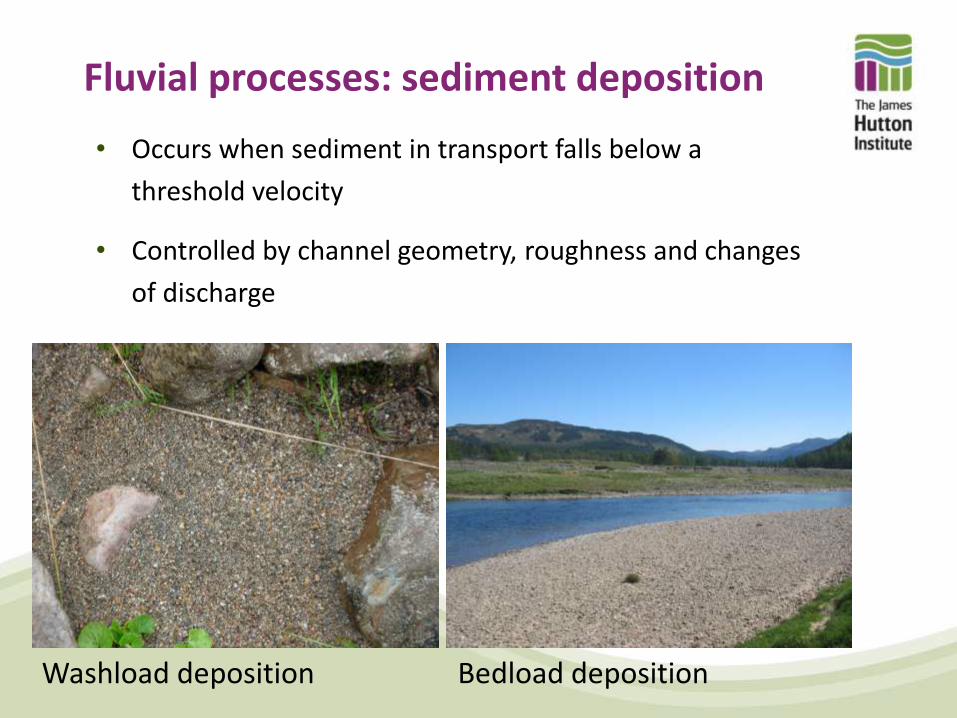
Fluvial processes: sediment deposition
• Occurs when sediment in transport falls below a
threshold velocity
• Controlled by channel geometry, roughness and changes
of discharge
Washload deposition Bedload deposition

Dominant discharge • Exceptional flood events that exceed bankfull can
significantly alter channel morphology through sediment
transport and have a long lasting morphological impact
• However smaller flows, dominant discharge (~bankfull)
flows that occur every 1-2 years (~median annual flood)
may have a greater control on average channel size,
sediment characteristics and pattern.
~Bankfull flow Low flow

Fluvial processes: bank erosion
• Common mode of adjustment in coarse bedded rivers.
• Rate controlled by material
properties, vegetation, weather and degree of scour by flowing water
• Allows accommodation of prevailing flow regime and creates habitat
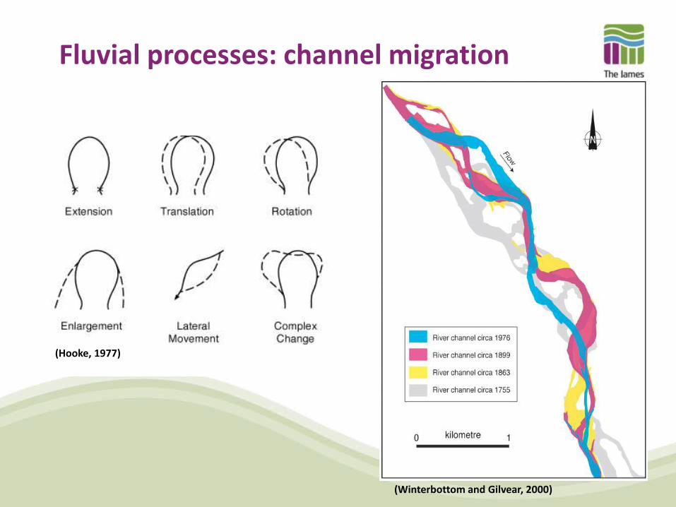
Fluvial processes: channel migration
(Winterbottom and Gilvear, 2000)
(Hooke, 1977)
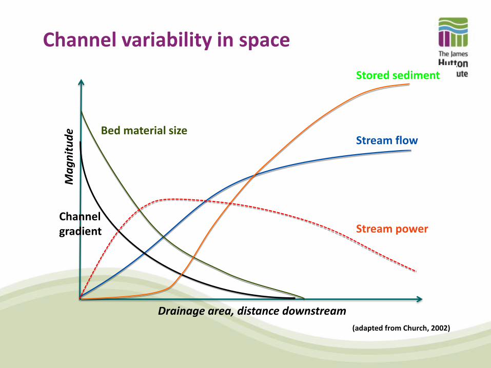
Channel variability in space
Stored sediment
Stream flow
Stream power
Bed material size
Channel gradient
Drainage area, distance downstream
Ma
gn
itu
de
(adapted from Church, 2002)

Alluvial reach
Bedrock reach
Local ‘step’ changes
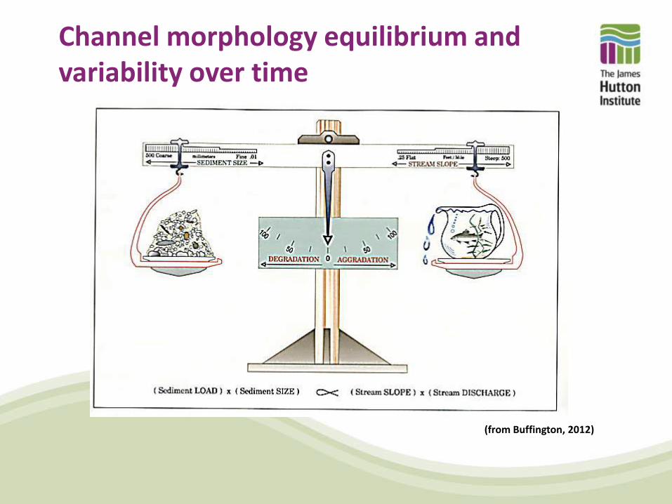
Channel morphology equilibrium and variability over time
(from Buffington, 2012)

Channel morphology equilibrium and variability over time • Channels in perfect equilibrium: sediment input =
sediment output
• Seldom occurs in reality, channels tend to be in a state of
dynamic- or quasi-equilibrium
• Channel equilibrium can be perturbed but will evolve
towards a new state of equilibrium
Quasi Dynamic Response to a major disturbance (Knighton, 1998)
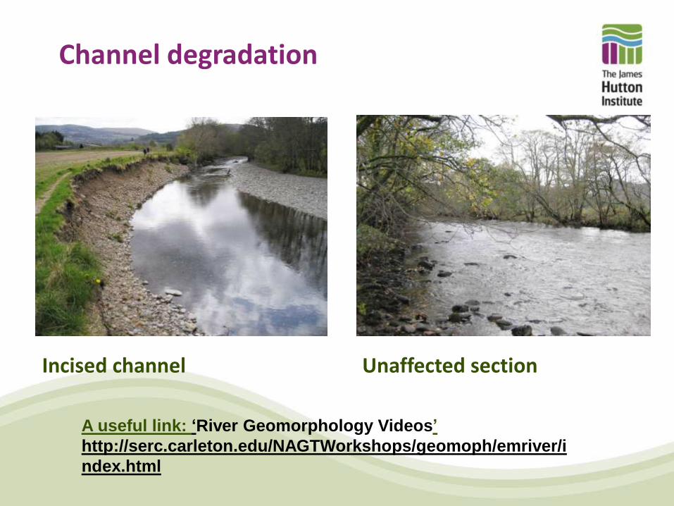
Channel degradation
Incised channel Unaffected section
A useful link: ‘River Geomorphology Videos’
http://serc.carleton.edu/NAGTWorkshops/geomoph/emriver/i
ndex.html

Sudden channel change
Jan 2007 March 2009
30 m
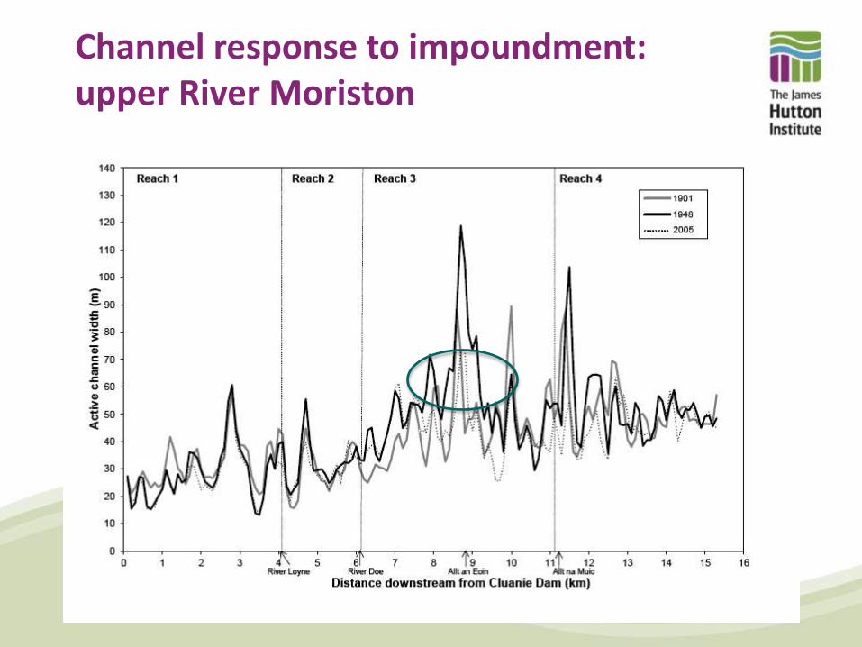
Channel response to impoundment: upper River Moriston

10 years before dam completion
(RCAHMS, 2010)

15 years after dam construction
(RCAHMS, 2010)

48 years after dam construction
Get Mapping, 2010)

Channel classification
(Montgomery and Buffington, 1998)

Bedrock channels
High gradient for a given drainage area and high transport
capacity relative to sediment supply
Limited sediment storage and highly stable
Often form ‘knick-points’ in river profiles and base levels

Boulder-bed channels
High gradient, confined channels dominated by boulder
and cobble substrate
High transport capacity relative to sediment supply
Exhibit cascade or step-pool morphologies that are
stabilised by large ‘key-stones’

Plane-bed and plane-riffle channels
Medium to low channel gradient characterised by a
relatively featureless bed topography
Transport capacity to sediment supply ratios are in
balance
Low sinuosity and variable floodplain extent

Meandering channels
Low channel gradient characterised by an undulating bed
topography
Tend to have pool-riffle sequences and extensive floodplain
Sediment deposition over point bars balanced by erosion on
outside of meanders
(SNH/Aerographica)

Wandering channels
Low gradient channels with locally braided planform and extensive
sediment storage
Characterised by a high sediment supply to transport capacity ratio
Associated with rapid channel migration and avulsion (channel switching)
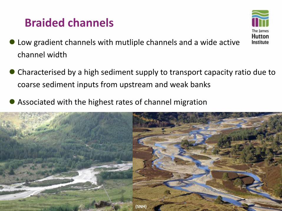
Braided channels
Low gradient channels with mutliple channels and a wide active
channel width
Characterised by a high sediment supply to transport capacity ratio due to
coarse sediment inputs from upstream and weak banks
Associated with the highest rates of channel migration
(SNH)
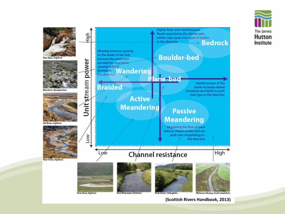
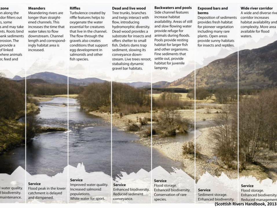
(Scottish Rivers Handbook, 2013)
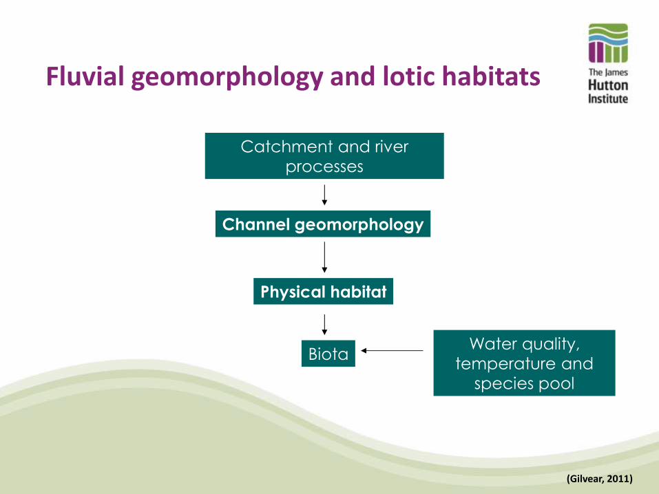
Fluvial geomorphology and lotic habitats
Water quality,
temperature and
species pool
Channel geomorphology
Physical habitat
Biota
Catchment and river
processes
(Gilvear, 2011)
(Scottish Rivers Handbook, 2013)
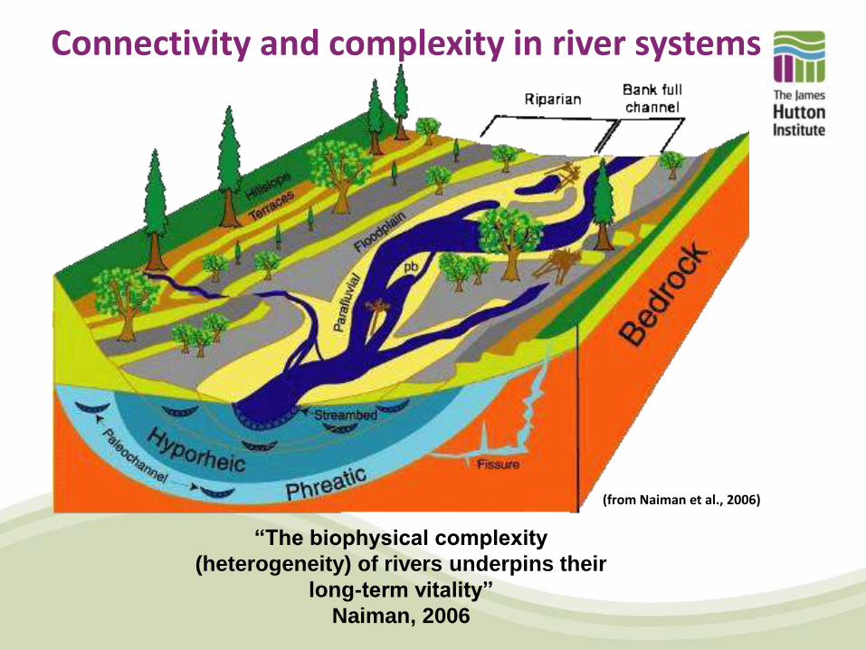
Connectivity and complexity in river systems
“The biophysical complexity
(heterogeneity) of rivers underpins their
long-term vitality”
Naiman, 2006
(from Naiman et al., 2006)
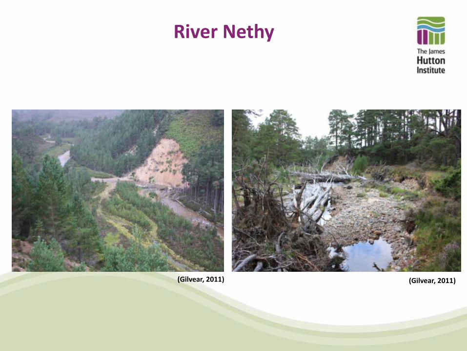
River Nethy
(Gilvear, 2011) (Gilvear, 2011)

150 plant species: two national rarities Purple Iris and Jacobs Ladder (both introduced) and the native nationally rare plants Maiden Pink and Shady Horsetail, plus 31 locally rare higher plants.
Ballinluig Island (SSSI), River Tummel 1946
1989
1994
1999
(Gilvear and Wilby, 2006)
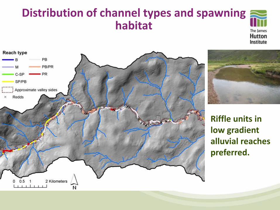
Distribution of channel types and spawning habitat
Riffle units in low gradient alluvial reaches preferred.

Freshwater pearl mussel habitat
Physical habitat quality dictated by the ability of mussels
to burrow into bed sediments and the stability of the
substrate over time
Survival also depends on a healthy salmon population and
the habitat to support it
Summary • For a given river section, its morphology is characterised by five
variables: cross-sectional shape, sediment size, slope, bedforms and planform
• Rivers naturally adjust these variables to the imposed natural drivers and ultimately evolve towards the most stable and efficient condition for transporting water and sediment
• Artificial alteration of controlling factors may cause a departure from its natural adjustment or equilibrium and in turn have undesired consequences
• Different river types and features will play a role in maintaining differing species and lifestyles. River complexity, heterogeneity and a shifting habitat mosaic is important