geomedia® motion video analysis professional
TRANSCRIPT
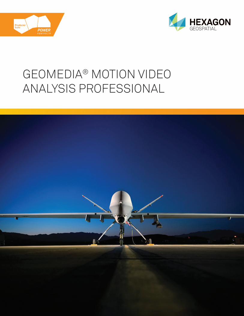
GEOMEDIA® MOTION VIDEO ANALYSIS PROFESSIONAL


3
GEOMEDIA® MOTION VIDEO ANALYSIS PROFESSIONALHexagon Geospatial’s GeoMedia® Motion Video Analysis Professional provides a high-productivity environment for analysis of full motion video taken from unmanned aerial vehicles (UAVs). Agencies, military, and commercial organizations can use it to exploit and analyze the video for near real-time decision-making. GeoMedia Motion Video Analysis Professional provides a seamless Multi-source environment for the analysis of all types of geospatial data: raster maps, vector data, motion video, satellite imagery, and signal intelligence. It is well-suited for conducting advanced analysis on all sources of geospatial data by integrating motion video with geospatial data to generate a complete operational picture.

4
SUPERIOR MANAGEMENT OF GEOSPATIAL CONTENTA critical factor in video analysis is the ability to easily query through vast archives of imagery to find specific clips. GeoMedia Motion Video Analysis Professional stores all tracking information associated with the video, including aircraft trackline, camera angle, video trackline, and video path polygon, that you can use to easily locate the exact video you need for pattern-of-life analysis or change detection. It even handles multiple live video feeds simultaneously, which lets you leverage video from drones that support that capability, and fuse the imagery with other geospatial data. The result is a scenario in which you can quickly zoom to any part of the world – possibly even down to a street corner – and instantly queue up segments from collected video from the last 10 days that pertains to that location. You can then fuse those results with satellite images and other data, and effectively plan your action.
INSTANT AND ACCURATE REAL-TIME ENHANCEMENTS INFORMATIONIn some cases, even with superior content management and powerful data integration and visualization tools, poor-quality video can hamper your analysis. For example, the original captured video may be of poor quality – or even unusable – due to flight path, altitude, buffeting of aircraft, and other factors. To mitigate this problem, Hexagon Geospatial’s technology works in a modular fashion to perform real-time enhancements and corrections on the video, such as removing atmospheric distortion, correcting for shadows that affect brightness and contrast, and stabilizing jittery video. This state-of-the-art technology, increases the usefulness of UAV video in a real-time and forensic
capacity. Setting thresholds, tolerances, and other parameters, and performing tasks in batch mode or interactively, helps you handle the ever-increasing volume of video that must be processed for analysis.
CREATING, STORING, AND RETRIEVING ANNOTATIONSKnowing when an event occurred is often as important as knowing where it occurred. The ability to place annotations and clipmarks within a video stream and save them is essential to intelligence analysis. Annotations are searchable by both geospatial and temporal location, which is key to strategic and tactical planning.
VIDEO INGESTYou can import video into GeoMedia Motion Video Analysis Professional for real-time analysis and exploitation. When you need video for trend awareness, analysis, and change detection, the motion video connection interface will allow you to geospatially query in multiple ways: by a geographic minimum bounding rectangle in which you key in or draw in the map window, from a center point and radius in which you can also key in or draw in the map window, or by entering a Military Grid Reference System (MGRS) location. Additionally, you can specify a temporal filter to find video from a certain day and time. Other attributes, such as camera angle, clipmarks, or annotations, can help you locate only the videos that apply to a specific area, item, or event of interest.
VIDEO ENHANCEMENT AND STABILIZATIONOften, when you receive video, it needs to be stabilized and enhanced before analysis is possible. GeoMedia Video Motion Analysis Professional
Graphic displays of full motion video and its associated tracking graphics are geo-fused with other forms of geospatial information to provide an instant view of the common operating picture
includes patented enhancement and stabilization algorithms proven effective over many years in the public safety market. The application allows analysts to remove shaky motion and atmospheric distortion, as well as enhance poor-quality motion imagery with tools such as brightening, dehaze, frame averaging, and intensity centroid stabilization in real-time as the video is played. Automatic enhancements, zooming, and centering allow the operator to focus on video analysis and let the software continuously optimize the viewing environment.
CLIPMARKING AND ANNOTATIONThe software provides initial review capability for incoming video, such as placing clipmarks and extracting single-frame images and clips. Once the video is ready for analysis, the ability to place clipmarks to identify items or events of interest is important. The software provides user-definable pre-defined clipmarks and associated hot keys for common items of interest. The use of hot keys eliminates the need for mouse clicks and enables quick reaction to items of interest. You can also create a custom clipmark name and associated text. Clipmarks, as well as their associated annotations, are geographically located along the video centerline, which makes them searchable by geographic location and time in addition to textual content. You can send clipped and annotated video for further analysis and reporting. You can also treat the clipmarks and annotations as permanent intelligence data and store it in a Geospatial Content Management application for enterprise-wide access and historical research.
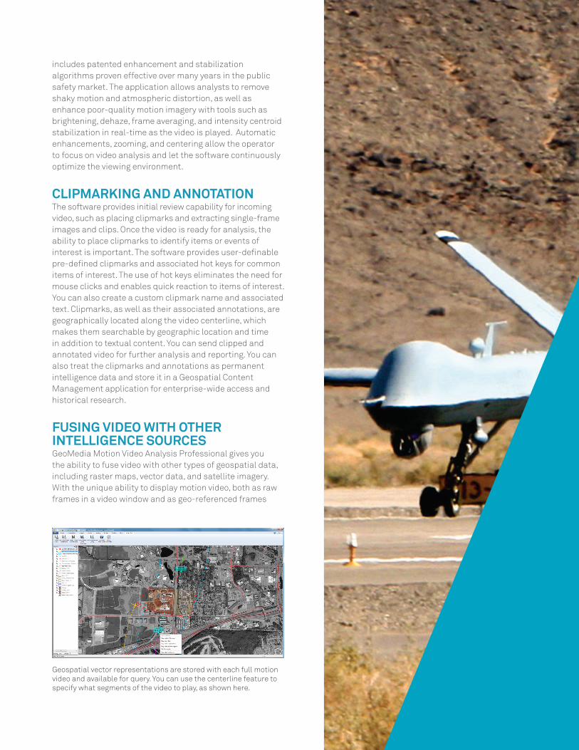
FUSING VIDEO WITH OTHER INTELLIGENCE SOURCESGeoMedia Motion Video Analysis Professional gives you the ability to fuse video with other types of geospatial data, including raster maps, vector data, and satellite imagery. With the unique ability to display motion video, both as raw frames in a video window and as geo-referenced frames
Geospatial vector representations are stored with each full motion video and available for query. You can use the centerline feature to specify what segments of the video to play, as shown here.

7
fused with other data in a map window, you can gain an understanding of the video’s geospatial context. GeoMedia Motion Video Analysis Professional integrates seamlessly with the high-performance Electronic Light Table (ELT) of GeoMedia Image Professional for producing reports from snapshots extracted from video and annotated with video intelligence and map information. This allows you to create reports and actionable intelligence in minutes rather than hours, with a few button clicks in a single integrated environment without having to manually switch between different applications.
ARCHIVING AND MANAGING VIDEOOnce you have stabilized, enhanced, geo-fused, analyzed, clipped, and annotated the video, you can catalog and store the files, footprints, frame-centerlines, sensor-centerlines, and/or frame-centroids and associated data. Annotations, clipmarks, and frame-specific telemetry will be stored with the video file so you can easily query the video for further analysis.
FEATURES AND BENEFITS OF GEOMEDIA MOTION VIDEO ANALYST PROFESSIONAL• Fully exploit video and imagery data in one seamless,
geo-fused environment• Leverage Hexagon Geospatial’s advanced video
enhancement and stabilization capabilities• Discover a new geospatial context in which to review
incoming video data from files or live streams• Geographically track the movement of your aircraft,
the camera angle, and other relevant geospatial information, in a single homogeneous environment
• Geo-fuse your video over vector data, raster maps, or other still imagery and watch it play across your map in context with other geospatial data
• Capture relevant snapshots and clips of imagery and video for additional analysis and reporting
• Query your video data by attribute, annotation, or geospatial location
• Auto-enhance your motion video for superior analytical results
• Visualize and archive all geographic data relevant to your video
• Watch your video simultaneously in a video window and a map window
• Control your motion video with familiar DVR-like controls
• Mark your video for further analysis and historical query capabilities
• Extract image mosaics from your video data segments • Annotate your item or event of interest with a
searchable geospatial definition
© 2014 Intergraph® Corporation. All rights reserved. Hexagon Geospatial is part of Intergraph Corporation. Hexagon®, Intergraph® and related logos are registered trademarks of Hexagon AB or its subsidiaries. All other trademarks or servicemarks used herein are property of their respective owners. The information in this publication is subject to change without notice. DFI-US-0031D-ENG 10/14
Hexagon Geospatial helps you make sense of the dynamically changing world. Known globally as a maker of leading-edge technology, we enable our customers to easily transform their data into actionable information, shortening the lifecycle from the moment of change to action. Hexagon Geospatial provides the software products and platforms to a large variety of customers through direct sales, channel partners, and Hexagon businesses, including the underlying geospatial technology to drive Intergraph® Security, Government & Infrastructure (SG&I) industry solutions. Hexagon Geospatial is a division of Intergraph® Corporation. For
more information, visit www.hexagongeospatial.com. Contact us at [email protected]. Intergraph® Corporation is part of Hexagon (Nordic exchange: HEXA B). Hexagon is a leading global provider of design, measurement and visualisation technologies that enable customers to design, measure and position objects, and process and present data. Learn more at www.hexagon.com.