geology and utilization of tennessee phosphate rock*library.aimehq.org/library/books/aime technical...
TRANSCRIPT

TRANSACTIONS O F THE AMERICAN INSTITUTE O F MINING AXD METALLUR- GICAL ENGINEERS [SUBJECT TO REVISION]
NO. 18'78-M. ISSUED W ~ E I MINING AND METALLURGY, SEPTEMBER. 1924. DISCUSSION OF THIS PAPER IS INVITED. It should preferably be presented in person at
the Birmingham Meeting. October. 1924, when an abstract of the paper wiU he read. If this is impos- sible,, discussion in writing may be sent to the Editor. American Institute of Mining and Metallurgical Engineers 29 West 39th Street. New York. N. Y., for presentation by the Secretary or other representa- tive of ita'author. Unless special arrangement is made, the discuseion of this paper will close Dec. 1. 1924. Any discussion offered thereafter should preferably be in the form of a new paper.
Geology and Utilization of Tennessee Phosphate Rock*
(Birmingham Meeting, October, 1924)
After a brief history of the phosphate industrl~ of Tennessee, the dislrib~ction and origin of the phosphaie rocks are described. Then the mining and treatment, together with costs of production, and the uses of the rocks are giaen.
THERE are three distinct varieties of phosphate rock, in Tennessee, known commercially as: (a) the "brown" rock, which is the residual prod- uct of the weathering and natural concentration of certain phosphatic Ordovician limestones; @)'the "blue" rock, which is an unaltered phos- phatic stratum of Mississippian or Devonian age; and (c) the "white" rock, which is the result of chemical replacement and deposition.
Before 1894, South Carolina and Florida had supplied most of the phosphate of the United States, South Carolina leading until that date and Florida from then until the present time. In December, 1893, the blue phosphate of Tennessee was discovered almost simultaneously on Swan Creek, in Lewis County, by two independent parties-by one as the result of a careful and systematic search for a workable deposit of the long known kidney phosphate, and by the other through mistaking it for a "bloom" of coal. Leases were taken and, with further prospect- ing disclosing other deposits in the region, the development progressed as rapidly as could be expected without railroad transportation.
In January, 1896, Judge S. Q. Weatherly, who was interested in the development of the blue phosphate, while riding along the road south of Mt. Pleasant, noticed some slabs of a brown rock in place above the lime- stone. He took samples, and had them analyzed, thus discovering the high-grade brown phosphate of this district. This discovery was kept a secret until July, 1896, when mining was started a t the village of Mt.
* Published with the permission of the Tennessee Geological Survey. This paper is a synopsis of a detailed report in preparation for publication by the Tennessee Geological Survey.
t Assistant Geologist of Tennessee Geological Survey.
Copyright, 1924, by the Ameriean Institute of Mining and Metallurgical Engineers, Inc.
2 GEOLOGY AND UTILIZATION OF TENNESSEE PHOSPHATE ROCK
Pleasant. Development proceeded ,rapidly, many owners obtaining their capital by the sale of their rock fences, which were largely composed of slabs of high-grade brown phosphate. The development of the brown rock, which is richer and more easily mined than the blue, caused Ten- nessee to advance from a poor third in production to second, surpassing the.output of South Carolina, and being excelled only by Florida.
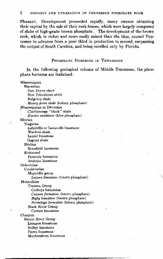
In the following geological column of Middle Tennessee, the phos- phate horizons are italicized :
Mississippian Waverlian
Fort Payne chert New Providence shale Ridgetop shale Maury green shale (kidney phosphate)
Mississippian or Devonian Chattanooga "blnck" shale Hardzn sandstone (blue phosphate)
Silurian Niagaran
Lobelville or Louisville limestone Waldron shale Laurel limestone Osgood shale
Medina Brassfield limestone
Richmond Fernvale formation Arnheim limestone
Ordovician Cincinnatian
Maysville group La'pers limestone (brown phosphate)
Mohawkian Trenton Group
Catheys formation Cannon formation (brown phosphate) Bigby limestone (brown phosphate) Hermilage formation (brown phosphate)
Black River Group Carters limestone
Chazyan Stones River Group
Lebanon limestone Ridley limestone Pierce limestone Murfreesboro li~nestone

RICHARD W. SMITH
At no one place in the Central Basin are all of these formations pres- ent. At some places certain formations are absent because that region was above water a t the time and erosion was going on instead of deposi- tion, and the time interval is represented by an unconformity; a t other places, because the formations missing were once present but were later eroded before the deposition of the later beds. During Silurian time, most of Middle Tennessee was above water, and the Silurian sea extended only in narrow arms or embayments along the western edge of the Central Basin, so that the Silurian formations are very irregular in thickness and extent.
The work in recent years of Dr. E. 0. Ulrich, of the U. S. Geological Survey, and Dr. R. S. Bassler, of the U. S. National Museum, has added greatly to our knowledge of the stratigraphy of the Central Basin of Tennessee.
In general, the brown rock is confined to the western edge of the Central Basin. The center of the basin has no deposits, because the rocks out-
( cropping there are stratigraphically lower than the phosphate horizons. i' The eastern edge contains no deposits, because the phosphate horizons are
absent or, if pr&ent, their character has changed so that they are not phosphatic limestones. For example, along the eastern edge of the Central Basin the Bigby formation is absent, and the Cannon formation, which gives rise to phosphate deposits around Franklin and Nashville, is composed almost entirely of "dove" limestones similar to the basal dove member of this formation a t Nashville. In considering the distribution
I by fields or districts, it must be borne in mind that they represent some- whit artificial divisions which, in many cases, connect with one another directly, without complete interruption.
Mt. Pleasant District i
I The Mt. Pleasant field is the most striking example of the blanket type of deposit. Its superiority is due to the remarkable development of all the factors that are helpful in the formation of a good blanket deposit.
4 The Bigby formation, which is richer in phosphate here than elsewhere in the Basin, outcrops over a large area having the structure of a low dome with its center east of the town of Mt. Pleasant. The rocks dip away from this crest on all sides, providing good underground drainage to three creeks. These creeks, in places, have cut down to the upper Hermitage formation, about 30 ft. below the undulating surface of the land between;
' . and this, with the easily soluble character of a bed in the upper Hermitage, has provided perfect drainage 'over all parts of the area. This has resulted in a blanket deposit of from 2 to 10 ft. over much of the area, in addition to the rich lump rock found in the cutters.

4 GEOLOGY AND UTILIZATION OF TENNESSEE PHOSPHATE ROCK
PHOSPHATE DEPOSITS
LARGE ACTIVE MINE
BROWN PHOSPHATE
BLUE PHOSPHATE
Since its discovery, several millions of tons of phosphate have been removed from this district. The end of the industry has often been pre- dicted, and would have been accomplished by now had not improved methods of recovery enabled the companies to rework the entire area, formerly hurriedly gone over for the best lump rock. At present, five large companies are mining and operating washing plants in the Mt. Pleasant district. Their holdings are estimated to be a 20 years supply.
Scott's Mill and Southport Districts . Southeast from Mt. Pleasant, towards Scott's Mill and Southport,
- the country becomes more hilly, and the Bigby limestone outcrops well up on the sides of the hills, forming numerous rim deposits. These deposits contain quite a tonnage of good grade phosphate but are not easily worked with machinery. On some of them, lump rock is being mined by hand and carted to Scott's Mill, the end of a branch railroad from Mt. Pleasant, where the phosphate is dried on wood and loaded for shipment. Deposits of this character continue east as far as Culleoka on the L. & N. railroad between Columbia and Pulaski.
Wales District
Along Pigeon Roost and Richland creeks, near Wales Station, Giles County, 5 miles north of Pulaski, are numerous deposits of phosphate derived from the Bigby and Cannon formations, some of which approach the blanket type. These depositi are mostly of a sandy and clayey muck containing very little lump rock, and require a careful washing process to keep the grade of the product above 72 per cent. bone phosphate of lime. Two companies have washers here, only one of which is operating a t the present time.
Brick Church District
Near the upper end of Richland Creek between Buford Station and Brick Church, several miles northeast of Wales, are extensive deposits of a low-grade siliceous phosphate in the upper Hermitage, Bigby, and Cannon formations. At present these are too low grade for profitable development, but they may be of considerable value in the future. At other places in Giles County are smaller and scattered deposits of similar character that have not been developed.
Columbia District
In the vicinity of Columbia, northeast of Mt. Pleasant, are several deposits of varying size and grade derived from the Bigby formation. On the Williamsport Pike, 8 miles west of Columbia, is a large blanket deposit resembling the Mt. Pleasant deposits. Here two companies have washers, only one of which is operating at present. In its mines thephos-

phatic stratum is thick but quite deeply buried, and is being mined by the largest drag line in the field, having a boom 125 ft. long.
To the northeast of Columbia, in the vicinity of Bear Creek, are deposits of limited extent of both the "rim" and "blanket" types from the Bigby and' Cannon formations. These have been mined to a small extent in the past, but are not being developed at present.
Spring Hill District
West of Spring Hill is a fairly extensive blanket deposit of Bigby phosphate from which the lump rock was mined a number of years. ago. Recently a modern washerhas been built here and the deposit is being reworked.
Franklin and Nashville Districts
In the vicinity of Franklin and Nashville are numerous small and irregular deposits derived from the Cannon formation and to a less extent from the Bigby formation. From some of these, a little rock has been mined a t intervals in the past.
Centerville and Swan Creek Districts
Along Swan Creek, from Gordonsburg to Centerville, and a t a number of places in the vicinity of Centerville, the Leipers formation has given rise to very productive deposits of brown phosphate, largely of the sandy type. At present two companies are operating mines a t Twomey, 1 mile south of Centerville.
Other Scattered Localities
At other places, such as Marshall, Lincoln, and Sumner counties, small deposits of poor quality have been found. At Gallatin, Sumner County, some mining has been done in a blanket deposit of Leipers age, but the mines have been idle for a number of years.
The high-grade blue rock lies mainly in Hickman, Lewis, and Maury Counties, notably a t Gordonsburg on Swan Creek in Lewis County, a t Centerville in Hickman County, and a t Leatherwood, in Maury County. At present, the mines a t Gordonsburg are the only ones operating.
Igneous rocks contain several phosphate minerals of which the only important one is "apatite," Ca5(P04)3(F, Cl). It is principally found as a vein mineral.or as a product of magmatic differentiation, but is also widely distributed as an accessory mineral. By the action of carbonated waters, the apatite is slowly decomposed and its products carried to the

RICHARD W. SMITH 7
sea, where the phosphatic ingredients are probably soon absorbed into the shells, bones, and tissues of marine animals. When the animals die their remains sink to the bottom, forming slightly phosphatic deposits. The organic remains vary widely as regards their richness in phosphate. Bones and some crustacean remains are very rich, while mollusks and corals are the poorest, as they consist mainly of calcium carbonate; however, certain brachiopods are highly phosphatic.
The Paleozoic seas of Middle Tennessee contained an abundant invertebrate marine life of which some forms secreted phosphatic shells. Certain of the Ordovician limestones &re-deposited, according to Hayes and Ulrich,l in a very shallow sea, the bottom of which was more or less affected by wave action and tidal currents, and without the addition of much detrital matter from land erosion. I n this shallow sea, the deposits were almost wholly of organic origin, consisting in part of tf;e phosphatic shells af small mollusks that flourished abundantly a t this time and in part of the more common calcium carbonate shells that form ordinary limestone. Some part of the calcium, carbonate was probably redis- solved by the sea water, while the less soluble nhosphatic shells were rolled and broken by the wave action and tidal currents, and finally
'
deposited on the sea bottom together with more or less carbonate. The rolled fragments of phosphatic shells were probably enlarged somewhat
'
by coatings of phosphate, derived by precipitation from the water which, in turn, had received it from the decomposing animal remains.
SUCH an origin for the phosphatic Ordovician limestones of Middle Tennessee is clearly shown by their character. They'are cross-bedded, due to the current and wave action on the loose material on the bottom of the shallow sea; and are made up of narrow, irregular, alternating bands of relatively pure crystalline limestone, and darker granular, phosphatic layers, both of which contain abundant small fragments of shells. When such a limestone is subjected to weathering by acidulated ground waters, charged with carbon dioxide from the atmosphere and from decaying . vegetable matter, as well as the humic acids of the soil, the result is that the, calcium carbonate is carried away in solution, leaving behind the more insoluble calcium phosphate as well as the impurities. The extent to which such a weathering takes place depends on the following factors:
1. Position of the phosphatic limestone strata relative to surface topography;
2. Abundant jointing of the rocks, affording channels for the rapid circulation of underground waters;
3. Favorable surface drainage conditions; 4. Character of the underlying and overlying rocks; 5. Presence of clay seams in the limestone.
1 C. W. Hayes and' E. 0. Ulrich: U. S. Geol. Surv., Geol. Atlas, Columbia Folio (1903) 96, 5.

8 GEOLOGY AND UTILIZATION O F TENNESSEE PHOSPHATE ROCK
The position of the phosphatic limestone relative to the surface topography is of utmost importance. If the limestone is buried so deeply by the overlying rocks that weathering cannot reach it, there is no further concentration of phosphate. If the phosphatic limestone lies in a bed too far from the tops of the hills to be completely exposed to surface weathering, but only outcrops and is weathered around the sides of the hills, there is formed on this outcrop a deposit encircling the hills, but not reaching to the top. This is called a "rim " or "hat band " deposit. But if erosion has removed the overlying rocks so that the phosphatic limestone itself forms the surface rock, weakhering can extend deeper and the areal distribution is not confined to a limited banded outcrop, but is determined more by other condit;ions. Such deposits are usually more extensive and are knoyn as "blanket" deposits.
Another important factor in the formation of the brown-phosphate deposits is the abundant jointing of the limestones, caused by fracturing as they were elevated to their present position. The underground water, seeping into these cracks and joints, gradually enlarges them by solution of the calcium carbonate of the limestone until they become, in many instances, large underground water channels carrying the water for long distances to the creeks. In this way the so-called cutters are formed. These are the long narrow trenches in the limestone filled with the residual brown phosphate. If the phosphate left is platy, due to alternating bands of varying phosphatic content in the original limestone, the original structure is preserved in the phosphate filling the cutters, the layers sag- ging in the center because of the removal of the calcium-carbonate por- tion of the phosphatic limestone. In the Mt. Pleasant field, these cutters are pronounced in their development. In almost any of the larger pits where the phosphate has been mined, there may be seen the long, narrow trenches, separated by the intervening walls of fresh limestone which are irregularly traversed by smaller cross cutters. The main cutters all trend N. 60' W., following the direction of the main joint system of the Central Basin. This is true even with a rim deposit completely encir- cling a hill, producing parallel cutters on all sides of the hill instead of radial drainage as one might expect.
To produce the deep weathering necessary to form a good phosphate deposit of the blanket type, the main creeks should all be lower than the surrounding country, so that there may -be a rapid movement of the underground water through the phosphatic strata to the streams. There should be numerous tributary streams so that every part of the phosphatic strata is well drained. If the dip of the rocks is toward the streams, the rapidity of the movement of the underground water and of its solution powers is increased.
The effect of the character of the underlying and overlying beds is of considerable importance. In the Mt. Pleasant district, the upper

RICHARD W. SMITH 9 -
part of the Hermitage formation contains a bed of shelly and easily soh- ble limestone that frequently weathers cavernous, permitting the sur- face water to drain down through the cutters in the Bigby formation t o it and emerge as springs at the outcrop of this bed along the creeks. I n places where this bed is absent or is separated from the Bigby by a thick bed of the usual argillaceous Hermitage limestone, the drainage . conditions are not as ideal for the formation of extensive phosphate deposits. Around Franklin and Nashville, the Bigby formation is over- lain by a dense, resistant "dove" limestone, which is the basal member of the Cannon formation. This formation is absent in the Columbia and Mt. Pleasant regions. This dove limestone, acting as a resistant capping, has prevented the exposure of broad areas of the Bigby formation like those in Maury County, and has thus prevented the formation of exten- sive blanket deposits of Bigby phosphate in these regions.
Clay seams are usually quite impervious to water and tend locally to restrict its downward percolation. Thus, if there is a clay seam in the phosphatic limestone, the limestone just above i t is subjected to a more than ordinary supply of acidulated water, causing somewhat more leaching action. In this way caves are formed, extending back into the limestone walls, sometimes connecting two adjacent cutters, and leaving unweathered limestone boulders completely surrounded by phosphate.
The blue phosphate is an unaltered phosphatic portion of the Hardin sandstone outcropping a t the base of the Chattanooga "black" shale a t the edge of the Highland Rim on the southwest side of the Central Basin. I t varies in thickness from a few inches to 3 or 4 ft.; and in composition from a highly phosphatic, oolitic variety to an ordinary shale or sandstone. Unlike the brown phosph'ate, it is evidently a sediment that has *ot been altered since its formation. How, then, did it get its phosphatic content? The best clue to its origin is its position. It is present only where the underlying Ordovician limestone (Leipers) is phosphatic. Furthermore, in places where there is an intervening layer of Silurian limestone and the blue rock does not rest immediately on the Ordovician,, it is much less phosphatic. It was therefore suggested by Hayes and U l r i ~ h , ~ that just before or during Devonian time there was an interval of erosion, during which brown phosphate deposits, similar to those in the Central Basin today, were formed by the leaching of the phosphatic Leipers limestone. These brown phosphate deposits, on submergence in the sea, would furnish an abundant source of material for the making up of the new beds; and if so situated as to receive no additional sediments, would tend to produce a high-grade phosphate rock. Above the Chattanooga
LOC. cil., 6.

10 GEOLOGY AND UTILIZATION O F TENNESSEE PHOSPHATE ROCK
"black " shale, the thin Maury green shale contains rounded phosphatic nodules or "kidneys;" these, however, are not of economic importance.
ORIGIN OF WHITE PHOSPHATE
The white phosphate is found in Perry and Decatur Counties near the Tennessee River, i n d in Johnson County in the northeastern part of the state, in formations not present in the Central Basin and therefore not shown in the geological column. In both cases, it is the result of chemical replacement or secondary deposition by waters bearing phos- phate derived from slightly phosphatic overlying formations. In the Tennessee River section, i t occurs in formations of the upper Silurian
FIG. 2 . -MINING DEEP CUTTER, HOOVER &: MASON MINE, M T . PLEASANT, TENN.
and Devonian age; and -in Johnson County, in formations of Cambrian . age. Owing to its irregular character and limited extent, the white phos- phat,e has never been developed.
Brown-rock deposits lie near the surface and are easily worked in open pits. The overburden of soil, clay, and slightly phosphatic muck varies in thickness from almost nothing to such a thickness that its removal is unprofitable. I t is generally considered that the economic limit is 6 Et. of overhrden for every foot of phosphate found; but of course this depends on the selling price of phosphate, the cost of labor, and the mining methods used.

RICHARD W. SMITH 11
Early Methods
In the early days of thc industry, mining was done entirely by hand. The overburden was removed by hand or by horse scrapers. The phosphate was loosened with a pick and the lumps were shoveled into carts with a "spa11 fork;" the rich phosphate sand or "muck" and the smaller lumps that would pass through the tines of the fork were allowed to go to waste. Where the deposit occurred on a slope, a face was usually started on the lower end and worked toward the upper; the over- burden, being undermined, was allowed to fall in on the worked ground, and shoveled back.
Before shipping, the rock was dried by piling up on wood, which was then ignited; or by spreading i t on the ground in the sun for several days
FIG. 3.-MINE OF ARMOUR FERTILIZER CO., CENTURY D'ISTRICT, A L O S G COLUMBIA- WILLIAMSPORT PIKE.
andSturning it repeatedly with a plow. With the coming of the larger companies, these crude and wastefuI methods were gradually replaced by modern machinery; but they are still used to some extent by indi- viduals mining small and isolated tracts for the lump rock only.
Modern Mining Methods
The larger companies now strip the overburden by drag-line excava- tors using a 136 to 235 c u ~ d . Page scraper budket ona 50-to 85-ft. boom. The overburden is strippFd from a long area, the width of the reach of the machine, and dumped on previously mined over ground a t one side.

12 GEOLOGY AND UTILIZATION O F TENNESSEE PHOSPHATE ROCK
The entire thickness of the phosphate horizon, lump rock, muck and all, is mined. Where i t is thick enough, drag-line excavators are used for the mining; but where the phosphate is thin or occurs in the narrow "cutters" or underground drainage channels between "horses" of limestone, i t is mined by pick and shovel with negro labor. One phos- phate company a t Mt. Pleasant has designed a machine, called the "cantilever," resembling a traveling crane, for raising hand-filled buckets from deep or narrow cutters and dumping them into the tram cars.
Steam shovels have been tried for both mining and jemoving the overburden, but because of their limited reach, in comparison with the drag-line excavators which mine to a depth of 40 to 50 ft., their use has .
been abandoned. The material is transported to the washers by tram haulage, using 10-
to 18-ton dinky locomotives on a 36-in. gage line. Either 3-yd. end- dump or 4-yd. side dump cars are used.
FIG. 4.-MINING WITH CANTILEVER, HOOVER & MASON M I N E ; OVERBURDEN IS PILED I N MINED-OUT AREA.
At one mine, where the topographic conditions are favorable, the over- burden is stripped and the phosphate is mined by hydraulic methods similar t o those of the Florida phosphate field. Two streams of water are used with 10-in. nozzles with I-in. openings. The water is under 120 Ib. pressure. After the overburden h a s h e n washed into the pre- viously mined-over territory, the phosphate is washed to a depression, or "sump," where i t is picked up by a hydraulic jet and carried to a

RICHARD W. SMITH 13
centrally located pump. Here the larger lumps are caught on a 4-in. grid, and the material is pumped to a point from which it can flow to the washer in a trough. With this method, some trouble has been experienced by flint and iron nodules in the o~erburden settling down on top of the phosphate horizgn instead of flowing off with the overburden as it was removed.
Washing Methods
The muck, or unconsolidated portion of the phosphatic stratum, is a mixture of phosphatic sand and clay, and has a phosphate content of from 30 per cent. to 60 per cent. bone phosphate of lime. Asthe fertilizer manufacturers demand phosphate running 72 per cent. bone phosphate of lime or ovep, and with impurities of iron and alumina less than 6 per cent.,. this material cannot be utilized without washing out the clay and thus concentrating the product until it meets the requirements.
The first attempt at washing brown phosphate was made by the old Tennessee Phosphate Co., at Mt. Pleasant, in 1899 or 1900. This was simply a log washer for cleaning the lumps of their adhering clay. No attempt was made to save the fine material, with the result that the old mud ponds of the washers of this type contained material running from 40 per cent. to 60 per cent. bone phosphate of lime. Most of these have since been reworked a t a profit. In 1907 the Independant Phosphate Co. made the first attempt to save the fine material by running the wash water from the log washer through long troughs that settled the coarsest of the phosphate san'd. When the plant was shut down, the sand was shoveled out of. the troughs. From this time on, considerable attention was given to saving the fine material and improvements were gradually made, until today the washing plants are large and complicated, and the recovery is relatively perfect.
Though the details of manipulation vary a t the different plants, the principles of recovery are the same a t all. Briefly, it consists of a thorough mixing of the material with water and agitation until the clay lumps are thoroughly disintegrated and the clay and fine sand are in suspension and separated from the coarse sand and lumps. This is followed by a separation of the lump material, the coarse sand, and the fine sand; and a separation of the sands from the clay by gravity with the addition of fresh water a t frequent intervals.
The material is usually carried to a crusher at the top of the washer, which partially breaks the large lumps of clay and phosphatic muck. From the crusher the material goes through a mixing process consisting of either double iron log washers or rotating cylinders with flights or shelves that lift the material and drop it back into the water. The object is td break up the mud balls and agitate the material until the clay and

fine sand are in suspension and separated from the coarse sand and lumps. The overflow goes to the fine-sand recovery; the discharge to some form of classifier, usually a revolving screen, which separates the lump rock from the coarse sand. The oversize from this screen runs over a picking belt, where the remaining mud balls and pieces of chert a d limestone are removed by hand, and the resulting lump rock goes to the wet storage
Incline .
H:;er
Jet $. 25'~ouble Log Washer
FIG. 5.-PROPOSED FLOW SHEET OF REMODELED WASHER OF INTERNATIONAL AGRI- CULTURAL CORPN. PLANT AT MT. PLEASANT, TENN.
pile before drying. The undersize from the screen goes to the coarse- sand recovery.
The coarse-sand recovery equipment consists of a series of jet cones, inverted pyramids, cylindrical jet tanks, Allen hydraulic cones, .or a combination of two or more of these. The jet cone is an inverted metal

RICHARD W . SMITH
cone with an overflow around the rim, by which the clay and the finest sand are carried away to the fine-sand recovery. The heavier sand settles to the bottom, where a jet of fresh water carries it up through a pipe to the next cone and finally to some dewatering device. The inverted pyramid is the same except in shape. The jet tank is a cylindrical tank, but works on the same principle because the sand settles in the box until the free space for the water is in the shape of an inverted cone.
, The last step in the coarse-sand recovery is the dewatering of the washed product by an Allen dewatering cone, a Dorr triple-deck classifier, or a plain drag classifier. The drag classifier is simply an endless drag conveyor removing the settled phosphate sand from a long settling box with an inclined bottom up which the conveyor moves. Whichever device is used, the dewatered phosphate sand goes to the wet storage pile for further draining before drying, while the overflow goes to the fine- sand recovery.
The equipment for the fine-sand recovery consists of a large Dorr thickener, more Allen hydraulic cones, or both. The dewatering of the fine sand is accomplished by more Allen dewatering cones, or a Dorr
, bowl classifier. .This is a combination of a single-deck classifier with a small bowl thickener, placed over the lower end of the classifier tank. With either method of dewatering, the discharge goes to the wet storage pile, while the overflow is carried either to the settling pond or back to the fine-sand recovery.
After draining on the wet storage pile, the washed material is carried, by cranes, to the feed bins of the driers. The driers are rotary cylinders 5 to 7 ft. in diameter and 30 to 50 ft. in length, heated by coal or oil burners at one end. The heat and gases pass through the driers to a stack a t the other end; the rock is fed in at either the hot or cold end. ~ r o m the driers, a conveyor belt or a small tram or trolley carcarriesthe rock to the top of the dry storage shed. underneath this shed is a con- crete tunnel containing a conveyor belt on to which the rock can be fed by gravity: At the end of this conveyor belt, automatic loaders fill the freight cars for shipment. Such is the general process of washing the phosphate. The details vary, and the flow sheet of one company may be more elaborate than that of another. Each company has a different problem to deal with, according to the character of the deposit it is mining.
Cost of Production
The cost of production varies considerably among the different com- panies and fluctuates from time to time. James A. Barr, engineer for the International Agricultural Corpn., has furnished the following estimate for the general cost of production in the Mt. Pleasant field in 1923:

COET PEB LONQ TON
Stripping overburden. . . . . . . . . . . . . . . . . . . . . . . . . . . . . . . . . . . . . . $0.50 . . Mlmng . . . . . . . . . . . . . . . . . . . . . . . . . . . . . . . . . . . . . . . . . . . . . . . . . 0.75 Transportation to washer. . . . . . . . . . . . . . . . . . . . . . . . . . . . . . . . . . . 0.20 Washing . . . . . . . . . . . . . . . . . . . . . . . . . . . . . . . . . . . . . . . . . . . . . . . . . . 0.75 Drying . . . . . . . . . . . . . . . . . . . . . . . . . . . . . . . . . . . . . . . . . . . . . . . . . . . 0.75 Shipping and track expense. . . . . . . . . . . . . . . . . . . . . . . . . : . . . . . . . 0.10
Workingcost . . . . . . . . . . . . . . . . . . . . . . . . . . . . . . . . . . . . . . . . . . . $3.05 Capital reserve for rock depletion. . . . . . . . . . . . . . . . . . . . . . . . . . . 0.75 Insurance, overhead, depreciation of equipment, etc . . . . . . . . . . . 1 .OO -
Total cost per long ton. . . . . . . . . . . . . . . . . . . . . . . . . . . . . . . . . . . $4.80
If the rock is not owned outright a royalty of $0.50 to $1.00 per long. ton must be substituted for reserve for rock depletion.
Because of-the irregular character of the brown phosphate deposits, careful prospecting is necessary before development. The area to be prospected is laid off in 50-ft. or 100-ft. squares, and a t the intersection of each square a hole is put down to the limestone by means of a post-hole auger. By examining the material brought up, the thickness of the over- burden and of the phosphate is determined. The sample of the phos- phate thus obtained is washed in as many changes of water as seems necessary to approximate the conditions of a phosphate washer and, after drying, is analyzed. At certain determined places in the phosphate area thus blocked out, pits are sunk to the bottom of the phosphate. From each pit, a sample 1 ft. square and the thickness of the entire phosphate layer is taken. This is washed in tubs, approximating asnearly as possible the conditions of a phosphate washer, and the resulting washed phosphate is weighed. This weight divided by the thickness will give the recovery per cubic foot. The average recovery per cubic foot times the area, in square feet, underlain by commercial phosphate times the average thickness of the phosphate in this area, all divided by 2240 Ib., will give the tonnage of phosphate that may be recovered from the area.
The blue rock is workable where a minimum thickness of about 18 in. of high-grade rock is present. Such deposits occur a t intervals over the whole area, and are usually connected with one another by the thinner, unworkable portions. Their character as a rock stratum extending into and through the sides of the hills makes it necessary to use under- ground methods of mining. Main tunnels are driven from the surface

RICHARD W. SMITH 17
into the phosphate and, a t regular intervals, rooms about 25 ft. wide are turned off a t right angles, leaving pillars of about the same width. Sometimes double rooms, 50 ft. wide, are worked. After the rooms are completed, the pillars are drawn, allowing the roof of shale to cave. One- ton cars, loaded by hand, are hauled to the mouth of the tunnel by mules, thence by engines, to the crusher.
Where the Chattanooga "black" shale is thin or absent, so that it is necessary to remove the kidney phosphate layer of the Maury green shale when mining the blue rock, it is sometimes possible to make use of these phosphatic nodules. , As the blue rock contains little or no clay and chert, i t is not washed like the brown, but is simply crushed and dried in the rotary kiln driers.
Fertilizer
The greater part of the phosphate rock mined in Tennessee is made into soluble "acid phosphate " in various fertilizer factories, located '
near the market, by treatment with an equal amount of sulfuric acid. In this form, a maximum amount of phosphorus is immediately available as a plant food. I t may be used alone or as the basis for complete ferti- lizers. Most of the larger phosphate-mining companies in Tennestke have their own fertilizer factories scattered over the Southern and Middle Western States.
A recently patented process, called the A. L. Kreiss process, produces a phosphorus-potash fertilizer by fusing phosphate rock with soluble potash salts in a rotary cylindrical kiln a t temperatures of 850" t o 1300" C. The product is a soluble calcium-potassium phosphate that is said to have the advantage of correcting rather than adding to the acidity of a soil. A plant using this process has been in operation for several years a t Lakeland, Florida, making a product that is said to give very satisfactory results to the consumers. I t is expected that the process will soon be in operation in Tennessee.
I t has been demonstrated3 that on certain soils phosphate rock, when finely ground and mixed with the soil along with humus in the form of
' manure or plowed-under crops, becomes available slowly, perhaps through the action of bacteria and the weak acids formed by the decom- position of the organic matter. At points to which freight rates are not too high, the phosphorus is much cheaper in this form, but the result is a gradual building up of the soil rather than a forcing of the imme- diate crop. To meet this demand, some of the Tennessee phosphate is finely pulverized . and sold direct to the farmers, particularly in the Middle Western States, such as Illinois, where the State Agricultural
8 W. H. Waggaman and C. R. Wagner: Analysis of Experimental Work with Ground Rock Phosphate as.a Fertilizer. U. S. Dept. Agr. Bull. No. 699 (1918).

Experiment Station has strongly recommended .the. use of raw ground-rock phosphate.
Raw ground-rock phosphate is finding an increasing use as one of the ingredients of cattle feed, for the purpose of furnishing the necessary phosphorus for bone and tissue building. In 1923, over 20,000 tons of ground phosphate rock were shipped from Tennessee to various feed companies in the United States.
Metalhrgical Uses
There has been an increasing demand in the last few years for high- grade lump rock for use by steel plants in the United States to raise the phosphorus content of the steel to the required limits. There has also been an increasing demand for ferrophosphorus, largely used by foun- dries and basic open-hearth furnaces to obtain the correct phosphorus content in their products. By the use of ferrophosphorus, the phos- phorus content of the steel can be easily adjusted without changing the grade of the product. For example, the low-phosphorus steel produced in the basic open hearth is a disadvantage in the manufacture of tinplate, because the steel sticks together when rolled double.
The entire production of ferrophosphorus in the United States is by t x o furnaces; the Rockdale Furnace a t Rockdale, Tenn., 6 miles south of Mt. Pleasant, and the Federal Phosphorus Co. a t Anniston, Ala. The Rockdale Furnace is a 55-ft. stack, four-stove blast furnace owned and operated under patents by J. J. Grey, Jr. I t is charged with coke, lump phosphate rock, siliceous Tennessee brown iron ore, and some mill cinder and limestone. The fundamental principle involved is that a t temperatures of 1300" to 1500" C., with the reducing conditions maintained by carbon or coke, silica assumes the properties of a relatively strong acid in so far as its ability to combine with bases is concerned and, . therefore, it can displace the phosphoric acid of phosphate rock forming silicates of lime and free phosphoric anhydride (PzO j). By the reduction power of the incandescent coke, elemental phosphorus is produced, which is absorbed by the molten iron. The result is an iron containing from 16 to 22 per cent. phosphorus. It is cast in slabs, instead of pigs, and is broken into convenient lumps. The slag is pulverized by pour- ing into cold water, and the adhering ferrophosphorus is recovered by magnetic separation.
The Federal Phosphorus Co. obtains the same results by using an electric furnace, thus avoiding infringement of Mr. Grey's patents, which cover the blast-furnace production only. In addition, by maintaining an excess of phosphate rock over that required to saturate the molten iron, i t obtains fumes of phosphoric anhydride (P20j), which are collected by a Cottrell precipitator, in the form of liquid phosphoric acid containing 55 per cent. H3P04, for chemical uses.

RICHARD W. SMITH 19
Chemical Uses
In addition to the phosphoric acid produced at Anniston, a small amount of the best grade of Tennessee phosphate is made into chemically pure phosphoric acid for chemical use.
The Victor Chemical Co. of Nashville, Tenn., is making monocal- cium phosphate for use in self-raising flour.
The phosphate industry has not recovered from the after-war slump. This is largely because of the poor financial condition of the farmers, who since 1920 have bought as little fertilizer .as possible. Then, too, the Floridalield, having lost most of its export trade, has encroached upon the Tennessee market where the freight rates are favorable. It is hard to estimate when conditions will pick up and production become normal.
The easily mined high-grade deposits of Tennessee are rapidly becom- ing exhausted. The problem of the future is how to utilize the vast deposits of lower grade material. The Bureau of Soils has done con- siderable experimenting on the use of an electric furnace or a modified
, blast furnace to produce phosphoric acid by its volatilization and collec- tion by a Cottrell precipitator. The results of these experiments4 indicate that 'such a process will be commercially feasible provided that certain mechanical difficulties can be remedied, such as the chilling of the highly siliceous slag on the hearth.
Such a process will have the following advantages over the sulfuric acid method of producing soluble phosphate :
1. As the presence of silica is necessary in the process, low-grade silice- ous phosphates that are unfit for sulfuric-acid treatment can be utilized. There are vast quantities of such siliceous phosphates in Tennessee.
2. Run-of-mine material can be used, dispensing with the costly step of washing the rock, which entails the loss of so much phosphate.
3. The furnace process calls for no sulfuric acid, which under present conditions is hauled to the fertilizer plants as acid and hauled away again
. as gypsum in acid phosphate. 4. By using the furnace process near the phosphat'e mines, it is possi-
ble to produce a relatively concentrated product that can stand heavy handling charges and the cost of long freight hauls.
There has recently been considerable discussion of the possibility of manufacturing nitrate fertilizer on a large scale at Muscle Shoals. If this is done, the most logical way of marketing it would be in the form of complete fertilizers of the ordinary type, or superstrength if the market can be educated to use them. In Tennessee, within a radius of 30 to 70 miles of Muscle Shoals, are vast deposits of low-grade siliceous phosphate - : W. H. Wagaman: Investigations of the Manufacture of Phosphoric Acid by the
Volatilization Process. U. S. Dept. Agr. Bull. No. 1179 (1923).
20 GEOLOGY AND UTILIZATION OF TENNESSEE PHOSPHATE ROCK
suitable for the furnace process just described. An electric-furnace plant using electric power from Muscle Shoals could be located a t the mines and the liquid phosphoric acid used to treat ground phosphate rock to make triple superphosphate, to which the nitrates could be added in making nitrogenous fertilizers.
The increasing demand for high-grade lump rock for the steel trade and the production of ferrophosphorus will soon be hard to meet. The fine material cannot be used because i t sifts down through the charge in the furnace. At present, a number of the phosphate companies are experimenting on processes for briquetting the fine material to supply this demand.