geoint a pivotal combat multiplier in iraq pathfinder article may june 2012
TRANSCRIPT

M ay/June 2012Vol. 10 No. 3

On My Mind: Supporting the WarfighterU.S. military partners depend on the National Geospatial-Intelligence Agency’s GEOINT products and services to help them carry out their mission set, including conducting counter-insurgency and counterterrorism operations in Afghanistan, fighting organized crime and the illegal narcotics trade in the Western Hemisphere, mounting post-conflict reconstruction efforts in Africa and delivering humanitarian assistance and disaster relief in the Pacific. The warfighter depends on us because we provide them with vital GEOINT when they need it, where they need it and how they need it.
Members of the NGA Volunteer Deployment Team, embedded with military commanders and operators around the world, provide GEOINT products, information and expertise in real time to soldiers on the ground and pilots in the air. Not only do NGA deployers supplement missions by providing access to imagery and geospatial holdings, but they also integrate that information with multi-intelligence analysis to create customized GEOINT products for target packages, route studies, force protection assessments and precision targeting. NGA ensures military units are equipped with the tools to better assist in humanitarian efforts, such as by providing critical infrastructure assessments. The support NGA provides runs deep. Experts from across the broad spectrum of GEOINT tradecrafts at our headquarters locations serve in a reachback capacity for our forward-deployed personnel, ultimately increasing GEOINT support to the military customer.
Just as NGA sends analysts and technical experts to military sites, including regional and functional combatant commands, the military services send their personnel to NGA. Some are assigned to the NGA College as instructors. Some come to the college as students, taking GEOINT tradecraft classes with their fellow service members and with NGA GEOINT and technical specialists. Others work at NGA locations as analysts alongside their NGA counterparts. The synergy that results from this kind of collaboration improves NGA’s ability to support the military because the soldier, sailor, airman or Marine sitting at the workstation next to an NGA analyst brings a real-world operational perspective to the analytical process. In fact, the service member could be working on a GEOINT product to support the very same mission he or she just supported during a deployment.
In this issue of the Pathfinder, you will learn about some of the ways the agency supports the 21st century warfighter and how the NGA-military services collaboration enhances both of our abilities to more effectively meet the military’s GEOINT requirements and better harness the power of GEOINT for mission success.
As I have traveled to Iraq, Afghanistan, the combatant commands and other military sites, I have received one consistent message from our mission partners: keep on doing what you’re doing, and then do more. NGA’s GEOINT is making a mission-critical difference. That mission-critical difference is built on a foundation of close collaboration and mutual respect. NGA is honored to support the mission of the U.S. armed forces.
2
Path
finde
r » M
ay/J
une
2012
ON MY MIND
Letitia A. LongDirector

3
Path
finde
r » M
ay/J
une
2012
CONTENTS
2 On My Mind: Supporting the Warfighter
» Features4 Military Support Drives Value, Power of GEOINT Into Hands of Mission Partners6 Experiments, Demonstrations Add Value to New, Emerging Capabilities7 Military Gives Real-World Context to NGA Warfighter Support8 Air Force GEOINT Office Promotes Next Generation Intelligence Collaboration10 NSG Expeditionary Architecture Reshapes GEOINT12 GEOINT a Pivotal Combat Multiplier in Iraq14 NGA’s Enduring Presence in Iraq16 Service NGA Support Teams Serve the Line19 USTRANSCOM Commander Visits NGA Campus West 19 AFRICOM Commander Visits NGA Campus East20 Scene Visualization Advancements Great Boon to Partners22 InnoVision Rallies Mission Partners, Codifies Mobile Application Standards
» History24 Cuban Missile Crisis Marked Coming of Age 26 DMA Retrospective: 40 Years Later
DIRECTORLetitia A. LongDEPUTY DIRECTORLloyd RowlandOFFICE OF CORPORATE COMMUNICATIONS, DIRECTORSharon Flowers, ActingEDITORSusan H. MeisnerGRAPHIC ARTISTMaurice M. Smith
Published by the National Geospatial-Intelligence Agency Office of Corporate Communications Telephone: (571) 557-5400 DSN 547-5400 E-mail: [email protected]
The Pathfinder is the National Geospatial-Intelligence Agency publication that promotes awareness and understanding of geospatial intelligence. The Pathfinder is an authorized Department of Defense publication for members of the Department of Defense. Contents of this publication are not necessarily the official view of, or endorsed by, the U.S. government, Department of Defense or NGA. Articles in the Pathfinder may be reproduced in whole or in part without permission, unless stated otherwise. If reproduced, credit the author and the “National Geospatial-Intelligence Agency, the Pathfinder magazine.” Any reproduction of graphics, photographs and imagery is subject to the original copyright.
On the Cover: In Mirzaka, Afghanistan, Nov. 4, Army Sgt. Sean Haskins provides security. As a Department of Defense combat support and intelligence community agency, the National Geospatial-Intelligence Agency provides geospatial intelligence to the military worldwide, supporting both warfighter and civil affairs missions. DOD photo by Air Force Sgt. Barry Loo. Cover design by Maurice Smith.
On the Back Cover: According to a U.S. Army Corps of Engineers Baltimore District website, Public Law 99-572 authorized the Korean War Veterans Memorial “…to honor members of the U.S. armed forces who served in the Korean War, particularly those who were killed in action, are still missing in action or were held as prisoners of war.” The site, dedicated in 1995, is adjacent to the Lincoln Memorial directly across the reflecting pool from the Vietnam Veterans Memorial in Washington, D.C. The memorial includes statues of 14 soldiers, three Marines, one sailor and one airman and a mural wall consisting of 41 panels with 2,400 images of Army, Navy, Marine Corps, Air Force and Coast Guard personnel and their equipment. In NGA photographer Rob Cox’s photo the statues reflect in the black granite of the mural wall. Memorial Day, observed on May 28 this year, commemorates the men and women who died in military service. Back cover design by Maurice Smith.
7 20 2222

4
Path
finde
r » M
ay/J
une
2012
MILITARY SUPPORT DRIVES VALUE
Military Support Drives Value, Power of GEOINT Into Hands of Mission PartnersBy Navy Rear Adm. Tom Meek
I assumed my responsibilities as
the Director of Military Support in July 2011. Reflecting on the past year, I continue to be impressed with NGA’s efforts to support, influence, guide and shape the geospatial intelligence functional area with the military
services while we continue to provide world-class GEOINT support at home and in various theaters of operation. My goal is collaboration across the full spectrum of the National System for Geospatial Intelligence to optimize NGA’s role as a combat support agency and further drive the value and power of GEOINT into the hands of our mission partners. Accomplishment of this goal requires the strongest of commitments to foster partnerships and provide GEOINT support anytime and anywhere.
Through our engagement at the Pentagon with the Joint Requirements Operations Council and Defense Acquisition Board, along with our established partnership with NGA-assigned service GEOINT executives, NGA continues
to shape and influence the military services to improve GEOINT capability and capacity. Our overall efforts help the services, their architectures, acquisition programs, doctrine, training and readiness operations evolve and converge with NGA’s vision.
Our service NGA support teams are critical points of intersection on matters of functional management. Our service support teams assist the service GEOINT executives with GEOINT policy guidance, requirements development and integration of GEOINT related activities and functions. We provide or coordinate various levels of reach-back support for our deployed mission partners. Service support team personnel equip soldiers, airmen, sailors and Marines with up-to-date information on how to access, use and disseminate mission-specific GEOINT. They constantly evolve to meet and exceed the expanding GEOINT needs of our supported services. This evolution of their mission has placed a new emphasis on the support teams as strategic components working on behalf of the entire agency.
Events such as 9/11, Hurricane Katrina and the Missouri and Mississippi river floods ushered in a new era of military response. Our nation became more reliant on the
The view from a Navy helicopter captured
the devastation of Hurricane Ike to the
Biloxi, Miss., coastline in September 2008.
DOD photo
Navy Rear Adm. Tom Meek

Our operational experiences also provide critical and timely feedback to better understand the services’ current needs and emerging requirements. Our involvement with the joint requirements boards, joint lessons learned and joint exercise programs ensures that the most up-to-date GEOINT tactics, techniques and procedures are in the hands of the warfighter, and that tomorrow’s innovation and capabilities are built into future warfare systems. Through our experiments and demonstrations, we incorporate innovative technologies and methodologies into exercises, plans and training, enabling us to thoroughly evaluate their effectiveness before delivering them to the warfighter.
While dedicated to improving our current processes, we’ve incorporated a series of rigorous checkpoints — joint force readiness reviews; biannual combat support agency review teams; monthly mission readiness briefings; and other feedback and evaluations — to constantly assess and enhance the level and effectiveness of our support to the services and combatant commands. These report cards on combat support activity readiness provide vital partner input for NGA leadership to adjust and determine priorities to improve our collective combat readiness.
Our collective effort is breathing life into our new vision with increasing demand for GEOINT. It has shown NGA and its NSG partners the way ahead, changing the current business model to greatly enhance access to data, richer content and increased self-service and contributory operations.
5
Path
finde
r » M
ay/J
une
2012
MILITARY SUPPORT DRIVES VALUE
military element of national power for its rapid response and robust logistical support capabilities. As expeditionary operations at home and abroad increased, so did the need for real-time geographic information and intelligence. With its feet firmly planted in both the intelligence community and the Department of Defense, NGA was perfectly suited to respond. As these mission sets evolved, the level of GEOINT support increased to meet requirements.
Our expeditionary operations augment the full spectrum of hard and soft power with embedded analytical, logistical and digital infrastructure support for combat, counterterrorism, reconstruction and disaster relief operations around the globe. Through the agency’s cadre of more than 1,000 volunteers, we deploy intelligence and geospatial analysts forward. Whether it’s a geospatial support team with Combined Joint Task Force–Horn of Africa; partnerships with Army civil affairs; or teams embedded with a brigade combat team in Afghanistan — we are positioned to deliver the best support possible with the shortest response time. NGA’s expeditionary support is on par with the domestic support services we provide. The agency supports the Federal Emergency Management Agency, U.S. Northern Command, Department of Homeland Security, Department of Justice and others through the deployment of the Domestic Mobile Integrated Geospatial-Intelligence System — NGA services and hardware on a mobile response vehicle — providing data directly to first responders and recovery experts.
Navy Petty Officer 1st Class Michauli Martin and Nigerian navy Capt. Adejimi Osinowo pass out bags of rice to Haitian civilians during Operation Unified Response relief efforts for the victims of the Haiti earthquake in 2010.
DOD photo by Petty Officer 2nd Class Kelvin Edwards

Experimentation fuels the discovery and creation of knowledge that leads to the
development and improvement of products, processes, systems and analytical methods. Anything available for use today arrived through a process of organized experimentation. Improved tools, new processes and alternative technologies are available because someone worked them out in varied, structured ways and then tested their effectiveness through experiments and demonstrations.
The National Geospatial-Intelligence Agency’s Experiment and Demonstration program provides logistical support for NGA-specific, limited objective experiments that broaden the analytical knowledge and understanding of NGA scientists and program managers.
In February, Geospatial Intelligence Advancement Testbed-Southwest personnel asked the program to facilitate an experiment utilizing manned and unmanned aerial vehicles. Logistical support included developing a statement of work and evaluation materials; acquiring platform support, scheduling range time, locations and access; and providing safety and security training. Testing confirmed that the GIAT-Southwest’s process was highly reliable in identifying key activities on the ground and the new process could be developed into new tactics, techniques and procedures for the warfighter.
NGA’s program also facilitates the delivery of new and emerging GEOINT technologies directly to the warfighter; the goal is to resolve critical capability gaps. Each of the services and a number of government agencies provide venues that allow participants from across the Department of Defense to test and evaluate new technologies that address their specific needs.
6
Path
finde
r » M
ay/J
une
2012
EXPERIMENTS, DEMONSTRATIONS
NGA will be supporting the Trident Spectre E&D venue in the spring of 2012. Trident Spectre focuses on preparing the environment; intelligence surveillance and reconnaissance; special operations; and combat support. During this event, service personnel will take NGA’s handheld technologies out into the field to assess their mission capabilities and evaluate their effectiveness to work within the operational environment. Assessors will let NGA know how they think the technology needs to improve and if it fills a gap. If it does, NGA will work to make it immediately available to the services.
Effectiveness of DemonstrationsOften a new capability is sent to the troops in theater, claiming it will do X, Y and Z. However, once the product is fielded, the troops realize it can do X and Y, but Z doesn’t work at all. As an example, the Army fielded the M4 carbine rifle for combat use in Afghanistan. The M4 has a reputation for lightness, customizability and, compared to its most frequent rival the AK-47, a reputation for accuracy. A December 2006 survey, which the Center for Naval Analyses Corporation conducted on behalf of the Army (Soldiers Perspectives on Small Arms in Combat, December 2006), found that in combat use sand, dirt and powder residue clogged the M4 and prevented soldiers from firing. New capabilities must do exactly what we say they can do and be capable of performing in all types of environments.
Experiments and demonstrations have proven to be a low-cost way to root out incompatibilities and technical glitches before new capabilities reach the troops. Service and government agency events provide NGA the venue to determine if a particular innovation has military utility; generate ideas about the best way to deploy the innovation; and identify the conditions under which military members can use them effectively.
The added benefit of E&D venues is the ability to demonstrate these new technologies on non-operational research and development networks without jeopardizing or impacting real-world ones. They allow for cross-domain solution testing across levels of classification.
Experiments and demonstrations matter because they allow NGA to learn what works and what doesn’t work among new product, process, system and technology developments.
Experiments, Demonstrations Add Value to New, Emerging CapabilitiesBy David Barnes, Chief, Experiments and Demonstrations, Military Support Directorate
NGA photo by Charles Wiggins
Air Force Lt. Col Christopher Biegun,
deputy chief, Experiments and Demonstrations
Branch, and Scott Miller, Fort Huachuca,
Ariz., range control manager, evaluate
the range for an upcoming
experiment.

7
Path
finde
r » M
ay/J
une
2012
MILITARY AT NGA
Compared to other combat support agencies, NGA has few assigned service members. Although Army, Navy, Air Force and Marine representatives work at NGA, they total only several hundred personnel, of which about half are officers and half enlisted. Reservists on full-time orders make up about one quarter, covering critical specialties or active-duty shortfalls. Compared to the entire NGA workforce of about 17,000, the military provides a small, but critical element — and a huge wealth of recent, relevant experience. Service members are assigned to most NGA directorates, with the majority working in the Analysis and Production Directorate as intelligence officers or analysts. Some work in the Human Development Directorate as instructors or staff officers with the NGA College’s Military Training Program, while others serve in the Source Operations and Management Directorate and Office of Contract Services.
Meek is NGA’s senior military member. While he is the only flag officer assigned to NGA, an additional senior officer serves as the military executive to the agency director and a senior noncommissioned officer serves as the agency’s senior enlisted advisor.
Each service nominates qualified military members to fill NGA’s military billets. A small force means the need is always greater than the number of military members available. NGA’s Military Management Board, a sub-committee of NGA’s Human Capital Management Board, ensures the agency places and uses its military personnel in the most effective and efficient manner.
NGA’s military personnel have experienced firsthand how critical GEOINT is and, upon return to their respective services, serve as important advocates of GEOINT and NGA — spreading the word on what NGA can contribute to the fight. This tie between the services and NGA continues to grow stronger and pay dividends as evidenced by the relevant and timely GEOINT support provided to the warfighter.
Military Gives Real-World Context to NGA Warfighter SupportBy Chief, Military Force Management
Service members are assigned to the National Geospatial-Intelligence Agency
to ensure the agency meets the needs and requirements of the warfighter. They bring a sense of urgency and realism to NGA analysis. They translate why geospatial intelligence products and services are important and how they impact and aid the front line.
“Our uniformed military service members are a small proportion of the overall NGA workforce,” said Rear Adm. Tom Meek, the director of Military Support and a member of NGA’s command element. “While limited in numbers, their impact at NGA is profound. Military personnel occupy key leadership positions, produce foundation and intelligence products and remind all of us that NGA is foremost a Department of Defense combat support agency. Support to the warfighters is a mindset and our military service members are visible reminders of that.”
Service members at NGA learn a lot about NGA’s mission, capabilities and future vision while NGA civilians gain insight, awareness and understanding of our service mission partners and their requirements. Service members provide the operational context for why customers need a particular product. The military analysts have the opportunity to enhance their tradecraft by working alongside experienced civilian analysts. This exchange of experience, knowledge and ideas is vital to the service and NGA and helps the agency realize its vision.
Experiments, Demonstrations Add Value to New, Emerging CapabilitiesBy David Barnes, Chief, Experiments and Demonstrations, Military Support Directorate
NG
A p
hoto
by
Larr
y Fr
ankl
in
From left to right, David Lucio, Airman 1st Class Blake Jones and Navy Petty Officer 2nd Class Aaron McLaurin view a Wikimapia image.

8
Path
finde
r » M
ay/J
une
2012
Modern warfare is tricky; countering a highly mobile and adaptive enemy takes
a precise and fast response. Anything less could be deadly.
America’s warfighters face a rapidly evolving environment that requires geospatial intelligence products and services that meet these needs. A one-dimensional reconnaissance photo or a single hard-copy map of an enemy position is not enough. Air Force personnel learn through ongoing combat operations how to cooperate, share and fuse data to enable air superiority.
“One picture may be worth 1,000 words, but now we need to integrate multiple new sensor readings on top of the picture in near-real time,” said Maj. David Ziegler with the Air Force Geospatial-Intelligence Office. AFGO, a part of the Air Force Intelligence, Surveillance and Reconnaissance Agency, serves as the on-site Air Force liaison to the National Geospatial-Intelligence Agency and its many mission partners.
The Air Force established AFGO in late 2009 to advance Air Force GEOINT and synchronize the Air Force GEOINT enterprise with the NGA strategic vision. AFGO works in concert
AIR FORCE GEOINT
Air Force GEOINT Office Promotes Next Generation Intelligence CollaborationBy Kathi Ghannam, Contractor, Office of Corporate Communications
with the Air Force deputy chief of staff for intelligence and Air Force ISR Agency to achieve greater integration within the Air Force.
“One of AFGO’s goals is to realize the next generation of GEOINT in consideration of U.S. Air Force requirements and needs,” said Dr. Eileen Preisser, AFGO director. “NGA and the Air Force have common GEOINT aims; we are essentially moving in parallel.” AFGO is reducing costs by avoiding duplication of effort between NGA and the Air Force by blending efforts where possible and forming stronger partnerships, said Preisser. “To this end we want to bring Air Force expertise and capabilities to the table to advance the community’s vision and effectiveness.
“We are in a global environment — e-based, digital demand — with less reaction time and more challenges,” said Preisser. “We must combine fused intelligence into a timeline so military planners and operators can clearly understand the ‘so what’ and the ‘what’s next’ of the problem set.”
To achieve efficiencies, Preisser’s staff of experts is facilitating cooperation between the Air Force and NGA on NGA strategic initiatives.
Ron Deagle (left) and Rod Blazvick
prepare to load an optical bar
camera into a U-2 high-altitude,
all-weather surveillance and reconnaissance
aircraft March 13, 2011, at
Osan Air Base, South Korea. The
U-2 was being prepared for a humanitarian
mission to capture
imagery of the earthquake- and tsunami-affected
areas of Japan.
U.S. Air Force photo by Senior Master Sgt. Paul
Holcomb
the Distributed Common Ground System. Air Force DCGS is the service’s globally networked ISR weapon system; it produces intelligence information collected from unmanned aerial vehicles.
“We require our AFISRA airmen to have all the tools and techniques available to the entire intelligence community,” said Preisser. “The results from several trips from NGA to Air Force sites to deepen the analysts’ tradecraft have already made a noticeable difference. The support NGA has provided through the director of military support and Mr. Orrin Mills (director of Military Readiness) has been stellar.”
“NGA and the AFGO share a common mission; we both want to make sure the Air Force has the GEOINT it needs,” said Mills. “We are so much stronger when we work together, share ideas and resources than if we work as separate entities. I believe this relationship is a best practice and will only get better as we expand the mutual support we provide to each other.”
Another goal for AFGO is engagement with international partners, said Presser.
“In lean economies with restricted resources, partnerships become essential to success in military operations,” said Preisser. “Limiting our use of systems to U.S.-only strategies is no longer the best option.”
The Air Force Eagle Vision commercial imaging dissemination program is an example of how the Air Force is bringing enhanced capabilities to the National System for Geospatial Intelligence using the Air Force’s relationships with industry and international partners. Eagle Vision allows international partners to look at data in a common operating picture during a combined offensive. This strategic cooperation has been a force multiplier for the U.S. during major crises and recent overseas coalition operations.
“Air Force is here,” said Preisser. “We want to help. Tell us where we can plug in. Ultimately, by leveraging Air Force and NGA strengths and using a one-team leadership philosophy, we will exercise a sense of jointness from within our ranks that will save time, money and most importantly, lives.”
9
Path
finde
r » M
ay/J
une
2012
AIR FORCE GEOINT
“The NGA initiatives are producing tools and apps which will contribute to the next generation of storing, tagging and fusing GEOINT information,” said Preisser. “The Air Force GEOINT Office is participating in all initiatives closely. Together we have gained a lot of traction in full-spectrum analysis, open IT (information technology) and cloud computing work, self-service Web interfaces, data architecture security and management for units forward, and GEOINT acquisition alignment opportunities between the Air Force and NGA.”
AFGO spent significant time during 2011 working with NGA on GEOINT acquisition synchronization efforts.
“The Air Force is hosting NGA visits to demonstrate how our innovation comes from involving users as well as the traditional developers at Air Force research facilities,” said Preisser. “Efforts at the National Air and Space Intelligence Center are a great example of how the Air Force is using fused GEOINT from multiple platforms, advanced storage solutions and user-generated apps and algorithms to answer complex questions quickly for operators in the air.”
Training and certification excellence in GEOINT is another goal for the Air Force ISR Agency and Air Force GEOINT Office, said Preisser.
“The 2011 accredited Geospatial Intelligence Certificate Program at the U.S. Air Force Academy represents growth for the discipline,” said Preisser. “Air Force Institute of Technology also offers a 10-week advance certification course that we opened up to NGA employees.
“Our efforts in accreditation and certification affirm Air Force commitment to the growing importance of GEOINT for protecting our national interests,” said Preisser. We seek to expand certification into our professional ranks in cooperation with the NGA College and our own Air Force intelligence schools. Geospatial intelligence certificate programs will assure Air Force professionals are trained to a common standard.”
For on-the-job training, Preisser wants to continue partnering with NGA to introduce advanced agency tradecraft practices into the Air Force’s forward-deployed arenas via

10
Path
finde
r » M
ay/J
une
2012
NEA RESHAPES GEOINT
The rapid explosion of new intelligence, surveillance and reconnaissance collection
capabilities in the last four years has reshaped the geospatial-intelligence expectations of decision makers, combatant commanders and warfighters. Intelligence leaders often call this rapid growth of new GEOINT collection capabilities a data tsunami. However, unlike a tsunami that eventually recedes, there appears to be no abatement of appetite in sight for these new geospatial capabilities. Challenging the National Geospatial-Intelligence Agency’s existing environment, users expect and demand GEOINT data and services to be available on-demand anytime, anywhere.
To address these needs, former NGA Director Navy Vice Adm. Robert B. Murrett stood up the National System for Geospatial Intelligence Expeditionary Architecture Integrated Program Office in 2009. He chartered NEA to engineer, develop, deploy and sustain GEOINT core services for U.S. military, coalition and civilian expeditionary and crisis operations. As NGA adapted, he directed NEA to broaden
warfighter access to national intelligence while improving the unity of effort between NSG community members and increasing GEOINT operational effectiveness.
“Our current model has served us well, but has become less agile,” said current NGA Director Letitia A. Long in a recent employee forum. “Increasingly, we have had to bolt on new processes and new structures to do new things. Today’s pace is very fast, today’s users —warfighters, policymakers, first responders and intelligence community colleagues — demand access to our content and capabilities in ways that our existing architecture cannot efficiently deliver. We must adapt.”
Focused on improving unity of effort, NEA acknowledges that all geospatial data is multipurpose. An intelligence agency may collect an image over a region of interest to meet an immediate need — known as a time-dominant information requirement — but other organizations may repurpose the image to create planning products, generate gridded reference
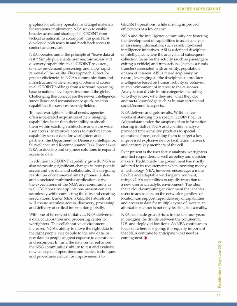
NSG Expeditionary Architecture Reshapes GEOINTBy Keith L. Barber, Director, National System for Geospatial Intelligence Expeditionary Architecture Integrated Program Office
U.S. Sgt. Maj. of the Army Ray Chandler and International
Security Assistance
Force U.S. Army Command Sgt.
Maj. Thomas Capel depart from Combat
Outpost Bari Alai on a UH-60 Black Hawk helicopter
near Jalalabad, Afghanistan, April 3, after
an awards ceremony. The
National System for Geospatial
Intelligence Expeditionary
Architecture Integrated
Program Office supports
expeditionary and crisis
operations around the world.
DOD photo by Army Sgt. Christopher
Harper
11
Path
finde
r » M
ay/J
une
2012
NEA RESHAPES GEOINT
GEOINT operations, while driving improved efficiencies at a lower cost.
NGA and the intelligence community are fostering the development of capabilities to assist analysts in assessing information, such as activity-based intelligence initiatives. ABI is a defined discipline of intelligence where the analyst and subsequent collection focus on the activity (such as passengers exiting a vehicle) and transactions (such as a funds transfer) associated with an entity, population or area of interest. ABI is interdisciplinary by nature, leveraging all the disciplines to produce intelligence based on human activity or behavior in an environment of interest to the customer. Analysts can divide it into categories including who they know; who they are; what they do; and meta-knowledge such as human terrain and social/economic aspects.
NEA delivers and gets results. Within a few weeks of standing up a special GEOINT cell in Afghanistan under the auspices of an information sharing initiative, NGA and coalition analysts provided time-sensitive products to special operations forces, enabling them to target a key improvised explosive device facilitation network and capture key members of the cell.
Ever present is the user focus: analysts, warfighters and first responders, as well as policy and decision makers. Traditionally, the government has strictly adhered to its requirements when investing money in technology. NEA, however, encourages a more flexible and adaptable working environment, using NGA’s capabilities to rapidly transition to a new user and analytic environment. The idea that a cloud-computing environment that enables users to access data on the network regardless of location can support rapid delivery of capabilities and access to data for multiple types of users in an affordable manner is not only feasible, it is a reality.
NEA has made great strides in the last four years in bridging the divide between the continental U.S. and deployed locations. As NEA continues to focus on where it is going, it is equally important that NEA continue to anticipate what need is coming next.
graphics for artillery operation and target materials for weapons employment. NEA seeks to enable broader access and sharing of all GEOINT from tactical to national. To accomplish this goal, NEA developed both reach-in and reach-back access to content and services.
NEA operates under the principle of “leave data at rest.” Simply put, enable user reach-in access and discovery capabilities to all GEOINT resources, on-site/on-demand processing, and allow rapid retrieval of the results. This approach allows for greater efficiencies in NGA’s communications and infrastructure while ensuring on-demand access to all GEOINT holdings from a forward operating base to national level agencies around the globe. Challenging this concept are the newer intelligence, surveillance and reconnaissance quick-reaction capabilities the services recently fielded.
To meet warfighters’ critical needs, agencies often accelerated acquisition of new imaging capabilities faster than their ability to absorb them within existing architecture or ensure wide user access. To improve access to quick-reaction capability sensor data for warfighters and partners, the Department of Defense’s Intelligence, Surveillance and Reconnaissance Task Force asked NEA to develop and engineer solutions to expand access to data.
In addition to GEOINT capability growth, NGA is also witnessing significant changes in how people access and use data and collaborate. The on-going revolution of commercial smart phones, tablets and associated multimedia applications drive the expectations of the NGA user community as well. Collaborative applications present content seamlessly while connecting the dots and creating associations. Under NEA, a GEOINT storefront will ensure seamless access, discovery, processing and delivery of critical information globally.
With one of its newest initiatives, NEA delivered a data collaboration and processing center to warfighters. This collaborative environment increased NGA’s ability to move the right data to the right people vice people to the raw data, or raw data to people at great expense to operations and resources. In turn, the data center enhanced the NSG communities’ ability to test and evaluate new concepts of operations and tactics, techniques and procedures critical for improvements to
One of them is Army Col. Jerry Blixt, the deputy director of the Source Operations Group (S3).
When Blixt arrived in Baghdad as the country lead in February 2007, he saw potential for providing even more GEOINT, he said.
“What were the requests for the combat commanders? How do we get [military commanders] convinced that they need NGA support inside of their command headquarters?” Blixt asked.
Late on a Sunday evening in his office, with the sounds of rockets and mortars in the distance, Blixt scribbled the phrase “GEOINT Support Teams” (GSTs) on a small piece of paper. He had his answer.
Blixt saw GEOINT as a pivotal combat multiplier, delivering accurate information and enabling more informed decisions, he said.
The result was a lot of historical firsts for NGA, said Blixt. Among them was a better relationship with host country personnel.
“I saw the Iraqis really open up and trust us,” said Rob Alberts, the current branch chief of the NGA Combat Operations Support Team
12
Path
finde
r » M
ay/J
une
2012
GEOINT A PIVOTAL COMBAT MULTIPLIER
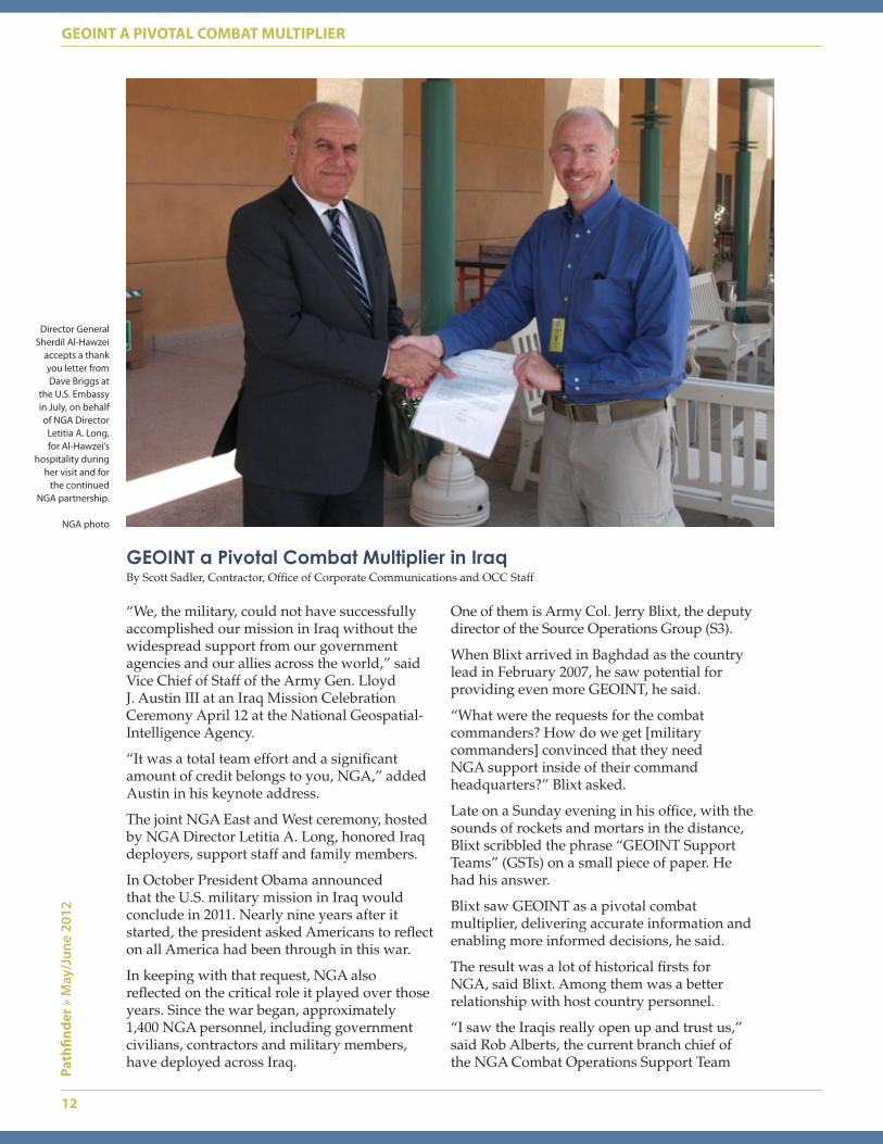
Director General Sherdil Al-Hawzei
accepts a thank you letter from Dave Briggs at
the U.S. Embassy in July, on behalf of NGA Director
Letitia A. Long, for Al-Hawzei’s
hospitality during her visit and for
the continued NGA partnership.
NGA photo
“We, the military, could not have successfully accomplished our mission in Iraq without the widespread support from our government agencies and our allies across the world,” said Vice Chief of Staff of the Army Gen. Lloyd J. Austin III at an Iraq Mission Celebration Ceremony April 12 at the National Geospatial-Intelligence Agency.
“It was a total team effort and a significant amount of credit belongs to you, NGA,” added Austin in his keynote address.
The joint NGA East and West ceremony, hosted by NGA Director Letitia A. Long, honored Iraq deployers, support staff and family members.
In October President Obama announced that the U.S. military mission in Iraq would conclude in 2011. Nearly nine years after it started, the president asked Americans to reflect on all America had been through in this war.
In keeping with that request, NGA also reflected on the critical role it played over those years. Since the war began, approximately 1,400 NGA personnel, including government civilians, contractors and military members, have deployed across Iraq.
GEOINT a Pivotal Combat Multiplier in IraqBy Scott Sadler, Contractor, Office of Corporate Communications and OCC Staff
computers worked to support NGA’s customers — a critical role because decision makers couldn’t get products if the systems went down, said Bradley, now a staff officer in the Information Technology Services Directorate.
“It’s gratifying to hear the soldiers actually doing the patrols or convoys tell how important the products were to their mission,” said Bradley.
As operations in Iraq wind down and the U.S. State Department takes on more of a supporting role, the roles of future NGA deployers will need to broaden, said Dave Briggs, who was on his second deployment as NGA country lead in Iraq for supporting the U.S. military. He left Iraq in November.
NGA personnel will continue to support intelligence community partners throughout the country, said Briggs. They will also continue to be an interface with the Iraqi Imagery and Mapping Directorate.
The agency’s relationship with the Iraqis will also have to evolve, said Bill Harmon, deputy director of Expeditionary Operations at NGA.
“Do they want us there as advisers to their military or in another capacity?” asked Harmon. “It’s the Iraqis’ country. We tend to forget that when we’ve been in the thick of the conflict.”
Regardless of the future role NGA deployers will play in Iraq, the agency’s reputation catapulted as a result of the work already done there, said Blixt.
“When people see GSTs today, they know it’s NGA, and they expect a professional product that’s going to support the mission,” said Blixt. “When I look at the result, I think we did well.”
13
Path
finde
r » M
ay/J
une
2012
GEOINT A PIVOTAL COMBAT MULTIPLIER
(COST), who served there 27 nonconsecutive months from September 2007 to August. For seven of those months, he was the site lead of the NGA team embedded with the 10th Mountain Division.
NGA and the Iraqi Ministry of Defense signed a memorandum of understanding in April 2010 that created a partnership to share unclassified GEOINT data.
“This was the first time an intelligence organization had a formal relationship with the Iraqis,” said Alberts.
NGA helped the Iraqi Security Forces develop a GEOINT-based targeting process, said Alberts. This allowed the Iraqis to use it to target insurgent forces attacking Americans and Iraqis. The agency also helped create the Iraqi Imagery and Mapping Directorate.
Alberts takes pride in the work he performed with his Iraqi partners.
“When else are you going to get this opportunity in your life to actually go in and build another nation’s intelligence service?” he asked. “[The Iraqi people] place a lot of value on friendship and honor, and the NGA relationship is huge to them.”
NGA also installed its own satellite communication system in 2004, said Austin Bradley, who deployed from 2005-6, sometimes flying into the International Zone to get computers up and running for NGA analysts supporting the U.S. military and the U.S. Department of State.
His job, as the lead IT support contractor on Camp Victory in Baghdad, was to ensure all
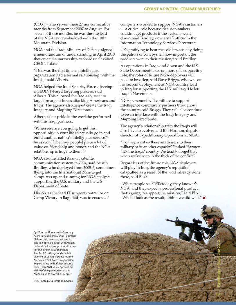
Cpl. Thomas Human with Company K, 3rd Battalion, 8th Marine Regiment (Reinforced), mans an overwatch position during a patrol with Afghan national police through a local bazaar in Farah province, Afghanistan, Jan. 24. 3/8 is the ground combat element of Special Purpose Marine Air Ground Task Force - Afghanistan. By partnering with Afghan security forces, SPMAGTF-A strengthens the ability of the government of the Afghanistan to protect its people.
DOD Photo by Cpl. Pete Thibodeau

14
Path
finde
r » M
ay/J
une
2012
NGA’S ENDURING PRESENCE IN IRAQ
The National Geospatial-Intelligence Agency keeps an eye on the world … literally.
Turning its all-seeing eye onto Iraq in 2003, NGA quickly responded to the needs of the warfighter and provided optimal geospatial intelligence support for nearly nine years.
Operations Iraqi Freedom and New Dawn are examples of some of the agency’s greatest successes. NGA evolved from a reactive to a proactive model of providing GEOINT, improved systems and technology, and strengthened relationships with NGA’s international counterparts — all of which contribute to NGA’s enduring presence in Iraq.
Dec. 15 marked the end of NGA’s embedded warfighter support in Iraq. Amidst the celebration of returning troops and personnel, a big question remained: what would NGA’s role be after the drawdown?
Know the Earth…As one of the first agencies into Iraq, NGA navigated through Iraq’s harsh and unknown terrain alongside the 3rd Infantry Division. With the mobile integrated geospatial intelligence system, or MIGS — a self-sustaining suite of GEOINT equipment, life support and transportation — analysts supplied the 3rd ID with real-time, actionable GEOINT as they moved from Kuwait into Baghdad. NGA demonstrated how the right combination of personnel, GEOINT expertise and technological systems could provide military commands with unprecedented, tactical level support. NGA’s ability to “know
NGA’s Enduring Presence in Iraq By Sammie Jackson, Director of the Expeditionary Operations Office
the Earth” enabled commands to better visualize the battlefield and make decisions concerning force protection, battle cadence and targeting.
In January 2007, the Combat Operations Support Team formed in response to the increasing number of GEOINT requirements supporting the surge force of 20,000. The NGA footprint in Iraq increased from 20 to 100 personnel. In all, these military operations and humanitarian efforts resulted in the largest overseas deployment of NGA personnel ever, comprising a total of approximately 1,400 volunteers from 2003-2011, with 306 of them deploying to Iraq more than once.
Todd Ebron, a four-time NGA deployer said, “The troop surge was the watershed event of our efforts in Iraq because that is when NGA started dedicating serious resources — people, money and infrastructure — to the expeditionary mission.”
Show the Way…NGA deployers were initially responsible for filling requests for paper maps and tasked to produce customized products for military operations. Analysts used baseline imagery and basic geospatial coverage garnered from a continental U.S.-based repository that had limited accessibility from Iraq. As GEOINT mission support requirements evolved and increased, NGA deployed additional imagery and geospatial analysts to answer the call. To better anticipate customer needs, these analysts expanded their scope of work to include attendance at shift change and production meetings, as well as commander’s daily updates and other forums. Having a seat at the table allowed NGA deployers to “show the way” to their mission partners, educating them on how GEOINT and multi-intelligence analyses could help them identify and fulfill gaps in operational planning.
“We spent a lot of time educating mission partners on the added value of our tradecraft because NGA was a relatively new agency and GEOINT was not in their lexicon,” said Ebron.
In time NGA’s expeditionary architecture matured into a more comprehensive core services suite that included resources for analysts in theater such as GEOINT products,
NGA contractor Keith O’Neill pauses while packing up NGA systems for the convoy with V Corps, Camp Virginia, Kuwait, into Baghdad, Iraq, soon after the 2003 invasion.
NG
A p
hoto
15
Path
finde
r » M
ay/J
une
2012
NGA’S ENDURING PRESENCE IN IRAQ
visualization and communications tools, same-day imagery capabilities and a complete video and image library.
“The approach of pushing data to theater and our commitment to showing mission partners how GEOINT analysis is integral to operations was the biggest, most significant change to how NGA does business,” said Ebron.
Mission partners relied on embedded analysts to not only deliver intelligence products but also to improve processes and refine their tradecraft to bring better and more accurate geodata, said Dave Briggs, the last NGA country lead in Iraq. “Putting our people to work down to the brigade level and sitting side-by-side with our mission partners was a big win from a combat support perspective.”
Understand the WorldEducating mission partners on the power of GEOINT laid the groundwork for what NGA hopes to maintain long after the drawdown: a lasting ally in Iraq. After establishing the GEOINT Support Team-32 at the Multinational Security Transition Command-Iraq, NGA began a mentoring relationship with the GEOINT section of Iraq’s Directorate General of Intelligence and Security.
“NGA was proactive in understanding Iraq’s needs and provided the tradecraft training and unclassified GEOINT data to answer those needs,” said Ebron. “Our work was
recognized as some of the most successful amongst IC (intelligence community) agencies partnered with the Iraqis. This trust grew into a partnership that ultimately led to the formation of a sophisticated imagery and geospatial capability to support the government of Iraq.”
This capability is known as Iraq’s Imagery and Mapping Directorate (IMD). For almost five years, NGA provided the directorate with two analysts and one linguist for daily GEOINT training, mentoring and support.
Enduring Presence: Looking to the FutureIn accordance with the status of forces agreement with Iraq, the drawdown of troops and personnel began during the latter part of 2011. Several months prior to the final exit in December, NGA worked to ensure a successful drawdown and transitioned GEOINT responsibilities to the Iraqi government.
As NGA withdrew the bulk of its personnel, Iraq retained some NGA support. The agency maintains an enduring presence of four personnel stationed in Baghdad who support the U.S. Embassy-Iraq. They serve the Department of State regional security officer as well as the Office of Security Cooperation-Iraq. They additionally liaise with Iraq’s mapping directorate on behalf of NGA’s Office of International Affairs as the relationship transitions to a more traditional form.
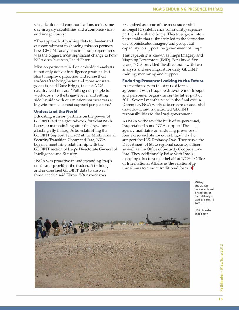
Military and civilian personnel board a helicopter at Camp Liberty in Baghdad, Iraq, in 2007.
NGA photo by Todd Ebron
16
Path
finde
r » M
ay/J
une
2012
SERVICE NSTS SERVE THE LINE
The military service National Geospatial-Intelligence Agency support teams — or
service NSTs — deliver geospatial intelligence support to Army, Navy, Air Force and Marine Corps forces in the continental United States and at deployed locations. They provide National System for Geospatial Intelligence functional management support to include training and mission-tailored GEOINT production support services, and they assist with software implementation and policy guidance associated with GEOINT operations. A key role of the service NSTs is to assist their partners with transitioning from a full-service GEOINT support model to one more focused on assisted and self service — in alignment with NGA’s vision. While there are common elements to the NSTs’ missions, each tailors its support to the individual needs of its supported service.
U. S. Army SupportIn Chief of Staff of the Army Gen. Raymond T. Odierno’s recently published vision for the
future Army force, he reflected on the hard-won lessons of the past while highlighting the required characteristics to remain “America’s force of decisive action.” The characteristics of depth and versatility; adaptability and innovativeness; flexibility and agility; integrated and synchronized operations; and lethality that is discriminate mesh well with NGA’s — and the Army NST’s — vision for the future.
The Army team is a diverse group of military and civilian personnel embedded with units on installations across the continental United States. The external members serve as representatives to NGA’s Army mission partners and assist the team chief in fulfilling his role as the NGA director’s delegated GEOINT functional manager to the Army. The NST’s support model centers on assisted GEOINT service to all continental U.S. Army corps and division headquarters, as well as major Army GEOINT training sites. The team’s current focus is on the Army’s deployment preparations, with the
Service NGA Support Teams Serve the LineBy the Service NGA Support Team Chiefs, Military Support Directorate
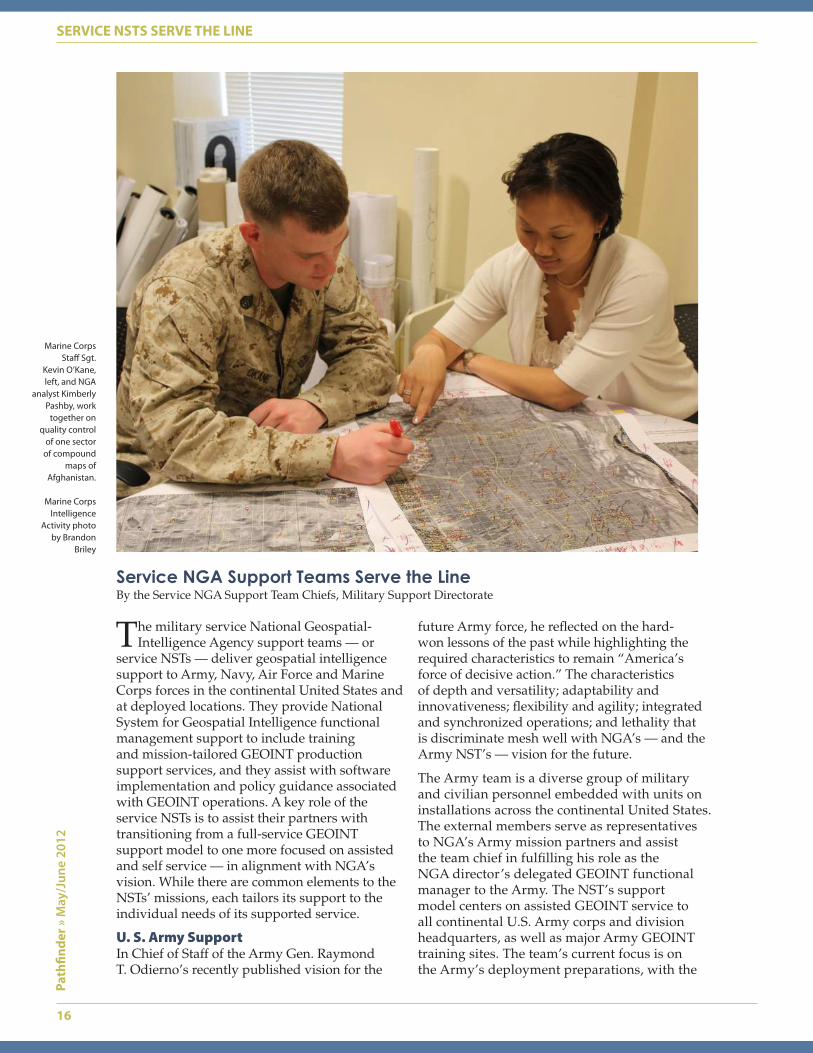
Marine Corps Staff Sgt.
Kevin O’Kane, left, and NGA
analyst Kimberly Pashby, work
together on quality control
of one sector of compound
maps of Afghanistan.
Marine Corps Intelligence
Activity photo by Brandon
Briley
17
Path
finde
r » M
ay/J
une
2012
SERVICE NSTS SERVE THE LINE
largest interaction occurring during the ready stage as a unit begins it deployment training in earnest. NGA personnel at corps and division sites provide mentoring, technical assistance and, if needed, production support.
As Army corps and divisions deploy, NGA supporting analysts and staff officers deploy with them. Since 2009 the Army NST has deployed with all three corps and seven of eight division headquarters to ensure requested NGA continuity for deployed Army forces within their theater of operations. In addition to this expeditionary support model, the team has a range of responsibilities to execute functional management guidance for the NGA director. The team fulfills these responsibilities in collaboration with the Army’s GEOINT Office at NGA headquarters. Responsibilities include assessing NGA’s ability to support the Army via the mission readiness brief process and collaborating on GEOINT policy and guidance.
Keeping GEOINT capabilities current and assimilated into all decision making processes is vital to the Army. As the nation transitions out of Iraq and Afghanistan, the purpose of the U.S. Army remains to decisively fight and win wars. GEOINT is a key component of ensuring the future Army remains ready and the Army NST delivers it.
U.S. Navy SupportThe Navy NST team located at NGA headquarters in Springfield, Va., advocates for NSG requirements through direct interaction and collaboration with the Navy Geospatial Intelligence Office in Washington, D.C.
The Navy relies on NGA services and support to safely navigate on the land, above and below the sea and in the air. The Navy primarily focuses its production concerns on NGA’s support to safety of navigation as the service continues its transition to electronic navigation.
Emerging Navy combat systems such as the littoral combat ship and future generation CVN 21 aircraft carrier will require new technical solutions to collect, process and disseminate critical GEOINT data and products to better support navigation, precision strike, maritime domain awareness and other warfighter missions.
The Navy NST works closely with the Navy to identify and understand its GEOINT data requirements and needs and help facilitate integration of Navy GEOINT-related activities and functions across the NSG.
Fleet GEOINT SupportThe Navy NST implements fleet support through its Fleet Support Branch. Branch members serve at U.S. Fleet Forces Command and the Naval Expeditionary Combat Command in Norfolk, Va.; at Third Fleet and the Fleet Intelligence Training Center in San Diego, Calif., and at the Naval Strike Air Warfare Center in Fallon, Nev.
The Fleet Support Branch provides timely pre-deployment training as well as GEOINT products and services in support of maritime domain awareness and crisis management. Training is provided at shore training facilities or shipboard, either pierside or while under way, at the time and place the fleet customer requests. Within the maritime operations centers at fleet headquarters, Navy NST representatives demonstrate to fleet leadership the value GEOINT adds to domain awareness and provide daily geospatial data access and maritime analysis training and assistance to fleet maritime watchstanders.
Support to Navy Combat Systems DevelopmentThe Navy NST has a representative at the Naval Air Systems Command in Patuxent River, Md. The NAVAIR representative works with program managers, systems engineers and working groups to ensure optimal GEOINT support to naval air weapons development.
U.S. Air Force SupportDespite its small footprint, the U.S. Air Force NST provides an outsized service. With members strategically located at Langley Air Force Base, Va; Lackland Air Force Base, Texas; Nellis Air Force Base, Nev., and NGA Campus East, Springfield, Va., team members support the U.S. Air Force in its Title 10 mission to organize, train and equip combat ready air forces. The team’s embedded subject matter experts serve as the mission partner’s conduit to NGA. Working primarily through the assisted-service model, the team mentors and educates airmen on NGA data, services and products to enable airmen to discover and use NGA data and services on their own, online and on-demand.
Director’s Representative to the U.S. Air ForceThe team works closely with Headquarters, U.S. Air Force, the Air Force Intelligence, Surveillance and Reconnaissance Agency and the Air Force GEOINT Office to ensure Air Force GEOINT requirements are articulated and ingested into the NSG needs process. As the NGA director’s representative to the Air Force, the team works with Air Force GEOINT leaders on functional management issues such as unified GEOINT operations and adherence to
18
Path
finde
r » M
ay/J
une
2012
SERVICE NSTS SERVE THE LINE
GEOINT standards by Air Force sensors. The NST also works with the joint aeronautical safety of navigation community on reducing reliance on hard-copy media.
Support to Deploying AirmenThe team enhances Air Force mission readiness by providing pre-deployment training, which emphasizes showing airmen how to access NGA knowledge through NGA’s self-service portals. At Langley, team members provide training at the Air Force’s ISR liaison course, which prepares commissioned and noncommissioned officers deploying in support of U.S. Army maneuver units. At Shaw Air Force Base, S.C., team members train airmen preparing to deploy in support of theater air operations centers. The Red Flag live-fly exercise at Nellis Air Force Base brings together Air Force flying units preparing to deploy as part of an air expeditionary force. During the exercise, NST personnel provide training to unit intelligence personnel on how to access NGA knowledge and expose aircrews to the various NGA products and services.
The Air Force is a key NSG mission partner. The integration of Air Force-supplied airborne data and analysis contributes to the advancement of GEOINT, while the Air Force NST serves as the focal point for Air Force – NGA integration.
U.S. Marine Corps SupportThe Marine NST is the focal point for GEOINT support to the Marine Corps, enabling and improving the full range of GEOINT services to the Corps. With an emphasis on assisted and self-service support, the team identifies GEOINT opportunities and coordinates support from across NGA.
As the focal point for NGA support to the Marine Corps, the team is uniquely configured as compared to other service teams. At the Marines’ request, the service and service intelligence center teams merged at the Marine Corps Intelligence Activity, Quantico, Va., the hub for Marine Corps GEOINT. Today, the team operates as a single entity under the operational control of NGA’s military readiness office. Personnel receive training, tradecraft and reintegration support from the Analysis
and Production Directorate. Team personnel are embedded with I Marine Expeditionary Force at Camp Pendleton, Calif., II MEF at Camp Lejeune, N.C., and MCIA and Marine Corps Systems Command at Quantico. They provide subject matter expertise, training, data access, systems coordination and tradecraft development for their mission partners. The team provides only limited production support because the Marines retain a robust organic capability. However, the team often deploys in support of its mission partner as part of the NGA Volunteer Deployment Program. Team members are also on the lookout for data, products and tools of value to NGA and the NSG, given the recognition that GEOINT support flows in both directions.
The NST leadership assists Marine Corps staff and leadership with GEOINT strategic planning across doctrine, organization, training, material, leadership, personnel and facilities. This helps ensure the GEOINT visions for NGA and the Marine Corps are aligned and supportable. In pursuing these objectives, the Marine team chief and the Marine GEOINT officer work closely together as part of a continuing effort to coordinate GEOINT requirements and support, now and in the future, for both NGA and the U.S. Marine Corps.
The service NSTs deliver timely and relevant GEOINT training and tailored production support in an operational setting that enhances the deployed mission effectiveness of our military partners. The knowledge, experience and mentoring that service NST analysts, GEOINT officers and externally assigned liaisons provide to their extensive customer base plays an active role in broadening the analytical expertise of military GEOINT users at the operational and tactical levels. Additionally, the embedded support model the service NSTs use allows them to affect unit level GEOINT training activities and improve their understanding of how to access and disseminate online, on-demand GEOINT in an operational environment. The close relationship of the service NSTs with their military partners puts them at the tip of the spear in providing GEOINT support to the warfighter.

Army Gen. Carter F. Ham, commander of U.S. Africa Command, met with NGA
Director Letitia A. Long and analysts focused on intelligence problems in Africa to learn about the role NGA is playing in Africa and to discuss priorities for the continent.
Ham, who became commander of the Department of Defense’s sixth geographic command in March 2011, received briefings from NGA analysts that focused on terrorist networks in his area of operations.
“[In Africa], a little effort goes a long way,” said Ham, after receiving a briefing about the Integrated Work Group-Yemen/Horn of Africa from its team lead. “We receive disproportionate benefit for moderate [effort].”
Ham, who deemed the region “data poor,” said the challenge for his command is “to know what’s out there, to know where to look and to set priorities.”
The AFRICOM team lead explained how NGA receives Africa priorities from AFRICOM through close working relationships with command GEOINT officers embedded in the command and from input of the joint staff and guidance from national intelligence and defense plans.
Since October, the lead and the team working Yemen/Horn of Africa issues have been trying to overcome the challenge of disparate information about the continent.
19
Path
finde
r » M
ay/J
une
2012
TRANSCOM/AFRICOM VISITS
West Executive Dr. Bobby Laurine hosted U.S. Transportation Command
Commander Air Force Gen. William M. Fraser III March 12 at NGA West’s 2nd Street (St. Louis) location to give the general an overview of NGA activities.
The visit was Fraser’s first to NGA since taking command of USTRANSCOM in October 2011.
USTRANSCOM relies on NGA products to conduct its mission “to synchronize and deliver unrivaled, full-spectrum deployment and distribution solutions” to the warfighter. More than 30 NGA employees support the USTRANSCOM team through the NGA support team there.
During the visit, Fraser toured the NGA Operations Center, the Counterterrorism Airborne Analysis Center and the Domestic Mobile Integrated Geospatial-Intelligence System. Specific items of interest for Fraser were briefings on NGA’s aeronautical activities, which directly support USTRANSCOM’s component command, Air Mobility Command, and the latest geospatial products on Afghanistan, Pakistan and the northern distribution network.
Laurine also highlighted NGA’s assistance to humanitarian aid and domestic response efforts. Like NGA, USTRANSCOM supports disaster relief following events such as the earthquakes in Japan and Haiti.
At the conclusion of the visit, Fraser commented the information received was outstanding, and he looks forward to future collaboration.
AFRICOM Commander Visits NGA Campus EastBy Rosie Heiss, Office of Corporate Communications
USTRANSCOM Commander Visits NGA Campus West By NGA Campus West Executive Office
Air Force Gen. William M. Fraser III tours the Domestic Mobile Integrated Geospatial-Intelligence System with NGA West Executive Bobby Laurine March 12 at NGA Campus West.
NGA photo by Marcella Taylor
Army Gen. Carter F. Ham, commander of U.S. Africa Command, met March 19 with NGA Director Letitia A. Long and analysts focused on intelligence problems in Africa.
NGA photo by Rob Cox

20
Path
finde
r » M
ay/J
une
2012
SCENE VISUALIZATION
From Osama bin Laden’s fortress to the damage caused by the tsunami at
Fukushima Nuclear Power Plant in Japan, scene visualization helps NGA partners obtain situational awareness of unfamiliar terrain and develop threat analyses in three-and even four-dimensional perspectives.
This all happens at NGA’s Office of Integrated Analytic Services, where a team of visualization specialists uses a variety of modeling and geospatial software tools to craft interactive scene visualization products. But it took a lot of forward thinking and experimentation to bring NGA to where it is today. In the late 1980s, modeling and geospatial software was still in its infancy, and building even a 15-second video of a fly-through – a geospatial product that creates the illusion of the viewer flying over a target — was a painstaking process, according to current and former NGA scene visualization specialists.
Through the mid-1990s, analysts at the Defense Mapping Agency and other NGA predecessor agencies typically reviewed imagery flats on analog light tables. To create three dimensions from this imagery, scene visualization specialists had to squint through the eyepiece
of a stereo lens to measure structures and topography point-by-point using a room-sized stereo comparator, a piece of equipment that generated 3-D coordinates.
The stereo comparator enabled simultaneous viewing of two satellite images of the same area taken from slightly different viewpoints, giving the illusion of a 3-D perspective. To achieve the illusion, scene visualization specialists placed each film flat of the different shots on its own glass stage. They then moved the stages remotely with track balls similar to the modern computer mouse. To pinpoint a ground location, the specialist maneuvered each stage independently until a dot of light — called a reticule — fused onto the location. The comparator generated a focused beam of light and projected it onto the images. To create a digital elevation model of the terrain, the specialist input these points into a computer assisted design application. The scene visualization specialist then recorded the 3-D coordinate and saved these manually measured image points to bulky reel-to-reel magnetic tapes that were downloaded into a CAD application that created the digital elevation model and building structures.
Scene Visualization Advancements Great Boon to Partners By Jay D. Krasnow, Office of Integrated Analytic Services
To create three dimensions
from imagery, scene
visualization specialists
had to squint through the eyepiece of
a stereo lens to measure
structures and topography
point by point using the room-
sized stereo comparator
depicted here, a piece of
equipment that was used to
generate 3-D coordinates.
NGA Historical Research
Center photo

21
Path
finde
r » M
ay/J
une
2012
SCENE VISUALIZATION
In the late 1990s and early 2000s, the stereo comparator gave way to digital imagery and stereo workstations. Scene visualization specialists could now scan film flats using high-resolution scanners and pipe the scanned images to stereo-capable UNIX® (UNiplexed Information and Computing Service) workstations, powerful computers that NGA analysts used to review images in 3-D. Despite technological advances, the specialists still obtained ephemeris data, the technical information on how an image was taken, through a painstaking manual process. Ephemeris data is important because it enables precise geopositioning and mensuration. (Mensuration is the scientific term for measuring the lengths or position of objects observed in imagery.)
In the early 2000s, digital point positioning database files — highly refined stereo imagery used for precise geopositioning — were only available on 8 mm tapes. And digital terrain elevation data was only available on CD. Analysts had to check out these files from agency libraries in Bethesda, Md., or St. Louis. Today, analysts no longer need to scan images, copy ephemeris data or obtain georeferencing data because all GEOINT analyst workstations automatically integrate that information into their digital light tables.
“What used to take days, now takes minutes,” said the branch chief for GEOINT Scene Visualization at the Office of Integrated Analytic Services.
Extracting the measurements and entering this data into a computer weren’t the only parts of building scene visualizations that were time-intensive. Rendering the data, that is, building an executable file, could take hours
In fact, in the mid-1990s it took two to three minutes to render just one frame of a fly-through and it took 24 frames to compose one second of video. The process took so long, explained a former chief photogrammetrist at NGA, that visualization specialists would “press a button and let the file render overnight.”
“Immense computer power and highly specialized software was required to render, frame by frame, short movie clips, which today appear as ancient relics because modern computers have made them obsolete,” said the branch chief. “Only a select few people had computers with the
processing power and knowledge to create scene visualization products.”
In the early days, analysts had to carry the data to its recipients. No one had heard of the Internet and email was still in its infancy. Indeed, few computer networks existed in the mid-1990s. A project scientist in the Industry Outreach Division of InnoVision, an NGA directorate, remembered the obstacles they faced. “Due to feeble or no network connectivity, we had to build in time for the delivery of products on external media by hand or by mail,” he said. “We also had to be concerned with troubleshooting hardware and software issues on the customer’s end.”
“Nowadays, thanks to modern network communications and the proliferation of visualization software, these issues are pretty much gone,” added the branch chief.
The genesis of network communications in scene visualization dates to the early 2000s, when NGA invested $667,500 in Keyhole, Inc., a Mountain View, Calif.-based software development firm that specialized in geospatial data visualization applications. NGA and its intelligence community partners — including CIA — eventually invested $2.15 million in Keyhole. Google bought Keyhole in 2004 and re-released its flagship product one year later as Google Earth™, a striking example of how funding for government research in new technologies spurred innovation in the private sector.
As the new technology, including GoogleEarth, improved the NGA scene visualization team’s ability to create products quickly and efficiently, the demand for scene visualization products grew, especially for fly-throughs.
A steady stream of military, intelligence and policymaker customers solicited the team to help them prepare for military operations and major events like the 19th FIFA (International Federation of Association Football) World Cup in South Africa.
“It is amazing how far scene visualization has come in the last five years,” said the team lead for scene visualization. “Nowadays, specially built high-end computers aren’t necessary to view detailed 3-D visualization products, and soon this technology will be commonplace on many mobile platforms.”

22
Path
finde
r » M
ay/J
une
2012
INNOVISION RALLIES
If you think it’s tough meeting the needs of the National Geospatial-Intelligence Agency’s
geospatial intelligence customers inside the strict confines of the intelligence community, try meeting the needs of a multitude of federal agencies and vendors who are scrambling to develop and field viable applications for commercial mobile device users despite a perfect storm of hurdles posed by rapid technology advancement, lack of a common data standard, onerous public licensing and government security considerations.
Enter a team of visionaries from InnoVision, who recently gathered experts from across the Department of Defense, intelligence community, federal government and key industry partners in Chantilly, Va., for the 2nd Annual Mobile Application Summit to confront these issues and close the gap on a common framework that all government entities can apply to the development process for mobile apps.
InnoVision Rallies Mission Partners, Codifies Mobile Application Standards By Ken White, Office of Corporate Communications
NGA’s leading role for the conference wasn’t about credit or accolades but to increase awareness of best practices among diverse agencies, and moreover, to push toward common standards and approaches that should govern app development across government, with the ultimate goal being to reduce duplication of effort and benefit end users of mobile apps.
“The whole idea behind our mobile apps is putting GEOINT in the hands of the user, and though we have made a lot of progress technically we still need to address the standards, policy and legal issues to move forward,” said Bert Beaulieu, director of InnoVision.
“One of our big focuses right now is developing apps able to work in a disconnected or intermittently connected environment because the last thing we want is to put something
InnoVision’s Hicham Laoudi
(center) demonstrates
NGA’s Anti-Shipping
Activity Messages
application for the iPad to
Master Gunnery Sgt. Daniel
Schaller (left), senior enlisted advisor to the
director of Marine Corps
Intelligence, while
InnoVision’s Benjamin Tuttle looks on during
the NGA-hosted Mobile
Application Summit
recently.
NGA photo by Larry Franklin

mobile devices also poses challenges to fielding viable apps. Given security complexities and lack of standards across agencies, “there are a lot of people who still aren’t really sure how to do it,” Tuttle said.
While commercial mobile devices offer great convenience and flexibility to end users, they are also capable of being monitored down to the individual keystroke, posing a potential risk to unsecured data at rest, particularly when running an app that accesses government-owned data from a firewalled government server during a real-world mission where life, health and safety may hang in the balance, according to Bowers.
“Is the data used on the device protected? Is the use of the application properly limited to the authorized users? Is it data accurate, and how does the desired app degrade the network, the device and battery life? All of these things are critical considerations in the development of an app,” said Bowers.
Licensing of apps, given strict commercial legal controls and attendant usage fees, is yet another hurdle standing in the way of quick deployment, and while a factor easy to overlook in the lab during development, it can just as easily relegate that app to a shelf instead of a user’s hands, said Bowers.
“It’s all about getting the data you want in an app, and that can be expensive,” said Bowers. “It’s not as simple as just saying, ‘I’ll just connect in. I know what the data looks like, and I’ll display it.’”
As for the quick wins, according to Tuttle, “for the foreseeable future our biggest winners in all of this will be first responders, folks responding to natural disasters and crises of that sort. Part of that comes down to the fact that security requirements for those users are not quite as significant as some of the other potential customers, so they are an easier group to deploy capabilities to quickly.”
“As we work out the security issues, we expect to evolve to mobile apps for military and security forces in the field, providing the forces with a capability that is of benefit without putting them at risk,” said Tuttle.
23
Path
finde
r » M
ay/J
une
2012
INNOVISION RALLIES
in the hands of the user that the user has to babysit, which detracts from their mission,” said InnoVision’s Ben Tuttle, who planned the conference. “This is all about future capabilities that will enable apps to be quickly developed and fielded that above all are accessible, secure and available on multiple devices at speeds that customers demand for their missions.”
Though the development of government apps in a lab setting has been relatively easy, the process of negotiating the legalities and assurance levels to get those same apps fully operational and into the hands of a GEOINT user has largely been uncharted territory for the intelligence community, according to Tuttle. This factor has slowed app deployment.
InnoVision, through the help of these summits, seeks to create a road map for agencies to follow when fielding an app from cradle to grave, to include government-wide standards for federal government developers to use to baseline their apps.
“We’re looking for all federal app developers to synchronize onto common data standards so that all the apps can read from a singular downloaded data set regardless of what agency was responsible for building that app,” Tuttle said.
To that end, a group led by Nathan Frantz of the Army Geospatial Center is making great progress on developing consensus on a common data standard.
“Applying lessons learned in the development of the Army’s GeoPackage — a baseline data packaging service that supports the Army’s key geospatial data and analysis program — Frantz has not only pulled together the community and other government agencies but also the vendors because there is no point coming up with a standard if the vendors aren’t willing to support it,” said Tuttle.
NGA’s success depends upon the ability to move quickly to lay out a road map to deliver U.S. government-accredited mobile apps to an increasingly impatient government customer base that has high expectations as active consumers of commercially available apps for their own private devices, according to Tuttle.
According to the Naval Research Laboratory’s Rachel Bowers, app security on commercial

24
Path
finde
r » M
ay/J
une
2012
CUBAN MISSILE CRISIS
Intelligence professionals may feel very familiar with the events that contributed to
the Cuban missile crisis, a benchmark event in American intelligence history. Intelligence community members celebrate President John F. Kennedy’s success in that confrontation and the essential role of the community, as well as the flexibility and capability of American leadership, diplomacy and military potential. However, in 2012 has the community truly learned all that it can from the events of October 1962?
Has the community ever looked at the Cuban missile crisis as a declaration by photo interpreters that their tradecraft had truly matured into a critical strategic intelligence asset? Do National Geospatial-Intelligence Agency members realize that the role played by photo interpretation in 1962 brought this type of intelligence to the attention of national policymakers as never before? Furthermore, can NGA say that this crisis began the process of blurring the distinction between photo interpreter and analyst?
Cuban Missile Crisis Marked Coming of AgeDr. Gary E. Weir, Chief Historian, Office of Corporate Communications
The Soviet Union and Cuba jointly announced Sept. 2, 1962, that the former would send military aid to Fidel Castro’s Caribbean island. The Soviet leaders felt this action would provide the Union of Soviet Socialist Republics with multiple benefits. It would cause the United States to pause before opposing the USSR on the international stage while politically and economically nurturing a communist regime in Latin America.
The Kennedy administration paid close attention to the Castro regime in Cuba. Could this buildup suggest that the Soviets intended to use Cuba as a springboard for revolution in Latin America? Did the Russians pay sufficient attention to Kennedy’s warning that the Soviet Union should not introduce offensive weaponry into Cuba, especially medium (MRBM) and intermediate (IRBM) range ballistic missiles capable of carrying nuclear warheads? Kennedy also pointed out that the U.S. could not tolerate a submarine base in Cuba. The president began to craft a policy of toleration, with very clear limits and predictable consequences.
National Photographic Interpretation
Center interpreters who made the
startling find of offensive missiles in Cuba included Army Lt. Richard
Rininger, Navy civilian Joseph L.
Sullivan, Air Force civilian James P. Holmes and CIA
civilian Vincent N. DiRenzo.
NGA Historical Research Center
photo

Nikita S. Khrushchev, appeals from the armed forces on both sides for military action, and the daily brinksmanship of missile sites in Cuba under accelerated construction. Those old enough to remember the events recall the confrontation between U.S. Ambassador Adlai Stevenson and Soviet Ambassador Valerian Zorin at the United Nations and the briefing boards that revealed the truth of Kennedy’s assertions in imagery.
An informal pledge to remove antiquated American Jupiter missiles from Turkey along with a guarantee that the United States would not invade Cuba led the Soviet leadership to submit completely to Kennedy’s demand that they remove their missiles and offensive weaponry under a U.N. verification regime. As Secretary of State Dean Rusk noted, “We were eyeball to eyeball and I think the other fellow blinked.”
The Cuban missile crisis became a landmark event for aerial photographic collection and photo interpretation. Kennedy developed a special relationship with Lundahl and came to depend on the excellence of the photos and the regular insights provided by the interpreters. The evidence they could provide offered a high degree of insight into unfolding events. In addition, the interpreters could now go beyond merely reading the imagery to offer analyses based upon the situations they discovered in the photos.
The Cuban missile crisis marked both a coming of age and the beginning of a process. The analysis of aerial imagery had become more important and more essential than ever in a tense nuclear world in which Armageddon could be unleashed without recall. The national command authority could no longer do without it. In addition, those who became most familiar with the technology, the imagery, the situation on the ground and the national need now found themselves called upon to provide informed analysis. This significantly advanced the process of evolution that would finally turn the photo interpreter into an imagery analyst.
25
Path
finde
r » M
ay/J
une
2012
CUBAN MISSILE CRISIS
As long as the weapons remained defensive, the administration would tolerate the deliveries. If that changed, a very serious situation would arise.
Kennedy discovered a dangerous Russian deception Oct. 16. The surface to air missile sites discovered via photo interpretation days earlier now emerged as merely defensive components of MRBM (1,100 nautical mile range) and IRBM (2,200 nautical mile range) installations under construction in Cuba. Analysis quickly demonstrated that the missiles involved, the SS-4 and SS-5, could reach with nuclear warheads all of the continental U.S. save for the Pacific Northwest. These were not defensive weapons.
Once the photo interpreters at the National Photographic Interpretation Center (an NGA predecessor agency) discovered the missiles, the president and the executive committee he assembled to work on the crisis had to decide on a strategy. Cold warriors like Gen. Curtis LeMay, chief of staff of the Air Force, and Dean Acheson, former secretary of state, recommended air strikes and invasion. Others like Attorney General Robert Kennedy could not condone massive military action against Cuba and became an early proponent of his brother’s favored alternative, a quarantine of the island and removal of the missiles under supervision by the United Nations.
By Oct. 21 the president had decided on quarantine and planned a televised address to the nation on Oct. 23. After arranging a full briefing via NPIC Director Art Lundahl for former President Dwight D. Eisenhower, Kennedy sent senior representatives to major allies to brief them on the situation and his intentions. As the Army and Marines prepared at the president’s behest for possible invasion if the primary plan failed, Kennedy turned to Chief of Naval Operations Adm. George W. Anderson to enact the quarantine.
The story of just how the opposing forces resolved the Cuban missile crisis includes backroom diplomacy, the loss of a brave U-2 pilot, erratic messages from Soviet Premier
NGA Historical Research Center background photo

26
Path
finde
r » M
ay/J
une
2012
DMA Retrospective: 40 Years Later
The opinions expressed in this article are the authors’ and do not necessarily reflect the views of the National Geospatial-Intelligence Agency or the U.S. Department of Defense.
The spring of 1972 found a start-up staff of 40 people diligently working to launch a new
defense agency, the Defense Mapping Agency, on July 1. The agency’s establishment had seemed unlikely as recently as six months earlier. All of the services, as well as the Joint Chief of Staff, had non-concurred in a study, initiated by an Office of Management and Budget budget examiner and conducted by the Defense Intelligence Agency Mapping and Charting Directorate (DIAMC). The study proposed that the mapping, charting and geodesy (MC&G) activities of the Defense Department be combined into a new defense agency. But in the fall of 1971, the OMB budget examiner, who believed great economies could be realized by consolidation, was able to insert the consolidation into a presidential decision paper dealing with the intelligence community.
It is important to understand the basis for the earlier unanimous non-concurrences. Almost from the beginning of the Vietnam War, there had been an on-going conflict between the services and DIAMC, which had DOD-level oversight of MC&G activities. The services, attuned to reports from the command on the need for specialized products to deal with the special nature of the environment and the conflict, wanted to develop and rapidly field new types of products and services. DIAMC believed that, since standard map and chart coverage was available, the services should stay primarily focused on meeting the remaining global requirements for standard products. Thus, given that the DIAMC consolidation rationale was based on potential economies that might be achieved and not on any perceived or reported deficiency in the support being provided to the commands, their Vietnam War experience led the services to conclude that a potential for economies was not worth relinquishing control to a new defense agency.
Given this recent and ongoing experience, the services had been strongly opposed to relinquishing control of their MC&G capabilities to a defense agency. Now the problem was how to implement President Richard M. Nixon’s decision while at the same time staying focused on user needs. That was exactly the charge the newly designated DMA director, Army Lt. Gen. Howard Penney, gave to his nine-man organizing
committee when it convened at the Brookmont facility in Bethesda, Md., on Feb. 22, 1972.
The resultant organization that became operational on July 1, 1972, was a decentralized structure (9,000 strong with a 100-member headquarters staff) with strong emphasis on interaction with users from national authority level on down to tactical levels. The leadership went to great lengths to assure and demonstrate to the services and commands that DMA would be attuned and responsive to their needs.
At the same time, incremental improvements in processes were made, documenting a productivity improvement of about 12 percent in the first three years — with the administration and Congress agreeing to allow DMA to retain the savings for priority production. Program sharing between production centers (aerospace, topographic and hydrographic) did not begin until full-fledged digital data production geared up in the mid-1970s, and it was not without its turbulence, as some elements had to be reequipped and learn new, more stringent production procedures. Meanwhile, as new weapons systems’ (e.g., cruise missile) demands were introduced, the workforce was increasing to 10,000 with more contracting of selected production activities. Our article “Geospatial-intelligence Impact on the Cold War” in the December 2011 Cold War Times (www.coldwar.org) provides a fuller account of these challenges.
The defense agency concept, which the services had feared would lead to less responsiveness, was proving to be not only more responsive to current needs but also capable of meeting the challenges associated with the impending loss of film-based reconnaissance systems, the attendant digital production system revolution, and the challenges of new products and media to support emerging weapons systems. The well-tested organization was ready, in the 1990s, for the next important step into the National Imagery and Mapping Agency/NGA era.
NOTE: Al Anderson served on the nine-man DMA organizing committee, then in various DMA positions, finally as deputy director for programs, production and operations. Larry Ayers served on the DMA start-up staff, then in various DMA positions, finally as deputy director, management and technology.
The Pathfinder makes space available for NGA alumni groups to provide content that may be of interest to the current NGA workforce. NGA does not endorse any particular alumni group or any other outside organization.
DMA Retrospective: 40 Years LaterBy Al Anderson and Larry Ayers, National Geospatial-Intelligence Alumni Association

Photo InterpretationThe U.S. has played a role in the development of photo interpretation since manned flight began.
Activities with balloons during the Civil War tested the ability of an individual to observe an enemy from points aloft. World War I – the Great War of 1914-1918 – demonstrated the effectiveness and potency of cameras taking pictures over combat areas, a capability now available due to the newly developed airplane.
With the end of World War I, personnel left the U.S. armed services, taking with them much of the talent and knowledge that enabled the photo interpretive process. Upon entering World War II, the U.S. Army formed a photo interpretive unit led by Lt. Col. Elliot Roosevelt, the president’s son. The unit resided with British experts at Danesfield House at Medmenham in the U.K. to redevelop much of the interpretive art lost with demobilization in 1919. This formed the foundation for Cold War photo interpretation and nurtured an intense desire within the community of photo interpreters not only to describe the content of an image, but also to understand the circumstances revealed by that image.
Soldiers prepare the balloon, Intrepid, for observation duties during the Battle of Seven Pines in Henrico County, Va.
In 1895, Lt. Hugh D. Wise experimented with photo kites at Madison Barracks, N.Y. He built a kite 18 feet high and attached a box camera to it with string. Triggered by a timing device, the camera took photos from an altitude of 600 feet.
Aerial photos show the effect of bombardment on Allied trenching during World War I.
The bridges over the River Kwai include the destroyed steel bridge replaced by the famous prisoner-of-war built wooden trestle. The POW camp is located at the upper left.
NGA Historical Research Center photos
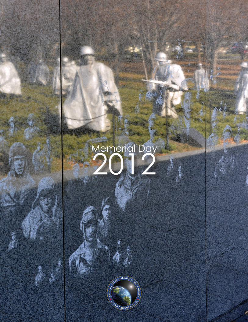
Memorial Day 2012