geo global water sustainability (geoglows): earth...
TRANSCRIPT
Page 1 of 11
GEO Global Water Sustainability (GEOGLOWS): Earth Observations for sustainability in water management in the Americas and around
the world
Angelica Gutierrez-Magness**, Bradley Doornb, Richard Lawfordc, Cesar Garayd , Norman Jonese, Ivan DeLoatchf, Eldrich Frazierf
a Office of Water Prediction, NOAA, 1325 East West Highway, Silver Spring, MD, USA 20910, [email protected] b Applied Sciences Program, Earth Sciences Division, NASA Headquarters, 300 E St SW, Washington, DC, USA 20546, [email protected] c Morgan State University, 1700 E Cold Spring Ln, Baltimore, MD, USA 21251 [email protected] d Centro de Investigaciones del Rio Magdalena, Colombia [email protected] e Brigham Young University, 242L Clyde Building, Provo UT, USA, [email protected] f Federal Geographic Data Committee, FGDC, 12201 Sunrise Valley Dr., VA USA 20192 [email protected] ** Corresponding Author
Abstract
The GEOGLOWS framework seeks collaboration and coordination facilitating the use of Earth Observations to address water shortages and excesses, as well as degraded water quality arising from population growth, climate variation, and development. Analyses of the Essential Water Variables (EWVs) constitute the foundation of knowledge development, supporting water management decisions to minimize watershed and regional risk and to inform national and local policies to promote water sustainability. Such analyses are used to support capacity building through regional programs and alliances. GEOGLOWS promotes GEO principles of free and open data exchange.
Keywords: Earth observations, GEO, AmeriGEOSS, Americas, Water Sustainability

1. Introduction Water sustainability is among national priorities around the globe, and it is challenged by change and uncertainties in areas including water demand, water quality degradation, fast changing socio-economic conditions, the shift in the patterns of extreme events among others. Accordingly to the World Bank, 8,835 disasters, 1.94 million deaths and US$ 2.4 trillion of economic losses were reported globally between 1970 and 2012 and as a result of hydro-meteorological disasters [1]. In 2015, USAID’s Office of U.S. Foreign Disaster Assistance (USAID/OFDA), provided $11 million dollars in support of hydrometeorological disaster risk reduction (DRR) activities [2]. Despite these complexities, water-monitoring networks are often inadequate to support management decisions, capacity in the use of Earth Observations is limited, and in many cases policies and decisions lack the information provided by Earth Observations. In 2015, the United Nations hosted the UN Sustainable Development Summit and formally adopted a set of 17 Sustainable Development Goals (SDGs) intended to promote action by the international community on a broad set of issues including clean water and sanitation and many others with the nexus to water [3]. This action has experienced difficulties related to the lack of data, which are reflected in the Tier system in which the reporting indicators are classified [4]. As the world addresses water issues to achieve these goals, Environmental Observations plays a central and critical role in monitoring, assessment, and accountability, all relevant in National and Regional contexts. Improving and facilitating the incorporation of EO into the decision-making process is in the vision of the Group on Earth Observations (GEO): "To realize a future where decisions and actions, for the benefit of humankind, are informed by coordinated, comprehensive and sustained Earth observation information and services [5].” GEO is a voluntary partnership of governments and organizations – currently 103 nations and the European Commission, and 106 Participating Organizations – working to connect the demand for sound and timely environmental information to the supply of data and information about the Earth [6]. GEO advocates for broad, open data policies to achieve this objective. The GEO-Global Water Sustainability (GEOGLOWS) initiative supports the GEO Strategic Objectives and follows the model of GEO projects. It advocates, through capacity building and collaborations, the use of Earth observations in decision-making and evidence-based policymaking. This advocacy is directed at national governments UN agencies, science organizations, NGOs and the general public. GEOGLOWS also facilitates engagement through outreach and training activities and its policy of promoting open architecture and maintaining a Community of Practice that is open to all. It also has a range of projects many of which can benefit from participation from many external organizations. GEOGLOWS plays a key role in GEOSS and system inputs, which are central to GEO and its user community as it brings data, forecasts, information, and knowledge to the world community involved in water resources management. Advancements in the acquisition and dissemination of Earth observations, coupled with advances in cloud computing, web apps, and online mapping and visualization provide a unique opportunity to deliver actionable information to water managers to assist them is addressing global and regional challenges and opportunities. GEO participants collaborate globally in the areas of Biodiversity and Ecosystem Sustainability; Disaster Resilience; Energy and Mineral Resources Management; Food
Page 3 of 11
Security and Sustainable Agriculture; Infrastructure & Transportation Management; Public Health Surveillance; Sustainable Urban Development; and Water Resources Management. Within the water area, the GEOGLOWS initiative provides a framework for effectively mobilizing Earth Observation assets to contribute to mitigating water challenges on various scales and across different climates and landscapes around the world. GEOGLOWS has strong linkages with GEO initiatives such as AmeriGEOSS and Earth Observations in Service of The 2030 Agenda For Sustainable Development and is focusing on developing linkages with other regional communities such as Africa (AfriGEOSS) and Asia (O-P GEOSS).
2. GEOGLOWS Overview In 2014, the GEOSS Water Strategy [7] was prepared by the Integrated Global Water Cycle Observations (IGWCO) Community of Practice (CoP) to communicate the capabilities and needs of the GEO Water community. The Strategy recognized that the identification of a set of Essential Water Variable (EWV) was useful for water management decisions and also as a potential contributor to indicators of environmental change. In contrast to the Essential Climate and Biodiversity Variables, introduced respectively by the GCOS for IPCC and EBVs introduced by GEO BON for IPBES, EWVs do not yet have a strong stakeholder supported by an international convention. GEOGLOWS has accepted the challenge of further developing and disseminating the EWV among the water and policy communities and in view of their potential to contribute, inter alia to the SDGs and more broadly to sustainable development of the world’s water resources. Through 58 recommendations, the GEOSS Water Strategy gives also priority to the use of water-related Earth observations in six critical theme areas. These themes include the global security of domestic and useable water supplies, the adaptation of water resource systems to the impacts of climate change, the water-related health and welfare needs of the poor, protection from hydro- meteorological extremes (including floods and droughts), the information needs of the security nexus of water, energy, and food, and access to water for ecosystems and biological systems. GEOGLOWS addresses five of the six priority areas outlined and adopted in the GEOSS Water Strategy. GEOGLOWS also consolidates many of the positive elements of the water activities in the first phase of GEO and ensures that strong coordination and commitment is in place for links between data, information, knowledge, and applications, and policy. As an important step in this process, a number of the former GEO Water community activities became part of GEOGLOWS. The specific goals of GEOGLOWS are: 1. Strengthen capacity to understand water data needs and develop user-driven
applications products from EO data and applications 2. Engage end users and boundary organizations to understand needs and decision-
making process by region, and to prioritize activities based on vulnerability analyses 3. Coordinate and leverage GEOGLOWS partners to more effectively provide
information and expertise to stakeholder and end-user communities 4. Strengthen capacity to use science and water EO effectively across spatial and
temporal scales
Page 4 of 11
5. Contribute to the assessments of population and economic growth impacts on water resources availability and climate change, to inform planning and adaptation activities
The GEOGLOWS framework includes activities focusing on:
1. Enhancing Global Water Sustainability (Sustainable Development Goals; water scarcity and access; climate change; cold regions;).
2. Minimizing Basin and Regional Risk (integrated water prediction including floods and droughts; transboundary issues and Integrated Water Resources Management; Water-Energy-Food-Environment-Health Nexus; Climate Change Adaptation).
3. Essential Water Variable (EWV) Understanding (water quality and use; water cycle Variables).
4. Earth Observations, Integrated Data Products and Applications, and Tool Development.
5. Data Sharing, Dissemination of Data, Information, Products, and Knowledge. 6. User Engagement, Capacity Building, and implementations through Regional
Initiatives (e.g., AmeriGEOSS.)
These efforts included the satellite aspects of water observations through CEOS and space agencies; science initiatives through the Global Water System Project (GWSP) and the World Climate Research Programme and its Global Energy and Water Exchanges (GEWEX) project; capacity building efforts through the University of Tokyo, NASA, and NOAA, primarily; and initiatives launched in South America and Europe. Also, the formation of CIEHLYC in 2011 and the development of AmeriGEOSS in 2014 led to the development of a much stronger Programme for water in the Americas. The IGWCO CoP serves as a coordination vehicle for these diverse water activities. This community assists in the coordination of GEOGLOWS and the GEO Water Task. It also serves as an incubator for new ideas, coordinates the implementation of the GEOSS Water Strategy through GEOGLOWS and other groups, and provides a regular venue for exchanging information of relevant water activities among its 150 members. Within the GEOGLOWS Initiative, USGEO is bringing new insights to the water challenges related to minimizing the effects of Basin and Regional Risks. NOAA’s Integrated Water Prediction (IWP) [8] is establishing a framework to deliver next-generation water prediction science and services and a suite of more holistic water intelligence products to help communities and industries make better-informed decisions about water management and how to prepare for and respond to extreme water events. NOAA’s IWP transforms NOAA’s existing water forecasting capability by dramatically improving the density of NOAA’s river forecasting models nationwide and combining them with coastal and storm surge models at the coast. This framework leverages significant advances in water resources science and cyber infrastructure technology to address water challenges that heretofore have been too big or too complex to address on the national scale. Another example at a smaller scale is provided by The Magdalena River Authority of

Page 5 of 11
Colombia (Centro de Investigación Científica del Río Magdalena - CIRMAG who is contributing to GEOGLOWS activities of Basin and Regional Risk. CIRMAG has been an active partner in the testing and implementation of hydro-informatics tools developed at the NOAA/National Water Center (NWC) Innovators Program and in partnership with the Brigham Young University in the U.S.
The GEOSS Water Strategy presents and discusses the concept of Essential Water Variable (EWV) as those used for water management decisions and also as a potential contributor to indicators of environmental change. Two primary user-groups are identified for when developing Strategies for addressing water data product needs: water cycle variables for climate and macro-scale hydrological research, and water variables that are essential for water resources management applications and operations. The Dissemination, Data Sharing and Transfer of Data, information, products, and knowledge are critical aspects of water services. GEOGLOWS strives to enhance observational programs, implements systems for data and product dissemination, innovates ways to make more effective use of data, and promotes GEO principles of free and open data exchange. Dissemination of data is carried in accordance with GEO principles on data sharing. GEONETCast-Americas (GNC-A) [9] has become the leading light for data sharing throughout the GEO Members countries participating in the Global Earth Observation System of Systems across the Americas, from the Canadian Arctic to the Southern tip of Patagonia, through the Regional Initiative. The near real-time, global network of satellite-based data dissemination systems is designed to distribute space-based, airborne and in situ data, metadata, and products to diverse communities lacking in high-speed Internet access. GNC-A has increased its bandwidth to 11.6 megabits per second (Mbps) in preparation for GOES-16 imagery and products along with other product offerings [10]. Product contributors include the Instituto Nacional de Pesquisas Espaciais (Brasil), the National Oceanic and Atmospheric Administration (USA), Instituto Meteorologico Nacional (Costa Rica), and many others. GNC-A has achieved coverage in 12 countries with 50 operational antennas in the Americas. Capacity building is a foundational activity in the GEOGLOWS initiative. GEOGLOWS is leveraging resources from GEO Initiatives, Regional Initiatives, and other non-GEO Programs to build capacity by promoting EO monitoring networks, and the use of in-situ and remote sensing data in decision making. In the Americas, the AmeriGEOSS Initiative is leading in the development of a regional platform to support the AmeriGEOSS activities; GEOGLOWS will leverage this resource for data exploration, analyses, and EO applications. The envisioned platform will support a variety of capabilities going beyond data exploration with the ability to generate derived products, tools and services to help the community explore and understand the data to improve decision-making.
3. AmeriGEOSS Partnership The Americas are an important early regional focus for these activities, as GEO country
Page 6 of 11
members through the AmeriGEOSS initiative agreed to a coordinated collaboration in four (4) priority areas, including water. Among these activities, the GEONETCast-Americas data distribution system, where hydrology and meteorology users in many AmeriGEOSS member countries have operational systems that provide water data to users, is expanding. In 2016 the systems reached 50 receiving antennas in 12 countries. In 2017, in addition to increasing coverage in other countries, the goal is the expansion of services to the marine biodiversity and ecosystem area. As a first step in addressing this challenge, the Global Marine Biodiversity Observation Network (MBON) has volunteered to coordinate and broadcast products provided by partners in the Americas. An example of project implementation is provided by the United States National Oceanic and Atmospheric Administration (NOAA), which is transforming its water prediction services with an improved National Water Model, now fully operational on the National Weather Service Weather and Climate Operational Supercomputing System. The United States and Canada are also collaborating in the Great Lakes [11] to make bi-national datasets discoverable (easy to find), transparent (easy to understand) and interoperable (easy to use). A unique group under AmeriGEOSS is the Community of Hydrographic and Spatial Information for Latin America and the Caribbean (CIEHLYC), a technical network established in 2011 as a working group of the GEO Americas Caucus, which provides a unique GEO perspective in the areas of outreach and capacity building in the water area. This group of water and remote sensing experts from governments and academia has created an international non-profit network that coordinates and develops water-related projects and activities in Latin America and the Caribbean. The AmeriGEOSS initiative is a cooperative effort of the sixteen (16) GEO Americas Caucus member countries: Argentina, Bahamas, Belize, Brazil, Canada, Chile, Colombia, Costa Rica, Ecuador, Honduras, Mexico, Panama, Paraguay, Peru, the United States, and Uruguay (see Fig. 1). The AmeriGEOSS initiative was born in 2014 to regionalize GEO for the Americas. This is a perspective shared by GEOGLOWS as it recognizes that Water Sustainability at the global scale is driven by the decision-making at the regional and local level.

Page 7 of 11
Fig. 1. AmeriGEOSS member countries. AmeriGEOSS is initially focusing its activities in the four (4) priority technical areas selected at the 2014 Americas Caucus meeting: food security and sustainable agriculture, disaster resilience, water resources management, biodiversity and ecosystem sustainability, and in foundational activities, e.g. data systems infrastructure and capacity building. The AmeriGEOSS community platform is part of the foundational activities with information on the priority areas including water. The platform has established a data hub to link, share and collaborate in the development of regional efforts to use EO in decision-making. The data hub includes the development of resource collections to include websites, analytical and visual tools, data catalogs, products and services that will advance the Societal Benefit Areas’s (SBA’s) and support alignment and reporting of SDG indicators using Earth Observations. In 2017 the AmeriGEOSS community is setting case studies within the AmeriGEOSS priority areas that demonstrates how management decisions are improved using EO. GEO has focused on making global data discoverable and available through the GEOSS portal [12]. The AmeriGEOSS regional platform will go beyond data access and discovery–towards usability and application.
Page 8 of 11
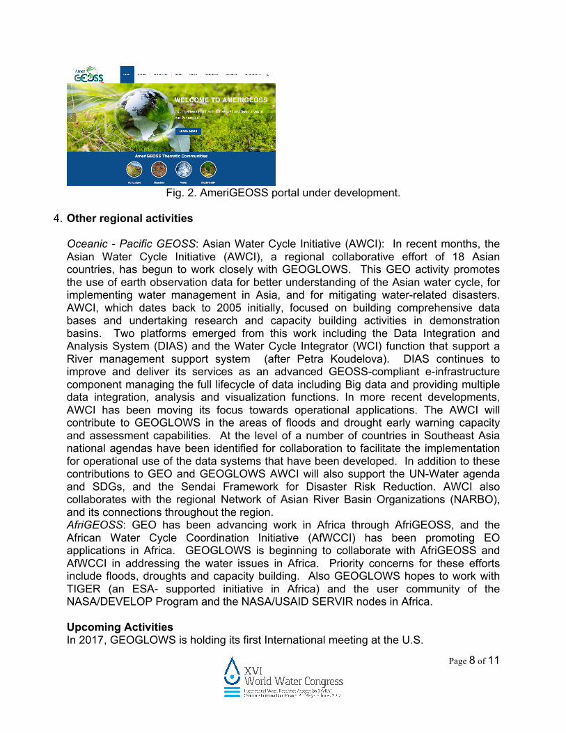
Fig. 2. AmeriGEOSS portal under development.
4. Other regional activities
Oceanic - Pacific GEOSS: Asian Water Cycle Initiative (AWCI): In recent months, the Asian Water Cycle Initiative (AWCI), a regional collaborative effort of 18 Asian countries, has begun to work closely with GEOGLOWS. This GEO activity promotes the use of earth observation data for better understanding of the Asian water cycle, for implementing water management in Asia, and for mitigating water-related disasters. AWCI, which dates back to 2005 initially, focused on building comprehensive data bases and undertaking research and capacity building activities in demonstration basins. Two platforms emerged from this work including the Data Integration and Analysis System (DIAS) and the Water Cycle Integrator (WCI) function that support a River management support system (after Petra Koudelova). DIAS continues to improve and deliver its services as an advanced GEOSS-compliant e-infrastructure component managing the full lifecycle of data including Big data and providing multiple data integration, analysis and visualization functions. In more recent developments, AWCI has been moving its focus towards operational applications. The AWCI will contribute to GEOGLOWS in the areas of floods and drought early warning capacity and assessment capabilities. At the level of a number of countries in Southeast Asia national agendas have been identified for collaboration to facilitate the implementation for operational use of the data systems that have been developed. In addition to these contributions to GEO and GEOGLOWS AWCI will also support the UN-Water agenda and SDGs, and the Sendai Framework for Disaster Risk Reduction. AWCI also collaborates with the regional Network of Asian River Basin Organizations (NARBO), and its connections throughout the region. AfriGEOSS: GEO has been advancing work in Africa through AfriGEOSS, and the African Water Cycle Coordination Initiative (AfWCCI) has been promoting EO applications in Africa. GEOGLOWS is beginning to collaborate with AfriGEOSS and AfWCCI in addressing the water issues in Africa. Priority concerns for these efforts include floods, droughts and capacity building. Also GEOGLOWS hopes to work with TIGER (an ESA- supported initiative in Africa) and the user community of the NASA/DEVELOP Program and the NASA/USAID SERVIR nodes in Africa.
Upcoming Activities In 2017, GEOGLOWS is holding its first International meeting at the U.S.

Page 9 of 11
NOAA/National Water Center, Tuscaloosa, Alabama. During 2016, GEOGLOWS strengthened ties with AmeriGEOSS and is now in a position to begin to strengthen ties with the other regional GEO initiatives including AfriGEOSS and AOGEOSS and to Europe through NextGEOSS and other related European activities. GEOGLOWS seeks to establish its Steering Committee and its working groups with participation from all regions of the world and accelerate the development of important activities such as the identification of the EWV for better water management decisions. In particular, GEOGLOWS plans to collaborate with the Swiss Federal Department of the Environment to organize a workshop in Geneva, Switzerland in the summer to scope out the role EWVs can play in policy and senior level decision-making. Acknowledgements The GEOGLOWS initiative represents the works of many people engaged in GEO water activities and water activities at the global, national, and regional level. Their open sharing of lessons has enabled GEOGLOWS initial progress. GEO is the work of the GEO Secretariat and many who work tirelessly on the global initiatives and community activities. It is through leveraging each other’s work that efficient progress is made. This paper is written on their behalf with thanks for their efforts.

Page 10 of 11
Acronyms/Abbreviations AfWCCI - African Water Cycle Coordination Initiative AfriGEOSS – GEO Initiative in Africa AoGEOSS - Asia-Oceania GEOSS Initiative AmeriGEOSS – GEO Initiative of the Americas AWCI – Asia Water Cycle Initiative CEOS - Committee on Earth Observation Satellites CIEHLYC - Comunidad para la Información Espacial e Hidrográfica para Latinoamérica y el Caribe CIRMAG – Centro de Investigación Científica del Río Magdalena DEVELOP – Digital Earth Virtual Environment Learning Outreach Project EO - Earth Observation ESA – European Space Agency GCOS – Global Climate Observing System GEO - Group on Earth Observations GEO BON - Group on Earth Observations Biodiversity Observation Network GEOGLOWS - GEO Global Water Sustainability GEOSS - Global Earth Observation System of Systems GOES-16 - Geostationary Operational Environmental Satellite - R Series GWSP Global Water System Project GNC-A - GEONETCast Americas IGWCO CoP - Integrated Global Water Cycle Observations Community of Practice NASA - U.S. National Aeronautics and Space Administration NARBO - regional Network of Asian River Basin Organizations NextGEOSS - Next generation of the Global Earth Observation System of Systems NGO – Non-governmental organization NOAA - U.S. National Oceanic and Atmospheric Administration NWS - U.S. National Weather Service NWC - U.S. National Water Center Societal Benefit Areas’s (SBA’s) SDGs – Sustainable Development Goals UN – United Nations USAID - United States Agency for International Development References [1] Climate Risks Early Warning Systems Flyer - UNFCCC Newsroom, newsroom.unfccc.int/media/454809/climate-risks-early-warning-systems-flyer.pdf, accessed 11,12,16 [2] USAID/OFDA Natural and Technological Risks: Hydrometeorological Hazards Update, October 2015 Accessed 12.20.16 [3] N, 2017b. Sustainable Development Goals - 17 Goals to Transform our World. In: The United Nations. http://www.un.org/sustainabledevelopment/development-agenda/ Accessed 01.30.17. [4] A world that counts, mobilizing the data revolution for sustainable development,

Page 11 of 11
http://www.undatarevolution.org/report/ Accessed 01.02.17
[5] GEO: Our Mandate, GEO Vision http://www.earthobservations.org/vision.php, (accessed 06.09.16).
[6] GEO Strategic Plan 2016-2025: Implementing GEOSS, http://www.earthobservations.org/documents.php?smid=100 (accessed 01.08.17).
[7] The GEOSS Water Strategy. From Observations to Decision http://ceos.org/document_management/Ad_Hoc_Teams/WSIST/WSIST_GEOSS-Water-Strategy-Full-Report_Jan2014.pdf (accessed 01.09.17).
[8] NOAA Water Initiative http://sab.noaa.gov/sites/SAB/Meetings/2016%20Documents/April%202016%20Documents/FINAL%20Integrated%20Water%202-pager.pdf (accessed 01.12.17)
[9] GEONETCast-A http://www.geonetcastamericas.noaa.gov/ [10] GEONETCast-Americas Product Catalog V20152110,
http://www.geonetcastamericas.noaa.gov/pubs/section-1/GEONETCast-Americas%20Product%20Catalog%20-%20V20152110.pdf (accessed 01.09.17).
[11] GEO Great Lakes, Coordinating Collaborative Data Management for the Great Lakes Region, http://64.9.208.36/geo-greatlakes/content/about-us (accessed 01.12.17).
[12] GEOSS Portal: Discover, Access, Contribute Earth Observations, Information and Services, http://www.geoportal.org/web/guest/geo_home_stp (accessed 01.09.17).