gambia - birdlife...
TRANSCRIPT

357
Important Bird Areas in Africa and associated islands – The Gambia
Piapiac Ptilostomus afer. (ILLUSTRATION: MARK ANDREWS)
GENERAL INTRODUCTION
The Republic of The Gambia is the smallest country in mainlandAfrica, with a land area of 11,147 km2. Its narrow, meanderingboundary encloses the lower 475 km of the Gambia River, whichrises in the Fouta Djallon mountains of Guinea. The country isentirely surrounded by Senegal except for 80 km of coastline whichface the Atlantic Ocean. The population in 1993 was 1,038,145,making the country the fourth most densely populated in Africa.The annual rate of population increase is 4.2%. The country isdivided administratively into five Divisions: the Western, NorthBank, Lower River, Central River and Upper River. The capital isBanjul, located on the coast on the southern bank of the river.
The landscape of The Gambia consists of a low sandstoneplateau and gently sloping hills, with occasional laterite outcropsand escarpments. The Gambia River has cut a shallow valley intothe plateau, partly filled with alluvial clays and sands. The coasthas narrow sandy beaches backed by low stabilized dunes and shortlengths of laterite cliffs and reefs, one of which has formed theunstable, offshore Bijol Islands. The inshore waters lie over thecontinental shelf and are a part of the rich East Atlantic fisheries.Nowhere is the land more than 100 m above sea-level. The climateis a northern tropical one, dominated by a short rainy seasonbetween July and October, in which most of the 900–1,300 mm falls,and a long dry season during which evaporation is intense awayfrom the coast. Rainfall declines and temperatures increaseeastwards towards the interior. Mean monthly maximumtemperatures range from 27–31°C at the coast to 32–41°C 350 kminland, with the highest temperatures occurring just before the rains.
Much of The Gambia lies within the Sudan–Guinea Savannabiome, where the climax vegetation is undifferentiated dry savannawoodland with a moderate diversity of trees and shrubs above alayer of tall, perennial grasses. The diversity and density of thewoodland increases westwards with increasing rainfall and, abovethe 1,100 mm isohyet, some 50 km from the coast, it merges withthe Guinea–Congo lowland forest transition zone. A few small
patches of semi-evergreen forest remain, along freshwater streamsand in seasonally damp hollows in more humid areas near the coast,wherever there is a high water-table throughout the year.Characteristic Guinea–Congo forest tree species such as Daniellaoliveri, Parinari excelsa and Elais guineensis dominate the canopy,and there is an abundance of lianas. These forests, broadly similarto the Parinari–Erythrophleum–Detarium forest of coastalCasamance in southern Senegal, mark the northern limit of theWest African rainforest, a small fraction of the flora and fauna ofwhich occurs in these fragments.
One fifth of the country is covered with wetlands. Within thesaline reach of the Gambia River, which extends for 100 km upriverduring the rains and 250 km in the late dry season, the alluvialsoils are vegetated with 150 km2 of tall Rhizophora mangrove forest,580 km2 of low, open Avicennia mangrove and smaller areas ofSesuvium portulacastrum saltmarsh on slightly raised ground, allcut with a labyrinth of creeks, bordered by narrow mudflats at lowtide. Within the former flood-plain, where deposition has raisedthe land slightly above the tidal reach of the river and so causedthe mangrove forest to die back, are seasonally wet saltmarshes,shallow lakes and sparsely vegetated mudflats on hyper-saline soils,the latter known locally as banto faros. In the rainy season on theless saline soils, these areas become a mosaic of pools fringed bylow Gramineae and Cyperaceae. In the area of transition to thepermanently freshwater reaches of the river the Rhizophoramangrove thins and is backed by extensive tall swamps dominatedby Phragmites karka, which also covers several low-lying alluvialislands in the river. Freshwater wetlands are most extensive in theUpper River Division. Where rainwater collects over less permeablesoils, a few tens of square kilometres of lakes and marshes occur,most of them seasonal and reduced to a few pools or entirely dryby February. On the seasonally flooded banks of the river and theeasternmost islands are a few small areas of Sudanian riparianforest, characteristically species-poor and dominated by Mitragynainermis. Smaller freshwater marshes occur elsewhere in the countryalong spring lines, the upper reaches of tributaries, incised meanders
■■■■■ THE GAMBIAPAUL ROBINSON

358
Important Bird Areas in Africa and associated islands – The Gambia
in the freshwater reaches of the main river and the few small streamswhich feed directly into the Atlantic.
Most of the landscape has been intensely modified by man andthe largest changes have occurred in the last 40 years, coincidingwith a tripling of the human population. Some 75% of thepopulation are primarily farmers, practising low-input mixedfarming. Wood is the sole source of fuel for 85% of the population.A third of the land has been converted to arable farming, for theproduction of locally consumed millet, sorghum, maize and riceand of groundnuts for export. The expansion of arable ontomarginal lands is a cause of soil erosion. The area of open andclosed savanna woodland declined by 60–70% between 1972 and1980. In attempts to counteract this loss 66 Forest Parks covering327 km2 have been designated, although few of these are effectivelymanaged, and there is increasing effort to create community forestsand plantations (mainly of Gmelina) to meet the die-back of nativeforest trees, the encroachment of scrub into freshwater marshesand desertification on the north bank of the river.
ORNITHOLOGICAL IMPORTANCE
Despite its small size and the pressures on its habitats, The Gambiahas a remarkably rich bird fauna: to date, about 545 species havebeen recorded. A total of 232 species are known to breed and a further52 are thought to do so. Most breeding species are resident or arethought to make only local movements, particularly during the rains.Of the regular non-breeding species, 98 derive from the Palearctic, 40from within Africa and one is a pelagic species from the South Atlantic.
Five species of global conservation concern occur, none of whichbreeds. Circus macrourus and Falco naumanni winter in smallnumbers, but both may briefly be more common, in the early dryseason and on spring passage respectively. A few recent recordssuggest there is a small wintering population of Gallinago media inthe freshwater swamps of the upper river. Larus audouinii passesthrough the coast in hundreds in February and a few tens winter.
Map 1. Location and size of Important Bird Areas in The Gambia.
Table 1. Summary of Important Bird Areas 13 IBAs covering in The Gambia. 585.5 km2
Criteria (see p. 11; forA3 codes, see Table 2)
IBA Administrative A3 A4i A4iiicode Site name region A04 A05
GM001 Abuko Nature Reserve Western ✔
GM002 Pirang Forest Park Western ✔
GM003 Niumi National Park North Bank ✔
GM004 Tanbi wetland complex Western ✔ ✔
GM005 Tanji River (Karinti) Bird Reserve Western ✔ ✔
GM006 Allahein to Kartung coast Western ✔
GM007 Kiang West National Park Lower River ✔
GM008 Bao Bolon Wetland Reserve North Bank ✔ ✔
GM009 Samba Sotor to Kaur wetlands North Bank, ✔Central River
GM010 Dankunku wetlands Central River ✔
GM011 Islands of the Central River Division Central River ✔ ✔
GM012 Jakhaly rice-fields Central River ✔
GM013 Prufu–Darsilami area Upper River ✔
Total number of IBAs qualifying: 2 2 9 4
Lastly, Phoenicopterus minor is a rare vagrant. There are no speciesof restricted range, though elements of two biome-restrictedassemblages occur. The majority of the country falls within theSudan–Guinea Savanna biome (A04) and 30 of the 54 species of thisbiome have been recorded nationally. In addition, 26 of the 278 speciesof the Guinea–Congo Forests biome (A05) occur in the few smallforest outliers that remain. Two species of the Sahelian biome (A02)have also been recorded. The diverse inland and coastal wetlandsattract large numbers of Palearctic and inter-African migrantwaterbirds. Indeed, one third of the national avifauna are waterbirdsand a number occur in congregations of global importance.
The avifauna of The Gambia can be described in terms of fivemajor habitat-types—(1) coast and inshore waters; (2) Lower Riverwetlands; (3) Central and Upper River wetlands; (4) savanna and‘upland’ arable; and (5) lowland and riverine forest.
Coast and inshore waters: tens of thousands of non-breedingterns and gulls, of both Palearctic and Afrotropical origin, feedoffshore and roost on the less disturbed islands, sandbars andbeaches. Amongst the most abundant are Sterna caspia and Larusfuscus during the winter and Chlidonias niger on passage. A fewthousand Palearctic waders winter on the shoreline and largernumbers occur on passage. Characteristic species include Calidrisalba and Arenaria interpres. The only sizeable breeding colony isof Sterna caspia, S. maxima and Larus cirrocephalus on the BijolIslands. A small and declining breeding population of Charadriusmarginatus is restricted in The Gambia to undisturbed beaches.The discards of the artisanal fisheries, the catches of which areprocessed on the beach, attract congregations of gulls.
Lower River wetlands: the shallow waters of the saline lengthof the Gambia River and its inlets provide feeding for the highestconcentrations of non-breeding pelicans and Pandion haliaetus inthe country. Terns are common, though in smaller numbers thanon the coast. The mudflats attract low densities of waders, heronsand egrets. Amongst the most common are Egretta gularis, Burhinussenegalensis and Numenius phaeopus. Larger numbers of waterbirdsoccur on the seasonally wet mudflats and saltmarshes behind themangrove fringe, where flocks of thousands of Calidris minuta andLimosa limosa occur. Herons, egrets and storks can be abundant.The mangrove forest has few breeding species, but these includemany with localized distributions in The Gambia; Anthreptesgabonicus is entirely restricted to this habitat.
Central and Upper River wetlands: the central length of the riverand its islands hold roosts of large numbers of wildfowl, herons,egrets and storks, which feed on the adjacent marshes and rice-fields. These include Leptoptilos crumeniferus, Casmerodius albus,Egretta ardesiaca, Nycticorax nycticorax and Bubulcus ibis. ‘BirdIsland’ has the only remaining large mixed heronry on the river.Characteristic species of the irrigated rice-fields and naturalfreshwater wetlands are Nettapus auritus, Actophilornis africanusand often abundant, non-breeding Glareola pratincola. The faunaof the tall swamp vegetation is poorly known. There are probablylarge, undiscovered seasonal roosts of Riparia riparia and Motacillaflava. The riverine thickets and groundnut-landing sites attract hugenumbers of Streptopelia turtur.
Savanna and ‘upland’ arable: the degraded savanna woodland,fallow and arable which cover most of the terrestrial part of thecountry have an abundant bird fauna, the breeding community ofwhich is numerically dominated by a few species of the Columbidae,Sylviidae, Ploceidae and Estrildidae. Less disturbed areas are thebreeding habitat for many species of raptor and the small remainingpopulations of bustards. The main variation in the bird communitydepends on the openness of the woodland with, for example,Emberiza tahapisi and Mirafra rufocinnamomea in thin woodlandon laterite outcrops and Campephaga phoenicea and Hyliotaflavigaster in areas of tall canopy woodland. A few nationallyuncommon species such as Lagonosticta larvata and Galeridamodesta are restricted to the east of the country. Tall trees, especiallysilk-cottons, of now restricted villages, hold most of the country’scolonies of herons, egrets, storks and pelicans. In the dry seasonnumbers of raptors and passerines increase, with influxes from bothelsewhere in the Afrotropics and the Palearctic.
Lowland and riverine forest: lowland semi-evergreen forest isrestricted to the Western Division, within 50 km of the coast.Sudanian riverine forest occurs on the banks of the river and itsislands in the Central and Upper River Divisions. Both forest-types
2
3
5
6
7
8
9 11
1213
4
101
S E N E G A L
Area of IBA (ha)
<100
100 to 999
1,000 to 9,999
10,000 to 49,999
0 100
km
50

359
Important Bird Areas in Africa and associated islands – The Gambia
are scarce and are threatened with further reductions. They arehome to many of The Gambia’s rarest breeding species; 21 forestspecies are known from fewer than 10 locations. All the forestpatches are tiny; the largest at the coast is under 100 ha.
Despite widespread changes in land-use there is only slightevidence of changes in the avifauna of The Gambia in the last 25years, since ornithological records have been kept in earnest. Thepopulations of many species must have changed dramatically withthe shift from closed woodland to open, scrubby savanna and thehuge increase in the human population, but there have been noknown losses of breeding species in this period. Hunting might beimplicated in the decline of breeding numbers of larger gamebirdsand waterbirds such as Mycteria ibis, Pelecanus rufescens,Sarkidiornis melanotos, Numida meleagris, Eupodotis melanogasterand Balearica pavonina, all of which are known to be hunted. Thereduction in the area of uncultivated savanna may be responsiblefor declines in large raptors such as Terathopius ecaudatus. Numbersof waterfowl on the river are reported to have decreased, thoughthe main species implicated, Anas querquedula, was probably alwayserratic in numbers. There are no recent large counts of Philomachuspugnax, which has lost some of its traditional feeding sites to ricecultivation and is a recognized pest of rice grain. Three species ofEstrildid finches associated with the uncultivated edges of marsheshave declined, probably due to the tidying of the landscapeassociated with rice cultivation and clearance of riverine thickets.Recent colonists and expanding species are from the Sahel biomeand more arid regions of the Sudan–Guinea Savanna biome, andare concentrated on the drier north bank of the river where thewoodland is being most dramatically thinned—for example, Neotisdenhami, Lamprotornis pulcher and Myrmecocichla aethiops.
CONSERVATION INFRASTRUCTURE ANDPROTECTED-AREA SYSTEM
The main law covering nature conservation is the WildlifeConservation Act (1977) which is administered by the Departmentof Parks and Wildlife Management (DPWM). It allows for theestablishment of three types of protected area: national parks, naturereserves and local sanctuaries. The distinction between these threecategories is not, however, relevant to their protection, as all arecovered by the same articles concerning ministerial regulation andcontrol of their management and the prohibition of hunting. All arebest considered simply as protected areas, managed or wardened byDPWM staff. The National Environmental Management Act (1987),written to give effect to the African Convention on the Conservationof Nature and Natural Resources, states that conservation areasshould be maintained or extended to protect representativeecosystems and to ensure the conservation of all species. The ForestAct (1977) allows the Forestry Department to designate Forest Parksand Protected Forests, where control of land-use can be as stringentas in other types of protected area. Several of these parks are nowmooted as informal wildlife reserves. The Forest Act also gives totalprotection to 19 tree species, including mangroves.
There are seven protected areas, covering 473 km2 or about 4.2%of the country. All the major semi-natural habitats are represented,with the exception of freshwater marshes in the Upper River Division.The intention is to expand the network to cover a minimum of 5% ofthe country (557 km2). None of the protected areas is establishedspecifically for the conservation of particular flora, fauna or habitatsand there are no guidelines in the Wildlife Conservation Act to directthe selection of areas. However, the selection and establishment ofprotected areas is based entirely or in part on the following features:species and habitat diversity, rarity, fragility, typicalness, naturalness,intrinsic value and threats, etc. The level of management of theprotected areas varies. In the two smallest areas, Abuko NatureReserve and the Gambia River National Park, the most destructiveof traditional land-uses are excluded while the collection of medicinalplants and sacred waters is permitted. Both sites are, however, atypical:a relict riverine forest which is a popular tourist attraction and achimpanzee rehabilitation site respectively. In the larger parks theintention is to integrate rural land-use with conservation, either withinthe protected area or in the buffer zone. The effectiveness ofmanagement is limited by resources, particularly infrastructure, thenumber of staff and their level of training. The main management
Table 2. The occurrence of biome-restricted species atImportant Bird Areas in The Gambia. Sites that meet theA3 criterion are highlighted in bold.
A04 – Sudan–Guinea Savanna biome(30 species in The Gambia; two sites meet the A3 criterion)IBA code: 001 002 007 013Streptopelia hypopyrrha ✔
Poicephalus senegalus ✔ ✔
Musophaga violacea ✔
Merops bulocki ✔
Coracius cyanogaster ✔ ✔
Lybius dubius ✔ ✔
Galerida modesta ✔
Hirundo leucosoma ✔
Corvinella corvina ✔ ✔
Cossypha albicapilla ✔
Myrmecocichla albifrons ✔
Turdoides reinwardtii ✔ ✔
Cisticola dorsti ✔
Cisticola rufus ✔
Hypergerus atriceps ✔
Eremomela pusilla ✔ ✔
Anthoscopus parvulus ✔ ✔
Nectarinia coccinigaster ✔ ✔
Emberiza affinis ✔
Pytilia phoenicoptera ✔ ✔
Lagonosticta rufopicta ✔
Lagonosticta larvata ✔
Estrilda caerulescens ✔ ✔
Estrilda troglodytes ✔ ✔
Petronia dentata ✔ ✔
Plocepasser superciliosus ✔ ✔
Ploceus heuglini ✔
Lamprotornis purpureus ✔ ✔
Lamprotornis chalcurus ✔ ✔
Ptilostomus afer ✔ ✔
Number of species recorded: 1 1 22 22
A05 – Guinea–Congo Forests biome(26 species in The Gambia; two sites meet the A3 criterion)IBA code: 001 002 008 011
Tigriornis leucolophus ✔
Accipiter erythropus (✔) (✔)Francolinus ahantensis ✔ ✔
Sarothrura pulchra ✔ ✔
Tauraco persa ✔ ✔
Tockus fasciatus ✔ ✔
Indicator maculatus (✔)Campethera nivosa ✔ ✔ ✔
Psalidopocne obscura ✔ ✔
Thescelocichla leucopleura (✔) (✔)Phyllastrephus scandens ✔ ✔
Bleda canicapilla ✔ ✔
Nicator chloris (✔)Illadopsis puveli ✔
Phyllanthus atripennisCamaroptera chloronota (✔) (✔)Sylvietta virens ✔ ✔
Hylia prasina ✔ ✔
Bias flammulatus (✔)Terpsiphone rufiventer ✔ ✔
Anthreptes gabonicus ✔ ✔
Nigrita bicolor (✔)Pyrenestes sanguineus ✔
Spermophaga haematina ✔ ✔
Ploceus nigerrimus (✔)Malimbus nitens ?Number of species recorded: 12 14 2 2

360
Important Bird Areas in Africa and associated islands – The Gambia
■ SITE ACCOUNTS
efforts in the larger areas are to control bush fires, tree-felling,cultivation, hunting and grazing. Illegal activities however remaincommonplace. Recently, there has been emphasis on planning forecotourism and on compensation for villages at the edges of the parksfor the loss of land, by seeking funds to help them establish income-generating activities such as orchards, bee-keeping and novel livestock-rearing.
It is recognized that the protected-area network has not reversedthe decline of many species and there is a policy paper on biodiversityand wildlife legislation, now approved by Cabinet, which promotes,amongst other things, the incorporation of wildlife conservation intoland-use planning. A provisional list of Sites of High Ecological Valuehas been compiled by the DPWM and some legal protection forthem is being promoted by the Department. The sites have alreadybeen considered informally in recent conflicts over land development.
INTERNATIONAL MEASURES RELEVANT TO THECONSERVATION OF SITES
The Gambia has ratified the Convention on Biological Diversity,CITES, the African–Eurasian Waterbird Agreement, the WorldHeritage Convention, the Convention to Combat Desertification,the Convention on Climate Change and the Ramsar Convention,under which one site has been designated and one more proposedby DPWM. Regionally, The Gambia also participates in UNESCO’sMan and Biosphere (MAB) Programme and has ratified the AfricanConvention on the Conservation of Nature and Natural Resourcesand the Convention for Cooperation in the Protection andDevelopment of the Marine and Coastal Environment of the Westand Central African Region (WACAF).
OVERVIEW OF THE INVENTORY
The inventory lists 13 Important Bird Areas (IBAs), covering an areaof 585.5 km2 or 5.25% of the surface area of the country. All of TheGambia’s six protected areas are included and a further three sitesare on the country list of Sites of High Ecological Value. One of theseis protected as a Forest Park. The sites are spread through all fiveadministrative Divisions of the country, though most are on andnear the coast in the Western Division. Nine sites are wetlands, chosenprimarily for their numbers of migrant and wintering waterbirds.Two sites qualify for the Sudan–Guinea Savanna biome (A04) holdingbetween them 29 of the 30 species of this biome, while the remainingspecies also occurs at the two sites selected for the Guinea–CongoForests biome (A05), at which 22 of the 26 species occur, althoughthe status of some at these sites is uncertain (Table 2). Two of theremaining species occur at sites selected for other reasons.
Coverage of the country is uneven. The forests and the coastalwetlands, close to the centres of the urban and tourist populations,are reasonably well known. Most of the inland wetlands are seldomvisited and their selection has depended on one or two recent counts.There is an almost complete lack of data from these sites for themonths of August to November, when their importance is likely to
be greatest. The distribution of the Sudan–Guinea Savanna biomespecies in the east is patchily known from a few well-watched sites.More information might reveal an additional wetland site in the UpperRiver Division, combining several adjacent freshwater marshes witha more accurately defined site for the Sudan–Guinea Savanna biome.
COMMENTS ON THE INVENTORY
• The site names used are either those recognized by the DPWMfor their protected areas (sites GM001, GM003, GM005,GM007, GM008), that of the notified Ramsar Site (GM004),or names of the nearest settlement(s), with spellings taken fromthe Ordnance Survey 1:50,000 maps of the country.
• Precise areas are given only for the protected areas; boundariesfor the other sites are not yet fully defined. The approximatearea measurements are taken from habitat boundaries shownon the O.S. 1:50,000 maps.
• Records in The Gambia of the species hitherto identified asCisticola ruficeps have recently been shown to be of C. dorsti;the status of C. ruficeps therefore remains uncertain.
ACKNOWLEDGEMENTS
The general information on the country was compiled from a review ofenvironmental literature, for which the resources of the Research andDevelopment Unit of the DPWM were made available. The site accounts andoverview of ornithological importance derive from a review of published andunpublished ornithological information held in The Gambia and fieldwork bythe author during 1996–1998. Data on other threatened/endemic wildlife arederived from records held by the DPWM, discussions with resident naturalistsand the author’s fieldwork. With funding from Wetlands International for theAfrican Waterfowl Census in 1998, The Gambia was able to engage a team ofnational and international experts, led by the author, to gather information forthe census and to fill some of the gaps in the data that then existed. Staff of theDPWM and the Conservation Society of Sierra Leone assisted in gathering fielddata for the census. Many discussions with Clive Barlow and access to his librarywere invaluable as was the distributional database compiled by Dr Tim Wacherin the 1990s. John Clayton helped with many of the waterfowl censuses andprovided information from his regular observations at Tanji River (Karinti) BirdReserve. Solomon Jallow and Baba Bah provided local ornithological expertiseon several sites. Dr A. Camara, the Director of the DPWM, provided the authorwith desk space and office facilities during the project. His staff were helpful inmany matters and encouraged the aims of the project. Without the spirit ofcooperation and partnership that characterized the entire process, this reportwould not have seen the light of day. Linda Barnett kindly provided muchadditional information.
GLOSSARY
banto faros hyper-saline mudflats in the old flood-plain of the river.bolon tributary or tidal creek of the river.DPWM Department of Parks and Wildlife Management.
Abuko Nature Reserve GM001Admin region WesternCoordinates 13°22’N 16°38’W A3 (A05)Area 134 ha Altitude 0–30 m Nature Reserve
■ Site descriptionAbuko is a small area of fenced forest and woodland located on themain south bank road, 3 km from the edge of the main urban centre ofSerekunda. The Lamin stream flows through the centre of the reserve.Bordering the stream is the largest and most botanically rich exampleof semi-evergreen forest in the country. Forest covers approximatelyone third of the area of the reserve. Characteristic canopy tree speciesare Elaeis guineensis, Khaya senegalensis, Erythrophleum guineense,Chlorophora regia and Anthocleista procera. There is an abundance of
lianas and a dense understorey in more open areas, smothered by theclimber Saba senegalensis. Away from the stream the forest merges intosavanna woodland. There are several pools and patches of tall swampvegetation along the lower reaches of the stream.
■ BirdsSee Box and Table 2 for key species. The reserve is probably the mostintensively birdwatched forest in West Africa. Abuko has the richestassemblage in the country of species of the Guinea–Congo Forestsbiome. Characteristic species which are locally common here includeTauraco persa, Tockus fasciatus, Andropadus virens, Hylia prasina,Apalis flavida and Terpsiphone rufiventer. Other notable breedingspecies include Gorsachius leuconotus and Accipiter tachiro. Inaddition, one species of the Sudan–Guinea Savanna biome occurs;see Table 2.
361
Important Bird Areas in Africa and associated islands – The Gambia
■ Other threatened/endemic wildlifeMammals of global conservation concern include Procolobus badiustemminckii (EN).
■ Conservation issuesThe forest was formerly revered as a home of benign spirits andprotected by the belief that the felling of trees would bring bad luck.However, these beliefs declined and, in the early 1980s, the villagersof Pirang decided to clear the forest to create a mango plantation.The Gambian-German Forestry Project (GGFP) and the GermanEmbassy intervened persuading the villagers to create a plantationelsewhere while the Forestry Department gave the site legal protection,recently gazetted , as a forest park with a prohibition on grazing, fellingand burning. The forest is now fenced and managed by the ForestryDepartment with some technical assistance from the GGFP. Thevillagers appear to support this plan, though the forest must remainunder some threat as the local population and its need for timber growand as there is currently no financial benefit to the villagers from itsprotection.
■ Further readingEllenberg et al. (1988), Wacher (1993).
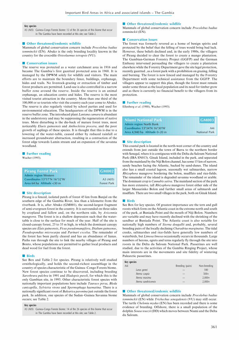
Niumi National Park GM003Admin region North BankCoordinates 13°34’N 16°30’W A4iArea 4,940 ha Altitude 0–20 m National Park
■ Site descriptionThis coastal park is located in the north-west corner of the country andextends from just outside the town of Barra to the northern borderwith Senegal, where it is contiguous with the Delta du Saloum NationalPark (IBA SN013). Ginak Island, included in the park, and separatedfrom the mainland by the Niji Bolon channel, has some 15 km of narrow,sandy beaches facing the Atlantic, backed by sand-dunes. The islandalso has a small coastal lagoon, seasonally wet saltmarshes, narrowRhizophora mangrove bordering the bolon, mudflats and rice-fields.The remainder of the island is degraded savanna woodland or arable.The dominant crop is Cannabis sativa. The mainland section of the parkhas more extensive, tall Rhizophora mangrove forest either side of thelarger Massarinko Bolon and further small areas of saltmarsh andmudflats. There are two small villages in the park, both on Ginak Island.
■ BirdsSee Box for key species. Of greatest importance are the tern and gullroosts which form on the Atlantic coast in the extreme north and southof the park, at Buniada Point and the mouth of Niji Bolon. Numbersare variable and may have recently declined with the shrinking of thesandbar at Buniada Point. The Atlantic coast is also notable fornationally high numbers of Sterna dougallii and, probably, severalbreeding pairs of the locally declining Charadrius marginatus. The tidalcreeks, saltmarshes and rice-fields have generally low numbers ofwaterbirds, but Limosa limosa occasionally occurs in thousands. Largenumbers of herons, egrets and terns regularly fly through the site intoroosts in the Delta du Saloum National Park. Passerines are wellstudied, due to the activities of the Gambia Ringing Project, whosemain interests are in the movements and site fidelity of winteringPalearctic passerines.
Key speciesA4i Breeding (pairs) Non-breeding
Larus genei — 180Sterna caspia — 500+Sterna maxima — 2,000+Sterna sandvicensis — 2,000+
■ Other threatened/endemic wildlifeMammals of global conservation concern include Procolobus badiustemminckii (EN) while Trichechus senegalensis (VU) may still occur.The turtle Chelonia mydas (EN) has been recorded and there is someevidence of breeding. Offshore, there is a small population of thedolphin Sousa teuszii (DD) which moves between Niumi and the Deltadu Saloum.
Key speciesA3 (A05) Guinea–Congo Forests biome: 12 of the 26 species of this biome that occur
in The Gambia have been recorded at this site; see Table 2.
■ Other threatened/endemic wildlifeMammals of global conservation concern include Procolobus badiustemminckii (EN). Abuko is the only breeding locality known in thecountry for the crocodile Osteolaemus tetrapsis (VU).
■ Conservation issuesThe reserve was protected as a water catchment area in 1916 andbecame The Gambia’s first gazetted protected area in 1968. It ismanaged by the DPWM solely for wildlife and visitors. The mainefforts are to maintain the boundary fence, buildings, orphanage,hides and trails. No livestock-grazing or extraction of timber andforest products are permitted. Land-use is also controlled in a narrowbuffer zone around the reserve. Inside the reserve is an animalorphanage, an education centre and hides. The reserve is the mostvisited tourist attraction in the country. More than one third of the100,000 or so tourists who visit the country each year come to Abuko.The reserve is also regularly visited by school parties and used forenvironmental education. The headquarters of the DPWM is in thereserve buffer zone. The introduced plant Lantana camara is abundantin the understorey and may be suppressing the regeneration of nativetrees. More disturbing is the die-back of mature forest trees, mostnoticeably Elaeis guineensis and Anthocleista procera, and the poorgrowth of saplings of these species. It is thought that this is due to alowering of the water-table, caused either by reduced rainfall orincreased groundwater abstraction, resulting in a contraction of theforest edge towards Lamin stream and an expansion of the savannawoodland.
■ Further readingWacher (1993).
Pirang Forest Park GM002Admin region WesternCoordinates 13°17’N 16°32’W A3 (A05)Area 64 ha Altitude <30 m Forest Park
■ Site descriptionPirang is a fenced, isolated patch of forest 45 km from Banjul on thesouthern edge of the Gambia River, less than a kilometre from theriverbank. It is, after Abuko (GM001), the second-largest fragmentof semi-evergreen forest in the country. It is surrounded on three sidesby cropland and fallow and, on the northern side, by Avicenniamangrove. The forest is in a shallow depression such that the water-table is close to the surface for much of the year. Half of the site isclosed-canopy forest, 25 to 35 m high, in which the dominant canopyspecies are Elais guineensis, Ficus pseudomangifera, Dialium guineense,Pseudospondias microcarpa and Parinari excelsa. The remainder ofthe forest has been partly cleared and has an abundance of lianas.Paths run through the site to link the nearby villages of Pirang andBonto, whose populations are permitted to gather local products anddead wood for fuel from the forest.
■ BirdsSee Box and Table 2 for species. Pirang is relatively well studiedornithologically, and holds the second-richest assemblage in thecountry of species characteristic of the Guinea–Congo Forests biome.New forest species continue to be discovered, including breedingSarothrura pulchra in 1991 and Illadopsis puveli, for which this is theonly Gambian site, in 1993. Other characteristic forest species withnationally important populations here include Tauraco persa, Bledacanicapilla, Sylvietta virens and Spermophaga haematina. There is anationally significant roost of Balearica pavonina just outside the forestpark. In addition, one species of the Sudan–Guinea Savanna biomeoccurs; see Table 2.
Key speciesA3 (A05) Guinea–Congo Forests biome: 14 of the 26 species of this biome that occur
in The Gambia have been recorded at this site; see Table 2.

362
Important Bird Areas in Africa and associated islands – The Gambia
■ Conservation issuesThe park was gazetted in 1986. Tourist development along the attractiveAtlantic coast is tightly controlled. Activities of the human populationof the park include fishing and some arable and livestock-farming.However, the illegal cultivation and harvest of Cannabis sativa hasbecome the main local source of income and this has led to conflictwith park authorities and government. There are also pressures fromthe villagers to gain additional benefits from the expansion of tourismincluding the building of more guest houses. The park has been proposedas a Ramsar Site.
■ Further readingDPWM (1997, 2000).
Tanbi wetland complex GM004Admin region WesternCoordinates 13°25’N 16°37’W A4i, A4iiiArea 4,500 ha Altitude 0–5 m Ramsar Site (Unprotected)
■ Site descriptionThe wetland lies at the mouth of the Gambia River and separates thecapital Banjul from the urban centres of Serekunda, Bakau and theirsuburbs. Most of the site is low, open Avicennia mangrove scrub andtaller Rhizophora mangrove cut by tidal creeks. There are small patchesof saline mudflats between the mangrove and the rice-fields, whichborder much of the site to the south and west. In the north, the mainhighway linking Banjul to the mainland roughly follows, for some10 km, the boundary between the mangrove and the shifting sandbeaches and tidal lagoons of the Atlantic coast. In the extreme north-west there is a small area of freshwater marsh around Cape Creek. Inthe east the Bund Road, created to stabilize the land around Banjul,has enclosed several shallow lagoons whose tidal ranges are controlled.The largest expanses of mudflats are on the river immediately south ofthese lagoons and at the Mandinari flats, 5 km upriver.
■ BirdsSee Box for key species. The area holds large numbers of non-breedingterns, gulls, herons, egrets and Palearctic waders. Larus audouinii isrecorded occasionally in small (<10) numbers. The main concentrationsof waders are at the Bund Road lagoons and adjacent mudflats. Gullsand terns flock here and on the Atlantic coast, particularly at the mouthof Cape Creek and the lagoons at the Wadner Beach Hotel. There is aroost of several thousand Bubulcus ibis in the mangrove around CapeCreek. In addition to the species listed below, Arenaria interpres, Calidrisminuta and C. ferruginea also occur commonly in winter or on passage.
Key speciesA4i Breeding (pairs) Non-breeding
Egretta gularis — 1,630Himantopus himantopus — 2,000Limosa limosa — 6,000+Larus cirrocephalus — 1,000+Larus genei — 100+Sterna caspia — 500+Sterna maxima — 1,000+
A4iii More than 20,000 waterbirds are thought to occur regularly at the site.
■ Other threatened/endemic wildlifeMammals: Trichechus senegalensis (VU) still occurs.
■ Conservation issuesThe Gambia has experienced a huge growth of its urban populationand several hundred thousand people now live within 5 km of thiswetland. Rice cultivation and vegetable gardening have encroachedinto the freshwater marsh. Shrimp fishing and oyster gathering arelocally intensive. There is some uncontrolled dumping around the edgeof the wetland. There are several hotels on the Atlantic coast andindustrial development and sand mining towards Banjul. Coastalerosion and tourist development have removed the ornithologicalinterest of parts of the Atlantic coast. Water-level control on the BundRoad lagoons appears to be erratic and the lagoons are vulnerable toencroachment by mangrove, reclamation or use as a dumping site.The mangrove is not under immediate threat, but must be vulnerable
to large scale land reclamation due to its position. This complex ofwetlands has been proposed as a Ramsar Site.
■ Further readingDPWM (1997, 2000).
Tanji River (Karinti) Bird Reserve GM005Admin region WesternCoordinates 13°22’N 16°48’W A4i, A4iiiArea 612 ha Altitude 0–30 m Bird Reserve
■ Site descriptionThe reserve lies on the Atlantic coast, 15 km to the south-west of themain tourist centres of Fajara and Bakau and 1 km from the expandingtown of Brufut. The reserve boundary encloses the tidal, saline reachesof the small Tanji river, which is bordered by 2 km2 of low mangroveforest, saltmarsh and mudflats. Longshore drift creates a shiftingchannel for the river as it reaches the ocean and is blocked by a sandbeach parallel to the land. This has also created several small lagoonsbetween the river’s mouth and Cape Point. The point is the landwardlimit of a lateritic outcrop which reappears 2 km offshore to form thetiny Bijol Islands, which are included in the reserve. The two unstableislands are accumulations of sand trapped by laterite reefs. They wereformerly lightly wooded, disappeared in the 1960s and have graduallyreformed since then. The main island is now vegetated with the creepinghalophytes Ipomoea pes-caprae and Sesuvium portulacastrum. Theremainder of the mainland reserve is degraded savanna and stabilizedsand-dunes, the latter with wooded grassland dominated by Parinarimacrophylla. There are tiny patches of forest.
■ BirdsSee Box for key species. The Bijol Islands and the mouth of the Tanjiriver are the most important sites in the country for flocks of most speciesof gulls and terns and occasionally hold more than 20,000 waterbirds.The islands also hold the only known breeding site in The Gambia forSterna caspia, S. maxima and Larus cirrocephalus (up to 238 pairs).Larus fuscus and Sterna caspia predominate in winter. Larus audouiniiwas known from occasional counts of fewer than 10 birds on passageand in winter during the 1990s although there was an unprecedentedcount of 404 on the Bijol Islands in February 1998. Pelecanus onocrotalushas recently begun to roost in hundreds on the Bijol Islands andCharadrius marginatus probably breeds both here and on the mainland.It is suspected that the success of the island’s breeding population ofSterna caspia is low, due to disturbance. The diversity of breeding andmigrant birds is impressive, due to Tanji’s position on a headland andthe range of habitats. Regular observations have shown it to be therichest site for birds, measured by the number of species recorded, inThe Gambia.
Key speciesA4i Breeding (pairs) Non-breeding
Arenaria interpres — 523 (1998)Larus audouinii — 404 (1998)Larus fuscus — 6,500 (1998)Larus genei — 200+ (1998)Sterna caspia 150 (1997) 2,100 (1998)Sterna maxima 7,360 (2000) 5,100 (1997)Sterna sandvicensis — 2,000 (1998)Sterna albifrons — 1,500 (1998)
A4iii More than 20,000 waterbirds have been recorded at this site.
■ Other threatened/endemic wildlifeMammals of global conservation concern include Procolobus badiustemminckii (EN), while Monachus monachus (CR) and the dolphinsSousa teuzsii (DD) and Tursiops truncatus (DD) occur in thesurrounding waters. The turtle Chelonia mydas (EN) is regular offshoreand breeds on the Bijol Islands.
■ Conservation issuesThe reserve was gazetted in 1993, is managed by the DPWM and isstaffed with rangers and a reserve manager. The reserve has aheadquarters and trails have been cut through the scrub. The fishingvillages of Tanji and Ghana Town are situated at the edge of the reserve

363
Important Bird Areas in Africa and associated islands – The Gambia
and both have large artisanal fleets and fish-curing sites on the beaches,which provide for both the Gambian market and export, particularlyof shark meat, to Ghana. There is little cultivation within the reserve,but the demand for firewood for fish smoking is met by tree-felling andthe cutting of the roots of mature trees so that the dead wood can belegitimately gathered. Ungulates are hunted on the mainland and turtlesare hunted, or killed as by-catch, offshore. Tanji village is becoming apopular tourist resort. The Bijol Islands may, officially, only be visitedfor research purposes; however, they are regularly disturbed by touristsand also fishermen, who illegally collect tern and gull eggs. The effectsof these activities on the birdlife have not been quantified, but are likelyto increase as the entire coast south of the Gambia River, excluding thereserve, is zoned for tourist development.
■ Further readingBarnett et al. (2001).
Allahein to Kartung coast GM006Admin region WesternCoordinates 13°04’N 16°45’W A4iArea 300 ha Altitude 0–10 m Unprotected
■ Site descriptionThe Allahein river forms the border between The Gambia and southernSenegal. The river is half a kilometre wide where it meets the AtlanticOcean. At its mouth is a sandbar, while extending to the north-north-west are 3 km of sandy beaches behind which lie shallow seasonallagoons. The coastline then turns abruptly northwards to face west.One kilometre north of this bend is the border town of Kartung. Thereis a large area between the town and the coast that is quarried—theKartung sand quarries, the country’s main source of sand for buildingdevelopment. The quarrying has created several freshwater lakes. Thispart of the mine is being decommissioned.
■ BirdsSee Box for key species. The area is relatively poorly known but therehave been occasional records of Larus audouinii during the 1990s, witha maximum count of 38 birds. The area may prove to be an importantroost site for other species of gulls, terns and waders. In addition toLarus cirrocephalus, the Kartung quarry lakes may also be importantperiodically for other waterbirds; numbers of Tachybaptus ruficollis,Porzana pusilla and Porphyrio alleni have been recorded.
Key speciesA4i Breeding (pairs) Non-breeding
Larus cirrocephalus — 1,900 (1998)Sterna caspia — 6,000 (1998)
■ Other threatened/endemic wildlifeThe turtle Chelonia mydas (EN) is occasionally found dead on thebeaches but is not known to breed.
■ Conservation issuesArtisanal fisheries operate from Kartung and Allahein. The coast betweenKartung and Tanji (GM005), some 40 km to the north, althoughcurrently relatively undisturbed, is zoned for tourist development for itsentire length. The Allahein river is on the DPWM’s list of Sites of HighEcological Value. The decommissioned parts of Kartung sand mines arethe site of a landscape restoration plan, the first in The Gambia. Althoughthe plan is mainly to stabilize the sandbanks and provide orchards andfish-farms for the villages, there is the opportunity to incorporate natureconservation and this has been proposed by DPWM.
Kiang West National Park GM007Admin region Lower RiverCoordinates 13°23’N 15°55’W A3 (A04)Area 11,500 ha Altitude <30 m National Park
■ Site descriptionThe park is on the south bank of the Gambia River, 100 km from thecoast. It is, by Gambian standards, a substantial area of unpopulated
savanna, although seven villages lie close to its border. Most of thesite is on a low-lying plateau which supports a degraded savannadominated by open Combretum and Pterocarpus erinaceus woodlandwith occasional taller trees such as Adansonia digitata and Ceibapentandra and a layer of Andropogon grasses. There are a few areas ofmore closed-canopy woodland on escarpments and near the villageof Jali. Towards the river the plateau is cut by the tidal inlets of Jarin,Jali and Nganingkoi Bolons. Here there is a typical zonation fromMitragyna–Acacia woodland to saltmarsh, Avicennia mangrove andRhizophora mangrove. The park extends to the bank of the river. Thereare several small watering holes below the escarpment and beyondthese are saltmarsh, mangrove and narrow tidal mudflats.
■ BirdsSee Box and Table 2 for species. The reserve is well studiedornithologically. The park is a stronghold of Sudan–Guinea Savannabiome species such as Myrmecocichla albifrons, Cisticola dorsti, C.rufus, Emberiza affinis and Plocepasser superciliosus, all of which haverestricted distributions in The Gambia. It is also probably importantfor species dependent on closed-canopy savanna woodland such asCampephaga phoenicia and Coracina pectoralis. The park is notablefor its diversity of raptors including Terathopius ecaudatus. Themangrove forests hold an important population of Poicephalusrobustus, although it is uncertain whether they breed here or in BaoBolon Wetland Reserve (GM008) on the opposite bank of the river.There are generally low numbers of waterbirds on the bolons andriverbank.
Key speciesA3 (A04) Sudan–Guinea Savanna biome: 22 of the 30 species of this biome that occur
in The Gambia have been recorded at this site; see Table 2.
■ Other threatened/endemic wildlifeMammals of global conservation concern include Procolobus badiustemminckii (EN); Trichechus senegalensis (VU) used to occur but maynow be extinct.
■ Conservation issuesThe park was gazetted in 1987 and is managed by the DPWM. Themain management efforts are to maintain the firebreak whichsurrounds the park, to educate villagers about the park’s functionsand to restrict illegal grazing, felling and hunting. Poaching, however,is still a problem. At present few tourists visit the park, but the plannedtrails, camps and guides will, it is hoped, change this. There are alsoproposals for aid to support the surrounding villages in agroforestryand for ecotourism projects in the buffer zone of the park, so thatnearby villagers can benefit from the existence of the park. There is alittle permitted rice cultivation inside the park boundaries and villagerscan gather minor forest products and some firewood.
■ Further readingGilbert and Camara (1990), Gilbert et al. (1992), Wheeler and Wheeler (1992).
Bao Bolon Wetland Reserve GM008Admin region North BankCoordinates 13°31’N 15°50’W A4i, A4iiiArea 22,000 ha Altitude 5–40 m Wetland Reserve, Ramsar Site
■ Site descriptionThe reserve is situated on the north bank of the Gambia River almostopposite Kiang West National Park (GM007) and extends from theriver to the country’s northern border with Senegal. Bao Bolon is afreshwater tributary of the Gambia River that originates 50 km northof the international border and is a permanent watercourse in anotherwise semi-arid region of Senegal. The shallow valley of the bolonis bordered with extensive tall swamps of Cyperus, Scirpus andAndropogon species and a few square kilometres of Phragmites karka.Further from the channel are seasonal fresh/brackish marshes which,during the rains, are a mosaic of shallow pools and low-growingGramineae and Cyperaceae. To the west of the Bolon are extensive,sparsely vegetated saline mudflats, shallow lakes and inlets of theGambia River. On raised ground are islands of scrub and openwoodland. Further south, within the river’s tidal influence, are open

364
Important Bird Areas in Africa and associated islands – The Gambia
Avicennia mangrove scrub interspersed with mudflats and, on slightlyraised ground, meadows of Sesuvium portulacastrum saltmarsh. Withinthe daily tidal reach of the river is one of the most extensive and intactareas of tall Rhizophora mangrove forest in the country, cut bynumerous inlets. Narrow mudflats border the inlets and the river. Thereserve also includes a relatively undisturbed area of closed-canopysavanna woodland above a laterite escarpment.
■ BirdsSee Box for key species. Most of the reserve is not well knownornithologically. The first complete survey, excluding the mangroveforest, was made in February 1998. The reserve is thought to holdmore than 20,000 waterbirds regularly between August and December.It is certainly, measured by the number of waterbird species recorded,the most diverse inland wetland in the country. The open wetlandshold large numbers of herons, egrets, pelicans and Palearctic wadersand, in addition to those species listed below, are suspected to be animportant passage site for Himantopus himantopus, Charadriushiaticula, Limosa limosa and Tringa nebularia. The site is of nationalimportance for non-breeding congregations of Anhinga rufa, Pelecanusonocrotalus and P. rufescens. Known or suspected breeding species inthe Rhizophora mangrove include Gorsachius leuconotus, Podicasenegalensis, Scotopelia peli, Apalis flavida and Elminia longicauda.The bolon is a flyway for large waterbirds and raptors. The latterinclude Falco naumanni, several hundred of which passed through thereserve in a few hours in March 1994. In addition, two species of theGuinea–Congo Forests biome have been recorded; see Table 2.
Key speciesA4i
Egretta garzetta — 3,000 (1996)Casmerodius albus — 800 (1996)Glareola pratincola — c.2,500 (1996–1998)Calidris minuta — 12,000 (1996)Larus genei — 300 (1996)
A4iii More than 20,000 waterbirds are thought to occur regularly at this site.
■ Other threatened/endemic wildlifeThere are occasional records of Trichechus senegalensis (VU).
■ Conservation issuesThe reserve is managed by the DPWM and was The Gambia’s firstdesignated Ramsar site (1996). The DPWM’s involvement has beento explain the purpose of the reserve to neighbouring villages and todiscourage illegal activities. The reserve is used intensively by peoplefrom the surrounding villages and the Senegalese villages to the north.Rice cultivation is widespread. Cattle range throughout the open areasduring the rains and early dry season. Later in the dry season largeareas of tall swamp vegetation are cut for roofing and fencing. Todate there are no plans to restrict rice cultivation, grazing or theharvesting of vegetation. The hunting of wildfowl and pelicans is notadequately controlled. The felling of mangrove has been discouragedwith the assistance of staff from Kiang West National Park. Thereserve is vulnerable to deterioration through the expansion ofagriculture, grazing and hunting.
■ Further readingDPWM (1997, 2000).
Samba Sotor to Kaur wetlands GM009Admin region North Bank, Central RiverCoordinates 13°38’N 15°23’W A4iArea 1,500 ha Altitude <30 m Unprotected
■ Site descriptionThe site comprises a line of shallow freshwater and brackish lakesbordered with extensive beds of Typha swamp, mudflats and ricecultivation. The lakes are located on the north bank of the GambiaRiver, 150 km from the coast and to the south of the divisional capitalKaur. The northernmost lake, close to Kaur and bisected by the mainnorth bank road, is a seasonal wetland. The other lakes may be spring-fed and permanent. They lie below a broken series of lateritic outcropsset back 3–4 km from the Gambia River.
■ BirdsSee Box for key species. The birds of the lake nearest Kaur are relativelywell known; those of the remainder much less so. The lake near Kauris one of the most important in the country for Pluvianus aegyptius,Vanellus albiceps and Charadrius pecuarius. In the early dry seasonover 100 Circus aeruginosus and C. pygargus, together with a few C.macrourus, have been recorded congregating around the lakes.
Key speciesA4i Breeding (pairs) Non-breeding
Burhinus senegalensis — c.450 (1996)Glareola pratincola — 1,600+
■ Other threatened/endemic wildlifeNone known to BirdLife International.
■ Conservation issuesRice is cultivated between the lakes and the river. Cattle range overthe site during the rains and in the early dry season. No conservationmeasures have been taken. There are few evident threats and as thereare no apparently conflicting land-uses it is hoped that the site can beincluded in the DPWM’s list of Sites of High Ecological Value.
■ Further readingRobinson (in prep.).
Dankunku wetlands GM010Admin region Central RiverCoordinates 13°36’N 15°22’W A4iArea 6,500 ha Altitude <10 m Unprotected
■ Site descriptionAlthough lying almost opposite site GM009, on the other side of theriver, these wetlands are of a quite different character. They extendfor approximately 30 km, up to 3 km wide, on the eastern, ‘inner’ sideof a large meander of the Gambia River, where they run parallel to it.Their character is uniform throughout. Next to the river is a narrowbelt of Rhizophora mangrove, behind which is a 1 km wide strip ofPhragmites karka, forming the largest continuous area of reedbed inthe country, and beyond this in turn are seasonal freshwater andbrackish marshes, which are a mosaic of shallow pools and low-growing Gramineae and Cyperaceae in the rains. The southernboundary of the site is Sofaniyama Bolon, a tributary of the GambiaRiver which extends for 100 km into southern Senegal. It is fringedwith Rhizophora mangrove forest along its length in The Gambia.
■ BirdsSee Box for key species. The area is little studied. The mouth ofSofaniyama Bolon is known for non-breeding gatherings of Pelecanusrufescens, Mycteria ibis and Balearica pavonina. The latter may alsobreed locally. Trees in the nearby villages hold breeding colonies forLeptopilos crumeniferus, which feed on the site. Brief visits to a smallfraction of the site during the rains in 1996 suggested that the marsheshold large numbers of waders, herons, egrets and storks. Motacillaflava and Riparia riparia have been recorded in large numbers andthe reedbeds may be seasonally important roosts.
Key speciesA4i Breeding (pairs) Non-breeding
Casmerodius albus — 500–1,000(1996–1998)
Glareola pratincola — 4,500
■ Other threatened/endemic wildlifeNone known to BirdLife International.
■ Conservation issuesThere is rice cultivation in some areas, including irrigated cultivationin cleared areas of Phragmites karka opposite Dankunku, but mostof the site is undisturbed, making this, other than mangrove forest,the most extensive semi-natural wetland in the country. The site is onthe list of the DPWM’s Sites of High Ecological Value. Noconservation measures have been taken. There are few immediate

365
Important Bird Areas in Africa and associated islands – The Gambia
threats to the site, although the expansion of rice cultivation coulddamage the reedbeds and marshes.
Islands of the Central River Division GM011Admin region Central RiverCoordinates 13°36’N 14°58’W A4i, A4iiiArea 3,000 ha Altitude <5 m National Park, Unprotected
■ Site descriptionThe site consists of a number of low, alluvial islands in the GambiaRiver, between the town of Kaur in the west almost as far east as thedivisional capital Janjanbureh (Georgetown), where permanent salinewater is replaced with fresh and where mangrove gradually gives wayto freshwater riverine forest and thickets, much of which have beencleared. Between Kaur and Kuntaur is a line of seven islands separatedby narrow channels and covered with Phragmites karka reedbeds.There are also three smaller islands, including Bird Island, coveredwith scrub. Further east, between Kuntaur and Georgetown, are twogroups of islands, those of the Gambia River National Park and theKai Hai Islands. Both groups are fringed with seasonally floodedriverine forest, dominated by Mitragyna inermis. MacCarthy Island,upon which Georgetown is located, is excluded from the IBA.
■ BirdsSee Box for key species. This length of the river is an important roostingarea for non-breeding wildfowl. Numbers are highly variable, withmaxima of more than 10,000 Dendrocygna viduata and Anasquerquedula, thousands of Plecopterus gambensis and an apparentlydeclining population of Sarkidiornis melanotos, which is now recordedonly in hundreds. The diminutive Bird Island, north of Kuntaur, hasthe only large mixed waterbird colony on the river. Although withfewer than 1,000 pairs, it is the national stronghold for breedingPhalacrocorax africanus, Anhinga rufa, Casmerodius albus and,possibly, Nycticorax nycticorax. Bird Island is also a roost site for15,000–20,000 herons, egrets, darters and cormorants, including upto 9,500 Bubulcus ibis. Other island roosts probably remain to bediscovered. Little is known of the birds of the islands with thePhragmites reedbeds, which are potential strongholds for breedingIxobrychus minutus and Rallidae, feeding areas for waterfowl, heronsand egrets and roost sites for Palearctic Hirundinidae and Motacillidae.The riverine forest of the Gambia River National Park has isolatedpopulations of a few forest species, including two species of theGuinea–Congo Forests biome; see Table 2. These include Pyrenestessanguineus which, in The Gambia, is found only here and in the nearbyNianimaru and Gassang forests on the mainland.
Key speciesA4i Breeding (pairs) Non-breeding
Anhinga rufa — 600 (1997)Egretta ardesiaca — 500 (1997)Casmerodius albus 500 (1997) 1,300 (1997)
A4iii More than 20,000 waterbirds occur at this site.
■ Other threatened/endemic wildlifeThe majority of recent sightings of Trichechus senegalensis (VU) arefrom this part of the river.
■ Conservation issuesThe western swamp islands have no permanent settlements but thereis some rice cultivation on several. In the late dry season a few cattleare brought over to graze and temporary settlements are established.The Gambia River National Park was gazetted in 1978 and is managedby the DPWM. The islands of the park are undisturbed, have no publicaccess and are the site of a chimpanzee rehabilitation project. TheKai Hai islands are more intensively cleared for rice and bananacultivation. A baboon rehabilitation project started in 1998 on a smallisland in this group. There is some artisanal fishing on the river and afew groundnut barges and tourist boats ply the channels. The otherislands are vulnerable to expanding rice cultivation. This length ofthe river is known to be popular with the few expatriate wildfowlhunters. There is no information on the levels of local hunting but, asammunition is expensive, only geese populations are likely to bethreatened.
Jakhaly rice-fields GM012Admin region Central RiverCoordinates 13°33’N 14°56’W A4iArea 1,000 ha Altitude <5 m Unprotected
■ Site descriptionThe Jakhaly rice-fields are 200 km from the coast, on the south bank ofthe Gambia River, close to the agricultural research station of Sapu, tothe west of Janjanbureh (Georgetown). They formed the first and arestill the largest pump-irrigated rice cultivation project in the country,fed from the river and created by the drainage of the freshwater Jakhalyswamp in the 1970s. Rice is cultivated throughout the year and the rice-fields are, in consequence, the largest area of standing water in the CentralRiver Division in the dry season. The landscape is one of dry or shallowlyflooded fields with a grid of feeder ditches, earth embankments and dirttracks. There are some abandoned fields and natural pools with patchesof tall swamp vegetation and floating plants dominated by Nymphaeaspp. and Ipomoea aquatica. There is some scrub and occasional treesalong the banks. The fields are in a basin of almost level ground whichextends to the riverbank, along which mature trees are more frequent.
■ BirdsSee Box for key species. In the 1970s Jakhaly swamp was well knownfor supporting large numbers of waterfowl, waders and Balearicapavonina. The rice-fields still regularly hold several thousand waterbirds.They are a breeding and wintering stronghold for Actophilornisafricanus, which number up to 1,000 in the dry season, when hundredsof Himantopus himantopus, Limosa limosa and Tringa glareola are alsopresent. Little is known about the waterbird numbers during the rains.Probable breeding species include Nettapus auritus, Porphyrio alleni andP. porphyrio.
Key speciesA4i Breeding (pairs) Non-breeding
Glareola pratincola — 2,000+
■ Other threatened/endemic wildlifeThere is a declining population of Procolobus badius temminckii (EN)in the riverine woodland.
■ Conservation issuesNo conservation measures have been taken. Waders and waterfowl arerecognized by farmers to be pests of rice seed, but are not known to beextensively hunted, though bird-scarers are used. The area of cultivationis being expanded and further areas of riverine woodland bulldozed.
Prufu–Darsilami area GM013Admin region Upper RiverCoordinates 13°20’N 14°12’W A3 (A04)Area 2,500 ha Altitude <30 m Unprotected
■ Site descriptionThe area on either side of the Gambia River, immediately east of thedivisional capital Basse Santa Su, 350 km from the coast, is a modifiedbut representative example of typical habitat originally found in theUpper River Division. Prufu swamp is a seasonal, rain-fed freshwatermarsh. Prufu Bolon, a tributary of the Gambia River, flows through themarsh. There are patches of riverine woodland and thicket along thebolon and on the riverbank just east of Basse. On the north bank of theriver there are further areas of seasonal marsh and degraded savanna,some of it cleared for agriculture, on thin soils above a low lateriteescarpment close to the village of Darsilami, which is on the main northbank road.
■ BirdsSee Box and Table 2 for key species. The area is the ornithologicallybest-known part of the Upper River Division. The recently discoveredpopulation of Galerida modesta is known only from degraded savannaaround Darsilami, although it is probably more widespread.Characteristic species of riverine thickets are Musophaga violacea,Cossypha albicapilla and Hypergerus atriceps. The Basse area is a focusfor occasional sightings of Streptopelia hypopyrrha, Lagonosticta

366
Important Bird Areas in Africa and associated islands – The Gambia
rufopicta and L. larvata. The former species was discovered in riverinehabitats in this region of The Gambia in the 1990s. Merops bulocki,another eastern Gambian species, has a small breeding colony near Prufuswamp. Small numbers of Circus macrourus are regularly reported inthe early dry season.
Key speciesA3 (A04) Sudan–Guinea Savanna biome: 22 of the 30 species of this biome that occur
in The Gambia have been recorded at this site; see Table 2.
■ Other threatened/endemic wildlifeNone known to BirdLife International.
■ Conservation issuesThe swamps are grazed by livestock during the rains and early dryseason when rice is also cultivated. Upland arable cultivation occursaround Darsilami. Gathering of wood and timber in the area iswidespread and probably uncontrolled. No conservation measureshave been taken.
BARLOW, C., WACHER, T. J. AND DISLEY, A. (1997) A field guide to the birds ofThe Gambia and Senegal. UK: Pica Press.
BARNETT, L. K., EMMS, C. AND CAMARA, A. (2001) The birds of Bijol Island,Tanji River (Karinti) Bird Reserve, The Gambia. Bull. African Bird Club8: 39–43.
BERHAUT, J. (1967) Flore du Senegal. Second edition. Dakar: EditionsClairafrique.
CAWKELL, E. M. AND MOREAU, R. E. (1965) Notes on birds in The Gambia.Ibis 105: 56–176.
DPWM [DEPARTMENT OF PARKS AND WILDLIFE MANAGEMENT] (1997) Ramsarstudy, The Gambia. (Unpubl. report.)
DPWM [DEPARTMENT OF PARKS AND WILDLIFE MANAGEMENT] (2000) RamsarWetland Study, The Gambia. Management Plans for Niumi National Park,Bao Bolon Wetland Reserve and Tanbi Wetland Complex. Compiled byDr L. Barnett, DPWM, under the Dept. of State for Fisheries, NaturalResources and the Environment, in collaboration with the Ramsar Bureau.(Unpubl. report.)
ELLENBERG, H., GALAT-LUONG, A., VON MAYDELL, H., MUHLENBERG, M.,PANZER, K. F., SCHMIDT-LORENZ, R., SUMSER, M. AND SZOLNOKI, T. W.(1988) Pirang. Ecological investigations in a forest island in The Gambia.Hamburg, Germany: Stiftung Waledehaltung in Afrika.
BIBLIOGRAPHY
ERIE, T., ED. (1997) Biodiversity country study. An overview of the current statusof biological diversity in The Gambia. First draft. (Unpubl. report.)
GILBERT, V. C. AND CAMARA, A., EDS (1990) Kiang West National Park. Anintegrated conservation and village development project. (Unpubl. report.)
GILBERT, V. C., CAMARA, A. AND WILKIE, D. S., EDS (1992) Kiang WestNational Park integrated conservation and development project.Unpublished planning report.
JONES, M. (1994) Flowering plants of The Gambia. Rotterdam, The Netherlands:A. A. Balkema.
MOREL, G. J. AND MOREL, M.-Y. (1990) Les oiseaux de Senegambia. Noticeset cartes de distribution. Paris: ORSTOM.
NATIONAL ENVIRONMENT AGENCY (1997) State of the environment report. TheGambia. Banjul: National Environment Agency.
ROBINSON, P. (in prep.) Report on the 1998 African Waterfowl Census in TheGambia. Wageningen, The Netherlands: Wetlands International.
WACHER, T. J. (1993) Some new observations of forest birds in The Gambia.Malimbus 15: 24–37.
WHEELER, D. AND WHEELER, K. S. (1992) The Kiang West National Parkbird list, including a temporal-spatial distribution of bird species for theKiang West National Park area for 1990–1991. (Unpubl. report.)