gagan (gps aided geo augmented navigation)
TRANSCRIPT

PRAKHAR ADITYAPCE/EC/11/001
Ms. Uma RajchandaniASST. PROF.DEPT. OF ECE

CONTENTS
OVERVIEW AND IMPLEMENTATION OF GAGANTECHNOLOGY DEMONSTRATION AND INTEGRATIONSBAS-SATELLITE BASED AUGMENTATION SYSTEMSBAS SEGMENTS AND OPERATIONSGAGAN TECHNOLOGY DEMONSTRATIONSYSTEM CONFIGURATION OF GAGANINRESINMCCINLUSPOSSIBLE RANGING ERRORSADVANTAGES OF THE TECHNOLOGYCONCLUSION
2

OVERVIEW AND HISTORY
Navigation experts from all over the world have been discussing for many years about the
concept of one navigation system that is available everywhere in the globe with esteemed
accuracy.
Satellite Navigation and positioning system represent the most important technological
breakthrough in civil aviation navigation surveillance and air traffic management.
The GPS, developed by United States is currently approved for supplemental use in all
weather conditions but for the civil aviation community whose requirement is stringent,
failed to meet the requirements.
3

TECHNOLOGY DEMONSTRATION & INTEGRATION
The GAGAN system consists of a network of 15 Indian Navigation Reference Earth Stations
(INRES) spread over the country that are precisely surveyed to compare the position determined from GPS
satellite signals against the location of the receiver.
The GAGAN signal is currently being broadcast through two Geostationary Earth Orbit (GEO) satellites -
GSAT8 and GSAT10 - covering whole Indian Flight Information Region (FIR) and beyond.
One essential component of the GAGAN project is the study of the ionospheric behavior over the Indian
region. This has been specially taken up in view of the rather uncertain nature of the behavior of the
ionosphere in the region. The study will lead to the optimization of the algorithms for the ionospheric
corrections in the region.
GAGAN after its final operational phase completion, will be compatible with other SBAS systems such as
the Wide Area Augmentation System (WAAS), the European Geostationary Navigation Overlay
Service (EGNOS) and the Multi-functional Satellite Augmentation System (MSAS) and will provide
seamless air navigation service across regional boundaries.
4

SATELLITE BASED AUGMENTATION SYSTEM (SBAS)
Satellite-based augmentation systems (SBAS), such as EGNOS, complement existing global navigation
satellite systems (GNSS). SBAS compensate for certain disadvantages of GNSS in terms of accuracy,
integrity, continuity and availability.
The SBAS concept is based on GNSS measurements by accurately-located reference stations deployed
across an entire continent.
The GNSS errors are then transferred to a computing center, which calculate differential corrections and
integrity messages which are then broadcasted over the continent using geostationary satellites as an
augmentation or overlay of the original GNSS message. SBAS messages are broadcast via geostationary
satellites able to cover vast areas.
5

MAJOR SBAS SEGMENTS6

CURRENT SCENARIO ACROSS THE GLOBE7

HOW GAGAN WORKS
The GAGAN system consists of a network of 15 Indian Navigation Reference Earth Stations
(INRES) spread over the country that are precisely surveyed to compare the position determined from GPS
satellite signals against the location of the receiver.
The observed deltas are then be sent to 2 Indian Navigation Master Control Centers (INMCC) where
computer processing will extrapolate the data to generate correcting deltas for GPS signals anywhere
within the network.
These correcting deltas will be relayed via 3 Indian Navigation Land Uplink Stations (INLUS)
and geostationary satellites to civil aircraft so more precise fixes of their position can be derived from GPS
satellite signals.
INRES sites and INMCCs are connected using Optical Fiber Cable Data Communication Network as well
as VSAT link.
8
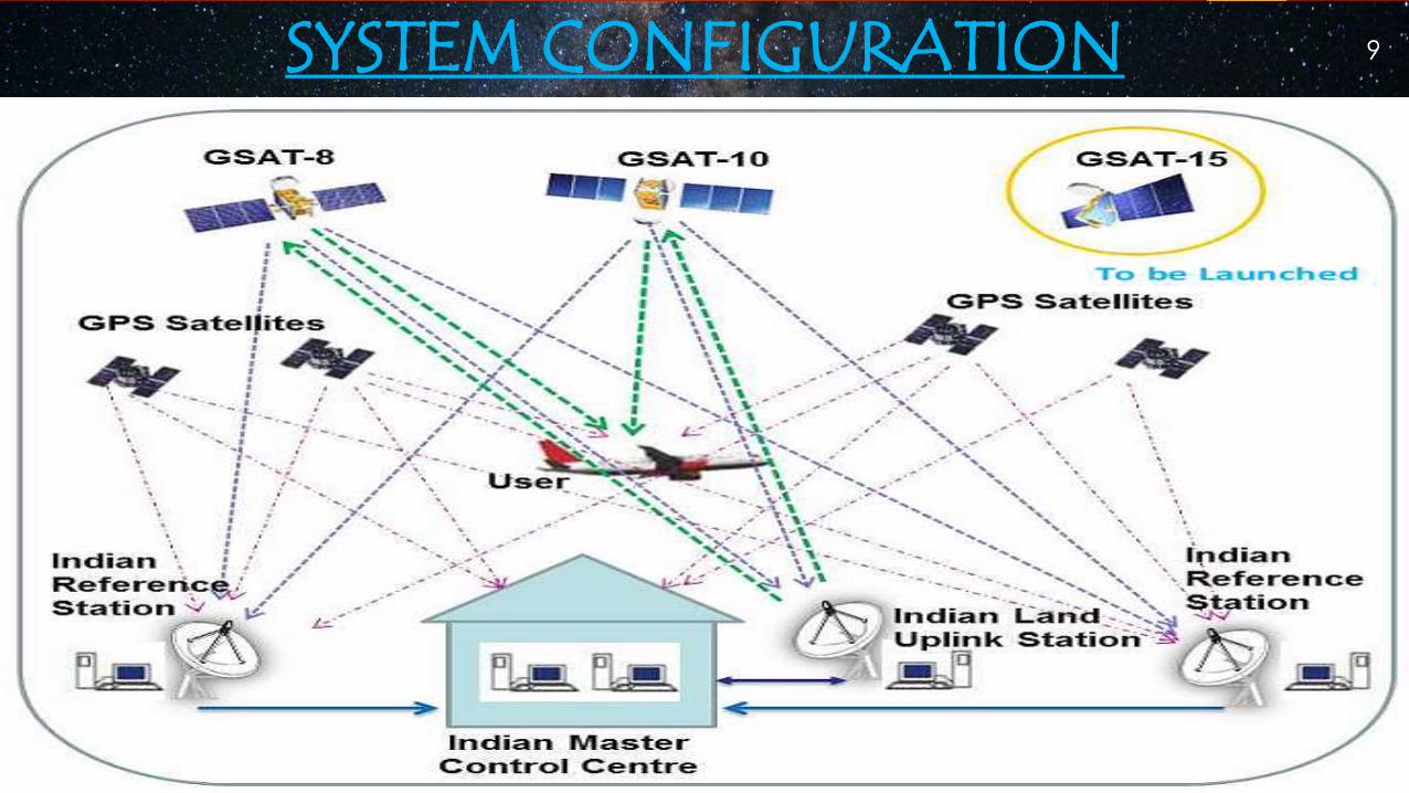
SYSTEM CONFIGURATION 9

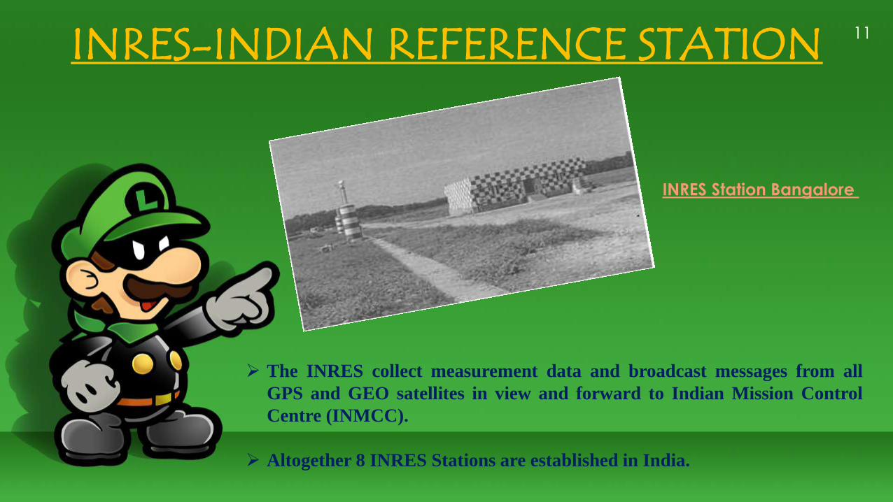
INRES-INDIAN REFERENCE STATION
The INRES collect measurement data and broadcast messages from all
GPS and GEO satellites in view and forward to Indian Mission Control
Centre (INMCC).
Altogether 8 INRES Stations are established in India.
INRES Station Bangalore
11
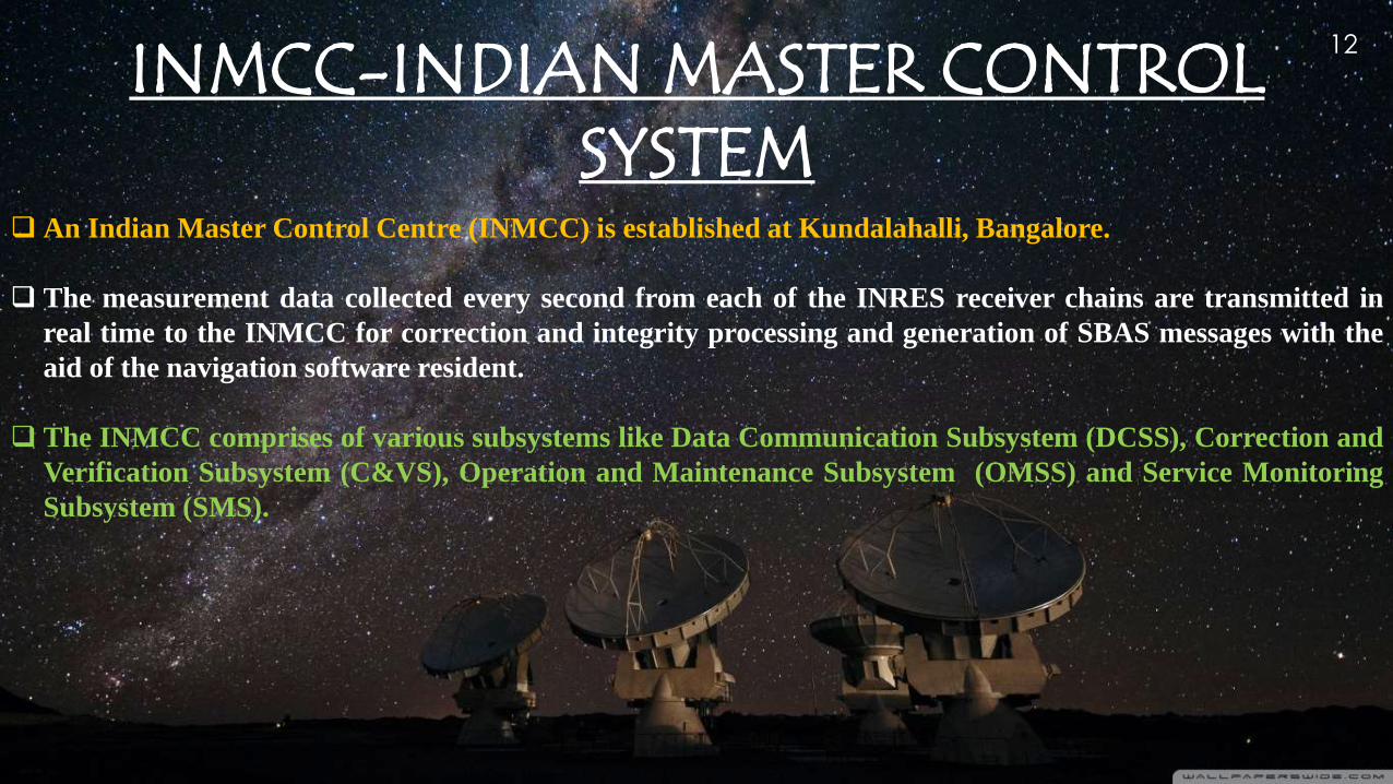
INMCC-INDIAN MASTER CONTROL SYSTEM
An Indian Master Control Centre (INMCC) is established at Kundalahalli, Bangalore.
The measurement data collected every second from each of the INRES receiver chains are transmitted in
real time to the INMCC for correction and integrity processing and generation of SBAS messages with the
aid of the navigation software resident.
The INMCC comprises of various subsystems like Data Communication Subsystem (DCSS), Correction and
Verification Subsystem (C&VS), Operation and Maintenance Subsystem (OMSS) and Service Monitoring
Subsystem (SMS).
12

INLUS-INDIAN NAVIGATION LAND EARTH UPLINK STATION
The INLUS receives correction messages from the INMCC, format those messages for GPS compatibility
and transmit them to the GEO satellites for broadcast to user platforms.
The INLUS is collocated with INMCC at Bangalore. The INLUS also provides GEO satellite ranging
information and corrections to the GEO satellite clocks.
Message formats and timing will be according to the functional and performance specifications, which are
derived from MOPS (Minimum Operation Performance Standard).
13

Bangalore INRES Facility
INMCC CTF Building
VSAT Antenna (6.3m Dia)
INLUS 11m Antenna

Ephemeris errors result when the GPS message does not transmit the correct satellite location.
Ionospheric Errors because of free electrons in the ionosphere, GPS signals do not travel at the vacuum
speed of light as they transit this region
Tropospheric Errors as variations in temperature, pressure, and humidity all contribute to variations in the
speed of light and radio waves.
Multipath is the error caused by reflected signals entering the front end of the receiver and masking the real
correlation peak.
15

ADVANTAGES OF THE TECHNOLOGY
GAGAN enhances reliability and reduces delays to aircraft
GAGAN reduced workload of flight crew and Air Traffic Controllers.
It enhanced meteorological information
It also reduced congestion
It enhanced safety, reduced delays and increased airport & airspace capacity
16


REFERENCES
1. ICAO International Standards and Recommended Practices, Annex 10 to the Convention pm
International Civil Aviation, Volume I Radio Navigation Aids, Section 3.7.1: Definitions
2. Mishra Pratap & Enge Per, Global Positioning System, Signals, Measurements and Performance (Ganga-
Jamuna Press, Lincoln, Mass, USA), 2001, pp.-123-173
3. Parkinson Bradford W & Spilker James J, Global Positioning System: Theory and Applications, Volume I, by
(Jr. American Institute of Aeronautics and Astronautics Inc, USA), 1996, pp. 10-17, 478-483, 485-513.
4. Klobuchar J A, P H Doherty, M B El-Arini, Lejeune R, Dehel T, de Paula E R & Rodrigues F S, Ionospheric
Issues for a SBAS in the Equatorial Region, Ionospheric Effects Symposium, Alexandria, Virginia, 7-9 May
2002.
18