g rick - sandiego.gov · the program shall meet all applicable requirements of the state water ......
TRANSCRIPT
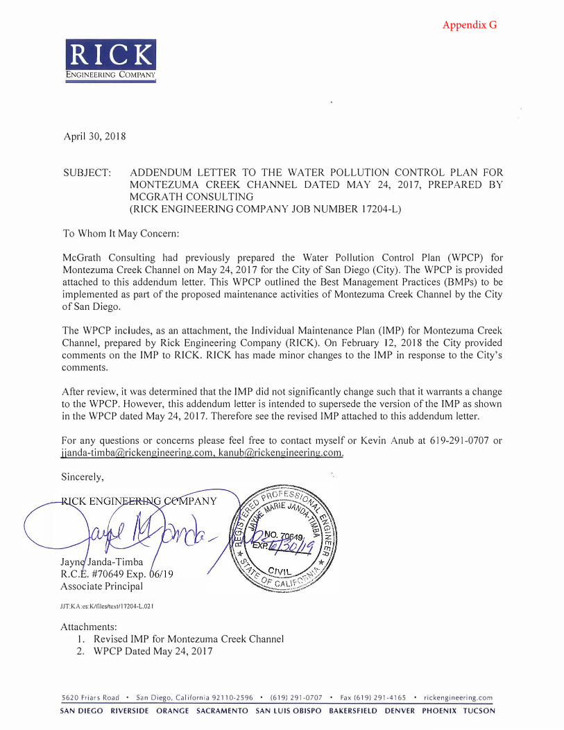
RICK ENGINEERING COMPANY
April 30, 2018
SUBJECT: ADDENDUM LETTER TO THE WATER POLLUTION CONTROL PLAN FOR MONTEZUMA CREEK CHANNEL DATED MAY 24, 2017, PREPARED BY MCGRATH CONSUL TING (RICK ENGINEERING COMPANY JOB NUMBER 17204-L)
To Whom It May Concern:
McGrath Consulting had previously prepared the Water Pollution Control Plan (WPCP) for Montezuma Creek Channel on May 24, 2017 for the City of San Diego (City). The WPCP is provided attached to this addendum letter. This WPCP outlined the Best Management Practices (BMPs) to be implemented as part of the proposed maintenance activities of Montezuma Creek Channel by the City of San Diego.
The WPCP includes, as an attachment, the Jndividual Maintenance Plan (IMP) for Montezuma Creek Channel, prepared by Rick Engineering Company (IUCK). On February 12, 2018 the City provided comments on the IMP to RICK. RICK has made minor changes to the IMP in response to the City's comments.
After review, it was determined that the IMP did not significantly change such that it warrants a change to the WPCP. However, this addendum letter is intended to supersede the version of the IMP as shown in the WPCP dated May 24, 2017. Therefore see the revised IMP attached to this addendum letter.
For any questions or concerns please feel free to contact myself or Kevin Anub at 619-291-0707 or [email protected], [email protected].
Sincerely,
Jayn Janda-Timba R.C. . #70649 Exp.Associate Principal
JJT:KA:es:K/files/text/17204-L.02 I
Attachments: 1. Revised IMP for Montezuma Creek Channel2. WPCP Dated May 24, 2017
5620FriarsRoad • SanDiego,California92110-2596 • (619)291-0707 • Fax(619)291-4165 • rickengineering.com
SAN DIEGO RIVERSIDE ORANGE SACRAMENTO SAN LUIS OBISPO BAKERSFIELD DENVER PHOENIX TUCSON
Appendix G

Attachment 1
Revised IMP for Montezuma Creek Channel

1. THIS PROJECT IS SUBJECT TO MUNICIPAL STORM WATER PERMIT ORDER
NO.___________________; AND RISK LEVEL/TYPE: CHECK ONE BELOW
WPCP
CGP RISK LEVEL 1 CGP LUP TYPE 1
CGP RISK LEVEL 2 CGP LUP TYPE 2
CGP RISK LEVEL 3 CGP LUP TYPE 3
2. WDID NO: _____________
3. CHECK ONE
THIS PROJECT WILL EXCEED THE MAXIMUM DISTURBED AREA LIMIT,
THEREFORE A WEATHER TRIGGERED ACTION PLAN (WTAP) IS REQUIRED.
THIS PROJECT WILL FOLLOW PHASED GRADING NOT TO EXCEED FIVE (5)
ACRES PER PHASE.
NOT APPLICABLE
4. THE CONTRACTOR SHALL COMPLY WITH THE REQUIREMENTS OF THE WPCP
OR SWPPP AS APPLICABLE.
5. WATERSHED: _____________
R920070001
7. HYDROLOGIC SUB AREA NUMBER: _____________
NOT APPLICABLE
6. HYDROLOGIC SUB AREA NAME: _______________
TITLE SHEET FOR:
LOW
(VEHICLES)
INSPECTOR
CONTRACTOR
FOR CITY ENGINEER
BY
AS-BUILTS
P.T.S NO.
NAD83 COORDINATES
- -D
c2018
Rick Engineering Co
mpany
21-MAR-2018 16:24
W:\17204-L_TO#39_IHHA_FY17\4_Montezuma Map 66\Civil\Sheets\SD CorpStds 2005.dscript
W:\17204-L_TO#39_IHHA_FY17\4_Montezuma Map 66\Civil\Sheets\17204L_Montezuma01.dgn
CONSTRUCTION CHANGE TABLE STREET DATA TABLE
EFFECTED OR ADDED SHEET NUMBERS APPROVAL NO.DATECHANGE
NOT TO SCALE.
THEN DRAWING IS
NOT MEASURE 1"
IF THIS BAR DOES
WARNING
CLASSIFICATIONSTREET NAMESPEED
(MPH)
ADT R/W
(FT)
0 1/2 1
DATE STARTED
DATE COMPLETED
APPROVEDDESCRIPTION FILMED
DATE
DATE
ORIGINAL REC
CITY OF SAN DIEGO, CALIFORNIA I.O. NO.
V.T.M.
LAMBERT COORDINATES
CONSTRUCTION SITE STORM WATER PRIORITY:______
TRANSPORTATION AND STORMWATER DEPARTMENT
SHEET OF SHEETS
DEVELOPMENT SERVICES DEPARTMENT
MAP #66MONTEZUMA CREEK CHANNEL
SEE CASQA MANUALSCHEDULING
SEE CASQA MANUALPRESERVE EXISTING VEGETATION
SEE CASQA MANUALGRAVEL OR SAND BAG BARRIERS
SEE CASQA MANUALFIBER ROLLS OR STRAW WATTLES
SEE CASQA MANUALDIVERT RUN-ON FROM SURROUNDING AREAS
SEE CASQA MANUALCHECK DAMS
SEE CASQA MANUALSPILL PREVENTION AND CONTROL
SEE CASQA MANUALSOLID WASTE MANAGEMENT
SEE CASQA MANUALLIQUID WASTE MANAGEMENT
SEE CASQA MANUALSANITARY WASTE MANAGEMENT
SEE CASQA MANUALSTOCKPILED WASTE MANAGEMENT
SEE CASQA MANUALMATERIAL STORAGE
SEE CASQA MANUALMATERIAL HANDLING
SEE CASQA MANUALVEHICLE AND EQUIPMENT FUELING
SEE CASQA MANUALILLICIT CONNECTION / DISCHARGE CONTROL
SEE CASQA MANUALWATER CONSERVATION PRACTICE
SEE CASQA MANUALDEWATTERING OPERATIONS
SEE CASQA MANUALWIND EROSION CONTROL
(NOT ALL WILL BE GRAPHICALLY ILLUSTRATED WITHIN SITE MAPS)
EC-1
EC-2
SE-6 SE-8
SE-5
EC-9 SE-5 SE-6
SE-4
WM-4
WM-5
WM-10
WM-9
WM-3
WM-1
WM-2
NS-9
NS-6
NS-1
NS-2
WE-1
SE-13
8
REFERENCE DRAWINGS
1
STA N
IA
REGIS
TER
ED P
ROFESSIONAL ENGIN
EER
N
OT
GNI
GDE .P
NO
SR
AC
No.76519
TE OF CALIFOR
R.C.E. NO. 76519
PRESERVE ALL HISTORICAL OR CONTROLLING MONUMENTS. IF DESTROYED, SUCH MONUMENTS SHALL BE REPLACED WITH
APPROPRIATE MONUMENTS BY A LAND SURVEYOR. A CORNER RECORD OR RECORD OF SURVEY, AS APPROPRIATE
SHALL BE FILED AS REQUIRED BY THE PROFESSIONAL LAND SURVEYORS ACT. IF ANY VERTICAL CONTROL IS TO BE
DISTURBED OR DESTROYED, THE CITY OF SAN DIEGO FIELD SURVEY SECTION MUST BE NOTIFIED, IN WRITING, AT LEAST
VERTICAL CONTROL BENCHMARKS DESTROYED BY THE CONSTRUCTION.
3 DAYS PRIOR TO THE CONSTRUCTION. THE CONTRACTOR WILL BE RESPONSIBLE FOR THE COST OF REPLACING ANY
1. APPROVAL OF THESE PLANS BY THE CITY ENGINEER DOES NOT AUTHORIZE ANY WORK TO BE PERFORMED UNTIL A
ARE DISTURBED OR DESTROYED BY CONSTRUCTION. A LAND SURVEYOR MUST FIELD LOCATE, REFERENCE, AND/OR
ISSUED BEFORE A ''PERMIT TO EXCAVATE" WILL BE VALID. FOR YOUR DIG ALERT I.D. NUMBER, CALL UNDERGROUND
SERVICE ALERT, TOLL FREE 1-800-422-4133, TWO DAYS BEFORE YOU DIG.
AND/OR CONSTRUCTION ACTIVITIES. THE PROGRAM SHALL MEET ALL APPLICABLE REQUIREMENTS OF THE STATE WATER
RESOURCE CONTROL BOARD AND THE CITY OF SAN DIEGO MUNICIPAL CODE AND STORM WATER STANDARDS MANUAL.
IMPROVEMENTS IS REQUIRED, THE OWNER SHALL OBTAIN THE REQUIRED PERMITS FOR WORK IN THE PUBLIC
RIGHT-OF-WAY, SATISFACTORY TO THE PERMIT- ISSUING AUTHORITY.
MAKE ARRANGEMENTS FOR A PRE-CONSTRUCTION MEETING WITH THE CITY OF SAN DIEGO FIELD ENGINEERING DIVISION
(858) 627-3200.
THE CITY ENGINEER OR THE CHANGE IS REQUIRED BY THE CITY INSPECTOR.
THE CITY OF SAN DIEGO.
PRIOR TO START OF THE WORK. THE PERMIT APPLICANT AND ALL OF THEIR REPRESENTATIVES OR CONTRACTORS SHALL
COMPLY WITH THE REQUIREMENTS FOR PROTECTION OF THIS AREA AS REQUIRED BY ANY APPLICABLE AGENCY. ISSUANCE
OF THE CITY'S GRADING PERMIT SHALL NOT RELIEVE THE APPLICANT OR ANY OF THEIR REPRESENTATIVES OR
CONTRACTORS FROM COMPLYING WITH ANY STATE OR FEDERAL REQUIREMENTS BY AGENCIES INCLUDING BUT NOT
LIMITED TO CALIFORNIA REGIONAL WATER QUALITY CONTROL BOARD, CALIFORNIA DEPARTMENT OF FISH AND GAME.
COMPLIANCE MAY INCLUDE OBTAINING PERMITS, OTHER AUTHORIZATIONS, OR COMPLIANCE WITH MANDATES BY ANY
APPLICABLE STATE OR FEDERAL AGENCY.
GENERAL NOTES
PERMIT HAS BEEN ISSUED.
2. THE CONTRACTOR SHALL BE RESPONSIBLE FOR SURVEY MONUMENTS AND/OR VERTICAL CONTROL BENCHMARKS WHICH
3. IMPORTANT NOTICE: SECTION 4216 OF THE GOVERNMENT CODE REQUIRES A DIG ALERT IDENTIFICATION NUMBER BE
4. CONTRACTOR SHALL IMPLEMENT AN EROSION AND SEDIMENT CONTROL PROGRAM DURING THE PROJECT GRADING
5. ''PUBLIC IMPROVEMENT SUBJECT TO DESUETUDE OR DAMAGE." IF REPAIR OR REPLACEMENT OF SUCH PUBLIC
6. PRIOR TO ANY DISTURBANCE TO THE SITE, EXCLUDING UTILITY MARK-OUTS AND SURVEYING, THE CONTRACTOR SHALL
7. DEVIATIONS FROM THESE SIGNED PLANS WILL NOT BE ALLOWED UNLESS A CONSTRUCTION CHANGE IS APPROVED BY
8. AS-BUILT DRAWINGS MUST BE SUBMITTED TO THE RESIDENT ENGINEER PRIOR TO ACCEPTANCE OF THIS PROJECT BY
9. THE AREA WHICH IS DEFINED AS A NON GRADING AREA AND WHICH IS NOT TO BE DISTURBED SHALL BE STAKED
CASQA MANUAL
HANDBOOK PORTAL: CONSTRUCTION, JANUARY 2015
STORMWATER BEST MANAGEMENT PRACTICE
CALIFORNIA STORMWATER QUALITY ASSOCIATION,
ITEM SYMBOL
907.11
MONTEZUMA CREEK CHANNEL MMP MAP#66
(619) 443-3811
EL CAJON, CA. 92021
PO BOX 2488
McGRATH CONSULTING
CHANNEL MAINTENANCE PROJECT PREPARED BY:
WATER POLLUTION CONTROL PLAN FOR MONTEZUMA CREEK
CITY OF SAN DIEGO DRAWING NO. 13391-L
AND UNNAMED EASEMENTS IN AND ADJOINING PICARD ESTATES UNIT NO. 1
PLANS FOR THE IMPROVEMENT OF DEFIANCE WAY, PROSPERITY LANE
CITY OF SAN DIEGO DRAWING NO. 7199A-D
COLLEGE GLEN UNIT NO. 2 DRAINAGE CHANNEL
CITY OF SAN DIEGO DRAWING NO. 16057-D
PLANS FOR THE IMPROVEMENT OF COLLEGE VALLEY
ELEV. 459.89 M.S.L.
EASTERLY RETURN
BRASS PLUG AT N.E. CORNER 55TH & MONTEZUMA ROAD IN CURB AT
ELEV. 417.95
MAP NO. 2906
CHISELED SQUARE ON WATER M.H. S.W. CORNER LOTS 36&37 COLLEGE HTS
ELEV. 419.52 M.S.L.
BRASS PLUG N.E. RETURN 54TH AND ADAMS. FB. 1720-55
EL CAJON BLVD.
FAIR
MO
UN
T
AV
E.
EX
PY.
MONTEZUMA RD.
BL
VD.
CO
LL
WO
OD
54
TH S
T.
CO
LLE
GE
AV
E.
15
SEE SHEET 2MAP #66
LOWER SAN DIEGO
MISSION SAN DIEGO
4
SYMBOL
TOPOGRAPHY SOURCESHEET INDEX
LEGEND
EXIST. CURB INLET
DECLARATION OF RESPONSIBLE CHARGE
DATE
DESCRIPTION
DESCRIPTION
DOCUMENT NO.
DOCUMENT NO.
W
S
WORK TO BE DONE
CONSTRUCTION (GREENBOOK), 2012 EDITION
STANDARD SPECIFICATIONS FOR PUBLIC WORKS
CUSTOMARY STANDARD PLANS, 2010 EDITION
CALIFORNIA DEPARTMENT OF TRANSPORTION U.S.
WORKS CONSTRUCTION, 2012 EDITION
CITY OF SAN DIEGO STANDARD DRAWINGS FOR PUBLIC
PITS070112-01
PITS070112-02
PITS070112-04
PITS070112-06
PITS070112-03
PITS070112-05
STANDARD SPECIFICATIONS:
STANDARD DRAWINGS
PUBLIC WORKS CONSTRUCTION (WHITEBOOK), 2012 EDITION
CITY OF SAN DIEGO STANDARD SPECIFICATIONS FOR
OF UNIFORM TRAFFIC CONTROL DEVICES, 2012 EDITION
CALIFORNIA DEPARTMENT OF TRANSPORTATION MANUAL
CUSTOMARY STANDARD SPECIFICATIONS, 2010 EDITION
CALIFORNIA DEPARTMENT OF TRANSPORTATION U.S.
EXIST. CONTOURS
1
OF MY RESPONSIBILITIES FOR PROJECT DESIGN.
REVIEW ONLY AND DOES NOT RELIEVE ME, AS ENGINEER OF WORK,
SPECIFICATIONS BY THE CITY OF SAN DIEGO IS CONFINED TO A
I UNDERSTAND THAT THE CHECK OF PROJECT DRAWINGS AND
IS CONSISTENT WITH CURRENT STANDARDS.
THE BUSINESS AND PROFESSIONS CODE, AND THAT THE DESIGN
THE DESIGN OF THE PROJECT AS DEFINED IN SECTION 6703 OF
PROJECT, THAT I HAVE EXERCISED RESPONSIBLE CHARGE OVER
I HEREBY DECLARE THAT I AM THE ENGINEER OF WORK FOR THIS
GROUND WATER DISCHARGE
R9-2007-0034 NPDES NO. CAG919001.
WATER QUALITY CONTROL BOARD IN ACCORDANCE WITH THE TERMS, PROVISIONS AND CONDITIONS OF STATE ORDER NO
AUTHORIZATION FROM THE STATE OF CALIFORNIA VIA OFFICIAL "ENROLLMENT LETTER" FROM THE REGIONAL
DIEGO BAY ARE PROHIBITED UNTIL IT CAN BE DEMONSTRATED THAT THE OWNER HAS APPLIED AND OBTAINED
3. ALL GROUND WATER EXTRACTIONS AND SIMILAR WASTE DISCHARGES TO SURFACE WATERS NOT TRIBUTARY TO THE SAN
OBTAINED, AND DISCHARGE OPERATIONS MODIFIED TO ACCOMMODATE THE INCREASED RATES.
LETTER" FROM THE REGIONAL BOARD UNLESS PRIOR NOTIFICATION AND SUBSEQUENT AUTHORIZATION HAS BEEN
2. THE ESTIMATED MAXIMUM DISCHARGE RATES MUST NOT EXCEED THE LIMITS SET IN THE OFFICIAL "ENROLLMENT
R9-2009-0002 NPDES CAG919002.
WATER QUALITY CONTROL BOARD IN ACCORDANCE WITH THE TERMS, PROVISIONS AND CONDITIONS OF SATE ORDER NO
AUTHORIZATION FROM THE STATE OF CALIFORNIA VIA AN OFFICIAL "ENROLLMENT LETTER" FROM THE REGIONAL
DIEGO BAY ARE PROHIBITED UNTIL IT CAN BE DEMONSTRATED THAT THE OWNER HAS APPLIED AND OBTAINED
1. ALL GROUND WATER EXTRACTION AND SIMILAR WASTE DISCHARGES TO SURFACE WATER NOT TRIBUTARY TO THE SAN
EXISTING IMPROVEMENTS
MAINTENANCE PLANS FOR:
ITEM
EXIST. WATER MAIN
EXIST. SEWER MAIN
EXIST. STORM DRAIN MAIN SD
EXIST. LOT LINE
KEY MAP
BENCHMARK
SEDIMENT AND OTHER DEBRIS
MAINTENANCE OF CONCRETE & EARTHENED CHANNELS TO REMOVE ACCUMULATED
PLANS AND THE SPECIFICATIONS AND STANDARD DRAWINGS OF THE CITY OF SAN DIEGO.
THE IMPROVEMENTS CONSIST OF THE FOLLOWING WORK TO BE DONE ACCORDING TO THESE
CARSON P. EDGINGTON
CHANNEL MAINTENANCE AREA
ACCESS & LOADING AREA
SE-7
SE-8
STORM WATER MANAGEMENT BMPs
STREET SWEEPING AND VACUUMING DAILY SEE CASQA MANUAL
SANDBAG BARRIER SEE CASQA MANUAL
NO SCALE
STORM DRAIN INLET PROTECTION SEE CASQA MANUAL
STAGING AREA
STORM WATER PROTECTION NOTES
SHEET 4
SHEET 3
SHEET 2
SHEET 1CITY OF SAN DIEGO SANGIS 2014 2 FOOT CONTOURS, NAVD88
ENVIRONMENTAL MITIGATION MEASURES
PROTOCOL REQUIREMENTS AND PEIR
MASTER MAINTENANCE PROGRAM (MMP)
MAINTENANCE METHODOLOGIES AND BMP NOTES
MAINTENANCE PLAN
TITLE SHEET
STEEL PLATE PLACEMENT
SE-10

LOT LINE (TYP.)
APPROXIMATE
AREA
ACCESS & LOADING
AREA
STAGING
SE-8
BY-PASS PUMP
HOSE LINE
TEMPORARY DIVERSION
EXIST. STORM DRAIN (TYP.)
EXIST. WATER LINE (TYP.)
EXIST. WATER LINE (TYP.)
AREA
ACCESS & LOADING
54T
H S
TR
EET
54TH STREET
CO
LL
WO
OD B
LVD
10
11 12 13
14
15
16
2
NOT TO SCALE
SECTION A-A
GROUND
EXISTING
3.5'
10.0' 20' EASEMENT
SUBDIVISION BOUNDARY & CL
1.5:1
1.5:1
6.0'
4" P.C.C. OR GRANITE LINED CHANNEL
WITH 6", 6", #10, #10 WELDED WIRE MESH
16.5' 11.75'1.75'
A
A
CHANNEL CENTERLINE
MONTEZUMA CREEK
VEGETATION ESTABLISHED
DEPOSITION OR
PROPOSED - NO SEDIMENT
NO MAINTENANCE
B
B
NOT TO SCALE
SECTION B-B
GROUND
EXISTING1.5:1
1' 2' 2' 2' 2' 2' 1'
TOP OF POSTS 2.5'
ABOVE EXIST CHANNEL
FLOW LINE
3" STEEL POSTS
GROUND
EXISTING
NOT TO SCALE
SECTION C-C
GROUND
EXISTING1.5:1
PALM TREES
ATTACHED. REMOVE ALL DEAD/FALLEN
LEFT IN GROUND WITH ROOTBALLS
A HEIGHT OF 2'. STUMPS SHOULD BE
CUT ALL EXISTING PALM TREES TO LEAVE ALL OTHER
EXISTING VEGETATION
NO GRADING/SEDIMENT
REMOVAL. KEEP
EXISTING FLOWLINE
AND WIDTH
VARIES VARIES 6'
SLOPE VARIES
EXISTING GROUND
C
C
D
D
TOP RAIL
2' MIN.
3'
3"
CONCRETE
5660-C-3250
SECTIONNOT TO SCALE
BOTTOM RAIL
TO CHAIN LINK FENCE
ATTACH SILT FENCE FABRIC
FABRIC 6"
EMBED
3"
MATCH EXISTING FLOW LINE
CONCRETE TO BE REPAIRED TO
TO BE REMOVED. CRACKED
CONCRETE CHANNEL BOTTOM
PALM TREE GROWING OUT OF
5660-C-3250 CONCRETE
FOOTING PER DETAIL BELOW
PER MAP #66
MONTEZUMA CHANNEL
MAINTENANCE FOR
BEGINNING OF
STA. 13+19.4
MAP #66
MONTEZUMA CHANNEL PER
END OF MAINTENANCE FOR
STA. 16+56.9
1. CHAIN LINK FENCE SHALL BE 2" MESH, 9 GAGE GALVANIZED STEEL WIRE,
PLACED ON THE UPSTREAM SIDE OF THE POSTS AND RAILS.
2. SECURE FENCE TO RAILS WITH 12 GAGE GALVANIZED STEEL WIRE
LOOPED AT 6" OC.
4. CHAIN LINK FENCE SHALL BE SECURED TO POSTS WITH 9 GAGE WIRE CLIPS AT 9" OC.
NS-9 (150 FT AWAY)
WE-1
WM-4, WM-5
WM-2, WM-3
SE-5, WM-1
NS-2
SAN DIEGO
SAGEWORT
WM8, WM-9, WM-10
EC-2
WE-1
WM-5, WM-8
WM-10 SE-7
SE-7
AVOIDED WITHIN THE STAGING AREA. THE SAN DIEGO SAGEWEST SHOULD BE
DISCUSSED DURING THE PRE-MAINTENANCE MEETING AND FENCED OFF PRIOR
TO MAINTENANCE.
1. SAN DIEGO SAGEWORT IS A PROTECTED VEGETATION SPECIES, AND SHOULD BE
DIRECTION
FLOW
1. BOLLARD SHALL BE 6" STEEL, 5.79 LB/FT FILLED WITH MORTAR PRIOR TO INSTALLATION
2. BOLLARD TO HAVE INTERNALLY BOLTED LOCKING ARMS TO ASSIST IN REMOVAL AND
TRANSPORTATION OF BOLLARD
3. BOLLARD TO BE RELIANCE FOUNDRY MODEL R-7906 OR APPROVED EQUAL
2'
3'
8"
1"
(5.79 LB/FT)
STEEL PIPE
6" DIA. HOLLOW
SLEEVE
STEEL PIPE
6 1/4" DIA.
CONCRETE
5660-C-3250
2.7
5'
2.75'
GENERAL NOTE
BOLLARD NOTES
1.5'
TOP RAIL
BOTTOM RAIL
NOT TO SCALE
SECTION
CONCRETE
EXIST.
SECTION D-D
FOOTING
FABRIC AROUND
CUT SILT FENCE
4.125' 4' 4.125'1.5'4'4'
BOLLARD
REMOVABLE
FENCE POST
FENCE POST
FENCE POSTPOST
FENCE
0
GRAPHIC SCALE 1" = 50'
50 25 50 100 150
CHECK DAM AND FENCE POST NOTES
SECTIONNOT TO SCALE
(FOR BOTH CHECK DAM AND FENCE POST).
3. POSTS SHALL BE 3" STEEL PIPE, 5.79LB/FT FILLED WITH MORTAR PRIOR TO INSTALLATION
FIELD.TO BE DETERMINED INLOCATION OF PLATESSAN DIEGO DESIGN.AREA, PER CITY OF ACCESS AND LOADINGWITHIN LIMITS OF4'-BY-8' STEEL PLATESPLACE SETS OF TWO
FOR CITY ENGINEER
- -D
CARSON P. EDGINGTON R.C.E. 76519 DATE
STA N
IA
REGIS
TER
ED P
ROFESSIONAL ENGIN
EER
N
OT
GNI
GDE .P
NO
SR
AC
No.76519
TE OF CALIFOR
CITY OF SAN DIEGO, CALIFORNIA
DESCRIPTION
ORIGINAL
BY
REC
APPROVED
DATE
DATE FILMED
AS-BUILTS
CONTRACTOR
INSPECTOR
DATE STARTED
DATE COMPLETED
LAMBERT COORDINATES
NAD83 COORDINATES
V.T.M.
P.T.S NO.
23-MAR-2018 09:57
W:\17204-L_TO#39_IHHA_FY17\4_Montezuma Map 66\Civil\Sheets\SD CorpStds 2005.dscript
W:\17204-L_TO#39_IHHA_FY17\4_Montezuma Map 66\Civil\Sheets\17204L_Montezuma02.dgn
c2018
Rick Engineering Co
mpany
ENGINEER OF WORK
I.O. NO.
TRANSPORTATION AND STORMWATER DEPARTMENT
SHEET OF SHEETS
J-17204-L
MAP #66MONTEZUMA CREEK CHANNEL
MAINTENANCE PLANS FOR:
2 4
SE-5, WM-1

FOR CITY ENGINEER
- -D
CARSON P. EDGINGTON R.C.E. 76519 DATE
STA N
IA
REGIS
TER
ED P
ROFESSIONAL ENGIN
EER
N
OT
GNI
GDE .P
NO
SR
AC
No.76519
TE OF CALIFOR
CITY OF SAN DIEGO, CALIFORNIA
DESCRIPTION
ORIGINAL
BY
REC
APPROVED
DATE
DATE FILMED
AS-BUILTS
CONTRACTOR
INSPECTOR
DATE STARTED
DATE COMPLETED
LAMBERT COORDINATES
NAD83 COORDINATES
V.T.M.
P.T.S NO.
21-MAR-2018 13:41
W:\17204-L_TO#39_IHHA_FY17\4_Montezuma Map 66\Civil\Sheets\SD CorpStds 2005.dscript
W:\17204-L_TO#39_IHHA_FY17\4_Montezuma Map 66\Civil\Sheets\17204L_Montezuma03.dgn
c2018
Rick Engineering Co
mpany
ENGINEER OF WORK
I.O. NO.
TRANSPORTATION AND STORMWATER DEPARTMENT
SHEET OF SHEETS
J-17204-L
MAP #66MONTEZUMA CREEK CHANNEL
MAINTENANCE METHODOLOGIES:
3
3
MAINTENANCE BMPs
NECESSARY PROJECT SPECIALIST (BIOLOGIST, HISTORICAL MONITOR, ETC.)
18. FINAL LOCATION OF CHANNEL CENTERLINE WILL BE DETERMINED IN THE FIELD AND COORDINATED WITH THE
25 MONTHS AFTER PLANTING.
MAINTENANCE ACTIVITIES. THE REVEGETATED AREAS WILL BE MONITORED FOR A PERIODS OF NOT LESS THAN
17. PREVIOUSLY UNDISTURBED STAGING AREAS WILL BE REVEGETATED WITHIN 30 DAYS OF COMPLETION OF
PERSON. COMPLETED INSPECTION CHECKLIST WILL BE KEPT WITH THE WPCP.
PERFORM ANY NECESSARY BMP MAINTENANCE/REPAIRS, AND REPORT THE RESULTS TO THE QUALIFIED CONTACT
THE MONITOR WILL CHECK THE NATIONAL WEATHER SERVICE FORECAST, COMPLETE BMP INSPECTION CHECKLIST,
16. THE QUALIFIED CONTACT PERSON WILL ASSIGN A MONITOR FOR DAILY INSPECTION OF THE BMPs EACH MORNING.
INSPECTION, AND MAINTENANCE OF ONSITE BMPs.
15. CONTRACTOR SHALL PROVIDE TRAINING FOR ALL PERSONNEL RESPONSIBLE FOR THE PROPER INSTALLATION,
BE IMPLEMENTED TO REMEDIATE EROSION AREAS AND TO MINIMIZE FUTURE EROSION.
SUBSTANTIAL EROSION HAS OCCURRED, EROSION CONTROL MEASURES RECOMMENDED BY THE FIELD ENGINEER WILL
14. CHANNELS WILL BE INSPECTED WITHIN 72 HOURS OF THE FIRST 2-YEAR STORM FOLLOWING MAINTENANCE. IF
SHALL BE CONDUCTED AS DETERMINED NECESSARY BY THE CITY OF SAN DIEGO.
13. SAMPLING AND ANALYSIS, MONITORING AND REPORTING, AND POST-MAINTENANCE MANAGEMENT OF THE PROJECT
ENTERING THE CHANNELS. NO CONSTRUCTION ACTIVITIES SHALL OCCUR DURING RAIN EVENTS.
SITE SHALL BE SECURED TO PREVENT ANY CONSTRUCTION RELATED MATERIALS FROM LEAVING THE SITE AND
12. THE CONTRACTOR SHALL MONITOR THE 5 DAY WEATHER FORECAST. IF ANY PRECIPITATION IS FORECASTED, THE
OF SUCH EQUIPMENT.
VEHICLES, ETC.) ON-SITE DURING ALL PHASES OF PROJECT ACTIVITIES, ALONG WITH TRAINED PERSONNEL FOR USE
11. THE CONTRACTOR SHALL PROVIDE EQUIPMENT NECESSARY TO EXTINGUISH SMALL BRUSH FIRES (FROM SPARKING
SHALL BE AVAILABLE ONSITE AT ALL TIMES.
10. SPILLS SHALL BE MANAGED FOLLOWING THE GUIDANCE OF BMP FACT SHEET WM-4. SPILL CLEANUP MATERIALS
TO CWC 13260.
IN ACCORDANCE WITH WASTE DISCHARGE REQUIREMENTS ESTABLISHED BY THE SAN DIEGO WATER BOARD PURSUANT
9. THE TREATMENT, STORAGE, AND DISPOSAL OF WASTEWATER DURING THE LIFE OF THE PROJECT MUST BE DONE
MATERIALS CLEAN-UP/REMEDIATION SERVICE SHALL BE LOCALLY AVAILABLE ON CALL.
LOCAL, STATE AND FEDERAL REGULATIONS. A REGISTERED FIRST-RESPONSE, PROFESSIONAL HAZARDOUS
WATER FACILITIES. HAZARDOUS MATERIALS SHALL BE MANAGED AND STORED IN ACCORDANCE WITH APPLICABLE
8. HAZARDOUS MATERIALS USED DURING MAINTENANCE WILL NOT BE STORED WITHIN 50 FEET FROM STORM
LEAVING THEM IN PLACE.
MAINTENANCE UNLESS THEIR REMOVAL WOULD RESULT IN GREATER ENVIRONMENTAL IMPACT THAN
7. TEMPORARY EROSION OR SEDIMENT CONTROL MEASURES WILL BE REMOVED UPON COMPLETION OF
-PRODUCING RAINFALL.
6. CONTRACTOR SHALL RESTORE ALL EROSION CONTROL DEVICES TO WORKING ORDER AFTER EACH RUNOFF
SERVICE FORECAST.
GREATER CHANCE OF LIKELY PRECIPITATION OF 0.1 INCH OR GREATER BY THE NATIONAL WEATHER
5. WEATHER TRIGGERED ACTION PLAN SHALL BE IMPLEMENTED WHEN THERE IS A FORECASTED 50% OR
FOLLOWING THE GUIDANCE OF BMP FACT SHEET SE-7.
PAVED SURFACES DUE TO EXCAVATION ACTIVITIES. STREET SWEEPING AND VACUUMING WILL BE MANAGED
4. CONTRACTOR SHALL BE RESPONSIBLE FOR CLEANUP OF SILT AND MUCH ON STREETS AND OTHER
AREA FOLLOWING THE GUIDANCE OF BMP FACT SHEET EC-2.
3. EXISTING VEGETATION TO BE PRESERVED IN PLACE SHALL BE CLEARLY MARKED WITH A BUFFER
2. CONTRACTOR WILL LIMIT ALL CONSTRUCTION RELATED ACTIVITIES TO THE PROJECT FOOTPRINT.
GRANTED IN CONFORMANCE WITH ALL APPLICABLE PERMITS.
SHALL BE COMPLETED BETWEEN SEPTEMBER 15TH AND FEBRUARY 15TH UNLESS AN EXTENSION IS
WILL BE RESPONSIBLE FOR IMPLEMENTING THE WATER POLLUTION CONTROL PLAN (WPCP). ALL WORK
WITH CONSTRUCTION AND MAINTAINED THROUGHOUT THE PROJECT. A QUALIFIED CONTACT PERSON
1. ALL BEST MANAGEMENT PRACTICES (BMPs) WILL BE IMPLEMENTED PRIOR TO OR CONCURRENT IMP MAINTENANCE METHODOLOGY TABLEMONTEZUMA CREEK CHANNEL - MAP NO. 66
4
FACILITY/CHANNEL
MAINTENANCE METHOD
IN SIZE/TYPE)
EQUIVALENT OR SMALLER
(EQUIPMENT WILL BE
EQUIPMENT
DIMENSIONS
MAINTENANCE PROCEDURE
CHANNEL SEQUENCE
AREA(S)
ACCESS & LOADING
METHODOLOGY
SCHEDULE
STAFFING
POST-MAINTENANCE
OTHER NOTES
2. REMOVE TEMPORARY CONSTRUCTION BMPS.
1. DEMOBILIZE EQUIPMENT.
AREA
STAGING & STOCKPILE
10 TO 14 PEOPLE
7:00 AM TO 7:00 PM
IN CHANNEL MAINTENANCE WILL TAKE APPROXIMATELY 30 DAYS
TO 60" PIPETH
MONTEZUMA CHANNEL WEST OF 54
- MAP NO. 66 MONTEZUMA CHANNEL
MAXIMUM CUBIC YARDS OF MATERIAL REMOVAL: 8,6000.5'-1' OF SEDIMENT 3.5' IN DEPTH6' BOTTOM WIDTHAPPROX. 16.5' TOP WIDTH620' LENGTHTRAPEZOIDAL EARTHEN CHANNEL
MECHANIZED VEGETATION MAINTENANCE ONLY
* 6" PUMPS OR SMALLER
* DUMP TRUCKS(S) (12 YD)
* FRONT-END LOADER (CAT 966)
* EXCAVATOR (CAT 349)
* TRACK STEER (CAT 289D)
* GRADALL (5100 SERIES)
STATION 13+19.4 TO 15+95 AND 16+27.7 TO 16+56.9
OF 4883 COLLWOOD BLVD, AND LOADS TRUCKS.
: (12+53) - GRADALL SITS ABOVE CHANNEL, AT REAR LOADING AREA
CHANNEL VIA EARTHEN RAMP.
: (STATION 13+88.6) - TRACK STEER DRIVES INTO ACCESS AREA
HAULED IMMEDIATELY TO A LEGAL DISPOSAL SITE (MIRAMAR LANDFILL).
AND ON EASEMENT AT REAR OF 4883 COLLWOOD BLVD. ALL MATERIALS WILL BE
EQUIPMENT AND TRUCKS WILL BE STAGED ON ASPHALT PAVED PARKING LOT OF
1. DRY WEATHER FLOW DIVERSION BERM (TIGER DAM/SANDBAGS) & DIVERSION
PUMP(S) WILL BE PLACED AT EASTERN LIMITS OF CHANNEL CLEANING.
DIVERSION PIPES WILL BE PLACED ON EASTERN SIDE OF THE CHANNEL AND
EXTENDED TO A DISCHARGE AREA WEST OF THE PROJECT MAINTENANCE
LIMITS.
2. TRACK STEER /EXCAVATOR/FRONT-END LOADER ENTER/EXIT(S) CHANNEL AT
ACCESS & LOADING AREA(S).
3. TRACK STEER/FRONT END-LOADER PUSHES VEGETATION & SEDIMENT TO
EXCAVATOR/FRONT-END LOADER, STATIONED IN THE CHANNEL
4. TRACK STEER/FRONT-END LOADER SCOOPS MATERIAL & LOADS MATERIAL
INTO WAITING DUMP TRUCKS, LOCATED AT BOTTOM OF ACCESS RAMP.
5. DUMP TRUCKS HAUL MATERIAL TO LEGAL DISPOSAL SITE.
6. TRACK STEER/EXCAVATOR/FRONT-END LOADER EXIT CHANNEL.
7. DRY WEATHER DIVERSION BERM, DIVERSION PUMP(S) & HOSES REMOVED.
1. SWEEPER SWEEPS ADJACENT PUBLIC RIGHTS-OF-WAY AND PRIVATE ACCESS
AREA AT PROJECT'S COMPLETION.
2. EQUIPMENT FUELED OUTSIDE CHANNEL & LOCATED AT LEAST 150' FROM
WATERS OF US/STATE.
3. DEWATERING PUMP(S) MAY BE USED AT VARIOUS LOCATIONS TO REMOVE
PONDED WATER PRIOR TO EQUIPMENT ENTERING THE CHANNEL. WATER WILL BE
DISCHARGED JUST WEST OF THE PROJECT MAINTENANCE LIMITS.

FOR CITY ENGINEER
- -D
CARSON P. EDGINGTON R.C.E. 76519 DATE
STA N
IA
REGIS
TER
ED P
ROFESSIONAL ENGIN
EER
N
OT
GNI
GDE .P
NO
SR
AC
No.76519
TE OF CALIFOR
CITY OF SAN DIEGO, CALIFORNIA
DESCRIPTION
ORIGINAL
BY
REC
APPROVED
DATE
DATE FILMED
AS-BUILTS
CONTRACTOR
INSPECTOR
DATE STARTED
DATE COMPLETED
LAMBERT COORDINATES
NAD83 COORDINATES
V.T.M.
P.T.S NO.
21-MAR-2018 13:22
W:\17204-L_TO#39_IHHA_FY17\4_Montezuma Map 66\Civil\Sheets\SD CorpStds 2005.dscript
W:\17204-L_TO#39_IHHA_FY17\4_Montezuma Map 66\Civil\Sheets\17204L_Montezuma04.dgn
c2018
Rick Engineering Co
mpany
ENGINEER OF WORK
I.O. NO.
TRANSPORTATION AND STORMWATER DEPARTMENT
SHEET OF SHEETS
J-17204-L
MAP #66MONTEZUMA CREEK CHANNEL
4
4
MASTER MAINTENANCE PROGRAM (MMP) PROTOCOL REQUIREMENTS:
ATTACHMENT 1 TO THIS IMP.
MAINTENANCE ACTIVITY. TO FULFILL THIS REQUIREMENT, THE MMRP IS INCLUDED IN ITS ENTIRETY AS
(PEIR) BE INCLUDED WITH THE MAINTENANCE DOCUMENTS AND CONTRACT SPECIFICATIONS FOR EACH
ADOPTED FOR THE MMP REQUIRES ALL OF THE MITIGATION MEASURES IDENTIFIED IN THE PROGRAM EIR
GENERAL MITIGATION MEASURE 1 OF THE MITIGATION MONITORING AND REPORTING PROGRAM (MMRP)
TO LEAVE THE MAINTENANCE AREA UNHARMED.
4. IF ANY WILDLIFE IS ENCOUNTERED DURING THE COURSE OF MAINTENANCE, SAID WILDLIFE SHALL BE ALLOWED
IF MAINTENANCE IS TO OCCUR BETWEEN JANUARY 15 AND AUGUST 31.
-NESTING BIRDS HAVE BEEN IDENTIFIED AND NECESSARY MAINTENANCE SETBACKS HAVE BEEN ESTABLISHED
AND/OR
-NOISE ATTENUATION MEASURES NEEDED TO PROTECT SENSITIVE WILDLIFE ARE IN PLACE AND EFFECTIVE;
MAINTENANCE HAS BEEN IMPLEMENTED;
-FENCING, FLAGGING, SIGNAGE OR OTHER MEANS TO PROTECT SENSITIVE RESOURCES TO REMAIN AFTER
THE MONITORING BIOLOGIST SHALL VERIFY THAT THE FOLLOWING ACTIONS HAVE BEEN TAKEN, AS APPROPRIATE:
3. PRIOR TO COMMENCING ANY MAINTENANCE ACTIVITY WHICH MAY IMPACT SENSITIVE BIOLOGICAL RESOURCES,
2. AVOID THE INTRODUCTION OF INVASIVE PLANT SPECIES WITH PHYSICAL EROSION CONTROL MEASURES.
PROGRAM-SM# 1600-2011-0271-R5.
ACTIVITIES. NOTIFICATION SHALL BE SENT TO CDFW' S SOUTH COAST OFFICE, ATTN: STREAMBED ALTERATION
FIVE DAYS PRIOR TO INITIATION OF CONSTRUCTION PRIOR TO COMPLETION OF CONSTRUCTION (PROJECT)
1. THE CITY SHALL NOTIFY CALIFORNIA DEPARTMENT OF FISH & WILDLIFE (CDFW), IN WRITING, AT LEAST
ADDITIONAL MAINTENANCE REQUIREMENTS
AS FIBER BLANKETS, TO REMEDIATE SUBSTANTIAL EROSION WHICH HAS OCCURRED AND TO MINIMIZE FUTURE EROSION.
FOLLOWING MAINTENANCE. IMPLEMENT EROSION CONTROL MEASURES RECOMMENDED BY THE FIELD ENGINEER, SUCH
19. WQ-10: INSPECT EARTHEN-BOTTOM STORM WATER FACILITIES WITHIN 30 DAYS OF THE FIRST 2-YEAR STORM
VEGETATION GROWTH HAS REACHED A POINT WHERE THE STRUCTURE IS NO LONGER REQUIRED.
CHANNELS PER TABLE 1-104.108 OF THE CITY'S DESIGN MANUAL. THESE STRUCTURES MAY BE REMOVED WHEN
DURING A "BANK-FULL" STORM EVENT WOULD BE EXPECTED TO EXCEED THE VELOCITIES IDENTIFIED FOR UNLINED
18. WQ-9: INSTALL A CHECK DAM OR OTHER COMPARABLE MECHANISM WHENEVER THE VELOCITY OF STORM WATER
AND REMOVE ANY TRASH RECEPTACLES REGULARLY (AT LEAST WEEKLY).
17. WQ-8: STORE MAINTENANCE-RELATED TRASH IN AREAS AT LEAST 50 FEET FROM STORM WATER FACILITIES,
STATE, AND FEDERAL REGULATIONS.
FACILITIES. HAZARDOUS MATERIALS SHALL BE MANAGED AND STORED IN ACCORDANCE WITH APPLICABLE LOCAL,
16. WQ-7: AVOID STORING HAZARDOUS MATERIALS USED DURING MAINTENANCE WITHIN 50 FEET FROM STORM WATER
MONITOR AND MAINTAIN REVEGETATED AREAS FOR A PERIOD OF NOT LESS THAN 25 MONTHS FOLLOWING PLANTING.
15. WQ-5: REVEGETATE SPOIL AND STAGING AREAS WITHIN 30 DAYS OF COMPLETION OF MAINTENANCE ACTIVITIES.
MAINTENANCE OF ON-SITE BMPS.
14. WQ-4: PROVIDE TRAINING FOR PERSONNEL RESPONSIBLE FOR THE PROPER INSTALLATION, INSPECTION, AND
OFF-SITE SEDIMENT TRANSPORT.
13. WQ-3: STORE BMP MATERIALS ON-SITE TO PROVIDE COMPLETE PROTECTION OF EXPOSED AREAS AND PREVENT
THEM IN PLACE.
MAINTENANCE UNLESS THEIR REMOVAL WOULD RESULT IN GREATER ENVIRONMENTAL IMPACT THAN LEAVING
TRANSPORT VEHICLES. REMOVE TEMPORARY EROSION OR SEDIMENT CONTROL MEASURES UPON COMPLETION OF
FIBER ROLLS AND/OR BERMS) FOR MATERIAL STOCKPILES; AND PROPERLY FITTED COVERS FOR MATERIAL
STABILIZED MAINTENANCE ACCESS POINTS (E.G., SHAKER PLATES); CONTAINMENT BARRIERS (E.G., SILT FENCE,
AREAS. INSTALL BMPS SUCH AS SILT FENCES, FIBER ROLLS; GRAVEL BAGS; TEMPORARY SEDIMENT BASINS;
SEDIMENT CONTROLS WITHIN STORM WATER FACILITIES, ALONG ACCESS ROUTES AND AROUND STOCKPILE/STAGING
12. WQ-2: PREVENT OFF-SITE SEDIMENT TRANSPORT DURING MAINTENANCE THROUGH THE USE OF EROSION AND
FROM APPLIANCES AND DISPOSED IN ACCORDANCE WITH THIS PROTOCOL.
HAZARDOUS MATERIALS (E.G., MACHINE OIL, MERCURY SWITCHES, AND REFRIGERANT GASES) SHALL BE REMOVED
SHALL HAVE THE APPROPRIATE TRAINING TO HANDLE, STORE, TRANSPORT, AND/OR DISPOSE THE MATERIAL.
WASTE STORAGE, RECYCLING, TREATMENT OR DISPOSAL FACILITY. PERSONNEL HANDLING HAZARDOUS MATERIALS
11. WM-4: LOG AND TRANSPORT ANY HAZARDOUS MATERIALS ENCOUNTERED DURING MAINTENANCE TO A HAZARDOUS
TO AN APPROPRIATE DISPOSAL FACILITY.
TRANSPORTED UNDER A COMPLETED COMPREHENSIVE TRIP LOG (CTL) TO DOCUMENT THAT THE TIRES WERE TAKEN
FACILITY. IF MORE THAN NINE TIRES ARE IN A VEHICLE OR WASTE BIN AT ANY ONE TIME, THEY SHALL BE
10. WM-3: SEPARATE WASTE TIRES FROM EXCAVATED MATERIAL AND TRANSPORT THEM TO AN APPROPRIATE DISPOSAL
ACCORDANCE WITH APPLICABLE LOCAL, STATE AND FEDERAL REGULATIONS.
OR OTHER RAW MATERIAL USES. RE-USED MATERIAL (AGGREGATES, SOIL, SAND OR SILT) SHALL BE DOCUMENTED IN
9. WM-2: RE-USE EXCAVATED MATERIAL, WHENEVER POSSIBLE, AS FILL MATERIAL, AGGREGATE SAND REPLENISHMENT,
IF AVAILABLE.
8. WM-1: DISPOSE AND TRANSPORT COMPOSTABLE GREEN WASTE MATERIAL TO AN APPROVED COMPOSTING FACILITY,
LEFT THE NEST.
NORTHERN HARRIER'S NEST, OR 500 FEET OF ANY OTHER RAPTOR'S NEST UNTIL ANY FLEDGLINGS HAVE
7. BIO-7: AVOID MECHANIZED MAINTENANCE WITHIN 300 FEET OF A COOPER'S HAWK NEST, 900 FEET OF A
CUT AND PAINT METHOD SHALL BE APPLIED TO ALL RESPROUTS.
FOR UP TWO YEARS, OR UNTIL NO RESPROUTING IS OBSERVED DURING AN INSPECTION. IF RESPROUTING IS OBSERVED, THE
DISPOSED OFFSITE. AFTER THE INITIAL TREATMENT, THE AREA OF REMOVAL SHALL BE INSPECTED ON A QUARTERLY BASIS
REMOVAL OF SEDIMENT CONTAINING RHIZOMES, LOOSE RHIZOME MATERIAL SHALL BE REMOVED FROM THE CHANNEL AND
SEDIMENT SHALL BE EXCAVATED TO A DEPTH SUFFICIENT TO REMOVE THE RHIZOMES, WHEREVER FEASIBLE. FOLLOWING
WHEN ARUNDO IS INTERMIXED WITH NATIVE PLANTS. WHEN SEDIMENT SUPPORTING ARRUNDO MUST BE REMOVED, THE
CUT AND PAINT (CUTTING STEMS CLOSE TO THE GROUND AND SPRAYING OR PAINTING HERBICIDE ON CUT STEM SURFACE)
HERBICIDE ON LEAVES AND STEMS WITHOUT CUTTING FIRST) WHEN ARUNDO OCCURS IN MONOTYPIC STANDS, OR (2)
6. BIO-6: REMOVE ARUNDO THROUGH ONE, OR A COMBINATION OF, THE FOLLOWING METHODS;(1) FOLIAR SPRAY (SPRAYING
ENVIRONMENTAL REVIEW UNDER CEQA WILL BE REQUIRED.
COVERED BY THE PEIR, SWD SHALL CONTACT THE APPROPRIATE WILDLIFE AGENCIES AND ADDITIONAL
SPECIES. IF SENSITIVE ANIMAL SPECIES ARE IDENTIFIED DURING PRE-MAINTENANCE SURVEYS THAT ARE NOT
QUALIFIED BIOLOGIST TO AVOID SIGNIFICANT DIRECT AND/OR INDIRECT IMPACTS TO IDENTIFIED SENSITIVE ANIMAL
MITIGATION MONITORING AND REPORTING PLAN (MMRP) SHALL BE IMPLEMENTED UNDER THE DIRECTION OF A
THE PROGRAM ENVIRONMENTAL IMPACT REPORT (PEIR) ARE IDENTIFIED, THEN APPLICABLE MEASURES FROM THE
SEASON OF A SENSITIVE ANIMAL SPECIES (JANUARY 15 TO AUGUST 31). IF SENSITIVE ANIMAL SPECIES COVERED BY
5. BIO-5: CONDUCT APPROPRIATE PRE-MAINTENANCE SURVEYS IF MAINTENANCE IS PROPOSED DURING THE BREEDING
4. BIO-4: AVOID THE INTRODUCTION OF INVASIVE PLANT SPECIES WITH PHYSICAL EROSION CONTROL MEASURES.
ENTANGLE WILDLIFE).
METHODS TO CONFIRM THEY WILL NOT POSE RISK TO WILDLIFE (E.G., NON-BIODEGRADABLE BLANKETS MAY
BIOLOGICAL RESOURCES AS NECESSARY. THE BIOLOGIST SHALL ALSO REVIEW THE PROPOSED EROSION CONTROL
FLAG/DELINEATE SENSITIVE RESOURCES TO BE AVOIDED, REVIEW SPECIFIC MEASURES TO PROTECT SENSITIVE
BIOLOGIST SHALL POINT OUT OR IDENTIFY SENSITIVE BIOLOGICAL RESOURCES TO BE AVOIDED DURING MAINTENANCE,
AND OTHER KEY PERSONNEL CONDUCTING OR INVOLVED IN CHANNEL MAINTENANCE ACTIVITIES. THE QUALIFIED
SHALL INCLUDE A QUALIFIED BIOLOGIST, FIELD ENGINEER, PLANNER, EQUIPMENT OPERATORS/SUPERINTENDENT
THAT OCCURS WITHIN OR ADJACENT TO SENSITIVE BIOLOGICAL RESOURCES. THE PRE-MAINTENANCE MEETING
3. BIO-3: CONDUCT A PRE-MAINTENANCE MEETING ON SITE PRIOR TO THE START OF ANY MAINTENANCE ACTIVITY
INDIVIDUAL MAINTENANCE PLAN (IMP) PREPARED FOR THE WORK.
INDIVIDUAL BIOLOGICAL ASSESSMENT (IBA), INDIVIDUAL HYDROLOGY AND HYDRAULIC ASSESSMENT (IHHA), AND/OR
MAINTENANCE AREA PRIOR TO INITIATION OF MAINTENANCE ACTIVITIES IN ACCORDANCE WITH THE SITE SPECIFIC
2. BIO-2: FLAG AND DELINEATE ALL SENSITIVE BIOLOGICAL RESOURCES TO REMAIN WITHIN OR ADJACENT TO
1. BIO-1: RESTRICT VEHICLES TO ACCESS DESIGNATED IN THE MMP.
4
PEIR ENVIRONMENTAL MITIGATION MEASURES:
MASTER MAINTENANCE PROGRAM (MMP)PROTOCOL REQUIREMENTS AND
PEIR ENVIRONMENTAL MITIGATION MEASURES

Attachment 2
WPCP Dated May 24, 2017

Water Pollution Control Plan
for: Montezuma Creek Channel
Site Located at: North: Montezuma Rd., West: Collwood Blvd., East: 54th St., South: El Cajon. Blvd. WPCP Prepared by: Company: McGrath Consulting Individual: Michael McGrath Address: P.O. Box 2488
El Cajon, CA 92021
Preparation Date: 05/24/2017 Prepared for: City of San Diego Storm Water Division Transportation & Storm Water Department Address: 2781 Caminito Chollas, MS 46 San Diego, CA 92105

CITY OF SAN DIEGO STANDARD WATER POLLUTION CONTROL PLAN
TABLE OF CONTENTS
1.0 PROJECT INFORMATION ......................................................................................................... 1 1.1 INTRODUCTION .............................................................................................................. 1 1.2 OBJECTIVES.................................................................................................................... 2 1.3 GENERAL PROJECT INFORMATION ......................................................................... 2
1.3.1 Project Location ................................................................................................... 2 1.3.2 Project Description .............................................................................................. 3 1.3.3 Maintenance Schedule ....................................................................................... 4 1.3.4 Site Priority ........................................................................................................... 4 1.3.5 Site Features, Maintenance Activities, and Associated Potential
Pollutants .............................................................................................................. 4 1.4 RESPONSIBILITY FOR WPCP DEVELOPMENT AND
IMPLEMENTATION ......................................................................................................... 7 1.5 AVAILABILITY .................................................................................................................. 7 1.6 AMENDMENTS ................................................................................................................ 7 1.7 NON-STORM WATER DISCHARGES ......................................................................... 7 1.8 SITE MAP DEVELOPMENT........................................................................................... 7
2.0 BEST MANAGEMENT PRACTICES ........................................................................................ 9 2.1 EROSION CONTROL ..................................................................................................... 9
2.1.1 Physical Stabilization ........................................................................................ 10 2.1.2 Vegetation Stabilization .................................................................................... 11
2.2 SEDIMENT CONTROL ................................................................................................. 12 2.2.1 Perimeter Control .............................................................................................. 12 2.2.2 Resource Protection ......................................................................................... 12 2.2.3 Sediment Capture ............................................................................................. 14 2.2.4 Off-Site Sediment Tracking ............................................................................. 14
2.3 RUN-ON AND SITE STORM WATER MANAGEMENT CONTROLS .................................................................................................................... 15
2.4 MATERIALS AND WASTE MANAGEMENT CONTROLS ...................................... 16 2.4.1 Spill Control ........................................................................................................ 16 2.4.2 Waste Management .......................................................................................... 17 2.4.3 Material Storage and Handling ....................................................................... 18 2.4.4 Vehicle and Equipment Management ............................................................ 19
2.5 NON-STORM WATER MANAGEMENT CONTROLS ............................................. 20 2.6 PARTICULATE AND DUST CONTROL ..................................................................... 20 2.7 FINAL STABILIZATION ................................................................................................ 21
3.0 BEST MANAGEMENT PRACTICE MAINTENANCE AND INSPECTION ....................... 22 3.1 BMP MAINTENANCE .................................................................................................... 22 3.2 BMP INSPECTIONS ...................................................................................................... 23
3.2.1 Qualified Contact Person ................................................................................. 23 3.2.2 Self-Inspections ................................................................................................. 24 3.2.3 Recordkeeping and Reports ............................................................................ 25
4.0 REFERENCES ............................................................................................................................ 26
Water Pollution Control Plan i Montezuma Creek Channel Project, San Diego, CA
CITY OF SAN DIEGO STANDARD WATER POLLUTION CONTROL PLAN
APPENDICES A INDIVIDUAL MAINTENANCE PLAN B CERTIFICATION C CITY OF SAN DIEGO FORM DS-560, STORM WATER REQUIREMENTS
APPLICABILITY CHECKLIST D INSPECTION FORM
LIST OF TABLES
Table 1 Project Location and Contact Information ............................................................................... 2 Table 2 Project Description ....................................................................................................................... 3 Table 3 Maintenance Schedule ............................................................................................................... 4 Table 4 Determination of Site Features, Activities, and Potential Pollutants ................................... 5 Table 5 General Erosion Control BMPs .............................................................................................. 10 Table 6 Physical Stabilization BMPs ..................................................................................................... 11 Table 7 Vegetation Stabilization BMPs ................................................................................................. 12 Table 8 Resource Protection BMPs ...................................................................................................... 13 Table 9 Sediment Capture BMPs .......................................................................................................... 14 Table 10 Off-Site Sediment Tracking BMPs ........................................................................................ 15 Table 11 Run-On and Site Storm Water Management BMPs........................................................... 16 Table 12 Spill Control BMPs ................................................................................................................... 17 Table 13 Waste Management BMPs .................................................................................................... 18 Table 14 Material Storage and Handling BMPs .................................................................................. 19 Table 15 Vehicle and Equipment Management BMPs ....................................................................... 19 Table 16 Non-Storm Water Management BMPs ................................................................................. 20 Table 17 Particulate and Dust Control BMPs ...................................................................................... 21 Table 18 BMP Maintenance Requirements ......................................................................................... 22 Table 19 Qualified Contact Person and Designees ............................................................................ 24
ii Water Pollution Control Plan Montezuma Creek Channel Project, San Diego, CA

CITY OF SAN DIEGO STANDARD WATER POLLUTION CONTROL PLAN
1.0 PROJECT INFORMATION
1.1 INTRODUCTION
The San Diego Regional Water Quality Control Board (RWQCB) adopted Order No. R9-2013-0001, National Pollutant Discharge Elimination System (NPDES) Permit and Waste Discharge Requirements for Discharges from the Municipal Separate Storm Sewer Systems (MS4s) Draining the Watersheds within the San Diego Region on May 8, 2013 (MS4 Permit). The MS4 Permit requires the City of San Diego (City) to implement effective best management practices (BMPs) to reduce discharges of pollutants in storm water from soil disturbing activities originating from any maintenance or construction sites to the maximum extent practicable and effectively prohibit non-storm water discharges into the MS4.
As of January 2016, the City has updated the 2012 Storm Water Standards Manual to comply with requirements under the MS4 and NPDES General Permit for Storm Water Discharges Associated with Construction and Land Disturbance Activities (Order No. 2009-0009-DWQ, NPDES No. CAS000002) (CGP). Maintenance projects are not subject to the CGP and associated amendments because, as stated in the CGP, it consists of “routine maintenance to maintain original line and grade, hydraulic capacity, or original purpose of the facility.” The maintenance work to be performed at individual channels is subject to multiple permits. The permits and specific requirements are indicated within the unique Individual Maintenance Plan (IMP) once permits are issued.
A Water Pollution Control Plan (WPCP) must be developed and implemented to ensure BMPs and maintenance protocols are followed during maintenance activities, to avoid and/or minimize effects to environmental resources, and incorporate the analysis of the operational and pollution prevention benefits of each proposed project under the Master Storm Water System Maintenance Program (MMP) (2011). Selected BMPs must be seasonally appropriate, tailored to each maintenance site, and shall be implemented at each maintenance site year-round during the course of the proposed activities. Dry season BMP implementation must plan for and address unseasonal rain events that may occur during the dry season (May 1 through September 30).
This document has been prepared to comply with the City’s 2016 Storm Water Standards, and will be used as of November 2016 for the development of WPCP within the Storm Water Division of the Transportation and Storm Water Department (TS&W).
Water Pollution Control Plan 1 Montezuma Creek Channel Project, San Diego, CA

CITY OF SAN DIEGO STANDARD WATER POLLUTION CONTROL PLAN
1.2 OBJECTIVES
The main objectives of the WPCP are:
• To identify all pollutant sources which may affect the quality of storm water discharges from the site associated with maintenance activities;
• To identify non-storm water discharges and eliminate unauthorized non-storm water discharges, illicit connections, and dumping;
• To establish, implement, and maintain BMPs to reduce or eliminate pollutants in storm water discharges and authorized non–storm water discharges from the maintenance site; and
• To develop an inspection program to determine the effectiveness of site BMPs.
1.3 GENERAL PROJECT INFORMATION
This section provides project information relevant to the development of this WPCP.
1.3.1 Project Location
The project location and identifying information are provided in Table 1.
Table 1 Project Location and Contact Information
Contact Information
Applicant Name: City of San Diego Transportation and Stormwater Department
Contact Name: Christine Rothman – Development Project Manager II
Mailing Address: 2781 Caminito Chollas
City: San Diego State: CA Zip Code: 92105
Telephone No.: 619.527.3470 Email address: [email protected]
General Project Information
Address: West of 54th St., East of Collwood Blvd., South of Montezuma Rd. and North of El Cajon Blvd.
City: San Diego State: CA Zip Code: 92115
Qualified Contact Person (QCP): TBD Telephone No.: Email address:
2 Water Pollution Control Plan- Montezuma Creek Channel Project, San Diego, CA

CITY OF SAN DIEGO STANDARD WATER POLLUTION CONTROL PLAN
1.3.2 Project Description
The project description including the project maintenance area is described in Table 2.
Table 2 Project Description
Project Scope: Pursuant to the Individual Maintenance Plan (IMP) (RICK 2017), the proposed project includes maintenance of approximately 620 feet of Reach 2 of Map 66 of the City MMP, as defined in the Individual Hydrologic and Hydraulic Assessment (IHHA) (RICK 2017). The maintenance would be limited to cutting existing palm trees at a height of 2 feet above ground level. All other existing vegetation would be left in place, and no sediment would be removed. In addition, two erosion control devices would be installed. A 2.75-foot check dam formed by fence posts, imbedded in concrete footings with chain-link fencing would be installed at the upstream end of the maintenance area to reduce runoff velocities. Downstream of the check dam, fence posts spaced at 2-foot intervals would be installed to reduce velocity, and intercept dislodged plant material before it can clog the downstream culvert. Lastly, broken concrete in the downstream portion of the maintenance area would be repaired.
Total Channel Maintenance Area (in ft2):
6,109 sq. ft.
Total Staging and Access Areas (in ft2):
18,988 sq. ft.
Estimated Material Removal (in yd3):
8,600 cubic yards
Watershed Lower San Diego River
Receiving Water Body
San Diego River, Lower
303 (d) Listed Impairments
Enterococcus, fecal Coliform, low dissolved oxygen, manganese, nitrogen, phosphorus, total dissolved solids, and toxicity
Existing Storm Water Features:
Lined channel
Sources of Run-on to the Site:
Montezuma Creek Channel flow
Downstream Discharge Locations:
Lower San Diego River
Other Site Features:
Biologically Significant Areas (BSAs) to be delineated by biologists prior to commencement of work.
Water Pollution Control Plan 3 Montezuma Creek Channel Project, San Diego, CA

CITY OF SAN DIEGO STANDARD WATER POLLUTION CONTROL PLAN
1.3.3 Maintenance Schedule
The maintenance schedule is provided in Table 3. The start of work is subject to the completion of the following additional City measures:
• Notification to the California Department of Fish and Wildlife (CDFW), in writing, at least five days prior to initiation/completion of maintenance activities,
• Biological evaluation of the maintenance project boundary to determine the absence/presence of Nesting Birds during the breeding season (January 15 and August 31), sensitive biological resources, and/or determination of the required noise attenuation measures, and
• Installation of any biological measures such as fencing, flagging, signage or other means to protect sensitive resources
Table 3 Maintenance Schedule
The scheduled work may be extended with written permission from the Department of Development Services (DSD) or TS&W.
1.3.4 Site Priority
The proposed maintenance project is anticipated to be a low priority per the City’s Form DS-560 (see Appendix C). This project will not discharge directly to a coastal lagoon or other receiving water within a Water Quality Sensitive Area, or subject to phased grading or advanced treatment requirements.
1.3.5 Site Features, Maintenance Activities, and Associated Potential Pollutants
Potential pollutant sources may stem from maintenance materials used on-site that are not designed to be outdoors and exposed to environmental conditions. Maintenance materials have the potential to come into contact with storm water when stored or used outdoors on the site. Table 4 identifies which potential sources of pollutant may be applicable and the corresponding BMPs to be taken to reduce potential impacts.
Maintenance Activity Approximate
Duration (Days)
BMP Install Approx 1 day
Mechanized Material Removal
Approx 30 days
BMP Removal Approx 1 day
4 Water Pollution Control Plan- Montezuma Creek Channel Project, San Diego, CA

CITY OF SAN DIEGO STANDARD WATER POLLUTION CONTROL PLAN
Table 4 Determination of Site Features, Activities, and Potential Pollutants
No. Site Feature Question No Yes
If Yes, Select BMPs from
Table:
Potential Pollutant Sources
(add, if not listed)
1 Is there run-on to the site from surrounding areas?
11
2 Are storm drain inlets located within the project boundary and/or will the site discharge storm water to nearby storm drain inlets?
9 and 11
3 Will concentrated flows and/or large accumulations of water occur on-site?
11
4 Is the site adjacent to a waterway or sensitive habitat (i.e., wetland, vernal pool, etc.)? Note: additional permitting may be required.
11
5 Is the site likely to discharge to impaired or sensitive water bodies (tributary to a Clean Water Act Section 303[d]-listed/impaired water body segments), adjacent to or discharging directly to coastal lagoons, or other receiving waters in Water Quality Sensitive Areas (as defined in Attachment C of the San Diego Municipal Storm Water Permit, Order No R9-2007-0001)?
See Storm Water
Standards,
6 Will the site have exposed/disturbed slopes greater than 5 percent?
5, 6, 7, and 9
7 Will there be soil-disturbance activities (grading, stockpiling, trenching, etc.)?
5, 6, 7, 9, and 10
Sediment
8 Will there be asphalt paving, cutting, and/or patching?
14 Asphalt, aggregate
9 Will there be stockpiling (i.e., soil, concrete, solid waste, etc.) for over 24 hours?
5 and 13 Stockpiled material, please specify:
10 Will there be slurries from concrete or mortar mixing, coring, or saw cutting?
12, 13, and 14
Concrete materials, aggregate, slurry water
Water Pollution Control Plan 5 Montezuma Creek Channel Project, San Diego, CA

CITY OF SAN DIEGO STANDARD WATER POLLUTION CONTROL PLAN
Table 4 (Continued) Determination of Site Features, Activities, and Potential Pollutants
No. Site Activity Question No Yes
If Yes, Select
BMPs from Table:
Potential Pollutant
Sources (add, if not listed)
11 Will wash water or liquid waste be generated from this project?
12, 13, and 16
Liquid waste: Concrete for check dam and fence post footings and concrete lining repair.
12 Will there be dewatering operations? 16 Dewatering water, please specify: Diversion pumps are proposed.
13 Will there be on-site storage of construction materials such as mortar mix, raw landscaping and soil stabilization materials, treated lumber, rebar, and plated metal fencing materials?
14 Construction materials, please specify:
14 Will trash or solid wastes (including landscaping wastes) be generated from this project?
13 Solid waste, please specify: Vegetation waste, concrete waste
15 Will hazardous materials or wastes, including paint, be stored or handled on-site?
13 Hazardous material, please specify:
16 Will construction equipment and/or vehicles be stored, fueled, maintained, or washed on- site?
12, 15, and 16
Engine fluids, fuels, oil, grease, wash water
17 Will portable sanitary facilities (“Porta-potties”) be used on the site?
12 and 13 Sanitary waste
18 Are underlying soils potentially contaminated? 13 Contaminated soil
19 Will dust (i.e., from grading, driving on unpaved roads, etc.) or particulates (i.e., from sandblasting, concrete cutting, painting, etc.) be generated from this project?
17 Sediment, particulate construction materials, please specify:
20 Other activities will be performed that are not described above?
Select applicable BMPs from Tables 5-17
Please specify: Vegetation removal.
21 Final stabilization of the site.
6 Water Pollution Control Plan- Montezuma Creek Channel Project, San Diego, CA

CITY OF SAN DIEGO STANDARD WATER POLLUTION CONTROL PLAN
1.4 RESPONSIBILITY FOR WPCP DEVELOPMENT AND IMPLEMENTATION
This WPCP has been completed and shall be certified by a Qualified Contact Person (QCP) at McGrath Consulting. This QCP will also be responsible for amending this WPCP. The City will have identify a QCP who will be responsible for WPCP implementation and self-inspections (see Section 3.0).
1.5 AVAILABILITY
This WPCP shall remain on-site at all times during business hours and readily available for review by the U.S. Environmental Protection Agency (EPA), SWRCB, San Diego RWQCB, City of San Diego representatives, and all operating personnel for the duration of the project. Authorized representatives from the U.S. EPA, SWRCB, San Diego RWQCB, City of San Diego, and any other regulatory agency shall be permitted entry to the site for review of this WPCP, inspecting the site, and/or collecting storm water samples.
1.6 AMENDMENTS
This WPCP shall be amended whenever there is a change in maintenance or operations which may affect the discharge of pollutants to surface waters, groundwater, or to the City’s MS4 or are deemed necessary by the Resident Engineer or Division Supervisor.
1.7 NON-STORM WATER DISCHARGES
Discharging any material other than storm water to Waters of the State or to the City’s MS4 is prohibited. However, certain exceptions apply. The following non-storm water discharges are allowed, provided that the discharges are essential for emergency response purposes, structural stability, slope stability or occur naturally:
1. Discharges associated with emergency firefighting operations;
2. Foundation and footing drains;
3. Water from crawl space or basement pumps;
4. Hillside or upstream dewatering;
5. Naturally occurring groundwater seepage via a storm drain; and
6. Non-anthropogenic flows from a naturally occurring stream via a culvert or storm drain, as long as there are no contributions of anthropogenic runoff.
See the City’s Storm Water Standards – BMP Standards to determine applicable non-storm water regulations.
As the project is limited to maintenance of an existing storm water channel, non-storm water discharges are not anticipated.
1.8 SITE MAP DEVELOPMENT
An IMP has been developed to define the proposed maintenance (See Appendix A.) The IMP includes the following elements:
• Legend, north arrow, and scale of the drawing.
Water Pollution Control Plan 7 Montezuma Creek Channel Project, San Diego, CA

CITY OF SAN DIEGO STANDARD WATER POLLUTION CONTROL PLAN
• The site boundary and limits of maintenance; including access points to the channel being maintained;
• Staging areas associated for channel access and equipment staging;
• Temporary material, stockpile, and waste storage areas;
• Vehicle and equipment fueling areas;
• Locations of portable sanitary facilities;
• Storm water conveyance features and discharge points;
• Drainage areas, direction of flow, nearby water bodies (including Clean Water Act Section 303(d) List of Impaired Segments in the site’s vicinity), and municipal storm water system features (i.e., inlets, curbing, etc.);
• List of BMPs;
• Locations of all BMP implementation areas, where applicable.
• Design and cross-section of proposed check dam and fence posts;
• Storm water diversion pump and hose location;
• Maintenance methodology summary; and
• List of applicable MMP protocols.
8 Water Pollution Control Plan- Montezuma Creek Channel Project, San Diego, CA

CITY OF SAN DIEGO STANDARD WATER POLLUTION CONTROL PLAN
2.0 BEST MANAGEMENT PRACTICES
The BMPs listed in this WPCP will be implemented on a year-round basis throughout the duration of maintenance activities, not solely during seasons in which the probability of a rain event is high. All areas not in use for 14 days will be stabilized (i.e., exposed soil will be covered). Sufficient BMP materials will be maintained on-site to allow implementation with this WPCP and emergency installation in the event of a breech. Locations where BMPs will be implemented are to be shown on the IMP in Appendix A.
BMPs must be implemented on maintenance sites to reduce pollution to the maximum extent practicable. Sections 5.0 and Appendix H of the City’s Storm Water Standards, which is available online at http://www.sandiego.gov/stormwater/regulations/index.shtml outlines the requirements for maintenance/construction storm water BMPs. The following BMP categories must be addressed:
• Erosion control;
• Sediment control;
• Run-on and site storm water management;
• Materials management;
• Non-storm water management;
• Particulate and dust control; and
• Final stabilization.
BMPs from each of the above categories must be used together as a system in order to prevent potential pollutant discharges. Each category is generally described and applicable BMPs are listed in the following sections. Projects containing site features identified with a “yes” answer in Table 4 must utilize BMPs from the applicable BMP table(s). If no BMPs from a specific table are selected, an explanation must be provided. For BMP implementation details, refer to:
• California Stormwater Quality Association (CASQA) Construction BMP Handbook Portal, 2010, online at: http://www.casqa.org/LeftNavigation/ConstructionBMPHandbookPortalSWPPPTemplate/tabid/200/Default.aspx, (subscription required); and
• California Department of Transportation (Caltrans) Construction Site BMP Handbook, 2003, online at: http://www.dot.ca.gov/hq/construc/stormwater/CSBMPM_303_Final.pdf.
2.1 EROSION CONTROL
Erosion control, also referred to as soil stabilization, consists of source control measures that are designed to prevent soil particles from detaching and becoming transported in storm water runoff. Erosion control BMPs protect the soil surface by covering and/or binding soil particles and many have the secondary effect of increasing water infiltration. Erosion controls are provided in Tables 5-7.
Erosion controls must be used in conjunction with sediment controls. Apply erosion controls as soon as grading and/or excavation are completed for any portion of the site, but no longer than 14 days after activity has ceased. Prior to and during rain events, slopes must be stabilized and erosion control BMPs must be maintained. Loose maintenance and landscaping materials, including stockpiles, must be covered and bermed at the end of each work day. Plastic sheeting for erosion control should be avoided. Exposed areas shall be inspected frequently and if signs of erosion are observed, additional erosion control BMPs shall be implemented.
Water Pollution Control Plan 9 Montezuma Creek Channel Project, San Diego, CA

CITY OF SAN DIEGO STANDARD WATER POLLUTION CONTROL PLAN
Scheduling maintenance is required on all sites to minimize soil exposure and soil disturbance during the rainy season. When planning grading activities, minimize slope length and gradient to the greatest extent possible to avoid erosion and to promote vegetation establishment. Ensure slopes are set back from the property boundary whenever possible. Inactive stockpiles should be covered and bermed (with jute netting and fiber rolls or similar).
Table 5 General Erosion Control BMPs
Best Management Practices
References Check at least
one BMP CASQA
BMP Caltrans
BMP Scheduling EC-1 SS-1
Minimize Slope Length and Gradient - -
Manage Soil Stockpiles WM-3 WM-3
If no BMPs were selected, explain the rationale:
Describe any additional erosion control BMPs to be implemented:
Describe where erosion and sediment control BMPs will be implemented/installed: Erosion and sediment control BMPs will be in place prior to initiating maintenance. Unless needed for long-term protection, these BMPs will be removed upon completion of maintenance activities.
2.1.1 Physical Stabilization
Physical stabilization consists of materials other than vegetation used to temporarily or permanently stabilize exposed areas. Materials used for physical stabilization should be determined based on site conditions. For example, geotextiles are generally installed where runoff is concentrated and are left in place long term. Jute erosion control blankets, hydraulic mulch, and soil binders are usually installed as temporary BMPs. Erosion control blankets, which can consist of jute, straw, coconut, and/or wood fiber, are common BMPs for stabilizing slopes. The type of blanket used usually depends on the longevity needed (see BMP references for details). Blankets need to be staked into the soil as specified by the manufacturer, keyed in on the top of the slope, and must have good soil contact to be effective (i.e., generally not suitable for rocky sites).
Hydraulic mulch usually consists of wood fiber mulch, water, and sometimes soil binder. Bonded fiber matrix is similar, but the mulch material is long strand wood fibers that lock together with a bonding agent and is also applied hydraulically. The longevity varies with different products; see the BMP references for details.
Straw is generally the material used for mulch; it should be punched into soil or covered with soil binder so that it does not blow or wash away. Chipped brush and trees may also be used as mulch and usually doesn’t required application of soil binder. Vegetation grubbed from the site, chipped, and reapplied to exposed soils may also provide a seed bank for vegetation establishment. Mulch used in conjunction with seeding may also enhance vegetation establishment.
A compost blanket (a layer of compost on the soil surface) can be a very effective BMP and can be used on rocky slopes. An added benefit of compost is that can enhance vegetation establishment while protecting again erosion. The thickness of the compost layer needed is dependent upon the slope
10 Water Pollution Control Plan- Montezuma Creek Channel Project, San Diego, CA

CITY OF SAN DIEGO STANDARD WATER POLLUTION CONTROL PLAN
gradient (see BMP resources for details). Soil binder in conjunction with compost blanket is usually not necessary. Compost can be applied by hand, with a compost blower, or hydraulically (certain proprietary brands are designed to be applied with hydroseeding equipment).
Roughening a slope reduces the slope’s erodibility. Although when used alone, soil roughening does not meet final stabilization requirements and, therefore, is generally used to prepare soil for seeding application, as it provides micro-sites for seed germination. This is performed by mechanical methods such as track-walking, sheep’s foot rolling, scarifying, etc.
Reapplying topsoil consists of removing and stockpiling topsoil in areas to be graded or cut. Reapplying the topsoil after grading is completed can provide seed, organic matter, symbiotic fungi, and other elements beneficial to vegetation establishment.
Table 6 Physical Stabilization BMPs
Best Management Practices
References Check at least
one BMP CASQA
BMP Caltrans
BMP Erosion Control Blankets EC-7 SS-7
Hydraulic Mulch and Bonded Fiber Matrix EC-3, EC-5 SS-3
Mulch or Compost Blankets
EC-6, EC-8, EC-14
SS-6, SS-8
Soil Roughening EC-15 - Topsoil Reapplication - - Other Material (to be approved by the City) EC-16 - If no BMPs were selected, explain the rationale: No physical stabilization BMPs are expected to be required. However, measures will be taken, if necessary. Describe any additional physical stabilization BMPs to be installed:
Describe where physical stabilization BMPs will be installed: Erosion and sediment control BMPs may be used for site access, staging areas, or for final stabilization on an as-needed basis.
2.1.2 Vegetation Stabilization
Any biologically sensitive vegetation that has been identified in the Individual Biological Assessment (IBA) will be delineated and protected prior to start of work.
If required, vegetation must be installed, irrigated, and established (to uniform vegetative coverage with 70 percent coverage) prior to October 1. In the event that stabilizing vegetation has not been established by October 1, other forms of physical stabilization (see previous section) must be employed to prevent erosion until the vegetation is established.
Preserving existing vegetation to the maximum extent possible reduces the need for vegetation re-establishment and is recommended. Areas where vegetation is to be protected need to be clearly marked on the site to avoid accidental removal. Where preservation is not feasible, interim and permanent vegetation/landscaping can be established by seeding; hydroseeding; and installing plugs,
Water Pollution Control Plan 11 Montezuma Creek Channel Project, San Diego, CA

CITY OF SAN DIEGO STANDARD WATER POLLUTION CONTROL PLAN
sod, or container stock. Begin re-establishing permanent vegetation as early in the project as feasible. The soil should be prepared prior to seeding and the use of compost blankets or straw mulch in conjunction with seeding is recommended.
Access and staging areas will be re-stabilized as part of a restoration plan to be established by TSW as work is completed.
Table 7 Vegetation Stabilization BMPs
References Check at least
one BMP CASQA
BMP Caltrans
BMP Preserve Existing Vegetation EC-2 SS-2
Establish Interim Vegetation EC-4 SS-4
Establish Permanent Landscaping - -
If no BMPs were selected, explain the rationale:
Describe any additional vegetation stabilization BMPs to be implemented:
Describe where vegetation stabilization BMPs will be installed: Any biologically sensitive vegetation that has been identified in the Individual Biological Assessment (IBA) will be delineated and protected prior to start of work. Stabilization BMPs may be used for site access, staging areas, and final stabilization on an as-needed basis.
2.2 SEDIMENT CONTROL
The goal of sediment control is to capture soil particles which have become detached from disturbed areas by water or wind. Sediment controls, consisting of perimeter control, resource protection, sediment capture, and off-site sediment tracking control (as described below) are required year-round and must be installed and maintained to comply with performance standards of the Storm Water Standards. Sediment control BMPs are provided in Tables 8-11. They should be used in conjunction with erosion controls.
2.2.1 Perimeter Control
See table 9 (Sediment Capture BMPs) for sediment control BMPs and potential perimeter control BMPs to be used in active work and access areas.
2.2.2 Resource Protection
Year-round protection of waterways and sensitive areas is required. Linear protection may be installed using silt fencing, gravel bag barriers, fiber rolls, and/or compost socks/berms. Linear protection should be installed between the maintenance area and the sensitive area. However, it should not be installed up and down a slope, which can cause erosion.
The Storm Water Standards, requires preserving natural hydraulic features and riparian area buffers where possible. Additionally, BMPs must be implemented for performing demolition adjacent to a water
12 Water Pollution Control Plan- Montezuma Creek Channel Project, San Diego, CA

CITY OF SAN DIEGO STANDARD WATER POLLUTION CONTROL PLAN
body (such as installing turbidity curtains) and crossing waterways, dry conveyances, or areas where storm water flows.
Table 8 Resource Protection BMPs
Best Management Practices
References
Check at least one BMP CASQA BMP
Caltrans BMP
Linear Protection
SE-1, SE-6, SE-5, SE-13
SC-10, SC-6, SC-5
Preserve Natural Hydraulic Features and Riparian Area Buffers
- -
Demolition Adjacent to Water NS-15 NS-15
Temporary Stream Crossing NS-4 -
If no BMPs were selected, explain the rationale:
Describe any additional resource protection BMPs to be implemented:
Describe where resource protection BMPs will be installed: Any biologically sensitive vegetation that has been identified in the Individual Biological Assessment (IBA) will be delineated and protected prior to start of work. Proposed erosion and sediment controls, e,g, fiber rolls, will protect downstream biological resources from adverse effects related to erosion and sedimentation associated with the proposed maintenance.
Water Pollution Control Plan 13 Montezuma Creek Channel Project, San Diego, CA

CITY OF SAN DIEGO STANDARD WATER POLLUTION CONTROL PLAN
2.2.3 Sediment Capture
Sediment in storm water is generally captured by gravity-based (i.e., sediment traps and basins) and passive filtration systems (i.e., silt fence, fiber rolls, etc).
Storm drain inlet filters are considered “last resort” BMPs, which are designed to capture only small amounts of sediment. Controlling sediment should begin upstream of the storm drain inlet, via erosion and sediment controls installed at the source. Good housekeeping (i.e., street sweeping and maintaining stabilized entrances/exits) should be performed throughout the life of the project. Check dams may also be installed in the gutter upstream of the drain to slow the velocity of runoff and pre-filter before reaching the drain. Block and gravel filters, which will likely allow higher velocities of runoff to flow through than gravel bags, and compost socks, which allow for moderate runoff flow-through and also may filter metals and oil/grease are recommended.
Table 9 Sediment Capture BMPs
Best Management Practices
References
Check at least one BMP
CASQA BMP
Caltrans BMP
Storm Drain Inlet Protection SE-10 SC-10 Silt Fencing SE-1 SC-10 Gravel or Sand Bag Barriers SE-6, SE-8 SC-6, SE-8 Fiber Rolls or Straw Wattles SE-5 SC-5 Compost Socks and Berms SE-13 - If no BMPs were selected, explain the rationale:
Describe any additional sediment capture BMPs to be implemented: The proposed check dam would intercept sediment carried in the storm water flow. In addition, the IMP requires implementation of Protocol WQ-2 of the MMP. This protocol requires the installation of silt fences, fiber rolls, gravel bags, and/or temporary sediment basins to control sedimentation. Describe where sediment capture BMPs will be implemented/installed: Active work areas within the channel, as necessary. Inlets within the vicinity of work that may be impacted by work activities will be protected.
2.2.4 Off-Site Sediment Tracking
Off-site sediment tracking BMPs must be installed and maintained year-round at entrances/exits to comply with performance standards from the Storm Water Standards .The site entrance/exit needs to be stabilized to ensure tracking does not occur. If minimal amounts of sediment tracking are anticipated, shaker plates or similar equipment may be used. However, if larger amounts of sediment tracking or clayey soils are expected, the entrance/exits should be stabilized with 3-6-inch rock overlaying filter fabric, 50 feet by 30 feet minimum, with the length corresponding to the anticipated level of tracking. A tire wash may be installed, if necessary, but must be frequently inspected and maintained to ensure non-storm water discharges to not occur. The entrance/exit should be designed so that vehicles and equipment cannot be driven around the stabilization measures. Construction roads should be stabilized with road base or soil binder to prevent wind and water erosion.
14 Water Pollution Control Plan- Montezuma Creek Channel Project, San Diego, CA

CITY OF SAN DIEGO STANDARD WATER POLLUTION CONTROL PLAN
Roads adjacent to the site should be swept or vacuumed when sediment or construction debris has been deposited. Adjacent roads should be inspected daily to ensure tracking is not occurring.
Table 10 Off-Site Sediment Tracking BMPs
Best Management Practices
References
Check at least one BMP
CASQA BMP
Caltrans BMP
Entrance/Exit Stabilization TC-1 TC-1
Road Stabilization TC-2 - Street Sweeping and Vacuuming SE-7 SC-7
If no BMPs were selected, explain the rationale:
Describe any additional off-site sediment tracking BMPs to be implemented:
Describe where off-site sediment tracking BMPs will be implemented/installed: Site access roadways.
2.3 RUN-ON AND SITE STORM WATER MANAGEMENT CONTROLS
All run-on, runoff within the site, and runoff that discharges off-site, must be managed to prevent erosive flows. Run-on and site storm water management BMPs are provided in Table 11. Runoff from the site must be directed away from all disturbed areas. If runoff or dewatering operation discharges are concentrated, velocity must be controlled using an energy dissipater. Discharge points and discharge flows must be free of pollutants, including sediment.
Run-on to the site should be diverted around the site if possible. Check dams are used to reduce velocity of concentrated flows, limit erosion in channels, and trap sediment. They can be installed in gutter to reduce sediment loading to storm drain inlets. Slope drains and drainage swales should be used to convey runoff downslope without causing erosion. Slope drains and sediment trap/basin outlets require outlet protection to prevent erosion in this area.
Water Pollution Control Plan 15 Montezuma Creek Channel Project, San Diego, CA

CITY OF SAN DIEGO STANDARD WATER POLLUTION CONTROL PLAN
Table 11 Run-On and Site Storm Water Management BMPs
Best Management Practices
References
Check at least one BMP
CASQA BMP
Caltrans BMP
Divert Run-on from Surrounding Areas EC-9, SE-5, SE-6, SE-13
SC-5, SS-9, SC-6, NS-5
Check Dams SE-4 SC-4 Slope Drains and/or Stabilized Drainage Swales EC-9, EC-11 SS-9, SS-11
Outlet Protection EC-10 SS-10 If no BMPs were selected, explain the rationale:
Describe any additional run-on and site storm water management BMPs to be implemented: Surface flow from upstream will be intercepted by sand bags and pumped through a hose where it will be discharged downstream of the maintenance. Describe where run-on and site storm water management BMPs will be implemented/installed: Within the channel, where run-on may occur from dry weather flows or rain events, as-needed.
2.4 MATERIALS AND WASTE MANAGEMENT CONTROLS
Materials and waste materials are not expected to be stored onsite. If this occurs BMPs must be installed to control all maintenance and waste materials. Additionally, maintenance-related materials, spills, and residues must be prevented from entering the MS4. Materials and waste management BMPs are provided in Table 13-14. Keep an inventory of maintenance materials that will be used outdoors and exposed to precipitation, other than those designed for this purpose (i.e., poles, bricks, etc.). Designate materials loading, unloading, and storage areas. Do not perform activities during a rain event that may contribute to storm water pollution (i.e., loading/ unloading, etc.) and minimize exposure of maintenance materials to precipitation.
2.4.1 Spill Control
Post procedures for storage, clean-up, and spill-reporting for hazardous materials and wastes in open, conspicuous, and accessible locations adjacent to storage areas. Ensure all on-site staff receives spill prevention, control, and reporting training. Ample spill controls materials should be stored on-site. Significant spills must be reported to the City Enforcement Agency within 24 hours.
In accordance with MMP protocol #14 on the IMP, maintenance crews will be trained in spill prevention, control, and reporting. Maintenance BMP #10 requires that spills be reported immediately.
16 Water Pollution Control Plan- Montezuma Creek Channel Project, San Diego, CA

CITY OF SAN DIEGO STANDARD WATER POLLUTION CONTROL PLAN
Table 12 Spill Control BMPs
Best Management Practices
References
Check at least one BMP
CASQA BMP
Caltrans BMP
Spill Prevention and Control WM-4 WM-4 Reporting Significant Spills - -
If no BMPs were selected, explain the rationale:
Describe any additional spill control BMPs to be implemented:
Describe where spill control BMPs will be implemented/installed: In active work areas where concrete work will take place.
2.4.2 Waste Management
Wastes must be fully managed to prevent discharges to the MS4. Properly designate and protect waste storage areas. Waste disposal containers must be free of leaks and covered at the end of every business day and during rain events.
Liquid waste management includes, but is not limited to, wash water, or accumulated storm water that has come into contact with pollutants. In some cases, a system to collect liquid wastes from the ground (via vacuuming or collecting in a temporary capture device) may be necessary.
Install secondary containment for, and stake down, portable restrooms to prevent leaks and blow-over. Portable restrooms must be located away from storm water conveyance features and vehicle/equipment traffic. Stockpiled waste materials must be secure and protected from wind and rain at all times unless actively being used. Waste stockpiles must be covered and bermed unless actively being used. Remove waste stockpiles from the site as soon as possible.
Water Pollution Control Plan 17 Montezuma Creek Channel Project, San Diego, CA

CITY OF SAN DIEGO STANDARD WATER POLLUTION CONTROL PLAN
Table 13 Waste Management BMPs
Best Management Practices
References
Check at least one BMP
CASQA BMP
Caltrans BMP
Solid Waste Management WM-5 WM-5 Liquid Waste Management WM-10 WM-10
Contaminated Soil Management WM-7 WM-7 Sanitary Waste Management WM-9 WM-9
Concrete Waste Management WM-8 WM-8
Hazardous Waste Management WM-6 WM-6
Stockpiled Waste Management WM-3 WM-3
If no BMPs were selected, explain the rationale:
Describe any additional waste management BMPs to be implemented: Vegetation will be transferred from the channel to haul trucks for off-site disposal. Furthermore, implementation of MMP protocol #8 mandates that trash be stored 50 feet from the channel and trash is removed weekly. Describe where waste management BMPs will be implemented installed: Waste management BMPs will be implemented/installed with the portable restrooms, for concrete waste within active work and staging areas, and channel maintenance activities for vegetation removal, as-needed.
2.4.3 Material Storage and Handling
Manage and store maintenance materials, chemicals (including paints, solvents, glue/epoxy, primers thinners, liquid asphalts and emulsions, and hazardous materials) so that they will not spill or leak and will not pollute storm water. Cover or store materials indoors and provide secondary containment for materials not designed to come into contact with storm water. Paving and concrete materials should be properly contained and covered if necessary. Slurries from cutting activities should be vacuumed and disposed of off-site. Storm drain inlets downstream of paving and concrete activities should be covered while handling or using materials that could discharge to the storm drain system.
18 Water Pollution Control Plan- Montezuma Creek Channel Project, San Diego, CA

CITY OF SAN DIEGO STANDARD WATER POLLUTION CONTROL PLAN
Table 14 Material Storage and Handling BMPs
Best Management Practices
References
Check at least one BMP
CASQA BMP
Caltrans BMP
Material Storage WM-1 WM-1 Material Handling WM-2 WM-1 If no BMPs were selected, explain the rationale:
Describe any additional material storage and handling BMPs to be implemented: Maintenance BMP # 8 and MMP Protocol WQ-7 of the IMP require appropriate storage and handling of hazardous materials. Concrete materials will be properly contained and covered, if necessary. No vegetation will be stockpiled on the site. Palm trees will be loaded into trucks and hauled immediately to an appropriate disposal site. Describe where material storage and handling BMPs will be implemented/installed: Within active work and staging areas, as-needed.
2.4.4 Vehicle and Equipment Management
Vehicle and equipment management BMPs are needed if these will be used, fueled, maintained, and/or parked onsite. All fueling will be performed outside of the channel and located at least 150 feet from waters of the US/State. Storage, service, cleaning, and maintenance areas for vehicles and equipment are not expected to occur onsite. All maintenance of equipment shall be perform at the appropriate maintenance facility. Spill materials should always be available during fueling and fueling operations should not be left unattended. If fueling or maintaining equipment in the field is performed, drip pans should be used to capture spills. Also utilize drip pans under leaking equipment or vehicles, inspect the pans regularly to prevent overflow, and remove leaking vehicles/ equipment from the site as soon as feasible.
Table 15 Vehicle and Equipment Management BMPs
Best Management Practices
References
Check at least one BMP
CASQA BMP
Caltrans BMP
Vehicle and Equipment Fueling NS-9 NS-9 Vehicle and Equipment Maintenance NS-10 NS-10 If no BMPs were selected, explain the rationale:
Describe any additional vehicle and equipment management BMPs to be implemented:
Describe where vehicle and equipment management BMPs will be implemented/installed: Vehicle fueling may occur onsite at least 150 feet away from channel work areas and waters of the U.S. Drip pans will be used to capture fuel spill during fueling pursuant to BMP #16 of the IMP. All maintenance of equipment will be performed at an offsite maintenance facility.
Water Pollution Control Plan 19 Montezuma Creek Channel Project, San Diego, CA

CITY OF SAN DIEGO STANDARD WATER POLLUTION CONTROL PLAN
2.5 NON-STORM WATER MANAGEMENT CONTROLS
Non-storm water discharges are defined as any discharges to the storm water conveyance system that is not entirely composed of storm water. Non-storm water management BMPs are provided in Table 16. Non-storm water discharges must be eliminated or controlled to the maximum extent practicable. See Section 1.7 for a list of allowable discharges to the City’s MS4. All non-storm water discharges shall be controlled by implementing water conservation practices, implementing good housekeeping techniques, and implementing a program to detect and eliminate illicit discharges.
The site should be inspected frequently for illicit connections and discharges. If observed, action should be taken as soon as possible to halt the connection/discharge. Illicit discharges to the City’s MS4 should be reported to the City Enforcement Agency within 24 hours. Overspray and overwatering of vegetation for erosion control and landscaping should be avoided. Water line breaks should be repaired as soon as possible. Vehicle and equipment cleaning should be performed off-site if possible or otherwise in a location where wash water will drain to the sanitary sewer.
Dewatering uncontaminated (i.e., free of sediment or any other pollutant) groundwater and surface water is allowable, but may require additional permitting depending on the discharge location (i.e., see the San Diego RWQCB's Order No. R9-2007-0034, Order No. R9-2008-0002 and General Conditional Waiver No. 2). If discharging groundwater to the sanitary sewer, a Request for Authorization must be submitted to the City Public Utilities Department. Dewatering of accumulated, uncontaminated storm water is allowable if the discharges are monitored/visually observed.
Table 16 Non-Storm Water Management BMPs
Best Management Practices
References
Check at least one BMP
CASQA BMP
Caltrans BMP
Illicit Connection/Discharge Control NS-6 NS-6 Potable Water/Irrigation NS-7 NS-7 Vehicle and Equipment/Cleaning NS-8 NS-8 Water Conservation Practice NS-1 NS-1 Dewatering Operations NS-2 NS-2 If no BMPs were selected, explain the rationale:
Describe any additional non-storm water management BMPs to be implemented:
Describe where non-storm water management BMPs will be implemented/installed: Within active work and staging areas, as-needed.
2.6 PARTICULATE AND DUST CONTROL
Wind erosion control BMPs are implemented to prevent the air deposition of site materials and site operations. Particulate and dust control BMPs are provided in Table 17. Such particulates can include sediment, nutrients, trash, metals, bacteria, oil/grease, and organics. Ensure a water truck is available while maintenance activities are being performed, in the event that soil and stockpiled material being handled is dry and causes potential to be airborne. Spray exposed soils with water or soil binder via water
20 Water Pollution Control Plan- Montezuma Creek Channel Project, San Diego, CA

CITY OF SAN DIEGO STANDARD WATER POLLUTION CONTROL PLAN
truck. Ensure maintenance materials are not discharged through the air. Do not perform activities that may discharge particulates on windy days.
Table 17
Particulate and Dust Control BMPs
Best Management Practices
References
Check BMP, if applicable
CASQA BMP
Caltrans BMP
Wind Erosion Control WE-1 WE-1 If no BMPs were selected, explain the rationale:
Describe any additional particulate and dust control BMPs to be implemented:
Describe where particulate and dust control BMPs will be implemented: Staging and stockpile areas, as needed.
2.7 FINAL STABILIZATION
For a maintenance project to be considered complete, all of the following conditions must be met:
• The site will not pose any additional sediment discharge risk than it did prior to the commencement of construction activity.
• Final stabilization has been reached by one of the following:
− Attaining 70 percent uniform vegetative cover or equivalent stabilization measures1, such as: erosion control blankets, reinforced channel liners, and geotextiles; or
− Otherwise demonstrating that final stabilization has been achieved.
• Maintenance materials, temporary BMPs, and wastes have been removed from the site.
Final stabilization BMPs will be determined prior to the start of work.
Installation of the proposed check dam and fence posts will stabilize the channel by reducing the velocity of storm water in order to reduce erosion and sedimentation. Retention of the palm tree stumps will also reduce stormwater velocities.
1 Where background native vegetation covers less than 100 percent of the surface, the 70 percent coverage criteria is adjusted as follows: if the native vegetation covers 50 percent of the ground surface, 70 percent of 50 percent (0.70 X 0.50 = 0.35) would require 35 percent total uniform surface coverage.
Water Pollution Control Plan 21 Montezuma Creek Channel Project, San Diego, CA

CITY OF SAN DIEGO STANDARD WATER POLLUTION CONTROL PLAN
3.0 BEST MANAGEMENT PRACTICE MAINTENANCE AND INSPECTION
Maintenance is a dynamic operation where changes are expected. Storm water BMPs for maintenance sites are typically temporary measures that require frequent maintenance to maintain effectiveness. BMPs facilities may require relocation, revision and re-installation, particularly as earthwork activity progresses.
3.1 BMP MAINTENANCE
Best management practice maintenance requirements are listed in Table 18. The following subsections describe the inspection program responsibilities and requirements.
Table 188 BMP Maintenance Requirements
Best Management Practices Maintenance Requirements
Scheduling Periodically review schedule determine if activity during the rainy season can be minimized.
Preserve Existing Vegetation Ensure protected vegetation is clearly marked.
Gravel Bag Barriers Replace every 2-3 months as bags degrade. Remove sediment accumulated to 1/3 the bag height.
Preserve Natural Hydraulic Features and Riparian Area Buffers Not applicable.
Storm Drain Inlet Protection Repair compromised protection. Remove accumulated sediment and debris.
Street Sweeping and Vacuuming Implement as soon as possible upon sediment deposition.
Divert Run-on from Surrounding Areas Ensure that diversions are effective.
Check Dams Remove accumulated sediment and debris when it reaches 1/3 the height of the dam.
Spill Prevention and Control Ensure that ample supplies of spill cleanup materials are stored onsite and within vehicles and equipment.
Reporting Significant Spills Ensure that on-site staff receives spill cleanup and reporting training.
Solid Waste Management Arrange for waste collection as necessary; remove deposited solids in containment areas and collection devices; inspect and repair containment areas and capturing devices.
Liquid Waste Management Arrange for waste collection as necessary; remove liquid wastes containment areas and collection devices; inspect and repair containment areas and capturing devices.
22 Water Pollution Control Plan- Montezuma Creek Channel Project, San Diego, CA

CITY OF SAN DIEGO STANDARD WATER POLLUTION CONTROL PLAN
Concrete Waste Management Repair concrete washout when compromised. Ensure adequate freeboard prior to rain events. Remove accumulated waste when 1/3 capacity.
Stockpiled Waste Management Ensure that stockpiled waste is covered and bermed at all times, unless actively using.
Material Storage and Handling
Store ample supplies of spill cleanup materials onsite; clean and organize storage areas; repair perimeter controls, containment structures, covers, and liners; spot check materials use throughout the maintenance period to ensure proper practices are utilized.
Concrete Management
Remove and dispose of hardened concrete as needed. Concrete waste facilities must be cleaned, or new facilities must be constructed and ready for use once facilities are 75% full. Inspect concrete waste facilities for damage (e.g. torn liner, evidence of leaks, signage, etc.). Repair all identified damage.
Illicit Connection/Discharge Control Prohibit staff and subcontractors from disposing of debris on site; notify owner/operator of illicit connections or discharge incidents immediately.
Water Conservation Practice Repair water equipment as needed to prevent non-storm water discharges.
Final Stabilization As-needed.
3.2 BMP INSPECTIONS
Self-inspections are to be performed by a QCP, as described in the following section.
3.2.1 Qualified Contact Person
A QCP, as per the Storm Water Standards (definition is to be assigned for the project). The QCP is to be specifically trained in storm water pollution prevention, including the installation and maintenance of sediment and erosion control measures. The QCP may designate additional, trained persons to assist with QCP responsibilities. The specific duties of the QCP and persons delegated by the QCP are:
• Coordinating with the appropriate City representatives to ensure the project complies with the WPCP and approved plans at all times;
• Implementing all elements of the WPCP, including prompt and effective erosion, sediment, tracking, and wind erosion control measures and management of non-storm water discharges and maintenance materials and liquid, solid, and hazardous wastes;
• Assigning authority to mobilize crews in order to conduct immediate and complete BMP repairs and providing storm water pollution prevention training;
• Tracking weather conditions, as reported on the National Weather Service Forecast’s website [http://www.noaa.gov/wx.html]);
Water Pollution Control Plan 23 Montezuma Creek Channel Project, San Diego, CA

CITY OF SAN DIEGO STANDARD WATER POLLUTION CONTROL PLAN
• Performing self-inspections;
• Overseeing site stabilization; and
• Ensuring WPCP availability and retaining records.
Table 19 Qualified Contact Person and Designees
Name
Company/ Organization Phone Number
Qualified Contact Person TBD
Additional Persons Designated by the Qualified Contact Person
TBD
3.2.2 Self-Inspections
The QCP or his/her designees is required to perform self-inspections, as per the Storm Water Standards. The objectives are to:
• Demonstrate the site is in compliance with the City’s Storm Water Standards and San Diego Municipal Code Sect. 43.03;
• Ensure that storm water BMPs are properly documented, implemented, and effective in preventing or reducing pollutants in storm water discharges and authorized non-storm water discharges;
• Identify BMP maintenance (i.e., sediment removal) and repair needs;
• Ensure that the site-specific WPCP is fully implemented and updated; and
• Ensure final stabilization of the site before demobilization.
The Storm Water Standards requires performing self-inspections throughout the life of the project (until final stabilization is achieved). Self-inspections are not required during dangerous weather conditions such as flooding and electrical storms or outside of scheduled site business hours. Self-inspections are to be performed:
• At 24-hour intervals during extended rainfall events; and
• During the dry season, weekly.
During self-inspections, the QCP or designee should identify and record BMPs that are in need of maintenance to operate effectively, have failed, or could fail to operate as intended and if additional BMPs are needed. If additional BMPs are necessary, the WPCP should be revised accordingly. All self-inspections must be documented using a checklist. The self-inspection checklist shall also note the date, time, and weather conditions during the inspection. Completed checklists should be made available upon
24 Water Pollution Control Plan- Montezuma Creek Channel Project, San Diego, CA

CITY OF SAN DIEGO STANDARD WATER POLLUTION CONTROL PLAN
request. During self- inspections, storm water discharges must be monitored to determine the presence of pollutants. If any failures or deficiencies are identified, repairs or design changes should begin to be implemented within 72 hours and noted on the self-inspection checklist. The blank self-inspection checklist can be found in Appendix D of this document.
3.2.3 Recordkeeping and Reports
Records for the following items should be retained for a minimum of three years:
• Completed site inspection forms;
• Training documentation (if any);
• Discharge reports (if any); and
• WPCP and amendments (if any).
Water Pollution Control Plan 25 Montezuma Creek Channel Project, San Diego, CA

CITY OF SAN DIEGO STANDARD WATER POLLUTION CONTROL PLAN
4.0 REFERENCES
California Department of Transportation (Caltrans) 2003 Storm Water Quality Handbook SWPPP/WPCP Preparation Guide. February 1.
California Stormwater Quality Association (CASQA) 2003 Construction Stormwater BMP Handbook. January.
City of San Diego 2012 Storm Water Standards. Available online at: http://www.sandiego.gov/thinkblue/pdf/stormwatermanual.pdf. January 2012.
City of San Diego 2016 Storm Water Standards. Available online at: https://www.sandiego.gov/stormwater/regulations January 2016.
San Diego Regional Water Quality Control Board (RWQCB) 2013 Order No. R9-2013-0001, National Pollutant Discharge Elimination System (NPDES) Permit and Waste Discharge Requirements for Discharges from the Municipal Separate Storm Sewer Systems (MS4s) Draining the Watersheds within the San Diego Region. Available online at: http://www.waterboards.ca.gov/rwqcb9/water_issues/programs/stormwater/docs/updates 052313/2013-0523_Order_No._R9-2013-0001_COMPLETE.pdf . May 8.
State Water Resources Control Board (SWRCB) 2009 National Pollutant Discharge Elimination System (NPDES) General Permit for Storm Water Discharges Associated with Construction and Land Disturbance Activities, Water Quality Order 2009-0009-DWQ, General Permit No. CAS000002. Available online at: http://www.swrcb.ca.gov/water_issues/programs/stormwater/constpermits.shtml
26 Water Pollution Control Plan- Montezuma Creek Channel Project, San Diego, CA

CITY OF SAN DIEGO STANDARD WATER POLLUTION CONTROL PLAN
This page intentionally left blank.
Water Pollution Control Plan 27 Montezuma Creek Channel Project, San Diego, CA

A INDIVIDUAL MAINTENANCE PLAN

1. THIS PROJECT IS SUBJECT TO MUNICIPAL STORM WATER PERMIT ORDER
NO.___________________; AND RISK LEVEL/TYPE: CHECK ONE BELOW
WPCP
CGP RISK LEVEL 1 CGP LUP TYPE 1
CGP RISK LEVEL 2 CGP LUP TYPE 2
CGP RISK LEVEL 3 CGP LUP TYPE 3
2. WDID NO: _____________
3. CHECK ONE
THIS PROJECT WILL EXCEED THE MAXIMUM DISTURBED AREA LIMIT,
THEREFORE A WEATHER TRIGGERED ACTION PLAN (WTAP) IS REQUIRED.
THIS PROJECT WILL FOLLOW PHASED GRADING NOT TO EXCEED FIVE (5)
ACRES PER PHASE.
NOT APPLICABLE
4. THE CONTRACTOR SHALL COMPLY WITH THE REQUIREMENTS OF THE WPCP
OR SWPPP AS APPLICABLE.
5. WATERSHED: _____________
R920070001
7. HYDROLOGIC SUB AREA NUMBER: _____________
NOT APPLICABLE
6. HYDROLOGIC SUB AREA NAME: _______________
TITLE SHEET FOR:
LOW
(VEHICLES)
INSPECTOR
CONTRACTOR
FOR CITY ENGINEER
BY
AS-BUILTS
P.T.S NO.
NAD83 COORDINATES
- -D
c2017
Rick Engineering Co
mpany
18-MAY-2017 07:40
W:\17204-L_TO#39_IHHA_FY17\4_Montezuma Map 66\Civil\Sheets\SD CorpStds 2005.dscript
W:\17204-L_TO#39_IHHA_FY17\4_Montezuma Map 66\Civil\Sheets\17204L_Montezuma01.dgn
CONSTRUCTION CHANGE TABLE STREET DATA TABLE
EFFECTED OR ADDED SHEET NUMBERS APPROVAL NO.DATECHANGE
NOT TO SCALE.
THEN DRAWING IS
NOT MEASURE 1"
IF THIS BAR DOES
WARNING
CLASSIFICATIONSTREET NAMESPEED
(MPH)
ADT R/W
(FT)
0 1/2 1
DATE STARTED
DATE COMPLETED
APPROVEDDESCRIPTION FILMED
DATE
DATE
ORIGINAL REC
CITY OF SAN DIEGO, CALIFORNIA I.O. NO.
V.T.M.
LAMBERT COORDINATES
CONSTRUCTION SITE STORM WATER PRIORITY:______
TRANSPORTATION AND STORMWATER DEPARTMENT
SHEET OF SHEETS
DEVELOPMENT SERVICES DEPARTMENT
MAP #66MONTEZUMA CREEK CHANNEL
SEE CASQA MANUALSCHEDULING
SEE CASQA MANUALPRESERVE EXISTING VEGETATION
SEE CASQA MANUALGRAVEL OR SAND BAG BARRIERS
SEE CASQA MANUALFIBER ROLLS OR STRAW WATTLES
SEE CASQA MANUALDIVERT RUN-ON FROM SURROUNDING AREAS
SEE CASQA MANUALCHECK DAMS
SEE CASQA MANUALSPILL PREVENTION AND CONTROL
SEE CASQA MANUALSOLID WASTE MANAGEMENT
SEE CASQA MANUALLIQUID WASTE MANAGEMENT
SEE CASQA MANUALSANITARY WASTE MANAGEMENT
SEE CASQA MANUALSTOCKPILED WASTE MANAGEMENT
SEE CASQA MANUALMATERIAL STORAGE
SEE CASQA MANUALMATERIAL HANDLING
SEE CASQA MANUALVEHICLE AND EQUIPMENT FUELING
SEE CASQA MANUALILLICIT CONNECTION / DISCHARGE CONTROL
SEE CASQA MANUALWATER CONSERVATION PRACTICE
SEE CASQA MANUALDEWATTERING OPERATIONS
SEE CASQA MANUALWIND EROSION CONTROL
(NOT ALL WILL BE GRAPHICALLY ILLUSTRATED WITHIN SITE MAPS)
EC-1
EC-2
SE-6 SE-8
SE-5
EC-9 SE-5 SE-6
SE-4
WM-4
WM-5
WM-10
WM-9
WM-3
WM-1
WM-2
NS-9
NS-6
NS-1
NS-2
WE-1
SE-13
8
REFERENCE DRAWINGS
1
STA N
IA
REGIS
TER
ED P
ROFESSIONAL ENGIN
EER
N
OT
GNI
GDE .P
NO
SR
AC
No.76519
TE OF CALIFOR
R.C.E. NO. 76519
PRESERVE ALL HISTORICAL OR CONTROLLING MONUMENTS. IF DESTROYED, SUCH MONUMENTS SHALL BE REPLACED WITH
APPROPRIATE MONUMENTS BY A LAND SURVEYOR. A CORNER RECORD OR RECORD OF SURVEY, AS APPROPRIATE
SHALL BE FILED AS REQUIRED BY THE PROFESSIONAL LAND SURVEYORS ACT. IF ANY VERTICAL CONTROL IS TO BE
DISTURBED OR DESTROYED, THE CITY OF SAN DIEGO FIELD SURVEY SECTION MUST BE NOTIFIED, IN WRITING, AT LEAST
VERTICAL CONTROL BENCHMARKS DESTROYED BY THE CONSTRUCTION.
3 DAYS PRIOR TO THE CONSTRUCTION. THE CONTRACTOR WILL BE RESPONSIBLE FOR THE COST OF REPLACING ANY
1. APPROVAL OF THESE PLANS BY THE CITY ENGINEER DOES NOT AUTHORIZE ANY WORK TO BE PERFORMED UNTIL A
ARE DISTURBED OR DESTROYED BY CONSTRUCTION. A LAND SURVEYOR MUST FIELD LOCATE, REFERENCE, AND/OR
ISSUED BEFORE A ''PERMIT TO EXCAVATE" WILL BE VALID. FOR YOUR DIG ALERT I.D. NUMBER, CALL UNDERGROUND
SERVICE ALERT, TOLL FREE 1-800-422-4133, TWO DAYS BEFORE YOU DIG.
AND/OR CONSTRUCTION ACTIVITIES. THE PROGRAM SHALL MEET ALL APPLICABLE REQUIREMENTS OF THE STATE WATER
RESOURCE CONTROL BOARD AND THE CITY OF SAN DIEGO MUNICIPAL CODE AND STORM WATER STANDARDS MANUAL.
IMPROVEMENTS IS REQUIRED, THE OWNER SHALL OBTAIN THE REQUIRED PERMITS FOR WORK IN THE PUBLIC
RIGHT-OF-WAY, SATISFACTORY TO THE PERMIT- ISSUING AUTHORITY.
MAKE ARRANGEMENTS FOR A PRE-CONSTRUCTION MEETING WITH THE CITY OF SAN DIEGO FIELD ENGINEERING DIVISION
(858) 627-3200.
THE CITY ENGINEER OR THE CHANGE IS REQUIRED BY THE CITY INSPECTOR.
THE CITY OF SAN DIEGO.
PRIOR TO START OF THE WORK. THE PERMIT APPLICANT AND ALL OF THEIR REPRESENTATIVES OR CONTRACTORS SHALL
COMPLY WITH THE REQUIREMENTS FOR PROTECTION OF THIS AREA AS REQUIRED BY ANY APPLICABLE AGENCY. ISSUANCE
OF THE CITY'S GRADING PERMIT SHALL NOT RELIEVE THE APPLICANT OR ANY OF THEIR REPRESENTATIVES OR
CONTRACTORS FROM COMPLYING WITH ANY STATE OR FEDERAL REQUIREMENTS BY AGENCIES INCLUDING BUT NOT
LIMITED TO CALIFORNIA REGIONAL WATER QUALITY CONTROL BOARD, CALIFORNIA DEPARTMENT OF FISH AND GAME.
COMPLIANCE MAY INCLUDE OBTAINING PERMITS, OTHER AUTHORIZATIONS, OR COMPLIANCE WITH MANDATES BY ANY
APPLICABLE STATE OR FEDERAL AGENCY.
GENERAL NOTES
PERMIT HAS BEEN ISSUED.
2. THE CONTRACTOR SHALL BE RESPONSIBLE FOR SURVEY MONUMENTS AND/OR VERTICAL CONTROL BENCHMARKS WHICH
3. IMPORTANT NOTICE: SECTION 4216 OF THE GOVERNMENT CODE REQUIRES A DIG ALERT IDENTIFICATION NUMBER BE
4. CONTRACTOR SHALL IMPLEMENT AN EROSION AND SEDIMENT CONTROL PROGRAM DURING THE PROJECT GRADING
5. ''PUBLIC IMPROVEMENT SUBJECT TO DESUETUDE OR DAMAGE." IF REPAIR OR REPLACEMENT OF SUCH PUBLIC
6. PRIOR TO ANY DISTURBANCE TO THE SITE, EXCLUDING UTILITY MARK-OUTS AND SURVEYING, THE CONTRACTOR SHALL
7. DEVIATIONS FROM THESE SIGNED PLANS WILL NOT BE ALLOWED UNLESS A CONSTRUCTION CHANGE IS APPROVED BY
8. AS-BUILT DRAWINGS MUST BE SUBMITTED TO THE RESIDENT ENGINEER PRIOR TO ACCEPTANCE OF THIS PROJECT BY
9. THE AREA WHICH IS DEFINED AS A NON GRADING AREA AND WHICH IS NOT TO BE DISTURBED SHALL BE STAKED
CASQA MANUAL
HANDBOOK PORTAL: CONSTRUCTION, JANUARY 2015
STORMWATER BEST MANAGEMENT PRACTICE
CALIFORNIA STORMWATER QUALITY ASSOCIATION,
ITEM SYMBOL
907.11
MONTEZUMA CREEK CHANNEL MMP MAP#66
(619) 443-3811
EL CAJON, CA. 92021
PO BOX 2488
McGRATH CONSULTING
CHANNEL MAINTENANCE PROJECT PREPARED BY:
WATER POLLUTION CONTROL PLAN FOR MONTEZUMA CREEK
CITY OF SAN DIEGO DRAWING NO. 13391-L
AND UNNAMED EASEMENTS IN AND ADJOINING PICARD ESTATES UNIT NO. 1
PLANS FOR THE IMPROVEMENT OF DEFIANCE WAY, PROSPERITY LANE
CITY OF SAN DIEGO DRAWING NO. 7199A-D
COLLEGE GLEN UNIT NO. 2 DRAINAGE CHANNEL
CITY OF SAN DIEGO DRAWING NO. 16057-D
PLANS FOR THE IMPROVEMENT OF COLLEGE VALLEY
ELEV. 459.89 M.S.L.
EASTERLY RETURN
BRASS PLUG AT N.E. CORNER 55TH & MONTEZUMA ROAD IN CURB AT
ELEV. 417.95
MAP NO. 2906
CHISELED SQUARE ON WATER M.H. S.W. CORNER LOTS 36&37 COLLEGE HTS
ELEV. 419.52 M.S.L.
BRASS PLUG N.E. RETURN 54TH AND ADAMS. FB. 1720-55
EL CAJON BLVD.
FAIR
MO
UN
T
AV
E.
EX
PY.
MONTEZUMA RD.
BL
VD.
CO
LL
WO
OD
54
TH S
T.
CO
LLE
GE
AV
E.
15
SEE SHEET 2MAP #66
LOWER SAN DIEGO
MISSION SAN DIEGO
4
SYMBOL
TOPOGRAPHY SOURCESHEET INDEX
LEGEND
EXIST. CURB INLET
DECLARATION OF RESPONSIBLE CHARGE
DATE
DESCRIPTION
DESCRIPTION
DOCUMENT NO.
DOCUMENT NO.
W
S
WORK TO BE DONE
CONSTRUCTION (GREENBOOK), 2012 EDITION
STANDARD SPECIFICATIONS FOR PUBLIC WORKS
CUSTOMARY STANDARD PLANS, 2010 EDITION
CALIFORNIA DEPARTMENT OF TRANSPORTION U.S.
WORKS CONSTRUCTION, 2012 EDITION
CITY OF SAN DIEGO STANDARD DRAWINGS FOR PUBLIC
PITS070112-01
PITS070112-02
PITS070112-04
PITS070112-06
PITS070112-03
PITS070112-05
STANDARD SPECIFICATIONS:
STANDARD DRAWINGS
PUBLIC WORKS CONSTRUCTION (WHITEBOOK), 2012 EDITION
CITY OF SAN DIEGO STANDARD SPECIFICATIONS FOR
OF UNIFORM TRAFFIC CONTROL DEVICES, 2012 EDITION
CALIFORNIA DEPARTMENT OF TRANSPORTATION MANUAL
CUSTOMARY STANDARD SPECIFICATIONS, 2010 EDITION
CALIFORNIA DEPARTMENT OF TRANSPORTATION U.S.
EXIST. CONTOURS
1
OF MY RESPONSIBILITIES FOR PROJECT DESIGN.
REVIEW ONLY AND DOES NOT RELIEVE ME, AS ENGINEER OF WORK,
SPECIFICATIONS BY THE CITY OF SAN DIEGO IS CONFINED TO A
I UNDERSTAND THAT THE CHECK OF PROJECT DRAWINGS AND
IS CONSISTENT WITH CURRENT STANDARDS.
THE BUSINESS AND PROFESSIONS CODE, AND THAT THE DESIGN
THE DESIGN OF THE PROJECT AS DEFINED IN SECTION 6703 OF
PROJECT, THAT I HAVE EXERCISED RESPONSIBLE CHARGE OVER
I HEREBY DECLARE THAT I AM THE ENGINEER OF WORK FOR THIS
GROUND WATER DISCHARGE
R9-2007-0034 NPDES NO. CAG919001.
WATER QUALITY CONTROL BOARD IN ACCORDANCE WITH THE TERMS, PROVISIONS AND CONDITIONS OF STATE ORDER NO
AUTHORIZATION FROM THE STATE OF CALIFORNIA VIA OFFICIAL "ENROLLMENT LETTER" FROM THE REGIONAL
DIEGO BAY ARE PROHIBITED UNTIL IT CAN BE DEMONSTRATED THAT THE OWNER HAS APPLIED AND OBTAINED
3. ALL GROUND WATER EXTRACTIONS AND SIMILAR WASTE DISCHARGES TO SURFACE WATERS NOT TRIBUTARY TO THE SAN
OBTAINED, AND DISCHARGE OPERATIONS MODIFIED TO ACCOMMODATE THE INCREASED RATES.
LETTER" FROM THE REGIONAL BOARD UNLESS PRIOR NOTIFICATION AND SUBSEQUENT AUTHORIZATION HAS BEEN
2. THE ESTIMATED MAXIMUM DISCHARGE RATES MUST NOT EXCEED THE LIMITS SET IN THE OFFICIAL "ENROLLMENT
R9-2009-0002 NPDES CAG919002.
WATER QUALITY CONTROL BOARD IN ACCORDANCE WITH THE TERMS, PROVISIONS AND CONDITIONS OF SATE ORDER NO
AUTHORIZATION FROM THE STATE OF CALIFORNIA VIA AN OFFICIAL "ENROLLMENT LETTER" FROM THE REGIONAL
DIEGO BAY ARE PROHIBITED UNTIL IT CAN BE DEMONSTRATED THAT THE OWNER HAS APPLIED AND OBTAINED
1. ALL GROUND WATER EXTRACTION AND SIMILAR WASTE DISCHARGES TO SURFACE WATER NOT TRIBUTARY TO THE SAN
EXISTING IMPROVEMENTS
MAINTENANCE PLANS FOR:
ITEM
EXIST. WATER MAIN
EXIST. SEWER MAIN
EXIST. STORM DRAIN MAIN SD
EXIST. LOT LINE
KEY MAP
BENCHMARK
SEDIMENT AND OTHER DEBRIS
MAINTENANCE OF CONCRETE & EARTHENED CHANNELS TO REMOVE ACCUMULATED
PLANS AND THE SPECIFICATIONS AND STANDARD DRAWINGS OF THE CITY OF SAN DIEGO.
THE IMPROVEMENTS CONSIST OF THE FOLLOWING WORK TO BE DONE ACCORDING TO THESE
CARSON P. EDGINGTON
CHANNEL MAINTENANCE AREA
ACCESS & LOADING AREA
SE-7
SE-8
STORM WATER MANAGEMENT BMPs
STREET SWEEPING AND VACUUMING DAILY SEE CASQA MANUAL
SANDBAG BARRIER SEE CASQA MANUAL
NO SCALE
STORM DRAIN INLET PROTECTION SEE CASQA MANUAL
STAGING AREA
STORM WATER PROTECTION NOTES
SHEET 4
SHEET 3
SHEET 2
SHEET 1CITY OF SAN DIEGO SANGIS 2014 2 FOOT CONTOURS, NAVD88
ENVIRONMENTAL MITIGATION MEASURES
PROTOCOL REQUIREMENTS AND PEIR
MASTER MAINTENANCE PROGRAM (MMP)
MAINTENANCE METHODOLOGIES AND BMP NOTES
MAINTENANCE PLAN
TITLE SHEET
SE-10

LOT LINE (TYP.)
APPROXIMATE
AREA
ACCESS & LOADING
AREA
STAGING
SE-8
BY-PASS PUMP
HOSE LINE
TEMPORARY DIVERSION
EXIST. STORM DRAIN (TYP.)
EXIST. WATER LINE (TYP.)
EXIST. WATER LINE (TYP.)
AREA
ACCESS & LOADING
54T
H S
TR
EET
54TH STREET
CO
LL
WO
OD B
LVD
10
11 12 13
14
15
16
2
NOT TO SCALE
SECTION A-A
GROUND
EXISTING
3.5'
10.0' 20' EASEMENT
SUBDIVISION BOUNDARY & CL
1.5:1
1.5:1
6.0'
4" P.C.C. OR GRANITE LINED CHANNEL
WITH 6", 6", #10, #10 WELDED WIRE MESH
16.5' 11.75'1.75'
A
A
CHANNEL CENTERLINE
MONTEZUMA CREEK
VEGETATION ESTABLISHED
DEPOSITION OR
PROPOSED - NO SEDIMENT
NO MAINTENANCE
B
B
NOT TO SCALE
SECTION B-B
GROUND
EXISTING1.5:1
1' 2' 2' 2' 2' 2' 1'
TOP OF POSTS 2.5'
ABOVE EXIST CHANNEL
FLOW LINE
3" STEEL POSTS
GROUND
EXISTING
NOT TO SCALE
SECTION C-C
GROUND
EXISTING1.5:1
PALM TREES
ATTACHED. REMOVE ALL DEAD/FALLEN
LEFT IN GROUND WITH ROOTBALLS
A HEIGHT OF 2'. STUMPS SHOULD BE
CUT ALL EXISTING PALM TREES TO LEAVE ALL OTHER
EXISTING VEGETATION
NO GRADING/SEDIMENT
REMOVAL. KEEP
EXISTING FLOWLINE
AND WIDTH
VARIES VARIES 6'
SLOPE VARIES
EXISTING GROUND
C
C
D
D
TOP RAIL
2' MIN.
3'
3"
CONCRETE
5660-C-3250
SECTIONNOT TO SCALE
BOTTOM RAIL
TO CHAIN LINK FENCE
ATTACH SILT FENCE FABRIC
FABRIC 6"
EMBED
3"
MATCH EXISTING FLOW LINE
CONCRETE TO BE REPAIRED TO
TO BE REMOVED. CRACKED
CONCRETE CHANNEL BOTTOM
PALM TREE GROWING OUT OF
5660-C-3250 CONCRETE
FOOTING PER DETAIL BELOW
PER MAP #66
MONTEZUMA CHANNEL
MAINTENANCE FOR
BEGINNING OF
STA. 13+19.4
MAP #66
MONTEZUMA CHANNEL PER
END OF MAINTENANCE FOR
STA. 16+56.9
1. CHAIN LINK FENCE SHALL BE 2" MESH, 9 GAGE GALVANIZED STEEL WIRE,
PLACED ON THE UPSTREAM SIDE OF THE POSTS AND RAILS.
2. SECURE FENCE TO RAILS WITH 12 GAGE GALVANIZED STEEL WIRE
LOOPED AT 6" OC.
4. CHAIN LINK FENCE SHALL BE SECURED TO POSTS WITH 9 GAGE WIRE CLIPS AT 9" OC.
NS-9 (150 FT AWAY)
WE-1
WM-4, WM-5
WM-2, WM-3
SE-5, WM-1
NS-2
SAN DIEGO
SAGEWORT
WM8, WM-9, WM-10
EC-2
WE-1
WM-5, WM-8
WM-10 SE-7
SE-7
AVOIDED WITHIN THE STAGING AREA. THE SAN DIEGO SAGEWEST SHOULD BE
DISCUSSED DURING THE PRE-MAINTENANCE MEETING AND FENCED OFF PRIOR
TO MAINTENANCE.
1. SAN DIEGO SAGEWORT IS A PROTECTED VEGETATION SPECIES, AND SHOULD BE
DIRECTION
FLOW
1. BOLLARD SHALL BE 6" STEEL, 5.79 LB/FT FILLED WITH MORTAR PRIOR TO INSTALLATION
2. BOLLARD TO HAVE INTERNALLY BOLTED LOCKING ARMS TO ASSIST IN REMOVAL AND
TRANSPORTATION OF BOLLARD
3. BOLLARD TO BE RELIANCE FOUNDRY MODEL R-7906 OR APPROVED EQUAL
2'
3'
8"
1"
(5.79 LB/FT)
STEEL PIPE
6" DIA. HOLLOW
SLEEVE
STEEL PIPE
6 1/4" DIA.
CONCRETE
5660-C-3250
2.7
5'
2.75'
GENERAL NOTE
BOLLARD NOTES
1.5'
TOP RAIL
BOTTOM RAIL
NOT TO SCALE
SECTION
CONCRETE
EXIST.
SECTION D-D
FOOTING
FABRIC AROUND
CUT SILT FENCE
4.125' 4' 4.125'1.5'4'4'
BOLLARD
REMOVABLE
FENCE POST
FENCE POST
FENCE POSTPOST
FENCE
0
GRAPHIC SCALE 1" = 50'
50 25 50 100 150
CHECK DAM AND FENCE POST NOTES
SECTIONNOT TO SCALE
(FOR BOTH CHECK DAM AND FENCE POST).
3. POSTS SHALL BE 3" STEEL PIPE, 5.79LB/FT FILLED WITH MORTAR PRIOR TO INSTALLATION
FOR CITY ENGINEER
- -D
CARSON P. EDGINGTON R.C.E. 76519 DATE
STA N
IA
REGIS
TER
ED P
ROFESSIONAL ENGIN
EER
N
OT
GNI
GDE .P
NO
SR
AC
No.76519
TE OF CALIFOR
CITY OF SAN DIEGO, CALIFORNIA
DESCRIPTION
ORIGINAL
BY
REC
APPROVED
DATE
DATE FILMED
AS-BUILTS
CONTRACTOR
INSPECTOR
DATE STARTED
DATE COMPLETED
LAMBERT COORDINATES
NAD83 COORDINATES
V.T.M.
P.T.S NO.
05-JUN-2017 09:01
W:\17204-L_TO#39_IHHA_FY17\4_Montezuma Map 66\Civil\Sheets\SD CorpStds 2005.dscript
W:\17204-L_TO#39_IHHA_FY17\4_Montezuma Map 66\Civil\Sheets\17204L_Montezuma02.dgn
c2017
Rick Engineering Co
mpany
ENGINEER OF WORK
I.O. NO.
TRANSPORTATION AND STORMWATER DEPARTMENT
SHEET OF SHEETS
J-17204-L
MAP #66MONTEZUMA CREEK CHANNEL
MAINTENANCE PLANS FOR:
2 4

FOR CITY ENGINEER
- -D
CARSON P. EDGINGTON R.C.E. 76519 DATE
STA N
IA
REGIS
TER
ED P
ROFESSIONAL ENGIN
EER
N
OT
GNI
GDE .P
NO
SR
AC
No.76519
TE OF CALIFOR
CITY OF SAN DIEGO, CALIFORNIA
DESCRIPTION
ORIGINAL
BY
REC
APPROVED
DATE
DATE FILMED
AS-BUILTS
CONTRACTOR
INSPECTOR
DATE STARTED
DATE COMPLETED
LAMBERT COORDINATES
NAD83 COORDINATES
V.T.M.
P.T.S NO.
18-MAY-2017 07:43
W:\17204-L_TO#39_IHHA_FY17\4_Montezuma Map 66\Civil\Sheets\SD CorpStds 2005.dscript
W:\17204-L_TO#39_IHHA_FY17\4_Montezuma Map 66\Civil\Sheets\17204L_Montezuma03.dgn
c2017
Rick Engineering Co
mpany
ENGINEER OF WORK
I.O. NO.
TRANSPORTATION AND STORMWATER DEPARTMENT
SHEET OF SHEETS
J-17204-L
MAP #66MONTEZUMA CREEK CHANNEL
MAINTENANCE METHODOLOGIES:
3
3
MAINTENANCE BMPs
NECESSARY PROJECT SPECIALIST (BIOLOGIST, HISTORICAL MONITOR, ETC.)
18. FINAL LOCATION OF CHANNEL CENTERLINE WILL BE DETERMINED IN THE FIELD AND COORDINATED WITH THE
25 MONTHS AFTER PLANTING.
MAINTENANCE ACTIVITIES. THE REVEGETATED AREAS WILL BE MONITORED FOR A PERIODS OF NOT LESS THAN
17. PREVIOUSLY UNDISTURBED STAGING AREAS WILL BE REVEGETATED WITHIN 30 DAYS OF COMPLETION OF
PERSON. COMPLETED INSPECTION CHECKLIST WILL BE KEPT WITH THE WPCP.
PERFORM ANY NECESSARY BMP MAINTENANCE/REPAIRS, AND REPORT THE RESULTS TO THE QUALIFIED CONTACT
THE MONITOR WILL CHECK THE NATIONAL WEATHER SERVICE FORECAST, COMPLETE BMP INSPECTION CHECKLIST,
16. THE QUALIFIED CONTACT PERSON WILL ASSIGN A MONITOR FOR DAILY INSPECTION OF THE BMPs EACH MORNING.
INSPECTION, AND MAINTENANCE OF ONSITE BMPs.
15. CONTRACTOR SHALL PROVIDE TRAINING FOR ALL PERSONNEL RESPONSIBLE FOR THE PROPER INSTALLATION,
BE IMPLEMENTED TO REMEDIATE EROSION AREAS AND TO MINIMIZE FUTURE EROSION.
SUBSTANTIAL EROSION HAS OCCURRED, EROSION CONTROL MEASURES RECOMMENDED BY THE FIELD ENGINEER WILL
14. CHANNELS WILL BE INSPECTED WITHIN 72 HOURS OF THE FIRST 2-YEAR STORM FOLLOWING MAINTENANCE. IF
SHALL BE CONDUCTED AS DETERMINED NECESSARY BY THE CITY OF SAN DIEGO.
13. SAMPLING AND ANALYSIS, MONITORING AND REPORTING, AND POST-MAINTENANCE MANAGEMENT OF THE PROJECT
ENTERING THE CHANNELS. NO CONSTRUCTION ACTIVITIES SHALL OCCUR DURING RAIN EVENTS.
SITE SHALL BE SECURED TO PREVENT ANY CONSTRUCTION RELATED MATERIALS FROM LEAVING THE SITE AND
12. THE CONTRACTOR SHALL MONITOR THE 5 DAY WEATHER FORECAST. IF ANY PRECIPITATION IS FORECASTED, THE
OF SUCH EQUIPMENT.
VEHICLES, ETC.) ON-SITE DURING ALL PHASES OF PROJECT ACTIVITIES, ALONG WITH TRAINED PERSONNEL FOR USE
11. THE CONTRACTOR SHALL PROVIDE EQUIPMENT NECESSARY TO EXTINGUISH SMALL BRUSH FIRES (FROM SPARKING
SHALL BE AVAILABLE ONSITE AT ALL TIMES.
10. SPILLS SHALL BE MANAGED FOLLOWING THE GUIDANCE OF BMP FACT SHEET WM-4. SPILL CLEANUP MATERIALS
TO CWC 13260.
IN ACCORDANCE WITH WASTE DISCHARGE REQUIREMENTS ESTABLISHED BY THE SAN DIEGO WATER BOARD PURSUANT
9. THE TREATMENT, STORAGE, AND DISPOSAL OF WASTEWATER DURING THE LIFE OF THE PROJECT MUST BE DONE
MATERIALS CLEAN-UP/REMEDIATION SERVICE SHALL BE LOCALLY AVAILABLE ON CALL.
LOCAL, STATE AND FEDERAL REGULATIONS. A REGISTERED FIRST-RESPONSE, PROFESSIONAL HAZARDOUS
WATER FACILITIES. HAZARDOUS MATERIALS SHALL BE MANAGED AND STORED IN ACCORDANCE WITH APPLICABLE
8. HAZARDOUS MATERIALS USED DURING MAINTENANCE WILL NOT BE STORED WITHIN 50 FEET FROM STORM
LEAVING THEM IN PLACE.
MAINTENANCE UNLESS THEIR REMOVAL WOULD RESULT IN GREATER ENVIRONMENTAL IMPACT THAN
7. TEMPORARY EROSION OR SEDIMENT CONTROL MEASURES WILL BE REMOVED UPON COMPLETION OF
-PRODUCING RAINFALL.
6. CONTRACTOR SHALL RESTORE ALL EROSION CONTROL DEVICES TO WORKING ORDER AFTER EACH RUNOFF
SERVICE FORECAST.
GREATER CHANCE OF LIKELY PRECIPITATION OF 0.1 INCH OR GREATER BY THE NATIONAL WEATHER
5. WEATHER TRIGGERED ACTION PLAN SHALL BE IMPLEMENTED WHEN THERE IS A FORECASTED 50% OR
FOLLOWING THE GUIDANCE OF BMP FACT SHEET SE-7.
PAVED SURFACES DUE TO EXCAVATION ACTIVITIES. STREET SWEEPING AND VACUUMING WILL BE MANAGED
4. CONTRACTOR SHALL BE RESPONSIBLE FOR CLEANUP OF SILT AND MUCH ON STREETS AND OTHER
AREA FOLLOWING THE GUIDANCE OF BMP FACT SHEET EC-2.
3. EXISTING VEGETATION TO BE PRESERVED IN PLACE SHALL BE CLEARLY MARKED WITH A BUFFER
2. CONTRACTOR WILL LIMIT ALL CONSTRUCTION RELATED ACTIVITIES TO THE PROJECT FOOTPRINT.
GRANTED IN CONFORMANCE WITH ALL APPLICABLE PERMITS.
SHALL BE COMPLETED BETWEEN SEPTEMBER 15TH AND FEBRUARY 15TH UNLESS AN EXTENSION IS
WILL BE RESPONSIBLE FOR IMPLEMENTING THE WATER POLLUTION CONTROL PLAN (WPCP). ALL WORK
WITH CONSTRUCTION AND MAINTAINED THROUGHOUT THE PROJECT. A QUALIFIED CONTACT PERSON
1. ALL BEST MANAGEMENT PRACTICES (BMPs) WILL BE IMPLEMENTED PRIOR TO OR CONCURRENT IMP MAINTENANCE METHODOLOGY TABLEMONTEZUMA CREEK CHANNEL - MAP NO. 66
4
FACILITY/CHANNEL
MAINTENANCE METHOD
IN SIZE/TYPE)
EQUIVALENT OR SMALLER
(EQUIPMENT WILL BE
EQUIPMENT
DIMENSIONS
MAINTENANCE PROCEDURE
CHANNEL SEQUENCE
AREA(S)
ACCESS & LOADING
METHODOLOGY
SCHEDULE
STAFFING
POST-MAINTENANCE
OTHER NOTES
2. REMOVE TEMPORARY CONSTRUCTION BMPS.
1. DEMOBILIZE EQUIPMENT.
AREA
STAGING & STOCKPILE
10 TO 14 PEOPLE
6:00 AM TO 6:00 PM
IN CHANNEL MAINTENANCE WILL TAKE APPROXIMATELY 30 DAYS
TO 60" PIPETH
MONTEZUMA CHANNEL WEST OF 54
- MAP NO. 66 MONTEZUMA CHANNEL
MAXIMUM CUBIC YARDS OF MATERIAL REMOVAL: 8,6000.5'-1' OF SEDIMENT 3.5' IN DEPTH6' BOTTOM WIDTHAPPROX. 16.5' TOP WIDTH620' LENGTHTRAPEZOIDAL EARTHEN CHANNEL
MECHANIZED VEGETATION MAINTENANCE ONLY
* 6" PUMPS OR SMALLER
* DUMP TRUCKS(S) (12 YD)
* FRONT-END LOADER (CAT 966)
* EXCAVATOR (CAT 349)
* TRACK STEER (CAT 289D)
* GRADALL (5100 SERIES)
STATION 13+19.4 TO 15+95 AND 16+27.7 TO 16+56.9
OF 4883 COLLWOOD BLVD, AND LOADS TRUCKS.
: (12+53) - GRADALL SITS ABOVE CHANNEL, AT REAR LOADING AREA
CHANNEL VIA EARTHEN RAMP.
: (STATION 13+88.6) - TRACK STEER DRIVES INTO ACCESS AREA
HAULED IMMEDIATELY TO A LEGAL DISPOSAL SITE (MIRAMAR LANDFILL).
AND ON EASEMENT AT REAR OF 4883 COLLWOOD BLVD. ALL MATERIALS WILL BE
EQUIPMENT AND TRUCKS WILL BE STAGED ON ASPHALT PAVED PARKING LOT OF
1. DRY WEATHER FLOW DIVERSION BERM (TIGER DAM/SANDBAGS) & DIVERSION
PUMP(S) WILL BE PLACED AT EASTERN LIMITS OF CHANNEL CLEANING.
DIVERSION PIPES WILL BE PLACED ON EASTERN SIDE OF THE CHANNEL AND
EXTENDED TO A DISCHARGE AREA WEST OF THE PROJECT MAINTENANCE
LIMITS.
2. TRACK STEER /EXCAVATOR/FRONT-END LOADER ENTER/EXIT(S) CHANNEL AT
ACCESS & LOADING AREA(S).
3. TRACK STEER/FRONT END-LOADER PUSHES VEGETATION & SEDIMENT TO
EXCAVATOR/FRONT-END LOADER, STATIONED IN THE CHANNEL
4. TRACK STEER/FRONT-END LOADER SCOOPS MATERIAL & LOADS MATERIAL
INTO WAITING DUMP TRUCKS, LOCATED AT BOTTOM OF ACCESS RAMP.
5. DUMP TRUCKS HAUL MATERIAL TO LEGAL DISPOSAL SITE.
6. TRACK STEER/EXCAVATOR/FRONT-END LOADER EXIT CHANNEL.
7. DRY WEATHER DIVERSION BERM, DIVERSION PUMP(S) & HOSES REMOVED.
1. SWEEPER SWEEPS ADJACENT PUBLIC RIGHTS-OF-WAY AND PRIVATE ACCESS
AREA AT PROJECT'S COMPLETION.
2. EQUIPMENT FUELED OUTSIDE CHANNEL & LOCATED AT LEAST 150' FROM
WATERS OF US/STATE.
3. DEWATERING PUMP(S) MAY BE USED AT VARIOUS LOCATIONS TO REMOVE
PONDED WATER PRIOR TO EQUIPMENT ENTERING THE CHANNEL. WATER WILL BE
DISCHARGED JUST WEST OF THE PROJECT MAINTENANCE LIMITS.

FOR CITY ENGINEER
- -D
CARSON P. EDGINGTON R.C.E. 76519 DATE
STA N
IA
REGIS
TER
ED P
ROFESSIONAL ENGIN
EER
N
OT
GNI
GDE .P
NO
SR
AC
No.76519
TE OF CALIFOR
CITY OF SAN DIEGO, CALIFORNIA
DESCRIPTION
ORIGINAL
BY
REC
APPROVED
DATE
DATE FILMED
AS-BUILTS
CONTRACTOR
INSPECTOR
DATE STARTED
DATE COMPLETED
LAMBERT COORDINATES
NAD83 COORDINATES
V.T.M.
P.T.S NO.
18-MAY-2017 07:41
W:\17204-L_TO#39_IHHA_FY17\4_Montezuma Map 66\Civil\Sheets\SD CorpStds 2005.dscript
W:\17204-L_TO#39_IHHA_FY17\4_Montezuma Map 66\Civil\Sheets\17204L_Montezuma04.dgn
c2017
Rick Engineering Co
mpany
ENGINEER OF WORK
I.O. NO.
TRANSPORTATION AND STORMWATER DEPARTMENT
SHEET OF SHEETS
J-17204-L
MAP #66MONTEZUMA CREEK CHANNEL
4
4
AS FIBER BLANKETS, TO REMEDIATE SUBSTANTIAL EROSION WHICH HAS OCCURRED AND TO MINIMIZE FUTURE EROSION.
FOLLOWING MAINTENANCE. IMPLEMENT EROSION CONTROL MEASURES RECOMMENDED BY THE FIELD ENGINEER, SUCH
17. WQ-10: INSPECT EARTHEN-BOTTOM STORM WATER FACILITIES WITHIN 30 DAYS OF THE FIRST 2-YEAR STORM
AND REMOVE ANY TRASH RECEPTACLES REGULARLY (AT LEAST WEEKLY).
16. WQ-8: STORE MAINTENANCE-RELATED TRASH IN AREAS AT LEAST 50 FEET FROM STORM WATER FACILITIES,
STATE, AND FEDERAL REGULATIONS.
FACILITIES. HAZARDOUS MATERIALS SHALL BE MANAGED AND STORED IN ACCORDANCE WITH APPLICABLE LOCAL,
15. WQ-7: AVOID STORING HAZARDOUS MATERIALS USED DURING MAINTENANCE WITHIN 50 FEET FROM STORM WATER
MAINTENANCE OF ON-SITE BMPS.
14. WQ-4: PROVIDE TRAINING FOR PERSONNEL RESPONSIBLE FOR THE PROPER INSTALLATION, INSPECTION, AND
OFF-SITE SEDIMENT TRANSPORT.
13. WQ-3: STORE BMP MATERIALS ON-SITE TO PROVIDE COMPLETE PROTECTION OF EXPOSED AREAS AND PREVENT
THEM IN PLACE.
MAINTENANCE UNLESS THEIR REMOVAL WOULD RESULT IN GREATER ENVIRONMENTAL IMPACT THAN LEAVING
TRANSPORT VEHICLES. REMOVE TEMPORARY EROSION OR SEDIMENT CONTROL MEASURES UPON COMPLETION OF
FIBER ROLLS AND/OR BERMS) FOR MATERIAL STOCKPILES; AND PROPERLY FITTED COVERS FOR MATERIAL
STABILIZED MAINTENANCE ACCESS POINTS (E.G., SHAKER PLATES); CONTAINMENT BARRIERS (E.G., SILT FENCE,
AREAS. INSTALL BMPS SUCH AS SILT FENCES, FIBER ROLLS; GRAVEL BAGS; TEMPORARY SEDIMENT BASINS;
SEDIMENT CONTROLS WITHIN STORM WATER FACILITIES, ALONG ACCESS ROUTES AND AROUND STOCKPILE/STAGING
12. WQ-2: PREVENT OFF-SITE SEDIMENT TRANSPORT DURING MAINTENANCE THROUGH THE USE OF EROSION AND
FROM APPLIANCES AND DISPOSED IN ACCORDANCE WITH THIS PROTOCOL.
HAZARDOUS MATERIALS (E.G., MACHINE OIL, MERCURY SWITCHES, AND REFRIGERANT GASES) SHALL BE REMOVED
SHALL HAVE THE APPROPRIATE TRAINING TO HANDLE, STORE, TRANSPORT, AND/OR DISPOSE THE MATERIAL.
WASTE STORAGE, RECYCLING, TREATMENT OR DISPOSAL FACILITY. PERSONNEL HANDLING HAZARDOUS MATERIALS
11. WM-4: LOG AND TRANSPORT ANY HAZARDOUS MATERIALS ENCOUNTERED DURING MAINTENANCE TO A HAZARDOUS
TO AN APPROPRIATE DISPOSAL FACILITY.
TRANSPORTED UNDER A COMPLETED COMPREHENSIVE TRIP LOG (CTL) TO DOCUMENT THAT THE TIRES WERE TAKEN
FACILITY. IF MORE THAN NINE TIRES ARE IN A VEHICLE OR WASTE BIN AT ANY ONE TIME, THEY SHALL BE
10. WM-3: SEPARATE WASTE TIRES FROM EXCAVATED MATERIAL AND TRANSPORT THEM TO AN APPROPRIATE DISPOSAL
ACCORDANCE WITH APPLICABLE LOCAL, STATE AND FEDERAL REGULATIONS.
OR OTHER RAW MATERIAL USES. RE-USED MATERIAL (AGGREGATES, SOIL, SAND OR SILT) SHALL BE DOCUMENTED IN
9. WM-2: RE-USE EXCAVATED MATERIAL, WHENEVER POSSIBLE, AS FILL MATERIAL, AGGREGATE SAND REPLENISHMENT,
IF AVAILABLE.
8. WM-1: DISPOSE AND TRANSPORT COMPOSTABLE GREEN WASTE MATERIAL TO AN APPROVED COMPOSTING FACILITY,
LEFT THE NEST.
NORTHERN HARRIER'S NEST, OR 500 FEET OF ANY OTHER RAPTOR'S NEST UNTIL ANY FLEDGLINGS HAVE
7. BIO-7: AVOID MECHANIZED MAINTENANCE WITHIN 300 FEET OF A COOPER'S HAWK NEST, 900 FEET OF A
CUT AND PAINT METHOD SHALL BE APPLIED TO ALL RESPROUTS.
FOR UP TWO YEARS, OR UNTIL NO RESPROUTING IS OBSERVED DURING AN INSPECTION. IF RESPROUTING IS OBSERVED, THE
DISPOSED OFFSITE. AFTER THE INITIAL TREATMENT, THE AREA OF REMOVAL SHALL BE INSPECTED ON A QUARTERLY BASIS
REMOVAL OF SEDIMENT CONTAINING RHIZOMES, LOOSE RHIZOME MATERIAL SHALL BE REMOVED FROM THE CHANNEL AND
SEDIMENT SHALL BE EXCAVATED TO A DEPTH SUFFICIENT TO REMOVE THE RHIZOMES, WHEREVER FEASIBLE. FOLLOWING
WHEN ARUNDO IS INTERMIXED WITH NATIVE PLANTS. WHEN SEDIMENT SUPPORTING ARRUNDO MUST BE REMOVED, THE
CUT AND PAINT (CUTTING STEMS CLOSE TO THE GROUND AND SPRAYING OR PAINTING HERBICIDE ON CUT STEM SURFACE)
HERBICIDE ON LEAVES AND STEMS WITHOUT CUTTING FIRST) WHEN ARUNDO OCCURS IN MONOTYPIC STANDS, OR (2)
6. BIO-6: REMOVE ARUNDO THROUGH ONE, OR A COMBINATION OF, THE FOLLOWING METHODS;(1) FOLIAR SPRAY (SPRAYING
ENVIRONMENTAL REVIEW UNDER CEQA WILL BE REQUIRED.
COVERED BY THE PEIR, SWD SHALL CONTACT THE APPROPRIATE WILDLIFE AGENCIES AND ADDITIONAL
SPECIES. IF SENSITIVE ANIMAL SPECIES ARE IDENTIFIED DURING PRE-MAINTENANCE SURVEYS THAT ARE NOT
QUALIFIED BIOLOGIST TO AVOID SIGNIFICANT DIRECT AND/OR INDIRECT IMPACTS TO IDENTIFIED SENSITIVE ANIMAL
MITIGATION MONITORING AND REPORTING PLAN (MMRP) SHALL BE IMPLEMENTED UNDER THE DIRECTION OF A
THE PROGRAM ENVIRONMENTAL IMPACT REPORT (PEIR) ARE IDENTIFIED, THEN APPLICABLE MEASURES FROM THE
SEASON OF A SENSITIVE ANIMAL SPECIES (JANUARY 15 TO AUGUST 31). IF SENSITIVE ANIMAL SPECIES COVERED BY
5. BIO-5: CONDUCT APPROPRIATE PRE-MAINTENANCE SURVEYS IF MAINTENANCE IS PROPOSED DURING THE BREEDING
4. BIO-4: AVOID THE INTRODUCTION OF INVASIVE PLANT SPECIES WITH PHYSICAL EROSION CONTROL MEASURES.
ENTANGLE WILDLIFE).
METHODS TO CONFIRM THEY WILL NOT POSE RISK TO WILDLIFE (E.G., NON-BIODEGRADABLE BLANKETS MAY
BIOLOGICAL RESOURCES AS NECESSARY. THE BIOLOGIST SHALL ALSO REVIEW THE PROPOSED EROSION CONTROL
FLAG/DELINEATE SENSITIVE RESOURCES TO BE AVOIDED, REVIEW SPECIFIC MEASURES TO PROTECT SENSITIVE
BIOLOGIST SHALL POINT OUT OR IDENTIFY SENSITIVE BIOLOGICAL RESOURCES TO BE AVOIDED DURING MAINTENANCE,
AND OTHER KEY PERSONNEL CONDUCTING OR INVOLVED IN CHANNEL MAINTENANCE ACTIVITIES. THE QUALIFIED
SHALL INCLUDE A QUALIFIED BIOLOGIST, FIELD ENGINEER, PLANNER, EQUIPMENT OPERATORS/SUPERINTENDENT
THAT OCCURS WITHIN OR ADJACENT TO SENSITIVE BIOLOGICAL RESOURCES. THE PRE-MAINTENANCE MEETING
3. BIO-3: CONDUCT A PRE-MAINTENANCE MEETING ON SITE PRIOR TO THE START OF ANY MAINTENANCE ACTIVITY
INDIVIDUAL MAINTENANCE PLAN (IMP) PREPARED FOR THE WORK.
INDIVIDUAL BIOLOGICAL ASSESSMENT (IBA), INDIVIDUAL HYDROLOGY AND HYDRAULIC ASSESSMENT (IHHA), AND/OR
MAINTENANCE AREA PRIOR TO INITIATION OF MAINTENANCE ACTIVITIES IN ACCORDANCE WITH THE SITE SPECIFIC
2. BIO-2: FLAG AND DELINEATE ALL SENSITIVE BIOLOGICAL RESOURCES TO REMAIN WITHIN OR ADJACENT TO
1. BIO-1: RESTRICT VEHICLES TO ACCESS DESIGNATED IN THE MMP.
MASTER MAINTENANCE PROGRAM (MMP) PROTOCOL REQUIREMENTS:
ATTACHMENT 1 TO THIS IMP.
MAINTENANCE ACTIVITY. TO FULFILL THIS REQUIREMENT, THE MMRP IS INCLUDED IN ITS ENTIRETY AS
(PEIR) BE INCLUDED WITH THE MAINTENANCE DOCUMENTS AND CONTRACT SPECIFICATIONS FOR EACH
ADOPTED FOR THE MMP REQUIRES ALL OF THE MITIGATION MEASURES IDENTIFIED IN THE PROGRAM EIR
GENERAL MITIGATION MEASURE 1 OF THE MITIGATION MONITORING AND REPORTING PROGRAM (MMRP)
TO LEAVE THE MAINTENANCE AREA UNHARMED.
4. IF ANY WILDLIFE IS ENCOUNTERED DURING THE COURSE OF MAINTENANCE, SAID WILDLIFE SHALL BE ALLOWED
IF MAINTENANCE IS TO OCCUR BETWEEN JANUARY 15 AND AUGUST 31.
-NESTING BIRDS HAVE BEEN IDENTIFIED AND NECESSARY MAINTENANCE SETBACKS HAVE BEEN ESTABLISHED
AND/OR
-NOISE ATTENUATION MEASURES NEEDED TO PROTECT SENSITIVE WILDLIFE ARE IN PLACE AND EFFECTIVE;
MAINTENANCE HAS BEEN IMPLEMENTED;
-FENCING, FLAGGING, SIGNAGE OR OTHER MEANS TO PROTECT SENSITIVE RESOURCES TO REMAIN AFTER
THE MONITORING BIOLOGIST SHALL VERIFY THAT THE FOLLOWING ACTIONS HAVE BEEN TAKEN, AS APPROPRIATE:
3. PRIOR TO COMMENCING ANY MAINTENANCE ACTIVITY WHICH MAY IMPACT SENSITIVE BIOLOGICAL RESOURCES,
2. AVOID THE INTRODUCTION OF INVASIVE PLANT SPECIES WITH PHYSICAL EROSION CONTROL MEASURES.
PROGRAM-SM# 1600-2011-0271-R5.
ACTIVITIES. NOTIFICATION SHALL BE SENT TO CDFW' S SOUTH COAST OFFICE, ATTN: STREAMBED ALTERATION
FIVE DAYS PRIOR TO INITIATION OF CONSTRUCTION PRIOR TO COMPLETION OF CONSTRUCTION (PROJECT)
1. THE CITY SHALL NOTIFY CALIFORNIA DEPARTMENT OF FISH & WILDLIFE (CDFW), IN WRITING, AT LEAST
ADDITIONAL MAINTENANCE REQUIREMENTS
4
PEIR ENVIRONMENTAL MITIGATION MEASURES:
MASTER MAINTENANCE PROGRAM (MMP)PROTOCOL REQUIREMENTS AND
PEIR ENVIRONMENTAL MITIGATION MEASURES

B CERTIFICATION

CITY OF SAN DIEGO STANDARD WATER POLLUTION CONTROL PLAN TEMPLATE
Appendix B
This WPCP must be certified by the applicant.
[Please sign and date below.]
The Water Pollution Control Plan Preparer must print and sign the following certification.
I have read and understand that the City of San Diego has adopted minimum requirements for managing urban runoff, including storm water from construction and land development activities. I certify that the BMPs selected on this form will be implemented to minimize the potentially negative impacts of this project's construction and land development activities on water quality. I further agree to install, monitor, maintain, or revise the selected BMPs to ensure their effectiveness. I also understand that non-compliance with the City’s Storm Water Standards may result in enforcement by the City, including fines, cease and desist orders, or other actions.
Applicant Signature: Date:
Name and Title: Tel. Number
The applicant must print and sign the following certification before a permit will be issued.
I have read and understand that the City of San Diego has adopted minimum requirements for managing urban runoff, including storm water from construction and land development activities. I certify that the BMPs selected on this form will be implemented to minimize the potentially negative impacts of this project's construction and land development activities on water quality. I further agree to install, monitor, maintain, or revise the selected BMPs to ensure their effectiveness. I also understand that non-compliance with the City’s Storm Water Standards may result in enforcement by the City, including fines, cease and desist orders, or other actions.
Applicant Signature: Date:
Name and Title: Tel. Number
Water Pollution Control Plan B-1 Montezuma Creek Channel Project, San Diego, CA
Michael McGrath, QSD/QSP 619.250.2025
05/24/2017
CITY OF SAN DIEGO STANDARD WATER POLLUTION CONTROL PLAN TEMPLATE
This page intentionally left blank.
B-2 Water Pollution Control Plan Montezuma Creek Channel Project, San Diego, CA

C CITY OF SAN DIEGO FORM DS-560, STORM WATER REQUIREMENTS APPLICABILITY CHECKLIST

City of San DiegoDevelopment Services1222 First Ave., MS-302San Diego, CA 92101(619) 446-5000
Printed on recycled paper. Visit our web site at www.sandiego.gov/development-services.
Upon request, this information is available in alternative formats for persons with disabilities.DS-560 (02-16)
Storm Water Requirements Applicability Checklist
FORM
DS-560February 2016
SECTION 1. Construction Storm Water BMP Requirements:All construction sites are required to implement construction BMPs in accordance with the performance standards in the Storm Water Standards Manual. Some sites are additionally required to obtain coverage under the State Construction General Permit (CGP)� , which is administered by the State Water Resources Control Board.
For all project complete PART A: If project is required to submit a SWPPP or WPCP, con-tinue to PART B.
PART A: Determine Construction Phase Storm Water Requirements.
�. Is the project subject to California’s statewide General NPDES permit for Storm Water Discharges Associatedwith Construction Activities, also known as the State Construction General Permit (CGP)? (Typically projectswith land disturbance greater than or equal to � acre.)
❏ Yes; SWPPP required, skip questions 2-4 ❏ No; next question
2. Does the project propose construction or demolition activity, including but not limited to, clearing, grading, grub-bing, excavation, or any other activity that results in ground disturbance and contact with storm water runoff?
❏ Yes; WPCP required, skip 3-4 ❏ No; next question
3. Does the project propose routine maintenance to maintain original line and grade, hydraulic capacity, or originalpurpose of the facility? (Projects such as pipeline/utility replacement)
❏ Yes; WPCP required, skip 4 ❏ No; next question
4. Does the project only include the following Permit types listed below?• Electrical Permit, Fire Alarm Permit, Fire Sprinkler Permit, Plumbing Permit, Sign Permit, Mechanical Per-
mit, Spa Permit.• Individual Right of Way Permits that exclusively include only ONE of the following activities: water service,
sewer lateral, or utility service.• Right of Way Permits with a project footprint less than �50 linear feet that exclusively include only ONE of
the following activities: curb ramp, sidewalk and driveway apron replacement, pot holing, curb and gutter re-placement, and retaining wall encroachments.
❏ Yes; no document required
Check one of the boxes to the right, and continue to PART B:
❏ If you checked “Yes” for question �, a SWPPP is REQUIRED. Continue to PART B
❏ If you checked “No” for question �, and checked “Yes” for question 2 or 3, a WPCP is REQUIRED. If the project proposes less than 5,000 square feet of ground disturbance AND has less than a 5-foot elevation change over the entire project area, a Minor WPCP may be required instead. Continue to PART B.
❏ If you checked “No” for all questions �-3, and checked “Yes” for question 4 PART B does not apply and no document is required. Continue to Section 2.
�. MoreinformationontheCity’sconstructionBMPrequirementsaswellasCGPrequirementscanbefoundat:www.sandiego.gov/stormwater/regulations/index.shtml
Project Address: Project Number (for City Use Only):
x
x
Montezuma Creek Channel

Page � of 4 City of San Diego • Development Services Department • Storm Water Requirements Applicability Checklist
PART B: Determine Construction Site Priorit This prioritization must be completed within this form, noted on the plans, and included in the SWPPP or WPCP. The city reserves the right to adjust the priority of projects both before and after construction. Construction proj-ects are assigned an inspection frequency based on if the project has a “high threat to water quality.” The City has aligned the local definition of “high threat to water quality” to the risk determination approach of the State Construction General Permit (CGP). The CGP determines risk level based on project specific sediment risk and receiving water risk. Additional inspection is required for projects within the Areas of Special Biological Signifi-cance (ASBS) watershed. NOTE: The construction priority does NOT change construction BMP requirements that apply to projects; rather, it determines the frequency of inspections that will be conducted by city staff.
Complete PART B and continued to Section 2
1. ❏ ASBS a. Projects located in the ASBS watershed.
2. ❏ High Priority
a. Projects � acre or more determined to be Risk Level 2 or Risk Level 3 per the ConstructionGeneral Permit and not located in the ASBS watershed.
b. Projects � acre or more determined to be LUP Type 2 or LUP Type 3 per the ConstructionGeneral Permit and not located in the ASBS watershed.
3. ❏ Medium Priority a. Projects � acre or more but not subject to an ASBS or high priority designation. b. Projects determined to be Risk Level � or LUP Type � per the Construction General Permit and
not located in the ASBS watershed.
4. ❏ Low Priority a. Projects requiring a Water Pollution Control Plan but not subject to ASBS, high, or medium priority designation.
SECTION 2. Permanent Storm Water BMP Requirements.
Additional information for determining the requirements is found in the Storm Water Standards Manual.
PART C: Determine if Not Subject to Permanent Storm Water Requirements. Projects that are considered maintenance, or otherwise not categorized as “new development projects” or “rede-velopment projects” according to the Storm Water Standards Manual are not subject to Permanent Storm Water BMPs.
If “yes” is checked for any number in Part C, proceed to Part F and check “Not Subject to Permanent Storm Water BMP Requirements”.
If “no” is checked for all of the numbers in Part C continue to Part D.
�. Does the project only include interior remodels and/or is the project entirely within anexisting enclosed structure and does not have the potential to contact storm water? ❏ Yes ❏ No
2. Does the project only include the construction of overhead or underground utilities withoutcreating new impervious surfaces? ❏ Yes ❏ No
3. Does the project fall under routine maintenance? Examples include, but are not limited to:roof or exterior structure surface replacement, resurfacing or reconfiguring surface parkinglots or existing roadways without expanding the impervious footprint, and routinereplacement of damaged pavement (grinding, overlay, and pothole repair). ❏ Yes ❏ No
x
x
x
x

City of San Diego • Development Services Department • Storm Water Requirements Applicability Checklist Page � of 4
PART D: PDP Exempt Requirements.
PDP Exempt projects are required to implement site design and source control BMPs.
If “yes” was checked for any questions in Part D, continue to Part F and check the box la-beled “PDP Exempt.”
If “no” was checked for all questions in Part D, continue to Part E.
�. Does the project ONLY include new or retrofit sidewalks, bicycle lanes, or trails that: • Are designed and constructed to direct storm water runoff to adjacent vegetated areas, or other
non-erodible permeable areas? Or;• Are designed and constructed to be hydraulically disconnected from paved streets and roads? Or; • Are designed and constructed with permeable pavements or surfaces in accordance with the
Green Streets guidance in the City’s Storm Water Standards manual?
❏ Yes; PDP exempt requirements apply ❏ No; next question
2. Does the project ONLY include retrofitting or redeveloping existing paved alleys, streets or roads designedand constructed in accordance with the Green Streets guidance in the City’s Storm Water Standards Manual?
❏ Yes; PDP exempt requirements apply ❏ No; project not exempt. PDP requirements apply
PART E: Determine if Project is a Priority Development Project (PDP). Projects that match one of the definitions below are subject to additional requirements including preparation of a
Storm Water Quality Management Plan (SWQMP).
If “yes” is checked for any number in PART E, continue to PART F.
If “no” is checked for every number in PART E, continue to PART F and check the box la-beled “Standard Development Project”.
�. New Development that creates 10,000 square feet or more of impervious surfacescollectively over the project site. This includes commercial, industrial, residential,mixed-use, and public development projects on public or private land. ❏ Yes ❏ No
2. Redevelopment project that creates and/or replaces 5,000 square feet or more ofimpervious surfaces on an existing site of 10,000 square feet or more of impervioussurfaces. This includes commercial, industrial, residential, mixed-use, and publicdevelopment projects on public or private land. ❏ Yes ❏ No
3. New development or redevelopment of a restaurant. Facilities that sell prepared foodsand drinks for consumption, including stationary lunch counters and refreshment stands sellingprepared foods and drinks for immediate consumption (SIC 58�2), and where the landdevelopment creates and/or replace 5,000 square feet or more of impervious surface. ❏ Yes ❏ No
4. New development or redevelopment on a hillside. The project creates and/or replaces5,000 square feet or more of impervious surface (collectively over the project site) and wherethe development will grade on any natural slope that is twenty-five percent or greater. ❏ Yes ❏ No
5. New development or redevelopment of a parking lot that creates and/or replaces5,000 square feet or more of impervious surface (collectively over the project site). ❏ Yes ❏ No
6. New development or redevelopment of streets, roads, highways, freeways, anddriveways. The project creates and/or replaces 5,000 square feet or more of impervioussurface (collectively over the project site). ❏ Yes ❏ No
x
x
x
x
x
x
x
x
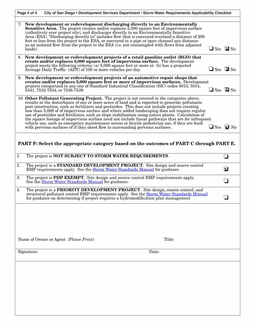
Page 4 of 4 City of San Diego • Development Services Department • Storm Water Requirements Applicability Checklist
7. New development or redevelopment discharging directly to an EnvironmentallySensitive Area. The project creates and/or replaces 2,500 square feet of impervious surface(collectively over project site), and discharges directly to an Environmentally SensitiveArea (ESA). “Discharging directly to” includes flow that is conveyed overland a distance of 200feet or less from the project to the ESA, or conveyed in a pipe or open channel any distanceas an isolated flow from the project to the ESA (i.e. not commingled with flows from adjacentlands). ❏ Yes ❏ No
8. New development or redevelopment projects of a retail gasoline outlet (RGO) thatcreate and/or replaces 5,000 square feet of impervious surface. The developmentproject meets the following criteria: (a) 5,000 square feet or more or (b) has a projectedAverage Daily Traffic (ADT) of �00 or more vehicles per day. ❏ Yes ❏ No
9. New development or redevelopment projects of an automotive repair shops thatcreates and/or replaces 5,000 square feet or more of impervious surfaces. Developmentprojects categorized in any one of Standard Industrial Classification (SIC) codes 50�3, 50�4,554�, 7532-7534, or 7536-7539. ❏ Yes ❏ No
�0. Other Pollutant Generating Project. The project is not covered in the categories above,results in the disturbance of one or more acres of land and is expected to generate pollutantspost construction, such as fertilizers and pesticides. This does not include projects creatingless than 5,000 sf of impervious surface and where added landscaping does not require regularuse of pesticides and fertilizers, such as slope stabilization using native plants. Calculation ofthe square footage of impervious surface need not include linear pathways that are for infrequentvehicle use, such as emergency maintenance access or bicycle pedestrian use, if they are builtwith pervious surfaces of if they sheet flow to surrounding pervious surfaces. ❏ Yes ❏ No
PART F: Select the appropriate category based on the outcomes of PART C through PART E.
�. The project is NOT SUBJECT TO STORM WATER REQUIREMENTS. ❏
2. The project is a STANDARD DEVELOPMENT PROJECT. Site design and source controlBMP requirements apply. See the Storm Water Standards Manual for guidance. ❏
3. The project is PDP EXEMPT. Site design and source control BMP requirements apply.See the Storm Water Standards Manual for guidance. ❏
4. The project is a PRIORITY DEVELOPMENT PROJECT. Site design, source control, andstructural pollutant control BMP requirements apply. See the Storm Water Standards Manualfor guidance on determining if project requires a hydromodification plan management ❏
Name of Owner or Agent (Please Print): Title:
Signature: Date:
x
x
x
x
x

D INSPECTION FORM

WATER POLLUTION CONTROL PLAN SELF-INSPECTION FORM
SITE INFORMATION
Project:____Montezuma Channel Maintenance
Date: Time of Day:
The information contained in this inspection report was gathered and evaluated by qualified personnel before submittal. Based on my review of the information and inquiry of those who gathered and evaluated the information, the information submitted is, to the best of my knowledge and belief, true, accurate, and complete.
Inspector Name: Inspector Signature:
GENERAL INSPECTION INFORMATION
Location of work:____________________________________ Station Number:
WPCP onsite? Yes No
Is site work occurring? Yes No
Description of Work:
Best Management Practice's Inspected and Implemented On-site
Sediment Control Good Housekeeping Waste Management Tracking Control
Sweeping / Dust
Additional Comments: Describe any BMP maintenance required, deficiencies, unusual conditions, situations or special requirements needed to do the work such as diversion of water, construction of staging area, replacement of bank material, presence of utilities, etc.
Channel Material Removed Stockpile Area Material Removed
Type Removed Quantity (linear Feet) Type Quantity/Unit
Silt/Sand Sediment
Debris Debris
Vegetation Vegetation
Tires (#)
Equipment
Equipment Number Description Idle/Down Additional Remarks