from producers to consumers: democratizing the access to reference data
TRANSCRIPT
JORGE SANZ · SOLUTIONS ENGINEEREUROSDR // INSTITUTO GEOGRÁFICO NACIONAL // OCTOBER 2016
FROM PRODUCERS TO CONSUMERS: DEMOCRATIZING THE ACCESS TO REFERENCE DATA
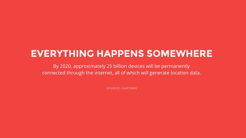
By 2020, approximately 25 billion devices will be permanently connected through the internet, all of which will generate location data.
SOURCE: GARTNER
EVERYTHING HAPPENS SOMEWHERE

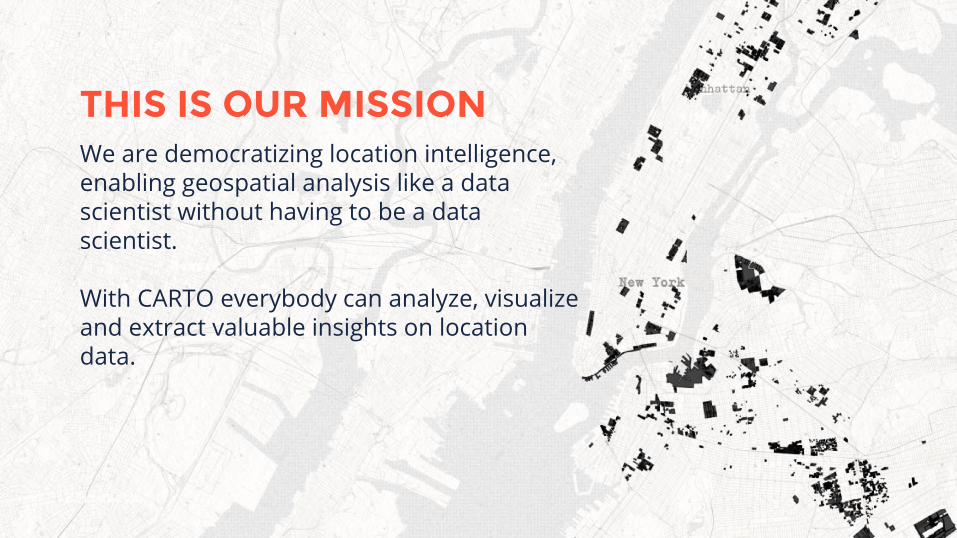
We are democratizing location intelligence, enabling geospatial analysis like a data scientist without having to be a data scientist.
With CARTO everybody can analyze, visualize and extract valuable insights on location data.
THIS IS OUR MISSION
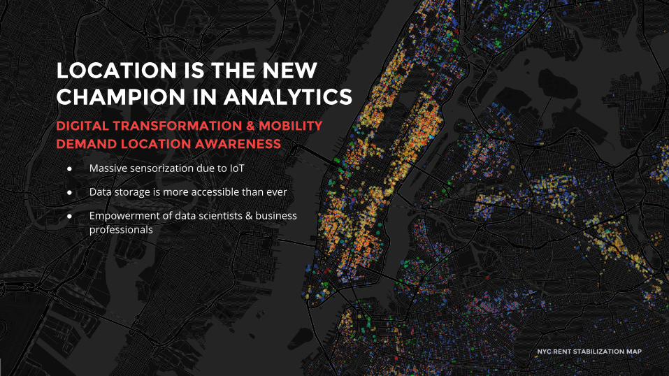
LOCATION IS THE NEW CHAMPION IN ANALYTICSDIGITAL TRANSFORMATION & MOBILITY DEMAND LOCATION AWARENESS
NYC RENT STABILIZATION MAP
● Massive sensorization due to IoT
● Data storage is more accessible than ever
● Empowerment of data scientists & business professionals
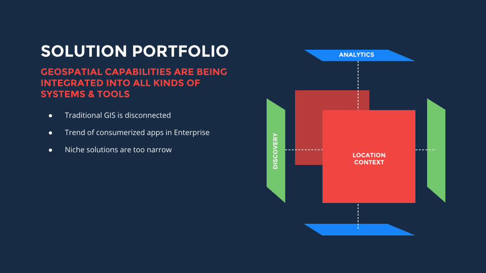
SOLUTION PORTFOLIO
● Traditional GIS is disconnected
● Trend of consumerized apps in Enterprise
● Niche solutions are too narrow
ANALYTICS
LOCATION CONTEXT
DIS
CO
VE
RY
GEOSPATIAL CAPABILITIES ARE BEING INTEGRATED INTO ALL KINDS OF SYSTEMS & TOOLS
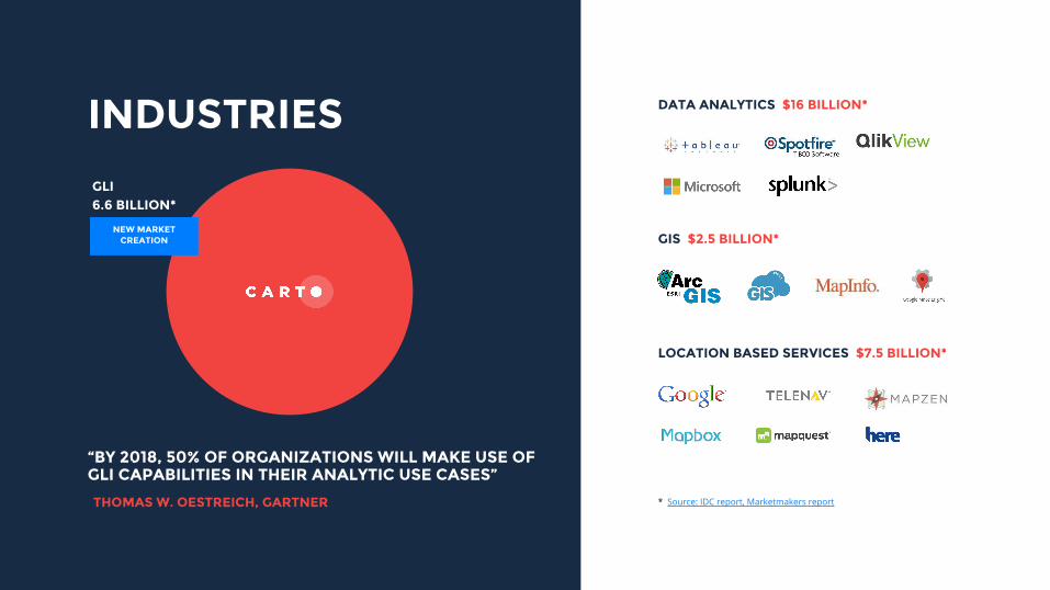
* Source: IDC report, Marketmakers report
NEW MARKET CREATION
INDUSTRIES DATA ANALYTICS $16 BILLION*
GLI6.6 BILLION*
GIS $2.5 BILLION*
LOCATION BASED SERVICES $7.5 BILLION*
“BY 2018, 50% OF ORGANIZATIONS WILL MAKE USE OF GLI CAPABILITIES IN THEIR ANALYTIC USE CASES”
THOMAS W. OESTREICH, GARTNER
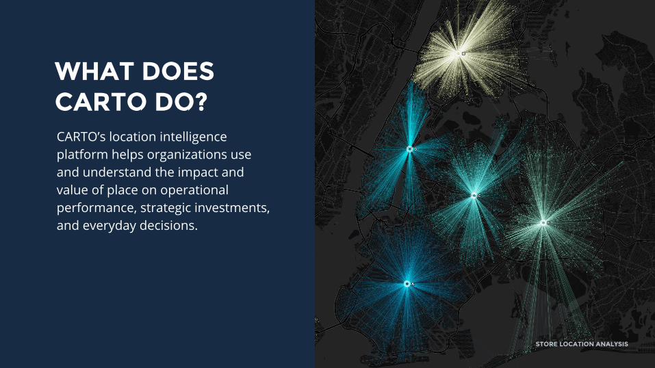
WHAT DOES CARTO DO?CARTO’s location intelligence platform helps organizations use and understand the impact and value of place on operational performance, strategic investments, and everyday decisions.
STORE LOCATION ANALYSIS
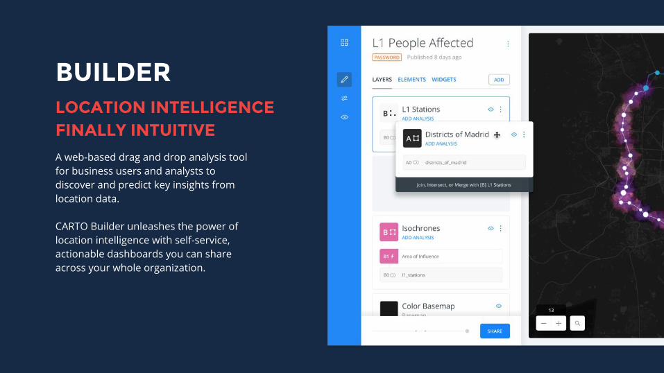
BUILDER
A web-based drag and drop analysis tool for business users and analysts to discover and predict key insights from location data.
CARTO Builder unleashes the power of location intelligence with self-service, actionable dashboards you can share across your whole organization.
LOCATION INTELLIGENCE FINALLY INTUITIVE
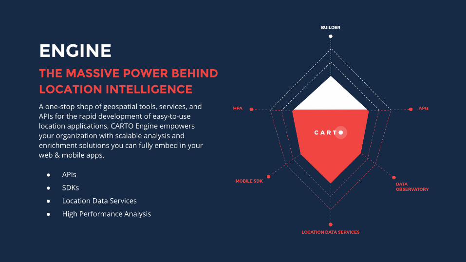
ENGINE
A one-stop shop of geospatial tools, services, and APIs for the rapid development of easy-to-use location applications, CARTO Engine empowers your organization with scalable analysis and enrichment solutions you can fully embed in your web & mobile apps.
● APIs
● SDKs
● Location Data Services
● High Performance Analysis
THE MASSIVE POWER BEHIND LOCATION INTELLIGENCE
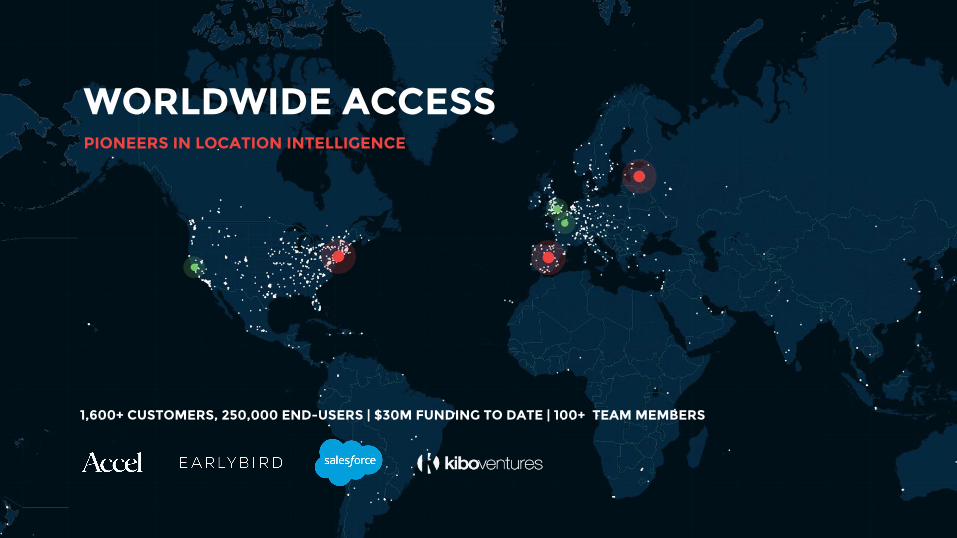
WORLDWIDE ACCESS
1,600+ CUSTOMERS, 250,000 END-USERS | $30M FUNDING TO DATE | 100+ TEAM MEMBERS
PIONEERS IN LOCATION INTELLIGENCE


By 2020, approximately 25 billion devices will be permanently connected through the internet, all of which will generate location data.
SOURCE: GARTNER
EVERYTHING HAPPENS SOMEWHERE
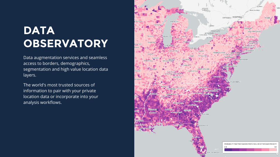
DATA OBSERVATORYData augmentation services and seamless access to borders, demographics, segmentation and high value location data layers.
The world's most trusted sources of information to pair with your private location data or incorporate into your analysis workflows.
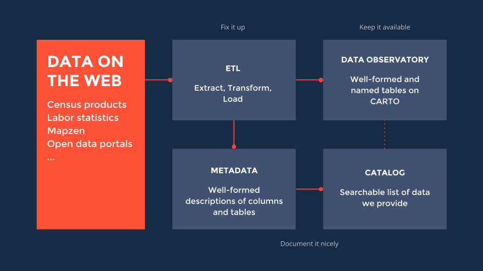
ETL
Extract, Transform, Load
METADATA
Well-formed descriptions of columns
and tables
DATA OBSERVATORY
Well-formed and named tables on
CARTO
CATALOG
Searchable list of data we provide
DATA ON THE WEBCensus productsLabor statisticsMapzenOpen data portals...
Keep it availableFix it up
Document it nicely
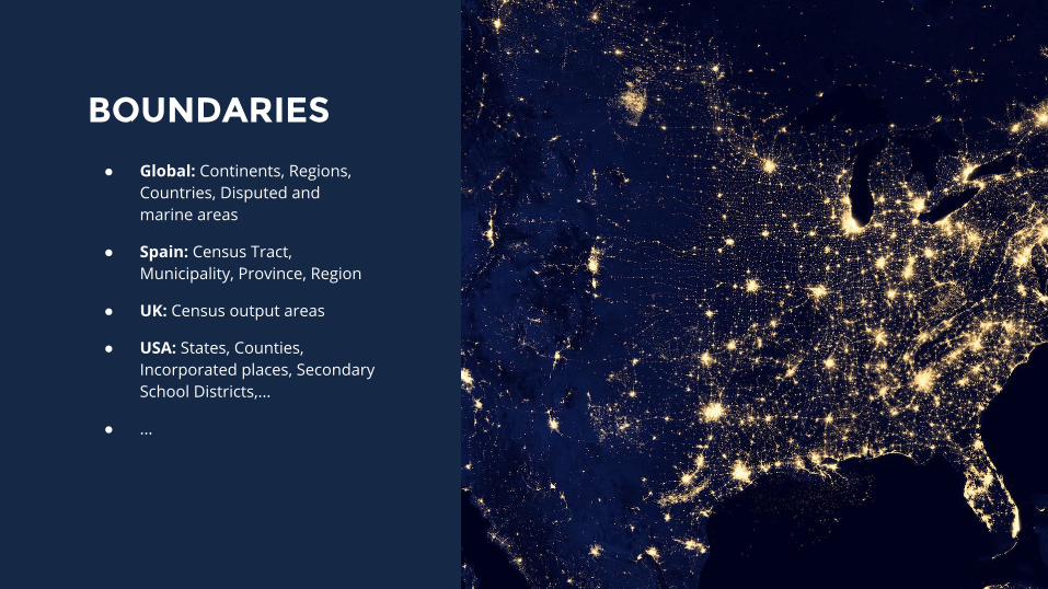
BOUNDARIES
● Global: Continents, Regions, Countries, Disputed and marine areas
● Spain: Census Tract, Municipality, Province, Region
● UK: Census output areas
● USA: States, Counties, Incorporated places, Secondary School Districts,...
● ...
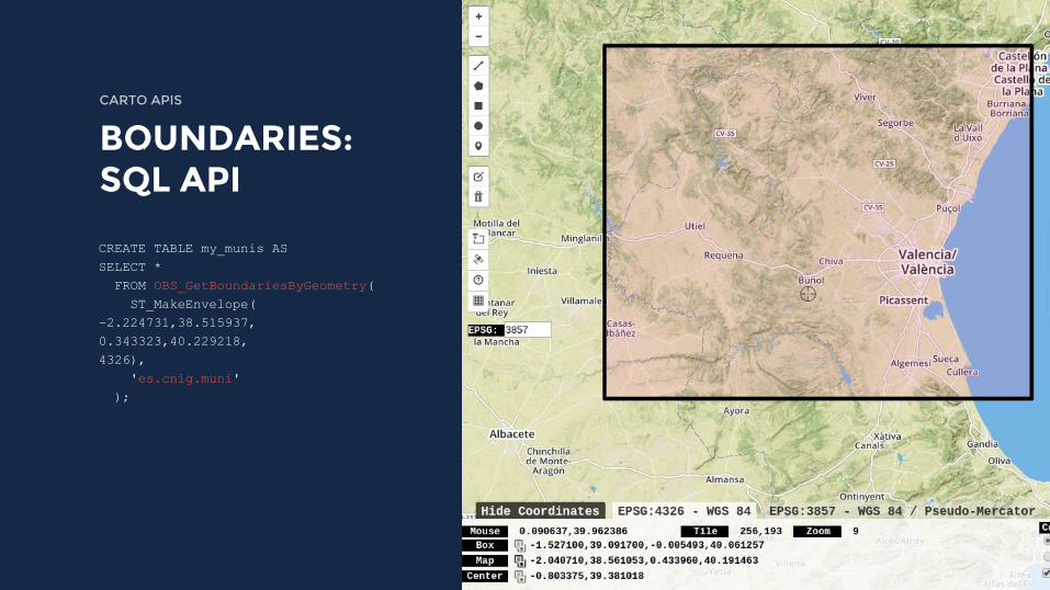
CREATE TABLE my_munis ASSELECT * FROM OBS_GetBoundariesByGeometry( ST_MakeEnvelope(-2.224731,38.515937,0.343323,40.229218,4326), 'es.cnig.muni' );
CARTO APIS
BOUNDARIES: SQL API
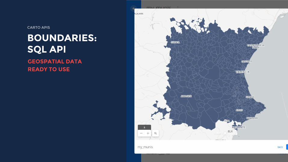
CARTO APIS
BOUNDARIES: SQL APIGEOSPATIAL DATA READY TO USE
CARTO APIS
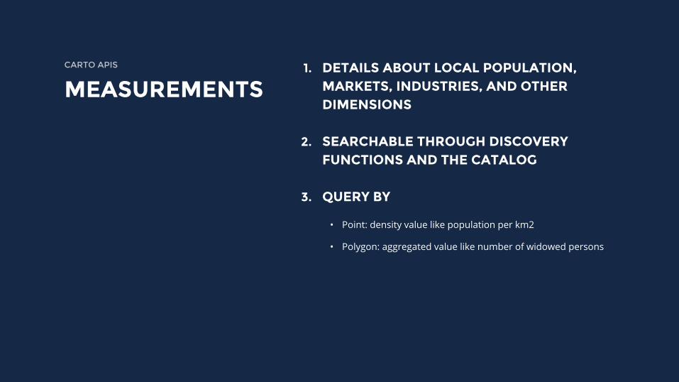
MEASUREMENTS1. DETAILS ABOUT LOCAL POPULATION,
MARKETS, INDUSTRIES, AND OTHER DIMENSIONS
2. SEARCHABLE THROUGH DISCOVERY FUNCTIONS AND THE CATALOG
3. QUERY BY
• Point: density value like population per km2
• Polygon: aggregated value like number of widowed persons
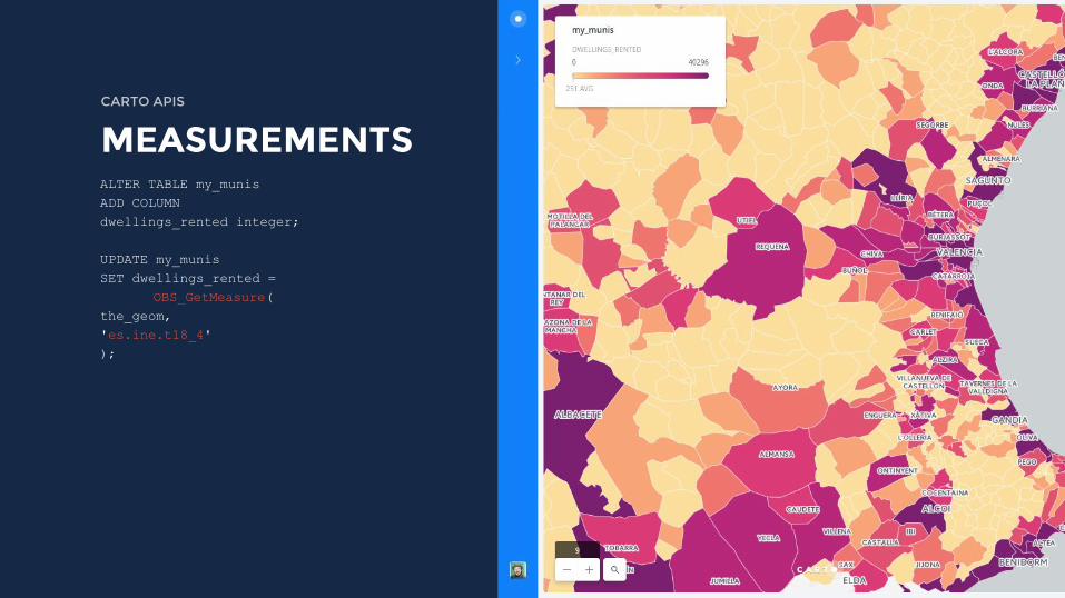
ALTER TABLE my_munis ADD COLUMN dwellings_rented integer;
UPDATE my_munisSET dwellings_rented =
OBS_GetMeasure(the_geom, 'es.ine.t18_4');
CARTO APIS
MEASUREMENTS
We are democratizing location intelligence, enabling geospatial analysis like a data scientist without having to be a data scientist.
With CARTO everybody can analyze, visualize and extract valuable insights on location data.
THIS IS OUR MISSION

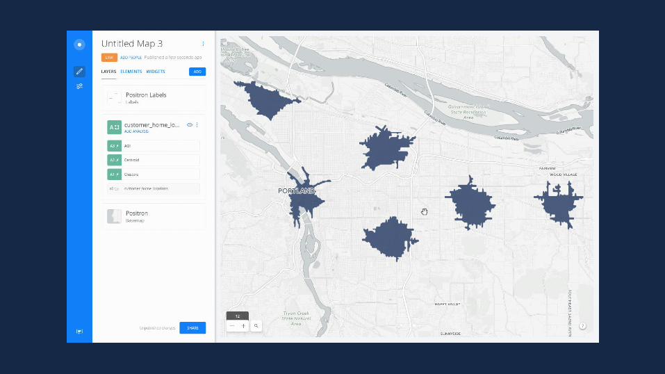
BUILDER: FRIENDLY INTERFACEDEMO TIME

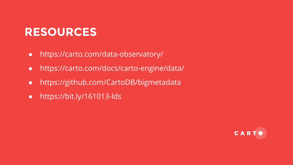
RESOURCES
● https://carto.com/data-observatory/
● https://carto.com/docs/carto-engine/data/
● https://github.com/CartoDB/bigmetadata
● https://bit.ly/161013-lds

THANKS! GET IN TOUCH
http://bit.ly/161019-data-observatoryEUROSDR // INSTITUTO GEOGRÁFICO NACIONAL // OCTOBER 2016