from: christinawalshconsultant@grace-inc - home … · if you have any difficulty downloading this...
TRANSCRIPT
From: [email protected] Sent: Monday, June 06, 2016 2:31 PM To: Owens, Cassandra@Waterboards; Ali, Mazhar@Waterboards; Cope, Grant@EPA; Lee,
Barbara@DTSC; Hung, David@Waterboards; Smith, Deborah@Waterboards; Rubin, Marcia@DTSC; Leclerc, Ray@DTSC; Unger, Samuel@Waterboards; Malinowski, Mark@DTSC; Rainey, Laura@DTSC; ZORBA, PETER D. (HQ-RA000); Paul Costa; Jones, John
Cc: Bowen, Patrice@DTSC; Hume, Richard@DTSC; Paulson, Roger@DTSC; Seckington, Tom@DTSC; Sam Cohen; Smith, Kim@DTSC; Erreca, Erik@DTSC; Rohlfes, Larry@DTSC; Kracov, Gideon@DTSC; [email protected]; Dassler, David W; Carpenter, Paul@DTSC; King, Buck@DTSC; Bothwell, Nancy@DTSC; Knight, Daniel@DTSC; MANES, LORI (MSFC-AS01)[GREAT SOUTHERN ENGINEERING]; Jennings, Stephanie; Tim Brehm; [email protected]; Michael K. Stenstrom Ph. D., P.E.; Jon Jones; Robert Pitt; Robert Gearheart; Ross Berman; Richard Brandlin Brandlin; cleanuprocketdyne.org; Albert Knight; Chris Rowe; Holly Huff; Christian Kiillkkaa Kiillkkaa; Dawn Kowalski; Kramer, Debbie; Wendy Lowe; Humble, Jeff@Wildlife
Subject: Revised Human Health Risk Assessment Work Plan for Santa Susana Field Laboratory Order Pursuant to California Water Code 13383; CA0001309 Cl No. 6027
Attachments: WaterboardComments13383_2016 21o.pdf
Dear Cassandra, Sam, Mazhar, et al:
RE: Revised Human Health Risk Assessment Work Plan for Santa Susana Field Laboratory Order Pursuant to California Water Code 13383; CA0001309 Cl No. 6027
I appreciate the opportunity to provide comments on this process and also appreciate the extension given in order to accommodate a difficult schedule. If you have any difficulty downloading this file, please let me know. I also have a high-res version which is much larger, if you prefer, I can dropbox it to you.
Warm regards,
Christina Walsh cleanu rocketdyne.org
1
Christina Walsh cleanuprocketdyne.orct REF: SHEA-115436
1
June 5, 2016
Ms. Cassandra Owens Regional Water Quality Control Board Los Angeles Region
320 West 4th Street, Suite 200 Los Angeles, California, 90013
Dear Cassandra:
Subject: Revised Human Health Risk Assessment Work Plan for Santa Susana Field Laboratory, Ventura County, CA (Order Pursuant to California Water Code 13383; CA0001309 Cl No. 6027)
http://www.waterboards.ca.gov/losangeles/public notices/Boeing/Boeing%2OSSFP/020Revised %2OHHRP/020Workplan 3 31 16.pdf
I appreciate the opportunity to provide comments on the issues related to the HHRA process. The deadline extension allowed interested parties meaningful time needed to organize substantive comments on this very important work. I hope the concerns that I and others articulate will aid in providing additional robust discussion and review.
I have been involved for many years, and I am grateful for the Board's attitude and willingness to seek information and input from the affected public throughout this complicated process.
History and background: Over the years, I have submitted my comments and concerns both in person as well as in writing including all of the RFI group reports submitted for the 2007 Order. Related to my continued concerns about the cleanup and how the SSFL is regulated, I founded cleanuprocketdyne.org, savesantasusana.org, provided evidence that prompted the ISE01 cleanup of the northern drainage as well as substantive recommendations for the ISRA2 conducted and directed by this board. I also built an environmental advocacy museum and have petitioned for a national monument designation—all, because I felt that it was vital to have the public involved in the process early, before final decisions are made, and most importantly, to prevent people from ever living atop the site where this long history of contamination took place.
Given the complicated history and complicated ownership relationship, where the site was federally owned and operated, but regulated by the State of California—and because the State chose to refuse Superfund listing—USEPA has since refused to be further involved, despite their leadership role in completing the ARRA funded Radiation Soil Survey and Background Study that supports the AOC cleanup implementation effort. 1 Immediate and Substantial Endangerment Determination and Order and Remedial Action Order Docket No USED 07/08-002, Health and Safety Code Sections 25355.5(a)(1)(B), 25358(a), 58009 and 58010
2 Interim Source Removal Action - Outfalls 8 and 9
Christina Walsh cleanuprocketdvne.orct REF: SHEA-115436
2
The results of the ARRA [American Reinvestment and Recovery Act] $43 million dollar project are difficult to find at best—and for most people, they aren't aware that it took place at all. This is unfortunate, not only because of the millions spent of taxpayer monies, but it was also the most comprehensive radiological survey every undertaken by USEPA, and that valuable information is NOT being used to guide the decisions of this project for soil remediation. One of the most important aspects of the process was that it included ALL of the voices related to cleanup concerns. We all went from area to area, determining sampling locations together, and therefore built important trust in the process. Today there are two sides, they don't speak, and each offers the public only THEIR version of history and what is needed, instead of offering regulatory facts and data to allow the public to navigate and participate in the discussion.
Why Public Participation Matters Instead of relying on transparent data based on the collaborative process in which all responsible parties and regulators were involved, we've gone back to theories and scary videos put on by surrogates and special interest groups, as if none of the comprehensive "every square inch" investigation ever happened. As a result, trust and public understanding of the issues have greatly suffered.
This site is extremely complex and indeed difficult for the public to be able to follow the process, much less understand how these decisions will affect the safety of their communities. For responsible parties and regulators, the roles and responsibilities are even more blurred, and blame and fear continue to be used in favor of facts and inclusive collaboration.
Public participation
is designed to be - missed by the
public
The overall system of public participation under DTSC lead oversight, is largely designed to be missed by the public, especially when the process endures for multiple generations and the leadership on the project for both the regulators and the responsible parties seems to change every 18 months. For me, my son was a toddler when I got involved, and today he is 66," and going to college. I never would have imagined that I would still be waiting for the final cleanup to start or even be decided on. Groundwater impacts at the site have affected the local groundwater
resources for the region, and groundwater is one of our most precious resources. California's groundwater non-degradation policy is vital to protecting the State's agricultural and environmental future.
It has been made clear on global levels, through the President's agenda that the American public voted for in 2012, and the Paris Climate Agreement, delineating these risks and concerns related to climate change including drought impacts. California water and drought impacts and known, severe, and expected to become more problematic over time. California provides food products to more than half the nation, so we cannot excuse polluters in a way that enables them to potentially further diminish these fragile resources. I think this means that more than ever, we need to take very seriously the environmental impacts of our acts, and we've seen pushback and inaction at the site for decades. However, I must also acknowledge the work done by the responsible parties/dischargers on improving the conditions on an interim basis. The long-term improvements based on the work done by Boeing's Stormwater Expert Panel has forever IMPROVED conditions for when it rains. We understand the slope-factor and how much water
Christina Walsh cleanuprocketdyne.orci REF: SHEA-115436
3 comes down the hill on big storm events, and the watersheds where the Panel has analyzed and worked to improve source areas demonstrates that a real solution IS possible. That's why I fight the excuses, because I know we can have a cleanup, that works, isn't crazy, and is long-term. We just have to want it.
General Process Comments: My initial impression of this document and the work that went into this process on both sides is of appreciation for the work done. The report is well organized. Allowing the public access to the process is critical so information that guides decisions on how to preserve and protect both water quality and public health is balanced with protecting the surrounding natural environment and considers the issues known to, and experienced by the surrounding public.
Unfortunately, because of the complexities of the site, and the iterative nature of cleanup investigation, the public is woefully misinformed. This is largely due to the lead regulator's decision to defer those responsibilities to Boeing surrogates. The resulting political stranglehold on this site, caused by fear and misdirection, has also been detrimental to the public process and the public's ability to understand the decisions before them and how they might be affected. This issue has simply not been adequately addressed through public outreach and education.
Much of my work is now focused on the importance of a transparent inclusion of the public so that trust in the resulting solutions can be built and maintained. Currently, there is very little trust on this project. Without trust, no matter how much money is spent, the result will not be enough to manage the fear created. The opposite of extreme cleanup cannot be "nothing happened here," and so I continue to work toward a transparent and fair process through each of the regulatory agencies and boards.
The only way I believe we can have a successful cleanup and future for the site, is to build on a shared understanding of the site and the moving parts based on facts. This Board is literally the only place in town, when it comes to facts being properly presented about the site with fair and impartial process, and is deeply appreciated.
I have made many requests of Board Staff, and they have treated me with respect and have considered my concerns with seriousness and great diligence. They have hiked with me when needed, to see the areas of concern. They've asked the right questions in order to gain the needed understanding of the geological and topographical complexities of the site and how potential impacts related to climate change and drought have potentially further complicated the methodologies for cleanup and treatment of water resources both at the site and beyond.
MIRA Workplan Comments: Introduction states that the work plan, "identifies the data that will be used including the locations where the data were or will be collected." This provides a preliminary conceptual site model identifying potential exposure media, receptor populations, and exposure pathways that are considered relevant.
Christina Walsh cleanuprocketdvne.orq REF: SHEA-115436
4 1. During the last three years, I have appeared several times before this board articulating
concern about groundwater pumping at SSFL for the purpose of "drawing down" the groundwater elevations so that seeps cease to discharge. During this process, my concerns developed as my photographic observations supported my theory that this was exacerbating the biological condition of the downstream riparian habitats.
2. The act of groundwater pumping during drought without properly replacing the water removed exacerbate the impacts from the prolonged drought—causing widespread impacts to local ephemeral creeks as well as year-round Bell Creek, down-gradient to outfall 2 and the headwaters to the L.A. River. https://www.youtube.com/watch?v=KsZSvfifwik
3. By pumping above the Outfall 2 location but discharging below the Outfall 1 location, this was causing displacement of perched groundwater, bank storage where the down-stream implications were severe. I am deeply appreciative of this Board's willingness to consider these concerns. While I pushed based on my observations, which I was confident of, through years of observation and documentation. I am also appreciative that Board Staff followed the data, to make sure we weren't making two mistakes to prevent one. ht-tps:// www.voutube.com/watch ?v=x4S5ym LBIs0
Unintended consequences have plagued the operation of this site as well as the plan and public process of remediation, it is certainly correct that extreme pressures to deny or exaggerate the facts for political gain can easily result in tragic habitat and cultural resource loss. These are complex issues, and the diligence to ensure a positive outcome that protects human health and the environment is my goal, and clearly that of this Board. Your dedication to the truth in data is deeply appreciated.
4. I support the addition of Outfall 20, and I believe it will provide Boeing and the partner responsible parties the ability to make smart water-conservation and protection decisions moving forward.
Boeing has asserted "open space standards" which cannot be known when future use is not known.
5, 1 remain concerned about Outfall 2, where according to this document, discharges account for a predominant portion of the site's overall discharges since the construction for Outfall 20 has not yet begun.
1. I have asked for sampling data at this outfall following rain events and even during multi-day rain events, I have been told that no water flowed during the event that was adequate to sample.
2. 1 was also told that auto-sampling techniques are employed at Outfall 2, so it is difficult for me to understand how 20 samples could have detections when we are
Christina Walsh cleanuprocketdvne.orq REF: SHEA-115436
5 told repeatedly that no sampling took place during rain events during the most recent drought years.
3. I therefore request an audit of the sample concentrations included.
6. Using data limited to the last five years is problematic for several reasons:
1. The highest concentrations were historic, so using only data from the last five years when no operations were taking place gives a falsely low picture.
2. In the last five years, there was very little data because of the drought, and the program to "Pump Down" the groundwater was specific to lower groundwater elevation by 25 feet so that the seep area [890a/b] would not emerge. That result would also falsely 'lower' the results because the normal mix from multiple fracture/ flow areas would instead be limited to treated water, which is good for the downstream receptors in the general sense, but would not reflect the conditions experienced by those same receptors in a wet year [El Nino example] where more surface runoff sediment would erode and be carried with the water, potentially freeing previously secure contaminants [meaning trapped in the bedrock]
3. By limiting the data to years where very few samples were taken, the data population for meaningful statistics will be too small when millions of reports documenting the operable past are available. It seems that there is an unwarranted focus on the current condition being "non-operable" when all the contaminated soil largely remains at the site. The cleanup plan for how the cleanup will be handled has not even been presented to the public.
7. There seems to be a continued effort to look at the past accomplishments as if they have solved the problem, when the primary cleanup has not yet begun.
1. This is a dangerous notion because it has been used by Boeing surrogates such as the SSFLCAG to claim that no more work is needed and that people should be satisfied with leaving the remaining contamination in place. With the continued violations of the NPDES permit levels on a year-by-year basis, while dramatically improved thanks to the work of this Board, the work is not finished — in fact, the primary soil removal has not begun so it is improper to communicate "completion" before the start of the cleanup action.
2. Meaningful understanding by the public of the site conditions has also been damaged by the site lead regulator [DTSC1, who has deferred communication to the

Christina Walsh cloanuprocketdyneorq REF: SHEA-115436
6 public to polluter surrogates and has failed to uphold requirements3 under the law to protect the process. They have painted a very different picture using "state appointed authority" to do so. The surrounding affected communities have thus been deprived of having accurate, reliable information. Trust in the process has therefore been severely diminished.
3. Reducing the dataset to non-operational years provides another basis for special interest groups to misuse data to claim that nothing happened at the site, the contamination is somehow "not real" and therefore cleanup is not needed.4
4. Dangerous and false rhetoric has been aggressive and all views to the contrary have been pushed out, and are not allowed to be presented. In fact, the LA Regional Water Control Board is the only resource we have in this process that is NOT biased and works to solve the problems to protect for the future.
5. If this limited data set is used, then it is imperative that limitations on the data be applied so that these falsely lower concentration estimates are not used to rewrite history as we have seen by both extreme sides of the issue.
6. Making people more afraid of trucks than of the radiological and chemical contamination, which this board has acknowledged to be massive in nature, is a disservice to the surrounding affected public and more importantly, does not serve the purpose of a CAG which is to help inform the community about a corrective action to be taken, not to cover it up. The most recent, and quite egregious example of this can be found here: https://www.youtube.com/watch?v=XUdKGfprOkw
8. This health risk assessment assumes a land use scenario of open-space, when Boeing has repeatedly said in public, "Suburban Residential."
1. There has been no formal or written promise or guarantee of open-space designation for future use. Frankly, they've made promises before, and here we sit in 2016 and the cleanup, promised to be complete in 2017, has not yet begun.
2. Boeing can only speak for their portion of the site since the portions owned by the Federal government [NASAs Area II and Lox Plant in Area I] do not have a known future use no matter what Boeing wishes or says, and until those decisions are made, no consideration for a lesser level of cleanup should be considered.
3 California Health and Safety Code section 25358.7 requires DTSC to provide an opportunity for meaningful public participation in response actions taken under Chapter 6.8 of the Health and Safety Code.
4 https://wvvw.voutube.com/watch?v=XUdKGfprOkw

7
BELL CANYON ROAD
3. The Boeing Company has insisted that it doesn't have to adhere to the assumption of backyard gardens, which is truly absurd considering the likely home values. If developed, it would resemble Bell Canyon where many homes are in excess of $12 million in value and many acres in size. The idea that development at the top of this mountain would be limited to exclude fruit trees, is unacceptable and truly fantastical in its assertion.
4. Risk assessments done on surface water flow exiting the site need to consider the historic use of these drainages and potential erosion of bank sediments carrying historically higher contaminant concentrations. The purpose of needing this risk assessment is NOT because of activities during remediation years—this is about the severe burden of impacts over a 60-year period of rocket development and testing.
5. To only include non-operational years would fail the purpose of having a risk assessment. Excluding rocket tests where millions of gallons of TCE and other off-spec fuel chemicals were used and discharged directly into the drainage, as a matter of procedure for decades is ludicrous.
6. Annual rainfall fluctuates greatly, so high impact years of discharges and transport mechanisms that define and complete exposure pathways will affect the impact of
Christina Walsh cleanuprocketdyne.orq REF: SHEA-115436
*-CN.GEF:
HAZARDOUS WASTE AR EA u‘AUTHORIZED PERSCNNEL
KEEP OUT
ZONA DE RESIDOUS PELIGROSO
PROH BMA NI PEcSONA

Christina Walsh cleanuprocketdyne.orq REF: SHEA-115436
8 those concentrations. If a later year results in two times or more rainfall, it can be expected that previously stable impacts could potentially be displaced downstream.
7. Changing groundwater elevations alter the flow pathways taken by water depending on flow, duration of flow and quantity per hour of flow.
1. During historic interviews with former workers, one neighbor described a "cattle kill" where he said over 100 head of cattle (Bell Canyon used to be a cattle ranch) died over night, and the rancher was paid 10 cents above market price for the meat. These 10 year and above storms are documented where berms failed and contaminants held at the Area 1 Burnpit as well as other areas washed downstream. The entire burn pit area continues to be tarped to this day.
Since future land use has not been resolved, we have been seeking designation as a National Monument for the purpose of protecting and honoring the Native American artifacts as well as the significant national space history that took place at the site. We believe this will provide assurances of a proper cleanup, a reasonable cleanup, and a known outcome which allows for a smart cleanup which ensures that there will NEVER be houses built at the site.
8. The only way residential development of the property can be avoided is by such designation that ensures an enduring and known future such as a National Monument. However, without proper and believable cleanup, that idea would put people at risk instead of protecting them. It is therefore vital that the cleanup be transparent, fair, and with the objective of addressing all known contamination levels consistent with the agreements signed by the responsible parties.5
9. Senator Dianne Feinstein has also amended congressional language to tie NASA cleanup funding through the AOC to protection and defining the native american
5 To protect Burro Flats Painted Cave (VEN-1072) on the site with little protection for this and any cultural resources built into any cleanup. The Churnash implemented a two pronged strategy to protect the site: (1) Federal law protection under EO 13007 and NHPA 106; and (2) Requesting ownership of the site as excess federal property.
Chumash started exploring National Monument designation for SSFL, especially the NASA site. The Chumash met with DOE Secretary Moniz and he asked for a White Paper to summarize and explain Monument status for SSFL. Essentially, National Monument status would keep NPS ownership and protect ALL cultural resources on the site. Legal background on National Monuments can be found in this excellent CRS report: https.//www.la6.oryisgpk;r shn isc/R 41330. po

Christina Walsh cleanuprocketdyne.orq REF: SHEA-115436
9 "artifacts" which had previously gone undefined, and left the sites vulnerable for the future.8
10.Since all of the remaining test stands are on NASA federal property, as well as R2 detention pond complex7, it is not reasonable to apply the lesser standard between the "Boeing cleanup plan based on future land use, and that of the Federal Government where the future land use is not known. I am participating in the Section 106 process with the Department of Energy to develop a process and plan for the cultural resources, and I also participated fully in the Section 106 process by NASA for Areas II and I (Lox Plant). Since the DOE ROD [record of decision] has not yet been made, the future use remains unknown.
1.1 Site Background Information
1. The assertion that less regulation is okay because site operations have ceased is inappropriate, especially when massive grading of these contaminated areas is being planned for the next year. Historic concentrations have not always been reduced over time, so this continued assumption can be problematic for areas where persistent impacts are resurfacing and are not fully understood, such as the WS9a seep cluster, north of Outfall 2.8
2. While site operations have ceased, massive grading is planned for the excavation and soil removal for the cleanup of the site, which will potentially create erosion control challenges, especially if an El Nino year happens.
3. Reducing accountability on numeric limits or the breadth of data is inappropriate and inadequate to protect the local populations.
6 Preservation of Tribal Artifacts at Santa Susana Field Laboratory—As NASA works to meet the requirements of the 2010 Administrative Order on Consent for Remedial Action, along with preceding agreements and court orders, the agency is encouraged to protect the unique and historically significant Native American sites on the property, including but not limited to the Burro Flats Painted Cave. To the maximum extent practicable, NASA shall include all Traditional Cultural Properties and Traditional Cultural Landscapes (as defined by 30 CFR 60.4 and National Park Service Bulletin 38) as "Native American artifacts that are formally recognized as Cultural Resources," for the purposes of the Administrative
Order. (See page 112 here: ___________________________________________________ This language gives NASA the ability to interpret the Administrative Order in a way most broadly protects the resources on the federal property. This language is in the Appropriations Committee report, and the Senate has tied the protection of resources at SSFL to NASA's funding.
7 R2 Detention Pond Complex is where all surface water that is managed through the ponds is eventually released, meaning this area will carry potential contaminants from ALL areas of the site where water treatment is needed and necessary.
8 The fracture studies that have been done by Boeing, DOE, and NASA have not been able to identify all flow patterns through fractured weathered and unweathered bedrock. WS9a is also in proximity to areas with the highest VOC concentrations on the site, and since these flow patterns are not fully understood, they cannot be dismissed.

Christina Walsh cleanuprocketdvne.orq REF: SHEA-115436
10
4. By including wet and dry years, a more representative depiction of the potential conditions at the site can be postulated, and more importantly for those who live just below the site.
5. Operational years, where historical detection levels were often thousands of times higher than that which flows today, should be included for the purpose of identifying potential risks, which may not be as apparent using non-operational data.
8. The effort to "not look" has been used at an alarming level by the responsible parties, where samples and monitoring is resisted and avoided. At the same time, Boeing has proposed "monitored attenuation" as a solution to the problem. This does not adequately address the problem given the history of push-back to include pushing the issue to the state-level to avoid penalties for chronic violations we've seen over the years. The groundwater issue is a long-term problem that will likely exceed all of our lifetimes, and it is therefore incumbent upon us to design a system that looks to protect future residents downstream of the area who will likely know even less about the site in years to come.
7. It is important to compare areas where interim measures have vastly improved the conditions to those where no interim measures have occurred.
8. While Outfalls 8 and 9 have improved from the extraordinary work done on the outfalls and careful modification to all tributary drainages contributing to the flow of surface water (specifically 8 and 9 where ISRA remediation occurred as well as northern drainage enhancements), the other portions of the site have not received the same level of attention where focus has instead remained on collecting and containerizing contaminated water and managing discharges through the use of pond-capacity management.
9. For five-year storm events and larger, the area where the majority of surface water flow exists (60%—Outfall 2), is not being adequately addressed considering the known emergence of contaminants upstream of the outfall. This will not adequately protect the public without addressing the similar challenges to the other watersheds.The same hard work done based on this Board's direction for 8 and 9 should be applied to the other external outfalls, especially 1, 2 to the south, and 3, 4, and 5 to the north.
10. The long-term planned work to improve these steep drainages to "wear the water out" by meandering flow channels, modifying culverts and stone work has vastly improved the water quality leaving the site both to the north and to the east. This is what works and has made people living near the site SAFER thanks to the work of this Board. Looking to solve problems for the long term, even with their interim measure approach, is crucial and what I feel is still needed here. The transparency and fairness provided by this board-driven format should serve as a model for the other regulatory agencies under CalEPA.

Christina Walsh cleanuprocketdyne.org REF: SHEA-115436
11 11. While I have often been frustrated by the grueling process as we try to work to be
involved from the "outside," I believe this Board has made EVERY effort to ensure that people including myself are heard, and that our concerns are considered and investigated. That is the best we can hope for, so I can only hope for more LARWOCB led process, as I believe it enhances public understanding and remains focused on fairness, pubic safety and long-term smart planning; and this approach is in dire need of duplication across the State's regulatory system.
12. "..The periodic burning of off-spec fuels in ponds may have produced polychlorinated dibenzodioxins and dibenzofurans. Special attention to TCDD 2378 congeners is appreciated as they generally implicate site-operationally generated dioxin versus those from local brush fires, which has historically been used by the discharger as an excuse to avoid this issue. We can tell the difference through this analysis approach, and we should pay special attention to these congeners providing that indication, especially because of the much higher toxicity quotient.
13. In this report, it describes the percentage of runoff that travels to the south via Outfalls 1 and 2 to be 60%. I appreciate this modification. In early NPDES permit data, this number was altered to reflect 90% (leaving only 10% traveling to the north). I have emphasized the importance of properly locating the actual outfall where samples are collected to an area where water flows during rain events. This is currently not the case at Outfall 2 based on the information I've been provided during my inquiries following rain events.
14. While I appreciate the addition of Outfall 20 and the construction necessary to proper discharge of water to the TWO drainages in a balanced way that supports both drainages, I think it's crucial that we emphasize that the seep discharge near 890 which has traditionally been problematic at levels over 1000 pg/I in chlorinated solvents and should be included specifically in this risk assessment process as this seep emergence is potentially one of the "forever" problems that will need to have long-term solutions applied, and understanding risk issues will better inform those decisions. A localized treatment-train system that wears the water out locally using UV solutions similar to the GETS would be helpful in preventing further damage to the ecosystem.
15. Instead of worsening drought conditions by pumping down water elevations, water quality can be improved without negatively impacting downstream receptors by installing local treatment train solar powered system to address impacted seeps.
16. Bell Creek was always year-round, and with the exception of the compounded drought conditions with pumping activities, the creek hasn't been dry in 20 years. Downstream receptors should be considered based on flowing years, as that is more protective and the purpose of the HHRS.
1.2 Risk Assessment Approach

12 The purpose is to assess the nature and probability of adverse health effects in humans resulting from exposure to constituents in environmental media. It is therefore critical to properly assess exposure pathways to sensitive receptors downstream.
1. While it is acknowledged that there are active treatment systems since 2011 at Outfalls 11 and 18 respectively, there have been gaps of months and even years where the system was not operable. In fact, there were presentations to the public and even bus tours to show off the GETS system, where the public was assured of its effectiveness. It cannot be effective if it isn't operational. At one point, they had a program where they turned all pumping systems OFF for a multi-year period in order to observe the effects in groundwater elevation.
2. This is an example of showing the public solutions that were not being sincerely implemented, much like what we've seen with the waving around of the AOC as a success without implementation the actual cleanup.
3. The 2007 Consent Order for Corrective Action mandated that elevation monitoring FLUTe lined wells be installed across the site in order to better
Christina Walsh cleanuprocketdyne.org REF: SHEA-115436
1 I Er I I I- I 1 I I cu S •
0 t 1.
* . . . . . . . . . . . . . .
• •
44tith
• 4 ,0 ? _
• orfcy .
•

Christina Walsh cleanuprocketdyne.orq REF: SHEA-115436
13 understand the impact of groundwater treatment and better understand potential migration patterns.
4. The liners were installed for that purpose—to implement and comply with the 2007 Order—and earlier this year, we learned that "all" of the FLUTe liners were inoperable and had been inoperable since December, 2013. As a result, I wrote a letter requesting assessment of penalties for failing to comply with the requirements of the 2007 order, which are described as $15,000 per day for every day out of compliance. $15,000 x 365 days x 2 years, five months, and since all three parties share responsibility in groundwater impacts to the receiving waters below as well as the surrounding public, that penalty assessment should be collected from all three parties: $11,010,000
5. It's important to accurately describe the current conditions in place for surface water runoff management. It also indicates that these outfalls receive discharge from undeveloped buffer zones, but it is also true that waters discharging from these outfalls include operational areas such as the R2 pond, which is one of the most impacted areas, in that no matter where surface water begins at Santa Susana, it ends at the R2 pond and discharging to the south as long as precipitation levels remain at a manageable level.
6. It states that surface water samples are collected at each outfall as part of the permit, yet when I have inquired following rain events that lasted more than one day, I was told that there was not adequate flow to collect a sample at outfall 2.
7. If 60% of the water discharged exits the site here, it seems illogical for there to never be water at the outfall.
8. Please provide a list of the 20 detects mentioned for TCE at Outfall 2 and the dates and concentrations of each of these detections as my inquiries have failed to result in this information.
9. Since current and planned future uses at the site have not been finalized, it is inappropriate to use the least protective standard for assessment review as indicated by the "open space" reference. Until final binding dedication, as either a National Monument or National Park, adequate certainty of "open space" future use cannot be attained or used as reasoning to choose a lesser protective cleanup standard. Even if Boeing follows through on their open-space promise, depending on what happens to the core rocket testing areas owned by the federal government, that decision does not guarantee water quality as defined herein.
10. Edible aquatic plants and fish are present downstream from the outfalls in Bell Canyon and therefore should be considered "complete" as part of a risk-based pathway to aquatic organisms. In order to properly measure the completeness of this pathway, please be certain to evaluate the entirety of

Christina Walsh cleanuprocketdyne.orq REF: SHEA-115436
14 the Bell Canyon drainage down gradient from outfalls 1 and 2, 19, and the future 20.
Following is an example showing aerial view of SRE Outfall 4, where the sampling is done in a location that misses all surface water flow that comes down the concrete swale which was expressly built to carry contaminants down to the former SRE pond:
2.1 Data Evaluation 1. It is stated that changes to
site conditions over time and reduction of impervious surfaces should assure us that fewer violations of contaminant concentration action levels will occur because of significant changes and BMPs.
2. While the conditions of the site have significantly improved for Outfalls 8 and 9 due to the ISRA work, best management practices, culvert modifications, removal of asphalt and other impervious surfaces, and more aggressive stormwater management practices, it does not acknowledge that the other outfalls have received very little improvement. If similar work methodologies were to be applied to Outfalls 1 and 2 (with special attention to WS9a contaminant seep cluster), 19 and 20, as well as those below Area IV that lead to Runkle Canyon, there would be much better control of the overall discharges during precipitation events in the future.
1. The bulk of the soil volume required to cleanup Santa Susana has not even begun, so it is incorrect to state that conditions in water quality are assured to be improved over time.
2. Throughout the course of cleanup at all outfalls, it is expected that increases in erosion and contaminant release on a temporary basis will likely occur.
3. During the ISRA and the ISE0 cleanup of the northern drainage, Boeing did seek relief from compliance requirements during cleanup activities on that very basis. It therefore cannot be stated that water quality in this case will always improve. Risk assessment to these chemical constituents and radionuclides must include estimates of likely exposure, not hopeful exposure levels. Assessment assumptions must include both dry and wet years.
Christina Walsh cleanuorocketdyne.orq REF: SHEA-115436
• 15
4. It should also be noted that upstream from outfall 2, but south of the operational border is a seep cluster south of WS9a, where average concentrations of VOCs such as TOE in excess of 1000 ii.g/1, and pond storage capacity has been well managed, but not free of violations on a fairly regular basis.
5. Since this area is expected to be contaminated, it cannot be assumed that the outfall down-drainage from this location will be free from contaminants.
6. The lacking sampling data for Outfall 2 is indicative of misplacement of the actual sampling collector which I am told is an auto-sampler, so there should be no reason to miss sampling opportunities based on safety/access to the area.
7. Perhaps during the design and installation of Outfall 20, a more appropriate location for Outfall 2/20 can be considered to ensure that regular flow that we observe daily is captured in the monitoring program.
8. Including only data from drought years from 2009 and forward is insufficient, especially when these are the same years Boeing pumped down the groundwater level elevation for the purpose of reducing flow, and we were experiencing the very well documented California drought.
9. Documented in the NPDES permit 00001309 historical precipitation data. It cannot be stated that these are years most indicative of future conditions since we have had El Nino conditions this year, and high rain years which will have vastly different migration pathways based on groundwater elevation, saturation of bank storage, as well as groundwater pump testing.

Total Seasonal Rainfall (Precipitation) Los Angeles Civic Center, 1877-2015 Average since 1877 thru 2015 (138 years): 14.81 inches
Season (July 1-June 30) Total Inches of Rainfall +Inches AboveiBelow (+11 138 Year Average
2015-2016 Data to Date 2014-2015 6.52 -6,29 2013-2014 6.08 -8.73 2012-2013 5.85 -8.96 2011-2012 8.69 -6.12 2010-2011 20.2 +5 39 2009-2010 16.36 +1.56 2008-2009 9.08 -5.73 2007-2008 13.53 -1.28 2006 2007 3.21 11.60 2005-2006 13.19 -1.62 2004-2005 37.96 +23.15 2003-2004 9.25 -6.56 2002-2003 16.42 +1.61 2001-2002 4.42 -10.39 2000-2001 17.94 +113
1999-2000 11.57 -3.24 1 9 9 8 - 1 9 9 9
10. It is recommended that data include the years 2002 thru 2015 which indicate the conditions of the site when these agreements were signed and promised, as well as providing representative years of both high and low precipitation. Additionally, grading will likely be massive and complicated, and data resources that explicitly include operational discharge
Christina Walsh roc k e t e :o r REF: SHEA-115436
16

Christina Walsh cleanuprocketdyne.orq REF: SHEA-115436
17 years, will be more likely to include all constituents of concern based on the more than half a century of operational history.
11. Since specific wells were installed to gain a better understanding of water quality for the Outfall 2 watershed, and the public was taken on tours to show off the technology being employed to get these answers, it is recommended to include these seep wells as the flow matrix for the fractured bedrock lacks data given the historic high concentrations.
3. Exposure Assessment Historical contaminant concentrations prior to 2009 (the proposed start of data inclusion), were in many cases thousands and even tens of thousands of times higher than current levels since operations have ceased. It is also reasoned that these high contamination levels [which in some cases such as Core Hole 6, concentrations are literally at the level of pure product at some levels], have been captured and remain sequestered in the bedrock.
1. This same phenomenon can also cause high-concentration clusters from historical discharges that were held up in the drainages based on the dry condition at the time of discharge, would potentially later be released and carried along with surface water flow during times of high precipitation and water flow.
2. These unpredictable discharge releases cannot be anticipated easily and are demonstrated by the fluctuation in concentration results over time. Since they currently fluctuate so much based on elevation data as well as precipitation data, assumptions that a fluctuation will occur in the future is likely.
3. It is suggested that no exposure pathways are complete despite children playing in the drainage of Bell Canyon just below the site on a daily basis. Homes line the creek for more than two miles on both sides, so it cannot be stated that there are no human receptors, especially considering dermal contact and the requirement of crossing the creek multiple times in order to follow the hiking trails designed throughout. They are utilized daily and so it cannot be stated that these crossings by humans and horses do not matter when the known impacts of 1000 pg/I are just upstream.
In order to ride the "Pressman Trail" that meanders alongside Bell Creek, the trail crosses the creek 7 times, so one hike would include potential dermal contact at 14 different crossing activities. Often for the horse, the water goes up to their knee and sometimes up to their chest. When it is this deep, it is less likely that
Christina Walsh cleanuprocketdyne.org REF: SHEA-115436
18 humans will hike across, but horses definitely continue to be potentially exposed. For this reason, and the fact that a large equestrian center that includes trail riding exists in the canyon, this is of concern.
https://www.voutube.com/watch?v=JrbvveUi6ic indicates clearly the very large volume of surface water flow expected during normal rain events.
The well-known "Waterfall Trail" is less than 114 mile downstream from the property line to Santa Susana and this trail, because it includes a year-round waterfall, is very popular with families with children of all ages, so there cannot be exclusion of "young children" in the assumptions used here. https:// www.voutube.com/watch?v=t0Ze850mccE
3.1.3 Exposure Assumptions It is stated that flow is intermittent at the other outfalls (excluding 19 and 20) when indeed, the Waterfall Trail includes a year-round waterfall that is fed by seeps leading from Santa Susana. Since this flows every day all year long, and I have hiked with Board staff to this area and shown this evidence directly, it should not be assumed here that flow is intermittent. That should be corrected.
1. Statements of intermittent flow with regard to Outfall 2 — I reiterate my concern that the sampling collection location is misplaced and that either an additional upstream collection location should be created where flow is down-gradient from the impacted seep, and at a topographically "low point" so that water is present during precipitation.
2. Use of calibrated hydrologic models seem to have been faulty in their assumptions. Since there is data available for high precipitation years, that data should be used.
3. Assumptions include a statement that all water comes from groundwater treatment system at Outfall 2, but the seeps run 24R 365 days per year, and therefore indicate groundwater seep emergence as the source (just 10 meters south of Outfall 2, but still on Boeing property).
4. Based on the sampling data presented by Boeing, there does not seem to be adequate flow despite the 24/7 flow just a few meters to the south (closer to the property border).
− − I would also like to note the severity of the topographical slope present
in Bell Canyon. Most of the trails are not appropriate for horses

19 because they are simply too steep. That also means that during multi-day heavier rain events, a much larger volume can be expected. This is demonstrated by the design of driveways throughout the canyon to avoid being washed away or stranded during flooding. This means that bank storage impacts can easily be released during a heavy storm. Example included:
The incidental dermal ingestion estimates seem to be underestimated and should be modified to adequately consider those heavy five and ten-year storm releases, of which we have had many in the last three years throughout the State.
"Long term exposure to a single sample point is highly unlikely."
Discussion: While it may be true that these exposures are likely shorter to any given sample, what is not discussed or adequately acknowledged is the full-year nature of Bell Creek. To describe this creek as ephemeral when it runs every day for decades is inappropriate and even inaccurate. As a result, the repeated nature of exposures due to residential living habits in the canyon where dedicated trails with signage are used for exercise by the residents should be addressed. This potentially increases the exposure rate due to increased metabolic rates during
Christina Walsh cleanuprocketdyne.orq REF: SHEA-115436
Christina Walsh cleanuprocketdvne.orq REF: SHEA-115436
20 times of exercise or exertion. This describes most people hiking steep hills. Some are observed running the same steep hills over and over, and could be compared to running laps on a track. It is therefore recommended that this higher level of recreation (also to include mountain bikers) should be considered during risk assessment evaluation.
I am deeply troubled by the preference to model this information when there is data from previous years.
1. It is inappropriate to remove the high-concentration data from operational years, falsely lowering the perceived impacts.
2. Removing data from high precipitation years has a similar problematic effect.
3. This alters the stream "bank storage" and potential sediment erosion because the saturation level is higher, sometimes more than ten-fold.
4. Over the years, I have been told that no sample data was available because there was insufficient flow. As a result, I began to call Boeing after each rain-event and ask for sampling information. In the last year, I was repeatedly told that there was insufficient water to sample at all outfall locations except Outfall 9.
Avorago Ely Month Th1N Year 2015 To Dan)
•
Source: h ftnf Hm_ttp_tbeid__.=4.QLI.c_sngele5o_i /I/ -A -C lif rnia
Question If the sample collection is done automatically, and the collection mechanism is properly located in a "low spot" where water would collect during flow—what would be the potential reasoning behind failure to collect water at Outfall 2, where 60% of the surface water is estimated to exit
Christina Walsh cleanuprocketdyne org REF: SHEA-115436
21 the site at this location? If this is the case, why are there so few samples recorded from this location?
According to the monthly records available at the aforementioned link, indicate that February of 2005 had record rainfall, and therefore would be important to include in the data. This also clearly indicates drought conditions for the last five years. It is recommended that annual precipitation data, along with historic violation data, be compared in order assess potential association between precipitation levels with water quality violations. It's important that the health risk assessment be designed to consider years of potential violation is it is associated with risk. Because the purpose of a risk assessment is to weigh actions and ensure future receptors are protected, it is critical to include representative data of what future flow might look like considering fluctuations from El Nino, and other contributing factors.
There are never water violations if the water isn't flowing.
This fact needs to be balanced with making sure that water is not deprived from receptors that rely on it, i.e. wildlife and plant life receptors, including riparian and benthic environments.
3.2 Exposure Point Concentrations
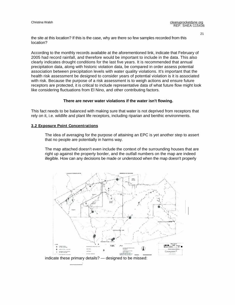
The idea of averaging for the purpose of attaining an EPC is yet another step to assert that no people are potentially in harms way.
The map attached doesn't even include the context of the surrounding houses that are right up against the property border, and the outfall numbers on the map are indeed illegible. How can any decisions be made or understood when the map doesn't properly
indicate these primary details? — designed to be missed: -
smornavaraammm
" ' a . if• i.
s , . " s
OMNI
WM/ NT.
_
IRINI013,1 11•110.11 MI. ••••
-
1",..4.-e••••
• a . . . . . . . ' ' ' ' ' ' ' ' +-am. .•'•.•
0
••......50. germs* MotreZe....„.V•
Christina Walsh cleanuprocketdyne.org. REF: SHEA-115436
22 FIGURE 1 — Site Layout I am disappointed in the poor quality of this map. For years, when I commented on all of the Group RFI submission reports, I regularly commented in the lacking context markers used on maps and figures. This map, even zoomed in, does not identify the outfalls legibly. None of the numbers can be read, so how can the public be expected to understand the discussion of the outfalls, their locations and related challenges, when none of the numbers are readable. This is another example of presentation of data that is designed to be missed by the public.
5. Risk Based Concentrations Assumptions of likely cancer rates of one in three for women and one in two for men should emphasize the importance of NOT adding incremental risk to the surrounding human receptors as well as wildlife who are also reduced to seeking water where there is limited water access. The impairment of water quality in Bell Creek has particularly high potential impacts to the surrounding wildlife because it is often the ONLY water source in the region as it is the only year-round creek.
Removal of COPCs based on fewer than 5 detections This is inappropriate, especially when purposefully using non-operational and drought years. I request an audit comparison of rainfall and sampling for the last ten regulatory years to ensure that the actions taken here are used to address the problem and improve the conditions, and not to explain away discharges that potentially cause harm to human and other biological receptors.
Examples like the "pure product" concentration levels found deep within Core Hole 6 indicate that massive concentrations remain sequestered by various means, that in no way guaranteed to continue. Any change in groundwater elevation can change sub-surface flow significantly over time, with changing elevation conditions, and these cannot necessarily be controlled in the future.9
General Board Process While the process has been riddled with politics and controversy, the Regional Water Quality Control Board and its staff have managed their responsibilities at this site with more transparency and fairness than any other regulatory agency. As you are likely aware, I have managed to kick the tires of process for some time now.
I appreciate this overall process, board-driven, with report-back culture of transparency and inclusion. I believe it is designed to provide the concerned and affected public with the tools, process, and access to navigate the information. Having our voices heard within the decision making process, is critical to developing solutions that the community can believe in and support. We are then part of the process and of the solution.
Thank you for the opportunity to participate and I look forward to your consideration of these issues and concerns. If you believe my points are in need of clarification, please don't hesitate to call or write: 818-922-5123 [email protected]
9 Seckington, Tom 2007 DTSC

Christina Walsh
Sincerely,
Christina Walsh cleanuprocketdyne.org
cleanuprocketdyne.ora REF: SHEA-115436
23
CSW:slb
\Attachments include previously submitted comments relating to surface water runoff across the site over time:
Previous Comments related to this issues from RFI submissions: "

Christina Walsh cleanuprocketdyne.orci REF: SHEA-115436
24
Please update maps and figures to reflect accurate neighboring ownership
• BBI should be listed as American Jewish University
• Bell Canyon [directly adjacent] is not identified • Centex should say Dayton Canyon
Incomplete investigation of potential migration pathways of contaminants
• Blue lines indicating surface water runoff create the impression there is no migration pathway in this direction. I believe this has been incorrectly characterized due to the topograph$ca I lines, photographic evidence, steep gradient to Dyson Canyon. No nude is located there.
Sitewide Commen t
SSFL SITE BOUNDARY
0614% CAffirlet 4M-Z - a 10C1
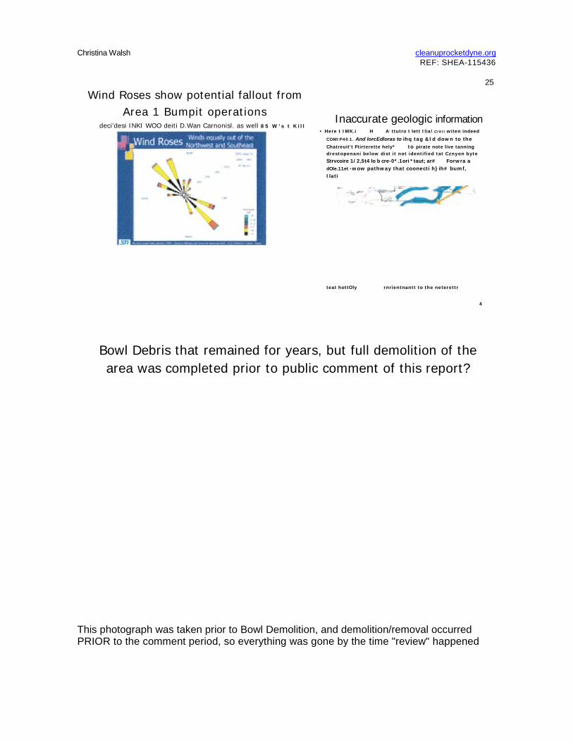
Wind Roses show potential fallout from Area 1 Bumpit operations
deci'desi INKI WOO deiti D.Wan Carnonisl. as well 85 W's t K i l l
Inaccurate geologic information • Here t IMK.i H A , ttutro t lett Ilia! Crkti witen indeed
COMIP40-1. And lorcEdloras to ihq tag &Id down to the Chatreuit't Ftirterette hely* to pirate note live tanning drestopenani below dist it not identified tat Cznyon byte Strvcoire 1/2,5t4 lo b cre-0*.1ori *taut; ar# Forwra a dOle.11et -wow pathway that coonecti h}ih# bumf, Ilati
teat hottOly rnrientnantt to the neterettr
4
Bowl Debris that remained for years, but full demolition of the area was completed prior to public comment of this report?
Christina Walsh cleanuprocketdyne.org REF: SHEA-115436
25
This photograph was taken prior to Bowl Demolition, and demolition/removal occurred PRIOR to the comment period, so everything was gone by the time "review" happened

Please note the YELLOW barrels decaying over time at the "Bowl" in Area I. Normally at Santa Susana, yellow barrels indicated radiological constituents.
Christina Walsh cleanuprocketdyne.orq REF: SHEA-115436
26
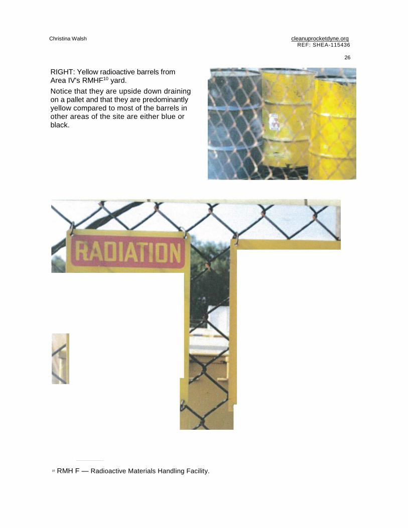
RIGHT: Yellow radioactive barrels from Area IV's RMHF10 yard. Notice that they are upside down draining on a pallet and that they are predominantly yellow compared to most of the barrels in other areas of the site are either blue or black.
10 RMH F — Radioactive Materials Handling Facility.

CAUTION
RADIATION AREA
IRX
Caution \ t
a Radioactive
Material . LY f`(

Christrna Walsh cleanuprocketdvne.orq REF: SHEA-115436
27
Soil Vapor monitoring results Burnpit and CTL V VOC vapor cont.
PCBs in Soil
• Ex1F•nsive CMS areas, bug ConcernPd that downer-ad lent areas are not adequatt•ly sampled.
Metals in Soil • Same comment about adequate $arn pimp. to
the south for these contshtuents of concern.
• 1/1...1/ mbni AIR 111.11,1(100.111111.111
• low IN._ msa pom. P Mel Clonabein. Oral-
row& Apthicrd torm•
OhClJILf l t
• 1...••••,. MANS •••••• ••• ••••3 1••••.. •RAM,
• •••-•••• 101 •••••• ••••• ••• •••
• •••••.• ••..••••••..•
r -
MM. i• .•••- I •.• IMM ••••-•••• t . . . - . • • • • • • • • 40.• .0••• r /-
Dioxins in Soil
inadeCtitale dtaXin SJrnpl ing cormilming concentrations found at CTL II, north areas of Bump*, and Bowl

28
Below is an overlay that demonstrates the proximity and relative size of Santa Susana compared to the Dayton Canyon Pulte Development below, where 143 homes are being build in close proximity and 1000 feet below the site. Human receptors should be reflected in both of these new developments and added to the HH RA. [Runkle Canyon to the north]
Context of Group lb to Dayton Canyon
Understanding proximity and spatial relevance to the communities below is important. When we add more homes just down the hill, it DOES matter because we have no way of knowing that the impacts look like at depth after 50 years of stormwater erosion and
Christina Walsh cleanuprocketdyne.orq REF: SHEA-115436
,
Alt - _ .+1.•
29 operations that included burning toxic waste and pouring solvents down the drain.
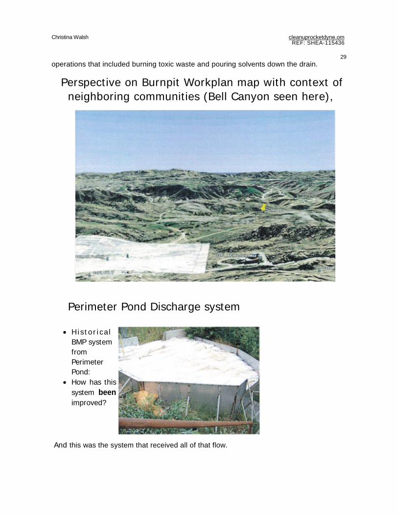
Perspective on Burnpit Workplan map with context of neighboring communities (Bell Canyon seen here),
Perimeter Pond Discharge system
Christina Walsh cleanuprocketdyne.om REF: SHEA-115436
• H is tor i ca l BMP system from Perimeter Pond:
• How has this system been improved?
And this was the system that received all of that flow.
-

30
Burnpit Historical Photographs
Burial of Barrels Burn and storage areas throughout the site
• Is this from the Area 1 Burniut) If not, which location is it from?
Thry .appars to be a widoi shOt trim 1h* previous photo fixation What is bet-reved to be contamed us the-se many barrels 7
Were they to he IgroWid as shown irt htstorlcal photographs?
' flow does the wituttose account fur Me many decades the burnpits were ifl opevatiun?
Christina Walsh cleanuprocketdyne.orq. REF: SHEA-115436

Discharge pipes from CTL V
Effluent discharge pipe from CTL V to Burnpit area
Christina Walsh cleanuprocketdyne.orq REF: SHEA-115436
31
4i Wh4E WaS SE al-NJ
*2.11111. this tented area g.k..„ t,
• *;44 and concrete pads
- and

Christina Walsh cleanuprocketdyne.org REF: SHEA-115436
C4,it 1.1 *C.
32
Figura
•Kt/ OM, WYE -
!Ift.
t • I 1 / A a - • , • " ' " •
ter
, * C 4 1 1 L.
17.0 ra
7,
rad b• I „ „ l a s s '4'•Imal,"Sh • +14
we*
4410 40.
•

Area 1 Burnpit drainage perspective
CTL HI reclamation pond not shown

Discharge Pipe closeup
Discharge from CTL III
Christina Walsh cleanuprocketdvne.orq REF: SHFA-115436
33

Christina Walsh cleanuorocketdvne.orq REF: SHEA-115436
34
Christina Walsh cleanuprocketdyne.orct REF: SHEA-115436
35
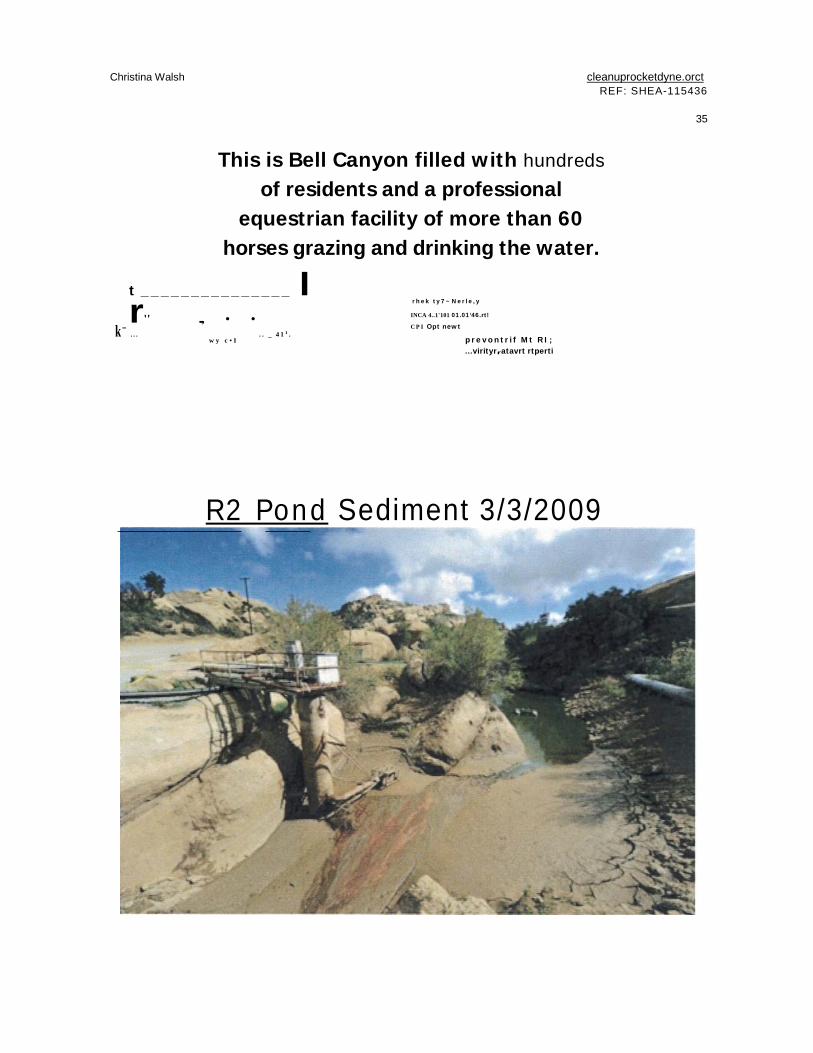
This is Bell Canyon filled with hundreds of residents and a professional
equestrian facility of more than 60 horses grazing and drinking the water.
t _______________ I r'' ..., • •
k- . . . . . _ 4 1 1 .
w y c • I
rhek ty7~Nerle,y
INCA 4..1'101 01.01‘46.rt!
C P I Opt newt
p re vo nt r i f M t R I ; ...virityrratavrt rtperti
R2 Pond Sediment 3/3/2009

36
R2 Pond Sediment 3/3/2009
Christina Walsh cleanuprocketdyne.ora REF: SHEA-115436
Fr
•til" - • -
r -

Christina Walsh cleanuprocketdyre.orq REF. SHEA-115436
37
Walking up the steep road to the Skyline Tanks, we actually came across this old sign, very rusty, but you could make out the letters of -Wally Swan" if you looked really carefully (and had seen this photo before).
ENTERING
SKYLINE DRIVE arive C4A5e,beil

Christina Walsh cleanuprocketdvne,orq REF: SHEA-115436
38
cc: Mazar All Sam Unger Deb Smith Barbara Lee Ray Leclerc Mark Malinowski Grant Cope
