franklin street feasibility study - phase ii city of portland
TRANSCRIPT
Franklin Street Feasibility Study - Phase II City of Portland
PAC Meeting #2 | October 2, 2013 With Gorrill Palmer Consulting Engineers, Inc. | S.W. Cole Engineering, Inc. | Titcomb Associates | Morris Communications
2
Agenda
Welcome and Introductions Review of Existing Conditions Opportunities Break Review of Previous Alternatives Group Conversation – Revising Phase I
Alternatives Wrap-up

3
Review of Existing Conditions
Demographics
Land Use
Streetscape
Transportation
4
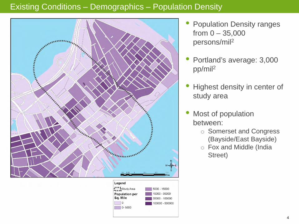
Existing Conditions – Demographics – Population Density
• Population Density ranges from 0 – 35,000 persons/mil2
• Portland’s average: 3,000
pp/mil2
• Highest density in center of
study area
• Most of population between: o Somerset and Congress
(Bayside/East Bayside) o Fox and Middle (India
Street)

5
Existing Conditions – Incomes and Poverty
• Poverty levels around 70%
• Portland’s average: 14%
6
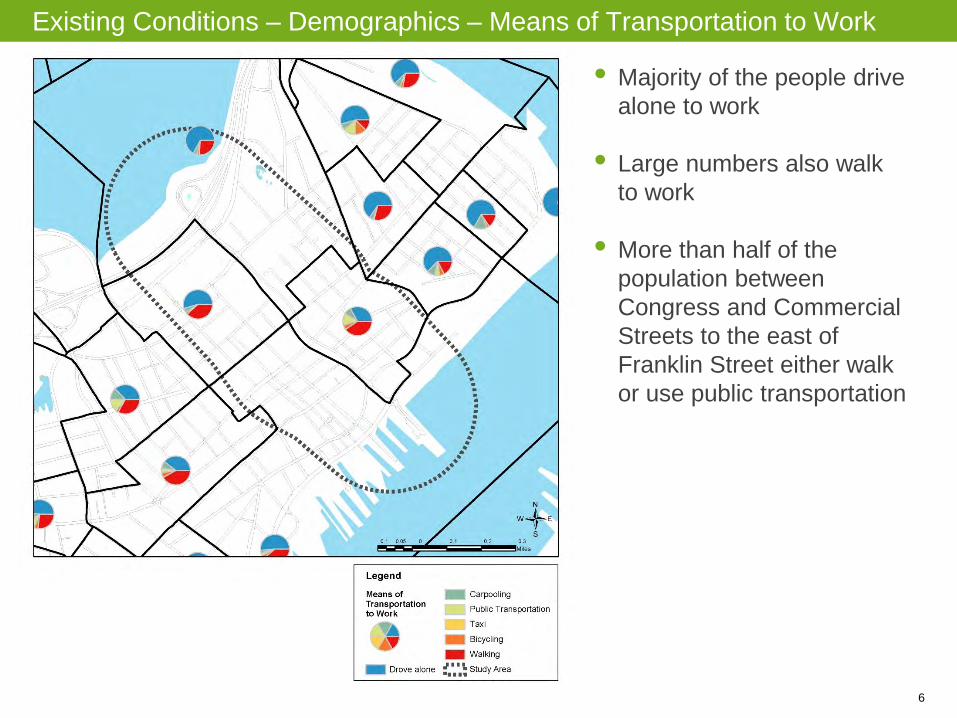
Existing Conditions – Demographics – Means of Transportation to Work
• Majority of the people drive alone to work
• Large numbers also walk to work
• More than half of the population between Congress and Commercial Streets to the east of Franklin Street either walk or use public transportation
7
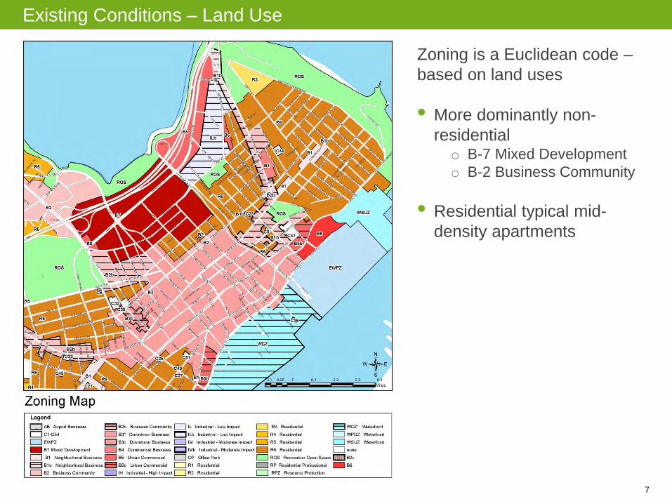
Existing Conditions – Land Use
Zoning is a Euclidean code – based on land uses • More dominantly non-
residential o B-7 Mixed Development o B-2 Business Community
• Residential typical mid-
density apartments

8
Existing Conditions – Land Use
• “Edge Condition” between the residential on one side and commercial on other with Franklin as a “buffer”
• Franklin is a purposeful
divider
• Significant underutilized areas (from the perspective of development) o Median o Parking lots o Community gardens o Large warehouse

9
Existing Conditions – Land Use
• Existing larger format uses/larger parcels allow for land consolidation/ intensification
• For a more active environment, need longer activity periods
10
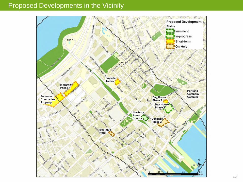
Proposed Developments in the Vicinity
11
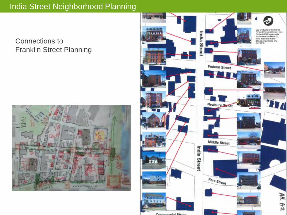
India Street Neighborhood Planning
Connections to Franklin Street Planning

12
India Street Neighborhood Planning
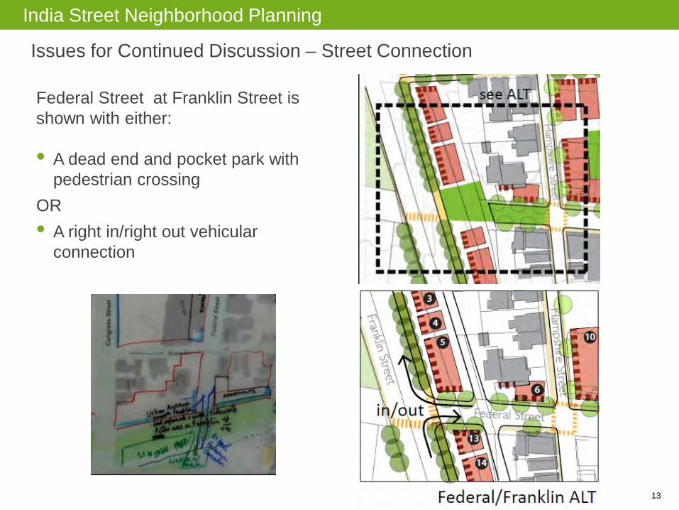
13
Federal Street at Franklin Street is shown with either: • A dead end and pocket park with
pedestrian crossing OR • A right in/right out vehicular
connection
India Street Neighborhood Planning
Issues for Continued Discussion – Street Connection

14
India Street Neighborhood Planning
Issues for Continued Discussion – Franklin Street Alignment
Existing Franklin Right of Way
Conceptual Franklin Right of Way
Future Franklin alignment implicates potential developable land and opportunities for restoration of Lincoln Park to its “Pre-Franklin” Size.
15
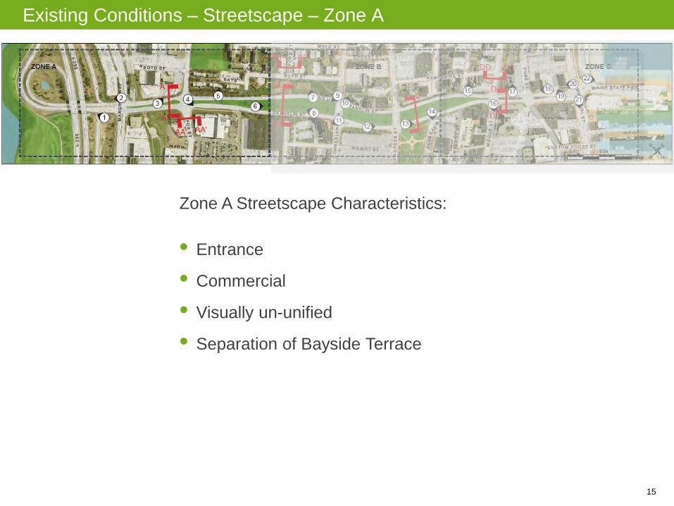
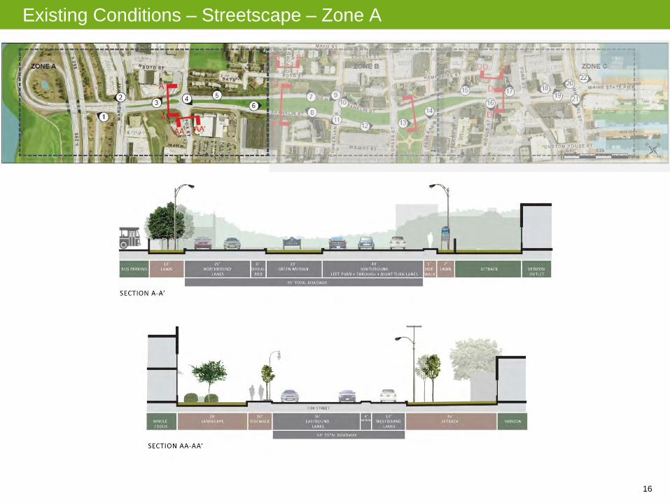
Existing Conditions – Streetscape – Zone A
Zone A Streetscape Characteristics: • Entrance
• Commercial
• Visually un-unified
• Separation of Bayside Terrace
16
Existing Conditions – Streetscape – Zone A

17
Existing Conditions – Streetscape – Zone A

18
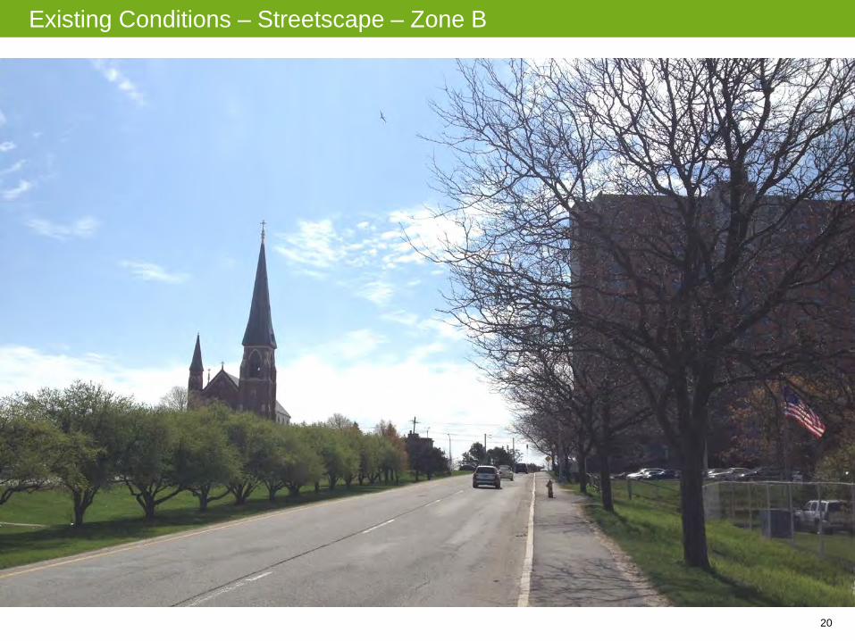
Existing Conditions – Streetscape – Zone B
Zone B Streetscape Characteristics: • Imbalance / inappropriate screening – Franklin Towers,
sidewalks, views in both directions, parking lot
• Missing sidewalks
• Peak / Crest

19
Existing Conditions – Streetscape – Zone B
20
Existing Conditions – Streetscape – Zone B

21
Existing Conditions – Streetscape – Zone B
PATH TO OXFORD STREET

22
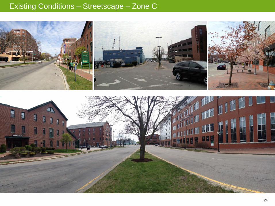
Existing Conditions – Streetscape – Zone C
Zone C Streetscape Characteristics: • Franklin narrows
• Retaining wall / grade
• Commercial Street visual gap
• Imbalance between building facades and sidewalks

23
Existing Conditions – Streetscape – Zone C
24
Existing Conditions – Streetscape – Zone C

25
Existing Conditions – Traffic and Transportation – Traffic Volumes
Heavier traffic volumes to the north of the study area

26
Existing Conditions – Traffic and Transportation – Traffic Volumes

27
Future Baseline – Traffic Volumes

28
Existing Conditions – Traffic and Transportation – Crashes
High Crash Location: Franklin Street and Marginal Way

29
Existing Conditions – Traffic and Transportation – LOS
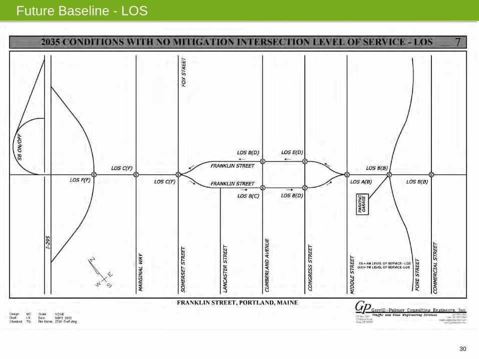
Worse LOS to the north of the study area
30
Future Baseline - LOS

31
Existing Conditions – Traffic and Transportation – Multimodal LOS

32
Existing Conditions – Traffic and Transportation – Multimodal LOS
• MMLOS F for transit o Doesn’t account for cross-
service (e.g. along Congress) o Very few facilities
• Bicycle LOS is next worst.
Challenges: o Little to no facilities provided o Intersections/turns o Design guidelines would at
least require a 4’ – 10’ marked shoulder.
o Plan includes bicycle lane • Pedestrian Environment is better towards Commercial Street end (higher ped
volumes as well). Challenges: o Generally does not meet ADA or design guidelines (Portland 2010 Technical
Manual) o Desire lines indicate greater demand for crossing o Long crossing distances o Intersections/turns

33
Existing Conditions – Pedestrian and Bicycle Transportation
Pedestrian Infrastructure
• Significant gaps, particularly in N
34
Existing Conditions – Pedestrian and Bicycle Transportation
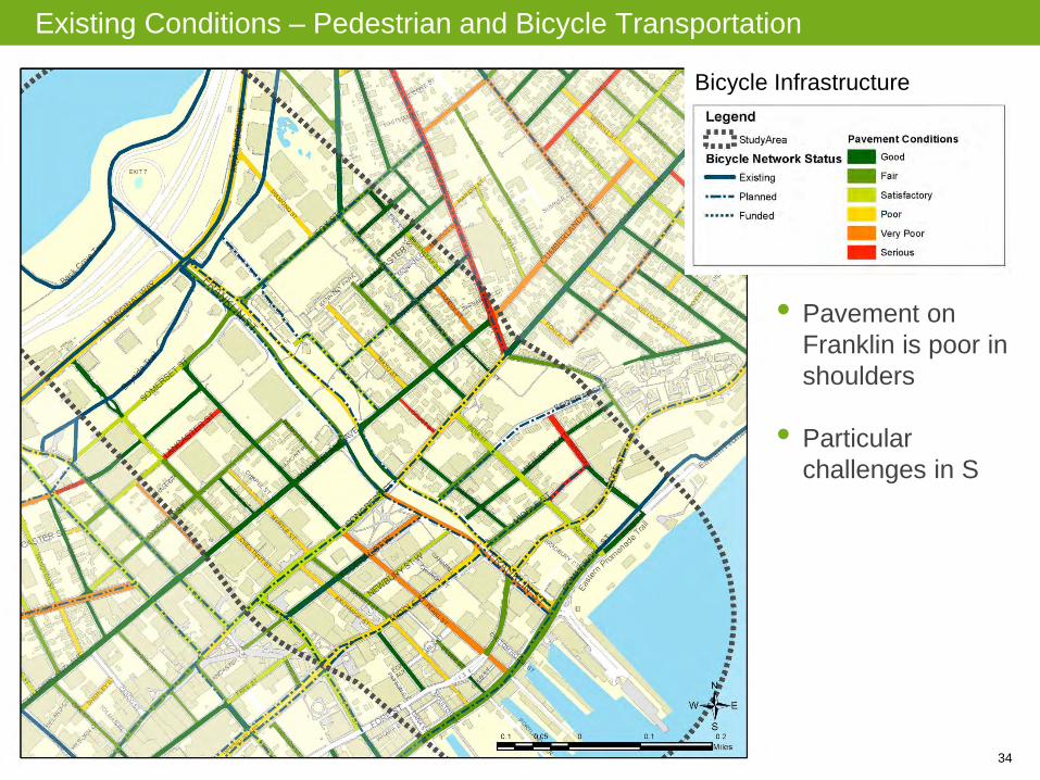
Bicycle Infrastructure
• Pavement on Franklin is poor in shoulders
• Particular challenges in S

35
Existing Conditions – Pedestrian and Bicycle Transportation
• Committee noted more generators in N, attractors in S

36
Existing Conditions – Pedestrian and Bicycle Transportation
• Challenges: intersections, pavement, turns, entrances, wayfinding
• EW Desire Line not met
37
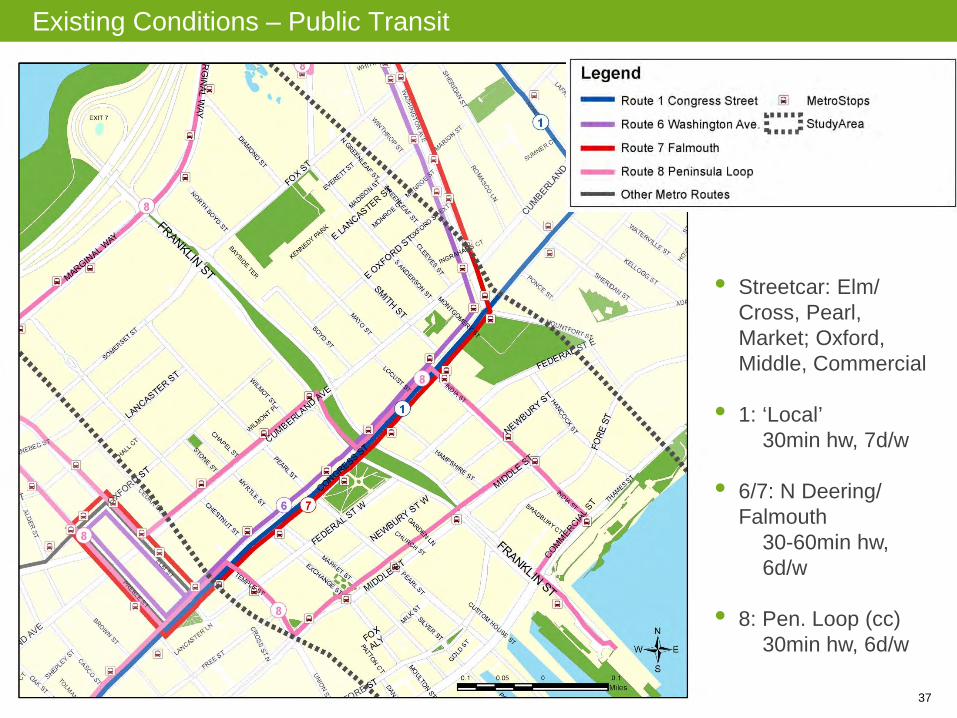
Existing Conditions – Public Transit
• Streetcar: Elm/ Cross, Pearl, Market; Oxford, Middle, Commercial
• 1: ‘Local’ 30min hw, 7d/w • 6/7: N Deering/
Falmouth 30-60min hw, 6d/w • 8: Pen. Loop (cc) 30min hw, 6d/w

38
Opportunities
Then and Now
Nodal Development
Reconnections
Grading
Transportation / Realignment
Scale and Balance
Case Studies

39
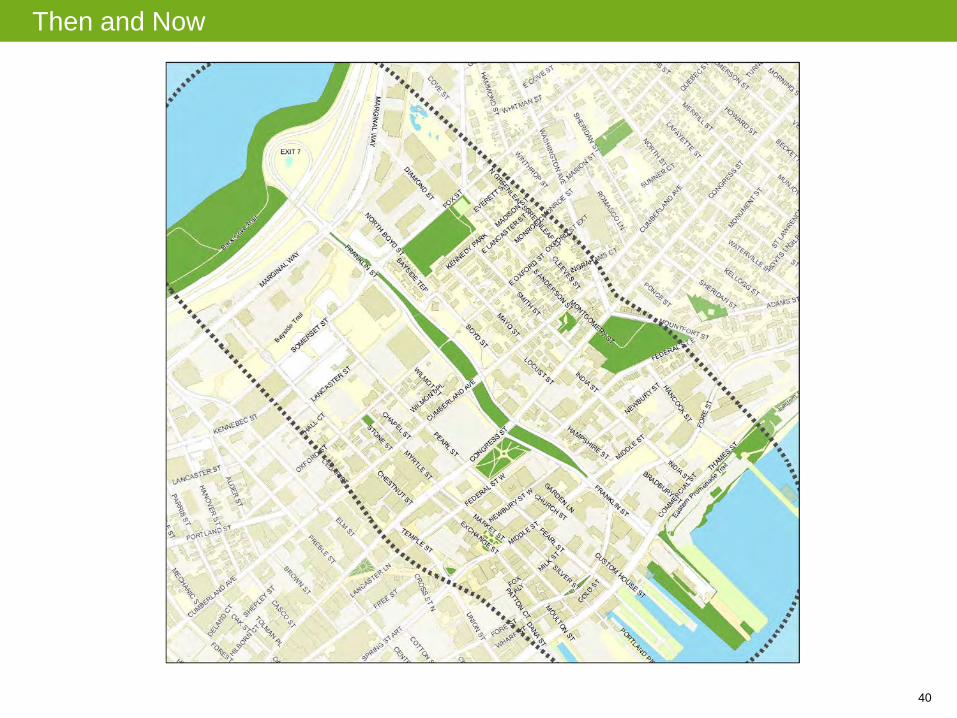
Then and Now
40
Then and Now
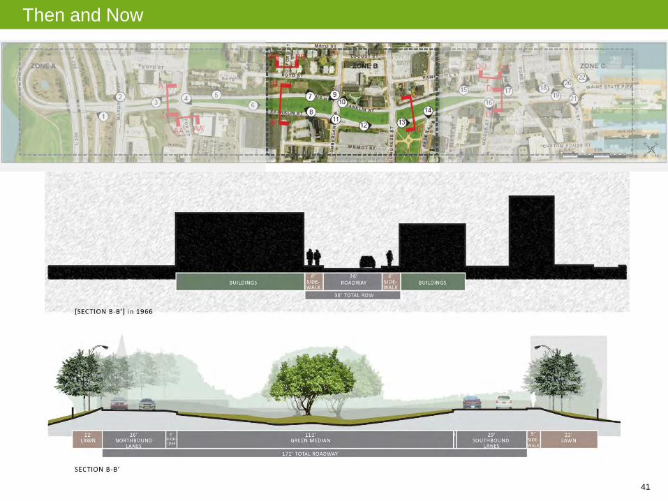
41
Then and Now
42
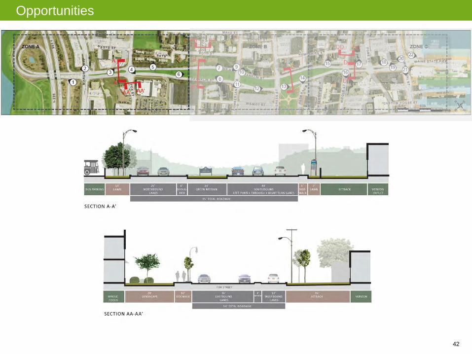
Opportunities

43
Opportunities – Nodal Development
• Nodes of development or gateway treatments
• Potential nodes: 1. Cumberland Intersection 2. 1-295 Overpass 3. Casco Bay Ferry Terminal
Cumberland Intersection

44
Opportunities – Reconnections
• Key east-west desire lines are unmet • Potential Reconnections:
1. Wayfinding 2. Vehicular connections 3. Non-motorized connections
Oxford Street Desire Lines

45
Opportunities – Grading
• Grading presents challenge for non-motorized transportation, reconnecting streets, and stormwater management.
Cut (in red) and Fill (in blue) Analysis

46
Opportunities – Possible Re-alignment
• North-south alignments or reduction or elimination of median provides following opportunities:
1. Mixed use development 2. Restoration of Lincoln Park 3. Stormwater challenges/opportunities
47
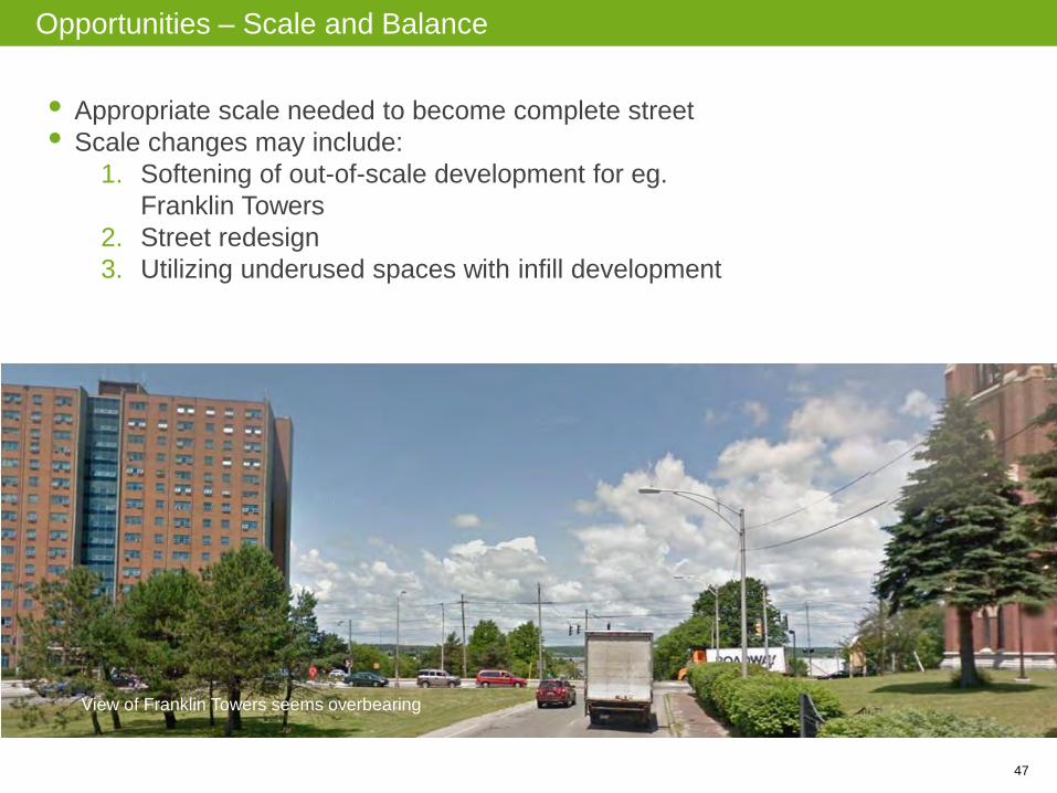
Opportunities – Scale and Balance
• Appropriate scale needed to become complete street • Scale changes may include:
1. Softening of out-of-scale development for eg. Franklin Towers
2. Street redesign 3. Utilizing underused spaces with infill development
View of Franklin Towers seems overbearing

48
Opportunities – Case Studies – SR Mid-City BRT – San Diego
49
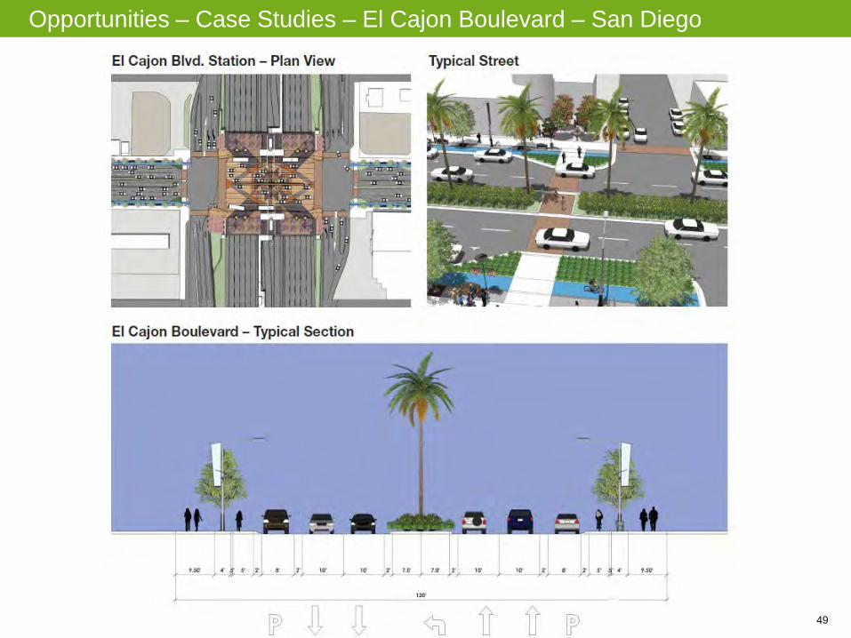
Opportunities – Case Studies – El Cajon Boulevard – San Diego

50
Opportunities – Case Studies – University Boulevard – San Diego

51
Phase I Alternatives
1. Urban Street
2. Urban Parkway
3. Multi-way Boulevard

52
Phase I Alternatives
Accommodates 20% growth in traffic Bicycle lanes/parallel bicycle boulevard Parallel parking
Accommodates 20% growth in traffic Shared bike/ped path Reconnections: Oxford and federal
(cars), all other cross streets (peds) Median for possible future light rail
Through lanes and access lanes Reconnections: Oxford (cars);
Lancaster, Federal, Newbury (peds) Expanded Lincoln Park
Multi-way Boulevard
Urban Street
Urban Parkway

53
Phase I Alternative Elements
Development Vehicle Right-of-Way Target Speed Lincoln Park Parking Transit Pedestrian Crossings Street Crossings Parallel Street Connections Bicycles Vehicle Mobility Roundabouts
Others?
Urban Street Urban Parkway Multiway Boulevard
Development 3 – 4 story buildings Green space and Parks 5+ story building
Lincoln Park Maintain size and form Full restoration Partial expansion
Parking Parallel parking on segments Limited parallel parking Parallel parking on access roads
Transit Curbside stops Reserve median for future fixed guideway
Curbside stops
Accommodation of growth in traffic
20% growth 20% growth
Reconnections Lancaster (signalized pedestrian – right turn only) Oxford (signalized) Newbury (unsignalized) Federal (unsignalized)
Lancaster (signalized pedestrian only) Oxford (signalized) Newbury (unsignalized) Federal (median refuge)
Lancaster (signalized pedestrian – right turn only) Oxford (signalized – right turn only) Newbury (unsignalized – pedestrian only) Federal (unsignalized – pedestrian only)
Parallel Street Connections Wilmot: Somerset‐Marginal, Oxford‐Lancaster, and Congress‐Cumberland. Pearl: Somerset to Marginal.
Wilmot: Congress‐Cumberland. Pearl: Somerset to Marginal.
Pearl: Somerset to Marginal.
Vehicle right of way 2-lane street from I-295 to Congress Street, 1-way street from Congress to Commercial Street
2-lane street from I-295 to Congress Street, 1-way street from Congress to Commercial Street
Separate side access roads
Target Speed 25 mph 30 mph 30 mph, 15 mph for access roads
Bicycle Infrastructure Bicycle lanes Bicycle lanes and bicycle paths Bicycles use side access roads
Vehicle Mobility Turning lanes Turning lanes, roundabout Turning lanes

54
Phase I Alternatives – Urban Street

55
Phase I Alternatives – Urban Parkway

56
Phase I Alternatives – Multi-Way Boulevard
57
Thank You