for corse 2000 june 27, 2000 wetmaap development team catherine m. lockwoodlawrence r. handley jean...
TRANSCRIPT
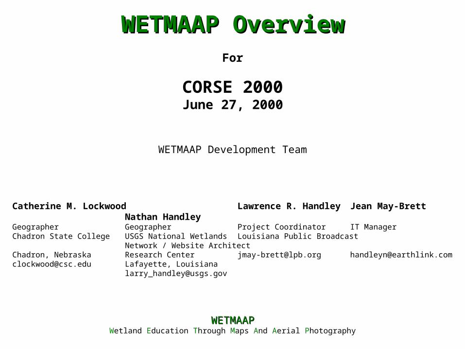
For
CORSE 2000June 27, 2000
WETMAAP Development Team
Catherine M. Lockwood Lawrence R. Handley Jean May-Brett Nathan HandleyGeographer Geographer Project Coordinator IT ManagerChadron State College USGS National Wetlands Louisiana Public Broadcast Network / Website ArchitectChadron, Nebraska Research Center [email protected] [email protected]@csc.edu Lafayette, Louisiana
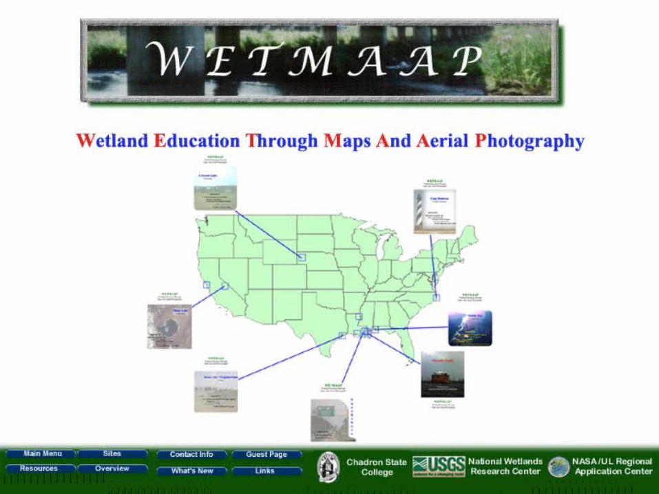
WETMAAPWETMAAPWetland Education Through Maps And Aerial Photography
WETMAAP OverviewWETMAAP Overview
WETMAAP (Wetland Education Through Maps and Aerial Photography) provides a significant new means of disseminating environmental information about wetlands and upland habitats from a geographic perspective through workshops and the Internet. Because technology is evolving at an extremely rapid rate, WETMAAP delivers state-of-the-art technology in a low-cost, low-tech fashion to meet the needs of teachers and school districts with limited budgets. The Program offers a series of wetland workshops that provide training in basic ecological concepts, technological skills, and methods of interpretation necessary for assessing wetland and upland habitat change. Workshops explore wetlands using aerial photography, satellite imagery, and wetland maps, and introduce traditional mapping technology into the classroom. Workshop participants or website users have the option to reproduce workshop materials at a minor copy price or to print most of the materials from the website. Through use of the WETMAAP website (www.rac.louisiana.edu/wetmaap) website educators can increase their ability to promote student awareness of and interest in wetland issues. The website is an accessible source for satellite images, aerial photography, topographic maps, workshop outlines, and other Internet sources.
AbstractAbstract
• Introduce educators to wetland habitats’ functions and values
• Introduce educators and students to wetland mapping, digital databases, and GIS technology
• Assist educators with the integration of wetland issues into existing curricula
• Promote public awareness of wetland loss issues and provide an understanding of the cause and effect of wetland change
WETMAAP GoalsWETMAAP Goals
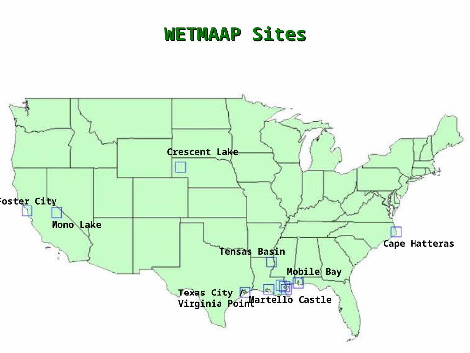
WETMAAP SitesWETMAAP Sites
Crescent Lake
Cape Hatteras
Mono Lake
Foster City
Texas City /Virginia Point
Mobile Bay
Tensas Basin
Martello Castle
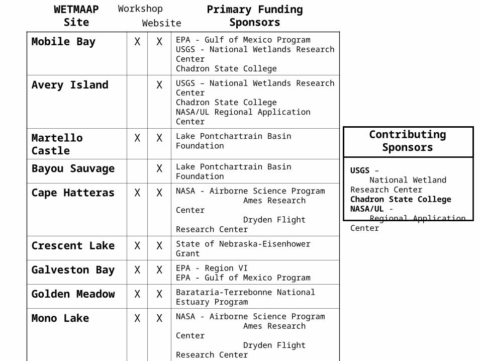
Mobile Bay X X EPA - Gulf of Mexico ProgramUSGS - National Wetlands Research CenterChadron State College
Avery Island X USGS – National Wetlands Research CenterChadron State CollegeNASA/UL Regional Application Center
Martello Castle X X Lake Pontchartrain Basin Foundation
Bayou Sauvage X Lake Pontchartrain Basin Foundation
Cape Hatteras X X NASA - Airborne Science Program Ames Research Center Dryden Flight Research Center
Crescent Lake X X State of Nebraska-Eisenhower Grant
Galveston Bay X X EPA - Region VIEPA - Gulf of Mexico Program
Golden Meadow X X Barataria-Terrebonne National Estuary Program
Mono Lake X X NASA - Airborne Science Program Ames Research Center Dryden Flight Research Center
Northshore X X Lake Pontchartrain Basin Foundation
San Francisco Bay X X USGS - National Wetlands Research CenterChadron State College
Tensas Basin X X U.S. Department of EnergyUniversity of Louisiana at Lafayette
WETMAAPSite
Primary FundingSponsorsWebsite
Workshop
USGS – National Wetland Research CenterChadron State CollegeNASA/UL - Regional Application Center
ContributingSponsors
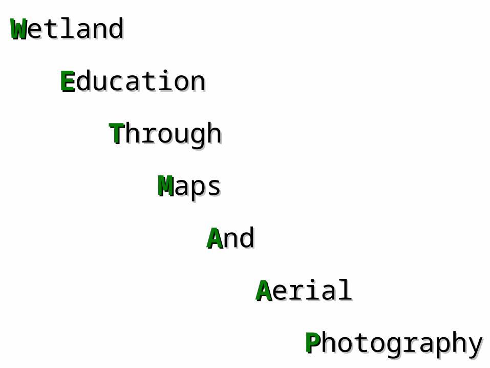
WWetlandetland
EEducationducation
TThroughhrough
MMapsaps
AAndnd
AAerialerial
PPhotographyhotography
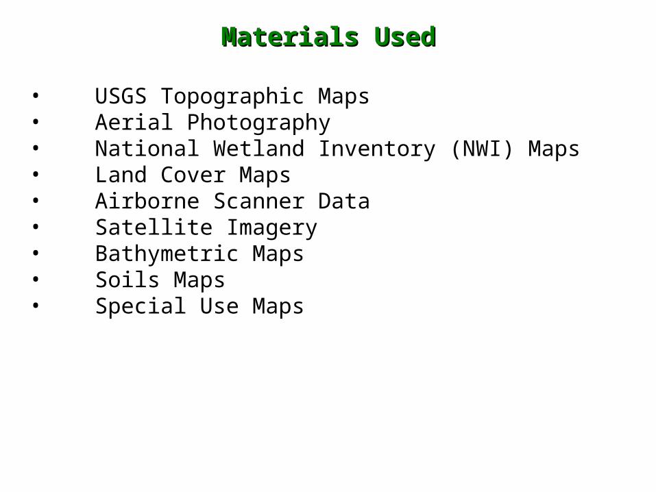
Materials UsedMaterials Used
• USGS Topographic Maps• Aerial Photography• National Wetland Inventory (NWI) Maps• Land Cover Maps• Airborne Scanner Data• Satellite Imagery• Bathymetric Maps• Soils Maps• Special Use Maps
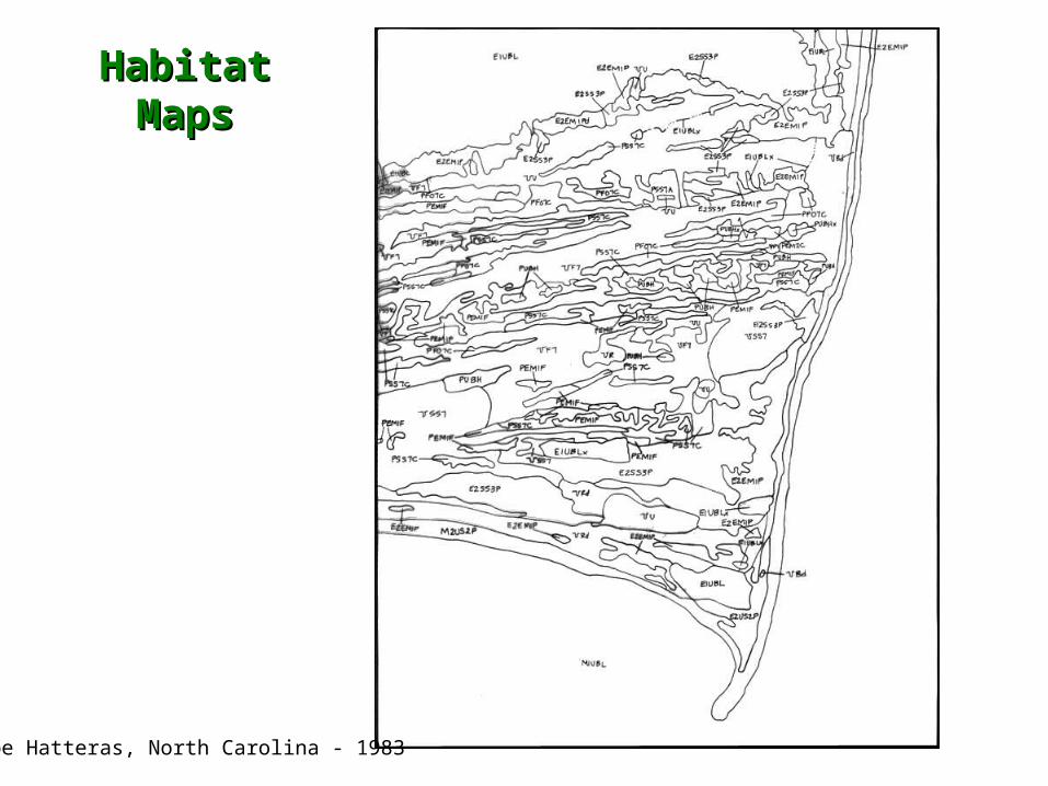
Habitat MapsHabitat Maps
Cape Hatteras, North Carolina - 1983
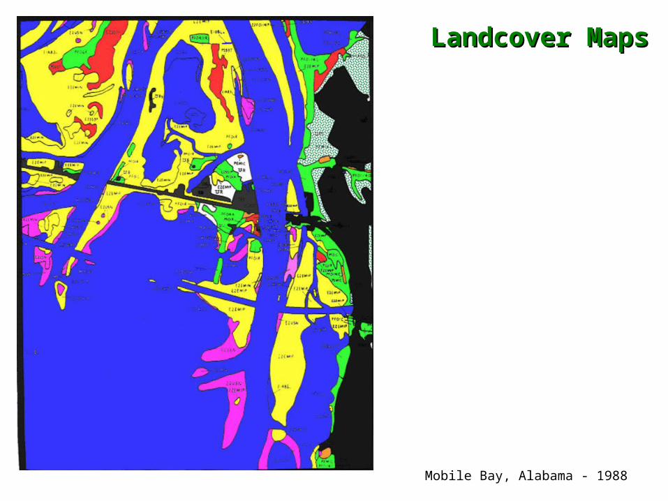
Landcover MapsLandcover Maps
Mobile Bay, Alabama - 1988
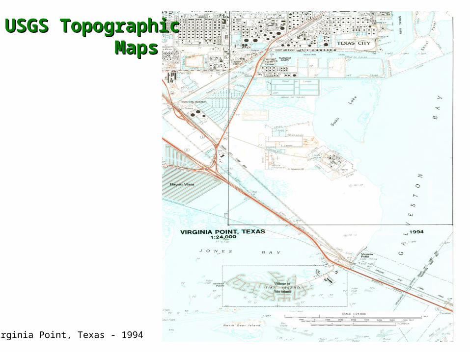
USGS TopographicUSGS Topographic MapsMaps
Virginia Point, Texas - 1994
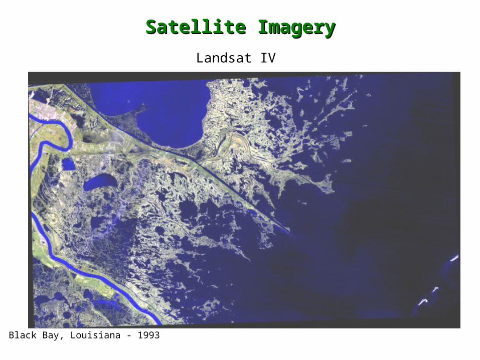
Satellite ImagerySatellite Imagery
Landsat IV
Black Bay, Louisiana - 1993
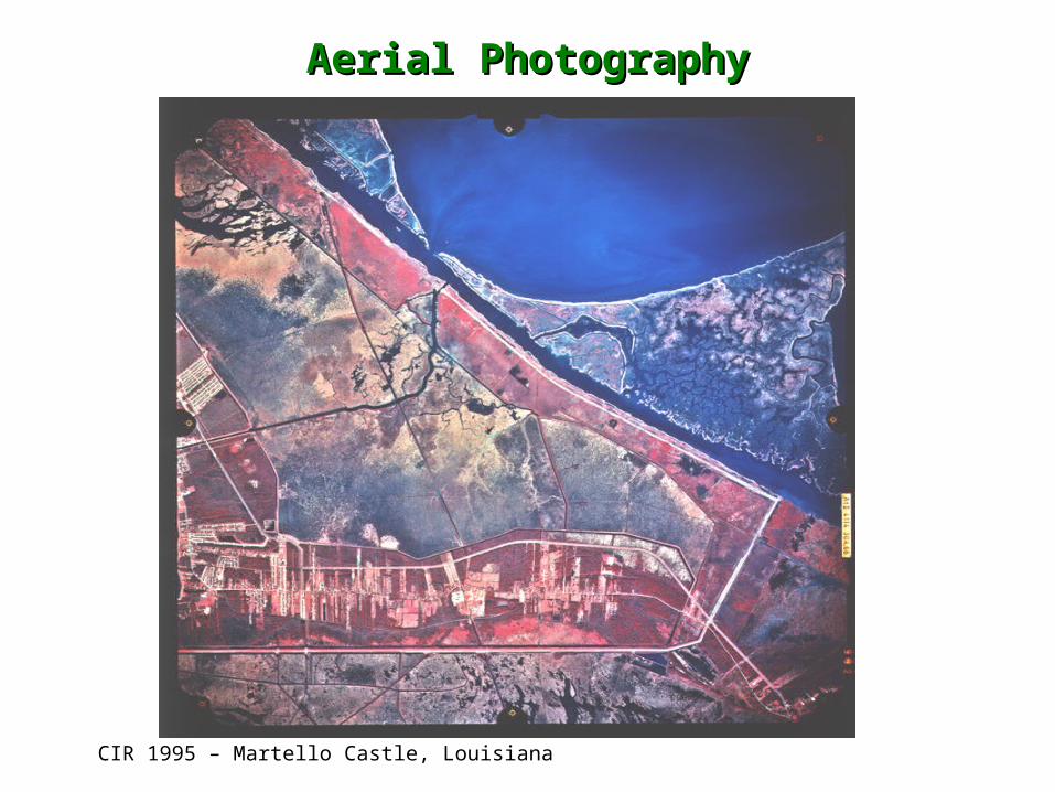
Aerial PhotographyAerial Photography
CIR 1995 – Martello Castle, Louisiana
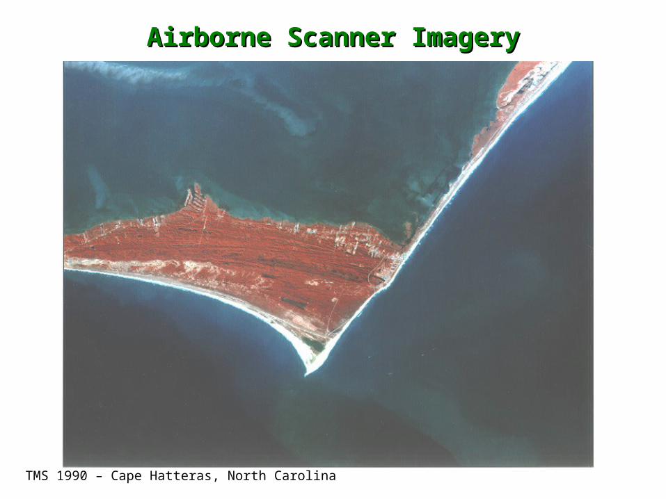
Airborne Scanner ImageryAirborne Scanner Imagery
TMS 1990 – Cape Hatteras, North Carolina
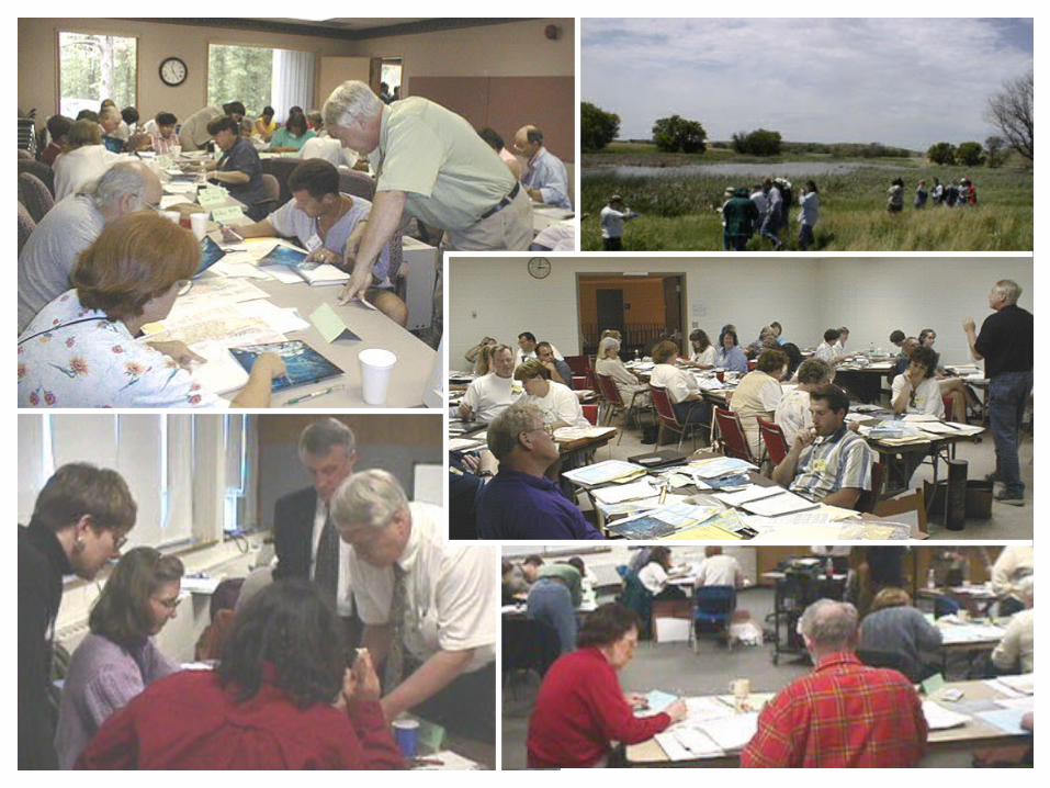
HHands-Onands-On
TTeachereacher
WWorkshopsorkshops
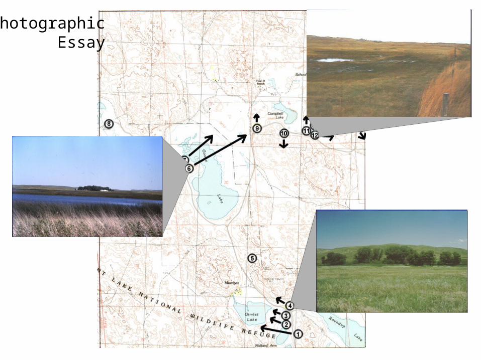
PhotographicEssay
SStandardstandards
BBasedased
EExercisesxercises
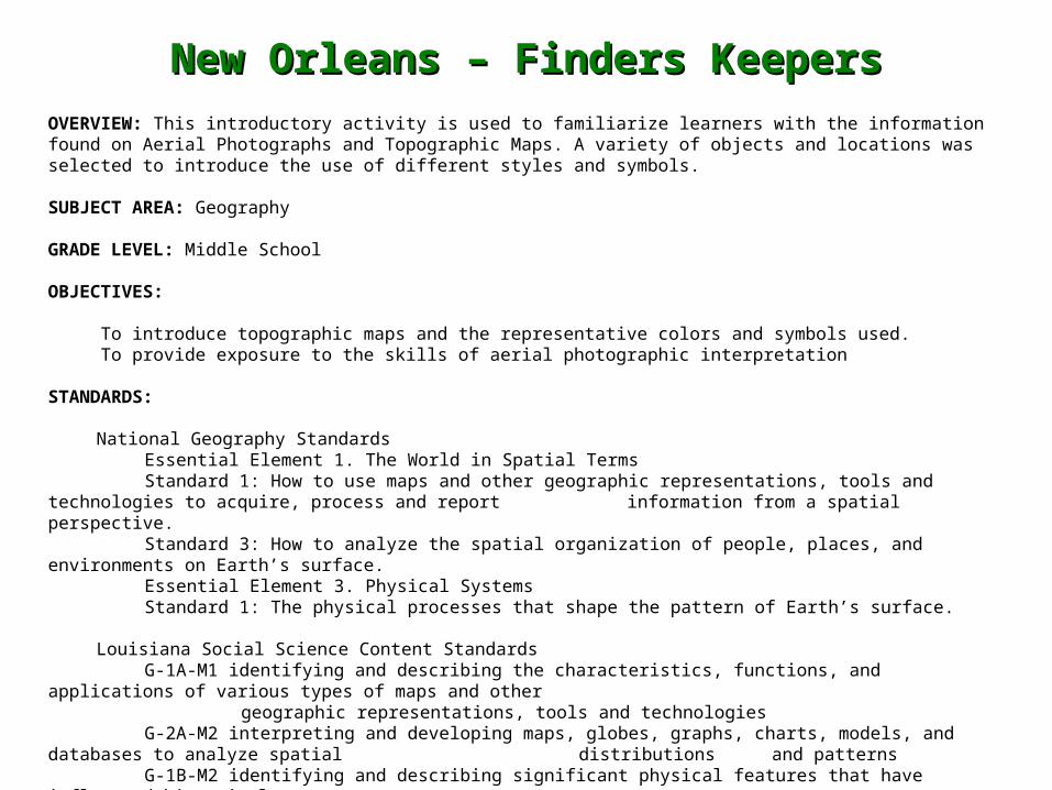
New Orleans – Finders KeepersNew Orleans – Finders Keepers
OVERVIEW: This introductory activity is used to familiarize learners with the information found on Aerial Photographs and Topographic Maps. A variety of objects and locations was selected to introduce the use of different styles and symbols.
SUBJECT AREA: Geography
GRADE LEVEL: Middle School
OBJECTIVES:
To introduce topographic maps and the representative colors and symbols used. To provide exposure to the skills of aerial photographic interpretation
STANDARDS:
National Geography StandardsEssential Element 1. The World in Spatial TermsStandard 1: How to use maps and other geographic representations, tools and technologies to acquire, process and report
information from a spatial perspective.Standard 3: How to analyze the spatial organization of people, places, and environments on Earth’s surface.Essential Element 3. Physical SystemsStandard 1: The physical processes that shape the pattern of Earth’s surface.
Louisiana Social Science Content StandardsG-1A-M1 identifying and describing the characteristics, functions, and applications of various types of maps and other
geographic representations, tools and technologiesG-2A-M2 interpreting and developing maps, globes, graphs, charts, models, and databases to analyze spatial
distributions and patternsG-1B-M2 identifying and describing significant physical features that have influenced historical events
CROSS CURRICULAR CONNECTIONS:
Mathematics: comparing scale Language Arts: Communication
Art: development of pattern recognitionEarth Science: Identification of surface features and processes
TIME: Teacher: 30 minutes for preparation of material packets Class time: one 50 minute class
MATERIALS:
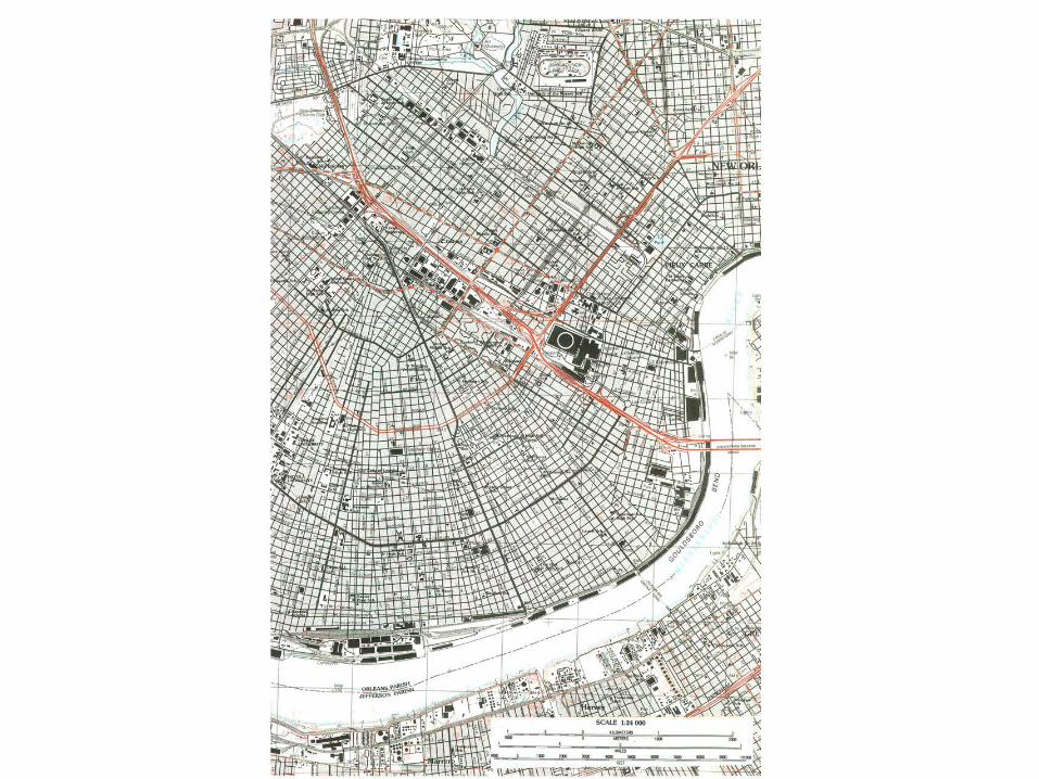
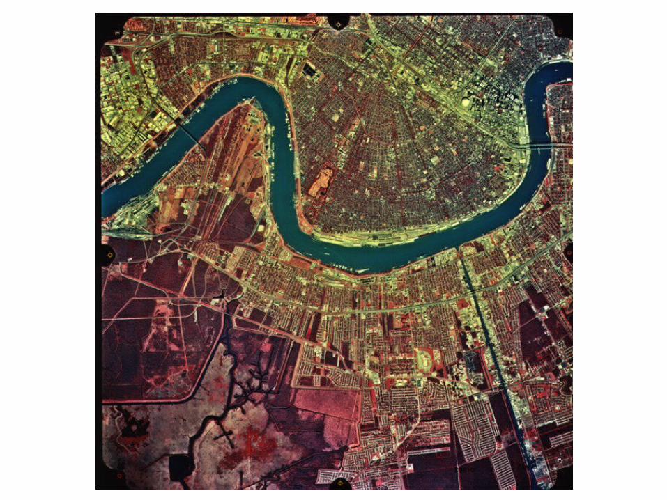
1995 Aerial Photograph, New Orleans, Louisiana1982 1:24,000 Topographic Map, New Orleans EastMagnifying glassTopographic symbols chart
SUGGESTED PROCEDURE:
As the students receive the materials packet, encourage group exploration and quick comparisons. Simple discussion questions should be used to have the students notice the use of colors, symbols, and labeling techniques. Use sections 1,2, and 3 for this.
Introduction to color, symbols, and scale.: Ask the following discussion questions and have the students identify and locate topographic symbols.Using the topographic symbols chart and the topographic map:
Blue colored features represent?Green colored features represent?Black colored features represent?Purple colored features represent?
New Orleans – Finders Keepers – Cont.New Orleans – Finders Keepers – Cont.
Using the topographic symbols chart:Identify the symbol for marsh.Identify symbol for a power line.Identify symbol for a school.Identify symbol for a dual highway with median.
On the New Orleans East 1:24,000 topographic map:Locate a schoolLocate a railroadLocate a cemetery
Using the 1:24,000 New Orleans East topographic map:Find the scale in feetFind "0" on the scale. Why is there 1000 feet to the left and 1000 feet to the right of "0"?Using the edge of a piece of paper, determine the distance in feet from the Loyola. University to Lee Circle in
downtown New Orleans.What is the straight line distance?What is the distance following St. Charles Avenue?
Section 1: Given the table below, first find the object listed on the topographic map and then locate the identified site on the aerial photograph.
Object LocationSuperdome Near center of mapOil Storage tanks Southeast quadrant of map on the West BankFrench Quarter Center, East edge of map
(Vieux Carre)
Section 2: On the 1995 Aerial Photograph1. Locate the Huey R Long Bridge 2. Locate Audubon Park 3. Locate some marsh
New Orleans – Finders Keepers – Cont.New Orleans – Finders Keepers – Cont.
Section 3: On the 1995 Aerial Photograph 1. Note the ferry crossing the river at the foot of Canal Street.2. How many barges are in the "tow" going under the Greater New Orleans Bridge? 3. How many large ships can you count in the river?
ASSESSMENT:
1. The instructor will circulate throughout the room questioning each group to establish student mastery of the materials and to troubleshoot and direct student attention to features an objects.
2. If the materials have been laminated, students may label the objects or places in Sections 1- 2 using a washable marker. 3. Student journal entries on the objectives of the activity.4. After completing the search and locate tasks provided in Sections 1- 3, the student or cooperative group may select other objects or sites to develop peer quizzes.
EXPLORATIONS MAY INCLUDE:
Packets of local topographic maps and aerial photographs for the students to identify known and unknown sites. Student construction of a school topographic map completed to scale and properly oriented.
INTERNET SITES:
http:// evlweb.eecs.uic.edu/pape/vrml/etopo
http:// www_nmd.usgs.gov
New Orleans – Finders Keepers – Cont.New Orleans – Finders Keepers – Cont.
Resource MaterialsResource Materials
• Wetlands Functions and Values Blackline Masters• Geographic Summary and Background Information• NASA Airborne Science Program Slides• Habitat Slides• Background Slides• National Wetland Inventory Classification• Habitat Categories• USGS Topographic Symbols Chart• How to Determine Scale• Glossary

HTTP://HTTP://WWW.RAC.LOUISIANA.EDU/WETMAAPWWW.RAC.LOUISIANA.EDU/WETMAAP