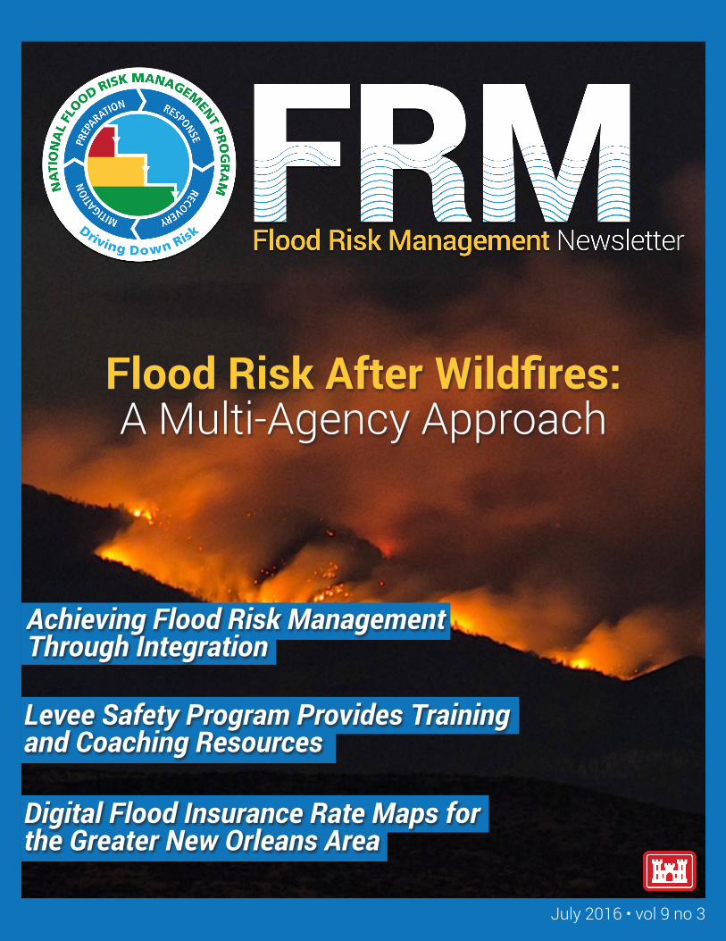
flood risk after wildfires: a multi-agency approach
TRANSCRIPT
July 2016 • vol 9 no 3
Flood Risk After Wildfires: A Multi-Agency Approach
Achieving Flood Risk Management Through Integration
Levee Safety Program Provides Training and Coaching Resources
Digital Flood Insurance Rate Maps for the Greater New Orleans Area
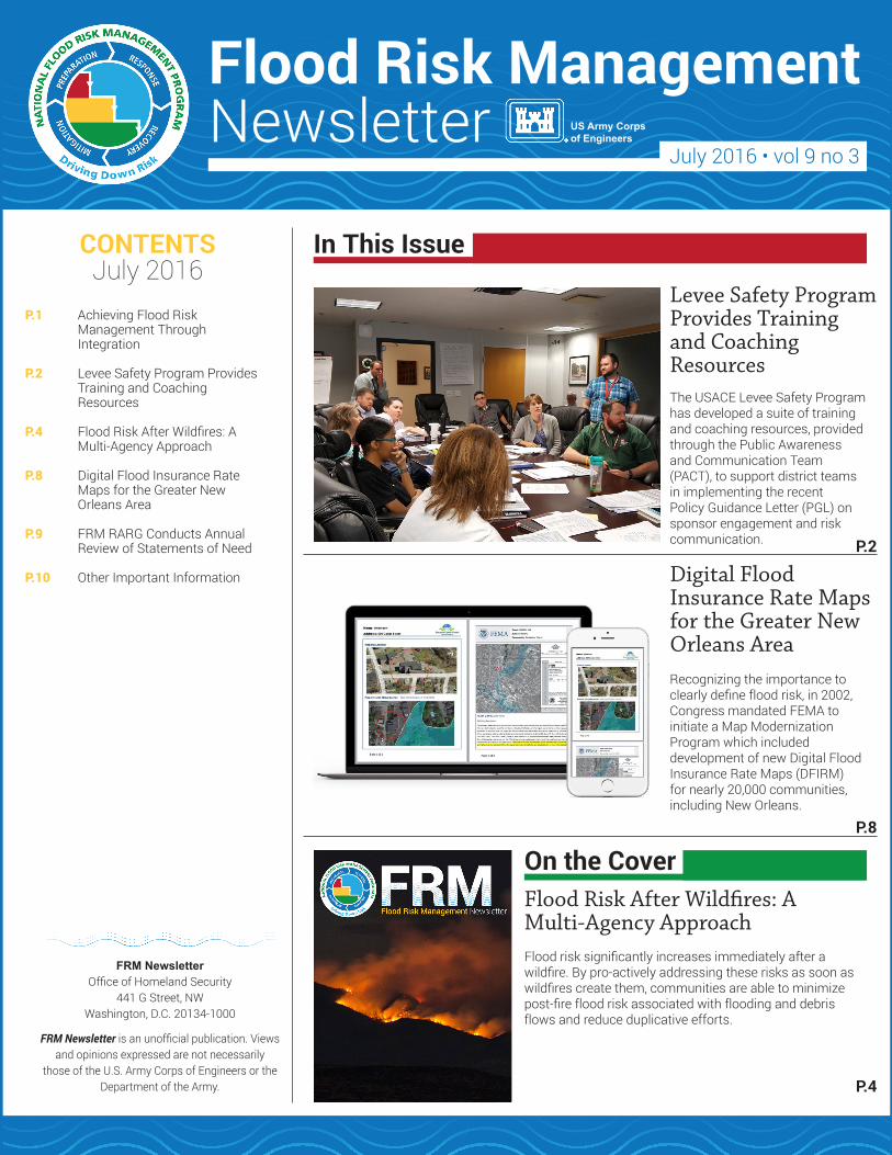
On the Cover
The USACE Levee Safety Program has developed a suite of training and coaching resources, provided through the Public Awareness and Communication Team (PACT), to support district teams in implementing the recent Policy Guidance Letter (PGL) on sponsor engagement and risk communication.
Recognizing the importance to clearly define flood risk, in 2002, Congress mandated FEMA to initiate a Map Modernization Program which included development of new Digital Flood Insurance Rate Maps (DFIRM) for nearly 20,000 communities, including New Orleans.
P.1 Achieving Flood Risk Management Through Integration
P.2 Levee Safety Program Provides Training and Coaching Resources
P.4 Flood Risk After Wildfires: A Multi-Agency Approach
P.8 Digital Flood Insurance Rate Maps for the Greater New Orleans Area
P.9 FRM RARG Conducts Annual Review of Statements of Need
P.10 Other Important Information
Flood Risk After Wildfires: A Multi-Agency Approach
Flood Risk ManagementNewsletter
July 2016 • vol 9 no 3US Army Corpsof Engineers
CONTENTSJuly 2016
In This Issue
Levee Safety Program Provides Training and Coaching Resources
Digital Flood Insurance Rate Maps for the Greater New Orleans Area
P.4
P.8
P.2
Flood risk significantly increases immediately after a wildfire. By pro-actively addressing these risks as soon as wildfires create them, communities are able to minimize post-fire flood risk associated with flooding and debris flows and reduce duplicative efforts.
FRM NewsletterOffice of Homeland Security
441 G Street, NWWashington, D.C. 20134-1000
FRM Newsletter is an unofficial publication. Views and opinions expressed are not necessarily
those of the U.S. Army Corps of Engineers or the Department of the Army.
Continued on page 2.
FRM Newsletter • July 2016 • vol 9 no 3 1
Achieving Flood Risk Management Through Integration
Summer greetings to you and thank you for taking the time to review this latest edition of the Flood Risk Management Newsletter. In recent weeks, I have been taking some time to think about the importance of integration in order to better achieve flood risk management success. We often discuss the need to integrate internally among our Communities of Practice (CoPs) and externally with partner agencies related to flood risk management. In accordance, we frequently refer to our Flood Risk Management Program Managers and Silver Jackets Coordinators as integrators.
We just completed a review of the Directorate of Contingency Operations Vision and Guiding Principles document and I was once more reminded of two principles: “Know the history before you launch and understand the bigger picture,” and “who else needs to know – communicate.” I believe both of these principles bring together the importance of integration.
Flooding can result in a wide variety of impacts ranging from damages to flood control works, water supply infrastructure, navigational facilities,
recreational areas, hydropower operations, and more. It can stress social institutions, disrupt lives, and have profound environmental effects, both positive and negative. The impact of any given flood is rarely isolated to a single USACE business line, and when viewing this issue externally there isn’t a single Federal agency or department with broad responsibility for addressing all impacts. In a society as interconnected as we are, we can achieve the results we strive for in managing our flood risk if we successfully align our authorities, responsibilities, and abilities to tackle these challenges.
Internally, there are a number of CoPs and functional areas with some responsibility for flood risk management. These CoPs include Planning, Dam and Levee Safety, Engineering and Construction, Emergency Management, and Operations. Both our organization and the public are best served when flood risk management decisions are made collaboratively with input from others – and with consideration for how those decisions will affect other CoPs potentially impacted by flood risk management decisions, including Navigation, Recreation, or Regulatory.
Better decisions can be made when we come together, appreciate the importance and complexities of our diverse mission space, and talk through decisions related to flood risk management together.
We observed the need for this integration in action during the flooding that occurred in December 2015 and January 2016 across much of the country and within many of our Division boundaries. Staff from Operations were expertly performing water management by actively managing releases at dams and reservoirs in synchronization with other local and state flood risk reduction projects. Levee Safety Program staff were involved in monitoring and inspecting levees before, during, and after the event, as well as communicating the risk/impacts to the levees internally and externally. Similarly, Emergency Management staff were involved in monitoring the situation, tracking activities to provide a common operating picture for senior leaders and are now involved in conducting the necessary work to facilitate rehabilitation efforts. However, the flood events affected navigation on several rivers, and affected operation of numerous recreational areas associated with reservoir projects. These concerns and their impacts are also important components of the USACE enterprise and must be considered in making decisions to manage future flood risk.
In addition to numerous internal CoPs that could be involved in flood risk management, there are many external partners to consider. Some of these agencies are well known, such as FEMA, NOAA/NWS, and USGS at the federal level, as well as state and local emergency management agencies and floodplain administrators. These partners have equities in FRM. They either have
By Mark Roupas, Deputy Chief, Office of Homeland Security
“Better decisions can be made when we come together, appreciate the importance and complexities of our diverse mission space, and talk through decisions related to flood risk management together. ”
Continued on page 3.
FRM Newsletter • July 2016 • vol 9 no 3 2
direct responsibility for managing some aspect of flood risk, or provide necessary information that assists in flood risk management decision-making. All of the stakeholders, federal, state and local, are better served when an agency makes flood risk management decisions with full stakeholder involvement.
Given the direct and indirect involvement of so many partners in flood risk management, it is critical to have a strong focus on integrating or aligning
all relevant partners into decision making. This is one key component of the National Flood Risk Management Program (NFRMP), including the Silver Jackets Program. As new program guidance is developed for the NFRMP, we are making a concerted effort to involve the broader group of internal partners to ensure we truly capture the needs and opportunities for internal and external integration. The new guidance will help identify how the NFRMP can work with other internal and external
partners to achieve integration and alignment. However, it is those of you reaching across boundaries who are leading us to more comprehensive, smarter flood risk management solutions. Going forward, we will continue to seek and find opportunities to integrate our efforts and move our nation to being better positioned to withstand, recover, and adapt to ever-changing flood risks.Thank you for all you are doing to make our Nation and our communities safer.
Levee Safety Program Provides Training and Coaching Resources By Carol Sanders, Rehired Annuitant, and Stacy Langsdale, USACE Institute for Water
Resources
To support district teams in implementing the recent Policy Guidance Letter (PGL) on sponsor engagement and risk communication, the USACE Levee Safety Program has developed a suite of training and coaching resources, provided through the Public Awareness and Communication Team (PACT). The PACT team is staffed with multi-disciplinary
representatives from the Collaboration and Public Participation Center of Expertise (CPCX), Public Affairs (PA) and Levee Safety. Additional expertise is provided from subject matter experts in Silver Jackets, Flood Risk Management, Emergency Management, the National Levee Database, Tribal Affairs, and the Federal Emergency Management Agency (FEMA).
The first of the monthly coaching calls kicked off the effort in March. These sessions provide an opportunity for mini-trainings, for getting your questions answered by experts and the HQ Levee Safety Program leadership, and for sharing your lessons learned and success stories. Topics to date have been: Developing your District Strategies (an overview of activities
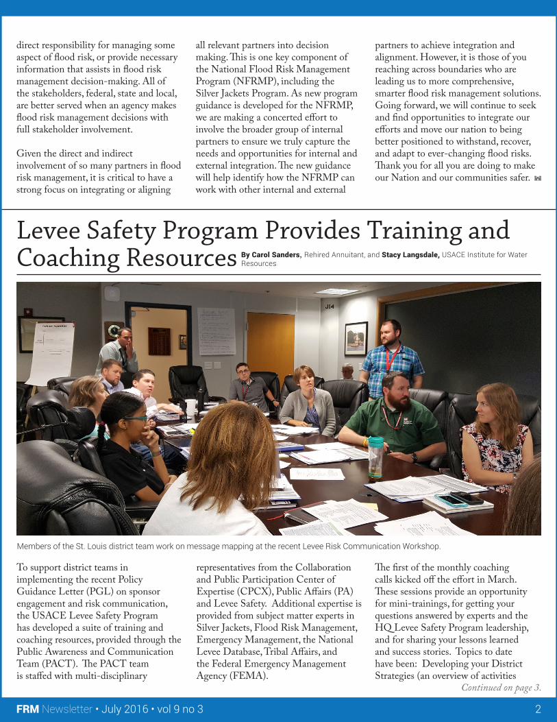
Members of the St. Louis district team work on message mapping at the recent Levee Risk Communication Workshop.
FRM Newsletter • July 2016 • vol 9 no 3 3
called for in the PGL), Tips for Developing the Levee System Summary, and Communicating Uncertainty with Dr. Charlie Yoe. Future session topics may include “lessons from the field,” “what does successful engagement look like,” “framing your story for the media,” and “the sponsors’ perspective.” Notes and slides from completed webinars are available at the USACE Public Affairs Community of Practice homepage under Shared Documents – Levee Safety (https://cops.usace.army.mil/sites/PA). If you have lessons or successes you’d like to share, or topics you’d like to hear about, please send your ideas to Stacy Langsdale.
Many districts are in the middle of developing their engagement and communication strategies and plans. Feedback is always helpful, and the PACT is providing a voluntary review service on draft District
Programmatic Sponsor Engagement and Communication strategies, a levee system communication plan, and/or a specific Levee System Summary. The feedback is high-level and focuses on the elements suggested in the PGL, the recently released HQ Communication Plan for the PGL, additional communication guidance, and best practices. For further information or to submit a strategy or product for review, contact Carol Sanders with PAO.A series of self-paced e-learning modules is in the works and will be available within the month. These brief (10-20 minute) modules can assist district teams in establishing a common, baseline level of knowledge before developing and/or implementing plans. They are designed for team members to choose the modules in which their knowledge is limited. Subjects include basic information on the levee safety program, levee inspections/assessments,
risk communication and effective teams. You can find the modules on the PAO Community of Practice site listed above. For more information, contact Stacy Langsdale.
In June and July, the first team-based, hands-on workshops will be provided to district teams in the Mississippi Valley Division and Southwest Division. These will be the first of many workshops that are customized with the existing capabilities and particular issues of the district in mind. The PACT team of skilled facilitators and levee safety program experts will assist districts in clarifying team members’ roles, responsibilities and resources and assist in applying key skills to develop and implement the district strategy and plans, including message mapping for the development of the Levee System Summary. The workshops are intended to include as many participants from the multi-disciplinary district team as possible. They are designed to build capabilities of the District team, whose members may have a variety of skills related to levee and flood risk and/or risk communication and may come from a variety of USACE programs including, but not limited to, Levee Safety, Silver Jackets, Public Affairs, Emergency Management, Planning, and Flood Risk Management. In cases where multiple districts have a shared interest, such as shared levee systems, shared sponsors or shared state/local jurisdictional boundaries, districts are encouraged to pursue joint workshop sessions in order to ensure consistency of messaging and avoid duplicative efforts. For more information or to schedule a workshop, contact Mary Weidel or Stacy Langsdale.
Additional documents that have been developed to support the PGL implementation such as webinar presentations and the HQ Communications Plan for the PGL are available at the USACE Public Affairs Community of Practice homepage under Shared Documents - Levee Safety (https://cops.usace.army.mil/sites/PA).
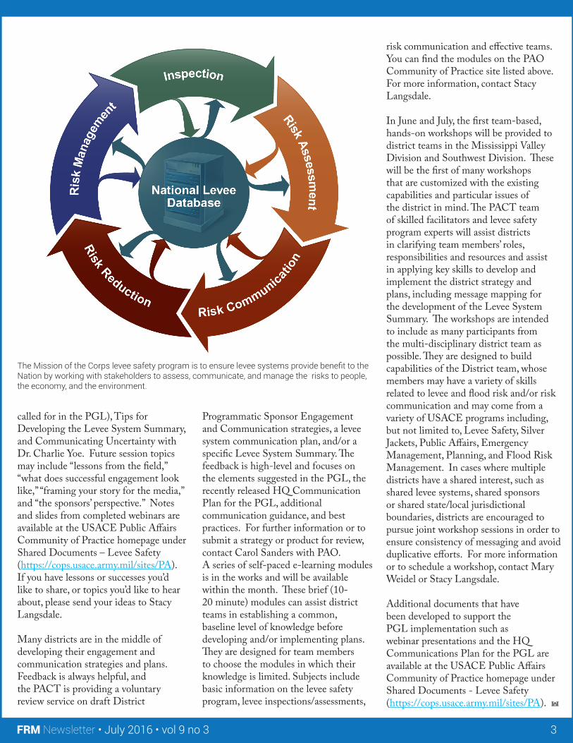
The Mission of the Corps levee safety program is to ensure levee systems provide benefit to the Nation by working with stakeholders to assess, communicate, and manage the risks to people, the economy, and the environment.
Continued on page 5.
FRM Newsletter • July 2016 • vol 9 no 3 4
Flood Risk After Wildfires: A Multi-Agency Approach
BACKGROUND ON WILDFIRE EVENTS
Idaho experienced significant, devastating wildfires across the state in 2013 and 2015. The Pony/Elk Complex and Beaver Creek fires in 2013 consumed extensive acreage on U.S. Forest Service (USFS) and Bureau of Land Management (BLM) lands and destroyed homes. In 2015, the Clearwater Complex, Teepee Springs, Soda, and Municipal fires destroyed many homes and burned significant
By Ellen Berggren, USACE Institute for Water Resources, Travis Ball, USACE NWS, Brandon Hobbs, USACE NWW, Paul Sclafani, USACE NWP, and Stephen Scissons, USACE SPA, and Gina Webber, USACE NWD
acreage across Federal, Tribal, State, and privately owned lands. Each fire presented different hazards to impacted communities, and identifying and mitigating the threats were beyond the capabilities of any one jurisdiction or agency. The Idaho Silver Jackets (ID SJ) worked with local jurisdictions to coordinate multiple Federal, state and local agency mitigation activities within the watersheds. Assistance included technical analysis, training, and small mitigation projects.
New Mexico has a long history of large, destructive wildfires. The 2000 Cerro Grande Fire improved understanding about the magnitude of and ways to reduce the increased flood risk following a wildfire. This knowledge helped the New Mexico Silver Jackets (NM SJ) efficiently address flood risk issues following large wildfires from 2011 through 2014, including Las Conchas (2011), Whitewater-Baldy and Little Bear Fires (2012), Tres Lagunas Fire (2013), and Asaayi Lake Fire (2014).
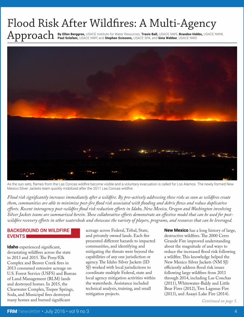
As the sun sets, flames from the Las Concas wildfire become visible and a voluntary evacuation is called for Los Alamos. The newly formed New Mexico Silver Jackets team quickly mobilized after the 2011 Las Concas wildfire.
Flood risk significantly increases immediately after a wildfire. By pro-actively addressing these risks as soon as wildfires create them, communities are able to minimize post-fire flood risk associated with flooding and debris flows and reduce duplicative efforts. Recent interagency post-wildfire flood risk reduction efforts in Idaho, New Mexico, Oregon and Washington involving Silver Jackets teams are summarized herein. These collaborative efforts demonstrate an effective model that can be used for post-wildfire recovery efforts in other watersheds and showcase the variety of players, programs, and resources that can be leveraged.
Continued on page 6.
FRM Newsletter • July 2016 • vol 9 no 3 5
These large fires burned acreage under the jurisdictions of USFS, BLM, New Mexico State Forestry Division (NMSF), Tribal Lands co-managed by Tribes and Bureau of Indian Affairs (BIA), and private lands. The newly formed NM SJ quickly mobilized after the 2011 Las Conchas wildfire. The team functioned as an information exchange hub for Federal, state, and local agencies. The team’s first interagency project involved installation of a rain gage network in severely burned canyons and watersheds above communities where flood risk had increased dramatically.
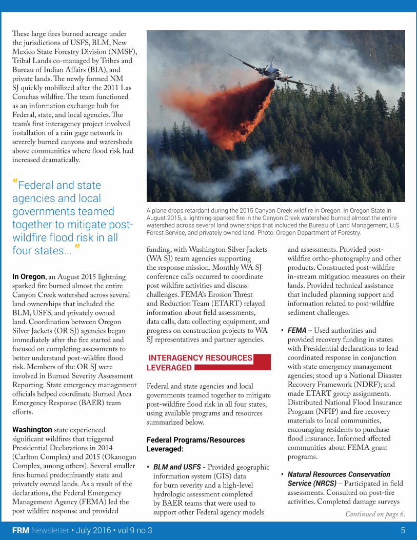
In Oregon, an August 2015 lightning sparked fire burned almost the entire Canyon Creek watershed across several land ownerships that included the BLM, USFS, and privately owned land. Coordination between Oregon Silver Jackets (OR SJ) agencies began immediately after the fire started and focused on completing assessments to better understand post-wildfire flood risk. Members of the OR SJ were involved in Burned Severity Assessment Reporting. State emergency management officials helped coordinate Burned Area Emergency Response (BAER) team efforts.
Washington state experienced significant wildfires that triggered Presidential Declarations in 2014 (Carlton Complex) and 2015 (Okanogan Complex, among others). Several smaller fires burned predominantly state and privately owned lands. As a result of the declarations, the Federal Emergency Management Agency (FEMA) led the post wildfire response and provided
funding, with Washington Silver Jackets (WA SJ) team agencies supporting the response mission. Monthly WA SJ conference calls occurred to coordinate post wildfire activities and discuss challenges. FEMA’s Erosion Threat and Reduction Team (ETART) relayed information about field assessments, data calls, data collecting equipment, and progress on construction projects to WA SJ representatives and partner agencies.
INTERAGENCY RESOURCES LEVERAGED
Federal and state agencies and local governments teamed together to mitigate post-wildfire flood risk in all four states, using available programs and resources summarized below.
Federal Programs/Resources Leveraged:
• BLM and USFS - Provided geographic information system (GIS) data for burn severity and a high-level hydrologic assessment completed by BAER teams that were used to support other Federal agency models
and assessments. Provided post-wildfire ortho-photography and other products. Constructed post-wildfire in-stream mitigation measures on their lands. Provided technical assistance that included planning support and information related to post-wildfire sediment challenges.
• FEMA – Used authorities and provided recovery funding in states with Presidential declarations to lead coordinated response in conjunction with state emergency management agencies; stood up a National Disaster Recovery Framework (NDRF); and made ETART group assignments. Distributed National Flood Insurance Program (NFIP) and fire recovery materials to local communities, encouraging residents to purchase flood insurance. Informed affected communities about FEMA grant programs.
• Natural Resources Conservation Service (NRCS) – Participated in field assessments. Consulted on post-fire activities. Completed damage surveys
A plane drops retardant during the 2015 Canyon Creek wildfire in Oregon. In Oregon State in August 2015, a lightning-sparked fire in the Canyon Creek watershed burned almost the entire watershed across several land ownerships that included the Bureau of Land Management, U.S. Forest Service, and privately owned land. Photo: Oregon Department of Forestry.
“Federal and state agencies and local governments teamed together to mitigate post-wildfire flood risk in all four states... ”
Continued on page 7.
FRM Newsletter • July 2016 • vol 9 no 3 6
and reports identifying on-the-ground actions to rehabilitate areas and reduce risk under its Emergency Watershed Protection Program. Provided assistance to several post-wildfire mitigation projects.
• NOAA National Weather Service (NWS) – Provided meteorological assistance. Served as subject matter expert for weather forecasting specific to burn scars and developed a web-based outlook for potential burn scar flooding (burn matrix) with daily updates and a web page with community outreach information. Developed weather and flood warning thresholds. Modeled scenarios using its Community Hydrologic Prediction System model with modeled output used by other agencies in hydrologic analyses. Participated on FEMA ETART mission and independent BAER teams. Led joint-agency field assessments. Assisted with gage installations and on-going monitoring.
• U.S. Army Corps of Engineers - Provided assistance through its Public Law 84-99 Advanced Measures authority, including field reconnaissance, risk assessment, mitigation alternatives evaluation, site specific flood response preparation and training, and project construction. Flood response training included
sandbag training, identification of flood fight equipment staging areas in high risk areas to enhance preparedness, and table top exercises. Provided small-scale field assessments and briefings through its Floodplain Management Services program that included modeling of post-fire hydrology, hydraulics and sediment transport. Provided technical, design and construction assistance under Section 205 of the Continuing Authorities Program. Participated on ETART and independent BAER teams.
• U.S. Geological Survey – Provided technical assistance. Assessed debris flow hazard potential. Served as subject matter expert for rain and stream gage installation, maintenance, and interpretation of data. Created rain and stream gage networks for early warning networks.
State and Local Resources Leveraged:
• State Emergency Management Agencies - Led the coordinated response with FEMA. Administered Fire Mitigation Assistance Grants to counties. Supported local communities with funding assistance and identifying short and intermediate mitigation actions. Provided public outreach materials for post wildfire recovery. Provided coordination and communication support to county emergency managers and commissioners.
• State Forestry Agencies – Provided technical assistance. Established a web portal with information for communities and individuals affected by wildfires.
• State Water Resources Agencies - Consolidated existing GIS datasets. Conducted NFIP outreach. Financed and led installation of gages, including several rapid deployed rain gauges.
• Counties and Communities – Funded small mitigation and rehabilitation projects. Coordinated communications with citizens. Shared GIS data and local perspective on past and current hazards. Provided personnel to help install gages and set up early warning mechanisms. Funded installation of immediate post wildfire mitigation efforts. Provided engineering support for alternative development. Updated Hazard Mitigation Plans and evacuation plans. Provided cost shares to support debris flow modeling analyses and install early warning gages.
KEY OUTCOMES
The ID SJ completed an after action review to document strengths, weaknesses, and opportunities to improve future coordination. The assessment led to the development of a post-wildfire flood risk mitigation resource guide for use by local communities and residents that will provide information about actions and available resources to reduce post-wildfire flood risk. A future proposed interagency team project will develop a more formal manual that will provide example requests for assistance letters, and describe available resources and standard operating procedures to engage state and Federal resources. The NM SJ team has incorporated many best practices as a result of its experience, such as increasing the meeting and conference call frequency during fire and
“The assessment led to the development of a post-wildfire flood risk mitigation resource guide for use by local communities and residents that will provide information about actions and available resources to reduce post-wildfire flood risk. ”
“The comprehensive and effective public outreach supported by OR SJ members resulted in community support for county mitigation efforts.”
FRM Newsletter • July 2016 • vol 9 no 3 7
monsoon months. Establishment of a SJ team with open and coordinated communication has helped state and local governments recognize agency roles and to efficiently access specific technical guidance and expertise from member agencies.
The comprehensive and effective public outreach supported by OR SJ members resulted in community support for county mitigation efforts. Based on recommendation of an Oregon state emergency management staff, a full-time county emergency manager was hired and a comprehensive hazard mitigation plan for the county and affected communities was developed. Implemented mitigation projects will reduce risk associated with moderate flooding during the snowmelt and thunderstorm flood season.
The WA SJ partners hosted a two-day post-wildfire workshop that was attended by more than 50 participants representing local and state jurisdictions. Workshop outcomes included establishment of a committee to lead pre- and post-wildfire activity throughout the year and steer decision making. The WA SJ has agreed to chair and organize a Washington Wildfire and Flood Committee. The Committee is comprised of 15 to 20 members that include WA SJ partners and other state and local agencies with field operations experience, technical competence, and policy influence. The committee will use existing authorities, funding streams, and technical expertise throughout the year to prepare for wildfire season and more efficiently coordinate during crisis mode.
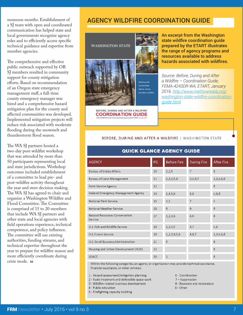
AGENCY WILDFIRE COORDINATION GUIDE
An excerpt from the Washington state wildfire coordination guide prepared by the ETART illustrates the range of agency programs and resources available to address hazards associated with wildfires.
Source: Before, During and After a Wildfire – Coordination Guide, FEMA-4243DR-WA, ETART, January 2016. http://www.methowready.org/washington-state-wildfire-coordination-guide.html
Continued on page 9.
FRM Newsletter • July 2016 • vol 9 no 3 8
Flooding is the #1 natural disaster in the U.S. and only flood insurance covers these unexpected, damaging and sometimes fatal events. The effects of flooding are not covered by most homeowner insurance policies. Anyone without flood insurance risks uninsured losses to their homes, personal property and businesses.
“We have to know what our risks are before we can prepare for them,” said Federal Emergency Management Agency (FEMA) Region VI Administrator Tony Robinson. “Floods can happen anywhere.”
Recognizing the importance to clearly define the flood risk, in 2002, Congress mandated FEMA to initiate a Map Modernization Program which included development of new Digital Flood Insurance Rate Maps (DFIRM) for
nearly 20,000 communities by 2010. Subsequently, FEMA Region VI and the US Army Corps of Engineers (USACE), New Orleans District (MVN) entered into a cooperative partnership with FEMA to prepare selected DFIRMs beginning in 2003. These agreements allowed FEMA to:
• Utilize data and analysis completed for previous studies conducted by the District;
• Capitalize on the District’s expertise of hydrologic and hydraulic conditions in southern Louisiana;
• Achieve consistency amongst federal agencies;
• Update the coastal surge analysis for the entire Gulf Coast; o Without information from the
district FEMA funding only allowed for digitalization of current effective FIRM; this approach
maximized utilization of federal funds
o This analysis was ongoing prior to Katrina, rather than being initiated as a result of Katrina
o The surge analysis is not an overly conservative approach to justify higher levee elevations and BFEs
o Methodology is nationally accepted and has been reviewed by multiple independent reviewers/agencies/organizations (ASCE, NRC, University of Texas, University of Florida)
Prior to 2005 storm season, USACE MVN was in the process of conducting modeling to update DFIRMs for several southern Louisiana parishes. Due to the 2005 storm events, FEMA delayed the release of all coastal DFIRMs in order to:
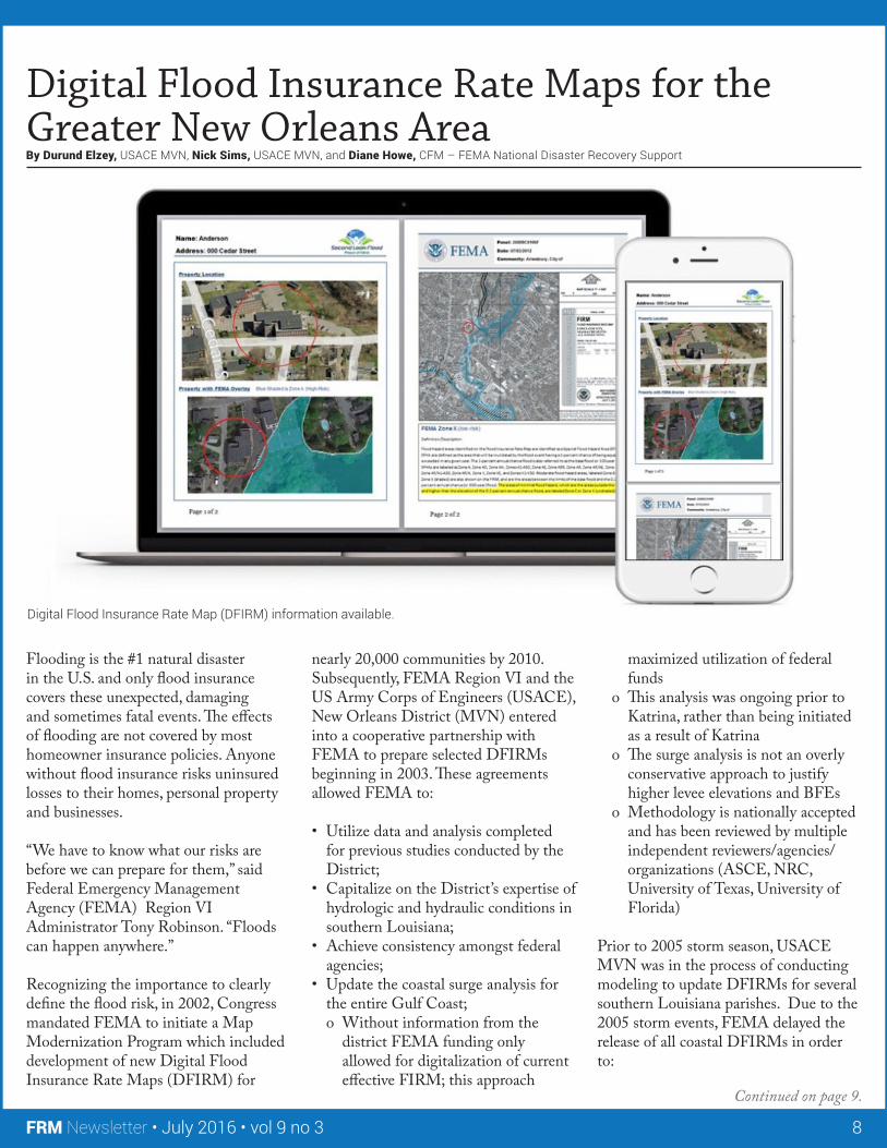
Digital Flood Insurance Rate Maps for the Greater New Orleans Area By Durund Elzey, USACE MVN, Nick Sims, USACE MVN, and Diane Howe, CFM – FEMA National Disaster Recovery Support
Digital Flood Insurance Rate Map (DFIRM) information available.
FRM Newsletter • July 2016 • vol 9 no 3 9
• Incorporate the ongoing coastal analysis that adequately defined 1% surge values
• Ensure that one consistent federal surge value was utilized to determine 100 year levee heights and more accurately depict the coast flood zones on the DFIRMs.
With the completion of the Hurricane and Storm Damage Risk Reduction system (HSDRRS), FEMA released new revised DFIRMs in 2012 in partnership with USACE MVN, the State of Louisiana, and local parishes. Open Houses and Flood Insurance Workshops were held in Orleans, Jefferson, St. Bernard, Plaquemines and St. Charles to provide an understanding of the current flood risk and encourage the use of the latest DFIRMs.
Recently, Jefferson Parish reached an important milestone in its effort to identify flood risk. Using the most current data and the latest modeling and digital mapping technologies, FEMA released revised preliminary DFIRMs on
February 15, 2016, depicting the current flood risks for Jefferson Parish. FEMA coordinates with local community officials during the process of mapping updates to communicate those changes in the map to local citizens. Jefferson Parish held a series of public Open Houses to increase awareness of the changing risk and FEMA partnered with Parish officials to provide Flood Insurance Workshops for stakeholders in both Jefferson and Orleans Parish. Jefferson Parish continues to move forward in the mapping process towards effective maps. The next step in the process is the Appeal and Comment period, which is anticipated in Summer 2016.
The Orleans Parish Revised Preliminary FIRMs were released December 1, 2014. Since that time, a Consultation Coordination Officer meeting with local officials was held and a formal Appeals and Comment period took place from May 8, 2015 through August 6, 2015. The Letter of Final Determination (LFD) for Orleans
Parish was issued March 30, 2016 and the map will be effective on September 30, 2016. FEMA anticipates working with the Parish to provide additional Flood Insurance Workshops for agents, real estate professionals, and lenders in the area to answer questions about the Newly Mapped Procedure and other changes to the National Flood Insurance Program (NFIP).
Once these maps become effective, FEMA estimates Orleans Parish will see over 75,000 structures removed from the floodplain and approximately 1,400 added. FEMA estimates Jefferson Parish maps, once effective, will remove approximately 50,500 structures from the floodplain and add approximately 5,400. Extensive outreach to insurance and real estate agents is ongoing. Property risk is not removed, just reduced. While there is no federal flood insurance requirement for those properties identified in low to moderate risk areas, but there may still be a lender requirement. These properties may be eligible for low-cost insurance option, the Preferred Risk Policy.
FRM RARG Conducts Annual Review of Statements of Need By Cary Talbot, Ph.D, P.E., Engineer Research & Development Center – Coastal &
Hydraulics Laboratory
On April 18-19, 2016, The Flood Risk Management Research Area Review Group (FRM RARG) met at HQUSACE to conduct their annual review and ranking of field-submitted Statements of Need (SoNs). Thirteen different Communities of Practice (CoPs) were represented by CoP leads or designates in addition to representatives from the field from across the Corps, a total of 22 in all.
The FRM RARG considered 32 SoNs, 12 of which were newly submitted in FY16. Each SoN was presented by the appropriate CoP lead and discussed at length to determine the relative priority (high, medium or low) that should be assigned.
In this discussion process, SoNs are evaluated for appropriateness, similarity or overlap with other needs, and determination of whether the need
represents a viable topic for research. The process this year resulted in 22 ranked SoNs for consideration in FY17. The exact number of SoNs that will be started in FY17 will depend on funding levels after the budget is passed and R&D program funding levels determined.
The RARG provides vital input to the R&D process and helps to ensure that FRM R&D is able to deliver on the goal of being a requirements-driven program. Our thanks to all who participated in this year’s RARG and we look forward to everyone’s continued participation in the R&D process through identification and submission of SoNs and by discussing R&D needs with CoP leaders.
“In this discussion process, SoNs are evaluated for appropriateness, similarity or overlap with other needs, and determination of whether the need represents a viable topic for research.”
FRM Newsletter • July 2016 • vol 9 no 3 10
Events
Other Important Information
This listing is for information only and is not a complete list of FRM-related meetings. These meetings are not endorsed by the Corps of Engineers unless specifically stated. If we have failed to list a conference/meeting/symposium that would be of interest to the Flood Risk Management community, please forward the conference details to us.
US Army Corpsof Engineers
This newsletter is a product for and by the Flood Risk Management Community. The views and opinions expressed in this unofficial publication are not necessarily those of the U.S. Army Corps of Engineers or the Department of the Army.
If you would like to submit an article or an idea for an article for the next edition of the newsletter, or if you have any comments or questions about articles in this edition, please email [email protected].
FRM Statements of Need: Submitting “Statement of Need” is the first step in the process of a concept becoming a requirement for research and development. If USACE District personnel have problems or situations they feel should be addressed by research, the Flood Risk Management Gateway, http://operations.usace.army.mil/flood.cfm, is the place to submit these research Statements of Need (SoNs).
Past issues of this newsletter, various links, news items, and presentations, are all available on the Flood Risk Management Gateway, http://operations.usace.army.mil/flood.cfm. Check it out!
12-15 July 2016 – River Flow 2016 Eighth International Conference on Fluvial Hydraulics – St Louis, MO –http://www.iihr.uiowa.edu/riverflow2016/registration/important-dates/ 17-22 July 2016 – International Conference of Coastal Engineering – Ottawa, Canada – http://www.coastlab2016.com/
22-25 August 2016 – National Association of Flood & Stormwater Managers Agencies (NAFSMA) - Annual Meeting – Portland, OR v– http://www.nafsma.org 19-23 September 2016 – MTS/IEEE OCEANS’16 Conference – Monterey, California – http://www.oceans16mtsieeemonterey.org/call-for-abstracts
17-21 October 2016 – 3rd European Conference on Flood Risk Management – Lyon, France– http://floodrisk2016.net
10-15 December 2016 – 8th National Summit on Coastal and Estuarine Restoration and 25th Biennial Meeting of the Coastal Society – New Orleans, LA - https://www.estuaries.org/Summit
24-26 April 2017– 2nd International Conference on Coastal Cities and their Sustainable Future – Cadiz, Spain – witconferences.com/coastal2017
5-7 Sept 2017 – 7th International Conference on Flood Management – Leeds, UK – http://www.icfm7.org.uk/
Be sure to check out floods.org for the dates of state conferences and training opportunities: http://www.floods.org/n-calendar/calendar.asp?date=3/12/2016