figure a-4 fuss and o’neill wetlands … an and and e&s detail sheet (fuss & o'neill,...
TRANSCRIPT

FIGURE A-4
FUSS AND O’NEILL WETLANDS DELINEATION

MaBur
WMa
A. Important:When filling out 1. forms on thecomputer, useonly the tab keyto move yourcursor - do notuse the returnkey.
2.
ssachusetts Department of Environmental Protectioneau of Resource Protection - Wetlands Springfield
PA Form 1-City/Town
Request for Determination of Applicabilityssachusetts Wetlands Protection Act M.G.L. c. 131, §40
General Information
Applicant:
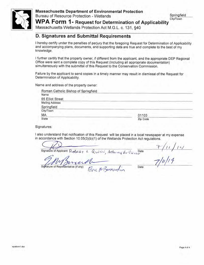
Roman Catholic Bishop of Springfield / Robert Quinn [email protected] E-Mail Address
67 Market StreetMailing Address
Springfield MA 01102City/Town State Zip Code
413-737-0260Phone Number Fax Number (if applicable)
Representative (if any):
Fuss & O'Neill, Inc.Firm
Eric M. Bernardin, P.E. [email protected] Name E-Mail Address
78 Interstate DriveMailing Address
West Springfield MA 01089City/Town State Zip Code
413-452-0445 413-846-0497Phone Number Fax Number (if applicable)
B. Determinations1. I request the Springfield Con. Com. make the following determination(s). Check any that apply:
Conservation Commission
a. whether the area depicted on plan(s) and/or map(s) referenced below is an area subject tojurisdiction of the Wetlands Protection Act.
b. whether the boundaries of resource area(s) depicted on plan(s) and/or map(s) referencedbelow are accurately delineated.
c. whether the work depicted on plan(s) referenced below is subject to the Wetlands Protection Act.
d. whether the area and/or work depicted on plan(s) referenced below is subject to the jurisdictionof any municipal wetlands ordinance or bylaw of:
SpringfieldName of Municipality
e. whether the following scope of alternatives is adequate for work in the Riverfront Area asdepicted on referenced plan(s).
wpaform1.doc Page 1 of 4

Massachusetts Department of Environmental ProtectionBureau of Resource Protection - Wetlands Springfield
WPA Form 1-City/Town
Request for Determination of ApplicabilityMassachusetts Wetlands Protection Act M.G.L. c. 131, §40
C. Project Description
1. a. Project Location (use maps and plans to identify the location of the area subject to this request):
260 Surrey Road SpringfieldStreet Address City/Town
11330-0051Assessors Map/Plat Number Parcel/Lot Number
b. Area Description (use additional paper, if necessary):
The project area includes the parcels with the address 260 Surrey Road which consist of theCathedral High School, including the main High School building, Gymnasium building, and theScience Wing, with associated access driveways, parking areas, and sports fields. Island Pond islocated on the project site to the east of the high school.
c. Plan and/or Map Reference(s):
Cathedral High School HazMat & Demolition Project (O'Reilly Talbot & Okun) 4/4/2014 (4 pgs)Title Date
Wetland Resource Area Delineation, Erosion and Sedimentation Controls 7/11/2014 (3 pgs)
TiPl
tlean and and E&S Detail Sheet (Fuss & O'Neill, Inc.) Date
Title Date
2. a. Work Description (use additional paper and/or provide plan(s) of work, if necessary):
See Attachment A
wpaform1.doc Page 2 of 4
MB
M
assachusetts Department of Environmental Protectionureau of Resource Protection - Wetlands Springfield
WPA Form 1-City/Town
Request for Determination of Applicabilityassachusetts Wetlands Protection Act M.G.L. c. 131, §40
C. Project Description (cont.)
b. Identify provisions of the Wetlands Protection Act or regulations which may exempt the applicantfrom having to file a Notice of Intent for all or part of the described work (use additional paper, ifnecessary).
See Attachment A
3. a. If this application is a Request for Determination of Scope of Alternatives for work in theRiverfront Area, indicate the one classification below that best describes the project.
Single family house on a lot recorded on or before 8/1/96
Single family house on a lot recorded after 8/1/96
Expansion of an existing structure on a lot recorded after 8/1/96
Project, other than a single family house or public project, where the applicant owned the lotbefore 8/7/96
New agriculture or aquaculture project
Public project where funds were appropriated prior to 8/7/96
Project on a lot shown on an approved, definitive subdivision plan where there is a recorded deedrestriction limiting total alteration of the Riverfront Area for the entire subdivision
Residential subdivision; institutional, industrial, or commercial project
Municipal project
District, county, state, or federal government project
Project required to evaluate off-site alternatives in more than one municipality in anEnvironmental Impact Report under MEPA or in an alternatives analysis pursuant to anapplication for a 404 permit from the U.S. Army Corps of Engineers or 401 Water QualityCertification from the Department of Environmental Protection.
b. Provide evidence (e.g., record of date subdivision lot was recorded) supporting the classificationabove (use additional paper and/or attach appropriate documents, if necessary.)
wpaform1.doc Page 3 of 4

WPA Form 1- Request for Determination of Applicability -- ATTACHMENT ADemolition of Cathedral High School
260 Surrey RoadSpringfield, Massachusetts
July 11, 2014
Application Section C (2)(a) - Work Description
The proposed project is for the demolition of Cathedral High School located at 260 Surrey Road inSpringfield, Massachusetts. The demolition includes the removal of the buildings on site, including the highschool, the gymnasium, and the science wing. The access roadway and the rear parking lot are to remain. Thestorm drain utilities shall remain with the exception of the roof drain lines which will be removedapproximately 20 feet outside of the building or the nearest drainage manhole. Several walkways around thesite will be demolished. The bleachers and concrete pad adjacent to the football/soccer field will be removed.
A Professional Wetland Scientist delineated the extent of Wetland Resource Areas subject to the WetlandProtection Act within the project area under 310 CMR 10.54 through 10.58. The Bank and associated Landunder Water Body named Island Brook was delineated using numbered flags a100 through a119 and surveyedusing a sub-meter GPS unit, as displayed with the associated 100-foot Buffer Zone on the Site Plan “WetlandResource Area Delineation, Erosion and Sedimentation Controls Plan” (Fuss & O’Neill) 7/11/2014). Thereare no other wetland resource areas on the project site.
Activities within the 100-foot Buffer to Island Pond (LUWW) include:
· Stockpiling of reclaimed asphalt and concrete materials as shown on the Site Plan titled “CathedralHigh School HazMat & Demolition Project” (O'Reilly Talbot & Okun) 4/4/2014 (4 pgs).
· Installation of erosion and sedimentation controls as shown on “Wetland Resource Area Delineation,Erosion and Sedimentation Controls Plan and and E&S Detail Sheet, (Fuss & O’Neill) 7/11/2014)to include:· All catch basins to remain will have filter fabric or similar silt sack installed prior to site demotion
to minimize sedimentation entering the drainage system.· The stockpiles for reclaimed asphalt and concrete will be stored on the existing paved parking
area located partially within the 100 foot buffer to Island Pond (delineated Bank). Straw balesstaked with rebar will be installed around the stockpiles.
· Silt fence backed with straw bales along the edge of the parking area and north to the practicefields to minimize sedimentation to Island Pond.
Erosion and sedimentation controls will be used throughout the site to minimize the potential for sedimentand pollutants to enter Island Pond. Silt sacks will be installed at all storm drain catch basins around the site.Storm drain pipes which are removed will be properly abandoned and capped to prevent untreated flow intothe drainage system. The fire hydrants located on site will be used for dust control throughout demolition. Allstockpiles of materials with the potential to generate sediment in stormwater runoff will be contained withperimeter sediment and erosion controls, such as straw bales or silt fence.
F:\P2011\1057\A40\Deliverables\RDA\Attachment A.Docx 1

WPA Form 1- Request for Determination of Applicability -- ATTACHMENT ADemolition of Cathedral High School
260 Surrey RoadSpringfield, Massachusetts
July 11, 2014
Application Section C (2)(b) - Provisions of the WPA which may exempt the applicant from havingto file a Notice of Intent
This proposed activities within the Buffer Zone, including stockpiling and erosion and sedimentation controlsare believed not subject to further regulation under M.G.L. c. 131, § 40, since the following requirements aremet under 310 CMR 10.02(2)(b)(2):
· The buffer zone does not contain slopes greater than 15%.
· The buffer zone does not contain estimated wildlife habitat identified on the most recent EstimatedHabitat Map of State-listed Rare Wetlands Wildlife of the Natural Heritage and Endangered SpeciesProgram.
· The Buffer Zone does not border an Outstanding Resource Water.
· There is no new impervious area proposed.
· Erosion and sedimentation controls will be installed and maintained at the limit of work or at least 50feet from the resource area, whichever is farther away, sufficient to prevent sediment from reachingresource areas during construction. The applicant will provide written notification to theconservation commission one week prior to commencement of work to allow verification thaterosion and sediment controls are properly installed.
F:\P2011\1057\A40\Deliverables\RDA\Attachment A.Docx 2
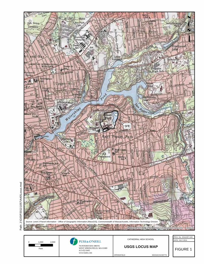
Copyright:© 2013 National Geographic Society, i-cubed
p
PROJ. No. 20111057.A40
DATE: JULY 2014
SPRINGFIELD MASSACHUSETTS
USGS LOCUS MAP
Source: Level 3 Parcel information - Office of Geographic Information (MassGIS), Commonwealth of Massachusetts, Information Technology Division.
CATHEDRAL HIGH SCHOOL0 1,000 2,000
Feet FIGURE 1
dxm.s
ucoL\0
\A4
7501\11
02P
S\
IG\:J :ht
Pa
78 INTERSTATE DRIVEWEST SPRINGFIELD, MA 01089413.452.0445www.fando.com
SITE

SCALE:
DATUM:
VERT.:
HORZ.:
VERT.:
HORZ.:
PROJ. No.:
DATE:
MS
V
IE
W:
LA
YE
R S
TA
TE
:
No. DATEDESCRIPTION
DESIGNER REVIEWER
jhodgen
FO
.S
TB
U
ser:
Mon, July 14, 2014 - 12:06 P
M
C
TB
F
ile:
DW
G T
O P
DF
.P
C3
Plotter:
P
lotted:
W-1
Layout:
J:\D
WG
\P
2011\1057\A
40\C
ivil\P
lan\20111057.A
40_S
TP
01.dw
gF
ile P
ath:
1"=100'
CATHEDRAL HIGH SCHOOL 20111057.A40
07/11/2014
WETLAND RESOURCE AREA DELINEATIONEROSION & SEDIMENTATION CONTROL PLAN
SPRINGFIELD MASSACHUSETTS
78 INTERSTATE DRIVEWEST SPRINGFIELD, MA 01089413.452.0445www.fando.com

SCALE:
DATUM:
VERT.:
HORZ.:
VERT.:
HORZ.:
PROJ. No.:
DATE:
MS
V
IE
W:
LA
YE
R S
TA
TE
:
No. DATEDESCRIPTION
DESIGNER REVIEWER
jhodgen
FO
.S
TB
U
ser:
Mon, July 14, 2014 - 12:06 P
M
C
TB
F
ile:
DW
G T
O P
DF
.P
C3
Plotter:
P
lotted:
D-1
Layout:
J:\D
WG
\P
2011\1057\A
40\C
ivil\P
lan\20111057.A
40_S
TP
01.dw
gF
ile P
ath:
N.T.S.
CATHEDRAL HIGH SCHOOL 20111057.A40
07/11/2014
EROSION & SEDIMENTATION CONTROLDETAIL SHEET
SPRINGFIELD MASSACHUSETTS
78 INTERSTATE DRIVEWEST SPRINGFIELD, MA 01089413.452.0445www.fando.com


