figure 1: john hills map of philadelphia, 1796 queen inn market street arch (mulberry) street apple...
TRANSCRIPT

Figure 1: John Hills Map of Philadelphia, 1796
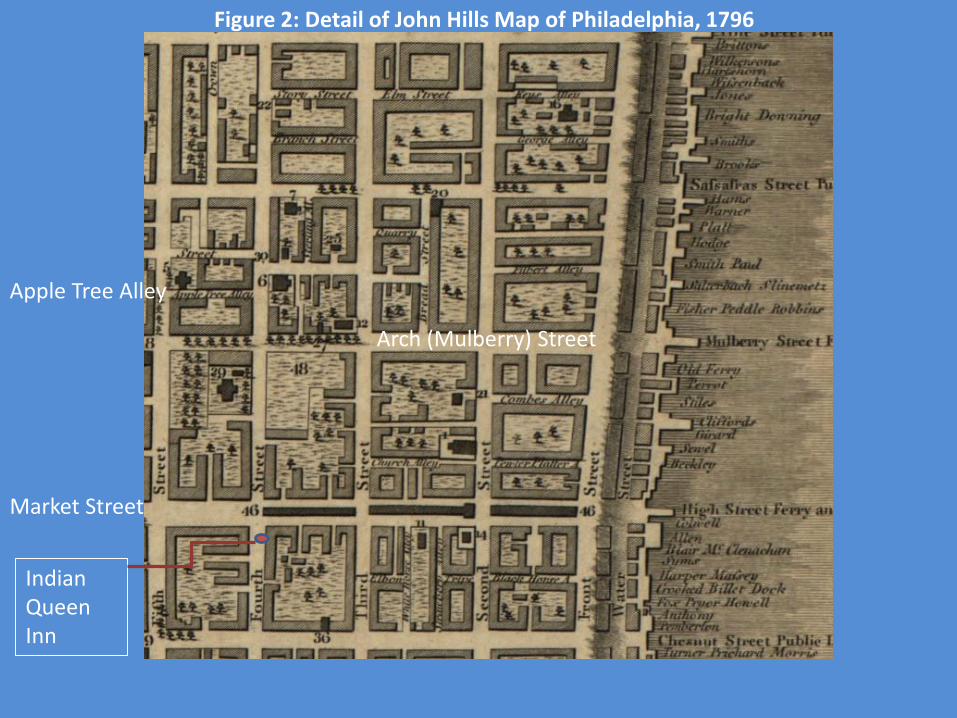
Indian Queen Inn
Market Street
Arch (Mulberry) Street
Apple Tree Alley
Figure 2: Detail of John Hills Map of Philadelphia, 1796

Figure 3: All Householders in Philadelphia

Blocks in red are the most densely populated
Blocks in red are the most densely populated
Figure 4: All Householders in Philadelphia

Figure 5: Householders in Apple Tree Alley
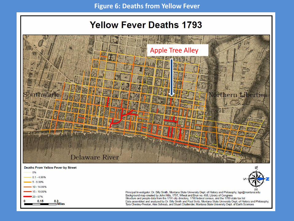
Apple Tree Alley
Figure 6: Deaths from Yellow Fever

Figure 7: Laborers and Merchants Householders

Figure 8: Laborers and Merchant Householders in 1801

Figure 9: The “Elite Corridor”
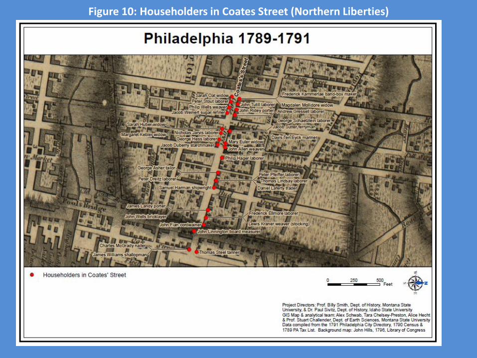
Figure 10: Householders in Coates Street (Northern Liberties)

Figure 11: Shoemakers

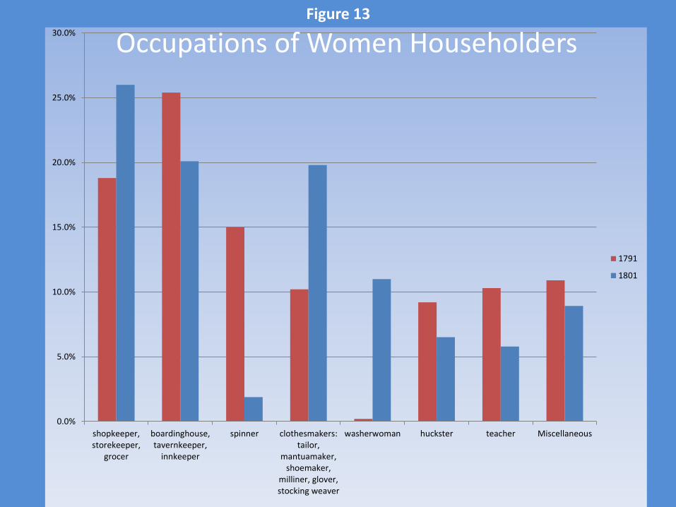
Figure 12: Female Householders
Red is higher density
0.0%
5.0%
10.0%
15.0%
20.0%
25.0%
30.0%
shopkeeper,storekeeper,
grocer
boardinghouse,tavernkeeper,
innkeeper
spinner clothesmakers:tailor,
mantuamaker,shoemaker,
milliner, glover,stocking weaver
washerwoman huckster teacher Miscellaneous
1791
1801
Occupations of Women HouseholdersFigure 13

Figure 14: Washerwomen Householders
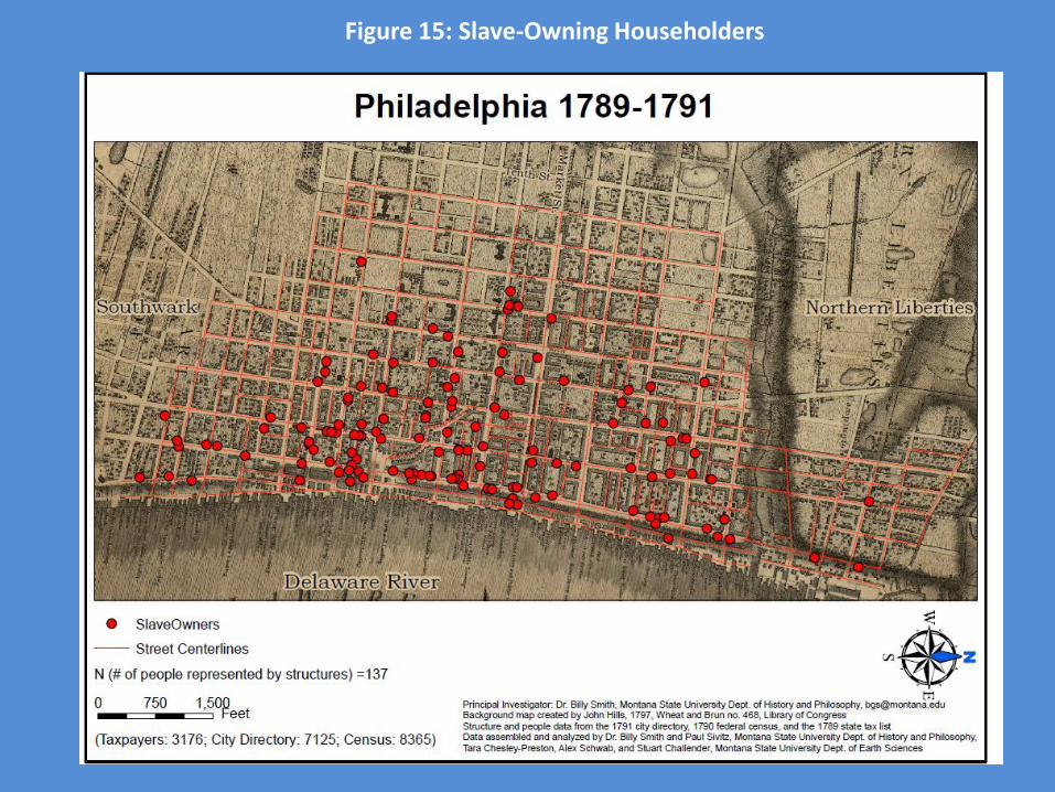
Figure 15: Slave-Owning Householders
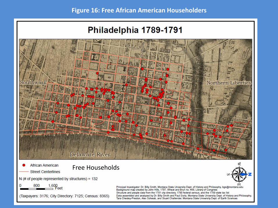
Figure 16: Free African American Householders
Free Households
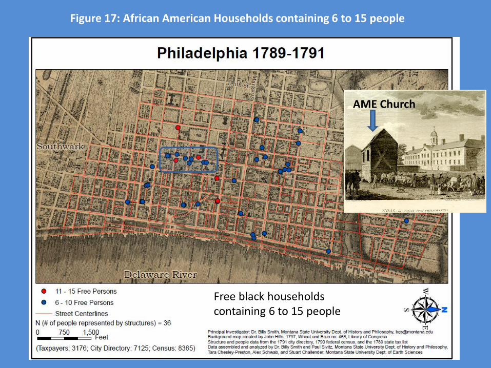
AME Church
Free black households containing 6 to 15 people
Figure 17: African American Households containing 6 to 15 people

Figure 18: Householders in Helltown
Household Heads