fidusar sand stone mine (q.l. no 2070) cluster...
TRANSCRIPT

PRE-FEASIBILITY REPORT
OF
Fidusar Sand Stone Mine (Q.L. No 2070) Cluster 07
[Cluster: Fidusar]
AT
VILLAGE – Fidusar, TEHSIL – Jodhpur, DISTRICT – Jodhpur,
STATE – Rajasthan
Proposed Production Capacity: 1710 TPA of Sandstone
Lease Area: 0.18 Ha
Category of Project: B1
Project Cost: 8 Lakhs
Date of issue of Work Order: 09.07.2015
Name of Project Proponent: Hukam singh
Address: Hukam singh
R/o Village –Bhawala Bera, Mandor, Jodhpur, Tehsil –Jodhpur,
District –Jodhpur, State –Rajasthan,
Pin – 342001
E-mail address: NA
Mobile No.: 9414126844
Prepared By
GRASS ROOTS RESEARCH & CREATION INDIA (P) LTD. (An ISO 9001:2008 Certified Co.: Accredited by QCI / NABET: Approved by MoEF, GoI)
F-374-375, Sector-63, Noida, U.P.
Ph.: 0120- 4044630, Telefax: 0120- 2406519
Email: [email protected], [email protected]
Website: http://www.grc-india.com
GRC INDIA TRAINING & ANALYTICAL LABORATORY
(Recognized by NABL & MoEF, GoI)
A unit of GRC India


PRE-FEASIBILITY REPORT
PROJECT: Fidusar Sand Stone Mine (Q.L. No 2070) Cluster 07
APPLICANT: Hukam singh
18
20.0. EXECUTIVE SUMMARY
The salient features of the sandstone mining project in Jodhpur district is given in the table below:
Table-2 of 2: Salient Features of the Project
(I) General Information
1 Project Name Fidusar Sand Stone Mine (Q.L. No 2070) Cluster 07
2 Applicant Name Hukam singh
3 Project Category B1
4 Production (in TPA) 1710
5 Project Area (in ha) 0.18
6 Project Schedule 1(a)
7 Type of Mineral Sand Stone
8 Method of Mining Opencast semi-mechanized mining
9 Land Use Govt. Waste Land
10 No. of working days 300
11 No. of Workers/Manpower 3
(II) Project Location
1 FRP Coordinates for the cluster Latitude
26°19'26."96"N
Longitude
73°0'47.66"E
2 Derived Coordinates for the QL Latitude 26°19'26."96"N 73°0'47.66"E
3 Khasra No./Gata No./Survey No./Q.L.No. Q. L. No 2070
4 Panchayat Fidusar
5 Village Fidusar
6 Tehsil Jodhpur
7 District Jodhpur
8 State Rajasthan
(III) Connectivity
1 Nearest Railway Station Mandor Railway Station
2 Distance of nearest Railway Station (in kms) Approx. 3.4 km in NE Direction
3 Nearest Airport Jodhpur Airport
4 Distance of nearest Airport (in kms) Approx. 9.1 km in SE Direction
5 Nearest Town Jodhpur
6 Distance of nearest Town (in kms) Approx. 4.6 km in SE direction
7 Nearest City Jodhpur
8 Distance of nearest City (in kms) Approx. 4.6 km in SE direction
9 Nearest District Headquarters Jodhpur
10 Distance of nearest District Headquarters (in kms) Approx. 4.6 km in SE direction
11 Nearest Highway NH-114
12 Distance of nearest Highway (in kms) Approx. 1.6 km in SW direction
(IV) Project Characteristics

PRE-FEASIBILITY REPORT
PROJECT: Fidusar Sand Stone Mine (Q.L. No 2070) Cluster 07
APPLICANT: Hukam singh
19
1 Toposheet No. 45 B/15 & 45 F/3(Cluster)
2 Life of Mine (in Years) 20
License Validity/Details:
3 License Date From (DDMMYYYY) 1/4/2015
4 License Date To (DDMMYYYY) 31-03-2016
5 License Validity (in Years) 1
6 Lease Area (in hectares) 0.18
Reserves for the Cluster (Total Capacity in Tonnes):
7 Proved 28728
8 Probable 20520
9 Possible 6156
10 Total Mineable Reserves (in Tonnes) 55404
Proposed Year wise Production (in Tonnes):
11 First Year 1710
12 Second Year 1710
13 Third Year 1710
Water Demand (in KLD):
14 Water requirement for workers 0.075
15 Water requirement for dust suppression on
haul roads (for entire cluster)
30
Elevation (in m):
16 EL-1 (Highest) 340
17 EL-2 (Lowest) 285
18 Slope Direction West to East
19 Width of Green Belt around the Cluster (in m) 10
Bench Details (in m):
20 Height 2
21 Width 2
22 Height of Dump (in m) 5
23 Depth of Mining (in m) 12
(V) Estimated Project Cost (in INR)
1 Total Project Cost 8 Lakhs
2 EMP will be implemented by the association and the EMP cost has allotted to be Rs 32.7 Lakhs as
capital cost and Rs. 23.4 Lakhs as recurring cost for the cluster.
PRE-FEASIBILITY REPORT
PROJECT: Fidusar Sand Stone Mine (Q.L. No 2070) Cluster 07
APPLICANT: Hukam singh
20
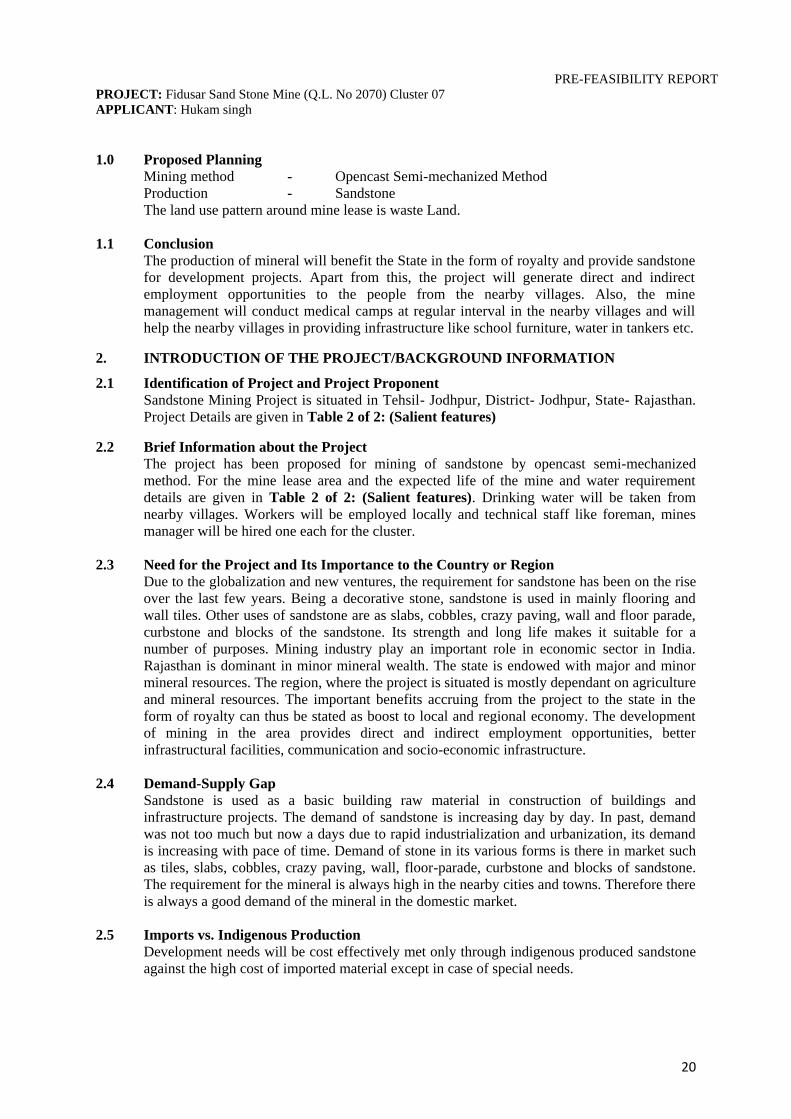
1.0 Proposed Planning
Mining method - Opencast Semi-mechanized Method
Production - Sandstone
The land use pattern around mine lease is waste Land.
1.1 Conclusion
The production of mineral will benefit the State in the form of royalty and provide sandstone
for development projects. Apart from this, the project will generate direct and indirect
employment opportunities to the people from the nearby villages. Also, the mine
management will conduct medical camps at regular interval in the nearby villages and will
help the nearby villages in providing infrastructure like school furniture, water in tankers etc.
2. INTRODUCTION OF THE PROJECT/BACKGROUND INFORMATION
2.1 Identification of Project and Project Proponent
Sandstone Mining Project is situated in Tehsil- Jodhpur, District- Jodhpur, State- Rajasthan.
Project Details are given in Table 2 of 2: (Salient features)
2.2 Brief Information about the Project
The project has been proposed for mining of sandstone by opencast semi-mechanized
method. For the mine lease area and the expected life of the mine and water requirement
details are given in Table 2 of 2: (Salient features). Drinking water will be taken from
nearby villages. Workers will be employed locally and technical staff like foreman, mines
manager will be hired one each for the cluster.
2.3 Need for the Project and Its Importance to the Country or Region
Due to the globalization and new ventures, the requirement for sandstone has been on the rise
over the last few years. Being a decorative stone, sandstone is used in mainly flooring and
wall tiles. Other uses of sandstone are as slabs, cobbles, crazy paving, wall and floor parade,
curbstone and blocks of the sandstone. Its strength and long life makes it suitable for a
number of purposes. Mining industry play an important role in economic sector in India.
Rajasthan is dominant in minor mineral wealth. The state is endowed with major and minor
mineral resources. The region, where the project is situated is mostly dependant on agriculture
and mineral resources. The important benefits accruing from the project to the state in the
form of royalty can thus be stated as boost to local and regional economy. The development
of mining in the area provides direct and indirect employment opportunities, better
infrastructural facilities, communication and socio-economic infrastructure.
2.4 Demand-Supply Gap
Sandstone is used as a basic building raw material in construction of buildings and
infrastructure projects. The demand of sandstone is increasing day by day. In past, demand
was not too much but now a days due to rapid industrialization and urbanization, its demand
is increasing with pace of time. Demand of stone in its various forms is there in market such
as tiles, slabs, cobbles, crazy paving, wall, floor-parade, curbstone and blocks of sandstone.
The requirement for the mineral is always high in the nearby cities and towns. Therefore there
is always a good demand of the mineral in the domestic market.
2.5 Imports vs. Indigenous Production
Development needs will be cost effectively met only through indigenous produced sandstone
against the high cost of imported material except in case of special needs.

PRE-FEASIBILITY REPORT
PROJECT: Fidusar Sand Stone Mine (Q.L. No 2070) Cluster 07
APPLICANT: Hukam singh
21
2.6 Export Possibility
There is enough possibility of mineral export of sandstone in various forms such as tiles,
slabs, cobbles, crazy paving, wall & floor parade, curbstone and blocks of the sandstone etc.
2.7 Domestic/ Export Markets
There is always an increasing demand of sandstone in domestic market as well as in export
markets.
2.8 Employment Generation
By proposed project of sandstone mining in the area, people get employment. The project
directly generates the employment opportunities for the local people and indirectly for others.
The total manpower requirement for the proposed mining operation is given in salient features
Table 2 of 2: (Salient features). Indirect employment is expected by allied activities.
3. PROJECT DESCRIPTION
3.1 Type of Project Including Interlinked and Interdependent Projects, If Any.
The proposed production is of sandstone. This is an independent mining project and there are
no interlinked projects involved.
3.2 Location
The mining lease area is located at Tehsil- Jodhpur, District- Jodhpur, Rajasthan.
Fig 1: Location Map of proposed Project site
Mine Sites in Cluster

PRE-FEASIBILITY REPORT
PROJECT: Fidusar Sand Stone Mine (Q.L. No 2070) Cluster 07
APPLICANT: Hukam singh
22
3.3 Details of Alternate Sites
The area was allotted by Dept. of Mines and Geology so, no alternative site is proposed.
3.4 Size or magnitude of operation
The mining lease details are given in salient features Table 2 of 2: (Salient features). The
mining operation will be production of sandstone. The average number of working days in the
year would be 300 days.
3.5 Geology of the area: -The rock formation of the area belongs to Marwar Super Group.
Marwar Super Group is further subdivided into three groups i.e. Lower Jodhpur Group,
Middle Bilara Group and Upper-Nagaur Group of rocks which represent arenaceous,
Calcareous and Arenaceous-Argillaceous facies of sedimentary rocks respectively. The
regional stratigraphical sequence of the area is being given below:
Group Formation Rock Type
Upper
Proterozoic
Middle
Proterozoic
Marwar
Supergroup
Nagaur
Group
Tunklain
Formation
Sandstone, Gritty sandstone &
Pebbly sandstone
Nagaur Formation Brick red stone, siltstone
Bilara
Group
Pundlo Formation Dolomite, Dolomitic
limestone, cherty dolomite,
stromatolite limestone etc.
Gotan Formation Limestone with bands of
cherty and dolomite
Dhanappa
Formation
Stromatolite limestone,
dolomite limestone, cherty
and cherty dolomite
Jodhpur
Group
Girbhakar
Formation
Bricked siltstone, shale and
sandstone
Sonia Formation Maroon siltstone, shale and
Sandstone
--Unconfirmity--
Pokaran Boulder
Formation
Bed comprising pebbles,
cobbles, boulders and
erratic of malani granite and
rhyolite in
sand/silt/clay
--Unconfirmity--
Malani Igneous
Suites
Rhyolite/Granite/Dolerite
Basement Rocks
3.5.1 Local Geology
The area mainly comprises of sandstone of Jodhpur Group of lower formation i.e. The Sonia
Formation. The sandstone is fine to medium grained, pinkish white to brownish in color
showing two set of joints and sedimentary structure like ripple marks tabular cross bedded
units. The sandstone of the area occurs as thickly bedded from which large, size blocks can be
excavated. The litho units of the area are horizontal disposed shown minor paleo-slopes and it
covered by thin capping of alluvium/ sand. The thickness of the massive sandstone varies
from 15m to 20m. The thickness of weathered, coarse to pebbly sandstone varies from 0.5m
to 1.0m, which is occurred as overburden.
Sandstone occurs in two distinct verities (a) Friable and (b) Non-Friable.

PRE-FEASIBILITY REPORT
PROJECT: Fidusar Sand Stone Mine (Q.L. No 2070) Cluster 07
APPLICANT: Hukam singh
23
3.6 Project description with process details
This is a proposed project of Sandstone mining of Tehsil & District-Jodhpur, Rajasthan.
Mining of sandstone is proposed. Mining activity will be carried by semi-mechanized open
cast method. The mine will work for 300 working days in a year.
3.6.1 Method of Mining
Sandstone is quarried in thick blocks which are easily splittable. The mining will be by
manual opencast method of mining by drilling small diameter holes with the help of
compressed air operated Jack hammer drill.
In the beginning, overburden is either removed manually or with the help of light drilling.
Small dia. 32-34 mm holes are drilled with hand held jack hammer drill and holes are filled
up by using Sino crack stone cracking powder. Any topsoil lying over the sandstone
overburden is scrapped, removed separately and used for plantation.
The run-of mine sandstone blocks are then trucked away to the processing plant where they
are further reduced either by sawing or by hand sectioning and finally dressed as per user
requirements. The residual small fragments have other industrial usage such as road building
and foundation layering.
Production details
The Proposed Production of Stone details are given in salient features: Table 2 of 2: (Salient
features).
3.7 Raw Material Required Along With Estimated Quantity, Likely Source, Marketing
Area of Final Product/s, Mode of Transport of Raw Material and Finished Product
No raw material will be required for production of sandstone. The mineral sandstone is being
loaded into dumpers/truck by manual labour for its transportation to stock.
3.8 Reserve Optimization/ Recycling and Removal
Not envisaged.
3.9 Availability of Water Its Source, Energy/ Power Requirement and Source
3.9.1 Water Requirement
Water Requirement details are given in Table 2 of 2: (Salient features). It is proposed to
obtain water from nearby villages.
3.9.2 Power
Electric power supply line does not exist in the area. The nearby villages are electrified and
the mine will work in one shift in day time only, so no electric power supply is required.
3.10 Quantity of wastes to be generated (Liquid and Solid) and Scheme for their
Management/Disposal
3.10.1 Solid Waste Generation& its Disposal
Recovery of friable sandstone may be considered as 95%. Rest of the 5% is waste.
Overburden waste will be loaded manually into the dumper or truck or trolley to transport the
waste at the earmarked dump site.

PRE-FEASIBILITY REPORT
PROJECT: Fidusar Sand Stone Mine (Q.L. No 2070) Cluster 07
APPLICANT: Hukam singh
24
Dump Management
Selection of dumping site
Dumping site is allotted to the group of quarry license holders in cluster area.
Maximum height and spread of dumps
Dump height will be restricted to 5m. Spreading of dump will be done by JCB.
3.10.2 Liquid Effluent
No process effluent will be generated from the project operations. Sewage from site toilets
will be disposed off in septic tank and soak pits.
4. SITE ANALYSIS
4.1 Connectivity
Area is well connected with road and rail transport. The district is well served by a network of
metalled and unmetalled roads. Mine site is well connected with village road. Details are
given in Table 2 of 2: (Salient features).
4.2 Landform, Land use and Land ownership
4.2.1 Landform
Soil is meagrely occupying the mining lease area. The surface texture varies from rugged
terrain of debris and mild gradient terrain. Entire mining lease area is in waste land.
4.2.2 Land use
The land use pattern around mine lease is Waste Land. The details are given in Table 2 of 2:
(Salient features) of salient features.
4 .2.3 Land Ownership
The mining lease area is Government Waste Land.
4.3 Topography
The topography of Jodhpur is almost flat. Maximum part of the area is soil covered. Drainage
in the lease area is along slope of the area.
The main physiographic zones of Jodhpur are dune covered western part and Luni- Jawai
plains. Hillocks are also found scattered as isolated outcrops near Jodhpur, Kherapa, Ratkudia
and Balesar villages. Sand dunes of transverse, longitudinal and parabolic variety are present
and attain a height of 10 to 40m.
Luni-Jawai plain has the only integrated drainage system in western Rajasthan. Apart from
Luni, the other rivers associated are Sukri-Jojri & many small streams. These streams are of
ephemeral nature. General elevation of the land area is 150 to 300m above mean sea level.
Some parts have hillocks rising 300 to 600m above general ground.
4.4 Existing land Use Pattern
The leased out area comes under waste land. There are no eco sensitive areas such as forest,
national park, wildlife sanctuary, biosphere reserves and wildlife corridors etc. located in core
zone.
Mining will be done in leased out area. No other land will be disturbed/ altered.
4.5 Existing Infrastructure
There is existing road near to the working site. Manpower is also cheaply available.

PRE-FEASIBILITY REPORT
PROJECT: Fidusar Sand Stone Mine (Q.L. No 2070) Cluster 07
APPLICANT: Hukam singh
25
4.6 Biological Environment
4.6.1 Flora of the Study Area
The core zone consists of the mine lease areas, which is rocky and barren with some grasses
and herbs.
The buffer zone of the area is dominated by barren land with thorny vegetation. Most of the
area around human settlement and the roadside have good vegetation. The common species
found to exist in the area are Azadirachta indica, Ficus bengalensis, Ficus religiosa,
Mangifera indica, Prosopis cineraria, Acacia catechu, Salvadora oleoides, Salvadora
persica, Albizia lebbeck, Ailanthus excelsa, Prosopis juliflora, Zizyphus xylopyrus, Tribulus
sp., Acacia Senegal, and Dactyloctenium aegyptium, whereas among shrubs and herbs
Calotropis gigantia, Capparis deciduas, Calligonum polygonoides, Ziizyphus nummularia,
Euphorbia caducifolia, Calotropis procera, Tephrosia purpurea Tinospora cordifolia, etc.
some recently planted trees are Azadirachta indica, Mangifera indica, Ficus religiosa, F.
bengalensis, Delonis regia, Pongamia pinnata, and Dalbergia sisoo on roadsides, gardens,
resorts, and official campuses. In addition to this, Propopis juliflora has invaded each
possible place since it was introduced. The wetland vegetation near water bodies are Typha
latifolia, Vallisnaria spp., Eichhornia crassipes, Phragmites karka, Hydrilla verticillata,
Chara spp. and Green algae are found growing.
The agriculture fields mainly consist of crops of Bajra, Jowar, Sesamum, Cluster Bean, Moth
Bean, Green Gram and Red Chillies. In the gardens and orchards, large fruit trees of mango
(Mangifea indica) and black plum (Eugenia jambolana) are common while several other
medium sized fruit tree (ber, aonla, lisoda) are also cultivated. The horticultural crops include
Red Chillies, Onion, Garlic, and Carrot. Other crops are also undertaken such as medicinal
and aromatic crops (Isabgol), Plantation crop of Mehandi (Hina), industrial pulp wood crops
and fodder crops (Sorghum, Bajra fodder, guar fodder, Lucene).
Some of the plants in buffer zone are of medicinal importance. They are used by local
communities for their private use but not on commercial scale. Medicinal plants played an
essential role in the development of human culture, for example, religious and different
ceremonies. Medicinal plants are most importance resource for the traditional medicine &
herbal industry and they are also a source of livelihood. Some of the common medicinal
plants in this area are Adhatoda vasica, Aegle marmelos, Azadirachta indica, Eucalyptus sp.,
Ocimum gratissimum, Tridax procumbens, Syzigium cumini, Terminalia arjuna, Terminalia
bellerica and Vitex negundo.
Most of the grass species are xerophilious, belonging to family poaceae. The grasslands
consist of Eragrostis spp., Aristida adscensionis, Cenchrus biflorus, Cymbopogon spp.,
Cyperus spp., Eleusine spp., Panicum spp., Lasiurus sindicus, Aeluropus logopoides and
Sporobolus spp.
4.6.2 Fauna of Study Area
The core zone consists of rocky area which will have human activity and with feeble
vegetation. There is no wildlife species occurring in the core zone of the study area.
The fauna in the buffer zone is as follows:
Mammals
Faunal diversity provides a characterization of the project site and interconnections with
respect to the wildlife and wildlife habitat that either occurs on or within the vicinity of the
project site.
The study area consists of dry and thorny vegetation. Present conditions of the area do not
support higher mammals. On the basis of available data, the wild life in the area are Indian

PRE-FEASIBILITY REPORT
PROJECT: Fidusar Sand Stone Mine (Q.L. No 2070) Cluster 07
APPLICANT: Hukam singh
26
Hare (Lepus nigricolis), House Mouse (Mus musculus), Blue Bull (Boselaphus
tragocamelus), Common Mongoose (Herpeses edwardsii), squirrel (Funambulus palmarum)
are present in the area.
Avifauna
Birds are good ecological indicators and they are easily observable. Moreover, trends that
hold for birds may hold for other species of wildlife as well. Diversity of avifauna is one of
the most important ecological indicators to evaluate the quality of habitats. Now-a-days,
avifaunal diversity has been decreasing due to the destruction of natural habitats and human
disturbances. Birds are essential animal group of an ecosystem and maintain a trophic level.
Therefore, detail study on avifauna and their ecology is important to protect them.
Birds are the bio-indicators of different status of environment like urbanization,
industrialization and human disturbance. They are one of the best indicators of ecosystem.
The area having good bird diversity signifies healthy forest or vegetation. They can be
sensitive indicators of pollution and function as early warning system.
The avifauna in the area is found to be mostly distinctive to the habitat which consists of a
combination of hilly terrain, agricultural fields, barren land and some water bodies. Birds like
pigeons, doves, crows, peafowl, myna, sparrows, bulbuls, babblers and Eurasian collared
dove are observed in and around the mine lease and village areas.
Jodhpur exhibits wide variety of avian fauna native as well as migratory. There has been
reportedly a continuous increase in aggravation of bird species which has increased from 125
species to 278 since 1992 to 2010. An ample water supply in this area have changed overall
ecological scenario of wetland birds also, inflow of water through Indira Gandhi canal have
created several wetlands from seasonal to perennial which in turn have attracted several
wetland species to this area. Urbanization has changed the scrublands into residential areas
and gardens. The well managed gardens have attracted several species, as a result of which
there is a considerable change in species composition of species. The native fauna is declining
and facing pressure of aggravation of sympatric species competition.
4.7 Soil Classification
There is a 1.0m to 3.0m thick layer of top soil over hard sandstone in the buffer zone, while it
is up to 0.2 in core zone. Soil of the region falls within the rainfall zone of 300–500mm. The
soil is sandy loam to sandy in texture. The nutrient status of the Jodhpur soil is graded as low
to medium level. Soils of the district are classified as follows:
Red deserted soils: These types of soils are most predominant soils in central, eastern and
southern parts of the district. These are pale brown to reddish brown soils, loose and well
drained and texture varies from sandy loam to sandy clay loam.
Desert soils: Desert soils occupy a considerable area of the district forming its northern and
western part of the district. These are mainly windblown sand and soils of interdunal
depressions.
Sand dunes: Sand dunes occupy a small part in northern and north-western margin of the
district. These are sandy to loamy sand, loose, structure less and well drained.
Lithosol and regosols of hills: These types of soils are found in hills and hill slopes of
central and western part of the district. These are shallow, light textured, fairly drained,
reddish brown to grayish brown in colour.

PRE-FEASIBILITY REPORT
PROJECT: Fidusar Sand Stone Mine (Q.L. No 2070) Cluster 07
APPLICANT: Hukam singh
27
4.8 Climate data from Secondary Sources:
The climate of the area is dry with extreme temperature variation. The temperature varies
43°C to 46°C in summer and 2°C to 5°C in winter. The average rainfall is about 359mm. The
rainfall over Jodhpur is erratic and scanty is concentrated over four month i.e. from June to
September. Relative humidity is very low during summer season in the month of May-June
and higher in the months of rainy season in the month of August. However agriculture and the
animal wealth are dependent on rains to large extent.
Rainfall Statistics of Tehsil & District Jodhpur, Rajasthan
S.No. Year Annual Rainfall
in mm. S.No. Year
Annual
Rainfall in
mm. 1 1995 374.0 10 2004 182.0
2 1996 521.1 11 2005 283.0
3 1997 572.1 12 2006 210.0
4 1998 577.0 13 2007 205.0
5 1999 357.5 14 2008 475.9
6 2000 273.0 15 2009 156.0
7 2001 527.0 16 2010 511.0
8 2002 91.0 17 2011 314.0
9 2003 359.0 10 2004 182.0
Average Annual Rainfall in mm = 359.4
(Source: waterresources.rajasthan.gov.in)
4.9 Socio Economic Environment
Demographic Particulars
The socio-economic and demographic details of Jodhpur district at a glance is given below:
As per Census 2011, Jodhpur district administers 22, 850 sq.km of areas with population
density of 161 people per sq.km. The total population of the region as per Census 2011 is 36,
87,165 out of which 19, 23,928 are males and 17, 63,237 are females. With regards to Sex
Ratio in Jodhpur, it stood at 916 per 1000 male. According to Census 2011, Children under 0-
6 formed 16.45 percent of Jodhpur District population. The child sex ratio is 891 girls per
1000 boys. The average literacy rate in the area is 65.94. If things are looked out at gender
wise, male and female literacy rates are 78.95 and 51.83 respectively. Total literates in
Jodhpur District are 2,031,532 of which males and females are 12, 65,753 and 7, 65,779
respectively.
Total main workers are 10, 56,479 (70.9% of total workers) whereas 4, 33,262 (29.1% of total
workers). Of the total workers, 56.0 per cent belongs to ‘Agricultural Works’ followed by
‘Other Works’ which constitute 41.1 per cent of total work force and the rest 2.9 per cent
belongs to ‘Household Industrial works’. Of the total Agricultural Workers, 71.0 per cent are
Cultivators and the remaining 29.0 per cent are Agricultural Labours.
Infrastructure Resource
The infrastructure resources details have been abstracted from Housing, Household Amenities
and Assets of Jodhpur District from Rajasthan.
PRE-FEASIBILITY REPORT
PROJECT: Fidusar Sand Stone Mine (Q.L. No 2070) Cluster 07
APPLICANT: Hukam singh
28
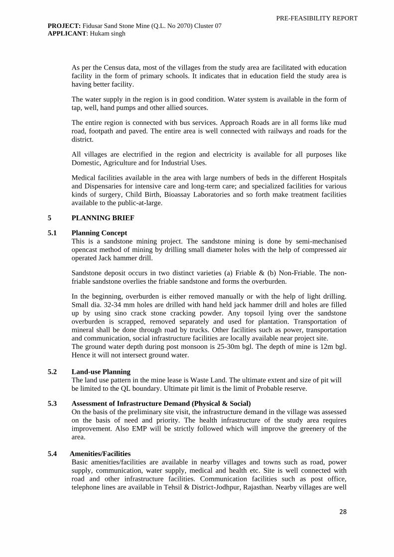
As per the Census data, most of the villages from the study area are facilitated with education
facility in the form of primary schools. It indicates that in education field the study area is
having better facility.
The water supply in the region is in good condition. Water system is available in the form of
tap, well, hand pumps and other allied sources.
The entire region is connected with bus services. Approach Roads are in all forms like mud
road, footpath and paved. The entire area is well connected with railways and roads for the
district.
All villages are electrified in the region and electricity is available for all purposes like
Domestic, Agriculture and for Industrial Uses.
Medical facilities available in the area with large numbers of beds in the different Hospitals
and Dispensaries for intensive care and long-term care; and specialized facilities for various
kinds of surgery, Child Birth, Bioassay Laboratories and so forth make treatment facilities
available to the public-at-large.
5 PLANNING BRIEF
5.1 Planning Concept
This is a sandstone mining project. The sandstone mining is done by semi-mechanised
opencast method of mining by drilling small diameter holes with the help of compressed air
operated Jack hammer drill.
Sandstone deposit occurs in two distinct varieties (a) Friable & (b) Non-Friable. The non-
friable sandstone overlies the friable sandstone and forms the overburden.
In the beginning, overburden is either removed manually or with the help of light drilling.
Small dia. 32-34 mm holes are drilled with hand held jack hammer drill and holes are filled
up by using sino crack stone cracking powder. Any topsoil lying over the sandstone
overburden is scrapped, removed separately and used for plantation. Transportation of
mineral shall be done through road by trucks. Other facilities such as power, transportation
and communication, social infrastructure facilities are locally available near project site.
The ground water depth during post monsoon is 25-30m bgl. The depth of mine is 12m bgl.
Hence it will not intersect ground water.
5.2 Land-use Planning
The land use pattern in the mine lease is Waste Land. The ultimate extent and size of pit will
be limited to the QL boundary. Ultimate pit limit is the limit of Probable reserve.
5.3 Assessment of Infrastructure Demand (Physical & Social)
On the basis of the preliminary site visit, the infrastructure demand in the village was assessed
on the basis of need and priority. The health infrastructure of the study area requires
improvement. Also EMP will be strictly followed which will improve the greenery of the
area.
5.4 Amenities/Facilities
Basic amenities/facilities are available in nearby villages and towns such as road, power
supply, communication, water supply, medical and health etc. Site is well connected with
road and other infrastructure facilities. Communication facilities such as post office,
telephone lines are available in Tehsil & District-Jodhpur, Rajasthan. Nearby villages are well

PRE-FEASIBILITY REPORT
PROJECT: Fidusar Sand Stone Mine (Q.L. No 2070) Cluster 07
APPLICANT: Hukam singh
29
electrified. Apart from the above, during operational phases of mining, following facilities
shall be provided for the cluster of QLs:
(i) All the safety norms will be strictly followed.
(ii) Provision of clean drinking water.
(iii) Group insurance scheme for engaged workers.
(iv) First-aid facilities.
(v) Periodical medical campaigns for mine workers and nearby villagers.
Power supply
Electric power supply line does not exist in the area. The nearby villages are electrified and
the mine will work in one shift in a day time only, so no electric power supply is required.
Water Supply
Water shall be supplied from nearby villages for drinking purpose. Tractor-mounted tanker is
being used for supply of water to mining work, spraying, watering the plants and drinking
purposes.
6. PROPOSED INFRASTRUCTURE
6.1 Industrial Area (Processing Area)
As locals from nearby areas will be hired for mining activity, so no permanent infrastructure
is proposed.
6.2 Residential Area (Non Processing Area)
No permanent residential area/ housing are proposed.
6.3 Green Belt
It is proposed to have plantation on statutory barrier zone marked along the cluster boundary
and over overburden dump area to provide cover against dust dissemination. During
plantation, local plant species will be given preference or in consultation with local forest
officials.
6.4 Social Infrastructure
Pucca roads are available in villages. Existing road will be maintained regularly. Proposed
project of sandstone mining in the area provides employment opportunities in the area/region
and this helps to check migration of people of one place to other. Medical and educational
facilities will be provided.
6.5 Connectivity
Area is well connected with road and rail transport. The district is well served by a network of
metalled and unmetalled roads. Mine site is well connected with village road.
6.6 Drinking Water Management
Water required for drinking purpose will be supplied from nearby villages through tankers.
The water requirement details are given in Table 2 of 2: (Salient features).
6.7 Sewerage System
Domestic waste water will be treated into septic tank followed by soak pit
6.8 Industrial Waste Management
Not applicable

PRE-FEASIBILITY REPORT
PROJECT: Fidusar Sand Stone Mine (Q.L. No 2070) Cluster 07
APPLICANT: Hukam singh
30
6.9 Solid Waste management
Recovery of friable sandstone may be considered as 95%. Rest of the 5% is waste.
Overburden waste will be loaded manually into the dumper or truck or trolley to transport the
waste at the earmarked dump site.
Dump Management
Selection of dumping site
Dumping site is allotted to the group of quarry license holders in cluster area.
Maximum height and spread of dumps
Dump height will be restricted to 5m. Spreading of dump will be done by JCB.
6.10 Power Requirement & Supply/Source
Electric power supply line does not exist in the area. The nearby villages are electrified and
the mine will work in one shift in a day time only, so no electric power supply is required.
7. REHABILITATION AND RESETTLEMENT (R&R) PLAN
Not applicable as no person or family will be uprooted, needing any resettlement or
rehabilitation.
8 PROJECT SCHEDULE & COST ESTIMATES
8.1 Likely Date of Start of Construction and Likely Date of Completion (time schedule for
the project to be given)
No construction activities are required for proposed mining activities. The mining activity
will commence only after receiving environmental clearance.
8.2 Estimated Project Cost Along With Analysis In Terms of Economic Viability of the
Project
The project cost details are given in Table 2 of 2: (Salient features).
8.3 Corporate Social Responsibility (CSR)/ Enterprise Social Responsibility (ESR)
CSR/ESR will be taken care by the Association of the cluster which will spend 5% of Project
Cost over 5 years in the activities decided by local authority in the consultation with villager &
local NGO.
9.0 ANALYSIS OF PROPOSAL (FINAL RECOMMENDATIONS)
Proposed project of sandstone mining is of utmost importance to the area/region for interest
of mineral development and improves the socio-economic conditions of the local habitants.
Mine will provide direct employment opportunities to the locals and they will be indirectly
benefitted by their allied activities. Lessee is committed to provide better infrastructural
facilities such as education, medical, clean drinking water, maintenance of approach roads in
nearby areas of the mine site. The State Government will get revenue in the form of royalty
from selling of mineral, land tax/surface rent; Sales tax/VAT, income tax etc. will be addition.
The operation of the proposed project of sandstone mining will bestow various social and
economic benefits to the local communities of the area. Thus the project of sandstone mining
will prove beneficial to the area.
****************

Annexure -1
Disclosure of Consultant Engaged
GRC India (P) Ltd. has got the Initial accreditation from QCI NABET and has undergone Surveillance
Assessment as well. As per the recently published QCI NABET ‘List of Accredited Consultant
Organizations/Rev. 37(A)/Jan 06, 2016’, listed in as accredited consultant, Category ‘A’ Sl. No. 76.
Name of the Project: Fidusar Sand Stone Mine (Q.L. No 2070) Cluster 07
Nature of consultancy Name and address of the
Consultant/expert
Approvals, if any from
(NABL/DGMS/IBM/
NRBPT/MOEF/CPCB/others
etc)*, give reference
EIA/ EMP Organization
Grass Roots Research and
Creation India (P) Ltd.
Address F-374-375, Sector 63,
Noida, Uttar Pradesh 201301.
Ph-0120-4044630.
QCI and NABET Accredited
(Reference given as Fig.1,
below)
EIA Coordinator Dr. P. R. Chaudhari NABET Accredited
FAE- AP Mr. K. D. Choudhury NABET Accredited
FAE- NV Mr. K. D. Choudhury NABET Accredited
FAE- EB Dr. P. R. Chaudhari NABET Accredited
FAE- WP Dr. P. R. Chaudhari NABET Accredited
FAE- SE Mr. Subimal Pattadar NABET Accredited
FAE- Soil Dr. S. R. Maley NABET Accredited
FAE- GEO Dr. Tapan Majumder NABET Accredited
FAE- HG Dr. Tapan Majumder NABET Accredited
FAE- RH Mr. K. D. Choudhury NABET Accredited
FAE- LU Mr. P. Radhakrishnamoorthy NABET Accredited
FAE- SHW Dr. Dhiraj Kumar Singh NABET Accredited
FAE- AQM Dr. C. Mary Sukanya NABET Accredited
Environmental Monitoring &
analysis
GRC India Training & Analytical
Laboratory
Address F-374-375, Sector 63,
Noida, Uttar Pradesh 201301.
Ph-0120-4044630.
NABL
Hydro geological study Not Applicable
Soil investigation Not Applicable
Mining plan
Simplified Mine Plan is prepared
by Dept. of Mines and Geology,
Jodhpur
Rainwater Harvesting Not Applicable
Risk Assessment Grass Roots Research and
Creation India (P) Ltd.
Architectural Plan Not Applicable
Fire Fighting/Utilities plan Not Applicable
Services (STP/ETP design) etc. Not Applicable
Others, such as project consultants
etc Not Applicable
* Only Govt. /Statutory Approvals to be mentioned. Put NA where not applicable. Add brief resume where required.
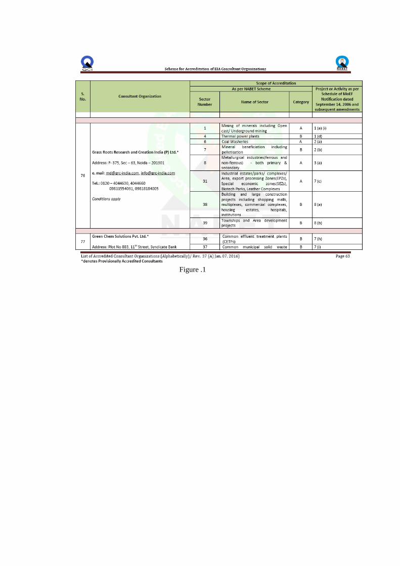
Figure .1

Annexure - 2