faculty of engineering civil engineering department
TRANSCRIPT

Tishk International University
Faculty of Engineering
Civil Engineering Department
Survey I
Lecturer : Esamaddin M. Saeed Mulapeer
MSc in Civil Engineering - Construction Materials
1
Tel:07504511153 - 07518080357

Out lines
❖ Introduction to Course.
❖ Definition of Surveying.
❖ Importance of Surveying.
❖ Types of Surveying.
❖ References.
2

3

4Introduction to the Course.
Aims
To introduce and develop the basic understanding of the principles
of surveying.

Lectures. 5
WeekLecture
1 Fundamentals of surveying, Basic definitions.
2 Accuracy of surveyed quantities, errors, accuracy and precision, unit of measurement.
3 Measurement of horizontal distances.
4 Measurement of vertical distance ( Leveling) , Uses of level.
5 Basic Definitions, Basic principles of leveling.
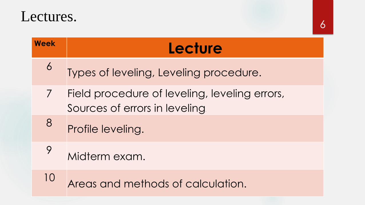
6Lectures.
WeekLecture
6Types of leveling, Leveling procedure.
7 Field procedure of leveling, leveling errors,
Sources of errors in leveling.
8Profile leveling.
9Midterm exam.
10Areas and methods of calculation.

7Lectures.
WeekLecture
11Cross sections.
12Calculation of cross sectional area.
13Volume and methods of calculation.
14Contour Lines.
16Final Exam
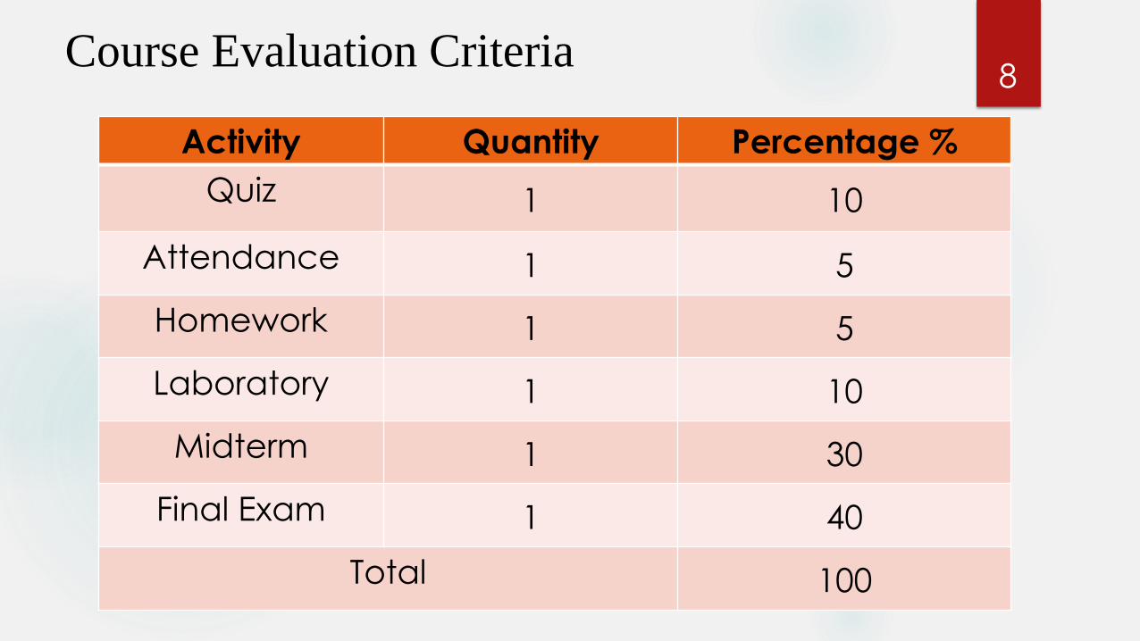
8Course Evaluation Criteria
Activity Quantity Percentage %
Quiz 1 10
Attendance 1 5
Homework 1 5
Laboratory 1 10
Midterm 1 30
Final Exam 1 40
Total 100

9References.
Ghilani, C. D. and P. R. WOLF (2014). Elementary Surveying: An Introduction to Geomatics . New Jersey, PEARSON.
Uren, J. and B. Price (2010). Surveying for Engineers. UK, PALGRAVE MACMILLAN.
Barry F. Kavanagh – 7th – ed. SURVEYING with ConstructionApplications. PEARSON.
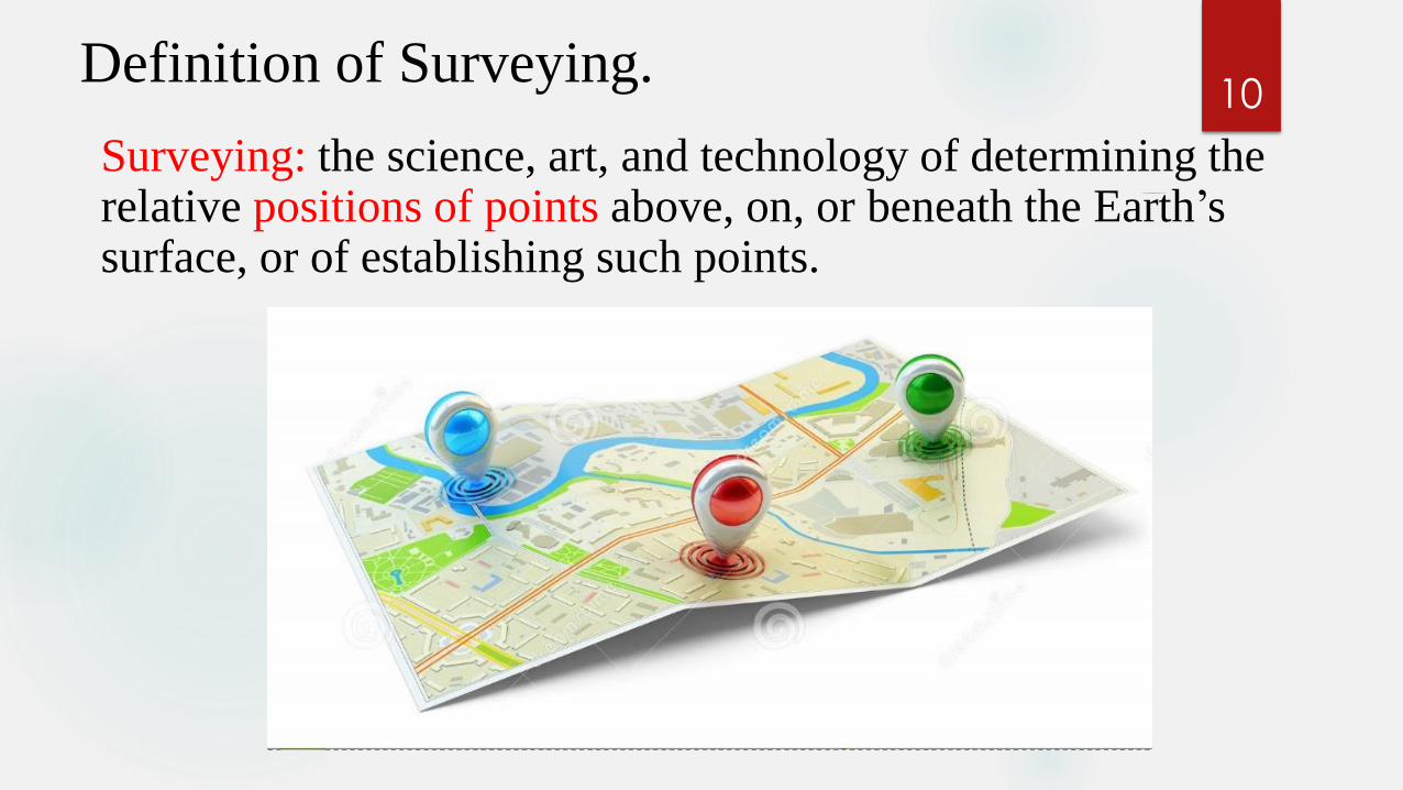
10Definition of Surveying.
Surveying: the science, art, and technology of determining the relative positions of points above, on, or beneath the Earth’s surface, or of establishing such points.

11Importance of Surveying.
1. To determine horizontal positions of arbitrary points on the earth`s surface.2. To determine elevations of arbitrary points above or below a reference surface, such as mean sea level.3. To determine the configuration of the ground.4. To determine the direction of lines.5. To determine the lengths of lines.6. To determine the position of boundary lines.7. To determine the areas of tracts bounded by given lines.

12Surveying Types.
❖ Control Survey: Create a network of horizontal and vertical effects.
❖ Topographic Survey: Determine locations of natural and artificial features.
❖ Land, boundary, and cadastral Survey: Create property lines and property corner signs.
❖ Hydrographic Survey: Define shorelines and depth of lakes, streams, oceans, reservoirs, and other bodies of water.
13Surveying Types.
❖ Alignment Survey: Deals with plan, design, and construct highways, railroads, pipelines, and other linear projects.
❖ Construction Survey: Provide line, grade, control elevations, horizontal positions, dimensions, and configuration for construction operations.
❖ As-Built Survey: Documentation the final locations and layouts of engineering works, and record any design changes that may have been incorporated into the construction.
❖Mining Survey: Study of above and underground to guide tunneling and other operations associated with mining.

References 14
Ghilani, C. D. and P. R. WOLF (2014). Elementary Surveying: An Introduction to Geomatics . New Jersey, PEARSON.
Uren, J. and B. Price (2010). Surveying for Engineers. UK, PALGRAVE MACMILLAN.
Barry F. Kavanagh – 7th – ed. SURVEYING with ConstructionApplications. PEARSON.

15End of Lecture 1