enable people to do amazing things with geography and gis · 10.2 online 10.2.1 10.2.2 10.3...
TRANSCRIPT

Enable People to Do Amazing Things
with Geography and GIS
Pacific User Conference
Sacramento California
October 13, 2014
Christopher CappelliCorporate Director, Esri
@ChrisCappelli


Leveraging Community Knowledge . . .
. . . Sharing Innovation and Best Practices
Creating a More Resilient Future

in-spi-ra-tionNOUN
The process of being mentally stimulated to do or feel
something, especially to do something creative

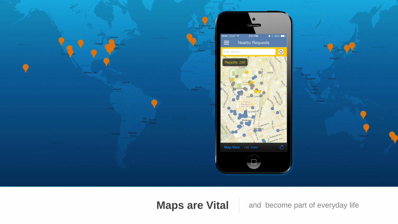
Maps are Vital and become part of everyday life

Increased Demand For authoritative mapping and
location-aware apps at work
Pew Research Center
74% of adults use their smartphone to get
directions or other information based on their
current location.


Without Integration

GIS Professionals have the passion, knowledge and
the technology to bring GIS to everyone today!

Devices Social Apps
Consumerization of IT

58%
Own a Smartphone
2.8Devices Owned by
Knowledge Workers
87%Using the Internet


"Times and conditions change so
rapidly that we must keep our aim
constantly focused on the future.”
Walt Disney


Empower Employees and ContractorsTo discover, use, make, and share maps
from any device, anywhere, anytime

spreadsheets
web services
business systems
big data collections
images / video
sensor networks
social media
analytics
spatial data
Maps at WorkIntegrate, display, analyze, and enrich
information from many sources

Maps at WorkRepresent the authoritative inventory
of your assets and resources

Maps at WorkEnable you to quickly see important
changes that impact your business

Maps at WorkBring new insight that reveals
patterns and trends in the data

Maps at WorkIllustrate time, show status and
performance, and support decision making

Maps at WorkEnable evaluation and simulation that
support strategic decision making

Maps at WorkProvide your organization with a
collection of useful information products

A Complete Location PlatformProviding mapping, analysis, data
management, and collaboration
Asset
Management
ArcGIS -- Integrated Web GIS Platform
Planning &
Analysis
Field
Mobility
Operational
Awareness
Constituent
Engagement
Transform Data
Into Actionable
Information
Collect, Organize,
& Exchange Data
Get Information
Into and Out of
the Field
Disseminate
Information Where
and When it is
Needed
Get Feedback and
Make Informed
Decisions

ArcGIS is a PlatformMaking mapping and GIS available
across an organization
ArcGIS
Knowledge
Workers
Professional
GIS
Work
Anywhere
Public
Engagement
Executive
Access
Enterprise
Integration

Advanced
Tools for
You

Apps for Everyonea suite of easy to use apps that work
on any device, anywhere, anytime
Microsoft Office
Microsoft SharePoint
Microsoft Dynamics
SAP Business Objects
MicroStrategy
IBM COGNOS
Salesforce.com
plus an SDK framework

County of RiversideDamian Laning | County of Riverside
Justin Fan | Esri
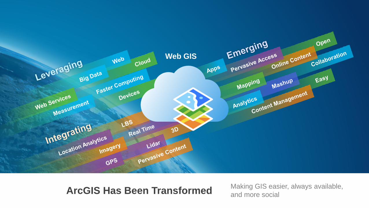
Web GIS
ArcGIS Has Been TransformedMaking GIS easier, always available,
and more social

Enriching
Your Own Work
Supporting Sharing
and Collaboration
Web GIS Transforms
How GIS Professionals Work
Improving How They Organize and
Share Their Knowledge
Improving Your Productivity . . .
. . . Making Everyone’s GIS Better

Improved
• Quality
• Performance
• Cartography
• Analytics
• Image Processing
• Security (PKI)Continued Support . . .
. . . with Dramatic Improvement
Professional GIS
ApplicationsDesktop
Arc
GIS
New
• Intuitive
• Fast (64 bit)
• Multiple Layouts
• 2D / 3D
• Create Web Maps
• Tasks and Projects
ArcMap ArcGIS Pro
New
Side-by-Side
Providing Mapping, Visualization, Editing, and Analysis

• Unlimited Web Mapping
• Data Hosting
• Living Atlas
• Many Apps
. . . Extending Your Capabilities
Users
Apps
Anonymous
Access
Includes ArcGIS OnlineDesktop
Arc
GIS
Web GISDesktop
Improved
• User Experience
• Mapping
• Analytics
• Management
• Security
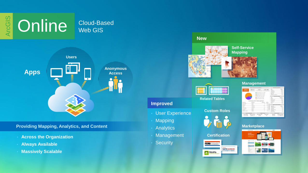
New
Cloud-Based
Web GIS
Management
Related Tables
Self-Service
Mapping
• Across the Organization
• Always Available
• Massively Scalable
Online
Arc
GIS
Providing Mapping, Analytics, and Content
Certification
Marketplace
Custom Roles
Users
AppsAnonymous
Access

New
• Portal (Included)
• Custom Roles
• 3D Services
• Real-Time Services
Improved
• Scalability and Quality
• Authentication (SAML)
• Active Directory Support
. . . Supporting On-Premises and Hybrid Systems
Enterprise GIS in
Your Own InfrastructureServer
Arc
GIS
Users
AppsAnonymous
Access
Now a Web GIS
Monitoring Tools
Improved Server ExperienceProviding Geodata Management, Analysis, and Mapping
Portal
Server

2013
2014
10.2Online
10.2.1
10.2.2
10.3
Incremental Software Releases . . .
. . . Continuous Online Improvements
. . . Focused on Quality, User Needs, and Innovation
2015
Facility Networks
Crowdsourcing
Modeling
Web Raster
Analysis
Vector Web
Mapping
Native Big Data
SupportPro
Massive 3D
AdvancedNavigation
Real-Time
Location Awareness
Advancing
the PlatformRoad Map
Arc
GIS

BreakSession Resumes at 10:45 AM


Location Strategy for Your OrganizationTo transform how people use
geography to do their work
Geo-Centric
Systems
Mapping
Platform for
Organization
Mapping
Platform for
Developers

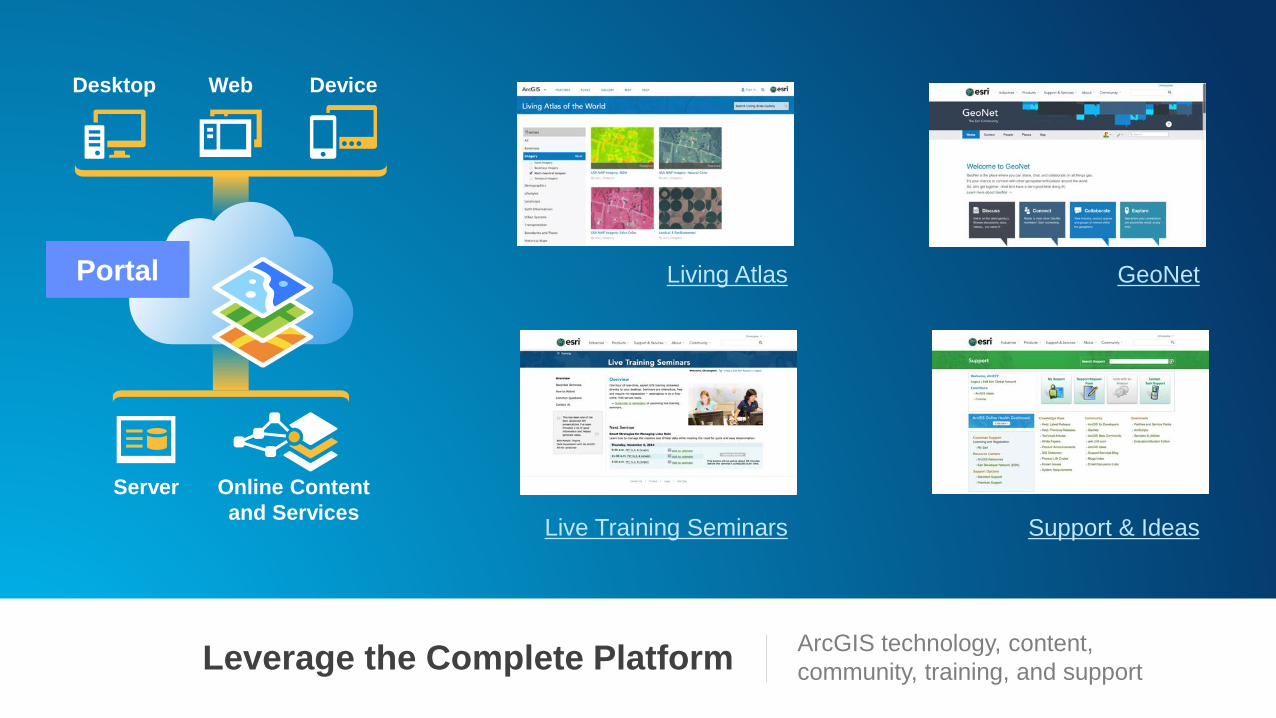
Leverage the Complete PlatformArcGIS technology, content,
community, training, and support
Desktop Web Device
Server Online Content
and Services
Portal GeoNetLiving Atlas
Live Training Seminars Support & Ideas

Create a Destination with PortalWhere everyone goes to find maps
and geographic knowledge

Configure First, Customize SecondLeverage apps and templates in order
to be more agile and reduce your costs
Web
Templates
Story Maps
Dashboard
Explorer for Devices
Web AppBuilder
Business System Integration
(SAP, Cognos, MS Dynamics….)
Open Data
ArcGIS Solutions
Collector

Creating Useful InformationKatja Krivoruchko | Esri

Create Useful Information Productsa library of maps and apps that bring
geographic knowledge to your users
Data
Analysis
Function or
Python Script
Store
Feature Classes
and Tiles
Register in
Your Portal
Existing
Feature Classes
and Tiles

Light Up Everyone…Make mapping and GIS available to
everyone in your organization


“If I had asked people what they
wanted, they would have said ‘faster
horses.’”Henry Ford

Enable People to Do Amazing
Things with Geography and GIS

Esriserving our users, advancing GIS, and
promoting spatial literacy