employing an automated design module (adm) in wildlife ... · surrounding land uses, and promote...
TRANSCRIPT

Employing an Automated Design Module (ADM)
in Wildlife Corridor Design
Ryan M. Perkl, Ph.D. Planning Degree Program
School of Landscape Architecture & Planning The University of Arizona
Research Team:
Samuel Chambers, Brandon Herman, Garrett Smith, Wanyi Song
1

Santa Cruz Watershed
2 2
What can we do to “design” these modeled “voids”?
How do we design these linkages in an efficient way?

3
Linkage Modeling

4
Linkage Modeling

5
More to Linkage Modeling
A modeled corridor by itself is NOT a design, but rather a planning mechanism that can be consulted and used to guide decision making. It is a very helpful and necessary first step. Design requires attention to site specific characteristics, functions, and even qualitative variables such as aesthetics. These variables are not easily captured in corridor modeling and require additional refinement. What do we know about landscape patterns and their effect on connectivity? Can we borrow from other disciplines and integrate this knowledge into the design of modeled corridors to enhance how they function?
6
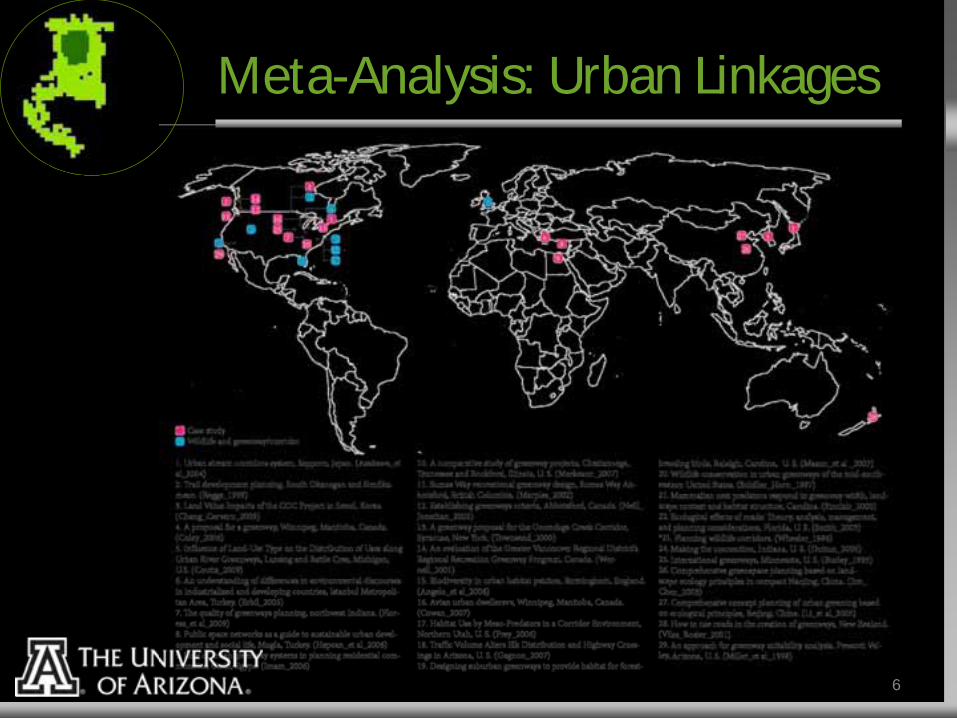
Meta-Analysis: Urban Linkages

Meta-Analysis: Landscape Pattern

Edge Conditions

Edge Conditions

Edge Conditions

Edge Conditions and Ecotones

Edge Conditions and Ecotones

Edge Conditions and Ecotones

Edge Conditions and Ecotones

Meta-Analysis: Landscape Pattern
Extensions:
Gap Fences:
Stepping Stones:
Fragmented Condition: Designed Condition to Enhance Connectivity:

Meta-Analysis: Landscape Pattern
Cap Termini:
Cap Fingers:
Ball & Socket:
Fragmented Condition: Designed Condition to Enhance Connectivity:

A Way Forward: GeoDesign


Pattern Integration


What About Automation?
Here, we illustrate the development of an Automated Design Module (ADM). Utilizes landscape characteristics to develop capability surfaces for native vegetation. Vegetation requirements are parameterized per focal species requirements and modeled corridor characteristics. The module generates vegetation density, heterogeneity, and aspects of pattern such as linearity and cohesion per user defined criteria. Corridor outputs are then populated with suitable vegetation arranged in spatial patterns which promote connectivity, mitigate edge effects of surrounding land uses, and promote desired landscape patterns.

Native Vegetation Library
Common Name Scientific Name Size Elevation Soil Aspect Slope Hydrology Temp (threshold) Trees
blue palo verde Parkinsonia florida 15ft 0 - 4,000ft well drained, alkaline full sun bottomland drought tollerant, prefers riparian edge habitat
18F
velvet mequite Prosopis velutina 30ft 0 - 4,800ft well drained, alkaline, deep soil full sun all prefers deep water table 10F
whitethorn acacia Acacia constricta 18ft 0 - 4,500ft sandy, caliche type, sandy loam, limestone soil full sun all arid 10F
cat claw acacia Acacia greggii 10ft 0 - 5,000ft sandy, caliche type, sandy loam, limestone soil full sun all arid 0F
ironwood Olneya tesota 30ft 0 - 2,300ft sandy/gravely soil full sun bottomland arid 20F
Shrubs
creosote Larrea tridentata 8ft 0 - 4,000ft sandy, sandy loam, medium loam, caliche type full sun - part shade bottomland - med slope arid 0F
triangleleaf bursage Ambrosia deltoidea 3ft 1,000 - 3,000ft sandy, sandy loam, alkaline full sun all arid 18F
Cacti
saguaro Carnegiea gigantea 50ft 0 - 4, 000ft sandy, sandy loam, alkaline full sun - part shade. Southern slopes at higher elevation all arid 20F
buckhorn cholla Cylindropuntia acanthocarpa 9ft 0 - 3,500ft sandy, well drained full sun all arid 10F
engelmann prickley pear Opuntia engelmannii 5ft 1,000 - 6,500ft all full sun - part shade all arid 10F
fishook barrel Ferocactus wislizenii 8ft 0 - 5,000ft sandy or gravelly full sun - part shade all arid 10f
Common Name Scientific Name Size Elevation Soil Aspect Slope Hydrology Temp (thresTrees
blue palo verde Parkinsonia florida 15ft 0 - 4,000ft well drained, alkaline full sun bottomland drought tollerant, prefers riparian edgehabitat
18F
Species: Blue Palo Verde, Parkinsonia florida Size: 15’ Elevation: 0 – 4,000’ Soil: Well drained, alkaline Aspect: Full sun Slope: Bottomland Hydrology: Drought Tolerant, prefers riparian edge Min Temp: 18f
dge
uckbuckbuckbuckbuckbuckbuckbuckbuckckbuckuckbuckbuckbuckuckbuckbuckuckckuckhornhornhornohorororornhorhornhornhornhornhohohornohornhohh chohhohohhohohohohhohohhohohohohohohoh llallaallallallallaaaallallallallllallallallaaaa CyliCyliCyliCyliCyliCyliCCyliCyliCyliyyyy ndronnnnnnn puntiaacanaacanacanacanacaanna anthocthothothocthocthocthochochochococthochochocthocthocthothhochocho arpaarpaarpaarpaarpaarpaarparparpaarpapaarpaarpaarpapaarpapapapap 9ft9ft99ft9ftt9ft99ft9ft9ft99ft9ft99ft99ft9
engeengeengeengeengeengeengengeengeengeengeengeengeengeengeengeengengeenengeengelmanlmanlmanmanmanmamanmanmanmalmamanmanmamanmanmanmamanmanmann prprprprrprprrprprrrprprprrpprickicicklickickkkickickickickkickickkickickkickkk ey yyyyyyyyyyyyyyyyypearpearpearpearpepepearpearpearpepepepeepepepepepepep Opunpupuuuuupuuupupupuppuppp tia engelmannii 5ft
ssfishfisfi hhfisfissfishfishhhhfiss ooook ookook ook ook ookkookookookokokokooook ookook ababarbababarbarbararrbarrbarrarrbarrrrrra eleleleleeeeleeelelelelelell Feroeroeeroeroeroeroeroeroeroereroeroeroeeroeeroeroerocactcactcactcactcactcactcaccactcactcactcaccactcactcactcactcactcactcactcactcactcactussssssus wiswiswiswiwiswiswiswiswiswiswiswiswiswwiwiswiswiwiswislizezezezezezezzezezeizeezezeezezezezezeniii ii i i iiii iiiiiiiiiiiiiiii 8ft

Landscape Capability Models: Native Vegetation

Pattern Generators & Rules-Based Design Filters

Pattern Generators & Design Filters
Cohesion: Density & Heterogeneity: Linearity:

Current Vs. Proposed

Corridor Interior Populated

Pattern Integration and Editing

Traditional Corridor Design?

Improved Corridor Design?

Closing Thoughts
We need to do a better job translating science into terms and concepts that land use planners and designers can readily integrate and implement. Modeled corridor outputs require additional specificity within urban landscapes in order to be implemented, thus, more detailed planning and design is needed to fill in the voids of modeled corridors and guide decision making towards implementation. We need better ways to design large swaths of the landscape (i.e. modeled corridors) through maximizing efficiency, integrating data as the foundation upon which designs are based to increase function, and through integrating patterns known to enhance connectivity. We believe tools such as ADM may help.

Thank You
32
Ryan M. Perkl, Ph.D.
Research Team: Samuel Chambers Brandon Herman
Garrett Smith Wanyi Song

Baldwin, R. F., R. M. Perkl, S. C. Trombulak, and W. B. Burwell III. 2010. Modeling Ecoregional Connectivity in T. S.C., and B. R.F., editors. Landscape-scale Conservation Planning. Springer-Verlag, New York, NY. USA. Baldwin, R. F., A. J. K. Calhoun, and P. G. deMaynadier. 2006. The significance of hydroperiod and stand maturity for pool-breeding amphibians in forested landscapes. Canadian Journal of Zoology-Revue Canadienne De Zoologie 84:1604-1615.
Haddad, N. M., and J. J. Tewksburry. 2006. Impacts of corridors on populations and communities. Pages pp. 390-415 in K. R. Crooks, and M. Sanjayan, editors. Connectivity Conservation. Cambridge University Press, Cambridge, UK.
Majka, D., J. Jenness, and P. Beier. 2007. CorridorDesigner: ArcGIS tools for designing and evaluating corridors. McRae, B. H., and P. Beier. 2007. Circuit theory predicts gene flow in plant and animal populations. Proceedings of the National Academy of Sciences of the United States of America 104:19885-19890. Perkl, R. M., and R. F. Baldwin. 2010. Connections between GAP Status 1 lands. Theobald, D. M. 2006a. Exploring the functional connectivity of landscapes using landscape networks. Conservation Biology Series-Cambridge. 14:416. Theobald, D. M. 2006a. Exploring functional connectivity of landscapes using landscale networks. Pages pp. 416-443 in C. M. Sanjayan, editor. Connectivity Conservation. Cambridge University Press, Cambridge, UK. Theobald, D. M., N. J. B., and S. M.R. 2006b. FunConn v1 user's manual: ArcGIS tools for functional connectivity modeling. Colorado State University, Natural Resources Ecology Lab, Fort Collins, CO.
Urban, D., and T. Keitt. 2001. Landscape connectivity: A graph-theoretic perspective. Ecology 82:1205-1218. Woolmer, G., S. C. Trombulak, J. C. Ray, P. J. Doran, M. G. Anderson, R. F. Baldwin, A. Morgan, and E. W. Sanderson. 2008. Rescaling the Human Footprint: A tool for conservation planning at an ecoregional scale. Landscape and Urban Planning 87:42-53.
33
Citations

Bazelet, C. and M. Samways "Relative importance of management vs. design for implementation of large-scale ecological networks." Landscape Ecology 26(3): 341-353. Craig, L. (1999). "Optimizing wildlife habitat mitigation with a habitat defragmentation algorithm." Forest Ecology and Management 120(1-3): 245-251. DeStefano, S., A. X. Esparza, et al. (2009). Wildlife Corridors and Developed Landscapes. The Planner's Guide to Natural Resource Conservation, Springer New York: 85-102.
Drielsma, M., G. Manion, et al. (2007). "The spatial links tool: Automated mapping of habitat linkages in variegated landscapes." Ecological Modelling 200(3-4): 403-411.
Forman, R. T. T. (1995). Land mosaics : the ecology of landscapes and regions. Cambridge [England]; New York, Cambridge University Press.
Horskins, K., P. Mather, et al. (2006). "Corridors and connectivity: when use and function do not equate." Landscape Ecology 21(5): 641-655.
Linehan, J., M. Gross, et al. (1995). "Greenway planning: developing a landscape ecological network approach." Landscape and Urban Planning 33(1-3): 179-193.
Olson, D. H. and K. M. Burnett (2009). "Design and management of linkage areas across headwater drainages to conserve biodiversity in forest ecosystems." Forest Ecology and Management 258, Supplement(0): S117-S126.
Pinto, N. and T. Keitt (2009). "Beyond the least-cost path: evaluating corridor redundancy using a graph-theoretic approach." Landscape Ecology 24(2): 253-266.
34
Citations