edward j. tarbuck & frederick k. lutgens. alfred wegener first proposed hypothesis, 1915...
TRANSCRIPT
Edward J. Tarbuck & Frederick K. Lutgens
Alfred Wegener • First proposed hypothesis, 1915 • Published The Origin of Continents and
Oceans Continental drift hypothesis
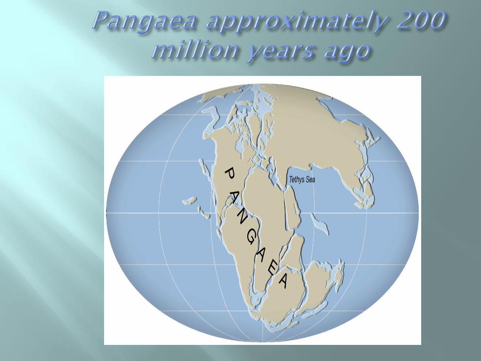
• Supercontinent called Pangaea began breaking apart about 200 million years ago
• Continents "drifted" to present positions • Continents "broke" through the ocean crust
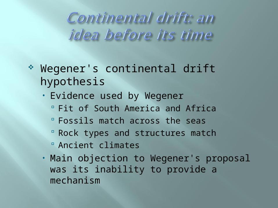
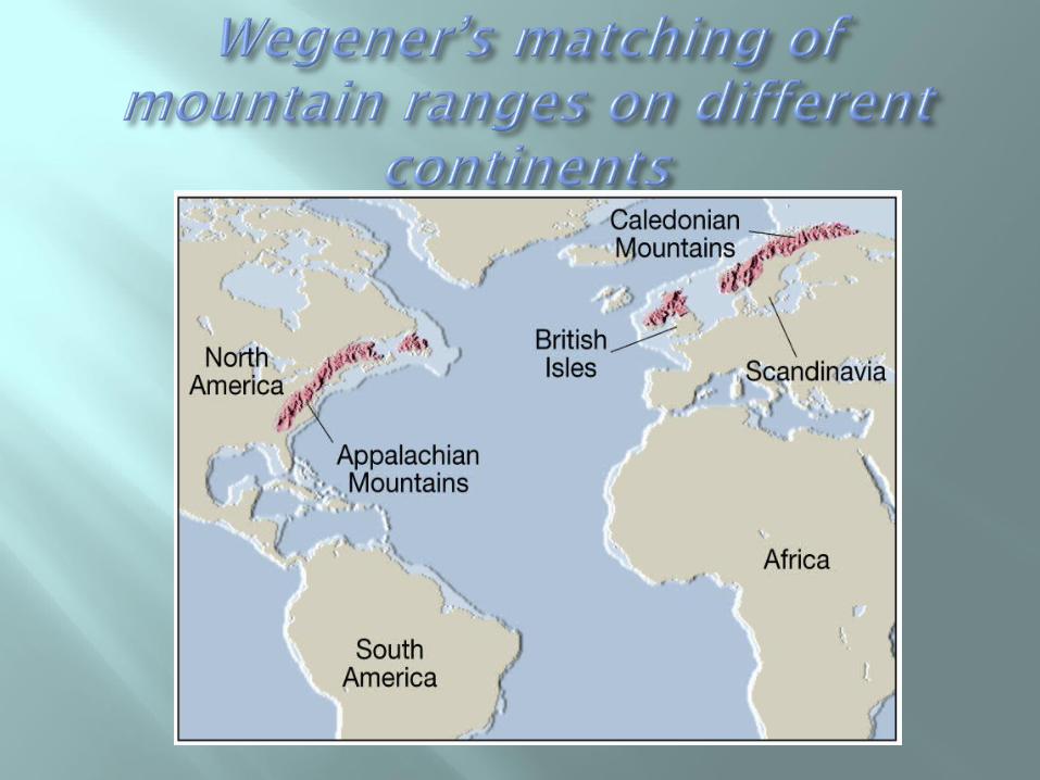
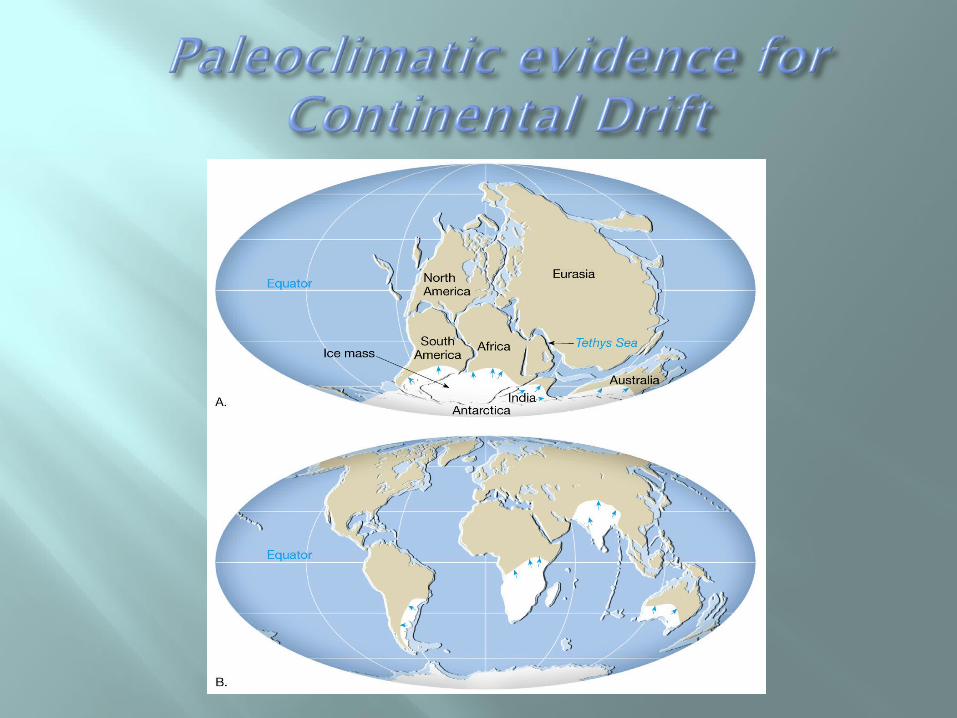
Wegener's continental drift hypothesis• Evidence used by Wegener
Fit of South America and Africa Fossils match across the seas Rock types and structures match Ancient climates
• Main objection to Wegener's proposal was its inability to provide a mechanism

More encompassing than continental drift
Associated with Earth's rigid outer shell • Called the lithosphere • Consists of several plates
Plates are moving slowly Largest plate is the Pacific plate Plates are mostly beneath the ocean
Asthenosphere • Exists beneath the lithosphere • Hotter and weaker than lithosphere• Allows for motion of lithosphere
Plate boundaries • All major interactions among plates occur
along their boundaries

Plate boundaries • Types of plate boundaries
Divergent plate boundaries (constructive margins) •Two plates move apart•Mantle material upwells to create new seafloor
•Ocean ridges and seafloor spreading •Oceanic ridges develop along well-developed boundaries
•Along ridges, seafloor spreading creates new seafloor

Plate boundaries • Types of plate boundaries
Divergent plate boundaries (constructive margins)
•Continental rifts form at spreading centers within a continent
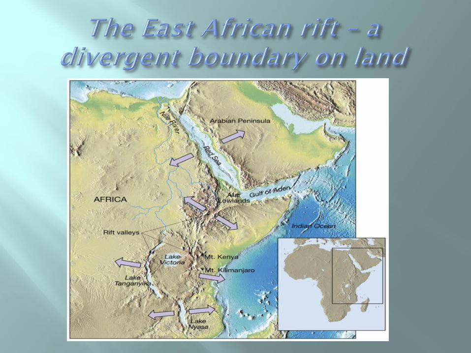
Plate boundaries • Types of plate boundaries
Convergent plate boundaries (destructive margins)
•Plates collide, an ocean trench forms and lithosphere is subducted into the mantle
Convergent plate boundaries (destructive margins)
•Oceanic-continental convergence •Denser oceanic slab sinks into the asthenosphere
•Pockets of magma develop and rise •Continental volcanic arcs form•Examples include the Andes, Cascades, and the Sierra Nevadan system
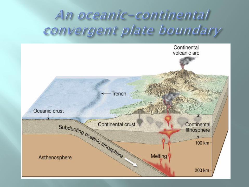

Plate boundaries • Types of plate boundaries
Convergent plate boundaries (destructive margins)•Oceanic-oceanic convergence
•Two oceanic slabs converge and one descends beneath the other
•Often forms volcanoes on the ocean floor
•Volcanic island arcs forms as volcanoes emerge from the sea
•Examples include the Aleutian, Mariana, and Tonga islands
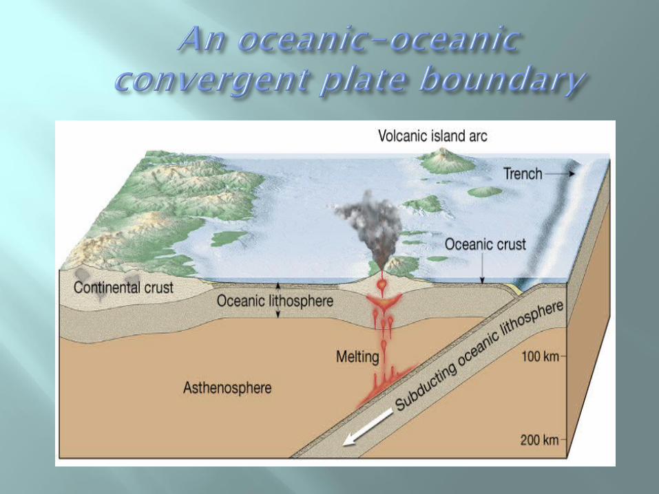

Plate boundaries • Types of plate boundaries
Convergent plate boundaries (destructive margins)
•Continental-continental convergence •When subducting plates contain continental material, two continents collide
•Can produce new mountain ranges such as the Himalayas
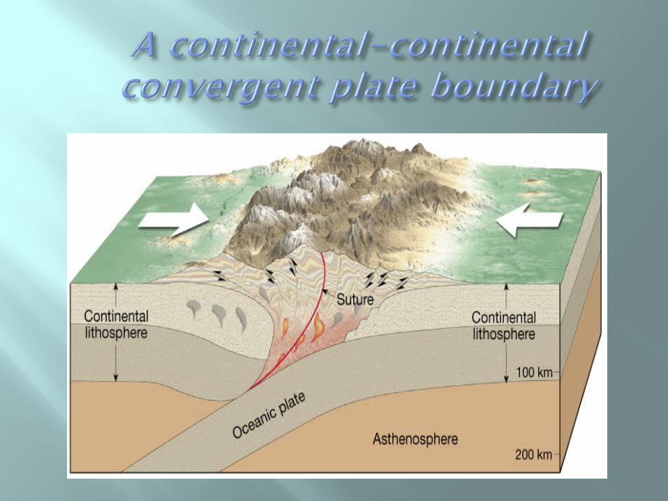

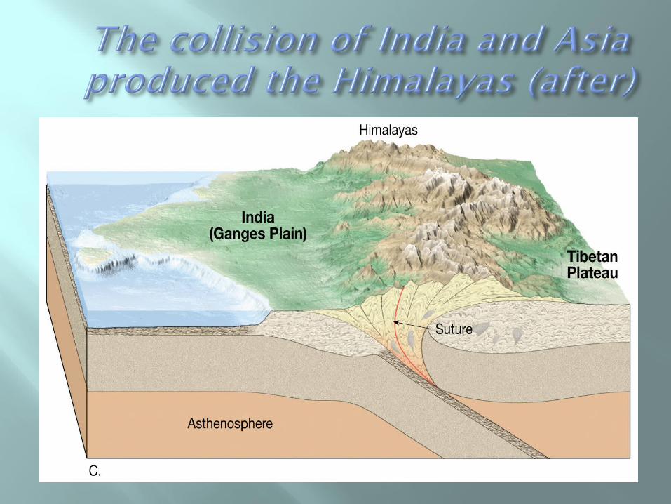

Plate boundaries • Types of plate boundaries
Transform fault boundaries •Plates slide past one another •No new crust is created •No crust is destroyed
•Transform faults •Most join two segments of a mid-ocean ridge
•At the time of formation, they roughly parallel the direction of plate movement
•Aid the movement of oceanic crustal material

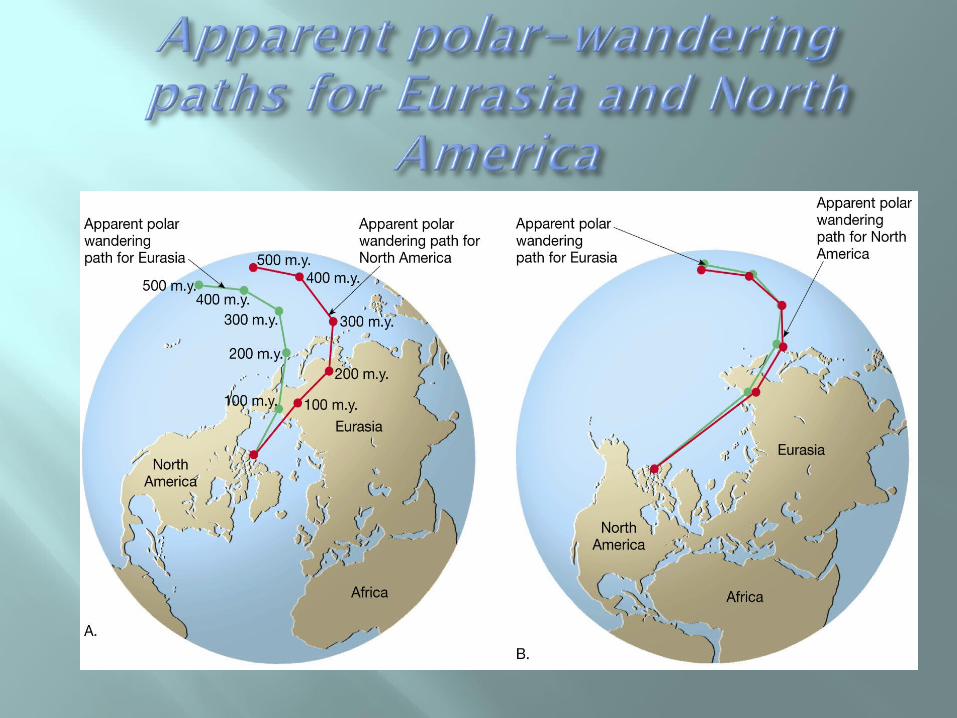
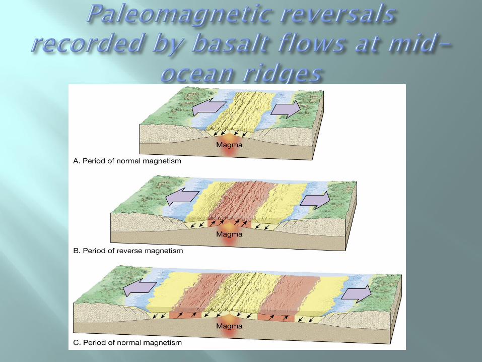
Evidence for the plate tectonics model • Paleomagnetism
Probably the most persuasive evidence Ancient magnetism preserved in rocks Paleomagnetic records show
•Polar wandering (evidence that continents moved)
•Earth's magnetic field reversals •Recorded in rocks as they form at oceanic ridges
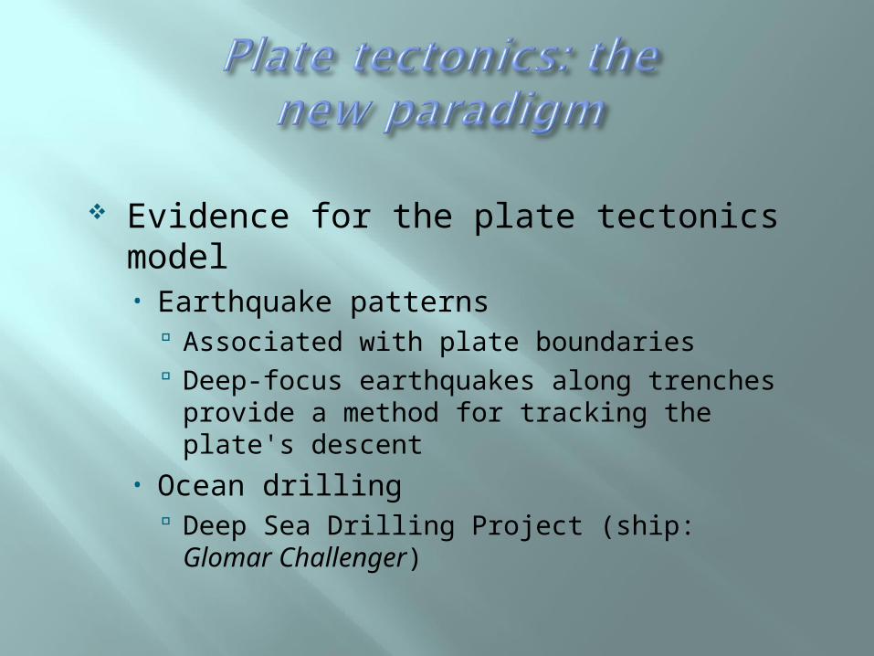
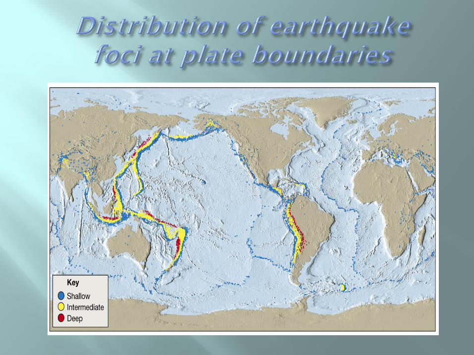
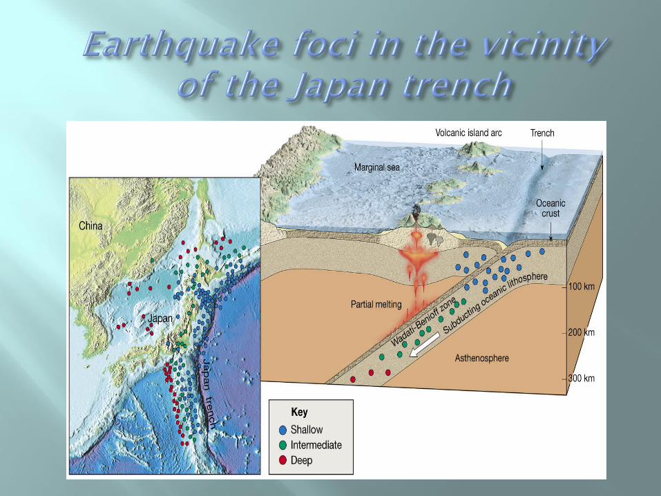
Evidence for the plate tectonics model • Earthquake patterns
Associated with plate boundaries Deep-focus earthquakes along trenches
provide a method for tracking the plate's descent
• Ocean drilling Deep Sea Drilling Project (ship: Glomar
Challenger)
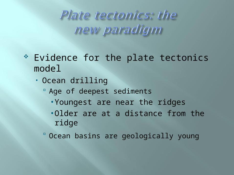
Evidence for the plate tectonics model • Ocean drilling
Age of deepest sediments
•Youngest are near the ridges •Older are at a distance from the ridge
Ocean basins are geologically young
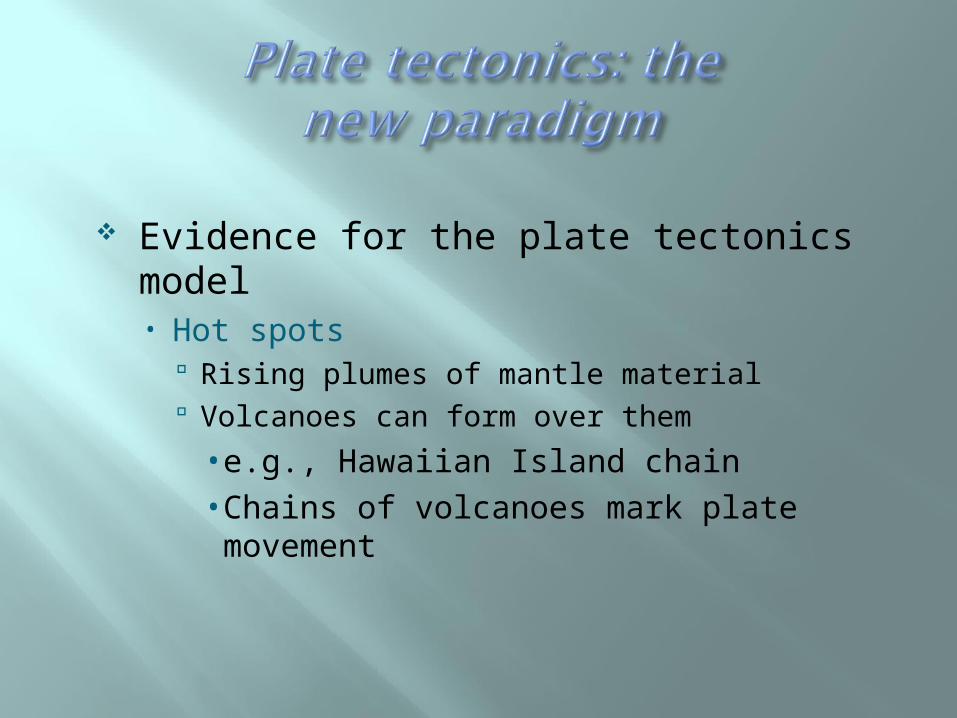
Evidence for the plate tectonics model • Hot spots
Rising plumes of mantle material Volcanoes can form over them
•e.g., Hawaiian Island chain•Chains of volcanoes mark plate movement
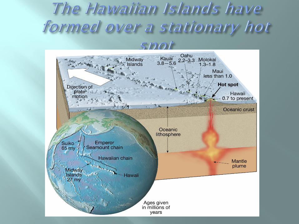

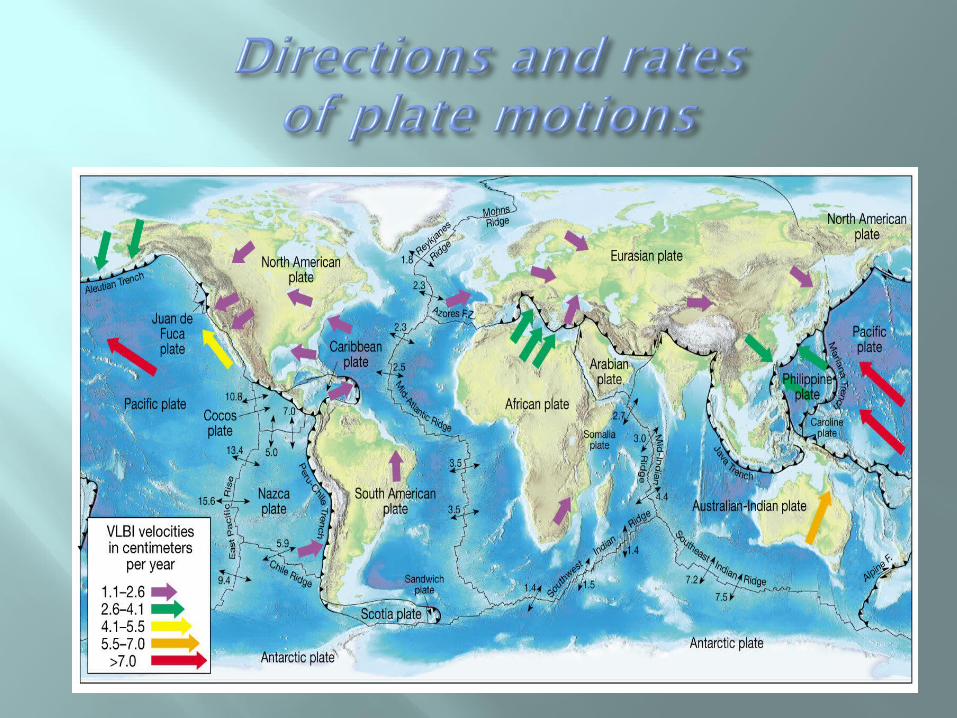
Measuring plate motion• By using hot spot “tracks” like those of the
Hawaiian Island - Emperor Seamount chain• Using space-age technology to directly
measure the relative motion of plates Very Long Baseline Interferometry (VLBI) Global Positioning System (GPS)

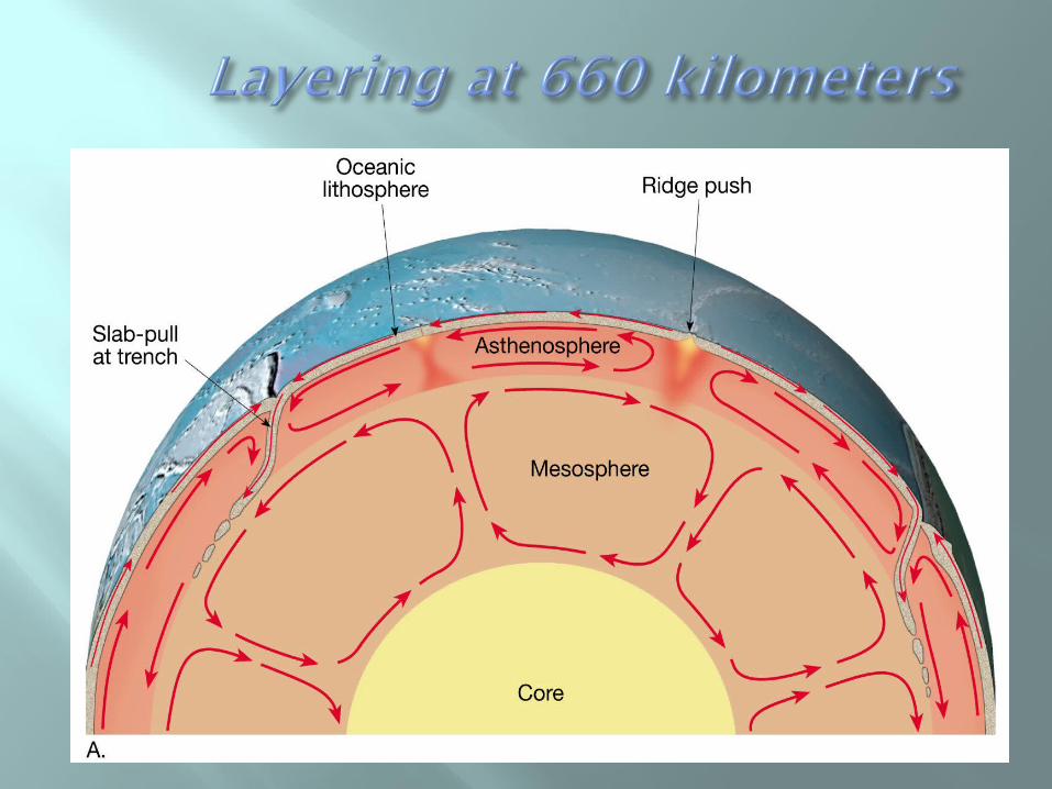
Driving mechanism of plate tectonics • No one model explains all facets of plate
tectonics • Earth's heat is the driving force• Several models have been proposed
Slab-pull and slab-push model
•Descending oceanic crust pulls the plate •Elevated ridge system pushes the plate

Driving mechanism of plate tectonics• Several models have been proposed
Plate-mantle convection
•Mantle plumes extend from mantle-core boundary and cause convection within the mantle
•Models •Layering at 660 kilometers •Whole-mantle convection •Deep-layer model