edge city to real city. the transformation of tysons corner va and white flint md
TRANSCRIPT

Edge City to Real City: The Transformation of Tysons Corner, Virginia and White
Flint, Maryland
Friday,
October 15
9:15 a.m. – 10:30 a.m.


Transforming Tysons Jim Zook
Fairfax County, Virginia

Tysons in the Region
11 miles to
Dulles Airport
11 miles to
Downtown DC
Image source: Google Maps

1950s: Dairy
farms and a
general store
Image source: Fairfax County Library

2010: Edge city
poster child
Image source: Fairfax County EDA

2050: City place
Image source: PB PlaceMaking

Tysons Today
• Economic engine of Northern Virginia
• 12th largest CBD in U.S.
• Half the land covered by impervious surfaces, including 167,000 parking spaces
• Auto-oriented, single-use development pattern
• Few transit options
Image source: Fairfax County EDA

Tysons by the Numbers
• 2,100 acres
(0.8% of Fairfax County)
• 17,000 residents
(1.6% of County total)
• 105,000 jobs
(18.5% of County Total)

Why Re-Plan Tysons?
• Metrorail expansion to Dulles
with 4 Tysons stations
• Regional growth
management strategy to
concentrate development in
activity centers
• Tysons is not sustainable
(economically or
environmentally) as a
suburban office park
Image source: Dulles Corridor Metrorail Project

Community Outreach
• Tysons Task Force held 45 public workshops and outreach sessions from 2006 - 2008
• Hundreds of citizens participated in three rounds of workshops focusing on planning alternatives and scenarios
• Web site provided information and opportunities for input
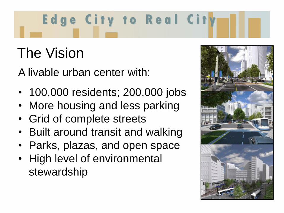
The Vision
A livable urban center with:
• 100,000 residents; 200,000 jobs
• More housing and less parking
• Grid of complete streets
• Built around transit and walking
• Parks, plazas, and open space
• High level of environmental
stewardship

• A place where people want to
live
• Urban standards for buildings,
services and infrastructure
• Affordable/workforce housing
targets
• Urban design guidelines
• Arts, cultural, recreation
opportunities
People-Focused Urban
Setting
Image source: PB PlaceMaking

Transit-Oriented Densities

Urban Street Grid
Tysons “super-blocks” today
- Potential for smaller, walkable blocks

Complete Streets
• Expanded facilities for
pedestrians, bikes, transit
vehicles, and cars
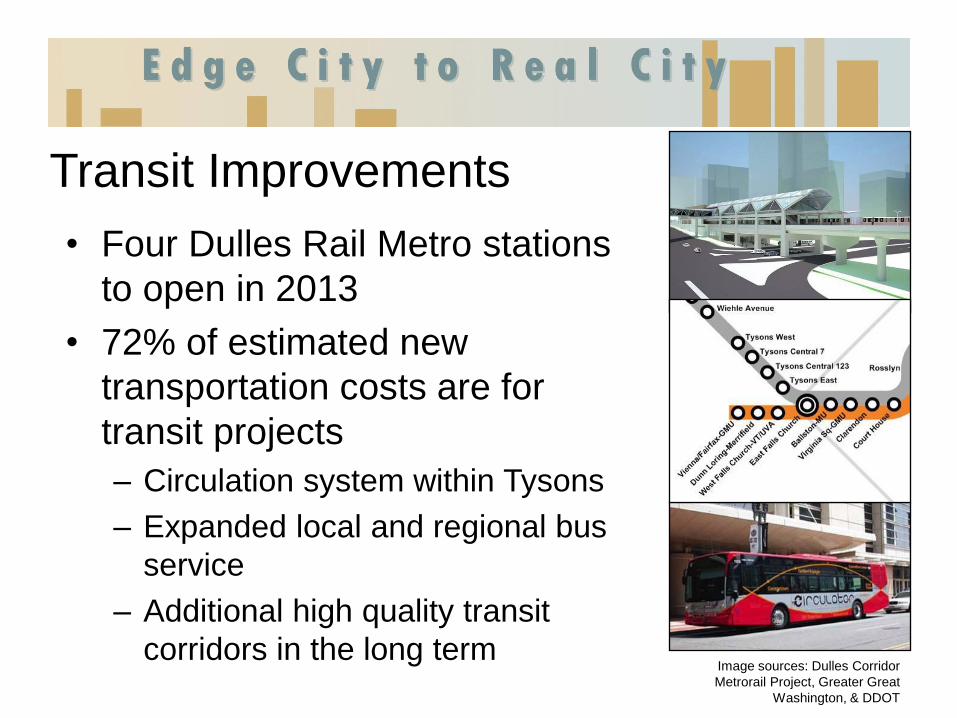
Transit Improvements
• Four Dulles Rail Metro stations
to open in 2013
• 72% of estimated new
transportation costs are for
transit projects
– Circulation system within Tysons
– Expanded local and regional bus
service
– Additional high quality transit
corridors in the long term
Image sources: Dulles Corridor
Metrorail Project, Greater Great
Washington, & DDOT

TDM and Parking Maximums
• Long term vehicle trip
reduction goals of 45% -
65%, based on distance
from Metro
• Philosophy shift from
parking minimums to
parking maximums
• No minimum parking
requirement for offices in
TODs
Image sources: PB PlaceMaking
and Bing Maps

Focus on the Environment
Image source: PB PlaceMaking
Green building requirements and
incentives
Network of parks, plazas, and
open space areas

Demonstration Project
Image source: Georgelas Group
The project would redevelop what is now a mishmash of
establishments, such as low-rise car dealerships, an industrial office
park and Georgelas’ headquarters on Greensboro Drive.
Washington Post, 1/12/2010

21
The implications of this
redevelopment project
stretch far beyond Fairfax
County, as suburbs and
exurbs across the country
look for ways to repair the
damage from five decades
of outward, rather than
upward, expansion. – TIME, 6/11/2009
Image source: TIME
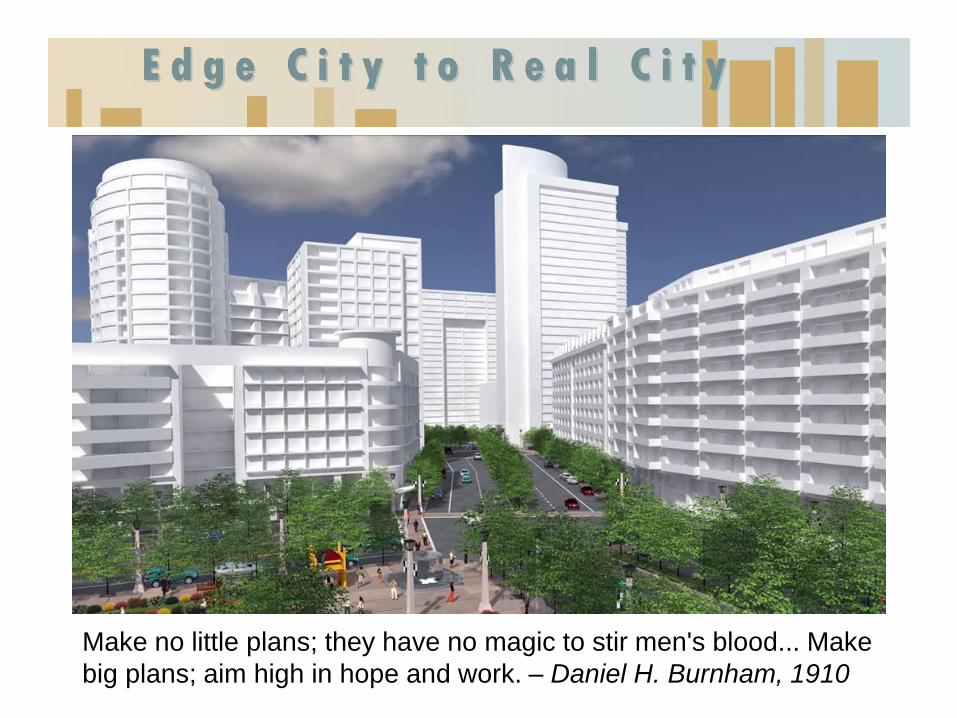
Make no little plans; they have no magic to stir men's blood... Make
big plans; aim high in hope and work. – Daniel H. Burnham, 1910

Tysons Demonstration Project
Aaron Georgelas
The Georgelas Group

Demonstration Project
Two Primary Goals
• Inform the New Comprehensive Plan
• Facilitate the review of projects that integrate
with the Metrorail, in an effort to ensure they
are constructed concurrently with the
operation of Metrorail.

Progress
• Mix of Uses
• Density Calculation
• Building Heights
• Grid of Streets
• Building Set Backs
• Flexibility
• Green Building
• Storm Water
Management
• Affordable Housing


TYSONS WEST TODAY
METRO

THE VISION
TRANSIT ORIENTED DESTINATION

THREE NEIGHBORHOODS
NEIGHBORHOOD 1
NEIGHBORHOOD 2
NEIGHBORHOOD 3 NEIGHBORHOOD 1

STATION INTEGRATION

VIBRANT COMMUNITY

TRANSIT ORIENTED DESTINATION

THREE NEIGHBORHOODS
NEIGHBORHOOD 1
NEIGHBORHOOD 2
NEIGHBORHOOD 3 NEIGHBORHOOD 2
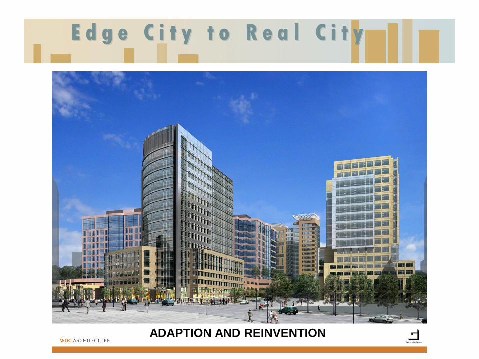
ADAPTION AND REINVENTION
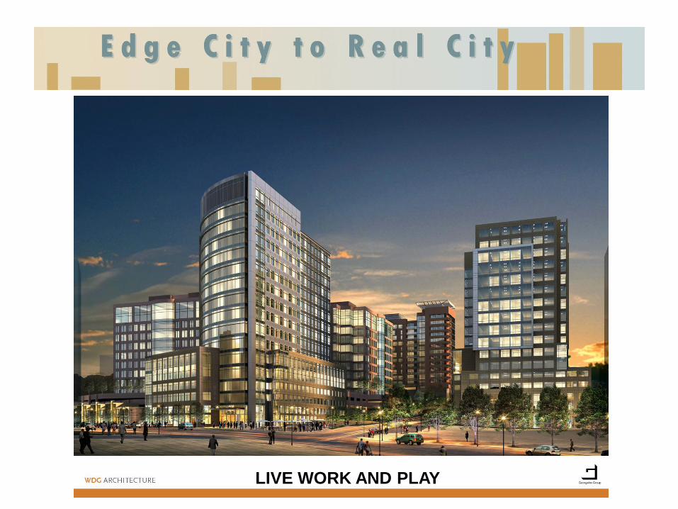
LIVE WORK AND PLAY

THREE NEIGHBORHOODS
NEIGHBORHOOD 1
NEIGHBORHOOD 2
NEIGHBORHOOD 3 NEIGHBORHOOD 3

FIRE STATION 429 RELOCATED TO TYCO RD
429
429

RESIDENTIAL

LIVABILITY AFTER 5:00pm


GRID OF STREETS


TRANSIT ORIENTED DESTINATION

Transforming White Flint Rollin Stanley
Montgomery County, Maryland

Transforming White Flint Evan Goldman
Federal Realty

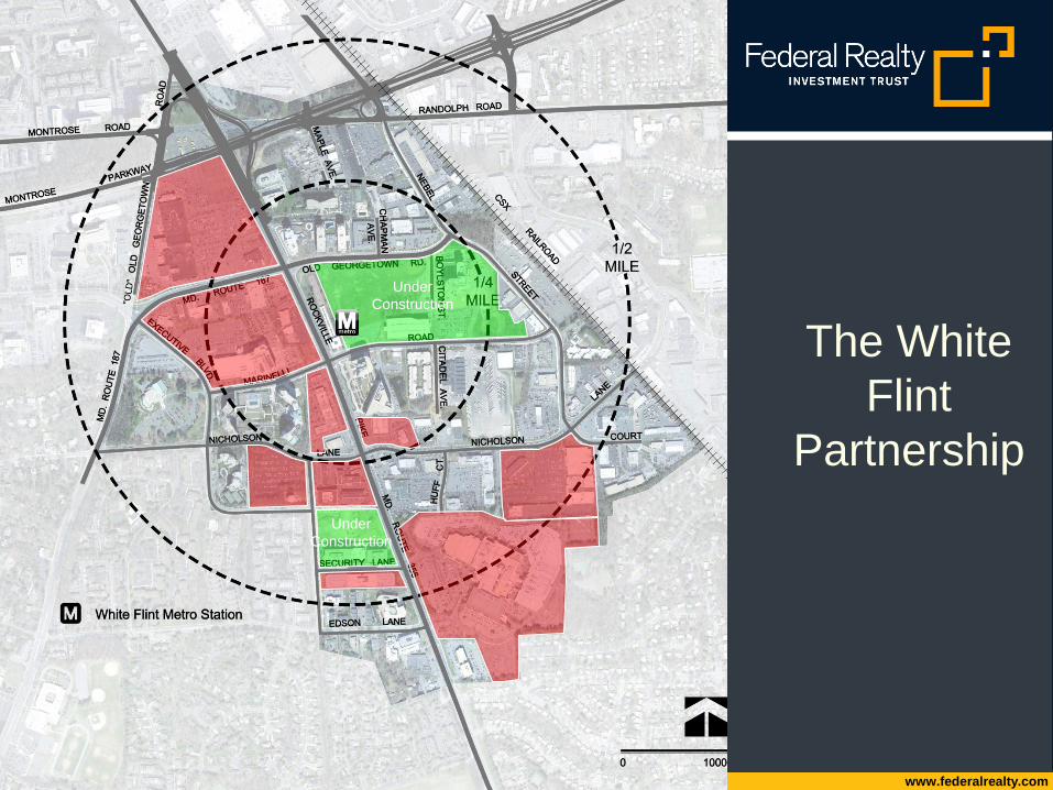
White Flint Partnership
Developer Perspective
October 14, 2010
www.federalrealty.com
The White
Flint
Partnership
Under
Construction
Under
Construction
www.federalrealty.com
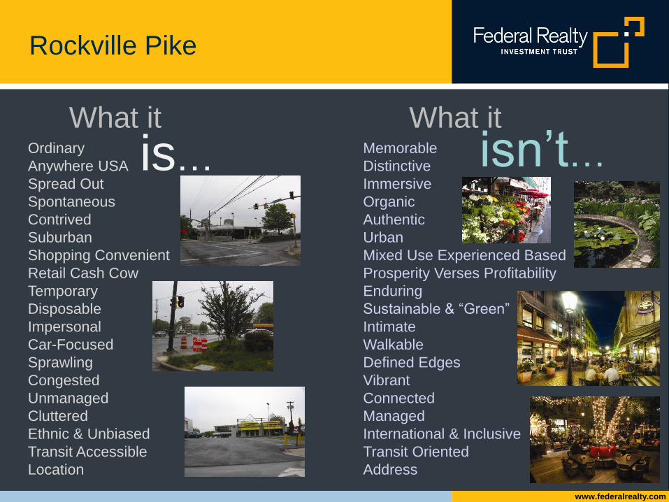
Rockville Pike
Ordinary
Anywhere USA
Spread Out
Spontaneous
Contrived
Suburban
Shopping Convenient
Retail Cash Cow
Temporary
Disposable
Impersonal
Car-Focused
Sprawling
Congested
Unmanaged
Cluttered
Ethnic & Unbiased
Transit Accessible
Location
Memorable
Distinctive
Immersive
Organic
Authentic
Urban
Mixed Use Experienced Based
Prosperity Verses Profitability
Enduring
Sustainable & “Green”
Intimate
Walkable
Defined Edges
Vibrant
Connected
Managed
International & Inclusive
Transit Oriented
Address
What it What it
is…
isn’t…
www.federalrealty.com
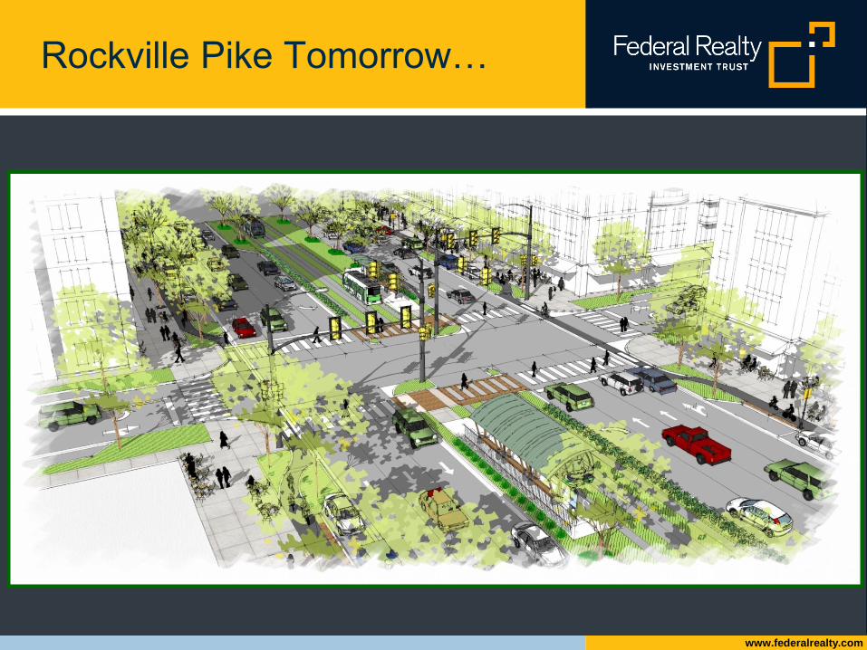
Rockville Pike Tomorrow…
www.federalrealty.com
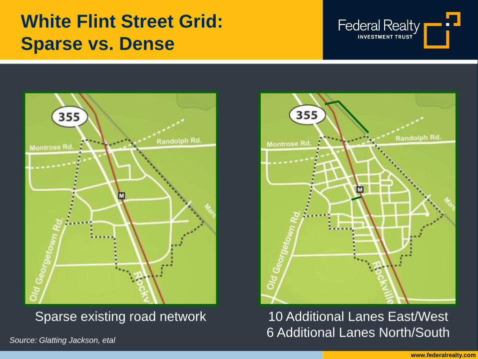
White Flint Street Grid:
Sparse vs. Dense
Source: Glatting Jackson, etal
Sparse existing road network 10 Additional Lanes East/West
6 Additional Lanes North/South

www.federalrealty.com
Connected and Convenient:
Five Minute Walk Neighborhoods

www.federalrealty.com
Old Georgetown Road Creates the
Combined Neighborhood

www.federalrealty.com
Connected and Convenient:
Neighborhoods C & D
Stepped down building
heights to respect and
transition with existing
neighborhoods

www.federalrealty.com
Active Pedestrian Friendly
Streetscapes

www.federalrealty.com
Streets as Public Use Space

www.federalrealty.com
Design & Programming

www.federalrealty.com
Existing Conditions: Mid-Pike

www.federalrealty.com
Mid-Pike Existing Conditions

www.federalrealty.com
Mixed Use Plans: Retail
Focused on Ground Level
Program
Retail 305,200 sf
Office 1,147,188 sf
Residential 1,900,500 sf
1,725 du
Hotel 90,000 sf
125 keys
Total 3,442,888 sf
www.federalrealty.com
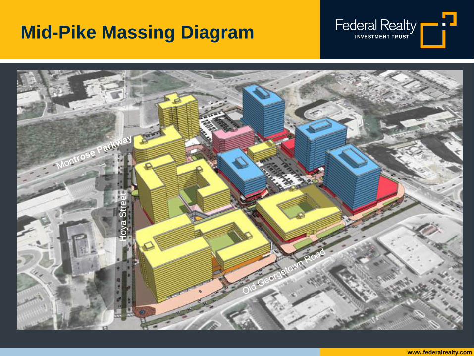
Mid-Pike Massing Diagram
Ho
ya
Str
ee
t

www.federalrealty.com
www.federalrealty.com
www.whiteflintpartnership.com
Feel Free to Contact with Questions:
• Evan Goldman
• 301-998-8375