earth link & advanced resources development … link & advanced resources development...
TRANSCRIPT
Earth Link & Advanced Resources DevelopmentSelected ReferencesWater Resources Managemenet & Applied Earth Sciences
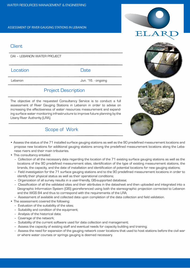
ASSESSMENT OF RIVER GAUGING STATIONS IN LEBANON
• Assess the status of the 71 installed surface gauging stations as well as the 90 predefined measurement locations and propose new locations for additional gauging stations among the predefined measurement locations along the Leba-nese rivers and their main tributaries.
• This consultancy entailed:– Collection of all the necessary data regarding the location of the 71 existing surface gauging stations as well as the
locations of the 90 predefined measurement sites, identification of the type of existing measurement stations, the brands, the capacity, and the date of installation and identification of potential locations for new gauging stations;
– Field investigation for the 71 surface gauging stations and to the 90 predefined measurement locations in order to identify their physical status as well as their operational conditions;
– Organization of all survey results in a user-friendly, GIS-supported database;– Classification of all the validated sites and their attributes in the datasheet and then uploaded and integrated into a
Geographic Information System (GIS) georeferenced using both the stereographic projection corrected to Lebanon and the WGS 84 and thus to correspond with the requirements of the LRA;
– Assessment of available and collected data upon completion of the data collection and field validation.• The assessment covered the following:
– Evaluation of the suitability of the sites;– Suitability and condition of the equipment;– Analysis of the historical data;– Coverage of the network;– Suitability of the current software used for data collection and management;– Assess the capacity of existing staff and eventual needs for capacity building and training;– Assess the need for expansion of the gauging network cover locations that used to host stations before the civil war
or where water courses or springs gauging is deemed necessary.
Client
Date
Scope of Work
WATER RESOURCES MANAGEMENT & ENGINEERING
Location
DAI – LEBANON WATER PROJECT
Lebanon Jun. ’16. - ongoing
Project Description
The objective of the requested Consultancy Service is to conduct a full assessment of River Gauging Stations in Lebanon in order to advise on increasing the effectiveness of water resources measurement and expand-ing surface water monitoring infrastructure to improve future planning by the Litany River Authority (LRA).

FEASIBILITY ASSESSMENT AND DESIGN FOR THE UPGRADE OF IRRIGATION NETWORKS IN NORTH LEBANON AND THE BEQAA
• Assess the condition of existing irrigation networks• Bills of quantities and cost-estimates for their rehabilitation• Determine the baseline conditions in the respective regions and according-
ly prioritize the networks that need to upgraded• Prepare the design drawings, including sections and elevations.• Prepare tender documents and technical specifications.
Client
Date
Scope of Work
WATER RESOURCES MANAGEMENT & ENGINEERING
Location
United Nations Development Programme (UNDP)
Lebanon Apr. ‘16 - Feb. ’17
Project Description
The project aims to enhance the access to safe drinking water to meet the National minimum standards of Water Quantity and Quality, for the popula-tion living in three villages located in Nabatieh District in South Lebanon, Kfar Fila, Kfar Roumman and Mayfadoun targeting approximately 43,000 people of Lebanese and Syrian Refugees. It entails the Design and Supervision during the Works' Execution of Water Facilities in the targeted villages conceived to upgrade the water supply systems currently present through the execution of Water Facilities, the Design and Supervision during the Works' Execution.
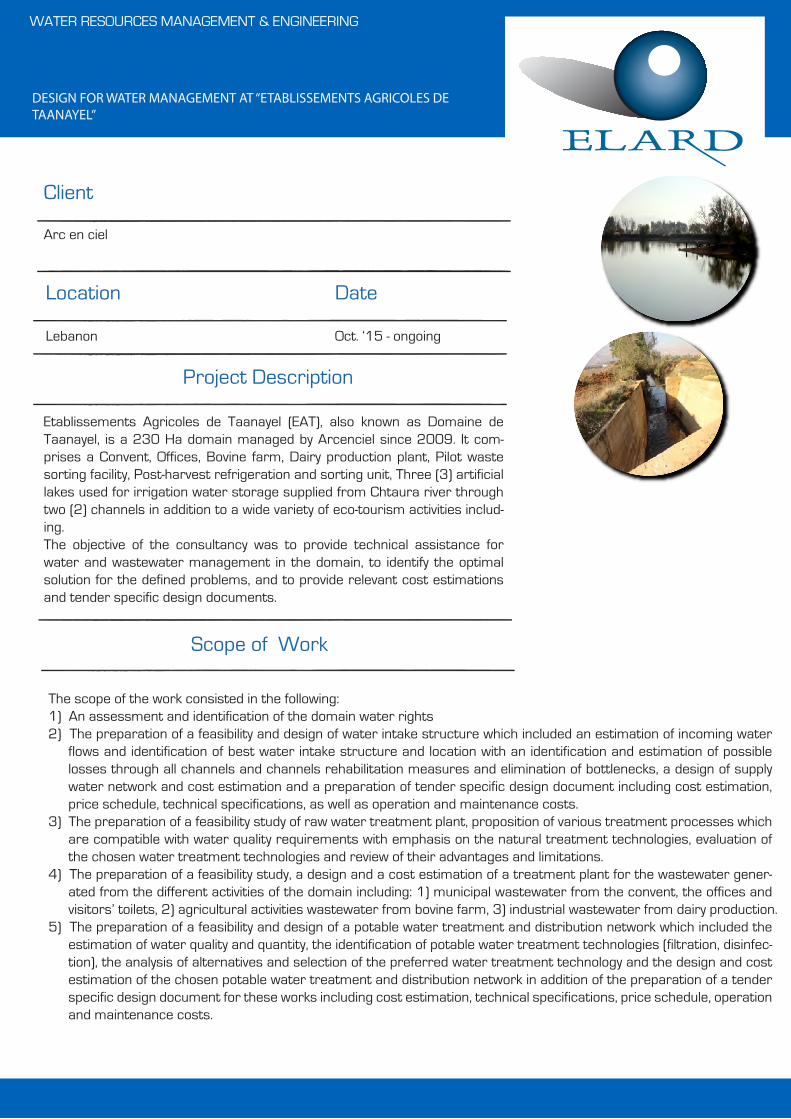
DESIGN FOR WATER MANAGEMENT AT “ETABLISSEMENTS AGRICOLES DE TAANAYEL”
The scope of the work consisted in the following:1) An assessment and identification of the domain water rights2) The preparation of a feasibility and design of water intake structure which included an estimation of incoming water
flows and identification of best water intake structure and location with an identification and estimation of possible losses through all channels and channels rehabilitation measures and elimination of bottlenecks, a design of supply water network and cost estimation and a preparation of tender specific design document including cost estimation, price schedule, technical specifications, as well as operation and maintenance costs.
3) The preparation of a feasibility study of raw water treatment plant, proposition of various treatment processes which are compatible with water quality requirements with emphasis on the natural treatment technologies, evaluation of the chosen water treatment technologies and review of their advantages and limitations.
4) The preparation of a feasibility study, a design and a cost estimation of a treatment plant for the wastewater gener-ated from the different activities of the domain including: 1) municipal wastewater from the convent, the offices and visitors’ toilets, 2) agricultural activities wastewater from bovine farm, 3) industrial wastewater from dairy production.
5) The preparation of a feasibility and design of a potable water treatment and distribution network which included the estimation of water quality and quantity, the identification of potable water treatment technologies (filtration, disinfec-tion), the analysis of alternatives and selection of the preferred water treatment technology and the design and cost estimation of the chosen potable water treatment and distribution network in addition of the preparation of a tender specific design document for these works including cost estimation, technical specifications, price schedule, operation and maintenance costs.
Client
Date
Scope of Work
WATER RESOURCES MANAGEMENT & ENGINEERING
Location
Arc en ciel
Lebanon Oct. ‘15 - ongoing
Project Description
Etablissements Agricoles de Taanayel (EAT), also known as Domaine de Taanayel, is a 230 Ha domain managed by Arcenciel since 2009. It com-prises a Convent, Offices, Bovine farm, Dairy production plant, Pilot waste sorting facility, Post-harvest refrigeration and sorting unit, Three (3) artificial lakes used for irrigation water storage supplied from Chtaura river through two (2) channels in addition to a wide variety of eco-tourism activities includ-ing.The objective of the consultancy was to provide technical assistance for water and wastewater management in the domain, to identify the optimal solution for the defined problems, and to provide relevant cost estimations and tender specific design documents.

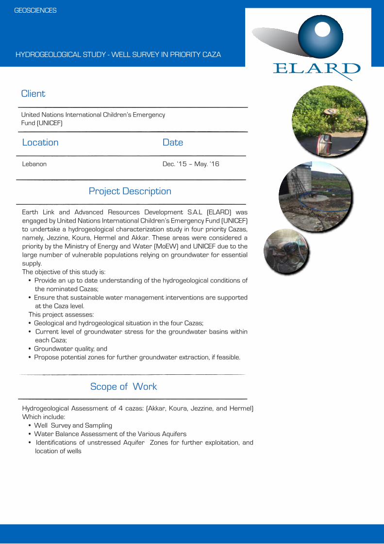
HYDROGEOLOGICAL STUDY - WELL SURVEY IN PRIORITY CAZA
Hydrogeological Assessment of 4 cazas: (Zahle, Minieh-Dannyeh, Marjehyoun, and Rachaya) Which include:
• Well Survey and Sampling• Water Balance Assessment of the Various Aquifers• Aquifer Pollution Assessment• Identifications of unstressed Aquifer Zones for further exploitation.
Client
Date
Scope of Work
GEOSCIENCES
Location
United Nations International Children’s Emergency Fund (UNICEF)
Lebanon Sep. ‘16 – Jan. ’17
Project Description
Earth Link and Advanced Resources Development S.A.L (ELARD) was engaged by United Nations International Children’s Emergency Fund (UNICEF) to undertake a hydrogeological characterization study in four priority Cazas, namely, Jezzine, Koura, Hermel and Akkar. These areas were considered a priority by the Ministry of Energy and Water (MoEW) and UNICEF due to the large number of vulnerable populations relying on groundwater for essential supply.The objective of this study is:
• Provide an up to date understanding of the hydrogeological conditions of the nominated Cazas;
• Ensure that sustainable water management interventions are supported at the Caza level.
This project assesses:• Geological and hydrogeological situation in the four Cazas;• Current level of groundwater stress for the groundwater basins within
each Caza;• Groundwater quality; and• Propose potential zones for further groundwater extraction, if feasible.

WATER RESOURCES ASSESSMENT TO SUPPLY WATER FOR 4 TOWNS (3 IN NORTH GOVERNORATE AND 1 IN BEKAA GOVER-NORATE)
Hydrogeological Assessment of 4 cazas: (Aley Baabda, Baabdaa, and West Bekaa, Which include:
• Well Survey and Sampling• Water Balance Assessment of the Various Aquifers• Aquifer Pollution Assessment• Identifications of unstressed Aquifer Zones for further exploitation.• Location and Design of proposed wells
Client
Date
Scope of Work
GEOSCIENCES
Location
United Nations High Commissioner for Refugees (UNHCR)
Lebanon Jul. ‘16 – Jan. ’17
Project Description
Earth Link and Advanced Resources Development S.A.L. (ELARD) was engaged by the United Nations High Commissioner for Refugees (UNHCR) to undertake a hydrogeological characterization study in four priority Cazas, namely, Baalbek, West Bekaa, Baabda and Aley. These areas were consid-ered a priority by the Ministry of Energy and Water (MoEW) and UNHCR due to the large number of vulnerable populations relying on groundwater for essential supply.Key objectives of this study were essentially to:
• Provide an up-to-date understanding of the hydrogeological conditions of the nominated Cazas in order to ensure that sustainable water manage-ment interventions are supported at the Caza level; and
• Propose prospective groundwater extraction locations to meet the water demand of refugees living in Informal Settlements (IS).
This project assesses the following:• Geological and hydrogeological situation in the four Cazas; • Current level of groundwater stress for the groundwater basins within
each Caza; • Groundwater quality and potential polluting sources;• Propose potential zones for further groundwater extraction, if feasible.
HYDROGEOLOGICAL STUDY - WELL SURVEY IN PRIORITY CAZA
Hydrogeological Assessment of 4 cazas: (Akkar, Koura, Jezzine, and Hermel) Which include:
• Well Survey and Sampling• Water Balance Assessment of the Various Aquifers• Identifications of unstressed Aquifer Zones for further exploitation, and
location of wells
Client
Date
Scope of Work
GEOSCIENCES
Location
United Nations International Children’s Emergency Fund (UNICEF)
Lebanon Dec. ‘15 – May. ’16
Project Description
Earth Link and Advanced Resources Development S.A.L (ELARD) was engaged by United Nations International Children’s Emergency Fund (UNICEF) to undertake a hydrogeological characterization study in four priority Cazas, namely, Jezzine, Koura, Hermel and Akkar. These areas were considered a priority by the Ministry of Energy and Water (MoEW) and UNICEF due to the large number of vulnerable populations relying on groundwater for essential supply.The objective of this study is:
• Provide an up to date understanding of the hydrogeological conditions of the nominated Cazas;
• Ensure that sustainable water management interventions are supported at the Caza level.
This project assesses:• Geological and hydrogeological situation in the four Cazas;• Current level of groundwater stress for the groundwater basins within
each Caza;• Groundwater quality; and• Propose potential zones for further groundwater extraction, if feasible.

AL OUYOUN PUMP STATION WELL ASSESSMENT IN THE REGION OF AKKAR
• Dismantling of Existing Pumps using a truck mounted winch.• CCTV Survey using borehole video camera.• Straightness and Alignment Test using a drilling rig.• Well Development using a bailer lowered on cable tool.• Pumping Test (step draw-down and long-term pumping tests) using tempo-
rary submersible pump and discharge measurement flow meters as well as monitoring probes equipped with a pressure transducer, and a temperature sensor with a built-in data-logger.
Client
Date
Scope of Work
GEOSCIENCES
Location
DAI
Lebanon Jan. ‘13 - May ’13
Project Description
The project consisted of assessing the rehabilitation/ cleanup of four (4) existing water supply wells located at Al Ouyoun Pumping Station in Akkar. This was achieved through performing a number of services and field tests (listed below) based on which recommendations regarding the technical specifications of the permanent submersible pump to be installed in each well were provided and a water management plan for operating the water wells was presented.
HYDROGEOLOGICAL STUDY AND GROUNDWATER MODELING – STRATEGIC WATER STORAGE AND RECOVERY PROJECT – LIWA, ABU DHABI, UNITED ARAB EMIRATES
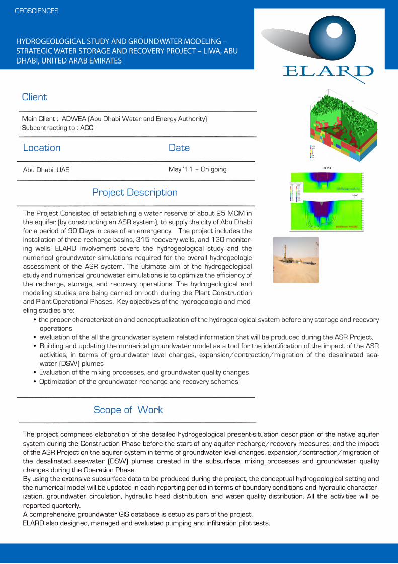
The project comprises elaboration of the detailed hydrogeological present-situation description of the native aquifer system during the Construction Phase before the start of any aquifer recharge/recovery measures; and the impact of the ASR Project on the aquifer system in terms of groundwater level changes, expansion/contraction/migration of the desalinated sea-water (DSW) plumes created in the subsurface, mixing processes and groundwater quality changes during the Operation Phase. By using the extensive subsurface data to be produced during the project, the conceptual hydrogeological setting and the numerical model will be updated in each reporting period in terms of boundary conditions and hydraulic character-ization, groundwater circulation, hydraulic head distribution, and water quality distribution. All the activities will be reported quarterly. A comprehensive groundwater GIS database is setup as part of the project.ELARD also designed, managed and evaluated pumping and infiltration pilot tests.
Client
Date
Scope of Work
GEOSCIENCES
Location
Main Client : ADWEA (Abu Dhabi Water and Energy Authority)Subcontracting to : ACC
Abu Dhabi, UAE May ‘11 – On going
Project Description
The Project Consisted of establishing a water reserve of about 25 MCM in the aquifer (by constructing an ASR system), to supply the city of Abu Dhabi for a period of 90 Days in case of an emergency. The project includes the installation of three recharge basins, 315 recovery wells, and 120 monitor-ing wells. ELARD involvement covers the hydrogeological study and the numerical groundwater simulations required for the overall hydrogeologic assessment of the ASR system. The ultimate aim of the hydrogeological study and numerical groundwater simulations is to optimize the efficiency of the recharge, storage, and recovery operations. The hydrogeological and modelling studies are being carried on both during the Plant Construction and Plant Operational Phases. Key objectives of the hydrogeologic and mod-eling studies are:
• the proper characterization and conceptualization of the hydrogeological system before any storage and recevory operations
• evaluation of the all the groundwater system related information that will be produced during the ASR Project, • Building and updating the numerical groundwater model as a tool for the identification of the impact of the ASR
activities, in terms of groundwater level changes, expansion/contraction/migration of the desalinated sea- water (DSW) plumes
• Evaluation of the mixing processes, and groundwater quality changes• Optimization of the groundwater recharge and recovery schemes

PROVISION OF ASSESSING THE NATIONAL GROUNDWATER RESOURCES THROUGH DATA COLLECTION AND FIELD ASSESSMENT CAMPAIGN OF GROUNDWATER RESOURCES ACROSS LEBANON
The project consists of: • Conducting a comprehensive survey of all public and private wells of
Lebanon;• Establishing a nationwide database of Hydrogeological data including wells;• Conducting a 1-year well monitoring programme;• Reassessment of the country’s groundwater resources by basin in light of
the recent studies performed in the last forty years (i.e. since UNDP assessment of 1970);
• Conducting a preliminary assessment of the potential for artificial recharge in Lebanon; and
• Constructing a groundwater flow model for Akkar Quaternary Aquifer.
Client
Date
Scope of Work
GEOSCIENCES
Location
United Nations Development Programme (UNDP)
Lebanon Oct. ‘11 – Apr. ’14
Project Description
This project aims at: 1) quantifying the national groundwater resources through a national data collection and field assessment campaign; and 2) establishing a national database at the Ministry of Energy and Water (MoEW), that will allow the integration of data from various sources and facili-tate the performance of essential analysis. The overall goal of the project is to establish a tool that will assist MoEW in the Management of the limited and scarce national water resources of the country in a sustainable manner, in line with the Water Sector Strategy that was developed by MoEW.

WATER QUALITY SURVEY – HIGH PRIORITY SURVEYS FOR THE IRAQ COMMON SEAWATER SUPPLY PROJECT
ELARD mobilized a team of 17 project staff in Basra to implement the following scope:
• Execution of an intensive surface water sampling program, every two hours for five days, twice per day over 30 days and once per week over one year, for a total of over 1500 samples.
• Analytical laboratory testing of collected water samples, for a suite of 37 analytes, out of which 15 parameters were analysed in the newly established ELARD Environmental Laboratory.
• Performance of specialized testing for coagulant demand, chlorine demand/decay and settleability.
• Collection and testing of bed sediment samples.
Client
Date
Scope of Work
ENVIRONMENTAL MANAGEMENT
Location
Petrolinvest / South Oil Company
Basra, Iraq Jun. ‘14 – Dec. ’15
Project Description
The project site is located in Khor Al Zubair, Basra where a seawater treat-ment facility will be erected to process water that will be supplied to the southern Iraqi oilfields. As part of the High Priority Surveys Project, ELARD was retained to execute a Water Quality Survey Program on the estuary located at the mouth of Shatt Al-Basra, at a location that is subject to exten-sive variation in water quality due to tidal fluctuation. The objective of the survey is to collect sufficient data for the design of the treatment plant. The Water Quality Survey Program entails the:
• Development of a Detailed Survey Execution Plan and Procedures, including field sampling and testing procedures, laboratory analytical testing methods and logistical approaches to collect and transport samples to the labs.
• Establishment of an environmental testing laboratory in Basra, led by a Water Quality Expert and a Senior Chemist, to analyse water samples for parameters with short holding times. The established custom-built laboratory uses Standard Methods and follows standard QA/QC procedures for analysis and reporting.
• Coordination with TestAmerica laboratories, USA for the periodic transport of water samples from Basra to Florida and the analysis of water samples.
• Development of an exhaustive and user-friendly results database.

QADISHA VALLEY WASTEWATER PROJECT (Updating Of Waste-water Master Plan, Preparation of a Feasibility Study, Scoping Report for Environmental and Social Impact Assessment)
• Data Collection and update of the Master Plan• Collecting existing data and relevant documents• Establishing a full survey for the entire area• Updating the Master Plan Sanitation• Executing an area recognition• Operating a measurement and Diagnosis campaign• Performing a feasibility Study• Designing and preparation of tender documents• Establishment of a scoping report for the ESIA
Client
Date
Scope of Work
WATER RESOURCES MANAGMENT & ENGINEERING
Location
Agence Francaise de Developpement (AFD)/ Council for Development and Reconstruction (CDR)
Bcharreh, North Lebanon Jun. ‘15 – Aug. ’15
Project Description
The Consortium Cabinet Merlin/ELARD was retained by the “Agence Fran-caise de Developpement (AFD)” and the Council for Development and Recon-struction (CDR) to provide consultancy services to update the Wastewater Master Plan, to conduct a Feasibility Study and to prepare a Scoping Report for Environmental and Social Impact Assessment for the entire Qadisha Valley in the North of Lebanon. The project covers the entire Governorate of Becharre which comprises 22 villages and towns. The Feasibility study, include the selection of the location of the various waste-water treatment facilities as wells as the assessment of the various treat-ment processes., and specifically natural treatment using Reed beds (i.e., wetlands)
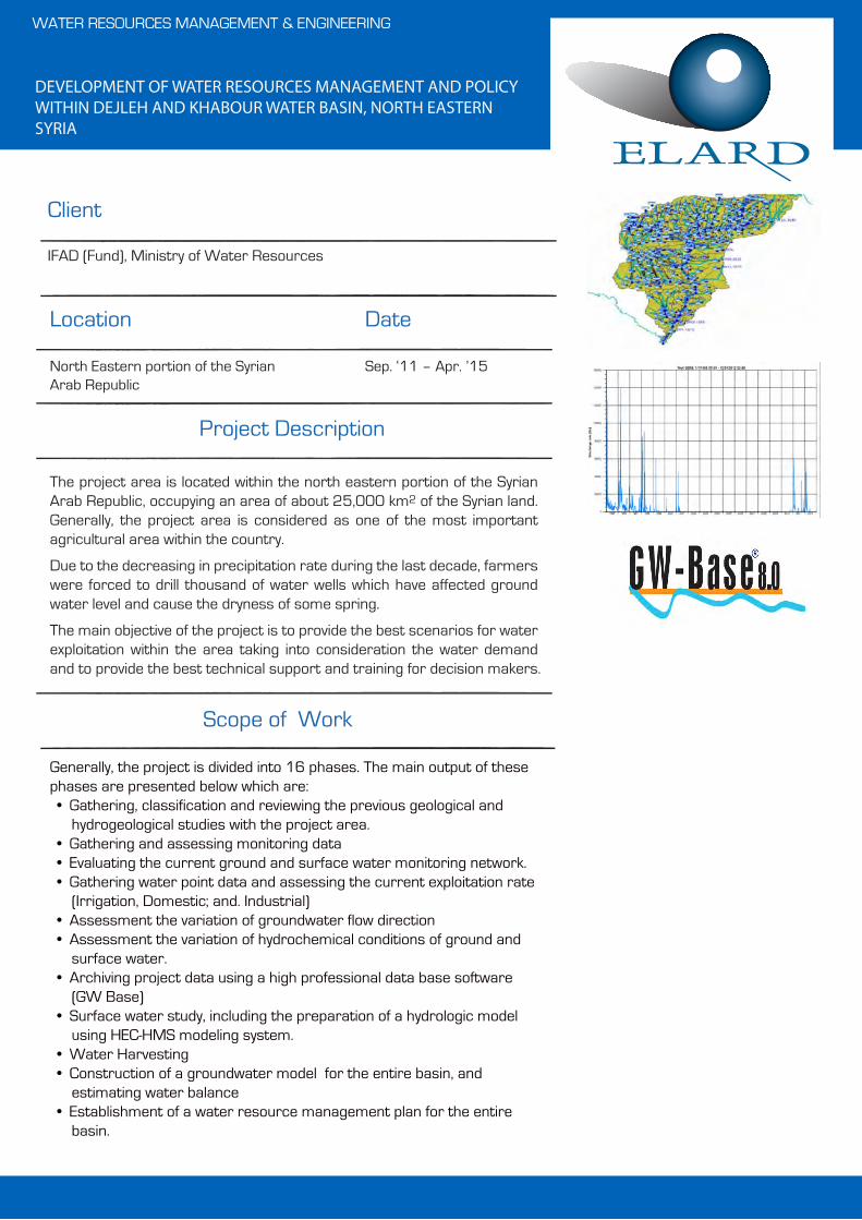
DEVELOPMENT OF WATER RESOURCES MANAGEMENT AND POLICY WITHIN DEJLEH AND KHABOUR WATER BASIN, NORTH EASTERN SYRIA
Generally, the project is divided into 16 phases. The main output of these phases are presented below which are:• Gathering, classification and reviewing the previous geological and
hydrogeological studies with the project area. • Gathering and assessing monitoring data• Evaluating the current ground and surface water monitoring network.• Gathering water point data and assessing the current exploitation rate
(Irrigation, Domestic; and. Industrial)• Assessment the variation of groundwater flow direction• Assessment the variation of hydrochemical conditions of ground and
surface water.• Archiving project data using a high professional data base software
(GW Base)• Surface water study, including the preparation of a hydrologic model
using HEC-HMS modeling system.• Water Harvesting• Construction of a groundwater model for the entire basin, and
estimating water balance• Establishment of a water resource management plan for the entire
basin.
Client
Date
Scope of Work
WATER RESOURCES MANAGEMENT & ENGINEERING
Location
IFAD (Fund), Ministry of Water Resources
North Eastern portion of the Syrian Arab Republic
Sep. ‘11 – Apr. ’15
Project Description
The project area is located within the north eastern portion of the Syrian Arab Republic, occupying an area of about 25,000 km2 of the Syrian land. Generally, the project area is considered as one of the most important agricultural area within the country.
Due to the decreasing in precipitation rate during the last decade, farmers were forced to drill thousand of water wells which have affected ground water level and cause the dryness of some spring.
The main objective of the project is to provide the best scenarios for water exploitation within the area taking into consideration the water demand and to provide the best technical support and training for decision makers.

TECHNICAL ASSISTANCE IN SUPPORT FOR THE SOUTH LEBANON WATER & WASTEWATER PROJECT
Component I - Project management support for the CDR• Overall project management• Reviewing and commenting on reports prepared by the design ebgineer,
construction contractors and the relevant supervision consultants• Supporting CDR in tendering, selection and contracting of consultants and
contractors and in meeting conditions for disbursement and reporting requirements of the EIB loan
• Monitoring Construction Quality, Progress and Accounting• Project completion and hand-over• Monitoring the Operation Period (WWTP)• Assisting Unions of Municipalities
Component II: Institutional development support for the SLWE• Assist in creating a Wastewater Management Department in SLWE• Training of SLWE Staff• Support for setting up and equipping a central laboratory for wastewater
testing
Client
Date
Scope of Work
WATER RESOURCES MANAGEMENT & ENGINEERING
Location
IGIP / Council for Development and Reconstruction (CDR)
South Lebanon Sep. ‘11 - Jan. ’15
Project Description
The South Lebanon wastewater project, to which this technical assistance operation relates, covers the whole Governorate of South Lebanon and is divided between the basins of Sour and Saida. It provides sewerage and centralized wastewater treatment facilities for 40 towns and villages in coastal and inland areasSince 2004, the EIB has financed the part of the project in the Sour District, while JBIC has financed the part of the project in the Saida District. This contract covers the Sour District, where 25 km of trunk and interceptor sewers, with 4 pumping stations, are to be provided to serve the city of Sour together with 7 suburban communities within a 6 km distance of the city. Addi-tionally, a wastewater treatment plant is to be provided, for an average flow of 30,800 m3/day, and a sea outfall conveyor, is to be constructed.
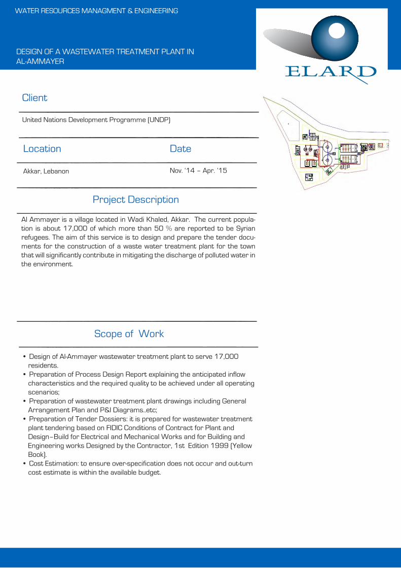
DESIGN OF A WASTEWATER TREATMENT PLANT IN AL-AMMAYER
• Design of Al-Ammayer wastewater treatment plant to serve 17,000 residents.
• Preparation of Process Design Report explaining the anticipated inflow characteristics and the required quality to be achieved under all operating scenarios;
• Preparation of wastewater treatment plant drawings including General Arrangement Plan and P&I Diagrams..etc;
• Preparation of Tender Dossiers: it is prepared for wastewater treatment plant tendering based on FIDIC Conditions of Contract for Plant and Design–Build for Electrical and Mechanical Works and for Building and Engineering works Designed by the Contractor, 1st Edition 1999 (Yellow Book).
• Cost Estimation: to ensure over-specification does not occur and out-turn cost estimate is within the available budget.
Client
Date
Scope of Work
WATER RESOURCES MANAGMENT & ENGINEERING
Location
United Nations Development Programme (UNDP)
Akkar, Lebanon Nov. ‘14 – Apr. ’15
Project Description
Al Ammayer is a village located in Wadi Khaled, Akkar. The current popula-tion is about 17,000 of which more than 50 % are reported to be Syrian refugees. The aim of this service is to design and prepare the tender docu-ments for the construction of a waste water treatment plant for the town that will significantly contribute in mitigating the discharge of polluted water in the environment.

AL OUYOUN PUMP STATION WELL ASSESSMENT IN THE REGION OF AKKAR
• Dismantling of Existing Pumps using a truck mounted winch.• CCTV Survey using borehole video camera.• Straightness and Alignment Test using a drilling rig.• Well Development using a bailer lowered on cable tool.• Pumping Test (step draw-down and long-term pumping tests) using tempo-
rary submersible pump and discharge measurement flow meters as well as monitoring probes equipped with a pressure transducer, and a temperature sensor with a built-in data-logger.
Client
Date
Scope of Work
GEOSCIENCES
Location
DAI
Lebanon Jan. ‘13 - May ’13
Project Description
The project consisted of assessing the rehabilitation/ cleanup of four (4) existing water supply wells located at Al Ouyoun Pumping Station in Akkar. This was achieved through performing a number of services and field tests (listed below) based on which recommendations regarding the technical specifications of the permanent submersible pump to be installed in each well were provided and a water management plan for operating the water wells was presented.

GROUNDWATER MODELING IN UPPER LITANI BASIN
The Project’s scope of work comprised the following main tasks:• Hydro-geological Model Conceptualization• Initial Model Setup:• Model Calibration and Sensitivity Analysis• Model Simulation and Predictions• Capacity building and Training
Client
Date
Scope of Work
GEOSCIENCES
Location
International Resource Group (IRG)
Lebanon Jan. ‘13 – Jan. ’14
Project Description
The objective of the ULB groundwater flow model was to develop a tool that can be used by the staff of the Litani River water Authority as a decision support system to assist them in better managing the existing water resources of the Litani River Basin. The model will be used to monitor the status of the groundwater resources in various part of the basin, and will allow for making rough predictions of groundwater and aquifers behavior under various pumping schemes. This will also allow identifying aquifer areas being overexploited / depleted, and identifying future potential zones where aquifers can be further exploited.
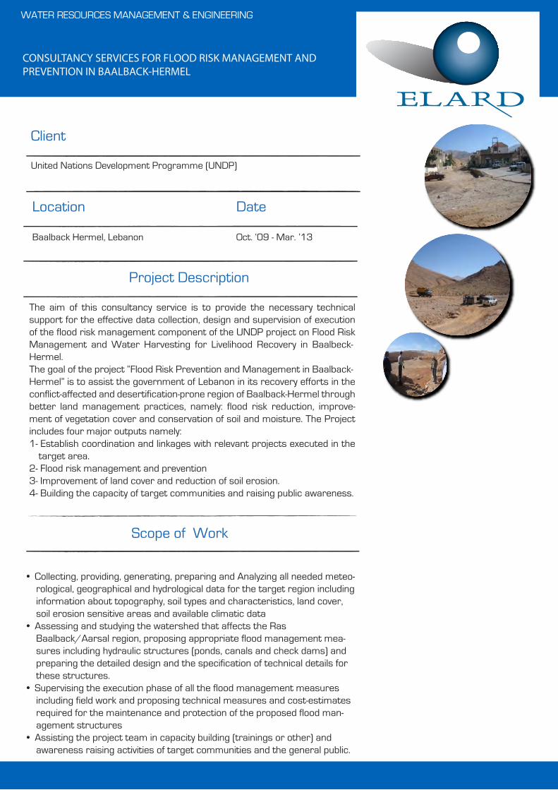
CONSULTANCY SERVICES FOR FLOOD RISK MANAGEMENT AND PREVENTION IN BAALBACK-HERMEL
• Collecting, providing, generating, preparing and Analyzing all needed meteo-rological, geographical and hydrological data for the target region including information about topography, soil types and characteristics, land cover, soil erosion sensitive areas and available climatic data
• Assessing and studying the watershed that affects the Ras Baalback/Aarsal region, proposing appropriate flood management mea-sures including hydraulic structures (ponds, canals and check dams) and preparing the detailed design and the specification of technical details for these structures.
• Supervising the execution phase of all the flood management measures including field work and proposing technical measures and cost-estimates required for the maintenance and protection of the proposed flood man-agement structures
• Assisting the project team in capacity building (trainings or other) and awareness raising activities of target communities and the general public.
Client
Date
Scope of Work
WATER RESOURCES MANAGEMENT & ENGINEERING
Location
United Nations Development Programme (UNDP)
Baalback Hermel, Lebanon Oct. ‘09 - Mar. ’13
Project Description
The aim of this consultancy service is to provide the necessary technical support for the effective data collection, design and supervision of execution of the flood risk management component of the UNDP project on Flood Risk Management and Water Harvesting for Livelihood Recovery in Baalbeck-Hermel. The goal of the project “Flood Risk Prevention and Management in Baalback-Hermel” is to assist the government of Lebanon in its recovery efforts in the conflict-affected and desertification-prone region of Baalback-Hermel through better land management practices, namely: flood risk reduction, improve-ment of vegetation cover and conservation of soil and moisture. The Project includes four major outputs namely: 1- Establish coordination and linkages with relevant projects executed in the
target area. 2- Flood risk management and prevention3- Improvement of land cover and reduction of soil erosion. 4- Building the capacity of target communities and raising public awareness.
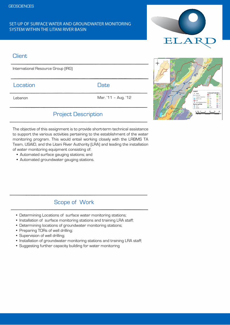
SET-UP OF SURFACE WATER AND GROUNDWATER MONITORING SYSTEM WITHIN THE LITANI RIVER BASIN
• Determining Locations of surface water monitoring stations;• Installation of surface monitoring stations and training LRA staff;• Determining locations of groundwater monitoring stations;• Preparing TORs of well drilling;• Supervision of well drilling;• Installation of groundwater monitoring stations and training LRA staff;• Suggesting further capacity building for water monitoring
Client
Date
Scope of Work
GEOSCIENCES
Location
International Resource Group (IRG)
Lebanon Mar. ‘11 – Aug. ’12
Project Description
The objective of this assignment is to provide short-term technical assistance to support the various activities pertaining to the establishment of the water monitoring program. This would entail working closely with the LRBMS TA Team, USAID, and the Litani River Authority (LRA) and leading the installation of water monitoring equipment consisting of:
• Automated surface gauging stations; and• Automated groundwater gauging stations.

WATER RRESOURCES ASSESSMENT FOR LAFARGE CEMENT PLANT -KARBALA, IRAQ
PHASE 1: PRELIMINARY ASSESSMENT
• Field Survey: which will includes:- Hydrogeological/hydrological survey;- survey of water use within the study area, for various sectors,
Estimates of the water quantity, and assessment of water quality for each sector;
- survey on sewage/wastewater infrastructure in the region, - pumping/aquifer test
• Geophysical Survey: (Vertical Electrical Sounding VES)
PHASE 2: EXPLORATION OF THE DEEPER AQUIFERS
• Well Design and Construction Supervision• Preparation of a Feasibility Study
PHASE 3: WATER WELLS NETWORK DESIGN
• Water Exploitation and mixing scheme • Water Management Scenarios • Design of Water supply scheme (with tender documents)• Design of a groundwater monitoring /control program (with tender docu-
ments) • Preparation of the general specifications and the technical tender docu-
ments for the required pre-treatment plant, as well as for the selected disposable option of the effluent water of the plant.
Client
Date
Scope of Work
WATER RESOURCES MANAGEMENT & ENGINEERING
Location
Lafarge Cement Company (LCC)
Karbala- Iraq Jul. ‘13 - ongoing
Project Description
Lafarge is managing a cement plant at 90 Km south east of Karbala City and 220 Km from Baghdad – Iraq. The plant is producing cement by dry process and planning to produce 1.8 M ton clinker / year after executing the rehabilitation project.ELARD provided consultancy services for Lafarge Cement Company for assessing and managing groundwater resources such that to meet daily production demand (i.e., to about 2,000 ton/day).

PREPARATION OF DROUGHT VULNERABILITY ASSESSMENT STUDY TO DEVELOP IRAQ NATIONAL FRAMEWORK FORINTEGRATED DROUGHT RISK MANAGEMENT (DRM)
• Inception Phase set the stage for the development of the DRM framework; includes Mapping Key Project Stakeholders and gathering the needed Data through stocktaking (ELARD sources from Iraq, Web, Iraqi sources…) in order to conduct the initial vulnerability assessment.
• Drought Vulnerability Assessment covered selected pilot areas decided on during the first workshop focusing on agriculture, natural ecosystems related to water resources, and social groups, including assessment of vulnerability at the institutional level.
• A Draft Drought Risk Management Framework is prepared addressing the following:1. Governance structure for DRM2 Policy and legal framework enhancement3. Drought risk identification, impact assessment and early warning4. Drought awareness and knowledge management5. Drought mitigation and preparedness measures6. Resource Mobilization for DRM
• Final Drought Risk Management Framework, aiming at better understanding of Drought and its impacts, having a political momentum, having a Task Force for the supervision of the plan development, assigning concerned Drought-Citizen groups, and devising a Drought Plan (Monitoring and early warning, Risk assessment and Management). This will assist both the community and the government to reduce the impacts of drought.
Client
Date
Scope of Work
WATER RESOURCES MANAGEMENT & ENGINEERING
Location
United Nations Development Programme (UNDP)
Iraq Jul. ‘13 - Jan. ’14
Project Description
ELARD was Contracted to develop an Integrated Drought Risk Management Framework for Iraq. The DRM will identify measures to prevent and mitigate the impacts of drought but more importantly set the stage for the develop-ment of resilient institutions and communities able to face risks of drought in Iraq.

GROUND WATER AND SOIL PROTECTION PROJECT-YEMEN
The Work of ELARD Consultant included:• Review reports and supplement preliminary assessment of groundwater situation of major areas in the
country.• Prepare a report with data tables on baseline conditions of aquifers and groundwater abstraction for
some prioritized areas.• Propose a detailed M&E plan (hydrological and water abstraction), hydro-geological investigation study
plan, technical specification of key monitoring equipment for tendering, as well as implementation schedule.
• Prepare detailed technical assistance plan for MOE, NWRA and MAI in terms of hydrological and water use monitoring including the TORs for major consultancy services, including that for policy recommen-dations on groundwater monitoring and regulatory framework.
• Prepare community-based groundwater monitoring and management plans on a pilot scale. This includes the elaboration of a plan on how to translate technical monitoring data into easily apprehen-sible diagrams, maps, and graphs for farmers, using various technical instruments and communication devices, as well as proposing possible roles for farmers and their representatives of WUGs in terms of monitoring and management.
Scope of Work
GEOSCIENCES
Project Description
One of the objectives of the GSCP is to reduce groundwater abstraction through the improved irrigation efficiency and to create a model for a partici-patory management approach that would be replicated in other basins.Through the discussion with the government, it was confirmed that the MAI is the implementing agency of the project, which are mainly composed of (i) groundwater irrigation improvement through PVC/GI pipes and advanced on-farm irrigation technologies and (ii) upper watershed conservation through spate and terrace rehabilitation while theMWE / NWRA are the responsible entities for water resources manage-ment policy and monitoring / regulatory activities, for which the project will provide technical assistance and capacity building. It was also agreed that Water Use Groups (WUGs) and Irrigation Advisory Service (IAS) will help collect water use records in cooperation with NWRA branches and Field Units (FUs) of MAI. Data collection, database establishment, and information dissemination will play an important role for public awareness rising and informed community based water management.
Executing Agent Date
World Bank/ FAO
Ministry of Agriculture, Yemen
All over Yemen
Aug. ‘03 – Sept. ’04
Client Location

HYDROGEOLOGICAL STUDY - DRILLING, LOGGING AND TESTING WATER WELLS IN BASHAER AREA
• Gathering and producing data related to site setting such as the geographi-cal location, topography as well as review of background information and assessment of the geology and hydrogeology of the site.
• Conducting a site reconnaissance, a well survey and a surface geophysical survey.
Client
Date
Scope of Work
GEOSCIENCES
Location
LOON Latakia Limited
Hama, Syrian Arab Republic Feb. ‘11 – May ’11
Project Description
Earth Link and Advanced Resources Development ELARD prepared a hydro-geophysical study of LOON Latakia Limited Development Area, which includes:
1. A general description of the area such as geology, hydrogeology and the climate conditions.
2. The interpretation of the collected data during a well survey and a geophysical survey.
3. Propose a location for an exploratory/production well.

WATER RESOURCE ASSESSMENT FOR THE EIGHTH GATE DEVELOP-MENT - SABBOURA
• Review of background information• Detailed well survey• Well inspection • Geophysical well logging• Well CCTV survey• Pumping Test • Generation of a comprehensive technical report• Generation of a performance assessment report
Client
Date
Scope of Work
GEOSCIENCES
Location
EMAAR-IGO
Syria Dec. ‘10 – Mar ‘11
Project Description
ELARD was engaged by EMAAR-IGO in carrying a water assessment study at EMAARs’ Eighth Gate Project site located along Beirut-Damascus highway in Sabboura.Three existing wells were recently drilled within the project area but turned out not to be productive. The objective of the study was to assess the status and condition of the wells as well as find and recommend adequate water resources for securing the project’s water demand.The assignment included also a performance assessment of the former project consultant “Halcrow”.
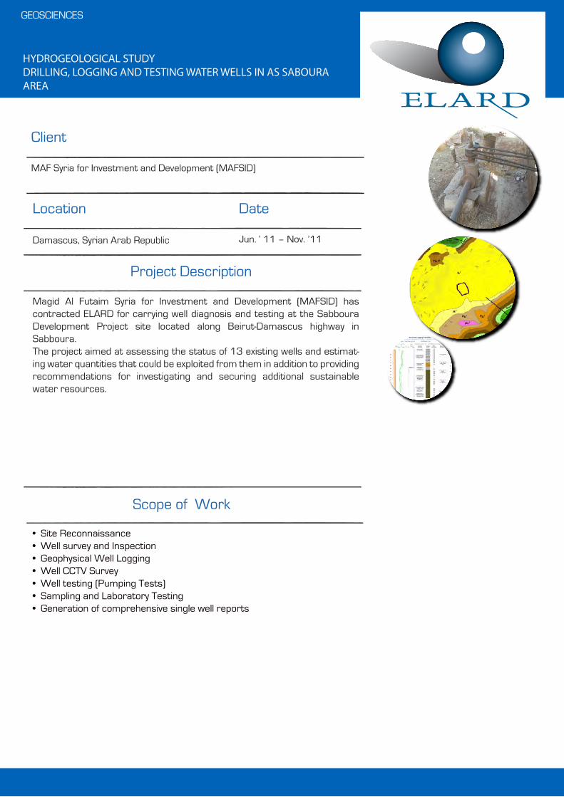
HYDROGEOLOGICAL STUDYDRILLING, LOGGING AND TESTING WATER WELLS IN AS SABOURA AREA
• Site Reconnaissance• Well survey and Inspection• Geophysical Well Logging• Well CCTV Survey• Well testing (Pumping Tests)• Sampling and Laboratory Testing• Generation of comprehensive single well reports
Client
Date
Scope of Work
GEOSCIENCES
Location
MAF Syria for Investment and Development (MAFSID)
Damascus, Syrian Arab Republic Jun. ‘ 11 – Nov. ’11
Project Description
Magid Al Futaim Syria for Investment and Development (MAFSID) has contracted ELARD for carrying well diagnosis and testing at the Sabboura Development Project site located along Beirut-Damascus highway in Sabboura. The project aimed at assessing the status of 13 existing wells and estimat-ing water quantities that could be exploited from them in addition to providing recommendations for investigating and securing additional sustainable water resources.

INTEGRATED LAND AND WATER PROJECT MAZANDARAN, IRAN
• Prepare the Environmental Management plan and developed detailed water monitoring plan, which include the development of a detailed surface water and groundwater monitoring plan;
• Assist in the development of an integrated water management plan for the entire basin, which involve the establishment of a Basin Water Committee and a Basin Water Management Fund;
• Develop ToR for the establishing an MIS/DSS system to optimize water distribution system from the dam reservoir, diversion weir, canal systems, and to farm fields, using advanced decision making system linked with hydrological and irrigation water use monitoring equipment.
• The Management Information Support (MIS) system will provide updated water storage and use conditions not only for the RWA, O&M Company, but also WUAs for efficient and equitable water distribution, in order to allow them to operate the system in a most efficient manner based on the hydrological and water demands parameters on a real time base
Scope of Work
WATER RESOURCES MANAGEMENT & ENGINEERING
Project Description
The proposed project is situated in Pasha kola area of the northern province of Mazandaran. The main components of the project are (a) conserving upper watershed area through sustainable livestock / forest management with beneficiaries' participation for reducing soil erosion and sedimentation yield; (b) rehabilitating and improving downstream irrigation / drainage system for improving water use efficiency as well as establishing sustainable O&M through water users' associations and increased cost recovery; and (c) providing support for institutional capacity building for the community and government institutions with emphasis on the mainstreaming of environ-mental and social aspects as well as managing water resources in an integrated manner from surface water, groundwater and to abandon (farm pond) water.
Executing Agent Date
World Bank / FAO
Ministry of Agriculture and Jihad/Ministry of Water Resources, Iran
Mazandaran Province, North Iran
2003 - 2004
Client Location
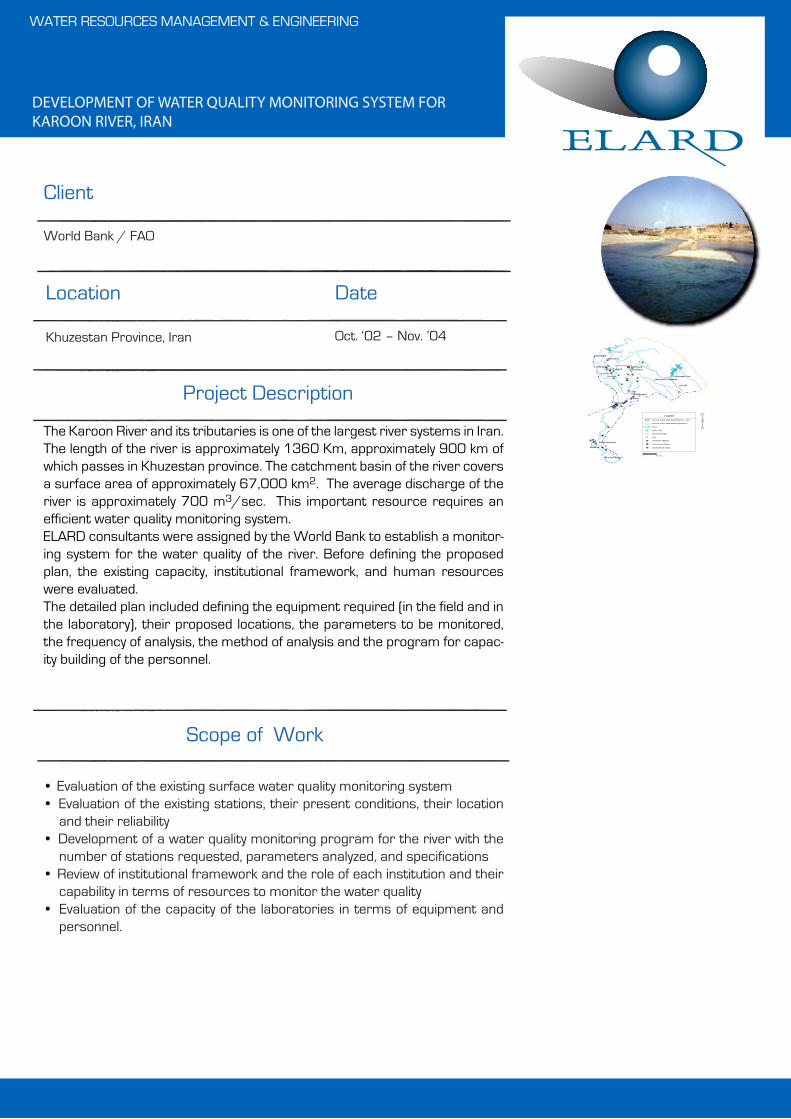
DEVELOPMENT OF WATER QUALITY MONITORING SYSTEM FOR KAROON RIVER, IRAN
The Karoon River and its tributaries is one of the largest river systems in Iran. The length of the river is approximately 1360 Km, approximately 900 km of which passes in Khuzestan province. The catchment basin of the river covers a surface area of approximately 67,000 km2. The average discharge of the river is approximately 700 m3/sec. This important resource requires an efficient water quality monitoring system.ELARD consultants were assigned by the World Bank to establish a monitor-ing system for the water quality of the river. Before defining the proposed plan, the existing capacity, institutional framework, and human resources were evaluated.The detailed plan included defining the equipment required (in the field and in the laboratory), their proposed locations, the parameters to be monitored, the frequency of analysis, the method of analysis and the program for capac-ity building of the personnel.
Client
Date
Scope of Work
WATER RESOURCES MANAGEMENT & ENGINEERING
Location
World Bank / FAO
Khuzestan Province, Iran Oct. ‘02 – Nov. ’04
Project Description
• Evaluation of the existing surface water quality monitoring system• Evaluation of the existing stations, their present conditions, their location
and their reliability• Development of a water quality monitoring program for the river with the
number of stations requested, parameters analyzed, and specifications• Review of institutional framework and the role of each institution and their
capability in terms of resources to monitor the water quality• Evaluation of the capacity of the laboratories in terms of equipment and
personnel.
City
Domestic effluent
Agricultural drain
Industrial effluent
Area of water shed basin Karoon - Dez
Area of water shed basin in province
River
Dam Lake
Reservoir Dam
Mollasani
Vase
Ahwaz
Khorranshah
Arvand Kenar
Abadan
Masjed Soleiman
Izeh
Andimeshk
ShooshtarShoosh
Ab Shirin
Mostofea
Dezfool
Dez Dam
Abbaspoor Dam
Gotvand
Lali
Haft Tappeh
Gotvand Dam
30 Km0

WATER RESOURCES STUDY OF THE QUETTA CITY, PAKISTAN
• Drilling of deep exploratory wells• Development of a detailed groundwater monitoring program• Geophysical survey (seismic, electrical, and electromagnetic)• Detailed geological survey using remote sensing techniques to delineate
major structures• Detailed hydrological study• Groundwater modeling• Oracle database development• Capacity building and training
Scope of Work
GEOSCIENCES
Project Description
The objective of this water resources study is to identify new water sources to supply the Quetta city, which has been subject to drought for the last 10 years. The study covers an area of 2000 km2 and is bounded by several mountain chains.
A comprehensive investigation is conducted, including drilling of deep explor-atory wells, implementation of major water sampling, development of a detailed groundwater monitoring program, geophysical surveys, detailed geological survey using remote sensing techniques, detailed hydrological study and groundwater modeling.
The work also includes the development of a GIS and Oracle-based database management system for the organization of the hydrogeological, water abstraction and geographical data. The MIS has been developed using Oracle 8 and all existing data was transferred to this database from various database engines, such as Fox Pro and MS Access. The comprehensive database is fully integrated with special data on topography and geology in Arc View based GIS system.
Executing Agent Date
Inter-Consult, Pakistan
Government of Balochistan
Balochistan, Pakistan
Sep. ‘02 – Mar. ’04
Client Location
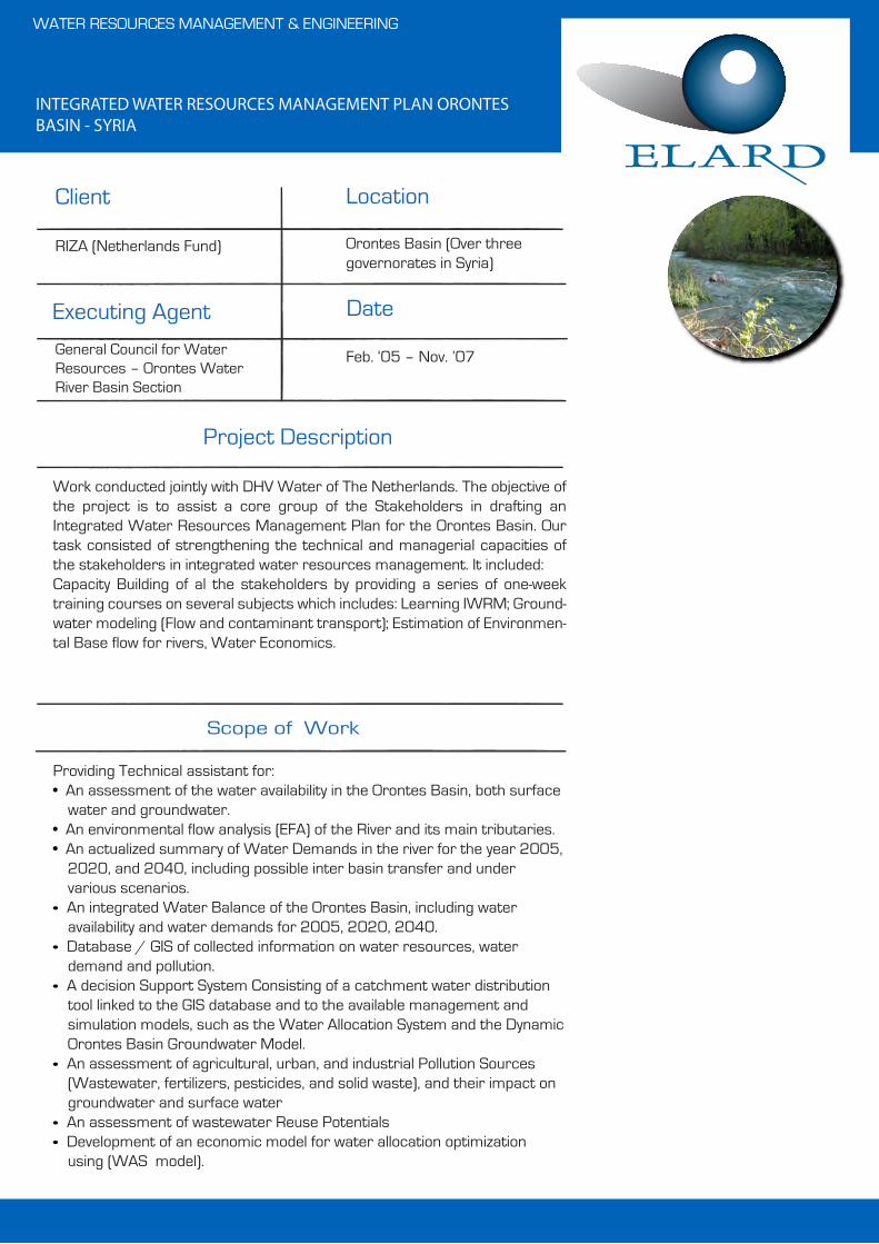
INTEGRATED WATER RESOURCES MANAGEMENT PLAN ORONTES BASIN - SYRIA
Providing Technical assistant for:• An assessment of the water availability in the Orontes Basin, both surface
water and groundwater.• An environmental flow analysis (EFA) of the River and its main tributaries.• An actualized summary of Water Demands in the river for the year 2005,
2020, and 2040, including possible inter basin transfer and under various scenarios.
• An integrated Water Balance of the Orontes Basin, including water availability and water demands for 2005, 2020, 2040.
• Database / GIS of collected information on water resources, water demand and pollution.
• A decision Support System Consisting of a catchment water distribution tool linked to the GIS database and to the available management and simulation models, such as the Water Allocation System and the Dynamic Orontes Basin Groundwater Model.
• An assessment of agricultural, urban, and industrial Pollution Sources (Wastewater, fertilizers, pesticides, and solid waste), and their impact on groundwater and surface water
• An assessment of wastewater Reuse Potentials• Development of an economic model for water allocation optimization
using (WAS model).
Scope of Work
WATER RESOURCES MANAGEMENT & ENGINEERING
Project Description
Work conducted jointly with DHV Water of The Netherlands. The objective of the project is to assist a core group of the Stakeholders in drafting an Integrated Water Resources Management Plan for the Orontes Basin. Our task consisted of strengthening the technical and managerial capacities of the stakeholders in integrated water resources management. It included:Capacity Building of al the stakeholders by providing a series of one-week training courses on several subjects which includes: Learning IWRM; Ground-water modeling (Flow and contaminant transport); Estimation of Environmen-tal Base flow for rivers, Water Economics.
Executing Agent Date
RIZA (Netherlands Fund)
General Council for Water Resources – Orontes Water River Basin Section
Orontes Basin (Over three governorates in Syria)
Feb. ‘05 – Nov. ’07
Client Location
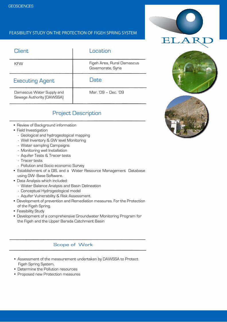
FEASIBILITY STUDY ON THE PROTECTION OF FIGEH SPRING SYSTEM
• Assessment of the measurement undertaken by DAWSSA to Protect Figeh Spring System.
• Determine the Pollution resources• Proposed new Protection measures
Scope of Work
GEOSCIENCES
Project Description
• Review of Background information• Field Investigation - Geological and hydrogeological mapping - Well Inventory & GW level Monitoring - Water sampling Campaigns - Monitoring well Installation - Aquifer Tests & Tracer tests - Tracer tests - Pollution and Socio economic Survey• Establishment of a GIS, and a Water Resource Management Database
using GW- Base Software.• Data Analysis which included: - Water Balance Analysis and Basin Delineation - Conceptual Hydrogeological model - Aquifer Vulnerability & Risk Assessment• Development of prevention and Remediation measures. For the Protection
of the Figeh Spring.• Feasibility Study• Development of a comprehensive Groundwater Monitoring Program for
the Figeh and the Upper Barada Catchment Basin
Executing Agent Date
KFW
Damascus Water Supply and Sewage Authority (DAWSSA)
Figeh Area, Rural Damascus Governorate, Syria
Mar. ‘09 – Dec. ’09
Client Location
FEASIBILITY STUDY FOR EXTRACTING GROUNDWATER RESOURCES & BRINE DISCHARGE FOR HAMRIYAH STEELS – HAMRIYAH FREE ZONE, SHARJAH, UAE
• Legal and institutional frameworks• Installation of Wells Aquifer Test• Background Monitoring• Pumping Test• Groundwater Assessment.• Brine Injection Study
Scope of Work
GEOSCIENCES
Project Description
Hamriyah Steel is the Free Zone Company constructing its steel manufactur-ing facility. Hamriyah Steels wants to undergo feasibility study for extracting groundwater for its huge water demand for the production process by installing reverse osmosis plant for production of water.ELARD prepared a Groundwater assessment report and feasibility of brine discharge for the proposed development.
Executing Agent Date
Hamriyah Steels
International Utilities FZE
Hamriyah Free ZoneSharjah, UAE
May ‘09 – Aug. ’09
Client Location

DESIGN OF THE CONSTRUCTION CHANGES FOR THE INSTALLATION OF THE MULTIPARAMETER PROBES FOR THE PROJECT ENTITLED “PROTECTION OF JEITA SPRING, LEBANON”.
• Design of the System; this task includes the design of the system including installation procedures and the concept of constructional changes.• Installation of the Probes, telemetry and cables. Installation of the Multi parameter probes and telemetry units in the 5 sites, including programming and testing.• Training; This task consists of training of 3 persons at Dbaye treatment plant concerning data download and telemetric data transfer
Client
Date
Scope of Work
WATER RESOURCES MANAGMENT & APPLIED EARTH SCIENCES
Location
Federal Institute for Geosciences and Natural Resources (BGR)
Lebanon June 2010
Project Description
The project consists of installing multiparameter probes at 5 sites; 1- Jeita cave , Daraya tunnel 2- Kashkoush spring 3- Naber al Laban 4- Nabee al Assal 5- Jeita grottoThe project also included;Design of the construction changes and installationIn all the sites, the installation of the probes will need prior construction works and changes for protection of the multiparameter probes and Telemetry units from drowning, vandalism or theft. Dams were constructed for some of the stations.
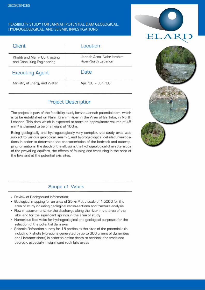
FEASIBILITY STUDY FOR JANNAH POTENTIAL DAM GEOLOGICAL, HYDROGEOLOGICAL, AND SEISMIC INVESTIGATIONS
• Review of Background Information;• Geological mapping for an area of 25 km2 at a scale of 1:5000 for the
area of study including geological cross-sections and fracture analysis• Flow measurements for the discharge along the river in the area of the
lake, and for the significant springs in the area of study• Numerous field visits for hydrogeological and geological purposes for the
selection of the potential dam axis• Seismic Refraction survey for 15 profles at the sites of the potential axis
including 7 shots (vibrations generated by up to 300 grams of dynamites and Hammer shots) in order to define depth to bedrock and fractured bedrock, especially in significant rock falls areas
Scope of Work
GEOSCIENCES
Project Description
The project is part of the feasibility study for the Jannah potential dam, which is to be established on Nahr Ibrahim River in the Area of Qartaba, in North Lebanon. This dam which is expected to store an approximate volume of 45 mm3 is planned to be of a height of 100m.
Being geologically and hydrogeologically very complex, the study area was subject to various geological, seismic, and hydrogeological detailed investiga-tions in order to determine the characteristics of the bedrock and outcrop-ping formations, the depth of the alluvium, the hydrogeological characteristics of the prevailing aquifers, the effects of faulting and fracturing in the area of the lake and at the potential axis sites.
Executing Agent Date
Khatib and Alami- Contracting and Consulting Engineering
Ministry of Energy and Water
Jannah Area- Nahr Ibrahim River-North Lebanon
Apr. ‘06 – Jun. ’06
Client Location

ENVIRONMENTAL BASELINE STUDY OF THE APHAMIA BLOCK AND ENVIRONMENTAL IMPACT ASSESSMENT FOR THE LOCATION OF WELLS DESIGNED TO EXPLORE AND ASSESS THE CURRENT STATUS OF THE OLD WELLS
• Collect preliminary information about Aphamia Block.• Study the environmental impact of the company' activities on each of
Hydrogeology and geology of the study area, population, biodiversity and archeological sites.
• Collect soil, water, air and noise samples • Preparation of environmental impact assessment report and the report of
Environmental Baseline Study of the project and the Due Diligence report to assess the current status of the wells that had been explored previ-ously.
Client
Date
Scope of Work
ENVIRONMENTAL MANAGEMENT
Location
Hayan petroleum CompanyINA INDUSTRIAL NAFTE D.D
Hama, Syrian Arab Republic May ‘09 – Oct. ’09
Project Description
Earth Link and Advanced Resources Development ELARD prepared an Environmental Baseline Study of Aphamia Block, which includes a general description of the Aphamia Block such as geology, hydrology, biodiversity, population, archeological sites and analyze the results of lab samples. As the company has an environmental impact assessment for the Mudawara – 3 well, where the report included in addition to describe the current environ-mental situation, analyze the results of lab samples and develop a plan to reduce the environmental impacts that would result from drilling activities. Also, Was evaluated the current status of the wells have been drilled and explored previously, where the report included an overview of the history of these wells and provide solutions to the environmental impacts resulting from the remaining drilling of these wells.

GEOPHYSICAL LOGGING FOR A WELL (WW-2) WITHIN ASH SHAER DEVELOPMENT AREA
Determine the lithological sequence within the well named WW-2 by using the logging methods
Client
Date
Scope of Work
GEOSCIENCES
Location
Petro Canada Ltd.
Wadi Al Nazmi, Ash shaer Mountain, Homs Governorate, Syrian Arab Republic
Sept. – Oct. ‘09
Project Description
The Project includes:• Review of the available Geological data.• Performed the measurement which include: - Gamma Ray - Normal resistivity - Lateral resistivity - Spot resistance measure - Spontaneous potential - Drilling mud resistivity - Temperature• Determine the Lithophysical properties

WATER RESOURCES ASSESSMENT, DEVELOPMENT AND EXPLOITA-TION FOR THE LAFARGE CEMENT SYRIA (LCS) - PREVIOUSLY CALLED: SYRIAN CEMENT COMPANY (SCC)
• Comprehensive field Geological/ hydrogeological survey including: - well survey, - groundwater and surface water sampling, - Geophysical survey.• Identify, and assess the various alternative water supply sources, and provide recommendations for the selected long
and short term alternatives sources of water.• Design and supervise the drilling and testing of deep water supply wells (more than 900 m deep), and the rehabilitation
and testing of existing shallow wells. This includes: borehole geophysical logging, the performance of several aquifer tests that ranges from 3 days to 1 month.
• Design and implement a groundwater quality monitoring program, including the installation of groundwater monitoring equipment in the wells, with telemetry units. This includes installation.
• Design the water conveyor for supplying water from the Orontes, and the water connection network, that links the groundwater wells to the various storage reservoirs.
• Prepare a water exploitation plan• Establish a groundwater management database using GW- Base, for the monitoring and exploitation of the groundwa-
ter.
Client
Date
Scope of Work
GEOSCIENCES
Location
Lafarge cement Syria (Previously called: Syrian Cement Company)
Serren-Khrab Eshq Aleppo-Syria 6 Phases: ‘08 - Jul. ’10
Project Description
ELARD was hired by LAFARGE the leading worldwide cement manufacturing company, to secure a sustainable source of water supply to meet the demand of its new plant (about 12,000 m3/day) located 160 km northeast of Aleppo city. The project consisted of several Phases, through several contracts:1. Phase 1: consisted of conducting a comprehensive water resource
assessment (surface and Groundwater, with respect to quality and Quan-tity. This included a hydrological and hydrogeological study
2. Phase 2: consisted of conducting a feasibility study for supplying the Cement factory with water. Several water sources were evaluated. This includes Groundwater from shallow and deep aquifers, and surface water from the Orontes River located about 35 km away.
3. Phase 3: This included: the preparation of design and tender documents, and providing construction supervision services for the proposed short term solutions, which consisted of exploiting simultaneously the shallow and deep aquifer, and design a conveyor to secure a water supply from the Orontes River, as a long term solution.

AMRIT DEVELOPMENT PROJECT GEOLOGICAL AND HYDROGEO-LOGICAL STUDY
• Assessment of available water resources (surface and ground water), regarding the quality and quantity in the project area
• Development of an integrate management plan for water to meet the water needs of the project (uses household, drinking water, irrigation).
Client
Date
Scope of Work
GEOSCIENCES
Location
BENA properties
Amrit Tartus Governorate, Syrian Arab Republic
Aug. ‘09 - Nov. ’09
Project Description
The hydrogeological study was conducted in response to BENA Properties’ request to assess and evaluate the water resources of the Amrit project development area located within the Governorate of Tartus.ELARD conducted the study through:• Review of previous studies that contain information about the project area.• Hydrogeological survey of groundwater and surface water sources in the
project area and the surrounding area in addition to water sampling for analysis
• Geophysical surveys and studies by both VES and geo electric profile meth-ods to identify and describe aquifers in the study area.
• Study the discharge of springs in study area.• Study the changes in conductivity of water in the study area to identify the
connection between sea water and groundwater.• Develop an integrate management plan for water to meet the water needs
of the project.
AMRIT RESORT- COASTAL MODELLING AND HYDRAULIC STUDIES
• Collect available data and reports of relevant studies.• Provide a clear identification of present coastal processes in the area.
Client
Date
Scope of Work
GEOSCIENCES
Location
BENA properties
Tartous Governorate, Syrian Arab Republic
July - Sept. ‘09
Project Description
Comprehensive coastal modeling and hydraulic studies for the resort area , divided into the following main phases:• Desk-top study.• Preliminary and detailed analysis using numerical modeling techniques.• Physical modeling (provisional).

INTEGRATED WATER RESOURCES MANAGEMENT IN THE SOUTHERN LEBANESE COAST
• Assessment of water resources in the study area in both quantitative and qualitative aspects
• Review of legal and institutiomal frameworks related to water resource management in the study area
• Organization of stakeholders meetings to promote cooperation and consensus during strategy formulation
• Review of the role of economic instruments in water resources man-agement
• Preparation of an integrated water resouce management plan for the pilot municipalities
• Identification of sustainability indicators to be used by the municipalities for monitoring water resorce management activities
Scope of Work
WATER RESOURCES MANAGEMENT & ENGINEERING
Project Description
ELARD was hired by RAC/PAP to prepare an Integrated Water Resource Management (IWRM) plan as part of the Coastal Area Man-agement Programme (CAMP) for Lebanon. The project is executed by the Ministry of Environment (MoE).The objective of CAMP-Lebanon is to promote sustainable development along the Lebanese coast by integrating urban planning, environment, eco-tourism, cultural heritage and water resource management. The selected study area is the southern stretch of the Lebanese coast extending from Damour down to the newly liberated Naqoura. Pilot stud-ies were conducted in the municipalities of Damour, Sarafand, and Naqoura.
The data collection phase included review of previous studies in the study area, detailed geological and hydrogeological investigations, water quality characterization, field surveys, and stakeholder involvement meetings.Specific strategies and recommendations to promote sustainable use of the water resources in the study area, and more specifically in the three pilot municipalities were formulated. The recommendations focused on technical, social, and economic aspects of water resource management. Practical day-to-day measures as well as medium to long-term strategies were included.
Executing Agent Date
Regional Activity Center, Priority Actions Programme (RAC/PAP), Split Croatia
Ministry of Environment (MoE)
Southern Coast, Lebanon
Oct. ‘02 – Oct. ’03
Client Location
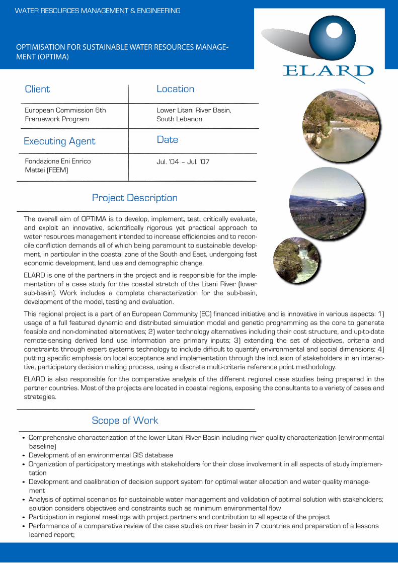
OPTIMISATION FOR SUSTAINABLE WATER RESOURCES MANAGE-MENT (OPTIMA)
• Comprehensive characterization of the lower Litani River Basin including river quality characterization (environmental baseline)
• Development of an environmental GIS database• Organization of participatory meetings with stakeholders for their close involvement in all aspects of study implemen-
tation• Development and caalibration of decision support system for optimal water allocation and water quality manage-
ment• Analysis of optimal scenarios for sustainable water management and validation of optimal solution with stakeholders;
solution considers objectives and constraints such as minimum environmental flow• Participation in regional meetings with project partners and contribution to all apects of the project • Performance of a comparative review of the case studies on river basin in 7 countries and preparation of a lessons
learned report;
WATER RESOURCES MANAGEMENT & ENGINEERING
Project Description
The overall aim of OPTIMA is to develop, implement, test, critically evaluate, and exploit an innovative, scientifically rigorous yet practical approach to water resources management intended to increase efficiencies and to recon-cile confliction demands all of which being paramount to sustainable develop-ment, in particular in the coastal zone of the South and East, undergoing fast economic development, land use and demographic change.
ELARD is one of the partners in the project and is responsible for the imple-mentation of a case study for the coastal stretch of the Litani River (lower sub-basin). Work includes a complete characterization for the sub-basin, development of the model, testing and evaluation.
This regional project is a part of an European Community (EC) financed initiative and is innovative in various aspects: 1) usage of a full featured dynamic and distributed simulation model and genetic programming as the core to generate feasible and non-dominated alternatives; 2) water technology alternatives including their cost structure, and up-to-date remote-sensing derived land use information are primary inputs; 3) extending the set of objectives, criteria and constraints through expert systems technology to include difficult to quantify environmental and social dimensions; 4) putting specific emphasis on local acceptance and implementation through the inclusion of stakeholders in an interac-tive, participatory decision making process, using a discrete multi-criteria reference point methodology.
ELARD is also responsible for the comparative analysis of the different regional case studies being prepared in the partner countries. Most of the projects are located in coastal regions, exposing the consultants to a variety of cases and strategies.
Executing Agent Date
European Commission 6th Framework Program
Fondazione Eni Enrico Mattei (FEEM)
Lower Litani River Basin, South Lebanon
Jul. ‘04 – Jul. ’07
Client Location
Scope of Work
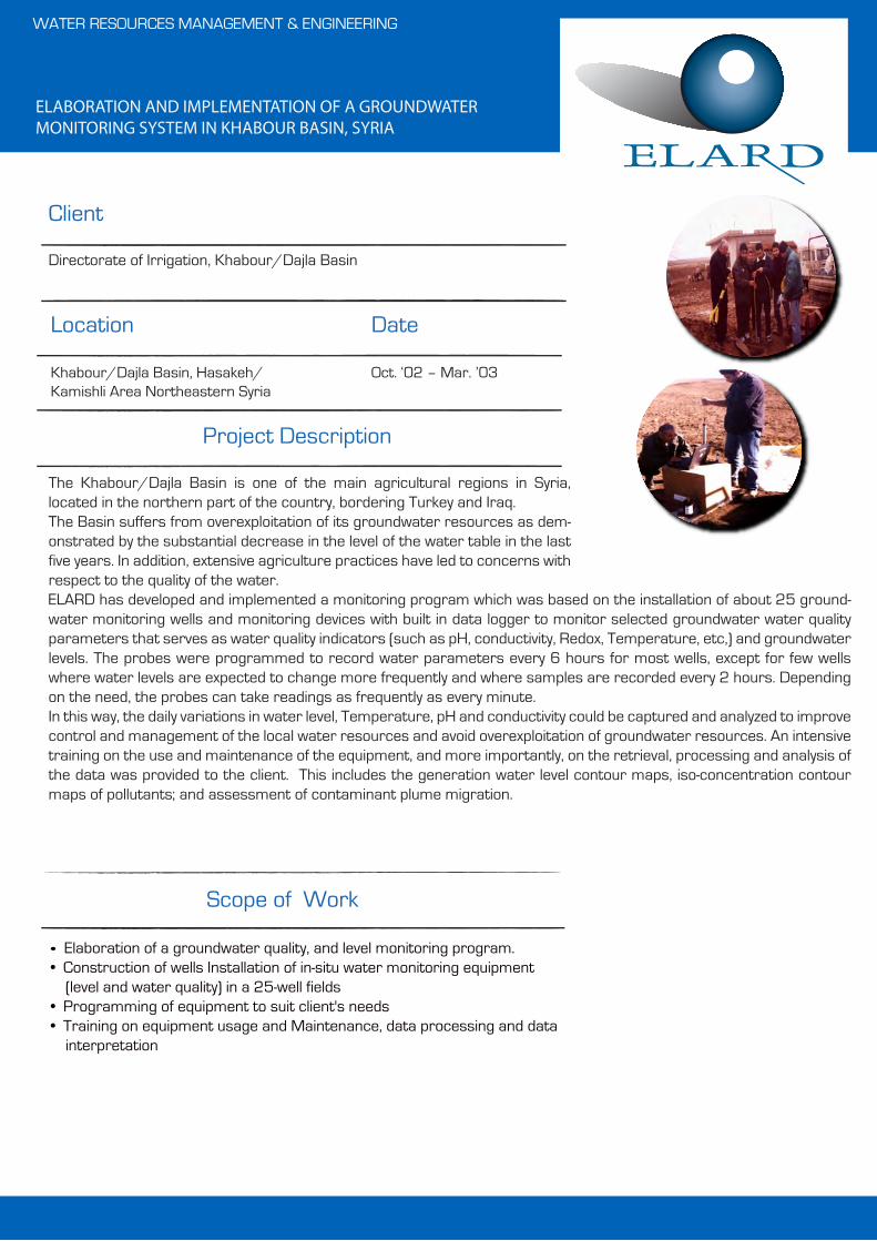
ELABORATION AND IMPLEMENTATION OF A GROUNDWATER MONITORING SYSTEM IN KHABOUR BASIN, SYRIA
• Elaboration of a groundwater quality, and level monitoring program.• Construction of wells Installation of in-situ water monitoring equipment
(level and water quality) in a 25-well fields• Programming of equipment to suit client's needs• Training on equipment usage and Maintenance, data processing and data
interpretation
Client
Date
Scope of Work
WATER RESOURCES MANAGEMENT & ENGINEERING
Location
Directorate of Irrigation, Khabour/Dajla Basin
Khabour/Dajla Basin, Hasakeh/ Kamishli Area Northeastern Syria
Oct. ‘02 – Mar. ’03
Project Description
The Khabour/Dajla Basin is one of the main agricultural regions in Syria, located in the northern part of the country, bordering Turkey and Iraq.The Basin suffers from overexploitation of its groundwater resources as dem-onstrated by the substantial decrease in the level of the water table in the last five years. In addition, extensive agriculture practices have led to concerns with respect to the quality of the water.ELARD has developed and implemented a monitoring program which was based on the installation of about 25 ground-water monitoring wells and monitoring devices with built in data logger to monitor selected groundwater water quality parameters that serves as water quality indicators (such as pH, conductivity, Redox, Temperature, etc,) and groundwater levels. The probes were programmed to record water parameters every 6 hours for most wells, except for few wells where water levels are expected to change more frequently and where samples are recorded every 2 hours. Depending on the need, the probes can take readings as frequently as every minute.In this way, the daily variations in water level, Temperature, pH and conductivity could be captured and analyzed to improve control and management of the local water resources and avoid overexploitation of groundwater resources. An intensive training on the use and maintenance of the equipment, and more importantly, on the retrieval, processing and analysis of the data was provided to the client. This includes the generation water level contour maps, iso-concentration contour maps of pollutants; and assessment of contaminant plume migration.
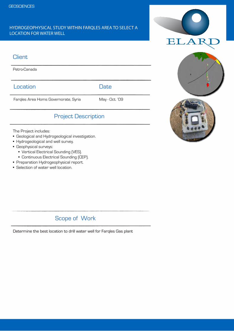
HYDROGEOPHYSICAL STUDY WITHIN FARQLES AREA TO SELECT A LOCATION FOR WATER WELL
Determine the best location to drill water well for Farqles Gas plant
Client
Date
Scope of Work
GEOSCIENCES
Location
Petro-Canada
Farqles Area Homs Governorate, Syria May - Oct. ‘09
Project Description
The Project includes:• Geological and Hydrogeological investigation.• Hydrogeological and well survey.• Geophysical surveys: • Vertical Electrical Sounding (VES). • Continuous Electrical Sounding (CEP).• Preparation Hydrogeophysical report.• Selection of water well location.

AUTONOMOUS DESALINATION UNITS BASED ON RENEWABLE ENERGY (ADU-RES) – LEBANON
• Assisting WIP in the overall coordination of the project;• Development of individual needs assessment methodology using questionnaires and a computer spreadsheet
model (for the calculation of energy needs, storage requirements, preliminary technology suggestions etc.) which is based on the MedWater Model for Integrated Water Planning;
• Assessment of water needs and consumption monitoring of four consumers from prominent user groups in the Mediterranean region in remote and rural areas (e.g. tourist resorts, plantations, food processing industries);
• Detailed study of the consumers of Task 2 concerning their paying ability using scenario comparison in respect of status quo expenditure on energy and water supply, additional beneficiaries, etc.
• Investigation of private and third-party financing schemes for the selected users.
Client
Date
Scope of Work
WATER RESOURCES MANAGEMENT & ENGINEERING
Location
WIP – Renewable Energies (Munich)
Lebanon Apr. ‘04 – Jun. ’07
Project Description
ADU-RES is a research coordination action financed by the 6-th framework programme INCO-Mediterranean Partner Countries (INCO-MPC) financed by the European Community (EC). The Coordination Action ADU-RES will achieve two main objectives: 1) Further development of integrated plant designs for mature and cost efficient autonomous desalination units (ADUs) which are based on renewable energy sources (RES), and 2) Formulation of political strategies for boosting ADU-RES implementation within the existing political and legislative frameworks in the Mediterranean.
R&D units of autonomous desalination units with a capacity below 50 m3 per day which are based on RES are operating successfully under the supervision of water and research institutes.
Still, commercial applications remain rare. Now is the time to strengthen and unite research work for the design of robust and cost-effective desalination plants that operate autonomously on RES. Remaining S&T challenges are:
• Radical cost reduction• Advanced management and control system• Improved long-term reliability• Environmentally sound set-ups
ELARD is leading and coordinating one complete Work package (WP3) in addition to be joint coordinator for the overall project together with WIP (WP1). WP3 relates to consumer demands and financing, and aims at providing a needs-oriented overview of the ADU-RES market and market potential and the procedural and technological framework for the provision of ADU-RES solutions, oriented by the needs and requirements of user groups.

HYDROGEOPHYSICAL STUDY WITHIN KAHEELEH MOUNTAIN AREA TO SELECT A LOCATION FOR A WATER WELL
Determine the best location to drill a water well which is expected to penetrate the upper Cretaceous aquifer.
Client
Date
Scope of Work
GEOSCIENCES
Location
CEMENA, Arabic Cement Company
Kaheeleh Mountain, Homs Governor-ate, Syria
Sept. ’09 - Dec. ‘09
Project Description
The Project includes:• Geological and Hydrogeological investigation.• Hydrogeological and well survey.• Geophysical surveys: - Vertical Electrical Sounding (VES). - Continuous Electrical Sounding (CEP).
• Preparation Hydrogeophysical report.• Selection of water well location.• Preparation of the tender document for the well drilling and installation.• Supervision on the drilling activities.• Preparation of a technical report for the well.• Suggestions and recommendations for water consumption and saving.
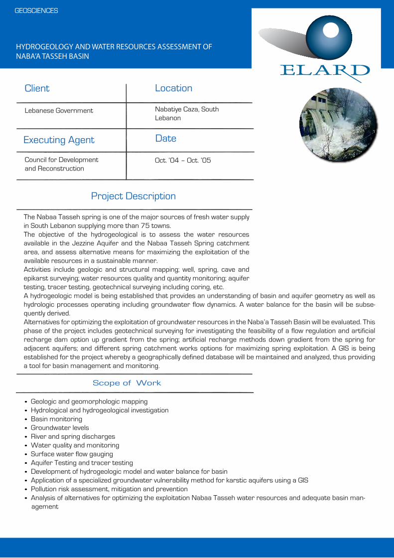
HYDROGEOLOGY AND WATER RESOURCES ASSESSMENT OF NABA’A TASSEH BASIN
• Geologic and geomorphologic mapping• Hydrological and hydrogeological investigation• Basin monitoring• Groundwater levels• River and spring discharges• Water quality and monitoring • Surface water flow gauging• Aquifer Testing and tracer testing • Development of hydrogeologic model and water balance for basin• Application of a specialized groundwater vulnerability method for karstic aquifers using a GIS• Pollution risk assessment, mitigation and prevention• Analysis of alternatives for optimizing the exploitation Nabaa Tasseh water resources and adequate basin man-
agement
Scope of Work
GEOSCIENCES
Project Description
The Nabaa Tasseh spring is one of the major sources of fresh water supply in South Lebanon supplying more than 75 towns.The objective of the hydrogeological is to assess the water resources available in the Jezzine Aquifer and the Nabaa Tasseh Spring catchment area, and assess alternative means for maximizing the exploitation of the available resources in a sustainable manner.Activities include geologic and structural mapping; well, spring, cave and epikarst surveying; water resources quality and quantity monitoring; aquifer testing, tracer testing, geotechnical surveying including coring, etc.A hydrogeologic model is being established that provides an understanding of basin and aquifer geometry as well as hydrologic processes operating including groundwater flow dynamics. A water balance for the basin will be subse-quently derived.Alternatives for optimizing the exploitation of groundwater resources in the Naba’a Tasseh Basin will be evaluated. This phase of the project includes geotechnical surveying for investigating the feasibility of a flow regulation and artificial recharge dam option up gradient from the spring; artificial recharge methods down gradient from the spring for adjacent aquifers; and different spring catchment works options for maximizing spring exploitation. A GIS is being established for the project whereby a geographically defined database will be maintained and analyzed, thus providing a tool for basin management and monitoring.
Executing Agent Date
Lebanese Government
Council for Development and Reconstruction
Nabatiye Caza, South Lebanon
Oct. ‘04 – Oct. ’05
Client Location

HYDROGEOPHYSICAL STUDY TO DETERMINE THE LOCATION OF WATER WELLS WITHIN AD-DIMAS DEVELOPMENT AREA
Determine the best location to drill high specification water wells
Client
Date
Scope of Work
GEOSCIENCES
Location
BENA for Properties
Ad-Dimas Area, Rural Damascus Governorate, Syrian Arab Republic
Aug. ‘09 - Mar. ’11
Project Description
The Project includes:• Geological and Hydrogeological investigation.• Hydrogeological survey.• Geophysical surveys:
- Vertical Electrical Sounding (VES). - Continuous Electrical Sounding (CEP).
• Spring and well survey.• Water sampling and analysis• Well location and design• Prepare the tender document for the wells drilling and installation.• Supervision on the drilling activities.• Prepare suggestion and recommendation for water consumption.

HYDROGEOPHYSICAL STUDY TO DETERMINE A LOCATION FOR WATER WELL WITHIN TWEENAN AREA
Determine the best location to drill high specification water well that penetrate the upper Cretaceous aquifer
Client
Date
Scope of Work
GEOSCIENCES
Location
Stroytransgaz
Near Tweenan Village, Homs Governor-ate, Syrian Arab Republic
Oct. ‘09 – Nov. ‘09
Project Description
The Project includes:• Geological and Hydrogeological investigation.• Hydrogeological and well survey.• Geophysical surveys: - Vertical Electrical Sounding (VES). - Continuous Electrical Sounding (CEP).• Prepare Hydrogeophysical report.• Determine a location for water well.• Prepare the tender document for the well drilling and installation.• Supervision on the drilling activities.• Prepare technical report for the well.• Prepare suggestion and recommendation for water consumption.
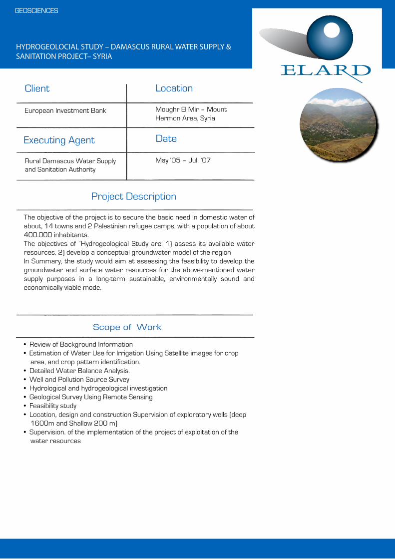
HYDROGEOLOCIAL STUDY – DAMASCUS RURAL WATER SUPPLY & SANITATION PROJECT– SYRIA
• Review of Background Information• Estimation of Water Use for Irrigation Using Satellite images for crop
area, and crop pattern identification.• Detailed Water Balance Analysis.• Well and Pollution Source Survey• Hydrological and hydrogeological investigation• Geological Survey Using Remote Sensing• Feasibility study• Location, design and construction Supervision of exploratory wells (deep
1600m and Shallow 200 m)• Supervision. of the implementation of the project of exploitation of the
water resources
Scope of Work
GEOSCIENCES
Project Description
The objective of the project is to secure the basic need in domestic water of about, 14 towns and 2 Palestinian refugee camps, with a population of about 400.000 inhabitants.The objectives of “Hydrogeological Study are: 1) assess its available water resources, 2) develop a conceptual groundwater model of the regionIn Summary, the study would aim at assessing the feasibility to develop the groundwater and surface water resources for the above-mentioned water supply purposes in a long-term sustainable, environmentally sound and economically viable mode.
Executing Agent Date
European Investment Bank
Rural Damascus Water Supply and Sanitation Authority
Moughr El Mir – Mount Hermon Area, Syria
May ‘05 – Jul. ’07
Client Location

REHABILITATION OF WATER SUPPLY SYSTEM OUTSIDE NAHR EL BARED CAMP
• Evaluation of the project• Supervision of the execution phase
Client
Date
Scope of Work
WATER RESOURCES MANAGMENT & ENGINEERING
Location
Cooperazione e Sviluppo (CESVI)
Lebanon Apr. ‘04 – Oct. ’04
Project Description
The project consists of evaluation and supervision of the execution of the water supply and wastewater infrastructure. The project includes wells, reservoirs, water supply and wastewater network.
THE REHABILITATION OF THE DRINKING AND WASTEWATER INFRA-STRUCTURES IN SOME PALESTINIAN REFUGEES UNREGISTERED CAMPS (GATHERINGS) IN TYR AREA, SOUTH LEBANON
• Evaluation of the project• Supervision of the execution phase
Client
Date
Scope of Work
WATER RESOURCES MANAGMENT & ENGINEERING
Location
CISP
Lebanon Oct. ‘03 – Feb. ’04
Project Description
The project consists of evaluating and supervising the execution of the water supply and wastewater infrastructure. The project includes wells, reservoirs, water supply and wastewater network.

REHABILITATION OF INFRASTRUCTURE FOR UNREGISTERED PALES-TINIAN CAMPS AND DISPLACEMENT CENTERS IN LEBANON
• Evaluation of the project• Supervision of the execution phase
Client
Date
Scope of Work
WATER RESOURCES MANAGMENT & ENGINEERING
Location
COOPI
Lebanon Mar. ‘03 – Sep. ’03
Project Description
The project consists of evaluating and supervising the execution of the water supply and wastewater infrastructsure. The project includes wells, reservoirs, water supply and wastewater network.
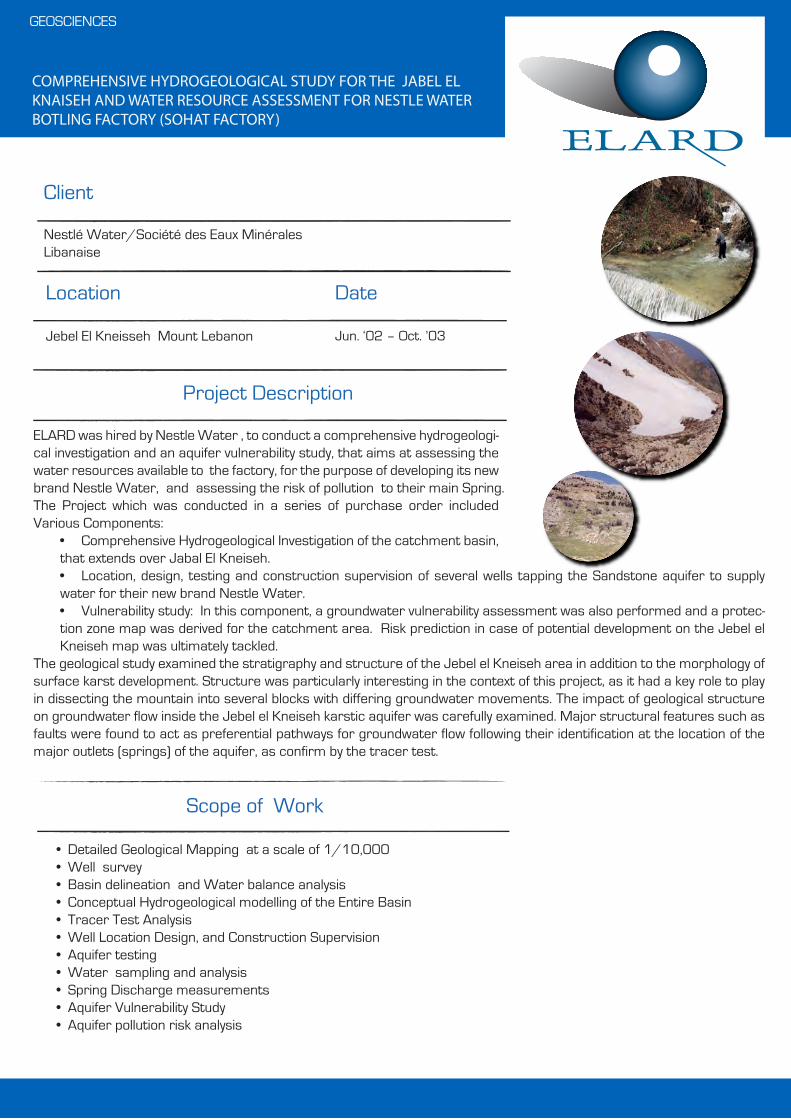
COMPREHENSIVE HYDROGEOLOGICAL STUDY FOR THE JABEL EL KNAISEH AND WATER RESOURCE ASSESSMENT FOR NESTLE WATER BOTLING FACTORY (SOHAT FACTORY)
• Detailed Geological Mapping at a scale of 1/10,000 • Well survey• Basin delineation and Water balance analysis• Conceptual Hydrogeological modelling of the Entire Basin• Tracer Test Analysis• Well Location Design, and Construction Supervision• Aquifer testing• Water sampling and analysis• Spring Discharge measurements• Aquifer Vulnerability Study• Aquifer pollution risk analysis
Client
Date
Scope of Work
GEOSCIENCES
Location
Nestlé Water/Société des Eaux Minérales Libanaise
Jebel El Kneisseh Mount Lebanon Jun. ‘02 – Oct. ’03
Project Description
ELARD was hired by Nestle Water , to conduct a comprehensive hydrogeologi-cal investigation and an aquifer vulnerability study, that aims at assessing the water resources available to the factory, for the purpose of developing its new brand Nestle Water, and assessing the risk of pollution to their main Spring.The Project which was conducted in a series of purchase order included Various Components:
• Comprehensive Hydrogeological Investigation of the catchment basin, that extends over Jabal El Kneiseh.• Location, design, testing and construction supervision of several wells tapping the Sandstone aquifer to supply water for their new brand Nestle Water.• Vulnerability study: In this component, a groundwater vulnerability assessment was also performed and a protec-tion zone map was derived for the catchment area. Risk prediction in case of potential development on the Jebel el Kneiseh map was ultimately tackled.
The geological study examined the stratigraphy and structure of the Jebel el Kneiseh area in addition to the morphology of surface karst development. Structure was particularly interesting in the context of this project, as it had a key role to play in dissecting the mountain into several blocks with differing groundwater movements. The impact of geological structure on groundwater flow inside the Jebel el Kneiseh karstic aquifer was carefully examined. Major structural features such as faults were found to act as preferential pathways for groundwater flow following their identification at the location of the major outlets (springs) of the aquifer, as confirm by the tracer test.

HYDRO AGRICULTURE DEVELOPMENT OF SOUTH LEBANON IRRIGA-TION AND WATER SUPPLY SCHEME – C 800 – GEOLOGICAL AND GEOPHYSICAL INVESTIGATION
• Geological and Geophysical investigation• Identification of structural and lithological variations in the study area• Identification of geomorphological features including karstic terrains• Hydrogeological investigation including (wells and springs surveys and
defining the ground water regime)
Scope of Work
GEOSCIENCES
Project Description
The C-800 is a part of the Litani Irrigation project that supplies South Leba-non with considerable quantities of water for irrigation. The project include the construction of tunnels and pipe lines that transport the water from the Markabe station to the South up to the southern Interna-tional boarder.A geological and geophysical investigation was conducted in order to define the structural and lithological variations in the area of concern. A hydrogeo-logical investigation was done to identify the water resources and define the hydrogeological regime in the area. All this was required to avoid any struc-tural complications during the implementation Phase. ELARD personnel supervised all the executed work, including the field geology and hydrogeol-ogy and geophysical prospecting (Contract amount 100 000 USD).
Executing Agent Date
Dar Al-Handasah - Shair and Partner
Council for Development and Reconstruction (CDR) and Litani Water Authority
South Lebanon
Jun. ‘02 – Oct. ’03
Client Location

GROUNDWATER RESOURCE INVESTIGATION TO SECURE ADDITIONAL WATER SOURCES FOR BEIRUT AND SOUTHERN METN CAZA
• Field Geological Survey.• Well Survey, • Location of exploratory wells
Client
Date
Scope of Work
GEOSCIENCES
Location
SOFRACO
Lebanon Mar. ‘01 - Feb. ’02
Project Description
ELARD was hired by SOFRACO, a large European Drilling Contracting Firm that used to be owned by Vivendi to conduct a hydrogeological study as part of a pre-feasibility study for new sources of water the southern Metn caza, and Beirut, and area of about 500 km.The project consisted of conducting an intensive field geological survey, where by a geological map at a scale of 1/20,000 were revised, and proposing locations for new water supply wells. The potential for tapping the Jurassic formation within Beirut was also assessed, and a deep explor-atory well of 1600 m depth was proposed.

INSTALLATION SUPERVISION OF NEW WELLS AND REHABILITATION OF OLD WELLS
• Hydrogeological study• Selection of locations for new wells• Well design• Well construction supervision• Geophysical logging (SP - Normal and lateral resistivity, Natural Gamma, Temp, Caliper, Deviation, etc...)• Pumping test• Recommendation for Well pump and appurtenances
Scope of Work
GEOSCIENCES
Project Description
As part of the National Emergency Recovery Plan, OTV-Vivendi Water has requested from ELARD to supervise the construction and rehabilitation of more than 50 wells ranging in depth between 100 and 900m all over Leba-non.Work entailed:
1) Well diagnostic, 2) Well location; 3) Well design; 4) Drilling and casing/screen installation; 5) Geophysical logging and borehole CCTV survey; 5) Aquifer testing and groundwater sampling; 6) Preparation of technical specifications for electromechanical works
(i.e. submersible pumps and appurtenances).
Executing Agent Date
Emergency National Emergency Recovery Program (ENRP 2)Water Supply Project -Omnium de Traitements des Eaux (OTV) –Vivendi Water
Council for Development and Reconstruction (CDR)
Lebanon
Aug. ‘98 – Mar. ’01
Client Location

BATROUN WATER SUPPLY PROJECT –ENRPII
• Determining Locations of surface water monitoring stations;• Hydrogeological study • Well location; • Well design;• Drilling and casing/screen installation; • Geophysical logging and borehole CCTV survey; • Aquifer testing and groundwater sampling; • Preparation of well Completion Report• Preparation of technical specifications for electromechanical works
(i.e. submersible pumps and appurtenances).
Client
Date
Scope of Work
WATER RESOURCES MANAGEMENT & ENGINEERING
Location
CDR (Subcontractor to CFE Belgium)
Lebanon Aug. ‘99 – Mar. ‘02
Project Description
As part of the National Emergency Recovery Plan, CFE has requested from ELARD to supervise the construction and rehabilitation of 8 wells ranging in depth between 300 and 500 m all over Lebanon.
