early warning for disaster preparedness and response in bangladesh
DESCRIPTION
Early Warning for Disaster Preparedness and Response in BangladeshTRANSCRIPT
Comprehensive Disaster Management Programme (CDMP II)
Early Warning for Disaster Preparedness and Response in Bangladesh

DROUGHT RIVER EROSION
FLOOD CYCLONE
FIRE BREAKOUT
EARTHQUAKE
SALINITY INTRUSION
LANDSLIDE
BANGLADESH DISASTER CONTEXT
Context analysis:
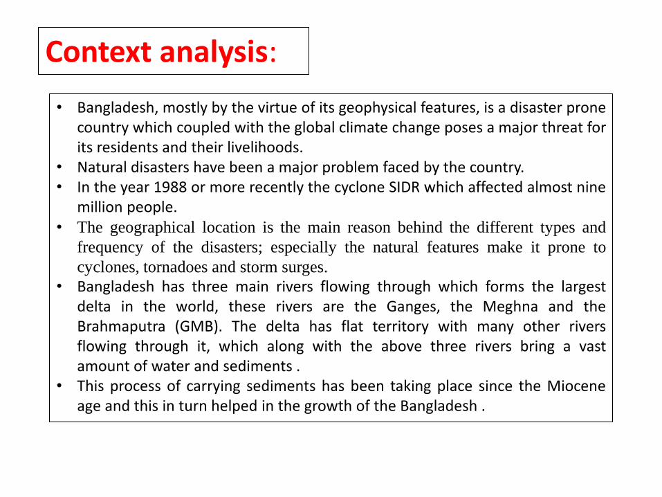
• Bangladesh, mostly by the virtue of its geophysical features, is a disaster prone country which coupled with the global climate change poses a major threat for its residents and their livelihoods.
• Natural disasters have been a major problem faced by the country. • In the year 1988 or more recently the cyclone SIDR which affected almost nine
million people. • The geographical location is the main reason behind the different types and
frequency of the disasters; especially the natural features make it prone to
cyclones, tornadoes and storm surges.
• Bangladesh has three main rivers flowing through which forms the largest delta in the world, these rivers are the Ganges, the Meghna and the Brahmaputra (GMB). The delta has flat territory with many other rivers flowing through it, which along with the above three rivers bring a vast amount of water and sediments .
• This process of carrying sediments has been taking place since the Miocene age and this in turn helped in the growth of the Bangladesh .
Context analysis: continue
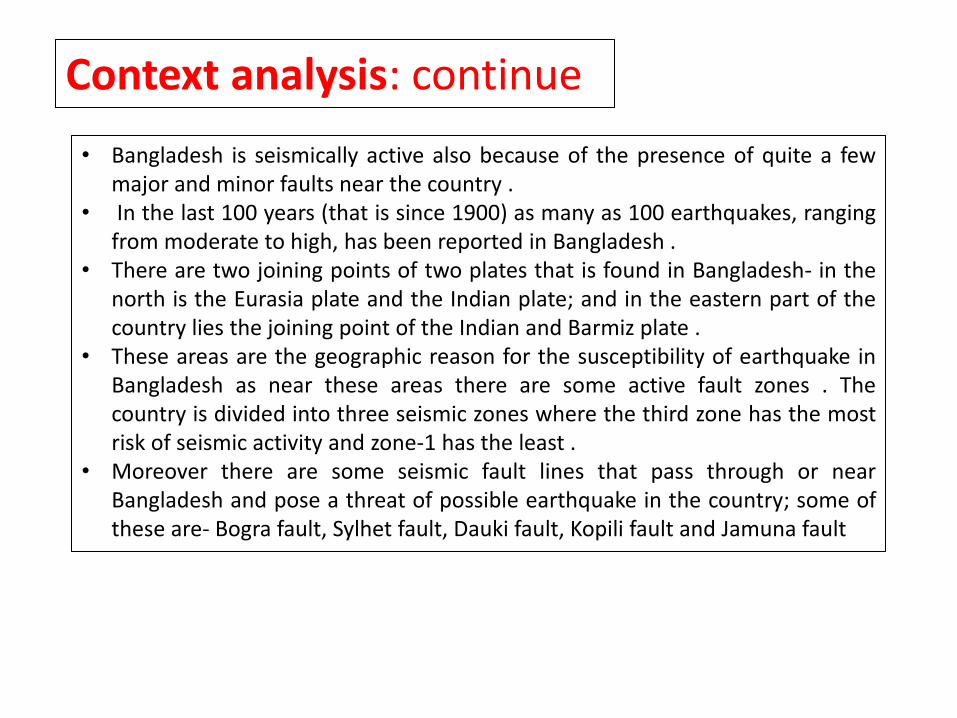
• Bangladesh is seismically active also because of the presence of quite a few major and minor faults near the country .
• In the last 100 years (that is since 1900) as many as 100 earthquakes, ranging from moderate to high, has been reported in Bangladesh .
• There are two joining points of two plates that is found in Bangladesh- in the north is the Eurasia plate and the Indian plate; and in the eastern part of the country lies the joining point of the Indian and Barmiz plate .
• These areas are the geographic reason for the susceptibility of earthquake in Bangladesh as near these areas there are some active fault zones . The country is divided into three seismic zones where the third zone has the most risk of seismic activity and zone-1 has the least .
• Moreover there are some seismic fault lines that pass through or near Bangladesh and pose a threat of possible earthquake in the country; some of these are- Bogra fault, Sylhet fault, Dauki fault, Kopili fault and Jamuna fault

DROUGHT - Affects about 8.3 million of land.
COUNTRY PROFILE
FLASH FLOOD - Unpredictable, uncertain.
FLOOD - Inundates more areas, increases river erosion, breaches
embankments, damages infrastructures.
CYCLONE - Remain to be the deadliest and most destructive
hazard. It has recurring events, lingering aftermath, complex
recovery.
Ranks globally among the most climate vulnerable nations
Fifth rank in the world risk index 2012
SALINITY INTRUSION - Spreading intrusion from 1.5 to 2.5 Mha
(2007). Projected displacement: 6-8 m by 2050
AND
CLIMATE CHANGE HAZARDS, EARTHQUAKES, FIRE
BREAKOUT, INFRASTRUCTURE COLLAPSE ETC.
BANGLADESH SHIFTED THE PARADIGM FROM RESPONSE/RELIEF-ORIENTED TO COMPREHENSIVE APPROACH AND RISK REDUCTION CULTURE SINCE MID 1980’S

Bangladesh is a
flood prone
country because
of its typical
geographical
location and
being placed in
the delta formed
by the Ganges,
the Brahmaputra
and the Meghna
rivers

Bangladesh Setting
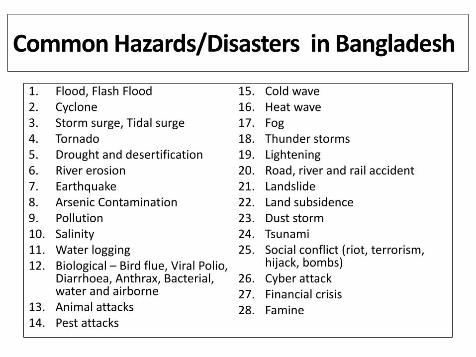
Common Hazards/Disasters in Bangladesh
1. Flood, Flash Flood 2. Cyclone 3. Storm surge, Tidal surge 4. Tornado 5. Drought and desertification 6. River erosion 7. Earthquake 8. Arsenic Contamination 9. Pollution 10. Salinity 11. Water logging 12. Biological – Bird flue, Viral Polio,
Diarrhoea, Anthrax, Bacterial, water and airborne
13. Animal attacks 14. Pest attacks
15. Cold wave 16. Heat wave 17. Fog 18. Thunder storms 19. Lightening 20. Road, river and rail accident 21. Landslide 22. Land subsidence 23. Dust storm 24. Tsunami 25. Social conflict (riot, terrorism,
hijack, bombs) 26. Cyber attack 27. Financial crisis 28. Famine

CONTEXT OF VULNERABILITY
Complex geo-physical and environmental diversity
• Deltaic landscape, 80% floodplain
• Most density populated country (over 146 million)
• High level of poverty (31.5%, HIES 2010)
• Natural resources based
• Victim to global Climate Change, most vulnerable country
Well established indigenous coping capacities
Strong sense of belonging and social cohesion
Vibrant NGO /CSOs/CBOs
GO-NGO/public–private partnership
Strong support from the development partners
Extensive safety nets
UN
FAV
OU
RA
BLE
FA
VO
UR
AB
LE
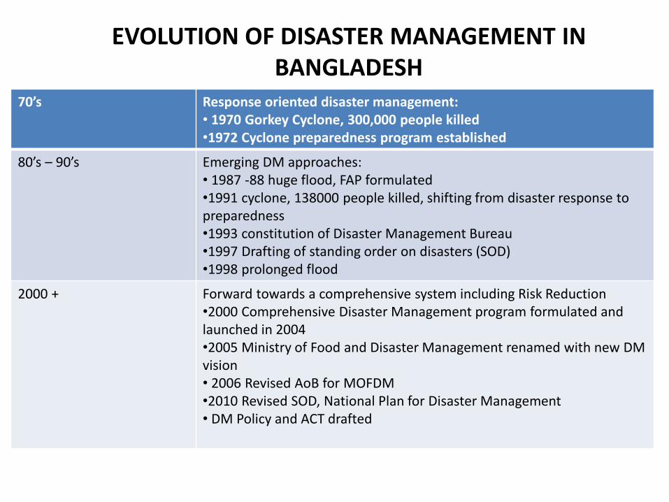
EVOLUTION OF DISASTER MANAGEMENT IN BANGLADESH
70’s Response oriented disaster management: • 1970 Gorkey Cyclone, 300,000 people killed •1972 Cyclone preparedness program established
80’s – 90’s Emerging DM approaches: • 1987 -88 huge flood, FAP formulated •1991 cyclone, 138000 people killed, shifting from disaster response to preparedness •1993 constitution of Disaster Management Bureau •1997 Drafting of standing order on disasters (SOD) •1998 prolonged flood
2000 + Forward towards a comprehensive system including Risk Reduction •2000 Comprehensive Disaster Management program formulated and launched in 2004 •2005 Ministry of Food and Disaster Management renamed with new DM vision • 2006 Revised AoB for MOFDM •2010 Revised SOD, National Plan for Disaster Management • DM Policy and ACT drafted
EARLY WARNING INSTITUTIONAL MECHANISM
AND CDMP SUPPORT

Indian Meghalaya Hill, world’s wettest region
Annual Rainfall: 12,000 mm = 12 meters!!

BMD, CDMP-II
CDMP-II Supported Projects for BMD
SI No.
Project Name Project Duration with
Cost Status
1 "Strengtheining of Bangladesh meteorological Department's (BMD) Early Warning Capacity"
Duration: 2011-2014,
Budget: 8,50,000 USD
2 Development and Pilot of Weather Radio System for Warning Dissemination to Fishermen at Sea"
Duration: 1 Year,
Budget: 4,25,977.2 USD (32864141 BDT)
• Mou Signed between CDMP-II & BMD has been done
• Sub-agreement between BMD & RIMES has been done
• Sites selection have been done
3 Enhancement and Pilot Application of Agro-Advisory Expert System – Bangladesh
Duration: 1.5 years
Budget: 3,49,743 USD

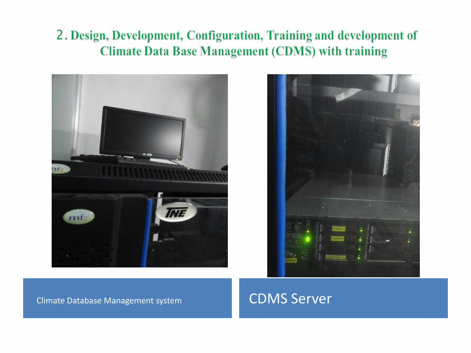
Climate Database Management system CDMS Server
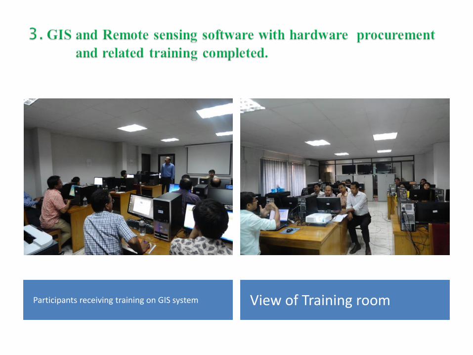
Participants receiving training on GIS system View of Training room
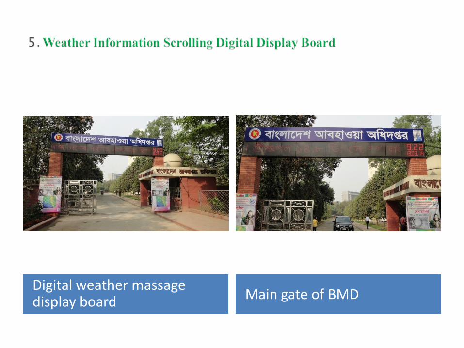
Digital weather massage display board Main gate of BMD
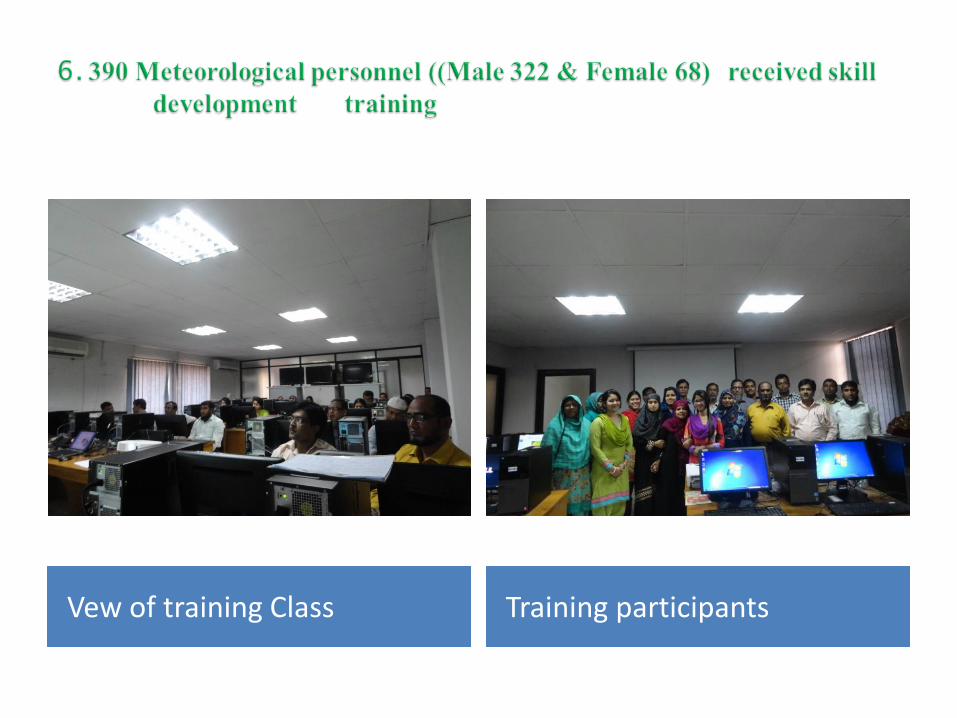
Vew of training Class Training participants
7. Automatic Communication System at 35 outer stations through
EADGE Modem.
8. High speed internet connection installed BMD head quarter (HQ),
Storm Warning Center (SWC) and Main Meteorological Office
(MMO), Hazrat Shah Jalal International Airport, Dhaka.
9. Up grading of H/W and Procurement & Distribution to Outer
Observatory Stations Completed.
Procurement (second Phase) & Distribution of Computer, UPS,
Printer, Cartridge, TV, Modem, Pen drive and other accessories
Completed.

What is Flood Forecasting, Warning and
Response System?
• A system to change the behaviour of people and
agencies before and during floods to save lives,
and reduce damage and disruption
• A system with the following integrated
components :
- Forecasting
- Interpretation
- Dissemination
- Response
- Review and Analysis

WATER
is great
opportunity
for
Bangladesh
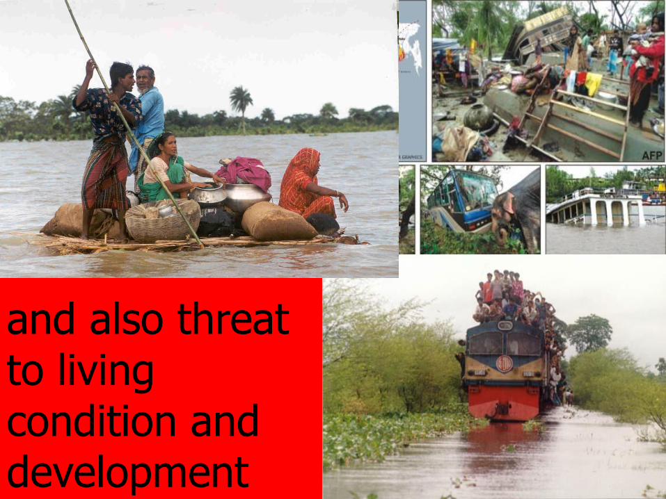
and also threat to living condition and development

27
India
RIVERS OF BANGLADESH
Brahmaputra/Jamuna
Ganges
Meghna
Qmaxm. =78,000 m3/sec
Qminm. = 700 m3/sec
WLmax.=15.19m
WLmin.=7.44m
Qmax.=98,000m3/sec
Qmin. =4,000 m3/sec
WLmax.=20.37m
WLmin.=12.95m
(Lower Meghna
Qmaxm. =180,000 m3/sec
Qminm. = 4,000 m3/sec
WLmax.=7.33m
WLmin.=1.97m
primarily a rain
fed river
snow melt & rain fed river
starts rising in March/April
& usually attains a peak in
June. Another peak in
July/August
snow melt & rain fed river
starts rising in June/July
and attains the annual
flood peak in late August
or early September
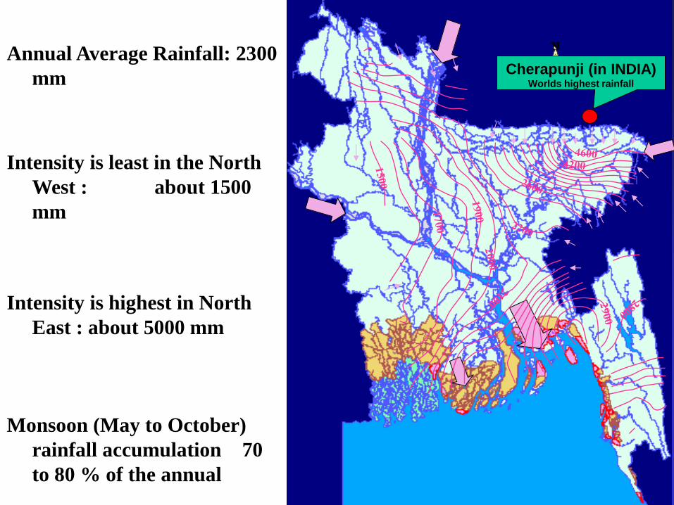
Cherapunji (in INDIA) Worlds highest rainfall
Annual Average Rainfall: 2300
mm
Intensity is least in the North
West : about 1500
mm
Intensity is highest in North
East : about 5000 mm
Monsoon (May to October)
rainfall accumulation 70
to 80 % of the annual

With huge population, 150 million
(about 1100 person/sq-km)
Comparatively flat and
low topography
Bangladesh identified as the top
most vulnerable countries to
climate change condition
•About 50% of the country is
within 6-7 m of MSL.
•Max 68% of the country is
flooded in 1998.
•25 to 30% of the area is
inundated during normal flood
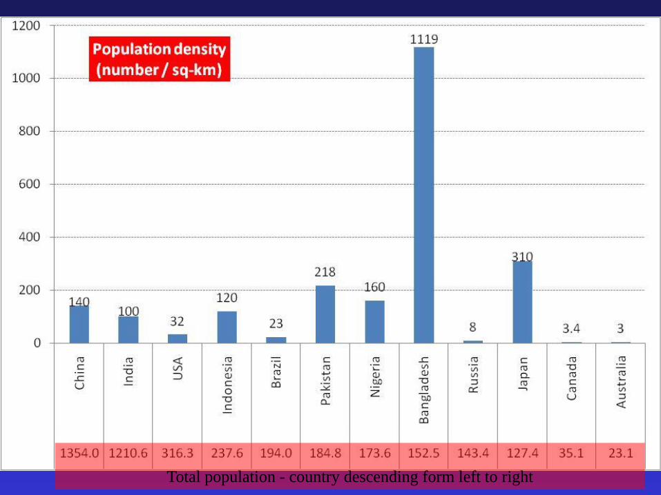
Total population - country descending form left to right
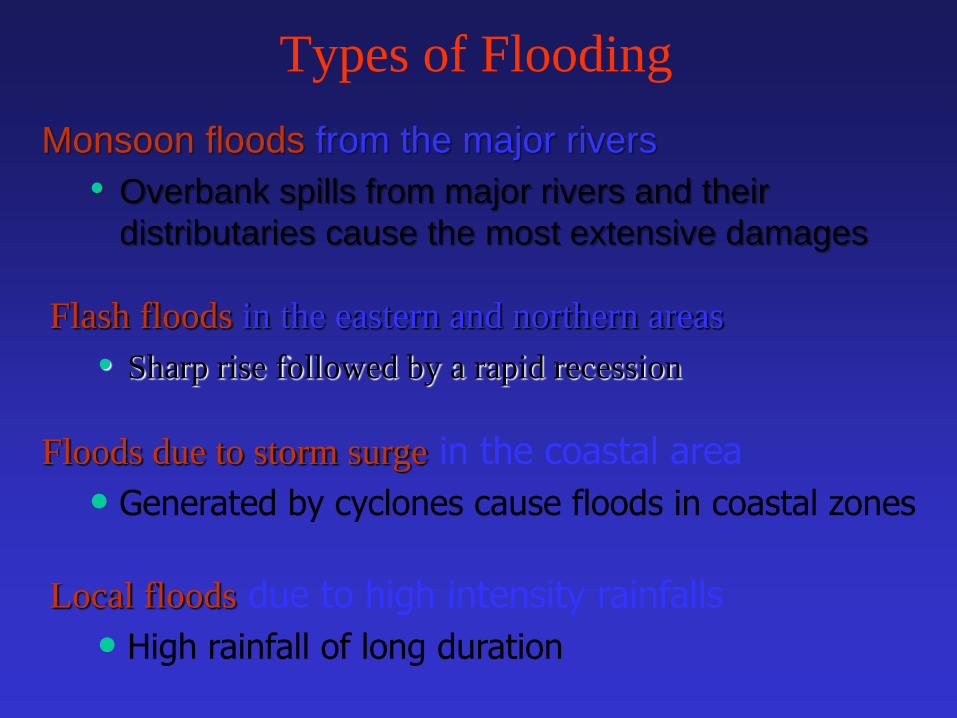
Types of Flooding
Monsoon floods from the major rivers
• Overbank spills from major rivers and their
distributaries cause the most extensive damages
Floods due to storm surge in the coastal area
• Generated by cyclones cause floods in coastal zones
Flash floods in the eastern and northern areas
• Sharp rise followed by a rapid recession
Local floods due to high intensity rainfalls
• High rainfall of long duration

32
Flooded Area during 1954 to 2013
UN mission, known as
Krug Mission fielded
EPWAPDA Started with
projects to save CROPS
BWDB formed
FFWC established
1998 is the
most sever
flood
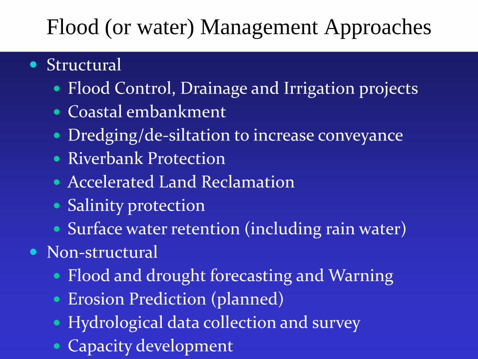
Flood (or water) Management Approaches
Structural
Flood Control, Drainage and Irrigation projects
Coastal embankment
Dredging/de-siltation to increase conveyance
Riverbank Protection
Accelerated Land Reclamation
Salinity protection
Surface water retention (including rain water)
Non-structural
Flood and drought forecasting and Warning
Erosion Prediction (planned)
Hydrological data collection and survey
Capacity development
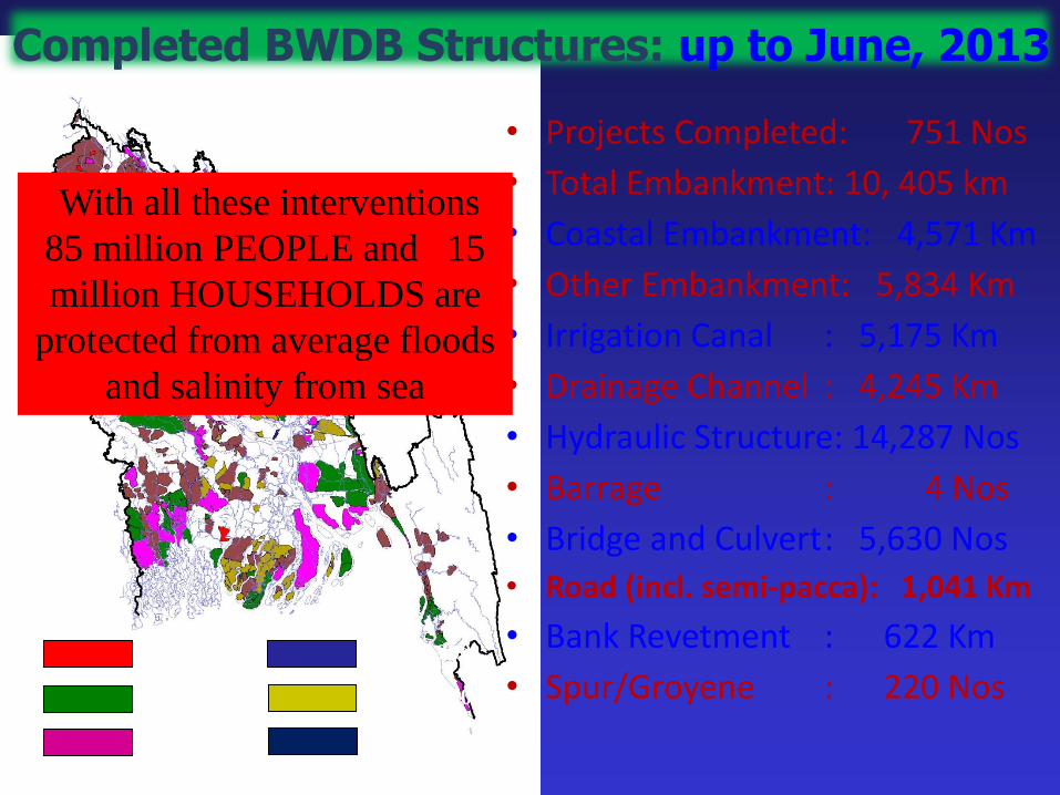
Completed BWDB Structures: up to June, 2013
• Projects Completed: 751 Nos
• Total Embankment: 10, 405 km
• Coastal Embankment: 4,571 Km
• Other Embankment: 5,834 Km
• Irrigation Canal : 5,175 Km
• Drainage Channel : 4,245 Km
• Hydraulic Structure: 14,287 Nos
• Barrage : 4 Nos
• Bridge and Culvert : 5,630 Nos
• Road (incl. semi-pacca): 1,041 Km
• Bank Revetment : 622 Km
• Spur/Groyene : 220 Nos 1961-1970
1951-1960
1971-1980
1981-1990
1991-2000
2001-2010
With all these interventions
85 million PEOPLE and 15
million HOUSEHOLDS are
protected from average floods
and salinity from sea

Food grain production from
Flood Control, Drainage and Irrigation
(FCDI) system of the BWDB
Overall trend is increasing
Thus contribute to;
• maintain FOOD SECURITY
• create JOB specially the rural population
• poverty reduction
Non Structural Measures
Flood Forecasting and Warning
Services

06:00 to 09:00 hrs 08:30 to 10:30 hrs 10:30 to 11:00 hrs 11:00 to 12:00 hrs 11:30 to --------
Field Observation
Water Level
Rainfall
Other Sources
BMD
Satellite image
Web-site
Indian data
Model
Run
FFWC
Office
Flood
Inundation
Map
Feed to
computer
Analysis
& Quality
check
Flood
Bulletin
Preparation
Dissemination
Through
Hard copy
Fax
Phone
Web-site
SMS
IVR-mobile
Distributed to
Policy makers
Disaster
managers (GO
& NGO)
Media
Others
Rainfall
Surface
Map
Result
consistency
check
Data Collection Preparation Dissemination Output
Flood Forecasting & Warning Activities
Error
check
Water Level
from 85
stations
85x5=425
Rainfall 56
stations, daily
basis
Data collection and feed to
computer MANUAL
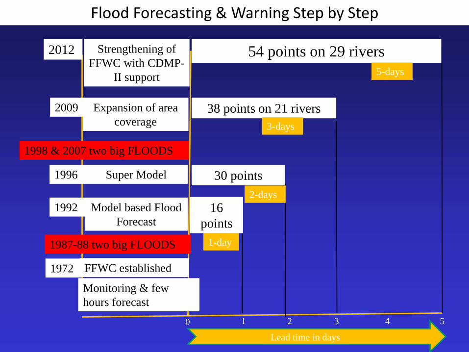
Model based Flood
Forecast
1992
Super Model 1996
Expansion of area
coverage
2009
Strengthening of
FFWC with CDMP-
II support
2012
FFWC established 1972
Monitoring & few
hours forecast
0 1 2 3 4 5
1987-88 two big FLOODS
1998 & 2007 two big FLOODS
Flood Forecasting & Warning Step by Step
Lead time in days
16
points
1-day
30 points
2-days
38 points on 21 rivers
3-days
54 points on 29 rivers
5-days

38 Flood Forecast points
River Station
Atrai Mohadevpur
Atrai
Little Jamuna Noagaon
Karatoya Chakrahimpur
Bogra
Teesta Kaunia
Brahmaputra Chilmari
Jamuna
Bahadurabad
Kazipur
Serajgonj
Porabari
Aricha
Old
Brahmaputra
Jamalpur
Mymensingh
Bangshi Nayerhat
Dhaleswari Jagir
Kalagacia
Kaliganga Taraghat
Tongi Khal Tongi
River Station
Turag Mirpur
Buriganga Dhaka(South)
Dhaka(West)
Balu Demra
Lakhya Narayangonj
Ganges
Rajshahi
Harding Bridge
Talbaria
Padma
Goallondo
Bhagyakul
Mawa
Gorai
Gorai Rl
Bridge
Kamarkhali
Surma
Sylhet
Sunamgonj
Kushyara Sheola
Meghna
Bhairab Bazar
Baidder Bazar
Meghna Bridge
Flood Forecast points 16 nos
is being added in 2013 & 2014
River Station River Station
Jamuna
Sariakandi Dharala Kurigram
Porabari Lakhya Lakhpur
Mathura Meghna Narsingdi
Baulai Khaliajuri Mohanonda C.Nwabgonj
Old Surma Derai Ghagot Gaibandha
Kalni Markuli Atrai Cankhair
Manu Moulvibazar Hurasagar Baghabari
Dhaleswari Elasin Ghat Padma Sureswar
21 rivers 38 stations
Upto 2012
29 rivers 54 stations
After 2014
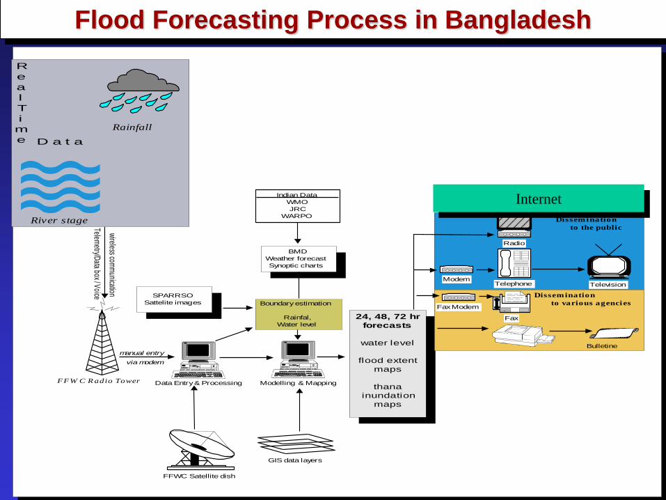
Indian Data
WMO
JRC
WARPO
FFW C R adio Tower
FFWC Satellite dish
24, 48, 72 hr
forecasts
water level
flood extent
maps
thana
inundation
maps
Telephone
Fax
Fax Modem
ModemTelevision
Bulletine
GIS data layers
Radio
wireless com
munication
via modem
manual entry
Telemetry/D
ata box / Voice SPARRSO
Sattelite images
BMD
Weather forecast
Synoptic charts
Boundary estimation
Rainfal,
Water level
Data Entry & Processing Modelling & Mapping
River stage
Rainfall
R
e
a
l
T
i
m
e D a t a
Dissemination
to the public
Dissemination
to various agencies
Internet
Flood Forecasting Process in Bangladesh
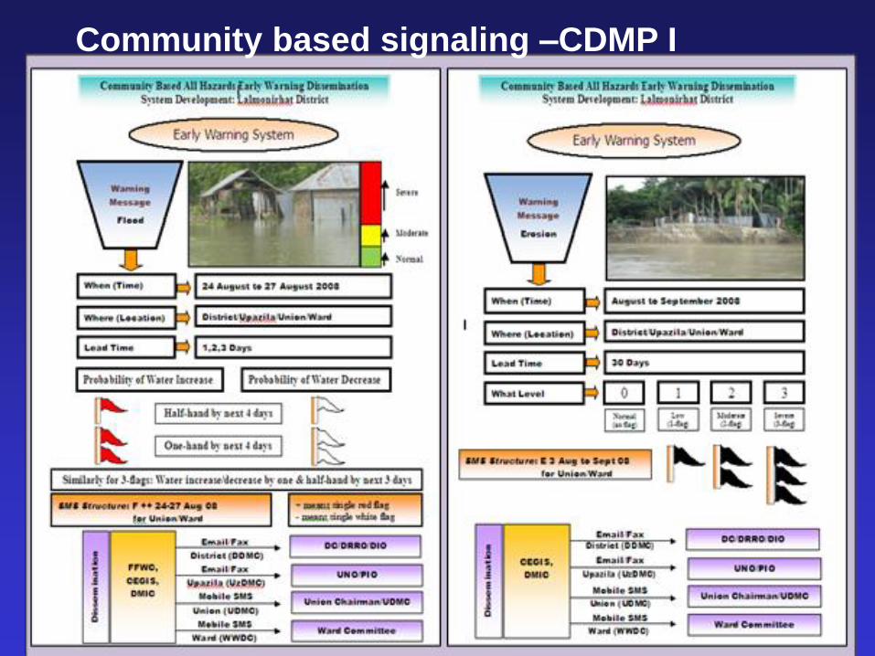
Community based signaling –CDMP I
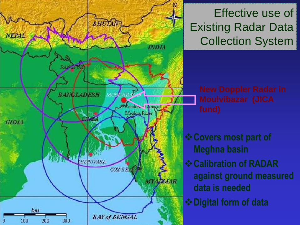
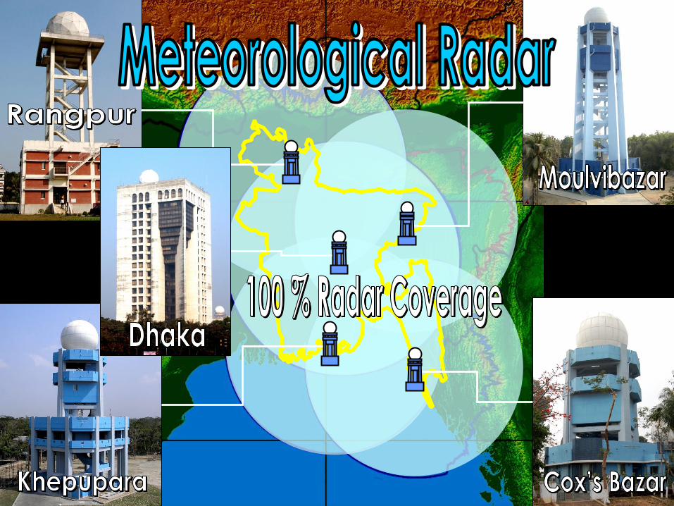
Effective use of
Existing Radar Data
Collection System
New Doppler Radar in
Moulvibazar (JICA
fund)
Covers most part of
Meghna basin
Calibration of RADAR
against ground measured
data is needed
Digital form of data
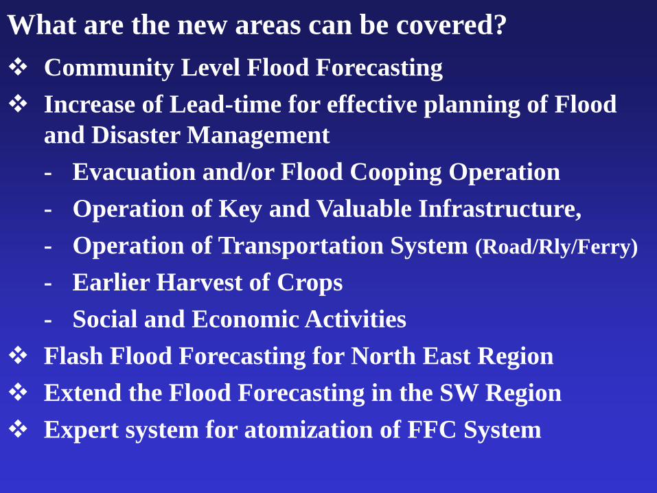
What are the new areas can be covered?
Community Level Flood Forecasting
Increase of Lead-time for effective planning of Flood
and Disaster Management
- Evacuation and/or Flood Cooping Operation
- Operation of Key and Valuable Infrastructure,
- Operation of Transportation System (Road/Rly/Ferry)
- Earlier Harvest of Crops
- Social and Economic Activities
Flash Flood Forecasting for North East Region
Extend the Flood Forecasting in the SW Region
Expert system for atomization of FFC System
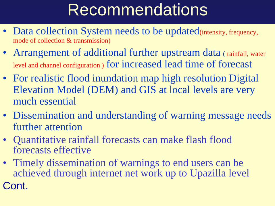
Recommendations • Data collection System needs to be updated(intensity, frequency,
mode of collection & transmission)
• Arrangement of additional further upstream data ( rainfall, water
level and channel configuration ) for increased lead time of forecast
• For realistic flood inundation map high resolution Digital Elevation Model (DEM) and GIS at local levels are very much essential
• Dissemination and understanding of warning message needs further attention
• Quantitative rainfall forecasts can make flash flood forecasts effective
• Timely dissemination of warnings to end users can be achieved through internet net work up to Upazilla level
Cont.

COMMUNITY BASED
EARLY WARNING
DISSEMINATION
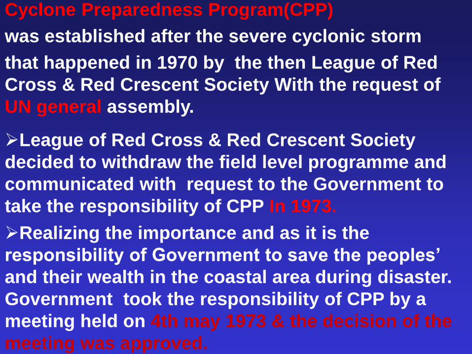
Cyclone Preparedness Program(CPP)
was established after the severe cyclonic storm
that happened in 1970 by the then League of Red
Cross & Red Crescent Society With the request of
UN general assembly.
League of Red Cross & Red Crescent Society
decided to withdraw the field level programme and
communicated with request to the Government to
take the responsibility of CPP In 1973.
Realizing the importance and as it is the
responsibility of Government to save the peoples’
and their wealth in the coastal area during disaster.
Government took the responsibility of CPP by a
meeting held on 4th may 1973 & the decision of the
meeting was approved.
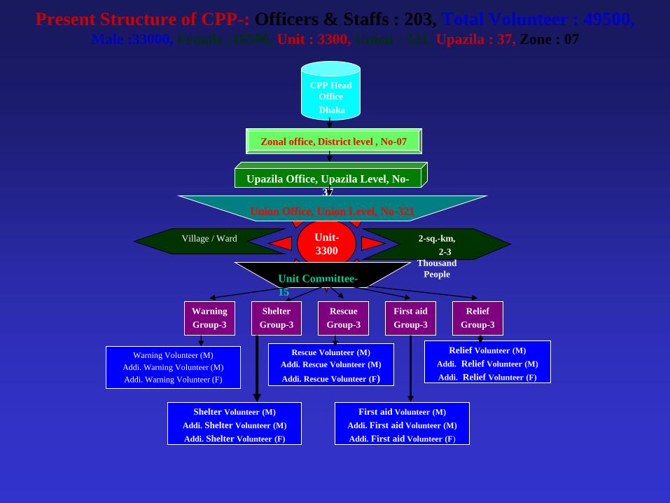
Unit-
3300
Present Structure of CPP-: Officers & Staffs : 203, Total Volunteer : 49500, Male :33000, Female :16500, Unit : 3300, Union : 321, Upazila : 37, Zone : 07
CPP Head
Office
Dhaka
Zonal office, District level , No-07
Upazila Office, Upazila Level, No-
37
Union Office, Union Level, No-321
2-sq.-km,
2-3
Thousand
People
Village / Ward
Unit Committee-
15
Warning
Group-3
Shelter
Group-3
Rescue
Group-3
First aid
Group-3
Relief
Group-3
Warning Volunteer (M)
Addi. Warning Volunteer (M)
Addi. Warning Volunteer (F)
Shelter Volunteer (M)
Addi. Shelter Volunteer (M)
Addi. Shelter Volunteer (F)
Rescue Volunteer (M)
Addi. Rescue Volunteer (M)
Addi. Rescue Volunteer (F)
First aid Volunteer (M)
Addi. First aid Volunteer (M)
Addi. First aid Volunteer (F)
Relief Volunteer (M)
Addi. Relief Volunteer (M)
Addi. Relief Volunteer (F)
FFWC
BMD ≠ 64 DISTRICTS AND
310 UPAZILLA
≠ 13 GOVERNMENT
AGENCIES
≠ NGO
≠ INGO
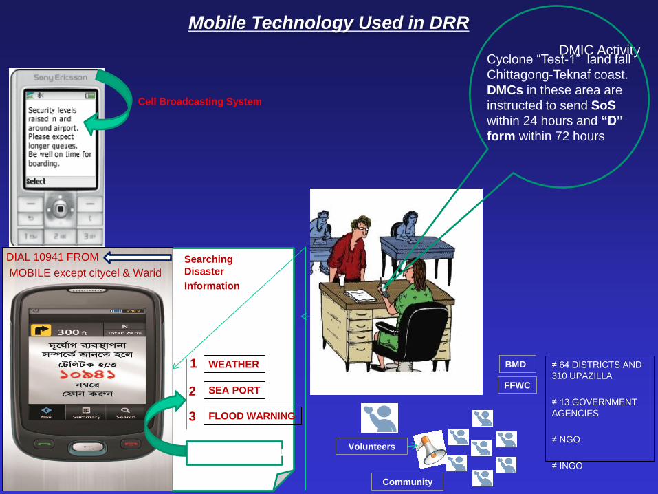
Cell Broadcasting System
DIAL 10941 FROM
MOBILE except citycel & Warid
Searching
Disaster
Information
WEATHER
SEA PORT
FLOOD WARNING
1
2
3
PRESS BUTTON Volunteers
HF/VHF
Community
DMIC Activity
Mobile Technology Used in DRR
Cyclone “Test-1” land fall
Chittagong-Teknaf coast.
DMCs in these area are
instructed to send SoS
within 24 hours and “D”
form within 72 hours

Cell Broadcasting (CB) Piloting of early warning dissemination in
flood prone Sirajganj and cyclone prone
Cox’s Bazar through Cell Broadcasting (CB)
has been Successful.
SMS SMS service to disseminate disaster
early warning during and after disaster
instruction will be circulated to officials
of relevant disaster management.
A
B
C
IVR (Interactive Voice Response) Initiative have been taken to weather, flood
forecasting and early warning for river port
through IVR. The Service is available through
all mobile subscribers. IVR Hot Line -
10941
Products/Services

Software – ArcGIS/ ENVI
Databases – Different layers including administrative boundaries, River, Sea,
School, shelter etc.
Administrative District Map Upazila/Union/ Natural (River)
Hazard Map – Flood, Cyclone, Salinity, Response Map
GIS Setup
Tools Used for mapping

Community are in action after receive
the early warning
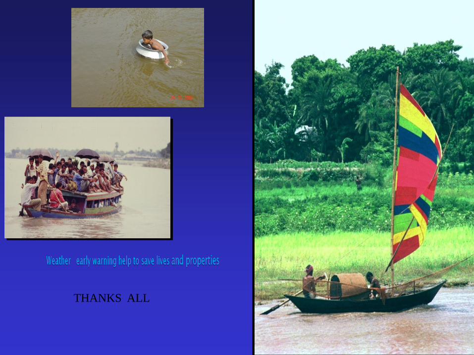
THANKS ALL