drr workshop wmo commission for hydrology geneva 10 -14 june 2013 ann calver 1
TRANSCRIPT

1
DRR workshop
WMO Commission for Hydrology
Geneva
10 -14 June 2013
Ann Calver
2
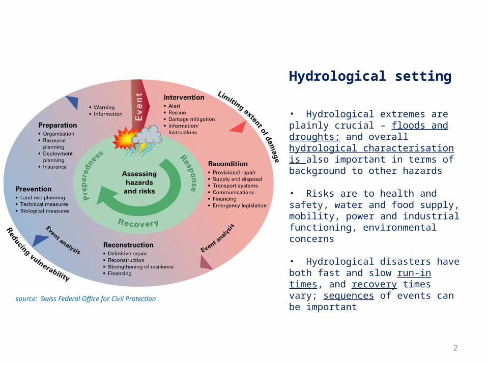
Hydrological setting
• Hydrological extremes are plainly crucial – floods and droughts; and overall hydrological characterisation is also important in terms of background to other hazards
• Risks are to health and safety, water and food supply, mobility, power and industrial functioning, environmental concerns
• Hydrological disasters have both fast and slow run-in times, and recovery times vary; sequences of events can be important
source: Swiss Federal Office for Civil Protection
3
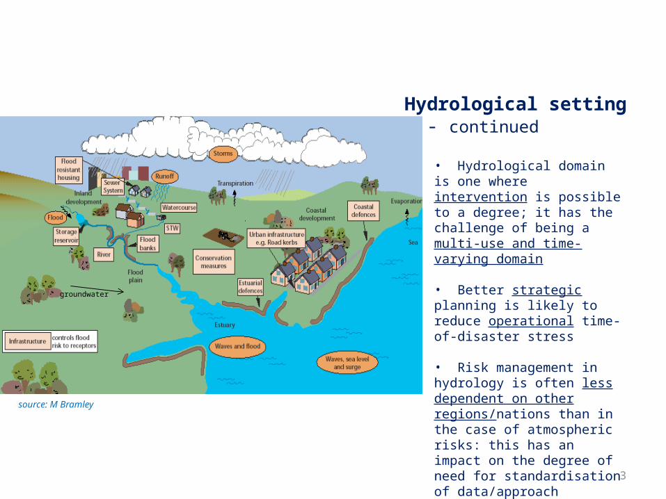
• Hydrological domain is one where intervention is possible to a degree; it has the challenge of being a multi-use and time-varying domain
• Better strategic planning is likely to reduce operational time-of-disaster stress
• Risk management in hydrology is often less dependent on other regions/nations than in the case of atmospheric risks: this has an impact on the degree of need for standardisation of data/approach
Hydrological setting - continued
source: M Bramley
groundwater
4
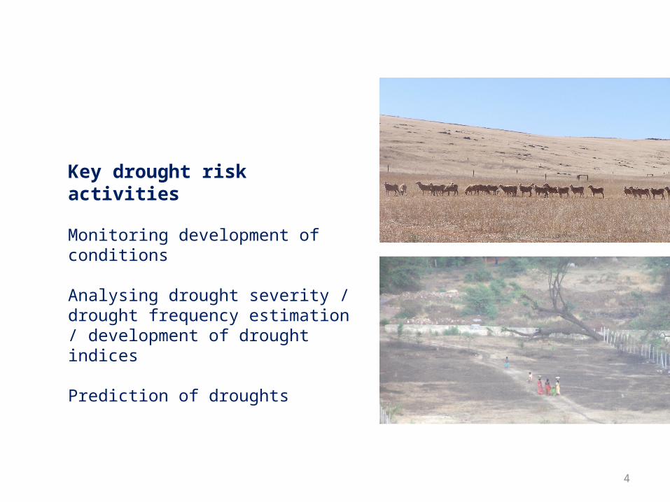
Key drought risk activities
Monitoring development of conditions
Analysing drought severity / drought frequency estimation / development of drought indices
Prediction of droughts

5
Key flood risk activities
Short-term flood forecasting
Longer term flood frequency estimation
Inundation extent
Specific aspects eg. urban flooding, groundwater floods
6
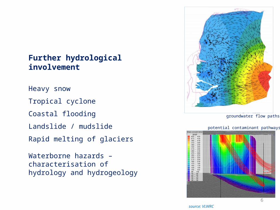
Further hydrological involvement
Heavy snow
Tropical cyclone
Coastal flooding
Landslide / mudslide
Rapid melting of glaciers
Waterborne hazards – characterisation of hydrology and hydrogeology
source: VLWRC
groundwater flow paths
potential contaminant pathways

7
Commission for Hydrology documents
Technical Regulations, volume III: Hydrology 2006
Manuals (see next slide)
[ International Glossary of Hydrology – with UNESCO ]
Guidelines / guidance materialespecially the Guide to Hydrological Practices 2008
Technical documents(see next but one slide)

8
Commission for Hydrology documents - continued

9
Commission for Hydrology documents - continued
Various technical reports
Various reports from operational hydrology series
CHy XIII Annex 1 to resolution 1: A quality management framework in hydrology
Technical material for water resources assessment
Climate and information requirements for water management

10
A few short examples of how in practice hydrology assesses disaster riskand the data and techniques involved ... ...
© RAF Benson

11
Real-time river flood ensemble forecasting
source: UK Met Office & NERC
based on precipitation forecasts and data, with catchment hydrological modelling
calibrated on past river flow data record
precipitation river flows
12
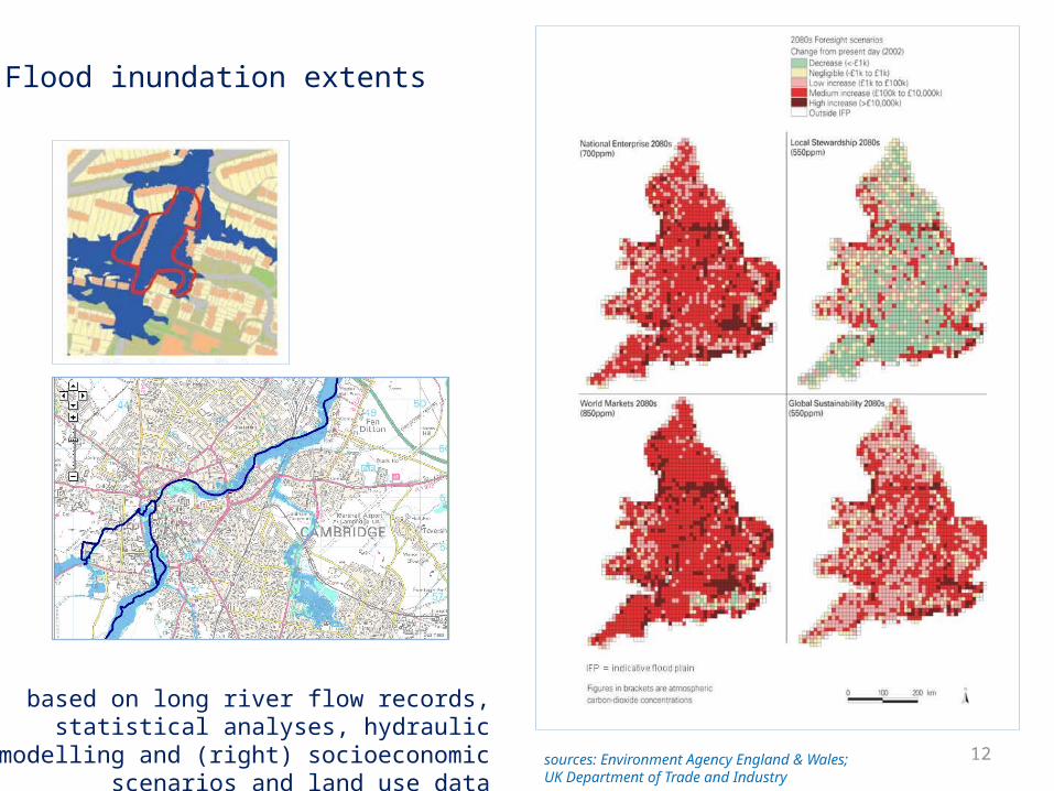
Flood inundation extents
sources: Environment Agency England & Wales; UK Department of Trade and Industry
based on long river flow records, statistical analyses, hydraulic modelling and (right)
socioeconomic scenarios and land use data

13
RIVER THAMES AT KINGSTON (NATURAL)Forecasts of mean monthly river flow from July 2006 for 12 months for different % average rainfall
0
5000
10000
15000
20000
25000
30000
35000
Oct-04 Jan-05 Apr-05 Jul-05 Oct-05 Jan-06 Apr-06 Jul-06 Oct-06 Jan-07 Apr-07
Flo
w (
Ml/d
)
Excep High Note High Above norm Norm Below norm Note low Excep low Actual
120%
% of AverageRainfall
100%
80%60%
Projecting river flow for drought development awareness
source: Environment Agency, England
based on river flow records, catchment precipitation, catchment hydrological modelling calibrated on past records

14
Long-term drought frequencies
source: European Environment Agency
based on climate projections, catchment data and hydrological modelling, statistical analyses
Relative change in minimum river flow with return period of 20 years compared with 1961-1990
recent drought extents

15
Some key cross-cutting issues
• Hydrological modelling
• Data-sparse areas
• Uncertainty / robustness / error evaluation
• Quality management
• Non-stationarity
• Information transfer
source: DHI

16
CONCLUDING REMARKS
Level to which hydrological risks are currently managed
varies greatly world-wide and with the specific risk – this is
in part a function of assessment abilities
Both standard and non-standard data and methods are used
in hydrological risk assessment; suites of hydrological
standards may be more appropriate than single standards
Realistic aim: world-wide awareness by practitioners
of the range of available hydrological techniques and,
at a different level, by those needing to use hydrological
information to reduce disaster risk
further information: [email protected]