draft urban design manual - london, ontario city of london / urban design guidelines / i what is...
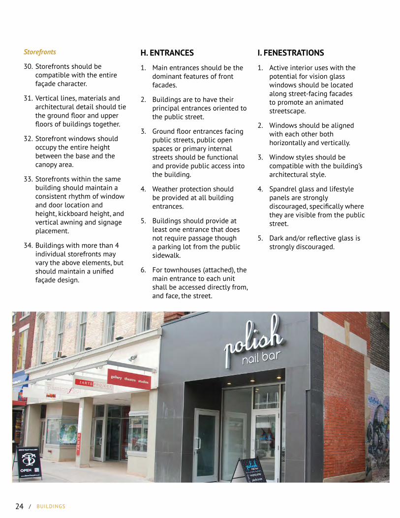
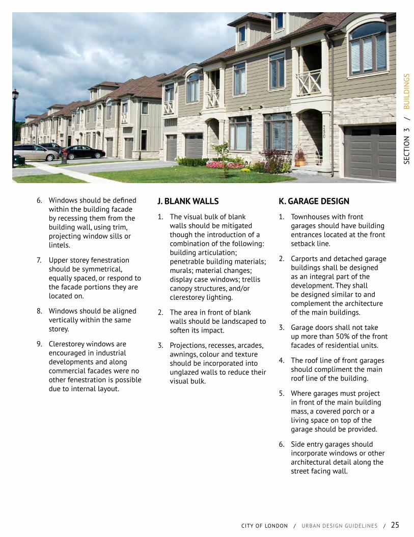
TRANSCRIPT
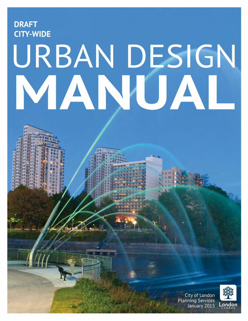
DRAFTCITY-WIDE
URBAN DESIGN
City of LondonPlanning Services
January 2015
MANUAL
INTR
OD
UCT
ION
CITY OF LONDON / URBAN DESIGN GUIDELINES / i
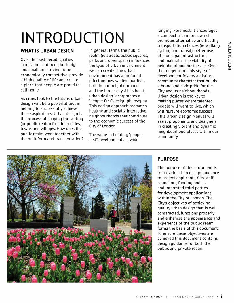
WHAT IS URBAN DESIGN
Over the past decades, cities across the continent, both big and small are striving to be economically competitive, provide a high quality of life and create a place that people are proud to call home.
As cities look to the future, urban design will be a powerful tool in helping to successfully achieve these aspirations. Urban design is the process of shaping the setting (or public realm) for life in cities, towns and villages. How does the public realm work together with the built form and transportation?
In general terms, the public realm (ie streets, public squares, parks and open space) influences the type of urban environment we can create. The urban environment has a profound effect on how we live our lives both in our neighbourhoods and the larger city. At its heart, urban design incorporates a “people first” design philosophy. This design approach promotes healthy and socially interactive neighbourhoods that contribute to the economic success of the City of London.
The value in building “people first” developments is wide
INTRODUCTIONranging. Foremost, it encourages a compact urban form, which promotes alternative and healthy transportation choices (ie walking, cycling and transit), better use of municipal infrastructure and maintains the viability of neighbourhood businesses. Over the longer term, this style of development fosters a distinct community character that builds a brand and civic pride for the City and its neighbourhoods. Urban design is the key to making places where talented people will want to live, which will nurture economic success. This Urban Design Manual will assist proponents and designers in creating vibrant and dynamic neighbourhood places within our community.
PURPOSE
The purpose of this document is to provide urban design guidance to project applicants, City staff, councilors, funding bodies and interested third parties for development applications within the City of London. The City’s objectives of achieving quality urban design that is well constructed, functions properly and enhances the appearance and experience of the public realm forms the basis of this document. To ensure these objectives are achieved this document contains design guidance for both the public and private realm.

ii / INTRODUCTION
POLICY CONTEXT
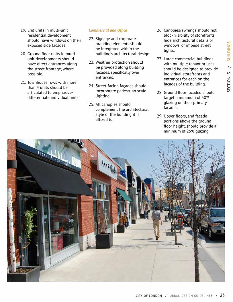
The policy and design standards identified in this document serve as a tool to integrate urban design into planning decisions and in the preparation of municipal engineering standards. The following documents where used to assist in the creation of this Manual:
Placemaking Design Guidelines
Adopted on November 2007, the City of London Placemaking Design Guidelines provides guidance to developers, builders, consultants, and internal Engineering and Planning Staff for the development of outstanding communities that offer a distinct character, a strong sense of community and a context for healthy lifestyles and a high quality of life. The Placemaking Design Guidelines establish a foundation for the adoption of the Urban Design Guidelines.
Official Plan
The Official Plan contains City Council’s objectives and policies to guide the short-term and long-term physical development of all lands within the boundary of the municipality. It provides direction for the allocation of land use, provision of municipal services and facilities, and preparation of regulatory by-laws to control the development and use of land.
Site Plan Control
All site plans for development must be submitted to the City for approval. The City’s design standards for site development are set out in the City’s Site Plan Control By-law and Policies.
Accessibility for Ontarians with Disabilities Act (AODA)
The purpose of the AODA is to develop, implement and enforce standards for accessibility related to goods, services, facilities, employment, accommodation and buildings.
Growth Management Implementation Strategy
The purpose for the Growth Management Implementation Strategy (GMIS) is to provide guidance for the coordination of the timing of City-initiated infrastructure works with the approval of development applications. The GMIS identifies priority areas for growth over the 0 to 5, 6 – 10, and 11 to 20 year time periods. Council adopted the GMIS on June 23, 2008.
Access Management Guidelines
The City of London recently prepared their Access Management Guidelines that contain a comprehensive set of guidelines and standards relative to the access or driveway layout, turning movement restrictions, roadway features, and parking operations. All development applications and associated access proposals should conform to the standards contained in the Access Management Guidelines.
INTR
OD
UCT
ION
CITY OF LONDON / URBAN DESIGN GUIDELINES / iii
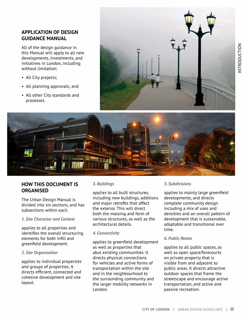
APPLICATION OF DESIGN GUIDANCE MANUAL
All of the design guidance in this Manual will apply to all new developments, investments, and initiatives in London, including without limitation:
• All City projects;
• All planning approvals; and
• All other City standards and processes.
3. Buildings
applies to all built structures, including new buildings, additions and major retrofits that affect the exterior. This will direct both the massing and form of various structures, as well as the architectural details.
4. Connectivity
applies to greenfield development as well as properties that abut existing communities. It directs physical connections for vehicles and active forms of transportation within the site and in the neighbourhood to the surrounding community and the larger mobility networks in London.
5. Subdivisions
applies to mainly large greenfield developments, and directs complete community design including a mix of uses and densities and an overall pattern of development that is sustainable, adaptable and transitional over time.
6. Public Realm
applies to all public spaces, as well as open space/forecourts on private property that is visible from and adjacent to public areas. It directs attractive outdoor spaces that frame the streetscape and encourage active transportation, and active and passive recreation.
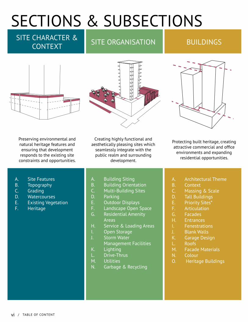
HOW THIS DOCUMENT IS ORGANISED
The Urban Design Manual is divided into six sections, and has subsections within each.
1. Site Character and Context
applies to all properties and identifies the overall structuring elements for both infill and greenfield development.
2. Site Organisation
applies to individual properties and groups of properties. It directs efficient, connected and cohesive development and site layout.
iv / INTRODUCTION
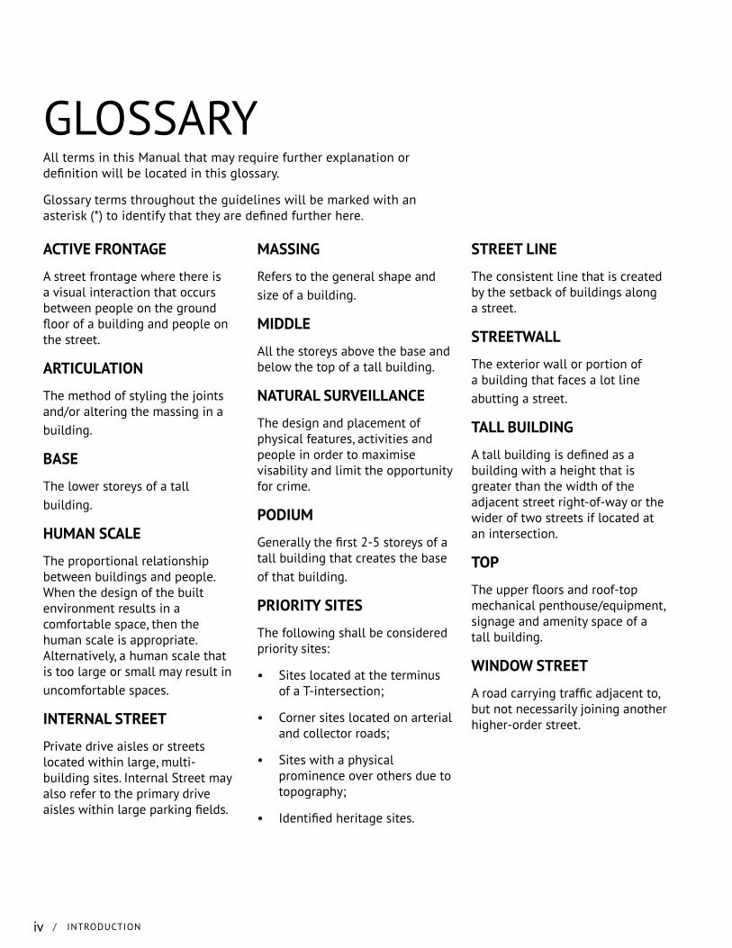
All terms in this Manual that may require further explanation or definition will be located in this glossary.
Glossary terms throughout the guidelines will be marked with an asterisk (*) to identify that they are defined further here.
ACTIVE FRONTAGE
A street frontage where there is a visual interaction that occurs between people on the ground floor of a building and people on the street.
ARTICULATION
The method of styling the joints and/or altering the massing in a building.
BASE
The lower storeys of a tall building.
HUMAN SCALE
The proportional relationship between buildings and people. When the design of the built environment results in a comfortable space, then the human scale is appropriate. Alternatively, a human scale that is too large or small may result in uncomfortable spaces.
INTERNAL STREET
Private drive aisles or streets located within large, multi-building sites. Internal Street may also refer to the primary drive aisles within large parking fields.
GLOSSARY
MASSING
Refers to the general shape and size of a building.
MIDDLE
All the storeys above the base and below the top of a tall building.
NATURAL SURVEILLANCE
The design and placement of physical features, activities and people in order to maximise visability and limit the opportunity for crime.
PODIUM
Generally the first 2-5 storeys of a tall building that creates the base of that building.
PRIORITY SITES
The following shall be considered priority sites:
• Sites located at the terminus of a T-intersection;
• Corner sites located on arterial and collector roads;
• Sites with a physical prominence over others due to topography;
• Identified heritage sites.
STREET LINE
The consistent line that is created by the setback of buildings along a street.
STREETWALL
The exterior wall or portion of a building that faces a lot line abutting a street.
TALL BUILDING
A tall building is defined as a building with a height that is greater than the width of the adjacent street right-of-way or the wider of two streets if located at an intersection.
TOP
The upper floors and roof-top mechanical penthouse/equipment, signage and amenity space of a tall building.
WINDOW STREET
A road carrying traffic adjacent to, but not necessarily joining another higher-order street.

INTR
OD
UCT
ION
CITY OF LONDON / URBAN DESIGN GUIDELINES / v
vi / TABLE OF CONTENT
SECTIONS & SUBSECTIONSSITE CHARACTER &
CONTEXT
A. Site FeaturesB. TopographyC. GradingD. WatercoursesE. Existing VegetationF. Heritage
Preserving environmental and natural heritage features and ensuring that development
responds to the existing site constraints and opportunities.
BUILDINGS
A. Architectural ThemeB. ContextC. Massing & ScaleD. Tall BuildingsE. Priority Sites*F. ArticulationG. FacadesH. EntrancesI. FenestrationsJ. Blank WallsK. Garage DesignL. RoofsM. Facade MaterialsN. ColourO. Heritage Buildings
Protecting built heritage, creating attractive commercial and office
environments and expanding residential opportunities.
SITE ORGANISATION
A. Building SitingB. Building OrientationC. Multi-Building SitesD. ParkingE. Outdoor DisplaysF. Landscape Open SpaceG. Residential Amenity
AreasH. Service & Loading AreasI. Open StorageJ. Storm Water
Management FacilitiesK. LightingL. Drive-ThrusM. UtilitiesN. Garbage & Recycling
Creating highly functional and aesthetically pleasing sites which
seamlessly integrate with the public realm and surrounding
development.
3m
TABL
E O
F C
ON
TEN
TS
CITY OF LONDON / URBAN DESIGN GUIDELINES / vii
SUBDIVISIONS
A. LayoutB. Street PatternC. Block ConfigurationD. Lot ConfigurationE. Parks & Open Space
LocationsF. Community BoundariesG. Community EntriesH. Focal Points I. BridgesJ. Mixed Development
Creating pedestrian-friendly and walkable neighbourhoods in both
greenfield and infill contexts.
Sidewalk[6.0m]
Sidewalk[6.0m]
Roadway[8.0m]
CONNECTIVITY
A. On-Site CirculationB. Walkway DesignC. Pedestrian AmenitiesD. Bicycle Circulation &
ParkingE. Transit CirculationF. WayfindingG. Community Circulation
Prioritizing city-wide connectivity for pedestrians, cyclists, transit
and vehicles.
PUBLIC REALM
A. StreetscapesB. Street TreesC. LandscapingD. ScreeningE. Planter BedsF. Foundation PlantingG. Plant MaterialsH. Plazas & Urban Civic
SpacesI. Waiting AreasJ. PatiosK. Park Design
Creating dynamic and welcoming public streetscapes and
recreational spaces.

viii / TABLE OF CONTENT
SECT
ION
1
/
SIT
E C
HAR
ACTE
R &
CO
NTE
XT
CITY OF LONDON / URBAN DESIGN GUIDELINES / 1
CONTENTS
A. Site FeaturesB. TopographyC. GradingD. WatercoursesE. Existing VegetationF. HeritageG. Trees
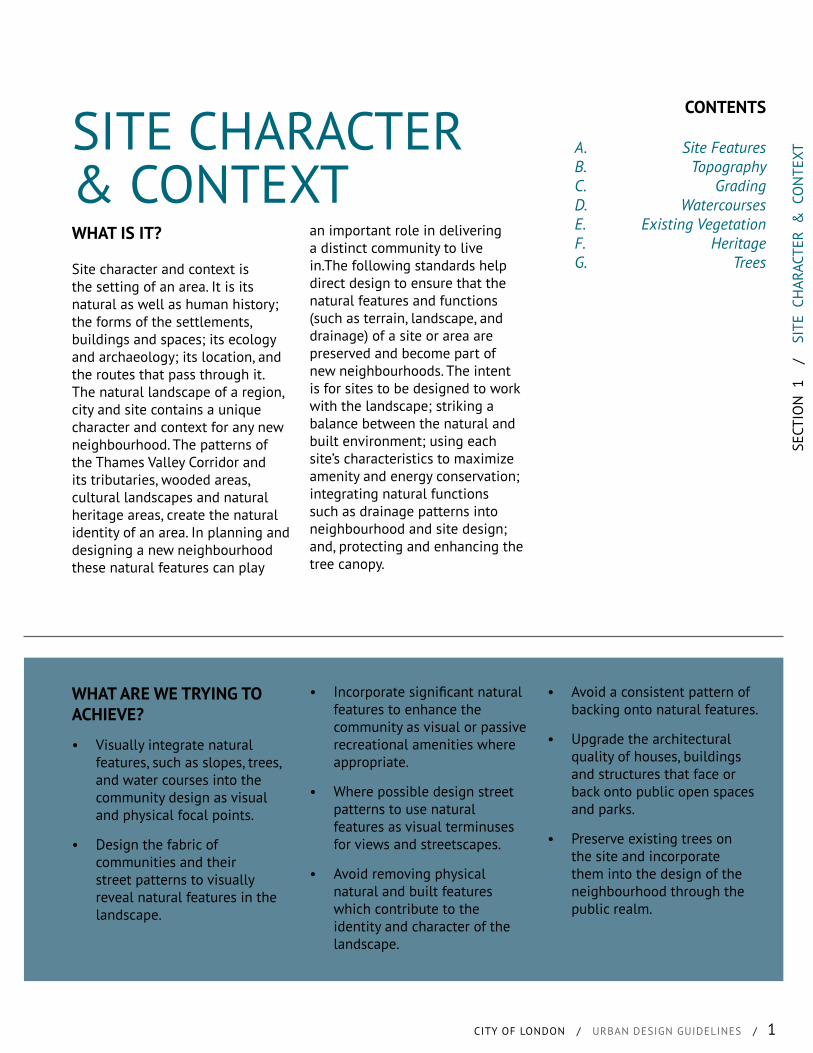
SITE CHARACTER & CONTEXTWHAT IS IT?
Site character and context is the setting of an area. It is its natural as well as human history; the forms of the settlements, buildings and spaces; its ecology and archaeology; its location, and the routes that pass through it. The natural landscape of a region, city and site contains a unique character and context for any new neighbourhood. The patterns of the Thames Valley Corridor and its tributaries, wooded areas, cultural landscapes and natural heritage areas, create the natural identity of an area. In planning and designing a new neighbourhood these natural features can play
WHAT ARE WE TRYING TO ACHIEVE?
• Visually integrate natural features, such as slopes, trees, and water courses into the community design as visual and physical focal points.
• Design the fabric of communities and their street patterns to visually reveal natural features in the landscape.
• Incorporate significant natural features to enhance the community as visual or passive recreational amenities where appropriate.
• Where possible design street patterns to use natural features as visual terminuses for views and streetscapes.
• Avoid removing physical natural and built features which contribute to the identity and character of the landscape.
• Avoid a consistent pattern of backing onto natural features.
• Upgrade the architectural quality of houses, buildings and structures that face or back onto public open spaces and parks.
• Preserve existing trees on the site and incorporate them into the design of the neighbourhood through the public realm.
an important role in delivering a distinct community to live in.The following standards help direct design to ensure that the natural features and functions (such as terrain, landscape, and drainage) of a site or area are preserved and become part of new neighbourhoods. The intent is for sites to be designed to work with the landscape; striking a balance between the natural and built environment; using each site’s characteristics to maximize amenity and energy conservation; integrating natural functions such as drainage patterns into neighbourhood and site design; and, protecting and enhancing the tree canopy.
2 / SITE CHARACTER & CONTEXT
A. SITE FEATURES
1. Views to the Thames River and other significant natural features should be protected as much as possible.
2. Development layout should maintain natural heritage features, cultural and heritage assets, and views to these features from the public realm.
3. Preserve, create and enhance access to water courses and bodies, while providing a public interface.
4. Open spaces and streetscapes should be designed to protect and enhance views to natural features such as wood lots, watercourses, and wetlands.
5. Public streets that terminate at a watercourse, water body or other natural feature should be maintained and enhanced to provide visual and physical access to that feature.
C. GRADING
1. The use of retaining walls, along streetscapes, open spaces, and other public areas should be limited as much as practical.
2. Where retaining walls cannot be avoided, terracing should be used to minimise the height of any single wall and landscaping should be provided to soften and screen the walls.
D. WATER COURSES
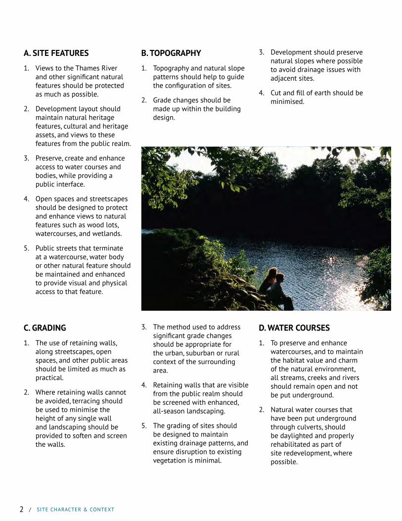
1. To preserve and enhance watercourses, and to maintain the habitat value and charm of the natural environment, all streams, creeks and rivers should remain open and not be put underground.
2. Natural water courses that have been put underground through culverts, should be daylighted and properly rehabilitated as part of site redevelopment, where possible.
B. TOPOGRAPHY
1. Topography and natural slope patterns should help to guide the configuration of sites.
2. Grade changes should be made up within the building design.
3. The method used to address significant grade changes should be appropriate for the urban, suburban or rural context of the surrounding area.
4. Retaining walls that are visible from the public realm should be screened with enhanced, all-season landscaping.
5. The grading of sites should be designed to maintain existing drainage patterns, and ensure disruption to existing vegetation is minimal.
3. Development should preserve natural slopes where possible to avoid drainage issues with adjacent sites.
4. Cut and fill of earth should be minimised.
SECT
ION
1
/
SIT
E C
HAR
ACTE
R &
CO
NTE
XT
CITY OF LONDON / URBAN DESIGN GUIDELINES / 3
E. EXISTING VEGETATION
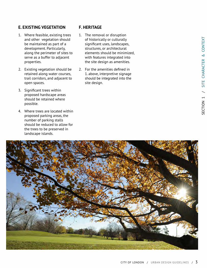
1. Where feasible, existing trees and other vegetation should be maintained as part of a development. Particularly, along the perimeter of sites to serve as a buffer to adjacent properties.
2. Existing vegetation should be retained along water courses, trail corridors, and adjacent to open spaces.
3. Significant trees within proposed hardscape areas should be retained where possible.
4. Where trees are located within proposed parking areas, the number of parking stalls should be reduced to allow for the trees to be preserved in landscape islands.
F. HERITAGE
1. The removal or disruption of historically or culturally significant uses, landscapes, structures, or architectural elements should be minimized, with features integrated into the site design as amenities.
2. For the amenities defined in 1. above, interpretive signage should be integrated into the site design.
4 / SITE ORGANISATION
SECT
ION
2
/
SIT
E O
RGAN
ISAT
ION
CITY OF LONDON / URBAN DESIGN GUIDELINES / 5
CONTENTS
A. Site LayoutB. BuildingsC. Multi-Building SitesD. ParkingE. Outdoor DisplaysF. Landscape Open SpaceG. Residential Amenity AreasH. Service & Loading AreasI. Open StorageJ. Storm Water Management
FacilitiesK. LightingL. Drive-ThrusM. UtilitiesN. Garbage & Recycling
SITE ORGANISATIONWHAT IS IT?
Site organisation includes the placement of buildings, parking and landscaping, all of which influence the character and feel of the public realm. The space between the road and the front of the building needs to be carefully designed and managed as it marks the transition from the public to the private realm.
The site organisation is heavily influenced by the characteristics of the site itself. These include, but are not limited to: topography; existing and potential routes (pedestrian, cycle, transit and vehicular); parks and open spaces;
WHAT ARE WE TRYING TO ACHIEVE?
• Buildings that are placed to create an active streetwall* that supports active transportation.
• Buildings located on sites to promote a healthy, vibrant, transit supportive and safe public realm.
• Landscaping that enhances the public realm experience for all users.
• Parking that provides for the appropriate functioning of a site, but does not degrade the overall experience for all users of the public realm.
• Green infrastructure developed as both functioning ecological features and as a community amenities.
• Site design that provides for safe and attractive connections between buildings.
natural features; view corridors; and site access. The overall site design needs to successfully integrate with the surrounding landforms while fostering a positive relationship with the built form in the neighbourhood. In fostering these relationships, it provides for a quality streetscape that enhances the routes which intersect with the site for pedestrians, cyclist, transit users and vehicles. Similar rules for site organisation help to create a coherent space in the public realm.
6 / SITE ORGANISATION
A. SITE LAYOUT
1. Buildings should be sited along the edge of the public right-of-way, as a main priority, to create a consistent street wall and to create a sense of enclosure.
2. Exceptions may be made to the above where a forecourt, public space or significant architectural feature is provided as a focal point.
3. The length and frontage of buildings along the street should be maximized as much as possible.
4. Breaks in the streetwall should be minimised to only accomodate necessary pedestrian walkways, vehicular accesses and significant view corridors.
5. Where other breaks are proposed, the streetwall should be maintained through a combination of landscape walls, decorative fencing, planting and/or public art features.
6. Where adjacent to a public open space, buildings should be sited along, and an active facade oriented to the open space.
7. Site design and built form location should reflect view corridors to the site, clear sight lines and potential focal point and gateway functions.
8. Buildings should be arranged to, first and foremost, frame the public streets and other public spaces.
9. Buildings should frame primary gateways located along the edge of the open space.
10. Building siting should relate to building locations on neighbouring sites, where appropriate, to create a consistent streetwall.
11. Infill development should have building setbacks that relate to the prevailing setback on the street.
12. Buildings located on the interior of sites should provide pedestrian connections to the public right-of-way.
13. Public, semi-public and private spaces should be clearly distinguishable.
14. Buildings should be situated and the site organised to capitalise on solar orientation and other green technologies.
15. The arrangement of building should take into account:
• Daylight and sunlight exposure;
• Wind and temperature;
• Minimising the impacts of shadows on open spaces and adjacent buildings;
• Relationships and access between various buildings and outdoor spaces;
• Scaling open areas to adjacent building heights;
• Site lines; and
• How all forms of transportation will navigate through the site.
16. Buildings should be oriented parallel to the public right-of-way to provide a consistent streetwall. Exceptions to the above may be permitted in existing areas where an angled site makes up the character of the neighbourhood.
17. Access to subdivisions and multi-unit residential developments should be from local or collector streets and not directly off of arterials, where practical.
Priority Sites*
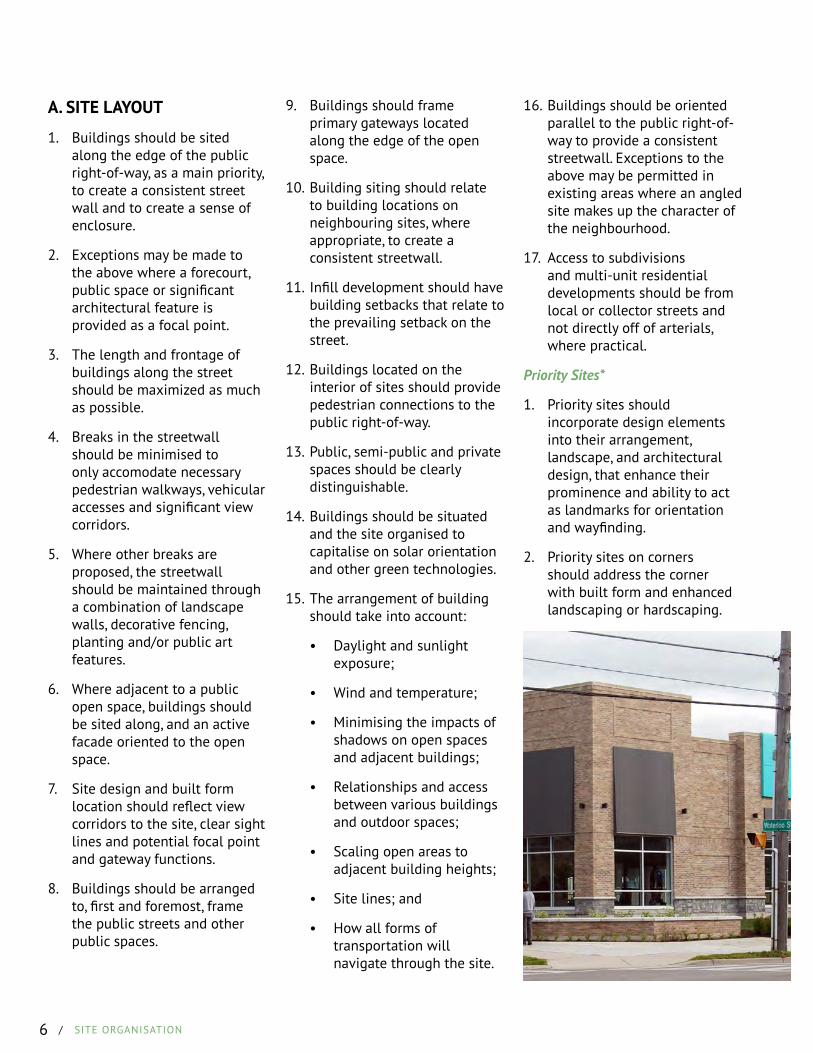
1. Priority sites should incorporate design elements into their arrangement, landscape, and architectural design, that enhance their prominence and ability to act as landmarks for orientation and wayfinding.
2. Priority sites on corners should address the corner with built form and enhanced landscaping or hardscaping.
SECT
ION
2
/
SIT
E O
RGAN
ISAT
ION
CITY OF LONDON / URBAN DESIGN GUIDELINES / 7
B. BUILDINGS
1. Building’s primary entrances, windows and associated outdoor activities should be oriented to the public realm.
2. Main entrances for all units should be visible from, and have direct access to streets and public open spaces.
3. Built form is to be designed with active frontages along the public right-of-way and public open spaces to provide natural surveillance* and street annotation.
4. Buildings should not face their loading or service areas onto existing or planned parks, public spaces or public rights-of-way.
C. MULTI-BUILDING SITES
1. Multiple buildings on the same site should demonstrate a functional relationship with one another and the public realm.
2. In multi-building sites, buildings should be arranged and sited, first and foremost to the public right-of-way and/or public spaces.
3. Buildings should also be arranged to frame open areas and relate to neighbouring buildings.
4. A coherent organising structure of private streets, buildings and pedestrian circulation in a grid pattern should be established.
5. In multiple-unit residential developments with multiple buildings, techniques such as varied separations, changes in orientation, articulation and floor plan of units should be considered to provide for individual unit privacy.
6. Within multiple building developments the architecture should be complementary in style, form, colour, material and roof line.
Mixed Use
1. Mixed-use development should aim to seperate uses vertically within buildings as opposed to horizontally between seperate buildings.
2. In mixed-use projects, ground floors should include active uses and be animated with entrances, vision glass and pedestrian amenities.
3. Separate entrances to residential and commercial portions of buildings should be clearly differentiated.
Site Character
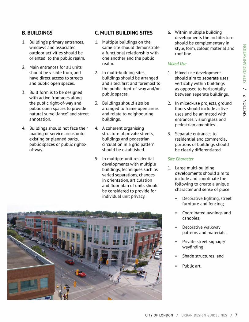
1. Large multi-building developments should aim to include and coordinate the following to create a unique character and sense of place:
• Decorative lighting, street furniture and fencing;
• Coordinated awnings and canopies;
• Decorative walkway patterns and materials;
• Private street signage/wayfinding;
• Shade structures; and
• Public art.
8 / SITE ORGANISATION
D. PARKING
General Provisions
1. Provide the minimum number of parking spaces required by the Zoning Bylaw to reduce excess parking.
2. Parking is generally not permitted between the building line and the public right-of-way.
3. Off-street parking for all uses other than single detached, semi-detached, duplex and townhouse dwellings, should be located underground or to the rear of the site (behind the building), in a structure or surface parking field.
4. Where the above is not possible, surface parking may be considered in the interior side yard, provided design measures are used to mitigate the parking field from the public realm.
5. Paving shall be reduced to the minimum necessary to accomplish site circulation and parking needs with other areas set aside for landscaping, or pedestrian amenity spaces.
Parking Area Entrances
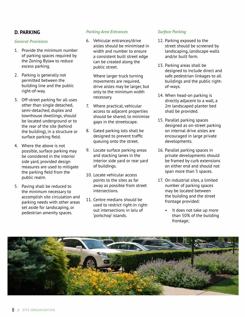
6. Vehicular entrances/drive aisles should be minimised in width and number to ensure a consistent built street edge can be created along the public street.
Where larger truck turning movements are required, drive aisles may be larger, but only to the minimum width necessary.
7. Where practical, vehicular access to adjacent properties should be shared, to minimise gaps in the streetscape.
8. Gated parking lots shall be designed to prevent traffic queuing onto the street.
9. Locate surface parking areas and stacking lanes in the interior side yard or rear yard of buildings.
10. Locate vehicular access points to the sites as far away as possible from street intersections.
11. Centre medians should be used to restrict right-in right-out intersections in leiu of ‘porkchop’ islands.
Surface Parking
12. Parking exposed to the street should be screened by landscaping, landscape walls and/or built form.
13. Parking areas shall be designed to include direct and safe pedestrian linkages to all buildings and the public right-of-ways.
14. When head-on parking is directly adjacent to a wall, a 2m landscaped planter bed shall be provided.
15. Parallel parking spaces designed as on-street parking on internal drive aisles are encouraged in large private developments.
16. Parallel parking spaces in private developments should be framed by curb extensions on either end and should not span more than 5 spaces.
17. On industrial sites, a limited number of parking spaces may be located between the building and the street frontage provided:
• It does not take up more than 50% of the building frontage;
SECT
ION
2
/
SIT
E O
RGAN
ISAT
ION
CITY OF LONDON / URBAN DESIGN GUIDELINES / 9
• Enhanced landscape screening is provided between the parking and the street; and
• There are no more than two rows of parking and one drive aisle.
Residential Parking
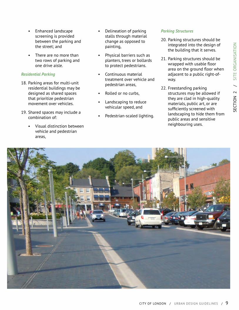
18. Parking areas for multi-unit residential buildings may be designed as shared spaces that prioritize pedestrian movement over vehicles.
19. Shared spaces may include a combination of:
• Visual distinction between vehicle and pedestrian areas,
• Delineation of parking stalls through material change as opposed to painting,
• Physical barriers such as planters, trees or bollards to protect pedestrians.
• Continuous material treatment over vehicle and pedestrian areas,
• Rolled or no curbs,
• Landscaping to reduce vehicular speed, and
• Pedestrian-scaled lighting.
Parking Structures
20. Parking structures should be integrated into the design of the building that it serves.
21. Parking structures should be wrapped with usable floor area on the ground floor when adjacent to a public right-of-way.
22. Freestanding parking structures may be allowed if they are clad in high-quality materials, public art, or are sufficiently screened with landscaping to hide them from public areas and sensitive neighbouring uses.
10 / SITE ORGANISATION
E. OUTDOOR DISPLAYS
1. Required parking and loading areas should not be used for outdoor displays.
2. Outdoor product display should be clearly defined and identifiable from other areas of the site through built features such as pergolas, or bordered by planter beds and/or landscaping.
3. Outdoor display areas should not be used for storage of none salable items.
4. Small outdoor display areas may be provided adjacent to walkways and building facades as long as they do not obstruct sight lines or pedestrian circulation.
Vehicle Displays
5. Vehicle displays should not be located closer to the street than the building setback.
6. A maximum of 2 rows of parking may be allowed between the building and the street for vehicle sales and display, provided it is designed as a forecourt with enhanced landscaping, special paving materials, no (or rolled) curbs and a dedicated pedestrian walkway.
7. Display pads for vehicle sales should be integrated into an overall landscape plan for the front of buildings. These should include hard surface, task lighting, and all season planting.
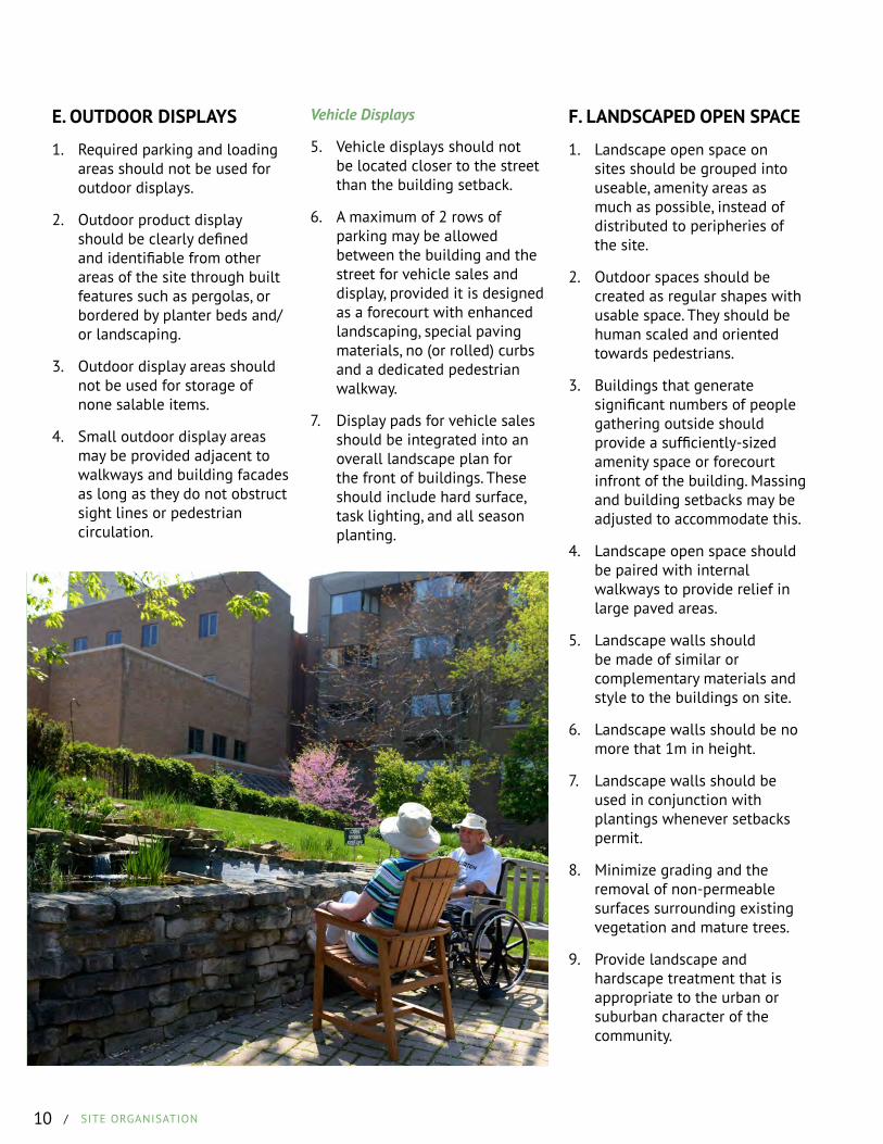
F. LANDSCAPED OPEN SPACE
1. Landscape open space on sites should be grouped into useable, amenity areas as much as possible, instead of distributed to peripheries of the site.
2. Outdoor spaces should be created as regular shapes with usable space. They should be human scaled and oriented towards pedestrians.
3. Buildings that generate significant numbers of people gathering outside should provide a sufficiently-sized amenity space or forecourt infront of the building. Massing and building setbacks may be adjusted to accommodate this.
4. Landscape open space should be paired with internal walkways to provide relief in large paved areas.
5. Landscape walls should be made of similar or complementary materials and style to the buildings on site.
6. Landscape walls should be no more that 1m in height.
7. Landscape walls should be used in conjunction with plantings whenever setbacks permit.
8. Minimize grading and the removal of non-permeable surfaces surrounding existing vegetation and mature trees.
9. Provide landscape and hardscape treatment that is appropriate to the urban or suburban character of the community.

SECT
ION
2
/
SIT
E O
RGAN
ISAT
ION
CITY OF LONDON / URBAN DESIGN GUIDELINES / 11
G. RESIDENTIAL AMENITY AREAS
1. Multi-unit residential developments should include common outdoor amenity areas for active and/or passive recreation.
2. Outdoor amenity spaces should have convenient access to residential units and the public street, and be centrally located.
3. Ground-floor residential units should have private open space directly adjacent to the unit in the form of a private backyard area, or a front patio area designed as a courtyard.
4. Private outdoor amenity spaces should be easily distinguishable from adjacent public areas.
I. OPEN STORAGE
1. Vehicle storage areas should meet the screening and landscape requirements for parking lots.
2. Outdoor storage should only be located in predefined areas.
Snow Storage Areas
3. Snow storage areas should be located behind buildings when possible.
4. Snow storage areas should be designed to not impact trees, landscaped areas, pedestrian circulation or views within the site.
H. SERVICE & LOADING AREAS
1. Designated areas should be provided and marked for service and delivery entrances, truck maneuvering, garbage and recycling, outdoor storage, outdoor work areas, and other similar uses.
2. Service and loading areas should be located behind buildings and use only as much space as is necessary for their function.
3. Service and loading areas should be screened from view of public areas and sensitive neighbouring uses.
4. Loading and delivery areas should not be located in an exterior side or front yard setback area.

12 / SITE ORGANISATION
J. STORMWATER MANAGEMENT FACILITIES
1. Stormwater management (SWM) ponds and channels should be considered a part of the greater open space network and designed as integral and significant features of the landscape.
2. SWM facilities should maintain the overall connectivity of a neighbourhood, and not pose a major pedestrian barrier.
3. Pedestrian walkways should be provided around ponds with large circumferences.
4. In addition to naturalized conditions, where appropriate, consider providing a hard edge to SWM facilities that can accommodate active
neighbourhood uses.
5. Ponds should be designed to not require safety fencing.
6. Public walking/cycling trails and pathways should encircle ponds and extend along stormwater channels.
7. When a compact built form is desirable, SWM facilities should be considered that are integrated with the built form and urban design.
8. SWM facilities should be designed and located with consideration for aesthetics.
9. SWM facilities should be integrated with open areas, parks, trails and tree retention areas, where they exist.
10. Low impact SWM should be incorporated into site design as much as possible, including permeable landscaped areas, bioswales and rain gardens.
11. SWM ponds should be visually and physically accessible from the public realm.
12. Retaining walls for SWM facilities should utilize natural or decorative materials, or be partially screened with landscaping to provide an aesthetic fit with the overall site design.
13. SWM facilities should be located and/or designed to fit the intended vision of the neighbourhood or the street.
SECT
ION
2
/
SIT
E O
RGAN
ISAT
ION
CITY OF LONDON / URBAN DESIGN GUIDELINES / 13
K. LIGHTING
1. All building entrances, and pedestrian areas should be lit with pedestrian-scaled lighting.
2. Lights provided in special event, and public gathering spaces may be required to be designed to structurally accommodate string lighting, banners and other seasonal elements.
3. Lighting should not spill over onto adjacent properties.
4. Light fixtures and associated hardware attached to building facades should be coordinated with the architectural style of the building.
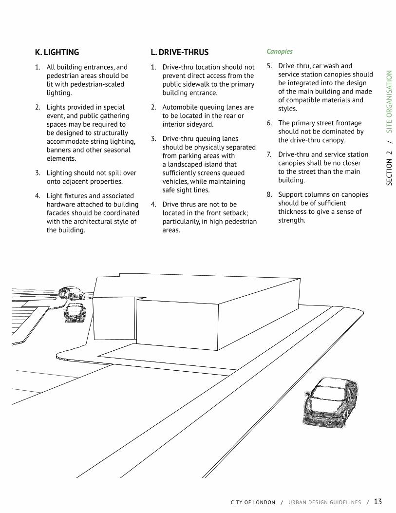
L. DRIVE-THRUS
1. Drive-thru location should not prevent direct access from the public sidewalk to the primary building entrance.
2. Automobile queuing lanes are to be located in the rear or interior sideyard.
3. Drive-thru queuing lanes should be physically separated from parking areas with a landscaped island that sufficiently screens queued vehicles, while maintaining safe sight lines.
4. Drive thrus are not to be located in the front setback; particularily, in high pedestrian areas.
Canopies
5. Drive-thru, car wash and service station canopies should be integrated into the design of the main building and made of compatible materials and styles.
6. The primary street frontage should not be dominated by the drive-thru canopy.
7. Drive-thru and service station canopies shall be no closer to the street than the main building.
8. Support columns on canopies should be of sufficient thickness to give a sense of strength.
14 / SITE ORGANISATION
M. UTILITIES
1. Transformers, gas and electrical meters, air conditioning units, cable and phone switch boxes and other mechanical equipment and utilities, should be located away from site entrances, front facades, intersections, public spaces; so as long as they are still accessible to service persons.
2. The items listed above should be visually integrated within building architecture, or mindfully located within landscape arrangements or built site features.
3. Landscaping should be provided to screen the above mentioned items from the public realm.
4. Utility lines should be located underground wherever possible.
5. Utility equipment should be located in a utility room within the building when possible.
6. Utilities within or adjacent to the public right-of-way should be aligned with the sidewalk.
7. Utilities should be grouped where possible.
8. Rooftop equipment should be located within a mechanical penthouse or adequately screened with building materials.
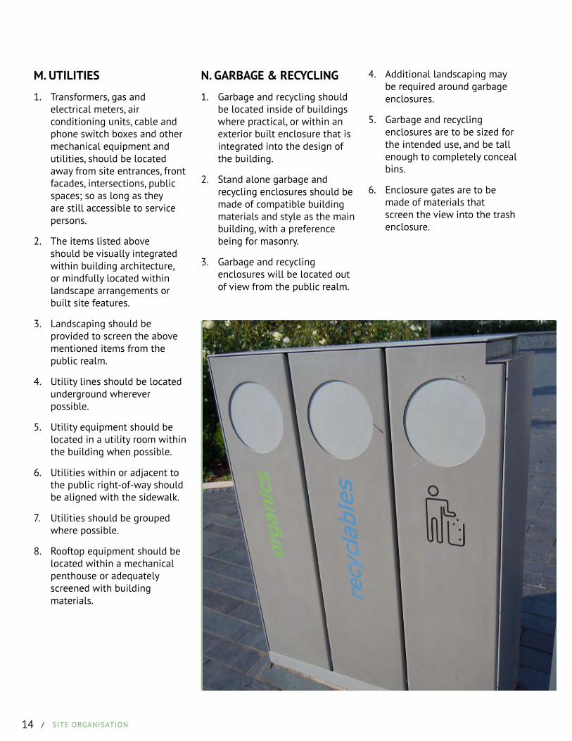
N. GARBAGE & RECYCLING
1. Garbage and recycling should be located inside of buildings where practical, or within an exterior built enclosure that is integrated into the design of the building.
2. Stand alone garbage and recycling enclosures should be made of compatible building materials and style as the main building, with a preference being for masonry.
3. Garbage and recycling enclosures will be located out of view from the public realm.
4. Additional landscaping may be required around garbage enclosures.
5. Garbage and recycling enclosures are to be sized for the intended use, and be tall enough to completely conceal bins.
6. Enclosure gates are to be made of materials that screen the view into the trash enclosure.
SECT
ION
3
/
BU
ILD
INGS
CITY OF LONDON / URBAN DESIGN GUIDELINES / 15
CONTENTS
A. Architectural ThemeB. ContextC. Massing & ScaleD. Tall BuildingsE. Priority Sites*F. ArticulationG. FacadesH. EntrancesI. FenestrationsJ. Blank WallsK. Garage DesignL. RoofsM. Facade MaterialsN. ColourO. Heritage Buildings
BUILDINGSWHAT IS IT?
The creation of good public spaces does not end at the boundary of the public right-of-way. The built form has an immense impact on the character of the space and its success in a neighbourhood. However, the built form’s end product (ie massing, rythmn and materiality) responds directly to the type of street environment/configuration that exists or is to be created over time.
The design of the built form can be categorised into three components: base, middle and top, while recognizing the importance of design creativity and flexibility.
WHAT ARE WE TRYING TO ACHIEVE?
• Allowance for design creativity that creates a high-quality, distinctive and memorable city image.
• Massing and scale of buildings that create a consistent urban form, at a human scale*, with its surrounding context.
• An integrated and supportive relationship between the private realm and the public realm.
• A city scape that carefully integrates natural and built features and is designed to be sustainable.
• Human-scale development with a built form that is supportive of all forms of active transportation.
• Building bases that positively contribute to the public realm, having active frontages* (transparent glass providing views to the interior), porches, awnings, lighting and high quality materials.
• Buildings that include a base, middle and top that architecturally complement one another by including windows and a material typology that is visually cohesive.
• Roofs and cornice treatments that enclose mechanical equipment and are appropriate to the scale and type of the building.
• Architecturally varied, and context appropriate, residential streetscapes.
Through each of these categories, massing and scale is very important to delivering an enhanced streetscape and pedestrian environment. To this end, the built form design should be at a human scale, one which integrates with the street environment and does not dominate the pedestrian experience and the overall streetscape. This guidance both generic and specfic, will assist with assessing planning and development applications.
16 / BUILDINGS
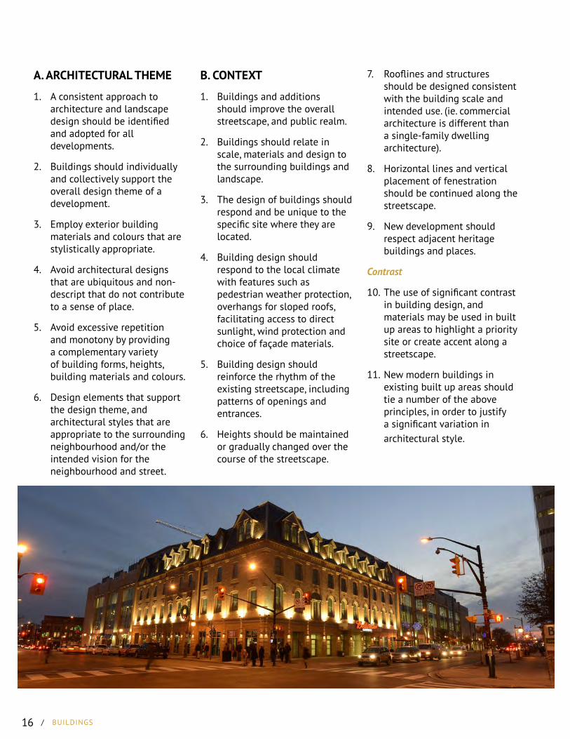
A. ARCHITECTURAL THEME
1. A consistent approach to architecture and landscape design should be identified and adopted for all developments.
2. Buildings should individually and collectively support the overall design theme of a development.
3. Employ exterior building materials and colours that are stylistically appropriate.
4. Avoid architectural designs that are ubiquitous and non-descript that do not contribute to a sense of place.
5. Avoid excessive repetition and monotony by providing a complementary variety of building forms, heights, building materials and colours.
6. Design elements that support the design theme, and architectural styles that are appropriate to the surrounding neighbourhood and/or the intended vision for the neighbourhood and street.
B. CONTEXT
1. Buildings and additions should improve the overall streetscape, and public realm.
2. Buildings should relate in scale, materials and design to the surrounding buildings and landscape.
3. The design of buildings should respond and be unique to the specific site where they are located.
4. Building design should respond to the local climate with features such as pedestrian weather protection, overhangs for sloped roofs, facilitating access to direct sunlight, wind protection and choice of façade materials.
5. Building design should reinforce the rhythm of the existing streetscape, including patterns of openings and entrances.
6. Heights should be maintained or gradually changed over the course of the streetscape.
7. Rooflines and structures should be designed consistent with the building scale and intended use. (ie. commercial architecture is different than a single-family dwelling architecture).
8. Horizontal lines and vertical placement of fenestration should be continued along the streetscape.
9. New development should respect adjacent heritage buildings and places.
Contrast
10. The use of significant contrast in building design, and materials may be used in built up areas to highlight a priority site or create accent along a streetscape.
11. New modern buildings in existing built up areas should tie a number of the above principles, in order to justify a significant variation in architectural style.
SECT
ION
3
/
BU
ILD
INGS
CITY OF LONDON / URBAN DESIGN GUIDELINES / 17
C. MASSING & SCALE
1. Arrange building height, massing and form to reinforce the character of the area.
2. Reinforce valued aspects of existing neighbourhood character unless planning policies identify a new character.
3. Mass new buildings in response to the scale of surrounding buildings unless doing otherwise helps to achieve neighbourhood character objectives.
4. Articulation and massing in a coherent architectural manner should be applied to distinguish the built form’s base*, middle* and top*.
5. Buildings that are over 3 storeys should incorporate architectural massing that avoids pitched roofs.
6. The built form shall avoid long expanses of pitched roofs.
Height
7. Relate building height to street width to create a strong sense of enclosure based on the character of the area.
8. Along all arterial roads, the minimum building height shall be two storeys or 7m (not including roof) to provide a human-scale relationship between the street width and building height.
9. Buildings that are 10 stories or less should provide articulation and massing that establishes the built form’s base, middle and top.
10. Buildings with a height of 11 stories or greater should incorporate a podium at the base of 3 to 4 stories in height.
11. Buildings that are more than 3 stories, or 10m taller than adjacent buildings should incorporate setbacks or stepbacks that reduce the apparent mass from the shorter building.
12. When siting multiple new residential unit types on a street, appropriate transitions should be considered to avoid more than a two-storey difference in height.
18 / BUILDINGS
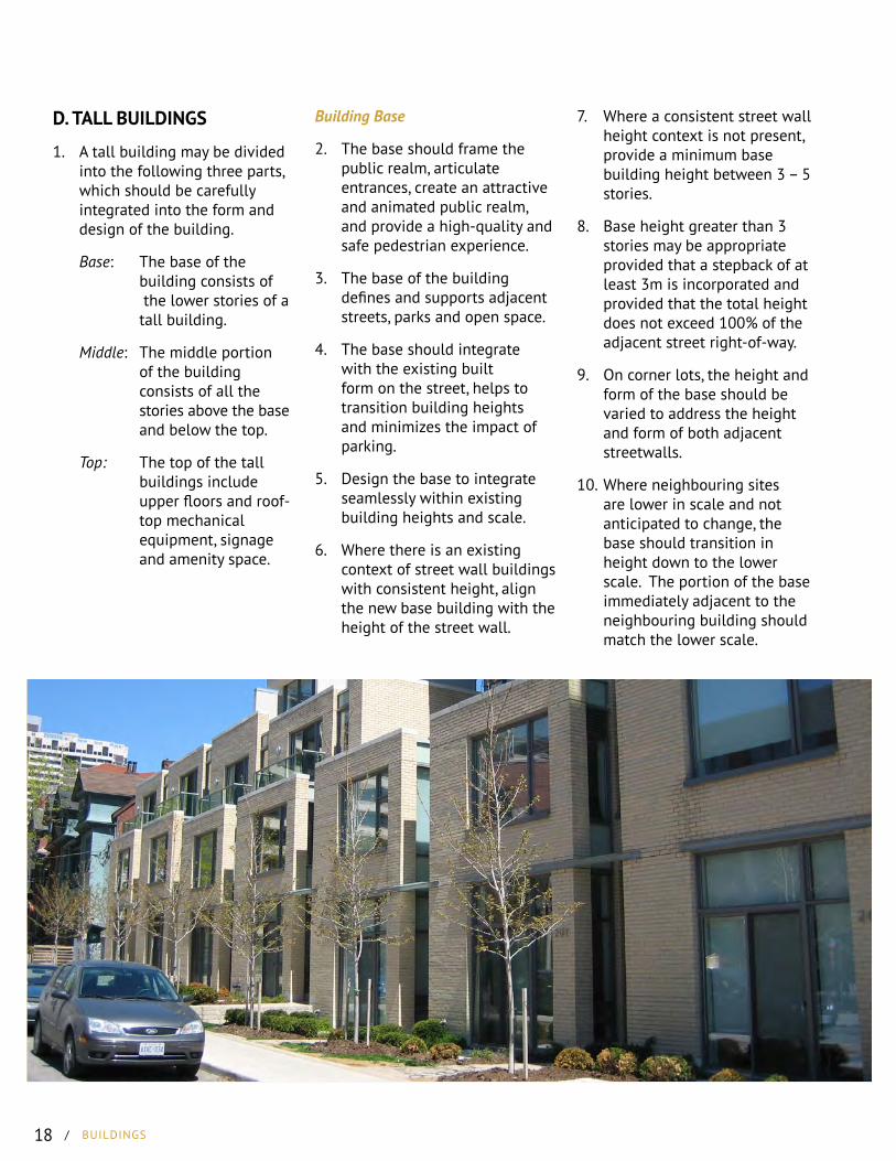
D. TALL BUILDINGS
1. A tall building may be divided into the following three parts, which should be carefully integrated into the form and design of the building.
Base: The base of the building consists of the lower stories of a tall building.
Middle: The middle portion of the building consists of all the stories above the base and below the top.
Top: The top of the tall buildings include upper floors and roof- top mechanical equipment, signage and amenity space.
Building Base
2. The base should frame the public realm, articulate entrances, create an attractive and animated public realm, and provide a high-quality and safe pedestrian experience.
3. The base of the building defines and supports adjacent streets, parks and open space.
4. The base should integrate with the existing built form on the street, helps to transition building heights and minimizes the impact of parking.
5. Design the base to integrate seamlessly within existing building heights and scale.
6. Where there is an existing context of street wall buildings with consistent height, align the new base building with the height of the street wall.
7. Where a consistent street wall height context is not present, provide a minimum base building height between 3 – 5 stories.
8. Base height greater than 3 stories may be appropriate provided that a stepback of at least 3m is incorporated and provided that the total height does not exceed 100% of the adjacent street right-of-way.
9. On corner lots, the height and form of the base should be varied to address the height and form of both adjacent streetwalls.
10. Where neighbouring sites are lower in scale and not anticipated to change, the base should transition in height down to the lower scale. The portion of the base immediately adjacent to the neighbouring building should match the lower scale.
SECT
ION
3
/
BU
ILD
INGS
CITY OF LONDON / URBAN DESIGN GUIDELINES / 19
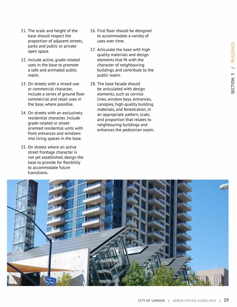
11. The scale and height of the base should respect the proportion of adjacent streets, parks and public or private open space.
12. Include active, grade-related uses in the base to promote a safe and animated public realm.
13. On streets with a mixed-use or commercial character, include a series of ground floor commercial and retail uses in the base, where possible.
14. On streets with an exclusively residential character, include grade-related or street-oriented residential units with front entrances and windows into living spaces in the base.
15. On streets where an active street frontage character is not yet established, design the base to provide for flexibility to accommodate future transitions.
16. First floor should be designed to accommodate a variety of uses over time.
17. Articulate the base with high quality materials and design elements that fit with the character of neighbouring buildings and contribute to the public realm.
18. The base facade should be articulated with design elements, such as cornice lines, window bays, entrances, canopies, high-quality building materials, and fenestration, in an appropriate pattern, scale, and proportion that relates to neighbouring buildings and enhances the pedestrian realm.
20 / BUILDINGS
Building Middle
19. Location, scale, floor plate size, orientation and separation distances of the middle should not negatively impact sky views, privacy wind, sunlight and shadows.
20. The floorplate size for any portion above the podium should be a maximum area of 1000 m2.
21. The tower floor plate should be located on the base in a way that minimizes adverse shadow and sky view impacts, allows for maximized natural light and that visually reduces the overall scale of the building.
22. The middle of buildings should be setback from streets, parks, open space, and neighbouring properties to reduce visual and physical impacts of the tower.
23. Step back the middle, including balconies, 3m or greater from the edge of the base, along all street, park, and open space frontages
24. Middle stepbacks greater than 3m are encouraged, especially in site that contain or are adjacent to heritage properties.
25. Provide separation distance between towers on the same site of 25m or greater.
26. Where taller buildings or larger middle floor plates are proposed, provide greater setbacks and separation distances in proportion to building size and height.
27. Apply creative building designs, such as offset towers/views, non-parallel walls, tapering or curved tower forms where possible, to increase actual or perceived tower separation distances.
28. Orient the middle of buildings to improve building energy performance, natural ventilation, and daylighting, provided that access to sky view is maintained and that wind and shadow impacts are minimized.
29. Variation in the design and articulation of each façade is encouraged to provide visual interest.
30. When multiple towers are proposed, vary the tower heights to create visual interest, mitigate wind and improve access to sunlight and sky views.
31. Articulation of the middle with high-quality materials and finishes is encouraged to promote attractive building facades.
Building Top
32. The top should be designed to create an integrated and attractive finish to the tall building.
33. Design the top of tall buildings to contribute to the quality and character of the city skyline
34. Integrate roof-top mechanical or telecommunications equipment, signage, and amenity space, where appropriate, into the design and massing of the upper floors of the tall building.
35. Where appropriate opportunities to taper thte building are to be considered on the upper floors/top of the building.

SECT
ION
3
/
BU
ILD
INGS
CITY OF LONDON / URBAN DESIGN GUIDELINES / 21
E. PRIORITY SITES*
1. Buildings at T-intersections should be sited and designed to terminate the view. This inlcudes, not locating service/loading areas, garages and/or non-descript architetural features, such as a blank walls. The above is an illustrative list only.
2. Buildings located at a community gateway or at the terminus of a vista should have a high level of architectural design.
Corner Sites
3. Buildings on corner sites shall be located at the setback lines of each street frontage. This does not preclude angled or sculpted building corners.
4. The same level of architectural detail should be provided on both facades for buildings located on corner sites.
5. Buildings on corner sites shall have a consistent parapet that fronts on both streets when appropriate to the architectural style of the building.
6. Where a forecourt is proposed the building may be setback to appropriate accommodate for the integration of the forecourt with the building.
F. ARTICULATION
1. The base, middle and top of buildings should be clearly defined through materials, scale and/or architectural details.
2. Building façades should present a unified appearance, with complementary materials and colours.
3. The use of oversized, or disproportionate, architectural elements is discouraged.
4. The ground floor of a building should be architecturally different from the above floors with an emphasis on human scale and active elements.
5. Entrances should be highlighted with built form, architectural detail or through other means, such as canopies, projections, or material change.
6. Upper floors should be horizontally articulated through material details, masonry detail, architectural trim or other subtle means.
7. Vertical articulation should be incorporated into wide facades to break up the visual mass of the building.
8. Variety in building height and floor levels, as well as facade offsets, recesses and projections should be incorporated to break up large monotonous facades.
9. Changes in height should be proportionate to the scale of the building.
10. Recesses, projections and building articulation should be proportionate to the size and scale of the facade in question.
11. Large building facades should be broken down into smaller facade portions to create proportions that are more human in scale.
12. Building elements should be designed to account for the various vantage points they may be viewed from.
13. Changes in material and in the rhythm of fenestration can be used to define different building masses.

22 / BUILDINGS
G. FACADES
1. Facades should create visual interest and harmony through a combination of entrances, windows, architectural details, projections, and recesses.
2. The level of detail on building facades should generally relate to the scale at which they are viewed.
3. All sides of a building shall be architecturally designed to be consistent with regard to style, materials, colours, and details.
4. Buildings should have a coherent architectural composition on all elevations
5. Buildings located on corner lots, should have the same level of detail integrated across both exposed facades.
6. Stairways, fences, garbage enclosures and other accessory elements should be designed as integral parts of the architecture.
7. Where multiple building entrances exist, a hierarchy should be established.
8. Use external lighting to enhance the design.
General Residential Provisions
9. Front and wraparound porches are strongly encouraged.
10. Garages should be recessed from the main building mass, or at a minimum, on the same setback as the main building.
11. Rear garages are strongly encouraged.
12. New residential developments should create a variety of dwelling types.
13. Where residential units are located adjacent to a public park or open space, they should front that open space.
14. Dwellings of similar models should not be located on adjacent lots.
15. Multi-unit row buildings should incorporate varying roof heights and wall planes to differentiate units.
Residential Façade
16. Brick, masonry, hardy board and/or wood siding are the preferred building materials for residential buildings.
17. Changes in building materials should be linked to a wall setback, projection or corner.
18. The proportion of roofs, facade planes and windows should maintain the rhythm on the street.
SECT
ION
3
/
BU
ILD
INGS
CITY OF LONDON / URBAN DESIGN GUIDELINES / 23
19. End units in multi-unit residential development should have windows on their exposed side facades.
20. Ground floor units in multi-unit developments should have direct entrances along the street frontage, where possible.
21. Townhouse rows with more than 4 units should be articulated to emphasize/differentiate individual units.
26. Canopies/awnings should not block visibility of storefronts, hide architectural details or windows, or impede street lights.
27. Large commercial buildings with multiple tenant or uses, should be designed to provide individual storefronts and entrances for each on the facades of the building.
28. Ground floor facaded should target a minimum of 50% glazing on their primary facades.
29. Upper floors, and facade portions above the ground floor height, should provide a minimum of 25% glazing.
Commercial and Office
22. Signage and corporate branding elements should be integrated within the building’s architectural design.
23. Weather protection should be provided along building facades, specifically over entrances.
24. Street-facing façades should incorporate pedestrian scale lighting.
25. All canopies should complement the architectural style of the building it is affixed to.
24 / BUILDINGS
Storefronts
30. Storefronts should be compatible with the entire façade character.
31. Vertical lines, materials and architectural detail should tie the ground floor and upper floors of buildings together.
32. Storefront windows should occupy the entire height between the base and the canopy area.
33. Storefronts within the same building should maintain a consistent rhythm of window and door location and height, kickboard height, and vertical awning and signage placement.
34. Buildings with more than 4 individual storefronts may vary the above elements, but should maintain a unified façade design.
H. ENTRANCES
1. Main entrances should be the dominant features of front facades.
2. Buildings are to have their principal entrances oriented to the public street.
3. Ground floor entrances facing public streets, public open spaces or primary internal streets should be functional and provide public access into the building.
4. Weather protection should be provided at all building entrances.
5. Buildings should provide at least one entrance that does not require passage though a parking lot from the public sidewalk.
6. For townhouses (attached), the main entrance to each unit shall be accessed directly from, and face, the street.
I. FENESTRATIONS
1. Active interior uses with the potential for vision glass windows should be located along street-facing facades to promote an animated streetscape.
2. Windows should be aligned with each other both horizontally and vertically.
3. Window styles should be compatible with the building’s architectural style.
4. Spandrel glass and lifestyle panels are strongly discouraged, specifically where they are visible from the public street.
5. Dark and/or reflective glass is strongly discouraged.
SECT
ION
3
/
BU
ILD
INGS
CITY OF LONDON / URBAN DESIGN GUIDELINES / 25
6. Windows should be defined within the building facade by recessing them from the building wall, using trim, projecting window sills or lintels.
7. Upper storey fenestration should be symmetrical, equally spaced, or respond to the facade portions they are located on.
8. Windows should be aligned vertically within the same storey.
9. Clerestorey windows are encouraged in industrial developments and along commercial facades were no other fenestration is possible due to internal layout.
K. GARAGE DESIGN
1. Townhouses with front garages should have building entrances located at the front setback line.
2. Carports and detached garage buildings shall be designed as an integral part of the development. They shall be designed similar to and complement the architecture of the main buildings.
3. Garage doors shall not take up more than 50% of the front facades of residential units.
4. The roof line of front garages should compliment the main roof line of the building.
5. Where garages must project in front of the main building mass, a covered porch or a living space on top of the garage should be provided.
6. Side entry garages should incorporate windows or other architectural detail along the street facing wall.
J. BLANK WALLS
1. The visual bulk of blank walls should be mitigated though the introduction of a combination of the following: building articulation; penetrable building materials; murals; material changes; display case windows; trellis canopy structures, and/or clerestorey lighting.
2. The area in front of blank walls should be landscaped to soften its impact.
3. Projections, recesses, arcades, awnings, colour and texture should be incorporated into unglazed walls to reduce their visual bulk.

26 / BUILDINGS
L. ROOFS
1. Roofs should be proportionate to the rest of the building, including the height, mass and other architectural features.
2. Where facade walls meet a flat roof, a cornice and parapet design should be utilised.
3. Mansard roofs should not be used for buildings less than 4 stories tall.
4. Sloped roofs should not be wider than 20m without providing variation in articulation.
5. Architectural details are encouraged on roofs, such as gables, dormers, cupolas and clock towers, where they are appropriate to the scale and style of architecture.
6. Townhouse buildings should utilize variations in the roof forms to emphasize individual units.
7. Residential streetscape should incorporate variations in roof style and articulation to provide interest.
M. FACADE MATERIALS
1. Building materials and colours should fit with the architectural style. Industrial buildings may use less decorative materials for non-street frontages, such as concrete and metal siding, as long as the front façade material is wrapped around to the sides.
2. Façade material and colour changes should generally relate to changes in plane, floor plate, and mass.
3. Materials such as brick and stone should be left in their natural colours.
4. Simulated materials may be used if determined to have an authentic appearance.
5. Metal siding, decorative concrete, mirrored and reflective materials, stucco, and similar materials may be used in combination with other materials.
SECT
ION
3
/
BU
ILD
INGS
CITY OF LONDON / URBAN DESIGN GUIDELINES / 27
N. COLOUR
1. Architectural colour palletes shall be selected to fit within the context of the surrounding neighbourhood.
2. Colour pallets and patterns associated with a particular corporate identity should not dominate the appearance of the building.
3. Strongly contrasting, intense, bright, and/or day-glow colours shall be used for accent only, and may be used on a maximum of 10% of façade area.
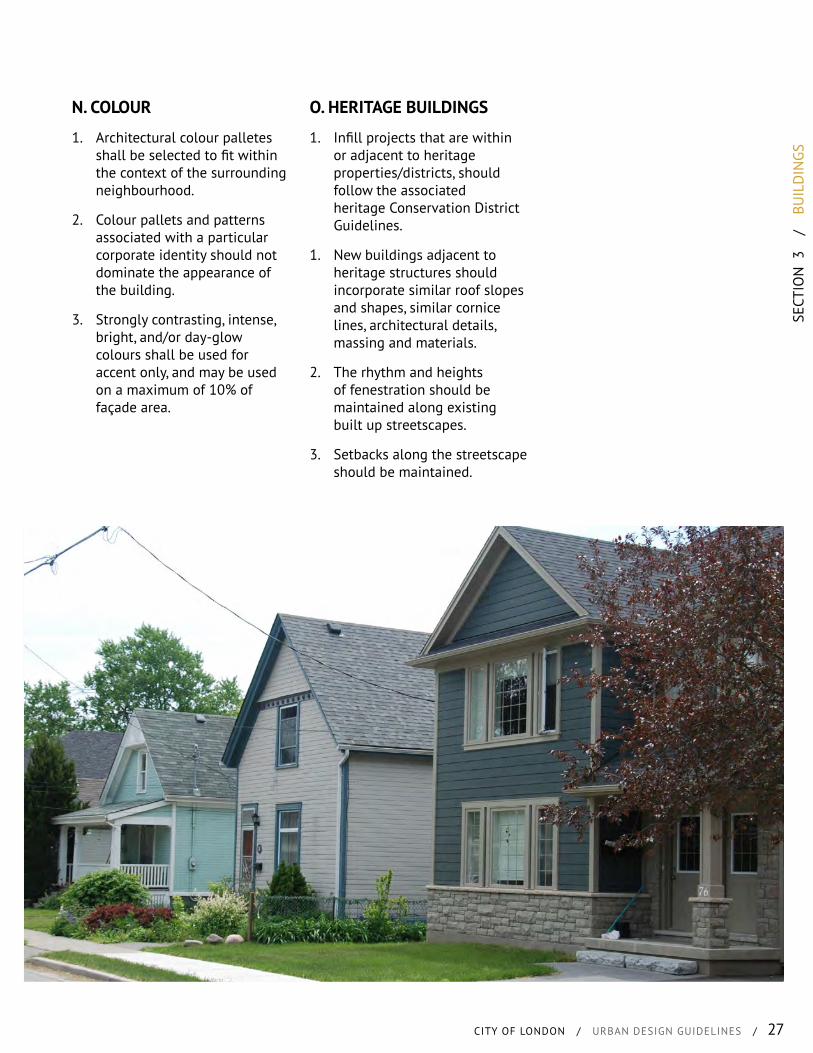
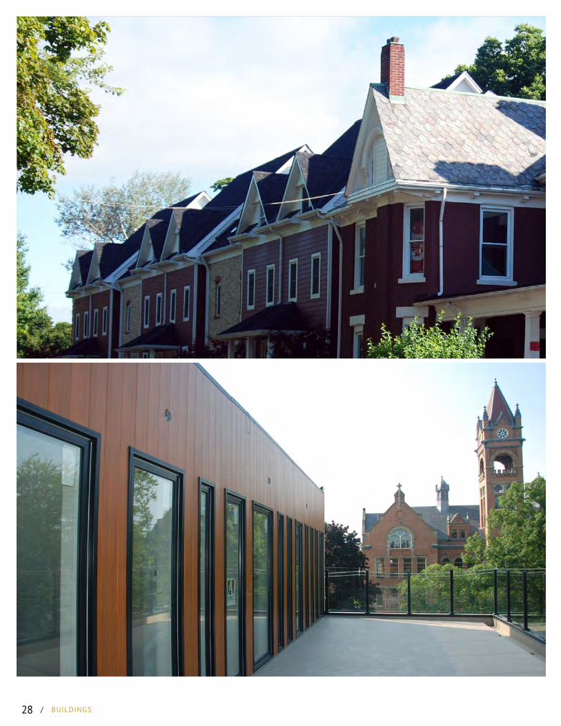
O. HERITAGE BUILDINGS
1. Infill projects that are within or adjacent to heritage properties/districts, should follow the associated heritage Conservation District Guidelines.
1. New buildings adjacent to heritage structures should incorporate similar roof slopes and shapes, similar cornice lines, architectural details, massing and materials.
2. The rhythm and heights of fenestration should be maintained along existing built up streetscapes.
3. Setbacks along the streetscape should be maintained.
28 / BUILDINGS

SECT
ION
4
/
CO
NN
ECTI
VITY
CITY OF LONDON / URBAN DESIGN GUIDELINES / 29
CONTENTS
A. On-Site CirculationB. Walkway DesignC. Pedestrian AmenitiesD. Bicycle Circulation &
ParkingE. Transit CirculationF. WayfindingG. Community Circulation
CONNECTIVITYWHAT IS IT?
An integrated network of active transportation options and supportive development patterns have many benefits directly affecting the health of the community, reducing infrastructure costs, reducing sprawl, as well as helping to reduce traffic congestion, and air pollution.
The following active transportation oriented requirements are intended to elevate the needs of pedestrians, cyclists, and mass transit to a state of balance with automobile use as a mode of mobility
This is in recognition that all means of mobility are equally important, and therefore need to be given equal consideration in the planning, design and construction of new developments. Primary consideration is the movement of people, by all modes, and the provision of the necessary infrastructure to achieve this.
Walkable environments tie a community together on a visual, physical and social level, enhancing the image of the community while promoting healthy lifestyles. Like so many other aspects of placemaking, the creation of walkable communities requires the integration and close coordination of elements within both the public and private domains.
WHAT ARE WE TRYING TO ACHIEVE?
• Enable the efficient movement of people and goods, across the city and region.
• Encourage the use of different modes of mobility, by providing realistic and efficient walking, cycling, public transit and automobile options.
• Support the location and function of land uses in a way that is sustainable, transit supportive, and pedestrian oriented.
• Improve the connectivity of the overall system in order to reduce travel distances and encourage walking and cycling.
• Establish key social, pedestrian and public transit connections between new development and the existing fabric of the city.
• Identify key open spaces and illustrate how these are related to the community in terms of access and connectivity.
• Identify key streetscapes and coordinate the conceptual design and location of landscaping and built forms.
• Identify where linkages will be established to support pedestrian, automobile, cycling movements throughout the community.
• Identify, create and integrate views and vistas, capitalizing upon these opportunities by offering pedestrian, cycling and automobile access to these points.
/ CONNECTIVITY30
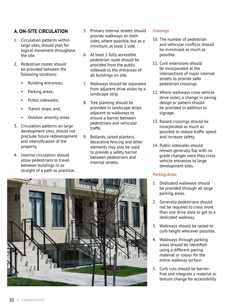
A. ON-SITE CIRCULATION
1. Circulation patterns within large sites, should plan for logical movement throughout the site.
2. Pedestrian routes should be provided between the following locations:
• Building entrances;
• Parking areas;
• Public sidewalks;
• Transit stops; and,
• Outdoor amenity areas.
3. Circulation patterns on large development sites, should not preclude future redevelopment and intensification of the property.
4. Internal circulation should allow pedestrians to travel between buildings in as straight of a path as practical.
5. Primary internal streets should provide walkways on both sides, where possible, but as a minimum, at least 1 side.
6. At least 1 fully accessible pedestrian route should be provided from the public sidewalk to the entrances of all buildings on site.
7. Walkways should be separated from adjacent drive aisles by a landscape strip.
8. Tree planting should be provided in landscape strips adjacent to walkways to ensure a barrier between pedestrians and vehicular traffic.
9. Bollards, raised planters, decorative fencing and other elements may also be used to provide a safety barrier between pedestrians and internal streets.
Crossings
10. The number of pedestrian and vehicular conflicts should be minimized as much as possible.
11. Curb extensions should be incorporated at the intersections of major internal streets to provide safer pedestrian crossings.
12. Where walkways cross vehicle drive aisles, a change in paving design or pattern should be provided in addition to signage.
13. Raised crossings should be incorporated as much as possible to reduce traffic speed and increase safety.
14. Public sidewalks should remain generally flat with no grade changes were they cross vehicle entrances to large development sites.
Parking Areas
1. Dedicated walkways should be provided through all large parking areas.
2. Generally pedestrians should not be required to cross more than one drive aisle to get to a dedicated walkway.
3. Walkways should be raised to curb height wherever possible.
4. Walkways through parking areas should be identified using a different paving material or colour for the entire walkway surface.
5. Curb cuts should be barrier-free and integrate a material or texture change for accessibility.

SECT
ION
4
/
CO
NN
ECTI
VITY
CITY OF LONDON / URBAN DESIGN GUIDELINES / 31
B. WALKWAY DESIGN
1. Walkways should be designed to be safe, convenient and comfortable.
2. Walkways should maintain a minimum 2m wide surface that is clear of obstacles.
3. Pedestrian routes should not meander around built form, landscape elements or furniture.
4. Developments that cater to children, the elderly or persons with temporary or longterm disabilities should provide walkways that are a minimum 3m wide.
C. PEDESTRIAN AMENITIES
1. Pedestrian amenties may include:
• Benches and seating walls
• Garbage and recycling receptacles;
• Shade and bicycle structures,
• Raised planters and decorative bollards and fencing;
• Water fountains; and,
• Way-finding signage and pedestrian-scale bulletin or information boards.
2. Pedestrian amenities such as street furniture, signage and shade structures should be coordinated and selected based on the intended use and pedestrian traffic volumes on the site.
3. Pedestrian amenities should be provided at building entrances, within gathering and amenity areas on site and adjancet to primary pedestrian entrances into the site.
5. Walkways should be made of slip-resistant, hard materials such as concrete, patterned concrete or patterned asphalt.
6. Walkways should be designed to be distinguishable from vehicular areas, raised to curb height or through pavement material change or texture.
7. Accessible design should be included where necessary including textured edges, ramps, railings, and painted lines.
8. Where stairs or ramps are required within a development, signage and safety railings should be provided.
/ CONNECTIVITY32
D. BICYCLE CIRCULATION & PARKING
1. Bicycle access and parking should be integrated into large commercial and residential developments.
2. Sewer grates should be located and designed to provide safe crossing.
3. Where practical, bicycle ramps should be provided on outdoor staircases.
4. Bicycle parking should be located in a highly visible location to deter theft and vandalism.
5. Bicycle parking should be provided within close proximity to the primary bicycle site entrance, as well as close to the main building entrances.
6. Weather-protected bicycle parking is strongly encouraged.
7. Bicycle racks should allow for both the frame and wheels to be locked.
8. Multiple-unit residential developments should provide long-term, inside bicycle storage.
E. TRANSIT CIRCULATION
1. Transit stops should be located close to building entrances, with a convenient pedestrian route to those entrances.
2. Transit stops should include weather protection, seating, and wayfinding signage.
3. A clear and accessible walkway should be provided from transit stops into the site and to main building entrances.
4. Site development should consider intermodal connections between the bicycle and pedestrian networks and the transit network.
F. WAYFINDING
1. A wayfinding system should be incorporated into the design of large sites, and may include signage, pavement markings, landmark features, kiosks and/or information boards.
2. An identifiable hierarchy of internal streets should be incorporated into the site design.
3. Where possible, wayfinding signage should be universally recognisable and use symbols and graphics in lieu of written text.
4. Wayfinding components should be compliant with Accessibility for Ontarians with Disabilities Act (AODA).
5. Signage, landscape elements and landmarks that are a part of a wayfinding system should not obstruct views to important or significant site features.
6. Wayfinding signage should be included for all connecting points from the subject site to the larger mobility network, including trails, transit stops and walkways.
7. Wayfinding signage and other elements should be coordinated and contribute to the character of the development.
8. Signage and associated elements should be made of durable and long-lasting materials that will stand up to harsh weather and require minimal maintenance.
9. The wayfinding system should be as visually and physically accessible as possible for children, the elderly and persons with physical disabilities.
SECT
ION
4
/
CO
NN
ECTI
VITY
CITY OF LONDON / URBAN DESIGN GUIDELINES / 33
G. COMMUNITY CIRCULATION
1. Multi-unit residential developments and subdivisions should provide street and pedestrian connections to neighbouring developments.
2. Subdivisions and multi-unit residential developments should delineate safe routes for students to walk to schools or common bus stops.
3. Walkways and other similar mid-block connections should not be substituted for a street connection to major focal points or mobility connections within a subdivision/neighbourhood.
4. A grid or modified grid network of streets is to be used in a subdivision to promote/support a variety of mobility modes within a neighbourhood.
Trails
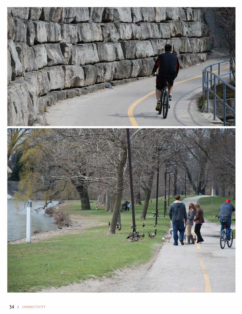
5. Connections should be made to the larger trail network where one exists surrounding a proposed development.
6. New trail connections should be incorporated into the site where the proposal involved a significant point of interest such as a public building, institutional use, significant natural or cultural feature of use, and/or open space intended for public use.
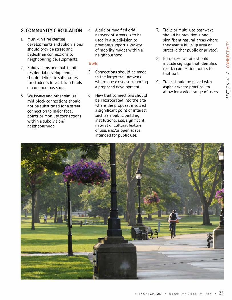
7. Trails or multi-use pathways should be provided along significant natural areas where they abut a built-up area or street (either public or private).
8. Entrances to trails should include signage that identifies nearby connection points to that trail.
9. Trails should be paved with asphalt where practical, to allow for a wide range of users.
/ CONNECTIVITY34
SECT
ION
5
/
SU
BDIV
ISIO
NS
CITY OF LONDON / URBAN DESIGN GUIDELINES / 35
WHAT IS IT?
Subdivisions is the process by which a neighbourhood is created. By dividing land and creating streets, parks, buildings and other features of the community this process shapes a city and its future.
Neighbourhoods consist of streets, buildings, public spaces, recreation, opportunities, access to transit, shopping, different housing types and places to work.
Residents in the City of London live in neighbourhoods and spend the majority of time connecting with people and places in these areas. Given this, it is imperative that when we construct a neighbourhood we ensure that it is designed to provide a healthy and vibrant place to live.
WHAT ARE WE TRYING TO ACHIEVE?
• A connected network of streets and blocks.
• Integrate a hierarchy of street types to ensure efficient pedestrian, bicycle, transit, truck and car flows and pleasant neighbourhood streetscapes.
• Land uses should be planned so as to reinforce the roles of different street types, in different parts of the city.
• Ensure a cohesive mobility network and the longer term economic viability for neighbourhoods.
• Designing with a compatible mix of land uses, reducing visual and physical homogeneity in communities and neighbourhoods.
• Livable and sustainable communities that support smart growth and placemaking.
• A range of housing opportunities, intensities and tenures.
• Create physical and visual focal points within communities.
• Use natural topography to provide a unique identity for a neighbourhood.
• Ensure the design of a neighbourhood is adaptable to societal changes over time.
CONTENTS
A. LayoutB. Street PatternC. Block ConfigurationD. Lot ConfigurationE. Parks & Open Space
LocationsF. Community BoundariesG. Community EntriesH. Focal Points I. BridgesJ. Mixed Development
SUBDIVISIONS
/ SUBDIVISIONS36
A. LAYOUT
1. Layout an interconnected pattern of streets based on a fine grid, or modified grid.
2. Locate buildings, open spaces, pedestrian and vehicle circulation networks in logical and strategic locations.
3. Locate, size and orient streets, blocks and individual lots to facilitate a mix of housing types.
4. Incorporate a mix of Intensities within subdivisions and multi-unit residential developments.
5. Higher intensity uses should be located adjacent to higher order streets, as well as community amenities, transit stops and public open spaces.
6. Various intensities and forms should be located within a development or subdivision to take advantage of, and be sympathetic to, existing adjacent properties and amenities.
7. Subdivisions should be laid out to not require noise attenuation fencing, berms or walls.
8. Subdivision should be designed and organised to capture the benefits of passive solar orientation and other green features.
B. STREET PATTERN
1. Streets should generally be straight lines to allow for continuous sight lines.
2. Curved streets may be used to create a unique community character or respond to natural features. Curved streets should maintain the same number of intersections as a grid layout.
3. Streets should be extended through adjacent developments.
4. Streets should extend to the community boundary in anticipation of future connections.
5. The street pattern should provide visual and physical connections to watercourses, natural features and open spaces by:
• Locating a single-loaded street that fronts on to these spaces; or,
• Terminating streets in alignment with these open spaces to allow for open views and access.
6. Crescent streets may be incorporated into a grid pattern street network where a 4-way or T-intersection is not possible due to a physical barrier.
Laneways
7. Rear laneways are encouraged to create pedestrian-oriented streets, that minimise the presence of vehicles in the streetscape.
8. Laneways should be provided for townhouses and row houses, where driveways and garages account for more than 50% of the lot width.
9. Laneways should be provided to allow for buildings to front onto public open spaces, water courses and natural features in lieu of backing on to these important spaces.
10. Where rear garages and driveways are proposed, the depth of lots may be increased to accommodate sufficient rear yard amenity space.
Cul-de-sacs & Dead Ends
11. Dead-end streets and cul-de-sacs are not supported.
12. Dead-end streets may be permitted as an interim condition until an adjacent property, and its street network, is developed.
13. Cul-de-sacs may be permitted if natural features, topography, servicing or other physical constraints prevent a through connection.
14. A pedestrian connection should be provided through the end of all cul-de-sacs to connect to adjacent development.
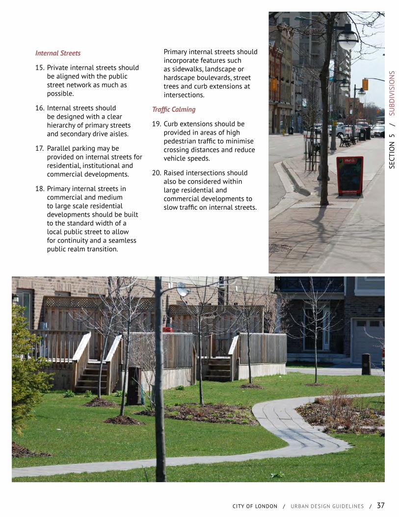
SECT
ION
5
/
SU
BDIV
ISIO
NS
CITY OF LONDON / URBAN DESIGN GUIDELINES / 37
Internal Streets
15. Private internal streets should be aligned with the public street network as much as possible.
16. Internal streets should be designed with a clear hierarchy of primary streets and secondary drive aisles.
17. Parallel parking may be provided on internal streets for residential, institutional and commercial developments.
18. Primary internal streets in commercial and medium to large scale residential developments should be built to the standard width of a local public street to allow for continuity and a seamless public realm transition.
Primary internal streets should incorporate features such as sidewalks, landscape or hardscape boulevards, street trees and curb extensions at intersections.
Traffic Calming
19. Curb extensions should be provided in areas of high pedestrian traffic to minimise crossing distances and reduce vehicle speeds.
20. Raised intersections should also be considered within large residential and commercial developments to slow traffic on internal streets.

/ SUBDIVISIONS38
C. BLOCK CONFIGURATION
1. Blocks should generally be regular rectangular shapes, but may vary from this to respond to existing natural features, adjacent development or to create unique focal points.
2. Generally blocks should be maximum 100m to 200m in length.
3. Blocks should have a maximum perimeter of 500m.
4. Blocks may have a larger perimeter if a publicly-accessible pedestrian connection is provided at the mid point of block. This connection does not include a rear or side lotted walkway.
5. Industrial blocks may be larger in size, but incorporate internal streets and pedestrian connections.
6. Access to subdivisions and multi-unit residential developments should be from neighbourhood connectors and neighbourhood streets and not directly off of higher order streets, where practical.
7. Blocks should be sized and oriented to allow for convenient access to new and proposed transit stops and station locations.
8. Subdivisions should provide multiple vehicle accesses to the surrounding street network.
9. Where it is not possible to connect streets to the surrounding community, pedestrian connections should be made. These connections should have active facades facing them and avoiding rear and side lotting.
10. Blocks should be arranged to promote views to topographic and natural heritage features, as well as special built features, such as bridges and major neighbourhood focal points.
Development Footprints
11. Commercial and mixed-use developments should provide publicly-accessible routes through large development blocks.
12. Publicly accessible routes may include sidewalks, walkways, internal or covered arcades, or shared space alleyways.
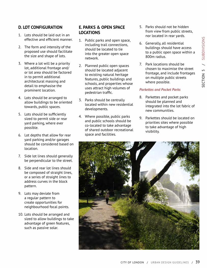
SECT
ION
5
/
SU
BDIV
ISIO
NS
CITY OF LONDON / URBAN DESIGN GUIDELINES / 39
D. LOT CONFIGURATION
1. Lots should be laid out in an effective and efficient manner.
2. The form and intensity of the proposed use should facilitate the size and shape of lots.
3. Where a lot will be a priority lot, additional frontage and/or lot area should be factored in to permit additional architectural massing and detail to emphasise the prominent location.
4. Lots should be arranged to allow buildings to be oriented towards, public spaces.
5. Lots should be sufficiently sized to permit side or rear yard parking, where ever possible.
6. Lot depths that allow for rear yard parking and/or garages should be considered based on location.
7. Side lot lines should generally be perpendicular to the street.
8. Side and rear lot lines should be composed of straight lines, or a series of straight lines to address curves in the block pattern.
9. Lots may deviate from a regular pattern to create opportunities for neighbourhood focal points.
10. Lots should be arranged and sized to allow buildings to take advantage of green features, such as passive solar.
E. PARKS & OPEN SPACE LOCATIONS
1. Public parks and open space, including trail connections, should be located to tie into the greater open space network.
2. Planned public open spaces should be located adjacent to existing natural heritage features, public buildings and schools, and properties whose uses attract high volumes of pedestrian traffic.
3. Parks should be centrally located within new residential developments.
4. Where possible, public parks and public schools should be co-located to take advantage of shared outdoor recreational space and facilities.
5. Parks should not be hidden from view from public streets, nor located in rear yards.
6. Generally, all residential buildings should have access to a public open space within a 800m radius.
7. Park locations should be chosen to maximise the street frontage, and include frontages on multiple public streets where possible.
Parkettes and Pocket Parks
8. Parkettes and pocket parks should be planned and integrated into the lot fabric of new communities.
9. Parkettes should be located on priorities sites where possible to take advantage of high visibility.

/ SUBDIVISIONS40
F. COMMUNITY BOUNDARIES
1. Uses and built form along the perimeter of neighbourhoods should be sited to minimise incompatibilities with adjacent properties.
2. Neighbourhoods on higher order streets should have blocks running perpendicular to that street, or implement a design that uses rear laneways or window streets with units fronting the major street.
3. Block layout should be designed to not require noise attenuation fencing or walls along major streets.
4. Buildings should be located close to the street and should be architecturally articulated to provide an appropriate level of detail that will visually animate the streetscape.
G. COMMUNITY ENTRIES
1. Landscape features, such as walls, fencing, medians and other similar elements that are used to demarcate an entry into a neighbourhood are not supported. The use of buildings and streets trees are encouraged.
2. Where commercial uses are located at entry points to a neighbourhood, parking lots, outside storage spaces, garbage and loading bays should be sited and arranged to reduce their visual impact on the image of the community.
H. FOCAL POINTS
1. Parks and natural heritage areas and features should be promoted and designed into neighbourhoods as community focal points.
2. Where they exist, heritage buildings and structures, and public use facilities, should be promoted as community focal points.
3. Commercial and institutional uses may be located in mainly residential neighbourhoods so that they act as focal points.
4. Physical and visual connections should be made from various points in the neighbourhood to community focal points and features.
5. The massing of buildings, trees and landscaping should provide a sense of enclosure around community foal points.
6. Public art, street furniture, pedestrian amenities and shade structures may be positioned to generate traffic around focal points and animate the area.

SECT
ION
5
/
SU
BDIV
ISIO
NS
CITY OF LONDON / URBAN DESIGN GUIDELINES / 41
I. BRIDGES
1. Bridges should be provided over waterways to maintain a continuous grid pattern of local streets as much as possible.
2. The siting and design of bridges in new residential neighbourhoods should maintain and create public views of the associated waterways or natural feature.
3. Public art that builds on the character of a community should be integrated into the design of bridges.
4. Sidewalks (and cycle lanes, where practical) should be provided across all bridges. Pedestrian walkways should be physically separated from vehicle lanes.
5. Additional open space should be provided in the vicinity of bridges to allow for pedestrian amenities and water access where possible.
6. Bridges are to be designed to create a community character and identity and be of a high quality design to promote a positive civic image.
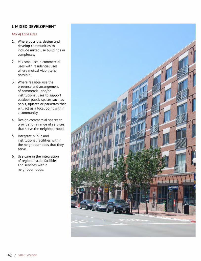
/ SUBDIVISIONS42
J. MIXED DEVELOPMENT
Mix of Land Uses
1. Where possible, design and develop communities to include mixed use buildings or complexes.
2. Mix small scale commercial uses with residential uses where mutual viability is possible.
3. Where feasible, use the presence and arrangement of commercial and/or institutional uses to support outdoor public spaces such as parks, squares or parkettes that will act as a focal point within a community.
4. Design commercial spaces to provide for a range of services that serve the neighbourhood.
5. Integrate public and institutional facilities within the neighbourhoods that they serve.
6. Use care in the integration of regional scale facilities and services within neighbourhoods.
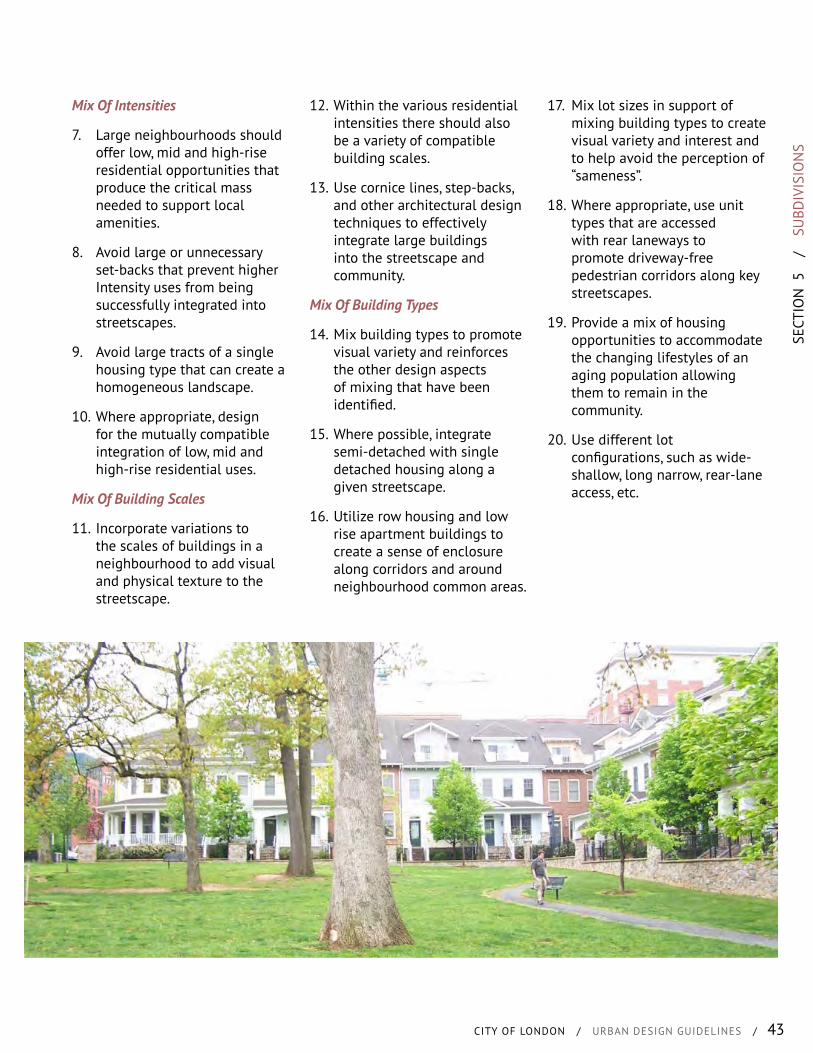
SECT
ION
5
/
SU
BDIV
ISIO
NS
CITY OF LONDON / URBAN DESIGN GUIDELINES / 43
Mix Of Intensities
7. Large neighbourhoods should offer low, mid and high-rise residential opportunities that produce the critical mass needed to support local amenities.
8. Avoid large or unnecessary set-backs that prevent higher Intensity uses from being successfully integrated into streetscapes.
9. Avoid large tracts of a single housing type that can create a homogeneous landscape.
10. Where appropriate, design for the mutually compatible integration of low, mid and high-rise residential uses.
Mix Of Building Scales
11. Incorporate variations to the scales of buildings in a neighbourhood to add visual and physical texture to the streetscape.
12. Within the various residential intensities there should also be a variety of compatible building scales.
13. Use cornice lines, step-backs, and other architectural design techniques to effectively integrate large buildings into the streetscape and community.
Mix Of Building Types
14. Mix building types to promote visual variety and reinforces the other design aspects of mixing that have been identified.
15. Where possible, integrate semi-detached with single detached housing along a given streetscape.
16. Utilize row housing and low rise apartment buildings to create a sense of enclosure along corridors and around neighbourhood common areas.
17. Mix lot sizes in support of mixing building types to create visual variety and interest and to help avoid the perception of “sameness”.
18. Where appropriate, use unit types that are accessed with rear laneways to promote driveway-free pedestrian corridors along key streetscapes.
19. Provide a mix of housing opportunities to accommodate the changing lifestyles of an aging population allowing them to remain in the community.
20. Use different lot configurations, such as wide-shallow, long narrow, rear-lane access, etc.
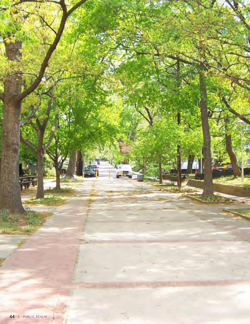
/ PUBLIC REALM/ PUBLIC REALM44

SECT
ION
6
/
PU
BLIC
REA
LM
CITY OF LONDON / URBAN DESIGN GUIDELINES / 45
WHAT IS IT?
The public realm is both the largest and most influential piece of infrastructure that a municipality or government owns. Its design has the largest impact on the type of built form that occurs in the City.
The public realm consists of two elements, the public right-of-way and the public space system. The edges of this space is often defined by the private realm (or the built form). As such, these spaces or “places” are the defining elements of any community. These are the primary arteries of the city that provide citizens the opportunity to move, work, shop, recreate or socialise.
It is through the design of the public realm that the lasting image of London for residents and visitors alike is created.
Through this design guidance, the public and private sectors will create a positive image for London that instills civic pride.
The public realm is composed of all those areas that the public has unrestricted physical access. In some circumstances the public realm may be extended to private land that is designed to blend with public areas, such as along an urban streetscape.
The process of creating a place relies heavily on the creation of a public realm that is functional, attractive and well integrated into the vision for the community. Ideally the public realm works in conjunction with the architecture and landscaping on private property to provide the common elements that bind a community together visually and physically.
WHAT ARE WE TRYING TO ACHIEVE?
• The design and development of attractive and functional streetscapes.
• Design public spaces at a variety of scales to encourage formal and informal community gatherings and social interaction.
• Preserving and enhancing existing views and vistas with the deliberate creation of new views and vistas through the arrangement of streets, buildings and landscaping.
• Coordinating highly visible public infrastructure and utilities such as street lights, utility boxes and signage to reduce streetscape clutter.
• The integration of the public right-of-way with public areas on private property.
• Make it a priority to design and develop a high quality public realm composed of public spaces such as parks, squares, sitting areas, streets and buildings that reflect the desired image of the community.
CONTENTS
A. StreetscapesB. Street TreesC. LandscapingD. ScreeningE. Planter BedsF. Foundation PlantingG. Plant MaterialsH. Plazas & Urban Civic
SpacesI. Waiting AreasJ. PatiosK. Park Design
PUBLIC REALM
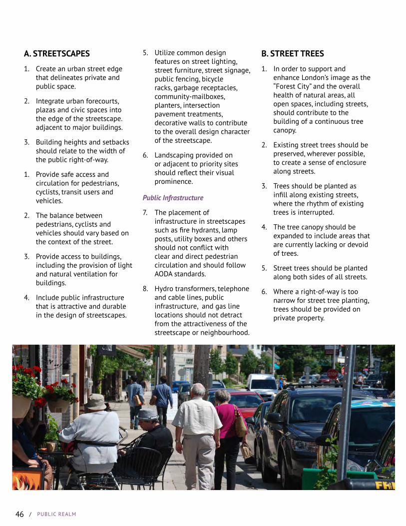
/ PUBLIC REALM46
A. STREETSCAPES
1. Create an urban street edge that delineates private and public space.
2. Integrate urban forecourts, plazas and civic spaces into the edge of the streetscape.adjacent to major buildings.
3. Building heights and setbacks should relate to the width of the public right-of-way.
1. Provide safe access and circulation for pedestrians, cyclists, transit users and vehicles.
2. The balance between pedestrians, cyclists and vehicles should vary based on the context of the street.
3. Provide access to buildings, including the provision of light and natural ventilation for buildings.
4. Include public infrastructure that is attractive and durable in the design of streetscapes.
B. STREET TREES
1. In order to support and enhance London’s image as the “Forest City” and the overall health of natural areas, all open spaces, including streets, should contribute to the building of a continuous tree canopy.
2. Existing street trees should be preserved, wherever possible, to create a sense of enclosure along streets.
3. Trees should be planted as infill along existing streets, where the rhythm of existing trees is interrupted.
4. The tree canopy should be expanded to include areas that are currently lacking or devoid of trees.
5. Street trees should be planted along both sides of all streets.
6. Where a right-of-way is too narrow for street tree planting, trees should be provided on private property.
5. Utilize common design features on street lighting, street furniture, street signage, public fencing, bicycle racks, garbage receptacles, community-mailboxes, planters, intersection pavement treatments, decorative walls to contribute to the overall design character of the streetscape.
6. Landscaping provided on or adjacent to priority sites should reflect their visual prominence.
Public Infrastructure
7. The placement of infrastructure in streetscapes such as fire hydrants, lamp posts, utility boxes and others should not conflict with clear and direct pedestrian circulation and should follow AODA standards.
8. Hydro transformers, telephone and cable lines, public infrastructure, and gas line locations should not detract from the attractiveness of the streetscape or neighbourhood.
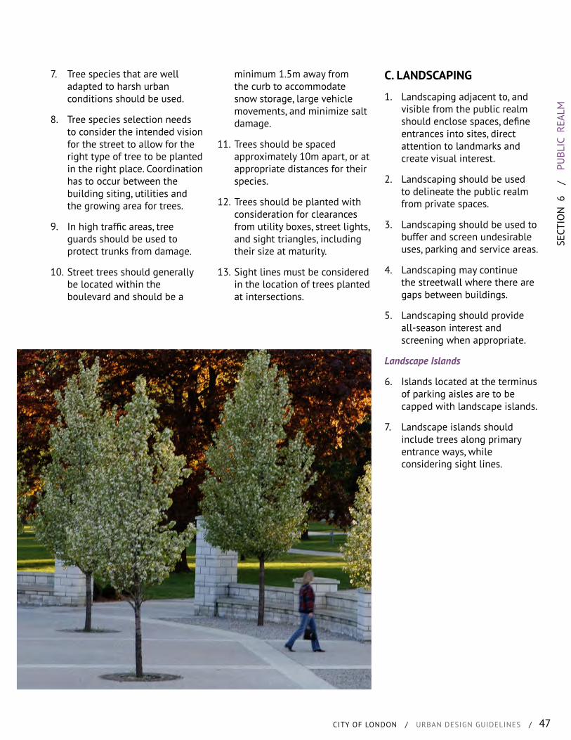
SECT
ION
6
/
PU
BLIC
REA
LM
CITY OF LONDON / URBAN DESIGN GUIDELINES / 47
7. Tree species that are well adapted to harsh urban conditions should be used.
8. Tree species selection needs to consider the intended vision for the street to allow for the right type of tree to be planted in the right place. Coordination has to occur between the building siting, utilities and the growing area for trees.
9. In high traffic areas, tree guards should be used to protect trunks from damage.
10. Street trees should generally be located within the boulevard and should be a
minimum 1.5m away from the curb to accommodate snow storage, large vehicle movements, and minimize salt damage.
11. Trees should be spaced approximately 10m apart, or at appropriate distances for their species.
12. Trees should be planted with consideration for clearances from utility boxes, street lights, and sight triangles, including their size at maturity.
13. Sight lines must be considered in the location of trees planted at intersections.
C. LANDSCAPING
1. Landscaping adjacent to, and visible from the public realm should enclose spaces, define entrances into sites, direct attention to landmarks and create visual interest.
2. Landscaping should be used to delineate the public realm from private spaces.
3. Landscaping should be used to buffer and screen undesirable uses, parking and service areas.
4. Landscaping may continue the streetwall where there are gaps between buildings.
5. Landscaping should provide all-season interest and screening when appropriate.
Landscape Islands
6. Islands located at the terminus of parking aisles are to be capped with landscape islands.
7. Landscape islands should include trees along primary entrance ways, while considering sight lines.
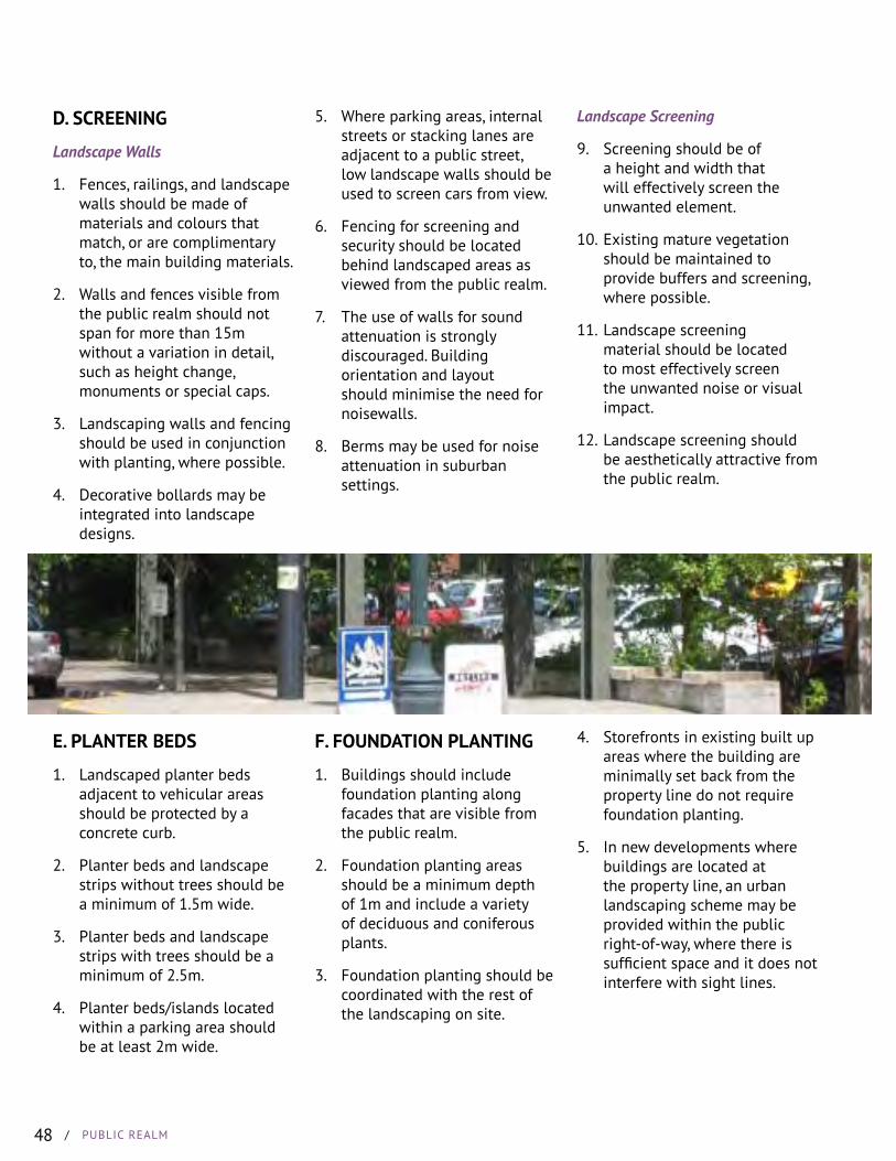
/ PUBLIC REALM48
D. SCREENING
Landscape Walls
1. Fences, railings, and landscape walls should be made of materials and colours that match, or are complimentary to, the main building materials.
2. Walls and fences visible from the public realm should not span for more than 15m without a variation in detail, such as height change, monuments or special caps.
3. Landscaping walls and fencing should be used in conjunction with planting, where possible.
4. Decorative bollards may be integrated into landscape designs.
5. Where parking areas, internal streets or stacking lanes are adjacent to a public street, low landscape walls should be used to screen cars from view.
6. Fencing for screening and security should be located behind landscaped areas as viewed from the public realm.
7. The use of walls for sound attenuation is strongly discouraged. Building orientation and layout should minimise the need for noisewalls.
8. Berms may be used for noise attenuation in suburban settings.
Landscape Screening
9. Screening should be of a height and width that will effectively screen the unwanted element.
10. Existing mature vegetation should be maintained to provide buffers and screening, where possible.
11. Landscape screening material should be located to most effectively screen the unwanted noise or visual impact.
12. Landscape screening should be aesthetically attractive from the public realm.
E. PLANTER BEDS
1. Landscaped planter beds adjacent to vehicular areas should be protected by a concrete curb.
2. Planter beds and landscape strips without trees should be a minimum of 1.5m wide.
3. Planter beds and landscape strips with trees should be a minimum of 2.5m.
4. Planter beds/islands located within a parking area should be at least 2m wide.
F. FOUNDATION PLANTING
1. Buildings should include foundation planting along facades that are visible from the public realm.
2. Foundation planting areas should be a minimum depth of 1m and include a variety of deciduous and coniferous plants.
3. Foundation planting should be coordinated with the rest of the landscaping on site.
4. Storefronts in existing built up areas where the building are minimally set back from the property line do not require foundation planting.
5. In new developments where buildings are located at the property line, an urban landscaping scheme may be provided within the public right-of-way, where there is sufficient space and it does not interfere with sight lines.
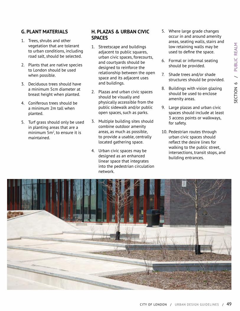
SECT
ION
6
/
PU
BLIC
REA
LM
CITY OF LONDON / URBAN DESIGN GUIDELINES / 49
H. PLAZAS & URBAN CIVIC SPACES
1. Streetscape and buildings adjacent to public squares, urban civic spaces, forecourts, and courtyards should be designed to reinforce the relationship between the open space and its adjacent uses and buildings.
2. Plazas and urban civic spaces should be visually and physically accessible from the public sidewalk and/or public open spaces, such as parks.
3. Multiple building sites should combine outdoor amenity areas, as much as possible, to provide a usable, centrally located gathering space.
4. Urban civic spaces may be designed as an enhanced linear space that integrates into the pedestrian circulation network.
G. PLANT MATERIALS
1. Trees, shrubs and other vegetation that are tolerant to urban conditions, including road salt, should be selected.
2. Plants that are native species to London should be used when possible.
3. Deciduous trees should have a minimum 5cm diameter at breast height when planted.
4. Coniferous trees should be a minimum 2m tall when planted.
5. Turf grass should only be used in planting areas that are a minimum 5m2, to ensure it is maintained.
5. Where large grade changes occur in and around amenity areas, seating walls, stairs and low retaining walls may be used to define the space.
6. Formal or informal seating should be provided.
7. Shade trees and/or shade structures should be provided.
8. Buildings with vision glazing should be used to enclose amenity areas.
9. Large plazas and urban civic spaces should include at least 3 access points or walkways, for safety.
10. Pedestrian routes through urban civic spaces should reflect the desire lines for walking to the public street, intersections, transit stops, and building entrances.
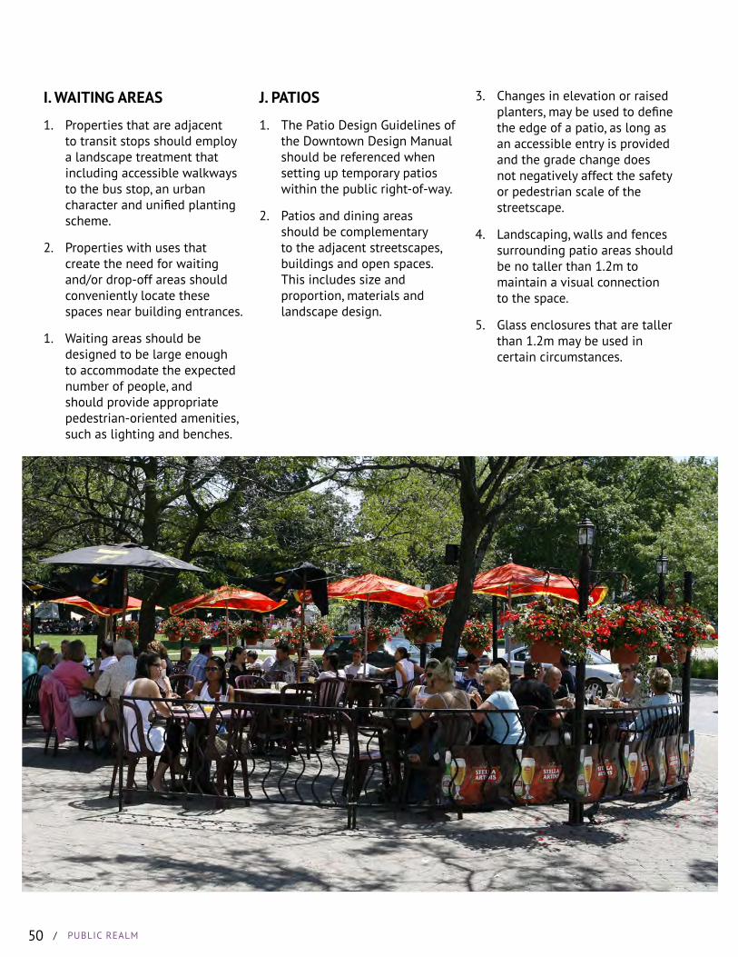
/ PUBLIC REALM50
I. WAITING AREAS
1. Properties that are adjacent to transit stops should employ a landscape treatment that including accessible walkways to the bus stop, an urban character and unified planting scheme.
2. Properties with uses that create the need for waiting and/or drop-off areas should conveniently locate these spaces near building entrances.
1. Waiting areas should be designed to be large enough to accommodate the expected number of people, and should provide appropriate pedestrian-oriented amenities, such as lighting and benches.
J. PATIOS
1. The Patio Design Guidelines of the Downtown Design Manual should be referenced when setting up temporary patios within the public right-of-way.
2. Patios and dining areas should be complementary to the adjacent streetscapes, buildings and open spaces. This includes size and proportion, materials and landscape design.
3. Changes in elevation or raised planters, may be used to define the edge of a patio, as long as an accessible entry is provided and the grade change does not negatively affect the safety or pedestrian scale of the streetscape.
4. Landscaping, walls and fences surrounding patio areas should be no taller than 1.2m to maintain a visual connection to the space.
5. Glass enclosures that are taller than 1.2m may be used in certain circumstances.
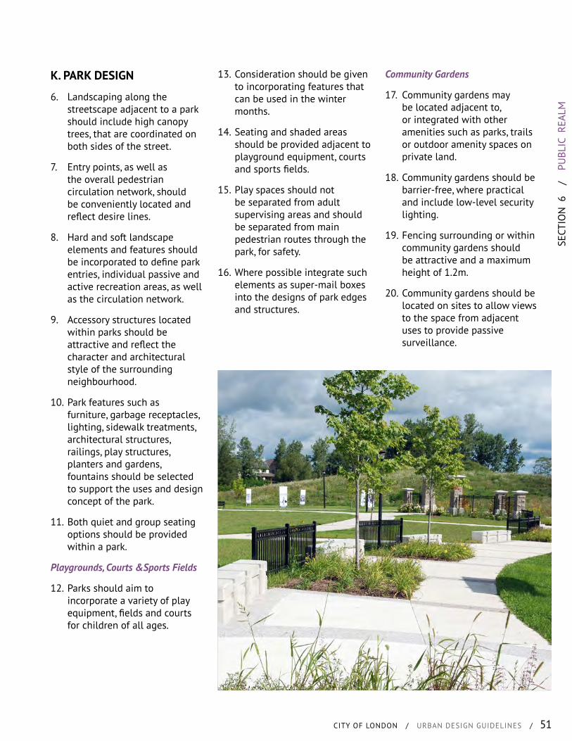
SECT
ION
6
/
PU
BLIC
REA
LM
CITY OF LONDON / URBAN DESIGN GUIDELINES / 51
K. PARK DESIGN
6. Landscaping along the streetscape adjacent to a park should include high canopy trees, that are coordinated on both sides of the street.
7. Entry points, as well as the overall pedestrian circulation network, should be conveniently located and reflect desire lines.
8. Hard and soft landscape elements and features should be incorporated to define park entries, individual passive and active recreation areas, as well as the circulation network.
9. Accessory structures located within parks should be attractive and reflect the character and architectural style of the surrounding neighbourhood.
10. Park features such as furniture, garbage receptacles, lighting, sidewalk treatments, architectural structures, railings, play structures, planters and gardens, fountains should be selected to support the uses and design concept of the park.
11. Both quiet and group seating options should be provided within a park.
Playgrounds, Courts &Sports Fields
12. Parks should aim to incorporate a variety of play equipment, fields and courts for children of all ages.
13. Consideration should be given to incorporating features that can be used in the winter months.
14. Seating and shaded areas should be provided adjacent to playground equipment, courts and sports fields.
15. Play spaces should not be separated from adult supervising areas and should be separated from main pedestrian routes through the park, for safety.
16. Where possible integrate such elements as super-mail boxes into the designs of park edges and structures.
Community Gardens
17. Community gardens may be located adjacent to, or integrated with other amenities such as parks, trails or outdoor amenity spaces on private land.
18. Community gardens should be barrier-free, where practical and include low-level security lighting.
19. Fencing surrounding or within community gardens should be attractive and a maximum height of 1.2m.
20. Community gardens should be located on sites to allow views to the space from adjacent uses to provide passive surveillance.